Water 2018, 10(12), 1707; https://doi.org/10.3390/w10121707 - 22 Nov 2018
Cited by 4 | Viewed by 4282
Abstract
Collecting accurate real-time soil moisture data in crop root zones is the foundation of automated precision irrigation systems. Soil moisture sensors (SMSs) have been used to monitor soil water content (SWC) in crop fields for a long time; however, there is no generally
[...] Read more.
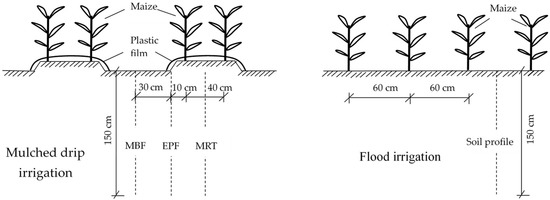
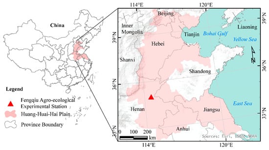
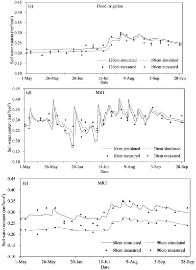
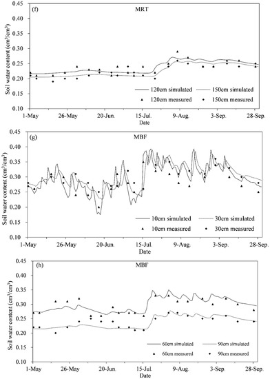
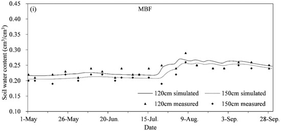
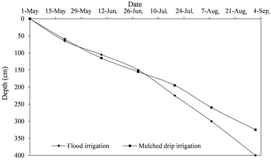
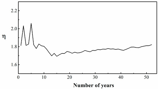
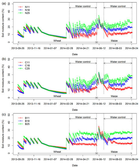
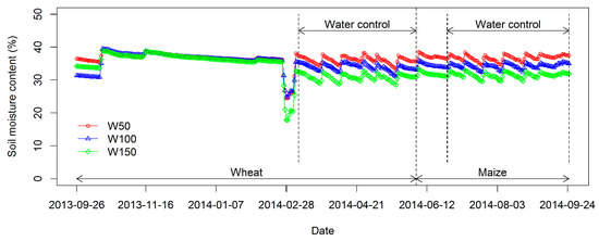
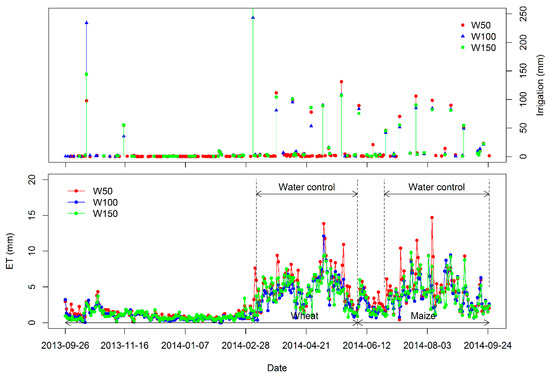
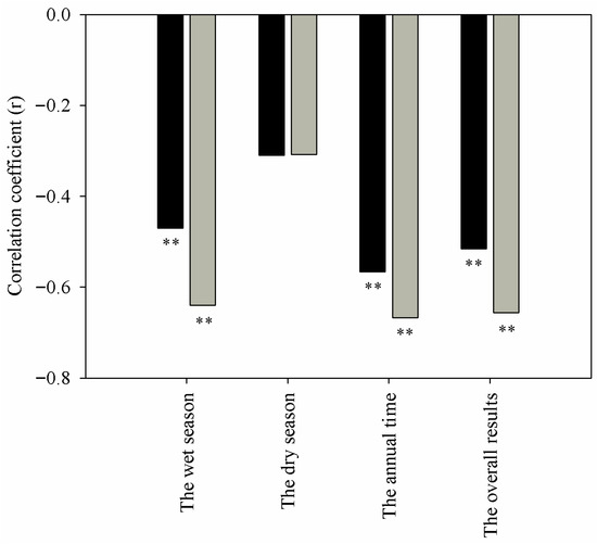
Collecting accurate real-time soil moisture data in crop root zones is the foundation of automated precision irrigation systems. Soil moisture sensors (SMSs) have been used to monitor soil water content (SWC) in crop fields for a long time; however, there is no generally accepted guideline for determining optimal number and placement of soil moisture sensors in the soil profile. In order to study adequate positioning for the installation of soil moisture sensors in the soil profile, six years of field experiments were carried out in North China Plain (NCP). Soil water content was measured using the gravimetric method every 7 to 10 days during six growing seasons of winter wheat (Triticum aestivum L), and root distribution was measured using a soil core method during the key periods of winter wheat growth. The results from the experimental data analysis show that SWC at different depths had a high linear correlation. In addition, the values of correlation coefficients decreased with increasing soil depth; the coefficient of variation (CV) of SWC was higher in the surface layers than in the deeper layers (depths were 0–40 cm, 0–60 cm, and 0–100 cm during the early, middle, and last stages of winter wheat, respectively); wheat roots were mainly distributed in the surface layer. According to an analysis of CV for SWC and root distribution, the depths of planned wetted layers were determined to be 0–40 cm, 0–60 cm, and 0–100 cm during the sowing to reviving stages (the early stage of winter wheat), returning green and jointing stages (the middle stage of winter wheat), and heading to maturity stage (the last stage of winter wheat), respectively. The correlation and R-cluster analyses of SWC at different layers in the soil profile showed that SMSs should be installed 10 and 30 cm below the soil surface during the winter wheat growing season. The linear regression model can be built using SWC at depths of 10 and 30 cm to predict total average SWC in the soil profile. The results of validation showed that the developed model provided reliable estimates of total average SWC in the planned wetted layer. In brief, this study suggests that suitable positioning of soil moisture sensors is at depths of 10 and 30 cm below the soil surface.
Full article
(This article belongs to the Section Water Use and Scarcity)
►
Show Figures

Figure 1


