Next Issue
Volume 27, ECAS 2023
Previous Issue
Volume 25, ECWS-7 2023
 
 
environsciproc-logo

Journal Browser

Journal Browser

Environ. Sci. Proc., 2023, COMECAP 2023

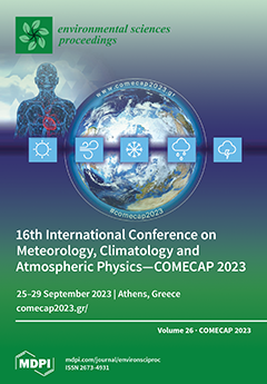
16th International Conference on Meteorology, Climatology and Atmospheric Physics—COMECAP 2023

Athens, Greece | 25–29 September 2023

Volume Editors:
Konstantinos Moustris, University of West Attica
Nastos Panagiotis, National and Kapodistrian University of Athens

Number of Papers: 213
  • Issues are regarded as officially published after their release is announced to the table of contents alert mailing list.
  • You may sign up for e-mail alerts to receive table of contents of newly released issues.
  • PDF is the official format for papers published in both, html and pdf forms. To view the papers in pdf format, click on the "PDF Full-text" link, and use the free Adobe Reader to open them.
Cover Story (view full-size image): Established in 1992, the International Conference on Meteorology, Climatology and Atmospheric Physics (COMECAP) is a leading conference where top experts and scientists present state-of-the-art [...] Read more.
Order results
Result details
Select all
Export citation of selected articles as:

Editorial

Jump to: Other

1 pages, 140 KiB  
Editorial
Statement of Peer Review
by Konstantinos Moustris and Nastos Panagiotis
Environ. Sci. Proc. 2023, 26(1), 213; https://doi.org/10.3390/environsciproc2023026213 - 25 Mar 2024
Viewed by 886
Abstract
In submitting conference proceedings to Environment Sciences Proceedings, the volume editors of the proceedings certify to the publisher that all papers published in this volume have been subjected to peer review administered by the volume editors [...] Full article

Other

Jump to: Editorial

6 pages, 1255 KiB  
Proceeding Paper
Spatial and Temporal Changes of Diurnal Temperature Range in Greece—The Urban Effect
by Dimitra Founda, Anna Mamara, Athanasios Argiriou, Fragiskos Pierros and Athanasios Sarantopoulos
Environ. Sci. Proc. 2023, 26(1), 1; https://doi.org/10.3390/environsciproc2023026001 - 22 Aug 2023
Cited by 1 | Viewed by 893
Abstract
Diurnal Temperature Range (DTR), defined as the difference between the daily maximum (Tmax) and daily minimum (Tmin) air temperature, has received considerable attention as an important indicator of climate change. In the present study, we analyse long-term highly homogenized [...] Read more.
Diurnal Temperature Range (DTR), defined as the difference between the daily maximum (Tmax) and daily minimum (Tmin) air temperature, has received considerable attention as an important indicator of climate change. In the present study, we analyse long-term highly homogenized DTR data from 51 Greek stations and investigate their spatiotemporal changes. The long-term temporal changes of DTR revealed mixed patterns with both increasing and decreasing trends over the study period and distinct seasonal differentiations. DTR pattern in Athens has fluctuated since the beginning of the twentieth century, generally following warming and cooling air temperature trends. After the mid-1980s, DTR showed a pronounced decreasing trend at a rate of 0.47 °C/decade in summer (p < 0.01) due to higher warming rates of Tmin, suggesting the combined effects of regional warming and urbanization levels. Full article
Show Figures

Figure 1

6 pages, 1089 KiB  
Proceeding Paper
Machine Learning Regression to Predict Pollen Concentrations of Oleaceae and Quercus Taxa in Thessaloniki, Greece
by Sofia Papadogiannaki, Serafeim Kontos, Daphne Parliari and Dimitrios Melas
Environ. Sci. Proc. 2023, 26(1), 2; https://doi.org/10.3390/environsciproc2023026002 - 23 Aug 2023
Cited by 1 | Viewed by 909
Abstract
Airborne pollen triggers allergic reactions in up to 40% of the global population. The incidence of pollen allergies is increasing in Thessaloniki, Greece and it is predicted that more than 50% of the European Union’s inhabitants will suffer from allergic rhinitis by 2025. [...] Read more.
Airborne pollen triggers allergic reactions in up to 40% of the global population. The incidence of pollen allergies is increasing in Thessaloniki, Greece and it is predicted that more than 50% of the European Union’s inhabitants will suffer from allergic rhinitis by 2025. Thus, it is essential to investigate and predict high pollen concentrations to address this growing concern. This study utilized the Gradient Boosting Regression (GBR) technique, a machine learning approach, to estimate pollen concentrations of Oleaceae and Quercus taxa, using daily meteorological and land surface data obtained from the European Center for Medium-Range Weather Forecasts (ECMWF). The method accurately predicted pollen concentrations for both species, with an Index of Agreement (IoA) of 0.86 for Oleaceae and 0.78 for Quercus, despite the limited size of the dataset. Full article
Show Figures

Figure 1

6 pages, 1027 KiB  
Proceeding Paper
Identifying the Relationship between Climate Parameters and Teleconnection Patterns in the North Atlantic Ocean
by Dafni Delioglani and Christina Anagnostopoulou
Environ. Sci. Proc. 2023, 26(1), 3; https://doi.org/10.3390/environsciproc2023026003 - 22 Aug 2023
Viewed by 645
Abstract
North Atlantic plays a pivotal role in modulating the Earth’s climate by absorbing, releasing, and transferring large amounts of heat all over the world. Sea level pressure (SLP), sea surface temperature (SST), and air temperature (Tair) are strongly influenced by climate change and [...] Read more.
North Atlantic plays a pivotal role in modulating the Earth’s climate by absorbing, releasing, and transferring large amounts of heat all over the world. Sea level pressure (SLP), sea surface temperature (SST), and air temperature (Tair) are strongly influenced by climate change and can affect Earth’s weather and climate conditions. This study aims to investigate the role of SLP, SST, and Tair in the formation of teleconnection patterns in the North Atlantic (e.g., NAO, AO). Pearson correlation and cross-correlation analysis are used to identify the relationship between the climate parameters as well as between these parameters and the teleconnection patterns. SLP over Northern Atlantic presents positive correlation with NAO and negative correlation with AO, while an above average value of NAO is likely to lead to a below average value of SST approximately 20 days later or earlier depending on the study region. Tair changes seem to occur with a day difference from NAO and AO changes. Full article
Show Figures

Figure 1

5 pages, 1214 KiB  
Proceeding Paper
HNMS Marine Forecasts in Cases of Weather Warnings: Verification against Satellite Measurements
by Spyridoula Oikonomou, Dimitra Deli, Dionysia Kotta, Ioannis Matsangouras and Michail Myrsilidis
Environ. Sci. Proc. 2023, 26(1), 4; https://doi.org/10.3390/environsciproc2023026004 - 22 Aug 2023
Viewed by 607
Abstract
The Hellenic National Meteorological Service (HNMS) issues marine weather bulletins for the Mediterranean and the Black Seas as part of the Global Maritime Distress and Safety System, with wind forecasts being of high importance. This study evaluates the accuracy of HNMS marine forecasts [...] Read more.
The Hellenic National Meteorological Service (HNMS) issues marine weather bulletins for the Mediterranean and the Black Seas as part of the Global Maritime Distress and Safety System, with wind forecasts being of high importance. This study evaluates the accuracy of HNMS marine forecasts during Wind Warning (WW) events when weather warnings were also issued for Greece. The analysis focuses on events that occurred over the Ionian and the Aegean Seas from September 2019 to February 2023. Remote sensing data are used to objectively verify the forecasted wind speed and sea state. An evaluation of the accuracy of numerical weather prediction products against satellite data during the weather system ‘Barbara’ (February 2023), that was also a WW event, is included. Full article
Show Figures

Figure 1

6 pages, 1765 KiB  
Proceeding Paper
Assimilation of In Situ Meteorological Data to Optimize a Weather Service for Mosquito Control
by Stergios Kartsios, Eleni Katragkou, Maria-Chara Karypidou, Sandra Gewehr and Spiros Mourelatos
Environ. Sci. Proc. 2023, 26(1), 5; https://doi.org/10.3390/environsciproc2023026005 - 23 Aug 2023
Viewed by 594
Abstract
This study investigates the impact of data assimilation to the weather forecasts produced within the project “MOSQUITO VISION”, concerning the development of a digital application for mosquito nuisance prediction. The in situ meteorological data used for the assimilation are retrieved from the Region [...] Read more.
This study investigates the impact of data assimilation to the weather forecasts produced within the project “MOSQUITO VISION”, concerning the development of a digital application for mosquito nuisance prediction. The in situ meteorological data used for the assimilation are retrieved from the Region of Central Macedonia (RCM) climate data hub, currently including 49 meteorological stations compliant with WMO requirements. Here, we assess the numerical system’s performance by ingesting available observations over the RCM through two different data assimilation techniques using the Weather Research and Forecasting model. The results indicate that there is no significant added value to the assimilated weather forecasted fields over the area of interest (RCM), and the assimilated signal is diminishing relative quickly due to non-linear processes. This study is funded under the Greek Research and Innovation Strategies for Smart Specialization call (RIS 3, project code: ΚΜΡ6_077890). Full article
Show Figures

Figure 1

7 pages, 2076 KiB  
Proceeding Paper
Seawater Quality Measurements at the Two Ports of Patras, Greece
by Aristeidis Bloutsos, Andriana Aravantinou, Ioannis D. Manariotis and Panayotis Yannopoulos
Environ. Sci. Proc. 2023, 26(1), 6; https://doi.org/10.3390/environsciproc2023026006 - 23 Aug 2023
Viewed by 731
Abstract
A monitoring program of seawater quality was conducted during the October 2013–June 2016 period at the port city of Patras. A total of fourteen sampling campaigns were conducted. Eleven sampling sites were selected at the Southern New Port and at the Northern Old [...] Read more.
A monitoring program of seawater quality was conducted during the October 2013–June 2016 period at the port city of Patras. A total of fourteen sampling campaigns were conducted. Eleven sampling sites were selected at the Southern New Port and at the Northern Old Port of Patras, namely at the discharge point of the south outlet of the collecting storm water conduit and at the two river mouths discharging at both sides of the Southern New Port, to evaluate the contribution of surface runoff and harbor activities on seawater pollution. At each site, water quality parameters were determined in situ, and water samples were transferred and analyzed at the laboratory. Taking into consideration the whole set of measurements, it can be concluded that the seawater quality of the two ports is satisfactory in comparison to other coastal zones in the area around Patras and other ports. Full article
Show Figures

Figure 1

6 pages, 1034 KiB  
Proceeding Paper
The Link of Extreme Precipitation with the Clausius–Clapeyron Relation: The Case Study of Thessaloniki, Greece
by Alexandros Papadopoulos-Zachos and Christina Anagnostopoulou
Environ. Sci. Proc. 2023, 26(1), 7; https://doi.org/10.3390/environsciproc2023026007 - 23 Aug 2023
Cited by 1 | Viewed by 1046
Abstract
One of the impacts of climate change is an increase in the frequency and intensity of extreme rainfall events. This has very significant social and economic consequences for the affected areas (flooding, loss of life, destruction of infrastructure, etc.). Future trends indicate a [...] Read more.
One of the impacts of climate change is an increase in the frequency and intensity of extreme rainfall events. This has very significant social and economic consequences for the affected areas (flooding, loss of life, destruction of infrastructure, etc.). Future trends indicate a further increase in extreme rainfall in the second half of the century, making the need for the timely and accurate forecasting of these phenomena more urgent than ever. However, despite the technological development of weather and climate models in recent years, there are still limitations in detecting the extremes, especially regarding the precipitation parameter. Extreme precipitation events show a link with temperature. The Clausius–Clapeyron (CC) equation, which relates temperature to saturation vapor pressure (es), is used to study the sensitivity of precipitation to temperature increase because it can estimate the increase in the available atmospheric water vapor with respect to temperature. Focusing on the Thessaloniki region in Greece, the aim of this paper is to investigate the applicability of the Clausius–Clapeyron relation to the scaling relationship between extreme precipitation intensity and surface air temperature. An additional attempt is also made to test the possibility of improving the underestimation that the reanalysis models exhibit in recording the extremes and in particular the ERA5 Land dataset. Full article
Show Figures

Figure 1

7 pages, 5367 KiB  
Proceeding Paper
Effect of Dust Events on Photovoltaics Electricity Production in the European and North African Regions
by Davender Sethi and Panagiotis G. Kosmopoulos
Environ. Sci. Proc. 2023, 26(1), 8; https://doi.org/10.3390/environsciproc2023026008 - 23 Aug 2023
Viewed by 780
Abstract
The effect of two dust events on solar energy has been studied in Europe and North Africa. For analysis, total aerosol and dust optical depth (AOD) in conjunction with solar irradiation and energy data were utilized from Copernicus Atmosphere Monitoring Service (CAMS). The [...] Read more.
The effect of two dust events on solar energy has been studied in Europe and North Africa. For analysis, total aerosol and dust optical depth (AOD) in conjunction with solar irradiation and energy data were utilized from Copernicus Atmosphere Monitoring Service (CAMS). The AOD reached ~2.8 and ~1.7 during the dust events (16–19 April 2021 and 15–18 March 2022), respectively. Both events originated in North Africa, reaching the northern parts of Europe and the Black Sea. The energy production of solar photovoltaics in the affected regions was reduced by almost 18–36 GWh, followed by an estimated financial loss of close to 4 million euros. Full article
Show Figures

Figure 1

6 pages, 4868 KiB  
Proceeding Paper
Observations of Transient Luminous Events from Greece
by Christos Doudoulakis, Thanasis Papathanasiou, Dimitris Sagiakos and Panagiotis Tsouras
Environ. Sci. Proc. 2023, 26(1), 9; https://doi.org/10.3390/environsciproc2023026009 - 23 Aug 2023
Viewed by 3976
Abstract
Transient Luminous Events (TLEs) are rare electrical discharges occurring in the middle and upper atmosphere above thunderstorms. The results of systematic observations of TLEs in a region that includes Greece and its surrounding area during a 2-year period (September 2020–September 2022) are presented. [...] Read more.
Transient Luminous Events (TLEs) are rare electrical discharges occurring in the middle and upper atmosphere above thunderstorms. The results of systematic observations of TLEs in a region that includes Greece and its surrounding area during a 2-year period (September 2020–September 2022) are presented. This study provides a first insight about the frequency, the spatiotemporal distribution, and the variety of these events in that region. In total, 1632 TLEs were observed during these 2 years. Of these, 95.5% were red sprites. Most events occurred over the Ionian Sea, the southern Adriatic Sea, and western Greece. The most favorable period for TLEs in Greece and its surrounding area is from October to February. Noteworthy were two prolific nights, 15–16 October 2020 and 4–5 December 2021, over mesoscale convective systems at the Ionian Sea and the southeastern Aegean Sea, respectively, when hundreds of these events were observed. Observations of this kind are of great significance, not only because they are the first-ever conducted in the aforementioned region but also due to the fact that these events seem to exhibit a relatively high frequency of appearance there. Full article
Show Figures

Figure 1

7 pages, 3463 KiB  
Proceeding Paper
Energy Autonomy Scenario for the Island of Mykonos in Greece with Solar Power Plants
by Agathi Nasioula and Panagiotis G. Kosmopoulos
Environ. Sci. Proc. 2023, 26(1), 10; https://doi.org/10.3390/environsciproc2023026010 - 23 Aug 2023
Cited by 1 | Viewed by 959
Abstract
Mykonos is one of the fastest growing Greek islands, and it attracts hundreds of thousands of tourists, mainly in the summer months. A consequence of this rapid development is an ever-increasing energy demand. Solar energy exploitation is the topic of this study, and [...] Read more.
Mykonos is one of the fastest growing Greek islands, and it attracts hundreds of thousands of tourists, mainly in the summer months. A consequence of this rapid development is an ever-increasing energy demand. Solar energy exploitation is the topic of this study, and the aim is to provide an energy autonomous solution for Mykonos that covers its electricity needs for the whole year from photovoltaic plants. Data from the Copernicus Atmosphere Monitoring Service and Eumetsat’s support to nowcasting and very short-range forecasting were combined with Radiative Transfer Models and the Photovoltaic Geographical Information System in order to quantify the island’s expected electricity production and the effect of atmospheric parameters, and this enabled an energy adequacy scenario to be formed and financial analysis to be conducted. The aim of the method proposed in this study is to highlight the opportunity for energy transition for Mykonos as well as the rest of Cyclades islands, and to thereby provide viable and sustainable development. Full article
Show Figures

Figure 1

6 pages, 932 KiB  
Proceeding Paper
A Machine Learning Approach for Rainfall Nowcasting Using Numerical Model and Observational Data
by Georgios Kyros, Ioannis Manolas, Konstantinos Diamantaras, Stavros Dafis and Konstantinos Lagouvardos
Environ. Sci. Proc. 2023, 26(1), 11; https://doi.org/10.3390/environsciproc2023026011 - 23 Aug 2023
Viewed by 814
Abstract
The application of machine learning (ML) algorithms in large datasets in the field of meteorology is at the forefront of research. In this context, the use of satellite data to estimate the amount of rainfall is an important field of research, with operational [...] Read more.
The application of machine learning (ML) algorithms in large datasets in the field of meteorology is at the forefront of research. In this context, the use of satellite data to estimate the amount of rainfall is an important field of research, with operational applications. It is important to accurately predict the amount of rainfall (or rain rate) in a particular area for the proper taking of life and property protection measures. The present work intends to deepen the analysis of meteorological data with ML techniques to improve our capacity in short-range forecasting of rainfall. To this end, relationships between thermodynamic parameters derived by satellite measurements and recorded rainfall by in situ gauges, along with outputs from a numerical atmospheric model are analyzed. The main purpose of the work is to find the best relationships between the atmospheric conditions and the formation of clouds that lead to production of rainfall and build a ML model for nowcasting of rainfall. Several ML methods are used, i.e., Auto Regression, Ensemble Machine Learning, and Deep Learning, and their results are compared in order to find the best fit model. Full article
Show Figures

Figure 1

6 pages, 1902 KiB  
Proceeding Paper
The Detection of Plastic and Petroleum Hydrocarbon Pollution at Sea with Laser-Induced Fluorescence
by Eleni Drakaki, Evangelini Zekou, Michail Serris and Nikolaos Merlemis
Environ. Sci. Proc. 2023, 26(1), 12; https://doi.org/10.3390/environsciproc2023026012 - 23 Aug 2023
Cited by 1 | Viewed by 951
Abstract
Plastic and oil pollutants’ distribution and composition quantifications are vital to better understanding their effects on marine life. We present preliminary experimental results to evaluate the potential of a compact Laser-Induced Fluorescence (LIF) apparatus for the detection of plastics and oil pollutants. The [...] Read more.
Plastic and oil pollutants’ distribution and composition quantifications are vital to better understanding their effects on marine life. We present preliminary experimental results to evaluate the potential of a compact Laser-Induced Fluorescence (LIF) apparatus for the detection of plastics and oil pollutants. The apparatus is based on a comparatively inexpensive method utilizing a 405 nm laser for sample excitation in water. Fluorescence spectra are recorded from known sources of microplastic pollutants, such as polyethylene, polypropylene, polystyrene and PMMA, as well as several petroleum substances. A novel identification indicator is proposed for classifying the pollutant type in realistic environmental conditions. Full article
Show Figures

Figure 1

7 pages, 2975 KiB  
Proceeding Paper
Meteorological Applications from the Perspective of a Private Weather Provider
by Christos Gatidis and Filotas Paschos
Environ. Sci. Proc. 2023, 26(1), 13; https://doi.org/10.3390/environsciproc2023026013 - 23 Aug 2023
Viewed by 563
Abstract
As the demand for accurate weather forecasts continues to rise, there is an increasing need for specialized meteorological services. As a result, several private weather providers have emerged, offering customized meteorological solutions to meet the diverse needs of their clients. The present study [...] Read more.
As the demand for accurate weather forecasts continues to rise, there is an increasing need for specialized meteorological services. As a result, several private weather providers have emerged, offering customized meteorological solutions to meet the diverse needs of their clients. The present study introduces several meteorology-related applications from the point of view of WeatherNews Inc. (WNI), which is a private weather company. These applications are developed to primarily assist shipping- and energy-related companies, with greater emphasis being given to vessel weather routing. Full article
Show Figures

Figure 1

6 pages, 1397 KiB  
Proceeding Paper
Temporal and Spatial Characteristics of the Economic Burden Related to Long-Term PM2.5 and O3 Exposure in Greece for the Period 2004–2019
by Kyriaki Psistaki, Ilias Petrou, Anastasia K. Paschalidou and Pavlos Kassomenos
Environ. Sci. Proc. 2023, 26(1), 14; https://doi.org/10.3390/environsciproc2023026014 - 23 Aug 2023
Viewed by 654
Abstract
Based on the value of statistical life and the willingness to pay methods, we estimated the economic cost resulting from premature mortality associated with fine particulate matter and ground-level ozone exposure across Greece during 2004–2019 under a constant and changing income elasticity scenario. [...] Read more.
Based on the value of statistical life and the willingness to pay methods, we estimated the economic cost resulting from premature mortality associated with fine particulate matter and ground-level ozone exposure across Greece during 2004–2019 under a constant and changing income elasticity scenario. The spatiotemporal trends of the economic burden were also investigated. The total economic burden attributable to premature mortality due to exposure to PM2.5 and O3 for the 16-year period was estimated at EUR 66.34 billion under the constant scenario and at EUR 273.65 billion under the changing scenario. A dramatic decline of the mortality cost was observed from 2009 to 2019 in the changing scenario, as opposed to a less profound downward trend under the constant scenario, where the annual gross domestic product and the consumer price index were not taken into account. Full article
Show Figures

Figure 1

5 pages, 1019 KiB  
Proceeding Paper
Surface Shortwave Radiation Measurements and Modeling under Intense Desert Dust Conditions
by Kyriakoula Papachristopoulou, Alexandra Tsekeri, Dimitra Kouklaki, Panagiotis Ioannis Raptis, Eleni Marinou, Vasilis Amiridis, Ilias Fountoulakis and Stelios Kazadzis
Environ. Sci. Proc. 2023, 26(1), 15; https://doi.org/10.3390/environsciproc2023026015 - 23 Aug 2023
Viewed by 607
Abstract
Desert dust atmospheric aerosols play an important role in the Earth-atmosphere system and constitute a key agent for the Earth’s climate through their radiative processes. However, dust radiative effects are still subjected to large uncertainties, due to the uncertain estimates of their optical [...] Read more.
Desert dust atmospheric aerosols play an important role in the Earth-atmosphere system and constitute a key agent for the Earth’s climate through their radiative processes. However, dust radiative effects are still subjected to large uncertainties, due to the uncertain estimates of their optical properties. A radiative closure study, under cloudless sky, using measurements and model results of shortwave radiation at the Earth’s surface was performed. All measurements were gathered under Saharan dust conditions during the ASKOS campaign at Mindelo, Cabo Verde. Radiation measurements were compared with radiative transfer simulations, using as input concurrent retrievals of dust optical properties. Full article
Show Figures

Figure 1

5 pages, 3376 KiB  
Proceeding Paper
Snow Depth Trends of European Ski Resorts
by Ioannis Masloumidis, Stavros Dafis, Georgios Kyros and Konstantinos Lagouvardos
Environ. Sci. Proc. 2023, 26(1), 16; https://doi.org/10.3390/environsciproc2023026016 - 23 Aug 2023
Cited by 1 | Viewed by 1609
Abstract
Snow significantly affects the economy of many European countries, especially in the sector of winter tourism. It affects the operation of ski resorts, the mountain real estate, and can cause disruptions in transportations. The objective of this study is to analyze trends in [...] Read more.
Snow significantly affects the economy of many European countries, especially in the sector of winter tourism. It affects the operation of ski resorts, the mountain real estate, and can cause disruptions in transportations. The objective of this study is to analyze trends in snow depth at ski resorts in Europe based on the CERRA-land reanalysis data. Time series are computed between 1985–2020 for 4507 European ski resorts. Results show that the majority of ski resorts are severely affected by decreasing trends in snow depth, especially in winter and spring. Spatial patterns based on the elevation of ski resorts are also discussed. Full article
Show Figures

Figure 1

6 pages, 1224 KiB  
Proceeding Paper
Bias Correction of Daily Precipitation on Two Eastern Mediterranean Stations with GAMs
by Georgia Lazoglou, Theo Economou, Christina Anagnostopoulou, Anna Tzyrkalli, George Zittis and Jos Lelieveld
Environ. Sci. Proc. 2023, 26(1), 17; https://doi.org/10.3390/environsciproc2023026017 - 23 Aug 2023
Viewed by 599
Abstract
Climate models are fundamental tools for assessing historical climate conditions and projecting future ones. However, the results often differ systematically from observational data. The minimization of these differences is known as bias correction. The present study aims to correct the biases between observed [...] Read more.
Climate models are fundamental tools for assessing historical climate conditions and projecting future ones. However, the results often differ systematically from observational data. The minimization of these differences is known as bias correction. The present study aims to correct the biases between observed daily precipitation values and the respective simulated ones from a EURO-CORDEX climate model. For this purpose, powerful statistical tools—generalized additive models (GAMs)—are used. GAMs are modified to adjust the simulated rainfall with the highest accuracy, and subsequently, they are evaluated by comparison with observational data. The method was applied to two eastern Mediterranean stations (Larissa in Greece and Larnaca in Cyprus) for the period 1981 to 2005. The results from both stations reveal that GAMs offer a valuable and accurate technique for the bias adjustment of daily precipitation. Full article
Show Figures

Figure 1

4 pages, 229 KiB  
Proceeding Paper
Climate Change Impacts on the Prevalence of Tick-Borne Diseases in Europe
by Maria E. Tsoumani, Sevastiani I. Papailia, Effie G. Papageorgiou and Chrysa Voyiatzaki
Environ. Sci. Proc. 2023, 26(1), 18; https://doi.org/10.3390/environsciproc2023026018 - 23 Aug 2023
Viewed by 1028
Abstract
Climate change (changes in temperature and weather patterns) plays a significant role in the outbreak of tick-borne diseases such as Lyme borreliosis (LB) disease and tick-borne encephalitis (TBE) in Europe. The prevalence of LB disease has increased lately and TBE, one of the [...] Read more.
Climate change (changes in temperature and weather patterns) plays a significant role in the outbreak of tick-borne diseases such as Lyme borreliosis (LB) disease and tick-borne encephalitis (TBE) in Europe. The prevalence of LB disease has increased lately and TBE, one of the most serious infections of the central nervous system, significantly affects public health. Changes in abiotic factors are the main determinants affecting their vectors. The warmer weather during winter has prolonged the extension of the period in which ticks are most active. Therefore, the increased risk of transmission of tick-borne diseases influenced by the climate conditions could be determined by advanced climate models. Full article
6 pages, 3027 KiB  
Proceeding Paper
Temporal Variation of PM1 on the Campus of the University of Patras, Greece
by Aristeidis Bloutsos and Panayotis Yannopoulos
Environ. Sci. Proc. 2023, 26(1), 19; https://doi.org/10.3390/environsciproc2023026019 - 23 Aug 2023
Viewed by 571
Abstract
Several scientific studies reveal that particulate matter that is smaller than 1 μm (PM1) represents the main hazard for the cardiorespiratory pathological status of the population. The present study deals with the presentation of the long-term continuous measurements of PM1 [...] Read more.
Several scientific studies reveal that particulate matter that is smaller than 1 μm (PM1) represents the main hazard for the cardiorespiratory pathological status of the population. The present study deals with the presentation of the long-term continuous measurements of PM1 in the atmospheric environment of the University of Patras Campus (UPC) at Rion. The 1 h mean concentrations of PM1 were recorded and presented in this study, covering a seven-year period (2012–2018) in a suburban area of Patras, with background characteristics. The results indicated that PM1 levels were quite low, with significant differences between cold and warm periods. However, they did not show significant variations. This project aimed to identify and assess UPC air quality. Our findings may contribute to useful PM1 concentration patterns based on the long-term recorded data. Full article
Show Figures

Figure 1

6 pages, 3162 KiB  
Proceeding Paper
On the Northward Shift of Agro-Climatic Zones in Europe under Different Climate Change Scenarios
by Dimitris Akritidis, Aristeidis K. Georgoulias, Roxanne S. Lorilla, Charalampos Kontoes, Andrej Ceglar, Andrea Toreti, Alkiviadis Kalisoras and Prodromos Zanis
Environ. Sci. Proc. 2023, 26(1), 20; https://doi.org/10.3390/environsciproc2023026020 - 23 Aug 2023
Viewed by 780
Abstract
We investigate future changes of agro-climatic zones over Europe under two different IPCC Representative Concentration Pathways (RCP4.5 and RCP8.5) based on an ensemble of 11 bias-corrected regional climate model simulations covering the period 1981–2100. Eight distinct agro-climatic zones were identified by applying the [...] Read more.
We investigate future changes of agro-climatic zones over Europe under two different IPCC Representative Concentration Pathways (RCP4.5 and RCP8.5) based on an ensemble of 11 bias-corrected regional climate model simulations covering the period 1981–2100. Eight distinct agro-climatic zones were identified by applying the k-means clustering method for the reference period 1981–2010 on two temperature-related parameters: the growing season length and the active temperature sum. Our results point towards a strong northward shift of the agro-climatic zones, especially under RCP8.5, towards the end of the century. A significant shift of the agro-climatic zones is also projected for RCP4.5 in the near-future and the end-of-the-century periods for large areas in Europe. Full article
Show Figures

Figure 1

6 pages, 1439 KiB  
Proceeding Paper
Study of the Seasonality of Extreme Precipitation Events over the Mediterranean for the Future Period 2081–2100
by Marina Antoniadou and Christina Anagnostopoulou
Environ. Sci. Proc. 2023, 26(1), 21; https://doi.org/10.3390/environsciproc2023026021 - 23 Aug 2023
Cited by 1 | Viewed by 627
Abstract
This study examines extreme precipitation seasonality in the Mediterranean for the future period 2081–2100, based on the climate scenario SSP5-8.5. Using data from the CNRM-CM6-1-HR, the study determines the dates of extreme precipitation events using the circular statistics method. The results indicate that [...] Read more.
This study examines extreme precipitation seasonality in the Mediterranean for the future period 2081–2100, based on the climate scenario SSP5-8.5. Using data from the CNRM-CM6-1-HR, the study determines the dates of extreme precipitation events using the circular statistics method. The results indicate that almost 50% of grid points experienced the first extreme event of the year between January and February during the reference period. In the future period, there will be an increase in the percentage of grid points experiencing events during the cold period, meaning that there will be a seasonal shift of extreme events to colder months mainly affecting the west and east Mediterranean. Full article
Show Figures

Figure 1

6 pages, 3978 KiB  
Proceeding Paper
Novel Measurements of Desert Dust Electrical Properties: A Multi-Instrument Approach during the ASKOS 2022 Campaign
by Sotirios Mallios, Vassiliki Daskalopoulou, Vasileios Spanakis-Misirlis, George Hloupis and Vassilis Amiridis
Environ. Sci. Proc. 2023, 26(1), 22; https://doi.org/10.3390/environsciproc2023026022 - 23 Aug 2023
Viewed by 499
Abstract
Synergetic measurements of the vertical atmospheric field and the total charge density in the presence of dust events are presented through the launches of balloon-borne instrumentation, including a MiniMill electrometer and a space charge sensor, under dust events during the AEOLUS Cal/Val campaign [...] Read more.
Synergetic measurements of the vertical atmospheric field and the total charge density in the presence of dust events are presented through the launches of balloon-borne instrumentation, including a MiniMill electrometer and a space charge sensor, under dust events during the AEOLUS Cal/Val campaign of ASKOS in Cabo Verde, in June/September 2022. The electric field profiling measurements obtained by different instrumentations are compared, and the near-ground observations are evaluated with a reference ground-based fieldmill electrometer. Moreover, their performance is assessed by utilizing measurements of the co-located Polly XT lidar and its extracted products above the launching site. Full article
Show Figures

Figure 1

7 pages, 4521 KiB  
Proceeding Paper
PBL Height Retrievals during ASKOS Campaign
by Ioanna Tsikoudi, Eleni Marinou, Kalliopi Voudouri, Iliana Koutsoupi, Eleni Drakaki, Anna Kampouri, Ville Vakkari, Holger Baars, Elina Giannakaki, Maria Tombrou and Vassilis Amiridis
Environ. Sci. Proc. 2023, 26(1), 23; https://doi.org/10.3390/environsciproc2023026023 - 23 Aug 2023
Viewed by 560
Abstract
This study analyzes the structure of the Planetary Boundary Layer (PBL) at Mindelo, Cabo Verde, where the ASKOS Campaign took place from 2021 to 2022. Datasets from ground-based remote sensing instruments and radiosondes are used to derive the PBL height, by applying the [...] Read more.
This study analyzes the structure of the Planetary Boundary Layer (PBL) at Mindelo, Cabo Verde, where the ASKOS Campaign took place from 2021 to 2022. Datasets from ground-based remote sensing instruments and radiosondes are used to derive the PBL height, by applying the Wavelet Covariance Transform (WCT), Threshold (TM), and Gradient Method (GM). Two case studies are described in detail, one with a significant dust load (23 September 2022) and one with relatively less dust load (12 September 2022). In the first case, the PBL top is found lower, and the methods used for the retrievals are characterized by larger uncertainties. In the second case, a higher and more convective PBL is observed. Additionally, results are compared with ECMWF outputs, establishing good agreement. Full article
Show Figures

Figure 1

7 pages, 2693 KiB  
Proceeding Paper
Solar Photovoltaic Energy Production Conditions in the Urban Environment of Athens, Cairo, Granada and Vienna
by Stavros Vigkos, Panagiotis G. Kosmopoulos and Alexandros Papayannis
Environ. Sci. Proc. 2023, 26(1), 24; https://doi.org/10.3390/environsciproc2023026024 - 23 Aug 2023
Cited by 1 | Viewed by 3296
Abstract
This study deals with the effect of clouds and aerosols on solar photovoltaic energy in the urban environments and conditions of Athens, Cairo, Granada and Vienna, so that there is diversity in terms of cloud presence, aerosol types and irradiation levels. To this [...] Read more.
This study deals with the effect of clouds and aerosols on solar photovoltaic energy in the urban environments and conditions of Athens, Cairo, Granada and Vienna, so that there is diversity in terms of cloud presence, aerosol types and irradiation levels. To this direction, satellite-based remote sensing data were used for a decade (2010–2019) from Eumetsat in conjunction with Copernicus and radiative-transfer-modelled data. Furthermore, an idealized solar energy planning scenario, making the most of photovoltaics installed on the roofs of city buildings, was investigated in order to cover the electricity needs of the pilot cities and to promote local energy security and transition. Full article
Show Figures

Figure 1

7 pages, 1218 KiB  
Proceeding Paper
Investigation into Atmospheric Pollution Impacts on Hospital Admissions in Attica Using Regression Models
by Aggelos Kladakis, Kyriaki-Maria Fameli, Konstantinos Moustris, Vasiliki D. Assimakopoulos and Panagiotis Nastos
Environ. Sci. Proc. 2023, 26(1), 25; https://doi.org/10.3390/environsciproc2023026025 - 23 Aug 2023
Viewed by 509
Abstract
Research in the field of air pollution epidemiology is crucial for identifying and enhancing quality of life by taking measures to manage adequately related medical emergencies. The aim of this paper is to investigate how the occurrence of certain respiratory and cardiovascular diseases [...] Read more.
Research in the field of air pollution epidemiology is crucial for identifying and enhancing quality of life by taking measures to manage adequately related medical emergencies. The aim of this paper is to investigate how the occurrence of certain respiratory and cardiovascular diseases in the urban population of the Attica region is affected by the existence of air pollution. The study takes into consideration the daily hospital admissions from two hospitals in central and western Attica as well as the air quality status from the neighboring monitoring stations. The Generalized Linear Models with Poisson Distribution were applied because of the distribution followed by the medical data. Preliminary results from the regression analysis revealed the relationship between pollutants’ concentrations and the associated health effects derived from public hospitals in Attica. The effects of the pollution episodes on health are closely related to factors such as the gender and age of patients, as well as the length of their hospital stays. Full article
Show Figures

Figure 1

6 pages, 815 KiB  
Proceeding Paper
Using Radiometric Measurements to Separate Dust and Smoke Radiative Effects during a Combined Smoke–Dust Event
by Ilias Fountoulakis, Nikolaos Siomos, Ioannis-Panagiotis Raptis, Kostas Eleftheratos, Dimitra Kouklaki, Basil E. Psiloglou, Vassilis Amiridis and Stelios Kazadzis
Environ. Sci. Proc. 2023, 26(1), 26; https://doi.org/10.3390/environsciproc2023026026 - 23 Aug 2023
Viewed by 508
Abstract
In August 2021, extreme wildfires burned wide areas in Greece. The most severe events took place in the region of Attica and significantly affected the air quality over the city of Athens. In the same period, southern winds transferred dust from the Sahara [...] Read more.
In August 2021, extreme wildfires burned wide areas in Greece. The most severe events took place in the region of Attica and significantly affected the air quality over the city of Athens. In the same period, southern winds transferred dust from the Sahara Desert to the city. We chose a day with high dust and smoke loads to test a new method for the determination of the individual components of the aerosol mixture, based on actinometric and radiometric measurements and radiative transfer modelling. Then, we estimated the radiative effect of each of the aerosol mixture components. Assuming that dust particles are coarse while all other particles are fine, coarse to fine mode ratios were estimated and were compared with the corresponding ratios from a CIMEL sun photometer, resulting in quite good agreement. Full article
Show Figures

Figure 1

6 pages, 522 KiB  
Proceeding Paper
Soil Optical and Hydraulic Properties of Burnt Forest Areas in Greece after the Implementation of Postfire Restoration Works–Preliminary Results
by Nikolaos D. Proutsos, Alexandra D. Solomou, Panagiotis Michopoulos, Athanassios Bourletsikas, Stavros Tsilikounas, Vereniki Louka, Panagiotis Lattas and Panagiotis Kalliris
Environ. Sci. Proc. 2023, 26(1), 27; https://doi.org/10.3390/environsciproc2023026027 - 23 Aug 2023
Viewed by 797
Abstract
The short-term changes in micrometeorological and hydraulic attributes of burnt forest soils were evaluated under the influence of three types of post-fire restoration works (wattles, log barriers, and log dams). Comparisons between the two zones (erosion EZ and deposition DZ) formed at the [...] Read more.
The short-term changes in micrometeorological and hydraulic attributes of burnt forest soils were evaluated under the influence of three types of post-fire restoration works (wattles, log barriers, and log dams). Comparisons between the two zones (erosion EZ and deposition DZ) formed at the area between two consecutive restoration work units were performed. The reflectance presents minor differences in the two zones, being slightly higher in the EZ, whereas cooler surface temperature and higher soil moisture were recorded in the DZ. The DZ can effectively infiltrate precipitation water with rates of about 150% higher compared to the EZ. Full article
Show Figures

Figure 1

6 pages, 1358 KiB  
Proceeding Paper
On the Influence of the Prevailing Weather Regime on the Atmospheric Pollution Levels in the City of Ioannina
by Anna Soupiadou, Christos J. Lolis and Nikolaos Hatzianastassiou
Environ. Sci. Proc. 2023, 26(1), 28; https://doi.org/10.3390/environsciproc2023026028 - 23 Aug 2023
Viewed by 459
Abstract
The dependence of the atmospheric pollution levels on the synoptic conditions and the associated prevailing weather regimes over Ioannina was examined for the 3-year period of 15 February 2019–14 February 2022. The study period is constrained by the availability of quality local air [...] Read more.
The dependence of the atmospheric pollution levels on the synoptic conditions and the associated prevailing weather regimes over Ioannina was examined for the 3-year period of 15 February 2019–14 February 2022. The study period is constrained by the availability of quality local air (particulate and gaseous) pollution measurements. The data used consist of (1) daily grid point values of the main meteorological parameters over the geographical domains of southeastern Europe and the greater Epirus region, obtained from ERA5 Reanalysis database and (2) hourly values of the main meteorological parameters and the concentration of basic pollutants recorded at the automatic environmental station of the Epirus Region located at the center of Ioannina. At first, 12 Weather Types (WTs) were defined on daily basis by applying a multivariate statistical methodology including Factor Analysis and k-means Cluster Analysis of the meteorological data. Next, for each WT, the average values, the standard deviations and the mean diurnal variations in the pollutant concentrations were calculated. According to the results, it appears that almost all pollutant concentrations were considerably higher during two anticyclonic WTs prevailing in the cold period of the year, while the diurnal variations in the concentrations were affected by the diurnal variations in traffic, combustion processes and solar radiation. The exact influence of the above factors depends on the characteristics of the prevailing WT. Full article
Show Figures

Figure 1

5 pages, 227 KiB  
Proceeding Paper
Aneurysms in the Times of the Climatic Change
by Eirini Karagianni and Aikaterini Karagianni
Environ. Sci. Proc. 2023, 26(1), 29; https://doi.org/10.3390/environsciproc2023026029 - 23 Aug 2023
Viewed by 1551
Abstract
The effects of climate change are now evident on a global level and indisputable even to the most skeptical. Melting ice, rising sea levels, and changing climate zones are a daily occurrence and subject of debate in the media. Beyond the obvious effects [...] Read more.
The effects of climate change are now evident on a global level and indisputable even to the most skeptical. Melting ice, rising sea levels, and changing climate zones are a daily occurrence and subject of debate in the media. Beyond the obvious effects of these phenomena on human lives, countless others arise and await being studied. Meanwhile, it has been proven that many health problems are related to changes in weather and large fluctuations of temperature. Specifically, studies have been conducted to correlate the rupture of intracranial aneurysms with seasonal and climatic conditions. The conclusions of these studies linked the rupture of intracranial aneurysms with higher temperatures, as well as with higher atmospheric pressure. Inevitably, one of the questions raised is whether the change in weather brings about conditions that favor the rupture of intracranial aneurysms throughout the year. The purpose of this paper is to present the results of studies that correlate these two factors and, then, to demonstrate that these meteorological conditions now prevail throughout the year, influencing, perhaps, and distributing the rupture of intracranial aneurysms during all seasons. Full article
5 pages, 2775 KiB  
Proceeding Paper
Statistical Analysis for Long-Term Weather Forecast
by Dimitrios Kampolis
Environ. Sci. Proc. 2023, 26(1), 30; https://doi.org/10.3390/environsciproc2023026030 - 23 Aug 2023
Viewed by 3393
Abstract
A weather forecast is a result of applying science and technology to predict the conditions of the atmosphere in a selected location and time in the future. The main input is a collection of data (atmospheric, land, and ocean), and the resulting output [...] Read more.
A weather forecast is a result of applying science and technology to predict the conditions of the atmosphere in a selected location and time in the future. The main input is a collection of data (atmospheric, land, and ocean), and the resulting output is meteorology (how atmospheric conditions will change). People have been trying to predict the weather by observing nature for thousands of years, but in a scientific way only since the 19th century. First manually and based mostly on changes in barometric pressure, and later in modern times with the contribution of computer-based models (numerical weather prediction). Despite the high inaccuracy of numerical weather prediction beyond 10 days, the interest in long-term weather forecasts is very high due to social reasons—energy sector, civil protection, etc.—and the scientific effort is constant. Here, we propose a statistical weather model for long-term weather forecasts based on weather/climate data time series. We will analyze atmospheric data in 850 hPa for a period of 35 years, resulting in temperature ensembles and temperature deviations for specific periods. Finally, we will contrast the results of the statistical weather model (prediction) with the real data to check the accuracy of the model. Full article
Show Figures

Figure 1

6 pages, 6622 KiB  
Proceeding Paper
Trends and Climatology of UTCI in the Czech Republic
by Martin Hynčica, Martin Novák and Simona Procházková
Environ. Sci. Proc. 2023, 26(1), 31; https://doi.org/10.3390/environsciproc2023026031 - 24 Aug 2023
Viewed by 691
Abstract
We present climatology and trends of the UTCI obtained from the ERA5 reanalysis between 1941 and 2018 for the Czech Republic. Long-term average of the UTCI exposes regions with approximately similar stress levels given by weather on humans, and it also forms the [...] Read more.
We present climatology and trends of the UTCI obtained from the ERA5 reanalysis between 1941 and 2018 for the Czech Republic. Long-term average of the UTCI exposes regions with approximately similar stress levels given by weather on humans, and it also forms the basis for the first bioclimatological mapping of the Czech Republic. Furthermore, positive long-term trends of UTCI indicate gradually increasing thermal stress on humans in all seasons but winter, in which, on the contrary, the cold stress decreases. Nevertheless, inhomogeneities in our results are expected because of flattened orography due to the coarse resolution of ERA5. Full article
Show Figures

Figure 1

6 pages, 662 KiB  
Proceeding Paper
Evaluation of the Simulated Atmospheric Particulate Matter Chemical Composition in Athens: Organic Aerosols Formation Sensitivity Tests
by Anastasia Poupkou, Serafim Kontos, Natalia Liora, Dimitrios Tsiaousidis, Ioannis Kapsomenakis, Stavros Solomos, Eleni Liakakou, Eleni Athanasopoulou, Georgios Grivas, Evangelia Diapouli, Vasiliki Vasilatou, Stefanos Papagiannis, Athena Progiou, Pavlos Kalabokas, Dimitrios Melas, Evangelos Gerasopoulos, Konstantinos Eleftheriadis and Christos Zerefos
Environ. Sci. Proc. 2023, 26(1), 32; https://doi.org/10.3390/environsciproc2023026032 - 24 Aug 2023
Viewed by 595
Abstract
Air quality simulations were performed for the Greater Athens Area in very high spatial resolution using the modeling system WRF-CAMx. Sensitivity runs were performed using the SOAP and VBS schemes for organic gas–aerosol partitioning and oxidation. In January 2019, OA-VBS decreased compared to [...] Read more.
Air quality simulations were performed for the Greater Athens Area in very high spatial resolution using the modeling system WRF-CAMx. Sensitivity runs were performed using the SOAP and VBS schemes for organic gas–aerosol partitioning and oxidation. In January 2019, OA-VBS decreased compared to OA-SOAP because of POA reduction. In July 2019, the OA-VBS increased with respect to OA-SOAP as a result of the increase in SOA levels exceeding the decrease in POA ones. The comparison of the WRF-CAMx results against PM10, PM2.5, and OC surface measurements provides the first indications for improved CAMx performance with the VBS scheme. Full article
Show Figures

Figure 1

4 pages, 1405 KiB  
Proceeding Paper
Estimation of Precipitable Water Using Thermal Infrared Images
by Vasileios Salamalikis, Panayiotis Tzoumanikas, Athanassios A. Argiriou and Andreas Kazantzidis
Environ. Sci. Proc. 2023, 26(1), 33; https://doi.org/10.3390/environsciproc2023026033 - 24 Aug 2023
Viewed by 544
Abstract
Atmospheric water vapor is an important greenhouse gas, mainly distributed in the lower tropospheric levels where its concentration varies significantly in space and time; consequently, so does precipitable water. This work uses information from thermal infrared images to model precipitable water (PW) under [...] Read more.
Atmospheric water vapor is an important greenhouse gas, mainly distributed in the lower tropospheric levels where its concentration varies significantly in space and time; consequently, so does precipitable water. This work uses information from thermal infrared images to model precipitable water (PW) under clear skies. PW is measured using a portable sun-photometer and thermal images obtained through a high-cost thermal infrared camera. PW depends on the zenith-point temperature (Tb) exhibiting a non-linear positive exponential relationship, with systematic and dispersion errors of 0.04 mm and 1.9 mm. Full article
Show Figures

Figure 1

5 pages, 1684 KiB  
Proceeding Paper
On the Contribution of Aerosols and Clouds to Global Dimming and Brightening Using a Radiative Transfer Model, ISCCP-H Cloud and MERRA-2 Aerosol Optical Properties
by Michael Stamatis, Nikolaos Hatzianastassiou, Marios-Bruno Korras-Carraca, Christos Matsoukas, Martin Wild and Ilias Vardavas
Environ. Sci. Proc. 2023, 26(1), 34; https://doi.org/10.3390/environsciproc2023026034 - 24 Aug 2023
Cited by 1 | Viewed by 685
Abstract
The interdecadal changes of the incident solar radiation at the Earth’s surface (SSR) are mainly driven by changes in clouds and aerosols. In order to investigate their contribution to the SSR changes (global dimming and brightening or GDB), the FORTH radiative transfer model [...] Read more.
The interdecadal changes of the incident solar radiation at the Earth’s surface (SSR) are mainly driven by changes in clouds and aerosols. In order to investigate their contribution to the SSR changes (global dimming and brightening or GDB), the FORTH radiative transfer model (RTM) is used to compute the SSR fluxes. The cloud input data were taken from satellite observations of ISCCP-H, while aerosols and meteorological data were taken from the MERRA-2 reanalysis dataset. The RTM operates on a monthly basis and in 0.5° × 0.625° latitude-longitude spatial resolution. The GDB was also computed keeping constant at their initial 1984 values, each input parameter that was examined, resulting in a GDB with the ‘frozen’ parameter. The contribution of each parameter to the GDB is defined as the subtraction of the frozen GDB from the base-run GDB, and the positive/negative values of the contribution indicate that the interdecadal variability of the examined parameter increased/decreased the SSR. The aerosol optical depth (AOD) produced a dimming in India, Amazonia, and S. China, whereas it induced a brightening in Europe and Mexico. On the other hand, the total cloud cover (TCC) changes caused a dimming over the Arctic, Australia, and the South Ocean against a brightening in Europe, Mexico, the Middle East, and South America. The global mean contribution of changing AOD is 0.37 W/m2, and for TCC, it is 4.7 W/m2, indicating that globally, the counteraction of cloud cover to the overall global dimming is larger. Opposite contributions to GDB from AOD and TCC may occur over specific regions, highlighting the complexity of the causes of the GDB phenomenon. Full article
Show Figures

Figure 1

6 pages, 5671 KiB  
Proceeding Paper
Flash Flood Forecasting Using Integrated Meteorological–Hydrological–Hydraulic Modeling: Application in a Mediterranean River
by George Varlas, George Papaioannou, Anastasios Papadopoulos, Vassiliki Markogianni, Leonidas Vardakas and Elias Dimitriou
Environ. Sci. Proc. 2023, 26(1), 35; https://doi.org/10.3390/environsciproc2023026035 - 24 Aug 2023
Cited by 2 | Viewed by 725
Abstract
This study aims at assessing meteorological, hydrological, and hydraulic modeling to develop a flash flood forecasting tool. The flash flood that occurred in the Evrotas River Basin (ERB) on 26 January 2023 is used as a case study. Precipitation over 150 mm and [...] Read more.
This study aims at assessing meteorological, hydrological, and hydraulic modeling to develop a flash flood forecasting tool. The flash flood that occurred in the Evrotas River Basin (ERB) on 26 January 2023 is used as a case study. Precipitation over 150 mm and water depths exceeding 2.5 m were recorded. The meteorological model initialized one day before flooding and simulated precipitation; the hydrological model, using meteorological input data, simulated discharge; and the hydraulic model, using discharge, estimated water depth at a bridge. The results indicate that the system can provide skillful and timely flash flood forecasts, thereby facilitating flood warnings. Full article
Show Figures

Figure 1

6 pages, 617 KiB  
Proceeding Paper
Application of AirQ+ Software in the Attica Region, Greece: The Hospitalizations and Work Days Lost Attributed to Air Pollutants
by Paraskevi Begou
Environ. Sci. Proc. 2023, 26(1), 36; https://doi.org/10.3390/environsciproc2023026036 - 24 Aug 2023
Cited by 1 | Viewed by 766
Abstract
The World Health Organization (WHO) has developed the AirQ+ software in order to estimate the magnitude of the impact of air pollution on health in a given population. In this study, the AirQ+ was applied to calculate the short-term effects attributed to PM [...] Read more.
The World Health Organization (WHO) has developed the AirQ+ software in order to estimate the magnitude of the impact of air pollution on health in a given population. In this study, the AirQ+ was applied to calculate the short-term effects attributed to PM2.5, NO2 and O3 in the Attica Region, Greece. Based on the health endpoints handled by the AirQ+ software, we evaluated the impact of air pollutants on hospitalizations and work days lost. In 2015, 69,460 and 48,972 patients were admitted to the hospitals in the Attica Region due to circulatory and respiratory diseases, respectively. For the estimation of the attributable burden, the time-series of PM2.5, NO2 and O3 concentrations for the year 2015 are used. The burden attributed to PM2.5 is 297 (55–546) and 441 (0–953) hospitalizations for circulatory and respiratory diseases, respectively. NO2 and O3 also contribute to the burden of hospitalizations for respiratory diseases. Specifically, 424 (271–576) and 381 (61–718) respiratory-related hospitalizations are attributed to NO2 and O3, respectively. An important effect of PM2.5 exposure also handled by the AirQ+ is work absenteeism. Based on health statistics for Greece, the number of self-reported work days lost per year due to illness are 14.7 days per employed person. The attributable burden of PM2.5 is 0.33 (0.28–0.38) work days lost (per employed person per year). In conclusion, the short-term effects of air pollution exposure has a great impact on human health. Full article
Show Figures

Figure 1

6 pages, 819 KiB  
Proceeding Paper
The Correlation between the Temperature, Precipitation, and Referrals for Physical Therapy for Patients with Chronic Musculoskeletal Problems
by Sotiria Vrouva, Varvara Sopidou, Vasileios Papatsimpas, Alexandra Nikolopoulou, Petros Tatsios, Konstantinos Chanopoulos and George A. Koumantakis
Environ. Sci. Proc. 2023, 26(1), 37; https://doi.org/10.3390/environsciproc2023026037 - 24 Aug 2023
Cited by 1 | Viewed by 666
Abstract
The aim of this study was to investigate how temperature and precipitation are associated with the number of referrals for physical therapy. Material and Methods: Weather data and monthly referrals were collected retrospectively for three years (2020–2022). A total of 937 referrals were [...] Read more.
The aim of this study was to investigate how temperature and precipitation are associated with the number of referrals for physical therapy. Material and Methods: Weather data and monthly referrals were collected retrospectively for three years (2020–2022). A total of 937 referrals were studied. Trend analysis was conducted to identify patterns and trends in data over time, including correlation analysis to discover relationships and multivariate linear regression analyses to model the direction and strength of this. Results: Monthly referrals were found to be strongly associated with weather indicators (rs = −0.744, p < 0.001 for temperature and rs = 0.894, p < 0.001 for precipitation). Multivariate regression analyses verified this significant correlation (b = −0.763, p < 0.025 and b = 0.598, p < 0.001, respectively). A stronger correlation was found for female referrals (b = 0.509, p < 0.001) compared to that found for male referrals (b = 0.089, p < 0.001). Conclusion: Low temperatures and high precipitation rates were found to be associated with an increased number of referrals. Females were more vulnerable to precipitation increases. Full article
Show Figures

Figure 1

6 pages, 1518 KiB  
Proceeding Paper
Lidar, Ceilometer and Drone-Borne Aerosol Profiling during the EVIAN 2022 Campaign in Cyprus
by Peletidou Georgia, Papetta Alkistis, Kezoudi Maria, Alvanou Panagiota, Balis Dimitris and Marenco Franco
Environ. Sci. Proc. 2023, 26(1), 38; https://doi.org/10.3390/environsciproc2023026038 - 24 Aug 2023
Viewed by 677
Abstract
In this study, we present primary results from the aErosol Vertical profiling with lIdars And droNes (EVIAN) campaign, under the ATMO-ACCESS project, which took place in Nicosia, Cyprus (35°10′21″ N, 33°21′54″ E). Measurements from different [...] Read more.
In this study, we present primary results from the aErosol Vertical profiling with lIdars And droNes (EVIAN) campaign, under the ATMO-ACCESS project, which took place in Nicosia, Cyprus (35°10′21″ N, 33°21′54″ E). Measurements from different instrument techniques, e.g., lidar, ceilometer and “drone-borne” Optical Particle Counter (OPC), have been used in a synergistic way during the campaign to derive the aerosol properties. This study focuses on the comparison of the drone-borne and ceilometer retrievals, mainly in the Planetary Boundary Layer (PBL), and the synergistic use of the above-mentioned instruments in analyzing the geometrical and optical properties of the detected aerosol layers to improve the determination of the lidar overlap function. Full article
Show Figures

Figure 1

5 pages, 1311 KiB  
Proceeding Paper
On the Methane Emissions of the Greater Thessaloniki Area
by Konstantinos Kourtidis, Apostolos Tzivleris, Stavros Stathopoulos, Alexandra Gemitzi and Aristeidis K. Georgoulias
Environ. Sci. Proc. 2023, 26(1), 39; https://doi.org/10.3390/environsciproc2023026039 - 24 Aug 2023
Cited by 1 | Viewed by 628
Abstract
We examine the atmospheric concentrations of methane (CH4) over the Greater Thessaloniki Area using data from the periods 2003–2004 and 2018–2022. Earlier data are from SCIAMACHY on ENVISAT, while the later years are from TROPOMI on Sentinel 5P. Large increases are [...] Read more.
We examine the atmospheric concentrations of methane (CH4) over the Greater Thessaloniki Area using data from the periods 2003–2004 and 2018–2022. Earlier data are from SCIAMACHY on ENVISAT, while the later years are from TROPOMI on Sentinel 5P. Large increases are observed over this period, as expected from the overall global trend. The data show increased concentrations over the rice fields of Chalastra, biological waste treatment units and biogas plants, and garbage burial sites. The highest concentrations are observed during autumn, while the lower ones are observed during spring. The 2022 levels are around 1900 ppb. Annual increases in the examined period up to 16 ppbv (2019–2020) have been observed. During December 2021, very high CH4 was observed over an area when no high CH4 concentrations had been observed prior to or after this episode. Full article
Show Figures

Figure 1

6 pages, 10577 KiB  
Proceeding Paper
Estimating the Effective Radiative Forcing of Anthropogenic Aerosols with the Use of CMIP6 Earth System Models
by Alkiviadis Kalisoras, Aristeidis K. Georgoulias, Dimitris Akritidis, Robert J. Allen, Vaishali Naik and Prodromos Zanis
Environ. Sci. Proc. 2023, 26(1), 40; https://doi.org/10.3390/environsciproc2023026040 - 24 Aug 2023
Viewed by 723
Abstract
We investigate the effective radiative forcing (ERF) of anthropogenic aerosols using simulations from seven Earth System Models participating in the Coupled Model Intercomparison Project Phase 6 (CMIP6). The ERF of individual aerosol species (black carbon, organic carbon, sulphates) is quantified along with the [...] Read more.
We investigate the effective radiative forcing (ERF) of anthropogenic aerosols using simulations from seven Earth System Models participating in the Coupled Model Intercomparison Project Phase 6 (CMIP6). The ERF of individual aerosol species (black carbon, organic carbon, sulphates) is quantified along with the all-aerosol ERF and decomposed into its aerosol–radiation interactions (ARI), aerosol–cloud interactions (ACI) and surface albedo (ALB) components, using the method proposed by Ghan in 2013. We find that the total anthropogenic aerosol ERF at the top of the atmosphere (TOA) is negative, mainly due to aerosol–cloud interactions. Sulphates exhibit a strongly negative ERF especially over industrialized regions of the Northern Hemisphere, such as Europe, North America, East and South Asia, while black carbon exerts a positive ERF predominantly over East and South Asia. Full article
Show Figures

Figure 1

6 pages, 596 KiB  
Proceeding Paper
Impact of Lithium Battery Recycling and Second-Life Application on Minimizing Environmental Waste
by Dimitrios Rimpas, Stavros D. Kaminaris, Dimitrios D. Piromalis, Georgios Vokas and Vasilios A. Orfanos
Environ. Sci. Proc. 2023, 26(1), 41; https://doi.org/10.3390/environsciproc2023026041 - 24 Aug 2023
Cited by 1 | Viewed by 2040
Abstract
In the prospect of greener transportation means and global emission limitations for the protection of the environment, the electric vehicles’ market share is constantly increasing. It is expected that 32% of new vehicles sold in 2030 will be pure electric or plug-in hybrids. [...] Read more.
In the prospect of greener transportation means and global emission limitations for the protection of the environment, the electric vehicles’ market share is constantly increasing. It is expected that 32% of new vehicles sold in 2030 will be pure electric or plug-in hybrids. As all electric vehicles utilize lithium batteries to power the powertrain, the need for rare earth materials, like lithium or nickel, exceeds the planet’s ability to provide the required capacities. Additionally, even though lithium-ion batteries provide high energy density, they have some disadvantages like a limited range and durability at high-temperature operation. This issue can be improved greatly with the implementation of a hybrid energy storage system consisting of batteries and ultracapacitors. In this paper, the power efficiency of this storage system will be analyzed. Finally, when the cells reach below a specific capacity threshold, they can be removed from the vehicle to be installed in renewable energy plants for storing surplus energy production. Therefore, environmental waste is minimized while simultaneously assisting grid power demands, before being recycled to recover a portion of the rare metals used. Full article
Show Figures

Figure 1

6 pages, 1443 KiB  
Proceeding Paper
Subseasonal-to-Seasonal Predictability Assessment of an Early Heat Wave in the Eastern Mediterranean in May 2020
by Dimitris Mitropoulos, Ioannis Pytharoulis, Prodromos Zanis and Christina Anagnostopoulou
Environ. Sci. Proc. 2023, 26(1), 42; https://doi.org/10.3390/environsciproc2023026042 - 24 Aug 2023
Cited by 2 | Viewed by 674
Abstract
Greece experienced an unusual heat wave in mid-May 2020, since it was observed earlier than the common Mediterranean heat wave period. On May 16th, the maximum air temperature at Kalamata (southern Greece) was 40 °C, and at Aydin (western Turkey) it was 41.6 [...] Read more.
Greece experienced an unusual heat wave in mid-May 2020, since it was observed earlier than the common Mediterranean heat wave period. On May 16th, the maximum air temperature at Kalamata (southern Greece) was 40 °C, and at Aydin (western Turkey) it was 41.6 °C. There was a significantly high climatological anomaly (ref: 1979–2009) relating to temperature at 850 hPa over Greece and Turkey from May 12 to May 20. The aim of this study was to evaluate how well this extreme event can be predicted at subseasonal timescales, since it is not a well-researched scientific topic by weather forecasters in the Eastern Mediterranean. Global forecasts from six meteorological centers (ECMWF, UKMO, NCEP, CMA, KMA, HMCR) and WRF simulations produced via CFS (NCEP) analyses and forecasts were examined for lead times ranging from 2 to 6 weeks ahead. The results show that skillful forecasts started 2.5 weeks before the event’s onset. Full article
Show Figures

Figure 1

5 pages, 1387 KiB  
Proceeding Paper
A Global Climatology (2005–2021) of Sea-Salt Aerosols Using MODIS and OMI Satellite Data
by Mastakouli Elli, Hatzianastassiou Nikos, Gavrouzou Maria, Marios-Bruno Korras-Carraca and Michalis Stamatis
Environ. Sci. Proc. 2023, 26(1), 43; https://doi.org/10.3390/environsciproc2023026043 - 24 Aug 2023
Viewed by 487
Abstract
A global climatology of sea-salt aerosols for the 17-year period 2005–2021 is produced with a satellite algorithm that uses input data of spectral aerosol optical depth (AOD) and single scattering albedo (SSA) at 388 nm, taken from MODIS-Aqua Collection 6.1 and OMI-Aura Satellite [...] Read more.
A global climatology of sea-salt aerosols for the 17-year period 2005–2021 is produced with a satellite algorithm that uses input data of spectral aerosol optical depth (AOD) and single scattering albedo (SSA) at 388 nm, taken from MODIS-Aqua Collection 6.1 and OMI-Aura Satellite databases, respectively. The results show that the maximum frequency of occurrence of sea-salt aerosols is observed over the Southern Tropical Pacific and Indian oceans, with values up to 60 and 70 days per year, respectively, while on a global mean basis, the sea-salt aerosols are observed with a decreasing frequency from 2005 to 2021. Full article
Show Figures

Figure 1

5 pages, 2599 KiB  
Proceeding Paper
The Analysis of Climate-Based Conditions on Irrigation in the Bačka Region (Northern Serbia)
by Mirjana Radulović, Dragana Blagojević, Biljana Basarin and Robert Wilby
Environ. Sci. Proc. 2023, 26(1), 44; https://doi.org/10.3390/environsciproc2023026044 - 25 Aug 2023
Viewed by 570
Abstract
Since climate conditions in a certain region have a significant role in setting irrigation practices, an optimized use of natural resources is needed. Therefore, climate elements, which have the most effect on plant growth and development, must be considered. This study aimed to [...] Read more.
Since climate conditions in a certain region have a significant role in setting irrigation practices, an optimized use of natural resources is needed. Therefore, climate elements, which have the most effect on plant growth and development, must be considered. This study aimed to create an indicator for irrigation applications using historical climate data for the Bačka region, characterized by a moderate continental climate. Considering daily temperature, precipitation, and evapotranspiration data from 1964 to 2012, this study examined the need for irrigation according to different climate conditions. Finally, three irrigation suggestions were provided, using the method for assigning the weights. Full article
Show Figures

Figure 1

6 pages, 2001 KiB  
Proceeding Paper
Introducing the Solar Radiation and Energy Laboratory of the Eratosthenes’ Centre of Excellence: Overview of Activities
by Konstantinos Fragkos, Argyro Nisantzi, Ilias Fountoulakis, Silas Michaelides, Georgia Charalampous, Kyriakoula Papachristopoulou, Charis Kontoes, Diofantos Hadjimitsis and Stelios Kazadzis
Environ. Sci. Proc. 2023, 26(1), 45; https://doi.org/10.3390/environsciproc2023026045 - 24 Aug 2023
Viewed by 729
Abstract
A brief overview of the newly established Solar Radiation and Energy Laboratory of the Eratosthenes’ Centre of Excellence is provided. The laboratory focuses on fundamental research and practical applications related to solar radiation levels, radiative transfer modeling, and atmospheric effects. The laboratory’s goal [...] Read more.
A brief overview of the newly established Solar Radiation and Energy Laboratory of the Eratosthenes’ Centre of Excellence is provided. The laboratory focuses on fundamental research and practical applications related to solar radiation levels, radiative transfer modeling, and atmospheric effects. The laboratory’s goal is to establish a scientific foundation that will support some of the most important sectors of the EU and Cyprus Smart Specialization Strategy, including energy, tourism, health, and agriculture, and become a reference point for the Eastern Mediterranean, Middle East, and North African region. Finally, some preliminary results concerning solar radiation climatology and a system for clear-sky ultraviolet index forecast over Cyprus are presented. Full article
Show Figures

Figure 1

6 pages, 1838 KiB  
Proceeding Paper
The ASPIRE Project: Atmospheric Parameters Affecting Solar Irradiance and Solar Energy in Athens, Greece—Overview and Results
by Kostas Eleftheratos, Ioannis-Panagiotis Raptis, Dimitra Kouklaki, Stelios Kazadzis, Ilias Fountoulakis, Basil E. Psiloglou, Kyriakoula Papachristopoulou, Dimitra Founda, Charilaos Benetatos, Andreas Kazantzidis and Andreas Richter
Environ. Sci. Proc. 2023, 26(1), 46; https://doi.org/10.3390/environsciproc2023026046 - 24 Aug 2023
Viewed by 545
Abstract
The study presents results of the research project ASPIRE (atmospheric parameters affecting spectral solar irradiance and solar energy). A new dataset has been created for Athens, Greece, for one year (December 2020–November 2021), consisting of detailed measurements of spectral solar irradiance (SSI) from [...] Read more.
The study presents results of the research project ASPIRE (atmospheric parameters affecting spectral solar irradiance and solar energy). A new dataset has been created for Athens, Greece, for one year (December 2020–November 2021), consisting of detailed measurements of spectral solar irradiance (SSI) from 300 to 1020 nm and its influencing parameters (clouds, aerosols, ozone, nitrogen dioxide, sulfur dioxide, water vapor). The new dataset is explored, and major results are presented. The datasets are available to scientists from interdisciplinary scientific communities for research and education purposes. Here, we present an overview of different studies within ASPIRE, dealing with effects of different aerosol types on solar measurements and PV-related outputs and also the evaluation of a nowcasting solar model under different atmospheric conditions. Full article
Show Figures

Figure 1

6 pages, 593 KiB  
Proceeding Paper
The Impact of Aeolus Wind Profile Measurements on Severe Weather Events: A COSMO NWP Case Study over Thessaly
by Ioannis Matsangouras, Evripidis Avgoustoglou, Ioannis Pytharoulis and Panagiotis Nastos
Environ. Sci. Proc. 2023, 26(1), 47; https://doi.org/10.3390/environsciproc2023026047 - 24 Aug 2023
Viewed by 725
Abstract
The limited availability of wind profile measurements has hindered atmospheric models and climate systems’ understanding. The European Space Agency’s Aeolus mission’s space-based Doppler wind lidar technology could solve this issue by measuring wind profiles in Near-Real-Time, providing valuable data for Numerical Weather Prediction [...] Read more.
The limited availability of wind profile measurements has hindered atmospheric models and climate systems’ understanding. The European Space Agency’s Aeolus mission’s space-based Doppler wind lidar technology could solve this issue by measuring wind profiles in Near-Real-Time, providing valuable data for Numerical Weather Prediction (NWP) models. A case study using the COSMO NWP model demonstrates the potential of Aeolus data in improving NWP models by examining the impact of Medicane IANOS in September 2020 over the Thessaly plain. The study aims to improve our ability to predict severe weather events and advance our understanding of Earth’s atmosphere. Full article
Show Figures

Figure 1

5 pages, 3869 KiB  
Proceeding Paper
Changes in Annual and Seasonal Extreme Precipitation over Southeastern Europe
by Igor Leščešen, Biljana Basarin, Zorica Podraščanin and Minučer Mesaroš
Environ. Sci. Proc. 2023, 26(1), 48; https://doi.org/10.3390/environsciproc2023026048 - 24 Aug 2023
Cited by 1 | Viewed by 614
Abstract
This study examined the association between precipitation indices and atmospheric processes in Southeast Europe using ERA5 land data from 1961 to 2020. The Rx1day intensity index showed predominantly positive trends in heavy precipitation events, resulting in more intense precipitation over fewer days in [...] Read more.
This study examined the association between precipitation indices and atmospheric processes in Southeast Europe using ERA5 land data from 1961 to 2020. The Rx1day intensity index showed predominantly positive trends in heavy precipitation events, resulting in more intense precipitation over fewer days in various parts of Southeast Europe, particularly during autumn. These findings highlight the potential increase in extreme precipitation frequency and intensity due to ongoing climate change, leading to an elevated risk of flood events. Such insights provide valuable information for policymakers and stakeholders to adapt to the impacts of extreme precipitation events. Full article
Show Figures

Figure 1

6 pages, 896 KiB  
Proceeding Paper
Optimization of Weather Forecast Data Using Machine Learning Algorithms
by Dimitrios Soumelidis, Georgios Karoutsos, Nikolaos Skepastianos and Nicolas Tzonichakis
Environ. Sci. Proc. 2023, 26(1), 49; https://doi.org/10.3390/environsciproc2023026049 - 24 Aug 2023
Viewed by 1597
Abstract
Numerical weather prediction models exhibit errors while simulating atmospheric processes. To provide alerts for weather hazards, early warning systems are fed with forecast data from these models. The success of such an early warning system requires the minimization of errors that are induced [...] Read more.
Numerical weather prediction models exhibit errors while simulating atmospheric processes. To provide alerts for weather hazards, early warning systems are fed with forecast data from these models. The success of such an early warning system requires the minimization of errors that are induced by the forecast models. On the other hand, machine learning techniques have been proposed as an alternate method for nonlinear and dynamic systems due to the fact that this approach includes effective structure and parameter estimation methodologies, and it is powerful when implemented for problems whose resolutions require knowledge that is hard to specify. In this study, the goal is to implement machine learning methods as post-process algorithms on model output. The algorithm will discover the patterns that produce the errors and then lead to improved information for the system. This way, better planning and more efficient decision making are possible. High-resolution forecast data are available from Weather Research and Forecasting Model (WRF) simulations using initial and boundary conditions from the Global Forecasting System (GFS). Using nested domains, the desired downscaling can be achieved. Observations are available from General Aviation Applications 3D S.A.’s automatic weather station network, which has been operational for over 5 years. The network covers the region of Central Macedonia and has more than twenty stations. Ten of them were selected based on the availability of the data and the data quality control checks. Two sets of data are established. The first one is used to train the algorithm and the other to validate the performance of the new forecast. Full article
Show Figures

Figure 1

5 pages, 880 KiB  
Proceeding Paper
A 16-Year Climatology of Polar Stratospheric Clouds Based on CALIPSO Measurements (2006–2021) and Relationship with the Stratospheric Temperatures
by Konstantinos Koutsougiannis, Michalis Stamatis, Stergios Misios and Nikos Hatzianastassiou
Environ. Sci. Proc. 2023, 26(1), 50; https://doi.org/10.3390/environsciproc2023026050 - 24 Aug 2023
Viewed by 679
Abstract
A 16-year global climatology of polar stratospheric clouds (PSCs) for the period 2006–2021 is produced, using satellite data products from the CALIOP lidar. The original Level 2 data (at 5 km horizontal and 180 m vertical resolution, from 8.5 to 30 km) were [...] Read more.
A 16-year global climatology of polar stratospheric clouds (PSCs) for the period 2006–2021 is produced, using satellite data products from the CALIOP lidar. The original Level 2 data (at 5 km horizontal and 180 m vertical resolution, from 8.5 to 30 km) were re-gridded at 1° × 1° latitude-longitude, for 121 vertical layers, on a monthly basis. From the obtained statistics the areal coverage and fractional cloud cover of PSCs were estimated. According to our analysis, PSCs are found in altitudes ranging from 13 to 25 km above the Earth’s surface, with the maximum frequency between 18 and 22 km, peaking in July in the Southern Hemisphere, and mostly in January in the Northern. Results show that the areal extent of PSCs, at the altitude of maximum frequency of occurrence, has increased over the NH from 2006 to 2021, and decreased over the SH, but these trends are not statistically significant. Stratospheric temperatures seem to follow a similar temporal and spatial pattern as that of PSCs. Full article
Show Figures

Figure 1

6 pages, 1437 KiB  
Proceeding Paper
Retrieval of Total NO2 Columns Using Direct-Sun Differential Optical Absorption Spectroscopy Measurements in Thessaloniki
by Dimitrios Nikolis, Dimitris Karagkiozidis and Alkiviadis F. Bais
Environ. Sci. Proc. 2023, 26(1), 51; https://doi.org/10.3390/environsciproc2023026051 - 25 Aug 2023
Viewed by 563
Abstract
The monitoring of trace gases in the troposphere has been routinely performed at the Laboratory of Atmospheric Physics, Thessaloniki, Greece, for a decade now, by multiple Multi-Axis Differential Optical Absorption Spectroscopy (MAX-DOAS) instruments. Even though measurements of trace gas concentrations in the troposphere [...] Read more.
The monitoring of trace gases in the troposphere has been routinely performed at the Laboratory of Atmospheric Physics, Thessaloniki, Greece, for a decade now, by multiple Multi-Axis Differential Optical Absorption Spectroscopy (MAX-DOAS) instruments. Even though measurements of trace gas concentrations in the troposphere are of great interest in terms of air quality, the MAX-DOAS technique is only sensitive to absorbers in the lowest few kilometers of the atmosphere. In this work, we present a methodology for the retrieval of total NO2 columns in the atmosphere by applying the DOAS technique on direct sun spectra (DS-DOAS) measured with a new research-grade system. The advantages and limitations of the total NO2 retrieval methodology, based on DS-DOAS, are discussed. The accuracy and the quality of the retrieved columns were assessed by comparison with a collocated Pandora system that also measures total NO2 column amounts using a similar technique with independent calibration. Full article
Show Figures

Figure 1

5 pages, 1589 KiB  
Proceeding Paper
Analyzing Four Years of Ground-Based Measurements of XCO2 and XCO over Thessaloniki, Greece Using FTIR Spectroscopy
by Thomas Panou, Chrysanthi Topaloglou, Marios Mermigkas, Dimitrios Balis, Darko Dubravica and Frank Hase
Environ. Sci. Proc. 2023, 26(1), 52; https://doi.org/10.3390/environsciproc2023026052 - 25 Aug 2023
Viewed by 672
Abstract
The issue of atmospheric pollution in urban centers has become a growing concern in recent years. The increasing levels of greenhouse gases in the atmosphere are a major contributor to atmospheric pollution, and it is imperative to monitor these gases. This study presents [...] Read more.
The issue of atmospheric pollution in urban centers has become a growing concern in recent years. The increasing levels of greenhouse gases in the atmosphere are a major contributor to atmospheric pollution, and it is imperative to monitor these gases. This study presents the measurements of column-averaged dry-air mole fractions of carbon dioxide (XCO2) and carbon monoxide (XCO) in Thessaloniki, Greece. The measurements were taken in Thessaloniki using the Bruker EM27/SUN instrument, which was developed by Bruker and KIT and has been part of the Collaborative Carbon Column Observing Network (COCCON) since 2018. COCCON is a global network of stations around the globe and serves as an important supplement to the high-resolution Bruker IFS125 spectrometer used in the Total Carbon Column Observing Network (TCCON), and it provides an increased density of column-averaged greenhouse gas observations. In this work, a four-year analysis of column-averaged dry-air mole fractions of XCO2 and XCO is presented, focusing on diurnal and seasonal cycles as well as on the comparison between them. The hourly time series show the expected seasonal cycle of XCO2 with a spring maximum and late summer minimum due to photosynthesis activity, while XCO2 presents a daily maximum of 419.987 ± 2.286 ppm and a daily minimum of 405.001 ± 3.067 ppm. The seasonal co-variability between XCO2 and XCO reveals an interesting correlation—especially during winter (R2=0.841 for 2022) and spring (R2=0.437 for 2022) period, when anthropogenic emission sources occur. Full article
Show Figures

Figure 1

6 pages, 1454 KiB  
Proceeding Paper
Modelling the Urban Thermal Environment through the Combined Use of WRF and the Local Climate Zones Approach: Case Study for Nicosia
by Konstantina Koutroumanou-Kontosi, Constantinos Cartalis, Panos Hadjinicolaou, Katiana Constantinidou and Ilias Agathangelidis
Environ. Sci. Proc. 2023, 26(1), 53; https://doi.org/10.3390/environsciproc2023026053 - 25 Aug 2023
Viewed by 679
Abstract
The Eastern Mediterranean and Middle East (EMME) region is an exceptionally thermally vulnerable area, projected to suffer from frequent and severe heatwaves in the coming decades. To assess the impacts of climate change on the urban thermal environment in cities, high-resolution numerical simulations [...] Read more.
The Eastern Mediterranean and Middle East (EMME) region is an exceptionally thermally vulnerable area, projected to suffer from frequent and severe heatwaves in the coming decades. To assess the impacts of climate change on the urban thermal environment in cities, high-resolution numerical simulations are crucial. In this study, the Weather Research and Forecasting (WRF) model is tested in order to progressively downscale the regional scale (12 km) to the local scale (1 km) and thus derive high-resolution data for the 2 m air temperature over Nicosia. Two different simulations were conducted, driven by the ERA5 re-analysis, over a two-month summer period, namely from 15 June to 15 August, 2021, to compare two different urban canopy schemes. The first simulation concerns the implementation of the bulk scheme using the default land cover of MODIS. In the second, the WRF model was coupled with the Single Layer Urban Canopy Model for a better representation of the urban characteristics of Nicosia, and detailed information on the urban form was inserted into the model via the creation of the Local Climate Zones classification scheme. A comparison between the two different physical schemes as well as an evaluation of the simulation results with observation data are performed. Full article
Show Figures

Figure 1

5 pages, 3861 KiB  
Proceeding Paper
The Development of a Dust Mineralogy Map from Satellite Retrievals and Implementation in WRF-Chem
by Stavros Solomos, Christos Spyrou, Nikolaos S. Bartsotas, Olga Sykioti, Vassilis Amiridis, Antonios Gkikas, Eleni Marinou, Petros Katsafados, Konstantinos Tsarpalis, Goran Pejanovic, Bojan Cvetkovic, Slobodan Nickovic, Nikolaos Kalivitis, Maria Kanakidou, Nikolaos Mihalopoulos and Christos Zerefos
Environ. Sci. Proc. 2023, 26(1), 54; https://doi.org/10.3390/environsciproc2023026054 - 25 Aug 2023
Viewed by 743
Abstract
Mineral dust particles are key ingredients of the atmosphere. They interact in atmospheric physics and chemistry and have important implications for human health. Therefore, it is important to examine the properties of these aerosols, including their ambient concentrations, size distributions, shape and mineral [...] Read more.
Mineral dust particles are key ingredients of the atmosphere. They interact in atmospheric physics and chemistry and have important implications for human health. Therefore, it is important to examine the properties of these aerosols, including their ambient concentrations, size distributions, shape and mineral composition. In this work, we use satellite remote sensing from Sentinel 2A and EMIT missions to derive the mineralogical composition of surface areas, and we describe the development of a new module to represent the atmospheric life cycle of individual dust minerals in WRF-Chem. In the first step, the GMINER30 mineralogical database is implemented in WRF-Chem to describe the emission, transport, dry and wet deposition of different mineral types. Full article
Show Figures

Figure 1

7 pages, 2281 KiB  
Proceeding Paper
Utilizing HSAF SE-E-SEVIRI (H10) Product to Track Seasonal and Monthly Variability in Snow Cover in Part of Southern Balkans
by Alexandros Paraskevas, Vasileios Skarmintzos, Theodoros Stamatopoulos, Antonios Polyzos, Ioannis Matsangouras, Konstantinos Kasapas and Panagiotis Nastos
Environ. Sci. Proc. 2023, 26(1), 55; https://doi.org/10.3390/environsciproc2023026055 - 25 Aug 2023
Viewed by 564
Abstract
Understanding the extent and location of snow cover is crucial for studying climate, hydrology, and ecosystems. Remote sensing, such as EUMETSAT’s H-SAF project, enables snow-cover monitoring using SEVIRI satellite data. This study analyzes the spatial variability of snow cover in the southern Balkans [...] Read more.
Understanding the extent and location of snow cover is crucial for studying climate, hydrology, and ecosystems. Remote sensing, such as EUMETSAT’s H-SAF project, enables snow-cover monitoring using SEVIRI satellite data. This study analyzes the spatial variability of snow cover in the southern Balkans over the past five years, focusing on the H10 product. Results reveal distinct seasonal dynamics, with limited snow cover during autumn and extensive cover during winter. January and February exhibit the highest snowfall probability and better snow cover persistence compared to autumn. Winter exhibits greater extent, duration, and quality of snow cover (>80% in December and January, ~70% in February). These findings contribute to regional climate understanding and water resource management. Full article
Show Figures

Figure 1

6 pages, 1075 KiB  
Proceeding Paper
Impact of Aerosols on Surface Solar Radiation and Solar Energy in the Mediterranean Basin
by Dimitra Kouklaki, Kyriakoula Papachristopoulou, Ilias Fountoulakis, Alexandra Tsekeri, Panagiotis-Ioannis Raptis, Stelios Kazadzis and Konstantinos Eleftheratos
Environ. Sci. Proc. 2023, 26(1), 56; https://doi.org/10.3390/environsciproc2023026056 - 25 Aug 2023
Viewed by 626
Abstract
In this study, we examine the direct effect of atmospheric aerosols on two components of downwelling surface solar irradiance, Global Horizontal Irradiance (GHI) and Direct Normal Irradiance (DNI), under clear-sky conditions and their implications for solar energy, focusing on the broader Mediterranean Basin, [...] Read more.
In this study, we examine the direct effect of atmospheric aerosols on two components of downwelling surface solar irradiance, Global Horizontal Irradiance (GHI) and Direct Normal Irradiance (DNI), under clear-sky conditions and their implications for solar energy, focusing on the broader Mediterranean Basin, over an 18-year time period between 2003 and 2020. In addition to the aerosol optical depth (AOD) from satellite retrievals and model data that have been used in previous studies, the present study utilizes ground-based direct measurements of AOD and aerosol optical properties from the AErosol RObotic NETwork (AERONET) to assess the direct effect of aerosols on GHI and DNI. Full article
Show Figures

Figure 1

5 pages, 1472 KiB  
Proceeding Paper
Internal Climate Variability and Extreme Temperatures over the Mediterranean
by Christos Kourtesiotis, Quan Liu, Kostas Philippopoulos, Chris Tzanis, Daniela Matei and Helena Flocas
Environ. Sci. Proc. 2023, 26(1), 57; https://doi.org/10.3390/environsciproc2023026057 - 25 Aug 2023
Cited by 1 | Viewed by 677
Abstract
In this work, the Max Planck Institute for Meteorology Grand Ensemble (MPI-GE) is used to quantify the climate system’s internal variability. The MPI-GE is a large ensemble of a single state-of-the-art comprehensive climate model and its use is crucial to evaluate average changes [...] Read more.
In this work, the Max Planck Institute for Meteorology Grand Ensemble (MPI-GE) is used to quantify the climate system’s internal variability. The MPI-GE is a large ensemble of a single state-of-the-art comprehensive climate model and its use is crucial to evaluate average changes in summer monthly means and extreme temperatures. Initially, model simulations are examined in terms of their ability to accurately reproduce the observed climatic regimes in the Mediterranean region for the historical period. The ERA5 reanalysis dataset is employed as a reference and the corresponding trends and frequencies of occurrence of temperature-extreme events are compared between these datasets. Subsequently, the MPI-GE is used as a tool for examining the effect of the climate system’s internal variability focusing on the Mediterranean summer temperatures under different levels of global warming. Understanding and decoupling the effects of internal variability and anthropogenic forcing on climate trends remain a key challenge. It is found that in the rcp8.5 scenario, the frequency of summer extreme temperatures is higher than that in the rcp2.6 scenario. Especially in the Greek region, the frequency is 1.5 times higher in rcp8.5 than in rcp2.6 Full article
Show Figures

Figure 1

7 pages, 5474 KiB  
Proceeding Paper
Synoptic Aspects of the Supercell of Halkidiki, 10 July 2019
by D. Brikas, P. Siomos, I. Nikolaou, A. Nikolopoulos, D. Papadopoulou-Papaioannou and T. Diomis
Environ. Sci. Proc. 2023, 26(1), 58; https://doi.org/10.3390/environsciproc2023026058 - 25 Aug 2023
Viewed by 635
Abstract
A synoptic study of the supercell of 10 July 2019, Halkidiki, Greece, shows that the gradual approach of a cold front from the north and a short-wave trough from the WSW brought into juxtaposition Saharan and polar air masses, creating a dynamical and [...] Read more.
A synoptic study of the supercell of 10 July 2019, Halkidiki, Greece, shows that the gradual approach of a cold front from the north and a short-wave trough from the WSW brought into juxtaposition Saharan and polar air masses, creating a dynamical and thermodynamical environment favourable for severe convection. Full article
Show Figures

Figure 1

7 pages, 617 KiB  
Proceeding Paper
A Technology Review of Decarbonization: Efficient Techniques for Producing Hydrogen as Fuel
by Ilias Chrysocheris, Evangelos C. Papakitsos, Dimitrios Piromalis and Nikolaos Laskaris
Environ. Sci. Proc. 2023, 26(1), 59; https://doi.org/10.3390/environsciproc2023026059 - 25 Aug 2023
Viewed by 735
Abstract
Climate change is obvious in many ways. The weather changes rapidly from day to day, reaching high temperatures, such as 28 °C, one day and heavy rain the next, with temperatures below 18 °C. There are also very strong storms caused by this [...] Read more.
Climate change is obvious in many ways. The weather changes rapidly from day to day, reaching high temperatures, such as 28 °C, one day and heavy rain the next, with temperatures below 18 °C. There are also very strong storms caused by this phenomenon. The way the environment acts is different than the current epoch would predict, indicating a long-term shift in weather and temperature patterns. The mean temperature of earth is rising due to the greenhouse effect that is caused by human activity and mostly by the burning of fossil fuel, emitting CO2 and other pollutant gasses. Nowadays, every country is trying to lower CO2 emissions from everyday human activities, a movement called “decarbonization”. Since the 18th century there has been a great deal of research carried out on possible alternatives to fossil fuels. Some of the work was just to discover ways to power heaters or automotive vehicle, but there is a great deal of work remaining to complete regarding this issue after discovering the greenhouse effect and its impact on the planet’s climate, in order to eliminate it by using fuel whose combustion emissions are more environmentally friendly. In the present work, many discoveries will be presented that use hydrogen (H2) or hydroxy (H-OH) as fuel. The main reason for this is the emission of pure water after combustion, but the most interesting part is the approach every scientist uses to create the fuel gas from water. Full article
Show Figures

Figure 1

6 pages, 2068 KiB  
Proceeding Paper
The Impact of Ocean–Atmosphere Coupling on the Prediction of Mediterranean Cyclones: A Case Study of Medicane Ianos
by John Karagiorgos, Ioannis Samos, Vassilios Vervatis, Sarantis Sofianos and Helena Flocas
Environ. Sci. Proc. 2023, 26(1), 60; https://doi.org/10.3390/environsciproc2023026060 - 25 Aug 2023
Viewed by 748
Abstract
Intense cyclones with tropical-like characteristics (also known as “medicanes”) occasionally develop in the Mediterranean. They can cause extreme weather phenomena with catastrophic potential due to excessive precipitation, windstorms, and coastal flooding. In this work, the impact of air–sea interactions on the track and [...] Read more.
Intense cyclones with tropical-like characteristics (also known as “medicanes”) occasionally develop in the Mediterranean. They can cause extreme weather phenomena with catastrophic potential due to excessive precipitation, windstorms, and coastal flooding. In this work, the impact of air–sea interactions on the track and intensity of a Mediterranean cyclone is evaluated using an atmosphere-only configuration (WRF) and a two-way coupled ocean–atmosphere configuration (NEMO-WRF). As a case study, we focus on a medicane that evolved over the central Mediterranean basin during 15–20 September 2020 (named “Ianos”), causing severe damage to western Greece. The atmosphere-only simulations were carried out using constant initial SST throughout the model integration, while in the coupling setup, the SST was consistent with the air–sea fluxes and updated every 6 min by the ocean model. The results from the two modeling approaches highlight the importance of air–sea feedbacks for predicting Mediterranean cyclone intensity, along with the forecast initialization time. Full article
Show Figures

Figure 1

6 pages, 2929 KiB  
Proceeding Paper
A Satellite-Based Evaluation of Upper-Level Aviation Turbulence Events over Europe during November 2009: A Case Study
by Vasileios T. Gerogiannis and Haralambos Feidas
Environ. Sci. Proc. 2023, 26(1), 61; https://doi.org/10.3390/environsciproc2023026061 - 25 Aug 2023
Viewed by 656
Abstract
Aviation turbulence is a major concern for flight safety. Detecting and nowcasting upper-level turbulence is usually associated with known sources of turbulence, such as convective clouds and transverse cirrus bands. However, in extended clear-air conditions where no optical indicators are present, this can [...] Read more.
Aviation turbulence is a major concern for flight safety. Detecting and nowcasting upper-level turbulence is usually associated with known sources of turbulence, such as convective clouds and transverse cirrus bands. However, in extended clear-air conditions where no optical indicators are present, this can be challenging for both aviation forecasters and pilots. This study aims to evaluate heavy–severe aviation scale turbulence events over 20.000 ft, by utilizing satellite data from MSG SEVIRI radiometer and in situ turbulence reports from en-route aircraft flights over Europe. We analyze 92 heavy–severe turbulence events during November 2009. The results could give an estimate of possible turbulence detection to pilots and aviation forecasters to identify and avoid upper-level turbulence, increasing flight safety. Full article
Show Figures

Figure 1

6 pages, 2577 KiB  
Proceeding Paper
Microclimate Monitoring Using Wireless Sensors for the Conservation of Cultural Heritage: The Case of the Holy Cross Hermitage in Olympus Area, Greece
by Christiana Papitsi, Theodore Ganetsos, Meropi Katsantoni, Christos Drosos and Eleni Symeonaki
Environ. Sci. Proc. 2023, 26(1), 62; https://doi.org/10.3390/environsciproc2023026062 - 25 Aug 2023
Viewed by 646
Abstract
This work presents an approach for wirelessly monitoring the indoor temperature, relative humidity, and carbon dioxide (CO2) concentration parameters affecting the microclimate of the Holy Cross hermitage, which extends into a small cave located in the Olympus area of Greece and [...] Read more.
This work presents an approach for wirelessly monitoring the indoor temperature, relative humidity, and carbon dioxide (CO2) concentration parameters affecting the microclimate of the Holy Cross hermitage, which extends into a small cave located in the Olympus area of Greece and maintains remarkable wall paintings dated back to 1339 A.D. The results indicate that the methodology applied was effective enough in maintaining a long-term monitoring process and, as a result, comprehending the ambient conditions of the hermitage with regard to its microclimate. In this context, it would be possible to identify any imminent hazards in time and therefore plan the required conservation actions. Full article
Show Figures

Figure 1

8 pages, 1076 KiB  
Proceeding Paper
Conductivity Transport Mechanisms of Solution-Processed Spinel Nickel Cobaltite-Based Hole Transporting Layers and Its Implementation as Charge Selective Contact in Organic Photovoltaics
by Apostolos Ioakeimidis, Aristeidis Kottaras, Dimitrios Karageorgopoulos, Efstathia Christia, Sotirios Sakkopoulos, Evangelos Vitoratos, Stelios A. Choulis and Ioannis T. Papadas
Environ. Sci. Proc. 2023, 26(1), 63; https://doi.org/10.3390/environsciproc2023026063 - 25 Aug 2023
Viewed by 661
Abstract
The electrical properties of solution-processed spinel nickel cobaltite (NiCo2O4) nanoparticulated-based metal oxide hole transporting layers are investigated using conductivity and Hall effect measurements. The mechanism of electrical conductivity of NiCo2O4-based electronic films as a function [...] Read more.
The electrical properties of solution-processed spinel nickel cobaltite (NiCo2O4) nanoparticulated-based metal oxide hole transporting layers are investigated using conductivity and Hall effect measurements. The mechanism of electrical conductivity of NiCo2O4-based electronic films as a function of temperature indicates hopping-type carrier transport. We show that NiCo2O4 hole transporting layers (HTLs) have suitable conductivity, low toxicity, and relatively low processing temperature, parameters that are important for electronic materials specifications of high performance and environmentally friendly emerging photovoltaics. As a proof of concept, NiCo2O4 and Cu-SCN surface-modified NiCo2O4 are incorporated as HTLs for non-fullerene acceptor Organic Photovoltaics (OPVs), and the photovoltaic performance results of the corresponding OPVs are presented. Full article
Show Figures

Figure 1

6 pages, 1083 KiB  
Proceeding Paper
The Snowball Earth Episodes
by Angelos Siozos, Fragiskos Markozanes, Georgios Gagaras, Iliana Polychroni, Konstantinos Laios, Sotirios Arsenis, Vasiliki Roussi and Christina Papaioannou
Environ. Sci. Proc. 2023, 26(1), 64; https://doi.org/10.3390/environsciproc2023026064 - 25 Aug 2023
Viewed by 1583
Abstract
Throughout the history of Earth, significant changes in its climate and consequent alterations to its surface have been recorded. One of the most extreme forms is the complete coverage of the planet by ice, known as Snowball Earth. This theory explains numerous findings [...] Read more.
Throughout the history of Earth, significant changes in its climate and consequent alterations to its surface have been recorded. One of the most extreme forms is the complete coverage of the planet by ice, known as Snowball Earth. This theory explains numerous findings from archaeological studies conducted worldwide during the Neoproterozoic Period. However, despite increasing evidence of intense climatic fluctuations occurring during this period, the theory of complete ice coverage is not widely accepted by the scientific community. In this work, we present a critical bibliographic review of the main points of this theory, shedding light on its key aspects and unresolved debates. Full article
Show Figures

Figure 1

6 pages, 3629 KiB  
Proceeding Paper
Synoptic, Dynamic Analysis and Numerical Simulations of Extreme Flood Cases in Pieria Region
by Dimitrios Bampzelis, Stergios Kartsios, Ioannis Pytharoulis, Vassilios Kostopoulos, Christos Spyrou, Ioannis Tegoulias and Prodromos Zanis
Environ. Sci. Proc. 2023, 26(1), 65; https://doi.org/10.3390/environsciproc2023026065 - 25 Aug 2023
Viewed by 500
Abstract
The synoptic and dynamic characteristics of three extreme precipitation events over the area of Pieria are analyzed. The objective of this study is to identify similarities in structure, intensity and behavior of the synoptic patterns that were responsible for the extreme precipitation over [...] Read more.
The synoptic and dynamic characteristics of three extreme precipitation events over the area of Pieria are analyzed. The objective of this study is to identify similarities in structure, intensity and behavior of the synoptic patterns that were responsible for the extreme precipitation over the examined area. Precipitation-derived data from weather radar images were also used to identify the intensity and extent of the events. The high-resolution non-hydrostatic WRF-ARW numerical weather prediction model was also used to simulate these intense precipitation events. Results indicated analogous synoptic conditions in all three cases suggesting the strong synoptic forcing of the events in extreme precipitation over the area. The model was able to capture these events adequately, even though discrepancies occurred regarding the intensity and the location of the precipitation maxima. Full article
Show Figures

Figure 1

6 pages, 1859 KiB  
Proceeding Paper
The Non-Boussinesq Taylor–Caulfield Instability
by Theodoros Tolidis and Nikolaos A. Bakas
Environ. Sci. Proc. 2023, 26(1), 66; https://doi.org/10.3390/environsciproc2023026066 - 25 Aug 2023
Viewed by 492
Abstract
The study of the conditions under which a stratified shear flow becomes turbulent is important, as turbulence is the source of mixing and dissipation in the atmosphere and can significantly influence the momentum and temperature structure of the atmospheric circulation. Oftentimes, the density [...] Read more.
The study of the conditions under which a stratified shear flow becomes turbulent is important, as turbulence is the source of mixing and dissipation in the atmosphere and can significantly influence the momentum and temperature structure of the atmospheric circulation. Oftentimes, the density structure of atmospheric flows is organized in thick layers of constant density separated by thin layers of sharp density gradients. It has been shown by previous studies that such multilayered flows can become unstable under shear. In this work, we investigate Taylor–Caulfield Instability (TCI), which occurs in a three-layer fluid moving with a constant shear flow. Previous studies examined the instability under the Boussinesq approximation, which is not expected to hold in cases of sharp density gradients. The non-Boussinesq limit is therefore investigated in this work. TCI is studied using the classical perturbation theory, that is by examining the evolution of small perturbations to the base flow. The wavelength of the waves expected to dominate the flow as well as the time in which these waves will emerge are calculated. In addition, the characteristics of the unstable waves are studied under a variety of conditions for the shear and the stratification. It is found that under the Boussinesq approximation, the wavelength of the instability waves is underestimated and the time for the evolution of the waves is overestimated. Full article
Show Figures

Figure 1

6 pages, 1425 KiB  
Proceeding Paper
Calculation of Inhaled Dose of Particulate Matter for Different Age Groups in the Metro Public Transport System in Athens, Greece
by Dimitrios-Michael Rodanas, Konstantinos Moustris and Georgios Spyropoulos
Environ. Sci. Proc. 2023, 26(1), 67; https://doi.org/10.3390/environsciproc2023026067 - 25 Aug 2023
Viewed by 953
Abstract
Public transportation has been an essential part of the urban lifestyle and a necessary means for effective transportation within most of the capital cities worldwide. That is why there is a great need for further monitoring and evaluation of the health impacts in [...] Read more.
Public transportation has been an essential part of the urban lifestyle and a necessary means for effective transportation within most of the capital cities worldwide. That is why there is a great need for further monitoring and evaluation of the health impacts in Public Transportation (PT) due to air quality. Specifically, in this work the Athens metro was monitored throughout different hours of the day and studied in order to evaluate the average particulate matter (PM) exposure for a passenger. A strong emphasis was given in calculating the inhalation dose of PM2.5 over time. By considering the ventilation rate of a passenger an estimation of the total PM2.5 inhalation dose for males and females as well as for different age groups was made. Full article
Show Figures

Figure 1

9 pages, 251 KiB  
Proceeding Paper
Impact Assessment of Climate Change on Public Health: A Global Perspective
by Efthymia Koliokosta
Environ. Sci. Proc. 2023, 26(1), 68; https://doi.org/10.3390/environsciproc2023026068 - 25 Aug 2023
Viewed by 835
Abstract
Climate change is unquestionable and climate disasters are projected to increase in frequency and intensity. The adverse effects of climate change on people’s health are significant and depend on the type of climate hazard that threatens vulnerable populations in different regions around the [...] Read more.
Climate change is unquestionable and climate disasters are projected to increase in frequency and intensity. The adverse effects of climate change on people’s health are significant and depend on the type of climate hazard that threatens vulnerable populations in different regions around the world. The climate change impacts on public health include not only the direct effects on people’s physical and mental health, but also the side effects of climate change on critical infrastructure and systems that are involved in assisting healthcare operations. This paper develops a methodology for assessing the impacts of climate extremes based on people’s and systems’ vulnerabilities and builds a global framework for assessing the public health risk of climate change. Full article
6 pages, 2987 KiB  
Proceeding Paper
The Impact of Climate Change on Olive Crop Production in Halkidiki, Greece
by Ilias Kalfas, Christina Anagnostopoulou and Errikos Michail Manios
Environ. Sci. Proc. 2023, 26(1), 69; https://doi.org/10.3390/environsciproc2023026069 - 25 Aug 2023
Cited by 3 | Viewed by 1922
Abstract
One of the main crops cultivated in Greece is the olive tree. In recent years, olives around the Mediterranean Basin and especially in Greece have been facing increasingly high temperatures and are more often exposed to water deficits, inducing severe abiotic stress, thus [...] Read more.
One of the main crops cultivated in Greece is the olive tree. In recent years, olives around the Mediterranean Basin and especially in Greece have been facing increasingly high temperatures and are more often exposed to water deficits, inducing severe abiotic stress, thus affecting plant physiology and productivity. Future projections point to a general increase in temperature of up to 2 °C. Precipitation is projected to decrease in northwestern Halkidiki, leading to enhanced water needs and resulting in a possible decrease in yield. The increase in temperature, especially in the winter season, seems to impact flowering buds. The small number of days with low temperatures resulting in reduced flowering during spring will decrease the quantity and quality of olives and oil. Full article
Show Figures

Figure 1

6 pages, 4554 KiB  
Proceeding Paper
Performance of the Aerosol Species Separation Algorithm (ASSA) Using Data from a Raman-Depolarization Lidar System at Thessaloniki, Greece
by Konstantinos Michailidis, Nikolaos Siomos and Dimitris Balis
Environ. Sci. Proc. 2023, 26(1), 70; https://doi.org/10.3390/environsciproc2023026070 - 25 Aug 2023
Cited by 1 | Viewed by 545
Abstract
The aerosol species separation algorithm (ASSA) is a method designed to retrieve vertical concentration profiles of individual aerosol species by combining measurements from lidar systems and spectrophotometers. The ASSA operates as a forward model, simulating as the first step the attenuated backscatter and [...] Read more.
The aerosol species separation algorithm (ASSA) is a method designed to retrieve vertical concentration profiles of individual aerosol species by combining measurements from lidar systems and spectrophotometers. The ASSA operates as a forward model, simulating as the first step the attenuated backscatter and volume depolarization ratios at various wavelengths initially measured by lidar systems. Subsequently, it extends these simulations to reproduce radiance spectra obtained from co-located spectrophotometers by integrating a radiative transfer model. Currently, the ASSA relies on a lookup table (LUT) of intensive aerosol properties that correspond to mixtures generated from up to eight pure aerosol species as these are defined in the OPAC database. In this study we are focusing on the first step and investigating the performance of the algorithm when solely fitting nighttime data from the Thessaloniki lidar system are used. The algorithm identifies the ensemble of mixture/mass concentration combinations that best fit the elastic and Raman 4 primary species attenuated backscatter and depolarization ratio profiles. Full article
Show Figures

Figure 1

6 pages, 1380 KiB  
Proceeding Paper
Estimating the Air Pollution Intake Dose in Three Port Cities in Europe with the Use of Ambient Fine Particulate Matter Measurements from Low-Cost Sensors
by Efstratia Karagiannopoulou, Kyriaki-Maria Fameli, Christos Tsitsis, Konstantinos Moustris and Kleopatra Ntourou
Environ. Sci. Proc. 2023, 26(1), 71; https://doi.org/10.3390/environsciproc2023026071 - 25 Aug 2023
Viewed by 525
Abstract
In urban areas, people live under poor air quality conditions since exceedances in limit concentrations set by the European Union are usually recorded. In port cities, air quality is further deteriorated due to emissions from port activities. This work investigates the variation in [...] Read more.
In urban areas, people live under poor air quality conditions since exceedances in limit concentrations set by the European Union are usually recorded. In port cities, air quality is further deteriorated due to emissions from port activities. This work investigates the variation in fine Particulate Matter (PM2.5) through the recordings of PurpleAir low-cost sensors in Aarhus, Hamburg, and Lisbon, which are in northern, central, and southern Europe, respectively, for the period of 2020–2022. Moreover, the calculation of the Intake Dose (ID) was attempted for active population groups of men and women aged from 21 to 61 years old. The results showed that the male population groups of active working ages generally inhale higher amounts of particulate matters. Full article
Show Figures

Figure 1

7 pages, 917 KiB  
Proceeding Paper
Projections of Heat-Related Mortality under the Impact of Climate Change in Thessaloniki, Greece
by Daphne Parliari, Stavros Keppas, Sofia Papadogiannaki, Giorgos Papadopoulos, Serafeim Kontos and Dimitrios Melas
Environ. Sci. Proc. 2023, 26(1), 72; https://doi.org/10.3390/environsciproc2023026072 - 25 Aug 2023
Cited by 1 | Viewed by 764
Abstract
The present study estimates the future impact of climate change on heat-related mortality in Thessaloniki, Greece. Mortality attributed to high temperatures will increase from 0.64% (95% eCI = −1.12, 2.48) to 3.32% (95% eCI: 0.52, 6.1), whereas cold-related mortality will be reduced from [...] Read more.
The present study estimates the future impact of climate change on heat-related mortality in Thessaloniki, Greece. Mortality attributed to high temperatures will increase from 0.64% (95% eCI = −1.12, 2.48) to 3.32% (95% eCI: 0.52, 6.1), whereas cold-related mortality will be reduced from 0.7% (95% eCI = −2.24, 3.31) to 0.37% (95% eCI = −1.63, 2.2). Overall, the excess total mortality attributed to temperature will be increased by 2.33% in the future. Among the elderly, high temperatures will cause 5.14% of deaths, highlighting their increased vulnerability. These findings emphasize the urgent need for targeted public health planning, mitigation, and adaptation strategies to address the health effects of climate change. Full article
Show Figures

Figure 1

6 pages, 1563 KiB  
Proceeding Paper
Investigation of the Influence of Stratospheric Shear on Baroclinic Instability
by Christos Gkoulekas and Nikolaos A. Bakas
Environ. Sci. Proc. 2023, 26(1), 73; https://doi.org/10.3390/environsciproc2023026073 - 25 Aug 2023
Viewed by 743
Abstract
Baroclinic instability is one of the main mechanisms for the formation of synoptic scale systems. Previous studies examined the exponential growth of small perturbations for a stably stratified troposphere in the case of a constant meridional temperature gradient ignoring the stratosphere (Eady’s model). [...] Read more.
Baroclinic instability is one of the main mechanisms for the formation of synoptic scale systems. Previous studies examined the exponential growth of small perturbations for a stably stratified troposphere in the case of a constant meridional temperature gradient ignoring the stratosphere (Eady’s model). However, since stratospheric flow also affects to some extent the motions in the troposphere, in this work we investigate the effect of stratospheric wind shear on baroclinic instability using the tools of Generalized Stability Theory (GST). GST is a linear stability theory that addresses both the exponential growth of perturbations that is pertinent in the large time asymptotic limit and the transient growth of perturbations at finite time. The optimal initial perturbations leading to the largest growth over a specified time interval are calculated for three main cases of stratospheric shear: positive, zero and negative shear over the stratosphere. It is found that the inclusion of stratospheric shear in all three cases decreases perturbation growth and influences the scale of the structures that will dominate the flow. For optimizing times of the order of a week, the development of systems with larger spatial scale compared to the prediction of the Eady model is expected, while for optimizing times of the order of a day, smaller scale systems are found to develop. Full article
Show Figures

Figure 1

6 pages, 1493 KiB  
Proceeding Paper
The Contribution of Carbonaceous Aerosols to Air Pollution and Excess Mortality in Europe
by Niki Paisi, Jonilda Kushta and Jos Lelieveld
Environ. Sci. Proc. 2023, 26(1), 74; https://doi.org/10.3390/environsciproc2023026074 - 25 Aug 2023
Viewed by 708
Abstract
Air pollution is an important environmental risk factor associated with increased morbidity and excess mortality. Fine particulate matter (PM2.5) is a complex mixture of both organic and inorganic compounds, depending on emissions sources and atmospheric chemistry. According to toxicological studies, there is strong [...] Read more.
Air pollution is an important environmental risk factor associated with increased morbidity and excess mortality. Fine particulate matter (PM2.5) is a complex mixture of both organic and inorganic compounds, depending on emissions sources and atmospheric chemistry. According to toxicological studies, there is strong evidence that anthropogenic carbonaceous aerosols, especially those emitted from combustion sources, are more hazardous to human health than other types of fine particles. In this study, we use WRF-Chem to simulate PM2.5 and the carbonaceous sub-components (black carbon and organics from anthropogenic sources) over Europe. The excess mortality attributed to long-term exposure to these particles is quantified using the MR-BRT (meta-Regression–Bayesian, regularized, trimmed) and the Global Exposure Mortality Model (GEMM) exposure–response functions to assess the public health outcomes. Differential toxicity of carbonaceous aerosols is assumed to account for their potentially more pronounced effect on excess mortality. Full article
Show Figures

Figure 1

7 pages, 810 KiB  
Proceeding Paper
Return Periods in Assessing Climate Change Risks: Uses and Misuses
by Efthymia Koliokosta
Environ. Sci. Proc. 2023, 26(1), 75; https://doi.org/10.3390/environsciproc2023026075 - 25 Aug 2023
Viewed by 3045
Abstract
Return periods (Ts) are used to estimate the interval of time between natural hazard occurrences of a certain size and assess the risks associated with hydrological occurrences, climate extremes, structural failures and seismicity. Despite Ts being widely used, they are characterized by [...] Read more.
Return periods (Ts) are used to estimate the interval of time between natural hazard occurrences of a certain size and assess the risks associated with hydrological occurrences, climate extremes, structural failures and seismicity. Despite Ts being widely used, they are characterized by strong misconceptions and ambiguities. Moreover, although they have been successfully used when discussing storm surges, high tides and extreme precipitation, concerns arise from their use in assessing probabilities of future global mean sea level rise (SLR). Most papers discuss SLR return periods considering storm surges or high tides and not SLR itself, as a separate and unique hazard. Sea level rise due to storm surges or tides is regional and temporary and differs from the global SLR, which is a long lasting and slow phenomenon. This paper discusses these misconceptions and misuses of return periods in assessing flood risk and the probability of sea level rise at the global level and suggests a method for assessing likelihoods of climate change risks that can be widely accepted and commonly used by all stakeholders and decision makers for all types of climate hazards. Full article
Show Figures

Figure 1

6 pages, 1043 KiB  
Proceeding Paper
Environmental Impact of Urban Design Elements in a Mediterranean City
by Areti Tseliou, Emmanouil Melas, Athina Mela and Ioannis Tsiros
Environ. Sci. Proc. 2023, 26(1), 76; https://doi.org/10.3390/environsciproc2023026076 - 25 Aug 2023
Cited by 2 | Viewed by 691
Abstract
Today, high-density building areas, along with low albedo construction materials and a lack of green spaces, have led to higher urban temperatures. Climate change significantly intensifies the magnitude of urban overheating and the frequency of extreme heat events is expected to increase over [...] Read more.
Today, high-density building areas, along with low albedo construction materials and a lack of green spaces, have led to higher urban temperatures. Climate change significantly intensifies the magnitude of urban overheating and the frequency of extreme heat events is expected to increase over time. The aim of this research is to showcase new insights into the cooling effects of urban elements and layouts in a residential area consisting of several building blocks in a Mediterranean city (Athens). The microclimatic model ENVI-met was applied to simulate thermal conditions for a typical summer day. Thermal conditions were evaluated according to air temperature and the estimations of the Universal Climate Thermal Index (UTCI, °C). The results showed that during the hottest hours of the day (11:00–17:00), among the examined design layouts, courtyards and the NS street induced the lower heat stress conditions, that fluctuated within the ‘Moderate heat stress’ condition. On the opposite end, the EW street, the avenue, the trees, and the pavement-affected areas induced ‘Very strong heat stress’ conditions. The maximum UTCI value, 40.9 °C (15:00 LST), was obtained in the areas affected by the EW street. The findings of this study highlighted the urban design layout patterns that enhance the development of hotspots and should be considered when designing mitigation strategies in cities with a Mediterranean climate. Full article
Show Figures

Figure 1

6 pages, 2290 KiB  
Proceeding Paper
Variability of Aerosol Properties Using AERONET Retrievals and Relation between Aerosol Optical Depth and PM Levels at Ioannina, Greece 2022
by Stefanos Nasikas, Konstantinos Michailidis, Maria Gavrouzou, Michael Stamatis, Dimitris Balis and Nikolaos Hatzianastassiou
Environ. Sci. Proc. 2023, 26(1), 77; https://doi.org/10.3390/environsciproc2023026077 - 25 Aug 2023
Viewed by 556
Abstract
In this study, we try to characterize local aerosols over the city of Ioannina for the first time using continuous AERONET CIMEL Sun–Sky spectral photometer measurements. The instrument, which belongs to the Laboratory of Atmospheric Physics of the Aristotle University of Thessaloniki, was [...] Read more.
In this study, we try to characterize local aerosols over the city of Ioannina for the first time using continuous AERONET CIMEL Sun–Sky spectral photometer measurements. The instrument, which belongs to the Laboratory of Atmospheric Physics of the Aristotle University of Thessaloniki, was installed in 2022 at the University of Ioannina and operated for a 5-month period from 23 February to 30 June 2022. Based on its measurements and retrievals, we investigate aerosol optical properties on a monthly, daily and hourly mean basis and reveal relationships between Aerosol Optical Depth (AOD) and local particulate matter (PM). It is found that the 5-month mean AOD is 0.17, from which 0.08 is ascribed to fine-mode and 0.09 to coarse-mode aerosols, while the corresponding mean Angstrom Exponent is 0.95. The total PM, PM10 and PM2.5 concentrations for the same period are equal to 32.51, 22.39 and 11.40 μg/m3, respectively. The correlation coefficient between PM10 and AOD500nm is equal to 0.79, and the one between the PM2.5/PM10 ratio and the Fine-Mode Fraction of AOD is equal to 0.76. Events of episodic fine and coarse aerosol conditions, which took place during the study period, are also analyzed using AERONET Volume Size Distribution (VSD) inversion products, along with back trajectories obtained with the NOAA’s HYSPLIT model, to assure the origin of the particles. Full article
Show Figures

Figure 1

7 pages, 1457 KiB  
Proceeding Paper
Fatigue of Mechanical Structures from Cyclic Wind Actions
by Anis Sulejmani and Odhisea Koça
Environ. Sci. Proc. 2023, 26(1), 78; https://doi.org/10.3390/environsciproc2023026078 - 28 Aug 2023
Cited by 1 | Viewed by 543
Abstract
It is difficult to analyse the action force of the wind in a way that considers the change in the height of its action, the change in direction, or the momentum required for the time of its action. Depending on the design codes [...] Read more.
It is difficult to analyse the action force of the wind in a way that considers the change in the height of its action, the change in direction, or the momentum required for the time of its action. Depending on the design codes of structures and buildings, wind action can be static or dynamic. In this article, we study the dynamic action of the wind on engineering structures (the object of study in this paper is truss structures), analysing in detail the phenomenon of pulsating cyclic loads and the fatigue of the elements of the structures because of its impact. First, we determine the cycle of the wind action, after which we extract its characteristics, such as the average load, the asymmetry of the cycle, the amplitude, and the frequency of the action using the data obtained for the wind from the meteorological services. Then, we evaluate the structure’s life by assessing the damage caused by this loading and cumulative accumulation. Also, in this material, we treat a specific case of a crane structure, where all the characteristics of wind action in the case of cyclic loads have been determined and the construction factor has been extracted as a characteristic that can be used in fast calculation by different engineers. Full article
Show Figures

Figure 1

7 pages, 1140 KiB  
Proceeding Paper
Comparative Measurements of Air Pollution Using Low-Cost Sensors in the Center of Athens and the Mt. Hymettus Aesthetic Forest
by Marianna Basoulou and Georgios Spyropoulos
Environ. Sci. Proc. 2023, 26(1), 79; https://doi.org/10.3390/environsciproc2023026079 - 25 Aug 2023
Viewed by 1141
Abstract
Air pollution is a global environmental issue that primarily affects the health of city residents. The purpose of this study was to comprehensively assess air pollution levels in the center of Athens and compare them with those in the peri urban Mt. Hymettus [...] Read more.
Air pollution is a global environmental issue that primarily affects the health of city residents. The purpose of this study was to comprehensively assess air pollution levels in the center of Athens and compare them with those in the peri urban Mt. Hymettus Aesthetic Forest. To achieve this, two low-cost sensors, namely, the “PurpleAir PA-II-SD,” were combined with the employed methodology. The first sensor was stationed at a fixed central point in the Mt. Hymettus Aesthetic Forest, whereas the second one captured measurements along a specific route among six points in the historic center of Athens during the summer of 2021. The pollutants measured included PM10, PM2.5, and PM1, as well as temperature and humidity. The research findings indicated that all pollutant values were significantly higher in the center of Athens, particularly in terms of PM2.5, which exceeded the permissible limits set by the European Commission. Furthermore, notable variations in temperature were observed in both areas. Full article
Show Figures

Figure 1

7 pages, 1773 KiB  
Proceeding Paper
S.Ind.Ai.R.—School Network for Indoor Air Quality and Radon: An Innovative Platform for the Flexible Development of Indoor Environment Research Projects in Greek Schools
by Evangelos Batris, Evangelia Georgaki, Dimitrios Nikolopoulos, Ioannis Valais and Konstantinos Moustris
Environ. Sci. Proc. 2023, 26(1), 80; https://doi.org/10.3390/environsciproc2023026080 - 28 Aug 2023
Viewed by 579
Abstract
Indoor air quality (radon, pollution, thermal fatigue, ventilation) is crucial for health and performance, especially for children. It is necessary to increase public awareness about the significance of air quality, particularly radon. Environmental school networks can enhance public awareness and provide research opportunities [...] Read more.
Indoor air quality (radon, pollution, thermal fatigue, ventilation) is crucial for health and performance, especially for children. It is necessary to increase public awareness about the significance of air quality, particularly radon. Environmental school networks can enhance public awareness and provide research opportunities for scientists. SINDAIR, a school network based on SIMA-AEP, provides a flexible platform for larger scale educational and research projects. SINDAIR is in its pilot phase, involving various schools around Greece. With the assistance of UniWA, SINDAIR has started a pilot radon measuring campaign. Preliminary results show increased radon concentrations in certain school rooms, higher than expected, justifying further radon risk and air quality assessment, management, and perception programs. Full article
Show Figures

Figure 1

6 pages, 3680 KiB  
Proceeding Paper
Statistical Downscaling of ERA5 Reanalysis Precipitation over the Complex Terrain of Greece
by Giorgos E. Ntagkounakis, Panagiotis T. Nastos and Yiannis Kapsomenakis
Environ. Sci. Proc. 2023, 26(1), 81; https://doi.org/10.3390/environsciproc2023026081 - 28 Aug 2023
Viewed by 919
Abstract
In this study, we present the preliminary results of our effort to construct a new high spatial resolution precipitation database (1 km × 1 km) over Greece, on an annual and monthly basis. A variety of spatial parameters (i.e., latitude, longitude, altitude, aspect, [...] Read more.
In this study, we present the preliminary results of our effort to construct a new high spatial resolution precipitation database (1 km × 1 km) over Greece, on an annual and monthly basis. A variety of spatial parameters (i.e., latitude, longitude, altitude, aspect, distance from water bodies, among others) and ERA5 reanalysis data were used as independent variables in an algorithm combined with the Regression Kriging with a Histogram-Based Gradient-Boosting Regression Tree. The dependent variable in the algorithm was the gauge data covering most of the area studied. Μaps were constructed for the ERA5 reanalysis and the modelled mean precipitation totals on an annual and monthly basis for the 1980–2010 study period. The findings of the analysis show that the applied methodology improves the spatial resolution and distribution of the ERA5 reanalysis precipitation totals over Greece. Furthermore, when comparing the modelled high spatial resolution datasets against ERA5 datasets over the gauge precipitation totals, the model achieved an average R2 improvement of 31.7%, with the largest improvement recorded on an annual basis, while the RMSE decreased by 16.6% on average and more than 40% on an annual basis. Full article
Show Figures

Figure 1

6 pages, 3285 KiB  
Proceeding Paper
A Climatology of Dust Aerosol Episodes over Asia and the Caspian Sea
by Petros A. Belimezis, Nikolaos Hatzianastassiou, Maria Gavrouzou and Marios-Bruno Korras-Carraca
Environ. Sci. Proc. 2023, 26(1), 82; https://doi.org/10.3390/environsciproc2023026082 - 28 Aug 2023
Viewed by 492
Abstract
In the present study, a satellite algorithm is used to identify Dust Aerosol Episodes (DAEs) over the wide region of Asia and the Caspian Sea, aiming to determine their spatial and temporal distribution by applying threshold values on key aerosol optical properties, emphasizing [...] Read more.
In the present study, a satellite algorithm is used to identify Dust Aerosol Episodes (DAEs) over the wide region of Asia and the Caspian Sea, aiming to determine their spatial and temporal distribution by applying threshold values on key aerosol optical properties, emphasizing their frequency of occurrence and intensity, during 2005–2021. Based on the algorithm outputs, a climatology of spatiotemporally extended Asian DAEs is built, emphasizing their interannual variability and tendencies over the 17-year study period. Full article
Show Figures

Figure 1

4 pages, 854 KiB  
Proceeding Paper
A Deep Learning Framework for Estimating Global and Diffuse Solar Irradiance Using All-Sky Images
by Vasileios Salamalikis, Panayiotis Tzoumanikas and Andreas Kazantzidis
Environ. Sci. Proc. 2023, 26(1), 83; https://doi.org/10.3390/environsciproc2023026083 - 28 Aug 2023
Viewed by 611
Abstract
Nowadays, all-sky imagers (ASI) provide valuable information regarding the sky’s state, and they have been extensively used in cloud detection, segmentation, and solar forecasting studies. In this study, global and diffuse horizontal irradiances (GHI and DHI) are modeled using a Convolutional Neural Network [...] Read more.
Nowadays, all-sky imagers (ASI) provide valuable information regarding the sky’s state, and they have been extensively used in cloud detection, segmentation, and solar forecasting studies. In this study, global and diffuse horizontal irradiances (GHI and DHI) are modeled using a Convolutional Neural Network (CNN) and Red–Green–Blue (RGB) information retrieved through ASI images. The predicted GHI and DHI underestimated observations with systematic biases of −1.8 W m−2 and −0.5 W m−2, while the dispersion errors were 82.7 W m−2 and 39.8 W m−2, respectively. The correlation coefficient was high, approaching 0.95 and 0.85 for GHI and DHI. Full article
Show Figures

Figure 1

6 pages, 1261 KiB  
Proceeding Paper
Exploring the Association of Heat Stress and Human Health in Cyprus
by Fragkeskos Kekkou, Georgia Lazoglou, Theo Economou and Christina Anagnostopoulou
Environ. Sci. Proc. 2023, 26(1), 84; https://doi.org/10.3390/environsciproc2023026084 - 28 Aug 2023
Viewed by 618
Abstract
High temperatures during the summer months are a common feature in countries with a Mediterranean climate, such as Cyprus and Greece. However, anthropogenic climate change is responsible for the increase in the frequency, intensity and duration of extreme high temperatures in the wider [...] Read more.
High temperatures during the summer months are a common feature in countries with a Mediterranean climate, such as Cyprus and Greece. However, anthropogenic climate change is responsible for the increase in the frequency, intensity and duration of extreme high temperatures in the wider Eastern Mediterranean region, especially since 1990. At the same time, future climate projections show that high temperatures and heatwaves that were observed at the beginning of the 21st century and characterized as extreme will become the norm in the coming years. This study confirms the increasing trend in maximum and minimum temperature for the last four decades in Cyprus. Bioclimatic indices provide a measure of human thermal discomfort caused by the thermal environment. In the present study, the UTCI index from the dataset ERA5-HEAT was used to estimate the heat stress of the average person under conditions of heat events. The spatial distribution of maximum monthly UTCIdaily values was carried out for the period 2004–2019. At the same time, the correlation of patient admissions to hospitals, as well as the relationship of mortality with high UTCIdaily values, was assessed. Mortality data and data from eight public hospitals located in five districts of Cyprus were analyzed as obtained from the Ministry of Health and the Cyprus Statistical Service. The data reveal that UTCIdaily values were positively associated with hospital admissions and mortality in some cases. Full article
Show Figures

Figure 1

6 pages, 720 KiB  
Proceeding Paper
Source Apportionment of the Atmospheric Aerosol in Western Macedonia, GREECE, Part 1: Concentrations of Metallic Components, Major Ions, and PAHs in PM10 Samples
by Stylianos Gkaras, Eleni Triantafyllou, Anna Dougali, Christos Diamantopoulos, Evangelos Tolis and Athanasios Triantafyllou
Environ. Sci. Proc. 2023, 26(1), 85; https://doi.org/10.3390/environsciproc2023026085 - 28 Aug 2023
Viewed by 454
Abstract
The government decision to promote the change of energy mix has led to a serious decrease in industrial activities in the energy basin of Western Macedonia and subsequently had a positive influence on the air quality of the region. To examine the fact [...] Read more.
The government decision to promote the change of energy mix has led to a serious decrease in industrial activities in the energy basin of Western Macedonia and subsequently had a positive influence on the air quality of the region. To examine the fact and estimate the current atmospheric emission sources, PM10 samples were collected at different sites in Western Macedonia, Greece, from February 2022 to May 2023 and were analyzed for metallic components, major ions, and PAHs. The dataset was then analyzed using PMF and CMB model to identify the possible emission sources. In this study, the first results are presented and discussed. Full article
Show Figures

Figure 1

7 pages, 9134 KiB  
Proceeding Paper
January 2023: An Extremely Warm Winter Month in Thessaloniki, Greece
by Kondylia Velikou and Konstantia Tolika
Environ. Sci. Proc. 2023, 26(1), 86; https://doi.org/10.3390/environsciproc2023026086 - 25 Aug 2023
Viewed by 518
Abstract
During the last few years, extremely high temperatures have been recorded in many Greek regions and, in some cases, have been rather abnormal for each season. These extreme events appear to be persistent in duration and are occurring at a disconcerting frequency. The [...] Read more.
During the last few years, extremely high temperatures have been recorded in many Greek regions and, in some cases, have been rather abnormal for each season. These extreme events appear to be persistent in duration and are occurring at a disconcerting frequency. The main objective of this study is to examine the exceptionally high temperatures that were recorded during January 2023 in Thessaloniki, Greece. The entire month was characterized by minimum and maximum temperatures that exceeded the climatological mean (1961–2000) by about 4.2 °C on average. Additionally, the average deviation for the mean maximum temperature of the month was calculated at 3.5 °C. In an attempt to classify the intensity of this possible extreme event compared to a future intermediate emission scenario (RCP4.5), a comparison of the observational data with the corresponding data from two future projections (2041–2060 and 2081–2100) of a high-resolution regional climate model was carried out. The spatial resolution of the simulations was 10 × 10 km and they were the result of the dynamical downscaling of the RegCM regional climate model after nesting a 25 km simulation of the model for the initial and boundary conditions. Finally, through this study, the contribution of the synoptic-scale atmospheric conditions of this event was examined. Full article
Show Figures

Figure 1

6 pages, 1551 KiB  
Proceeding Paper
Characteristics of Long-Lived Coherent Vortices in a Simple Model of Quasi-Geostrophic Turbulence
by Nikolaos A. Bakas
Environ. Sci. Proc. 2023, 26(1), 87; https://doi.org/10.3390/environsciproc2023026087 - 28 Aug 2023
Viewed by 618
Abstract
Macroscale turbulence in the atmosphere is observed to be self-organized into large-scale structures such as zonal jets and robust waves and vortices. A simple model containing the relevant dynamics of turbulence self-organization is quasi-geostrophic turbulence in a stably stratified atmosphere approximated with a [...] Read more.
Macroscale turbulence in the atmosphere is observed to be self-organized into large-scale structures such as zonal jets and robust waves and vortices. A simple model containing the relevant dynamics of turbulence self-organization is quasi-geostrophic turbulence in a stably stratified atmosphere approximated with a single-layer fluid on a beta-plane. Numerical simulations of this model have shown the dominance of Rossby waves, zonal jets and robust vortices in different regions of the parameter space. In this work, we perform numerical integrations of this model and focus on the regime in which robust large-scale vortices dominate the flow. The goal is to identify the Lagrangian coherent vortices that trap the same air masses in their core throughout their life cycle and to obtain their characteristics. The vortices are identified using an objective algorithm based on the Lagrangian-averaged vorticity deviation calculated using the advection of Lagrangian particles by the flow. Long-lived vortices with scales comparable to the deformation scale are found with a symmetry between cyclones and anti-cyclones as expected from the simplified dynamics of the model. The scale as well as the life span of the vortices are also found to increase alongside an increase in the strength of turbulence. Full article
Show Figures

Figure 1

6 pages, 1468 KiB  
Proceeding Paper
The HEAT-ALARM Project: Development of a Heat–Health Warning System in Greece
by Christos Giannaros, Ilias Agathangelidis, Elissavet Galanaki, Constantinos Cartalis, Vassiliki Kotroni, Konstantinos Lagouvardos and Andreas Matzarakis
Environ. Sci. Proc. 2023, 26(1), 88; https://doi.org/10.3390/environsciproc2023026088 - 28 Aug 2023
Viewed by 1078
Abstract
Europe has been experiencing an increasing number of sweltering heat waves in recent years. This run of hot extremes induces a significant impact on the human environment, especially in terms of excess mortality, highlighting the urgent need for improved heat–health action planning. This [...] Read more.
Europe has been experiencing an increasing number of sweltering heat waves in recent years. This run of hot extremes induces a significant impact on the human environment, especially in terms of excess mortality, highlighting the urgent need for improved heat–health action planning. This is particularly true in countries situated in the eastern Mediterranean, which is considered a climate change hot spot. To increase preparedness and response to overheating risks, heat–health warning systems (HHWSs) are of vital importance. In this direction, the principal aim of the HEAT-ALARM research project is to provide a novel scientific and technological framework for the development of efficient HHWSs, employing Greece as a testbed. Going beyond the simple notion that outdoor meteorological conditions alone can adequately describe the heat–health nexus, a sophisticated human-biometeorological index, the modified physiologically equivalent temperature (mPET), is used. Advanced statistical models and tools are employed in order to establish a clear link between mPET and excess mortality at regional-unit administrative level. Moreover, urban climate factors produced by combining remote sensing and geographical information system techniques are incorporated into the HHWS via a state-of-the-art numerical weather prediction model. The latter includes a scheme that combines the parameterization and modeling of building effects and energy, respectively, in order to account for the urban indoor thermal conditions and the intra-urban differential heat exposure within the five highest populated cities of Greece (Athens, Thessaloniki, Patras, Heraklion and Larissa). Further, the human body’s acclimatization ability is considered, as well as the physiological characteristics of different vulnerable groups of people, including the elderly, women and outdoor workers. The current paper describes the scientific background of HEAT-ALARM and provides preliminary results associated with the project’s realization. Full article
Show Figures

Figure 1

5 pages, 452 KiB  
Proceeding Paper
Simulations of Sky Radiances in Red and Blue Channels at Various Aerosol Conditions Using Radiative Transfer Modeling
by Christos-Panagiotis Giannaklis, Stavros-Andreas Logothetis, Vasileios Salamalikis, Panayiotis Tzoumanikas, Konstantinos Katsidimas and Andreas Kazantzidis
Environ. Sci. Proc. 2023, 26(1), 89; https://doi.org/10.3390/environsciproc2023026089 - 28 Aug 2023
Viewed by 489
Abstract
We conducted a theoretical analysis of the relationship between red-to-blue (RBR) color intensities and aerosol optical properties. RBR values are obtained by radiative transfer simulations of diffuse sky radiances. Changes in atmospheric aerosol concentration (parametrized by aerosol optical depth, AOD), particle’s size distribution [...] Read more.
We conducted a theoretical analysis of the relationship between red-to-blue (RBR) color intensities and aerosol optical properties. RBR values are obtained by radiative transfer simulations of diffuse sky radiances. Changes in atmospheric aerosol concentration (parametrized by aerosol optical depth, AOD), particle’s size distribution (parametrized by Ångström exponent, AE) and aerosols’ scattering (parametrized by single scattering albedo—SSA) lead to variability in sky radiances and, thus, affect the RBR ratio. RBR is highly sensitive to AOD as high aerosol load in the atmosphere causes high RBR. AE seems to strongly affect the RBR, while SSA effect the RBR, but not to such a great extent. Full article
Show Figures

Figure 1

7 pages, 2126 KiB  
Proceeding Paper
The High-Resolution Numerical Weather Prediction System of the Agroray Project
by Ioannis Pytharoulis, Stergios Kartsios, Vassilios Kostopoulos, Christos Spyrou, Ioannis Tegoulias, Dimitrios Bampzelis and Prodromos Zanis
Environ. Sci. Proc. 2023, 26(1), 90; https://doi.org/10.3390/environsciproc2023026090 - 28 Aug 2023
Cited by 1 | Viewed by 683
Abstract
The Agroray project was aimed at the development of a high-resolution numerical weather prediction system that will allow farmers to optimize their activities and protect their products from adverse weather events. The system is based on the Weather Research and Forecasting model and [...] Read more.
The Agroray project was aimed at the development of a high-resolution numerical weather prediction system that will allow farmers to optimize their activities and protect their products from adverse weather events. The system is based on the Weather Research and Forecasting model and focuses on Central Macedonia with a horizontal grid spacing of 1 km. The aim of this article is to describe the model configuration and validate its performance during selected frost and intense precipitation events. The evaluation against station measurements and radar precipitation showed that the optimum model setup includes Corine land use and enhanced vertical resolution near the surface. Full article
Show Figures

Figure 1

6 pages, 4389 KiB  
Proceeding Paper
Development and Validation of an Enhanced Aerosol Product for Aeolus (L2A+)
by Konstantinos Rizos, Antonis Gkikas, Emmanouil Proestakis, Thanasis Georgiou, Vassilis Amiridis, Eleni Marinou, David Donovan, Nikos Benas, Martin Stengel, Christian Retscher, Holger Baars and Athena Augusta Floutsi
Environ. Sci. Proc. 2023, 26(1), 91; https://doi.org/10.3390/environsciproc2023026091 - 28 Aug 2023
Viewed by 765
Abstract
The missing cross-channel of the lidar system aboard Aeolus (Atmospheric Laser Doppler Instrument; ALADIN) makes it impossible to obtain realistic optical products when the depolarizing atmospheric layers are probed (non-spherical particles). Additionally, it cannot provide retrievals separately for aerosol and cloud targets. To [...] Read more.
The missing cross-channel of the lidar system aboard Aeolus (Atmospheric Laser Doppler Instrument; ALADIN) makes it impossible to obtain realistic optical products when the depolarizing atmospheric layers are probed (non-spherical particles). Additionally, it cannot provide retrievals separately for aerosol and cloud targets. To overcome these inherent deficiencies, this study aims to deliver an enhanced Aeolus aerosol product (focusing on dust), which will be utilized on aerosol data assimilation schemes coupled with dust transport models to improve Numerical Weather Prediction (NWP). For the derivation of the improved aerosol product, a series of processing steps were designed, involving the use of spaceborne retrievals/products from multi-sensors in conjunction with reanalysis numerical outputs and reference ground-based measurements. Full article
Show Figures

Figure 1

6 pages, 8165 KiB  
Proceeding Paper
An Improved Indicator for Causal Interaction in Non-Linear Systems
by Nikolaos Kollas, Sandra Gewehr, Spiros Mourelatos and Ioannis Kioutsioukis
Environ. Sci. Proc. 2023, 26(1), 92; https://doi.org/10.3390/environsciproc2023026092 - 28 Aug 2023
Cited by 1 | Viewed by 525
Abstract
Utilizing an extension of Pearson’s correlation in the case of random vectors, we improve the empirical dynamic modeling causal analysis of non-linear systems. To prove the effectiveness of the use of such an extension we analyze two real-world examples, the paramecium-didinium protozoan system [...] Read more.
Utilizing an extension of Pearson’s correlation in the case of random vectors, we improve the empirical dynamic modeling causal analysis of non-linear systems. To prove the effectiveness of the use of such an extension we analyze two real-world examples, the paramecium-didinium protozoan system and the influence of environmental variables on mosquito abundance in northern Greece. In both examples it is shown that the causal analysis based on the extended metric outperforms the usual method of measuring the correlation between observed and predicted values of a single vector component. Full article
Show Figures

Figure 1

5 pages, 1296 KiB  
Proceeding Paper
Early Warning Impact of Temperature and Rainfall Anomalies onto West Nile Virus Human Cases
by Anastasia Angelou, Sandra Gewehr, Spiros Mourelatos and Ioannis Kioutsioukis
Environ. Sci. Proc. 2023, 26(1), 93; https://doi.org/10.3390/environsciproc2023026093 - 28 Aug 2023
Viewed by 531
Abstract
West Nile Virus (WNV) is transmitted among amplifying hosts and transferred through the bites of mosquitoes; humans and other mammals may become infected. The overwintering of infected mosquitoes is important for next season’s circulation of the virus. In this study, we combined the [...] Read more.
West Nile Virus (WNV) is transmitted among amplifying hosts and transferred through the bites of mosquitoes; humans and other mammals may become infected. The overwintering of infected mosquitoes is important for next season’s circulation of the virus. In this study, we combined the available climatic and entomological data at the municipality level to identify the impact of the wintertime climatic anomalies on the survival ability of diapausing mosquitoes in Central Macedonia, a region with great epidemiological interest in Greece. The analysis indicated a strong dependence of the mosquito abundances with spring temperature and winter precipitation, depending on the land use type and the geomorphology of the municipalities. Full article
Show Figures

Figure 1

6 pages, 1473 KiB  
Proceeding Paper
Top European Droughts since 1991
by Maria Olga Voudouri, Pavlina Liaskou, Errikos Michail Manios and Christina Anagnostopoulou
Environ. Sci. Proc. 2023, 26(1), 94; https://doi.org/10.3390/environsciproc2023026094 - 28 Aug 2023
Viewed by 536
Abstract
Severe and repeated droughts in Europe have significant impacts on agriculture, transport, energy and healthcare. During the summer of 2003, more than the two-thirds of Europe was under drought. The drought events of 2010 and 2018 were of a similar extent to 2003. [...] Read more.
Severe and repeated droughts in Europe have significant impacts on agriculture, transport, energy and healthcare. During the summer of 2003, more than the two-thirds of Europe was under drought. The drought events of 2010 and 2018 were of a similar extent to 2003. An unprecedented stress on water levels throughout the entire EU was created by the combination of severe drought and heat waves during August 2022—the worst drought event in 500 years according to according to the Commission’s Joint Research Centre. A raised awareness of drought characteristics is essential for better drought forecasting and monitoring in order to provide reliable adaptation strategies for drought hazard. In this study, the drought over six European stations for the last three decades using the standardized precipitation index (SPI) and the standardized precipitation evapotranspiration index (SPEI) was analyzed. SPI reveals that there are no significant changes in dry and wet conditions, while SPEI shows a significant increase in the drought frequency during the last decades for Central Europe and the Mediterranean. The discrepancies between the two indices can be explained by the increasing temperature and evapotranspiration that are fundamental components of drought occurrence in Europe. The SPI12 index managed to identify the drought of August 2022 in many regions in Europe, but with less intensity than it was recorded. Conversely, SPEI12 was able to identify the intensity of the drought. Full article
Show Figures

Figure 1

6 pages, 2983 KiB  
Proceeding Paper
Air Mass Trajectories regarding Hydro Meteorological Disasters in Greece Registered in the EM-DAT Database
by Evangelos Papakitsos, Dimitrios Ε. Alexakis and Anastasios Mavrakis
Environ. Sci. Proc. 2023, 26(1), 95; https://doi.org/10.3390/environsciproc2023026095 - 28 Aug 2023
Viewed by 560
Abstract
During the last few decades, there has been an increase in the number of natural disasters in Greece, triggering consequences and raising public awareness. This research highlights air masses trajectories during flash floods and meteorological disasters in Greece, registered in the Emergency Database [...] Read more.
During the last few decades, there has been an increase in the number of natural disasters in Greece, triggering consequences and raising public awareness. This research highlights air masses trajectories during flash floods and meteorological disasters in Greece, registered in the Emergency Database EM-DAT. Registered disasters on the EM-DAT platform offer a relevant information base for vulnerability assessment and rational decision-making in disaster situations. In Greece, the time series of registered disasters covered 117 years between 1904 and 2021, and 146 disasters were registered; 100 and 46 events were classified, respectively, as natural and technological disasters. The period 1980–2021 records a total of 83 out of 100 natural disasters. The categories of natural disasters included in the database do not vary, but there has been a striking increase in the number of meteorological and hydrological ones during the period 1980–2021. Meteorological disasters (a total of 17, out of which 15 were registered after 1980) and hydrological ones (23, all of them registered after 1980). Meteorological and hydrological disasters are associated with the large-scale circulation of air masses, which favors the occurrence of such phenomena. In order to identify their characteristics, back-trajectories analysis was used. The results indicate that flash floods occur when air masses are moving above warm sea waters, while for the other meteorological disasters, air masses moved from North Africa or North Europe/Atlantic areas. Full article
Show Figures

Figure 1

6 pages, 1625 KiB  
Proceeding Paper
Assessment of Present and Future Flood Hazards in Thasos Island, Greece
by Nikolaos Moisidis, Vasileios Pavlidis, Antonios Mouratidis, Marios Sapountzis and Eleni Katragkou
Environ. Sci. Proc. 2023, 26(1), 96; https://doi.org/10.3390/environsciproc2023026096 - 28 Aug 2023
Viewed by 635
Abstract
The aim of this study is to investigate the response of the rational method in flood hazard assessment in Potamia watershed of Thasos island, with climate data from Regional Climate Models. The precipitation intensity–duration–frequency (IDF) curves used were calculated using available EURO-CORDEX 0.11 [...] Read more.
The aim of this study is to investigate the response of the rational method in flood hazard assessment in Potamia watershed of Thasos island, with climate data from Regional Climate Models. The precipitation intensity–duration–frequency (IDF) curves used were calculated using available EURO-CORDEX 0.11 regional climate model simulations, under the RCP8.5 scenario. The Corine Land Cover dataset was utilized for the determination of the runoff coefficient of the watershed and geomorphological and hydrographic characteristics are calculated using a Geographic Information System software. A comparison against actual flood events of the period 1991–2019, as mapped with satellite Synthetic Aperture Radar (SAR) imagery, is also carried out. Full article
Show Figures

Figure 1

6 pages, 1487 KiB  
Proceeding Paper
Artificial Neural Network Models for the Estimation of Air Temperature Cooling and Warming Patterns Inside Urban Clusters: The Case of Courtyards in Athens, Greece
by Eleni Thoma, Konstantinos Moustris, Areti Tseliou, George Papadopoulos and Ioannis Tsiros
Environ. Sci. Proc. 2023, 26(1), 97; https://doi.org/10.3390/environsciproc2023026097 - 28 Aug 2023
Viewed by 508
Abstract
In the present study, the microclimatic conditions of two courtyards in the city of Athens are evaluated based on filed monitoring data and data predicted by artificial neural network models (ANNs). The study focuses on the development and application of ANNs in order [...] Read more.
In the present study, the microclimatic conditions of two courtyards in the city of Athens are evaluated based on filed monitoring data and data predicted by artificial neural network models (ANNs). The study focuses on the development and application of ANNs in order to estimate air temperature and relative humidity values in complex urban forms such as courtyards from a standard meteorological station, using air temperature and relative humidity as the only inputs. The results are then evaluated to identify the prognostic ability of the developed ANNs models, showing a remarkable predictive ability. Full article
Show Figures

Figure 1

6 pages, 3340 KiB  
Proceeding Paper
The Quality of the Atmospheric Environment during Periods of Confinement Due to COVID-19 in the Attica Basin
by Ilias Jbeily and Konstantinos Moustris
Environ. Sci. Proc. 2023, 26(1), 98; https://doi.org/10.3390/environsciproc2023026098 - 28 Aug 2023
Viewed by 556
Abstract
Based on ground-based measurements, the impact on air pollution over the Greater Athens Area (GAA) due to the two public lockdown periods (first lockdown period: 23 March 2020 until 3 May 2020; second lockdown period: 7 November 2020 until 2 May 2021) in [...] Read more.
Based on ground-based measurements, the impact on air pollution over the Greater Athens Area (GAA) due to the two public lockdown periods (first lockdown period: 23 March 2020 until 3 May 2020; second lockdown period: 7 November 2020 until 2 May 2021) in the GAA implemented to stop the spread of the COVID-19 is analyzed. The findings demonstrated that vehicular traffic is the main culprit of air pollution in the GAA, while secondary factors for the air pollution over the GAA are considered heating systems and the weather, while the ‘ozone paradox’ was noticed, too. Full article
Show Figures

Figure 1

11 pages, 6605 KiB  
Proceeding Paper
Aoos/Vjosa: Protection of the River from the Future Impacts of Climate Change and Anthropogenic Activities
by Panagiotis Vretos
Environ. Sci. Proc. 2023, 26(1), 99; https://doi.org/10.3390/environsciproc2023026099 - 28 Aug 2023
Viewed by 743
Abstract
This paper investigates the potential impacts of climate change and anthropogenic activities on the transboundary river of Aoos/Vjosa, flowing through Greece and Albania, and proposes strategies for its protection. The paper analyzes the current state of the river and its ecosystems, identifies the [...] Read more.
This paper investigates the potential impacts of climate change and anthropogenic activities on the transboundary river of Aoos/Vjosa, flowing through Greece and Albania, and proposes strategies for its protection. The paper analyzes the current state of the river and its ecosystems, identifies the key drivers of change, and examines the potential impacts of future climate scenarios and human activities. Using climate data and GIS mapping, the study highlights the importance of sustainable development and cross-border cooperation to ensure the long-term health and sustainability of the river and its resources. Full article
Show Figures

Figure 1

6 pages, 1544 KiB  
Proceeding Paper
Heating and Cooling Energy Consumption Estimation in a Typical House in the Greater Thessaloniki Area, Applying Cooling and Heating Degree Days Method
by Vassilis Kotakis and Konstantinos Moustris
Environ. Sci. Proc. 2023, 26(1), 100; https://doi.org/10.3390/environsciproc2023026100 - 29 Aug 2023
Viewed by 715
Abstract
In this work, data from ten (10) meteorological stations in various areas of Thessaloniki, Greece were used in order the cooling and heating degree days for each station to be calculated. The specific data were applied to a detached house for each of [...] Read more.
In this work, data from ten (10) meteorological stations in various areas of Thessaloniki, Greece were used in order the cooling and heating degree days for each station to be calculated. The specific data were applied to a detached house for each of the ten areas considered. Furthermore, an analysis of the thermal insulation adequacy of the single family house that has been selected with the necessary methodology and the necessary sketches was conducted in order to have the illustration of the building. The study was divided into two cases, where the first refers to a typical thermal insulation that characterizes a building of the territory of Greece, and the second case where the residence has undergone a radical renovation of its thermal insulation. Results show that three different climatic zones appear in the same region instead of one. Full article
Show Figures

Figure 1