

Journal Menu
► ▼ Journal Menu-
- Remote Sensing Home
- Aims & Scope
- Editorial Board
- Reviewer Board
- Topical Advisory Panel
- Photography Exhibition
- Instructions for Authors
- Special Issues
- Topics
- Sections & Collections
- Article Processing Charge
- Indexing & Archiving
- Editor’s Choice Articles
- Most Cited & Viewed
- Journal Statistics
- Journal History
- Journal Awards
- Society Collaborations
- Conferences
- Editorial Office
Journal Browser
► ▼ Journal BrowserNeed Help?
Announcements
17 December 2024
Over 100 German Universities Partner with MDPI in New National Agreement

More than 100 German universities and research institutions have entered into a national agreement with MDPI. The publication agreement negotiated by ZB MED comes into effect on 1 January 2025 and is valid until the end of 2026. Joining the consortium is still possible until the beginning of 2025. We are delighted by the high level of interest this agreement has already garnered, reflecting the strong demand for accessible and cost-effective open access publishing solutions among German research institutions.
This new cooperation aims to make scientific gold open access publishing more affordable and less administratively burdensome for researchers in Germany. The agreement includes substantial discounts on article processing charges (APCs) for corresponding authors from participating institutions. It offers flexible payment options, including centralized invoicing or individual payment of fees by researchers or their institutions. Additionally, the agreement features a flat-fee model that enables institutions to precisely plan expenses and optimize their library budgets.
"MDPI can look back on over a decade of successful partnerships with German research institutions," says Peter Roth, MDPI Head of Publishing. "The new agreement marks another milestone in the long-standing co-operation between MDPI and the German scientific community. It emphasizes our commitment to developing up-to-date and inventive solutions for the diverse needs of scientific institutions to promote open research for the benefit of researchers."
Petra Labriga, Head of Strategic License Management at ZB MED, highlighted the agreement's significance: "As one of the world's leading Gold OA publishers, MDPI plays a central role in the German publishing landscape. We are particularly pleased that we were able to achieve considerable potential cost savings for scientific institutions and their authors at a national level through our negotiations."
The partnership reflects a common goal of advancing the idea of open access and supporting researchers in making their scientific excellence internationally visible.
"We would like to thank the ZB MED consortium team for their excellent collaboration," added Adrian Stefan Zamfir, MDPI Institutional Partnership Manager for the DACH region. "We are delighted that this agreement will give even more researchers in Germany access to our tried-and-tested and reliable publication platform."

Franziska Fischer (right), Commercial Director at ZB MED, an Peter Roth (left), Head of Publishing at MDPI, celebrate the signing of the new national open access agreement between MDPI and the ZB MED Consortium.

More Information
Contact
- ZB MED: Team Konsortiallizenzen (konsortiallizenzen@zbmed.de) - Website
MDPI: Adrian Stefan Zamfir, Institutional Partnership Manager (zamfir@mdpi.com)
About ZB MED
ZB MED - Information Centre for Life Sciences is an infrastructure and research centre for life science information and data. Its aim is to support and strengthen research for people and the environment: from medicine to biodiversity and environmental protection.
The work of ZB MED is orientated towards the strategic guidelines:
- Research + Networking: We conduct research together with the regionally, nationally, European and globally networked research community.
- Data science: We enable data analyses and generate new knowledge through research.
- Access to information: We provide sustainable access to information, literature and data as a central information infrastructure.
- Open + FAIR: We promote open and reproducible science in line with open science and FAIR principles.
- Knowledge and skills transfer: We actively impart knowledge, competences and skills.
More information at www.zbmed.de.
About MDPI
Headquartered in Basel, Switzerland, MDPI is one of the world's leading open access publishers with a current portfolio of more than 440 journals in all scientific disciplines. MDPI‘s goal is to advance open science worldwide through greater transparency, efficiency and collaboration. To date, more than 3.7 million researchers have published their results in MDPI journals. The editorial process is overseen by a large network of dedicated reviewers and editors and supported by more than 6500 MDPI employees. MDPI currently works with over 800 academic institutions and 180 scientific societies worldwide, which benefit from a wide range of MDPI services and products.
17 December 2024
Article Layout and Template Revised for Future Volumes
We are pleased to announce a series of updates to our template, aimed at improving the readability and overall aesthetics of our publications. These changes have been meticulously designed to enhance the user experience and ensure consistency across all our publications. The updated template will be available for download from the Instructions for Authors page.
The following updates will be applied to articles published in the 2025 volumes, starting on 24 December 2024:
- Main text: The line spacing has been increased to improve the readability of publications;
- Header and footer: The link to the journal website will be removed, as a hyperlink has been integrated into the journal logo. Additionally, the DOI link will be moved from the left-hand side to the right-hand side, and both the header and footer will be slightly raised to achieve a better balance;
- Left information bar: The information provided here has been rearranged for better organization; the CC-BY logo will be removed;
- Font size: The font size used for the abstract, keywords, and first-level headings will be increased.
Furthermore, MDPI journals will continue to use article numbers. This approach enables us to maintain a rapid and efficient production process by being able to define pagination as soon as a paper is accepted.
We hope that the new version of the template will provide users with a better experience and make the process more convenient.
Please contact production@mdpi.com if you have any questions or suggestions.
6 December 2024
MDPI INSIGHTS: The CEO's Letter #18 - MDPI UK, Basel Job Fair, CETEF'24

Welcome to the MDPI Insights: The CEO's Letter.
In these monthly letters, I will showcase two key aspects of our work at MDPI: our commitment to empowering researchers and our determination to facilitating open scientific exchange.
Opening Thoughts

MDPI’s First UK Summit Held in Manchester
On 29 November, we hosted our first annual MDPI UK Summit, bringing together over 30 Chief Editors and Editorial Board Members (EBMs) to discuss MDPI’s mission, achievements, and collaborations in the UK.
Throughout the day we had talks from several members of MDPI, roundtable discussions on the peer-review process and upholding research integrity, and an engaging presentation from the Editor-in-Chief (EiC) of MDPI journal Mathematics, Francisco Chiclana, about his involvement with the Research Excellence Framework.

“This was a great first summit for MDPI UK and received excellent feedback”
In the following I highlight some of the sessions and the discussion topics covered in each session.
Session 1: Opening Speech and Introduction to MDPI

I shared an overview of MDPI’s mission, achievements, and commitment to quality. The Q&A touched on key topics such as perception and reputation management, expanding our arts and humanities portfolio, and funding challenges for open access (OA) in the UK.
A takeaway from this session was that in 2025, we will circulate a mini annual report to all editors, helping them understand MDPI’s mission and achievements beyond the context of their specific journals.
Session 2: MDPI and the Research Excellence Framework (REF)
Prof. Francisco Chiclana (EiC of Mathematics) highlighted MDPI’s role in REF, its purpose, and future directions.
Session 3: Editorial Process, Ethics, and Research Integrity
Dr. Giulia Stefenelli presented on the various editorial roles and responsibilities, quality metrics, and procedures for dealing with misconduct. The Q&A centred on AI in publishing, institutional roles in research integrity, and better data management practices.

Session 4: Institutional Open Access Program (IOAP)
Becky Castellon presented on IOAP benefits, including MDPI’s partnership with JISC, which includes more than 60 UK institutions, and highlighted the advantages of pure OA over transformative agreements.

Session 5: Round Table Discussion
Colleagues from our MDPI Manchester office Jaime Anderson and Dr. Michael O’Sullivan, along with colleagues from our Basel office Damaris Critchlow and Giulia Stefenelli, discussed innovations in peer review, challenges in maintaining scientific integrity, and future solutions.

Session 6: MDPI PR and the Voice of the Customer
I recapped our customer satisfaction drivers, including speed and editorial support. I also spoke about tackling misinformation about OA and MDPI in general, and outlined a way forward for us all to participate in advocating for open science.

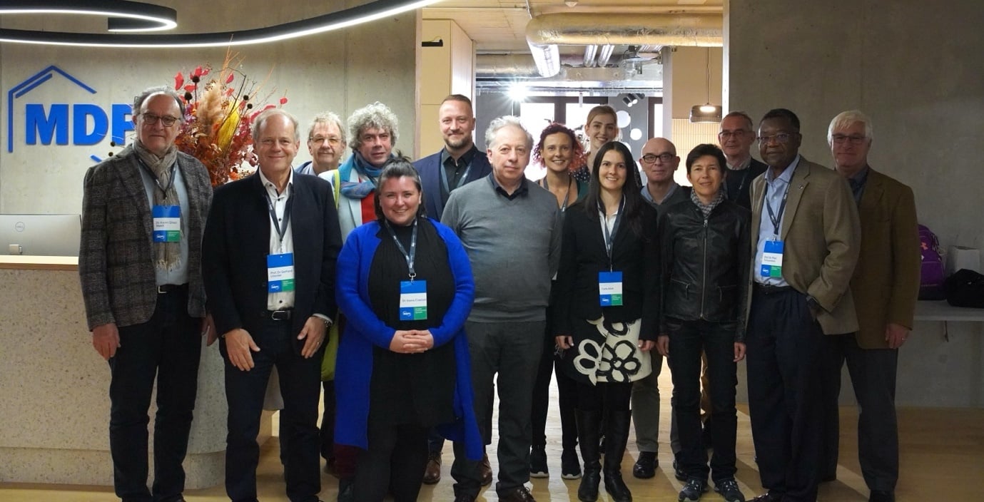
This was a great first summit for MDPI UK and received excellent feedback from our EiCs, SEiCs, and EBMs. A BIG thank-you to our Manchester team (pictured below) and everyone else involved in organizing this event. Their hard work and dedication are much appreciated!

Impactful Research

MDPI and UK Publications
The UK is an important market for MDPI, ranking ninth in total submissions to MDPI and eighth in total MDPI publications, with over 72,200 publications to date. As at October 2024, there were more than 3,600 EBMs from the UK, 48% of whom have an H-index above 26. We also have 46 EiCs, and 63 SEiCs in the UK, some of whom joined us in Manchester for the UK Summit.
The UK is a strong advocate of OA publishing, with nearly three quarters of all articles in 2023 published on open access platforms. The country enjoys a large academic market, producing high-quality papers, and is home to some of the world’s top universities. Among MDPI’s 825 IOAP agreements, over 60 of these are in the UK, facilitated through our partnership with JISC.
“The UK is a strong advocate of OA publishing”
Visit to MDPI’s Manchester Office
Last week, I visited our Manchester office to see the expanding office space, connect with our staff, and present at the MDPI UK Summit held in Manchester.

Throughout the day, I met with various teams to better understand their work and discuss their future development plans in greater depth. Hearing from group leads about the progress we have made and the challenges we face offered many valuable insights. I also had the chance to connect personally with members of the content team. It’s great to see how this young and ambitious team is coming together.

I also took the opportunity to address the entire office about the role of MDPI UK within the wider company. During this session, I answered questions about growth and public relations initiatives. Giulia Stefenelli joined us to address questions about the role of AI in MDPI’s future.
Jaime Anderson (Office Manager) and the Manchester team have done a great job of growing the office since its establishment in 2019. Today, it has around 150 staff members across various departments, including English editing, editorial services, marketing and communications, and IOAP. The team is highly active in local marketing initiatives, such as author training sessions, scholar visits, and conferences.
For more information and updates on our Manchester office, follow MDPI UK on LinkedIn.
Inside MDPI

Basel Job Fair
In November, the HR team from our Basel office connected with over 300 young professionals at the Basel Job Fair 2024. This is my biased opinion, of course, but we had the best branded booth and merchandise, which drew a lot of attention from young talent wanting to learn about current and future job opportunities at MDPI.

Our HR team also helped review CVs on the spot, providing advice on how to improve them and making a positive impression on the future workforce in Basel.

This is a reminder that MDPI is not only focused on supporting young researchers but that we also recruit and develop young talent. We have seen MDPI HR do this really well throughout all of our offices, from Asia Pacific to Europe and North America.
HR plays an important role in our growing company, helping us meet our recruitment targets as well as providing support for local teams, guidance on management and best practices, a safe space for employees, and brand recognition for MDPI, among many other things.

“MDPI is not only focused on supporting young researchers: we also recruit and develop young talent”
This is a quick appreciation post to all HR staff working to support MDPI and our colleagues, cultivating talent and supporting careers at every stage. Thanks HR staff, keep up the great work!
Coming Together for Science

Pharmaceuticals 2024 – Recent Advances in Pharmaceutical Sciences Towards a Healthy Life (The 20th Anniversary)
I am pleased to share that the Pharmaceuticals 2024 – Recent Advances in Pharmaceutical Sciences Towards a Healthy Life took place from 27 to 29 November 2024 in Barcelona, Spain. It was chaired by Prof. Dr. Amelia Pilar Rauter from the Universidade de Lisboa, Portugal; Dr. Alfredo Berzal Herranz from Instituto de Parasitología y Biomedicina López-Neyra (IPBLN) CSIC, Spain; and Prof. Dr. Mary Jane Meegan from Trinity College Dublin, Ireland.
The conference took place in Casa Convalescència, a part of the Sant Pau Art Nouveau Site. The three-day event included three plenary sessions and eight invited speakers, from eight countries, and 29 selected talks. Of the presentations on site, there were 32 posters and 29 oral presentations.

The main goal of the ‘Pharmaceuticals 2024’ international conference was to cover the newest technologies and research areas including medicinal chemistry, natural products, organic synthesis, radiopharmaceuticals, pharmacology, toxicology, and biomolecular and glycosciences, in a meeting that brought together experts to present their latest findings on combatting infection, inflammation, pain, and neurodegeneration, to mention just a few of the topics that were discussed.

“The main goal of ‘Pharmaceuticals 2024’ was to cover the newest technologies and research areas”
20th Anniversary of Pharmaceuticals
The year 2024 marks the 20th anniversary of Pharmaceuticals – a journal dedicated to medicinal chemistry and related drug sciences, which is published monthly online by MDPI. To honour this milestone, we are reflecting on our past accomplishments and embarking on an exciting new chapter. This celebration is also one of the reasons why we organized the conference Pharmaceuticals 2024. With an Impact Factor of 4.3 and a CiteScore of 6.1, the journal is covered in Scopus, SCIE (Web of Science), PubMed, PMC, Embase, CAPlus/SciFinder, and other databases. Pharmaceuticals has published over 6,000 papers from more than 37,000 authors. More than 10,000 reviewers have reviewed for it at least once.
20th Anniversary of Pharmaceuticals: The Video
This video captures the experiences of the conference chairs, honorary guests and committee members of the conference.
Thank you to our partnering societies
A special thank-you is due to our partnering societies the Spanish Society Of Medicinal Chemistry (SEQT) and the Spanish Society For Biochemistry And Molecular Biology (SEBBM) for their support of the Pharmaceuticals 2024 conference. I am also pleased to report that we presented two awards, sponsored by the journal Pharmaceuticals, including the Best Presentation Award and the Best Oral Presentation Award, recognizing the contributions of our participants.
Closing Thoughts

Presenting at the 4th Central European Technology Forum
I visited Krakow, Poland in November to participate in the 4th Central European Technology Forum (CETEF’24), which took place on 18 and 19 November.
CETEF is an international conference that has been jointly organized since 2014 by the Polish Chamber of Commerce for Advanced Technologies (IZTECH) and the Polish Federation of Engineering Associations, with the support of the European Parliament and the European Commission, in cooperation with universities, research institutes and the high-tech industry. The 2024 event focused on presentation to advance the European science and technology agenda for 2025–2030.

MDPI participated as a key publishing sponsor. We had an exhibition booth and held two key presentations during the conference. On Monday, I presented MDPI’s vision, purpose, and achievements.
On Tuesday, Dr. Giulia Stefenelli shared how MDPI supports advancements in high technology and energy transition, highlighting our portfolio, services, tools and initiatives for promoting progress and interdisciplinary collaboration.

We received positive feedback from scientists and government representatives in attendance.
A big thank-you goes to our colleagues from the Krakow office for their support in organizing our participation and managing the MDPI booth.
Special thanks are owing to Weronika Gorka-Kumik, Igor Matic, Vincent Di, Agnieszka Rydz, Ksenia Shubenkova, Anna Krakowka and Klaudia Kasprowicz.
Below is a photo with the President of the Polish Chamber of Commerce conference (centre), along with MDPI colleagues Giulia Stefenelli, Weronika Gorka-Kumik, and Igor Matic (left to right).

“This year’s event focused on ideas and proposals to advance the European science and technology agenda for 2025–2030”
Chief Executive Officer
MDPI AG
4 December 2024
685 MDPI Editors Named Highly Cited Researchers in 2024

We extend our heartfelt congratulations to the 685 Editorial Board Members of our journals – from 39 different countries and territories – who have been recognized as Highly Cited Researchers for 2024 by Clarivate. This distinction highlights their exceptional scientific achievements and significant contributions, which transcend academic boundaries to advance global knowledge, sustainability, security, and well-being.
Clarivate's annual Highly Cited Researcher™ list identifies the most influential scientists of the past decade, whose work has had a profound and widespread impact across various scientific and social science disciplines. Their impactful papers rank among the top 1% by citations in one or more of the 21 fields analyzed within the "Essential Science Indicators," marking them as leaders in their respective domains.
"Highly Cited Researchers have demonstrated significant and broad influence in their field(s) of research," according to Clarivate. In 2024, a total of 6,886 Highly Cited Researcher designations were awarded to 6,636 individuals.
The following is a list of MDPI's Editorial Board Members named Highly Cited Researchers in 2024. We congratulate them for their achievement and their contributions to advancing knowledge in their respective fields.
|
Abate, Antonio |
Jiang, Lianzhou |
Song, Jibin |
4 December 2024
Topics Webinar | Leveraging AI: Integrating Remote Sensing, GIS, and Machine Learning for Natural Disaster Resilience, 11 December 2024

A message from the webinar Chair:
It is a pleasure to welcome you to this webinar, entitled “Leveraging AI: Integrating Remote Sensing, GIS, and Machine Learning for Natural Disaster Resilience”, and hosted by Remote Sensing, Drones, Land, IJGI, and Geomatics. We are excited to bring together a remarkable group of experts and innovators from around the world to tackle a critical challenge of the modern era: building resilience against natural hazards through the power of advanced technology.
Natural hazards, including earthquakes, floods, landslides, volcanic eruptions, wildfires, and droughts, have profound impacts on communities and lead to devastating financial and human losses. In this webinar, we will explore the latest technological breakthroughs in this field, where machine learning (ML), remote sensing (RS), and geographic information systems (GISs) are reshaping how we approach these complex challenges. This session will highlight ML methods that can extract meaningful insights from large data sets, transforming raw information into valuable knowledge. GISs add a vital dimension to these insights, acting as powerful tools for spatial analysis and visualization. In addition, given recent advances in deep learning, ensemble methods, evolutionary algorithms, and explainable AI (XAI), the capabilities of hazard prediction and preparedness have never been more promising.
Our aim is to foster connections, spark new ideas, and explore how these innovative approaches are transforming hazard mapping, monitoring, and assessment. Thank you for being part of this crucial journey. I hope you have an inspiring day filled with insights, collaboration, and discovery.
Warm regards,
Dr. Paraskevas Tsangaratos
Date: 11 December 2024 at 9:00 a.m. CET | 4:00 p.m. CST Asia | 10:00 a.m. EET
Webinar ID: 843 0771 3005
Website: https://sciforum.net/event/Topics-30
Register now for free!![]()
Program:
|
Speaker |
Presentation Title |
Time in CET |
Time in CST Asia |
Time in EET |
|
Dr. Paraskevas Tsangaratos |
Chair’s Introduction |
9:00–9:10 a.m. |
4:00–4:10 p.m. |
10:00–10:10 a.m. |
|
Prof. Dr. Raffaele Albano |
AI-Based Flood Monitoring and Early Warning |
9:10–9:35 a.m. |
4:10–4:35 p.m. |
10:10–10:35 a.m. |
|
Dr. Haoyuan Hong |
Landslide Susceptibility Mapping Based on the Reliability of Landslide and Non-Landslide Samples |
9:35–10:00 a.m. |
4:35–5:00 p.m. |
10:35–11:00 a.m. |
|
Dr. Dimitrios Loukidis |
Integrating Geotechnical Parameters with Advanced Machine Learning for Enhanced Landslide Susceptibility Mapping: A Case Study of Southwestern Cyprus |
10:00–10:25 a.m. |
5:00–5:25 p.m. |
11:00–11:25 a.m. |
|
Q&A Session |
10:25–10:35 a.m. |
5:25–5:35 p.m. |
11:25–11:35 a.m. |
|
|
Dr. Paraskevas Tsangaratos (Chair) |
Closing of Webinar |
10:35 – 10:40 a.m. |
5:35–5:40 p.m. |
11:35–11:40 a.m. |
After registering, you will receive a confirmation email containing information on how to join the webinar. Registrations with academic institutional email addresses will be prioritized.
Unable to attend? Register anyway and we will let you know when the recording is available to watch.
Webinar Chair and Keynote Speakers:
- Dr. Paraskevas Tsangaratos, Department of Geological Studies, School of Mining and Metallurgical Engineering, National University of Athens, Athens, Greece;
- Prof. Dr. Raffaele Albano, School of Engineering, University of Basilicata, Potenza, Italy;
- Dr. Haoyuan Hong, School of Geographic Sciences, Nanjing University of Information Science and Technology, Nanjing, China;
- Dr. Dimitrios Loukidis, Department of Civil & Environmental Engineering, University of Cyprus, Nicosia, Cyprus.
Relevant Special Issues:
“Assessing Natural Hazards through Advanced Machine Learning Methods and Remote Sensing Technology: 3rd Edition”
Guest Editors: Dr. Paraskevas Tsangaratos, Dr. Wei Chen, Dr. Ioanna Ilia and Dr. Haoyuan Hong
Deadline for manuscript submissions: 31 December 2024
“Unmanned Aerial Systems (UAS) for Global Challenges: Current Technologies and Future Prospects”
Guest Editors: Dr. Bashar Alsadik, Prof. Dr. Francesco Nex, Prof. Dr. Fabio Remondino and Dr. Jesús Balado Frías
Deadline for manuscript submissions: 31 December 2024
“Advances in Remote Sensing and GIS for Natural Hazards Monitoring and Management”
Guest Editors: Dr. Adrianos Retalis and Dr. Dimitrios D. Alexakis
Deadline for manuscript submissions: 31 December 2024
“Artificial Intelligence for Soil Erosion Prediction and Modeling”
Guest Editors: Dr. Nikiforos Samarinas, Dr. Nikolaos L. Tsakiridis, Dr. Nikolaos Tziolas and Dr. Ioannis N. Daliakopoulos
Deadline for manuscript submissions: 3 April 2025
Relevant Article:
“Geospatial Intelligence and Machine Learning Technique for Urban Mapping in Coastal Regions of South Aegean Volcanic Arc Islands”
Authors: Pavlos Krassakis, Andreas Karavias, Paraskevi Nomikou, Konstantinos Karantzalos, Nikolaos Koukouzas, Stavroula Kazana, Issaak Parcharidis
Geomatics 2022, 2(3), 297-322; https://doi.org/10.3390/geomatics2030017
20 November 2024
Meet Us at the Second World Geography Conference, 22–24 November 2024, Shanghai, China
MDPI will attend the Second World Geography Conference, which will take place from 22 to 24 of November 2024 at the Shanghai International Procurement Exhibition Center, Shanghai, China.
To promote the study of geography in China, specifically that of major global issues and different countries’ regional geography, the Chinese Geographical Society, the East China Normal University, the China National Innovation and Development Strategy Research Association, and the University of Chinese Academy of Sciences successfully held the First World Geography Congress in Shanghai in November 2022. The congress, with the theme of “Geography and Building a Community with a Shared Future for Mankind” conducted in-depth exchanges and reached a broad consensus, releasing the “Declaration of the World Geography Congress” which called for holding said congress every two years. After careful consideration, the Second World Geography Congress is scheduled to be held in Shanghai from 22 to 24 of November 2024.
We welcome you to visit MDPI’s booth, where you will be able to have face-to-face exchanges with our representatives, learn more about our open access publishing services, and acquire gifts.
The following MDPI journals will be represented:
- Remote Sensing;
- Climate;
- Atmosphere;
- Geographies;
- Oceans;
- Energies;
- Sustainability;
- Resources;
- Clean Technologies;
- Land;
- Environments.
If you plan to attend this conference, we invite you to visit our booth and converse with our delegates at the conference venue. We are excited to meet you in person and will address any questions that you may have. For further details about this conference, please visit the following website: http://www.wgeoc.com/.
19 November 2024
Topics Webinar | EO&GEO Series: GIS Day—GeoAI and the Future of Spatial Analytics, 20 November 2024

Welcome message by Webinar Chair, Dr. Dev Raj Paudyal:
It is a great pleasure to welcome you to the special webinar to commemorate Geographic Information Systems (GIS) Day. The webinar is organized by the MDPI open access journal ISPRS International Journal of Geo-Information (IJGI, ISSN: 2220-9964) to encourage scientists to raise awareness about the importance of geography and GIS technology.
GIS Day is a very special day to celebrate and enjoy all of the exciting GIS activities and projects that have been conducted and accomplished over the year. GIS Day provides an international forum for learners, scholars, and practitioners of geographic information science and technology to demonstrate real-world applications that are making a difference in our society.
The first formal GIS Day took place in 1999. Esri president and co-founder Jack Dangermond credits Ralph Nader with being the person who inspired the creation of GIS Day. Nader considered GIS Day a good initiative for people to learn about geography and the uses of GIS and wanted GIS Day to be a grassroots effort that was open to everyone.
The webinar title this year is “GeoAI and the Future of Spatial Analytics”. We have invited three distinguished scholars to deliver presentations. Let’s celebrate GIS Day together.
Date: 20 November 2024 at 06.00 a.m. CET | 12:00 a.m. EST | 1:00 p.m. CST Asia
Webinar ID: 885 5794 5831
Register now for free!
![]()
|
Speaker/Presentation |
Time in CET |
Time in EST |
|
Dr. Dev Raj Paudyal Chair Introduction |
6:00–6:10 a.m. |
12:00–12:10 a.m. |
|
Dr. Wenwen Li Geospatial foundation model for flood mapping |
6:10–6:30 a.m. |
12:10–12:30 a.m. |
|
Dr. Sisi Zlatanova TBA |
6:30–6:50 a.m. |
12:30–12:50 a.m. |
|
Dr. Yongze Song TBA |
6:50–7:10 a.m. |
12:50–1:10 a.m. |
|
Q&A Session |
7:10–7:25 a.m. |
1:10–1:25 a.m. |
|
Dr. Dev Raj Paudyal Closing of Webinar |
7:25–7:30 a.m. |
1:25–1:30 a.m. |
After registering, you will receive a confirmation email containing information on how to join the webinar. Registrations with academic institutional email addresses will be prioritized.
Unable to attend? Register anyway and we will inform you when the recording is available.
Webinar Chair and Keynote Speakers:
- Dev Raj Paudyal (Chair), School of Surveying and Built Environment, University of Southern Queensland, Australia;
- Wenwen Li, School of Geographical Sciences and Urban Planning, Arizona State University, USA;
- Sisi Zlatanova,University of New South Wales, Australia;
- Yongze Song, School of Design and the Built Environment, Curtin University, Australia.
14 November 2024
Topics Webinar | EO & GEO Series: Tracking Coastal Change with Geospatial Artificial Intelligence Techniques, 21 November 2024

Join us for an engaging webinar! Coastal waterways and the natural systems that surround them are changing at an unprecedented rate due to population growth, the intensification of land use, and climate change. Monitoring the health of coastal waterways as well as natural systems and documenting their pace and pattern of change are both vital for informing coastal management and guiding solutions. In this webinar, Tracking Coastal Change with Geospatial Artificial Intelligence Techniques, we will explore a series of emerging technologies for achieving such coastal monitoring and change assessment tasks. Over the course of a series of short presentations, we will share the scope of the interdisciplinary work being pursued by members of the University of Florida's Center for Coastal Solutions in the rapidly growing space of geospatial AI, in addition to highlighting innovative application examples. These examples will include the exploration of (1) a new deep learning-based method for identifying tidal creeks and wetland features from high-resolution remotely sensed images, (2) an AI-enhanced technique for assessing salt marsh morphology from UAV-derived images, and (3) a neural network classifier that combines remote sensing data with spatiotemporally distributed in situ sample data to monitor blooms of the potentially harmful algae Karenia brevis (or red tide). We will welcome questions to engage and include the audience through the webinar.
Date: 21 November 2024
Time: 4:00 p.m. CET | 10:00 a.m. EDT | 11:00 p.m. CST Asia
Register in advance for this webinar: https://us02web.zoom.us/webinar/register/WN_UtOEEZb4T2eLv8sOBAZdqA
Webinar ID: 842 6788 0032
Webinar Secretariat: journal.webinar@mdpi.com
Webinar announcement: https://sciforum.net/event/Topics-28
Register now for free!
![]()
|
Speaker/Presentation |
Time in CEST/CET (Basel Time) |
Time in EST |
|
Dr. Christine Angelini |
3:00–3:05 p.m. |
10:00–10:05 a.m. |
|
Dr. Christine Angelini |
3:05–3:25 p.m. |
10:05–10:25 a.m. |
|
Ms. Richa Dutt |
3:25–3:45 p.m. |
10:25–10:45 a.m. |
|
Dr. Daniele Pinton |
3:45–5:05 p.m. |
10:45–11:05 a.m. |
|
Dr. Ron Fick |
5:05–5:25 p.m. |
11:05–11:25 a.m. |
|
Dr. Christine Angelini |
5:25–5:30 p.m. |
11:25–11:30 a.m. |
After registering, you will receive a confirmation email containing information on how to join the webinar. Registrations with academic or institutional email addresses will be prioritized.
Unable to attend? Feel free to still register; we will inform you when the recording is available.
Webinar Chair and Keynote Speakers:
- Dr. Christine Angelini, Center for Coastal Solution, Engineering School for Sustainable Infrastructure and Environment, University of Florida, USA;
- Ms. Richa Dutt, Computer and Information Science and Engineering, University of Florida, USA;
- Dr. Daniele Pinton, Civil and Coastal Engineering, Engineering School for Sustainable Infrastructure and Environment, University of Florida, USA;
- Dr. Ron Fick, Center for Coastal Solutions, Engineering School for Sustainable Infrastructure and Environment, University of Florida.
Relevant Topic Information:
“Advances in Earth Observation and Geosciences”
Topic Editors: Prof. Dr. Diego González-Aguilera and Prof. Dr. Pablo Rodríguez-Gonzálvez
5 November 2024
MDPI INSIGHTS: The CEO's Letter #17 - OA Week, Basel Open Day, Beijing Graphene Forum
Welcome to the MDPI Insights: The CEO's Letter.
In these monthly letters, I will showcase two key aspects of our work at MDPI: our commitment to empowering researchers and our determination to facilitating open scientific exchange.
Opening Thoughts
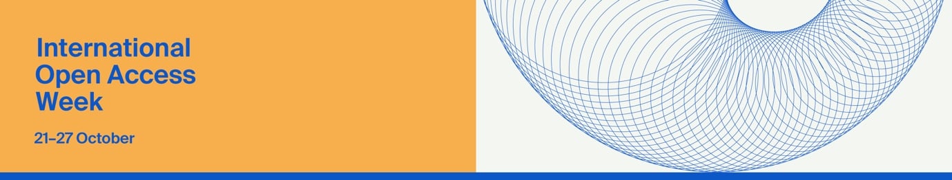
Open Access Week: Forging the Future of Open Access through Global Reach and Collaboration
From 21 to 27 October, we celebrated International Open Access Week (OAW), highlighting the importance of making research accessible to everyone. This campaign reinforced our commitment to advancing open access (OA) and showcased how we are helping research communities worldwide adopt OA as their standard.
“OA publishing is now a cornerstone of global research”
Throughout the week, we featured MDPI’s efforts to support quality open research through blog posts on topics such as how Research Integrity Promotes OA Practices, our Preprints.org platform, and supporting societies with different OA models. These initiatives capture our commitment to making research more inclusive and accessible to all.
OA publishing is now a cornerstone of global research, with more researchers choosing OA over traditional paywalled models, and embracing new, community-driven models.
Benefits of Open Access and Open Research
- Accelerated Discoveries: OA speeds up scientific progress by allowing immediate access to findings, enabling researchers to build on each other’s work faster.
- Community-Led Innovation: Open research empowers communities to manage their own platforms, creating collaboration and shared knowledge.
- Increased Visibility: OA broadens the reach of your research, leading to greater recognition, collaboration, and impact.
- Cross-Disciplinary Connections: By removing financial and geographical barriers, OA unites diverse fields, sparking innovation across disciplines.
MDPI Singapore Celebrates Open Access Week
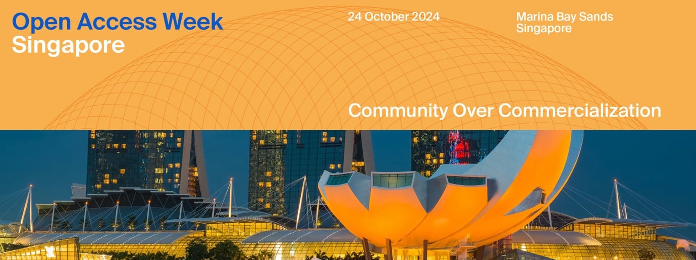
MDPI Singapore also hosted its first-ever OAW event at the Marina Bay Sands Convention Centre, bringing together academics, researchers, and students to discuss the future of open scholarship. Conversations focused on the potential of new publishing models, alternative funding strategies, and the importance of communicating research to wider audiences.
As OA evolves, MDPI remains a committed partner in advancing open science and creating a transparent, inclusive research environment. For a full recap of the week’s highlights and resources, visit our campaign page.

Impactful Research
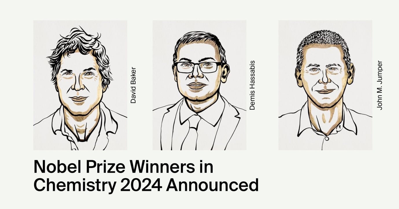
MDPI Connection to Nobel-Winning Protein Research
David Baker, an American biochemist, and Demis Hassabis and John M. Jumper, two scientists from Google DeepMind, have been awarded the 2024 Nobel Prize in Chemistry for their groundbreaking advancements in better understanding the structure of proteins, the molecular engines of life’s processes.
One half of the prize was awarded to Professor David Baker from the University of Washington for his development of revolutionary protein design software enabling the creation of novel proteins for vaccines, nanomaterials, and sensors. Prof. Baker co-authored a 2016 paper in MDPI’s Toxins journal on protein-based therapeutics.
Meanwhile, DeepMind’s Demis Hassabis and John M. Jumper received recognition for AlphaFold, the AI model that predicts protein structures from amino acid sequences, fulfilling a long-held scientific dream.
“We congratulate this year’s Nobel laureates for their groundbreaking contributions to the study of life”
Nobel Prize Laureates Entrust MDPI with Their Research
As at October 2024, 45 Nobel laureates had contributed to more than 115 articles across
35 MDPI journals. The privilege of hosting the research of such contributors, who significantly influence the open access movement, resonates deeply with our editorial teams.
We are proud to list the names of Pierre Agostini, Hiroshi Amano, Werner Arber, Aaron Ciechanover, Robert H. Grubbs, Oliver Hart, Gerard ‘t Hooft, Michael Houghton, Harald zur Hausen, Katalin Karikó, Jean-Marie Lehn, Gérard Mourou, Ferid Murad, Shuji Nakamura, William Nordhaus, Kostya S. Novoselov, Giorgio Parisi, Charles M. Rice, Alvin E. Roth, Donna Strickland, K. Barry Sharpless, George F. Smoot, Anne L’Huillier, Drew Weissman, Kurt Wüthrich, Ada Yonath, Tomas Lindahl, Thomas C. Südhof, Stanley B. Prusiner, Roger Kornberg, Robert F. Engle, Richard J. Roberts, Ōmura Satoshi, Kenneth J. Arrow, John B. Goodenough, Jennifer Doudna, Hamilton Othanel Smith, Eric R. Kandel, Carlo Rubbia, Bernard Feringa, Barry J. Marshall, Anthony J. Leggett, Andrew Victor Schally, and David Baker.
Notable MRNA Published in Cells
On 7 October 2024, the 2024 Nobel Prize in Physiology or Medicine was jointly awarded to Victor Ambros and Gary Ruvkun for the discovery of microRNA and its role in post-transcriptional gene regulation.
MicroRNAs are proving to be fundamentally important for how organisms develop and function. Some interesting papers about microRNA research are published in the MDPI journal Cells. I invite you browse through the notable papers related to microRNA research in Cells.
Inside MDPI
Basel Open Day
On 21 October, we held the Basel Open Day at our headquarters, welcoming a group of journal Editors-in-Chief (EiC) and Editorial Board Members (EBMs) for a full-day workshop. The event featured presentations and discussions on MDPI’s latest editorial updates, data integrity policies, society collaborations, and local market insights.
The following MDPI journals were represented during the visit: Physics, Journal of Personalized Medicine (JPM), Sci, Remote Sensing, Animals, Cells, Buildings, Histories, Sensors, and International Journal of Environmental Research and Public Health (IJERPH).
This was a great opportunity to showcase our new office space while gathering feedback from leading journal stakeholders. To get everyone on the same page, we took 60 minutes for round-table introductions, which helped set a collaborative tone and ground us in MDPI’s mission of disseminating open science.
“This was a great opportunity to gather feedback from leading journal stakeholders”
The general feedback from the day highlighted positive developments around our editorial and ethics policies, as well as areas for improvement, including flexibility regarding reviewer deadlines. There was a genuine appreciation and push for our ongoing efforts to share more about MDPI, including company updates and promoting high-quality research through our blog, announcements, and social media channels, which we have been growing and expanding.
Our Basel Open Day was a positive experience, bringing together key journal stakeholders and gathering insights to guide MDPI’s continued engagement with the academic community. We look forward to hosting future events of this kind and welcoming more scholars to our headquarters in Basel, Switzerland.
Coming Together for Science
ncRNA 2024 Conference in Basel
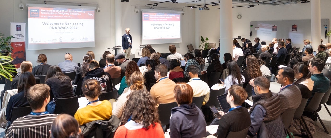
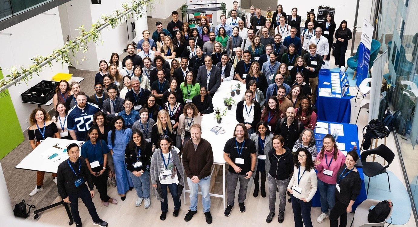
I am pleased to share that we held Non-coding RNA World 2024: Exploring Mechanisms, Designing Medicines (ICM 2024) in Basel, Switzerland this past 7–9 October.
The three-day event attracted just over 100 attendees, including two Chairs, 10 invited speakers and two keynotes from Prof. Mauro Giacca and Prof. Ling-Ling Chen. Of the presentations on site, there were 35 posters and 44 oral presentations.
The overall feedback was positive, with people enjoying the intimate event and the unique activities offered, including a guided tour around Basel’s Old Town (a must-see for anyone visiting the city) and a memorable conference dinner.
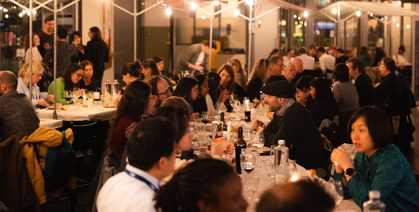
It was cool to see the winners of the 2024 Nobel Prize in Physiology or Medicine announced during the conference days. This was exciting for attendees, as the winners discovered a new class of RNA molecules (miRNAs). As one invited speaker put it, “It's exciting to be among fellows when something that important for the field is announced.”
“It's exciting to be among fellows when something that important for the field is announced”
Every attendee receives a conference survey, and I’m always pleased to see a high percentage of ‘Very Satisfied’ responses when asked about ‘treatment from conference personnel’. Kudos to our conference team for meeting our attendees’ needs. These events are a great opportunity for us to reach new audiences, as 92% of the respondents had never been to an MDPI conference, so I am thrilled to see us connecting with a new demographic of your researchers in the RNA field.
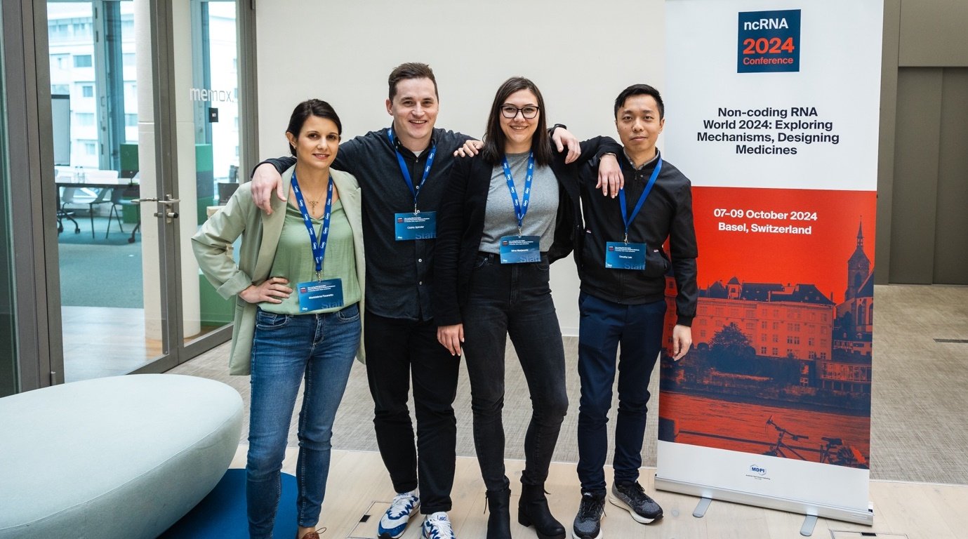
A special thank-you to our partnering societies The Epigenetics Society, The French Society of Genetics, LS2 / USGEB (Union of Swiss Societies for Experimental Biology), and The RNA Biology Group, as well as to our sponsors New England Biolabs and Arraystar for their support of the ncRNA 2024 conference. I am also pleased to report that we presented two awards, including the Best Presentation Award and two Best Poster Award, recognizing the contributions of our participants.
Upcoming In-Person Event
27–29 November 2024
Pharmaceuticals 2024 – Recent Advances in Pharmaceutical Sciences Towards a Healthy Life
Location: Barcelona, Spain
The discovery of new molecules, their properties, and actions to enhance human health and quality of life.
Find more upcoming MDPI events here.
Closing Thoughts
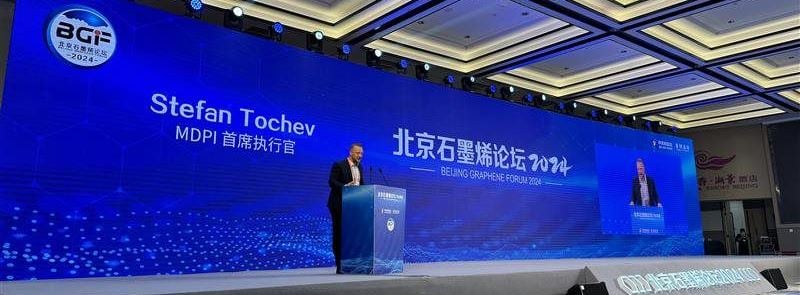
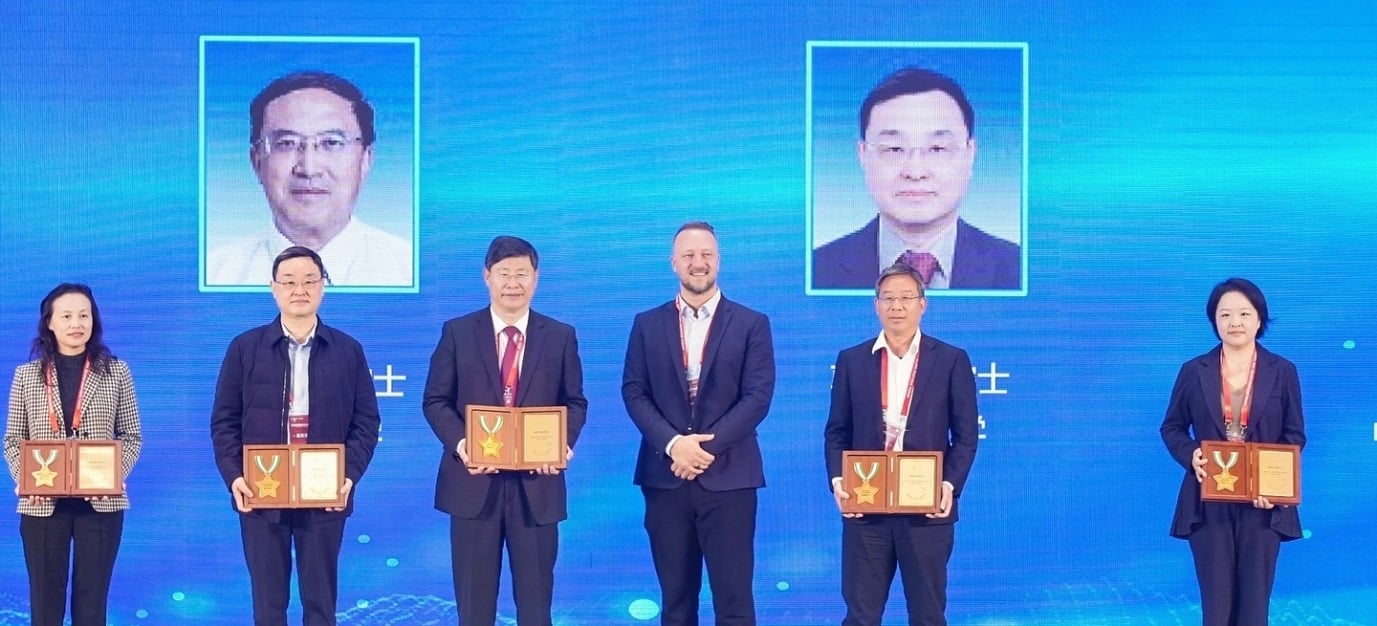
Beijing Graphene Forum 2024
I am pleased to share that we had a successful time at the Beijing Graphene Forum 2024, which drew around 1,000 attendees, including Konstantin Novoselov (2015 Nobel Prize in Physics) and other high-profile scholars in materials science and chemistry. It was a great opportunity to present MDPI on the big stage, with university presidents from institutions such as Peking University also in attendance.
I had the honour of awarding Prof. Zhongfan Liu, Chairman of the Chemical Science Committee, with a medal and presenting certificates to the members of the Chemical Science Committee; this is an important initiative to help expand MDPI’s journals and influence in China. These are highly respected scholars, and we enjoyed connecting with them over lunch as well.
“This is an important initiative to help expand MDPI’s journals and influence in China”
I also had the chance to speak about MDPI and open access, giving a five-minute speech during the opening ceremony and a 20-minute presentation at the close. MDPI hosted a sub-forum where both academic scholars and MDPI members shared insights, and we engaged with attendees at our MDPI booth.
This was a great opportunity to spotlight MDPI as the main publishing partner for the event, and I was proud to represent us on stage. We also met with scholars to discuss topics such as their publishing needs and institutional policies, open access, impact journals, and IOAP.
Chief Executive Officer
MDPI AG
22 October 2024
Join Us at “MDPI Open Access—Sensors and Remote Sensing Author Training Program”, 5 November 2024, Barcelona, Spain
MDPI is collaborating with the University of Barcelona, Spain, to hold an author training session comprising valuable insights about MDPI and open access publishing. MDPI has invited Academic Editors from the journals Sensors (ISSN: 1424-8220) and Remote Sensing (ISSN: 2072-4292) to inform authors about how to explore ongoing Special Issues and topics and discover opportunities tailored to specific author groups.
Date: 5 November 2024
Time: 11:00 a.m.–1:00 p.m.
Venue: “Eduard Fontserè” Graduate Room in the School of Physics and Chemistry, University of Barcelona, Spain
Schedule:
|
Time |
Program |
Speaker |
|
11:00 a.m.–11:40 a.m. |
MDPI and Sensors & Remote Sensing Introduction, Benefits of Open Access |
Dr. Jesús García Cano |
|
11:40 a.m.–12:20 p.m. |
Scientific Writing Skills |
Dr. Vesna Marinkovic |
MDPI Speakers:
|
Speaker |
Biography |
Dr. Jesús García Cano obtained a bachelor’s degree in biochemistry at the Autonomous University of Madrid, Spain, a master’s degree in molecular biology at the Autonomous University of Barcelona, and a Ph.D. in biomedicine at the University of Castilla-La Mancha, Spain. After two postdoctoral positions (at the University of the Basque Country, Spain and University of Barcelona, Spain), Dr. García Cano joined MDPI in February 2020 as an Assistant Editor and Section Managing Editor of the journals IJMS and Viruses. Currently, he is the Office Manager of the Barcelona Office and is a Journal Relations Specialist for EJIHPE.
Dr. Vesna Marinković completed her bachelor’s and master’s degrees in biochemistry at the University of Novi Sad, Serbia. She completed her Ph.D. in chemical engineering at the same university in 2020. She joined MDPI in May 2020, working as an Assistant Editor and Section Managing Editor for Sensors. In 2022, she was appointed Chief Section Managing Editor for the “Sensor Materials” Section in Sensors. She also works as a Journal Relations Specialist for Sensors, Automation, and Actuators.