Detecting Change at Archaeological Sites in North Africa Using Open-Source Satellite Imagery
Abstract
1. Introduction
2. Materials and Methods
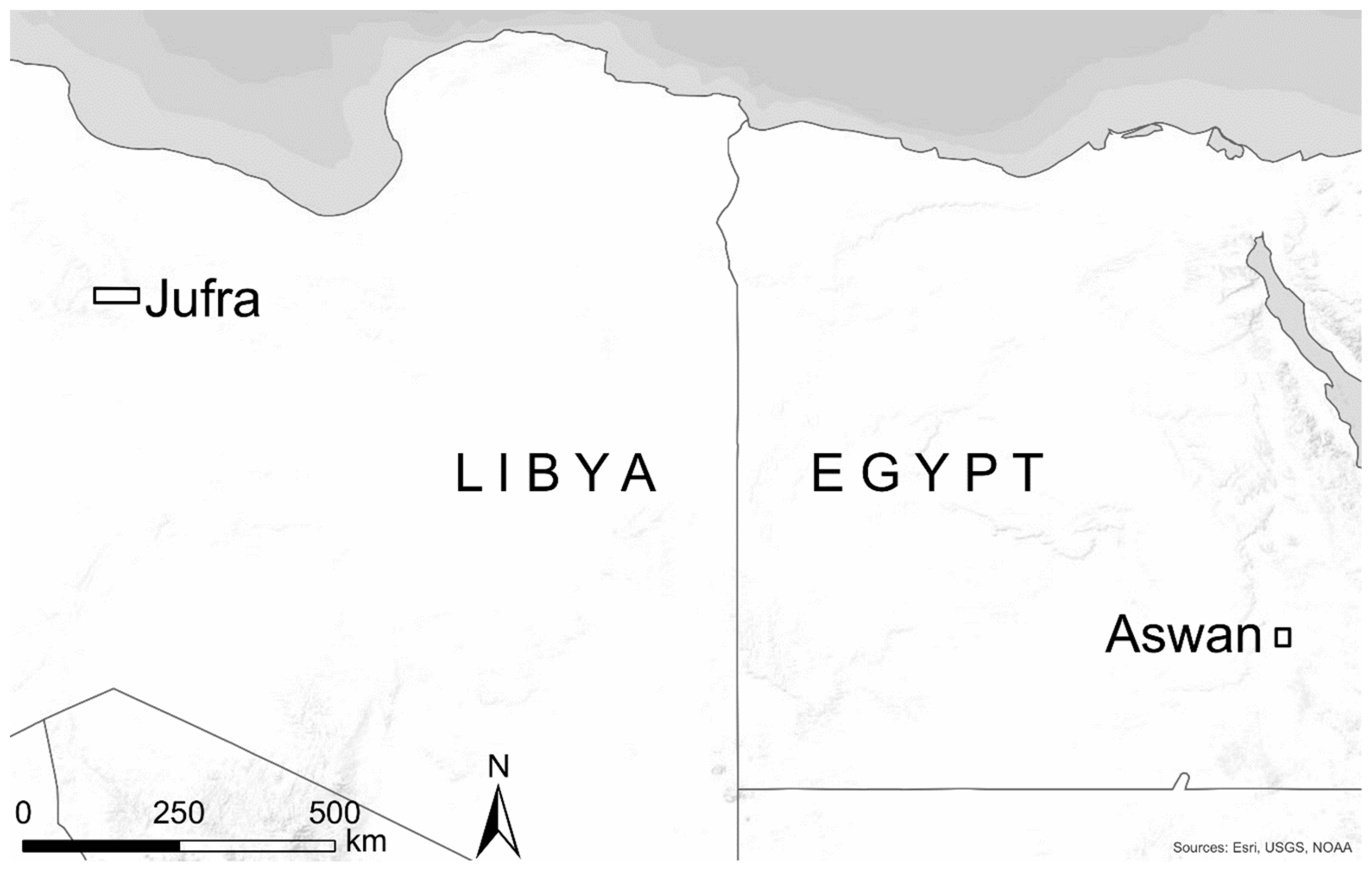
2.1. Datasets
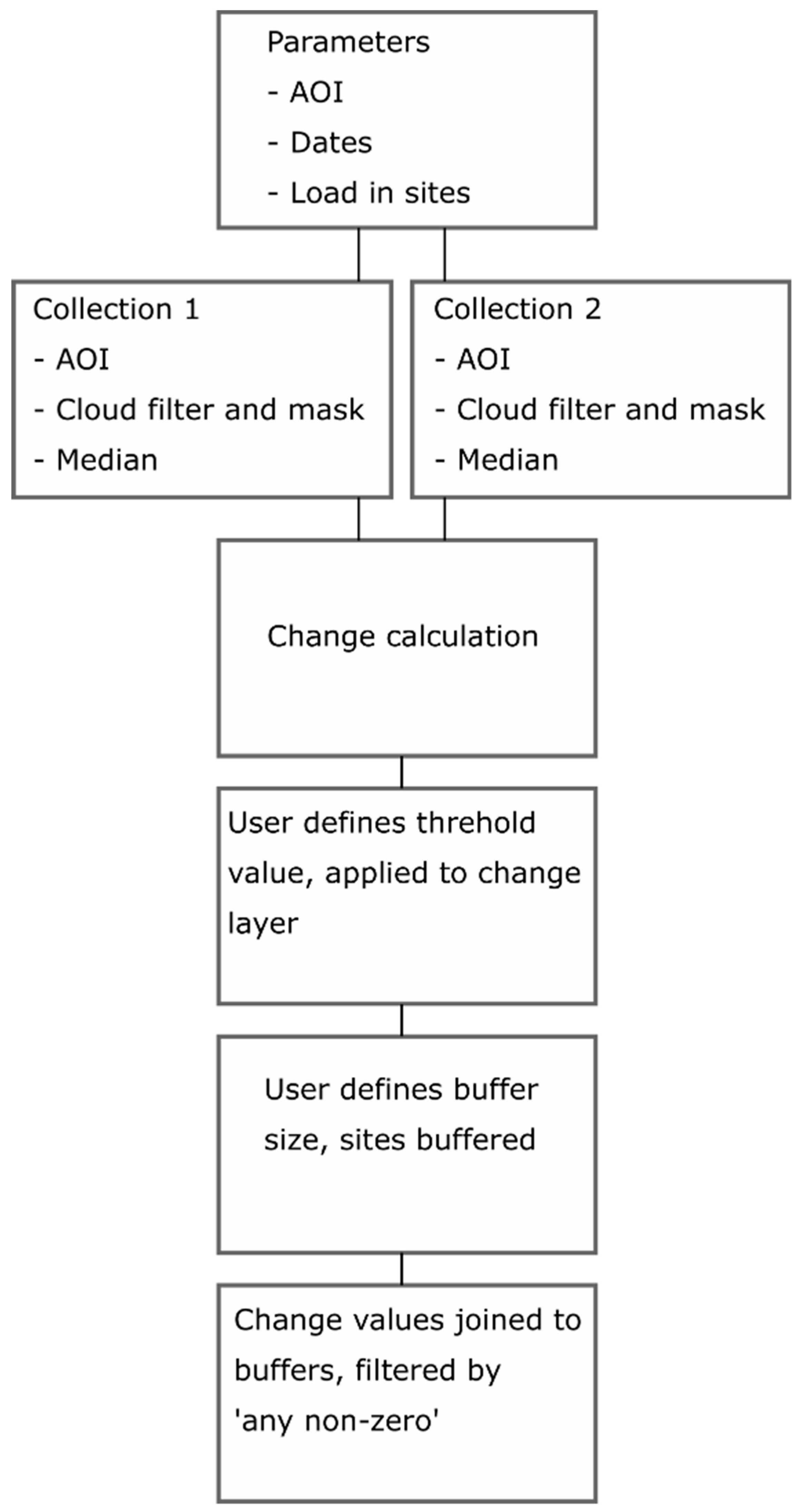
2.2. Change Detection
2.3. Validation and Field Condition Assessment
3. Results
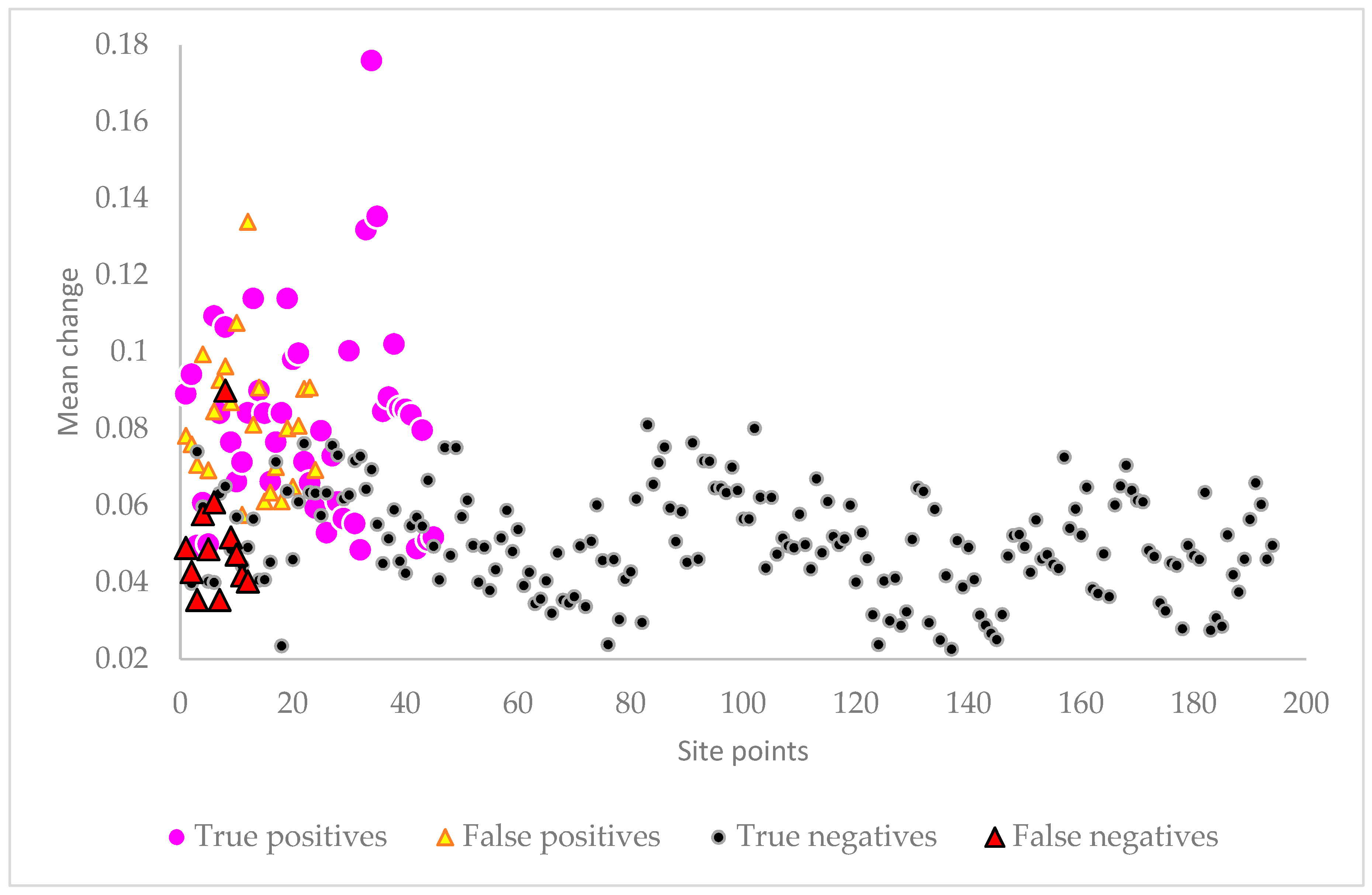
3.1. Aswan and Kom Ombo
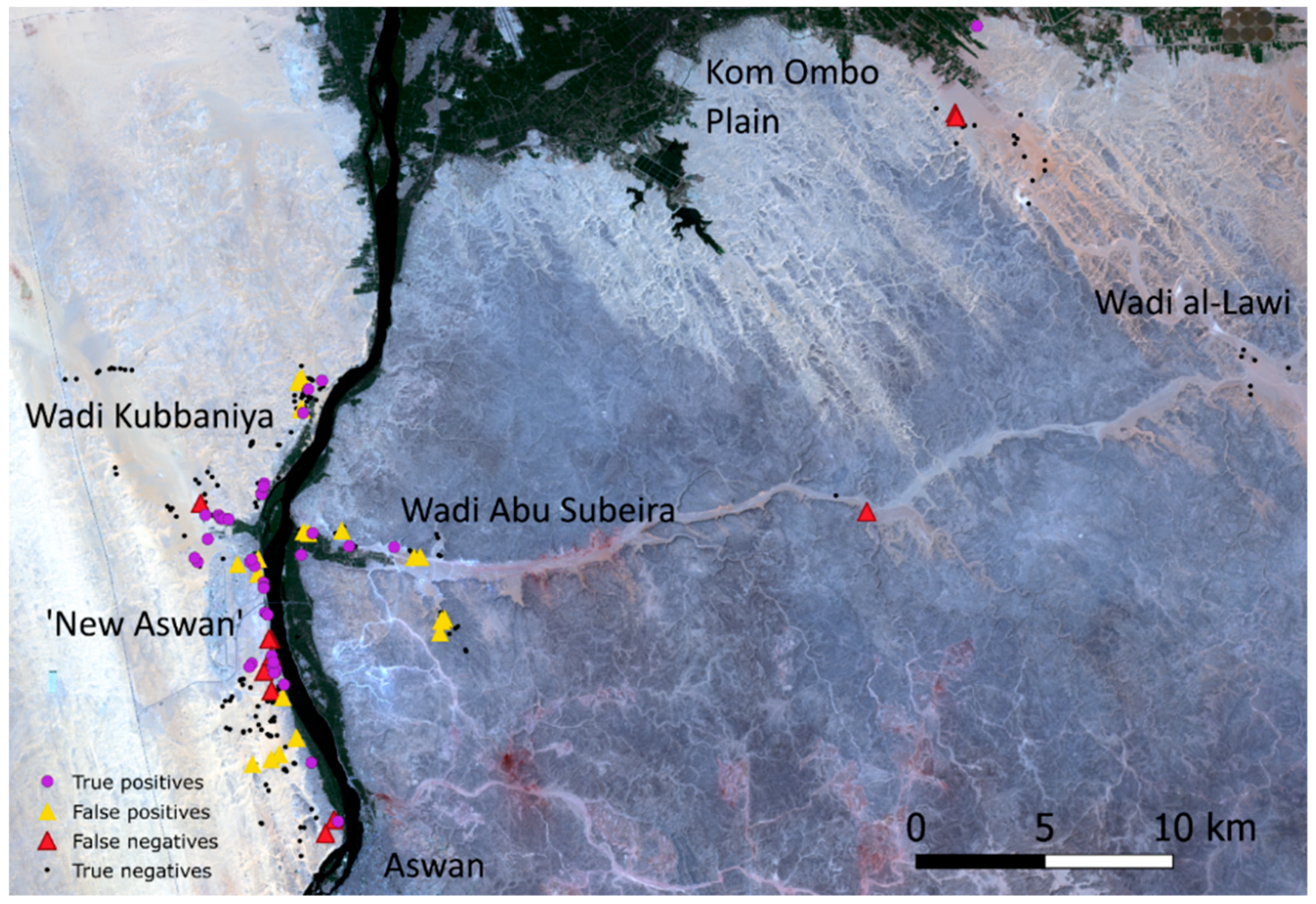
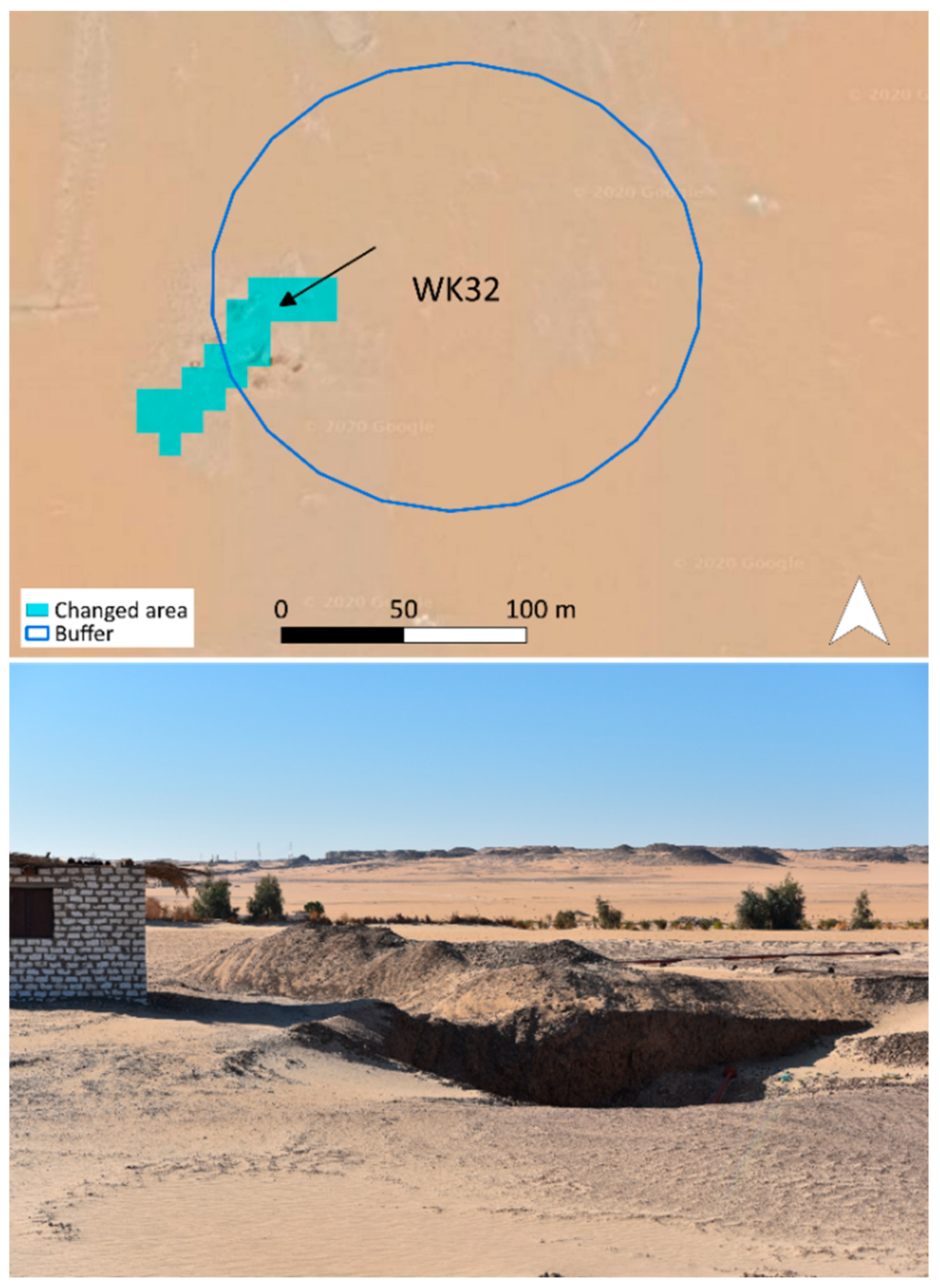
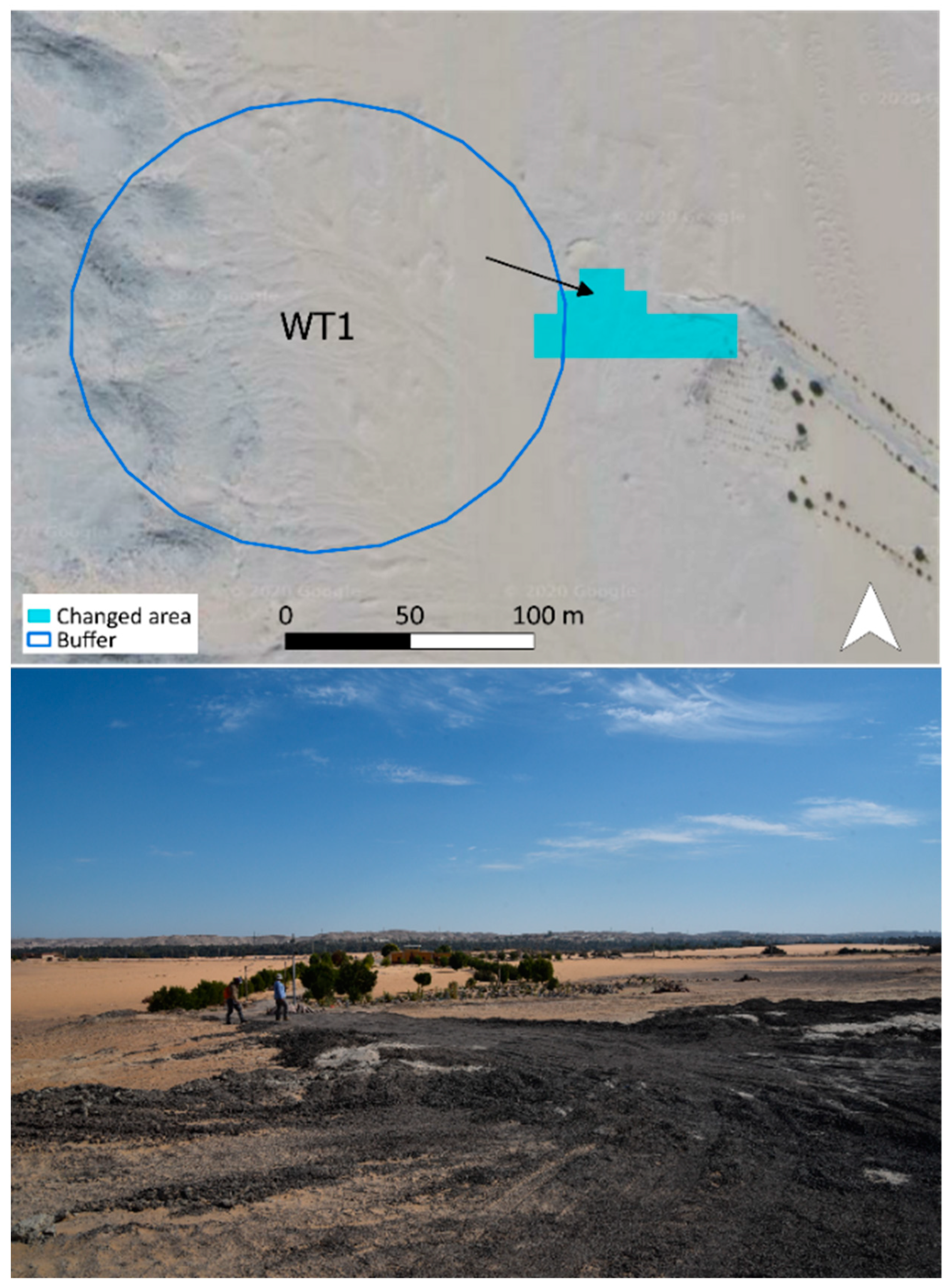
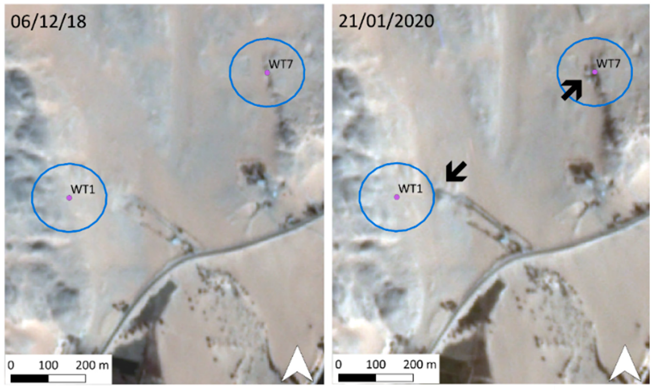
3.1.1. True Positives
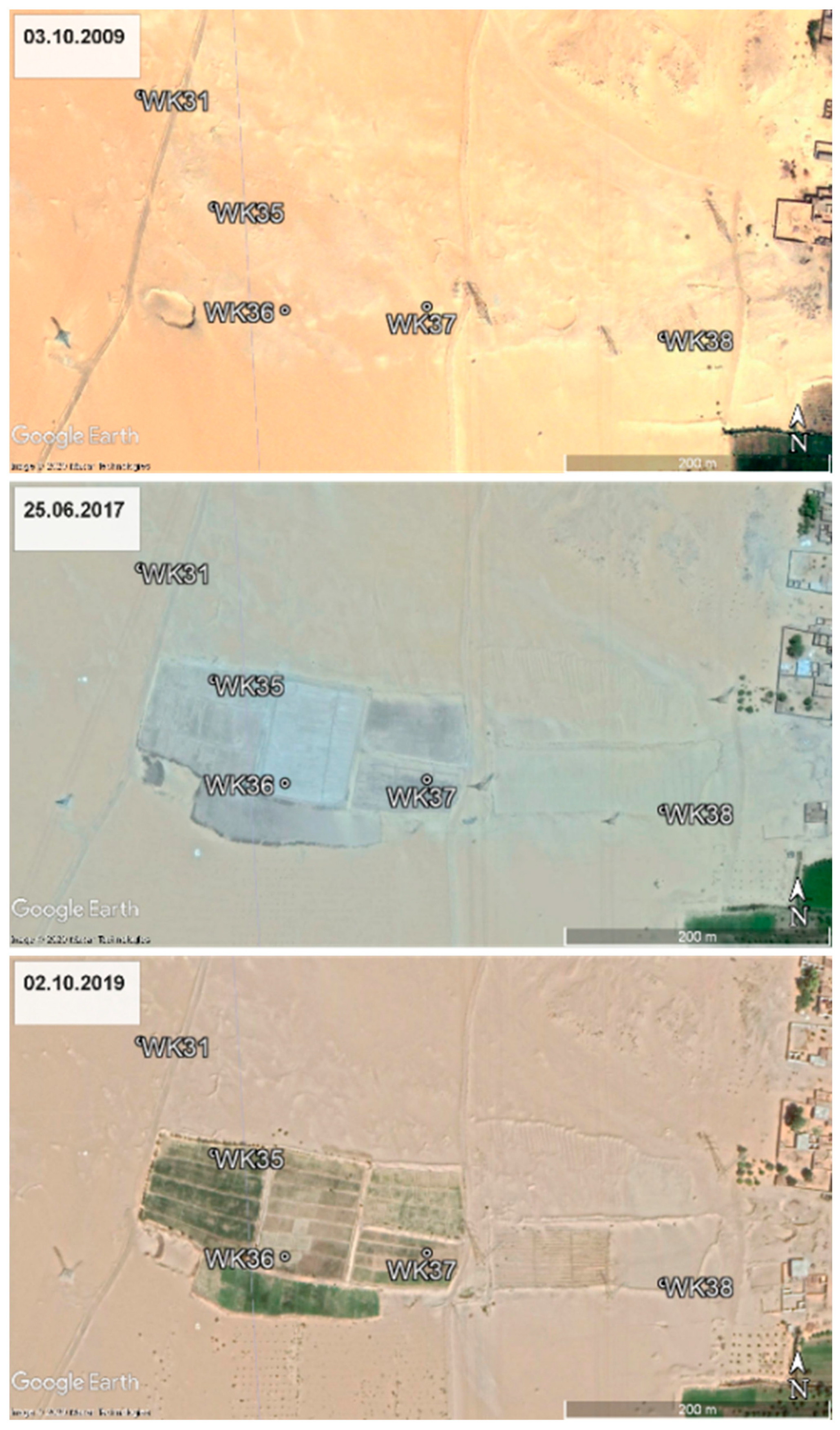
3.1.2. False Positives
3.1.3. True Negatives
3.1.4. False Negatives
3.2. Jufra
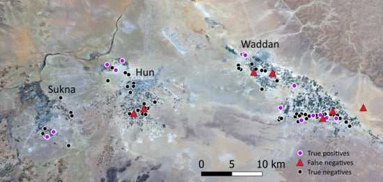
3.2.1. True Positives
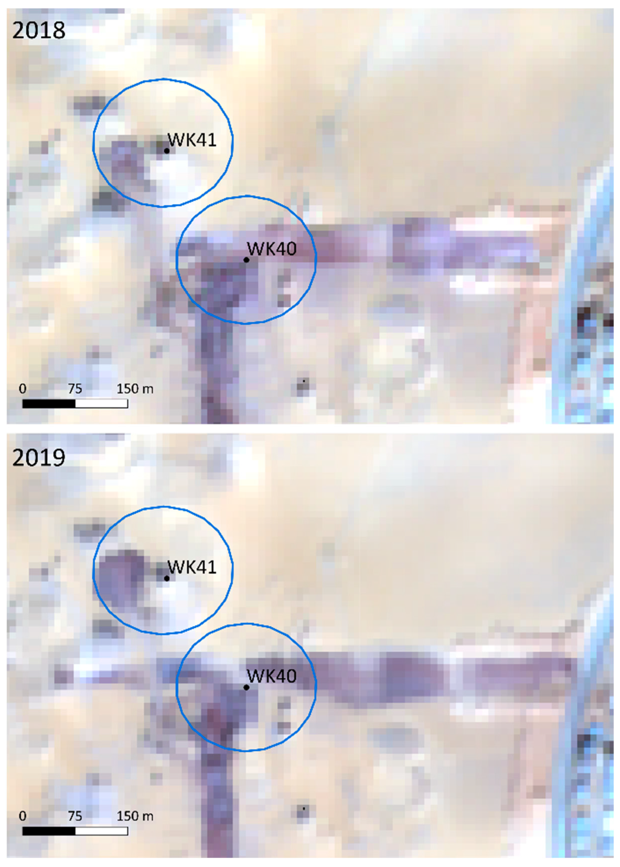
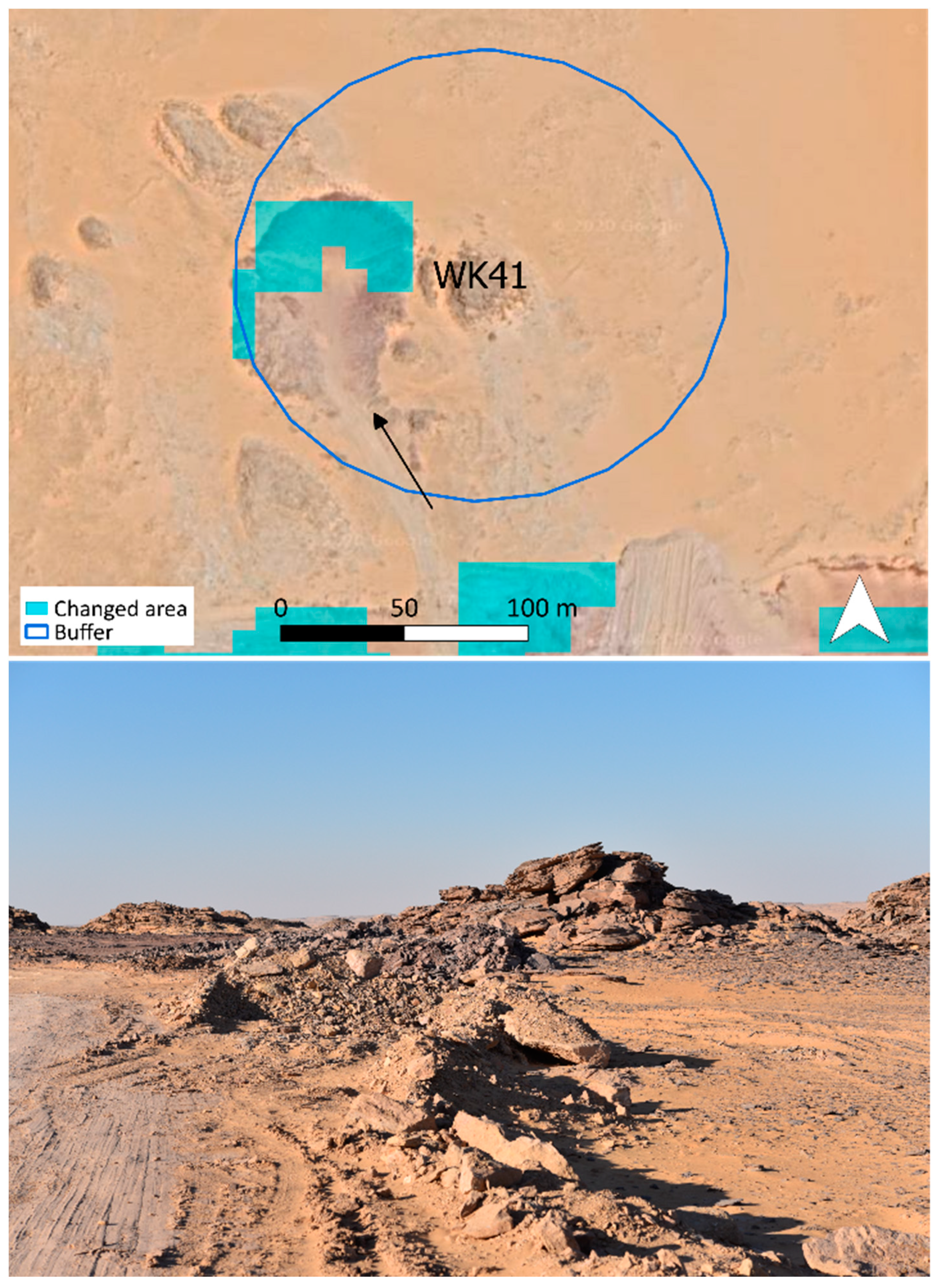
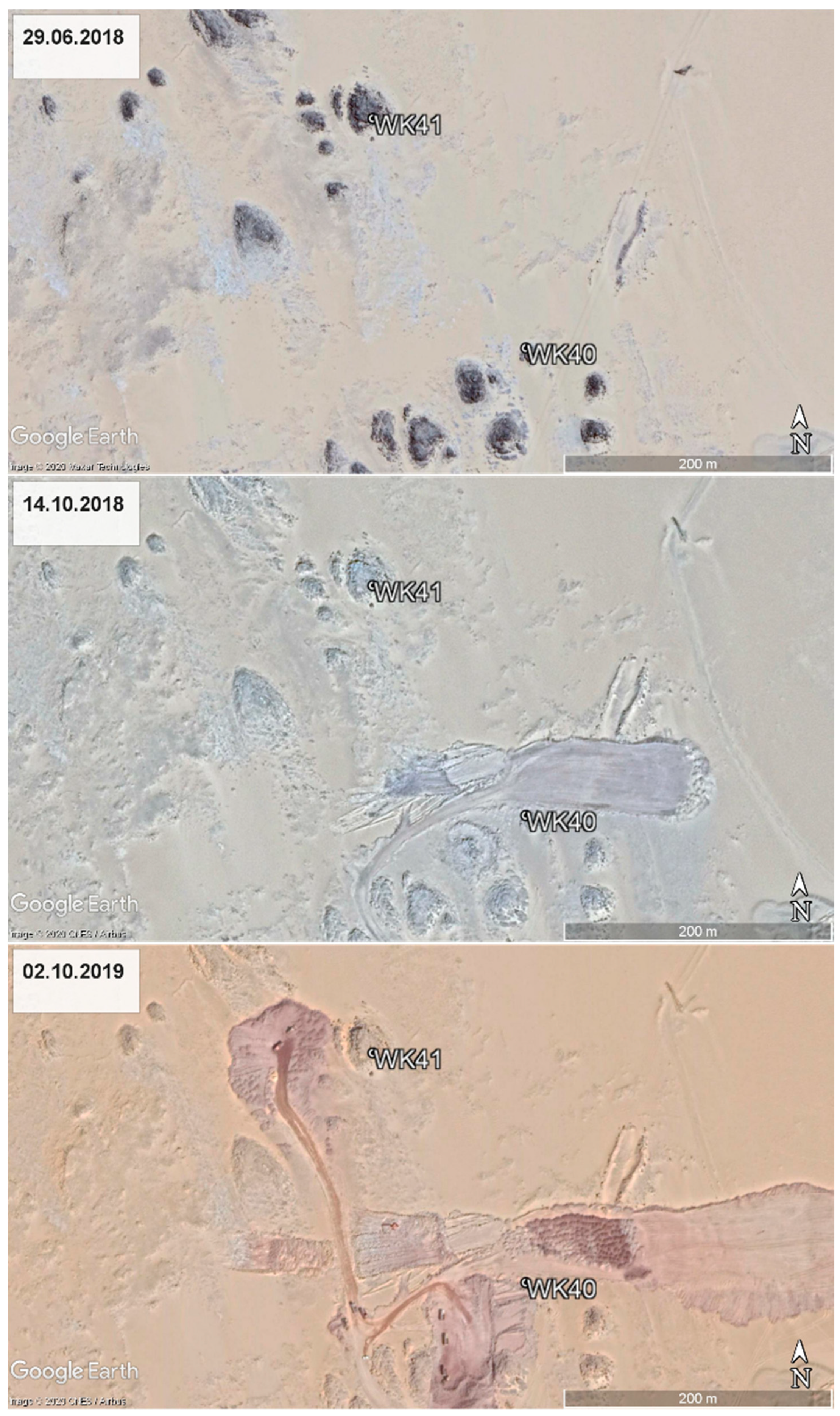
3.2.2. False Positives
3.2.3. True Negatives
3.2.4. False Negatives
4. Discussion
5. Conclusions
Supplementary Materials
Author Contributions
Funding
Acknowledgments
Conflicts of Interest
References
- Rayne, L.; Bradbury, J.; Mattingly, D.; Philip, G.; Bewley, R.; Wilson, A. From above and on the ground: Geospatial methods for recording endangered archaeology in the Middle East and North Africa. Geosciences 2017, 7. [Google Scholar] [CrossRef]
- Bewley, R.; Wilson, A.; Kennedy, D.; Mattingly, D.; Banks, R.; Bishop, M.; Bradbury, J.; Cunliffe, E.; Fradley, M.; Jennings, R. Endangered archaeology in the Middle East and North Africa: Introducing the EAMENA project. In CAA2015 Keep the Revolution Going: Proceedings of the 43rd Annual Conference on Computer Applications and Quantitative Methods in Archaeology, Siena, Italy, 31 March–2 April 2015; Archaeopress: Oxford, UK, 2016; p. 919. [Google Scholar]
- Zerbini, A. Developing a heritage database for the Middle East and North Africa. J. Field Archaeol. 2018, 43, S9–S18. [Google Scholar] [CrossRef]
- EAMENA. Available online: https://database.eamena.org/ (accessed on 27 September 2020).
- Arches. Available online: https://www.archesproject.org/ (accessed on 27 September 2020).
- Khalaf, N.; Insoll, T. Monitoring Islamic archaeological landscapes in Ethiopia using open source satellite imagery. J. Field Archaeol. 2019, 44, 401–419. [Google Scholar] [CrossRef]
- Davis, D.S.; Douglass, K. Aerial and spaceborne remote sensing in African archaeology: A review of current research and potential future avenues. Afr. Archaeol. Rev. 2020, 37, 1–16. [Google Scholar] [CrossRef]
- Tapete, D.; Cigna, F. Detection of archaeological looting from space: Methods, achievements and challenges. Remote Sens. 2019, 11, 2389. [Google Scholar] [CrossRef]
- Crawford, O.G.S. Castles and Churches in the Middle Nile Region; Sudan Antiquities Service Occasional Papers No. 2; Sudan Antiquities Service: Khartoum, Sudan, 1953. [Google Scholar]
- Mattingly, D.J.; Daniels, C.; Dore, J.N.; Edwards, D.N.; Hawthorne, J. The Archaeology of Fazzan Vol 2: Site Gazetteer, Pottery and Other Survey Finds; Society for Libyan Studies: London, UK, 2007. [Google Scholar]
- Edwards, D.N. The archaeology of the southern Fazzan and prospects for future research. Libyan Stud. 2001, 32, 49–66. [Google Scholar] [CrossRef]
- Al Raeid, F.; Di Valerio, E.; Di Antonio, M.G.; Menozzi, O.; El Mziene, M.A.A.; Tamburrino, C. The main issues of the Cyrene necropolis and the use of remote sensing for monitoring in the case of the eastern necropolis. Libyan Stud. 2016, 47, 7–30. [Google Scholar] [CrossRef]
- Bowen, E.F.; Tofel, B.B.; Parcak, S.; Granger, R. Algorithmic identification of looted archaeological sites from space. Front. ICT 2017, 4, 4. [Google Scholar] [CrossRef]
- Zerbini, A.; Fradley, M. Higher Resolution Satellite Imagery of Israel and Palestine: Reassessing the Kyl-Bingaman Amendment. Space Policy 2018, 44, 14–28. [Google Scholar] [CrossRef]
- Mattingly, D.J.; Sterry, M.; Rayne, L.; Al-Haddad, M. Pre-Islamic oasis settlements in the Eastern Sahara. In Urbanisation and State Formation in the Ancient Sahara and Beyond; Sterry, M.M., Mattingly, D.J., Eds.; Cambridge University Press: Cambridge, UK, 2020; pp. 112–146. [Google Scholar]
- Parcak, S.; Gathings, D.; Childs, C.; Mumford, G.; Cline, E. Satellite evidence of archaeological site looting in Egypt: 2002–2013. Antiquity 2016, 90, 188–205. [Google Scholar] [CrossRef]
- Allan, J.; Richards, T. Use of satellite imagery in archaeological surveys. Libyan Stud. 1983, 14, 8. [Google Scholar] [CrossRef]
- Agapiou, A. Remote sensing heritage in a petabyte-scale: Satellite data and heritage Earth Engine© applications. Int. J. Digit. Earth 2017, 10, 85–102. [Google Scholar] [CrossRef]
- Tapete, D.; Cigna, F. Appraisal of opportunities and perspectives for the systematic condition assessment of heritage sites with Copernicus Sentinel-2 high-resolution multispectral imagery. Remote Sens. 2018, 10, 561. [Google Scholar] [CrossRef]
- Rayne, L.; Sheldrick, N.; Nikolaus, J. Endangered archaeology in Libya: Recording damage and destruction. Libyan Stud. 2017, 48, 23–49. [Google Scholar] [CrossRef]
- Sterry, M.; Mattingly, D.J. (Eds.) Urbanisation and State Formation in the Ancient Sahara and Beyond; Cambridge University Press: Cambridge, UK, 2020. [Google Scholar]
- ESA. Sentinel-2 User Handbook. Available online: https://sentinel.esa.int/documents/247904/685211/Sentinel-2_User_Handbook (accessed on 27 September 2020).
- Gorelick, N.; Hancher, M.; Dixon, M.; Ilyushchenko, S.; Thau, D.; Moore, R. Google Earth Engine: Planetary-scale geospatial analysis for everyone. Remote Sens. Environ. 2017, 202, 18–27. [Google Scholar] [CrossRef]
- Hussain, M.; Chen, D.; Cheng, A.; Wei, H.; Stanley, D. Change detection from remotely sensed images: From pixel-based to object-based approaches. ISPRS J. Photogr. Remote Sens. 2013, 80, 91–106. [Google Scholar] [CrossRef]
- ESA. Cloud Masks. Available online: https://sentinel.esa.int/web/sentinel/technical-guides/sentinel-2-msi/level-1c/cloud-masks (accessed on 27 September 2020).
- Tewkesbury, A.P.; Comber, A.J.; Tate, N.J.; Lamb, A.; Fisher, P.F. A critical synthesis of remotely sensed optical image change detection techniques. Remote Sens. Environ. 2015, 160, 1–14. [Google Scholar] [CrossRef]
- Orengo, H.A.; Conesa, F.C.; Garcia-Molsosa, A.; Lobo, A.; Green, A.S.; Madella, M.; Petrie, C.A. Automated detection of archaeological mounds using machine-learning classification of multisensor and multitemporal satellite data. Proc. Natl. Acad. Sci. USA 2020, 117, 18240–18250. [Google Scholar] [CrossRef]
- Orengo, H.A.; Petrie, C.A. Large-scale, multi-temporal remote sensing of palaeo-river networks: A case study from northwest India and its implications for the Indus Civilisation. Remote Sens. 2017, 9, 735. [Google Scholar] [CrossRef]
- Hobson, M.S. EAMENA training in the use of satellite remote sensing and digital technologies in heritage management: Libya and Tunisia workshops 2017–2019. Libyan Stud. 2019, 50, 63–71. [Google Scholar] [CrossRef]
- Congalton, R.G. A review of assessing the accuracy of classifications of remotely sensed data. Remote Sens. Environ. 1991, 37, 35–46. [Google Scholar] [CrossRef]
- Rosin, P.L.; Ioannidis, E. Evaluation of global image thresholding for change detection. Pattern Recognit. Lett. 2003, 24, 2345–2356. [Google Scholar] [CrossRef]
- Fradley, M.; Sheldrick, N. Satellite imagery and heritage damage in Egypt: A response to Parcak et al.(2016). Antiquity 2017, 91, 784–792. [Google Scholar] [CrossRef]



| Sensor | Date Range | Cost | Temporal Resolution | Spatial Resolution (m) | Radiometric Resolution (µm) |
|---|---|---|---|---|---|
| Sentinel-2 (L2A) | Since 2017 | Free | 5 days | 10, 20, 60 | 0.493–1.374 |
| PlanetScope | Since 2016 | Limited free use | Daily | 3.7 | 0.455–0.860 |
| VHR via Google Earth and QGIS | Since c.2003 | Free | Varies, can be very limited | Various between c. 0.30–1 m | Unavailable |
| Case Study | Date Earlier | Date Later | Threshold Value | Reducer | Reducer Scale | Buffer Radius | Input Points | Changed Points |
|---|---|---|---|---|---|---|---|---|
| Aswan | October–December 2018 | October–December 2019 | 0.2 | Any non-zero | 10 | 100 | 279 | 73 |
| Jufra | March–May 2019 | March–May 2020 | 0.2 | Any non-zero | 10 | 100 | 82 | 15 |
| Algorithm | Change | Imagery Checked | ||
| Change | No Change | Total | ||
| 45 | 28 | 73 | ||
| No change | 12 | 194 | 206 | |
| Total | 57 | 219 | 279 | |
| Algorithm | Change | Imagery Checked | ||
| Change | No Change | Total | ||
| 15 | 0 | 15 | ||
| No change | 7 | 60 | 67 | |
| Total | 22 | 60 | 82 | |
Publisher’s Note: MDPI stays neutral with regard to jurisdictional claims in published maps and institutional affiliations. |
© 2020 by the authors. Licensee MDPI, Basel, Switzerland. This article is an open access article distributed under the terms and conditions of the Creative Commons Attribution (CC BY) license (http://creativecommons.org/licenses/by/4.0/).
Share and Cite
Rayne, L.; Gatto, M.C.; Abdulaati, L.; Al-Haddad, M.; Sterry, M.; Sheldrick, N.; Mattingly, D. Detecting Change at Archaeological Sites in North Africa Using Open-Source Satellite Imagery. Remote Sens. 2020, 12, 3694. https://doi.org/10.3390/rs12223694
Rayne L, Gatto MC, Abdulaati L, Al-Haddad M, Sterry M, Sheldrick N, Mattingly D. Detecting Change at Archaeological Sites in North Africa Using Open-Source Satellite Imagery. Remote Sensing. 2020; 12(22):3694. https://doi.org/10.3390/rs12223694
Chicago/Turabian StyleRayne, Louise, Maria Carmela Gatto, Lamin Abdulaati, Muftah Al-Haddad, Martin Sterry, Nichole Sheldrick, and David Mattingly. 2020. "Detecting Change at Archaeological Sites in North Africa Using Open-Source Satellite Imagery" Remote Sensing 12, no. 22: 3694. https://doi.org/10.3390/rs12223694
APA StyleRayne, L., Gatto, M. C., Abdulaati, L., Al-Haddad, M., Sterry, M., Sheldrick, N., & Mattingly, D. (2020). Detecting Change at Archaeological Sites in North Africa Using Open-Source Satellite Imagery. Remote Sensing, 12(22), 3694. https://doi.org/10.3390/rs12223694


