Journal Menu
► ▼ Journal Menu-
- Remote Sensing Home
- Aims & Scope
- Editorial Board
- Reviewer Board
- Topical Advisory Panel
- Photography Exhibition
- Instructions for Authors
- Special Issues
- Topics
- Sections & Collections
- Article Processing Charge
- Indexing & Archiving
- Editor’s Choice Articles
- Most Cited & Viewed
- Journal Statistics
- Journal History
- Journal Awards
- Society Collaborations
- Conferences
- Editorial Office
Journal Browser
► ▼ Journal BrowserNeed Help?
Announcements
8 June 2023
Topics Webinar | EO&GEO Series: UAV Remote Sensing for LULC, Landscape, Citizen Sciences, 13 July 2023

A message from Prof. Rui Alexandre Castanho, the webinar chair:
Throughout the webinar, we will have the opportunity to hear from leading experts in their fields, engage in productive discussions, and participate in hands-on workshops and activities. We aim to foster new partnerships through collaboration and innovation, providing a platform where a range of ideas can be shared.
Unmanned aerial vehicles (UAVs) have revolutionized remote sensing for land use and land cover (LULC) mapping and landscape analysis. The ability to capture high-resolution aerial imagery and create 3D landscape models has allowed for more accurate and detailed mapping of LULC patterns, changes, and trends over time.
Furthermore, using UAVs for citizen science initiatives has enabled communities to participate in monitoring and managing their local environments. This approach allows for a more collaborative and inclusive approach to environmental management and can help to build community awareness and engagement in environmental issues.
UAVs have also been used for mapping vegetation, soil erosion, and water quality monitoring. These applications have provided researchers and managers with new tools to better understand and manage natural resources. UAVs can collect data quickly and at a high resolution, allowing for more detailed analysis of small-scale features such as vegetation canopy cover, plant height, and soil erosion patterns.
Using UAVs for remote sensing and citizen science initiatives has opened up new opportunities for more efficient and effective environmental monitoring and management. As technology continues to improve, we can expect to see even more innovative applications of UAVs in environmental research and management.
At this webinar, we hope you will gain new insights, make valuable connections, and leave feeling inspired and motivated to drive positive change in your respective fields.
Date: 13 July 2023 at 5:00 p.m. CEST | 11:00 a.m. EDT | 11:00 p.m. CST Asia
Webinar ID: 870 9667 3555
Register now for free!
|
Speaker/Presentation |
Time in CEST |
Time in EDT |
|
Prof. Rui Alexandre Castanho |
5:00–5:10 p.m. |
11:00–11:10 a.m. |
|
Dr. Ana Hernando |
5:10–5:50 p.m. |
11:10–11:50 a.m. |
|
Dr. Luís Quinta-Nova |
5:50–6:30 p.m. |
11:50 a.m.–12:30 p.m. |
|
Q&A Session |
6:30–6:55 p.m. |
12:30–12:55 p.m. |
|
Prof. Rui Alexandre Castanho |
6:55–7:00 p.m. |
12:55–01:00 p.m. |
After registering, you will receive a confirmation email containing information on how to join the webinar. Registrations with academic institutional email addresses will be prioritized.
Unable to attend? Register as normal to be notified when the recording is available to watch.
Webinar Chair and Keynote Speakers
- Rui Alexandre Castanho, Department of Management, WSB University, Dabrowa Górnicza, Poland;
- Ana Hernando, Departamento de Ingeniería y Gestión Forestal y Ambiental Department of Forestry and Environmental Engineering and Management, Universidad Politécnica de Madrid, Spain;
- Luís Quinta-Nova, Agrarian Higher School, Polytechnic Institute of Castelo Branco, Castelo Branco, Portugal.
Relevant Topic:
“Advances in Earth Observation and Geosciences”
Edited by: Prof. Dr. Diego González-Aguilera and Dr. Pablo Rodríguez-Gonzálvez
Abstract submission deadline: 31 December 2023
Relevant Special Issues:
"Land-Use Planning in Borderlands and Ultra-Peripheral Regions"
Edited by: Dr. Rui Alexandre Castanho, Dr. José Manuel Naranjo Gómez, Prof. Dr. José Martín Gallardo, Dr. José Cabezas Fernández and Prof. Dr. Luís Quinta-Nova
"Planning Peripheral and Ultra-Peripheral Infrastructures"
Edited by: Prof. Dr. Rui Alexandre Castanho, Prof. Dr. Ana Vulevic, Prof. Dr. Gualter Couto and Prof. Dr. José Manuel Naranjo Gómez
"Sustainability in Tourism Activities and the Low-Density and Peripheral Territories"
Edited by: Prof. Dr. Rui Alexandre Castanho and Prof. Dr. Gualter Couto
"Remote Sensing Applications in Land Use, Land-Use Change and Forestry (LULUCF)"
Edited by: Dr. Ali Nadir Arslan, Prof. Dr. Katarzyna Dabrowska-Zielinska and Dr. Jose Manuel Álvarez-Martínez
"Resilient UAV Autonomy and Remote Sensing"
Edited by: Dr. Chi Chen, Dr. San Jiang, Dr. Xijiang Chen, Dr. Mao Tian, Dr. Jianping Li and Dr. Jian Zhou
"Advances on Land Cover/Land Use Ontologies for Innovative Production/Utilization of Land Information"
Edited by: Dr. Antonio Di Gregorio, Dr. Matieu Henry, Chris T. Hill, Prof. John Latham, Prof. Dr. Mohammed Abed Hossain, Dr. Khalid Mahmood and Dr. Foster Mensah
Relevant feature paper:
“The Land Use Mapping Techniques (Including the Areas Used by Pedestrians) Based on Low-Level Aerial Imagery”
by Maciej Smaczyński, Beata Medyńska-Gulij and Łukasz Halik
ISPRS Int. J. Geo-Inf. 2020, 9(12), 754; https://doi.org/10.3390/ijgi9120754
9 May 2023
Meet Us at the Japan Geoscience Union Meeting 2023 (JpGU 2023), 21–26 May 2023, Chiba, Japan

MDPI is attending the Japan Geoscience Union Meeting 2023 (JpGU 2023). The event will be held at the Makuhari Messe in Chiba, Japan, from 21 to 26 May 2023, and it is organized by the Japan Geoscience Union (JpGU). JpGU is an academic union that encompasses all the Earth and planetary science disciplines and related fields; additionally, it has been organizing annual meetings since 2005. JpGU 2023 will cover a wide range of Earth and planetary sciences, including space and planetary sciences, atmospheric and hydrospheric sciences, human geosciences, solid Earth sciences, and biogeosciences. The JpGU annual meeting provides participants with a good opportunity to become familiar with cutting-edge research and unique approaches to research objects within their own special field and beyond. Representatives of the following MDPI journals will be attending:
- Land;
- Remote Sensing;
- Minerals;
- Sustainability;
- Drones;
- Geographies;
- Climate;
- Geomatics;
- Geosciences;
- Water;
- Quaternary;
- Sensors;
- Earth.
If you are also attending this conference, please feel free to stop by our booth (#Pub05). Our delegates look forward to meeting you in person to answer any questions you may have. For more information about the conference, please visit: https://www.jpgu.org/meeting_e2023/.
21 April 2023
Topics Webinar | EO&GEO Series: Remote Sensing for Flood Risk and Hazard Management, Held on 11 May 2023

On 11 May 2023, MDPI and the journals Remote Sensing, Drones, Land and IJGI organized the webinar Remote Sensing for Flood Risk and Hazard Management.
The introduction was held by the Chair of the webinar, Dr. Guy Schumann, who holds academic research positions at the University of Colorado Boulder and the University of Bristol. He is also the Founder of RSS-Hydro, a European R&D company active in the areas of EO and computer modeling of water risks.
The first speaker to kick off this webinar was Dr. Laurence Hawker, who is a Senior Research Associate at the University of Bristol, specializing in global flood models and Digital Elevation Model data. He develops flood simulations and advances global datasets to support our understanding of current and future flood risks. Dr Hawker’s presentation was entitled “Generating a 30m Global Terrain Map and using them in Global Flood Models”.
The second presentation entitled “Satellite Monitoring of River Discharge and Its Use in Hydrological Applications” was held by Dr. Angelica Tarpanelli. Her research activities mainly regard the development and implementation of algorithms for hydrological and hydraulic applications through the leveraging of satellite sensors data. She is currently a Senior Researcher at the National Research Council, Research Institute for Geo-Hydrological Protection of (CNR-IRPI) in Perugia.
Dr. Patrick Matgen from the Luxembourg Institute of Science and Technology (LIST) was the third speaker, and his presentation was entitled “The Sentinel-1 Global Flood Monitoring system of the Copernicus Emergency Management Service”. His personal research interests include the assimilation of remote sensing-derived observations into hydrodynamic models and the assessment of flood hazard and risk at a large scale.
The webinar ended with a Q&A and discussion, moderated by the Chair.
Please note that this webinar is associated with the Topic titled “Advances in Earth Observation and Geosciences”. The deadline is 31 December 2023.
You can watch the recorded webinar below:
Webinar Chair and Keynote Speakers:
- Dr. Guy Schumann, School of Geographical Sciences, University of Bristol, Bristol, United Kingdom; Research and Education Department, RSS-Hydro, Dudelange, Luxembourg;
- Dr. Laurence Hawker, School of Geographical Sciences, University of Bristol, Bristol, United Kingdom;
- Dr. Angelica Tarpanelli, National Research Council, Research Institute for Geo-Hydrological Protection of (CNR-IRPI), Italy;
- Dr. Patrick Matgen, Luxembourg Institute of Science and Technology (LIST), Esch-Belval Esch-sur-Alzette, Luxembourg.
11 April 2023
Topics Webinar | EO&GEO Series: New Milestones in Drones—From New Drones Designs to Real-Time and Artificial Intelligence Applications, Held on 25 April 2023

On Tuesday, 25 April 2023, MDPI and the journals Remote Sensing, Drones, Land and IJGI organized the webinar entitled EO&GEO Series: New Milestones in Drones—from New Drones Designs to Real-Time and Artificial Intelligence Applications.
It is clear that drones have become an increasingly popular tool for mapping and surveying, with their ability to capture high-resolution and multi-sensor imagery. However, traditional mapping techniques often require significant time and effort to process the collected data before it can be used; therefore, real-time drone mapping offers a game-changing solution that is going to transform various application fields, such as emergency response or agriculture.
Thanks to our recognized speakers, we had the opportunity to share with the audience novel insights into drone technology, from real-time mapping applications and novel drone designs to close to market vertical solutions in agriculture.
Please note that this webinar is associated with the Topic titled “Advances in Earth Observation and Geosciences”. The deadline is 31 December 2023.
You can watch the recorded webinar here:
Webinar Chairs and Keynote Speakers:
- Dr. Diego González-Aguilera (Chair), Cartographic and Land Engineering Department, Higher Polytechnic School of Avila, University of Salamanca, Salamanca, Spain;
- Pablo Rodríguez-Gonzálvez (Chair), Department of Mining Technology, Topography and Structures, University of León, Ponferrada, Spain;
- Dr. Francesco Nex, Earth Observation Science (ESO) Department, ITC Faculty, University of Twente, Enschede, the Netherlands;
- Katerina Margarita, Acceligence Hellas Ltd, Greece;
- Mr. Xavier Silva Garcia, Hemav Technology SL., Spain
11 April 2023
Meet Us at the 2023 Science and Technology Annual Meeting of Chinese Society for Environmental Sciences, 22–23 April 2023, Nanchang, China

MDPI will be attending the 2023 Science and Technology Annual Meeting of Chinese Society for Environmental Sciences, which will be held from 22 to 23 April 2023, in Nanchang, China. The theme of the annual meeting is “Develop green and low-carbon, build a beautiful China”.
The annual meeting has arranged for an opening ceremony and specially invited keynote speeches, subsession seminars, high-end forums, special sessions for young scientists, poster exchanges, environmental protection science and technology achievement exhibitions, special events, etc. A total of 1800 delegates are expected to attend. Four academicians and other well-known experts are expected to deliver keynote speeches on climate change, the prevention and control of atmospheric, water, and soil environmental pollution, and environmental management science as well as technology. The invited keynote speeches touch on fields such as achievements in transformation.
The following MDPI journals will be represented:
- Sustainability;
- Toxics;
- Energies;
- Climate;
- Land;
- Minerals;
- Resources;
- Forests;
- Remote Sensing;
- Earth;
- Clean Technologies.
30 March 2023
Remote Sensing Webinar | Advances in Disaster Science, 5 April 2023

Date and time: 5 April 2023, 19:00–21:00 EDT/6 April 2023 8:00–10:00 JST
Webinar website: https://www.mdpi.com/journal/remotesensing/events/16005
Webinar ID: 822 7632 9470
Webinar secretariat: remotesensing@mdpi.com
Keywords: geohazards; flooding; tsunami; Earth observation; machine learning; building damage mapping
Register for free: https://us02web.zoom.us/webinar/register/4116786725558/WN_Q_eR5ORFQEioyKi-HfEkSw
Relevant Special Issue: “Technological Advancements in Disaster Damage Assessment Using Earth Observation, Machine Learning, and Numerical Simulation”
Disaster science is a research discipline that plays a critical role in understanding the processes underlying geo-hazards, evaluating, modeling, and forecasting hazard risks, and designing, as well as implementing disaster risk management policies and programs. This webinar will provide a high-level overview of recent advances in disaster sciences, including new geospatial methodologies and applications. The speakers will discuss common challenges and opportunities for rapid mapping and assessment of hazard risks in a range of applications. The webinar Chair and Co-Chair will highlight the key achievements of this fast-developing discipline and introduce the speakers, who will present case studies to illustrate the use of Earth observation as well as machine learning techniques in disaster science. The webinar will be conducted in English.
Chair:
|
|
Dr. Magaly Koch Boston University, Center for Remote Sensing and Department of Earth and Environment, Boston, USA |
Co-Chair:
|
|
Dr. Shunichi Koshimura International Research Institute of Disaster Science, Tohoku University, Sendai, Japan |
Speakers:
|
|
Dr. Bruno Adriano International Research Institute of Disaster Science, Tohoku University, Sendai, Japan |
|
|
Dr. Nidhi Verma Boston University, Center for Remote Sensing, Boston, USA |
We are looking forward to your participation in our event.
Remote Sensing Editorial Office
21 March 2023
2023 World Meteorological Day

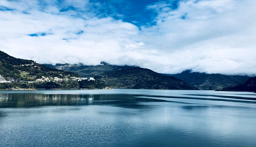
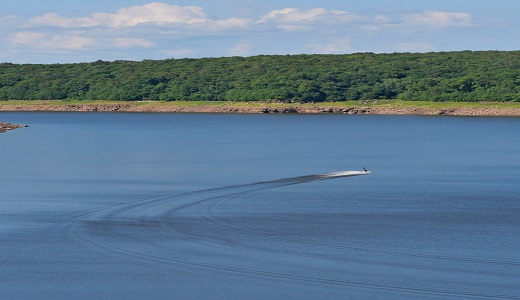
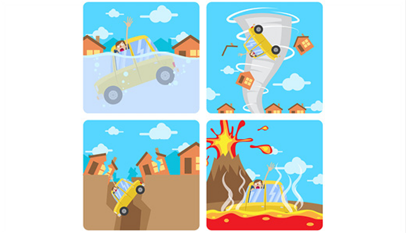
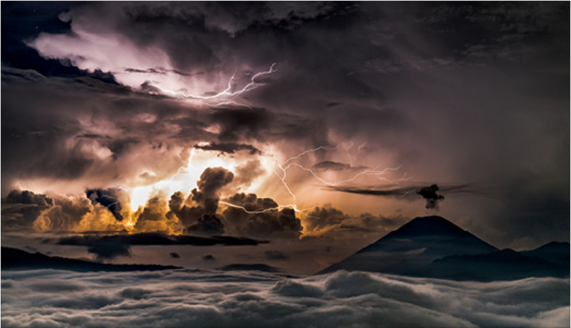
Rapid scientific and technological advances have greatly improved the accuracy of weather forecasts and life-saving early warnings. Our weather, climate, and water cycle will be different in the future, since weather, climate, and hydrological services will help us tackle the associated challenges and seize the opportunities. The theme for the 2023 World Meteorological Day is “The Future of Weather, Climate, and Water across Generations”. Please find more theme-related journals and contents as follows.

|
|
|
|
|
Location: Baoxing, Sichuan, China Photo by Qian Xue, Southwest Jiaotong University |
Location: Sanjiangyuan, China Photo by Bo yu, Nankai Univeristy |
Photo by Paulina Mielcarek-Bocheńska, Institute of Technology and Life Sciences |
To access more content about MDPI International Day Campaign Series activities, please click here.


- Meteorological Analysis of the 2021 Extreme Wildfires in Greece: Lessons Learned and Implications for Early Warning of the Potential for Pyroconvection
Atmosphere 2022, 13, 475; https://doi.org/10.3390/atmos13030475
- Characterisation of Thunderstorms with Multiple Lightning Jumps
Atmosphere 2022, 13, 171; https://doi.org/10.3390/atmos13020171
- Suitability Assessment of Weather Networks for Wind Data Measurements in the Athabasca Oil Sands Area
Climate 2022, 10, 10; https://doi.org/10.3390/cli10020010
- 3D Structure of the Ras Al Hadd Oceanic Dipole
Oceans 2022, 3, 268-288; https://doi.org/10.3390/oceans3030019
- Weather, Land and Crops in the Indus Village Model: A Simulation Framework for Crop Dynamics under Environmental Variability and Climate Change in the Indus Civilisation
Quaternary 2022, 5, 25; https://doi.org/10.3390/quat5020025
- The Future of Climate Modelling: Weather Details, Macroweather Stochastics—Or Both?
Meteorology 2022, 1, 414-449; https://doi.org/10.3390/meteorology1040027

|
Special Issue: GNSS in Meteorology and Climatology |
Special Issue: Extreme Weather Detection, Attribution and Adaptation Design |
|
Special Issue: Non-stationarity (Seasonality and Trends) in Time Series of Meteorological Extreme Events |
Special Issue: Early Career Scientists' (ECS) Contributions to Meteorology (2023) |

MDPI World Meteorological Day Webinar 2023
23 Mar 2023, 17:00 (CET)
Free to register for the two sessions.
Recordings will be available on Sciforum shortly afterward.

13 March 2023
MDPI’s Newly Launched Journals in December 2022
As a leading open access publisher, MDPI provides scholars with a high-quality and rich academic exchange platform by continuously expanding into new and exciting research areas.
In December 2022, MDPI launched five new journals, covering multiple subjects such as life sciences, biology, medicine and pharmacology, social sciences and humanities. These new journals are being edited by established scholars across the world.
|
Journal |
Founding Editor-in-Chief |
Journal Topics (Selected) |
|
Prof. Dr. Fabio Gresta, University of Messina, Italy| Editorial | view inaugural issue |
grass/forage/turf production; grassland management; pasture monitoring; grazing and livestock; grass agro-ecosystems| view journal scope | submit an article |
|
|
Prof. Dr. Christos G. Athanassiou, University of Thessaly, Greece| Editorial | view inaugural issue |
pesticides; fungicides; herbicides; fertilizers; soil conditioners| view journal scope | submit an article |
|
|
Prof. Dr. Stephen H. Safe, Texas A&M University, USA| Editorial | view inaugural issue |
receptor structure; receptor function; receptor signaling; receptor expression and regulation; receptor interactions with drugs| view journal scope | submit an article |
|
|
Dr. Jean Jacques Vanden Eynde, University of Mons-UMONS, Belgium| Editorial | view inaugural issue |
drug discovery; medicinal chemistry; preclinical and clinical research; marketed drugs; intellectual property and regulatory affairs| view journal scope | submit an article |
|
|
Prof. Dr. Heather Kanuka, University of Alberta, Canada| Editorial | view inaugural issue |
higher education; tertiary education; policy and practice in higher education; educational leadership in higher education; educational administration and management in higher education| view journal scope | submit an article |
If you are interested in creating more open access journals with us to publish cutting-edge research, please send your journal proposal application to newjournal-committee@mdpi.com.
7 March 2023
Displaying Co-Authors’ Email Addresses on the Webpage of Published Papers
MDPI is pleased to announce that we now display the co-authors’ email addresses in addition to the corresponding author’s email address on the webpage of published papers, protected by Captcha. For more information about this change, please visit the journal’s instructions for authors page.
We believe this change will facilitate academic discussions and advance our cause of open science and research. The corresponding authors are responsible for communicating with their co-authors and indicating in our system (https://susy.mdpi.com/) if co-authors would prefer for their email addresses not to be displayed.
22 February 2023
Meet Us at the 2023 AAG Annual Meeting, 23–27 March 2023, Denver, USA

Conference: 2023 AAG Annual Meeting
Date: 23–27 April 2023
Location: Denver, USA
MDPI will be attending the 2023 AAG Annual Meeting as an exhibitor, and we welcome researchers from different backgrounds to visit and share their latest ideas with us.
This conference is organized by the American Association of Geographers (AAG). The theme of the meeting is “Toward More Just Geographies”. At the meeting, specialists will share and discuss the latest in research and applications in geography, sustainability, and GIScience.
The following MDPI journals will be represented:
- Remote Sensing (leading journal);
- Sustainability (leading journal);
- IJGI;
- Hydrology;
- Land;
- Water;
- Earth;
- Atmosphere;
- IJERPH;
- Fire;
- Oceans;
- GeoHazards;
- Coasts;
- Geomatics.
Remote Sensing (ISSN: 2072-4292, IF: 5.349) publishes regular research papers, reviews, technical notes and communications covering all aspects of remote sensing science, from sensor design and validation/calibration to its application in geosciences, environmental sciences, ecology, and civil engineering. The aim is to publish novel/improved methods/approaches and/or algorithms of remote sensing to benefit the community, open to everyone in need of them.
Sustainability (ISSN: 2071-1050, IF: 3.889) encourages experts to publish their experimental, computational and theoretical research on sustainability. This encompasses topics related to social sciences, natural and applied science and engineering, in order to enable the application and development of sustainability.
If you are planning to attend this conference, please do not hesitate to start an online conversation with us. Our delegates look forward to meeting you in person and answering any questions that you may have. For more information about the conference, please visit the following website: https://www.aag.org/events/aag2023/.


