Next Issue
Volume 10, July
Previous Issue
Volume 10, May
 
 
water-logo

Journal Browser

Journal Browser

Water, Volume 10, Issue 6 (June 2018) – 148 articles

Cover Story (view full-size image): 
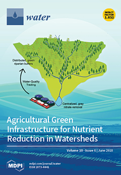
Agricultural intensification has the undesirable effect of degrading water quality. Water quality trading can enable cooperative solutions between urban residents and upstream rural residents through the installation of agricultural green infrastructure in the form of riparian buffers. Analysis of the Raccoon River Watershed in Iowa, USA reveals that agricultural green infrastructure is similar in cost to centralized gray infrastructure and offers more indirect, non-quantified benefits. View this paper.
  • Issues are regarded as officially published after their release is announced to the table of contents alert mailing list.
  • You may sign up for e-mail alerts to receive table of contents of newly released issues.
  • PDF is the official format for papers published in both, html and pdf forms. To view the papers in pdf format, click on the "PDF Full-text" link, and use the free Adobe Reader to open them.
Order results
Result details
Section
Select all
Export citation of selected articles as:

Editorial

Jump to: Research, Review, Other

3 pages, 159 KiB  
Editorial
The Impact of Climate on Hydrological Extremes
by Salvatore Manfreda 1,*, Vito Iacobellis 2, Andrea Gioia 2, Mauro Fiorentino 1 and Krzysztof Kochanek 3
1 Department of European and Mediterranean Cultures: Architecture, Environment and Cultural Heritage (DiCEM), University of Basilicata, 75100 Matera, Italy
2 Department of Civil, Environmental, Land, Construction and Chemistry (DICATECh), Polytechnic University of Bari, 70125 Bari, Italy
3 Institute of Geophysics, Polish Academy of Sciences, 01-452 Warsaw, Poland
Water 2018, 10(6), 802; https://doi.org/10.3390/w10060802 - 17 Jun 2018
Cited by 12 | Viewed by 4558
Abstract
High and low flows and associated floods and droughts are extreme hydrological phenomena mainly caused by meteorological anomalies and modified by catchment processes and human activities. They exert increasing on human, economic, and natural environmental systems around the world. In this context, global [...] Read more.
High and low flows and associated floods and droughts are extreme hydrological phenomena mainly caused by meteorological anomalies and modified by catchment processes and human activities. They exert increasing on human, economic, and natural environmental systems around the world. In this context, global climate change along with local fluctuations may eventually trigger a disproportionate response in hydrological extremes. This special issue focuses on observed extreme events in the recent past, how these extremes are linked to a changing global/regional climate, and the manner in which they may shift in the coming years. Full article
(This article belongs to the Special Issue Impact of Climate on Hydrological Extremes)

Research

Jump to: Editorial, Review, Other

14 pages, 5231 KiB  
Article
Characteristics of Aggregate Size Distribution of Nanoscale Zero-Valent Iron in Aqueous Suspensions and Its Effect on Transport Process in Porous Media
by Ruiqi Duan 1,2,3, Yanhui Dong 1,2,3,* and Qian Zhang 1,2,3
1 Key Laboratory of Shale Gas and Geoengineering, Institute of Geology and Geophysics, Chinese Academy of Sciences, Beijing 100029, China
2 Institutions of Earth Science, Chinese Academy of Sciences, Beijing 100029, China
3 College of Earth and Planetary Sciences, University of Chinese Academy of Sciences, Beijing 100049, China
Water 2018, 10(6), 670; https://doi.org/10.3390/w10060670 - 23 May 2018
Cited by 10 | Viewed by 3869
Abstract
Bare nanoscale zero-valent iron (NZVI) particles in aqueous suspensions aggregate into micron to submicron sizes. The transport process of enlarged aggregates or multi-sized aggregates is different from that of nanoparticles. In this work, we performed aggregate size distribution analysis of NZVI suspension using [...] Read more.
Bare nanoscale zero-valent iron (NZVI) particles in aqueous suspensions aggregate into micron to submicron sizes. The transport process of enlarged aggregates or multi-sized aggregates is different from that of nanoparticles. In this work, we performed aggregate size distribution analysis of NZVI suspension using a laser grain size analyzer and conducted a series of continuous injection column experiments with different injected NZVI concentrations. The results show that aggregates in NZVI suspensions range from submicron to submillimeter size and are mainly distributed around 5–9 μm and 50–100 μm. Quantitative calculation of iron transport and retention showed that the retained iron linearly correlates with injected concentration. The cross-section images revealed that clogging weakened from inlet to outlet. Furthermore, larger aggregates (>40 μm) appeared more often in the rising-declining stages of breakthrough curves, whereas small aggregates (<30 μm) dominated the steady stage. Indeed, relatively preferential flow facilitated the transport and discharge of both large and small iron aggregates. Straining of glass beads especially for the large iron aggregates resulted in a decline in breakthrough. Moreover, the blocking of attached and plugged iron prevented later retention of iron, resulting in a certain concentration of iron in the effluents. Our study provides greater insight into the transport of NZVI. Full article
(This article belongs to the Section Hydrology)
Show Figures

Figure 1

23 pages, 2690 KiB  
Article
Detention and Retention Behavior of Four Extensive Green Roofs in Three Nordic Climate Zones
by Birgitte Gisvold Johannessen 1,*, Tone Merete Muthanna 1 and Bent Christen Braskerud 2
1 Department of Civil and Environmental Engineering, Norwegian University of Science and Technology (NTNU), N-7491 Trondheim, Norway
2 Department of Water and Wastewater, The City of Oslo, N-0506 Oslo, Norway
Water 2018, 10(6), 671; https://doi.org/10.3390/w10060671 - 23 May 2018
Cited by 63 | Viewed by 8746
Abstract
Climate change coupled with increasing urbanization has made extensive green roofs, both for retrofitting and new developments, an attractive way to bring nature back to cities, while managing stormwater. This study has investigated extensive green roof retention and detention performance based on 3–8 [...] Read more.
Climate change coupled with increasing urbanization has made extensive green roofs, both for retrofitting and new developments, an attractive way to bring nature back to cities, while managing stormwater. This study has investigated extensive green roof retention and detention performance based on 3–8 years of field data from four Norwegian locations representing typical cold and wet Nordic climates, also comparing several different commercial configurations. Accumulated retention was found to be 11–30% annually and 22–46% in May through October. The performance was found to be strongly dependent in evapotranspiration and less dependent on material storage capacities. Estimates for available storage capacities for precipitation events larger than 5 mm are given and can be useful for design purposes. Median observed peak attenuation compared to the precipitation ranged from 65–90% depending on locations and configurations. The event-based approach for evaluating detention was found to be challenging due to the nature of the precipitation in the studied locations. An alternative approach using flow duration curves based on the observed time series was tested and found to give valuable information on runoff patterns from green roofs and to be useful for evaluating green roof performance in relation to local requirements. Full article
(This article belongs to the Special Issue Hydrological Performance of Green Roofs)
Show Figures

Figure 1

19 pages, 2095 KiB  
Article
Matching Ecosystem Functions with Adaptive Ecosystem Management: Decision Pathways to Overcome Institutional Barriers
by Amar V. V. Nanda 1,7, Jeroen Rijke 2,3, Leah Beesley 4,7, Berry Gersonius 5,7, Matthew R. Hipsey 6,7 and Anas Ghadouani 1,7,*
1 Department of Civil, Environmental & Mining Engineering, The University of Western Australia, 35 Stirling Highway, M051, Perth 6009, WA, Australia
2 HAN University of Applied Sciences, Ruitenberglaan 26, 6826 CC Arnhem, The Netherlands
3 VHL University of Applied Sciences, Larensteinselaan 26a, 6882 CT Velp, The Netherlands
4 School of Biological Sciences, The University of Western Australia, 35 Stirling Highway, M004, Perth 6009, WA, Australia
5 IHE, Westvest 7, 2611 AX Delft, The Netherlands
6 School of Agriculture and Environment, The University of Western Australia, Perth 6009, WA, Australia
7 Cooperative Research Centre for Water Sensitive Cities (CRCWSC), Clayton 3800, VIC, Australia
Water 2018, 10(6), 672; https://doi.org/10.3390/w10060672 - 23 May 2018
Cited by 11 | Viewed by 8250
Abstract
Environmental management strategies aim to protect or repair ecological assets (ecosystems, species) so that their ecological and social values can be preserved. However, creating an effective strategy is difficult because multiple government departments are involved and because water and land use legislation and [...] Read more.
Environmental management strategies aim to protect or repair ecological assets (ecosystems, species) so that their ecological and social values can be preserved. However, creating an effective strategy is difficult because multiple government departments are involved and because water and land use legislation and policy instruments are often fragmented. A key obstacle that is often overlooked is the spatial mismatch between ecological processes and institutional organisation (i.e., legislative framework and government departments). Successful management depends on the ability to cultivate resilient ecosystems through institutional reforms that take into account the complexity of ecosystems while supporting cross-sectoral and scale-dependent decision-making within the science–policy interface. Here, we use a case study approach to illustrate how collective strategic decisions can be made to manage a valued ecosystem situated within an urban matrix. We used a three-step framework to guide our approach and commenced by identifying a range of adaptation measures (i.e., management interventions) and the actors responsible. For each adaptation measure, we then investigated (i) mismatches among ecosystem and institution scales and levels; (ii) institutional barriers; and (iii) the role of actors in decision making. We use this information to identify ‘decision pathways’: i.e., a flexible decision-making platform that assists stakeholders to make strategic short- and long-term decisions. Key insights included the discussion of policy and practical experiences for ecosystem management at different levels and the necessary conditions to provide better alignment between jurisdictional an ecosystem scale to guide decision makers accordingly. We detail the institutional and jurisdictional changes that must be implemented across all levels of governance to protect and support the resilience of environmental assets. ‘Short-term’ decision pathways were preferred among actors and cross-level cooperation at jurisdictional level provided an adequate fit with the ecosystem scale. ‘Long-term’ decisions require substantial change of the institutional framework to enable the implementation of adaptive management. Although challenges at institutional and jurisdictional scales remain, decision pathways promote adaptive ecosystem management through a better fit of jurisdictional and institutional roles/policy and ecosystem-scale processes. Full article
(This article belongs to the Section Water Resources Management, Policy and Governance)
Show Figures

Graphical abstract

15 pages, 6315 KiB  
Article
Numerical Study of Spatial Behavior of Solute Particle Transport in Single Fracture with Variable Apertures
by Yong-Wook Jeong 1 and Woochang Jeong 2,*
1 Department of Architecture, Sejong University, 209, Neungdong-ro, Gwangjin-gu, Seoul 143-747, Korea
2 Department of Civil Engineering, Kyungnam University, 7, Kyungnamdaehak-ro, Masanhappo-gu, Changwon 631-701, Korea
Water 2018, 10(6), 673; https://doi.org/10.3390/w10060673 - 23 May 2018
Cited by 1 | Viewed by 3778
Abstract
The aim of this study is to numerically analyze spatial behaviors of solute particle transport in a single fracture with spatially correlated variable apertures under application of effective normal stress conditions. The numerical results show that solute particle transport in a single fracture [...] Read more.
The aim of this study is to numerically analyze spatial behaviors of solute particle transport in a single fracture with spatially correlated variable apertures under application of effective normal stress conditions. The numerical results show that solute particle transport in a single fracture is strongly affected by spatial correlation length of variable apertures and applied effective normal stress. As spatial correlation length increases, mean residence time of solute particles decreases and tortuosity and Peclet number (a dimensionless number representing the relationship between the rate of advection of solute particles by the flow and the rate of diffusion of solute particles) also decreases. These results indicate that the geometry of the aperture distribution is favorable to solute particle transport when the spatial correlation length is increased. However, as effective normal stress increases, the mean residence time and tortuosity tend to increase but the Peclet number decreases. The main reason for a decreasing Peclet number is that the solute particle is transported by one or two channels with relatively higher localized flow rates owing to increase in contact areas resulting from increasing effective normal stress. Based on the numerical results of the solute particle transport produced in this study, an exponential-type correlation formula between the mean residence time and the effective normal stress is proposed. Full article
(This article belongs to the Special Issue Water Resources Investigation: Geologic Controls on Groundwater Flow)
Show Figures

Figure 1

15 pages, 1551 KiB  
Article
Analysis of the Erosion Law of Karst Groundwater Using Hydrogeochemical Theory in Liulin Spring Area, North China
by Xiuqing Zheng 1,*, Kai Wang 2, Fei Zhang 3, Junfeng Chen 1, Aimin Li 4 and Yanping Chen 4
1 College of Water Resources Science and Engineering, Taiyuan University of Technology, Taiyuan 030024, China
2 North China Municipal Engineering Design & Research Institute Corporation Limited, Tianjin 300110, China
3 Taiyuan Design Research Institute for Coal Industry, Taiyuan 030001, China
4 Shanxi Hydrology and Water Resources Survey Bureau, Taiyuan 030001, China
Water 2018, 10(6), 674; https://doi.org/10.3390/w10060674 - 24 May 2018
Cited by 5 | Viewed by 3460
Abstract
The comprehensive geological, hydrogeological and hydrogeochemical model of the Liulin karstic spring area in the eastern limb of the Ordos syncline was established by a combination of chemical thermodynamics, chemical kinetics and hydrogeology. The study area was divided into four zones based on [...] Read more.
The comprehensive geological, hydrogeological and hydrogeochemical model of the Liulin karstic spring area in the eastern limb of the Ordos syncline was established by a combination of chemical thermodynamics, chemical kinetics and hydrogeology. The study area was divided into four zones based on the saturation indices of calcite, dolomite and gypsum, which were computed by the groundwater-chemical simulation software PHREEQC (a computer program for speciation, batch-reaction, one-dimensional transport, and inverse geochemical calculations), with consideration of the geological and hydrogeological conditions and hydro-geochemical reactions. The weight and volume modulus of carbonate rocks and sulphate rocks in each zone were calculated by the method of correlation analysis to evaluate the dissolution law of karst groundwater. The results showed that in the zone I (saturation index of calcite βc ≤ 1) the dissolution of calcite was the major geochemical reaction, the weight modulus of calcite was higher than that of dolomite and gypsum, and the pore space generated by the dissolution of calcite was one order of magnitude larger than that of dolomite and gypsum. In zone II (saturation index of calcite βc > 1 to saturation index of dolomite βd ≤ 1) the corrosion moduli were all smaller than that in zone I, the solubility of dolomite and gypsum increased, and calcite reached saturation. The space occupied by the calcite sediment was less than that dissolved by dolomite and gypsum. In zone III (saturation index of dolomite βd > 1 to saturation index of gypsum βg ≤ 1), calcite and dolomite had reached saturation, accompanied by dedolomitization, and the amount of gypsum dissolution increased obviously. The conclusions indicate that the hydrogeochemical environment plays an important role in mineral dissolution. Full article
(This article belongs to the Section Hydrology)
Show Figures

Figure 1

14 pages, 1297 KiB  
Article
Application of Klebsiella oxytoca Biomass in the Biosorptive Treatment of PAH-Bearing Wastewater: Effect of PAH Hydrophobicity and Implications for Prediction
by Dong Zhang 1,2, Li Lu 3,*, Hongting Zhao 1, Meiqing Jin 1, Ting Lü 1 and Jun Lin 4
1 College of Materials and Environmental Engineering, Hangzhou Dianzi University, Hangzhou 310018, China
2 College of Environmental & Resource Sciences, Zhejiang University, Hangzhou 310058, China
3 School of Environmental Science and Engineering, Zhejiang Gongshang University, Hangzhou 310012, China
4 College of Electronics and Information, Hangzhou Dianzi Univerisity, Hangzhou 310018, China
Water 2018, 10(6), 675; https://doi.org/10.3390/w10060675 - 24 May 2018
Cited by 13 | Viewed by 3489
Abstract
Biosorption has been widely recognized as a promising method to treat wastewater. However, few studies have investigated the impact of pollutants’ properties on wastewater treatment, as well as the underlying mechanisms and future predictions. In this study, the effects of pollutants’ hydrophobicity on [...] Read more.
Biosorption has been widely recognized as a promising method to treat wastewater. However, few studies have investigated the impact of pollutants’ properties on wastewater treatment, as well as the underlying mechanisms and future predictions. In this study, the effects of pollutants’ hydrophobicity on the biosorptive removal of polycyclic aromatic hydrocarbons (PAHs) were evaluated. The results showed that the inactive biomass of Klebsiella oxytoca effectively removes PAHs from aqueous solutions with a high biosorption capacity, high biosorption affinity, and short equilibrium time. The biosorption of seven PAHs achieved equilibrium rapidly (less than 2 h) and fitted well to the pseudo-second-order kinetic model. Sorption occurred with a predominantly linear partition process to the biomaterial with Kd values of 363.11, 1719.5, 2515.5, 7343.3, 6353.4, 22,806, and 19,541 L·kg−1 for naphthalene, acenaphthene, fluorene, phenanthrene, anthracene, pyrene, and fluoranthene, respectively. An increase in temperature led to a decrease in the biosorption affinity, and the bacterial biosorption of PAHs was spontaneous and exothermic. Furthermore, a positive correlation was observed between the sorption affinity and the octanol partition coefficient (Kow) (logKd = 1.011logKow − 0.7369), indicating that hydrophobicity is the main factor influencing the biosorption efficiency. These results suggest that biosorption is an efficient and predictable treatment for micropollutant-bearing wastewater. Full article
(This article belongs to the Section Wastewater Treatment and Reuse)
Show Figures

Figure 1

17 pages, 4120 KiB  
Article
Managing Salinity in Upper Colorado River Basin Streams: Selecting Catchments for Sediment Control Efforts Using Watershed Characteristics and Random Forests Models
by Fred D. Tillman 1,*, David W. Anning 2, Julian A. Heilman 1, Susan G. Buto 3 and Matthew P. Miller 4
1 Arizona Water Science Center, United States Geological Survey, Tucson, AZ 85719, USA
2 Arizona Water Science Center, United States Geological Survey, Flagstaff, AZ 86001, USA
3 Nevada Water Science Center, United States Geological Survey, Carson City, NV 89701, USA
4 Utah Water Science Center, United States Geological Survey, Salt Lake City, UT 84119, USA
Water 2018, 10(6), 676; https://doi.org/10.3390/w10060676 - 24 May 2018
Cited by 18 | Viewed by 5101
Abstract
Elevated concentrations of dissolved-solids (salinity) including calcium, sodium, sulfate, and chloride, among others, in the Colorado River cause substantial problems for its water users. Previous efforts to reduce dissolved solids in upper Colorado River basin (UCRB) streams often focused on reducing suspended-sediment transport [...] Read more.
Elevated concentrations of dissolved-solids (salinity) including calcium, sodium, sulfate, and chloride, among others, in the Colorado River cause substantial problems for its water users. Previous efforts to reduce dissolved solids in upper Colorado River basin (UCRB) streams often focused on reducing suspended-sediment transport to streams, but few studies have investigated the relationship between suspended sediment and salinity, or evaluated which watershed characteristics might be associated with this relationship. Are there catchment properties that may help in identifying areas where control of suspended sediment will also reduce salinity transport to streams? A random forests classification analysis was performed on topographic, climate, land cover, geology, rock chemistry, soil, and hydrologic information in 163 UCRB catchments. Two random forests models were developed in this study: one for exploring stream and catchment characteristics associated with stream sites where dissolved solids increase with increasing suspended-sediment concentration, and the other for predicting where these sites are located in unmonitored reaches. Results of variable importance from the exploratory random forests models indicate that no simple source, geochemical process, or transport mechanism can easily explain the relationship between dissolved solids and suspended sediment concentrations at UCRB monitoring sites. Among the most important watershed characteristics in both models were measures of soil hydraulic conductivity, soil erodibility, minimum catchment elevation, catchment area, and the silt component of soil in the catchment. Predictions at key locations in the basin were combined with observations from selected monitoring sites, and presented in map-form to give a complete understanding of where catchment sediment control practices would also benefit control of dissolved solids in streams. Full article
(This article belongs to the Section Hydrology)
Show Figures

Figure 1

23 pages, 6819 KiB  
Article
Evaluation of Multiple Satellite Precipitation Products and Their Use in Hydrological Modelling over the Luanhe River Basin, China
by Peizhen Ren, Jianzhu Li *, Ping Feng, Yuangang Guo and Qiushuang Ma
State Key Laboratory of Hydraulic Engineering Simulation and Safety, Tianjin University, Tianjin 300350, China
Water 2018, 10(6), 677; https://doi.org/10.3390/w10060677 - 24 May 2018
Cited by 49 | Viewed by 5179
Abstract
Satellite precipitation products are unique sources of precipitation measurement that overcome spatial and temporal limitations, but their precision differs in specific catchments and climate zones. The purpose of this study is to evaluate the precipitation data derived from the Tropical Rainfall Measuring Mission [...] Read more.
Satellite precipitation products are unique sources of precipitation measurement that overcome spatial and temporal limitations, but their precision differs in specific catchments and climate zones. The purpose of this study is to evaluate the precipitation data derived from the Tropical Rainfall Measuring Mission (TRMM) 3B42RT, TRMM 3B42, and Precipitation Estimation from Remotely Sensed Information using Artificial Neural Networks (PERSIANN) products over the Luanhe River basin, North China, from 2001 to 2012. Subsequently, we further explore the performances of these products in hydrological models using the Soil and Water Assessment Tool (SWAT) model with parameter and prediction uncertainty analyses. The results show that 3B42 and 3B42RT overestimate precipitation, with BIAs values of 20.17% and 62.80%, respectively, while PERSIANN underestimates precipitation with a BIAs of −6.38%. Overall, 3B42 has the smallest RMSE and MAE and the highest CC values on both daily and monthly scales and performs better than PERSIANN, followed by 3B42RT. The results of the hydrological evaluation suggest that precipitation is a critical source of uncertainty in the SWAT model, and different precipitation values result in parameter uncertainty, which propagates to prediction and water resource management uncertainties. The 3B42 product shows the best hydrological performance, while PERSIANN shows unsatisfactory hydrological performance. Therefore, 3B42 performs better than the other two satellite precipitation products over the study area. Full article
Show Figures

Figure 1

12 pages, 2169 KiB  
Article
The Role of Confluence in Shaping Water Quality Parameters on Example of the Flow-Through Lake Bikcze (Eastern Poland)
by Beata Ferencz 1,* and Jarosław Dawidek 2
1 Department of Hydrobiology and Protection of Ecosystems, University of Life Sciences, 13 Akademicka St., 20-950 Lublin, Poland
2 Department of Hydrology, Maria Curie-Skłodowska University, Aleja Kraśnicka 2 cd, 20-718 Lublin, Poland
Water 2018, 10(6), 679; https://doi.org/10.3390/w10060679 - 24 May 2018
Cited by 2 | Viewed by 3894
Abstract
The role of confluence (flowability) in shaping the concentration of dissolved oxygen (DO), chlorophyll-a (chl-a) and pH was determined using a model approach. The calculations considered both horizontal and vertical variability of parameters. There was a general tendency for the pH and oxygen [...] Read more.
The role of confluence (flowability) in shaping the concentration of dissolved oxygen (DO), chlorophyll-a (chl-a) and pH was determined using a model approach. The calculations considered both horizontal and vertical variability of parameters. There was a general tendency for the pH and oxygen to increase along the transect connecting the place of surface water inlet, deepest point of the lake basin and the place of water outlet, and the reverse tendency for chlorophyll. The average gradient for particulate radius was calculated as arithmetic mean value of six partial gradients (corresponding to individual depths, every 0.5 m). Values of average gradients indicated high dynamics of DO and pH concentration changes as well as low chlorophyll-a variability. A slight inclination of the final resultant vector gradients of DO and pH from the surface water inlet, deepest point of the lake basin and the place of water outlet transect indicated the dominant role of confluence in these parameters variability (values amounted to 6.08 mg·km−1 and 3.34 pH units·km−1, respectively). The value of the chlorophyll-a gradient vector (1.86 µg·km−1) indicated a slight differentiation of the parameter in the basin, independent of the hydrological conditions. The concentration of chl-a in the polymictic Lake Bikcze resulted from the effect of the limnic conditions; the flowability of the lake was just one of many factors affecting the variability of the parameter. Full article
(This article belongs to the Special Issue Eutrophication Management: Monitoring and Control)
Show Figures

Figure 1

13 pages, 5000 KiB  
Article
Geometric Characteristics of Spur Dike Scour under Clear-Water Scour Conditions
by Li Zhang 1,2,*, Pengtao Wang 1,2, Wenhai Yang 1,2, Weiguang Zuo 2, Xinhong Gu 2 and Xiaoxiao Yang 2
1 Water Conservancy and Hydropower Engineering, Hohai University, Nanjing 210098, China
2 Water Institute of Civil Engineers, North China University of Water Resources and Electric Power, Zhengzhou 450046, China
Water 2018, 10(6), 680; https://doi.org/10.3390/w10060680 - 24 May 2018
Cited by 19 | Viewed by 5818
Abstract
Factors such as flow and sediment characteristics affecting the spur dike’s local depth of erosion have yielded considerable research results, but there is little discussion of the geometry of the spur dike’s local scour holes. This study focuses on the spatial characteristics of [...] Read more.
Factors such as flow and sediment characteristics affecting the spur dike’s local depth of erosion have yielded considerable research results, but there is little discussion of the geometry of the spur dike’s local scour holes. This study focuses on the spatial characteristics of the geometry of local scour holes in straight-wall spur dikes. The discussion shows that the spur dike arrangement clearly changes the plane geometry of the scour hole. The maximum scour depth has a power function relationship with the area of the scour hole and the scour hole-volume. Moreover, the ratio of the product of the maximum scour depth and the plane area of the scour hole to the scour hole-volume is a fixed constant. The average slope of upstream of the scour hole and along the axis direction of the spur dike is slightly larger than the angle of repose of the sediment, the slope distribution of the scour holes profiles presents an inverted “U” type, and its profile morphology and slope distribution have geometric similarity. This distribution also reflected that, the interaction between the downward flow and the horseshoe vortex inside the scour hole leads to the formation of a cusp. Full article
(This article belongs to the Special Issue Water-Worked Bedload: Hydrodynamic and Mass Transport)
Show Figures

Figure 1

18 pages, 4035 KiB  
Article
Evaluation of the Impact of Water Management Technologies on Water Savings in the Lower Chenab Canal Command Area, Indus River Basin
by Muhammad Rizwan 1,2,*, Allah Bakhsh 3, Xin Li 4,5, Lubna Anjum 3, Kashif Jamal 1,2 and Shanawar Hamid 6
1 Key Laboratory of Remote Sensing and Geospatial Science, Northwest Institute of Eco-Environment and Resources, Chinese Academy of Sciences, Lanzhou 730000, China
2 University of Chinese Academy of Sciences, Beijing 100049, China
3 Department of Irrigation and drainage, Faculty of Agricultural Engineering and Technology, University of Agriculture, Faisalabad 38040, Pakistan
4 Institute of Tibetan Plateau Research, Chinese Academy of Sciences, Beijing 100101, China
5 CAS Center for Excellence in Tibetan Plateau Earth Sciences, Chinese Academy of Sciences, Beijing 100101, China
6 Department of Structures and Environmental Engineering, Faculty of Agricultural Engineering and Technology, University of Agriculture, Faisalabad 38040, Pakistan
Water 2018, 10(6), 681; https://doi.org/10.3390/w10060681 - 24 May 2018
Cited by 24 | Viewed by 6627
Abstract
Traditional irrigation practices, low crop productivity, unlevelled fields, water losses taking place during conveyance and application phases, as well as low irrigation efficiencies are the main problems of the common farmers in Pakistan. These problems are more noticeable in the command area of [...] Read more.
Traditional irrigation practices, low crop productivity, unlevelled fields, water losses taking place during conveyance and application phases, as well as low irrigation efficiencies are the main problems of the common farmers in Pakistan. These problems are more noticeable in the command area of Lower Chenab Canal (LCC), which is the main portion of the Indus Basin Project in Pakistan. To overcome these problems, different water management technologies such as precision land levelling (PLL), bed planting, drip irrigation systems, and watercourse improvement were introduced to farmers to increase water savings and crop yields in the area of five distributaries—Khurrianwala, Shahkot, Mungi, Khikhi, Killianwala and Dijkot—during the cropping seasons of 2008 to 2015. The use of drip irrigation resulted in savings of water and fertilizer and increased the crop yields by 30–40%. Three watercourses, one on each site of 1200 m in length, were lined, which resulted in improved conveyance efficiency of 15–20%. If wheat, rice and cotton in the command area of LCC are sown on precisely levelled fields and on beds, then about 2768.1 million m3 and 3699.3 million m3 of irrigation water can be saved. These results show the potential of water-efficient technologies for saving water as well as increasing crop yields. Full article
(This article belongs to the Section Water Resources Management, Policy and Governance)
Show Figures

Figure 1

16 pages, 2426 KiB  
Article
Assessing Urban Water Management Sustainability of a Megacity: Case Study of Seoul, South Korea
by Hyowon Kim 1, Jaewoo Son 1, Seockheon Lee 2, Stef Koop 3, Kees Van Leeuwen 3, Young June Choi 4 and Jeryang Park 1,*
1 School of Urban and Civil Engineering, Hongik University, Wausan-ro 94, Mapo-gu, Seoul 04066, Korea
2 Centre for Water Resource Cycle Research, Korea Institute of Science and Technology, Hwarangno 14-gil 5, Seongbuk-gu, Seoul 02792, Korea
3 KWR Watercycle Research Institute, Groningenhaven 7, Nieuwegein 3433 PE, and Copernicus Institute for Sustainable Development and Innovation, Utrecht University, Heidelberglaan 2, 3584 CS Utrecht, The Netherlands
4 Water Recycle Research Division, Seoul Water Institute, Cheonho-daero 716-10, Gwangjin-gu, Seoul 04981, Korea
Water 2018, 10(6), 682; https://doi.org/10.3390/w10060682 - 24 May 2018
Cited by 31 | Viewed by 10209
Abstract
Many cities are facing various water-related challenges caused by rapid urbanization and climate change. Moreover, a megacity may pose a greater risk due to its scale and complexity for coping with impending challenges. Infrastructure and governance also differ by the level of development [...] Read more.
Many cities are facing various water-related challenges caused by rapid urbanization and climate change. Moreover, a megacity may pose a greater risk due to its scale and complexity for coping with impending challenges. Infrastructure and governance also differ by the level of development of a city which indicates that the analysis of Integrated Water Resources Management (IWRM) and water governance are site-specific. We examined the status of IWRM of Seoul by using the City Blueprint® Approach which consists of three different frameworks: (1) Trends and Pressures Framework (TPF), (2) City Blueprint Framework (CBF) and (3) the water Governance Capacity Framework (GCF). The TPF summarizes the main social, environmental and financial pressures that may impede water management. The CBF assesses IWRM of the urban water cycle. Finally, the GCF identifies key barriers and opportunities to develop governance capacity. The results indicate that nutrient recovery from wastewater, stormwater separation, and operation cost recovery of water and sanitation services are priority areas for Seoul. Furthermore, the local sense of urgency, behavioral internalization, consumer willingness to pay, and financial continuation are identified as barriers limiting Seoul’s governance capacity. We also examined and compared the results with other mega-cities, to learn from their experiences and plans to cope with the challenges in large cities. Full article
(This article belongs to the Special Issue The Challenges of Water Management and Governance in Cities)
Show Figures

Figure 1

22 pages, 9483 KiB  
Article
River Discharge and Saltwater Intrusion Level Study of Yangtze River Estuary, China
by Zhi Xu 1,2, Jing Ma 2,*, Hao Wang 1,2, Yajie Hu 2, Guiyu Yang 2 and Wei Deng 1,2
1 Department of Hyraulic Engineering, Tsinghua University, Beijing 100084, China
2 China Institute of Water Resources and Hydropower Research, Beijing 100038, China
Water 2018, 10(6), 683; https://doi.org/10.3390/w10060683 - 25 May 2018
Cited by 23 | Viewed by 10802
Abstract
The Yangtze River Estuary (YRE) is the largest estuary in China, with three-order bifurcations and four outlets into the sea. In recent years, issues of saltwater intrusions have received increased attention due to the increased levels and frequencies of the intrusions. The saltwater [...] Read more.
The Yangtze River Estuary (YRE) is the largest estuary in China, with three-order bifurcations and four outlets into the sea. In recent years, issues of saltwater intrusions have received increased attention due to the increased levels and frequencies of the intrusions. The saltwater intrusions into the YRE resulting from river discharges were investigated in this study based on river discharge levels at the Datong station. A hydrodynamic and salinity transport model (MIKE21) was used to quantify the influences of the river discharges on the saltwater intrusions in the YRE. The model was effectively validated through observational data of the tidal and salinity levels. The 25%, 50% and 70% frequencies of the river discharges during the dry seasons were determined to be 18,112, 16,331 and 14,832 m3/s, respectively. A multi-year averaged river discharge of 27,856 m3/s was used to simulate the salinity level changes resulting from the different river discharges. The results revealed the following: (1) the salinity of the South Branch (SB) was distributed as “high–low–high”; and the changes in the salinity levels were greatly affected by the river discharges. A strong correlation was found between the salinity and flow in the North Branch (NB) and SB of between 0.917 and 1; (2) the changes in the river discharges had major impacts on the changes in the salinity levels in the SB. When the runoff was 27,856 m3/s, the salinity excessive area rate (the ratio between salinity excessive area (>0.45‰) and the SB area) less than 10%. However, when the river discharges were reduced to 16,331 m3/s, the salinity excessive area rate is more than 50%; (3) As the river discharges decreased, the amplification line (0.2‰) also rapidly decreased, and the amplification lines (0.45‰, 2‰) increased. At points far from the river’s entrance, the effects of the runoff were observed to be weakened, such as the amplification lines gradually becoming reduced; (4) the changes in the river discharges were observed to have significant impacts on the freshwater reservoir water withdrawal. When the river discharges were maintained at 27,856 m3/s, the salinity of the Baogang, Chenhang, and Qingcaosha Reservoirs remained below 0.45‰. The salinity levels of the four reservoir locations examined in this study were found to exceed the Chinese drinking water standard (0.45‰) for more than 23 days in the 14,832 m3/s river discharge scenario, which negatively affected the drinking water of the population living near the YRE. Full article
(This article belongs to the Section Hydrology)
Show Figures

Figure 1

17 pages, 1774 KiB  
Article
An Interval Quadratic Fuzzy Dependent-Chance Programming Model for Optimal Irrigation Water Allocation under Uncertainty
by Hang Wang, Chenglong Zhang and Ping Guo *
Center for Agricultural Water Research in China, China Agricultural University, Tsinghuadong Street, No. 17, Beijing 100083, China
Water 2018, 10(6), 684; https://doi.org/10.3390/w10060684 - 25 May 2018
Cited by 9 | Viewed by 3771
Abstract
In this study, an interval quadratic fuzzy dependent-chance programming (IQFDCP) model is proposed for irrigation water management under uncertainty. This model can deal with the interval and fuzzy uncertainties encountered in optimal irrigation water resources allocation problems. It takes optimal credibility level of [...] Read more.
In this study, an interval quadratic fuzzy dependent-chance programming (IQFDCP) model is proposed for irrigation water management under uncertainty. This model can deal with the interval and fuzzy uncertainties encountered in optimal irrigation water resources allocation problems. It takes optimal credibility level of system revenue as the objective function for addressing the conflict between maximum system revenue and the credibility level of the system revenue. By providing three scenarios of precipitation, the optimal solutions are obtained. The developed model is applied to a case study for irrigation water allocation in Minqin Oasis, Wuwei city, northwest China. This study can help determine how much irrigation water should be allocated to different crops under the maximum credibility level of the system revenue. The optimal solutions can provide a certain credibility level of system revenue corresponding to different scenarios and mitigate the system-failure risk level of water shortages in arid areas. Moreover, because the IQFDCP can objectively reflect the interrelationship among crop irrigation water amount, system revenue, and system-failure risk level, the results are able to provide advices to decision makers for efficiently managing water resources in different scenarios. Full article
(This article belongs to the Section Water Resources Management, Policy and Governance)
Show Figures

Figure 1

21 pages, 3496 KiB  
Article
Obtaining Key Parameters and Working Conditions of Wastewater Biological Nutrient Removal by Means of Artificial Intelligence Tools
by Pedro T. Martín de la Vega and Miguel A. Jaramillo-Morán *
Department of Electrical Engineering, Electronics & Automation, University of Extremadura, Avda. Elvas s/n, 06006 Badajoz, Spain
Water 2018, 10(6), 685; https://doi.org/10.3390/w10060685 - 25 May 2018
Cited by 10 | Viewed by 4067
Abstract
The oxidation-reduction potential (ORP) and the dissolved oxygen (DO) have been monitored in a municipal wastewater treatment plant (WWTP). Three thousand two hundred aeration–non-aeration cycles were recorded. They were analyzed by defining 16 parameters to characterize each one of them. The vectors so [...] Read more.
The oxidation-reduction potential (ORP) and the dissolved oxygen (DO) have been monitored in a municipal wastewater treatment plant (WWTP). Three thousand two hundred aeration–non-aeration cycles were recorded. They were analyzed by defining 16 parameters to characterize each one of them. The vectors so obtained were treated with the box-plot tool to reject those with outliers (abnormally high or low values). The remaining data were processed by a neural network (self-organizing map: SOM) in order to classify them into classes and to obtain relations between parameters to identify those more representative of the system dynamics. They were: the oxygen uptake rate (OUR), the oxygen rise average slope (ORAS), and the oxidation-reduction potential “arrow” (ORParrow, the maximum distance between the ORP curve and its linearization). Finally, the classes obtained from SOM were grouped into four macro-classes by means of the K-means algorithm in order to define four operation states related to seasonal and load characteristics, which may be taken into account, along with the key parameters, in the WWTP management with the aim of improving the nutrient removal performance by adapting their controllers to seasonal and load variations. Full article
(This article belongs to the Section Wastewater Treatment and Reuse)
Show Figures

Figure 1

17 pages, 8914 KiB  
Article
The Spatial and Temporal Variability of Groundwater Vulnerability and Human Health Risk in the Limin District, Harbin, China
by Ying Huang 1, Rui Zuo 1, Jiao Li 2, Jin Wu 3, Yuanzheng Zhai 1 and Yanguo Teng 1,*
1 College of Water Sciences, Beijing Normal University, Beijing 100875, China
2 Chinese Research Academy of Environmental Sciences, Beijing 100012, China
3 College of Architecture and Civil Engineering, Beijing University of Technology, No 100 Pinglevuan, Beijing 100124, China
Water 2018, 10(6), 686; https://doi.org/10.3390/w10060686 - 25 May 2018
Cited by 24 | Viewed by 4587
Abstract
This study aimed to analyze the variations in groundwater quality, vulnerability and potential health risk from 2006 to 2016 in the Limin District, Harbin, China. Groundwater geochemical characteristics were described using statistical analysis and Piper diagrams. A modified DRASTIC model that combined factors [...] Read more.
This study aimed to analyze the variations in groundwater quality, vulnerability and potential health risk from 2006 to 2016 in the Limin District, Harbin, China. Groundwater geochemical characteristics were described using statistical analysis and Piper diagrams. A modified DRASTIC model that combined factors of intrinsic aquifer vulnerability and land use was applied to assess groundwater vulnerability. The weights of parameters were adjusted by using the analytic hierarchy process (AHP) to optimize the model. The non-carcinogenic health risk was estimated by the Unites States Environmental Protection Agency (USEPA) model. Results suggested that concentrations of NH4-N, Fe and Mn in groundwater exceeded the limits both in 2006 and in 2016. The concentration of Fe in the groundwater showed more significant variation between 2006 and 2016 than the other parameters. Very high vulnerability zones increased from 6.3% in 2006 to 16.9% in 2016, and distributed on agricultural land, indicating that agriculture was still a major source of pollution. Mn and NO3-N contributed the most to human health risks in 2006 and 2016, respectively. This study highlights the influence of groundwater quality variation in decadal exploitation on human health. Full article
(This article belongs to the Section Hydrology)
Show Figures

Figure 1

22 pages, 7513 KiB  
Article
Coastal Aquifer Contamination and Geochemical Processes Evaluation in Tugela Catchment, South Africa—Geochemical and Statistical Approaches
by Badana Ntanganedzeni 1, Vetrimurugan Elumalai 1,* and Natarajan Rajmohan 2
1 Department of Hydrology, University of Zululand, Kwa Dlangezwa 3886, South Africa
2 Water Research Center, King Abdulaziz University, Jeddah 21598, Saudi Arabia
Water 2018, 10(6), 687; https://doi.org/10.3390/w10060687 - 25 May 2018
Cited by 54 | Viewed by 8009
Abstract
Assessment of groundwater quality, contamination sources and geochemical processes in the coastal aquifer of Tugela Catchment, South Africa were carried out by the geochemical and statistical approach using major ion chemistry of 36 groundwater samples. Results suggest that the spatial distribution pattern of [...] Read more.
Assessment of groundwater quality, contamination sources and geochemical processes in the coastal aquifer of Tugela Catchment, South Africa were carried out by the geochemical and statistical approach using major ion chemistry of 36 groundwater samples. Results suggest that the spatial distribution pattern of EC, TDS, Na, Mg, Cl and SO4 are homogenous and elevated concentrations are observed in the wells in the coastal region and few wells near the Tugela River. Wells located far from the coast are enriched by Ca, HCO3 and CO3. Durov diagrams, Gibbs plots, ionic ratios, chloro alkaline indices (CAI1 and CAI2) and correlation analysis imply that groundwater chemistry in the coastal aquifer of Tugela Catchment is regulated by the ion exchange, mineral dissolution, saline sources, and wastewater infiltration from domestic sewage; septic tank leakage and irrigation return flow. Principle component analysis also ensured the role of saline and anthropogenic sources and carbonates dissolution on water chemistry. Spatial distributions of factor score also justify the above predictions. Groundwater suitability assessment indicates that around 80% and 90% of wells exceeded the drinking water standards recommended by the WHO and South African drinking water standards (SAWQG), respectively. Based on SAR, RSC, PI, and MH classifications, most of the wells are suitable for irrigation in the study region. USSL classification suggests that groundwater is suitable for coarse-textured soils and salt-tolerant crops. The study recommends that a proper management plan is required to protect this coastal aquifer efficiently. Full article
(This article belongs to the Section Water Quality and Contamination)
Show Figures

Figure 1

23 pages, 6279 KiB  
Article
Monitoring of a Full-Scale Embankment Experiment Regarding Soil–Vegetation–Atmosphere Interactions
by Raül Oorthuis *, Marcel Hürlimann, Alessandro Fraccica, Antonio Lloret, José Moya, Càrol Puig-Polo and Jean Vaunat
Division of Geotechnical Engineering and Geosciences, Department of Civil and Environmental Engineering, UPC BarcelonaTECH, 08034 Barcelona, Spain
Water 2018, 10(6), 688; https://doi.org/10.3390/w10060688 - 25 May 2018
Cited by 28 | Viewed by 7181
Abstract
Slope mass-wasting like shallow slides are mostly triggered by climate effects, such as rainfall, and soil–vegetation–atmosphere (SVA) interactions play a key role. SVA interactions are studied by a full-scale embankment with different orientations (North and South) and vegetation covers (bare and vegetated) in [...] Read more.
Slope mass-wasting like shallow slides are mostly triggered by climate effects, such as rainfall, and soil–vegetation–atmosphere (SVA) interactions play a key role. SVA interactions are studied by a full-scale embankment with different orientations (North and South) and vegetation covers (bare and vegetated) in the framework of the prediction of climate change effects on slope stability in the Pyrenees. A clayey sand from the Llobregat river delta was used for the construction of the embankment and laboratory tests showed the importance of suction on the strength and hydraulic conductivity. Sixty sensors, which are mostly installed at the upper soil layer of the embankment, registered 122 variables at four vertical profiles and the meteorological station with a 5 min scan rate. Regarding temperature, daily temperature fluctuation at the shallow soil layer disappeared at a depth of about 0.5 m. There was great influence of orientation with much higher values at the South-facing slope (up to 55 °C at −1 cm depth) due to solar radiation. Regarding rainfall infiltration, only long duration rainfalls produced an important increase of soil moisture and pore water pressure, while short duration rainfalls did not trigger significant variations. However, these changes mostly affected the surface soil layer and decreased with depth. Full article
(This article belongs to the Special Issue Landslide Hydrology)
Show Figures

Figure 1

13 pages, 3134 KiB  
Article
The Testing of Standard and Recyclable Filter Media to Eliminate Hydrogen Sulphide from Sewerage Systems
by Petr Hluštík 1,* and Jiří Novotný 2
1 Institute of Municipal Water Management, Faculty of Civil Engineering, Brno University of Technology, AdMaS Centre, Purkyňova 139, 612 00 Brno, Czech Republic
2 Company Vodárenská akciová společnost, a.s., Soběšická 820/156, 638 00 Brno, Czech Republic
Water 2018, 10(6), 689; https://doi.org/10.3390/w10060689 - 25 May 2018
Cited by 7 | Viewed by 8054
Abstract
This article focuses on the subject of odours forming in sewage transfer chambers with displacement inlets, as well as the odours in their vicinity. It further covers the locations of odour formation, factors influencing the formation of hydrogen sulphide in wastewater, methods of [...] Read more.
This article focuses on the subject of odours forming in sewage transfer chambers with displacement inlets, as well as the odours in their vicinity. It further covers the locations of odour formation, factors influencing the formation of hydrogen sulphide in wastewater, methods of removing hydrogen sulphide from wastewater, and laboratory testing of filtration media efficacy at various concentration levels of H2S. The laboratory testing of filtration media efficacy is performed for products normally used by sewerage system operators guaranteeing the elimination of hydrogen sulphide (activated carbon, natural minerals and gels), recyclable materials (paper) and secondary raw materials in the field of waste management (biochar—the final product of microwave pyrolysis). Odour generated by sewerage systems is a secondary issue faced by all sewerage system operators, who sustain considerable expense in corrective measures to address this problem. The most economical and widespread measure used by those operators is hydrogen sulphide removal by filtration (filtration materials). Filtration media are installed in special cartridges under sewage covers in locations where the irritating odour is formed. These filtration cartridges, designed solely to eliminate odour from the surroundings, show various degrees of efficacy in removing H2S. Full article
(This article belongs to the Special Issue Design of Urban Water Drainage Systems)
Show Figures

Figure 1

16 pages, 3588 KiB  
Article
Parameter Uncertainty Analysis of the SWAT Model in a Mountain-Loess Transitional Watershed on the Chinese Loess Plateau
by Fubo Zhao 1, Yiping Wu 1,*, Linjing Qiu 1, Yuzhu Sun 1, Liqun Sun 2, Qinglan Li 2, Jun Niu 3 and Guoqing Wang 4
1 Department of Earth and Environmental Science, School of Human Settlements and Civil Engineering, Xi’an Jiaotong University, Xi’an 710049, China
2 Shenzhen Institutes of Advanced Technology, Chinese Academy of Sciences, Shenzhen 518055, China
3 Center for Agricultural Water Research in China, China Agricultural University, Beijing 100083, China
4 Nanjing Hydraulic Research Institute, Nanjing 210029, China
Water 2018, 10(6), 690; https://doi.org/10.3390/w10060690 - 25 May 2018
Cited by 90 | Viewed by 8921
Abstract
Hydrological models play an important role in water resource management, but they always suffer from various sources of uncertainties. Therefore, it is necessary to implement uncertainty analysis to gain more confidence in numerical modeling. The study employed three methods (i.e., Parameter Solution (ParaSol), [...] Read more.
Hydrological models play an important role in water resource management, but they always suffer from various sources of uncertainties. Therefore, it is necessary to implement uncertainty analysis to gain more confidence in numerical modeling. The study employed three methods (i.e., Parameter Solution (ParaSol), Sequential Uncertainty Fitting (SUFI2), and Generalized Likelihood Uncertainty Estimation (GLUE)) to quantify the parameter sensitivity and uncertainty of the SWAT (Soil and Water Assessment Tool) model in a mountain-loess transitional watershed—Jingchuan River Basin (JCRB) on the Loess Plateau, China. The model was calibrated and validated using monthly observed streamflow at the Jingchuan gaging station and the modeling results showed that SWAT performed well in the study period in the JCRB. The parameter sensitivity results demonstrated that any of the three methods were capable for the parameter sensitivity analysis in this area. Among the parameters, CN2, SOL_K, and ALPHA_BF were more sensitive to the simulation of peak flow, average flow, and low flow, respectively, compared to others (e.g., ESCO, CH_K2, and SOL_AWC) in this basin. Although the ParaSol method was more efficient in capturing the most optimal parameter set, it showed limited ability in uncertainty analysis due to the narrower 95CI and poor P-factor and R-factor in this area. In contrast, the 95CIs in SUFI2 and GLUE were wider than ParaSol, indicating that these two methods can be promising in analyzing the model parameter uncertainty. However, for the model prediction uncertainty within the same parameter range, SUFI2 was proven to be slightly more superior to GLUE. Overall, through the comparisons of the proposed evaluation criteria for uncertainty analysis (e.g., P-factor, R-factor, NSE, and R2) and the computational efficiencies, SUFI2 can be a potentially efficient tool for the parameter optimization and uncertainty analysis. This study provides an insight into selecting uncertainty analysis method in the modeling field, especially for the hydrological modeling community. Full article
Show Figures

Figure 1

13 pages, 2876 KiB  
Article
Hydrologic Modeling of Three Sub-Basins in the Kenai River Watershed, Alaska, USA
by Brett Wells 1,* and Horacio Toniolo 2
1 Alaska Department of Transportation and Public Facilities, 6860 Glacier Highway, Juneau, AK 99801, USA
2 Department of Civil and Environmental Engineering, University of Alaska Fairbanks, 505 N. Chandalar Dr., Fairbanks, AK 99775, USA
Water 2018, 10(6), 691; https://doi.org/10.3390/w10060691 - 25 May 2018
Cited by 3 | Viewed by 4218
Abstract
Streams in the Kenai River watershed are characterized by a fish-rich environment. The commercial fishing industry and recreational users compete for the fish in these streams, and resource managers strive to balance both groups’ needs while maintaining the sustainability of the resource. The [...] Read more.
Streams in the Kenai River watershed are characterized by a fish-rich environment. The commercial fishing industry and recreational users compete for the fish in these streams, and resource managers strive to balance both groups’ needs while maintaining the sustainability of the resource. The ability to estimate future river conditions could help preserve the resource and a strong economy on the Kenai Peninsula. This research used the U.S. Army Corps of Engineers Hydrological Modeling System, which transforms rainfall to river discharge. The main goal was to define a set of parameters that were calibrated using an event-based condition of concurrent rainfall and discharge data. The model was calibrated and validated in three sub-basins located in different environmental settings (i.e., lowlands, mid, and high elevation). Full article
(This article belongs to the Section Hydrology)
Show Figures

Figure 1

15 pages, 2352 KiB  
Article
The Influences of Riparian Vegetation on Bank Failures of a Small Meadow-Type Meandering River
by Haili Zhu 1,2,3,4, Xiasong Hu 1,2,4,*, Zhiwei Li 5, Lu Song 4, Ke Li 4, Xilai Li 6 and Guorong Li 4
1 Qinghai Institute of Salt Lakes, Chinese Academy of Sciences, Xining 810008, China
2 Qinghai Provincial Key Laboratory of Geology and Environment of Salt Lakes, Xining 810008, China
3 University of Chinese Academy of Sciences, Beijing 100049, China
4 Department of Geological Engineering, Qinghai University, Xining 810016, China
5 School of Hydraulic Engineering, Changsha University of Science & Technology, Changsha 410114, China
6 College of Agriculture and Animal Husbandry, Qinghai University, Xining 810016, China
Water 2018, 10(6), 692; https://doi.org/10.3390/w10060692 - 25 May 2018
Cited by 21 | Viewed by 5442
Abstract
The outer banks of meadow-type meandering river bends in the source zone of the Yellow River are especially vulnerable to bank failure. This study aims to understand how vegetation affects bank stability and the mechanism of bank failure, especially via a prediction of [...] Read more.
The outer banks of meadow-type meandering river bends in the source zone of the Yellow River are especially vulnerable to bank failure. This study aims to understand how vegetation affects bank stability and the mechanism of bank failure, especially via a prediction of the width of a collapsed block of small rivers through a proposed bank stability equilibrium as well as field sampling. Soil and vegetation properties were surveyed at four sites near the riverbank in 2013–2016. It was found that the failed blocks had, on average, a dimension of 0.865 m (width) by 0.817 m (thickness) by 2.228 m (length). The variability in the size of all the failed blocks was attributed predominantly to the roots of plants. Block thickness could be logarithmically predicted by root length at R2 ≥ 0.76. The block width predicted from the proposed equilibrium equation deviated from in situ measurements by approximately 22.1%, a discrepancy highly subject to the overestimation of root reinforcement using Wu’s model. By reducing the coefficient of Wu’s model from 1.2 to 0.85, the proposed equilibrium equation was reliable to predict the width of bank collapse. However, its applicability to other study areas needs to be verified in further studies. Full article
(This article belongs to the Special Issue Erosion and Torrent Control)
Show Figures

Figure 1

14 pages, 6798 KiB  
Article
Trunk Network Rehabilitation for Resilience Improvement and Energy Recovery in Water Distribution Networks
by Gustavo Meirelles 1,*, Bruno Brentan 2, Joaquín Izquierdo 3, Helena Ramos 4 and Edevar Luvizotto, Jr. 1
1 Department of Water Resources—DRH, Universidade Estadual de Campinas, Campinas 13083-889, Brazil
2 Centre de Recherche en Controle et Automatique de Nancy—CRAN, Université de Lorraine, 54000 Nancy, France
3 Institute for Multidisciplinary Mathematics, Universitat Politècnica de València, Camino de Vera s/n Edif. 5C, 46022 Valencia, Spain
4 Civil Engineering, Architecture and Georesources Departament—CERIS, Instituto Superior Técnico, Universidade de Lisboa, 1049-001 Lisboa, Portugal
Water 2018, 10(6), 693; https://doi.org/10.3390/w10060693 - 26 May 2018
Cited by 15 | Viewed by 5288
Abstract
Water distribution networks (WDNs) are designed to meet water demand with minimum implementation costs. However, this approach leads to poor long-term results, since system resilience is also minimal, and this requires the rehabilitation of the network if the network is expanded or the [...] Read more.
Water distribution networks (WDNs) are designed to meet water demand with minimum implementation costs. However, this approach leads to poor long-term results, since system resilience is also minimal, and this requires the rehabilitation of the network if the network is expanded or the demand increases. In addition, in emergency situations, such as pipe bursts, large areas will suffer water shortage. However, the use of resilience as a criterion for WDN design is a difficult task, since its economic value is subjective. Thus, in this paper, it is proposed that trunk networks (TNs) are rehabilitated when considering the generation of electrical energy using pumps as turbines (PATs) to compensate for an increase of resilience derived from increasing pipe diameters. During normal operation, these micro-hydros will control pressure and produce electricity. When an emergency occurs, a by-pass can be used to increase network pressure. The results that were obtained for two hypothetical networks show that a small increase in TN pipe diameters is sufficient to significantly improve the resilience of the WDN. In addition, the value of the energy produced surpasses the investment that is made during rehabilitation. Full article
(This article belongs to the Special Issue New Challenges in Water Systems)
Show Figures

Figure 1

16 pages, 2812 KiB  
Article
An Integrated Simulation, Inference and Optimization Approach for Groundwater Remediation with Two-Stage Health-Risk Assessment
by Aili Yang 1,*, Qi Yang 2, Yurui Fan 3, Meiqin Suo 4, Haiyan Fu 1, Jing Liu 1 and Xiajing Lin 1
1 Key Laboratory of Environmental Biotechnology, Xiamen University of Technology, Xiamen 361024, China
2 Huzhou Port and Shipping Authority, Nanhua Road No.106, Huzhou 313000, China
3 Institute for Energy, Environment and Sustainable Communities, University of Regina, Regina, SK S4S 0A2, Canada
4 College of Water Conservancy and Hydropower, Hebei University of Engineering, Handan 056021, China
Water 2018, 10(6), 694; https://doi.org/10.3390/w10060694 - 26 May 2018
Cited by 2 | Viewed by 3140
Abstract
In this study, an integrated simulation, inference and optimization approach with two-stage health risk assessment (i.e., ISIO-THRA) is developed for supporting groundwater remediation for a petroleum-contaminated site in western Canada. Both environmental standards and health risk are considered as the constraints in the [...] Read more.
In this study, an integrated simulation, inference and optimization approach with two-stage health risk assessment (i.e., ISIO-THRA) is developed for supporting groundwater remediation for a petroleum-contaminated site in western Canada. Both environmental standards and health risk are considered as the constraints in the ISIO-THRA model. The health risk includes two parts: (1) the health risk during the remediation process and (2) the health risk in the natural attenuation period after remediation. In the ISIO-THRA framework, the relationship between contaminant concentrations and time is expressed through first-order decay models. The results demonstrate that: (1) stricter environmental standards and health risk would require larger pumping rates for the same remediation duration; (2) higher health risk may happen in the period of the remediation process; (3) for the same environmental standard and acceptable health-risk level, the remediation techniques that take the shortest time would be chosen. ISIO-THRA can help to systematically analyze interaction among contaminant transport, remediation duration, and environmental and health concerns, and further provide useful supportive information for decision makers. Full article
(This article belongs to the Section Water Resources Management, Policy and Governance)
Show Figures

Figure 1

15 pages, 4729 KiB  
Article
Variability in the Wettability and Water Storage Capacity of Common Oak Leaves (Quercus robur L.)
by Anna Klamerus-Iwan * and Wojciech Witek *
Faculty of Forestry, Department of Forest Engineering, University of Agriculture in Krakow, Al. 29 Listopada 46, 31-425 Krakow, Poland
Water 2018, 10(6), 695; https://doi.org/10.3390/w10060695 - 27 May 2018
Cited by 34 | Viewed by 4878
Abstract
The canopy water storage capacity and wettability of the plant material are significantly dependent on the condition of the leaf surface. The aim of the present research was an analysis of the influence of infection with oak powdery mildew, seasonal changes occurring on [...] Read more.
The canopy water storage capacity and wettability of the plant material are significantly dependent on the condition of the leaf surface. The aim of the present research was an analysis of the influence of infection with oak powdery mildew, seasonal changes occurring on leaves and factors related to location on the surface of leaves and their hydrological properties. This study performed a series of experiments connecting the direct spraying of tree branches with simulated rainfall under laboratory conditions; an analysis of the content of aromatic hydrocarbons in leaves with the use of the chromatograph; and measurements of the angles of adherence of raindrops to the leaf surface. Degree of wettability was determined and, additionally, photographs were taken with a scanning electron microscope. The experiments were performed on common oak (Quercus robur L.) both in the city and in the forest, on two dates: in May and September. All series of measurements were done on healthy leaves and on leaves covered with oak powdery mildew (Microsphaera alphitoides Griff. et Maubl.) to various degrees. Oak powdery mildew has the largest influence on the canopy water storage capacity and on hydrophobicity. In September, the leaves retained an average of 7.2 g/g more water than in May; and, in the leaves from the city, the canopy water storage capacity was 3.1 g/g higher. A decreasing angle of inclination of raindrops to leaves testified to growing wettability and increased the amount of water retained in tree crowns. An additional analysis of SEM photographs points to a dependency of the canopy water storage capacity on the condition of the surface of leaves. Full article
(This article belongs to the Section Water Quality and Contamination)
Show Figures

Graphical abstract

18 pages, 1764 KiB  
Article
Conceptual Framework and Computational Research of Hierarchical Residential Household Water Demand
by Wenxiang Pan 1,†, Baodeng Hou 2,†, Ruixiang Yang 3, Xuzhu Zhan 4, Wenkai Tian 5, Baoqi Li 2, Weihua Xiao 2, Jianhua Wang 2,*, Yuyan Zhou 2, Yong Zhao 2 and Xuerui Gao 1,*
1 Institute of Soil and Water Conservation of Northwest A&F University, Yangling 712100, China
2 State Key Laboratory of Simulation and Regulation of Water Cycle in River Basin, China Institute of Water Resources and Hydropower Research, Beijing 100038, China
3 College of Water Resource and Hydropower, Sichuan University, Chengdu 610065, China
4 Beijing Water Consulting Co., Ltd., Beijing 100044, China
5 North China University of Water Resources and Electric Power, Zhengzhou 450045, China
These authors contributed equally to this work.
Water 2018, 10(6), 696; https://doi.org/10.3390/w10060696 - 27 May 2018
Cited by 12 | Viewed by 6129 | Correction
Abstract
Although the quantity of household water consumption does not account for a huge proportion of the total water consumption amidst socioeconomic development, there has been a steadily increasing trend due to population growth and improved urbanization standards. As such, mastering the mechanisms of [...] Read more.
Although the quantity of household water consumption does not account for a huge proportion of the total water consumption amidst socioeconomic development, there has been a steadily increasing trend due to population growth and improved urbanization standards. As such, mastering the mechanisms of household water demand, scientifically predicting trends of household water demand, and implementing reasonable control measures are key focuses of current urban water management. Based on the categorization and characteristic analysis of household water, this paper used Maslow’s Hierarchy of Needs to establish a level and grade theory of household water demand, whereby household water is classified into three levels (rigid water demand, flexible water demand, and luxury water demand) and three grades (basic water demand, reasonable water demand, and representational water demand). An in-depth analysis was then carried out on the factors that influence the computation of household water demand, whereby equations for different household water categories were established, and computations for different levels of household water were proposed. Finally, observational experiments on household water consumption were designed, and observation and simulation computations were performed on three typical households in order to verify the scientific outcome and rationality of the computation of household water demand. The research findings contribute to the enhancement and development of prediction theories on water demand, and they are of high theoretical and realistic significance in terms of scientifically predicting future household water demand and fine-tuning the management of urban water resources. Full article
(This article belongs to the Section Urban Water Management)
Show Figures

Figure 1

16 pages, 6916 KiB  
Article
A Dynamic Study of a Karst Spring Based on Wavelet Analysis and the Mann-Kendall Trend Test
by Liting Xing 1,2, Linxian Huang 1,2,*, Guangyao Chi 1, Lizhi Yang 3, Changsuo Li 4 and Xinyu Hou 1
1 School of Water Conservancy and Environment, University of Jinan, Jinan 250022, China
2 Engineering Technology Institute for Groundwater Numerical Simulation and Contamination Control, Jinan 250022, China
3 Shandong Institute of Geological Survey, Jinan 250000, China
4 Shandong Provincial Geo-mineral Engineering Exploration Institute, Jinan 250014, China
Water 2018, 10(6), 698; https://doi.org/10.3390/w10060698 - 28 May 2018
Cited by 52 | Viewed by 5062
Abstract
Over the last 40 years, declining spring water flow rates have become a typical feature of karst springs in Northern China. Wavelet analysis, the Mann-Kendall trend test and the mutation test were used to analyze dynamic monitoring data of groundwater levels and atmospheric [...] Read more.
Over the last 40 years, declining spring water flow rates have become a typical feature of karst springs in Northern China. Wavelet analysis, the Mann-Kendall trend test and the mutation test were used to analyze dynamic monitoring data of groundwater levels and atmospheric precipitation in the Jinan karst spring area, from 1956 to 2013, to study hydrological responses to atmospheric precipitation over one-year periods. Results from this analysis show that: (1) Atmospheric precipitation and the spring water level displayed multi-scale change characteristics, having two very similar cycles of change of 16 and 12 years. This finding shows that atmospheric precipitation generates a direct impact on the level of spring water. (2) From 1956 to 2013, the groundwater level in the Jinan spring area had a significant downward trend (0.65 m/10a). Precipitation recorded an increasing trend (12.65 mm/10a), however this was not significant. The weight of the influencing factors of the spring dynamic therefore changed due to the influence of human factors. (3) A mutation of atmospheric precipitation occurred in 1999, after which annual precipitation increased. Results for the mutation of the groundwater level showed an initial change in 1967. After this change the water level continued to decrease before rapidly increasing after 2004. The future trend of the spring water level should be maintained with consistent precipitation (having an upward trend), indicating that atmospheric precipitation is not the only factor affecting the dynamics of the spring. (4) Different periods were identified on the multiple regression model. The main influencing factors on groundwater level over the past 58 years were identified as a transition from precipitation to artificial mining. These results also validate the suitability and reliability of using wavelet analysis and the Mann-Kendall test method to study groundwater dynamics; these results provide a reference for the future protection of the Jinan City spring. Full article
(This article belongs to the Section Water Resources Management, Policy and Governance)
Show Figures

Figure 1

17 pages, 3034 KiB  
Article
Discharge Coefficient of Combined Orifice-Weir Flow
by Zong-Fu Fu 1, Zhen Cui 1,2,*, Wen-Hong Dai 1 and Yue-Jun Chen 1
1 College of Water Conservancy and Hydropower Engineering, Hohai University, Nanjing 210098, China
2 Civil and Environmental Engineering, University of California Davis, Davis, CA 95616, USA
Water 2018, 10(6), 699; https://doi.org/10.3390/w10060699 - 28 May 2018
Cited by 14 | Viewed by 6546
Abstract
Combined orifice-weir flow is a complex phenomenon in hydropower and the discharge capacity of a structure affects the safety of the structure. It is essential to propose an equation for computing the discharge coefficient of combined orifice-weir flow. Based on theoretical analyses and [...] Read more.
Combined orifice-weir flow is a complex phenomenon in hydropower and the discharge capacity of a structure affects the safety of the structure. It is essential to propose an equation for computing the discharge coefficient of combined orifice-weir flow. Based on theoretical analyses and physical experiments, 284 laboratory tests were performed to determine the discharge coefficient. The parameters affecting the discharge coefficient were determined and the relationships between the coefficient and four parameters, that is, the ratio of the water head to the upstream water level, the ratio of orifice height to orifice-weir height, the ratio of orifice height to the water head, and the ratio of the length to the height of the orifice-weir structure, were established. According to the dimensional analysis and the linear-fitting method of multidimensional ordinary least squares, five models were constructed to analyze the sensitivity of the model’s accuracy by using different parameters. The sensitivity to each parameter was also evaluated. The results were examined with statistical indices and they showed that one model yielded the best results, which were consistent with the experimental values. Thus, the proposed model is effective in estimating the discharge coefficient of combined orifice-weir flow. Full article
(This article belongs to the Section Hydraulics and Hydrodynamics)
Show Figures

Figure 1

13 pages, 2668 KiB  
Article
Effects of Water Depth and Ice Thickness on Ice Cover Blasting for Ice Jam Flood Prevention: A Case Study on the Heilong River, China
by Tao Wang 1, Xinlei Guo 1,*, Hui Fu 1, Yongxin Guo 1, Xuming Peng 2, Yunan Wu 2, Jiazhen Li 1 and Yinyin Xia 1
1 State Key Laboratory of Simulation and Regulation of Water Cycle in River Basin, China Institute of Water Resources and Hydropower Research, Beijing 100038, China
2 Support Centre of Flood Control and Drought Relief of Heilongjiang Province, Harbin 150001, China
Water 2018, 10(6), 700; https://doi.org/10.3390/w10060700 - 28 May 2018
Cited by 13 | Viewed by 4566
Abstract
Ice blasting with explosives is an important method for mitigating or preventing ice jam floods during the spring breakup of frozen rivers. Successful blasting relies on properly determining the relationships between parameters including blasting crater radius, explosive weight, ice cover thickness, and water [...] Read more.
Ice blasting with explosives is an important method for mitigating or preventing ice jam floods during the spring breakup of frozen rivers. Successful blasting relies on properly determining the relationships between parameters including blasting crater radius, explosive weight, ice cover thickness, and water depth, though variations in the final three factors have significant effects on the blasting crater radius. We conducted field experiments in an upper reach of the Heilong (Amur) River, which forms the border between China and Russia, in order to develop an empirical formula correlating these factors. The blasting crater radius determined by the proposed equation resulted in average errors of less than 8.5% when compared with the measured values. This formula was used for ice blasting along the upper Heilong River in spring 2016 and 2017, successfully preventing ice jam formation during river breakup and thus providing a scientific basis for the prevention of ice-related flooding in northern regions. Full article
(This article belongs to the Section Hydrology)
Show Figures

Figure 1

15 pages, 5329 KiB  
Article
Assessment of Rainfall Variability and Its Relationship to ENSO in a Sub-Andean Watershed in Central Bolivia
by Andres Gonzales Amaya 1,2,*, Mauricio F. Villazon 2 and Patrick Willems 3
1 Teknisk Geologi, Lund University, 22100 Lund, Sweden
2 Laboratório de Hidráulica, Universidad Mayor de San Simón, 1832 Cochabamba, Bolivia
3 Hydraulics Section, Katholieke Universiteit Leuven, 3001 Leuven, Belgium
Water 2018, 10(6), 701; https://doi.org/10.3390/w10060701 - 29 May 2018
Cited by 6 | Viewed by 4441
Abstract
Climate change and variability are likely to increase in most parts of the world, leading to more extreme events, which may increase the stress on already threatened water resources. This study focuses on the effects of the El Niño Southern Oscillation in the [...] Read more.
Climate change and variability are likely to increase in most parts of the world, leading to more extreme events, which may increase the stress on already threatened water resources. This study focuses on the effects of the El Niño Southern Oscillation in the rainfall of Pucara basin and in the groundwater levels of the Punata alluvial fan in the Bolivian sub-Andes. Climate change and variability were assessed using the Quantile Perturbation Method, by detecting anomalous temporal changes in extreme quantiles of annual precipitation in the Pucara watershed and the correlation with groundwater levels in the Punata fan. The results show oscillatory behavior over periods of 28 to 33 years for the occurrence of wet and dry extremes at all studied meteorological stations. This suggests a similar oscillatory behavior of the groundwater levels; however, longer groundwater level observations are needed in order to confirm the link between precipitation variability and groundwater fluctuations. Local actors such as water managers, farmers and decision makers must take into consideration this climate variability in order to plan for these multi-decadal variations in response to the changes. Full article
(This article belongs to the Section Hydrology)
Show Figures

Figure 1

10 pages, 661 KiB  
Article
Dynamic Analysis of Meteorological Parameters in Košice Climatic Station in Slovakia
by Martina Zeleňáková 1,*, Vinayakam Jothiprakash 2, Sasi Arjun 2, Daniela Káposztásová 3 and Helena Hlavatá 4
1 Department of Environmental Engineering, Faculty of Civil Engineering, Technical University of Košice, 042 00 Košice, Slovakia
2 Department of Civil Engineering, Indian Institute of Technology, Bombay, Mumbai 400076, India
3 Department of Architectural Engineering, Faculty of Civil Engineering, Technical University of Košice, 042 00 Košice, Slovakia
4 Slovak Hydrometeorological Institute, Branch Office Košice, 042 00 Košice, Slovakia
Water 2018, 10(6), 702; https://doi.org/10.3390/w10060702 - 29 May 2018
Cited by 8 | Viewed by 3992
Abstract
Evaporation and precipitation are often considered the most important processes in the water cycle. Recent studies have turned to chaotic analysis and short-term prediction for analyzing and forecasting the time series of such phenomena. However, even with chaos theory, the accurate forecasting of [...] Read more.
Evaporation and precipitation are often considered the most important processes in the water cycle. Recent studies have turned to chaotic analysis and short-term prediction for analyzing and forecasting the time series of such phenomena. However, even with chaos theory, the accurate forecasting of pan evaporation is not a straightforward business, as it involves a number of variables whose changes directly and/or indirectly affect the scale and amount of pan evaporation. In this study, the use of the false nearest neighbour method for the chaotic analysis of pan evaporation and related metrological parameters is discussed. A literature review is presented on chaos theory and its applications in modelling physical systems. Also, a review of the literature on multivariate analysis and the presence of chaos in meteorology are presented. A detailed procedure for finding the presence of chaos in a time series using false nearest neighbour (FNN) is discussed. The possible lag time to be considered in the FNN analysis is estimated using the autocorrelation function (ACF) and average mutual information (AMI) apart from the time-step of the measurement. Thus, FNN is studied with three different lag times of the time series. Six meteorological parameters: average temperature, relative humidity, wind speed, sunshine hours, dew point temperature, and pan evaporation are measured at the observation station Kosice in Slovakia for a period of 20 years. Thus, the available time series are analysed using ACF, AMI, and FNN methods, and the results obtained are analysed in the study. Nonlinear behaviour is seen in all of the observed parameters. Pan evaporation, average temperature, and dew point temperature are found to exhibit clear chaotic behaviour, while relative humidity, sunshine hours, and wind speed show stochastic behaviour. Full article
Show Figures

Figure 1

16 pages, 3358 KiB  
Article
Adsorption of Reactive Brilliant Red X-3B in Aqueous Solutions on Clay–Biochar Composites from Bagasse and Natural Attapulgite
by Si Chen 1,2, Min Zhou 1,2, Han-Fei Wang 1,2, Teng Wang 1, Xiao-Shu Wang 1,2, Hao-Bo Hou 1,2,* and Bi-Yu Song 1,*
1 School of Resource and Environmental Sciences, Wuhan University, Wuhan 430074, China
2 Hubei Environmental Remediation Material Engineering Technology Research Center, Wuhan University, Wuhan 430074, China
Water 2018, 10(6), 703; https://doi.org/10.3390/w10060703 - 29 May 2018
Cited by 39 | Viewed by 5053
Abstract
The study aims to determine the adsorption mechanism of reactive brilliant red X-3B (RBR) on a novel low-cost clay–biochar composite with different proportions of bagasse and natural attapulgite (ATP). Pure bagasse, pure ATP, and two mixtures with weight ratios of 1:5 and 1:3 [...] Read more.
The study aims to determine the adsorption mechanism of reactive brilliant red X-3B (RBR) on a novel low-cost clay–biochar composite with different proportions of bagasse and natural attapulgite (ATP). Pure bagasse, pure ATP, and two mixtures with weight ratios of 1:5 and 1:3 were pyrolyzed at 700 °C for 4 h in a muffle furnace. Biochar samples were characterized with an element analyzer and by scanning electron microscopy, X-ray diffraction, Fourier transform infrared, X-ray photoelectron spectroscopy, Brunauer–Emmett–Teller method, and zeta potential measurement. Results of the batch and leaching experiments showed that the adsorption capacities followed the order of 1:3 clay–biochar > 1:5 clay–biochar > bagasse biochar > pure ATP. Furthermore, ATP and bagasse exerted a synergistic effect on the adsorption of RBR. The adsorption data showed good correlation with the Langmuir isotherm, and the kinetic data were fitted to the pseudo-second-order model. The adsorption of RBR on clay-biochar involved electrostatic interaction, hydrogen bond, π–π interactions, and surface participation. The modification of biochar by ATP improved the adsorption capacity by increasing functional groups and creating adsorption sites. Therefore, ATP-modified clay–biochar composites could be effective adsorbents for the removal of RBR from wastewater. Full article
(This article belongs to the Section Wastewater Treatment and Reuse)
Show Figures

Figure 1

12 pages, 3593 KiB  
Article
Characterizing the Flash Flooding Risks from 2011 to 2016 over China
by Meihong Ma 1,2, Bingshun He 1,3,*, Jinhong Wan 1,*, Pengfei Jia 4, Xirong Guo 5, Liang Gao 6, Lane W. Maguire 6 and Yang Hong 6,7
1 China Institute of Water Resources and Hydropower Research, Beijing 100038, China
2 School of Geographic and Environmental Sciences, Tianjin Normal University, Tianjin 300387, China
3 State Key Laboratory of Simulation and Regulation of Water Cycle in River Basin, Beijing 100038, China
4 CITIC Construction Co., Ltd., Beijing 100004, China
5 School of Management, Chengdu University of Information Technology, Chengdu 610225, China
6 Advanced Radar Research Center, and School of Civil Engineering and Environmental Science, University of Oklahoma, Norman, OK 73072, USA
7 Department of Hydraulic Engineering, Tsinghua University, Beijing 100084, China
Water 2018, 10(6), 704; https://doi.org/10.3390/w10060704 - 30 May 2018
Cited by 29 | Viewed by 5425
Abstract
Flash floods induced by heavy rainfall occur frequently in China, which cause severe damages or even casualties every year. Flash floods generally occur in small catchments, and therefore were poorly documented. A Database including 963 flash flood events in China is compiled and [...] Read more.
Flash floods induced by heavy rainfall occur frequently in China, which cause severe damages or even casualties every year. Flash floods generally occur in small catchments, and therefore were poorly documented. A Database including 963 flash flood events in China is compiled and studied in this study. Analytical results (a) indicate flash flood condition in China; (b) shed light on the spatial-temporal distribution of flash flood under heavy rainfall and (c) detect the characteristics of the 2016 flash flood. In 2016, the deaths due to flash floods were severe and concentrated, accounting for about half of the elderly and children. Hebei and Fujian provinces were most affected by flash floods. The disasters mainly occurred in July and the major types were river floods. Despite the frequent torrential rains, inadequate monitoring and early warning systems made the flash flooding condition even worse in 2016. Full article
Show Figures

Figure 1

14 pages, 2700 KiB  
Article
Oxygen and Hydrogen Isotopes of Precipitation in a Rocky Mountainous Area of Beijing to Distinguish and Estimate Spring Recharge
by Ziqiang Liu, Xinxiao Yu, Guodong Jia * and Dandan Wang
Key Laboratory of State Forestry Administration on Soil and Water Conservation, Beijing Forestry University, Beijing 100083, China
Water 2018, 10(6), 705; https://doi.org/10.3390/w10060705 - 30 May 2018
Cited by 8 | Viewed by 4897
Abstract
Stable isotopes of oxygen and hydrogen were used to estimate seasonal contributions of precipitation to natural spring recharge in Beijing’s mountainous area. Isotopic compositions were shown to be more positive in the dry season and more negative in the wet season, due to [...] Read more.
Stable isotopes of oxygen and hydrogen were used to estimate seasonal contributions of precipitation to natural spring recharge in Beijing’s mountainous area. Isotopic compositions were shown to be more positive in the dry season and more negative in the wet season, due to the seasonal patterns in the amount of precipitation. The local meteoric water line (LMWL) was δ2H = 7.0 δ18O − 2.3 for the dry season and δ2H = 5.9 δ18O − 10.4 for the wet season. LMWL in the two seasons had a lower slope and intercept than the Global Meteoric Water Line (p < 0.01). The slope and intercept of the LMWL in the wet season were lower than that in the dry season because of the effect of precipitation amount during the wet season (p < 0.01). The mean precipitation effects of −15‰ and −2‰ per 100 mm change in the amount of precipitation for δ2H and δ18O, respectively, were obtained from the monthly total precipitation and its average isotopic value. The isotopic composition of precipitation decreased when precipitation duration increased. Little changes in the isotopic composition of the natural spring were found. By employing isotope conservation of mass, it could be derived that, on average, approximately 7.2% of the natural spring came from the dry season precipitation and the rest of 92.8% came from the wet season precipitation. Full article
(This article belongs to the Section Hydrology)
Show Figures

Figure 1

12 pages, 623 KiB  
Article
Factors Affecting the Choice, Intensity, and Allocation of Irrigation Technologies by U.S. Cotton Farmers
by Bijay K. Pokhrel 1, Krishna P. Paudel 2,* and Eduardo Segarra 3
1 Texas Institute for Applied Environmental Research (TIAER), Tarleton State University, Tarleton, TX 76401, USA
2 Department of Agricultural Economics and Agribusiness, Louisiana State University (LSU) and LSU Agricultural Center, Baton Rouge, LA 70803, USA
3 Department of Agricultural Economics, Texas Tech University, Lubbock, TX 79409, USA
Water 2018, 10(6), 706; https://doi.org/10.3390/w10060706 - 30 May 2018
Cited by 43 | Viewed by 7199
Abstract
We use the 2013 cotton precision farming survey data to study the adoption of irrigation technologies by cotton farmers in 14 states of the United States. We find that farmers with a higher irrigated yield, and who are from the Southern Plains (Texas [...] Read more.
We use the 2013 cotton precision farming survey data to study the adoption of irrigation technologies by cotton farmers in 14 states of the United States. We find that farmers with a higher irrigated yield, and who are from the Southern Plains (Texas and Oklahoma), adopt water-efficient irrigation technologies, such as sub-surface drip and trickle irrigation technologies. There are 10 irrigation technologies that farmers can adopt for cotton production in these 14 cotton-growing states. The intensity of the irrigation technologies, as measured by the number of irrigation technologies adopted in cotton production, is affected by the irrigated cotton yield realized, land holding (total land owned), education, computer use, and the origin of the cotton farmer being from the Southern Plains. We use a multivariate fractional regression model to identify land allocation by the different irrigation technologies used. Our results indicate that significant variables affecting land allocation with different irrigation technologies are the age of the operator, the cover crop, the information sources used, the per acre irrigated yield, the education, and the cotton farmer being from the Southern Plains. Full article
(This article belongs to the Section Water Resources Management, Policy and Governance)
Show Figures

Figure 1

32 pages, 2022 KiB  
Article
Equitable and Reasonable Utilization: Reconstructing the Nile Basin Water Allocation Dialogue
by Abby Muricho Onencan * and Bartel Van de Walle
Policy Analysis Section, Multi-Actor Systems (MAS) Department, Faculty of Technology, Policy and Management, Delft University of Technology, Building 31, Jaffalaan 5, 2628 BX Delft P.O. Box 5015, 2600 GA Delft, The Netherlands
Water 2018, 10(6), 707; https://doi.org/10.3390/w10060707 - 30 May 2018
Cited by 16 | Viewed by 11340
Abstract
Equitable and reasonable utilization is a core principle in the distribution of water resources. However, its practical application in the Nile Basin has been a significant challenge, leading to a water allocation deadlock. To address the deadlock, we used the van Eeten (1999) [...] Read more.
Equitable and reasonable utilization is a core principle in the distribution of water resources. However, its practical application in the Nile Basin has been a significant challenge, leading to a water allocation deadlock. To address the deadlock, we used the van Eeten (1999) four-step process for defining new agendas. To reconstruct the debate, nine possible water allocation methods are developed using the Stone (2002) framework. After that, the arguments are compared and contrasted using interpretative policy analysis and the relevant factors to determine equitable and reasonable utilization in the Nile basin. Unfortunately, none of the nine possible water allocation methods satisfied all of the factors of assessing equitable and reasonable utilization. Therefore, we identified a crosswalk position that combines three water allocation methods. This combination consists of: (1) a group-based distribution; (2) a value-based distribution; and (3) a consensus-based distribution. Since the crosswalk position does not address current and potential uses, we recommend a new agenda to recast the issue. This agenda entails a change in the recipient of the water resources, the allocated item, and the process of decision-making. Finally, we discuss the potential of applying the proposed methodology in Nile sub-basins and other river basins within Sub-Saharan Africa. Full article
(This article belongs to the Section Hydraulics and Hydrodynamics)
Show Figures

Figure 1

14 pages, 1934 KiB  
Article
An Assessment of the Microbiological Water Quality of Sand Dams in Southeastern Kenya
by Ruth Quinn 1, Orlando Avis 2, Manon Decker 1, Alison Parker 1,* and Sandy Cairncross 2
1 Cranfield Water Science Institute, Cranfield University, Cranfield MK43 0AL, UK
2 London School of Hygiene and Tropical Medicine, Keppel St, London WC1E 7HT, UK
Water 2018, 10(6), 708; https://doi.org/10.3390/w10060708 - 31 May 2018
Cited by 19 | Viewed by 10293
Abstract
Sand-storage dams have proven to be a successful water harvesting method and potential solution to water and food security issues in semi-arid regions such as south east Kenya. This paper examines the microbiological quality of water both contained in the sand dam via [...] Read more.
Sand-storage dams have proven to be a successful water harvesting method and potential solution to water and food security issues in semi-arid regions such as south east Kenya. This paper examines the microbiological quality of water both contained in the sand dam via test holes and abstracted from it through covered wells and scoop holes. In total, the values of thermotolerant coliform (TTC) concentration, turbidity, and pH are presented for 47 covered wells, 36 scoop holes, and 29 test holes, as well as the conductivity values in conductivity in 39 covered wells and 11 scoop holes. The water from test holes and covered wells was microbiologically of better quality than the scoop holes with median TTC levels of 0/100 mL and 159/100 mL respectively. However, the median values of turbidity for both scoop holes (20–30 NTU) and covered wells (5–10 NTU) exceed the World Health Organisation (WHO) guideline values. In addition the conductivity of water from 23% of scoop holes and 26% of covered wells is above the recommended WHO limit. This study also found that sanitary surveys are not a useful indicator of water quality in sand dams; however, they can identify areas in which sanitation and improvement of water sources are needed. Full article
(This article belongs to the Special Issue Health Risks of Alternative Water Sources)
Show Figures

Figure 1

13 pages, 3714 KiB  
Article
Dynamics of Bacterial Community Diversity and Structure in the Terminal Reservoir of the South-To-North Water Diversion Project in China
by Jiangqi Qu 1, Chengxia Jia 1, Qing Liu 2, Zhi Li 1,2, Pan Liu 1, Mu Yang 1, Meng Zhao 1, Wentong Li 1, Hua Zhu 1 and Qingjing Zhang 1,*
1 Beijing Key Laboratory of Fishery Biotechnology, Beijing Fisheries Research Institute, Beijing 100068, China
2 Key Laboratory of Hydrobiology of Liaoning Province, Dalian Ocean University, Dalian 116023, China
Water 2018, 10(6), 709; https://doi.org/10.3390/w10060709 - 31 May 2018
Cited by 23 | Viewed by 4774
Abstract
The South-to-North Water Diversion Project (SNWDP) is the largest water transfer project in the world, and its purpose is to relax water constraints in a region facing severe water scarcity. Bacterial communities from these reservoirs are important to human health, and analyzing their [...] Read more.
The South-to-North Water Diversion Project (SNWDP) is the largest water transfer project in the world, and its purpose is to relax water constraints in a region facing severe water scarcity. Bacterial communities from these reservoirs are important to human health, and analyzing their diversity and structure is crucial to water safety. Here, we investigated the dynamics of bacterial communities and their relationship with environmental parameters in the terminal reservoir (Miyun Reservoir) of the Middle Route of the SNWDP by high-throughput sequencing technology. Our results showed that Firmicutes, Proteobacteria, Cyanobacteria and Bacterioidetes were the most abundant phyla in the water column, and the community composition fluctuated seasonally. Moreover, the detected diversity of the bacterial community composition provided novel insights into the ongoing biogeochemical processes. The temperature was positively correlated with the dominant bacteria, with other factors, including the total dissolved solids, total phosphorus, dissolved oxygen and total nitrogen, shaping the structure and distribution of the microbial community. Furthermore, the metagenome showed broad phylogenetic diversity, indicating that organisms were involved in multiple essential environmental processes. This work is important for building a database to understand how microbial communities change after water transfers. Full article
(This article belongs to the Section Water Quality and Contamination)
Show Figures

Figure 1

20 pages, 3783 KiB  
Article
Calibration Parameter Selection and Watershed Hydrology Model Evaluation in Time and Frequency Domains
by Karthik Kumarasamy * and Patrick Belmont
Department of Watershed Sciences, Utah State University, Logan, UT 84322-5210, USA
Water 2018, 10(6), 710; https://doi.org/10.3390/w10060710 - 31 May 2018
Cited by 48 | Viewed by 7544
Abstract
Watershed scale models simulating hydrological and water quality processes have advanced rapidly in sophistication, process representation, flexibility in model structure, and input data. With calibration being an inevitable step prior to any model application, there is need for a simple procedure to assess [...] Read more.
Watershed scale models simulating hydrological and water quality processes have advanced rapidly in sophistication, process representation, flexibility in model structure, and input data. With calibration being an inevitable step prior to any model application, there is need for a simple procedure to assess whether or not a parameter should be adjusted for calibration. We provide a rationale for a hierarchical selection of parameters to adjust during calibration and recommend that modelers progress from parameters that are most uncertain to parameters that are least uncertain, namely starting with pure calibration parameters, followed by derived parameters, and finally measured parameters. We show that different information contained in time and frequency domains can provide useful insight regarding the selection of parameters to adjust in calibration. For example, wavelet coherence analysis shows time periods and scales where a particular parameter is sensitive. The second component of the paper discusses model performance evaluation measures. Given the importance of these models to support decision-making for a wide range of environmental issues, the hydrology community is compelled to improve the metrics used to evaluate model performance. More targeted and comprehensive metrics will facilitate better and more efficient calibration and will help demonstrate that the model is useful for the intended purpose. Here, we introduce a suite of new tools for model evaluation, packaged as an open-source Hydrologic Model Evaluation (HydroME) Toolbox. We apply these tools in the calibration and evaluation of Soil and Water Assessment Tool (SWAT) models of two watersheds, the Le Sueur River Basin (2880 km2) and Root River Basin (4300 km2) in southern Minnesota, USA. Full article
(This article belongs to the Section Hydrology)
Show Figures

Figure 1

20 pages, 3415 KiB  
Article
Effects of Alternate Wetting and Drying Irrigation Regime and Nitrogen Fertilizer on Yield and Nitrogen Use Efficiency of Irrigated Rice in the Sahel
by Koffi Djaman 1,*, Valere C. Mel 2, Lamine Diop 3, Abdoulaye Sow 2, Raafat El-Namaky 2, Baboucarr Manneh 2, Kazuki Saito 4, Koichi Futakuchi 4 and Suat Irmak 5
1 Department of Plant and Environmental Sciences, New Mexico State University, Agricultural Science Center at Farmington P.O. Box 1018, Farmington, NM 87499-1018, USA
2 Africa Rice Center, Senegal Station, P.O. Box 96 Saint Louis, Senegal
3 UFR S2ATA, “Sciences Agronomiques, de l’Aquaculture et des Technologies Alimentaires”, Universite’ Gaston Berger, BP 234 Saint-Louis, Senegal
4 Africa Rice Center, M’be Station, 01 B.P. 2551, Bouake 01, Cote d’Ivoire
5 Department of Biological Systems Engineering, University of Nebraska-Lincoln, Lincoln, NE 68583-0726, USA
Water 2018, 10(6), 711; https://doi.org/10.3390/w10060711 - 31 May 2018
Cited by 79 | Viewed by 12431
Abstract
The objectives of this study were to investigate water saving strategies in the paddy field and to evaluate the performance of some of the newly released rice varieties. Field experiments were conducted at Fanaye in the Senegal River Valley during two rice growing [...] Read more.
The objectives of this study were to investigate water saving strategies in the paddy field and to evaluate the performance of some of the newly released rice varieties. Field experiments were conducted at Fanaye in the Senegal River Valley during two rice growing seasons in 2015. Three irrigation regimes ((i) continuous flooding, (ii) trigging irrigation at soil matric potential (SMP) of 30 kPa, (iii) trigging irrigation at SMP of 60 kPa) were tested in an irrigated lowland rice field. Irrigation regimes (ii) and (iii) are alternate wetting and drying (AWD) cycles. Four inbred rice varieties (NERICA S-21, NERICA S-44, Sahel 210 and Sahel 222) and one hybrid rice (Hybrid AR032H) were evaluated under five nitrogen fertilizer rates (0, 50, 100, 150 and 200 kg N ha−1). The results showed that rice yield varied from 0.9 to 12 t ha−1. The maximum yield of 12 t ha−1 was achieved by NERICA S-21 under AWD 30 kPa at 150 kg N ha−1. The AWD irrigation management at 30 kPa resulted in increasing rice yield, rice water use and nitrogen use efficiency and reducing the irrigation applications by 27.3% in comparison with continuous flooding. AWD30 kPa could be adopted as a water saving technology for water productivity under paddy production in the Senegal River Middle Valley. Additional research should be conducted in the upper Valley, where soils are sandier and water is less available, for the sustainability and the adoption of the irrigation water saving practices across the entire Senegal River Valley. Full article
(This article belongs to the Section Water Use and Scarcity)
Show Figures

Figure 1

9 pages, 742 KiB  
Article
Use of the Coenobial Green Algae Pseudopediastrum boryanum (Chlorophyceae) to Remove Hexavalent Chromium from Contaminated Aquatic Ecosystems and Industrial Wastewaters
by Małgorzata Sutkowy and Grzegorz Kłosowski *
Department of Biotechnology, Kazimierz Wielki University, 85-671 Bydgoszcz, Poland
Water 2018, 10(6), 712; https://doi.org/10.3390/w10060712 - 31 May 2018
Cited by 23 | Viewed by 6372
Abstract
The idea of using microorganisms, especially microalgae, as biosorbents of heavy metals deserves particular attention due to their natural biosorbent properties and the relatively simple and inexpensive methods of obtaining their biomass. The cosmopolitan microscopic green alga of the genus Pseudopediastrum is an [...] Read more.
The idea of using microorganisms, especially microalgae, as biosorbents of heavy metals deserves particular attention due to their natural biosorbent properties and the relatively simple and inexpensive methods of obtaining their biomass. The cosmopolitan microscopic green alga of the genus Pseudopediastrum is an example of an organism with the desired biosorption properties. The aim of the study was to assess the potential use the dry biomass of Ps. boryanum var. longicorne in the process of biosorption of chromium(VI) (Cr(VI)) ions from aqueous solutions. Biomass of microalgae was cultivated in the photobioreactor conditions (L-S2T2 medium, light intensity of 4000 lx, photoperiod 12L:12D). The biomass obtained was used for the biosorption of Cr(VI) ions from aqueous solution. The effect of pH (2–6), biosorbent concentration (0.5–2 g/L) and initial chromium concentration (10–100 mg/L) was examined. The highest removal of Cr(VI) ions (70%) was observed at pH 2, initial chromium concentration of 10 mg/L and a biomass concentration of 2 g/L. At this chromium concentration, the sorption capacity of the microalga was the lowest. The results indicated that the biomass of the Ps. boryanum is suitable for the development of efficient biosorbent for the removal of Cr(VI) from wastewater. Full article
(This article belongs to the Special Issue Freshwater Quality as a Driver of Aquatic Ecosystem Health)
Show Figures

Figure 1

10 pages, 1215 KiB  
Article
Use of Decision Tables to Simulate Management in SWAT+
by Jeffrey G. Arnold 1,*, Katrin Bieger 2, Michael J. White 1, Raghavan Srinivasan 3, John A. Dunbar 4 and Peter M. Allen 4
1 Grassland Soil and Water Res. Lab, USDA-ARS, Temple, TX 76502, USA
2 Texas A&M AgriLife, Temple, TX 76502, USA
3 Texas A&M AgriLife, College Station, TX 77840, USA
4 1301 S University Parks Dr, Waco, TX 76706, USA
Water 2018, 10(6), 713; https://doi.org/10.3390/w10060713 - 31 May 2018
Cited by 77 | Viewed by 10807
Abstract
Decision tables have been used for many years in data processing and business applications to simulate complex rule sets. Several computer languages have been developed based on rule systems and they are easily programmed in several current languages. Land management and river–reservoir models [...] Read more.
Decision tables have been used for many years in data processing and business applications to simulate complex rule sets. Several computer languages have been developed based on rule systems and they are easily programmed in several current languages. Land management and river–reservoir models simulate complex land management operations and reservoir management in highly regulated river systems. Decision tables are a precise yet compact way to model the rule sets and corresponding actions found in these models. In this study, we discuss the suitability of decision tables to simulate management in the river basin scale Soil and Water Assessment Tool (SWAT+) model. Decision tables are developed to simulate automated irrigation and reservoir releases. A simple auto irrigation application of decision tables was developed using plant water stress as a condition for irrigating corn in Texas. Sensitivity of the water stress trigger and irrigation application amounts were shown on soil moisture and corn yields. In addition, the Grapevine Reservoir near Dallas, Texas was used to illustrate the use of decision tables to simulate reservoir releases. The releases were conditioned on reservoir volumes and flood season. The release rules as implemented by the decision table realistically simulated flood releases as evidenced by a daily Nash–Sutcliffe Efficiency (NSE) of 0.52 and a percent bias of −1.1%. Using decision tables to simulate management in land, river, and reservoir models was shown to have several advantages over current approaches, including: (1) mature technology with considerable literature and applications; (2) ability to accurately represent complex, real world decision-making; (3) code that is efficient, modular, and easy to maintain; and (4) tables that are easy to maintain, support, and modify. Full article
Show Figures

Figure 1

17 pages, 1645 KiB  
Communication
Water Event Categorization Using Sub-Metered Water and Coincident Electricity Data
by J. Scott Vitter 1,* and Michael Webber 2
1 Department of Mechanical Engineering, The University of Texas at Austin, 204 East Dean Keeton Street Stop 2200, Austin, TX 78712, USA
2 Energy Institute, The University of Texas at Austin, 2304 Whitis Ave Stop C2400, Austin, TX 78712, USA
Water 2018, 10(6), 714; https://doi.org/10.3390/w10060714 - 31 May 2018
Cited by 14 | Viewed by 4871
Abstract
This study evaluated the potential for data from dedicated water sub-meters and circuit-level electricity gauges to support accurate water end-use disaggregation tools. A supervised learning algorithm was trained to categorize end-use events from an existing database consisting of features related to whole-home and [...] Read more.
This study evaluated the potential for data from dedicated water sub-meters and circuit-level electricity gauges to support accurate water end-use disaggregation tools. A supervised learning algorithm was trained to categorize end-use events from an existing database consisting of features related to whole-home and hot water use. Additional features were defined based on dedicated irrigation metering and circuit-level electricity gauges on major water appliances. Support vector machine classifiers were trained and tested on portions of the database using multiple feature combinations, and then externally validated on water event data collected under dissimilar conditions from a demonstration house in Austin, Texas, USA. On the testing data, a trained classifier achieved true positive rates for occurrences and volume exceeding 95% for most categories and 93% for toilet events. Performance for faucet events was less than 90%. Initial results suggest that dedicated sub-meters and circuit-level electricity gauges can facilitate highly accurate categorization with simple features that do not rely on flow rate gradients. Full article
(This article belongs to the Section Urban Water Management)
Show Figures

Figure 1

16 pages, 3515 KiB  
Article
Impacts of Climate Change on Soil Erosion in the Great Lakes Region
by Lili Wang 1,2,*, Keith A. Cherkauer 1 and Dennis C. Flanagan 1,3
1 Department of Agricultural and Biological Engineering, Purdue University, West Lafayette, IN 47907, USA
2 Key Laboratory of Water Cycle and Related Land Surface Processes, Institute of Geographic Sciences and Natural Resources Research, Beijing 100101, China
3 USDA-Agricultural Research Service, National Soil Erosion Research Laboratory, West Lafayette, IN 47907, USA
Water 2018, 10(6), 715; https://doi.org/10.3390/w10060715 - 1 Jun 2018
Cited by 19 | Viewed by 8030
Abstract
Quantifying changes in potential soil erosion under projections of changing climate is important for the sustainable management of land resources, as soil loss estimates will be helpful in identifying areas susceptible to erosion, targeting future erosion control efforts, and/or conservation funding. Therefore, the [...] Read more.
Quantifying changes in potential soil erosion under projections of changing climate is important for the sustainable management of land resources, as soil loss estimates will be helpful in identifying areas susceptible to erosion, targeting future erosion control efforts, and/or conservation funding. Therefore, the macro-scale Variable Infiltration Capacity—Water Erosion Prediction Project (VIC-WEPP) soil erosion model was utilized to quantify soil losses under three climate change scenarios (A2, A1B, B1) using projections from three general circulation models (GFDL, PCM, HadCM3) for the Great Lakes region from 2000 to 2100. Soil loss was predicted to decrease throughout three future periods (2030s, 2060s, and 2090s) by 0.4–0.7 ton ha−1 year−1 (4.99–23.2%) relative to the historical period (2000s) with predicted air temperature increases of 0.68–4.34 °C and precipitation increases of 1.74–63.7 mm year−1 (0.23–8.6%). In the forested northern study domain erosion kept increasing by 0.01–0.18 ton ha−1 year−1 over three future periods due to increased precipitation of 9.7–68.3 mm year−1. The southern study domain covered by cropland and grassland had predicted soil loss decreases of 0.01–1.43 ton ha−1 year−1 due to air temperature increases of 1.75–4.79 °C and reduced precipitation in the summer. Fall and winter had greater risks of increased soil loss based on predictions for these two seasons under the A2 scenario, with the greatest cropland soil loss increase due to increased fall precipitation, and combined effects of increases in both precipitation and air temperature in the winter. Fall was identified with higher risks under the A1B scenario, while spring and summer were identified with the greatest risk of increased soil losses under the B1 scenario due to the increases in both precipitation and air temperature. Full article
(This article belongs to the Section Hydrology)
Show Figures

Figure 1

12 pages, 971 KiB  
Article
A Constructed Wetland System for Rural Household Sewage Treatment in Subtropical Regions
by Xinxi Fu, Xiaofu Wu *, Sangyang Zhou, Yonghua Chen, Mingli Chen and Runhua Chen
College of Environmental Science and Engineering, Central South University of Forestry and Technology, Changsha 410004, China
Water 2018, 10(6), 716; https://doi.org/10.3390/w10060716 - 1 Jun 2018
Cited by 27 | Viewed by 8165
Abstract
A constructed wetland system, consisting of a surface-flow wetland cell connected in series with three vertical subsurface-flow wetland cells, was tested for treatment of domestic sewage from rural families in southern China. Diatomite, vermiculate, zeolite and hydrotalcite, were used, respectively, as filler adsorbents [...] Read more.
A constructed wetland system, consisting of a surface-flow wetland cell connected in series with three vertical subsurface-flow wetland cells, was tested for treatment of domestic sewage from rural families in southern China. Diatomite, vermiculate, zeolite and hydrotalcite, were used, respectively, as filler adsorbents in the sequenced subsurface-flow cells for adsorption of organic, cationic and anionic pollutants. Selected trees, shrubs and annual herbs were planted to form a wetland plant community. The total treatment capacity, hydraulic loading rate and water retention time were 2 m3/d, 0.5 m/d and 48 h, respectively. Experimental data obtained from a year operation confirmed that the treatment process followed the dynamic pathway of pollutant transformation. The constructed system was effective to remove TSS, CODCr and BOD5 and their effluent concentrations met the first grade of the discharge standards legislated in China. The removal rates of TN, NH3-N and TP were relatively lower, and their effluent concentrations fell within the range between the first and second grade of the standards. An increase in initial pollutant loading and a decrease in temperature in winter caused apparent accumulation of TN, NH3-N and TP in the system. Discharge of sludge at adequate intervals was shown to be effective to enhance the treatment efficiency. Full article
(This article belongs to the Section Wastewater Treatment and Reuse)
Show Figures

Graphical abstract

18 pages, 987 KiB  
Article
Serial Use of Helosciadum nodiflorum and Typha latifolia in Mediterranean Constructed Wetlands to Naturalize Effluents of Wastewater Treatment Plants
by Antonio Camacho 1,*, Antonio Picazo 1, Carlos Rochera 1, María Peña 2, Daniel Morant 1, Javier Miralles-Lorenzo 1, Anna C. Santamans 1, Héctor Estruch 3, Tatiana Montoya 2, Gloria Fayos 3 and Carmen Ferriol 1
1 Cavanilles Institute for Biodiversity and Evolutionary Biology, University of Valencia, E-46980 Paterna, Valencia, Spain
2 Global Omnium Medioambiente S.A., E46005 Valencia, Spain
3 EGEVASA, Empresa General Valenciana del Agua, S.A., Diputación de Valencia, E46005 Valencia, Spain
Water 2018, 10(6), 717; https://doi.org/10.3390/w10060717 - 1 Jun 2018
Cited by 4 | Viewed by 5334
Abstract
Constructed wetlands are commonly used for sewage treatment. However, as the natural processes operate, these artificial ecosystems can also be used to enhance the equalization of water features to those of the receiving environments, thus reducing the impacts of the treated water on [...] Read more.
Constructed wetlands are commonly used for sewage treatment. However, as the natural processes operate, these artificial ecosystems can also be used to enhance the equalization of water features to those of the receiving environments, thus reducing the impacts of the treated water on the natural systems. Here, we studied, by a year-round survey, the simultaneous and separated operation of two subsurface wetlands that were used as a tertiary treatment to enhance the naturalization of wastewaters that had already been treated in a waste water treatment plant (WWTP). These wetlands were operating serially, with the first wetland being covered by the riparian plant Helosciadum nodiflorum, which has not been described so far as being used in treatment wetland, whereas the second was covered by Typha latifolia. The changes in the concentrations and transformation among the different types of pollutants and other physical and chemical parameters, as well as in the bacterial abundance and activity, were studied under different operational conditions of serial co-operation or of separately-operating wetlands. Both wetlands were differentially efficient in the reduction and transformation of the remaining pollutants, with very active nitrification and denitrification processes, which reduced the ammonium concentrations by more than 65%, although they changed according to the operational status of each wetland. They also reduced the already low organic matter contents by around 30% and promoted slight shifts in the dominant types of dissolved organic matter to less labile compounds. To a certain extent, the Typha-covered wetland also contributed to phosphorus removal, by up to 35%. Noticeably, both of the wetlands contributed greatly to the reduction of bacterial abundance, which was even 50% lower after the wetland transit, although the resulting community increased its activity, thus keeping the capacity for pollutant removal and transformation. Overall, the wetlands’ operation increased the similarity between the poured waters and those of the receiving stream, thus diminishing its environmental impact. Full article
Show Figures

Figure 1

19 pages, 53860 KiB  
Article
Spatial and Temporal Variations of Precipitation Extremes and Seasonality over China from 1961~2013
by Yiyuan Tao 1, Wen Wang 1,*, Shuang Song 1 and Jun Ma 2
1 State Key Laboratory of Hydrology-Water Resources and Hydraulic Engineering, Hohai University, Nanjing 210098, China
2 Bureau of Hydrology, Yellow River Conservancy Commission, Zhengzhou 450004, China
Water 2018, 10(6), 719; https://doi.org/10.3390/w10060719 - 1 Jun 2018
Cited by 25 | Viewed by 5554
Abstract
Using the 0.5° × 0.5° gridded Chinese ground precipitation dataset from 1961~2013, spatial and temporal variations in precipitation extremes, total precipitation, the seasonality of precipitation and their linkages in the context of climate change are investigated using the Mann-Kendall trend test, Pettitt change-point [...] Read more.
Using the 0.5° × 0.5° gridded Chinese ground precipitation dataset from 1961~2013, spatial and temporal variations in precipitation extremes, total precipitation, the seasonality of precipitation and their linkages in the context of climate change are investigated using the Mann-Kendall trend test, Pettitt change-point test and correlation analysis. The investigation focuses on four extreme indices, i.e., the annual maximum number of consecutive dry days (CDD), the annual maximum number of consecutive wet days (CWD), the annual total precipitation when daily precipitation is greater than 95th percentile (R95pTOT), and the maximum 1-day precipitation (RX1day). The results show that precipitation extremes increased in northwestern China, especially Xinjiang, Tibet and Qinghai (CWD, R95pTOT and RX1day), and scattered parts of southeastern China (R95pTOT and RX1day), but decreased over considerable parts of southwestern China (CWD) and some small parts of northern China (CWD, R95pTOT and RX1day); the spatial patterns of the trends in precipitation extremes and that of total precipitation exhibit considerable similarity over China, which indicates the close relationship between changes in precipitation extremes and total precipitation; change points are detected in different periods ranging from early 1970s to early 2000s for different regions and extreme precipitation indices, and the spatial patterns of the abrupt changes of extreme indices are similar to those of the trends in extreme indices; the concentration index (CI) is strongly positively correlated with R95pTOT and RX1day in most areas in northern China (from the northeast to the northwest) and southwestern China (including Sichuan, Chongqing Guizhou and Guangxi), which means for these regions, the temporal heterogeneity of daily precipitation over a year is dominated by heavy rainfall amounts. The seasonality index of precipitation (SI) is positively related to R95pTOT and RX1day over most areas above 30° N, indicating that heavy precipitation events have a better chance to occur in places with a strong seasonal variation in annual precipitation in these areas, but for most areas below 30° N, the positive relationship is not significant. Full article
(This article belongs to the Special Issue Impact of Climate on Hydrological Extremes)
Show Figures

Figure 1

22 pages, 5567 KiB  
Article
Climate Trends Impact on the Snowfall Regime in Mediterranean Mountain Areas: Future Scenario Assessment in Sierra Nevada (Spain)
by María José Pérez-Palazón 1,*, Rafael Pimentel 2 and María José Polo 1
1 Fluvial Dynamics and Hydrology Research Group—Andalusian Institute for Earth System Research (IISTA), University of Córdoba, Campus Rabanales, Edificio Leonardo da Vinci, Área Ingeniería Hidráulica, 14071 Córdoba, Spain
2 Hydrology Research Unit, Swedish Meteorological and Hydrological Institute (SMHI), Folkborgsvägen 17, 601 76 Norrköping, Sweden
Water 2018, 10(6), 720; https://doi.org/10.3390/w10060720 - 1 Jun 2018
Cited by 28 | Viewed by 7105
Abstract
Snow constitutes a key component of the water cycle, which is directly affected by changes in climate. Mountainous regions, especially those located in semiarid environments, are highly vulnerable to shifts from snowfall to rainfall. This study evaluates the influence of future climate scenarios [...] Read more.
Snow constitutes a key component of the water cycle, which is directly affected by changes in climate. Mountainous regions, especially those located in semiarid environments, are highly vulnerable to shifts from snowfall to rainfall. This study evaluates the influence of future climate scenarios on the snowfall regime in the Sierra Nevada Mountains, an Alpine/Mediterranean climate region in southern Spain. Precipitation and temperature projections from two future climate scenarios representative concentration pathway (RCP) 4.5 and RCP 8.5, Fifth Assessment Report of the Intergovernmental Panel for Climate Change (AR5 IPCC)) were used to estimate the projected evolution of the snowfall regime on both annual and decadal scales during the period of 2006–2100. Specific snowfall descriptors of torrentiality are also analyzed. A general decrease of the annual snowfall was estimated, with a significant trend that ranged from 0.21 to 0.55 (mm·year−1)·year−1. These changes are dependent on the scenario and region in the study area. However, the major impact of future climate scenarios on the snowfall regime relates to an increased torrentiality of snowfall occurrence, with a decreased trend of the annual number of snowfall days (RCP 4.5: −0.068 (days·year−1)·year−1 and RCP 8.5: −0.111 (days·year−1)·year−1) and an increased trend in the annual mean snowfall intensity (RCP 4.5: 0.006 (mm·days−1)·year−1 and RCP8.5: 0.01 (mm·days−1)·year−1)) under both scenarios. This enhanced torrentiality is heterogeneously distributed, with the most semiarid region, which is currently the one least influenced by snow, being the region most affected within the study area. Full article
Show Figures

Figure 1

23 pages, 6698 KiB  
Article
Problemshed or Watershed? Participatory Modeling towards IWRM in North Ghana
by William’s Daré 1,2,*, Jean-Philippe Venot 3,4, Christophe Le Page 1,2 and Aaron Aduna 5
1 CIRAD, UPR GREEN, 34398 Montpellier, France
2 GREEN, CIRAD, Univ Montpellier, 34398 Montpellier, France
3 UMR G-EAU, IRD, University of Montpellier, 34196 Montpellier, France
4 Water Resources Management Group, Wageningen University, 6700-PB Wageningen, The Netherlands
5 White Volta Basin Board, Water Resources Commission, PO Box 489, Bolgatanga, Ghana
Water 2018, 10(6), 721; https://doi.org/10.3390/w10060721 - 2 Jun 2018
Cited by 22 | Viewed by 6891
Abstract
This paper is a reflexive analysis of a three-year participatory water research project conducted in the Upper East Region (UER) of Ghana, whose explicit objective was to initiate a multi-level dialogue to support the national Integrated Water Resources Management (IWRM) policy framework. The [...] Read more.
This paper is a reflexive analysis of a three-year participatory water research project conducted in the Upper East Region (UER) of Ghana, whose explicit objective was to initiate a multi-level dialogue to support the national Integrated Water Resources Management (IWRM) policy framework. The transdisciplinary team adopted the Companion Modeling approach (ComMod), using role-playing games and a computerized agent-based model to support the identification of a problemshed centered on issues of river bank cultivation, erosion, and flooding, and initiate a multi-level dialogue on ways that this problemshed could be tackled. On the basis of this experience, we identify three key criteria for transdisciplinary research to support innovative water governance: (1) the iterative adaptation of tools and facilitation techniques based on feedback from participants; (2) a common understanding of the objectives pursued and the approach used among researchers, who need to explicit their posture, and crucially; (3) the co-identification of a problemshed that diverse stakeholders are interested in tackling. Finally, we argue that the context in which research is funded and conducted in the development sector constitutes a challenge for researchers to be “participants like any other” in the projects they coordinate, which constitutes a barrier to true transdisciplinarity. Full article
Show Figures

Figure 1

15 pages, 1249 KiB  
Article
Hydrological Behavior of Peat- and Coir-Based Substrates and Their Effect on Begonia Growth
by Paraskevi Londra 1,*, Angeliki Paraskevopoulou 2 and Maria Psychogiou 1
1 Department of Natural Resources Management and Agricultural Engineering, Agricultural University of Athens, 75 Iera Odos, 11855 Athens, Greece
2 Department of Floriculture and Landscape Architecture, Agricultural University of Athens, 75 Iera Odos, 11855 Athens, Greece
Water 2018, 10(6), 722; https://doi.org/10.3390/w10060722 - 2 Jun 2018
Cited by 16 | Viewed by 6467
Abstract
The physical–hydraulic properties of eight substrate mixtures based on sphagnum peat and coir were determined and their effect on the growth of Begonia xelatior was studied. The particle size distribution, water retention curve, saturated hydraulic conductivity, and pore size distribution of the [...] Read more.
The physical–hydraulic properties of eight substrate mixtures based on sphagnum peat and coir were determined and their effect on the growth of Begonia xelatior was studied. The particle size distribution, water retention curve, saturated hydraulic conductivity, and pore size distribution of the substrates were determined. All substrates exhibited high total porosity, satisfactory water retention capacity, and high saturated hydraulic conductivity. Increasing the percentage of perlite in the mixtures contributed to the reduction of water retention capacity and the increase of large pores. Unsaturated hydraulic conductivity estimated by the Mualem–van Genuchten model showed a sharp decrease within a range of water pressure heads (0 to −50 cm) observed between two successive irrigations. To assess aeration and water retention capacity, total porosity; airspace; and easily, and nonavailable water, as well as the bulk density of the substrates, were determined and concomitantly compared with the “ideal substrates” determined by De Boodt and Verdonck. The comparative results showed that substrate porosity alone is not efficient to create ideal plant growth conditions, but dynamic parameters are also needed. Plants grown in a substrate classified as “nonideal” showed significantly greater growth than the plants grown in most of the other substrates studied. Full article
(This article belongs to the Special Issue Soil-Plant-Water Relationships )
Show Figures

Figure 1

24 pages, 4076 KiB  
Article
Applying the Theory of Reliability to the Assessment of Hazard, Risk and Safety in a Hydrologic System: A Case Study in the Upper Sola River Catchment, Poland
by Bogdan Ozga-Zielinski 1, Jan Adamowski 2,* and Maurycy Ciupak 3
1 Department of Water Management and Engineering Systems, Institute of Meteorology and Water Management-National Research Institute, ul. Podlesna 61, 01-673 Warsaw, Poland
2 Department of Bioresource Engineering, McGill University, 21 111 Lakeshore Road, Sainte-Anne-de-Bellevue, QC H9X 3V9, Canada
3 Hydrological Forecasting Office, Institute of Meteorology and Water Management-National Research Institute, ul. Piotra Borowego 14, 30-215 Cracow, Poland
Water 2018, 10(6), 723; https://doi.org/10.3390/w10060723 - 2 Jun 2018
Cited by 7 | Viewed by 4628
Abstract
River basin safety issues and hazards arising from extreme hydrological and meteorological events pose significant risks to human life and can entail economic and financial losses. In this study, the practical aspects of reliability theory linked to reliability engineering, and the associated mathematical [...] Read more.
River basin safety issues and hazards arising from extreme hydrological and meteorological events pose significant risks to human life and can entail economic and financial losses. In this study, the practical aspects of reliability theory linked to reliability engineering, and the associated mathematical tools used to describe technical systems, were applied to explore the structural reliability of a quasi-natural system—a portion of the Upper Sola River catchment in Poland. As part of this study, methods such as the Fault Tree Method (FTM), Event Tree Method (ETM), Risk Matrix and Ranking Method for assessing hazard, risk and losses connected with the occurrence of such events are suggested to improve flood risk management and enhance the capacity to safeguard against such events by improving current flood protection protocols in accordance with EC Flood Directives. Full article
Show Figures

Figure 1

16 pages, 618 KiB  
Article
Stakeholder Engagement in Maritime Spatial Planning: The Efficacy of a Serious Game Approach
by Xander Keijser 1,2,*, Malena Ripken 3, Igor Mayer 4, Harald Warmelink 4, Lodewijk Abspoel 5, Rhona Fairgrieve 6 and Crawford Paris 7
1 Environmental Policy Group, Wageningen University, Hollandseweg 1, 6706 KN Wageningen, The Netherlands
2 Rijkswaterstaat, Zuiderwagenplein 2, 8224 AD, Lelystad, P.O. Box 2232, 3500 GE Utrecht, The Netherlands
3 COAST—Centre for Environment and Sustainability Research, Carl von Ossietzky University of Oldenburg, P.O. Box 2503, 26111 Oldenburg, Germany
4 Breda University of Applied Sciences, Academy for Digital Entertainment, Monseigneur Hopmansstraat 1, 4817 JT Breda, The Netherlands
5 Ministry of Infrastructure and Water Management, Rijnstraat 8, 2515 XP The Hague, P.O. Box 2090, 2500 EX The Hague, The Netherlands
6 Scottish Coastal Forum, Area 1-A South, Victoria Quay, Edinburgh EH6 6QQ, UK
7 School of Geosciences, University of Edinburgh, Drummond Street, Edinburgh EH8 9XP, UK
Water 2018, 10(6), 724; https://doi.org/10.3390/w10060724 - 2 Jun 2018
Cited by 44 | Viewed by 15868
Abstract
The 2014 EU Directive on Maritime Spatial Planning (MSP) lays down obligations for the EU Member States to establish a maritime planning process, resulting in a maritime spatial plan by 2020. Consultation should be carried out with local, national and transnational stakeholders. Stakeholder [...] Read more.
The 2014 EU Directive on Maritime Spatial Planning (MSP) lays down obligations for the EU Member States to establish a maritime planning process, resulting in a maritime spatial plan by 2020. Consultation should be carried out with local, national and transnational stakeholders. Stakeholder engagement in MSP is complex because of the great number and diversity of maritime stakeholders and the unfamiliarity of some of these stakeholders with MSP and its potential impact. To facilitate stakeholder engagement in MSP, the ‘MSP Challenge’ table top strategy game was designed and played as part of several stakeholder events in different European countries. The authors study the efficacy of the game for stakeholder engagement. Background and evaluation data of nineteen game sessions with a total of 310 stakeholders with different backgrounds were collected through post-game surveys. Furthermore, the efficacy of the game for stakeholder engagement processes, organised by competent MSP authorities in Scotland and Belgium, is studied in more detail. The results show that the board game, overall, has been a very efficient and effective way of familiarising a great diversity of stakeholders with MSP and to create meaningful interaction and learning among stakeholders in formal planning processes. However, the case studies also show that contextual factors—the level of familiarity with MSP and participants’ perception to sustainability—influences the efficacy of the game. Full article
Show Figures

Graphical abstract

17 pages, 3589 KiB  
Article
Evaluation of the Climate Forecast System Reanalysis Weather Data for Watershed Modeling in Upper Awash Basin, Ethiopia
by Mesfin Benti Tolera 1,2, Il-Moon Chung 1,2,* and Sun Woo Chang 1,2
1 Smart City & Construction Engineering Department, University of Science and Technology (UST), Daejeon 34113, Korea
2 Department of Land, Water and Environment Research, Korea Institute of Civil Engineering and Building Technology (KICT), Goyang 10223, Korea
Water 2018, 10(6), 725; https://doi.org/10.3390/w10060725 - 3 Jun 2018
Cited by 39 | Viewed by 6843
Abstract
Availability of reliable meteorological data for watershed modeling is one of the considerable challenges in the Awash River Basin in Ethiopia. To overcome this challenge, the Climate Forecast System Reanalysis (CFSR) global weather data was evaluated and compared with the limited conventional weather [...] Read more.
Availability of reliable meteorological data for watershed modeling is one of the considerable challenges in the Awash River Basin in Ethiopia. To overcome this challenge, the Climate Forecast System Reanalysis (CFSR) global weather data was evaluated and compared with the limited conventional weather data available in the Upper Awash Basin. The main objective of this study was to search for an optional data source for hydrological modeling, instead of using the limited available data, and for data-scarce areas of the basin. The Soil and Water Assessment Tool model was used to compare the performance of the two weather datasets at simulating monthly streamflow. For calibration, validation, and uncertainty analysis, the sequential uncertainty fitting algorithm was used. The model evaluation statistics showed that the CFSR global weather data performed similarly to the conventional weather data for simulating the observed streamflow at Melka Kunture. At Keleta, where the conventional data is scarce, the CFSR performed better. The CFSR performance at the two sub-basins indicated that it performed better for the large sub-basin, Melka Kunture. Generally, the CFSR weather data are a good addition to the dataset for areas where no reliable weather data exists for hydrological modeling in the basin. The precipitation data of the CFSR are slightly higher than that of the conventional data, which also resulted in a relatively higher water balance components. Full article
Show Figures

Figure 1

18 pages, 4995 KiB  
Article
On the Effect of Regular Waves on Inclined Negatively Buoyant Jets
by Simone Ferrari, Maria Grazia Badas and Giorgio Querzoli *
Dipartimento di Ingegneria Civile, Ambientale e Architettura (DICAAR), University of Cagliari, via Marengo 2, 09123 Cagliari, Italy
Water 2018, 10(6), 726; https://doi.org/10.3390/w10060726 - 3 Jun 2018
Cited by 12 | Viewed by 4474
Abstract
The target of this paper is to measure the modifications that regular waves induce on the geometrical features and dilution of inclined negatively buoyant jets. In order to achieve this aim, we have carried out a set of experiments in a wavemaker-equipped flume, [...] Read more.
The target of this paper is to measure the modifications that regular waves induce on the geometrical features and dilution of inclined negatively buoyant jets. In order to achieve this aim, we have carried out a set of experiments in a wavemaker-equipped flume, by measuring the concentration fields via light-induced fluorescence, a non-intrusive and full-field image analysis technique. The wave and jet parameters were selected in order to simulate the case of a typical discharge of brine, from a desalination plant, into the Mediterranean Sea, and compare it to a reference case, i.e., the same jet discharging into a stagnant water body. The mean concentration fields were obtained, as well as the geometrical features and dilution of the jets. The three main effects of waves on inclined negatively buoyant jets are the bifurcation (i.e., the separation in two branches), the rotation of the point of maximum height and the oscillation of the impact point around a fixed position different from the stationary one, and the reduction in size of the sea region interested by the discharge; this last effect increases with the wave period. As a consequence, under waves with high period and amplitude, the dilution of inclined negatively buoyant jets tends to decrease. Full article
(This article belongs to the Special Issue Turbulence in River and Maritime Hydraulics)
Show Figures

Figure 1

26 pages, 7170 KiB  
Article
Trends in Precipitation and Temperatures in Eastern Slovakia (1962–2014)
by Martina Zeleňáková 1,*, Pavol Purcz 2, Peter Blišťan 3, Zuzana Vranayová 4, Helena Hlavatá 5, Daniel Constantin Diaconu 6 and Maria Manuela Portela 7
1 Department of Environmental Engineering, Faculty of Civil Engineering, Technical University of Košice, Košice 042 00, Slovakia
2 Department of Applied Mathematics, Faculty of Civil Engineering, Technical University of Košice, Košice 042 00, Slovakia
3 Cartography and Geographical Information Systems, Institute of Geodesy, Faculty of Civil Engineering, Technical University of Košice, Košice 042 00, Slovakia
4 Department of Architectural Engineering, Faculty of Civil Engineering, Technical University of Košice, Košice 042 00, Slovakia
5 Slovakian Hydrometeorological Institute, Branch Office Košice, Košice 041 17, Slovakia
6 Research Center for Integrated Analysis and Territorial Management, Department of Meteorology and Hydrology, Faculty of Geography, University of Bucharest, Nicolae Balcescu 1, Bucharest 010041, Romania
7 Department of Civil Engineering, Technical University of Lisbon, Lisbon 1049-001, Portugal
Water 2018, 10(6), 727; https://doi.org/10.3390/w10060727 - 3 Jun 2018
Cited by 32 | Viewed by 5187
Abstract
In this paper, the results of trend analysis applied to precipitation and temperature monthly data for the period from 1962 to 2014 is presented for the hydrological year (from November to October) in sixteen climatic stations in Eastern Slovakia. The topography of this [...] Read more.
In this paper, the results of trend analysis applied to precipitation and temperature monthly data for the period from 1962 to 2014 is presented for the hydrological year (from November to October) in sixteen climatic stations in Eastern Slovakia. The topography of this part of the country is very diverse and it affects the climate. The Mann-Kendall non-parametric test coupled with Sen’s slope was applied to identify the significant long-term climatic trends, as well as the magnitude of those trends. According to the present study, all climatic stations in Eastern Slovakia show a positive trend in temperature during the year and almost all of them show a significant positive annual trend in temperature. Seasonal and monthly trend analyses produced the same results. Trends in temperature are always positive during winter and spring. Trends in precipitation are also mostly positive during winter and spring, although some negative trends were also found during these seasons. The spatial distribution of precipitation and temperature trends was modelled in ArcGIS using geostatistical analysis. Abrupt positive trend shifts in annual precipitation and temperature time series were also investigated. An abrupt shift in precipitation at the highest climatic station, Lomnický peak, began around 1985 (+). Abrupt shifts in temperature began around 1970 (+) at the presented climatic stations. The extremity of the climate is confirmed by an analysis of the trends in wet and dry spells. Trends showed increasing tendencies in medium- and long-term wet spells. Full article
Show Figures

Figure 1

18 pages, 24410 KiB  
Article
An Integration Approach for Mapping Field Capacity of China Based on Multi-Source Soil Datasets
by Xiaotao Wu, Guihua Lu, Zhiyong Wu *, Hai He, Jianhong Zhou and Zhenchen Liu
College of Hydrology and Water Resources, Hohai University, Nanjing 210098, China
Water 2018, 10(6), 728; https://doi.org/10.3390/w10060728 - 4 Jun 2018
Cited by 17 | Viewed by 4964
Abstract
Field capacity is one of the most important soil hydraulic properties in water cycle, agricultural irrigation, and drought monitoring. It is difficult to obtain the distribution of field capacity on a large scale using manual measurements that are both time-consuming and labor-intensive. In [...] Read more.
Field capacity is one of the most important soil hydraulic properties in water cycle, agricultural irrigation, and drought monitoring. It is difficult to obtain the distribution of field capacity on a large scale using manual measurements that are both time-consuming and labor-intensive. In this study, the field capacity ensemble members were established using existing pedotransfer functions (PTFs) and multiple linear regression (MLR) based on three soil datasets and 2388 in situ field capacity measurements in China. After evaluating the accuracy of each ensemble member, an integration approach was proposed for estimating the field capacity distribution and development of a 250 m gridded field capacity dataset in China. The spatial correlation coefficient (R) and root mean square error (RMSE) between the in situ field capacity and ensemble field capacity were 0.73 and 0.048 m3·m−3 in region scale, respectively. The ensemble field capacity shows great consistency with practical distribution of field capacity, and the deviation is revised when compared with field capacity datasets provided by previous researchers. It is a potential product for estimating field capacity in hydrological and agricultural practices on both large and fine scales, especially in ungauged regions. Full article
(This article belongs to the Section Hydrology)
Show Figures

Graphical abstract

30 pages, 5583 KiB  
Article
Geothermometry and Isotope Geochemistry of CO2-Rich Thermal Waters in Choygan, East Tuva, Russia
by Anastasia Shestakova 1,*, Natalia Guseva 1, Yulia Kopylova 1, Albina Khvaschevskaya 1, David A. Polya 2 and Igor Tokarev 3
1 Research and Education Centre “Water”, National Research Tomsk Polytechnic University, 30 Lenin Avenue, Tomsk 634050, Russia
2 School of Earth and Environmental Science and Williamson Research Centre for Molecular Environmental Science, University of Manchester, Manchester M13 9PL, UK
3 Resource center “Geomodel”, Research Park of Saint-Petersburg State University, Ulyanovskvayast. 1, Saint Petersburg 198504, Russia
Water 2018, 10(6), 729; https://doi.org/10.3390/w10060729 - 4 Jun 2018
Cited by 14 | Viewed by 4744
Abstract
The Choygan area of southern Siberia, Russia hosts a variety of CO2-rich thermal mineral and other waters emerging from springs at temperatures between 7 °C and 39 °C. Chemical analyses of the spring waters (n = 33) were carried out [...] Read more.
The Choygan area of southern Siberia, Russia hosts a variety of CO2-rich thermal mineral and other waters emerging from springs at temperatures between 7 °C and 39 °C. Chemical analyses of the spring waters (n = 33) were carried out to characterise the waters and determine their origin. A continuum of compositions was observed between relatively lower temperature (7 °C) HCO3-Ca-Na dominated waters with relatively low amount of total dissolved solids (TDS) and high Eh, and higher temperature (39 °C) HCO3-Na-Ca dominated waters with higher TDS and lower Eh—this reflects largely conservative mixing of these components between near surface low temperature, oxidising groundwaters and higher temperature, more reducing thermal waters derived from a deeper geothermal reservoir. Stable isotopic data are consistent with all the water ultimately being derived from meteoric water that has undergone varying degrees of isotopic fractionation following evaporation. The inferred δ18O and δ2H isotopic composition of the unfractionationed meteoric waters is lighter than that expected that of mean annual local precipitation, which together with a strong negative correlation between δ18O and the elevation of the sampled discharging springs, suggests recharge at higher elevations (1600 m to 3000 m; average 2600 m). Reservoir temperature, calculated using geothermometers and an analysis of saturation indices of plausible reservoir minerals, ranged from 70 °C to 100 °C at an inferred depth of 2 to 3 km. Not all chemical components were found to follow conservative mixing behaviour. In particular, (i) the CO2 contents of the waters were highly variable, suggesting either varying degrees of degassing and/or near discharge admixture with air, and (ii) SO4 concentrations in the lower temperature thermal CO2-rich waters were highly variable, suggesting a role of near surface oxidation processes, for example of pyrite, in modifying the concentration of redox sensitive components. Limited δ13C data are consistent with the CO2 predominately being derived from dissolution of metamorphic/igneous carbonate minerals in the reservoir. Based on geological conditions, isotope and chemical data, a conceptual circulation model of the Choygan hydrothermal system is proposed. Full article
(This article belongs to the Section Hydrology)
Show Figures

Figure 1

20 pages, 3689 KiB  
Article
A Comparative Study of Groundwater Level Forecasting Using Data-Driven Models Based on Ensemble Empirical Mode Decomposition
by Yicheng Gong 1,2,*, Zhongjing Wang 1,2,3,*, Guoyin Xu 1 and Zixiong Zhang 1
1 Department of Hydraulic Engineering, Tsinghua University, Beijing 100084, China
2 State Key Laboratory of Hydro-Science and Engineering, Tsinghua University, Beijing 100084, China
3 State Key Lab of Plateau Ecology and Agriculture, Qinghai University, Xining 810016, China
Water 2018, 10(6), 730; https://doi.org/10.3390/w10060730 - 4 Jun 2018
Cited by 66 | Viewed by 5164
Abstract
The reliable and accurate prediction of groundwater levels is important to improve water-use efficiency in the development and management of water resources. Three nonlinear time-series intelligence hybrid models were proposed to predict groundwater level fluctuations through a combination of ensemble empirical mode decomposition [...] Read more.
The reliable and accurate prediction of groundwater levels is important to improve water-use efficiency in the development and management of water resources. Three nonlinear time-series intelligence hybrid models were proposed to predict groundwater level fluctuations through a combination of ensemble empirical mode decomposition (EEMD) and data-driven models (i.e., artificial neural networks (ANN), support vector machines (SVM) and adaptive neuro fuzzy inference systems (ANFIS)), respectively. The prediction capability of EEMD-ANN, EEMD-SVM, and EEMD-ANFIS hybrid models was investigated using a monthly groundwater level time series collected from two observation wells near Lake Okeechobee in Florida. The statistical parameters correlation coefficient (R), normalized mean square error (NMSE), root mean square error (RMSE), Nash–Sutcliffe efficiency coefficient (NS), and Akaike information criteria (AIC) were used to assess the performance of the EEMD-ANN, EEMD-SVM and EEMD-ANFIS models. The results achieved from the EEMD-ANN, EEMD-SVM and EEMD-ANFIS models were compared with those from the ANN, SVM and ANFIS models. The three hybrid models (i.e., EEMD-ANN, EEMD-SVM, and EEMD-ANFIS) proved to be applicable to forecast the groundwater level fluctuations. The values of the statistical parameters indicated that the EEMD-ANFIS and EEMD-SVM models achieved better prediction results than the EEMD-ANN model. Meanwhile, the three models coupled with EEMD were found have better prediction results than the models that were not. The findings from this study indicate that the proposed nonlinear time-series intelligence hybrid models could improve the prediction capability in forecasting groundwater level fluctuations, and serve as useful and helpful guidelines for the management of sustainable water resources. Full article
(This article belongs to the Section Water Resources Management, Policy and Governance)
Show Figures

Figure 1

10 pages, 1385 KiB  
Article
What Germany’s University Beginners Think about Water Reuse
by Sarah Schmid * and Franz X. Bogner
ZMNU (Centre of Math & Science Education), Department of Biology Education, University of Bayreuth, NW-1, D-95447 Bavaria, Germany
Water 2018, 10(6), 731; https://doi.org/10.3390/w10060731 - 4 Jun 2018
Cited by 14 | Viewed by 4969
Abstract
Water reuse is a new technology, not yet implemented, but discussed for use in Germany. Public opinion plays a major role in the success of the introduction of this new technology and was not yet analyzed for Germany. When monitoring 340 university beginners’ [...] Read more.
Water reuse is a new technology, not yet implemented, but discussed for use in Germany. Public opinion plays a major role in the success of the introduction of this new technology and was not yet analyzed for Germany. When monitoring 340 university beginners’ conceptions regarding water reuse, a variety of conceptions appeared. While usage of tap water is accepted for drinking purposes, acceptance of recycled water for oral consumption was low. When asked for reasons for (not) using recycled water, three groups of respondents were extracted: (a) The acceptors (convinced of quality, or naming sustainability as a reason); (b) the undecided (doubts about quality, rejection of its use for consumption, and psychological conflicts of logic and disgust); (c) the non-acceptors (unconvinced of quality and preference for bottled water). When asked about factors that would lead to accepting the use of recycled water, insights into treatment processes were identified as the most convincing, followed by educational films and guided tours. Participants showed high conviction about currently existing tap-water qualities. Having water that is cleaned before it reaches the consumer was reported to have high priority. To increase acceptance of water reuse, recommendations for appropriate outreach programs are discussed. Full article
(This article belongs to the Special Issue Sustainable Water Supply through Desalination and Wastewater Reuse)
Show Figures

Figure 1

16 pages, 11506 KiB  
Article
Simulation of Urban Water Resources in Xiamen Based on a WEAP Model
by Limin Kou 1, Xiangyang Li 2, Jianyi Lin 1,* and Jiefeng Kang 1
1 Key Lab of Urban Environment and Health, Institute of Urban Environment, Chinese Academy of Sciences, 1799 Jimei Road, Xiamen 361021, China
2 Pearl River Water Resource Commission of the Ministry of Water Resources, 80 Tianshou Road, Guangzhou 510611, China
Water 2018, 10(6), 732; https://doi.org/10.3390/w10060732 - 5 Jun 2018
Cited by 37 | Viewed by 7573
Abstract
A water evaluation and planning model (WEAP) for Xiamen City was used to analyze trends in water use and demand between 2015 and 2050. This study was unique in that it considered the water resources of each of the city’s five districts’ separately, [...] Read more.
A water evaluation and planning model (WEAP) for Xiamen City was used to analyze trends in water use and demand between 2015 and 2050. This study was unique in that it considered the water resources of each of the city’s five districts’ separately, rather than the city as a whole. The water saving potential, water shortages, and water supply alternatives were analyzed under different simulated scenarios. The results show that future water consumption will greatly increase in Xiamen City, and that there will be a water shortage after 2030 without new water supplies. Water shortages will first occur in the Tongan and Xiangan districts, due to established water supply priorities and capacity. Industry restructuring (structural water-saving scenario, SWS) and advanced water-saving technology (technical water-saving scenario, TWS) can result in water saving potentials of 6.97% and 9.82% by 2050, respectively, while adopting both strategies (double water-saving scenario, DWS) can save 16.44%. The prevention of future water shortages requires the implementation of water-saving measures and the use of new water supplies. Full article
(This article belongs to the Special Issue Water Networks Management: New Perspectives)
Show Figures

Figure 1

18 pages, 17672 KiB  
Article
Validation of a Computational Fluid Dynamics Model for a Novel Residence Time Distribution Analysis in Mixing at Cross-Junctions
by Daniel Hernández-Cervantes 1, Xitlali Delgado-Galván 2, José L. Nava 2, P. Amparo López-Jiménez 3, Mario Rosales 1 and Jesús Mora Rodríguez 2,*
1 Ph.D. Student of Doctoral program on Water Sciences and Technology, Engineering Division, Universidad de Guanajuato, Av. Juárez No. 77, Centro, Guanajuato 36000, Mexico
2 Geomatics and Hydraulics Engineering Department, Universidad de Guanajuato, Av. Juárez No. 77, Centro, Guanajuato 36000, Mexico
3 Hydraulic Engineering and Environment Department, Universitat Politècnica de València, Camino de Vera, s/n, 46022 Valencia, Spain
Water 2018, 10(6), 733; https://doi.org/10.3390/w10060733 - 5 Jun 2018
Cited by 7 | Viewed by 5179
Abstract
In Water Distribution Networks, the chlorine control is feasible with the use of water quality simulation codes. EPANET is a broad domain software and several commercial computer software packages base their models on its methodology. However, EPANET assumes that the solute mixing at [...] Read more.
In Water Distribution Networks, the chlorine control is feasible with the use of water quality simulation codes. EPANET is a broad domain software and several commercial computer software packages base their models on its methodology. However, EPANET assumes that the solute mixing at cross-junctions is “complete and instantaneous”. Several authors have questioned this model. In this paper, experimental tests are developed while using Copper Sulphate as tracer at different operating conditions, like those of real water distribution networks, in order to obtain the Residence Time Distribution and its behavior in the mixing as a novel analysis for the cross-junctions. Validation tests are developed in Computational Fluid Dynamics, following the k-ε turbulence model. It is verified that the mixing phenomenon is dominated by convection, analyzing variation of Turbulent Schmidt Number vs. experimental tests. Having more accurate mixing models will improve the water quality simulations to have an appropriate control for chlorine and possible contaminants in water distribution networks. Full article
(This article belongs to the Special Issue New Challenges in Water Systems)
Show Figures

Figure 1

15 pages, 531 KiB  
Article
Decision Support for the Design and Operation of Variable Speed Pumps in Water Supply Systems
by Dimitri Nowak 1,*, Helene Krieg 1, Michael Bortz 1, Christian Geil 2, Axel Knapp 2, Harald Roclawski 2 and Martin Böhle 2
1 Fraunhofer Institute ITWM, 67663 Kaiserslautern, Germany
2 Department of Mechanical Engineering, Institute for Turbomachinery and Fluid Mechanics, University of Kaiserslautern, 67663 Kaiserslautern, Germany
Water 2018, 10(6), 734; https://doi.org/10.3390/w10060734 - 5 Jun 2018
Cited by 17 | Viewed by 4904
Abstract
The design and operation of water supply systems is a multicriteria task; the energy efficiency should be minimized while, at the same time, respecting technical requirements, such as the balanced operation of available pumps. On one hand, the overall system can be improved [...] Read more.
The design and operation of water supply systems is a multicriteria task; the energy efficiency should be minimized while, at the same time, respecting technical requirements, such as the balanced operation of available pumps. On one hand, the overall system can be improved by the use of variable speed pumps. They increase the number of operating options. On the other hand, they add more complexity to the operation problem. In this paper, we discuss the difficulties associated with speed control and propose a decision support system to overcome them. Full article
Show Figures

Figure 1

17 pages, 1595 KiB  
Article
Critical Issues Affecting Groundwater Quality Governance and Management in the United States
by Jacob D. Petersen-Perlman 1, Sharon B. Megdal 1,*, Andrea K. Gerlak 2, Mike Wireman 3, Adriana A. Zuniga-Teran 2 and Robert G. Varady 2
1 Water Resources Research Center, University of Arizona, 350 North Campbell Avenue, Tucson, AZ 85719, USA
2 Udall Center for Studies in Public Policy, University of Arizona, 803 East First Street, Tucson, AZ 85719, USA
3 Graniteridge Groundwater, 274 Granite Drive, Boulder, CO 80302, USA
Water 2018, 10(6), 735; https://doi.org/10.3390/w10060735 - 5 Jun 2018
Cited by 16 | Viewed by 8453
Abstract
Groundwater is increasingly important for meeting water demand across the United States (U.S.). Forward thinking governance and effective management are necessary for its sustainable use. In the U.S., state governments are primarily responsible for groundwater governance (i.e., making laws, policies, and regulations) and [...] Read more.
Groundwater is increasingly important for meeting water demand across the United States (U.S.). Forward thinking governance and effective management are necessary for its sustainable use. In the U.S., state governments are primarily responsible for groundwater governance (i.e., making laws, policies, and regulations) and management (i.e., implementation of laws, policies, and regulations). This decentralized system results in diverse strategies and practices. We surveyed a water quality professional from each state to better understand commonalities and differences across states. These professionals identify a wide assortment of groundwater issues and concerns, including quality and quantity impairment, staffing and budget issues, private well vulnerability, and overdraft. Respondents indicate contamination problems from natural and anthropogenic sources. Most respondents report that their states have significantly changed groundwater quality policy during the past 30 years. While most states have multiple funding sources for water quality programs, program budgets have decreased in the last decade, thereby hindering effective implementation of new policies. Over half of respondents indicate that water-quality/water-level monitoring and increased groundwater pumping will require more attention over the next decade. Several respondents anticipate groundwater regulation changes in the next five years. We discuss how our findings align with current groundwater uses in the U.S. Full article
(This article belongs to the Section Water Resources Management, Policy and Governance)
Show Figures

Figure 1

15 pages, 1930 KiB  
Article
Plant Harvesting Impacts on Soil Water Patterns and Phenology for Shrub-encroached Grassland
by Ying Fan 1,2,3, Xiao-Yan Li 1,2,*, Liu Li 1,2, Jun-Qi Wei 1,2, Fang-Zhong Shi 1,2, Hong-Yun Yao 1,2 and Lei Liu 1,2
1 State Key Laboratory of Earth Surface Processes and Resource Ecology, Faculty of Geographical Science, Beijing Normal University, Beijing 100875, China
2 School of Natural Resources, Faculty of Geographical Science, Beijing Normal University, Beijing 100875, China
3 Department of Environmental Science, Policy, and Management, University of California at Berkeley, CA 94720, USA
Water 2018, 10(6), 736; https://doi.org/10.3390/w10060736 - 5 Jun 2018
Cited by 2 | Viewed by 4213
Abstract
Harvesting is a common method in grassland management. With shrub encroachment into grassland, special hydrological and physiological dynamics probably occur in the shrub-grass coexisted ecosystem after harvesting, which remains largely unclear. Therefore, this study aims to identify potential effects of harvesting on soil [...] Read more.
Harvesting is a common method in grassland management. With shrub encroachment into grassland, special hydrological and physiological dynamics probably occur in the shrub-grass coexisted ecosystem after harvesting, which remains largely unclear. Therefore, this study aims to identify potential effects of harvesting on soil moisture pattern, phenology dynamics, and water utilization in a shrub encroached grassland. We monitored soil water for a year beneath the Caragana microphylla canopy and interspace grassland after harvesting. The results showed that the soil water content increased under shrubs and grass patches after harvesting, especially under later ones. The water storage in soil of 0–100 cm depth increased by 18.9 mm under grass but only 5.5 mm under shrubs. Harvesting also decreased the difference of water storage between shrubs and grass from 19.1 to 5.7 mm. More snowmelt compensation, less evapotranspiration, shorter growing season, and higher water use efficiency may jointly contribute to the water recovery of harvesting soil. This study contributes novel evidence to the ecohydrological impacts of harvesting on shrub-grass co-existed ecosystems, shows application value in controlling shrub encroachment process and provides fundamental insights for the further study on soil water dynamics of similar ecosystems worldwide. Full article
(This article belongs to the Special Issue Ecohydrology of Woodlands and Savannas)
Show Figures

Figure 1

16 pages, 3741 KiB  
Article
Hydrological Analysis of a Dyke Pumping Station for the Purpose of Improving Its Functioning Conditions
by Jerzy Machajski and Stanisław Kostecki *
Faculty of Civil and Hydro Engineering, Wroclaw University of Science and Technology, 50-370 Wrocław, Poland
Water 2018, 10(6), 737; https://doi.org/10.3390/w10060737 - 5 Jun 2018
Cited by 4 | Viewed by 4072
Abstract
This paper presents a methodology of calculating the water transfer capacity of a dyke pumping station in flood wave conditions in order to improve its functioning, especially with regards to the safety of the areas being drained. The exemplary analysis was carried out [...] Read more.
This paper presents a methodology of calculating the water transfer capacity of a dyke pumping station in flood wave conditions in order to improve its functioning, especially with regards to the safety of the areas being drained. The exemplary analysis was carried out for a pumping station situated on a small right-bank tributary of the Odra River in the southwest part of Poland, which, due to the inadequate capacity of its pumps, extensively flooded the surrounding areas in May and June 2010. Hydrological analyses were conducted in order to determine the rate of the designed and control flows using a spatial regression equation, and as a comparison, the rainfall-runoff method was also used. The corresponding flood-wave hydrographs were also determined, which included total precipitation using the German Association For Water Resources and Land Improvement (DVWK) method, effective precipitation using the Natural Resource Conservation Service curve number (NRCS-CN) method, as well as hypothetical waves using the instantaneous unit hydrograph (IUH) method. Flood-wave routing was carried out and alternative solutions for both the output of the required pumps and the retarding reservoir capacity were highlighted on this basis. The paper presents the possibility of a correct pump capacity selection, and in turn, the size of the pumping station retarding reservoir that results from this selection. This will enable pumping station exploitation costs or maintenance costs of the retarding reservoir to be considerably reduced. Full article
(This article belongs to the Section Hydrology)
Show Figures

Figure 1

29 pages, 8388 KiB  
Article
The Atmospheric Branch of the Hydrological Cycle over the Negro and Madeira River Basins in the Amazon Region
by Rogert Sorí 1,*, José A. Marengo 2, Raquel Nieto 1, Anita Drumond 1 and Luis Gimeno 1
1 Environmental Physics Laboratory (EPhysLab), Facultad de Ciencias, Universidade de Vigo, 32004 Ourense, Spain
2 National Center for Monitoring and Early Warning of Natural Disasters (CEMADEN), São José dos Campos, São Paulo 12247-016, Brazil
Water 2018, 10(6), 738; https://doi.org/10.3390/w10060738 - 5 Jun 2018
Cited by 27 | Viewed by 8199
Abstract
The Amazon region, in South America, contains the largest rainforest and biodiversity in the world, and plays an important role in the regional and global hydrological cycle. In the present study, we identified the main sources of moisture of two subbasins of the [...] Read more.
The Amazon region, in South America, contains the largest rainforest and biodiversity in the world, and plays an important role in the regional and global hydrological cycle. In the present study, we identified the main sources of moisture of two subbasins of the Amazon River Basin, the Negro and Madeira River Basins respectively. The source-sink relationships of atmospheric moisture are investigated. The analysis is performed for the period from 1980–2016. The results confirm two main oceanic moisture sources for both basins, i.e., oceanic regions in the Tropical North and South Atlantic oceans. On the continents are, the Negro River Basin itself, and nearby regions to the northeast. For the Madeira River Basin, the most important continental sources are itself, and surrounding regions of the South American continent. Forward-trajectory analysis of air masses over the source regions is used to compute the moisture contribution to precipitation over basins. Oceanic (continental) sources play the most important role in the Negro River Basin (Madeira River Basin). The moisture contribution from the Tropical North Atlantic region modulates the onset and demise of the rainy season in the Negro River Basin; while the moisture contribution from the rest of the Amazon River Basin, the Madeira Basin itself, and Tropical South America leads to the onset of the rainy season in the Madeira River Basin. These regions also played the most important role in decreasing the moisture supply during most severe dry episodes in both basins. During ‘’El Niño’’, generally occurs a reduction (increase) of the moisture contribution to the Negro River Basin (Madeira River Basin; mainly from April to August) from almost all the sources, causing a decrease in the precipitation. Generally, the contrary occurs during ‘’La Niña’’. Full article
Show Figures

Figure 1

16 pages, 1081 KiB  
Article
Governing Non-Potable Water-Reuse to Alleviate Water Stress: The Case of Sabadell, Spain
by Marketa Šteflová 1, Steven Koop 2,3, Richard Elelman 4, Jordi Vinyoles 5 and Kees Van Leeuwen 2,3,*
1 University College of Utrecht, Utrecht University, Campusplein 1, 3584 ED Utrecht, The Netherlands
2 KWR Watercycle Research Institute, Groningenhaven 7, 3433 PE Nieuwegein, The Netherlands
3 Copernicus Institute of Sustainable Development and Innovation, Utrecht University, Heidelberglaan 2, 3584 CS Utrecht, The Netherlands
4 Fundació CTM Centre Tecnològic, Plaça de la Ciencia, 2, 08243 Manresa, Spain
5 CASSA, Companyia d’Aigües de Sabadell, S.A., Concepció, 20-08202 Sabadell, Spain
Water 2018, 10(6), 739; https://doi.org/10.3390/w10060739 - 6 Jun 2018
Cited by 34 | Viewed by 9668
Abstract
The world will experience an estimated 40% freshwater supply shortage by 2030, converting water scarcity into one of the principal global challenges that modern society faces. Urban water reuse is recognized as a promising and necessary measure to alleviate the growing water stress [...] Read more.
The world will experience an estimated 40% freshwater supply shortage by 2030, converting water scarcity into one of the principal global challenges that modern society faces. Urban water reuse is recognized as a promising and necessary measure to alleviate the growing water stress in many regions. The transformation to widespread application of water-reuse systems requires major changes in the way water is governed, and countries such as Spain already find themselves involved in this process. Through the systematic assessment of the city of Sabadell (Spain), we aim to identify the main barriers, opportunities and transferable lessons that can enhance governance capacity to implement systems for non-potable reuse of treated wastewater in cities. It was found that continuous learning, the availability and quality of information, the level of knowledge, and strong agents of change are the main capacity-building priorities. On the other hand, awareness, multilevel network potential and implementing capacity are already well-established. It is concluded that in order to undertake a widespread application of water-reuse practices, criteria examining water quality according to its use need to be developed independently of the water’s origin. The development and implementation of such a legislative frame should be based on the experience of local water-reuse practices and continuous evaluation. Finally, the need for public engagement and adequate pricing mechanisms are emphasized. Full article
(This article belongs to the Special Issue The Challenges of Water Management and Governance in Cities)
Show Figures

Figure 1

15 pages, 5533 KiB  
Article
Integrating Field Experiments with Modeling to Evaluate the Freshwater Availability at Ungauged Sites: A Case Study of Pingtan Island (China)
by Xiaocong Liu 1,2, Zhonggen Wang 1,*, Yin Tang 1, Zehua Wu 3, Yuhan Guo 1,2 and Yashan Cheng 1,2
1 Key Laboratory of Water Cycle and Related Land Surface Processes, Institute of Geographic Sciences and Natural Resources Research, Chinese Academy of Sciences, Beijing 100101, China
2 University of Chinese Academy of Sciences, Beijing 100049, China
3 Fujian Research Institute of Water Conservancy and Hydropower, Fuzhou 350001, China
Water 2018, 10(6), 740; https://doi.org/10.3390/w10060740 - 6 Jun 2018
Cited by 4 | Viewed by 4516
Abstract
Predictions in ungauged basins (PUB) has been always a focus of hydrological research. The problem presented by ungauged basins is how to reasonably estimate water resource availability. To solve the issues of data scale, this study combines field experiments and hydrological models to [...] Read more.
Predictions in ungauged basins (PUB) has been always a focus of hydrological research. The problem presented by ungauged basins is how to reasonably estimate water resource availability. To solve the issues of data scale, this study combines field experiments and hydrological models to estimate freshwater availability in a typical ungauged sea island located in southeastern China. The free parameters in the hydrological model were derived from the point-scale rainfall-runoff experiments rather than calibration using river discharge observations. The rainfall-runoff experiments were performed on six sites covering 11 land cover types. Model validation at a sub-catchment showed that the combined method could successfully reproduce monthly streamflow, with a Nash–Sutcliffe Efficiency of 0.82, correlation coefficient of 0.85, and flow volume error of 6.5%. The simulation results indicate high heterogeneity and distinct seasonal dynamics in freshwater availability across the entire island. This pioneering PUB study for Chinese islands could provide reference for planning and management of freshwater in a water shortage area. Full article
Show Figures

Figure 1

18 pages, 1293 KiB  
Article
Uchimizu: A Cool(ing) Tradition to Locally Decrease Air Temperature
by Anna Solcerova 1,*, Tim Van Emmerik 1, Koen Hilgersom 1, Frans Van de Ven 1,2 and Nick Van de Giesen 1
1 Department of Water Management, Water Resources Section, Delft University of Technology, Stevinweg 1, 2628 CN Delft, The Netherlands
2 Deltares, P.O. Box 177, 2600 MH Delft, The Netherlands
Water 2018, 10(6), 741; https://doi.org/10.3390/w10060741 - 6 Jun 2018
Cited by 12 | Viewed by 9263
Abstract
The urban heat island effect was first described 200 years ago, but the development of ways to mitigate heat in urban areas reaches much further into the past. Uchimizu is a 17th century Japanese tradition, in which water is sprinkled around houses to [...] Read more.
The urban heat island effect was first described 200 years ago, but the development of ways to mitigate heat in urban areas reaches much further into the past. Uchimizu is a 17th century Japanese tradition, in which water is sprinkled around houses to cool the ground surface and air by evaporation. Unfortunately, the number of published studies that have quantified the cooling effects of uchimizu are limited and only use surface temperature or air temperature at a single height as a measure of the cooling effect. In this research, a dense three-dimensional Distributed Temperature Sensing (DTS) setup was used to measure air temperature with high spatial and temporal resolution within one cubic meter of air above an urban surface. Six experiments were performed to systematically study the effects of (1) the amount of applied water; (2) the initial surface temperature; and (3) shading on the cooling effect of uchimizu. The measurements showed a decrease in air temperature of up to 1.5 °C at a height of 2 m, and up to 6 °C for near-ground temperature. The strongest cooling was measured in the shade experiment. For water applied in quantities of 1 mm and 2 mm, there was no clear difference in cooling effect, but after application of a large amount of water (>5 mm), the strong near-ground cooling effect was approximately twice as high as when only 1 mm of water was applied. The dense measurement grid used in this research also enabled us to detect the rising turbulent eddies created by the heated surface. Full article
(This article belongs to the Section Urban Water Management)
Show Figures

Figure 1

15 pages, 4887 KiB  
Article
Application of SWAT Model with CMADS Data to Estimate Hydrological Elements and Parameter Uncertainty Based on SUFI-2 Algorithm in the Lijiang River Basin, China
by Yang Cao 1,2, Jing Zhang 1,*, Mingxiang Yang 3, Xiaohui Lei 3, Binbin Guo 1, Liu Yang 2, Zhiqiang Zeng 3 and Jiashen Qu 4
1 Key Laboratory of 3D Information Acquisition and Application of Ministry of Education, Capital Normal University, Beijing 100048, China
2 Graduate School of Integrate Arts and Sciences, Hiroshima University, Hiroshima 7398521, Japan
3 China Institute of Water Resource and Hydropower Research, Beijing 100038, China
4 Graduate School of Education, Hiroshima University, Hiroshima 7398521, Japan
Water 2018, 10(6), 742; https://doi.org/10.3390/w10060742 - 7 Jun 2018
Cited by 61 | Viewed by 6928
Abstract
The China Meteorological Assimilation Driving Datasets for the Soil and Water Assessment Tool model (CMADS) have been widely applied in recent years because of their accuracy. An evaluation of the accuracy and efficiency of the Soil and Water Assessment Tool (SWAT) model and [...] Read more.
The China Meteorological Assimilation Driving Datasets for the Soil and Water Assessment Tool model (CMADS) have been widely applied in recent years because of their accuracy. An evaluation of the accuracy and efficiency of the Soil and Water Assessment Tool (SWAT) model and CMADS for simulating hydrological processes in the fan-shaped Lijiang River Basin, China, was carried out. The Sequential Uncertainty Fitting (SUFI-2) algorithm was used for parameter sensitivity and uncertainty analysis at the daily scale. The pair-wise correlation between parameters and the uncertainties associated with equifinality in model parameter estimation were investigated. The results showed that the SWAT model performed well in predicting daily streamflow for the calibration period (2009–2010). The correlation coefficient (R2) was 0.92, and the Nash-Sutcliffe model efficiency coefficient (NSE) was 0.89. For the validation period (2011–2018), R2 = 0.89, NSE = 0.88, and reasonable values for the P-factor, R-factor, and percent bias (PBIAS) were obtained. In addition, the spatial and temporal variation of evapotranspiration (ET), surface runoff, and groundwater discharge were analyzed. The results clearly showed that spatial variation in surface runoff and groundwater discharge are strongly related to precipitation, while ET is largely controlled by land use types. The contributions to the water budget by surface runoff, groundwater discharge, and lateral flow were very different in flood years and dry years. Full article
Show Figures

Figure 1

17 pages, 1103 KiB  
Article
Influence of Climate Change on the Design of Retention Basins in Northeastern Portugal
by Luis F. Sanches Fernandes 1,2,*, Mário G. Pereira 1,3, Sónia G. Morgado 2 and Eduarda B. Macário 2
1 Centro de Investigação e de Tecnologias Agro-Ambientais e Biológicas (CITAB), Universidade de Trás-os-Montes e Alto Douro (UTAD), Quinta de Prados, 5000-801 Vila Real, Portugal
2 Departmento de Engenharias, Universidade de Trás-os-Montes e Alto Douro (UTAD), Quinta de Prados, 5000-801 Vila Real, Portugal
3 Instituto Dom Luiz, IDL, Universidade de Lisboa, 1749-016 Lisboa, Portugal
Water 2018, 10(6), 743; https://doi.org/10.3390/w10060743 - 7 Jun 2018
Cited by 7 | Viewed by 4076
Abstract
Retention basins are used to control the quantity and quality of stormwater runoff. Their design is based on Intensity-Duration-Frequency (IDF) curves and on the assumption that the rainfall distribution is stationary. The analysis of rainfall observed for recent past conditions and projected for [...] Read more.
Retention basins are used to control the quantity and quality of stormwater runoff. Their design is based on Intensity-Duration-Frequency (IDF) curves and on the assumption that the rainfall distribution is stationary. The analysis of rainfall observed for recent past conditions and projected for the future suggests the existence of significant changes in the frequency and intensity of extreme rainfall events. This study aims to assess the potential impacts of climate change in the design of retention basins. The adopted multi- and interdisciplinary methodological approach comprises: Rainfall aggregation and disaggregation, distribution fitting for different climate change scenarios, durations and return periods, model bias correction, robust regression of rainfall intensity for different durations and, finally, engineering design based on IDF curves. Results obtained with IDF curves defined in the Portuguese law and estimated from the ECHAM5/MPI-OM1/COSMO-CLM regional climate model for recent past and future climate scenarios point to: (i) Increase in the volume of the retention basin, more expressive in the end of the XXI century; (ii) changes of different magnitude within the country and the same rainfall region; and (iii) increase of 20% to 23% on average, and 46% to 65% at most, for the conditions of B1 and A1B scenarios, respectively. Full article
(This article belongs to the Section Water Resources Management, Policy and Governance)
Show Figures

Figure 1

11 pages, 1741 KiB  
Article
Uptake Fluoride from Water by Starch Stabilized Layered Double Hydroxides
by Jiming Liu, Xiuping Yue *, Xinyu Lu and Yu Guo
College of Environment Science and Engineering, Taiyuan University of Technology, Taiyuan 030024, China
Water 2018, 10(6), 745; https://doi.org/10.3390/w10060745 - 7 Jun 2018
Cited by 16 | Viewed by 4716
Abstract
A novel starch stabilized Mg/Al layered Double hydroxides (S-LDHs) was prepared in a facile approach and its fluoride ion removal performance was developed. Characterization of S-LDHs was employed by using X-ray diffraction (XRD), Fourier-transform infrared spectroscopy (FTIR), and particle size distribution. The adsorption [...] Read more.
A novel starch stabilized Mg/Al layered Double hydroxides (S-LDHs) was prepared in a facile approach and its fluoride ion removal performance was developed. Characterization of S-LDHs was employed by using X-ray diffraction (XRD), Fourier-transform infrared spectroscopy (FTIR), and particle size distribution. The adsorption property was studied through the assessment of the adsorption isotherms, kinetic models, thermal dynamics, and pH influence. The result shows that a low loading of starch of 10 mg onto layered double hydroxides (LDHs) could obviously improve the fluoride removal rate. The S-LDHs had three times higher the adsorption capacity to fluoride than that of Mg/Al LDHs to fluoride. The particle size was smaller and the particle size distribution was narrower for S-LDHs than that for Mg/Al LDHs. The Langmuir adsorption isotherm model and pseudo-second-order kinetic model fitted well with the experimental data. In thermodynamic parameters, the enthalpy (ΔH0) value was 35.63 kJ·mol−1 and the entropy (ΔS0) value was 0.0806 kJ·mol−1K−1. The values of ΔG0 were negative, implying the adsorption process is spontaneous. S-LDHs reveals stable adsorption property in a wide pH range from 3 to 9. The mechanism for fluoride adsorption on S-LDHs included surface adsorption and interaction ion exchange. Full article
(This article belongs to the Special Issue Innovative Water Management and Reuse)
Show Figures

Figure 1

16 pages, 55590 KiB  
Article
A Location Intelligence System for the Assessment of Pluvial Flooding Risk and the Identification of Storm Water Pollutant Sources from Roads in Suburbanised Areas
by Szymon Szewrański 1,*, Jakub Chruściński 1, Joost Van Hoof 1,2, Jan K. Kazak 1, Małgorzata Świąder 1, Katarzyna Tokarczyk-Dorociak 3 and Romuald Żmuda 4
1 Department of Spatial Economy, Faculty of Environmental Engineering and Geodesy, Wrocław University of Environmental and Life Sciences, ul. Grunwaldzka 55, 50-357 Wrocław, Poland
2 Faculty of Social Work & Education, The Hague University of Applied Sciences, Johanna Westerdijkplein 75, 2521 EN Den Haag, The Netherlands
3 Institute of Landscape Architecture, Faculty of Environmental Engineering and Geodesy, Wrocław University of Environmental and Life Sciences, ul. Grunwaldzka 55, 50-357 Wrocław, Poland
4 Institute of Environmental Protection and Development, Faculty of Environmental Engineering and Geodesy, Wrocław University of Environmental and Life Sciences, pl. Grunwaldzki 24, 50-363 Wrocław, Poland
Water 2018, 10(6), 746; https://doi.org/10.3390/w10060746 - 7 Jun 2018
Cited by 40 | Viewed by 7116
Abstract
The interplay of an ever-growing number of inhabitants, sprawl development, soil sealing, changes in urban traffic characteristics, as well as observed climate trends gives rise to more frequent pluvial flooding in cities, a higher run-off of water, and an increasing pollution of surface [...] Read more.
The interplay of an ever-growing number of inhabitants, sprawl development, soil sealing, changes in urban traffic characteristics, as well as observed climate trends gives rise to more frequent pluvial flooding in cities, a higher run-off of water, and an increasing pollution of surface water. The aim of this research is to develop a location intelligence system for the assessment of pluvial flooding risks and the identification of storm water pollutant sources from roads in newly-developed areas. The system combines geographic information systems and business intelligence software, and it is based on the original Pluvial Flood Risk Assessment tool. The location intelligence system effectively identifies the spatial and temporal distribution of pluvial flood risks, allows to preliminarily evaluate the total run-off from roads, and helps localise potential places for new water management infrastructure. Further improvements concern the modelling of a flow accumulation and drainage system, the application of weather radar precipitation data, and traffic monitoring and modelling. Full article
(This article belongs to the Special Issue Freshwater Quality as a Driver of Aquatic Ecosystem Health)
Show Figures

Figure 1

9 pages, 2044 KiB  
Article
The 1987–1989 Phytoplankton Bloom in Kaneohe Bay
by Edward Laws 1,* and Satoru Taguchi 2
1 Department of Environmental Sciences, College of the Coast and Environment, Louisiana State University, Baton Rouge, LA 70808, USA
2 National Institute of Polar Research, 10-3 Midori-Cho, Tachikawa, Tokyo 190_8518, Japan
Water 2018, 10(6), 747; https://doi.org/10.3390/w10060747 - 8 Jun 2018
Cited by 1 | Viewed by 3339
Abstract
A remarkable bloom of phytoplankton occurred in the southeast sector (SE) of Kaneohe Bay from 1987 through 1989. During the bloom, concentrations of chlorophyll a at the former site of the Kaneohe municipal wastewater treatment plant outfall averaged a little more than 2 [...] Read more.
A remarkable bloom of phytoplankton occurred in the southeast sector (SE) of Kaneohe Bay from 1987 through 1989. During the bloom, concentrations of chlorophyll a at the former site of the Kaneohe municipal wastewater treatment plant outfall averaged a little more than 2 mg m–3 for a period of 40 months. The increase of chl a was accompanied by a roughly twofold increase in the percentage of chl a accounted for by cells retained on a 35-micron filter, a drawdown of silicate concentrations from roughly 10 μM to 3–4 μM, an increase of nitrate concentrations from roughly 0.5 to more than 3 μM, and an increase of phosphate concentrations from roughly 0.2 to 0.5 μM. Extraordinarily heavy rains on 31 December 1987 led to flooding and land runoff that briefly raised chl a concentrations in the bay to as high as 17 mg m–3, but the bloom in question developed more than one year before the 1987 New Year’s Eve flood. It was not caused by unusually heavy rainfall: the average rainfall during 1987–1989 was only 10% above the long-term average. Instead, the bloom appears to have been caused by a leak in the sanitary sewer line that was previously used to discharge secondary treated sewage into Kaneohe Bay. Ultimately, leaks in the sanitary sewer lines maintained by the City and County of Honolulu led to legal action and a consent decree that required upgrading and the renovation of the wastewater collection system. Full article
(This article belongs to the Special Issue Water Pollution and Treatment: Challenges and Opportunities)
Show Figures

Figure 1

37 pages, 7401 KiB  
Article
Evolution of Surface Hydrology in the Sahelo-Sudanian Strip: An Updated Review
by Luc Descroix 1,*, Françoise Guichard 2, Manuela Grippa 3, Laurent A. Lambert 4, Gérémy Panthou 5, Gil Mahé 6, Laetitia Gal 3, Cécile Dardel 3, Guillaume Quantin 5, Laurent Kergoat 3, Yasmin Bouaïta 1, Pierre Hiernaux 3, Théo Vischel 5, Thierry Pellarin 5, Bakary Faty 7, Catherine Wilcox 5, Moussa Malam Abdou 8, Ibrahim Mamadou 8, Jean-Pierre Vandervaere 5, Aïda Diongue-Niang 9, Ousmane Ndiaye 9, Youssouph Sané 9, Honoré Dacosta 10, Marielle Gosset 3, Claire Cassé 3, Benjamin Sultan 11, Aliou Barry 12, Okechukwu Amogu 13, Bernadette Nka Nnomo 14, Alseny Barry 15 and Jean-Emmanuel Paturel 6add Show full author list remove Hide full author list
1 Unité Mixte de Recherche (UMR, Lab) Patrimoines Locaux et Gouvernance (PALOC) Institut de Recherche pour le Développement (IRD)/Muséum National d’Histoire Naturelle (MNHN), Laboratoire Mixte International (LMI) Patrimoines et Territoires de l’Eau(PATEO), IRD Hann, BP 1386, 18524 Dakar, Senegal
2 Centre National de Recherches Météorologiques (CNRM), UMR 3589, Centre National de la Recherche Scientifique (CNRS)/Météo-France, 31057 Toulouse, France
3 UMR Géosciences Environnement Toulouse (GET) CNRS/IRD, Observatoire Midi-Pyrénées (OMP), 31400 Toulouse, France
4 Social and Economic Survey Research Institute (SESRI), Qatar University, Al Dafna. P.O. Box 2713, Doha, Qatar
5 Institut des Géosciences et Environnement (IGE) CNRS/IRD/Université Grenoble-Alpes (UGA)/Grenoble Institut National Polytechnique (GINP), Observatoire des Sciences de l’Univers de Grenoble (OSUG), 38400 Grenoble, France
6 UMR Hydro-Sciences Montpellier (HSM) IRD/Université de Montpellier (UM), 34000 Montpellier, France
7 Direction de la Gestion et de la Planification des Ressources en Eau (DGPRE), BP 14484, 18524 Dakar, Senegal
8 Department of Geography, Zinder University, BP 656, Zinder, Niger
9 Agence Nationale de l’Aviation Civile et de la Météorologie (ANACIM), BP 8184, 18524 Dakar, Senegal
10 Department of Geography, Université Cheikh Anta Diop (UCAD), BP 5005, 18524 Dakar, Senegal
11 UMR ESPACE DEV IRD/Institut de Recherche des Sciences et Technologies de l’Environnement et de l’Agriculture (IRSTEA)/UM, 34000 Montpellier, France
12 Direction Nationale de l’Hydraulique, BP 642, 999049 Conakry, Guinea
13 Coyne et Bellier, Tractebel Engineering France, 92622 Gennevilliers, France
14 Centre de Recherches Hydrologique (CRH) de l’Institut de Recherches Géologiques et Minières (IRGM), BP 4110 Nlongkak, 999108 Yaoundé, Cameroon
15 MEEF Ministère de l’Environnement des Eaux et Forêts/Ministry of Environment, Water and Forests, BP 761, 999049 Conakry, Guinea
add Show full affiliation list remove Hide full affiliation list
Water 2018, 10(6), 748; https://doi.org/10.3390/w10060748 - 8 Jun 2018
Cited by 90 | Viewed by 11106
Abstract
In the West African Sahel, two paradoxical hydrological behaviors have occurred during the last five decades. The first paradox was observed during the 1968–1990s ‘Great Drought’ period, during which runoff significantly increased. The second paradox appeared during the subsequent period of rainfall recovery [...] Read more.
In the West African Sahel, two paradoxical hydrological behaviors have occurred during the last five decades. The first paradox was observed during the 1968–1990s ‘Great Drought’ period, during which runoff significantly increased. The second paradox appeared during the subsequent period of rainfall recovery (i.e., since the 1990s), during which the runoff coefficient continued to increase despite the general re-greening of the Sahel. This paper reviews and synthesizes the literature on the drivers of these paradoxical behaviors, focusing on recent works in the West African Sahelo/Sudanian strip, and upscaling the hydrological processes through an analysis of recent data from two representative areas of this region. This paper helps better determine the respective roles played by Land Use/Land Cover Changes (LULCC), the evolution of rainfall intensity and the occurrence of extreme rainfall events in these hydrological paradoxes. Both the literature review and recent data converge in indicating that the first Sahelian hydrological paradox was mostly driven by LULCC, while the second paradox has been caused by both LULCC and climate evolution, mainly the recent increase in rainfall intensity. Full article
(This article belongs to the Section Hydrology)
Show Figures

Figure 1

21 pages, 2358 KiB  
Article
Nutrient Reduction in Agricultural Green Infrastructure: An Analysis of the Raccoon River Watershed
by James F. Canning and Ashlynn S. Stillwell *,†
1 Department of Civil and Environmental Engineering, University of Illinois at Urbana-Champaign, Urbana, IL 61801, USA
Current address: 205 N. Mathews Ave., 2521 Hydrosystems Laboratory, Urbana, IL 61801, USA.
Water 2018, 10(6), 749; https://doi.org/10.3390/w10060749 - 8 Jun 2018
Cited by 15 | Viewed by 7244
Abstract
Agricultural intensification has had the undesirable effect of degrading water quality throughout the United States. Nitrate pollution presents a difficult problem for rural and urban communities, and it contributes to the immense Gulf of Mexico Hypoxia Zone. Current U.S. policy prohibits regulation of [...] Read more.
Agricultural intensification has had the undesirable effect of degrading water quality throughout the United States. Nitrate pollution presents a difficult problem for rural and urban communities, and it contributes to the immense Gulf of Mexico Hypoxia Zone. Current U.S. policy prohibits regulation of agricultural runoff because it is a nonpoint source. The Raccoon River Watershed upstream of Des Moines, Iowa, USA has some of the highest nitrate levels in the nation, and the drinking water utility in Des Moines unsuccessfully pursued litigation against drainage districts in the watershed. We propose a cooperative solution between urban residents and upstream rural residents—namely, the installation of agricultural green infrastructure in the form of riparian buffers throughout the watershed enabled by the principles of water quality trading. We compare this distributed, green approach with a centralized, gray approach (i.e., building a new nitrate removal facility at the drinking water utility). Using terrain analysis, we determined that first-order streams are the most fitting location for riparian buffers. We estimate the buffer installation to cost between $155–$185 million; maintenance of the current nitrate removal facility will cost $72 million, while a new facility could cost up to $184 million. Riparian buffer installation offers more indirect, non-quantified benefits than maintaining or building new centralized, gray treatment (e.g., living-wage jobs and in-stream water quality improvement). Our analysis could act as a model for water quality trading and distributed agricultural green infrastructure in other communities facing similar water quality challenges. Full article
Show Figures

Graphical abstract

18 pages, 5541 KiB  
Article
Water Resources Sustainability of Ulaanbaatar City, Mongolia
by Naranchimeg Batsaikhan 1,2, Jae Min Lee 3, Buyankhishig Nemer 2 and Nam C. Woo 1,*
1 Department of Earth System Sciences, Yonsei University, Seoul 03722, Korea
2 School of Geology and Mining Engineering, Mongolian University of Science and Technology, Ulaanbaatar 216046, Mongolia
3 Institute of Natural Sciences, Yonsei University, Seoul 03722, Korea
Water 2018, 10(6), 750; https://doi.org/10.3390/w10060750 - 8 Jun 2018
Cited by 29 | Viewed by 11533
Abstract
Ulaanbaatar (UB), the capital of Mongolia, is one of the fastest-growing cities in the developing world. Due to increasing demand driven by rapid population and industrial growth, sustainable water resource management is required. Therefore, we investigated sustainability in UB from the perspective of [...] Read more.
Ulaanbaatar (UB), the capital of Mongolia, is one of the fastest-growing cities in the developing world. Due to increasing demand driven by rapid population and industrial growth, sustainable water resource management is required. Therefore, we investigated sustainability in UB from the perspective of water quality. During five sampling campaigns, we collected 135 water samples (58 from bedrock wells, 44 from shallow wells tapped into the alluvial aquifer, 24 from rivers, and 9 from springs). The hydrochemistry of the water samples was controlled by two major processes: NO3 contamination, and silicate and carbonate mineral weathering. The groundwater samples could be classified into three groups based on their NO3 levels and spatial distribution. Group 1 had natural background NO3 levels (median: 1.7 mg/L) and silicate weathering–dominant water–rock interactions and was distributed in the alluvial aquifer along the floodplain. Group 2 was dominated by carbonate weathering processes, had a maximum NO3 concentration of 47.4 mg/L, and was distributed between the riverbank and upslope area; overall, it reflected ongoing contamination. Group 3 was distributed in the upslope Ger districts and showed significant NO3 contamination (range: 64.0–305.4 mg/L) due to dense and poor living conditions. The stable isotope signatures indicated that the city’s major water supply from riverbank filtration (i.e., Group 1 wells) mixed dynamically with the river; therefore, it showed no sign of NO3 contamination. However, the isotope values and bedrock groundwater quality of wells in Groups 2 and 3 implied that they were closely connected, with the same water source, and showed a strong potential for expanding NO3 contamination toward Group 1 wells. To support sustainable development in UB, the implementation of appropriate institutional measures to protect and preserve water resources, with systematic spatio-temporal monitoring and a focus on Ger districts, is crucial. Full article
(This article belongs to the Section Hydrology)
Show Figures

Figure 1

15 pages, 1098 KiB  
Article
Hazard Assessment under Multivariate Distributional Change-Points: Guidelines and a Flood Case Study
by Gianfausto Salvadori 1,*,†, Fabrizio Durante 2,†, Carlo De Michele 3,† and Mauro Bernardi 4,†
1 Dipartimento di Matematica e Fisica, Università del Salento, 73100 Lecce, Italy
2 Dipartimento di Scienze dell’Economia, Università del Salento, 73100 Lecce, Italy
3 Department Civil and Environmental Eng., Politecnico di Milano, 20133 Milano, Italy
4 Department. of Statistical Sciences, University of Padua, 35121 Padua, Italy
These authors contributed equally to this work.
Water 2018, 10(6), 751; https://doi.org/10.3390/w10060751 - 8 Jun 2018
Cited by 19 | Viewed by 4226
Abstract
One of the ultimate goals of hydrological studies is to assess whether or not the dynamics of the variables of interest are changing. For this purpose, specific statistics are usually adopted: e.g., overall indices, averages, variances, correlations, root-mean-square differences, monthly/annual averages, seasonal patterns, [...] Read more.
One of the ultimate goals of hydrological studies is to assess whether or not the dynamics of the variables of interest are changing. For this purpose, specific statistics are usually adopted: e.g., overall indices, averages, variances, correlations, root-mean-square differences, monthly/annual averages, seasonal patterns, maximum and minimum values, quantiles, trends, etc. In this work, a distributional multivariate approach to the problem is outlined, also accounting for the fact that the variables of interest are often dependent. Here, the Copula Theory, the Failure Probabilities, and suitable non-parametric statistical Change-Point tests are used in order to provide an assessment of the hazard. A hydrological case study is utilized to illustrate the issue and the methodology (viz., assessment of a dam spillway), considering the bivariate dynamics of annual maximum flood peak and volume observed at the Ceppo Morelli dam (located in the Piedmont region, Northern Italy) over a 50-year period. In particular, several problems—often present in hydrological analyses—are debated: namely, (i) the uncertainties due to the presence of heavy tailed random variables, and (ii) the hydrological meaning/interpretation of the results of statistical tests. Furthermore, the suitability of the procedures proposed to fulfill the goals of the study (viz., detecting and interpreting non-stationarity) is discussed. Overall, the main recommendation is that statistical (multivariate) investigations may represent a necessary step, though they may not be sufficient to assess hydrological (environmental) hazards. Full article
Show Figures

Figure 1

18 pages, 3211 KiB  
Article
Groundwater Hydrochemical Zoning in Inland Plains and its Genetic Mechanisms
by Liting Xing 1,2, Linxian Huang 1,2,*, Xinyu Hou 1, Lizhi Yang 3, Guangyao Chi 1, Junxiang Xu 4 and Henghua Zhu 3
1 College of Hydraulic and Environmental Engineering, University of Jinan, Jinan 250022, China
2 Engineering Technology Institute for Groundwater Numerical Simulation and Contamination Control, Jinan 250022, China
3 Shandong Insititute of Geological Survey, Jinan 250014, China
4 Shandong Provincial Bureal of Geology and Mineral Resources, Jinan 250013, China
Water 2018, 10(6), 752; https://doi.org/10.3390/w10060752 - 8 Jun 2018
Cited by 15 | Viewed by 3959
Abstract
Pore water in inland plain areas, generally having poor water quality, contain complex hydrochemical properties. In order to examine groundwater chemical composition formation characteristics, groundwater in the Jiyang area of Lubei Plain was studied using stratified monitoring of drilling, analysis of water level [...] Read more.
Pore water in inland plain areas, generally having poor water quality, contain complex hydrochemical properties. In order to examine groundwater chemical composition formation characteristics, groundwater in the Jiyang area of Lubei Plain was studied using stratified monitoring of drilling, analysis of water level and water quality, isotope analysis, ion ratio coefficient and isothermal adsorption experiments, hydrochemical characteristics, and analysis of variations in different shallow depths. Results show that: (1) Numerous hydrochemistry types are present in the diving. Along with the direction of groundwater flow, total dissolved solids (TDS) of diving in the study area generally increases and the hydrochemical type changes from the HCO3 type to the HCO3·SO4 type, Cl·HCO3 type and the Cl·SO4 type. (2) Shallow brackish water and freshwater in the horizontal direction are alternately distributed, and shallow brackish water is distributed in the area between old channels, showing sporadic spots or bands, whose hydrochemistry type is predominantly Cl·SO4-Na·Mg·Ca. (3) Affected by the sedimentary environment, hydrodynamic conditions and other factors; diving, middle brackish water and deep freshwater are vertically deposited in the study area. The dynamics of middle brackish water quality are stable due to the sedimentary environment and clay deposits. The hydrochemistry types of middle brackish water are mainly Cl·SO4-Mg·Na and SO4·Cl-Na·Mg, while the deep confined water is dominated by HCO3. (4) The optimal adsorption isotherms of Na+, Ca2+ and Mg2+ in groundwater from clay, with a thickness raging from 6–112 m, conformed to the Henry equation and the Langmuir equation. The retardation of Na+, Ca2+ and Mg2+ in groundwater differed with differing depths of the clay deposit. The trend of change in retardation strength correlates strongly with the TDS of groundwater. Groundwater in the inland plain area is affected by complicated hydrogeochemical processes; in addition, leaching, cation exchange, evaporative concentration and clay retardation have an important influence on the horizontal and vertical zonation of groundwater chemical components. Full article
(This article belongs to the Section Water Quality and Contamination)
Show Figures

Figure 1

17 pages, 6003 KiB  
Article
Application of Terrestrial Laser Scanning to Tree Trunk Bark Structure Characteristics Evaluation and Analysis of Their Effect on the Flow Resistance Coefficient
by Tomasz Kałuża 1, Mariusz Sojka 2, Paweł Strzeliński 3 and Rafał Wróżyński 2,*
1 Department of Hydraulic and Sanitary Engineering, Poznań University of Life Sciences, Piątkowska 94, 60-649 Poznań, Poland
2 Institute of Land Improvement, Environmental Development and Geodesy, Poznań University of Life Sciences, Piatkowska 94, 60-649 Poznań, Poland
3 Department of Forest Management, Poznań University of Life Sciences, Wojska Polskiego 71C, 60-625 Poznań, Poland
Water 2018, 10(6), 753; https://doi.org/10.3390/w10060753 - 8 Jun 2018
Cited by 8 | Viewed by 4343
Abstract
The paper presents an original method for the evaluation of bark structure characteristics of tree trunks on the basis of terrestrial laser scanning data. Measurements testing the method proposed were performed in laboratory conditions for trunks of pine (Pinus sylvestris L.) and [...] Read more.
The paper presents an original method for the evaluation of bark structure characteristics of tree trunks on the basis of terrestrial laser scanning data. Measurements testing the method proposed were performed in laboratory conditions for trunks of pine (Pinus sylvestris L.) and oak (Quercus robur L.). The laser scanner used was a FARO Focus 3D. The scanning was carried out in two variants for natural trunks (variant I: samples Oak-I, Pine-I) and for trunks wrapped in foil (variant II: samples Oak-II, Pine-II). The point clouds obtained were combined into a three-dimensional (3D) model, filtered, and exported to the *.xyz format in SCENE (v. 5×) software provided by FARO. For calculation of the bark structure characteristics the geoprocessing Tree Trunk Bark Structure Model (TTBSM) operating in the ArcGIS environment was developed. The mean bark height factor (BHF) of the natural pine and oak tree trunks was calculated to be 0.39 cm and 0.37 cm, while the values for the trunks wrapped in foil were 0.27 cm and 0.25 cm, respectively. The BHF of the tree trunks wrapped in foil varied in the range 0.26–0.28 cm and 0.24–0.26 cm for pine and oak, respectively, while for the natural tree trunks the range was 0.38–0.46 cm and 0.35–0.38 cm for pine and oak, respectively. The effect of BHF on the flow resistance was evaluated in a measuring trough and proved to be significant. The coefficient of flow resistance was on average 20% higher for the natural tree trunks than for those foil-wrapped. Full article
(This article belongs to the Section Hydraulics and Hydrodynamics)
Show Figures

Figure 1

17 pages, 3153 KiB  
Article
H3PO4-Activated Cattail Carbon Production and Application in Chromium Removal from Aqueous Solution: Process Optimization and Removal Mechanism
by Yan Shu 1, Chunfang Tang 1,*, Xinjiang Hu 1,2, Luhua Jiang 3, Xi Hu 1 and Yunlin Zhao 2,*
1 College of Environmental Science and Engineering, Central South University of Forestry and Technology, Changsha 410004, China
2 College of Life Science and Technology, Central South University of Forestry and Technology, Changsha 410004, China
3 College of Environmental Science and Engineering, Hunan University, Changsha 410084, China
Water 2018, 10(6), 754; https://doi.org/10.3390/w10060754 - 9 Jun 2018
Cited by 19 | Viewed by 4186
Abstract
In this study, Box–Behnken design (BBD) was employed to optimize the process for H3PO4-activated Typha angustifolia activated carbon (TAC) production and Cr removal by TAC; the removal mechanisms were discussed based on TAC characterization, and the regeneration evaluation was [...] Read more.
In this study, Box–Behnken design (BBD) was employed to optimize the process for H3PO4-activated Typha angustifolia activated carbon (TAC) production and Cr removal by TAC; the removal mechanisms were discussed based on TAC characterization, and the regeneration evaluation was also conducted. The optimum preparation conditions were activated time of 1.5 h, temperature of 469.02 °C, and incubation ratio of 4, resulting in an experimental carbon yield of 38.23% and Cr removal of 90.01%. The optimum adsorption parameters were found to be 0.02 g/50 mL TAC, 80 mg/L Cr(VI), and 2.21 pH with the observed Cr adsorption capacity of 59.54 mg/g. The removal mechanisms involved coulombic attraction, ionic exchange, surface complexation, and reduction. The process of Cr(VI) adsorption was feasible, spontaneous, and endothermic in nature, and the pseudo-second-order and Langmuir isotherm models were more appropriate for the removal process. After five adsorption/desorption cycles, the Cr adsorption capacity on TAC reduced by only 24.37%. The results showed that BBD could successfully optimize TAC production and Cr removal, and TAC could be developed as a promising, eco-friendly, and effective adsorbent for Cr pollution control. Full article
(This article belongs to the Section Wastewater Treatment and Reuse)
Show Figures

Figure 1

19 pages, 2435 KiB  
Article
Single Session of Chiseling Tillage for Soil and Vegetation Restoration in Severely Degraded Shrublands
by Ilan Stavi 1,*, Zehava Siegal 2, Ben Drori 2, Eran Hyams 2, Amir Shafir 2, Yevgeni Kamiski 2, Ashraf Al-Ashhab 3, Michael Dorman 4 and Asaf Tsoar 2
1 Dead Sea and Arava Science Center, Yotvata 88820, Israel
2 Israel Nature and Parks Authority, Southern District, Beer Sheva 84215, Israel
3 Dead Sea and Arava Science Center, Microbial Metagenomics Division, Masada 86900, Israel
4 Department of Geography and Environmental Development, Ben-Gurion University of the Negev, Beer Sheva 84105, Israel
Water 2018, 10(6), 755; https://doi.org/10.3390/w10060755 - 9 Jun 2018
Cited by 5 | Viewed by 3788
Abstract
While tillage of agricultural lands has been used extensively, its utilization for restoring degraded semi-natural lands is rare. This study was conducted in the arid southern Israel in a shrubland which has faced severe degradation processes over time, including soil erosion and compaction, [...] Read more.
While tillage of agricultural lands has been used extensively, its utilization for restoring degraded semi-natural lands is rare. This study was conducted in the arid southern Israel in a shrubland which has faced severe degradation processes over time, including soil erosion and compaction, and negation of vegetation recovery. In 2014, research plots were established for assessing the impact of a single chiseling session on the ecosystem’s restoration capacity. The study treatments included deep chiseling (35 cm), shallow chiseling (20 cm), and control (no-tillage). Data on spontaneously-established vegetation was collected one, two, and three years after the plots’ establishment, and soil data was collected once—three years after the plots’ establishment. Assessments of the vegetation parameters revealed a general similarity between the two chiseling treatments, which were generally better than those of the no-till plots. The soil properties revealed generally greater soil quality under the two chiseling treatments than that under the control plots, and a somewhat better soil quality for the deep chiseling than that for the shallow chiseling. Overall, results of this study show that in severely degraded lands, self-restoration processes are hindered, negating the effectiveness of passive restoration practices, and necessitating active intervention practices to stimulate restoration processes. Full article
(This article belongs to the Special Issue Ecohydrology of Woodlands and Savannas)
Show Figures

Figure 1

13 pages, 273 KiB  
Article
A Review of In-Situ and Remote Sensing Technologies to Monitor Water and Sanitation Interventions
by Luis Andres 1,*, Kwasi Boateng 2, Christian Borja-Vega 1 and Evan Thomas 3
1 World Bank Water Global Practice, Washington DC 20433, USA
2 Portland State University, Portland, OR 97201, USA
3 Mortenson Center in Engineering for Developing Communities, University of Colorado at Boulder, Boulder, CO 80309, USA
Water 2018, 10(6), 756; https://doi.org/10.3390/w10060756 - 9 Jun 2018
Cited by 81 | Viewed by 10154
Abstract
The United Nations Sustainable Development Goals (SDGs), announced in September 2015, present a vision of achieving a higher level of human health and well-being worldwide by the year 2030. The SDG targets specific to water and sanitation call for more detailed monitoring and [...] Read more.
The United Nations Sustainable Development Goals (SDGs), announced in September 2015, present a vision of achieving a higher level of human health and well-being worldwide by the year 2030. The SDG targets specific to water and sanitation call for more detailed monitoring and response to understand the coverage and quality of safely managed sources. It is hoped that improved monitoring of water and sanitation interventions will reveal more cost-effective and efficient ways of meeting the SDGs. In this paper, we review the landscape of approaches that can be used to support and improve on the water and sanitation targets SDG 6.1, “By 2030, achieve universal and equitable access to safe and affordable drinking water for all”, and SDG 6.2, “By 2030, achieve access to adequate and equitable sanitation and hygiene for all and end open defecation, paying special attention to the needs of women and girls and those in vulnerable situations”. Full article
29 pages, 6288 KiB  
Article
Beyond Eutrophication: Vancouver Lake, WA, USA as a Model System for Assessing Multiple, Interacting Biotic and Abiotic Drivers of Harmful Cyanobacterial Blooms
by Gretchen Rollwagen-Bollens 1,2,*, Tammy Lee 1, Vanessa Rose 1 and Stephen M. Bollens 1,2
1 School of the Environment, Washington State University, Vancouver, WA, 98686, USA
2 School of Biological Sciences, Washington State University, Vancouver, WA 98686, USA
Water 2018, 10(6), 757; https://doi.org/10.3390/w10060757 - 10 Jun 2018
Cited by 19 | Viewed by 6151
Abstract
Eutrophication of lakes and reservoirs has contributed to an increase in the magnitude and frequency of harmful cyanobacterial blooms; however, the interactive effects of nutrient availability (eutrophication) and other abiotic and biotic drivers have rarely been comprehensively studied in the field. We undertook [...] Read more.
Eutrophication of lakes and reservoirs has contributed to an increase in the magnitude and frequency of harmful cyanobacterial blooms; however, the interactive effects of nutrient availability (eutrophication) and other abiotic and biotic drivers have rarely been comprehensively studied in the field. We undertook an eight-year (2005–2013) research program that assessed the interaction of multiple factors driving cyanobacterial blooms in Vancouver Lake, a large, shallow eutrophic lake in Washington, USA. Our program consisted of nearly continuous monthly or weekly monitoring of water quality and plankton community composition over eight years, as well as multiple zooplankton grazing experiments over three years. We found a relatively consistent seasonal succession of phytoplankton and zooplankton assemblages, and a pattern of interacting factors influencing cyanobacterial bloom dynamics. Typically, a combined effect of decreased dissolved inorganic nitrogen (N), a sudden increase of dissolved inorganic phosphorus (P), and a cascading effect of zooplankton grazing created a ‘perfect storm’ of conditions that promoted the rapid proliferation of cyanobacteria over the two to three weeks before a bloom. At the blooms’ peaks, cyanobacterial carbon biomass reached as high as 20 µg L−1, with total [chl a] often exceeding 750 µg L−1. In the weeks following the blooms’ peaks, [PO4-P] and [NH4-N] dropped and copepod feeding rates fell to near zero, whereas microzooplankton grazing rates reached their maxima. Microzooplankton grazing impact, combined with low nutrient availability, then drove down cyanobacteria abundance. Vancouver Lake serves as a model for understanding multiple, interacting drivers of cyanobacterial bloom dynamics in shallow, temperate lakes, and is therefore an important system in which to investigate new questions related to the science and management of harmful algal blooms. Full article
(This article belongs to the Special Issue Eutrophication of Waterways: An Old Problem with Modern Consequences)
Show Figures

Figure 1

14 pages, 3400 KiB  
Article
Using Copulas to Evaluate Rationality of Rainfall Spatial Distribution in a Design Storm
by Leizhi Wang 1,2, Qingfang Hu 1,*, Yintang Wang 1, Zhenduo Zhu 3, Lingjie Li 1, Yong Liu 1 and Tingting Cui 1
1 State Key laboratory of Hydrology, Water Resources and Hydraulic Engineering & Science, Nanjing Hydraulic Research Institute, Nanjing 210029, China
2 College of Hydrology and Water Resources, Hohai University, Nanjing 210098, China
3 Department of Civil, Structural and Environmental Engineering, University at Buffalo, The State University of New York, Buffalo, NY 14220, USA
Water 2018, 10(6), 758; https://doi.org/10.3390/w10060758 - 11 Jun 2018
Cited by 5 | Viewed by 3889
Abstract
In the absence of long-series streamflow records in plain areas, design storm, which serves as the most important input in a hydrologic model, plays an important role in flood control and water resources management. For a large drainage basin, design storm may be [...] Read more.
In the absence of long-series streamflow records in plain areas, design storm, which serves as the most important input in a hydrologic model, plays an important role in flood control and water resources management. For a large drainage basin, design storm may be estimated for sub-basins separately; thus the spatial distribution of design storm needs to be carefully treated. However, few studies have been carried out to evaluate the rationality of the spatial distribution in a design storm, which means the storm over space should be in accordance with actual needs or its distributing patterns. Taking the Tai Lake Basin (TLB), 3-d Copula-based models combining extreme rainfall of different sub-basins were built using long-term rainfall data, and conditional probabilities of sub-basins encountering certain amounts of rainfall were investigated to evaluate the rationality of the design storm. Results show that the spatial distribution of the design storm based on a typical year is hardly rational, in which rainfall of the northeastern part of the basin is suggested to be weakened while in the southwest to be strengthened; after the rainfall is redistributed based on long-term information, it shows a better rationality of spatial distribution. Such information provides valuable significance in guiding flood control of TLB, and the considered evaluating method can be used for similar basins in plain areas. Full article
(This article belongs to the Section Hydrology)
Show Figures

Figure 1

10 pages, 2959 KiB  
Communication
Effects of Water Diversion from Yangtze River to Lake Taihu on the Phytoplankton Habitat of the Wangyu River Channel
by Jiangyu Dai 1, Shiqiang Wu 1,*, Xiufeng Wu 1, Wanyun Xue 1, Qianqian Yang 1, Senlin Zhu 1, Fangfang Wang 1 and Dan Chen 2,*
1 State Key Laboratory of Hydrology-Water Resources and Hydraulic Engineering, Nanjing Hydraulic Research Institute, No. 223 Guangzhou Road, Nanjing 210029, China
2 Nanjing Guohuan Science and Technology Co., Ltd. of Nanjing Institute of Environmental Sciences, Nanjing 210042, China
Water 2018, 10(6), 759; https://doi.org/10.3390/w10060759 - 11 Jun 2018
Cited by 35 | Viewed by 5188
Abstract
To reveal the effects of water diversion from the Yangtze River to Lake Taihu on the phytoplankton habitat of the main water transfer channel of the Wangyu River, we investigated the water’s physicochemical parameters and phytoplankton communities during the water diversion and non-diversion [...] Read more.
To reveal the effects of water diversion from the Yangtze River to Lake Taihu on the phytoplankton habitat of the main water transfer channel of the Wangyu River, we investigated the water’s physicochemical parameters and phytoplankton communities during the water diversion and non-diversion periods over the winters between 2014–2016, respectively. During the water diversion periods in the winter of 2014 and 2015, the nutrients and organic pollutant contents of the Wangyu River channel were significantly lower than those during the non-diversion period in 2016. Moreover, the phytoplankton diversities and relative proportions of Bacillariophyta during the diversion periods evidently increased during the water diversion periods in winter. The increase in the water turbidity content, the decrease in the contents of the permanganate index, and the total phosphorus explained only 21.4% of the variations in the phytoplankton communities between the diversion and non-diversion periods in winter, which revealed significant contributions of the allochthonous species from the Yangtze River and tributaries of the Wangyu River to phytoplankton communities in the Wangyu River. The increasing gradient in the contents of nutrients and organic pollutants from the Yangtze River to Lake Taihu indicated the potential allochthonous pollutant inputs along with the Wangyu River. Further controlling the pollutants from the tributaries of the Wangyu River is critical in order to improve the phytoplankton habitats in river channels and Lake Taihu. Full article
(This article belongs to the Special Issue Restoration of Biodiversity in Streams and Rivers)
Show Figures

Figure 1

21 pages, 1989 KiB  
Article
Development and Application of Advanced Muskingum Flood Routing Model Considering Continuous Flow
by Eui Hoon Lee 1, Ho Min Lee 2 and Joong Hoon Kim 2,*
1 Research Center for Disaster Prevention Science and Technology, Korea University, Seoul 02841, Korea
2 School of Civil, Environmental and Architectural Engineering, Korea University, Seoul 02841, Korea
Water 2018, 10(6), 760; https://doi.org/10.3390/w10060760 - 11 Jun 2018
Cited by 17 | Viewed by 4986
Abstract
The Muskingum flood routing model is a representative flood routing model. The field applicability of the Muskingum flood routing model is known to be good, and the structure of input data is simple. However, accurate flood routing cannot be conducted using current Muskingum [...] Read more.
The Muskingum flood routing model is a representative flood routing model. The field applicability of the Muskingum flood routing model is known to be good, and the structure of input data is simple. However, accurate flood routing cannot be conducted using current Muskingum flooding routing models due to the structural limitation of equations. The advanced nonlinear Muskingum flood routing model is suggested for improving accuracy, considering continuous flow using weighted inflow. Continuous flow means the past continuous inflows, including first and secondary inflow over time. Five flood data were selected for a comparison between the results of this study and previous ones. The sum of squares, root mean square errors, and Nash-Sutcliffe efficiency are applied in order to calculate the error values. The vision correction algorithm was used to estimate parameters in the new model. Generally, the new method yields better results than those described in previous studies, though it shows similar results with the most recent methods (NLMM-L) in some flood data. Finally, the new method and NLMM-L are applied for the prediction of Daechung flood data in Korea. The new method is useful in the prediction of outflows, because it shows better results than NLMM-L. Full article
(This article belongs to the Section Hydrology)
Show Figures

Figure 1

23 pages, 26207 KiB  
Article
A Stakeholder Oriented Modelling Framework for the Early Detection of Shortage in Water Supply Systems
by Emanuele Romano 1,*, Nicolas Guyennon 1, Andrea Duro 2, Raffaele Giordano 1, Anna Bruna Petrangeli 1, Ivan Portoghese 1 and Franco Salerno 1
1 Water Research Institute, National Research Council, Area della Ricerca di Roma 1, Strada Provinciale 35d, km 0,7, 00015 Montelibretti, Rome, Italy
2 National Civil Protection Department, via Vitorchiano 2, 00189, Rome, Italy
Water 2018, 10(6), 762; https://doi.org/10.3390/w10060762 - 11 Jun 2018
Cited by 12 | Viewed by 4188
Abstract
Management of water supply systems under shortage conditions due to drought requires computational tools able to relate the past precipitation regime over different time scales to future water resources availability. This work proposes a modelling framework to address the occurrence of shortage for [...] Read more.
Management of water supply systems under shortage conditions due to drought requires computational tools able to relate the past precipitation regime over different time scales to future water resources availability. This work proposes a modelling framework to address the occurrence of shortage for water supply systems whose resource is constituted by natural or artificial reservoirs. The proposed methodology aims at identifying “management triggers” for possible mitigation measures. Emphasis is given on the use of standardized indices to promote information sharing. The implemented tool is structured into five modules: “hydrological” module; “scenarios” module; “reservoir” module; a module for the evaluation of “indices of shortage”; and a “support to early-warning” module. The whole procedure has been applied to three Italian reservoirs. For each water body, a case specific shortage early-warning system, based on standardized precipitation indices has been identified, allowing the implementation of efficient local mitigation measures. Full article
(This article belongs to the Special Issue Climate-Water-Ecosystem-Interaction)
Show Figures

Graphical abstract

21 pages, 4157 KiB  
Article
Calculating the Economic Level of Friction in Pressurized Water Systems
by Enrique Cabrera, Elena Gómez, Enrique Cabrera, Jr. and Javier Soriano *
ITA, Dpto. Ingeniería Hidráulica y Medio Ambiente, Universitat Politècnica de València, 46022 Valencia, Spain
Water 2018, 10(6), 763; https://doi.org/10.3390/w10060763 - 11 Jun 2018
Cited by 12 | Viewed by 5783
Abstract
In this paper, an algebraic expression is presented to determine the optimum hydraulic gradient (J0) in a pressurized water system. J0 represents the economic level of friction losses (ELF), which is dependent on the network’s behavior as well as [...] Read more.
In this paper, an algebraic expression is presented to determine the optimum hydraulic gradient (J0) in a pressurized water system. J0 represents the economic level of friction losses (ELF), which is dependent on the network’s behavior as well as other parameters, including energy and the pipe costs. As these have prices changed over time, so has the value of J0. The network-related parameter was obtained from the total costs function and the sum of the operational and capital expenditures. Because these costs exhibited an opposite trend from J, a minimum total cost exists, specifically, J0. The algebraic expression, which was derived from the mathematical model of the network, was first calculated for the network’s steady state flow and was later generalized for application to a dynamic one. For a network operating in a given context, J0 was fairly stable in terms of dynamic flow variations, providing valuable information. The first piece of information was the ELF itself, which indicated the energy efficiency of the system from the perspective of friction loss. The second indicated which pipes required renewal from a similar perspective. Thirdly, it provided a simple criterion to calculate the diameter of new pipes. Finally, as J0 can be easily updated, when predictions are performed at the network’s designed time fail (e.g., growing urban trends, demand evolution, etc.), decisions can also be updated. Full article
Show Figures

Figure 1

16 pages, 4627 KiB  
Article
Impacts of Global Circulation Model (GCM) bias and WXGEN on Modeling Hydrologic Variables
by Sangchul Lee 1,2,*, Carlington W. Wallace 3, Ali M. Sadeghi 2, Gregory W. McCarty 2, Honglin Zhong 4 and In-Young Yeo 4,5
1 Department of Environmental Science and Technology, University of Maryland, College Park, MD 20740, USA
2 Hydrology and Remote Sensing Laboratory, USDA-ARS, Beltsville, MD 20705, USA
3 Interstate Commission on the Potomac River Basin, Rockville, MD 20850, USA
4 Department of Geographical Sciences, University of Maryland, College Park, MD 20740, USA
5 School of Engineering, The University of Newcastle, Callaghan, NSW 2308, Australia
Water 2018, 10(6), 764; https://doi.org/10.3390/w10060764 - 12 Jun 2018
Cited by 10 | Viewed by 4985
Abstract
A WXGEN weather generator is commonly used to generate daily climate data for Soil and Water Assessment Tool (SWAT) model when input climate data are not fully available. Of all input data for WXGEN, precipitation is critical due to its sensitivity to the [...] Read more.
A WXGEN weather generator is commonly used to generate daily climate data for Soil and Water Assessment Tool (SWAT) model when input climate data are not fully available. Of all input data for WXGEN, precipitation is critical due to its sensitivity to the number of wet days. Since global climate model (GCM) data tend to have excessive wet days, use of GCM precipitation data for WXGEN may cause errors in the estimation of climate variables and therefore SWAT predictions. To examine such impacts of GCM data, we prepared two climate data for SWAT using WXGEN with both the original GCM data with the excessive number of wet days (EGCM) and the processed GCM data with the reasonable number of wet days (RGCM). We then compared SWAT simulations from EGCM and RGCM. Results show that because of the excessive wet days in EGCM, solar radiation generated by WXGEN was underestimated, subsequently leading to 143 mm lower ET and 0.6–0.8 m3/s greater streamflow compared to the simulations from RGCM. Simulated crop biomass under EGCM was smaller than RGCM due to less solar radiation. Although use of WXGEN is increasing in projecting climate change impacts using SWAT, potential errors from the combination of WXGEN and GCM have not well investigated. Our findings clearly demonstrate that GCM bias (excessive wet days) leads WXGEN to generate inaccurate climate data, resulting in unreasonable SWAT predictions. Thus, GCM data should be carefully processed to use them for WXGEN. Full article
(This article belongs to the Section Hydrology)
Show Figures

Figure 1

27 pages, 13896 KiB  
Article
Spatial and Temporal Trend Analysis of Precipitation and Drought in South Korea
by Muhammad Azam 1, Seung Jin Maeng 1,*, Hyung San Kim 2, Seung Wook Lee 3 and Jae Eun Lee 4
1 Department of Agricultural and Rural Engineering, Chungbuk National University, Cheongju 28644, Korea
2 K-Water Research Institute, Daejeon 34045, Korea
3 Chungbuk Research Institute, Cheongju 28517, Korea
4 National Crisis and Emergency Management Research Institute, Chungbuk National University, Cheongju 28644, Korea
Water 2018, 10(6), 765; https://doi.org/10.3390/w10060765 - 12 Jun 2018
Cited by 41 | Viewed by 9805
Abstract
High spatial and temporal variation in precipitation in South Korea leads to an increase in the frequency and duration of drought. In this study, the spatial characteristics of temporal trends for precipitation and drought severity time series were analyzed at 55 stations across [...] Read more.
High spatial and temporal variation in precipitation in South Korea leads to an increase in the frequency and duration of drought. In this study, the spatial characteristics of temporal trends for precipitation and drought severity time series were analyzed at 55 stations across South Korea for the period 1980–2015. This study also reviewed the usefulness of different trend tests while addressing the issue of serial correlation, which has often received less attention in previous studies. Results showed that most significant trends in precipitation were detected along the south coast of South Korea, especially during winter, late spring and summer, whereas no significant trend was detected in annual precipitation. The Sen’s slope of the trends increased from January to August and decreased from August onward. Principal component analysis applied on Standardized Precipitation Index (SPI) at a 12-month time scale divides the whole of South Korea into four subregions with different temporal behaviors of drought severity. Moreover, drought severity showed a significant increasing trend, mainly on the northeast coast. Drought frequency analysis showed more frequent droughts in late winter, early spring and early autumn, with less frequent droughts in summer. Full article
(This article belongs to the Section Hydrology)
Show Figures

Figure 1

20 pages, 2391 KiB  
Article
The Influences of Sponge City on Property Values in Wuhan, China
by Shiying Zhang 1, Chris Zevenbergen 2,*, Paul Rabé 3 and Yong Jiang 4
1 SF Express Holding, Wuhan 430015, China
2 Department of Water Science Engineering, IHE Delft Institute for Water Education, 2611 AX Delft, The Netherlands
3 Institute for Housing and Urban Development Studies (IHS), Erasmus University Rotterdam, 3000 DR Rotterdam, The Netherlands
4 Department of Integrated Water Systems and Governance, IHE Delft Institute for Water Education, 2611 AX Delft, The Netherlands
Water 2018, 10(6), 766; https://doi.org/10.3390/w10060766 - 12 Jun 2018
Cited by 29 | Viewed by 10519
Abstract
Rapid urbanization in China and global climate change have increased urban flood exposure in Wuhan, and the increased flood risk has reduced property values in flood-prone areas. The central government of China is promoting the application of the sponge city concept to reduce [...] Read more.
Rapid urbanization in China and global climate change have increased urban flood exposure in Wuhan, and the increased flood risk has reduced property values in flood-prone areas. The central government of China is promoting the application of the sponge city concept to reduce urban flood risk and improve the environment in cities. Wuhan is one of the pilot cities of this initiative. A shortage of funds is one of the main obstacles to sponge city construction, as is the lack of a suitable business model. To test residents’ willingness to pay for sponge city construction, this research analyzed the impact of sponge city construction on the housing values of areas covered by sponge city interventions. The authors conducted interviews and analyzed secondary data to gauge residents’ awareness and perceptions of sponge city interventions. The results show that more than half of residents in Wuhan are willing to pay for sponge city measures, but the amount they are willing to pay is limited. Residents are more willing to pay for improvements of their living environment than for flood reduction measures. Full article
(This article belongs to the Special Issue Sponge Cities: Emerging Approaches, Challenges and Opportunities)
Show Figures

Figure 1

14 pages, 2120 KiB  
Article
Clock Hand Lateral, A New Layout for Semi-Permanent Sprinkler Irrigation System
by Lei Gan 1, Saeed Rad 1,*, Xiaobing Chen 2, Rongjie Fang 2, Lei Yan 3 and Shihua Su 4
1 Guilin University of Technology, Guangxi Collaborative Innovation Center for Water Pollution Control and Safety in Karst Area, Guilin 541004, Guangxi, China
2 Guilin university of Technology, Guangxi Key Laboratory of Environmental Pollution Control Theory and Technology, Guilin 541004, Guangxi, China
3 College of Environmental Science and Engineering, Guilin University of Technology, Guilin 541004, Guangxi, China
4 Guilin Irrigation Experiment Station, Guilin 541004, Guangxi, China
Water 2018, 10(6), 767; https://doi.org/10.3390/w10060767 - 12 Jun 2018
Cited by 8 | Viewed by 5522
Abstract
The experiment was done based on a new layout for a semi-permanent set-move sprinkler irrigation system with a lower capital and annual cost requirement. In this work, a center-pivot system layout was applied to set up a semi-permanent system with a hand-move lateral. [...] Read more.
The experiment was done based on a new layout for a semi-permanent set-move sprinkler irrigation system with a lower capital and annual cost requirement. In this work, a center-pivot system layout was applied to set up a semi-permanent system with a hand-move lateral. The clock hand lateral (CHL) sprinkler irrigation system was implemented using a shorter mainline length with a smaller diameter, lesser number of lateral pipes, minimum number of fittings and a single valve outlet. This combination offers an affordable irrigation system with minimizing the required components. The new irrigation system design was examined at the Agricultural Academy of Science experiment farm at Guangxi, China. The sprinkler system mainline pipe directly extended from the water resource to the center of the plot to feed a single lateral, connected through a pivot elbow. The lateral was rotating around the plot manually, the same way as clock hands do. An ordinary set-move split lateral for the same plot was designed for comparison and control. Based on results, a 37.5% capital cost reduction with an 11.2% annual cost decrement was obtained for CHL compared to the set-move semi-permanent. Water application depth was measured via distribution uniformity coefficient (DU) examination, using a catch can method. The low quarter DU for CHL was counted for 86%. Full article
(This article belongs to the Section Water Use and Scarcity)
Show Figures

Figure 1

17 pages, 7282 KiB  
Article
Evaluation of Agricultural Water Pricing in an Irrigation District Based on a Bayesian Network
by Xiaotong Zhu 1,2, Guangpeng Zhang 1,2, Kaiye Yuan 1,2, Hongbo Ling 1,* and Hailiang Xu 1
1 State Key Laboratory of Desert and Oasis Ecology, Xinjiang Institute of Ecology and Geography, Chinese Academy of Sciences (CAS), Urumqi 830011, China
2 University of Chinese Academy of Sciences, Beijing 10049, China
Water 2018, 10(6), 768; https://doi.org/10.3390/w10060768 - 12 Jun 2018
Cited by 21 | Viewed by 4741
Abstract
In recent years, the large-scale development of land and water resources has led to a conflict between water supply and demand. Especially in arid regions, fragile ecosystems and continuous farmland expansion have threatened the ecological and social security of river basins. Therefore, it [...] Read more.
In recent years, the large-scale development of land and water resources has led to a conflict between water supply and demand. Especially in arid regions, fragile ecosystems and continuous farmland expansion have threatened the ecological and social security of river basins. Therefore, it is urgent to propose scientific and reasonable water resource management models to alleviate this conflict. Based on the principle of “the strictest water resource management measures” for river basin water resources, this study has taken Heshuo County, Xinjiang as the research object, using a full-cost method to determine agricultural water prices for the irrigation district at 0.35 RMB/m3 and 1.4 RMB/m3. With the participation of stakeholders and experts, current water rights trading and management systems were analyzed by a Bayesian network (BN) model. In addition, the impact of water-pricing policy on farmers’ planting behavior was also quantified. The results indicated that an increase in water prices can effectively reduce agricultural water consumption for irrigation, but it would also induce negative externalities involving groundwater (GW) preservation and farmers’ income. A water resource management model mainly directed by water-pricing policy, and supplemented by GW protection and agricultural subsidy policies, could effectively regulate farmers’ water-use behavior, guarantee farmers’ income, and protect GW. This study provides a successful management approach for coordinating the relationship between agricultural water resources and the ecological environment in an arid basin watershed and promoting the efficient use of agricultural water resources in irrigated areas. Full article
(This article belongs to the Special Issue Data-Driven Methods for Agricultural Water Management)
Show Figures

Figure 1

11 pages, 1024 KiB  
Article
Statistical Distribution of TSS Event Loads from Small Urban Environments
by Dominik Leutnant 1,*, Dirk Muschalla 2 and Mathias Uhl 1
1 Institute for Infrastructure, Water, Resources, Environment, Muenster University of Applied Sciences, Correnstr. 25, 48149 Muenster, Germany
2 Institute of Urban Water Management and Landscape Water Engineering, Graz University of Technology, Stremayrgasse 10/I, 8010 Graz, Austria
Water 2018, 10(6), 769; https://doi.org/10.3390/w10060769 - 12 Jun 2018
Cited by 9 | Viewed by 4557
Abstract
Results from a long-term stormwater quality monitoring program were used to derive total suspended solids (TSS) event load distributions at four small urban environments (flat roof, parking lot, residential catchment, high traffic street). Theoretical distribution functions were fitted to the empirical distribution functions [...] Read more.
Results from a long-term stormwater quality monitoring program were used to derive total suspended solids (TSS) event load distributions at four small urban environments (flat roof, parking lot, residential catchment, high traffic street). Theoretical distribution functions were fitted to the empirical distribution functions obtained. Parameters of the theoretical distribution functions were optimized with respect to a likelihood function to get both optimized parameters and standard errors. Kolmogorov-Smirnov and Anderson-Darling test statistics were applied to assess the goodness-of-fit between empirical and theoretical distribution. The lognormal distribution function was found to be most expressive to approximate empirical TSS event load distributions at all sites. However, the goodness-of-fit of the statistical model strongly depends on the number of events available. Based on the results of a Monte-Carlo-based resampling strategy, around 40 events should be considered. Full article
(This article belongs to the Section Urban Water Management)
Show Figures

Figure 1

10 pages, 3370 KiB  
Article
Electrochemical Degradation of Phenol and Resorcinol Molecules through the Dissolution of Sacrificial Anodes of Macro-Corrosion Galvanic Cells
by Boguslaw Pierozynski * and Grazyna Piotrowska
Department of Chemistry, Faculty of Environmental Management and Agriculture, University of Warmia and Mazury in Olsztyn, Plac Lodzki 4, 10-727 Olsztyn, Poland
Water 2018, 10(6), 770; https://doi.org/10.3390/w10060770 - 12 Jun 2018
Cited by 7 | Viewed by 4799
Abstract
This paper reports on the processes of phenol and resorcinol electrodegradation carried-out through continuous anodic dissolution of aluminum alloy and carbon steel sacrificial anodes for artificially aerated Cu-Al alloy and Cu-Fe-based galvanic (macro-corrosion) cells and synthetically prepared wastewater solutions. Electrochemical experiments were carried-out [...] Read more.
This paper reports on the processes of phenol and resorcinol electrodegradation carried-out through continuous anodic dissolution of aluminum alloy and carbon steel sacrificial anodes for artificially aerated Cu-Al alloy and Cu-Fe-based galvanic (macro-corrosion) cells and synthetically prepared wastewater solutions. Electrochemical experiments were carried-out by means of a laboratory size, PMMA (Poly-methyl methacrylate)-made electrolyser unit, where significant degrees of phenol (10–89%) and resorcinol (13–37%) decomposition were obtained and visualized through the respective chemical/spectroscopy analyses. In addition, quantitative determination of phenol, as well as resorcinol (and possible electrodegradation products) for the selected experimental conditions was performed by means of instrumental high-performance liquid chromatography/mass spectrometry analysis. Full article
(This article belongs to the Special Issue Freshwater Quality as a Driver of Aquatic Ecosystem Health)
Show Figures

Figure 1

23 pages, 14101 KiB  
Article
A Cautionary Note on the Reproduction of Dependencies through Linear Stochastic Models with Non-Gaussian White Noise
by Ioannis Tsoukalas 1,*, Simon Michael Papalexiou 2, Andreas Efstratiadis 1 and Christos Makropoulos 1
1 Department of Water Resources and Environmental Engineering, School of Civil Engineering, National Technical University of Athens, Heroon Polytechneiou 5, 15780 Zographou, Greece
2 Department of Civil and Environmental Engineering, University of California, Irvine 92697, CA, USA
Water 2018, 10(6), 771; https://doi.org/10.3390/w10060771 - 12 Jun 2018
Cited by 19 | Viewed by 4966
Abstract
Since the prime days of stochastic hydrology back in 1960s, autoregressive (AR) and moving average (MA) models (as well as their extensions) have been widely used to simulate hydrometeorological processes. Initially, AR(1) or Markovian models with Gaussian noise prevailed due to their conceptual [...] Read more.
Since the prime days of stochastic hydrology back in 1960s, autoregressive (AR) and moving average (MA) models (as well as their extensions) have been widely used to simulate hydrometeorological processes. Initially, AR(1) or Markovian models with Gaussian noise prevailed due to their conceptual and mathematical simplicity. However, the ubiquitous skewed behavior of most hydrometeorological processes, particularly at fine time scales, necessitated the generation of synthetic time series to also reproduce higher-order moments. In this respect, the former schemes were enhanced to preserve skewness through the use of non-Gaussian white noise— a modification attributed to Thomas and Fiering (TF). Although preserving higher-order moments to approximate a distribution is a limited and potentially risky solution, the TF approach has become a common choice in operational practice. In this study, almost half a century after its introduction, we reveal an important flaw that spans over all popular linear stochastic models that employ non-Gaussian white noise. Focusing on the Markovian case, we prove mathematically that this generating scheme provides bounded dependence patterns, which are both unrealistic and inconsistent with the observed data. This so-called “envelope behavior” is amplified as the skewness and correlation increases, as demonstrated on the basis of real-world and hypothetical simulation examples. Full article
Show Figures

Figure 1

18 pages, 4148 KiB  
Article
Nonstationary Multivariate Hydrological Frequency Analysis in the Upper Zhanghe River Basin, China
by Henan Gu 1,2,*, Zhongbo Yu 1,2,*, Guofang Li 1,2 and Qin Ju 1,2
1 State Key Laboratory of Hydrology-Water Resources and Hydraulic Engineering, Hohai University, Nanjing 210098, China
2 College of Hydrology and water resources, Hohai University, Nanjing 210098, China
Water 2018, 10(6), 772; https://doi.org/10.3390/w10060772 - 12 Jun 2018
Cited by 15 | Viewed by 3688
Abstract
Design annual runoff is a classical issue in traditional univariate hydrological frequency analysis (HFA). We developed a multivariate HFA approach for designs for a study region covering the confluence of two streams. HFA relies on the assumption that probability distribution is consistent in [...] Read more.
Design annual runoff is a classical issue in traditional univariate hydrological frequency analysis (HFA). We developed a multivariate HFA approach for designs for a study region covering the confluence of two streams. HFA relies on the assumption that probability distribution is consistent in the past, present, and future; however, it has been asserted as incorrect under an uncertain and changing environment. A change-point was detected in our study and adopted to divide runoff into two periods, with no significant trends in all subseries. The post-change design annual runoff witnessed dramatic mean value decline by about half at four frequencies (50%, 75%, 90% and 95%), which were selected in the bivariate analysis. Probability distribution models were constructed with univariate p-III distributions through Clayton, Frank, and Gumbel copulas and independence. Frank copula showed a generally better match with observations than others. The traditional approach, adding up the same-frequency results from both tributaries independently, was disproved by the systematically smaller design values in independence model than copulas and the 40% asynchronous encounter probability. The 25.6% worst synchronous dry-dry encounter situation may be a concern for water resource managers. Consequently, multivariate HFA should prevail as design approach in terms of water resources security. Full article
(This article belongs to the Section Hydrology)
Show Figures

Figure 1

10 pages, 2834 KiB  
Article
Improved Assessment of Energy Recovery Potential in Water Supply Systems with High Demand Variation
by Laura Monteiro *, João Delgado and Dídia I. C. Covas
CERIS, Instituto Superior Técnico, Universidade de Lisboa, 1049-001 Lisbon, Portugal
Water 2018, 10(6), 773; https://doi.org/10.3390/w10060773 - 13 Jun 2018
Cited by 16 | Viewed by 4237
Abstract
Enhancing energy efficiency of water supply systems by recovering part of the excessive pressure is currently an issue of growing interest for water companies. The installation of micro hydro plants for energy recovery can be profitable in sites with excessive pressure, though requiring [...] Read more.
Enhancing energy efficiency of water supply systems by recovering part of the excessive pressure is currently an issue of growing interest for water companies. The installation of micro hydro plants for energy recovery can be profitable in sites with excessive pressure, though requiring proper technical and economical evaluation. This paper presents a methodology for assessing the energy recovery potential in water supply systems under high seasonal demand variation. The methodology is based on the calculation of head and flow rate conditions that maximize energy production for a specific energy recovery technology, given available head and flow rate ranges. The methodology is applied to the inlet of a storage tank of a water transmission system using hourly collected data over one year. Results show that, in systems of high variability of flow rate, the installation of turbomachines in parallel is necessary for maximizing energy recovery and that the developed methodology returns lower, but more realistic, energy production estimates than other approaches based on average head and flow rate data. Full article
Show Figures

Figure 1

18 pages, 8121 KiB  
Article
Development of an Integrated Modelling System for Evaluating Water Quantity and Quality Effects of Individual Wetlands in an Agricultural Watershed
by Yongbo Liu 1, Wanhong Yang 1,*, Hui Shao 1, Zhiqiang Yu 2 and John Lindsay 1
1 Department of Geography, University of Guelph, 50 Stone Road E., Guelph, ON N1G 2W1, Canada
2 Civica Infrastructure, Vaughan, ON L6A 4P5, Canada
Water 2018, 10(6), 774; https://doi.org/10.3390/w10060774 - 13 Jun 2018
Cited by 14 | Viewed by 7755
Abstract
A GIS-based fully-distributed model, IMWEBs-Wetland (Integrated Modelling for Watershed Evaluation of BMPs—Wetland), is developed to simulate hydrologic processes of site-specific wetlands in an agricultural watershed. This model, powered by the open-source GIS Whitebox Geospatial Analysis Tools (GAT) and advanced database technologies, allows users [...] Read more.
A GIS-based fully-distributed model, IMWEBs-Wetland (Integrated Modelling for Watershed Evaluation of BMPs—Wetland), is developed to simulate hydrologic processes of site-specific wetlands in an agricultural watershed. This model, powered by the open-source GIS Whitebox Geospatial Analysis Tools (GAT) and advanced database technologies, allows users to simulate and assess water quantity and quality effects of individual wetlands at site and watershed scales. A case study of the modelling system is conducted in a subbasin of the Broughton’s Creek Watershed in southern Manitoba of Canada. Modelling results show that the model is capable of simulating wetland processes in a complex watershed with various land management practices. The IMWEBs-Wetland model is unique in simulating the water quantity and quality effects of individual wetlands, which can be used to examine location-specific targeting of wetland retention and restoration at a watershed scale. Full article
(This article belongs to the Special Issue Wetlands for the Treatment of Agricultural Drainage Water)
Show Figures

Figure 1

16 pages, 3608 KiB  
Article
Integrated Modeling Approach for the Development of Climate-Informed, Actionable Information
by David R. Judi *, Cynthia L. Rakowski, Scott R. Waichler, Youcan Feng and Mark S. Wigmosta
Pacific Northwest National Laboratory, Richland, WA 99354, USA
Water 2018, 10(6), 775; https://doi.org/10.3390/w10060775 - 13 Jun 2018
Cited by 20 | Viewed by 5425
Abstract
Flooding is a prevalent natural disaster with both short and long-term social, economic, and infrastructure impacts. Changes in intensity and frequency of precipitation (including rain, snow, and rain-on-snow) events create challenges for the planning and management of resilient infrastructure and communities. While there [...] Read more.
Flooding is a prevalent natural disaster with both short and long-term social, economic, and infrastructure impacts. Changes in intensity and frequency of precipitation (including rain, snow, and rain-on-snow) events create challenges for the planning and management of resilient infrastructure and communities. While there is general acknowledgment that new infrastructure design should account for future climate change, no clear methods or actionable information are available to community planners and designers to ensure resilient designs considering an uncertain climate future. This research demonstrates an approach for an integrated, multi-model, and multi-scale simulation to evaluate future flood impacts. This research used regional climate projections to drive high-resolution hydrology and flood models to evaluate social, economic, and infrastructure resilience for the Snohomish Watershed, WA, USA. Using the proposed integrated modeling approach, the peaks of precipitation and streamflows were found to shift from spring and summer to the earlier winter season. Moreover, clear non-stationarities in future flood risk were discovered under various climate scenarios. This research provides a clear approach for the incorporation of climate science in flood resilience analysis and to also provides actionable information relative to the frequency and intensity of future precipitation events. Full article
(This article belongs to the Special Issue Impact of Climate on Hydrological Extremes)
Show Figures

Figure 1

21 pages, 3378 KiB  
Article
Observation of the Dynamics and Horizontal Dispersion in a Shallow Intermittently Closed and Open Lake and Lagoon (ICOLL)
by Kabir Suara 1,*, Neda Mardani 2, Helen Fairweather 2, Adrian McCallum 2, Chris Allan 3, Roy Sidle 4 and Richard Brown 1
1 Environmental Fluid Mechanics Group, Queensland University of Technology, Brisbane, QLD 4000, Australia
2 Environmental Engineering, University of the Sunshine Coast, Sippy Downs, QLD 4556, Australia
3 Sunshine Coast Regional Council, Environmental Operations Infrastructure Services, Caloundra, QLD 4551, Australia
4 Sustainability Research Centre, University of the Sunshine Coast, Sippy Downs, QLD 4556, Australia
Water 2018, 10(6), 776; https://doi.org/10.3390/w10060776 - 13 Jun 2018
Cited by 10 | Viewed by 4991
Abstract
Among the 135 or more estuaries on the southeast Australian coastline, 45% are intermittently open. A number of others, which would normally have an intermittently open entrance, are kept permanently open to improve the flushing and water quality that are functions of the [...] Read more.
Among the 135 or more estuaries on the southeast Australian coastline, 45% are intermittently open. A number of others, which would normally have an intermittently open entrance, are kept permanently open to improve the flushing and water quality that are functions of the horizontal dispersion of the estuarine system. Field studies that investigate the dynamics and horizontal dispersion processes of open and closed states of Intermittenly Closed and Open Lakes and Lagoons (ICOLL) are conducted. Clusters of Lagrangian drifters were used to characterise the surface flow. Horizontal dispersion coefficients (K) under study varied significantly for different tidal phases; the mean ebb tide K (~4.7 ± 3.8 m2 s−1) is an order of magnitude higher than that of the flood tide. During the closed state, K values were up to two orders of magnitude lower than those observed in the open state. These results highlight the contribution of tidal dispersion to transport and mixing processes within an ICOLL. The results showed that tidal pumping effects and tidal-induced horizontal velocity gradients are responsible for the horizontal surface transport and dispersion occurring during the open inlet state. The horizontal surface dispersion processes identified at different inlets and environmental conditions within this site are valuable for managing transport of particles, freshwater mixing, larvae transport, waste, and pest control. Full article
Show Figures

Graphical abstract

10 pages, 696 KiB  
Article
COD Discharge Limits for Urban Wastewater Treatment Plants in China Based on Statistical Methods
by Yuhua Zhou 1,2,*, Ning Duan 1,2, Xuefang Wu 2 and Hao Fang 3
1 College of Water Sciences, Beijing Normal University, Beijing 100875, China
2 Environmental Standards Institution, Chinese Research Academy of Environmental Sciences, Beijing 100012, China
3 Beijing Municipal Research Institute of Environmental Protection, State Environmental Protection and Industrial Wastewater Pollution Control Engineering and Technology (Beijing) Center, Beijing 100037, China
Water 2018, 10(6), 777; https://doi.org/10.3390/w10060777 - 13 Jun 2018
Cited by 38 | Viewed by 12286
Abstract
Discharge standards are among the most important regulations to control pollutants discharged from industries and domestic uses. China has made great efforts to build up its discharge standard system and develop methods to derive limits. However, there is still a lack of systematic [...] Read more.
Discharge standards are among the most important regulations to control pollutants discharged from industries and domestic uses. China has made great efforts to build up its discharge standard system and develop methods to derive limits. However, there is still a lack of systematic analysis of measured data and derivation of discharge limits based on statistical methods. The present study, taking chemical oxygen demand (COD) discharge limits of urban wastewater treatment plants (WWTPs) as an example, reviews the history of discharge standards of WWTPs in China and analyzes the statistical distributions of COD concentrations from 1753 WWTPs. Based on the lognormal distribution, three factors—geographic location, treatment process, and ratio of treated wastewater from industries—were found to be significantly correlated with logarithmic COD concentrations via a regression model and long-term averages of WWTPs were derived. Daily maximum variability factors for WWTPs based on the 99th percentile of the distribution of daily measurements and the discharge limits for WWTPs were also derived by multiplying long-term averages by variability factors. This study develops, for the first time in China, discharge limits based on statistical methods. The results may inform special discharge limit settings for different types of WWTPs. Full article
(This article belongs to the Section Wastewater Treatment and Reuse)
Show Figures

Figure 1

28 pages, 3134 KiB  
Article
Comparison of Time Nonlocal Transport Models for Characterizing Non-Fickian Transport: From Mathematical Interpretation to Laboratory Application
by Bingqing Lu 1, Yong Zhang 1,2,*, Chunmiao Zheng 3, Christopher T. Green 4, Charles O’Neill 5, Hong-Guang Sun 2 and Jiazhong Qian 6
1 Department of Geological Sciences, University of Alabama, Tuscaloosa, AL 35487, USA
2 Department of Engineering Mechanics, Hohai University, Nanjing 210098, Jiangsu, China
3 Guangdong Provincial Key Laboratory of Soil and Groundwater Pollution Control, School of Environmental Science & Engineering, Southern University of Science and Technology, Shenzhen 518055, Guangdong, China
4 U.S. Geological Survey, Menlo Park, CA 94025, USA
5 Department of Aerospace Engineering and Mechanics, University of Alabama, Tuscaloosa, AL 35487, USA
6 School of Resources and Environmental Engineering, Hefei University of Technology, Anhui 230009, Hefei, China
Water 2018, 10(6), 778; https://doi.org/10.3390/w10060778 - 13 Jun 2018
Cited by 34 | Viewed by 5478
Abstract
Non-Fickian diffusion has been increasingly documented in hydrology and modeled by promising time nonlocal transport models. While previous studies showed that most of the time nonlocal models are identical with correlated parameters, fundamental challenges remain in real-world applications regarding model selection and parameter [...] Read more.
Non-Fickian diffusion has been increasingly documented in hydrology and modeled by promising time nonlocal transport models. While previous studies showed that most of the time nonlocal models are identical with correlated parameters, fundamental challenges remain in real-world applications regarding model selection and parameter definition. This study compared three popular time nonlocal transport models, including the multi-rate mass transfer (MRMT) model, the continuous time random walk (CTRW) framework, and the tempered time fractional advection–dispersion equation (tt-fADE), by focusing on their physical interpretation and feasibility in capturing non-Fickian transport. Mathematical comparison showed that these models have both related parameters defining the memory function and other basic-transport parameters (i.e., velocity v and dispersion coefficient D) with different hydrogeologic interpretations. Laboratory column transport experiments and field tracer tests were then conducted, providing data for model applicability evaluation. Laboratory and field experiments exhibited breakthrough curves with non-Fickian characteristics, which were better represented by the tt-fADE and CTRW models than the traditional advection–dispersion equation. The best-fit velocity and dispersion coefficient, however, differ significantly between the tt-fADE and CTRW. Fitting exercises further revealed that the observed late-time breakthrough curves were heavier than the MRMT solutions with no more than two mass-exchange rates and lighter than the MRMT solutions with power-law distributed mass-exchange rates. Therefore, the time nonlocal models, where some parameters are correlated and exchangeable and the others have different values, differ mainly in their quantification of pre-asymptotic transport dynamics. In all models tested above, the tt-fADE model is attractive, considering its small fitting error and the reasonable velocity close to the measured flow rate. Full article
(This article belongs to the Special Issue Groundwater Contamination and Remediation)
Show Figures

Figure 1

23 pages, 4175 KiB  
Article
Study of the Scale Effect on Permeability in the Interlayer Shear Weakness Zone Using Sequential Indicator Simulation and Sequential Gaussian Simulation
by Meng Chen 1, Zhifang Zhou 1,2,*, Lei Zhao 3, Mu Lin 2, Qiaona Guo 2 and Mingwei Li 2
1 College of hydrology and Water Resources, Hohai University, No. 8 Focheng West Road, 211100 Nanjing, China
2 School of Earth Science and Engineering, Hohai University, No. 8 Focheng West Road, 211100 Nanjing, China
3 Beijing Research Institute of SINOPEC Group, 100728 Beijing, China
Water 2018, 10(6), 779; https://doi.org/10.3390/w10060779 - 13 Jun 2018
Cited by 9 | Viewed by 3802
Abstract
The interlayer shear weakness zone (ISWZ) is a deformation zone in stratified rock masses, with different width and spacing, due to tectonic stresses. It represents the main flow path in rocks due to higher permeability compared with massive rocks. The permeability values of [...] Read more.
The interlayer shear weakness zone (ISWZ) is a deformation zone in stratified rock masses, with different width and spacing, due to tectonic stresses. It represents the main flow path in rocks due to higher permeability compared with massive rocks. The permeability values of an ISWZ can vary significantly depending on the scale. This study focuses on the correlations between the permeability properties of ISWZs and their geometry properties. A range of realistic 3-D numerical models of ISWZs is developed using geostatistical modeling, with fine-scale geometry and permeability information taken into consideration. These ISWZs represent a set of mud content and width distributions that are typical for ISWZs. Horizontal and vertical permeability values for all ISWZs are found to change in small-scale samples, whereas these fluctuations decrease with increasing sample size. For different types of ISWZs, the results show that ISWZs with variable width will show a significantly larger scale effect on the permeability than that of ISWZs with constant width. Furthermore, ISWZs with a higher mud content display greater variation in horizontal permeability, while the opposite is true for vertical permeability. Based on the coefficient of permeability variation, a criterion is proposed to identify the calculated permeability of a sample is locally homogeneous. The size for this sample relies on the properties estimated (horizontal and vertical permeability) and geometry features. These findings could provide a basis for the selection of permeability values of an ISWZ in hydraulic engineering. Additionally, the procedures used in this article can be applied to any type of ISWZs. Full article
(This article belongs to the Section Hydrology)
Show Figures

Graphical abstract

15 pages, 2251 KiB  
Article
Concentrations, Distribution, and Ecological Risk Assessment of Heavy Metals in Daya Bay, China
by Huijuan Tang 1,2, Zhixin Ke 3, Muting Yan 1,2, Wenjing Wang 1,2, Huayue Nie 1,2, Boxing Li 1,2, Jingping Zhang 3, Xiangrong Xu 3 and Jun Wang 1,2,*
1 Joint Laboratory of Guangdong Province and Hong Kong Region on Marine Bioresource Conservation and Exploitation, South China Agricultural University, Guangzhou 510642, China
2 College of Marine Sciences, South China Agricultural University, Guangzhou 510642, China
3 Key Laboratory of Tropical Marine Bioresources and Ecology, South China Sea Institute of Oceanology, Chinese Academy of Sciences, Guangzhou 510301, China
Water 2018, 10(6), 780; https://doi.org/10.3390/w10060780 - 13 Jun 2018
Cited by 43 | Viewed by 6633
Abstract
Surface sediment samples were collected from 19 sites throughout Daya Bay, China to study the concentrations, spatial distributions, potential ecological risk, and possible sources of heavy, including metals copper (Cu), zinc (Zn), arsenic (As), cadmium (Cd), nickel (Ni), lead (Pb), mercury (Hg), and [...] Read more.
Surface sediment samples were collected from 19 sites throughout Daya Bay, China to study the concentrations, spatial distributions, potential ecological risk, and possible sources of heavy, including metals copper (Cu), zinc (Zn), arsenic (As), cadmium (Cd), nickel (Ni), lead (Pb), mercury (Hg), and chromium (Cr). The mean concentrations of the eight heavy metals were 24, 109, 6.5, 0.09, 35.3, 26.8, 0.07, and 109 µg g−1, respectively. The concentrations of most heavy metals were within range of those recorded in previous years. The spatial distribution pattern of most heavy metals were similar, with lowest values recorded along the southeast coast and the open sea area; the highest values were recorded in the northern Daya Bay, especially the northwest. Cu, Zn, As, Cd, Pb, and Hg were classified as Class I, and Ni and Cr were classified as Class II according to the Sediment Quality Guidelines (SQGs) of China. The potential ecological risk (Eif) indices of Cu, Zn, As, Pb, Ni, and Cr specify that these metals pose low risk to the ecosystem of the Bay, whereas Cd and Hg pose a very high risk in some sites. The geoaccumulation indices (Igeo) of Cu, Zn, As, Ni, and Cr specify weak or no pollution in Daya Bay, whereas those of Pb, Cd, and Hg in some sites indicate moderate or even high pollution. Spatial distribution, carbon/nitrogen analysis, Pearson correlation, and principal components analysis indicated that Cu, Zn, As, Pb, Ni, Cr, total organic carbon (TOC), and total nitrogen (TN) originated from the same sources. Ballast water or sewage from the cargo ships that park at the harbors or anchor in the Bay were the important sources for Cu, Zn, As, Pb, Ni, Cr, TOC, and TN. Other anthropogenic sources, such as agricultural runoff and aquaculture, might also be responsible, whereas Hg and Cd originated from other point sources. Full article
(This article belongs to the Section Water Quality and Contamination)
Show Figures

Figure 1

18 pages, 930 KiB  
Article
Institutionalizing Participation in Water Resource Development: Bottom-Up and Top-Down Practices in Southern Thailand
by Chakaphon Singto 1,*, Luuk Fleskens 1 and Jeroen Vos 2
1 Soil Physics and Land Management Group, Wageningen University & Research, P.O. Box 47, 6700AA Wageningen, The Netherlands
2 Water Resources Management Group, Wageningen University & Research, P.O. Box 47, 6700AA Wageningen, The Netherlands
Water 2018, 10(6), 781; https://doi.org/10.3390/w10060781 - 13 Jun 2018
Cited by 15 | Viewed by 5428
Abstract
Substantive stakeholder engagement is increasingly recognized as essential for effective water resource development. Infrastructure development projects and strategies are however typically designed by engineers first before initiating discussions about impacts with stakeholders. In altering this sequence, designing meaningful participatory planning processes needs careful [...] Read more.
Substantive stakeholder engagement is increasingly recognized as essential for effective water resource development. Infrastructure development projects and strategies are however typically designed by engineers first before initiating discussions about impacts with stakeholders. In altering this sequence, designing meaningful participatory planning processes needs careful attention. This requires an innovative approach taking into account the institutional and discursive structure of the negotiation arena. This study uses eight features of participation and related micro-politics questions to scrutinize the design process of two water resource development projects in Thailand. The research shows that in one case some of the affected stakeholders were excluded, and in the other case, a lack of trust made one village obstruct the design process from the start. In both cases, the capacity to facilitate the negotiation about alternative designs and compensation was deficient. It is concluded that participation should be institutionalized and facilitated in a way that fosters accountable representation by all stakeholders, builds trust, and recognizes stakeholder interests and knowledge. The approach taken helps to understand the outcomes of the planning process and is useful to design planning processes that foster the accountable representation of all stakeholders and the recognition of their interests and knowledge. Full article
(This article belongs to the Section Water Resources Management, Policy and Governance)
Show Figures

Figure 1

24 pages, 3594 KiB  
Article
EmiStatR: A Simplified and Scalable Urban Water Quality Model for Simulation of Combined Sewer Overflows
by Jairo Arturo Torres-Matallana 1,2,*, Ulrich Leopold 1, Kai Klepiszewski 3 and Gerard B. M. Heuvelink 2
1 Department for Environmental Research and Innovation, Luxembourg Institute of Science and Technology (LIST), L-4362 Esch-sur-Alzette, Luxembourg
2 Soil Geography and Landscape Group, Wageningen University, 6700AA Wageningen, The Netherlands
3 Department of Urban Drainage Monitoring, NIVUS GmbH, 75031 Eppingen, Germany
Water 2018, 10(6), 782; https://doi.org/10.3390/w10060782 - 13 Jun 2018
Cited by 12 | Viewed by 7077
Abstract
Many complex urban drainage quality models are computationally expensive. Complexity and computing times may become prohibitive when these models are used in a Monte Carlo (MC) uncertainty analysis of long time series, in particular for practitioners. Computationally scalable and fast “surrogate” models may [...] Read more.
Many complex urban drainage quality models are computationally expensive. Complexity and computing times may become prohibitive when these models are used in a Monte Carlo (MC) uncertainty analysis of long time series, in particular for practitioners. Computationally scalable and fast “surrogate” models may reduce the overall computation time for practical applications in which often large data sets would be needed otherwise. We developed a simplified semi-distributed urban water quality model, EmiStatR, which brings uncertainty and sensitivity analyses of urban drainage water quality models within reach of practitioners. Its lower demand in input data and its scalability allow for simulating water volume and pollution loads in combined sewer overflows in several catchments fast and efficiently. The scalable code implemented in EmiStatR reduced the computation time significantly (by a factor of around 24 when using 32 cores). EmiStatR can be applied efficiently to test hypotheses by using MC uncertainty studies or long-term simulations. Full article
(This article belongs to the Special Issue Quantifying Uncertainty in Integrated Catchment Studies)
Show Figures

Figure 1

20 pages, 3362 KiB  
Article
An Assessment of the Vertical Movement of Water in a Flooded Paddy Rice Field Experiment Using Hydrus-1D
by Abdikani Abdullahi Mo’allim 1, Md Rowshon Kamal 1,*, Hadi Hamaaziz Muhammed 1, Nasehir Khan E. M. Yahaya 2, Mohamed Azwan b. Mohamed Zawawe 1, Hasfalina Bt. Che Man 1 and Aimrun Wayayok 1
1 The Department of Biological and Agricultural Engineering, Faculty of Engineering, Universiti Putra Malaysia, Serdang, UPM Serdang 43400, Selangor DE, Malaysia
2 National Hydraulic Research Institute of Malaysia, Seri Kembangan, Selangor Darul Ehsan, Selangor 43300, Malaysia
Water 2018, 10(6), 783; https://doi.org/10.3390/w10060783 - 14 Jun 2018
Cited by 21 | Viewed by 6087
Abstract
A quantitative estimation of the major components of the field water balance provides management decisions on how the scheme ought to be operated to ensure better distribution of irrigation water and increased delivery performance. Therefore, in this study, the water balance component in [...] Read more.
A quantitative estimation of the major components of the field water balance provides management decisions on how the scheme ought to be operated to ensure better distribution of irrigation water and increased delivery performance. Therefore, in this study, the water balance component in transplanted and broadcasted rice fields with conventional irrigation (flooding irrigation) in the Tanjung Karang Rice Irrigation Scheme (TAKRIS), Sawah Sempadan were observed and then modeled using Hydrus-1D numerical model during two consecutive rice growing seasons. During the off-season, irrigation water accounted for 59.6% of the total water input (irrigation + rainfall), but about 76.2% of total water input during the main season. During the main season, rainfall water only contributed to 23.8% of total water input and 40.4% during the off-season. Drainage water accounted for 37.3% of the total water input during the off-season and 43.7% during the main season, respectively, which was the main path of water losses from conventional rice fields, which indicates that maintaining a high water level and huge rainfall events during both seasons increased drainage water. Simulated ET during the off-season and the main season accounted for 38.1% and 49.5% of the total water input, respectively. Observed and simulated water percolation revealed about 17.1% to 19.2% of total water input during both seasons, respectively. Additionally, the water productivities analyzed from total water input and irrigation water were 0.43 and 0.72 kg m−3 during the off-season and 0.60 and 0.78 kg m−3 during the main season, respectively. The water productivity index evaluated from observed and modeled evapotranspiration was 1.03 and 1.13 kg m−3 during the off-season and 0.98 and 0.94 kg m−3 during the main season, respectively. The overall results revealed that Hydrus-1D simulations were a reasonable and effective tool for simulating vertical water flow in both broadcasted and transplanted rice experimental fields. Full article
(This article belongs to the Special Issue Soil-Plant-Water Relationships )
Show Figures

Figure 1

16 pages, 5508 KiB  
Article
A Longitudinal Microcosm Study on the Effects of Ageing on Potential Green Roof Hydrological Performance
by Simon De-Ville 1,*, Manoj Menon 2, Xiaodong Jia 3 and Virginia Stovin 4
1 School of Architecture, Building & Civil Engineering, Loughborough University, Loughborough LE11 3TU, UK
2 Department of Geography, University of Sheffield, Sheffield S10 2TN, UK
3 School of Chemical and Process Engineering, University of Leeds, Leeds LS2 9JT, UK
4 Department of Civil & Structural Engineering, University of Sheffield, Sir Frederick Mappin Building, Mappin Street, Sheffield S1 3JD, UK
Water 2018, 10(6), 784; https://doi.org/10.3390/w10060784 - 14 Jun 2018
Cited by 9 | Viewed by 4806
Abstract
Green roofs contribute to stormwater management through the retention of rainfall and the detention of runoff. These processes are reasonably well understood, and runoff responses can be accurately modelled given known system properties. The physical properties of the substrate are particularly relevant to [...] Read more.
Green roofs contribute to stormwater management through the retention of rainfall and the detention of runoff. These processes are reasonably well understood, and runoff responses can be accurately modelled given known system properties. The physical properties of the substrate are particularly relevant to the hydrological response. The substrate is a living biological system, whose properties may change over time. Two sizes of green roof microcosms (50 mm and 150 mm diameter) were observed over a 12-month period. Six system configurations were considered, with two contrasting substrates and three vegetation treatments. Multiple approaches were used to characterize the microcosms’ physical and hydrological properties: standard physical tests, bespoke laboratory detention tests, and visualization of the substrate and the root systems using X-ray microtomography. Results suggests that both the substrates’ maximum water holding capacity and its capacity to detain runoff tend to increase with age. However, there were inconsistencies in the data and these are discussed within the paper. The noted increases were generally not statistically significant as a result of substrate heterogeneity. Notably, the observed differences after one year were relatively small when compared with differences resulting from original substrate compositions and seasonal changes reported elsewhere. Full article
(This article belongs to the Special Issue Hydrological Performance of Green Roofs)
Show Figures

Figure 1

18 pages, 5818 KiB  
Article
Assessment of Nutrient Leaching in Flooded Paddy Rice Field Experiment Using Hydrus-1D
by Abdikani Abdullahi Mo’allim 1, Md Rowshon Kamal 1,*, Hadi Hamaaziz Muhammed 1, Mohd Amin Mohd Soom 2, Mohamed Azwan b. Mohamed Zawawi 1, Aimrun Wayayok 1 and Hasfalina Bt. Che Man 1
1 Department of Agricultural Engineering, Faculty of Engineering, Universiti Putra Malaysia, Serdang 43400, Selangor, Malaysia
2 Faculty of Sustainable Agriculture, Universiti Malaysia Sabah (UMS), Jalan UMS, Kota Kinabalu 88400, Sabah, Malaysia
Water 2018, 10(6), 785; https://doi.org/10.3390/w10060785 - 14 Jun 2018
Cited by 25 | Viewed by 6624
Abstract
Solute runoff and leaching are two direct pathways of nutrient pollution from paddy fields into water systems. Due to the dynamic nature of paddy fields, solute transport and transformation processes are complex and difficult to understand. Therefore, in this study, nitrogen (N) transport [...] Read more.
Solute runoff and leaching are two direct pathways of nutrient pollution from paddy fields into water systems. Due to the dynamic nature of paddy fields, solute transport and transformation processes are complex and difficult to understand. Therefore, in this study, nitrogen (N) transport in flooded paddy rice fields with conventional irrigation (flooding irrigation) in the Tanjung Karang Rice Irrigation Scheme (TAKRIS), Sawah Sempadan, were observed and modelled using the Hydrus-1D numerical model during two consecutive rice growing seasons. Based on solute transport analysis results, it was observed that 50.3% to 48% of percolated N was accumulated in the top 40-cm soil layer, while 49.7% to 52% of leachate N was lost below the 40-cm soil layer (40–100 cm) during the off and main seasons, respectively. About 85% of N leaching loss was in the form of NO3. NO3 was absorbed by rice roots within 0–40 cm and the denitrified root zone; however, there was still a large quantity of NO3 which remained below the root zone, which was quickly transported downward along with the leachate water. The NH4+ concentration in subsurface water was lower than the NO3 concentration due to various processes that removed NH4+ from the topsoil layer (0–40 cm), such as ammonium volatilisation, nitrification, and plant uptake. The total leaching loss of N was 34.9 and 27.9 kg/ha during the off and main seasons, respectively. The simulated and observed water flow and nutrient leaching were in a good agreement (R2 = 0.98, RMSE = 0.24). The results showed that Hydrus-1D successfully simulated the solute movement under different soil depths during the study period. Full article
(This article belongs to the Section Water, Agriculture and Aquaculture)
Show Figures

Figure 1

0 pages, 2159 KiB  
Article
RETRACTED: Evaluation of Water Resource Security Based on an MIV-BP Model in a Karst Area
by Liying Liu 1,2, Dongjie Guan 3,4,* and Qingwei Yang 1
1 College of River and Ocean Engineering, Chongqing Jiaotong University, Chongqing 400074, China
2 College of Mathematics and Statistics, Chongqing Technology and Business University, Chongqing 400067, China
3 College of Architecture and Urban Planning, Chongqing Jiaotong University, Chongqing 400074, China
4 Key Laboratory of Mountain Town Construction and New Technology, Ministry of Education, Chongqing University, Chongqing 400045, China
Water 2018, 10(6), 786; https://doi.org/10.3390/w10060786 - 14 Jun 2018
Cited by 9 | Viewed by 4241 | Retraction
Abstract
Evaluation of water resource security deserves particular attention in water resource planning and management. A typical karst area in Guizhou Province, China, was used as the research area in this paper. First, based on data from Guizhou Province for the past 10 years, [...] Read more.
Evaluation of water resource security deserves particular attention in water resource planning and management. A typical karst area in Guizhou Province, China, was used as the research area in this paper. First, based on data from Guizhou Province for the past 10 years, the mean impact value–back propagation (MIV-BP) model was used to analyze the factors influencing water resource security in the karst area. Second, 18 indices involving five aspects, water environment subsystem, social subsystem, economic subsystem, ecological subsystem, and human subsystem, were selected to establish an evaluation index of water resource security. Finally, a BP artificial neural network model was constructed to evaluate the water resource security of Guizhou Province from 2005 to 2014. The results show that water resource security in Guizhou, which was at a moderate warning level from 2005 to 2009 and a critical safety level from 2010 to 2014, has generally improved. Groundwater supply ratio, industrial water utilization rate, water use efficiency, per capita grain production, and water yield modulus were the obstacles to water resource security. Driving factors were comprehensive utilization rate of industrial solid waste, qualifying rate of industrial wastewater, above moderate rocky desertification area ratio, water requirement per unit gross domestic product (GDP), and degree of development and utilization of groundwater. Our results provide useful suggestions on the management of water resource security in Guizhou Province and a valuable reference for water resource research. Full article
Show Figures

Figure 1

16 pages, 4094 KiB  
Article
Energy-Recovery Pressure-Reducer in District Heating System
by Dariusz Borkowski * and Tomasz Węgiel
Institute of Electromechanical Energy Conversion, Cracow University of Technology, 31-155 Kraków, Poland
Water 2018, 10(6), 787; https://doi.org/10.3390/w10060787 - 14 Jun 2018
Cited by 3 | Viewed by 4968
Abstract
Already existing man-made infrastructures that create water flow and unused pressure are interesting energy sources to which micro-hydropower plants can be applied. Apart from water supply systems (WSSs), which are widely described in the literature, significant hydropower potential can also be found in [...] Read more.
Already existing man-made infrastructures that create water flow and unused pressure are interesting energy sources to which micro-hydropower plants can be applied. Apart from water supply systems (WSSs), which are widely described in the literature, significant hydropower potential can also be found in district heating systems (DHSs). In this paper, a prototype, a so-called energy-recovery pressure-reducer (ERPR), utilized for a DHS, is presented. It consisted of a pump as a turbine coupled to a permanent magnet synchronous generator (PMSG). The latter was connected to the power grid through the power electronic unit (PEU). The variable-speed operation allowed one to modify the turbine characteristics to match the substation’s hydraulic conditions. The proposed ERPR device could be installed in series to the existing classic pressure reducing valve (PRV) as an independent device that reduces costs and simplifies system installation. The test results of the prototype system located in a substation of Cracow’s DHS are presented. The steady-state curves and regulation characteristics show the prototype’s operating range and efficiency. In this study, the pressure-reducer impact on the electrical and hydraulic systems, and on the environment, were analyzed. The operation tests during the annual heating season revealed an average system’s efficiency of 49%. Full article
(This article belongs to the Section Wastewater Treatment and Reuse)
Show Figures

Figure 1

19 pages, 7431 KiB  
Article
Drought Prediction for Areas with Sparse Monitoring Networks: A Case Study for Fiji
by Jinyoung Rhee * and Hongwei Yang
Climate Services and Research Department, APEC Climate Center, Busan 48058, Korea
Water 2018, 10(6), 788; https://doi.org/10.3390/w10060788 - 14 Jun 2018
Cited by 15 | Viewed by 7102
Abstract
Hybrid drought prediction models were developed for areas with limited monitoring gauges using the APEC Climate Center Multi-Model Ensemble seasonal climate forecast and machine learning models of Extra-Trees and Adaboost. The models provide spatially distributed detailed drought prediction data of the 6-month Standardized [...] Read more.
Hybrid drought prediction models were developed for areas with limited monitoring gauges using the APEC Climate Center Multi-Model Ensemble seasonal climate forecast and machine learning models of Extra-Trees and Adaboost. The models provide spatially distributed detailed drought prediction data of the 6-month Standardized Precipitation Index for the case study area, Fiji. In order to overcome the limitation of a sparse monitoring network, both in-situ data and bias-corrected dynamic downscaling of historical climate data from the Weather Research Forecasting (WRF) model were used as reference data. Performance measures of the mean absolute error as well as classification accuracy were used. The WRF outputs reflect the topography of the area. Hybrid models showed better performance than simply bias corrected forecasts in most cases. Especially, the model based on Extra-Trees trained using the WRF model outputs performed the best in most cases. Full article
Show Figures

Graphical abstract

19 pages, 6997 KiB  
Article
Spatio-Temporal Analysis of Meteorological Elements in the North China District of China during 1960–2015
by Jinsong Ti 1,2, Yuhao Yang 1,2, Xiaogang Yin 1,2, Jing Liang 3, Liangliang Pu 1,2, Yulin Jiang 1,2, Xinya Wen 1,2 and Fu Chen 1,2,*
1 College of Agronomy and Biotechnology, China Agricultural University, Yuan-Ming-Yuan West Road 2, Haidian, Beijing 100193, China
2 Key Laboratory of Farming system, Ministry of Agriculture and Rural Affairs of the People’s Republic of China, Yuan-Ming-Yuan West Road 2, Haidian, Beijing 100193, China
3 Department of Environmental Sciences, University of California, 900 University Ave, Riverside, CA 92521, USA
Water 2018, 10(6), 789; https://doi.org/10.3390/w10060789 - 15 Jun 2018
Cited by 24 | Viewed by 4677
Abstract
The North China District (NCD) is one of the main grain production regions in China. The double cropping system of irrigation has been leading to the groundwater table decline at the speed of 1–2 m per year. Climate change leads to uncertainty surrounding [...] Read more.
The North China District (NCD) is one of the main grain production regions in China. The double cropping system of irrigation has been leading to the groundwater table decline at the speed of 1–2 m per year. Climate change leads to uncertainty surrounding the future of the NCD agricultural system, which will have great effects on crop yields and crop water demands. In this research, the Meteorological dataset from 54 weather station sites over the period 1960–2015 were collected to quantify the long-term spatial and temporal trends of meteorological data, including daily minimum temperature (Tmin), maximum temperature (Tmax), precipitation, solar radiation, reference evapotranspiration (ET0), and aridity index (AI). The results show that the long-term wheat and maize growing season and annual average air temperatures (Tmin and Tmax) showed strong north to south increasing trends throughout the NCD. The average annual precipitation was 632.9 mm across the NCD, more than 70% of which was concentrated in the maize growing season. The regional average annual ET0 was 1026.1 mm, which was 531.2 and 497.4 mm for the wheat and maize growing season, respectively. The regional precipitation decreased from northwest to southeast in each growing season and annual timescale. The funnel areas have lower precipitation and higher ET0 than the regional average, which may lead to the mining of the groundwater funnel area. The regional average annual AI is 0.63, which lies in the humid class. For temporal analysis, the regional average trends in annual Tmin, Tmax, solar radiation, ET0, precipitation, and AI were 0.37 °C/10a, 0.15 °C/10a, −0.28 MJ/day/m2/10a, −2.98 mm/10a, −12.04 mm/10a, and 0.005/10a, respectively. The increasing trend of temperature and the decreasing trend of solar radiation may have a negative effect on the regional food security. The funnel area AI showed a significant increasing trend for the winter wheat growing season and a decreasing trend for maize, which indicated that more irrigation will be needed for the maize growing season and the winter fallow policy may lead to the increasing trend precipitation being wasted. Analyzing the growing season and the annual meteorological elements of the spatiotemporal trends can help us better understand the influence of climate change on the natural resources and agricultural development in both the past and the future, and will provide us with invaluable information for the modification of cropping patterns to protect the regional and national water and food security. Full article
(This article belongs to the Section Water Use and Scarcity)
Show Figures

Figure 1

15 pages, 3113 KiB  
Article
Adaptation Strategies of the Hydrosocial Cycles in the Mediterranean Region
by Ana Arahuetes *, María Hernández and Antonio M. Rico
Interuniversity Institute of Geography, University of Alicante, Ctra. San Vicente del Raspeig s/n, 03690 San Vicente del Raspeig, Spain
Water 2018, 10(6), 790; https://doi.org/10.3390/w10060790 - 15 Jun 2018
Cited by 15 | Viewed by 5074
Abstract
The Spanish Mediterranean region has been affected by several factors over the years (climatic conditions of aridity, high water demands, rapid and intense urban and population growth, climate change), that have generated a negative water balance whereby water resources are unable to meet [...] Read more.
The Spanish Mediterranean region has been affected by several factors over the years (climatic conditions of aridity, high water demands, rapid and intense urban and population growth, climate change), that have generated a negative water balance whereby water resources are unable to meet the demand. Diversifying supply sources by resorting to new resources has been a necessity that has stimulated the expansion and integration of non-conventional water sources (desalination and reuse of reclaimed water) and sustainable solutions. The aim of this paper is to evaluate the adaptation strategies that have been developed in Alicante, Benidorm and Torrevieja in order to adjust their hydrosocial cycles to development and future scenarios. The theoretical analysis developed in this paper is corroborated by the study of the hydrosocial cycle evolution of three cities in the southeast of Spain, and the adaptive measures that the different stakeholders involved in the cycle have developed in each of them. The input and output of the systems are accounted for with information provided by the management companies in each of the phases (urban consumption; treated, reused and desalinated volumes), which highlight how the diversification of resources and the incorporation of non-conventional resources have been essential for adaptation. Full article
Show Figures

Figure 1

21 pages, 2411 KiB  
Article
Assessing Environmental Flow Targets Using Pre-Settlement Land Cover: A SWAT Modeling Application
by Sean J. Zeiger 1,* and Jason A. Hubbart 2,3
1 School of Natural Resources, University of Missouri, 203-T ABNR Building, Columbia, MO 65211, USA
2 Institute of Water Security and Science, West Virginia University, 4121 Agricultural Sciences Building, Morgantown, WV 26506, USA
3 Davis College, Schools of Agriculture and Food, and Natural Resources, West Virginia University, 4121 Agricultural Sciences Building, Morgantown, WV 26506, USA
Water 2018, 10(6), 791; https://doi.org/10.3390/w10060791 - 15 Jun 2018
Cited by 13 | Viewed by 4808
Abstract
Determining environmental flow requirements to sustain aquatic ecosystem health remains a challenge. The purpose of this research was to quantify the extent of current flow alterations relative to baseline hydrologic conditions of a simulated historic flow regime prior to anthropogenic flow disturbance (i.e., [...] Read more.
Determining environmental flow requirements to sustain aquatic ecosystem health remains a challenge. The purpose of this research was to quantify the extent of current flow alterations relative to baseline hydrologic conditions of a simulated historic flow regime prior to anthropogenic flow disturbance (i.e., pre-settlement flows). Results allowed assessment of the efficacy of environmental flow targets based on pre-settlement land cover in a contemporary mixed-land-use catchment (i.e., urban, agricultural, and forested). Pre-settlement flows were simulated using the Soil and Water Assessment Tool (SWAT). Pre-settlement land cover, based on soil physical characteristics, was used to simulate pre-settlement flows with the SWAT model. Environmental flow targets were calculated for each flow element of a historic flow regime (magnitude, frequency, duration, timing, and rate of change). Urban (20% of watershed area) and agricultural development (42% of watershed area) were correlated to decreased median daily stream flow by 0.8 m3 s−1 (percent difference = −115%), increased maximum daily flow by 22 m3 s−1 (percent difference = 13%), and a 34% increase in daily flow variability. High flow frequency increased by 45–76% following development. Results highlight a need for consideration of environmental flow targets appropriate for watersheds already modified by existing land use, and point to a need for long-term, broad-scale, and persistent efforts to develop achievable environmental flow recommendations, particularly in rapidly urbanizing mixed-land-use watersheds. Full article
(This article belongs to the Section Water Resources Management, Policy and Governance)
Show Figures

Graphical abstract

27 pages, 5681 KiB  
Article
Horizontal Circulation Patterns in a Large Shallow Lake: Taihu Lake, China
by Sien Liu 1,*, Qinghua Ye 1,2, Shiqiang Wu 3 and Marcel J. F. Stive 1
1 Department of Hydraulic Engineering, Delft University of Technology, 1, Stevinweg, 2628 CN Delft, The Netherlands
2 Deltares, Boussinesqweg 1, 2629 HV Delft, The Netherlands
3 State Key Laboratory of Hydrology-Water Resources and Hydraulic Engineering, Nanjing Hydraulic Research Institute, Nanjing 210029, China
Water 2018, 10(6), 792; https://doi.org/10.3390/w10060792 - 15 Jun 2018
Cited by 25 | Viewed by 6682
Abstract
Wind induced hydrodynamic circulations play significant roles in the transport and mixing process of pollutants and nutrients in large shallow lakes, but they have been usually overlooked, while environmental, biological, and ecological aspects of eutrophication problems get the most focus. Herein we use [...] Read more.
Wind induced hydrodynamic circulations play significant roles in the transport and mixing process of pollutants and nutrients in large shallow lakes, but they have been usually overlooked, while environmental, biological, and ecological aspects of eutrophication problems get the most focus. Herein we use a three-dimensional model, driven by steady/unsteady wind, river discharge, rainfall, evaporation to investigate the spatially heterogeneous, large-scale hydrodynamic circulations and their role in transporting and mixing mechanisms in Taihu Lake. Wind direction and velocity determines the overall hydrodynamic circulation structure, i.e. direction, intensity, and position. A relative stable hydrodynamic circulation pattern has been formed shortly with steady wind (~2 days). Vertical profiles of horizontal velocities are linearly correlated to the relative shallowness of water depth. Volume exchange between subbasins, influenced by wind speed and initial water level, differs due to the complex topography and irregular shape. With unsteady wind, these findings are still valid to a high degree. Vertical variations in hydrodynamic circulation are important in explaining the surface accumulation of algae scums in Meiliang Bay in summers. Vorticity of velocity field, a key indicator of hydrodynamic circulation, is determined by wind direction, bathymetry gradient, and water depth. The maximum change of velocity vorticity happens when wind direction is perpendicular to bathymetry gradient. Furthermore, Lagrangian-based tracer transport is used to estimate emergency pollution leakage impacts, and also to evaluate operational management measurements, such as, the large-scale water transfer. The conclusion is that the large-scale water transfer does not affect the hydrodynamic circulation and volume exchanges between subbasins significantly, but succeeds to transport and then mix the fresh, clean Yangtze River water to a majority area of Taihu Lake. Full article
(This article belongs to the Section Hydraulics and Hydrodynamics)
Show Figures

Figure 1

21 pages, 1766 KiB  
Article
Efficiency Evaluation of Water Consumption in a Chinese Province-Level Region Based on Data Envelopment Analysis
by Ping Hu 1,2, Na Chen 1, Yongjun Li 3,* and Qiwei Xie 2,*
1 Faculty of Mathematics and Statistics, Hubei University, Wuhan 430062, China
2 School of Economics and Management, Beijing University of Technology, Beijing 100000, China
3 School of Management, University of Science and Technology of China, Hefei 230000, China
Water 2018, 10(6), 793; https://doi.org/10.3390/w10060793 - 15 Jun 2018
Cited by 26 | Viewed by 5555
Abstract
Due to the large volume of sewage in China, the efficiency of water consumption evaluated by the traditional model may be inaccurate. This paper evaluates the water consumption efficiency more scientifically. First, this paper uses the CCR model to evaluate the resource efficiency [...] Read more.
Due to the large volume of sewage in China, the efficiency of water consumption evaluated by the traditional model may be inaccurate. This paper evaluates the water consumption efficiency more scientifically. First, this paper uses the CCR model to evaluate the resource efficiency and environmental efficiency separately. The latter is generally lower than the former, which means the issue of water pollution is more serious than the problem of water resource consumption. Then, the water consumption efficiency is integrally evaluated by an eco-inefficiency model which focuses on undesirable outputs. The results are in good agreement with the results of the CCR model: (1) Only Beijing, Tianjin, and Shanghai are eco-efficient in terms of water consumption, water consumption efficiency in the southeastern coastal areas is higher than in the Midwest, and the overall water environment is bad; (2) China needs to focus on reducing industrial wastewater; (3) the output of water consumption has a lot of room for improvement; and (4) the output improvement schemes of all provinces have some similarities and are related to many features. So, this paper has made a clustering analysis of the improvement schemes and given detailed suggestions for improving the eco-efficiency of water consumption in China according to the clustering result. Full article
(This article belongs to the Section Water Resources Management, Policy and Governance)
Show Figures

Figure 1

18 pages, 3937 KiB  
Article
Navigating the Water-Energy Governance Landscape and Climate Change Adaptation Strategies in the Northern Patagonia Region of Argentina
by Laura Forni 1,*, Marisa Escobar 1, Pablo Cello 2, Marta Marizza 2,3, Gustavo Nadal 4, Leonidas Girardin 4,5, Fernando Losano 6, Lisandro Bucciarelli 6, Charles Young 1 and David Purkey 1
1 Stockholm Environment Institute, Davis, CA 95616, USA
2 Facultad de Ingeniería y Ciencias Hídricas, Universidad Nacional del Litoral, Santa Fe 3000, Argentina
3 Facultad de Ingeniería, Universidad Nacional del Comahue, Neuquén 8300, Argentina
4 Fundación Bariloche, San Carlos, de Bariloche R8402AGP, Río Negro, Argentina
5 Consejo Nacional de Investigaciones Científicas y Técnicas (CONICET), Buenos Aires C1425FQB CABA, Argentina
6 Autoridad Interjurisdiccional de las Cuencas de los ríos Limay, Neuquén y Negro (AIC), Cipolletti 8324, Río Negro, Argentina
Water 2018, 10(6), 794; https://doi.org/10.3390/w10060794 - 15 Jun 2018
Cited by 10 | Viewed by 6985
Abstract
Water scientists often find themselves interacting with decision-makers with varying levels of technical background. The sustainable management of water resources is complex by nature, and future conditions are highly uncertain, requiring modeling approaches capable of accommodating a variety of parameters and scenarios. Technical [...] Read more.
Water scientists often find themselves interacting with decision-makers with varying levels of technical background. The sustainable management of water resources is complex by nature, and future conditions are highly uncertain, requiring modeling approaches capable of accommodating a variety of parameters and scenarios. Technical findings from these analyses need to be positioned and conducted within the governance institutions to ensure decision-makers utilize them. This paper examines the water resource challenges for a large basin in northern Patagonia, Argentina and utilizes the Robust Decision Support (RDS) framework to evaluate trade-offs and strategies in a participatory process that included researchers and decision-makers. Integrated water resources models using simulation modeling and decision space visualization show significant climate change impacts, which are augmented with irrigated agriculture expansion and increasing hydropower production. Full article
(This article belongs to the Collection Water Policy Collection)
Show Figures

Figure 1

18 pages, 5046 KiB  
Article
Variability of Short-Term Diel Water Temperature Amplitudes in a Mountain Lake
by Adam Choiński 1,* and Agnieszka Strzelczak 2
1 Department of Hydrology and Water Management, Adam Mickiewicz University, Krygowskiego 10, 61-680 Poznań, Poland
2 Faculty of Food Sciences and Fisheries, West Pomeranian University of Technology in Szczecin, Pawła VI 3, 71-459 Szczecin, Poland
Water 2018, 10(6), 795; https://doi.org/10.3390/w10060795 - 15 Jun 2018
Cited by 4 | Viewed by 4037
Abstract
This paper presents an analysis of the variability of short-term water temperature amplitudes in Lake Morskie Oko, situated in the Tatra Mountains National Park, which makes the human impact on the lake very limited. The objective of the study was to determine to [...] Read more.
This paper presents an analysis of the variability of short-term water temperature amplitudes in Lake Morskie Oko, situated in the Tatra Mountains National Park, which makes the human impact on the lake very limited. The objective of the study was to determine to what extent an increase in depth contributes to suppressing daily water temperature amplitudes. It was shown, among other things, that water temperature amplitudes were the lowest in the period of occurrence of the ice cover, higher in the period of occurrence of other (than ice cover) ice phenomena, and the highest in the case of their lack. The analysis of profiles of water temperature amplitudes (in the case of lack of ice phenomena) resulted in determination of their six types. A strong correlation was observed in which the effect of mean daily air temperature and the effect of wind on water level amplitudes are considerably lower during the occurrence of ice phenomena in comparison to the period when the water surface is free from such phenomena. It was demonstrated that the near-bottom waters in Lake Morskie Oko are very stable in terms of temperature. The short transition period from ice cover to free water surface was determined to be very important, because it constitutes a threshold in the effect of air temperature and wind on changes in thermal dynamics of water (in this case expressed in amplitude values). Finally, proposals are presented for future expansion of the scope of research on water temperature amplitudes. This work is important, because the amplitudes were investigated not only at the surface of the lake, but also at its bottom, and also during the ice cover period, when the lake was isolated from the atmospheric influences. This study may contribute to better understanding of the lake water temperature responses to climate change and thus to more accurate prediction these patterns in lake globally. Moreover, understanding of changes in water temperature is closely related to the variability of its heat resources, and these in the future may be used on a large scale. In the case of a mountain lake such as Morskie Oko, the heat of water may be used, for example, for heating tourist shelters. Full article
(This article belongs to the Section Hydrology)
Show Figures

Figure 1

19 pages, 3807 KiB  
Article
Recent Glacier Mass Balance and Area Changes from DEMs and Landsat Images in Upper Reach of Shule River Basin, Northeastern Edge of Tibetan Plateau during 2000 to 2015
by Xiaowen Zhang 1,2, Haojie Li 1,2, Zhihua Zhang 1,2, Qianxin Wu 1,2 and Shiqiang Zhang 1,2,*
1 Shaanxi Key Laboratory of Earth Surface System and Environmental Carrying Capacity, Northwest University, Xi’an 710127, China
2 College of Urban and Environmental Science, Northwest University, Xi’an 710127, China
Water 2018, 10(6), 796; https://doi.org/10.3390/w10060796 - 16 Jun 2018
Cited by 11 | Viewed by 5221
Abstract
Glacier changes in the Upper Reach of the Shule River Basin (URSRB) serve as a good indicator of climate change in the western part of the Qilian Mountains, located on the northeastern edge of the Tibetan Plateau. However, information on recent glacier changes [...] Read more.
Glacier changes in the Upper Reach of the Shule River Basin (URSRB) serve as a good indicator of climate change in the western part of the Qilian Mountains, located on the northeastern edge of the Tibetan Plateau. However, information on recent glacier changes in the URSRB is limited. In this study, the changes in ice surface elevation were determined using geodetic methods based on digital elevation models (DEMs) derived from the Shuttle Radar Topography Mission (SRTM) (2000), and from pairs of Third Resources Satellite (ZY-3) of China (taken around 2013). In addition, glacier area changes from 2000–2015, were derived from Landsat TM/ETM+/OLI images. The results suggest that 478 glaciers with an area of 375.1 ± 2.68 km2 remained in the URSRB in 2015. Ice cover diminished by 57.5 ± 2.68 km2 (11.9 ± 0.60%), or 0.79 ± 0.04% a−1 and 35 small glaciers disappeared from 2000 to 2015 in the URSRB. The most pronounced glacier shrinkage occurred during 2004 to 2009. The average ice surface elevation of the URSRB from 1999 to 2013 reduced by about 4.98 ± 0.6 m, which is equal to a mass loss of 0.383 ± 0.046 m·a−1. This reduction indicates that the ice storage loss has accelerated since 1999, compared to a mass loss of 0.21 ± 0.04 m·a−1 around Tuanjiefeng from 1966 to 1999, as reported by Xu et al. (2013). Full article
(This article belongs to the Section Hydrology)
Show Figures

Figure 1

19 pages, 4170 KiB  
Article
The Assessment of Green Water Based on the SWAT Model: A Case Study in the Hai River Basin, China
by Kui Zhu 1, Zibo Xie 1, Yong Zhao 2,*, Fan Lu 2,*, Xinyi Song 1, Lu Li 3 and Xiaomeng Song 1
1 School of Resources and Earth Science, China University of Mining and Technology, Xuzhou 221116, Jiangsu, China
2 State Key Laboratory of Simulation and Regulation of Water Cycle in River Basin, China Institute of Water Resources and Hydropower Research, Beijing 100038, China
3 Uni Research Climate, Bjerknes Centre for Climate Research, Jahnebakken 5, 5007 Bergen, Norway
Water 2018, 10(6), 798; https://doi.org/10.3390/w10060798 - 16 Jun 2018
Cited by 19 | Viewed by 6889
Abstract
Green water accounts for two-thirds of precipitation, and the proportion could be even higher in dry years. Conflicts between water supply and demand have gradually become severe in the Hai River Basin (HRB) due to the socio-economic development. Thus, the exploitation and the [...] Read more.
Green water accounts for two-thirds of precipitation, and the proportion could be even higher in dry years. Conflicts between water supply and demand have gradually become severe in the Hai River Basin (HRB) due to the socio-economic development. Thus, the exploitation and the utilization of green water have attracted increasing attention. By gathering the related hydrological, meteorological, and geographic data, the spatiotemporal distribution of green water in HRB and the impacts of land use types on green water are analyzed based on the SWAT (Soil and Water Assessment Tool) model in this study. Furthermore, three new indices are proposed for evaluation, including the maximum possible storage of green water (MSGW), the consumed green water (CGW), and the utilizable green water (UGW). The results show that (1) the MSGW is relatively low in plain areas and its spatial distribution is significantly associated with the soil type; (2) according to the evaluation results of CGW and UGW in HRB, a further improvement of utilization efficiency of green water could be achieved; (3) in general, the utilization efficiency of precipitation in farmlands is higher than other land use types, which means that the planting of appropriate plants could be helpful to enhance the utilization efficiency of green water. Our results summarize the spatiotemporal distribution of green water resource and provide a reference for water resources management in other water-short agricultural areas. Full article
(This article belongs to the Section Hydrology)
Show Figures

Figure 1

19 pages, 5686 KiB  
Article
Research on Characteristics of Groundwater Recharge in the Weishan Irrigated District Based on a Bromide Tracer
by Xin Cong, Zhenghe Xu * and Tong Wang
School of Water Conservancy and Environment, University of Jinan, Jinan 250022, China
Water 2018, 10(6), 799; https://doi.org/10.3390/w10060799 - 17 Jun 2018
Cited by 5 | Viewed by 4390
Abstract
Bromide was used as tracer in the Weishan Irrigated District to determine the groundwater recharge as well as to evaluate the impacts of different irrigation basin locations, irrigation regimes, and crop types on the recharge. The comprehensive recharge coefficient and the Kriging Spatial [...] Read more.
Bromide was used as tracer in the Weishan Irrigated District to determine the groundwater recharge as well as to evaluate the impacts of different irrigation basin locations, irrigation regimes, and crop types on the recharge. The comprehensive recharge coefficient and the Kriging Spatial Interpolation methods were used to distinguish the effects of precipitation and surface water irrigation on the groundwater recharge rate. The results show that the recharge rates ranged from 85.8 to 243 mm/a, with an average of 168 mm/a. The average recharge rate in the upstream district is greater in the downstream and the average recharge rate of irrigated land (193 mm/a) is greater than non-irrigated land (110 mm/a). The recharge rates in fields of winter wheat-summer maize and cotton with irrigation are 210 mm/a and 140 mm/a, respectively, while they are 115 mm/a and 94.1 mm/a under no irrigation conditions. The comprehensive recharge coefficient of groundwater in the upstream irrigation area is larger than that in the downstream. By comparing the spatial distribution of the groundwater level and the comprehensive recharge coefficient, it is found that there is a positive relationship between the groundwater level and the comprehensive recharge coefficient. The results of this study can provide reference and guidance to a water resources analysis of the Weishan Irrigated District. Full article
(This article belongs to the Section Hydrology)
Show Figures

Figure 1

14 pages, 4309 KiB  
Article
Quantification of Seasonal Precipitation over the upper Chao Phraya River Basin in the Past Fifty Years Based on Monsoon and El Niño/Southern Oscillation Related Climate Indices
by Tsuyoshi Kinouchi 1,*, Gakuji Yamamoto 1, Atchara Komsai 1 and Winai Liengcharernsit 2
1 Department of Transdisciplinary Science and Engineering, School of Environment and Society, Tokyo Institute of Technology, Yokohama 226-8503, Japan
2 Department of Environmental Engineering, Faculty of Engineering, Kasetsart University, Bangkok 10900, Thailand
Water 2018, 10(6), 800; https://doi.org/10.3390/w10060800 - 17 Jun 2018
Cited by 11 | Viewed by 5021
Abstract
For better water resources management, we proposed a method to estimate basin-scale seasonal rainfall over selected areas of the Chao Phraya River Basin, Thailand, from existing climate indices that represent variations in the Asian summer monsoon, the El Niño/Southern Oscillation, and sea surface [...] Read more.
For better water resources management, we proposed a method to estimate basin-scale seasonal rainfall over selected areas of the Chao Phraya River Basin, Thailand, from existing climate indices that represent variations in the Asian summer monsoon, the El Niño/Southern Oscillation, and sea surface temperatures (SST) in the Pacific Ocean. The basin-scale seasonal rainfall between 1965 and 2015 was calculated for the upper Ping River Basin (PRB) and the upper Nan River Basin (NRB) from a gridded rainfall dataset and rainfall data collected at several gauging stations. The corresponding climate indices, i.e., the Equatorial-Southern Oscillation Index (EQ-SOI), Indian Monsoon Index (IMI), and SST-related indices, were examined to quantify seasonal rainfall. Based on variations in the rainfall anomaly and each climate index, we found that IMI is the primary variable that can explain variations in seasonal rainfall when EQ-SOI is negative. Through a multiple regression analysis, we found that EQ-SOI and two SST-related indices, i.e., Pacific Decadal Oscillation Index (PDO) and SST anomalies in the tropical western Pacific (SSTNW), can quantify the seasonal rainfall for years with positive EQ-SOI. The seasonal rainfall calculated for 1975 to 2015 based on the proposed method was highly correlated with the observed rainfall, with correlation coefficients of 0.8 and 0.86 for PRB and NRB, respectively. These results suggest that the existing indices are useful for quantifying basin-scale seasonal rainfall, provided a proper classification and combination of the climate indices are introduced. The developed method could forecast seasonal rainfall over the target basins if well-forecasted climate indices are provided with sufficient leading time. Full article
(This article belongs to the Special Issue Adaptive Catchment Management and Reservoir Operation)
Show Figures

Figure 1

11 pages, 4806 KiB  
Article
Effects of the Notch Angle, Notch Length and Injection Rate on Hydraulic Fracturing under True Triaxial Stress: An Experimental Study
by Yulong Chen 1,*, Qingxiang Meng 2,* and Jianwei Zhang 3,*
1 State Key Laboratory of Hydroscience and Engineering, Tsinghua University, Beijing 100084, China
2 Research Institute of Geotechnical Engineering, Hohai University, Nanjing 210098, China
3 School of Port and Transportation Engineering, Zhejiang Ocean University, Zhoushan 316022, China
Water 2018, 10(6), 801; https://doi.org/10.3390/w10060801 - 17 Jun 2018
Cited by 11 | Viewed by 5103
Abstract
This study focused on the effects of the notch angle, notch length, and injection rate on hydraulic fracturing. True triaxial hydraulic fracturing experiments were conducted with 300 × 300 × 300 mm cement mortar blocks. The test results showed that the fracture initiation [...] Read more.
This study focused on the effects of the notch angle, notch length, and injection rate on hydraulic fracturing. True triaxial hydraulic fracturing experiments were conducted with 300 × 300 × 300 mm cement mortar blocks. The test results showed that the fracture initiation pressure decreased as the notch length and injection rate increased, whereas, the fracture initiation pressure decreased as the notch angle decreased. Furthermore, the direction of the hydraulic fracture was always along the direction of the maximum principle stress. Full article
Show Figures

Figure 1

17 pages, 4914 KiB  
Article
Modeling the Spatial and Seasonal Variations of Groundwater Head in an Urbanized Area under Low Impact Development
by Yu Zheng 1, Sidian Chen 1, Huapeng Qin 1,* and Jiu Jimmy Jiao 2
1 Key Laboratory for Urban Habitat Environmental Science and Technology, School of Environment and Energy, Peking University Shenzhen Graduate School, Shenzhen 518055, China
2 Department of Earth Sciences, The University of Hong Kong, Hong Kong, China
Water 2018, 10(6), 803; https://doi.org/10.3390/w10060803 - 17 Jun 2018
Cited by 18 | Viewed by 5302
Abstract
Increasing impervious land cover has great impacts on groundwater regimes in urbanized areas. Low impact development (LID) is generally regarded as a sustainable solution for groundwater conservation. However, the effects of LID on the spatial-temporal distribution of groundwater are not yet fully understood. [...] Read more.
Increasing impervious land cover has great impacts on groundwater regimes in urbanized areas. Low impact development (LID) is generally regarded as a sustainable solution for groundwater conservation. However, the effects of LID on the spatial-temporal distribution of groundwater are not yet fully understood. In this case study, a coupled Storm Water Management Model (SWMM) and Finite Element Subsurface FLOW system (FEFLOW) model was used to simulate surface and groundwater flow in an urbanized area in Shenzhen, China. After verification, the model was used to analyze the spatial-seasonal variations of groundwater head and hydrological processes under different LID scenarios. The results indicate that if the runoff from 7.5% and 15% of impervious area is treated by LID facilities, the annual surface runoff decreases by 5% and 9%, respectively, and the spatial average groundwater head relative to sea level pressure increases by 0.9 m and 1.7 m in the study area, respectively. The rise in groundwater head generally decreases from the recharge zones to the discharge zones surrounded by the streams and coastal waters. However, the groundwater head change is determined not only by the location in the catchment, but also by the hydraulic conductivity of underlying aquifer and LID infiltration intensity. Moreover, LID significantly enhances groundwater recharge and aquifer storage in the wet seasons; in turn it increases aquifer release and groundwater discharge in the dry seasons. However, LID has the potential to increase the risk of groundwater flooding during wet seasons in areas with poor aquifer drainage capacity and shallow groundwater depth. The findings from this study provide the basis for further assessing the benefit and risk of LID infiltration for groundwater supplementation in the urbanized areas. Full article
(This article belongs to the Section Urban Water Management)
Show Figures

Figure 1

22 pages, 29622 KiB  
Article
Delineation of Suitable Zones for the Application of Managed Aquifer Recharge (MAR) in Coastal Aquifers Using Quantitative Parameters and the Analytical Hierarchy Process
by Nerantzis Kazakis
Department of Geology, Lab. of Engineering Geology & Hydrogeology, Aristotle University of Thessaloniki, 54124 Thessaloniki, Greece
Water 2018, 10(6), 804; https://doi.org/10.3390/w10060804 - 18 Jun 2018
Cited by 53 | Viewed by 9462
Abstract
Coastal aquifer salinization is usually related to groundwater overexploitation and water table decline. Managed Aquifer Recharge (MAR) can be applied as a measure to reverse and prevent this phenomenon. A detailed literature review was performed to identify the various methods and parameters commonly [...] Read more.
Coastal aquifer salinization is usually related to groundwater overexploitation and water table decline. Managed Aquifer Recharge (MAR) can be applied as a measure to reverse and prevent this phenomenon. A detailed literature review was performed to identify the various methods and parameters commonly used to determine suitable sites of MAR application. Based on the review results, a new multi-criteria index (SuSAM) that is compatible to coastal aquifers was developed to delineate suitable zones for MAR application. New parameters were introduced into the index, such as distance from the shore and hydraulic resistance of the vadose zone, while factor weights were determined using the Analytical Hierarchy Process (AHP) and single sensitivity analysis. The applicability of the new index was examined in the coastal aquifer of the Anthemountas basin located in northern Greece. The most suitable areas for MAR application cover 28% of the aquifer’s surface area, while 16% of the area was characterized as non-suitable for MAR application. The new method constitutes the first step of the managed aquifer recharge concept for the delineation of MAR-suitable zones in coastal aquifers. Full article
(This article belongs to the Special Issue Salinization of Coastal Aquifer Systems)
Show Figures

Graphical abstract

11 pages, 1162 KiB  
Article
Presence of Antibiotic-Resistant Escherichia coli in Wastewater Treatment Plant Effluents Utilized as Water Reuse for Irrigation
by Asli Aslan *, Zachariah Cole, Anunay Bhattacharya and Oghenekpaobor Oyibo
Department of Epidemiology and Environmental Health Sciences, Georgia Southern University, Statesboro, GA 30460, USA
Water 2018, 10(6), 805; https://doi.org/10.3390/w10060805 - 18 Jun 2018
Cited by 33 | Viewed by 12757
Abstract
Providing safe water through water reuse is becoming a global necessity. One concern with water reuse is the introduction of unregulated contaminants to the environment that cannot be easily removed by conventional wastewater treatment plants (WWTP). The occurrence of ampicillin, sulfamethoxazole, ciprofloxacin, and [...] Read more.
Providing safe water through water reuse is becoming a global necessity. One concern with water reuse is the introduction of unregulated contaminants to the environment that cannot be easily removed by conventional wastewater treatment plants (WWTP). The occurrence of ampicillin, sulfamethoxazole, ciprofloxacin, and tetracycline-resistant Escherichia coli through the treatment stages of a WWTP (raw sewage, post-secondary, post-UV and post-chlorination) was investigated from January to May 2016. The highest concentrations of antibiotic resistant E. coli in the effluent were detected in April after rainfall. Ampicillin-resistant E. coli was the most common at the post UV and chlorination stages comprising 63% of the total E. coli population. The minimum inhibitory concentration (MIC) analysis showed that one in five isolates was resistant to three or more antibiotics, and the majority of these E. coli were resistant to ampicillin, followed by sulfamethoxazole and ciprofloxacin. The highest MIC was detected at the finished water after application of multiple disinfection methods. Tetracycline resistance was the least observed among others, indicating that certain drug families may respond to wastewater treatment differently. Currently, there are no policies to enforce the monitoring of antibiotic-resistant pathogen removal in WWTP. Better guidelines are needed to better regulate reuse water and prevent health risk upon exposure to antibiotic-resistant bacteria. Full article
(This article belongs to the Special Issue Antimicrobial Resistance in Environmental Waters)
Show Figures

Figure 1

19 pages, 5551 KiB  
Article
Water Quality Prediction Model of a Water Diversion Project Based on the Improved Artificial Bee Colony–Backpropagation Neural Network
by Siyu Chen *, Guohua Fang *, Xianfeng Huang and Yuhong Zhang
College of Water Conservancy and Hydropower Engineering, Hohai University, Nanjing 210098, China
Water 2018, 10(6), 806; https://doi.org/10.3390/w10060806 - 18 Jun 2018
Cited by 70 | Viewed by 9047
Abstract
Prediction of water quality which can ensure the water supply and prevent water pollution is essential for a successful water transfer project. In recent years, with the development of artificial intelligence, the backpropagation (BP) neural network has been increasingly applied for the prediction [...] Read more.
Prediction of water quality which can ensure the water supply and prevent water pollution is essential for a successful water transfer project. In recent years, with the development of artificial intelligence, the backpropagation (BP) neural network has been increasingly applied for the prediction and forecasting field. However, the BP neural network frame cannot satisfy the demand of higher accuracy. In this study, we extracted monitoring data from the water transfer channel of both the water resource and the intake area as training samples and selected some distinct indices as input factors to establish a BP neural network whose connection weight values between network layers and the threshold of each layer had already been optimized by an improved artificial bee colony (IABC) algorithm. Compared with the traditional BP and ABC-BP neural network model, it was shown that the IABC-BP neural network has a greater ability for forecasting and could achieve much better accuracy, nearly 25% more precise than the BP neural network. The new model is particularly practical for the water quality prediction of a water diversion project and could be readily applied in this field. Full article
(This article belongs to the Special Issue Water Quality: A Component of the Water-Energy-Food Nexus)
Show Figures

Figure 1

21 pages, 2168 KiB  
Article
Improving the Muskingum Flood Routing Method Using a Hybrid of Particle Swarm Optimization and Bat Algorithm
by Mohammad Ehteram 1, Faridah Binti Othman 2, Zaher Mundher Yaseen 3,*, Haitham Abdulmohsin Afan 3, Mohammed Falah Allawi 4, Marlinda Bt. Abdul Malek 5,6, Ali Najah Ahmed 5,7, Shamsuddin Shahid 8, Vijay P. Singh 9 and Ahmed El-Shafie 2
1 Department of Water Engineering and Hydraulic Structures, Faculty of Civil Engineering, Semnan University, Semnan 35131-19111, Iran
2 Department of Civil Engineering, Faculty of Engineering, University of Malaya, Kuala Lumpur 50603, Malaysia
3 Sustainable Developments in Civil Engineering Research Group, Faculty of Civil Engineering, Ton Duc Thang University, Ho Chi Minh City, Vietnam
4 Civil and Structural Engineering Department, Faculty of Engineering and Built Environment, Universiti Kebangsaan Malaysia, Bangi 43600, Malaysia
5 Department of Civil Engineering, College of Engineering, University Tenaga National, Kajang 43000, Malaysia
6 Institute of Policy Energy Research (IPERe), Universiti Tenaga National, Kajang 43000, Malaysia
7 Institute for Energy Infrastructures, University Tenaga National, Kajang 43000, Malaysia
8 Faculty of Civil Engineering, Universiti Teknologi Malaysia, Johor Bahru 81310, Malaysia
9 Department of Biological and Agricultural Engineering and Zachry Department of Civil Engineering, Texas A&M University, 2117 TAMU, College Station, TX 77843-2117, USA
Water 2018, 10(6), 807; https://doi.org/10.3390/w10060807 - 19 Jun 2018
Cited by 54 | Viewed by 7325
Abstract
Flood prediction and control are among the major tools for decision makers and water resources planners to avoid flood disasters. The Muskingum model is one of the most widely used methods for flood routing prediction. The Muskingum model contains four parameters that must [...] Read more.
Flood prediction and control are among the major tools for decision makers and water resources planners to avoid flood disasters. The Muskingum model is one of the most widely used methods for flood routing prediction. The Muskingum model contains four parameters that must be determined for accurate flood routing. In this context, an optimization process that self-searches for the optimal values of these four parameters might improve the traditional Muskingum model. In this study, a hybrid of the bat algorithm (BA) and the particle swarm optimization (PSO) algorithm, i.e., the hybrid bat-swarm algorithm (HBSA), was developed for the optimal determination of these four parameters. Data for the three different case studies from the USA and the UK were utilized to examine the suitability of the proposed HBSA for flood routing. Comparative analyses based on the sum of squared deviations (SSD), sum of absolute deviations (SAD), error of peak discharge, and error of time to peak showed that the proposed HBSA based on the Muskingum model achieved excellent flood routing accuracy compared to that of other methods while requiring less computational time. Full article
(This article belongs to the Special Issue Flood Forecasting Using Machine Learning Methods)
Show Figures

Figure 1

20 pages, 3122 KiB  
Article
Research on Cascade Reservoirs’ Short-Term Optimal Operation under the Effect of Reverse Regulation
by Changming Ji 1, Hongjie Yu 1,*, Jiajie Wu 1, Xiaoran Yan 1 and Rui Li 2
1 School of Renewable Energy, North China Electric Power University, Beijing 102206, China
2 Overseas Exam Service Center, Shijiazhuang Information Engineering Vocational College, Shijiazhuang 050035, China
Water 2018, 10(6), 808; https://doi.org/10.3390/w10060808 - 19 Jun 2018
Cited by 14 | Viewed by 4979
Abstract
Currently research on joint operation of a large reservoir and its re-regulating reservoir focuses on either water quantity regulation or water head regulation. The accuracy of relevant models is in need of improvement if the influence of factors such as water flow hysteresis [...] Read more.
Currently research on joint operation of a large reservoir and its re-regulating reservoir focuses on either water quantity regulation or water head regulation. The accuracy of relevant models is in need of improvement if the influence of factors such as water flow hysteresis and the aftereffect of tail water level variation are taken into consideration. In this paper, given the actual production of Pankou-Xiaoxuan cascade hydropower stations that combines two operation modes (‘electricity to water’ and ‘water to electricity’), a coupling model of their short-term optimal operation is developed, which considers Xiaoxuan reservoir’s regulating effect on Pankou reservoir’s outflow volume and water head. Factors such as water flow hysteresis and the aftereffect of tail water level variation are also considered to enhance the model’s accuracy. The Backward Propagation (BP) neural network is employed for precise calculation of the downstream reservoir’s inflow and the upstream reservoir’s tail water level. Besides, we put forth Accompanying Progressive Optimality Algorithm (APOA) to solve the coupling model with aftereffect. An example is given to verify the scientificity of the proposed model and the advantages of APOA. Through analysis of the model calculation results, the optimal operation rules of the cascade reservoirs are obtained in terms of water quantity regulation and water head regulation, which can provide scientific reference for cascade reservoirs’ optimal operation. Full article
(This article belongs to the Special Issue Adaptive Catchment Management and Reservoir Operation)
Show Figures

Figure 1

19 pages, 8048 KiB  
Article
Multi-Source Uncertainty Analysis in Simulating Floodplain Inundation under Climate Change
by Nadine Maier 1,*, Lutz Breuer 1,2, Alejandro Chamorro 1, Philipp Kraft 1 and Tobias Houska 1
1 Institute for Landscape Ecology and Resources Management (ILR), Research Centre for BioSystems, Land Use and Nutrition (iFZ), Justus Liebig University Giessen, Heinrich-Buff-Ring 26, 35392 Giessen, Germany
2 Centre for International Development and Environmental Research (ZEU), Justus Liebig University Giessen, Senckenbergstraße 3, 35390 Giessen, Germany
Water 2018, 10(6), 809; https://doi.org/10.3390/w10060809 - 19 Jun 2018
Cited by 3 | Viewed by 5058
Abstract
Floodplains are highly complex and dynamic systems in terms of their hydrology. Thus, they harbor highly specialized floodplain plant species depending on different inundation characteristics. Climate change will most likely alter those characteristics. This study investigates the potential impact of climate change on [...] Read more.
Floodplains are highly complex and dynamic systems in terms of their hydrology. Thus, they harbor highly specialized floodplain plant species depending on different inundation characteristics. Climate change will most likely alter those characteristics. This study investigates the potential impact of climate change on the inundation characteristics of a floodplain of the Rhine River in Hesse, Germany. We report on the cascading uncertainty introduced through climate projections, climate model structure, and parameter uncertainty. The established modeling framework integrates projections of two general circulation models (GCMs), three emission scenarios, a rainfall–runoff model, and a coupled surface water–groundwater model. Our results indicate large spatial and quantitative uncertainties in the simulated inundation characteristics, which are mainly attributed to the GCMs. Overall, a shift in the inundation pattern, possible in both directions, and an increase in inundation extent are simulated. This can cause significant changes in the habitats of species adapted to these highly-endangered ecosystems. Full article
(This article belongs to the Section Hydrology)
Show Figures

Figure 1

23 pages, 2641 KiB  
Article
End Use Level Water and Energy Interactions: A Large Non-Residential Building Case Study
by Sudeep Nair 1,2,3,*, Hafiz Hashim 1,2,3, Louise Hannon 1,2,3 and Eoghan Clifford 1,2,3
1 College of Engineering and Informatics, National University of Ireland, Galway H91 TK33, Ireland
2 Ryan Institute, National University of Ireland, Galway H91 TK33, Ireland
3 Informatics Research Unit for Sustainable Engineering, National University of Ireland, Galway H91 TK33, Ireland
Water 2018, 10(6), 810; https://doi.org/10.3390/w10060810 - 19 Jun 2018
Cited by 10 | Viewed by 6116
Abstract
Within the European Union, buildings account for around 40% of the energy use and 36% of CO2 emissions, thus representing a significant challenge in the context of recent EU directives that require all new buildings to be nearly zero-energy by 2020. Reduced [...] Read more.
Within the European Union, buildings account for around 40% of the energy use and 36% of CO2 emissions, thus representing a significant challenge in the context of recent EU directives that require all new buildings to be nearly zero-energy by 2020. Reduced consumption of water, and hot water in particular, provides a significant opportunity to reduce energy consumption. While there have been numerous studies pertaining to the water-energy nexus of residential buildings, the complexity of water networks in larger buildings has meant that this area has been relatively unexplored. The paper presents a comprehensive investigation of the hot water use profile, associated energy use, on-site pumping energy use, carbon emissions, and solar energy harvesting potential in an Irish university building over periods before and after water conservation efforts. Total water-related energy consumption (including the heating and pumping losses) were analysed using the WHAM model and modified pumping energy expressions. The results revealed that water heating including losses contributed to as high as 30% of total building energy consumption, and stringent water conservation measures reduced the average hot water use rate by 8.5 m3/day. It was found that 10% of the total pumping energy was constituted by pump start-ups. Simulation results for solar harvesting potential in the study site found that around 60% of water heating energy demand could be met by solar energy in the new water demand scenario. The study results can act as a benchmark for similar buildings, and the model combination can be emulated in future studies. Full article
(This article belongs to the Special Issue Carbon Footprint of Water Supply and Wastewater Treatment)
Show Figures

Graphical abstract

18 pages, 8775 KiB  
Article
Simulation of Fluid and Complex Obstacle Coupling Based on Narrow Band FLIP Method
by Changjun Zou and Yong Yin *
Navigation College, Dalian Maritime University, Dalian 116026, China
Water 2018, 10(6), 811; https://doi.org/10.3390/w10060811 - 19 Jun 2018
Cited by 1 | Viewed by 5280
Abstract
With the continuous development of fluid simulation theory and technology, there are increasingly higher requirements for simulation of complex fluid interaction. Fluid simulation based on the Eulerian method is limited by the grid resolution, and the sawtooth phenomenon occurs near the obstacle boundary. [...] Read more.
With the continuous development of fluid simulation theory and technology, there are increasingly higher requirements for simulation of complex fluid interaction. Fluid simulation based on the Eulerian method is limited by the grid resolution, and the sawtooth phenomenon occurs near the obstacle boundary. To enhance the fluid interaction performance with complex obstacle, an advanced fluid interaction method was proposed based on NBFLIP. Improved from FLIP method, the NBFLIP method combines the advantages of Euler method and Lagrangian method. The SDF method is proposed in complex obstacle discretion, with an expectation to facilitate the processing with obstacle boundary and efficiency improvement. Compared with FLIP method, particle number in NBFLIP method is reduced by 86.2% and the average running time per frame is reduced by 36.1%. Full article
(This article belongs to the Section Hydraulics and Hydrodynamics)
Show Figures

Figure 1

21 pages, 6621 KiB  
Article
An Improved Approach for Evapotranspiration Estimation Using Water Balance Equation: Case Study of Yangtze River Basin
by Qiong Li 1,*, Zhicai Luo 1, Bo Zhong 2,3 and Hao Zhou 1,*
1 MOE Key Laboratory of Fundamental Physical Quantities Measurement, Hubei Key Laboratory of Gravitation and Quantum Physics, School of Physics, Huazhong University of Science and Technology, Wuhan 430074, China
2 School of Geodesy and Geomatics, Wuhan University, Wuhan 430079, China
3 Key Laboratory of Geospace Environment and Geodesy, Ministry of Education, Wuhan University, Wuhan 430079, China
Water 2018, 10(6), 812; https://doi.org/10.3390/w10060812 - 19 Jun 2018
Cited by 22 | Viewed by 6222
Abstract
Evapotranspiration (ET) is a critical component of the water cycle, and it plays an important role in global water exchange and energy flow. However, accurate estimation and numerical simulation of regional ET remain difficult. In this work, based on the water balance equation, [...] Read more.
Evapotranspiration (ET) is a critical component of the water cycle, and it plays an important role in global water exchange and energy flow. However, accurate estimation and numerical simulation of regional ET remain difficult. In this work, based on the water balance equation, an improved regional ET estimating approach was developed by using Gravity Recovery and Climate Experiment (GRACE), daily precipitation, and discharge data. Firstly, the method and algorithm were validated by simulation study. Compared with ET estimated from previous methods, the result derived from our method present significant improvement, with the correlation coefficient great than 0.9. Secondly, using our improved method, the spatially averaged ET over the Yangtze River Basin (YRB) was computed for the period 2003–2013. The ET estimations were in good consistency with different ET products, and the mean annual value of ET estimation over the YRB was close to the difference between precipitation and discharge over the YRB. Thirdly, the comparison between ET estimation and independent estimates of meteorological factors and soil moisture over the entire YRB were conducted through the entire YRB. The analysis indicated that near-surface temperature, as responsive to atmospheric demand, was the limiting factor of time variation of ET, with the correlation coefficients of 0.69. We also analyzed the relationship between the mean annual ET and atmospheric demand for seven subcatchments of the YRB, which indicated that the spatial distribution characteristics of ET estimated by our method were in accord with atmospheric conditions. These results indicated the good performance of our improved approach in estimating ET variations over the YRB. It also demonstrates the applicability of GRACE to the analysis of hydrological features such as regional ET. Full article
(This article belongs to the Section Hydrology)
Show Figures

Figure 1

15 pages, 1380 KiB  
Article
Extrapolation of Leaf Measurements to Obtain the Whole-Canopy Transpiration of C3 and C4 Xerophytic Shrubs
by Yanxia Jin 1,2, Xinping Wang 1,*, Yafeng Zhang 1, Yanxia Pan 1 and Rui Hu 1
1 Shapotou Desert Research and Experiment Station, Northwest Institute of Eco-Environment and Resources, Chinese Academy of Sciences, Lanzhou 730000, China
2 College of Resources and Environment, University of Chinese Academy of Sciences, Beijing 100049, China
Water 2018, 10(6), 813; https://doi.org/10.3390/w10060813 - 20 Jun 2018
Cited by 4 | Viewed by 4432
Abstract
Quantifying the water balance within areas with sparse vegetation requires frequent measurement of transpiration in water-limited, arid, desert ecosystems. Field experiments were conducted in Shapotou, northwestern China, to examine the feasibility of up-scaling the transpiration of C3 and C4 xerophytic shrubs [...] Read more.
Quantifying the water balance within areas with sparse vegetation requires frequent measurement of transpiration in water-limited, arid, desert ecosystems. Field experiments were conducted in Shapotou, northwestern China, to examine the feasibility of up-scaling the transpiration of C3 and C4 xerophytic shrubs (Reaumuria soongorica and Salsola passerina, respectively) from the leaf to the canopy level throughout the growing season in 2015. The large weighing lysimeter method and LI-6400XT portable photosynthesis system were used to make relatively long-term measurements of transpiration. The results indicated that meteorological factors coupled with stomatal conductance affected the transpiration rate of the two shrubs at the leaf level, and that the vapor pressure deficit other than net radiation and the air temperature affected the transpiration rate of S. passerina at the canopy level. Precipitation and vegetation characteristics determined the transpiration amount of the C3 and C4 xerophytic shrubs. The leaf gas exchange measurements were arithmetically scaled up to the canopy level based on the leaf area. The validity of the extrapolation was evaluated by comparing the upscale values of transpiration with the calculated values obtained from lysimeter measurement. The up-scaling approach accurately (±0.005 mm h−1, RMSE = 35%) obtained canopy transpiration from the leaf measurements. Our study suggests that the up-scaling method based on leaf area can be adopted to determine the canopy transpiration of C3 and C4 xerophytic shrubs in arid desert environments. Full article
(This article belongs to the Section Hydrology)
Show Figures

Figure 1

26 pages, 10512 KiB  
Article
The Impacts of Climate Variability and Land Use Change on Streamflow in the Hailiutu River Basin
by Guangwen Shao, Yiqing Guan, Danrong Zhang *, Baikui Yu and Jie Zhu
College of Hydrology and Water Resources, Hohai University, Nanjing 210098, China
Water 2018, 10(6), 814; https://doi.org/10.3390/w10060814 - 20 Jun 2018
Cited by 51 | Viewed by 7133
Abstract
The Hailiutu River basin is a typical semi-arid wind sandy grass shoal watershed in northwest China. Climate and land use have changed significantly during the period 1970–2014. These changes are expected to impact hydrological processes in the basin. The Mann–Kendall (MK) test and [...] Read more.
The Hailiutu River basin is a typical semi-arid wind sandy grass shoal watershed in northwest China. Climate and land use have changed significantly during the period 1970–2014. These changes are expected to impact hydrological processes in the basin. The Mann–Kendall (MK) test and sequential t-test analysis of the regime shift method were used to detect the trend and shifts of the hydrometeorological time series. Based on the analyzed results, seven scenarios were developed by combining different land use and/or climate situations. The Soil Water Assessment Tool (SWAT) model was applied to analyze the impacts of climate variability and land use change on the values of the hydrological components. The China Meteorological Assimilation Driving Datasets for the SWAT model (CMADS) was applied to enhance the spatial expressiveness of precipitation data in the study area during the period 2008–2014. Rather than solely using observed precipitation or CMADS precipitation, the precipitation values of CMADS and the observed precipitation values were combined to drive the SWAT model for better simulation results. From the trend analysis, the annual streamflow and wind speed showed a significant downward trend. No significant trend was found for the annual precipitation series; however, the temperature series showed upward trends. With the change point analysis, the whole study period was divided into three sub-periods (1970–1985, 1986–2000, and 2001–2014). The annual precipitation, mean wind speed, and average temperature values were 316 mm, 2.62 m/s, and 7.9 °C, respectively, for the sub-period 1970–1985, 272 mm, 2.58 m/s, and 8.4 °C, respectively, for the sub-period 1986–2000, and 391 mm, 2.2 m/s, and 9.35 °C, respectively, for the sub-period 2001–2014. The simulated mean annual streamflow was 35.09 mm/year during the period 1970–1985. Considering the impact of the climate variability, the simulated mean annual streamflow values were 32.94 mm/year (1986–2000) and 36.78 mm/year (2001–2014). Compared to the period 1970–1985, the simulated mean annual streamflow reduced by 2.15 mm/year for the period 1986–2000 and increased by 1.69 mm/year for the period 2001–2014. The main variations of land use from 1970 to 2014 were the increased area of shrub and grass land and decreased area of sandy land. In the simulation it was shown that these changes caused the mean annual streamflow to decrease by 0.23 mm/year and 0.68 mm/year during the periods 1986–2000 and 2001–2014, respectively. Thus, the impact of climate variability on the streamflow was more profound than that of land use change. Under the impact of coupled climate variability and land use change, the mean annual streamflow decreased by 2.45 mm/year during the period 1986–2000, and the contribution of this variation to the decrease in observed streamflow was 27.8%. For the period 2001–2014, the combined climate variability and land use change resulted in an increase of 0.84 mm/year in annual streamflow. The results obtained in this study could provide guidance for water resource management and planning in the Erdos plateau. Full article
Show Figures

Figure 1

24 pages, 5140 KiB  
Article
Phosphorus Fluxes from Three Coastal Watersheds under Varied Agriculture Intensities to the Northern Gulf of Mexico
by Songjie He 1 and Y. Jun Xu 1,2,*
1 School of Renewable Natural Resources, Louisiana State University Agricultural Center, Baton Rouge, LA 70803, USA
2 Coastal Studies Institute, Louisiana State University, Baton Rouge, LA 70803, USA
Water 2018, 10(6), 816; https://doi.org/10.3390/w10060816 - 20 Jun 2018
Cited by 3 | Viewed by 5129
Abstract
This study aims to evaluate recent total phosphorus (TP) and dissolved inorganic phosphorus (DIP) transport from three coastal rivers—the Calcasieu, Mermentau, and Vermilion Rivers—that drain watersheds with varied agriculture intensities (21%, 67%, and 61%, respectively) into the northern Gulf of Mexico, one of [...] Read more.
This study aims to evaluate recent total phosphorus (TP) and dissolved inorganic phosphorus (DIP) transport from three coastal rivers—the Calcasieu, Mermentau, and Vermilion Rivers—that drain watersheds with varied agriculture intensities (21%, 67%, and 61%, respectively) into the northern Gulf of Mexico, one of the world’s largest summer hypoxic zones. The study also examined the spatial trends of TP and DIP from freshwater to saltwater along an 88-km estuarine reach with salinity increasing from 0.02 to 29.50. The results showed that from 1990–2009 to 2010–2017, the TP fluxes for one of the agriculture-intensive rivers increased while no significant change was found for the other two rivers. Change in river discharge was the main reason for this TP flux trend. The two more agriculture-intensive river basins showed consistently higher TP and DIP concentrations and fluxes, as well as higher DIP:TP ratios than the river draining less agriculture-intensive land, confirming the strong effect of land uses on phosphorus input and speciation. Longitudinal profiles of DIP along the salinity gradient of the estuarine reach displayed characteristic input behavior. Desorption of DIP from suspended solids and river bed sediments, urban inputs, as well as stronger calcium carbonate and phosphorus co-precipitation at the marine endmember could be the reasons for such mixing dynamics. Full article
(This article belongs to the Special Issue Recent Progress in River Biogeochemistry Research)
Show Figures

Figure 1

Review

Jump to: Editorial, Research, Other

11 pages, 651 KiB  
Review
Constructed Wetlands: A Review on the Role of Radial Oxygen Loss in the Rhizosphere by Macrophytes
by Qian Wang 1,*,†, Yanbiao Hu 1,†, Huijun Xie 2 and Zhongchen Yang 3
1 College of Geography and Environment, Collaborative Innovation Center of Human-Nature and Green Development in Universities of Shandong, Shandong Normal University, Jinan 250358, China
2 Environment Research Institute, Shandong University, Jinan 250100, China
3 College of Environmental Science and Engineering, Peking University, Beijing 100871, China
These authors contributed equally to this work.
Water 2018, 10(6), 678; https://doi.org/10.3390/w10060678 - 24 May 2018
Cited by 94 | Viewed by 7917
Abstract
Constructed wetlands (CWs) are extensively used as an economical and environmentally friendly sewage treatment under ecological engineering technology. Knowledge of the oxygen in the rhizosphere is of primary importance in understanding the function and regulation of microbial communities and macrophytes. Numerous studies on [...] Read more.
Constructed wetlands (CWs) are extensively used as an economical and environmentally friendly sewage treatment under ecological engineering technology. Knowledge of the oxygen in the rhizosphere is of primary importance in understanding the function and regulation of microbial communities and macrophytes. Numerous studies on radial oxygen loss (ROL) have greatly elucidated the mechanism of contaminant removal in CWs. The main sources of oxygen in CWs are atmospheric reoxygenation, macrophyte transmission, and artificial aeration. However, artificial aeration is very expensive, and atmospheric reoxygenation is limited. Therefore, ROL by macrophytes is an essential and economical approach for oxygen input in CWs. In this review, we attempted to study the role of macrophytes in CWs. We described the mechanism of ROL and summarized the methods for determining ROL. We also investigated the role of ROL in contaminant removal in CWs. This review will provide considerable useful information on the oxygen input of CWs. Full article
(This article belongs to the Section Wastewater Treatment and Reuse)
Show Figures

Figure 1

24 pages, 2374 KiB  
Review
Compound Extremes in Hydroclimatology: A Review
by Zengchao Hao 1,*, Vijay P. Singh 2 and Fanghua Hao 1
1 Green Development Institute, College of Water Sciences, Beijing Normal University, Beijing 100875, China
2 Department of Biological and Agricultural Engineering and Zachry Department of Civil Engineering, Texas A&M University, College Station, TX 77843-2117, USA
Water 2018, 10(6), 718; https://doi.org/10.3390/w10060718 - 1 Jun 2018
Cited by 123 | Viewed by 12738
Abstract
Extreme events, such as drought, heat wave, cold wave, flood, and extreme rainfall, have received increasing attention in recent decades due to their wide impacts on society and ecosystems. Meanwhile, the compound extremes (i.e., the simultaneous or sequential occurrence of multiple extremes at [...] Read more.
Extreme events, such as drought, heat wave, cold wave, flood, and extreme rainfall, have received increasing attention in recent decades due to their wide impacts on society and ecosystems. Meanwhile, the compound extremes (i.e., the simultaneous or sequential occurrence of multiple extremes at single or multiple locations) may exert even larger impacts on society or the environment. Thus, the past decade has witnessed an increasing interest in compound extremes. In this study, we review different approaches for the statistical characterization and modeling of compound extremes in hydroclimatology, including the empirical approach, multivariate distribution, the indicator approach, quantile regression, and the Markov Chain model. The limitation in the data availability to represent extremes and lack of flexibility in modeling asymmetric/tail dependences of multiple variables/events are among the challenges in the statistical characterization and modeling of compound extremes. Major future research endeavors include probing compound extremes through both observations with improved data availability (and statistical model development) and model simulations with improved representation of the physical processes to mitigate the impacts of compound extremes. Full article
Show Figures

Figure 1

17 pages, 428 KiB  
Review
Quantifying Averted Disability-Adjusted Life Years as a Performance Indicator for Water Quality Interventions: A Review of Current Methodologies and Challenges
by Darcy M. Anderson 1,*,†, Evan A. Thomas 2 and Thomas F. Clasen 1
1 Department of Environment Health, Rollins School of Public Health, Emory University, Atlanta, GA 30322, USA
2 Mortenson Center for Engineering in Developing Communities, University of Colorado at Boulder, Boulder, CO 80309, USA
Current affiliation: Department of Environmental Sciences and Engineering, University of North Carolina at Chapel Hill, Gillings School of Global Public Health, Chapel Hill, NC 27599, USA.
Water 2018, 10(6), 744; https://doi.org/10.3390/w10060744 - 7 Jun 2018
Cited by 5 | Viewed by 5026
Abstract
Sustainable access to safe drinking water protects against infectious disease and promotes overall health. Despite considerable progress toward increasing water access, safe water quality and reliable service delivery remain a challenge. Traditional financing strategies pay implementers based on inputs and activities, with minimal [...] Read more.
Sustainable access to safe drinking water protects against infectious disease and promotes overall health. Despite considerable progress toward increasing water access, safe water quality and reliable service delivery remain a challenge. Traditional financing strategies pay implementers based on inputs and activities, with minimal incentives for water quality monitoring and sustained service operation. Pay-for-performance offers an alternative financing strategy that delivers all or a portion of payment based on performance indicators of desired outputs or outcomes. A pay-for-performance approach in the water sector could quantify and incentivize health impact. Averted disability-adjusted life years (ADALYs) have been used as a performance indicator to measure the burden of disease averted due to environmental health interventions. Water-related disease burden can be measured for application as an ADALYs performance indicator following either comparative risk assessment or quantitative microbial risk assessment. Comparative risk assessment models disease burden using water source type as a proxy indicator of microbial water quality, while quantitative microbial risk assessment models disease burden using concentrations of indicator pathogens. This paper compares these risk assessment methodologies, and summarizes the limitations of applying these approaches toward quantifying ADALYs as a performance indicator for water quality interventions. Full article
Show Figures

Figure 1

29 pages, 1374 KiB  
Review
Disinfection Methods for Swimming Pool Water: Byproduct Formation and Control
by Huma Ilyas 1,*, Ilyas Masih 1,2 and Jan Peter Van der Hoek 3,4
1 Water Treatment and Management Consultancy, 2289 ED Rijswijk, The Netherlands
2 IHE Delft, Institute for Water Education, 2611 AX Delft, The Netherlands
3 Department of Water Management, Faculty of Civil Engineering and Geosciences, Delft University of Technology, 2600 GA Delft, The Netherlands
4 Strategic Centre, Waternet, 1096 AC Amsterdam, The Netherlands
Water 2018, 10(6), 797; https://doi.org/10.3390/w10060797 - 16 Jun 2018
Cited by 37 | Viewed by 17396
Abstract
This paper presents a comprehensive and critical comparison of 10 disinfection methods of swimming pool water: chlorination, electrochemically generated mixed oxidants (EGMO), ultraviolet (UV) irradiation, UV/chlorine, UV/hydrogen peroxide (H2O2), UV/H2O2/chlorine, ozone (O3)/chlorine, O [...] Read more.
This paper presents a comprehensive and critical comparison of 10 disinfection methods of swimming pool water: chlorination, electrochemically generated mixed oxidants (EGMO), ultraviolet (UV) irradiation, UV/chlorine, UV/hydrogen peroxide (H2O2), UV/H2O2/chlorine, ozone (O3)/chlorine, O3/H2O2/chlorine, O3/UV and O3/UV/chlorine for the formation, control and elimination of potentially toxic disinfection byproducts (DBPs): trihalomethanes (THMs), haloacetic acids (HAAs), haloacetonitriles (HANs), trihaloacetaldehydes (THAs) and chloramines (CAMs). The statistical comparison is carried out using data on 32 swimming pools accumulated from the reviewed studies. The results indicate that O3/UV and O3/UV/chlorine are the most promising methods, as the concentration of the studied DBPs (THMs and HANs) with these methods was reduced considerably compared with chlorination, EGMO, UV irradiation, UV/chlorine and O3/chlorine. However, the concentration of the studied DBPs including HAAs and CAMs remained much higher with O3/chlorine compared with the limits set by the WHO for drinking water quality. Moreover, the enhancement in the formation of THMs, HANs and CH with UV/chlorine compared with UV irradiation and the increase in the level of HANs with O3/UV/chlorine compared with O3/UV indicate the complexity of the combined processes, which should be optimized to control the toxicity and improve the quality of swimming pool water. Full article
(This article belongs to the Section Water Quality and Contamination)
Show Figures

Figure 1

22 pages, 3782 KiB  
Review
Reuse and Recycling of Livestock and Municipal Wastewater in Chilean Agriculture: A Preliminary Assessment
by Cristina-Alejandra Villamar 1,*, Ismael Vera-Puerto 2, Diego Rivera 3 and Felipe De la Hoz 4
1 Departamento de Ingeniería en Obras Civiles, Facultad de Ingeniería, Universidad de Santiago de Chile, Av. Ecuador 3659, Estación Central, Santiago 9170124, Chile
2 Centro de Innovación en Ingeniería Aplicada, Departamento de Obras Civiles, Facultad de Ciencias de la Ingeniería, Universidad Católica del Maule, Av. San Miguel 3605, Talca 3480112, Chile
3 Centro de Recursos Hídricos para la Agricultura y Minería CRHIAM, Laboratorio de Políticas Comparadas en Gestión de Recursos Hídricos, Universidad de Concepción, Av. Méndez 595, Chillán 3812120, Chile
4 Centro del Agua para la Agricultura, Universidad de Concepción, Av. Méndez 595, Chillán 3812120, Chile
Water 2018, 10(6), 817; https://doi.org/10.3390/w10060817 - 20 Jun 2018
Cited by 60 | Viewed by 11159
Abstract
Chile is an agricultural power, but also one of the most vulnerable countries to climate change and water shortage. About 50% of the irrigated agriculture land in Chile is in the central zone, thanks to its agricultural-climatic characteristics that provide an adequate water [...] Read more.
Chile is an agricultural power, but also one of the most vulnerable countries to climate change and water shortage. About 50% of the irrigated agriculture land in Chile is in the central zone, thanks to its agricultural-climatic characteristics that provide an adequate water supply (100–4000 m3/s). However, the vulnerability scenario in this zone is high due to the seasonal availability of water resources. Therefore, opportunities to use non-conventional alternative sources (e.g., wastewater) become an appealing and feasible option due to the high population and animal density (>76%) in this part of the country. Moreover, the physicochemical characteristics of the municipal and livestock wastewater suggest that there are potential opportunities to recycle nutrients for agricultural production. In Chile, wastewater reuse opportunities are noted by the wide coverage of wastewater treatment programs, with municipal and intensified livestock production taking up most of the percentage (>99%). Nevertheless, more than 70% of wastewater treatment systems reach biological secondary treatment, which suggests reuse possibilities only for non-food crops. Therefore, this paper is focused on a preliminary analysis of the potential of reusing and recycling municipal and livestock wastewater for Chilean agriculture. There is some reuse work occurring in Chile, specifically in the use of municipal and livestock wastewater for cereal crops (animal feed), forests, and grasslands. However, aspects related to the long-term effects of these practices have not yet been evaluated. Therefore, municipal and livestock wastewater in Chile could be re-valued in agriculture, but the current quality and condition of treated wastewater do not ensure its safe use in food crops. In addition, state policies are needed to provide sustainability (circular and ethic economy) to water reusing/recycling in agriculture. Full article
(This article belongs to the Section Wastewater Treatment and Reuse)
Show Figures

Figure 1

Other

7 pages, 22774 KiB  
Technical Note
Using a Helicopter to Measure River Discharge under Extreme Environmental Conditions: A Methodological Approach on the Sagavanirktok River, Alaska
by John Keech 1, Mike Terwilliger 2, Joel Bailey 1 and Horacio Toniolo 1,*
1 Water and Environmental Research Center, University of Alaska Fairbanks, Fairbanks, AK 99775, USA
2 Quicksilver Air Inc., Fairbanks, AK 99707, USA
Water 2018, 10(6), 697; https://doi.org/10.3390/w10060697 - 28 May 2018
Cited by 2 | Viewed by 3221
Abstract
River discharge is a critical variable in many aspects of hydrology, particularly river mechanics. Due to the importance of river discharge, the standards for performing measurements are already established. In the extreme environmental conditions of breakup in Arctic regions, field crews face significant [...] Read more.
River discharge is a critical variable in many aspects of hydrology, particularly river mechanics. Due to the importance of river discharge, the standards for performing measurements are already established. In the extreme environmental conditions of breakup in Arctic regions, field crews face significant challenges in carrying out measurements, including risks to personnel, equipment safety, and river access difficulties. The use of a helicopter in performing river discharge measurements with these challenges provides an alternative to using a boat. We present the details of measuring river discharge with the help of a helicopter along the braided Sagavanirktok River on the Alaska North Slope. Full article
(This article belongs to the Section Hydraulics and Hydrodynamics)
Show Figures

Figure 1

1 pages, 146 KiB  
Erratum
Erratum: Worqlul, A.W.; et al. Impact of Climate Change on Streamflow Hydrology in Headwater Catchments of the Upper Blue Nile Basin, Ethiopia. Water 2018, 10, 120
by Abeyou Wale Worqlul 1,*, Yihun Taddele Dile 2, Essayas Kaba Ayana 2, Jaehak Jeong 1, Anwar Assefa Adem 3 and Thomas Gerik 1
1 Blackland Research Center, Texas A&M AgriLife Research, Temple, TX 76502, USA
2 Spatial Sciences Laboratory, Texas A&M University, College Station, TX 77843, USA
3 Faculty of Civil and Water Resource Engineering, Bahir Dar University, P.O. Box 26, Bahir Dar, Ethiopia
Water 2018, 10(6), 761; https://doi.org/10.3390/w10060761 - 11 Jun 2018
Cited by 2 | Viewed by 2499
Abstract
The authors wish to make the following correction to their paper [1]: The second author’s name should be changed from “Yihun Dile Taddele” to “Yihun Taddele Dile”[...] Full article
(This article belongs to the Section Hydrology)
11 pages, 522 KiB  
Technical Note
Parameter Estimation for Soil Water Retention Curve Using the Salp Swarm Algorithm
by Jing Zhang 1,2,3, Zhenhua Wang 4,* and Xiong Luo 1,2,3,*
1 School of Computer and Communication Engineering, University of Science and Technology Beijing (USTB), Beijing 100083, China
2 Guangdong Provincial Key Laboratory of New and Renewable Energy Research and Development, Guangzhou 510640, China
3 Key Laboratory of Geological Information Technology, Ministry of Land and Resources, Beijing 100037, China
4 College of Water Resources and Architectural Engineering, Shihezi University, Shihezi 832003, China
Water 2018, 10(6), 815; https://doi.org/10.3390/w10060815 - 20 Jun 2018
Cited by 60 | Viewed by 6263
Abstract
This paper employs an optimization algorithm called the salp swarm algorithm (SSA) for the parameter estimation of the soil water retention curve model. The SSA simulates the behavior of searching for food of the salp swarm and manages to find the optimal solutions [...] Read more.
This paper employs an optimization algorithm called the salp swarm algorithm (SSA) for the parameter estimation of the soil water retention curve model. The SSA simulates the behavior of searching for food of the salp swarm and manages to find the optimal solutions for optimization problems. In this paper, parameter estimation of the van Genuchten model based on nine soil samples, covering eight soil textures, is conducted. The optimization problem that minimizes the difference between the measured and the estimated water content is formulated, and the SSA is applied to solve this problem. To validate the competitive advantage of the SSA, the experimental results are compared with Particle Swarm Optimization algorithm, the Differential Evolution algorithm and the RETC program, which indicates that SSA performs better than the three methods. Full article
(This article belongs to the Special Issue Data-Driven Methods for Agricultural Water Management)
Show Figures

Figure 1

Previous Issue
Next Issue
Back to TopTop