Next Issue
Volume 17, August-2
Previous Issue
Volume 17, July-2
 
 
water-logo

Journal Browser

Journal Browser

Water, Volume 17, Issue 15 (August-1 2025) – 190 articles

Cover Story (view full-size image): 
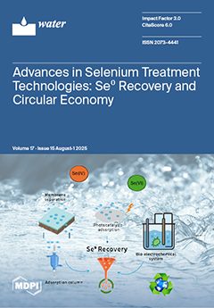
Selenium (Se) oxyanions, primarily selenite (Se(IV)) and selenate (Se(VI)), can occur in drinking water at harmful levels exceeding 50 µg/L, surpassing WHO (40 µg/L), Germany (10 µg/L), and industrial limits (5–10 µg/L) and pose serious health risks when daily intake exceeds 400 µg. Their presence arises from natural and anthropogenic sources, with speciation influenced by water origin. Se(VI), being more soluble, is dominant in surface waters. Conventional treatments are often ineffective. Emerging treatment methods including membranes, nanomaterials, photocatalysis–adsorption, and bio-electrochemical systems enable efficient Se removal via reduction to insoluble elemental Se0, facilitating recovery and reuse, and advancing circular economy goals. This review offers a novel perspective by integrating Se0 recovery with sustainable, resource-oriented water treatment strategies. View this paper
  • Issues are regarded as officially published after their release is announced to the table of contents alert mailing list.
  • You may sign up for e-mail alerts to receive table of contents of newly released issues.
  • PDF is the official format for papers published in both, html and pdf forms. To view the papers in pdf format, click on the "PDF Full-text" link, and use the free Adobe Reader to open them.
Order results
Result details
Section
Select all
Export citation of selected articles as:
14 pages, 74908 KB  
Article
Upscaling In Situ and Airborne Hyperspectral Data for Satellite-Based Chlorophyll Retrieval in Coastal Waters
by Roko Andričević
Water 2025, 17(15), 2356; https://doi.org/10.3390/w17152356 - 7 Aug 2025
Viewed by 401
Abstract
Monitoring water quality parameters in coastal and estuarine environments is critical for assessing their ecological status and addressing environmental challenges. However, traditional in situ sampling programs are often constrained by limited spatial and temporal coverage, making it difficult to capture the complex variability [...] Read more.
Monitoring water quality parameters in coastal and estuarine environments is critical for assessing their ecological status and addressing environmental challenges. However, traditional in situ sampling programs are often constrained by limited spatial and temporal coverage, making it difficult to capture the complex variability in these dynamic systems. This study introduces a novel upscaling framework that leverages limited in situ measurements and airborne hyperspectral data to generate multiple conditional realizations of water quality parameter fields. These pseudo-measurements are statistically consistent with the original data and are used to calibrate inversion algorithms that relate satellite-derived reflectance data to water quality parameters. The approach was applied to Kaštela Bay, a semi-enclosed coastal area in the eastern Adriatic Sea, to map seasonal variations in water quality parameters such as Chlorophyll-a. The upscaling framework captured spatial patterns that were absent in sparse in situ observations and enabled regional mapping using Sentinel-2A satellite data at the appropriate spatial scale. By generating realistic pseudo-measurements, the method improved the stability and performance of satellite-based retrieval algorithms, particularly in periods of high productivity. Overall, this methodology addresses data scarcity challenges in coastal water monitoring and its application could benefit the implementation of European water quality directives through enhanced regional-scale mapping capabilities. Full article
(This article belongs to the Section Oceans and Coastal Zones)
Show Figures

Figure 1

27 pages, 21306 KB  
Article
Study on the Spatio-Temporal Differentiation and Driving Mechanism of Ecological Security in Dongping Lake Basin, Shandong Province, China
by Yibing Wang, Ge Gao, Mingming Li, Kuanzhen Mao, Shitao Geng, Hongliang Song, Tong Zhang, Xinfeng Wang and Hongyan An
Water 2025, 17(15), 2355; https://doi.org/10.3390/w17152355 - 7 Aug 2025
Viewed by 332
Abstract
Ecological security evaluation serves as the cornerstone for ecological management decision-making and spatial optimization. This study focuses on the Dongping Lake Basin. Based on the Pressure–State–Response (PSR) model framework, it integrates ecological risk, ecosystem health, and ecosystem service indicators. Utilizing methods including Local [...] Read more.
Ecological security evaluation serves as the cornerstone for ecological management decision-making and spatial optimization. This study focuses on the Dongping Lake Basin. Based on the Pressure–State–Response (PSR) model framework, it integrates ecological risk, ecosystem health, and ecosystem service indicators. Utilizing methods including Local Indicators of Spatial Association (LISA), Transition Matrix, and GeoDetector, it analyzes the spatio-temporal evolution characteristics and driving mechanisms of watershed ecological security from 2000 to 2020. The findings reveal that the Watershed Ecological Security Index (WESI) exhibited a trend of “fluctuating upward followed by periodic decline”. In 2000, the status was “relatively unsafe”. It peaked in 2015 (index 0.332, moderately safe) and experienced a slight decline by 2020. Spatially, a significantly clustered pattern of “higher in the north and lower in the south, higher in the east and lower in the west” was observed. In 2020, “High-High” clusters of ecological security aligned closely with Shandong Province’s ecological conservation red line, concentrating in core protected areas such as the foothills of the Taihang Mountains and Dongping Lake Wetland. Level transitions were characterized by “predominant continuous improvement in low levels alongside localized reverse fluctuations in middle and high levels,” with the “relatively unsafe” and “moderately safe” levels experiencing the largest transfer areas. Geographical detector analysis indicates that the Human Interference Index (HI), Ecosystem Service Value (ESV), and Annual Afforestation Area (AAA) were key drivers of watershed ecological security change, influenced by dynamic interactive effects among multiple factors. This study advances watershed-scale ecological security assessment methodologies. The revealed spatio-temporal patterns and driving mechanisms provide valuable insights for protecting the ecological barrier in the lower Yellow River and informing ecological security strategies within the Dongping Lake Watershed. Full article
(This article belongs to the Section Biodiversity and Functionality of Aquatic Ecosystems)
Show Figures

Figure 1

13 pages, 3203 KB  
Article
Evaluation and Verification of Starch Decomposition by Microbial Hydrolytic Enzymes
by Makoto Takaya, Manzo Uchigasaki, Koji Itonaga and Koichi Ara
Water 2025, 17(15), 2354; https://doi.org/10.3390/w17152354 - 7 Aug 2025
Viewed by 333
Abstract
This study investigates the Enzyme Biofilm Method (EBM), a biological wastewater treatment technology previously developed by the authors. EBM employs microbial-derived hydrolytic enzyme groups in the initial treatment stage to break down high-molecular-weight organic matter—such as starch, proteins, and fats—into low-molecular-weight compounds. These [...] Read more.
This study investigates the Enzyme Biofilm Method (EBM), a biological wastewater treatment technology previously developed by the authors. EBM employs microbial-derived hydrolytic enzyme groups in the initial treatment stage to break down high-molecular-weight organic matter—such as starch, proteins, and fats—into low-molecular-weight compounds. These compounds enhance the growth of native microorganisms, promoting biofilm formation on carriers and improving treatment efficiency. Over the past decade, EBM has been practically applied in food factory wastewater facilities handling high organic loads. The enzyme groups used in EBM are derived from cultures of Bacillus mojavensis, Saccharomyces cariocanus, and Lacticaseibacillus paracasei. To clarify the system’s mechanism and ensure its practical viability, this study focused on starch—a prevalent and recalcitrant component of food wastewater—using two evaluation approaches. Verification 1: Field testing at a starch factory showed that adding enzyme groups to the equalization tank effectively reduced biological oxygen demand (BOD) through starch degradation. Verification 2: Laboratory experiments confirmed that the enzyme groups possess both amylase and maltase activities, sequentially breaking down starch into glucose. The resulting glucose supports microbial growth, facilitating biofilm formation and BOD reduction. These findings confirm EBM’s potential as a sustainable and effective solution for treating high-strength food industry wastewater. Full article
(This article belongs to the Special Issue Advanced Biological Wastewater Treatment and Nutrient Removal)
Show Figures

Figure 1

15 pages, 1507 KB  
Article
Effective Endotoxin Reduction in Hospital Reverse Osmosis Water Using eBooster™ Electrochemical Technology
by José Eudes Lima Santos, Letícia Gracyelle Alexandre Costa, Carlos Alberto Martínez-Huitle and Sergio Ferro
Water 2025, 17(15), 2353; https://doi.org/10.3390/w17152353 - 7 Aug 2025
Viewed by 574
Abstract
Endotoxins, lipopolysaccharides released from the outer membrane of Gram-negative bacteria, pose a significant risk in healthcare environments, particularly in Central Sterile Supply Departments (CSSDs), where the delivery of sterile pyrogen-free medical devices is critical for patient safety. Traditional methods for controlling endotoxins in [...] Read more.
Endotoxins, lipopolysaccharides released from the outer membrane of Gram-negative bacteria, pose a significant risk in healthcare environments, particularly in Central Sterile Supply Departments (CSSDs), where the delivery of sterile pyrogen-free medical devices is critical for patient safety. Traditional methods for controlling endotoxins in water systems, such as ultraviolet (UV) disinfection, have proven ineffective at reducing endotoxin concentrations to comply with regulatory standards (<0.25 EU/mL). This limitation presents a significant challenge, especially in the context of reverse osmosis (RO) permeate used in CSSDs, where water typically has very low conductivity. Despite the established importance of endotoxin removal, a gap in the literature exists regarding effective chemical-free methods that can meet the stringent endotoxin limits in such low-conductivity environments. This study addresses this gap by evaluating the effectiveness of the eBooster™ electrochemical technology—featuring proprietary electrode materials and a reactor design optimized for potable water—for endotoxin removal from water, specifically under the low-conductivity conditions typical of RO permeate. Laboratory experiments using the B250 reactor achieved >90% endotoxin reduction (from 1.2 EU/mL to <0.1 EU/mL) at flow rates ≤5 L/min and current densities of 0.45–2.7 mA/cm2. Additional real-world testing at three hospitals showed that the eBooster™ unit, when installed in the RO tank recirculation loop, consistently reduced endotoxin levels from 0.76 EU/mL (with UV) to <0.05 EU/mL over 24 months of operation, while heterotrophic plate counts dropped from 190 to <1 CFU/100 mL. Statistical analysis confirmed the reproducibility and flow-rate dependence of the removal efficiency. Limitations observed included reduced efficacy at higher flow rates, the need for sufficient residence time, and a temporary performance decline after two years due to a power fault, which was promptly corrected. Compared to earlier approaches, eBooster™ demonstrated superior performance in low-conductivity environments without added chemicals or significant maintenance. These findings highlight the strength and novelty of eBooster™ as a reliable, chemical-free, and maintenance-friendly alternative to traditional UV disinfection systems, offering a promising solution for critical water treatment applications in healthcare environments. Full article
Show Figures

Figure 1

21 pages, 8772 KB  
Article
Assessing Hydropower Impacts on Flood and Drought Hazards in the Lancang–Mekong River Using CNN-LSTM Machine Learning
by Muzi Zhang, Boying Chi, Hongbin Gu, Jian Zhou, Honggang Chen, Weiwei Wang, Yicheng Wang, Juanjuan Chen, Xueqian Yang and Xuan Zhang
Water 2025, 17(15), 2352; https://doi.org/10.3390/w17152352 - 7 Aug 2025
Viewed by 561
Abstract
The efficient and rational development of hydropower in the Lancang–Mekong River Basin can promote green energy transition, reduce carbon emissions, prevent and mitigate flood and drought disasters, and ensure the sustainable development of the entire basin. In this study, based on publicly available [...] Read more.
The efficient and rational development of hydropower in the Lancang–Mekong River Basin can promote green energy transition, reduce carbon emissions, prevent and mitigate flood and drought disasters, and ensure the sustainable development of the entire basin. In this study, based on publicly available hydrometeorological observation data and satellite remote sensing monitoring data from 2001 to 2020, a machine learning model of the Lancang–Mekong Basin was developed to reconstruct the basin’s hydrological processes, and identify the occurrence patterns and influencing mechanisms of water-related hazards. The results show that, against the background of climate change, the Lancang–Mekong Basin is affected by the increasing frequency and intensity of extreme precipitation events. In particular, Rx1day, Rx5day, R10mm, and R95p (extreme precipitation indicators determined by the World Meteorological Organization’s Expert Group on Climate Change Monitoring and Extreme Climate Events) in the northwestern part of the Mekong River Basin show upward trends, with the average maximum daily rainfall increasing by 1.8 mm/year and the total extreme precipitation increasing by 18 mm/year on average. The risks of flood and drought disasters will continue to rise. The flood peak period is mainly concentrated in August and September, with the annual maximum flood peak ranging from 5600 to 8500 m3/s. The Stung Treng Station exhibits longer drought duration, greater severity, and higher peak intensity than the Chiang Saen and Pakse Stations. At the Pakse Station, climate change and hydropower development have altered the non-drought proportion by −12.50% and +15.90%, respectively. For the Chiang Saen Station, the fragmentation degree of the drought index time series under the baseline, naturalized, and hydropower development scenarios is 0.901, 1.16, and 0.775, respectively. These results indicate that hydropower development has effectively reduced the frequency of rapid drought–flood transitions within the basin, thereby alleviating pressure on drought management efforts. The regulatory role of the cascade reservoirs in the Lancang River can mitigate risks posed by climate change, weaken adverse effects, reduce flood peak flows, alleviate hydrological droughts in the dry season, and decrease flash drought–flood transitions in the basin. The research findings can enable basin managers to proactively address climate change, develop science-based technical pathways for hydropower dispatch, and formulate adaptive disaster prevention and mitigation strategies. Full article
(This article belongs to the Section Water and Climate Change)
Show Figures

Figure 1

44 pages, 4978 KB  
Review
Performance of Continuous Electrocoagulation Processes (CEPs) as an Efficient Approach for the Treatment of Industrial Organic Pollutants: A Comprehensive Review
by Zakaria Al-Qodah, Maha Mohammad AL-Rajabi, Hiba H. Al Amayreh, Eman Assirey, Khalid Bani-Melhem and Mohammad Al-Shannag
Water 2025, 17(15), 2351; https://doi.org/10.3390/w17152351 - 7 Aug 2025
Viewed by 661
Abstract
Electrocoagulation (EC) processes have emerged as an efficient solution for different inorganic and organic effluents. The main characteristics of this versatile process are its ease of operation and low sludge production. The literature indicates that EC can be successfully used as a single [...] Read more.
Electrocoagulation (EC) processes have emerged as an efficient solution for different inorganic and organic effluents. The main characteristics of this versatile process are its ease of operation and low sludge production. The literature indicates that EC can be successfully used as a single process or a step within a combined treatment system. If used in a combined system, this process could be employed as a pre-, a post-, or middle treatment step. Additionally, the EC process has been used in both continuous and batch modes. In most studies, EC has achieved significant improvements in the treated water quality and relatively low total energy consumption. This review presents a comprehensive evaluation and analysis of standalone and combined continuous EC processes. The influence of key operational parameters on continuous EC performance is thoroughly discussed. Furthermore, recent advancements in reactor design, modeling, and process optimization are addressed. The benefits of integrating other treatment processes with the EC process, such as advanced oxidation, membranes, chemical coagulation, and adsorption, are also evaluated. The performance of most standalone and combined EC processes used for organic pollutant treatment and published in the last 25 years is critically analyzed. This review is expected to give researchers many insights to improve their treatment scenario with recent and efficient environmental experiences, sustainability, and circular economy. The clearly presented information is expected to guide researchers in selecting efficient, cost-effective, and time-saving treatment alternatives. The findings ensure the considerable potential of continuous EC treatment processes for organic pollutants. However, more research is warranted to enhance process design, operational efficiency, scale-up, and economic viability. Full article
(This article belongs to the Section Wastewater Treatment and Reuse)
Show Figures

Figure 1

16 pages, 2370 KB  
Article
Optimizing Cascade Hydropower Operations for Flood Control Using Unmanned Vessel Bathymetry
by Haijing Gao, Jingyuan Cui, Qingpeng Wu, Yan Li, Wei Shuai, Dajiang He, Jianyong Hu and Jinke Mao
Water 2025, 17(15), 2350; https://doi.org/10.3390/w17152350 - 7 Aug 2025
Viewed by 280
Abstract
To enhance regional flood control capacity, this study focused on the DX River section in Zhejiang Province. Unmanned vessel bathymetry was employed to obtain precise river cross-section data. A hydrodynamic model was established to simulate flood propagation processes and conduct flood routing analyses. [...] Read more.
To enhance regional flood control capacity, this study focused on the DX River section in Zhejiang Province. Unmanned vessel bathymetry was employed to obtain precise river cross-section data. A hydrodynamic model was established to simulate flood propagation processes and conduct flood routing analyses. Flood scenarios under 5-year, 10-year, and 20-year return periods were simulated to assess water level variations and overflow risks. The results indicate that under a 5-year flood, 19.5% of the right bank fails to meet flood control standards. This risk intensifies significantly with increasing return periods. Building on these findings, a flood optimal operation model was developed. The resulting coordinated strategy, which lowers the peak water level by 1.2 m during a 20-year flood, is sufficient to prevent overflow at the critical section and enhances regional flood control capacity. This is followed by dynamic gate regulation to match the outflow to the inflow. Dynamic regulation of spillway gates should then be implemented to achieve outflow rates commensurate with the incoming flood magnitude. This study demonstrates a robust workflow from high-resolution data acquisition to actionable operational rules, providing a transferable framework for mitigating flood risks in complex, regulated river systems. Full article
(This article belongs to the Special Issue Risk Assessment and Mitigation for Water Conservancy Projects)
Show Figures

Figure 1

22 pages, 5681 KB  
Article
Automatic Detection System for Rainfall-Induced Shallow Landslides in Southeastern China Using Deep Learning and Unmanned Aerial Vehicle Imagery
by Yunfu Zhu, Bing Xia, Jianying Huang, Yuxuan Zhou, Yujie Su and Hong Gao
Water 2025, 17(15), 2349; https://doi.org/10.3390/w17152349 - 7 Aug 2025
Viewed by 504
Abstract
In the southeast of China, seasonal rainfall intensity is high, the distribution of mountains and hills is extensive, and many small-scale, shallow landslides frequently occur after consecutive seasons of heavy rainfall. High-precision automated identification systems can quickly pinpoint the scope of the disaster [...] Read more.
In the southeast of China, seasonal rainfall intensity is high, the distribution of mountains and hills is extensive, and many small-scale, shallow landslides frequently occur after consecutive seasons of heavy rainfall. High-precision automated identification systems can quickly pinpoint the scope of the disaster and help with important decisions like evacuating people, managing engineering, and assessing damage. Many people have designed systems for detecting such shallow landslides, but few have designed systems that combine high resolution, high automation, and real-time capability of landslide identification. Taking accuracy, automation, and real-time capability into account, we designed an automatic rainfall-induced shallow landslide detection system based on deep learning and Unmanned Aerial Vehicle (UAV) images. The system uses UAVs to capture high-resolution imagery, the U-Net (a U-shaped convolutional neural network) to combine multi-scale features, an adaptive edge enhancement loss function to improve landslide boundary identification, and the development of the “UAV Cruise Geological Hazard AI Identification System” software with an automated processing chain. The system integrates UAV-specific preprocessing and achieves a processing speed of 30 s per square kilometer. It was validated in Wanli District, Nanchang City, Jiangxi Province. The results show a Mean Intersection over Union (MIoU) of 90.7% and a Pixel Accuracy of 92.3%. Compared with traditional methods, the system significantly improves the accuracy of landslide detection. Full article
Show Figures

Figure 1

12 pages, 1451 KB  
Article
Effects of Freshwater Restoration on Phytoplankton and Zooplankton Communities in the Yellow River Delta
by Jia Jia, Meng Xia, Yang Zhang, Shimin Tian, Yawei Hu, Zhanshuo Zhang, Xuejie Zhai, Bo Qu and Lingang Hao
Water 2025, 17(15), 2348; https://doi.org/10.3390/w17152348 - 7 Aug 2025
Viewed by 390
Abstract
Managed freshwater replenishment is a significant restoration method in the Yellow River Delta. However, their impacts on plankton communities, which are key bioindicators of aquatic ecosystem health and sensitive to the changes in the environment, remain poorly quantified. In this study, we conducted [...] Read more.
Managed freshwater replenishment is a significant restoration method in the Yellow River Delta. However, their impacts on plankton communities, which are key bioindicators of aquatic ecosystem health and sensitive to the changes in the environment, remain poorly quantified. In this study, we conducted plankton surveys across wetlands subjected to freshwater restoration durations ranging from 5 to 22 years. We assessed shifts in phytoplankton and zooplankton community structure, biomass, diversity, and their relationships with environmental drivers. Results revealed distinct temporal dynamics: phytoplankton biomass and diversity followed a “U-shaped” trajectory (initial decline followed by recovery), while zooplankton biomass decreased but diversity increased with restoration duration. Canonical Correspondence Analysis (CCA) and Partial Least Squares Path Modeling (PLS-PM) identified salinity (Cl, SO42−) and dissolved nitrate (NO3) as primary environmental controls for both groups. Cyanobacteria dominated phytoplankton biomass initially but declined with restoration age, while rotifers replaced copepods as the dominant zooplankton taxon over time. These findings demonstrate that freshwater restoration restructures plankton communities through salinity-mediated physiological constraints and altered nutrient availability, with implications for ecosystem function and adaptive management in anthropogenically influenced deltas. Full article
Show Figures

Figure 1

15 pages, 6405 KB  
Article
Rainy Season Onset in Northeast China: Characteristic Changes and Physical Mechanisms Before and After the 2000 Climate Regime Shift
by Hanchen Zhang, Weifang Wang, Shuwen Li, Qing Cao, Quanxi Shao, Jinxia Yu, Tao Zheng and Shuci Liu
Water 2025, 17(15), 2347; https://doi.org/10.3390/w17152347 - 7 Aug 2025
Viewed by 325
Abstract
The rainy season characteristics are directly modulated by atmospheric circulation and moisture transport dynamics. Focusing on the characteristics of the rainy season onset date (RSOD), this study aims to advance the understanding and prediction of climate change impacts on agricultural production and disaster [...] Read more.
The rainy season characteristics are directly modulated by atmospheric circulation and moisture transport dynamics. Focusing on the characteristics of the rainy season onset date (RSOD), this study aims to advance the understanding and prediction of climate change impacts on agricultural production and disaster mitigation strategies. Based on rainfall data from 66 meteorological stations in northeast China (NEC) from 1961 to 2020, this study determined the patterns of the RSOD in the region and established its mechanistic linkages with atmospheric circulation and water vapor transport mechanisms. This study identifies a climatic regime shift around 2000, with the RSOD transitioning from low to high interannual variability in NEC. Further analysis reveals a strong correlation between the RSOD and atmospheric circulation characteristics: cyclonic vorticity amplifies before the RSOD and dissipates afterward. Innovatively, this study reveals a significant transition in the water vapor transport paths during the early rainy season in NEC around 2000, shifting from eastern Mongolia–Sea of Japan to the northwestern Pacific region. Moreover, the advance or delay of the RSOD directly influences the water vapor transport intensity—an early (delayed) RSOD is associated with enhanced (weakened) water vapor transport. These findings provide a new perspective for predicting the RSOD in the context of climate change while providing critical theoretical underpinnings for optimizing agricultural strategies and enhancing disaster prevention protocols. Full article
Show Figures

Figure 1

19 pages, 17281 KB  
Article
Retrieving Chlorophyll-a Concentrations in Baiyangdian Lake from Sentinel-2 Data Using Kolmogorov–Arnold Networks
by Wenlong Han and Qichao Zhao
Water 2025, 17(15), 2346; https://doi.org/10.3390/w17152346 - 7 Aug 2025
Viewed by 498
Abstract
This study pioneers the integration of Sentinel-2 satellite imagery with Kolmogorov–Arnold networks (KAN) for the evaluation of chlorophyll-a (Chl-a) concentrations in inland lakes. Using Baiyangdian Lake in Hebei Province, China, as a case study, a specialized KAN architecture was designed to extract spectral [...] Read more.
This study pioneers the integration of Sentinel-2 satellite imagery with Kolmogorov–Arnold networks (KAN) for the evaluation of chlorophyll-a (Chl-a) concentrations in inland lakes. Using Baiyangdian Lake in Hebei Province, China, as a case study, a specialized KAN architecture was designed to extract spectral features from Sentinel-2 data, and a robust algorithm was developed for Chl-a estimation. The results demonstrate that the KAN model outperformed traditional feature-engineering-based machine learning (ML) methods and standard multilayer perceptron (MLP) deep learning approaches, achieving an R2 of 0.8451, with MAE and RMSE as low as 1.1920 μg/L and 1.6705 μg/L, respectively. Furthermore, attribution analysis was conducted to quantify the importance of individual features, highlighting the pivotal role of bands B3 and B5 in Chl-a retrieval. Furthermore, spatio-temporal distributions of Chl-a concentrations in Baiyangdian Lake from 2020 to 2024 were generated leveraging the KAN model, further elucidating the underlying causes of water quality changes and examining the driving factors. Compared to previous studies, the proposed approach leverages the high spatial resolution of Sentinel-2 imagery and the accuracy and interpretability of the KAN model, offering a novel framework for monitoring water quality parameters in inland lakes. These findings may guide similar research endeavors and provide valuable decision-making support for environmental agencies. Full article
(This article belongs to the Special Issue AI, Machine Learning and Digital Twin Applications in Water)
Show Figures

Figure 1

14 pages, 1121 KB  
Article
Electrical Circuit Model for Sensing Water Quality Analysis
by Omar Awayssa, Roqaya A. Ismail, Ali Hilal-AlNaqbi and Mahmoud Al Ahmad
Water 2025, 17(15), 2345; https://doi.org/10.3390/w17152345 - 7 Aug 2025
Viewed by 442
Abstract
Water is essential to human civilization and development, yet its quality is increasingly threatened by climate change, pollution, and resource mismanagement. This work introduces an empirical, non-invasive framework for assessing water potability using electrical impedance spectroscopy (EIS) combined with a novel equivalent circuit [...] Read more.
Water is essential to human civilization and development, yet its quality is increasingly threatened by climate change, pollution, and resource mismanagement. This work introduces an empirical, non-invasive framework for assessing water potability using electrical impedance spectroscopy (EIS) combined with a novel equivalent circuit model. A customized sensor holder was designed to reduce impedance magnitude and enhance phase sensitivity, improving detection accuracy. Various water samples, including seawater, groundwater, and commercially bottled water, were analyzed. The proposed method achieved a 100% classification accuracy in distinguishing among water types, as validated by extracted circuit parameters and verified by inductively coupled plasma (ICP) measurements. Sensitivity analysis demonstrated the ability to detect compositional changes as small as 10%, highlighting a strong potential for fine discrimination of ionic contents. The extracted parameters, such as resistance, capacitance, and inductance, showed clear correlations with ionic composition, enabling reliable potability classification in accordance with WHO guidelines. The approach is rapid, label-free, and suitable for field applications, offering a promising tool for real-time water quality monitoring and supporting sustainable water resource management. Full article
Show Figures

Graphical abstract

15 pages, 804 KB  
Article
Association Between Legionnaires’ Disease Incidence and Meteorological Data by Region and Time on the Island of Crete, Greece
by Efstathios Koutsostathis, Anna Psaroulaki, Dimosthenis Chochlakis, Chrysovalantis Malesios, Nicos Demiris, Kleomenis Kalogeropoulos and Andreas Tsatsaris
Water 2025, 17(15), 2344; https://doi.org/10.3390/w17152344 - 7 Aug 2025
Viewed by 927
Abstract
Since its first appearance as a human pathogen in 1976, Legionella pneumophila has been identified as a causative agent of community-acquired pneumonia (CAP). It survives in rivers, bays, lakes, and water reservoirs, and it is categorized as the fourth most common causative agent [...] Read more.
Since its first appearance as a human pathogen in 1976, Legionella pneumophila has been identified as a causative agent of community-acquired pneumonia (CAP). It survives in rivers, bays, lakes, and water reservoirs, and it is categorized as the fourth most common causative agent of CAP leading to hospitalization. We aimed to investigate patterns in which environmental, seasonal and regional factors may affect the prevalence of Legionnaires’ disease in Crete during the last two decades (2000–2022).The data used originated from the national surveillance database and included any person reported with travel-associated Legionnaires’ disease (TALD) between January 2000 and December 2022. Meteorological data were collected from the National Weather Service. The meteorological variables included (max) temperature (in °C), cloudiness (in octas), wind speed (in knots), and relative humidity (RH) (%). The statistical analysis was based on a case-crossover design with 1:1 matching characteristic. We revealed both seasonal and regional effects on the incidence of Legionnaires’ disease. Cases are significantly more frequent in autumn, in comparison to the other three seasons, while Rethymnon is the prefecture with fewer cases in comparison to Chania or Heraklion. In addition, our research showed that the majority of cases occurred during the years 2017–2018. TALD in Crete is significantly associated with temperature in °C and wind speed in knots. Our research suggests that temporal and spatial factors significantly influence disease cases. These results are in line with studies from foreign countries. The study results aspire to expand our knowledge regarding the epidemiological characteristics of Legionnaires’ disease in relation to local, geographical and meteorological factors on the island of Crete. Full article
(This article belongs to the Section Water and One Health)
Show Figures

Figure 1

7 pages, 1182 KB  
Comment
Comment on Tzampoglou, P.; Loupasakis, C. Hydrogeological Hazards in Open Pit Coal Mines–Investigating Triggering Mechanisms by Validating the European Ground Motion Service Product with Ground Truth Data. Water 2023, 15, 1474
by Georgios Louloudis, Christos Roumpos, Eleni Mertiri and Petros Kostaridis
Water 2025, 17(15), 2343; https://doi.org/10.3390/w17152343 - 7 Aug 2025
Viewed by 396
Abstract
The commented paper uses arbitrary and unsubstantiated hypotheses to attribute land subsidence phenomena in the Amyntaion basin to the operations of the Public Power Corporation (PPC) surface coal mine, disregarding, or at least grossly underestimating, the effect of about 600 pumped deep wells [...] Read more.
The commented paper uses arbitrary and unsubstantiated hypotheses to attribute land subsidence phenomena in the Amyntaion basin to the operations of the Public Power Corporation (PPC) surface coal mine, disregarding, or at least grossly underestimating, the effect of about 600 pumped deep wells for irrigation purposes all over the basin. In addition to the huge difference in the pumped quantities of water from the aquifer, ground water table lowering due to the PPC mine has negligible influence at distances over 500 m from the edge of the mine, while the areas examined in the paper are at distances of several kilometers from the edge of the mine. Furthermore, the authors attribute the landslide that occurred in the mine in 2017 to the steep excavation slopes of the mine and the increased groundwater pore pressure due to reduced peripheral pumping, which is completely inaccurate. To build their case, the authors of the commented paper disregard multiple references in research publications on the above issues, as explained in the main text of this discussion. Full article
Show Figures

Figure 1

27 pages, 16782 KB  
Article
Response of Grain Yield to Extreme Precipitation in Major Grain-Producing Areas of China Against the Background of Climate Change—A Case Study of Henan Province
by Keding Sheng, Rui Li, Fengqiuli Zhang, Tongde Chen, Peng Liu, Yanan Hu, Bingyin Li and Zhiyuan Song
Water 2025, 17(15), 2342; https://doi.org/10.3390/w17152342 - 6 Aug 2025
Viewed by 783
Abstract
Based on the panel data of daily meteorological stations and winter wheat yield in Henan Province from 2000 to 2023, this study comprehensively used the Mann–Kendall trend test, wavelet coherence analysis (WTC), and other methods to reveal the temporal and spatial evolution of [...] Read more.
Based on the panel data of daily meteorological stations and winter wheat yield in Henan Province from 2000 to 2023, this study comprehensively used the Mann–Kendall trend test, wavelet coherence analysis (WTC), and other methods to reveal the temporal and spatial evolution of extreme precipitation and its multi-scale stress mechanism on grain yield. The results showed the following: (1) Extreme precipitation showed the characteristics of ‘frequent fluctuation-gentle trend-strong spatial heterogeneity’, and the maximum daily precipitation in spring (RX1DAY) showed a significant uplift. The increase in rainstorm events (R95p/R99p) in the southern region during the summer is particularly prominent; at the same time, the number of consecutive drought days (CDDs > 15 d) in the middle of autumn was significantly prolonged. It was also found that 2010 is a significant mutation node. Since then, the synergistic effect of ‘increasing drought days–increasing rainstorm frequency’ has begun to appear, and the short-period coherence of super-strong precipitation (R99p) has risen to more than 0.8. (2) The spatial pattern of winter wheat in Henan is characterized by the three-level differentiation of ‘stable core area, sensitive transition zone and shrinking suburban area’, and the stability of winter wheat has improved but there are still local risks. (3) There is a multi-scale stress mechanism of extreme precipitation on winter wheat yield. The long-period (4–8 years) drought and flood events drive the system risk through a 1–2-year lag effect (short-period (0.5–2 years) medium rainstorm intensity directly impacted the production system). This study proposes a ‘sub-scale governance’ strategy, using a 1–2-year lag window to establish a rainstorm warning mechanism, and optimizing drainage facilities for high-risk areas of floods in the south to improve the climate resilience of the agricultural system against the background of climate change. Full article
(This article belongs to the Special Issue Soil Erosion and Soil and Water Conservation, 2nd Edition)
Show Figures

Figure 1

22 pages, 20118 KB  
Article
Streamflow Forecasting: A Comparative Analysis of ARIMAX, Rolling Forecasting LSTM Neural Network and Physically Based Models in a Pristine Catchment
by Diego Perazzolo, Gianluca Lazzaro, Alvise Fiume, Pietro Fanton and Enrico Grisan
Water 2025, 17(15), 2341; https://doi.org/10.3390/w17152341 - 6 Aug 2025
Viewed by 484
Abstract
Accurate streamflow forecasting at fine temporal and spatial scales is essential to manage the diverse hydrological behaviors of individual catchments, particularly in rapidly responding mountainous regions. This study compares three forecasting models ARIMAX, LSTM, and HEC-HMS applied to the Posina River basin in [...] Read more.
Accurate streamflow forecasting at fine temporal and spatial scales is essential to manage the diverse hydrological behaviors of individual catchments, particularly in rapidly responding mountainous regions. This study compares three forecasting models ARIMAX, LSTM, and HEC-HMS applied to the Posina River basin in northern Italy, using 13 years of hourly hydrological data. While recent literature promotes multi-basin LSTM training for generalization, we show that a well-configured single-basin LSTM, combined with a rolling forecast strategy, can achieve comparable accuracy under high-frequency, data-constrained conditions. The physically based HEC-HMS model, calibrated for continuous simulation, provides robust peak flow prediction but requires extensive parameter tuning. ARIMAX captures baseflows but underestimates sharp hydrological events. Evaluation through NSE, KGE, and MAE shows that both LSTM and HEC-HMS outperform ARIMAX, with LSTM offering a compelling balance between accuracy and ease of implementation. This study enhances our understanding of streamflow model behavior in small basins and demonstrates that LSTM networks, despite their simplified configuration, can be reliable tools for flood forecasting in localized Alpine catchments, where physical modeling is resource-intensive and regional data for multi-basin training are often unavailable. Full article
Show Figures

Graphical abstract

21 pages, 4581 KB  
Article
Spatiotemporal Variations and Drivers of the Ecological Footprint of Water Resources in the Yangtze River Delta
by Aimin Chen, Lina Chang, Peng Zhao, Xianbin Sun, Guangsheng Zhang, Yuanping Li, Haojun Deng and Xiaoqin Wen
Water 2025, 17(15), 2340; https://doi.org/10.3390/w17152340 - 6 Aug 2025
Viewed by 395
Abstract
With the acceleration of urbanization in China, water resources have become a key factor restricting regional sustainable development. Current research primarily examines the temporal or spatial variations in the water resources ecological footprint (WREF), with limited emphasis on the integration of both spatial [...] Read more.
With the acceleration of urbanization in China, water resources have become a key factor restricting regional sustainable development. Current research primarily examines the temporal or spatial variations in the water resources ecological footprint (WREF), with limited emphasis on the integration of both spatial and temporal scales. In this study, we collected the data and information from the 2005–2022 Statistical Yearbook and Water Resources Bulletin of the Yangtze River Delta Urban Agglomeration (YRDUA), and calculated evaluation indicators: WREF, water resources ecological carrying capacity (WRECC), water resources ecological pressure (WREP), and water resources ecological surplus and deficit (WRESD). We primarily analyzed the temporal and spatial variation in the per capita WREF and used the method of Geodetector to explore factors driving its temporal and spatial variation in the YRDUA. The results showed that: (1) From 2005 to 2022, the per capita WREF (total water, agricultural water, and industrial water) of the YRDUA generally showed fluctuating declining trends, while the per capita WREF of domestic water and ecological water showed obvious growth. (2) The per capita WREF and the per capita WRECC were in the order of Jiangsu Province > Anhui Province > Shanghai City > Zhejiang Province. The spatial distribution of the per capita WREF was similar to those of the per capita WRECC, and most areas effectively consume water resources. (3) The explanatory power of the interaction between factors was greater than that of a single factor, indicating that the spatiotemporal variation in the per capita WREF of the YRDUA was affected by the combination of multiple factors and that there were regional differences in the major factors in the case of secondary metropolitan areas. (4) The per capita WREF of YRDUA was affected by natural resources, and the impact of the ecological condition on the per capita WREF increased gradually over time. The impact factors of secondary metropolitan areas also clearly changed over time. Our results showed that the ecological situation of per capita water resources in the YRDUA is generally good, with obvious spatial and temporal differences. Full article
(This article belongs to the Section Water Resources Management, Policy and Governance)
Show Figures

Figure 1

20 pages, 3135 KB  
Article
Nonstationary Streamflow Variability and Climate Drivers in the Amur and Yangtze River Basins: A Comparative Perspective Under Climate Change
by Qinye Ma, Jue Wang, Nuo Lei, Zhengzheng Zhou, Shuguang Liu, Aleksei N. Makhinov and Aleksandra F. Makhinova
Water 2025, 17(15), 2339; https://doi.org/10.3390/w17152339 - 6 Aug 2025
Viewed by 354
Abstract
Climate-driven hydrological extremes and anthropogenic interventions are increasingly altering streamflow regimes worldwide. While prior studies have explored climate or regulation effects separately, few have integrated multiple teleconnection indices and reservoir chronologies within a cross-basin comparative framework. This study addresses this gap by assessing [...] Read more.
Climate-driven hydrological extremes and anthropogenic interventions are increasingly altering streamflow regimes worldwide. While prior studies have explored climate or regulation effects separately, few have integrated multiple teleconnection indices and reservoir chronologies within a cross-basin comparative framework. This study addresses this gap by assessing long-term streamflow nonstationarity and its drivers at two key stations—Khabarovsk on the Amur River and Datong on the Yangtze River—representing distinct hydroclimatic settings. We utilized monthly discharge records, meteorological data, and large-scale climate indices to apply trend analysis, wavelet transform, percentile-based extreme diagnostics, lagged random forest regression, and slope-based attribution. The results show that Khabarovsk experienced an increase in winter baseflow from 513 to 1335 m3/s and a notable reduction in seasonal discharge contrast, primarily driven by temperature and cold-region reservoir regulation. In contrast, Datong displayed increased discharge extremes, with flood discharges increasing by +71.9 m3/s/year, equivalent to approximately 0.12% of the mean flood discharge annually, and low discharges by +24.2 m3/s/year in recent decades, shaped by both climate variability and large-scale hydropower infrastructure. Random forest models identified temperature and precipitation as short-term drivers, with ENSO-related indices showing lagged impacts on streamflow variability. Attribution analysis indicated that Khabarovsk is primarily shaped by cold-region reservoir operations in conjunction with temperature-driven snowmelt dynamics, while Datong reflects a combined influence of both climate variability and regulation. These insights may provide guidance for climate-responsive reservoir scheduling and basin-specific regulation strategies, supporting the development of integrated frameworks for adaptive water management under climate change. Full article
(This article belongs to the Special Issue Risks of Hydrometeorological Extremes)
Show Figures

Figure 1

14 pages, 1747 KB  
Article
The Importance of Using Multi-Level Piezometers to Improve the Estimation of Aquifer Properties from Pumping Tests in Complex Heterogeneous Aquifers
by Majdi Mansour, Stephen Walthall and Andrew Hughes
Water 2025, 17(15), 2338; https://doi.org/10.3390/w17152338 - 6 Aug 2025
Viewed by 367
Abstract
Reliable estimates of aquifer properties are needed for groundwater resources management and for engineering applications. Pumping tests conducted in fractured aquifers using an open borehole may not produce a proper characterization of the aquifer properties leading to the failure of engineering solutions. In [...] Read more.
Reliable estimates of aquifer properties are needed for groundwater resources management and for engineering applications. Pumping tests conducted in fractured aquifers using an open borehole may not produce a proper characterization of the aquifer properties leading to the failure of engineering solutions. In this work, we apply a radial flow model to reproduce the time drawdown curves recorded at an observation borehole instrumented with multi-level piezometers drilled in the Permo-Triassic sandstone, which is a complex fractured hydraulic unit. The radial flow model and the optimization code PEST are used to estimate the aquifer hydraulic parameter values. The model is then used to investigate the implications of replacing the multi-level piezometers with an open borehole. The results show that the open borehole does not only significantly alter the groundwater head and flow patterns around the borehole, but the analysis of the time drawdown curve obtained would produce estimates of aquifer properties that bear no relationship with the actual hydraulic properties of the aquifer. For engineering control studies, the pumping test must be carefully designed to account for the presence of fractures, and these must be represented in the analysis tools to ensure the correct characterization of the hydraulic system. Full article
(This article belongs to the Section Hydrogeology)
Show Figures

Figure 1

18 pages, 11555 KB  
Article
Impacts of Land Use and Hydrological Regime on the Spatiotemporal Distribution of Ecosystem Services in a Large Yangtze River-Connected Lake Region
by Ying Huang, Xinsheng Chen, Ying Zhuo and Lianlian Zhu
Water 2025, 17(15), 2337; https://doi.org/10.3390/w17152337 - 6 Aug 2025
Viewed by 490
Abstract
In river-connected lake regions, both land use and hydrological regime changes may affect the ecosystem services; however, few studies have attempted to elucidate their complex influences. In this study, the spatiotemporal dynamics of eight ecosystem services (crop production, aquatic production, water yield, soil [...] Read more.
In river-connected lake regions, both land use and hydrological regime changes may affect the ecosystem services; however, few studies have attempted to elucidate their complex influences. In this study, the spatiotemporal dynamics of eight ecosystem services (crop production, aquatic production, water yield, soil retention, flood regulation, water purification, net primary productivity, and habitat quality) were investigated through remote-sensing images and the InVEST model in the Dongting Lake Region during 2000–2020. Results revealed that crop and aquatic production increased significantly from 2000 to 2020, particularly in the northwestern and central regions, while soil retention and net primary productivity also improved. However, flood regulation, water purification, and habitat quality decreased, with the fastest decline in habitat quality occurring at the periphery of the Dongting Lake. Land-use types accounted for 63.3%, 53.8%, and 40.3% of spatial heterogeneity in habitat quality, flood regulation, and water purification, respectively. Land-use changes, particularly the expansion of construction land and the conversion of water bodies to cropland, led to a sharp decline in soil retention, flood regulation, water purification, net primary productivity, and habitat quality. In addition, crop production and aquatic production were higher in cultivated land and residential land, while the accompanying degradation of flood regulation, water purification, and habitat quality formed a “production-pollution-degradation” spatial coupling pattern. Furthermore, hydrological fluctuations further complicated these dynamics; wet years amplified agricultural outputs but intensified ecological degradation through spatial spillover effects. These findings underscore the need for integrated land-use and hydrological management strategies that balance human livelihoods with ecosystem resilience. Full article
(This article belongs to the Section Ecohydrology)
Show Figures

Figure 1

30 pages, 9692 KB  
Article
Integrating GIS, Remote Sensing, and Machine Learning to Optimize Sustainable Groundwater Recharge in Arid Mediterranean Landscapes: A Case Study from the Middle Draa Valley, Morocco
by Adil Moumane, Abdessamad Elmotawakkil, Md. Mahmudul Hasan, Nikola Kranjčić, Mouhcine Batchi, Jamal Al Karkouri, Bojan Đurin, Ehab Gomaa, Khaled A. El-Nagdy and Youssef M. Youssef
Water 2025, 17(15), 2336; https://doi.org/10.3390/w17152336 - 6 Aug 2025
Viewed by 972
Abstract
Groundwater plays a crucial role in sustaining agriculture and livelihoods in the arid Middle Draa Valley (MDV) of southeastern Morocco. However, increasing groundwater extraction, declining rainfall, and the absence of effective floodwater harvesting systems have led to severe aquifer depletion. This study applies [...] Read more.
Groundwater plays a crucial role in sustaining agriculture and livelihoods in the arid Middle Draa Valley (MDV) of southeastern Morocco. However, increasing groundwater extraction, declining rainfall, and the absence of effective floodwater harvesting systems have led to severe aquifer depletion. This study applies and compares six machine learning (ML) algorithms—decision trees (CART), ensemble methods (random forest, LightGBM, XGBoost), distance-based learning (k-nearest neighbors), and support vector machines—integrating GIS, satellite data, and field observations to delineate zones suitable for groundwater recharge. The results indicate that ensemble tree-based methods yielded the highest predictive accuracy, with LightGBM outperforming the others by achieving an overall accuracy of 0.90. Random forest and XGBoost also demonstrated strong performance, effectively identifying priority areas for artificial recharge, particularly near ephemeral streams. A feature importance analysis revealed that soil permeability, elevation, and stream proximity were the most influential variables in recharge zone delineation. The generated maps provide valuable support for irrigation planning, aquifer conservation, and floodwater management. Overall, the proposed machine learning–geospatial framework offers a robust and transferable approach for mapping groundwater recharge zones (GWRZ) in arid and semi-arid regions, contributing to the achievement of Sustainable Development Goals (SDGs))—notably SDG 6 (Clean Water and Sanitation), by enhancing water-use efficiency and groundwater recharge (Target 6.4), and SDG 13 (Climate Action), by supporting climate-resilient aquifer management. Full article
Show Figures

Figure 1

5 pages, 153 KB  
Editorial
Adsorption Technologies in Wastewater Treatment Processes
by Qili Hu and Liting Hao
Water 2025, 17(15), 2335; https://doi.org/10.3390/w17152335 - 6 Aug 2025
Viewed by 418
Abstract
The escalating challenge of wastewater purification, driven by industrial expansion and population growth, seeks more effective solutions for removing persistent and emerging contaminants such as heavy metals [...] Full article
(This article belongs to the Special Issue Adsorption Technologies in Wastewater Treatment Processes)
5 pages, 149 KB  
Editorial
Advances in Ecohydrology in Arid Inland River Basins
by Lianqing Xue and Guang Yang
Water 2025, 17(15), 2334; https://doi.org/10.3390/w17152334 - 6 Aug 2025
Viewed by 257
Abstract
Water is the foundation of life, ecosystems, and socioeconomic development [...] Full article
(This article belongs to the Special Issue Advances in Ecohydrology in Arid Inland River Basins)
35 pages, 8516 KB  
Article
Study on Stress Monitoring and Risk Early Warning of Flexible Mattress Deployment in Deep-Water Sharp Bend Reaches
by Chu Zhang, Ping Li, Zebang Cui, Kai Wu, Tianyu Chen, Zhenjia Tian, Jianxin Hao and Sudong Xu
Water 2025, 17(15), 2333; https://doi.org/10.3390/w17152333 - 6 Aug 2025
Viewed by 403
Abstract
This study addresses the complex challenges associated with flexible mattress (soft mattress) installation in the sharply curved and deep-water sections of the Yangtze River, particularly in the Yaozui revetment reconstruction project. Under extreme hydrodynamic conditions—water depths exceeding 30 m and velocities over 2.5 [...] Read more.
This study addresses the complex challenges associated with flexible mattress (soft mattress) installation in the sharply curved and deep-water sections of the Yangtze River, particularly in the Yaozui revetment reconstruction project. Under extreme hydrodynamic conditions—water depths exceeding 30 m and velocities over 2.5 m/s—the risk of structural failures such as displacement, flipping, or tearing of the mattress becomes significant. To improve construction safety and stability, the study integrates numerical modeling and on-site strain monitoring to analyze the mechanical response of flexible mattresses during deployment. A three-dimensional finite element model based on the catenary theory was developed to simulate stress distributions under varying flow velocities and angles, revealing stress concentrations at the mattress’s upper edge and reinforcement junctions. Concurrently, a real-time monitoring system using high-precision strain sensors was deployed on critical shipboard components, with collected data analyzed through a remote IoT platform. The results demonstrate strong correlations between mattress strain, flow velocity, and water depth, enabling the identification of high-risk operational thresholds. The proposed monitoring and early-warning framework offers a practical solution for managing construction risks in extreme riverine environments and contributes to the advancement of intelligent construction management for underwater revetment works. Full article
(This article belongs to the Section Oceans and Coastal Zones)
Show Figures

Figure 1

19 pages, 3527 KB  
Article
Drought Vulnerability in South America
by Emma Silverman and Johanna Engström
Water 2025, 17(15), 2332; https://doi.org/10.3390/w17152332 - 6 Aug 2025
Viewed by 425
Abstract
Although it is the wettest continent, droughts are a regular occurrence in South America. As the effects of anthropogenic influences, including climate change, become more pronounced, droughts are expected to increase in frequency and severity. The purpose of this study is to assess [...] Read more.
Although it is the wettest continent, droughts are a regular occurrence in South America. As the effects of anthropogenic influences, including climate change, become more pronounced, droughts are expected to increase in frequency and severity. The purpose of this study is to assess the relative drought vulnerability of the countries in South America. Each country is evaluated for drought exposure, sensitivity, adaptive capacity, and overall vulnerability. Sixteen drought-related indicators were used to measure the relative vulnerability of each country and to measure separate scores for exposure, sensitivity, and adaptive capacity to identify what factor(s) contributed to a country’s vulnerability. The results indicate that Ecuador, a country with a high population and limited water resources, is the most vulnerable to drought in South America, followed by Colombia and Uruguay. Conversely, the country least vulnerable to drought is Guyana, followed by Suriname and Chile. Our analysis suggests that there are both geographic and as well as economic factors influencing the relative drought vulnerability of countries in South America. Full article
(This article belongs to the Section Water Use and Scarcity)
Show Figures

Figure 1

22 pages, 7171 KB  
Article
Distribution Characteristics, Mobility, and Influencing Factors of Heavy Metals at the Sediment–Water Interface in South Dongting Lake
by Xiaohong Fang, Xiangyu Han, Chuanyong Tang, Bo Peng, Qing Peng, Linjie Hu, Yuru Zhong and Shana Shi
Water 2025, 17(15), 2331; https://doi.org/10.3390/w17152331 - 5 Aug 2025
Viewed by 489
Abstract
South Dongting Lake is an essential aquatic ecosystem that receives substantial water inflows from the Xiangjiang and Zishui Rivers. However, it is significantly impacted by human activities, including mining, smelting, and farming. These activities have led to serious contamination of the lake’s sediments [...] Read more.
South Dongting Lake is an essential aquatic ecosystem that receives substantial water inflows from the Xiangjiang and Zishui Rivers. However, it is significantly impacted by human activities, including mining, smelting, and farming. These activities have led to serious contamination of the lake’s sediments with heavy metals (HMs). This study investigated the distribution, mobility, and influencing factors of HMs at the sediment–water interface. To this end, sediment samples were analyzed from three key regions (Xiangjiang River estuary, Zishui River estuary, and northeastern South Dongting Lake) using traditional sampling methods and Diffusive Gradients in Thin Films (DGT) technology. Analysis of fifteen HMs (Pb, Bi, Ni, As, Se, Cd, Sb, Mn, Zn, V, Cr, Cu, Tl, Co, and Fe) revealed significant spatial heterogeneity. The results showed that Cr, Cu, Pb, Bi, Ni, As, Se, Cd, Sb, Mn, Zn, and Fe exhibited high variability (CV > 0.20), whereas V, Tl, and Co demonstrated stable concentrations (CV < 0.20). Concentrations were found to exceed background values of the upper continental crust of eastern China (UCC), Yangtze River sediments (YZ), and Dongting Lake sediments (DT), particularly at the Xiangjiang estuary (XE) and in the northeastern regions. Speciation analysis revealed that V, Cr, Cu, Ni, and As were predominantly found in the residual fraction (F4), while Pb and Co were concentrated in the oxidizable fraction (F3), Mn and Zn appeared primarily in the exchangeable fractions (F1 and F2), and Cd was notably dominant in the exchangeable fraction (F1), suggesting a high potential for mobility. Additionally, DGT results confirmed a significant potential for the release of Pb, Zn, and Cd. Contamination assessment using the Pollution Load Index (PLI) and Geoaccumulation Index (Igeo) identified Pb, Bi, Ni, As, Se, Cd, and Sb as major pollutants. Among these, Bi and Cd were found to pose the highest risks. Furthermore, the Risk Assessment Code (RAC) and the Potential Ecological Risk Index (PERI) highlighted Cd as the primary ecological risk contributor, especially in the XE. The study identified sediment grain size, pH, electrical conductivity, and nutrient levels as the primary influencing factors. The PMF modeling revealed HM sources as mixed smelting/natural inputs, agricultural activities, natural weathering, and mining/smelting operations, suggesting that remediation should prioritize Cd control in the XE with emphasis on external inputs. Full article
(This article belongs to the Section Water Quality and Contamination)
Show Figures

Figure 1

17 pages, 1388 KB  
Article
Invertebrate Assemblages in Some Saline and Soda Lakes of the Kulunda Steppe: First Regional Assessment and Ecological Implications
by Larisa Golovatyuk, Timur Kanapatskiy, Olga Samylina, Nikolay Pimenov, Larisa Nazarova and Anna Kallistova
Water 2025, 17(15), 2330; https://doi.org/10.3390/w17152330 - 5 Aug 2025
Viewed by 417
Abstract
The taxonomic composition and structure of invertebrate assemblages in five lakes from the Kulunda steppe, located in an arid region of southwestern Siberia (Russia), were studied. The lakes varied greatly in their total salinity (5 to 304 g L−1) and carbonate [...] Read more.
The taxonomic composition and structure of invertebrate assemblages in five lakes from the Kulunda steppe, located in an arid region of southwestern Siberia (Russia), were studied. The lakes varied greatly in their total salinity (5 to 304 g L−1) and carbonate alkalinity (0.03 to 4.03 mol-eq L−1). The invertebrate fauna was characterized by low diversity. Only five taxa of macrozoobenthos and two taxa of planktonic invertebrates were identified. As water salinity increased, the taxonomic diversity of the studied lakes decreased, and at salinities > 276 g L−1, monodominant assemblages were formed. The high numbers and biomass of aquatic organism provide a rich food supply for native and migratory waterfowl. The low taxonomic diversity of the invertebrate assemblages of the lakes makes them vulnerable to any negative external impact. The climate in the Kulunda steppe demonstrates a long-term aridization trend. If this continues in the future, then over time, this may lead to the gradual salinization of lakes and a further decrease in the taxonomic diversity of hydrobiological assemblages. This emphasizes the ecological importance of the studied territory and the necessity for its inclusion in the list of sites protected by the Ramsar Convention. Full article
(This article belongs to the Section Biodiversity and Functionality of Aquatic Ecosystems)
Show Figures

Figure 1

21 pages, 3832 KB  
Article
Effects of Water Use Efficiency Combined with Advancements in Nitrogen and Soil Water Management for Sustainable Agriculture in the Loess Plateau, China
by Hafeez Noor, Fida Noor, Zhiqiang Gao, Majed Alotaibi and Mahmoud F. Seleiman
Water 2025, 17(15), 2329; https://doi.org/10.3390/w17152329 - 5 Aug 2025
Viewed by 401
Abstract
In China’s Loess Plateau, sustainable agricultural end products are affected by an insufficiency of water resources. Rising crop water use efficiency (WUE) through field management pattern improvement is a crucial plan of action to address this issue. However, there is no agreement among [...] Read more.
In China’s Loess Plateau, sustainable agricultural end products are affected by an insufficiency of water resources. Rising crop water use efficiency (WUE) through field management pattern improvement is a crucial plan of action to address this issue. However, there is no agreement among researchers on the most appropriate field management practices regarding WUE, which requires further integrated quantitative analysis. We conducted a meta-analysis by quantifying the effect of agricultural practices surrounding nitrogen (N) fertilizer management. The two experimental cultivars were Yunhan–20410 and Yunhan–618. The subplots included nitrogen 0 kg·ha−1 (N0), 90 kg·ha−1 (N90), 180 kg·ha−1 (N180), 210 kg·ha−1 (N210), and 240 kg·ha−1 (N240). Our results show that higher N rates (up to N210) enhanced water consumption during the node-flowering and flowering-maturity time periods. YH–618 showed higher water use during the sowing–greening and node-flowering periods but decreased use during the greening-node and flowering-maturity periods compared to YH–20410. The N210 treatment under YH–618 maximized water use efficiency (WUE). Increased N rates (N180–N210) decreased covering temperatures (Tmax, Tmin, Taver) during flowering, increasing the level of grain filling. Spike numbers rose with N application, with an off-peak at N210 for strong-gluten wheat. The 1000-grain weight was at first enhanced but decreased at the far end of N180–N210. YH–618 with N210 achieved a harvest index (HI) similar to that of YH–20410 with N180, while excessive N (N240) or water reduced the HI. Dry matter accumulation increased up to N210, resulting in earlier stabilization. Soil water consumption from wintering to jointing was strongly correlated with pre-flowering dry matter biological process and yield, while jointing–flowering water use was linked to post-flowering dry matter and spike numbers. Post-flowering dry matter accumulation was critical for yield, whereas spike numbers positively impacted yield but negatively affected 1000-grain weight. In conclusion, our results provide evidence for determining suitable integrated agricultural establishment strategies to ensure efficient water use and sustainable production in the Loess Plateau region. Full article
(This article belongs to the Special Issue Soil–Water Interaction and Management)
Show Figures

Figure 1

19 pages, 4451 KB  
Article
Assessment of the Payments for Watershed Services Policy from a Perspective of Ecosystem Services: A Case Study of the Liaohe River Basin, China
by Manman Guo, Xu Lu and Qing Ma
Water 2025, 17(15), 2328; https://doi.org/10.3390/w17152328 - 5 Aug 2025
Viewed by 518
Abstract
Payments for Watershed services (PWSs) have been emerging as a critical tool for environmental governance in watershed, yet their comparative effectiveness across implementation models has remained poorly understood. Based on a comparative analysis of Eco-Compensation (EC) and Payments for Ecosystem Services (PESs) frameworks, [...] Read more.
Payments for Watershed services (PWSs) have been emerging as a critical tool for environmental governance in watershed, yet their comparative effectiveness across implementation models has remained poorly understood. Based on a comparative analysis of Eco-Compensation (EC) and Payments for Ecosystem Services (PESs) frameworks, examining both theoretical foundations and implementation practices, this study aims to quantitatively assess and compare the effectiveness of two dominant PWSs models—the EC-like model (Phase I: October 2008–April 2017) and the PESs-like model (Phase II: 2017–December 2021). Using the Liaohe River in China as a case study, utilizing ecosystem service value (ESV) as an indicator and employing the corrected unit-value transfer method, we compare the effectiveness of different PWSs models from October 2008 to December 2021. The results reveal the following: (1) Policy Efficiency: The PESs-like model demonstrated significantly greater effectiveness than the EC-like model, with annual average increases in ESV of 3.23 billion CNY (491 million USD) and 1.79 billion CNY (272 million USD). (2) Functional Drivers: Water regulation (45.1% of total ESV growth) and climate regulation (24.3%) were dominant services, with PESs-like interventions enhancing multifunctionality. (3) Stakeholder Impact: In the PESs-like model, the cities implementing inter-county direct payment showed higher growth efficiency than those without it. The operational efficiency of PWSs increases with the number of participating stakeholders, which explains why the PESs-like model demonstrates higher effectiveness than the EC-like model. Our findings offer empirical evidence and actionable policy implications for designing effective PWSs models across global watershed ecosystems. Full article
Show Figures

Figure 1

19 pages, 30180 KB  
Article
Evaluating Distributed Hydrologic Modeling to Assess Coastal Highway Vulnerability to High Water Tables
by Bruno Jose de Oliveira Sousa, Luiz M. Morgado and Jose G. Vasconcelos
Water 2025, 17(15), 2327; https://doi.org/10.3390/w17152327 - 5 Aug 2025
Viewed by 387
Abstract
Due to increased precipitation intensity and sea-level rise, low-lying coastal roads are increasingly vulnerable to subbase saturation. Widely applied lumped hydrological approaches cannot accurately represent time and space-varying groundwater levels in some highly conductive coastal soils, calling for more sophisticated tools. This study [...] Read more.
Due to increased precipitation intensity and sea-level rise, low-lying coastal roads are increasingly vulnerable to subbase saturation. Widely applied lumped hydrological approaches cannot accurately represent time and space-varying groundwater levels in some highly conductive coastal soils, calling for more sophisticated tools. This study assesses the suitability of the Gridded Surface Subsurface Hydrologic Analysis model (GSSHA) for representing hydrological processes and groundwater dynamics in a unique coastal roadway setting in Alabama. A high-resolution model was developed to assess a 2 km road segment and was calibrated for hydraulic conductivity and aquifer bottom levels using observed groundwater level (GWL) data. The model configuration included a fixed groundwater tidal boundary representing Mobile Bay, a refined land cover classification, and an extreme precipitation event simulation representing Hurricane Sally. Results indicated good agreement between modeled and observed groundwater levels, particularly during short-duration high-intensity events, with NSE values reaching up to 0.83. However, the absence of dynamic tidal forcing limited its ability to replicate certain fine-scale groundwater fluctuations. During the Hurricane Sally simulation, over two-thirds of the segment remained saturated for over 6 h, and some locations exceeded 48 h of pavement saturation. The findings underscore the importance of incorporating shallow groundwater processes in hydrologic modeling for coastal roads. This replicable modeling framework may assist DOTs in identifying critical roadway segments to improve drainage infrastructure in order to increase resiliency. Full article
(This article belongs to the Topic Natural Hazards and Disaster Risks Reduction, 2nd Edition)
Show Figures

Figure 1

Previous Issue
Next Issue
Back to TopTop