Next Issue
Volume 10, March
Previous Issue
Volume 10, January
 
 
water-logo

Journal Browser

Journal Browser

Water, Volume 10, Issue 2 (February 2018) – 145 articles

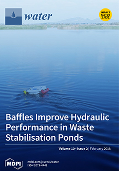
Cover Story (view full-size image): Waste stabilisation pond (WSP) performance is significantly affected by poor hydraulic control. Hydraulic reconfiguration of ponds with baffles is a solution to this problem; however, without full-scale validation, it is difficult to generalise for a wide range of sites. In this study, a full-scale experiment of baffles in a WSP was investigated to assess their impact on hydraulics. Optimal baffle configuration was determined by using high-resolution pond bathymetry and a 2D hydrodynamic model. The approach developed in this study is easily transferrable for use on other sites. View this paper
  • Issues are regarded as officially published after their release is announced to the table of contents alert mailing list.
  • You may sign up for e-mail alerts to receive table of contents of newly released issues.
  • PDF is the official format for papers published in both, html and pdf forms. To view the papers in pdf format, click on the "PDF Full-text" link, and use the free Adobe Reader to open them.
Order results
Result details
Section
Select all
Export citation of selected articles as:

Research

Jump to: Review, Other

16 pages, 5852 KiB  
Article
Land Cover Change Detection in Urban Lake Areas Using Multi-Temporary Very High Spatial Resolution Aerial Images
by Wenyuan Zhang *, Guoxin Tan *, Songyin Zheng, Chuanming Sun, Xiaohan Kong and Zhaobin Liu
National Research Center of Cultural Industries, Central China Normal University, Luoyu Road, Wuhan 430079, China
Water 2018, 10(2), 1; https://doi.org/10.3390/w10020001 - 23 Jan 2018
Cited by 41 | Viewed by 4921
Abstract
The availability of very high spatial resolution (VHR) remote sensing imagery provides unique opportunities to exploit meaningful change information in detail with object-oriented image analysis. This study investigated land cover (LC) changes in Shahu Lake of Wuhan using multi-temporal VHR aerial images in [...] Read more.
The availability of very high spatial resolution (VHR) remote sensing imagery provides unique opportunities to exploit meaningful change information in detail with object-oriented image analysis. This study investigated land cover (LC) changes in Shahu Lake of Wuhan using multi-temporal VHR aerial images in the years 1978, 1981, 1989, 1995, 2003, and 2011. A multi-resolution segmentation algorithm and CART (classification and regression trees) classifier were employed to perform highly accurate LC classification of the individual images, while a post-classification comparison method was used to detect changes. The experiments demonstrated that significant changes in LC occurred along with the rapid urbanization during 1978–2011. The dominant changes that took place in the study area were lake and vegetation shrinking, replaced by high density buildings and roads. The total area of Shahu Lake decreased from ~7.64 km2 to ~3.60 km2 during the past 33 years, where 52.91% of its original area was lost. The presented results also indicated that urban expansion and inadequate legislative protection are the main factors in Shahu Lake’s shrinking. The object-oriented change detection schema presented in this manuscript enables us to better understand the specific spatial changes of Shahu Lake, which can be used to make reasonable decisions for lake protection and urban development. Full article
(This article belongs to the Special Issue Optimizing Land Use Patterns in a Context of Watershed Management)
Show Figures

Figure 1

17 pages, 7075 KiB  
Article
Near-Bed Monitoring of Suspended Sediment during a Major Flood Event Highlights Deficiencies in Existing Event-Loading Estimates
by Alistair Grinham 1,*, Nathaniel Deering 1, Paul Fisher 1, Badin Gibbes 1, Remo Cossu 1, Michael Linde 2 and Simon Albert 1
1 School of Civil Engineering, The University of Queensland, Brisbane, QLD 4072, Australia
2 The Port of Brisbane Pty Ltd., Brisbane, QLD 4178, Australia
Water 2018, 10(2), 34; https://doi.org/10.3390/w10020034 - 23 Jan 2018
Cited by 10 | Viewed by 5619
Abstract
Rates of fluvial sediment discharge are notoriously difficult to quantify, particularly during major flood events. Measurements are typically undertaken using event stations requiring large capital investment, and the high cost tends to reduce the spatial coverage of monitoring sites. This study aimed to [...] Read more.
Rates of fluvial sediment discharge are notoriously difficult to quantify, particularly during major flood events. Measurements are typically undertaken using event stations requiring large capital investment, and the high cost tends to reduce the spatial coverage of monitoring sites. This study aimed to characterise the near-bed suspended sediment dynamics during a major flood event using a low-cost approach. Monitoring nodes consisted of a total suspended sediment (TSS) logger, a single stage sampler, and a time-lapse camera for a total cost of less than US$420. Seven nodes were deployed across an elevation gradient on the stream bank of Laidley Creek, Queensland, Australia, and two of these nodes successfully characterised the near-bed suspended sediment dynamics across a major flood event. Near-bed TSS concentrations were closely related to stream flow, with the contribution of suspended bed material dominating the total suspended load during peak flows. Observed TSS concentrations were orders of magnitude higher than historical monitoring data for this site collected using the State government event station. This difference was attributed to the event station pump inlet screening the suspended bed material prior to sample collection. The ‘first flush’ phenomenon was detected and attributed to a local resuspension of muddy crusts immediately upstream of the study site. This low-cost approach will provide an important addition to the existing monitoring of fluvial sediment discharge during flood events. Full article
Show Figures

Figure 1

15 pages, 1330 KiB  
Article
Assessment of Water Quality in Roof-Harvested Rainwater Barrels in Greater Philadelphia
by Kerry A. Hamilton 1,*, Kerrianne Parrish 1, Warish Ahmed 2 and Charles N. Haas 1
1 Department of Civil, Architectural, and Environmental Engineering, Drexel University, 3141 Chestnut Street, Philadelphia, PA 19104, USA
2 Commonwealth Scientific and Industrial Research Organization, Land and Water, Ecosciences Precinct, 41 Boggo Road, Dutton Park, Brisbane, QLD 4102, Australia
Water 2018, 10(2), 92; https://doi.org/10.3390/w10020092 - 24 Jan 2018
Cited by 15 | Viewed by 8715
Abstract
A study of water quality parameters was conducted in 38 small-scale roof-harvested rainwater barrels (RHRB) located in urban and peri-urban Philadelphia, USA in winter (November–December) 2014 and summer (June–August 2016). Parameters included two fecal indicator bacteria (FIB) (Escherichia coli and Enterococcus spp.) [...] Read more.
A study of water quality parameters was conducted in 38 small-scale roof-harvested rainwater barrels (RHRB) located in urban and peri-urban Philadelphia, USA in winter (November–December) 2014 and summer (June–August 2016). Parameters included two fecal indicator bacteria (FIB) (Escherichia coli and Enterococcus spp.) measured using culture-based methods, eight potential enteric and opportunistic pathogens (Campylobacter jejuni, Acanthamoeba spp., Legionella spp., L. pneumophila, Naegleria fowleri, Pseudomonas aeruginosa, Mycobacterium avium and Mycobacterium intracellulare) measured using quantitative polymerase chain reaction (qPCR), and two metals (lead and zinc) using inductively coupled plasma mass spectrometry (ICP-MS). Fecal indicator bacteria were detected in greater than 60% RHRB samples and concentrations (up to >103 per 100 mL) exceeded US Food and Drug Administration (USFDA) irrigation water quality standards. Among the enteric and opportunistic pathogens tested, 57.9, 44.7, 21.1, 18.4, 5 and 3% were PCR positive for Legionella spp., M. intracellulare, M. avium, Acanthamoeba spp., P. aeruginosa, and C. jejuni, respectively. N. fowleri and L. pneumophila were not detected in any sample. The concentrations of enteric and opportunistic pathogens ranged from 102 to 107 gene copies/L of barrel water. Lead and zinc were each observed in 88.5% of RHRB but the concentrations did not exceed US Environmental Protection Agency (USEPA) standards for irrigating produce, with the exception of one zinc observation (2660 µg/L). Based on these data, it appears that the risk associated with metals in RHRB is likely to be low, as these barrels are only used for gardening and non-potable purposes. However, risks due to fecal and opportunistic pathogens may be higher due to exposure to aerosols during gardening activities and produce consumed raw, and should be investigated further. Full article
(This article belongs to the Special Issue Health Risks of Alternative Water Sources)
Show Figures

Graphical abstract

24 pages, 9852 KiB  
Article
Long-Term Stability of Low-Pressure Reverse Osmosis (RO) Membrane Operation—A Pilot Scale Study
by Hyung-Gyu Park and Young-Nam Kwon *
School of Urban & Environmental Engineering, Ulsan National Institute of Science and Technology (UNIST), Ulsan 689-798, Korea
Water 2018, 10(2), 93; https://doi.org/10.3390/w10020093 - 23 Jan 2018
Cited by 25 | Viewed by 13054
Abstract
Reverse osmosis (RO) elements operating at a low pressure (LP) or a low energy (LE) are generally called “LPRO” or “LERO”, and the nomenclature “LP” and “LE” are convertible due to the interrelated features of the pressure and the energy in the RO [...] Read more.
Reverse osmosis (RO) elements operating at a low pressure (LP) or a low energy (LE) are generally called “LPRO” or “LERO”, and the nomenclature “LP” and “LE” are convertible due to the interrelated features of the pressure and the energy in the RO process. Not only can LPRO be operated at lower pressures, which enables energy saving, but also at the standard operating pressure with an enhanced permeate flux. In this study, the feasibility of the LPRO element was evaluated in the face of high fouling potential feed water. The commercially available standard RO and LPRO were chosen, and the membrane properties including the fouling susceptibility and the surface characteristics were thoroughly evaluated. The variations of various performance parameters were monitored during an 872 h operation in a pilot system, which was operated in a constant flux mode. Then, the used membranes were analyzed to further verify the fouling load localization and the fouling intensities. The average flux variation of the individual RO elements in a vessel and the economic feasibility of LPRO were also evaluated through a simulation study using an RO system design software. This study showed that the localization of fouling load within a pressure vessel of an LPRO system caused about 20% higher flux decline and almost 2-times higher salt passage than those of a standard RO membrane system. Furthermore, the simulation study predicted that average operating pressure difference ratio (%) between two RO membranes decreased from 24.4% to 17.8% and a substantial quantity of LPRO elements (83.3%) must be replaced to meet the designated water criteria only after 2 years’ operation. Full article
(This article belongs to the Special Issue Sustainable Water Supply through Desalination and Wastewater Reuse)
Show Figures

Figure 1

21 pages, 5590 KiB  
Article
The Cost of Clean Water in the Delaware River Basin (USA)
by Gerald J. Kauffman
Water Resources Center, School of Public Policy and Administration, University of Delaware, Newark, DE 19716, USA
Water 2018, 10(2), 95; https://doi.org/10.3390/w10020095 - 24 Jan 2018
Cited by 7 | Viewed by 13694
Abstract
The Delaware River has made a marked recovery in the half-century since the adoption of the Delaware River Basin Commission (DRBC) Compact in 1961 and passage of the Federal Clean Water Act amendments during the 1970s. During the 1960s, the DRBC set a [...] Read more.
The Delaware River has made a marked recovery in the half-century since the adoption of the Delaware River Basin Commission (DRBC) Compact in 1961 and passage of the Federal Clean Water Act amendments during the 1970s. During the 1960s, the DRBC set a 3.5 mg/L dissolved oxygen criterion for the river based on an economic analysis that concluded that a waste load abatement program designed to meet fishable water quality goals would generate significant recreational and environmental benefits. Scientists with the Delaware Estuary Program have recently called for raising the 1960s dissolved oxygen criterion along the Delaware River from 3.5 mg/L to 5.0 mg/L to protect anadromous American shad and Atlantic sturgeon, and address the prospect of rising temperatures, sea levels, and salinity in the estuary. This research concludes, through a nitrogen marginal abatement cost (MAC) analysis, that it would be cost-effective to raise dissolved oxygen levels to meet a more stringent standard by prioritizing agricultural conservation and some wastewater treatment investments in the Delaware River watershed to remove 90% of the nitrogen load by 13.6 million kg N/year (30 million lb N/year) for just 35% ($160 million) of the $449 million total cost. The annual least cost to reduce nitrogen loads and raise dissolved oxygen levels to meet more stringent water quality standards in the Delaware River totals $45 million for atmospheric NOX reduction, $130 million for wastewater treatment, $132 million for agriculture conservation, and $141 million for urban stormwater retrofitting. This 21st century least cost analysis estimates that an annual investment of $50 million is needed to reduce pollutant loads in the Delaware River to raise dissolved oxygen levels to 4.0 mg/L, $150 million is needed for dissolved oxygen levels to reach 4.5 mg/L, and $449 million is needed for dissolved oxygen levels to reach 5.0 mg/L. Full article
Show Figures

Figure 1

15 pages, 1468 KiB  
Article
Sorption of Arsenic from Desalination Concentrate onto Drinking Water Treatment Solids: Operating Conditions and Kinetics
by Xuesong Xu, Lu Lin, Charalambos Papelis and Pei Xu *
Department of Civil Engineering, New Mexico State University, Las Cruces, NM 88003, USA
Water 2018, 10(2), 96; https://doi.org/10.3390/w10020096 - 24 Jan 2018
Cited by 19 | Viewed by 6184
Abstract
Selective removal of arsenic from aqueous solutions with high salinity is required for safe disposal of the concentrate and protection of the environment. The use of drinking water treatment solids (DWTS) to remove arsenic from reverse osmosis (RO) concentrate was studied by batch [...] Read more.
Selective removal of arsenic from aqueous solutions with high salinity is required for safe disposal of the concentrate and protection of the environment. The use of drinking water treatment solids (DWTS) to remove arsenic from reverse osmosis (RO) concentrate was studied by batch sorption experiments. The impacts of solution chemistry, contact time, sorbent dosage, and arsenic concentration on sorption were investigated, and arsenic sorption kinetics and isotherms were modeled. The results indicated that DWTS were effective in removing arsenic from RO concentrate. The arsenic sorption process followed a pseudo-second-order kinetic model. Multilayer adsorption was simulated by Freundlich equation. The maximum sorption capacities were calculated to be 170 mg arsenic per gram of DWTS. Arsenic sorption was enhanced by surface precipitation onto the DWTS due to the high amount of calcium in the RO concentrate and the formation of ternary complexes between arsenic and natural organic matter (NOM) bound by the polyvalent cations in DWTS. The interactions between arsenic and NOM in the solid phase and aqueous phase exhibited two-sided effects on arsenic sorption onto DWTS. NOM in aqueous solution hindered the arsenic sorption onto DWTS, while the high organic matter content in solid DWTS phase enhanced arsenic sorption. Full article
(This article belongs to the Special Issue Desalination and Water Treatment)
Show Figures

Graphical abstract

22 pages, 7378 KiB  
Article
Tracers Reveal Recharge Elevations, Groundwater Flow Paths and Travel Times on Mount Shasta, California
by Elizabeth Peters 1, Ate Visser 2, Bradley K. Esser 2 and Jean E. Moran 1,*
1 Department of Earth and Environmental Sciences, California State University East Bay, Hayward, CA 94542, USA
2 Lawrence Livermore National Laboratory, Livermore, CA 94550, USA
Water 2018, 10(2), 97; https://doi.org/10.3390/w10020097 - 23 Jan 2018
Cited by 20 | Viewed by 9086
Abstract
Mount Shasta (4322 m) is famous for its spring water. Water for municipal, domestic and industrial use is obtained from local springs and wells, fed by annual snow melt and sustained perennially by the groundwater flow system. We examined geochemical and isotopic tracers [...] Read more.
Mount Shasta (4322 m) is famous for its spring water. Water for municipal, domestic and industrial use is obtained from local springs and wells, fed by annual snow melt and sustained perennially by the groundwater flow system. We examined geochemical and isotopic tracers in samples from wells and springs on Mount Shasta, at the headwaters of the Sacramento River, in order to better understand the hydrologic system. The topographic relief in the study area imparts robust signatures of recharge elevation to both stable isotopes of the water molecule (δ18O and δD) and to dissolved noble gases, offering tools to identify recharge areas and delineate groundwater flow paths. Recharge elevations determined using stable isotopes and noble gas recharge temperatures are in close agreement and indicate that most snowmelt infiltrates at elevations between 2000 m and 2900 m, which coincides with areas of thin soils and barren land cover. Large springs in Mt Shasta City discharge at an elevation more than 1600 m lower. High elevation springs (>2000 m) yield very young water (<2 years) while lower elevation wells (1000–1500 m) produce water with a residence time ranging from 6 years to over 60 years, based on observed tritium activities. Upslope movement of the tree line in the identified recharge elevation range due to a warming climate is likely to decrease infiltration and recharge, which will decrease spring discharge and production at wells, albeit with a time lag dependent upon the length of groundwater flow paths. Full article
(This article belongs to the Special Issue Isotopes in Hydrology and Hydrogeology)
Show Figures

Figure 1

27 pages, 2312 KiB  
Article
A Paradigm Shift in Water Quality Governance in a Transitional Context: A Critical Study about the Empowerment of Local Governance in Georgia
by Sisira S. Withanachchi 1,*, Giorgi Ghambashidze 2, Ilia Kunchulia 3, Teo Urushadze 2 and Angelika Ploeger 1
1 Department of Organic Food Quality and Food Culture, Faculty of Organic Agricultural Sciences, University of Kassel, Nordbahnhofstr. 1a, 37213 Witzenhausen, Germany
2 School of Agricultural and Nature Science, Agricultural University of Georgia, # 240 David Aghmashenebeli Alley, Tbilisi 0159, Georgia
3 Michail Sabashvili Institute of Soil Science, Agrochemistry and Melioration, Agricultural University of Georgia, # 240 David Aghmashenebeli Alley, Tbilisi 0159, Georgia
Water 2018, 10(2), 98; https://doi.org/10.3390/w10020098 - 24 Jan 2018
Cited by 29 | Viewed by 11239
Abstract
The management of water quality is an important part of natural resource governance. Assurance of water quality therefore requires formulation of the regulatory framework and institutional process. Water quality-related problems and their management are mainly recognized as local responsibilities in Integrated Water Resources [...] Read more.
The management of water quality is an important part of natural resource governance. Assurance of water quality therefore requires formulation of the regulatory framework and institutional process. Water quality-related problems and their management are mainly recognized as local responsibilities in Integrated Water Resources Management (IWRM). The politics of environmental policy-making should consider the political economic dynamics and socio-ecological patterns. Decentralization by providing more power to the local level and moving to a new spatial management system that is based on water basins are the two strong entreaties in the new water governance paradigm. Transitional countries facing rapid institutional adjustment, restructuring of regulations, and political-economic changes are encountering these demands internally and externally in their policy formulations. In this context, this study critically examines the case of Georgia, a transitional country. In particular, the focus is on how local governance entities can be empowered and what obstacles water quality governance encounters in Georgia. Qualitative research design is the main research method implemented in this study. The key findings from the research analysis are as follows: the existing regulations and governance system do not facilitate the active engagement of local entities in water quality governance. The application of new water polices may fail again if a top-down governance model is put in place that only creates a narrow space for local governance entities to effectively govern water quality. Full article
Show Figures

Figure 1

14 pages, 1255 KiB  
Article
High-Strength Domestic Wastewater Treatment and Reuse with Onsite Passive Methods
by José De Anda 1,*, Alberto López-López 1,†, Edgardo Villegas-García 1 and Karla Valdivia-Aviña 2
1 Departamento de Tecnología Ambiental, Centro de Investigación y Asistencia en Tecnología y Diseño del Estado de Jalisco, A. C. Av. Normalistas 800, Colinas de la Normal, Guadalajara CP 44270, Jalisco, Mexico
2 Centro Universitario de Ciencias Biológicas y Agropecuarias, Universidad de Guadalajara, Camino Ramón Padilla Sánchez, Nextipac 2100, Zapopan, Jalisco, Mexico
Died on 13 March 2017 in a car accident.
Water 2018, 10(2), 99; https://doi.org/10.3390/w10020099 - 25 Jan 2018
Cited by 32 | Viewed by 7704
Abstract
This paper describes the preliminary monitoring results of an onsite pilot wastewater treatment plant consisting of a septic tank, an anaerobic up-flow filter, and a horizontal subsurface flow wetland system planted with Agapanthus africanus. The system was designed to treat heavily polluted [...] Read more.
This paper describes the preliminary monitoring results of an onsite pilot wastewater treatment plant consisting of a septic tank, an anaerobic up-flow filter, and a horizontal subsurface flow wetland system planted with Agapanthus africanus. The system was designed to treat heavily polluted domestic wastewater produced in a research and development (R&D) center, reaching additional goals of zero energy consumption and eliminating the use of chemical additives. First water quality data shows that organic load in the treated sewage were removed achieving more than 95% efficiency. Nutrients were removed by almost 50%, and fecal and total coliform counts decreased by 99.96%. The results were compared to official Mexican regulations for wastewater discharged into lakes and reservoirs complied with all of them except for nutrients. In this pilot project, the resulting treated wastewater was directly reused for watering the green areas of the R&D center. The result was that the excess of nutrients improved the quality of the grass, avoiding the use of synthetic fertilizers, and created a wetland habitat for small wildlife species living in the area. Full article
(This article belongs to the Special Issue Recent Advances in Water Management: Saving, Treatment and Reuse)
Show Figures

Figure 1

21 pages, 7059 KiB  
Article
Quantification of Groundwater Discharge in a Subalpine Stream Using Radon-222
by Elizabeth Avery 1,†, Richard Bibby 2, Ate Visser 2, Bradley Esser 2 and Jean Moran 1,*
1 Department of Earth and Environmental Sciences, California State University East Bay, Hayward, CA 94542, USA
2 Lawrence Livermore National Laboratory, 7000 East Ave, Livermore, CA 94550, USA
Current affiliation: Department of Earth and Environmental Sciences, University of Kentucky, Lexington, KY 40506, USA
Water 2018, 10(2), 100; https://doi.org/10.3390/w10020100 - 25 Jan 2018
Cited by 24 | Viewed by 5938
Abstract
During the dry months of the water year in Mediterranean climates, groundwater influx is essential to perennial streams for sustaining ecosystem health and regulating water temperature. Predicted earlier peak flow due to climate change may result in decreased baseflow and the transformation of [...] Read more.
During the dry months of the water year in Mediterranean climates, groundwater influx is essential to perennial streams for sustaining ecosystem health and regulating water temperature. Predicted earlier peak flow due to climate change may result in decreased baseflow and the transformation of perennial streams to intermittent streams. In this study, naturally occurring radon-222 (222Rn) was used as a tracer of groundwater influx to Martis Creek, a subalpine stream near Lake Tahoe, CA. Groundwater 222Rn is estimated based on measurements of 222Rn activity in nearby deep wells and springs. To determine the degassing constant (needed for quantification of water and gas flux), an extrinsic tracer, xenon (Xe), was introduced to the stream and monitored at eight downstream locations. The degassing constant for 222Rn is based on the degassing constant for Xe, and was determined to be 1.9–9.0 m/day. Applying a simple model in which stream 222Rn activity is a balance between the main 222Rn source (groundwater) and sink (volatilization), the influx in reaches of the upstream portion of Martis Creek was calculated to be <1 to 15 m3/day/m, which cumulatively constitutes a significant portion of the stream discharge. Experiments constraining 222Rn emanation from hyporheic zone sediments suggest that this should be considered a maximum rate of influx. Groundwater influx is typically difficult to identify and quantify, and the method employed here is useful for identifying locations for focused stream flow measurements, for formulating a water budget, and for quantifying streamwater–groundwater interaction. Full article
(This article belongs to the Special Issue Isotopes in Hydrology and Hydrogeology)
Show Figures

Figure 1

15 pages, 2606 KiB  
Article
Submerged Fixed Floating Structure under the Action of Surface Current
by Zhen Cui 1, Zong-fu Fu 1,*, Wen-hong Dai 1 and Zheng-qing Lai 2
1 College of Water Conservancy and Hydropower Engineering, Hohai University, Nanjing 210098, China
2 Civil and Environmental Engineering, University of California Davis, Davis, CA 95616, USA
Water 2018, 10(2), 102; https://doi.org/10.3390/w10020102 - 26 Jan 2018
Cited by 4 | Viewed by 4396
Abstract
The implementation of floating structures has increased with the construction of new sluices for flood control. The overturning moment of floating structure and its influencing factors are the important parameters that determine the structural safety. It is essential to understand the overturning characteristics [...] Read more.
The implementation of floating structures has increased with the construction of new sluices for flood control. The overturning moment of floating structure and its influencing factors are the important parameters that determine the structural safety. It is essential to understand the overturning characteristics of these structures in currents. Based on hydrodynamic theory and equilibrium analysis, the hydraulic characteristics of a floating structure are discussed by means of theoretical analysis and experiments. A formula for the overturning moment is developed in terms of the time-averaged pressure on the structure. The corresponding parametric study aims to assess the effects of flow velocities, vertical positions, shape ratios and water levels on the overturning moment. The experimental results show that hydrodynamic factors have a significant influence on the overturning of the structure. Furthermore, a relationship is obtained between the overturning moment and the contributing parameters according to dimensional analysis and the linear fitting method of multidimensional ordinary least squares (OLS). The results predicted by the formula agree with the experimental results, demonstrating the potential for general applicability. Full article
Show Figures

Figure 1

12 pages, 2175 KiB  
Article
Numerical and Physical Investigation of the Performance of Turbulence Modeling Schemes around a Scour Hole Downstream of a Fixed Bed Protection
by Thi Hoang Thao Nguyen, Jungkyu Ahn * and Sung Won Park
Department of Civil and Environmental Engineering, Incheon National University, 119 Academy-ro, Yeonsu-gu, Incheon 22012, Korea
Water 2018, 10(2), 103; https://doi.org/10.3390/w10020103 - 26 Jan 2018
Cited by 12 | Viewed by 3687
Abstract
Local scour occurs around hydraulic structures such as piers, bed protections, and dikes. In this study, the turbulent flow around a scour hole downstream of a fixed bed protection was investigated. Numerical modeling with OpenFOAM was applied to compute the flow velocity and [...] Read more.
Local scour occurs around hydraulic structures such as piers, bed protections, and dikes. In this study, the turbulent flow around a scour hole downstream of a fixed bed protection was investigated. Numerical modeling with OpenFOAM was applied to compute the flow velocity and turbulent kinetic energy with respect to flow conditions by changing water depth. A proper computational grid size and time step for simulations are suggested. Three typical turbulent models, k ε , k ω , and k ω S S T , were considered for simulating the flow around a scour hole. The performances of the three models were evaluated by comparing them with numerical and laboratory experimental results. Mean flow velocity profiles computed by the three turbulent schemes are generally in good agreement with laboratory measurements. However, k ω has a limitation in simulating reversal flow in the scour hole, and the k ε model does not predict turbulent kinetic energy well near the bottom. Thus, this study found that the most suitable turbulent model for simulating flow around a scour hole downstream of a fixed bed protection is the k ω S S T model. Full article
Show Figures

Figure 1

16 pages, 2277 KiB  
Article
Occurrence, Distribution, and Risk Assessment of Antibiotics in a Subtropical River-Reservoir System
by Yihan Chen 1, Hongjie Chen 2,3, Li Zhang 1, Yue Jiang 1, Karina Yew-Hoong Gin 2,3 and Yiliang He 1,4,*
1 School of Environmental Science & Engineering, Shanghai Jiao Tong University, 800 Dongchuan Road, Shanghai 200240, China
2 Department of Civil and Environmental Engineering, National University of Singapore, 1 Engineering Drive 2, E1A 07-03, Singapore 117576, Singapore
3 Environmental Research Institute, National University of Singapore, 5A Engineering Drive 1, #02-01, Singapore 117411, Singapore
4 China-UK Low Carbon College, Shanghai Jiao Tong University, 800 Dongchuan Road, Shanghai 200240, China
Water 2018, 10(2), 104; https://doi.org/10.3390/w10020104 - 26 Jan 2018
Cited by 64 | Viewed by 7524
Abstract
Antibiotic pollutions in the aquatic environment have attracted widespread attention due to their ubiquitous distribution and antibacterial properties. The occurrence, distribution, and ecological risk assessment of 17 common antibiotics in this study were preformed in a vital drinking water source represented as a [...] Read more.
Antibiotic pollutions in the aquatic environment have attracted widespread attention due to their ubiquitous distribution and antibacterial properties. The occurrence, distribution, and ecological risk assessment of 17 common antibiotics in this study were preformed in a vital drinking water source represented as a river-reservoir system in South China. In general, 15 antibiotics were detected at least once in the watershed, with the total concentrations of antibiotics in the water samples ranging from 193.6 to 863.3 ng/L and 115.1 to 278.2 μg/kg in the sediment samples. For the water samples, higher rain runoff may contribute to the levels of total concentration in the river system, while perennial anthropic activity associated with the usage pattern of antibiotics may be an important factor determining similar sources and release mechanisms of antibiotics in the riparian environment. Meanwhile, the reservoir system could act as a stable reactor to influence the level and composition of antibiotics exported from the river system. For the sediment samples, hydrological factor in the reservoir may influence the antibiotic distributions along with seasonal variation. Ecological risk assessment revealed that tetracycline and ciprofloxacin could pose high risks in the aquatic environment. Taken together, further investigations should be performed to elaborate the environmental behaviors of antibiotics in the river-reservoir system, especially in drinking water sources. Full article
(This article belongs to the Special Issue Antimicrobial Resistance in Environmental Waters)
Show Figures

Figure 1

17 pages, 2596 KiB  
Article
Short-Term Effects of Drying-Rewetting and Long-Term Effects of Nutrient Loading on Periphyton N:P Stoichiometry
by Andres D. Sola 1,*, Luca Marazzi 2, Monica M. Flores 1, John S. Kominoski 2 and Evelyn E. Gaiser 2
1 Southeast Environmental Research Center & Department of Chemistry and Biochemistry, Florida International University, 11200 SW 8th St, Miami, FL 33199, USA
2 Southeast Environmental Research Center & Department of Biological Sciences, Florida International University, 11200 SW 8th St, Miami, FL 33199, USA
Water 2018, 10(2), 105; https://doi.org/10.3390/w10020105 - 26 Jan 2018
Cited by 5 | Viewed by 6898
Abstract
Nitrogen (N) and phosphorus (P) concentrations and N:P ratios critically influence periphyton productivity and nutrient cycling in aquatic ecosystems. In coastal wetlands, variations in hydrology and water source (fresh or marine) influence nutrient availability, but short-term effects of drying and rewetting and long-term [...] Read more.
Nitrogen (N) and phosphorus (P) concentrations and N:P ratios critically influence periphyton productivity and nutrient cycling in aquatic ecosystems. In coastal wetlands, variations in hydrology and water source (fresh or marine) influence nutrient availability, but short-term effects of drying and rewetting and long-term effects of nutrient exposure on periphyton nutrient retention are uncertain. An outdoor microcosm experiment simulated short-term exposure to variation in drying-rewetting frequency on periphyton mat nutrient retention. A 13-year dataset from freshwater marshes of the Florida Everglades was examined for the effect of long-term proximity to different N and P sources on mat-forming periphyton nutrient standing stocks and stoichiometry. Field sites were selected from one drainage with shorter hydroperiod and higher connectivity to freshwater anthropogenic nutrient supplies (Taylor Slough/Panhandle, TS/Ph) and another drainage with longer hydroperiod and higher connectivity to marine nutrient supplies (Shark River Slough, SRS). Total P, but not total N, increased in periphyton mats exposed to both low and high drying-rewetting frequency with respect to the control mats in our experimental microcosm. In SRS, N:P ratios slightly decreased downstream due to marine nutrient supplies, while TS/Ph increased. Mats exposed to short-term drying-rewetting had higher nutrient retention, similar to nutrient standing stocks from long-term field data. Periphyton mat microbial communities may undergo community shifts upon drying-rewetting and chronic exposure to nutrient loads. Additional work on microbial species composition may further explain how periphyton communities interact with drying-rewetting dynamics to influence nutrient cycling and retention in wetlands. Full article
Show Figures

Figure 1

18 pages, 10328 KiB  
Article
Cross-Analysis of Land and Runoff Variations in Response to Urbanization on Basin, Watershed, and City Scales with/without Green Infrastructures
by Jin-Cheng Fu 1, Jiun-Huei Jang 2,*, Chun-Mao Huang 3, Wen-Yen Lin 3 and Chia-Cheng Yeh 1
1 National Science and Technology Center for Disaster Reduction, Taipei 23143, Taiwan
2 Department of Hydraulic and Ocean Engineering, National Cheng Kung University, Tainan 70101, Taiwan
3 Department of Urban Planning and Disaster Management, Ming Chuan University, Taoyuan 33348, Taiwan
Water 2018, 10(2), 106; https://doi.org/10.3390/w10020106 - 26 Jan 2018
Cited by 10 | Viewed by 5628
Abstract
Evaluating land and runoff variations caused by urbanization is crucial to ensure the safety of people living in highly developed areas. Based on spatial scales, runoff analysis involves different methods associated with the interpretation of land cover and land use, the application of [...] Read more.
Evaluating land and runoff variations caused by urbanization is crucial to ensure the safety of people living in highly developed areas. Based on spatial scales, runoff analysis involves different methods associated with the interpretation of land cover and land use, the application of hydrological models, and the consideration of flood mitigation measures. Most studies have focused on analyzing the phenomenon on a certain scale by using a single data source and a specific model without discussing mutual influences. In this study, the runoff changes caused by urbanization are assessed and cross-analyzed on three sizes of study areas in the Zhuoshui River Basin in Taiwan, including basin (large), watershed (medium), and city (small) scales. The results demonstrate that, on the basin scale, land-cover changes interpreted from satellite images are very helpful for identifying the watersheds with urbanization hotspots that might have larger runoff outputs. However, on the watershed scale, the resolution of the land-cover data is too low, and land-cover data should be replaced by investigated land-use data for sophisticated hydrological modeling. The mixed usage of land-cover and land-use data is not recommended because large discrepancies occur when determining hydrological parameters for runoff simulation. According to present and future land-use scenarios, the influence of urbanization on runoff is simulated by HEC-1 and SWMM on watershed and city scales, respectively. The results of both models are in agreement and show that runoff peaks will obviously increase as a result of urbanization from 2008 to 2030. For low return periods, the increase in runoff as a result of urbanization is more significant and the city’s contribution to runoff is much larger than its area. Through statistical regression, the watershed runoff simulated by HEC-1 can be perfectly predicted by the city runoff simulated by SWMM in combination with other land/rainfall parameters. On the city scale, the installation of LID satisfactorily reduces the runoff peaks to pre-urbanization levels for low return periods, but the effects of LID are not as positive and are debatable for higher return periods. These findings can be used to realize the applicability and limitations of different approaches for analyzing and mitigating urbanization-induced runoff in the process of constructing a sponge city. Full article
(This article belongs to the Special Issue Sponge Cities: Emerging Approaches, Challenges and Opportunities)
Show Figures

Figure 1

12 pages, 1519 KiB  
Article
Defining Seasonal Functional Traits of a Freshwater Zooplankton Community Using δ13C and δ15N Stable Isotope Analysis
by Anna Visconti 1, Rossana Caroni 1,*, Ruth Rawcliffe 2, Amedeo Fadda 3, Roberta Piscia 1 and Marina Manca 1
1 National Research Council-Institute of Ecosystem Study, Largo Tonolli 50, 28922 Verbania, Italy
2 Advanced Technology Institute, University of Surrey, Guildford GU2 7XH, UK
3 University of Sassari, Department of Science for Nature and Environmental Resources, Piazza Università 21, 07100 Sassari, Italy
Water 2018, 10(2), 108; https://doi.org/10.3390/w10020108 - 27 Jan 2018
Cited by 16 | Viewed by 4379
Abstract
Functional-based approaches are increasingly being used to define the functional diversity of aquatic ecosystems. In this study, we proposed the use of δ13C and δ15N stable isotopes as a proxy of zooplankton functional traits in Lake Maggiore, a large, [...] Read more.
Functional-based approaches are increasingly being used to define the functional diversity of aquatic ecosystems. In this study, we proposed the use of δ13C and δ15N stable isotopes as a proxy of zooplankton functional traits in Lake Maggiore, a large, deep subalpine Italian lake. We analyzed the seasonal pattern of δ13C and δ15N signatures of different crustacean zooplankton taxa to determine food sources, preferred habitats, and trophic positions of species throughout one year. The cladocerans Daphnia longispina galeata gr., Diaphanosoma brachyurum, and Eubosmina longispina were grouped into a primary consumer functional group from their δ13C and δ15N isotopic signatures, but while the former two species shared the same food sources, the latter exhibited a more selective feeding strategy. Cyclopoid copepods occupied a distinct functional group from the other secondary consumers, being the most 15N enriched group in the lake. The δ15N signature of calanoid copepods showed trophic enrichment in comparison to Daphnia and Eubosmina and linear mixing model results confirmed a predator-prey relationship. In our study, we have demonstrated that the use of δ13C and δ15N stable isotopes represented an effective tool to define ecological roles of freshwater zooplankton species and to determine functional diversity in a lake. Full article
Show Figures

Figure 1

18 pages, 7236 KiB  
Article
Impact of Hydrodynamic Reconfiguration with Baffles on Treatment Performance in Waste Stabilisation Ponds: A Full-Scale Experiment
by Liah X. Coggins 1, Jesse Sounness 1, Lianpeng Zheng 1, Marco Ghisalberti 1,2 and Anas Ghadouani 1,*
1 Department of Civil, Environmental and Mining Engineering, The University of Western Australia, 35 Stirling Highway, M051, Crawley, WA 6009, Australia
2 Department of Infrastructure Engineering, The University of Melbourne, Parkville, VIC 3010, Australia
Water 2018, 10(2), 109; https://doi.org/10.3390/w10020109 - 27 Jan 2018
Cited by 22 | Viewed by 6250
Abstract
Wastewater infrastructure is expensive to build and maintain, and there is a need to focus on improving and modernising existing infrastructure before large capital investments are made to service future population needs. Waste stabilisation ponds (WSPs) are used worldwide for the treatment of [...] Read more.
Wastewater infrastructure is expensive to build and maintain, and there is a need to focus on improving and modernising existing infrastructure before large capital investments are made to service future population needs. Waste stabilisation ponds (WSPs) are used worldwide for the treatment of wastewater, but their performance is significantly affected by poor hydraulic control. Hydraulic reconfiguration of ponds is a possible solution to this problem, whereby the flow is controlled and short-circuiting is reduced. There is evidence to suggest that this approach has the potential to increase treatment performance, however in the absence of full-scale validation it is difficult to generalise this to a wide range of sites. For example, there is no consensus on the best baffle configuration to optimise hydraulic performance. The main objective of this study was to conduct a full-scale experiment of baffles in a WSP, and to investigate their impact on hydraulic performance. To achieve this objective, the approach combined high-resolution pond bathymetry and 2D hydrodynamic modelling, assessed with hydraulic indices, to determine the optimal baffle configuration for the site; it was shown that three baffles perpendicular to the inflow provided the greatest increase (up to 24%) in mean residence time. This configuration was then implemented in a working WSP. The effects of the baffles on the pond were then assessed using a combination of field tracer testing, revealing an increase in mean residence time of at least 20%, and further hydrodynamic modelling. Through the addition of wind data into the hydrodynamic model, it is shown that baffles not only improve the flow, but also attenuate the effect of wind on pond hydraulics. While the conclusions of this study are site-specific, the implementation of site-specific solutions is important for progress towards optimal pond design. The approach developed here is easily transferrable for use on other sites, and will enhance our ability to plan, design and operate WSP systems in the future. Full article
Show Figures

Graphical abstract

22 pages, 18665 KiB  
Article
A Numerical Approach to Predict Water Levels in Ungauged Regions—Case Study of the Meghna River Estuary, Bangladesh
by Zakir Hossein Syed 1, Gyewoon Choi 1 and Seongjoon Byeon 2,*
1 Department of Civil and Environmental Engineering, Incheon National University, Incheon 22012, Korea
2 International Center for Urban Water Hydroinformatics Research & Innovation, Incheon 21999, Korea
Water 2018, 10(2), 110; https://doi.org/10.3390/w10020110 - 27 Jan 2018
Cited by 14 | Viewed by 10002
Abstract
Quantitative flood frequency investigation in a large estuary is somewhat challenging by numerical modelling, because the model optimization depends on the appropriate physical and hydrodynamic properties of the estuarine river. This study attempts to solve the bathymetry configurations of the Meghna River estuary [...] Read more.
Quantitative flood frequency investigation in a large estuary is somewhat challenging by numerical modelling, because the model optimization depends on the appropriate physical and hydrodynamic properties of the estuarine river. This study attempts to solve the bathymetry configurations of the Meghna River estuary and the assimilation of flow data, which exposed an important role in water level prediction. Upstream flow rates and nonlinear semidiurnal tides have an impact on the instability of the flow in this estuarine river. A large amount of flow accumulates in the upstream confluence against or in favor of tides during the rainy season from the adjacent river basins and significantly moves in the Bay of Bengal. The aim of this study is to predict water levels in the un-gauged regions of the Meghna River estuary. A numerical technique was developed using Mike21 flexible mesh, comprising shallow water hydrodynamic components in the estuary. Subsequently, log-normal distribution was employed to analyze the flood magnitudes among the ungauged stations of the estuary. The calibration results comprised with the observed water levels adequately. In conclusion, these water level prediction results can be applied to alleviate the coastal land from extreme flooding and to design hydraulic structures in the narrow streams. Full article
Show Figures

Figure 1

22 pages, 5368 KiB  
Article
Streambank Alluvial Unit Contributions to Suspended Sediment and Total Phosphorus Loads, Walnut Creek, Iowa, USA
by William Beck 1,*, Thomas Isenhart 1, Peter Moore 1, Keith Schilling 2, Richard Schultz 1 and Mark Tomer 3
1 Department of Natural Resource Ecology and Management, Iowa State University, 2310 Pammel Dr., Ames, IA 50011, USA
2 Iowa Geological Survey, University of Iowa, 340A Trowbridge Hall, Iowa City, IA 52242, USA
3 National Laboratory for Agriculture and the Environment, Agricultural Research Service, United States Department of Agriculture, 2110 University Boulevard, Ames, IA 50011, USA
Water 2018, 10(2), 111; https://doi.org/10.3390/w10020111 - 28 Jan 2018
Cited by 29 | Viewed by 7335
Abstract
Streambank erosion may represent a significant source of sediment and phosphorus (P) to overall watershed loads; however, watershed-scale quantification of contributions is rare. In addition, streambanks are often comprised of highly variable stratigraphic source materials (e.g., alluvial deposits), which may differentially impact in-channel [...] Read more.
Streambank erosion may represent a significant source of sediment and phosphorus (P) to overall watershed loads; however, watershed-scale quantification of contributions is rare. In addition, streambanks are often comprised of highly variable stratigraphic source materials (e.g., alluvial deposits), which may differentially impact in-channel P dynamics once eroded. The objective of this study was to quantify sediment and total phosphorus (TP) losses from four materials comprising streambanks within a 5218 ha watershed in Iowa, USA. Streambank-face surveys, erosion pins, and soil analyses were used to quantify surface area representation, recession, and losses of sediment and TP over a two-year period. Cumulative, whole-bank gross mean recession totaled 18.6 cm over two years, and material-specific gross mean recession ranged from 15.5 to 64.1 cm. Cumulative, whole-bank mean gross mass losses totaled 0.28 Mg sediment and 0.7 × 10⁻⁵ Mg TP per meter channel length. Annual sediment losses equated to 4–44% of historic suspended sediment loads. Stratigraphy was significant in gross material erosion and losses, with lower materials (i.e., bank toe region) exhibiting the greatest recession rates and cumulative recession. Weathered/colluvial material dominated total bank face surface area (88.3%), and contributed the greatest proportion of sediment and TP mass loss (66, 68%, respectively) versus other streambank materials. Full article
(This article belongs to the Special Issue Streambank Erosion: Monitoring, Modeling and Management)
Show Figures

Graphical abstract

16 pages, 5635 KiB  
Article
Spatial and Temporal Analysis of Rainfall Concentration Using the Gini Index and PCI
by Claudia Sangüesa 1, Roberto Pizarro 1, Alfredo Ibañez 1, Juan Pino 1, Diego Rivera 2, Pablo García-Chevesich 3,4,5,* and Ben Ingram 6
1 Technological Center of Environmental Hydrology, University of Talca, Talca 3462227, Chile
2 Department of Water Resources, University of Concepción, Chillán 3812120, Chile
3 Faculty of Forest Sciences and Nature Conservancy, University of Chile, Santiago 8820808, Chile
4 Department of Hydrology and Atmospheric Sciences & Department of Agricultural and Biosystems Engineering, University of Arizona, Tucson, AZ 85721, USA
5 International Hydrological Programme & International Sediment Initiative, UNESCO, Montevideo 11#00 & 12#00, Uruguay
6 School of Water, Energy and Environment, Cranfield University, College Rd, Cranfield MK43 0AL, UK
Water 2018, 10(2), 112; https://doi.org/10.3390/w10020112 - 28 Jan 2018
Cited by 42 | Viewed by 8374
Abstract
This study aims to determine if there is variation in precipitation concentrations in Chile. We analyzed daily and monthly records from 89 pluviometric stations in the period 1970–2016 and distributed between 29°12′ S and 39°30′ S. This area was divided into two climatic [...] Read more.
This study aims to determine if there is variation in precipitation concentrations in Chile. We analyzed daily and monthly records from 89 pluviometric stations in the period 1970–2016 and distributed between 29°12′ S and 39°30′ S. This area was divided into two climatic zones: arid–semiarid and humid–subhumid. For each station, the Gini coefficient or Gini Index (GI), the precipitation concentration index (PCI), and the maximum annual precipitation intensity in a 24-h duration were calculated. These series of annual values were analyzed with the Mann–Kendall test with 5% error. Overall, it was noted that positive trends in the GI are present in both areas, although most were not found to be significant. In the case of PCI, the presence of positive trends is only present in the arid–semiarid zone; in the humid–subhumid zone, negative trends were mostly observed, although none of them were significant. Although no significant changes in all indices are evident, the particular case of the GI in the humid–subhumid zone stands out, where mostly positive trends were found (91.1%), of which 35.6% were significant. This would indicate that precipitation is more likely to be concentrated on a daily scale. Full article
Show Figures

Figure 1

14 pages, 1731 KiB  
Article
Seasonal Variability and Evolution of Glaciochemistry at An Alpine Temperate Glacier on the Southeastern Tibetan Plateau
by Shijin Wang 1,*, Xiaoyi Shi 2, Weihong Cao 3 and Tao Pu 1
1 State Key Laboratory of Cryospheric Sciences, Northwest Institute of Eco-Environment and Resources, Chinese Academy of Sciences (CAS), Lanzhou 730000, China
2 Key Laboratory of Western China’s Environmental Systems (Ministry of Education), College of Environmental Sciences, Lanzhou University, Lanzhou 730000, China
3 College of Civil and Architectural Engineering, North China University of Science and Technology, Tangshan 063009, China
Water 2018, 10(2), 114; https://doi.org/10.3390/w10020114 - 29 Jan 2018
Cited by 7 | Viewed by 3482
Abstract
Temperate glaciers are highly sensitive to climatic and environmental changes. Studying the chemical composition of snow, firn, and ice on temperate glaciers is important for understanding the variations in atmospheric circulation patterns, deposition conditions, and melting processes. To define snowpack chemistry and environmental [...] Read more.
Temperate glaciers are highly sensitive to climatic and environmental changes. Studying the chemical composition of snow, firn, and ice on temperate glaciers is important for understanding the variations in atmospheric circulation patterns, deposition conditions, and melting processes. To define snowpack chemistry and environmental significance, seven snowpacks (one snowpack in late autumn, two in winter, two in spring, and two in summer) were sampled in 2008/2009 on Baishui Glacier No. 1 in Mt. Yulong. Soluble ions in the winter snowpacks showed low values in the middle part but high values in the lower and upper parts, influenced by the atmospheric deposition of snow accumulation. The larger variations of ionic concentrations in the spring snowpacks were associated with the variable atmospheric patterns with high dust content in spring, leading to high ionic concentrations in the upper snowpack. Strong meltwater percolation resulted in quick migration and redistribution of ions for the profiles during the monsoon period. The ion elution sequence was Ca2+ > SO42− > NH4+ > K+ > NO3 > Na+ > Cl > Mg2+. Factor analysis showed that NO3, SO42−, NH4+ were mainly supplied by wet deposition-plus-anthropogenic input, while Cl and Na+ originated from marine sources. Ca2+ and Mg2+ had multiple sources and the local terrestrial source was important because of locally exposed carbonate. The results suggest that chemical concentrations reflect mainly impurities supplied by atmospheric circulation and precipitation during periods of snow accumulation, as well as during the melting process. Full article
Show Figures

Figure 1

15 pages, 17676 KiB  
Article
Occurrence, Seasonal Variation and Risk Assessment of Antibiotics in Qingcaosha Reservoir
by Yue Jiang 1, Cong Xu 1, Xiaoyu Wu 1, Yihan Chen 1, Wei Han 2, Karina Yew-Hoong Gin 3 and Yiliang He 2,*
1 School of Environmental Science and Engineering, Shanghai Jiao Tong University, Shanghai 200240, China
2 Sino-Japan Friendship Centre for Environmental Protection, Beijing 100029, China
3 Department of Civil and Environmental Engineering, Faculty of Engineering, National University of Singapore, Singapore 117576, Singapore
Water 2018, 10(2), 115; https://doi.org/10.3390/w10020115 - 29 Jan 2018
Cited by 37 | Viewed by 6645
Abstract
Qingcaosha Reservoir is an important drinking water source in Shanghai. The occurrence of five groups of antibiotics was investigated in the surface water of this reservoir over a one-year period. Seventeen antibiotics were selected in this study based on their significant usage in [...] Read more.
Qingcaosha Reservoir is an important drinking water source in Shanghai. The occurrence of five groups of antibiotics was investigated in the surface water of this reservoir over a one-year period. Seventeen antibiotics were selected in this study based on their significant usage in China. Of these antibiotics, 16 were detected, while oxytetracycline was not detected in any sampling site. The detected frequency of tylosin was only 47.92% while the other 15 antibiotics were above 81.25%. The dominant antibiotic was different in four seasons: norfloxacin was dominant in spring, and penicillinV was dominant in summer, autumn and winter, with medium concentrations of 124.10 ng/L, 89.91 ng/L, 180.28 ng/L, and 216.43 ng/L, respectively. The concentrations and detection frequencies of antibiotics were notably higher in winter than in other seasons, demonstrating that low temperature and low flow may result in the persistence of antibiotics in the aquatic environment. Risk assessment suggested that norfloxacin, ciprofloxacin, penicillinV, and doxycycline in the surface water presented high ecological risks. Full article
(This article belongs to the Special Issue Antimicrobial Resistance in Environmental Waters)
Show Figures

Figure 1

15 pages, 1089 KiB  
Article
Roof Rainwater Harvesting in Central Mexico: Uses, Benefits, and Factors of Adoption
by María L. Fuentes-Galván *, Josefina Ortiz Medel and Luz A. Arias Hernández
Engineering Division, University of Guanajuato, Av. Juarez 77 Centro P.C., Guanajuato 36000, Gto., Mexico
Water 2018, 10(2), 116; https://doi.org/10.3390/w10020116 - 29 Jan 2018
Cited by 23 | Viewed by 5954
Abstract
This study was carried out in rural communities in the state of Guanajuato, in central Mexico. A questionnaire was directly applied to users of rainwater (RW) to identify the uses, water consumption, and perception towards RW and traditional supply sources, for the purpose [...] Read more.
This study was carried out in rural communities in the state of Guanajuato, in central Mexico. A questionnaire was directly applied to users of rainwater (RW) to identify the uses, water consumption, and perception towards RW and traditional supply sources, for the purpose of evaluating the relevance of RW in different situations as an alternative supply, as well as the factors that affect the adoption and use of this source. RW turned out to be the users’ main water source, and functions as a tool to increase the knowledge and perception of the rainy season and other factors. The respondents identified at least one benefit from the use of RW; the most important benefits were the watering of plants and gardens, avoiding the purchase of water from tank trucks, avoiding the need to fetch water, among others. In the localities studied, where the traditional water supply is either deficient or totally lacking, the use and acceptance of RW has increased. Economic support and training to install systems were key factors for those systems’ installation in the communities. These findings may assist future projects to promote the use of RW harvesting at the domestic level and increase the water supply. Full article
Show Figures

Figure 1

17 pages, 594 KiB  
Article
Using DPSIR and Balances to Support Water Governance
by Rudy Vannevel
Laboratory of Environmental Toxicology and Aquatic Ecology, Ghent University, Coupure Links 653, 9000 Ghent, Belgium
Water 2018, 10(2), 118; https://doi.org/10.3390/w10020118 - 29 Jan 2018
Cited by 26 | Viewed by 7125
Abstract
The DPSIR framework has proven to be an effective communication tool, but has become subject to criticism upon increasing practical application. It is assumed that this is the consequence of the combination of terminological unclarity, absence of a methodological description for analyzing disturbances, [...] Read more.
The DPSIR framework has proven to be an effective communication tool, but has become subject to criticism upon increasing practical application. It is assumed that this is the consequence of the combination of terminological unclarity, absence of a methodological description for analyzing disturbances, and a confined conceptual basis when dealing with complex environmental issues. DPSIR has been embedded within the broader conceptual Pentatope Model (PTM), by making use of an ‘interface’ called GASI. GASI, which means Governance by Actor–Subject Impact Assessment, deals explicitly with governance as a framework and impact analysis as a process. The result is an extended version of DPSIR. Illustrated by means of a water balance, the importance of a combined PTM–GASI–DPSIR tool for impact assessments to support evidence-based governance is shown. Full article
Show Figures

Figure 1

14 pages, 2832 KiB  
Article
Comparing Mixed-Media and Conventional Slow-Sand Filters for Arsenic Removal from Groundwater
by Karolina M. Śmiech 1, Aize Tolsma 2, Tímea Kovács 2,3, Vlade Dalbosco 3,4, Kamuran Yasadi 5, Leo Groendijk 2 and Luewton L. F. Agostinho 1,3,*
1 Water Technology Research Group, NHL-Stenden University of Applied Sciences, Rengerslaan 10, 8917 DD Leeuwarden, The Netherlands
2 Van Hall Larenstein University of Applied Sciences, Agora 1, 8934 CJ Leeuwarden, The Netherlands
3 Centre of Expertise Water Technology, Agora 4, 8934 CJ Leeuwarden, The Netherlands
4 Department of Sanitary and Environmental Engineering, Faculty of Engineering, Federal University of Santa Catarina, Campus João David Ferreira Lima, s/n, Trindade, Florianópolis-SC 88040-900, Brazil
5 Wageningen University and Research Centre, Droevendaalsesteeg 4, 6708 PB Wageningen, The Netherlands
Water 2018, 10(2), 119; https://doi.org/10.3390/w10020119 - 29 Jan 2018
Cited by 10 | Viewed by 5936
Abstract
Arsenic contamination of groundwater is a major public health concern worldwide. The problem has been reported mainly in southern Asia and, especially, in Bangladesh. Slow-sand filters (SSF) augmented with iron were proven to be a simple, low-cost and decentralized technique for the treatment [...] Read more.
Arsenic contamination of groundwater is a major public health concern worldwide. The problem has been reported mainly in southern Asia and, especially, in Bangladesh. Slow-sand filters (SSF) augmented with iron were proven to be a simple, low-cost and decentralized technique for the treatment of arsenic-contaminated sources. In this research, three pilot-scale SSF (flowrate 6 L·h−1) were tested regarding their capability of removing arsenic from groundwater in conditions similar to those found in countries like Bangladesh (70 µg As(III) L−1, 26 °C). From the three, two filters were prepared with mixed media, i.e., sand mixed with corrosive iron matter (CIM filter) and iron-coated sand (ICS filter), and a third conventional SSF was used as a reference. The results obtained showed that the CIM filter could remove arsenic below the World Health Organization (WHO) guideline concentration of 10 µg·L−1, even for inlet concentrations above 150 µg·L−1. After 230 days of continuous operation the arsenic concentration in the effluent started increasing, indicating depletion or saturation of the CIM layer. The effluent arsenic concentration, however, never exceeded the Bangladeshi standard of 50 µg·L−1 throughout the whole duration of the experiments. Full article
Show Figures

Graphical abstract

18 pages, 3341 KiB  
Article
Impact of Climate Change on Streamflow Hydrology in Headwater Catchments of the Upper Blue Nile Basin, Ethiopia
by Abeyou Wale Worqlul 1,*, Yihun Taddele Dile 2, Essayas Kaba Ayana 2, Jaehak Jeong 1, Anwar Assefa Adem 3 and Thomas Gerik 1
1 Blackland Research Center, Texas A&M AgriLife Research, Temple, TX 76502, USA
2 Spatial Sciences Laboratory, Texas A&M University, College Station, TX 77843, USA
3 Faculty of Civil and Water Resource Engineering, Bahir Dar University, Bahir Dar P.O.Box 26, Ethiopia
Water 2018, 10(2), 120; https://doi.org/10.3390/w10020120 - 29 Jan 2018
Cited by 87 | Viewed by 8368
Abstract
This study assessed the impact of climate change on water availability and variability in two subbasins in the upper Blue Nile basin of Ethiopia. Downscaled future climate data from HadCM3 of A2 (medium-high) and B2 (medium-low) emission scenarios were compared to the observed [...] Read more.
This study assessed the impact of climate change on water availability and variability in two subbasins in the upper Blue Nile basin of Ethiopia. Downscaled future climate data from HadCM3 of A2 (medium-high) and B2 (medium-low) emission scenarios were compared to the observed climate data for a baseline period (1961–1990). The emission scenario representing the baseline period was used to predict future climate and as input to a hydrologic model to estimate the impact of future climate on the streamflow at three future time horizons: 2020–2045, 2045–2070 and 2070–2100. Results suggest that medium-high emission scenario best represents the local rainfall and temperature pattern. With A2 scenario, daily maximum/minimum temperature will increase throughout the future time horizons. The minimum and maximum temperature will increase by 3.6 °C and 2.4 °C, respectively, towards the end of the 21st century. Consequently, potential evapotranspiration is expected to increase by 7.8%, although trends in annual rainfall do not show statistically meaningful trends between years. A notable seasonality was found in the rainfall pattern, such that dry season rainfall amounts are likely to increase and wet season rainfall to decrease. The hydrological model indicated that the local hydrology of the study watersheds will be significantly influenced by climate change. Overall, at the end of the century, streamflow will increase in both rivers by up to 64% in dry seasons and decrease by 19% in wet seasons. Full article
Show Figures

Figure 1

21 pages, 1951 KiB  
Article
Simulating Water Allocation and Cropping Decisions in Yemen’s Abyan Delta Spate Irrigation System
by Derek Jin-Uk Marchant 1,*, Alondra García Peña 2,1, Mihai Tamas 1 and Julien J. Harou 3,1
1 Department of Civil, Environmental & Geomatic Engineering, University College London, Gower Street, London WC1E 6BT, UK
2 National Forestry Commission, Periférico Poniente 5360, Col. San Juan de Ocotán, Zapopan, Jalisco 45019, México
3 School of Mechanical, Aerospace and Civil Engineering, The University of Manchester, Manchester M13 9PL, UK
Water 2018, 10(2), 121; https://doi.org/10.3390/w10020121 - 29 Jan 2018
Cited by 7 | Viewed by 5856
Abstract
Agriculture employs more Yemenis than any other sector and spate irrigation is the largest source of irrigation water. Spate irrigation however is growing increasingly difficult to sustain in many areas due to water scarcity and unclear sharing of water amongst users. In some [...] Read more.
Agriculture employs more Yemenis than any other sector and spate irrigation is the largest source of irrigation water. Spate irrigation however is growing increasingly difficult to sustain in many areas due to water scarcity and unclear sharing of water amongst users. In some areas of Yemen, there are no institutionalised water allocation rules which can lead to water related disputes. Here, we propose a proof-of-concept model to evaluate the impacts of different water allocation patterns to assist in devising allocation rules. The integrated model links simple wadi flow, diversion, and soil moisture-yield simulators to a crop decision model to evaluate impacts of different water allocation rules and their possible implications on local agriculture using preliminary literature data. The crop choice model is an agricultural production model of irrigation command areas where the timing, irrigated area and crop mix is decided each month based on current conditions and expected allocations. The model is applied to Yemen’s Abyan Delta, which has the potential to be the most agriculturally productive region in the country. The water allocation scenarios analysed include upstream priority, downstream priority, equal priority (equal sharing of water shortages), and a user-defined mixed priority that gives precedence to different locations based on the season. Once water is distributed according to one of these allocation patterns, the model determines the profit-maximising plant date and crop selection for 18 irrigated command areas. This aims to estimate the impacts different water allocation strategies could have on livelihoods. Initial results show an equal priority allocation is the most equitable and efficient, with 8% more net benefits than an upstream scenario, 10% more net benefits than a downstream scenario, and 25% more net benefits than a mixed priority. Full article
(This article belongs to the Special Issue Hydroeconomic Analysis for Sustainable Water Management)
Show Figures

Figure 1

16 pages, 8424 KiB  
Article
A Heuristic Method for Measurement Site Selection in Sewer Systems
by Tanja Vonach 1,*, Franz Tscheikner-Gratl 2, Wolfgang Rauch 1 and Manfred Kleidorfer 1
1 Unit of Environmental Engineering, University of Innsbruck, Technikerstrasse 13, 6020 Innsbruck, Austria
2 Department of Water management, Delft University of Technology, P.O. Box 5048, 2600 GA Delft, The Netherlands
Water 2018, 10(2), 122; https://doi.org/10.3390/w10020122 - 29 Jan 2018
Cited by 17 | Viewed by 4685
Abstract
Although calibration of a hydrodynamic model depends on the availability of measurement data representing the system behavior, advice for the planning of necessary measurement campaigns for model calibration is scarce. This work tries to address this question of efficient measurement site selection on [...] Read more.
Although calibration of a hydrodynamic model depends on the availability of measurement data representing the system behavior, advice for the planning of necessary measurement campaigns for model calibration is scarce. This work tries to address this question of efficient measurement site selection on a network scale for the objective of calibrating a hydrodynamic model case study in Austria. For this, a model-based approach is chosen, as the method should be able to be used before measurement data is available. An existing model is assumed to represent the real system behavior. Based on this extended availability of “measurement data” in every point of the system, different approaches are established to heuristically assess the suitability of one or more pipes in combination as calibration point(s). These approaches intend to find suitable answers to the question of measurement site selection for this specific case study within a relatively short time and with a reasonable computational effort. As a result, the relevance of the spatial distribution of calibration points is highlighted. Furthermore, particular efficient calibration points are identified and further measurement sites in the underlying network are recommended. Full article
(This article belongs to the Special Issue Quantifying Uncertainty in Integrated Catchment Studies)
Show Figures

Figure 1

11 pages, 1067 KiB  
Article
Mathematical Modeling of Non-Fickian Diffusional Mass Exchange of Radioactive Contaminants in Geological Disposal Formations
by Anna Suzuki 1,*,†, Sergei Fomin 2, Vladimir Chugunov 3 and Toshiyuki Hashida 4
1 Institute of Fluid Science, Tohoku University, Sendai, Miyagi 980-8577, Japan
2 Department of Mathematics and Statistics, California State University, Chico, CA 95929, USA
3 Institute of Mathematics, Informatics and Natural Sciences, Moscow City University, 129226 Moscow, Russia
4 Fracture & Reliability Research Institute, School of Engineering, Tohoku University, Sendai, Miyagi 980-8579, Japan
Current address: 2-1-1 Katahira, Aoba-ku, Sendai, Miyagi 980-8577, Japan.
Water 2018, 10(2), 123; https://doi.org/10.3390/w10020123 - 29 Jan 2018
Cited by 10 | Viewed by 3607
Abstract
Deep geological repositories for nuclear wastes consist of both engineered and natural geologic barriers to isolate the radioactive material from the human environment. Inappropriate repositories of nuclear waste would cause severe contamination to nearby aquifers. In this complex environment, mass transport of radioactive [...] Read more.
Deep geological repositories for nuclear wastes consist of both engineered and natural geologic barriers to isolate the radioactive material from the human environment. Inappropriate repositories of nuclear waste would cause severe contamination to nearby aquifers. In this complex environment, mass transport of radioactive contaminants displays anomalous behaviors and often produces power-law tails in breakthrough curves due to spatial heterogeneities in fractured rocks, velocity dispersion, adsorption, and decay of contaminants, which requires more sophisticated models beyond the typical advection-dispersion equation. In this paper, accounting for the mass exchange between a fracture and a porous matrix of complex geometry, the universal equation of mass transport within a fracture is derived. This equation represents the generalization of the previously used models and accounts for anomalous mass exchange between a fracture and porous blocks through the introduction of the integral term of convolution type and fractional derivatives. This equation can be applied for the variety of processes taking place in the complex fractured porous medium, including the transport of radioactive elements. The Laplace transform method was used to obtain the solution of the fractional diffusion equation with a time-dependent source of radioactive contaminant. Full article
Show Figures

Figure 1

22 pages, 8466 KiB  
Article
A Wall Boundary Condition for the Simulation of a Turbulent Non-Newtonian Domestic Slurry in Pipes
by Dhruv Mehta 1,*,†, Adithya Krishnan Thota Radhakrishnan 1, Jules Van Lier 1 and Francois Clemens 1,2
1 Sanitary Engineering, Delft University of Technology, Stevinweg 1, 2628 CN Delft, The Netherlands
2 Deltares, Boussinesqweg 1, 2629 HV Delft, The Netherlands
Current address: Sanitary Engineering, Stevinweg 1, 2628 CN Delft, The Netherlands.
Water 2018, 10(2), 124; https://doi.org/10.3390/w10020124 - 30 Jan 2018
Cited by 20 | Viewed by 7520
Abstract
The concentration (using a lesser amount of water) of domestic slurry promotes resource recovery (nutrients and biomass) while saving water. This article is aimed at developing numerical methods to support engineering processes such as the design and implementation of sewerage for concentrated domestic [...] Read more.
The concentration (using a lesser amount of water) of domestic slurry promotes resource recovery (nutrients and biomass) while saving water. This article is aimed at developing numerical methods to support engineering processes such as the design and implementation of sewerage for concentrated domestic slurry. The current industrial standard for computational fluid dynamics-based analyses of turbulent flows is Reynolds-averaged Navier–Stokes (RANS) modelling. This is assisted by the wall function approach proposed by Launder and Spalding, which permits the use of under-refined grids near wall boundaries while simulating a wall-bounded flow. Most RANS models combined with wall functions have been successfully validated for turbulent flows of Newtonian fluids. However, our experiments suggest that concentrated domestic slurry shows a Herschel–Bulkley-type non-Newtonian behaviour. Attempts have been made to derive wall functions and turbulence closures for non-Newtonian fluids; however, the resulting laws or equations are either inconsistent across experiments or lack relevant experimental support. Pertinent to this study, laws or equations reported in literature are restricted to a class of non-Newtonian fluids called power law fluids, which, as compared to Herschel–Bulkley fluids, yield at any amount of applied stress. An equivalent law for Herschel–Bulkley fluids that require a minimum-yield stress to flow is yet to be reported in literature. This article presents a theoretically derived (with necessary approximations) law of the wall for Herschel–Bulkley fluids and implements it in a RANS solver using a specified shear approach. This results in a more accurate prediction of the wall shear stress experienced by a circular pipe with a turbulent Herschel–Bulkley fluid flowing through it. The numerical results are compared against data from our experiments and those reported in literature for a range of Reynolds numbers and rheological parameters that are relevant to the prediction of pressure losses in a sewerage transporting non-Newtonian domestic slurry. Nonetheless, the application of this boundary condition could be extended to areas such as chemical and food engineering, wherein turbulent non-Newtonian flows can be found. Full article
(This article belongs to the Special Issue Smart Hydraulics in Wastewater Transport)
Show Figures

Figure 1

10 pages, 2375 KiB  
Article
Cascade Cropping System with Horticultural and Ornamental Plants under Greenhouse Conditions
by Pedro García-Caparrós 1, Alfonso Llanderal 1, Ivana Maksimovic 2 and María Teresa Lao 1,*
1 Agronomy Department of Superior School Engineering, University of Almería, Agrifood Campus of International Excellence ceiA3, Ctra. Sacramento s/n, La Cañada de San Urbano, 04120 Almería, Spain
2 Faculty of Agriculture, University of Novi Sad, Trg Dositeja Obradovića 8, 21000 Novi Sad, Serbia
Water 2018, 10(2), 125; https://doi.org/10.3390/w10020125 - 30 Jan 2018
Cited by 23 | Viewed by 4673
Abstract
The blending of drainage with water of low electrical conductivity and the sequential reuse of the drainage water are innovative technologies to manage salts in agricultural drainage. Plants of Cucumis melo were grown in coir grow bags, and Rosmarinus officinalis and Cacti spp. [...] Read more.
The blending of drainage with water of low electrical conductivity and the sequential reuse of the drainage water are innovative technologies to manage salts in agricultural drainage. Plants of Cucumis melo were grown in coir grow bags, and Rosmarinus officinalis and Cacti spp. were grown in pots with a mixture of sphagnum peat-moss and perlite. In order to assess the effect and evolution over time of these water treatments on plant growth and water management and removal of nutrients, three water treatments were applied over a period of eight weeks. These were: (1) standard nutrient solution; (2) blended water treatment (drainage water blended with water of low electrical conductivity (EC)) and (3) sequential reuse of drainage water treatment. During the experimental growing period, samples of water supplies and drainages generated in each water treatment were collected weekly and from these data water volume and nutrient loads were calculated. At the end of the experiment, leaf fresh weight of rosemary plants decreased under the fertigation with the blended and sequential reuse water treatments. Nevertheless, the application of blended and sequentially reused water allowed for the saving of significant amounts of water and nutrients in comparison to the standard nutrient solution treatment. Considering these advantages, we strongly recommend the setting-up of these water treatments in areas with water scarcity such as in the Mediterranean Basin. Full article
Show Figures

Figure 1

17 pages, 18364 KiB  
Article
Multiple Climate Change Scenarios and Runoff Response in Biliu River
by Xueping Zhu 1,*, Chi Zhang 2, Wei Qi 3,4,*, Wenjun Cai 1, Xuehua Zhao 1 and Xueni Wang 1
1 College of Water Resources Science and Engineering, Taiyuan University of Technology, Taiyuan 030024, China
2 School of Hydraulic Engineering, Dalian University of Technology, Dalian 116024, China
3 School of Environmental Science and Engineering, South University of Science and Technology of China, Shenzhen 518055, China
4 State Key Laboratory of Water Resource & Hydropower Engineering Science, Wuhan University, Wuhan 430072, China
Water 2018, 10(2), 126; https://doi.org/10.3390/w10020126 - 30 Jan 2018
Cited by 16 | Viewed by 4216
Abstract
The impacts of temperature and precipitation changes on regional evaporation and runoff characteristics have been investigated for the Biliu River basin, which is located in Liaoning Province, northeast China. Multiple climate change scenarios from phase 3 and phase 5 of the Coupled Model [...] Read more.
The impacts of temperature and precipitation changes on regional evaporation and runoff characteristics have been investigated for the Biliu River basin, which is located in Liaoning Province, northeast China. Multiple climate change scenarios from phase 3 and phase 5 of the Coupled Model Intercomparison Project (CMIP3 and CMIP5) (21 scenarios in total) were utilized. A calibrated hydrologic model—SWAT model—was used to simulate future discharges based on downscaled climate data through a validated morphing method. Results show that both annual temperature and precipitation increase under most of the CMIP3 and CMIP5 scenarios, and increase more in the far future (2041–2065) than in the near future (2016–2040). These changes in precipitation and temperature lead to an increase in evaporation under 19 scenarios and a decrease in runoff under two-thirds of the selected scenarios. Compared to CMIP3, CMIP5 scenarios show higher temperature and wider ranges of changes in precipitation and runoff. The results provide important information on the impacts of global climate change on water resources availability in the Biliu River basin, which is beneficial for the planning and management of water resources in this region. Full article
(This article belongs to the Special Issue Adaptive Catchment Management and Reservoir Operation)
Show Figures

Figure 1

13 pages, 1632 KiB  
Article
Consumption of Free Chlorine in an Aqueduct Scheme with Low Protection: Case Study of the New Aqueduct Simbrivio-Castelli (NASC), Italy
by Vincenzo Torretta 1,†, Athanasia K. Tolkou 2,†, Ioannis A. Katsoyiannis 2,†, Athanasios Katsoyiannis 3,†, Ettore Trulli 4,†, Elena Magaril 5,† and Elena Cristina Rada 1,6,*,†
1 Department of Theoretical and Applied Sciences, Insubria University of Varese, via G.B. Vico, 46, I-21100 Varese, Italy
2 Laboratory of Chemical and Environmental Technology, Department of Chemistry, Aristotle University of Thessaloniki, GR-54124 Thessaloniki, Greece
3 Norwegian Institute for Air Research (NILU)—FRAM High North Research Centre on Climate and the Environment, Hjalmar Johansens gt. 14 NO, 9296 Tromso, Norway
4 Department of Engineering and Environmental Physics, University of Basilicata, via dell’Ateneo Lucano, 10, I-85100 Potenza, Italy
5 Department of Environmental Economics, Ural Federal University, Mira Str., 19, Ekaterinburg 620002, Russia
6 Department of Civil, Environmental and Mechanical Engineering, University of Trento, via Mesiano, 77, I-38123 Trento, Italy
These authors contributed equally to this work.
Water 2018, 10(2), 127; https://doi.org/10.3390/w10020127 - 30 Jan 2018
Cited by 6 | Viewed by 4315
Abstract
The safety of high quality drinking water supply relies on the quantities to be delivered, on the complexity of the water supply systems, and on the widespread phenomena of the contamination of water bodies. These parameters indicate the need for the development of [...] Read more.
The safety of high quality drinking water supply relies on the quantities to be delivered, on the complexity of the water supply systems, and on the widespread phenomena of the contamination of water bodies. These parameters indicate the need for the development of an application that will allow the quick acquisition of data on strategic management. This is requires both the analysis of factors related to the hydraulic operation of the plants and the characteristics of water quality. The present paper aims to evaluate the use of models that predict data for water quality in a distribution system. The assessment is made in order to consider the use of the model as a support tool for the management system of a supply network and to optimize the quality of the provided service. The improvement of the control system related to the operations of disinfection, in particular, in the case of long pipelines, is absolutely mandatory in order to ensure the safety of public health and respect for the environment at high levels. Full article
Show Figures

Figure 1

24 pages, 11892 KiB  
Article
Hydrologic Regime Changes in a High-Latitude Glacierized Watershed under Future Climate Conditions
by Melissa M. Valentin 1,*, Terri S. Hogue 2 and Lauren E. Hay 3
1 Department of Civil and Environmental Engineering, Colorado School of Mines, Golden, CO 80401, USA
2 Department of Civil and Environmental Engineering and Hydrologic Science and Engineering, Colorado School of Mines, Golden, CO 80401, USA
3 U.S. Geological Survey, Lakewood, CO 80225, USA
Water 2018, 10(2), 128; https://doi.org/10.3390/w10020128 - 30 Jan 2018
Cited by 22 | Viewed by 7302
Abstract
A calibrated conceptual glacio-hydrological monthly water balance model (MWBMglacier) was used to evaluate future changes in water partitioning in a high-latitude glacierized watershed in Southcentral Alaska under future climate conditions. The MWBMglacier was previously calibrated and evaluated against streamflow measurements, literature values of [...] Read more.
A calibrated conceptual glacio-hydrological monthly water balance model (MWBMglacier) was used to evaluate future changes in water partitioning in a high-latitude glacierized watershed in Southcentral Alaska under future climate conditions. The MWBMglacier was previously calibrated and evaluated against streamflow measurements, literature values of glacier mass balance change, and satellite-based observations of snow covered area, evapotranspiration, and total water storage. Output from five global climate models representing two future climate scenarios (RCP 4.5 and RCP 8.5) was used with the previously calibrated parameters to drive the MWBMglacier at 2 km spatial resolution. Relative to the historical period 1949–2009, precipitation will increase and air temperature in the mountains will be above freezing for an additional two months per year by mid-century which significantly impacts snow/rain partitioning and the generation of meltwater from snow and glaciers. Analysis of the period 1949–2099 reveals that numerous hydrologic regime shifts already occurred or are projected to occur in the study area including glacier accumulation area, snow covered area, and forest vulnerability. By the end of the century, Copper River discharge is projected to increase by 48%, driven by 21% more precipitation and 53% more glacial melt water (RCP 8.5) relative to the historical period (1949–2009). Full article
Show Figures

Figure 1

17 pages, 2654 KiB  
Article
Identification of Phytoplankton Blooms under the Index of Inherent Optical Properties (IOP Index) in Optically Complex Waters
by Jesús A. Aguilar-Maldonado 1,2,*, Eduardo Santamaría-del-Ángel 1,*, Adriana González-Silvera 1, Omar D. Cervantes-Rosas 3, Lus M. López 1, Angélica Gutiérrez-Magness 4, Sergio Cerdeira-Estrada 5 and María-Teresa Sebastiá-Frasquet 6,*
1 Facultad de Ciencias Marinas, Universidad Autónoma de Baja California, Ensenada 22860, Mexico
2 Alumni Ph.D. Posgraduated Program in Coastal Oceanography FCM-UABC, Ensenada 22860, Mexico
3 Facultad de Ciencias Marinas, Universidad de Colima, Manzanillo 28868, Mexico
4 NOAA-National Water Center (NWC), Tuscaloosa, AL 35401, USA
5 Comisión Nacional para el Conocimiento y Uso de la Biodiversidad, Mexico City 14010, Mexico
6 Institut d’Investigació per a la Gestió Integrada de Zones Costaneres, Universitat Politècnica de València, 46730 Gandia, Spain
Water 2018, 10(2), 129; https://doi.org/10.3390/w10020129 - 30 Jan 2018
Cited by 13 | Viewed by 6022
Abstract
Phytoplankton blooms are sporadic events in time and are isolated in space. This complex phenomenon is produced by a variety of both natural and anthropogenic causes. Early detection of this phenomenon, as well as the classification of a water body under conditions of [...] Read more.
Phytoplankton blooms are sporadic events in time and are isolated in space. This complex phenomenon is produced by a variety of both natural and anthropogenic causes. Early detection of this phenomenon, as well as the classification of a water body under conditions of bloom or non-bloom, remains an unresolved problem. This research proposes the use of Inherent Optical Properties (IOPs) in optically complex waters to detect the bloom or non-bloom state of the phytoplankton community. An IOP index is calculated from the absorption coefficients of the colored dissolved organic matter (CDOM), the phytoplankton ( phy ) and the detritus (d), using the wavelength (λ) 443 nm. The effectiveness of this index is tested in five bloom events in different places and with different characteristics from Mexican seas: 1. Dzilam (Caribbean Sea, Atlantic Ocean), a diatom bloom (Rhizosolenia hebetata); 2. Holbox (Caribbean Sea, Atlantic Ocean), a mixed bloom of dinoflagellates (Scrippsiella sp.) and diatoms (Chaetoceros sp.); 3. Campeche Bay in the Gulf of Mexico (Atlantic Ocean), a bloom of dinoflagellates (Karenia brevis); 4. Upper Gulf of California (UGC) (Pacific Ocean), a diatom bloom (Coscinodiscus and Pseudo-nitzschia) and 5. Todos Santos Bay, Ensenada (Pacific Ocean), a dinoflagellate bloom (Lingulodinium polyedrum). The diversity of sites show that the IOP index is a suitable method to determine the phytoplankton bloom conditions. Full article
Show Figures

Figure 1

10 pages, 820 KiB  
Article
Research on Validity Examination of Simulated Results of Eggplant Water Requirements with Drip Irrigation under Mulch in Sunlight Greenhouse
by Shunsheng Wang, Bo Li and Xuewen Gong *
School of Water Conservancy, North China University of Water Resources and Electric Power, Zhengzhou 450045, China
Water 2018, 10(2), 130; https://doi.org/10.3390/w10020130 - 31 Jan 2018
Cited by 7 | Viewed by 3297
Abstract
In order to explore the validity of the single and dual crop coefficient approaches in sunlight greenhouses, eggplant with drip irrigation was taken as the study object, and the crop water requirement was calculated via field experiments in a sunlight greenhouse. Results indicated [...] Read more.
In order to explore the validity of the single and dual crop coefficient approaches in sunlight greenhouses, eggplant with drip irrigation was taken as the study object, and the crop water requirement was calculated via field experiments in a sunlight greenhouse. Results indicated that the results of the two model simulations are satisfactory. Model parameters of the single crop coefficient approach are perfect with a correlation index (R2) of 0.8374, a regression coefficient of 0.8281, an average mean absolute error of 0.2335 mm/day, an average standard error of 0.28 mm/day, a consistency index of relative unbiasedness of 0.9530, and a residual variance of 0.0785. For the dual crop coefficient approach, the model parameters had a correlation index (R2) of 0.8597, a regression coefficient of 0.8220, an average mean absolute error of 0.2196 mm/day, an average standard error of 0.27 mm/day, a consistency index of relative unbiasedness of 0.9543, and a residual variance of 0.0685. The results indicated that the dual crop coefficient model was better than the single crop coefficient model. Our research can provide some reference for the study of crop water requirements with drip irrigation under mulch in a sunlight greenhouse. Full article
Show Figures

Figure 1

14 pages, 1752 KiB  
Article
Potential of Sentinel-1 Images for Estimating the Soil Roughness over Bare Agricultural Soils
by Nicolas Baghdadi 1,*, Mohammad El Hajj 1, Mohammad Choker 1, Mehrez Zribi 2, Hassan Bazzi 1, Emmanuelle Vaudour 3, Jean-Marc Gilliot 3 and Dav M. Ebengo 3
1 Territoires, Environnement, Télédétection et Information Spatiale (TETIS), Institut National de Recherche en Sciences et Technologies Pour l’Environnement et l’Agriculture (Irstea), University of Montpellier, 500 rue François Breton, 34093 Montpellier CEDEX 5, France
2 Centre d’Etudes Spatiales de la BIOsphère (CESBIO), Centre National de la Recherche Scientifique (CNRS), 18 av. Edouard Belin, bpi 2801, 31401 Toulouse CEDEX 9, France
3 Écologie Fonctionnelle et Ecotoxicologie des Agroécosystèmes (ECOSYS), AgroParisTech, Institut National de la Recherche Agronomique (INRA), Université Paris-Saclay, 78850 Thiverval-Grignon, France
Water 2018, 10(2), 131; https://doi.org/10.3390/w10020131 - 31 Jan 2018
Cited by 36 | Viewed by 6133
Abstract
The purpose of this study is to analyze the potential of Sentinel-1 C-band SAR data in VV polarization for estimating the surface roughness (Hrms) over bare agricultural soils. An inversion technique based on Multi-Layer Perceptron neural networks is used. It involves [...] Read more.
The purpose of this study is to analyze the potential of Sentinel-1 C-band SAR data in VV polarization for estimating the surface roughness (Hrms) over bare agricultural soils. An inversion technique based on Multi-Layer Perceptron neural networks is used. It involves two steps. First, a neural network (NN) is used for estimating the soil moisture without taking into account the soil roughness. Then, a second neural network is used for retrieving the soil roughness when using as an input to the network the soil moisture that was estimated by the first network. The neural networks are trained and validated using simulated datasets generated from the radar backscattering model IEM (Integral Equation Model) with the range of soil moisture and surface roughness encountered in agricultural environments. The inversion approach is then validated using Sentinel-1 images collected over two agricultural study sites, one in France and one in Tunisia. Results show that the use of C-band in VV polarization for estimating the soil roughness does not allow a reliable estimate of the soil roughness. From the synthetic dataset, the achievable accuracy of the Hrms estimates is about 0.94 cm when using the soil moisture estimated by the NN built with a priori information on the moisture volumetric content “mv” (accuracy of mv is about 6 vol. %). In addition, an overestimation of Hrms for low Hrms-values and an underestimation of Hrms for Hrms higher than 2 cm are observed. From a real dataset, results show that the accuracy of the estimates of Hrms in using the mv estimated over a wide area (few km2) is similar to that in using the mv estimated at the plot scale (RMSE about 0.80 cm). Full article
(This article belongs to the Special Issue Applications of Remote Sensing and GIS in Hydrology)
Show Figures

Figure 1

22 pages, 9049 KiB  
Article
Determining Surface Infiltration Rate of Permeable Pavements with Digital Imaging
by Caterina Valeo 1,* and Rishi Gupta 2
1 Mechanical Engineering, University of Victoria, Victoria, BC V8W 2Y2, Canada
2 Civil Engineering, University of Victoria, Victoria, BC V8W 2Y2, Canada
Water 2018, 10(2), 133; https://doi.org/10.3390/w10020133 - 31 Jan 2018
Cited by 23 | Viewed by 6044
Abstract
Cell phone images of pervious pavement surfaces were used to explore relationships between surface infiltration rates (SIR) measured using the ASTM C1701 standard test and using a simple falling head test. A fiber-reinforced porous asphalt surface and a highly permeable material comprised of [...] Read more.
Cell phone images of pervious pavement surfaces were used to explore relationships between surface infiltration rates (SIR) measured using the ASTM C1701 standard test and using a simple falling head test. A fiber-reinforced porous asphalt surface and a highly permeable material comprised of stone, rubber and a polymer binder (Porous Pave) were tested. Images taken with a high-resolution cellphone camera were acquired as JPEG files and converted to gray scale images in Matlab® for analysis. The distribution of gray levels was compared to the surface infiltration rates obtained for both pavements with attention given to the mean of the distribution. Investigation into the relationships between mean SIR and parameters determined from the gray level distribution produced in the image analysis revealed that mean SIR measured in both pavements were proportional to the inverse of the mean of the distribution. The relationships produced a coefficient of determination over 85% using both the ASTM and the falling head test in the porous asphalt surface. SIR measurements determined with the ASTM method were highly correlated with the inverse mean of the distribution of gray levels in the Porous Pave material as well, producing coefficients of determination of over 90% and Kendall’s tau-b of roughly 70% for nonparametric data. Full article
(This article belongs to the Special Issue Permeable Pavements and Their Role in Sustainable Urban Development)
Show Figures

Figure 1

28 pages, 9375 KiB  
Article
Identifying Critical Elements in Sewer Networks Using Graph-Theory
by Didrik Meijer 1,2,*, Marco Van Bijnen 2,3, Jeroen Langeveld 2,4, Hans Korving 1,5, Johan Post 4 and François Clemens 1,2
1 Deltares, P.O. Box 177, 2600 MH Delft, The Netherlands
2 Faculty of Civil Engineering and Geosciences, Delft University of Technology, P.O. Box 5048, 2600 GA Delft, The Netherlands
3 M. van Bijnen Advies, Donauring 210, 5152 TL Drunen, The Netherlands
4 Partners4urbanwater, Javastraat 104a, 6524 MJ Nijmegen, The Netherlands
5 Delft Institute of Applied Mathematics, Delft University of Technology, P.O. Box 5031, 2600 GA Delft, The Netherlands
Water 2018, 10(2), 136; https://doi.org/10.3390/w10020136 - 31 Jan 2018
Cited by 40 | Viewed by 6584
Abstract
Underground water infrastructure is essential for life in cities. The aging of these infrastructures requires maintenance strategies to maintain a minimum service level. Not all elements are equally important for the functioning of the infrastructure as a whole. Identifying the most critical elements [...] Read more.
Underground water infrastructure is essential for life in cities. The aging of these infrastructures requires maintenance strategies to maintain a minimum service level. Not all elements are equally important for the functioning of the infrastructure as a whole. Identifying the most critical elements in a network is crucial for formulating asset management strategies. The graph theory is presented as a means to identify the most critical elements in a network with respect to malfunctioning of the system as a whole. As opposed to conventional methods, the proposed method does not rely on iterative hydraulic calculations; instead, the structure of the network is taken as a starting point. In contrast to methods applied in practise, the results are independent on the chosen test-load. Because of the limited calculation effort, the method allows the analysis of large networks that are now, for practical reasons, beyond the scope of methods applied so-far. Full article
Show Figures

Figure 1

20 pages, 19797 KiB  
Article
Responses of Water Level in China’s Largest Freshwater Lake to the Meteorological Drought Index (SPEI) in the Past Five Decades
by Ruonan Wang 1,2, Wenqi Peng 1, Xiaobo Liu 1,*, Wenqiang Wu 1, Xuekai Chen 1 and Shijie Zhang 1
1 State Key Laboratory of Simulation and Regulation of Water Cycle in River Basin, China Institute of Water Resources and Hydropower Research (IWHR), Beijing 100038, China
2 College of Hydrology and Water Resources, Hohai University, Nanjing 210098, China
Water 2018, 10(2), 137; https://doi.org/10.3390/w10020137 - 1 Feb 2018
Cited by 39 | Viewed by 5163
Abstract
Poyang Lake, which is the largest freshwater lake in China, is an important regional water resource and iconic ecosystem that has experienced a period of continuous low water level in recent years. In this paper, the Standardized Precipitation Evapotranspiration Index (SPEI) was applied [...] Read more.
Poyang Lake, which is the largest freshwater lake in China, is an important regional water resource and iconic ecosystem that has experienced a period of continuous low water level in recent years. In this paper, the Standardized Precipitation Evapotranspiration Index (SPEI) was applied to analyze the temporal variability and spatial distribution characteristics of meteorological drought over the Poyang Lake Basin during 1961–2015. In addition, correlation analysis was used to investigate the response relationship between lake level and meteorological drought in the basin. The main results showed that: (1) The decline of water level in Poyang Lake since 2000 has been dramatic, especially in autumn, when the downward speed reached 11.26 cm/day. (2) The meteorological drought in the Poyang Lake Basin has obvious seasonal characteristics, and drying tendencies in spring and autumn were relatively obvious. Following the 1960s, this basin entered a new drought period in the 2000s. (3) The results of correlation analysis showed that three- and six-month timescales were the optimum times for the lake level to respond to the SPEI in the Poyang Lake Basin. Seasonally, the correlation was best in winter and worst in autumn. Furthermore, the spatial distribution of correlations was: Hukou < Xingzi < Duchang < Wucheng < Tangyin < Kangshan. Overall, the results of this study quantified the response of lake level to meteorological drought in the context of climate change, and they provide a reliable scientific basis for water resource management in similar basins. Full article
Show Figures

Figure 1

7 pages, 1895 KiB  
Article
Empirical Characterization of Particle Size Distribution Spatial Dynamics for Helminth Eggs Detection in Waste Stabilization Ponds (WSP)
by Fides Izdori 1,*, Andrea J. C. Semiao 2 and Paolo Perona 2
1 College of Engineering and Technology, Department of Water Resources Engineering, University of Dar es Salaam, Dar es Salaam P.O. Box 35131, Tanzania
2 School of Engineering, Institute for Infrastructure and Environment, The University of Edinburgh, Edinburgh EH8 9YL, UK
Water 2018, 10(2), 138; https://doi.org/10.3390/w10020138 - 1 Feb 2018
Cited by 2 | Viewed by 3944
Abstract
This study assesses seasonal particle size distribution (PSD) dynamics inside a waste stabilization ponds (WSP) (Buguruni, Tanzania) to understand settling dynamics of wastewater particles with an interest in helminth eggs. Results indicate that particles coming into the pond are mainly supracolloidal and settleables [...] Read more.
This study assesses seasonal particle size distribution (PSD) dynamics inside a waste stabilization ponds (WSP) (Buguruni, Tanzania) to understand settling dynamics of wastewater particles with an interest in helminth eggs. Results indicate that particles coming into the pond are mainly supracolloidal and settleables with 52.9% and 45.6%, respectively, in dry season and 48.9% and 49.9%, respectively, in wet season. Inflow PSD is a unimodal distribution that splits into settling and suspended PSDs, with an indication of particle breakage, as shown by the increased volume of smaller particles and hence the appearance of a bimodal distribution for the suspended particles. Up to 61.5% and 45.2% of particles that fall within the size range of helminths eggs are suspended during dry and wet seasons, respectively, with the potential to be carried in the effluent and to cause contamination. Full article
Show Figures

Figure 1

21 pages, 6395 KiB  
Article
Multi-Stakeholder Development of a Serious Game to Explore the Water-Energy-Food-Land-Climate Nexus: The SIM4NEXUS Approach
by Janez Sušnik 1,*, Chengzi Chew 2, Xavier Domingo 3, Simone Mereu 4,5, Antonio Trabucco 4,5, Barry Evans 6, Lydia Vamvakeridou-Lyroudia 6, Dragan A. Savić 6, Chrysi Laspidou 7 and Floor Brouwer 8,*
1 Integrated Water Systems and Governance Department, IHE Delft Institute for Water Education, PO Box 3015, 2601DA Delft, The Netherlands
2 DHI Group, Agern Allé 5, DK-2970 Hørsholm, Denmark
3 Eurecat, Lleida Agri-food Science and Technology Park, ICT Building, Ground Floor, 2, 25003 Lleida, Spain
4 Euro-Mediterranean Center on Climate Changes, IAFES Division, 07100 Sassari, Italy
5 Department of Science for Nature and Environmental Resources (DipNeT), University of Sassari, 07100 Sassari, Italy
6 Centre for Water Systems, College of Engineering, Mathematics and Physical Sciences, University of Exeter, Exeter EX4 4QF, UK
7 Civil Engineering Department, University of Thessaly, GR-38334 Volos, Greece
8 Wageningen Economic Research, PO Box 29703, 2502LS The Hague, The Netherlands
Water 2018, 10(2), 139; https://doi.org/10.3390/w10020139 - 1 Feb 2018
Cited by 101 | Viewed by 12117
Abstract
Water, energy, food, land and climate form a tightly-connected nexus in which actions on one sector impact other sectors, creating feedbacks and unanticipated consequences. This is especially because at present, much scientific research and many policies are constrained to single discipline/sector silos that [...] Read more.
Water, energy, food, land and climate form a tightly-connected nexus in which actions on one sector impact other sectors, creating feedbacks and unanticipated consequences. This is especially because at present, much scientific research and many policies are constrained to single discipline/sector silos that are often not interacting (e.g., water-related research/policy). However, experimenting with the interaction and determining how a change in one sector could impact another may require unreasonable time frames, be very difficult in practice and may be potentially dangerous, triggering any one of a number of unanticipated side-effects. Current modelling often neglects knowledge from practice. Therefore, a safe environment is required to test the potential cross-sectoral implications of policy decisions in one sector on other sectors. Serious games offer such an environment by creating realistic ‘simulations’, where long-term impacts of policies may be tested and rated. This paper describes how the ongoing (2016–2020) Horizon2020 project SIM4NEXUS will develop serious games investigating potential plausible cross-nexus implications and synergies due to policy interventions for 12 multi-scale case studies ranging from regional to global. What sets these games apart is that stakeholders and partners are involved in all aspects of the modelling definition and process, from case study conceptualisation, quantitative model development including the implementation and validation of each serious game. Learning from playing a serious game is justified by adopting a proof-of-concept for a specific regional case study in Sardinia (Italy). The value of multi-stakeholder involvement is demonstrated, and critical lessons learned for serious game development in general are presented. Full article
Show Figures

Figure 1

12 pages, 1433 KiB  
Article
The Total Risk Analysis of Large Dams under Flood Hazards
by Yu Chen * and Pengzhi Lin
State Key Laboratory of Hydraulics and Mountain River Engineering, Sichuan University, Chengdu 610065, China
Water 2018, 10(2), 140; https://doi.org/10.3390/w10020140 - 1 Feb 2018
Cited by 19 | Viewed by 7557
Abstract
Dams and reservoirs are useful systems in water conservancy projects; however, they also pose a high-risk potential for large downstream areas. Flood, as the driving force of dam overtopping, is the main cause of dam failure. Dam floods and their risks are of [...] Read more.
Dams and reservoirs are useful systems in water conservancy projects; however, they also pose a high-risk potential for large downstream areas. Flood, as the driving force of dam overtopping, is the main cause of dam failure. Dam floods and their risks are of interest to researchers and managers. In hydraulic engineering, there is a growing tendency to evaluate dam flood risk based on statistical and probabilistic methods that are unsuitable for the situations with rare historical data or low flood probability, so a more reasonable dam flood risk analysis method with fewer application restrictions is needed. Therefore, different from previous studies, this study develops a flood risk analysis method for large dams based on the concept of total risk factor (TRF) used initially in dam seismic risk analysis. The proposed method is not affected by the adequacy of historical data or the low probability of flood and is capable of analyzing the dam structure influence, the flood vulnerability of the dam site, and downstream risk as well as estimating the TRF of each dam and assigning corresponding risk classes to each dam. Application to large dams in the Dadu River Basin, Southwestern China, demonstrates that the proposed method provides quick risk estimation and comparison, which can help local management officials perform more detailed dam safety evaluations for useful risk management information. Full article
Show Figures

Figure 1

17 pages, 4800 KiB  
Article
Well Salinization Risk and Effects of Baltic Sea Level Rise on the Groundwater-Dependent Island of Öland, Sweden
by Marcus Eriksson 1, Karin Ebert 1,2,3,* and Jerker Jarsjö 1,3
1 Department of Physical Geography, Stockholm University, SE-106 91 Stockholm, Sweden
2 Natural Sciences, Technology and Environmental Studies, Södertörn University, SE-141 89 Huddinge, Sweden
3 The Bolin Centre for Climate Research, Stockholm University, SE-106 91 Stockholm, Sweden
Water 2018, 10(2), 141; https://doi.org/10.3390/w10020141 - 1 Feb 2018
Cited by 10 | Viewed by 7498
Abstract
In this study, we estimate baseline conditions in terms of the current risk of well salinization on the Baltic Sea island of Öland, Sweden, and assess the effects of future sea level rise on the land area, infrastructure and cultural values. We use [...] Read more.
In this study, we estimate baseline conditions in terms of the current risk of well salinization on the Baltic Sea island of Öland, Sweden, and assess the effects of future sea level rise on the land area, infrastructure and cultural values. We use a multicriterion geographical information systems (GIS) approach. Geomorphological and physical parameters affect the risk of saltwater intrusion into freshwater aquifers, including their hydrology, geomorphology, and climatology; the spatial distribution of the current risk of salinization is mapped in this study. In the event of a future 2 m sea level rise, a total land area of 67 km2 will be inundated on Öland, corresponding to approximately 5% of the island’s land surface. Inundation includes urban areas, nature reserves, and animal protection areas, implying the loss of environmental and socioeconomic values. A future 2 m sea level rise will also cause direct inundation of 3% of all wells on the island. Currently, 17.5% of all wells are at a high risk of becoming saltwater contaminated. More generally, the present results add evidence showing a relatively high vulnerability of major Baltic Sea islands and their infrastructure to future sea level rise. The approach used here and related results, including salinization risk maps, may prove useful for decision-makers in the planning of infrastructure. Drilling of new wells could for instance preferably be done in areas with identified lower risk-index values, which would facilitate an overall higher freshwater withdrawal in the interest of the entire island. Full article
(This article belongs to the Special Issue Seawater Intrusion: Simulation and Control)
Show Figures

Figure 1

13 pages, 1645 KiB  
Article
Gene Expression Programming Coupled with Unsupervised Learning: A Two-Stage Learning Process in Multi-Scale, Short-Term Water Demand Forecasts
by Sina Shabani 1, Antonio Candelieri 2, Francesco Archetti 2 and Gholamreza Naser 1,*
1 School of Engineering, University of British Columbia, Kelowna, BC V1V 1V7, Canada
2 Department of Computer Science, University of Milano Bicocca, Viale Sarca 336, 20126 Milan, Italy
Water 2018, 10(2), 142; https://doi.org/10.3390/w10020142 - 2 Feb 2018
Cited by 30 | Viewed by 4496
Abstract
This article proposes a new general approach in short-term water demand forecasting based on a two-stage learning process that couples time-series clustering with gene expression programming (GEP). The approach was tested on the real life water demand data of the city [...] Read more.
This article proposes a new general approach in short-term water demand forecasting based on a two-stage learning process that couples time-series clustering with gene expression programming (GEP). The approach was tested on the real life water demand data of the city of Milan, in Italy. Moreover, multi-scale modeling using a series of head-time was deployed to investigate the optimum temporal resolution under study. Multi-scale modeling was performed based on rearranging hourly based patterns of water demand into 3, 6, 12, and 24 h lead times. Results showed that GEP should receive more attention among the emerging nonlinear modelling techniques if coupled with unsupervised learning algorithms in detailed spherical k-means. Full article
Show Figures

Figure 1

24 pages, 7422 KiB  
Article
Groundwater Overexploitation and Seawater Intrusion in Coastal Areas of Arid and Semi-Arid Regions
by Nawal Alfarrah 1,2,* and Kristine Walraevens 1
1 Laboratory for Applied Geology and Hydrogeology, Department of Geology, Ghent University, Krijgslaan 281 S8, 9000 Ghent, Belgium
2 Geology Department, Az Zawiyah University, Az Zawiyah, Libya
Water 2018, 10(2), 143; https://doi.org/10.3390/w10020143 - 2 Feb 2018
Cited by 299 | Viewed by 25245
Abstract
The exploitation of groundwater resources is of high importance and has become very crucial in the last decades, especially in coastal areas of arid and semi-arid regions. The coastal aquifers in these regions are particularly at risk due to intrusion of salty marine [...] Read more.
The exploitation of groundwater resources is of high importance and has become very crucial in the last decades, especially in coastal areas of arid and semi-arid regions. The coastal aquifers in these regions are particularly at risk due to intrusion of salty marine water. One example is the case of Tripoli city at the Mediterranean coast of Jifarah Plain, North West Libya. Libya has experienced progressive seawater intrusion in the coastal aquifers since the 1930s because of its ever increasing water demand from underground water resources. Tripoli city is a typical area where the contamination of the aquifer in the form of saltwater intrusion is very developed. Sixty-four groundwater samples were collected from the study area and analyzed for certain parameters that indicate salinization and pollution of the aquifer. The results demonstrate high values of the parameters Electrical Conductivity, Na+, K+, Mg2+, Cl and SO42−, which can be attributed to seawater intrusion, where Cl is the major pollutant of the aquifer. The water types according to the Stuyfzand groundwater classification are mostly CaCl, NaCl and Ca/MgMix. These water types indicate that groundwater chemistry is changed by cation exchange reactions during the mixing process between freshwater and seawater. The intensive extraction of groundwater from the aquifer reduces freshwater outflow to the sea, creates drawdown cones and lowering of the water table to as much as 25 m below mean sea level. Irrigation with nitrogen fertilizers and domestic sewage and movement of contaminants in areas of high hydraulic gradients within the drawdown cones probably are responsible for the high NO3 concentration in the region. Full article
Show Figures

Figure 1

24 pages, 20811 KiB  
Article
Quantifying Climatic Impact on Reference Evapotranspiration Trends in the Huai River Basin of Eastern China
by Meng Li 1,†, Ronghao Chu 1,*,†, Shuanghe Shen 1,* and Abu Reza Md. Towfiqul Islam 2
1 Key Laboratory of Meteorological Disaster, Ministry of Education (KLME), Joint International Research Laboratory of Climate and Environment Change (ILCEC), Collaborative Innovation Center on Forecast and Evaluation of Meteorological Disasters (CIC-FEMD), Jiangsu Key Laboratory of Agricultural Meteorology, College of Applied Meteorology, Nanjing University of Information Science & Technology, Nanjing 210044, China
2 Department of Disaster Management, Begum Rokeya University, Rangpur 5400, Bangladesh
These authors contributed equally to this work.
Water 2018, 10(2), 144; https://doi.org/10.3390/w10020144 - 2 Feb 2018
Cited by 31 | Viewed by 5896
Abstract
Reference evapotranspiration (ETref) is an important study object for hydrological cycle processes in the context of drought-flood risks of the Huai River Basin (HRB). In this study, the FAO-56 Penman–Monteith (PM) model was employed to calculate seasonal and annual ET [...] Read more.
Reference evapotranspiration (ETref) is an important study object for hydrological cycle processes in the context of drought-flood risks of the Huai River Basin (HRB). In this study, the FAO-56 Penman–Monteith (PM) model was employed to calculate seasonal and annual ETref based on 137 meteorological station data points in HRB from 1961 to 2014. The Mann–Kendall (MK) trend analysis was adopted together with Theil–Sen’s estimator to detect tendencies of ETref and climate factors. Furthermore, a developed differential equation method based on the FAO-56 PM model was applied to quantify the sensitivities of ETref to meteorological factors and their contributions to ETref trends. The results showed that the ETref demonstrated a strong spatially heterogeneity in the whole HRB at each time scale. ETref showed a significant decreasing trend in the upper-middle HRB and Yi-Shu-Si River Basin, especially at the annual time scale, in growing season and summer, while a generally increasing trend in ETref was detected in the lower HRB, and the significance only showed in spring. These phenomena could be reasonably explained by a significantly increasing mean temperature (TA), a significantly decreasing wind speed (WS), solar radiation (SR), and a slightly decreasing relative humidity (RH). The most sensitive factor to ETref was RH in most sub-regions and most time scales, except in the growing season and summer. Based on the developed differential equation method, the dominant factor of the decreasing ETref was WS in the annual time scale, spring, autumn, and winter in most sub-regions, except the lower HRB, which then shifted to SR in the growing season and summer. However, in the lower HRB, the significantly decreasing RH was the most dominant factor, especially in the annual time scale, growing season, and spring, which might be responsible for the slightly increasing ETref there. Full article
Show Figures

Figure 1

16 pages, 4436 KiB  
Article
Improving Stochastic Modelling of Daily Rainfall Using the ENSO Index: Model Development and Application in Chile
by Diego Urdiales 1,2,*, Francisco Meza 1,3,4, Jorge Gironás 1,5,6,7 and Horacio Gilabert 1,3
1 Centro Interdisciplinario de Cambio Global, Pontificia Universidad Católica de Chile, Av. Vicuña Mackenna 4860, Santiago 7820436, Chile
2 Departamento de Recursos Hídricos y Ciencias Ambientales, Universidad de Cuenca, Cuenca 010150, Ecuador
3 Departamento de Ecosistemas y Medio Ambiente, Pontifica Universidad Católica de Chile, Av. Vicuña Mackenna 4860, Santiago 7820436, Chile
4 Aquasec IAI Center of Excellence for Water Security, Santiago 7820436, Chile
5 Centro de Desarrollo Urbano Sustentable CONICYT/FONDAP 15110020, Av. Vicuña Mackenna 4860, Santiago 7820436, Chile
6 Centro de Investigación para la Gestión Integrada de Desastres Naturales CONICYT/FONDAP 15110017, Av. Vicuña Mackenna 4860, Santiago 7820436, Chile
7 Departamento de Ingeniería Hidráulica y Ambiental, Pontifica Universidad Católica de Chile, Santiago 7820436, Chile
Water 2018, 10(2), 145; https://doi.org/10.3390/w10020145 - 2 Feb 2018
Cited by 12 | Viewed by 5988
Abstract
Stochastic weather simulation, or weather generators (WGs), have gained a wide acceptance and been used for a variety of purposes, including climate change studies and the evaluation of climate variability and uncertainty effects. The two major challenges in WGs are improving the estimation [...] Read more.
Stochastic weather simulation, or weather generators (WGs), have gained a wide acceptance and been used for a variety of purposes, including climate change studies and the evaluation of climate variability and uncertainty effects. The two major challenges in WGs are improving the estimation of interannual variability and reducing overdispersion in the synthetic series of simulated weather. The objective of this work is to develop a WG model of daily rainfall, incorporating a covariable that accounts for interannual variability, and apply it in three climate regions (arid, Mediterranean, and temperate) of Chile. Precipitation occurrence was modeled using a two-stage, first-order Markov chain, whose parameters are fitted with a generalized lineal model (GLM) using a logistic function. This function considers monthly values of the observed Sea Surface Temperature Anomalies of the Region 3.4 of El Niño-Southern Oscillation (ENSO index) as a covariable. Precipitation intensity was simulated with a mixed exponential distribution, fitted using a maximum likelihood approach. The stochastic simulation shows that the application of the approach to Mediterranean and arid climates largely eliminates the overdispersion problem, resulting in a much improved interannual variability in the simulated values. Full article
Show Figures

Figure 1

16 pages, 1614 KiB  
Article
Decision Support System for the Design and Planning of Low-Impact Development Practices: The Case of Seoul
by Jae-Yeol Song 1, Eun-Sung Chung 2,* and Soo Hyun Kim 2
1 Department of Civil Engineering, Portland State University, Portland, OR 97207, USA
2 Department of Civil Engineering, Seoul National University of Science and Technology, Gongneung-ro, Nowon-gu, Seoul 01811, Korea
Water 2018, 10(2), 146; https://doi.org/10.3390/w10020146 - 2 Feb 2018
Cited by 14 | Viewed by 3608
Abstract
This study presented the conceptual framework of the water-management analysis module (WMAM) to derive effective physical specifications for the design and planning of low-impact development (LID) practices using the storm-water management model (SWMM). This decision-support system can be used for six LID types [...] Read more.
This study presented the conceptual framework of the water-management analysis module (WMAM) to derive effective physical specifications for the design and planning of low-impact development (LID) practices using the storm-water management model (SWMM). This decision-support system can be used for six LID types and has the following key capabilities: determining relevant LID design parameters within the SWMM that critically influence the hydrological cycle components using a simple sensitivity analysis and determining the best hydrological values for LID planning specification. This study analyzed a highly urbanized university campus as a case study to determine the design and planning specifications for an infiltration trench and permeable pavement. In addition, the performance of different LID practices during high-intensity rainfall events was compared. The results indicate that the WMAM can be very useful in determining many LID design and planning parameters. Full article
Show Figures

Figure 1

19 pages, 2139 KiB  
Article
Improving the Multi-Objective Performance of Rainwater Harvesting Systems Using Real-Time Control Technology
by Wei D. Xu 1,*, Tim D. Fletcher 1, Hugh P. Duncan 1,2, David J. Bergmann 3, Jeddah Breman 3 and Matthew J. Burns 1
1 School of Ecosystem and Forest Sciences, The University of Melbourne, 500 Yarra Boulevard, Burnley, VIC 3121, Australia
2 Melbourne Water Corporation, 990 La Trobe Street, Docklands, VIC 3008, Australia
3 South East Water Corporation, 101 Wells Street, Frankston, VIC 3199, Australia
Water 2018, 10(2), 147; https://doi.org/10.3390/w10020147 - 2 Feb 2018
Cited by 64 | Viewed by 10376
Abstract
Many studies have identified the potential of rainwater harvesting (RWH) systems to simultaneously augment potable water supply and reduce delivery of uncontrolled stormwater flows to downstream drainage networks. Potentially, such systems could also play a role in the controlled delivery of water to [...] Read more.
Many studies have identified the potential of rainwater harvesting (RWH) systems to simultaneously augment potable water supply and reduce delivery of uncontrolled stormwater flows to downstream drainage networks. Potentially, such systems could also play a role in the controlled delivery of water to urban streams in ways which mimic baseflows. The performance of RWH systems to achieve these three objectives could be enhanced using Real-Time Control (RTC) technology to receive rainfall forecasts and initiate pre-storm release in real time, although few studies have explored such potential. We used continuous simulation to model the ability of a range of allotment-scale RWH systems to simultaneously deliver: (i) water supply; (ii) stormwater retention; and (iii) baseflow restoration. We compared the performance of RWH systems with RTC technology to conventional RWH systems and also systems designed with a passive baseflow release, rather than the active (RTC) configuration. We found that RWH systems employing RTC technology were generally superior in simultaneously achieving water supply, stormwater retention and baseflow restoration benefits compared with the other types of system tested. The active operation provided by RTC allows the system to perform optimally across a wider range of climatic conditions, but needs to be carefully designed. We conclude that the active release mechanism employing RTC technology exhibits great promise; its ability to provide centralised control and failure detection also opens the possibility of delivering a more reliable rainwater harvesting system, which can be readily adapted to varying climate over both the short and long term. Full article
(This article belongs to the Special Issue Development of Alternative Water Sources in the Urban Sector)
Show Figures

Figure 1

26 pages, 27206 KiB  
Article
A First Estimation of County-Based Green Water Availability and Its Implications for Agriculture and Bioenergy Production in the United States
by Hui Xu and May Wu *
Energy Systems Division, Argonne National Laboratory, 9700 S. Cass Ave, Lemont, IL 60439, USA
Water 2018, 10(2), 148; https://doi.org/10.3390/w10020148 - 2 Feb 2018
Cited by 32 | Viewed by 10538
Abstract
Green water is vital for the terrestrial ecosystem, but water resource assessment often focuses on blue water. In this study, we estimated green water availability for major crops (i.e., corn, soybean, and wheat) and all other users (e.g., forest, grassland, and ecosystem services) [...] Read more.
Green water is vital for the terrestrial ecosystem, but water resource assessment often focuses on blue water. In this study, we estimated green water availability for major crops (i.e., corn, soybean, and wheat) and all other users (e.g., forest, grassland, and ecosystem services) at the county level in the United States. We estimated green water resources from effective rain (ER) using three different methods: Smith, U.S. Department of Agriculture—Soil Conservation Service (USDA-SCS), and the NHD plus V2 dataset. The analysis illustrates that, if green water meets all crop water demands, the fraction of green water resources available to all other users varies significantly across regions, from the Northern Plains (0.71) to the Southeast (0.98). At the county level, this fraction varies from 0.23 to 1.0. Green water resources estimated using the three different ER methods present diverse spatiotemporal distribution patterns across regions, which could affect green water availability estimates. The water availability index for green water (WAI_R) was measured taking into account crop water demand and green water resources aggregated at the county level. Beyond these parameters, WAI_R also depends on the precipitation pattern, crop type and spatially differentiated regions. In addition, seasonal analysis indicated that WAI_R is sensitive to the temporal boundary of the analysis. Full article
(This article belongs to the Special Issue Progress in Water Footprint Assessment)
Show Figures

Figure 1

12 pages, 1998 KiB  
Article
Land Use Change over the Amazon Forest and Its Impact on the Local Climate
by Marta Llopart 1,2,*, Michelle Simões Reboita 3, Erika Coppola 4, Filippo Giorgi 4, Rosmeri Porfírio Da Rocha 5 and Diego Oliveira De Souza 6
1 São Paulo State University (UNESP), Av. Eng. Luiz Edmundo Carrijo Coube, 14-01, Bairro: Vargem Limpa, Bauru, SP 17033-360, Brazil
2 Bauru Meteorological Centre (IPMet/UNESP), Bauru, SP 17033-360, Brazil
3 Federal University of Itajuba (UNIFEI), Av. BPS, 1303, Bairro: Pinheirinho, Itajubá, MG 37500-903, Brazil
4 Earth System Physics, Abdus Salam International Centre for Theoretical Physics, Trieste 34100, Italy
5 University of São Paulo (USP), Rua do Matão, 1226, Bairro: Butantã, São Paulo, SP 05508-090, Brazil
6 National Centre for Monitoring and Early Warning of Natural Disasters—CEMADEN, São José dos Campos, SP 12247-016, Brazil
Water 2018, 10(2), 149; https://doi.org/10.3390/w10020149 - 3 Feb 2018
Cited by 56 | Viewed by 12115
Abstract
One of the most important anthropogenic influences on climate is land use change (LUC). In particular, the Amazon (AMZ) basin is a highly vulnerable area to climate change due to substantial modifications of the hydroclimatology of the region expected as a result of [...] Read more.
One of the most important anthropogenic influences on climate is land use change (LUC). In particular, the Amazon (AMZ) basin is a highly vulnerable area to climate change due to substantial modifications of the hydroclimatology of the region expected as a result of LUC. However, both the magnitude of these changes and the physical process underlying this scenario are still uncertain. This work aims to analyze the simulated Amazon deforestation and its impacts on local mean climate. We used the Common Land Model (CLM) version 4.5 coupled with the Regional Climate Model (RegCM4) over the Coordinated Regional Climate Downscaling Experiment (CORDEX) South America domain. We performed one simulation with the RegCM4 default land cover map (CTRL) and one simulation under a scenario of deforestation (LUC), i.e., replacing broadleaf evergreen trees with C3 grass over the Amazon basin. Both simulations were driven by ERA Interim reanalysis from 1979 to 2009. The climate change signal due to AMZ deforestation was evaluated by comparing the climatology of CTRL with LUC. Concerning the temperature, the deforested areas are about 2 °C warmer compared to the CTRL experiment, which contributes to decrease the surface pressure. Higher air temperature is associated with a decrease of the latent heat flux and an increase of the sensible heat flux over the deforested areas. AMZ deforestation induces a dipole pattern response in the precipitation over the region: a reduction over the west (about 7.9%) and an increase over the east (about 8.3%). Analyzing the water balance in the atmospheric column over the AMZ basin, the results show that under the deforestation scenario the land surface processes play an important role and drive the precipitation in the western AMZ; on the other hand, on the east side, the large scale circulation drives the precipitation change signal. Dipole patterns over scenarios of deforestation in the Amazon was also found by other authors, but the precipitation decrease on the west side was never fully explained. Using budget equations, this work highlights the physical processes that control the climate in the Amazon basin under a deforestation scenario. Full article
Show Figures

Figure 1

15 pages, 3216 KiB  
Article
Application of a Low Cost Ceramic Filter for Recycling Sand Filter Backwash Water
by Md Shafiquzzaman *, Abdullah Al-Mahmud, Saleem S. AlSaleem and Husnain Haider
Department of Civil Engineering, College of Engineering, Qassim University, Buraidah 52571, Saudi Arabia
Water 2018, 10(2), 150; https://doi.org/10.3390/w10020150 - 3 Feb 2018
Cited by 21 | Viewed by 6499
Abstract
The aim of this study is to examine the application of a low cost ceramic filter for the treatment of sand filter backwash water (SFBW). The treatment process is comprised of pre-coagulation of SFBW with aluminum sulfate (Alum) followed by continuous filtration usinga [...] Read more.
The aim of this study is to examine the application of a low cost ceramic filter for the treatment of sand filter backwash water (SFBW). The treatment process is comprised of pre-coagulation of SFBW with aluminum sulfate (Alum) followed by continuous filtration usinga low cost ceramic filter at different trans-membrane pressures (TMPs). Jar test results showed that 20 mg/L of alum is the optimum dose for maximum removal of turbidity, Fe, and Mn from SFBW. The filter can be operated at a TMP between 0.6 and 3 kPa as well as a corresponding flux of 480–2000 L/m2/d without any flux declination. Significant removal, up to 99%, was observed forturbidity, iron (Fe), and manganese (Mn). The flux started to decline at 4.5 kPa TMP (corresponding flux 3280 L/m2/d), thus indicated fouling of the filter. The complete pore blocking model was found as the most appropriate model to explain the insight mechanism of flux decline. The optimum operating pressure and the permeate flux were found to be 3 kPa and 2000 L/m2/d, respectively. Treated SFBW by a low cost ceramic filter was found to be suitable to recycle back to the water treatment plant. The ceramic filtration process would be a low cost and efficient option to recycle the SFBW. Full article
Show Figures

Figure 1

22 pages, 7933 KiB  
Article
Environmental Variability and Macrophyte Assemblages in Coastal Lagoon Types of Western Greece (Mediterranean Sea)
by Chrysoula Christia 1, Gianmarco Giordani 2 and Eva Papastergiadou 2,*
1 Department of Biology, University of Patras, 26504 Patras, Greece
2 Department of Chemistry, Life Sciences and Environmental Sustainability, University of Parma, Parco Area delle Scienze, 11A, I-43124 Parma, Italy
Water 2018, 10(2), 151; https://doi.org/10.3390/w10020151 - 3 Feb 2018
Cited by 23 | Viewed by 5520
Abstract
Coastal lagoon types of Western Greece were allocated to a spectrum of meso to polyhaline chocked lagoons; poly to euhaline restricted lagoons; and euhaline restricted lagoons along the Ionian Sea coast. This diversity comprises wide ranges of physical, chemical and environmental parameters in [...] Read more.
Coastal lagoon types of Western Greece were allocated to a spectrum of meso to polyhaline chocked lagoons; poly to euhaline restricted lagoons; and euhaline restricted lagoons along the Ionian Sea coast. This diversity comprises wide ranges of physical, chemical and environmental parameters in a seasonal and annual scale, which explains the variability in the distribution of benthic macrophytes. Four different macrophyte assemblages were distinguished, characterized by annual or perennial species. Extensive statistical analysis showed that salinity and nitrate concentrations had a great impact on the composition and distribution of macrophyte assemblages into lagoon types that also changed their abundance on a seasonal and annual scale. During the monitoring period, an important salinity shift in a chocked lagoon might cause the gradual loss of Zostera noltii and its replacement by Ruppia cirrhosa. Restricted lagoons were characterized by higher species diversity, while the other three identified macrophyte assemblages were dominated by the angiosperms Ruppia cirrhosa and Cymodocea nodosa. This integrated study of coastal lagoons is likely to be broadly applicable, since it was based on important parameters affecting such ecosystems, and the provided links between macrophyte assemblages and abiotic factors are of critical importance to improve management and environmental policies. Full article
Show Figures

Figure 1

13 pages, 2124 KiB  
Article
Impacts of Environmental Variables on a Phytoplankton Community: A Case Study of the Tributaries of a Subtropical River, Southern China
by Zhaojiang Hou 1,2, Yuan Jiang 1,2,*, Qi Liu 1,2, Yulu Tian 1,2, Kejian He 3 and Lan Fu 4
1 Beijing Key Laboratory of Traditional Chinese Medicine Protection and Utilization, Faculty of Geography Science, Beijing Normal University, Beijing 100875, China
2 College of Resources Science and Technology, Faculty of Geographical Science, Beijing Normal University, Beijing 100875, China
3 College of Resource and Environment, Yunnan University, Kunming 650091, China
4 Shenzhen Academy of Environmental Sciences, Shenzhen 518001, China
Water 2018, 10(2), 152; https://doi.org/10.3390/w10020152 - 4 Feb 2018
Cited by 18 | Viewed by 4788
Abstract
The phytoplankton community in the river is closely related to the location of the river and the impact of human activities. To summarize the patterns of phytoplankton community changes in rivers and to analyze the reasons for these patterns and differences, we sampled [...] Read more.
The phytoplankton community in the river is closely related to the location of the river and the impact of human activities. To summarize the patterns of phytoplankton community changes in rivers and to analyze the reasons for these patterns and differences, we sampled the three tributaries of the Dongjiang River at different latitudes in the dry and rainy season for three years. The results showed that the three rivers were mesotrophic, lightly eutrophic and moderately eutrophic respectively. From the south to the north, the water temperature and nutrition showed an increasing trend. In two different seasons, the differences in the water temperature and dissolved oxygen were clear. In the dry season, results of the multidimensional scaling (MDS) analysis indicated that the phytoplankton community structures in the Li River and Qiuxiang River were similar. Regardless of the number of species, the cell abundance or the dominance index, Bacillariophyta were found to be dominant. Chlorophyta was dominant in the Danshui River. In the rainy season, Bacillariophyta, Bacillariophyta-Chlorophyta and Chlorophyta-Cyanophyta became the dominant types in the Li River, Qiuxiang River and Danshui River, respectively. These different patterns in phytoplankton community variation were affected by both the water quality and temperature. Full article
Show Figures

Figure 1

14 pages, 796 KiB  
Article
Global Sensitivity Analysis of a Water Quality Model in the Three Gorges Reservoir
by Yao Cheng 1,2, Yajun Li 2, Fei Ji 3 and Yuchun Wang 1,*
1 State Key Laboratory of Simulation and Regulation of Water Cycle in River Basin, China Institute of Water Resources and Hydropower Research, Beijing 100038, China
2 School of Water Conservancy and Hydroelectric Power, Hebei University of Engineering, Handan 056002, China
3 Key Laboratory of Marine Environment and Ecology, Ministry of Education, Ocean University of China, Qingdao 266100, China
Water 2018, 10(2), 153; https://doi.org/10.3390/w10020153 - 5 Feb 2018
Cited by 6 | Viewed by 3320
Abstract
Global sensitivity analysis is the key to establishing advanced and complex water quality models and measurements of ecological parameters. In this paper, the Sobol’s sensitivity analysis method was applied to a quantitative analysis of the important factors governing a water quality model, which [...] Read more.
Global sensitivity analysis is the key to establishing advanced and complex water quality models and measurements of ecological parameters. In this paper, the Sobol’s sensitivity analysis method was applied to a quantitative analysis of the important factors governing a water quality model, which has been developed to simulate algal dynamics in Caotang Bay, one of the tributary bays in the Three Gorges Reservoir, China. The analysis focused on the response of chlorophyll-a and dissolved oxygen to 11 parameters. The results show that chlorophyll-a is influenced mainly by the maximum phytoplankton growth rate, the lower optimum temperature for algal growth, the phosphate half-saturation constant, and the phytoplankton linear mortality rate; while dissolved oxygen is influenced mainly by the maximum phytoplankton growth rate, the lower optimum temperature for algal growth, the phytoplankton basal respiration rate, and the detritus remineralization rate. These parameter sensitivities change with time and have a marked seasonal pattern. The parameter sensitivity differences between a shallow lake or reservoir and a deep reservoir suggest that mechanisms of cycling in nutrients and dissolved oxygen are different. Full article
Show Figures

Figure 1

19 pages, 4085 KiB  
Article
The Effects of Antibiotics on Microbial Community Composition in an Estuary Reservoir during Spring and Summer Seasons
by Zheng Xu 1, Yue Jiang 1, Shu Harn Te 2, Yiliang He 1,* and Karina Yew-Hoong Gin 2,3
1 School of Environmental Science and Engineering, Shanghai Jiao Tong University, Shanghai 200240, China
2 NUS Environmental Research Institute (NERI), National University of Singapore, Singapore 138602, Singapore
3 Department of Civil and Environmental Engineering, National University of Singapore, Singapore 138602, Singapore
Water 2018, 10(2), 154; https://doi.org/10.3390/w10020154 - 6 Feb 2018
Cited by 15 | Viewed by 5847
Abstract
The increased antibiotic pollutants in aquatic environments pose severe threats on microbial ecology due to their extensive distribution and antibacterial properties. A total of 16 antibiotics including fluoroquinolones (FQs) (ofloxacin (OFX), ciprofloxacin (CFX), norfloxacin (NFX)), Sulfonamides (SAs) (sulfamonomethoxine (SMM), sulfadiazine (SDZ), sulfaquinoxaline (SQX)), [...] Read more.
The increased antibiotic pollutants in aquatic environments pose severe threats on microbial ecology due to their extensive distribution and antibacterial properties. A total of 16 antibiotics including fluoroquinolones (FQs) (ofloxacin (OFX), ciprofloxacin (CFX), norfloxacin (NFX)), Sulfonamides (SAs) (sulfamonomethoxine (SMM), sulfadiazine (SDZ), sulfaquinoxaline (SQX)), Tetracyclines (TCs) (tetracycline (TC), doxycycline (DC)), β-lactams (penicillin G (PEN G), penicillin V (PEN V), cefalexin (LEX)), Macrolides (MLs) (erythromycin-H2O (ETM), tylosin (TYL)) and other antibiotics (Polymix-B (POL), Vancomycin (VAN), Lincomycin (LIN)) were detected in the surface water of the Qingcaosha Reservoir. Multivariate statistical analysis indicated that both water quality and physicochemical indexes have less contributions on variations of these antibiotics, suggesting the concentrations of antibiotics inside the reservoir are mainly affected by upstream runoff and anthropic activity along the river. Antibiotics including TYL, PEN G and ETM showed significant correlations with variations of bacterial community composition, and closely connected with various gram-negative bacteria in co-occurrence/exclusion patterns of the network, suggesting these bacterial taxa play important roles in the course of migration and transformation of related antibiotics. In conclusion, further research is required to evaluate the potential risk of genetic transfer of resistance to related bacteria induced by long-term exposure to low levels of antibiotics in the environment. Full article
(This article belongs to the Special Issue Antimicrobial Resistance in Environmental Waters)
Show Figures

Figure 1

12 pages, 1134 KiB  
Article
Treatment of Dairy Wastewater by Oxygen Injection: Occurrence and Removal Efficiency of a Benzotriazole Based Anticorrosive
by Santiago Martín-Rilo 1, Ricardo N. Coimbra 1, Carla Escapa 1 and Marta Otero 2,*
1 Department of Applied Chemistry and Physics and IMARENABIO (Institute of Environment, Natural Resources and Biodiversity), Universidad de León, Campus de Vegazana, 24071 León, Spain
2 Department of Environment and Planning and CESAM (Centre for Environmental and Marine Studies), University of Aveiro, Campus de Santiago, 3810-193 Aveiro, Portugal
Water 2018, 10(2), 155; https://doi.org/10.3390/w10020155 - 6 Feb 2018
Cited by 9 | Viewed by 6543
Abstract
Benzotriazole is used as corrosion inhibitor in many industrial sectors, such as the dairy industry. Due to its widespread use in various applications and everyday consumer products, this chemical easily reaches the aquatic environment, where it may have deleterious effects. In fact, benzotriazole [...] Read more.
Benzotriazole is used as corrosion inhibitor in many industrial sectors, such as the dairy industry. Due to its widespread use in various applications and everyday consumer products, this chemical easily reaches the aquatic environment, where it may have deleterious effects. In fact, benzotriazole has been included among the so-called emerging contaminants. In this work, the occurrence and fate of a benzotriazole based anticorrosive (BTA-A) during wastewater treatment in a dairy industry has been assessed. At this dairy, a new system for wastewater treatment based on the injection of pure oxygen was recently started. This system has been proved to be efficient, economic and able to stably operate under a wide range of chemical oxygen demand and total suspended solids inputs. Then, after detecting the presence of BTA-A in the effluent of the wastewater treatment plant, it was aimed to optimize oxygen injection for the removal of this anticorrosive together with the regulated parameters. The performance of the system was evaluated at a real scale during a month period, during which the mean removal performance of the oxygen injection based treatment was 91%, 90% and 99% for chemical oxygen demand, total suspended solids and BTA-A, respectively. Full article
(This article belongs to the Special Issue Recent Advances in Water Management: Saving, Treatment and Reuse)
Show Figures

Figure 1

13 pages, 1601 KiB  
Article
French Reed Bed as a Solution to Minimize the Operational and Maintenance Costs of Wastewater Treatment from a Small Settlement: An Italian Example
by Anacleto Rizzo, Riccardo Bresciani, Nicola Martinuzzi and Fabio Masi *
IRIDRA Srl, via La Marmora 51, 50121 Florence, Italy
Water 2018, 10(2), 156; https://doi.org/10.3390/w10020156 - 6 Feb 2018
Cited by 21 | Viewed by 7020
Abstract
French Reed Bed (FRB) is a particular constructed wetland (CW) solution which receives raw wastewater. Data from the full-scale FRB wastewater treatment plant of Castelluccio di Norcia (center of Italy) were collected to show the FRB capability to minimize the operational and management [...] Read more.
French Reed Bed (FRB) is a particular constructed wetland (CW) solution which receives raw wastewater. Data from the full-scale FRB wastewater treatment plant of Castelluccio di Norcia (center of Italy) were collected to show the FRB capability to minimize the operational and management (O&M) costs. The system was designed to treat wastewater variable from 200 person equivalent (PE) in off-season up to 1000 PE. Data from 2014 up to 2016 showed high removal efficiency in line with French experiences with FRBs. An interview was conducted with the Water Utility to estimate the operational and maintenance (O&M) costs faced by the WWTP, which allowed us to detail the O&M costs for energy consumption, water quality samples, and personnel for inspection. Other O&M expenditure items were estimated on the basis of parametric costs from the executive design. The FRB O&M costs in euro for 500–1000 PE (6–11 € PE−1 year−1) resulted from 5 to 13 lower in comparison to those reported for classical activated sludge systems in an Italian context (45–90 € year−1). The low O&M costs are mainly due to the limited energy consumed and to the minimized costs of sludge management. Full article
(This article belongs to the Special Issue Advances in the Economic Analysis of Residential Water Use)
Show Figures

Graphical abstract

21 pages, 11302 KiB  
Article
Impacts of Climate Change and Land Subsidence on Inundation Risk
by Ching-Nuo Chen 1,* and Samkele S. Tfwala 2
1 International Master Program in Soil and Water Engineering, National Pingtung University of Science and Technology, Pingtung 912, Taiwan
2 Department of Soil and Water Conservation, National Chung Hsing University, Taichung 402, Taiwan
Water 2018, 10(2), 157; https://doi.org/10.3390/w10020157 - 6 Feb 2018
Cited by 18 | Viewed by 4581
Abstract
In this study, a physiographic drainage-inundation model was used to analyse the impacts of land subsidence and climate change on inundation disaster and risk in a land subsidence area. The results indicated that for land subsidence and land subsidence combined with climate change, [...] Read more.
In this study, a physiographic drainage-inundation model was used to analyse the impacts of land subsidence and climate change on inundation disaster and risk in a land subsidence area. The results indicated that for land subsidence and land subsidence combined with climate change, inundation area, and volume increased under one- and two-day storms for 2-, 5-, 10-, 25-, 50-, 100-, and 200-year return periods. Moreover, locations that originally had high inundation depth showed even greater inundated areas and volumes in the presence of land subsidence. The inundation phenomenon under the combination of land subsidence and climate change proved to be severe, compared to that of land subsidence alone. Land subsidence increased not only inundation depth but also inundation duration. Given land subsidence and climate change, the average inundation duration for each return period increased. The average flooding duration for each return period post land subsidence was found to be 1.05–1.1 times greater than that preceding it. Under the combination of land subsidence and climate change, the average flooding duration for each return period post land subsidence was about 1.13–1.27 times greater than that before it. Furthermore, by assessing inundation risk with inundation depth index, inundation duration index, and damage index from different land uses, it was found that after land subsidence, inundation risk showed an increase, which was amplified in the presence of land subsidence combined with climate change. Full article
Show Figures

Figure 1

22 pages, 1502 KiB  
Article
Impact of a Programme for Water Affordability on Residential Consumption: Implementation of the “Programa Mínimo Vital de Agua Potable” in Bogotá, Colombia
by Laura Vargas 1,*, Sueli Aparecida Mingoti 2 and Léo Heller 3
1 Department of Sanitary and Environmental Engineering, Federal University of Minas Gerais, Av. Antonio Carlos 6627, Belo Horizonte (MG) 31270-901, Brazil
2 Department of Statistics, Federal University of Minas Gerais, Av. Antonio Carlos 6627, Belo Horizonte (MG) 31270-901, Brazil
3 René Rachou Research Center, Av. Augusto de Lima, 1715, Belo Horizonte (MG) 30190-002, Brazil
Water 2018, 10(2), 158; https://doi.org/10.3390/w10020158 - 6 Feb 2018
Cited by 4 | Viewed by 6649
Abstract
Affordability of services is a determinant for people’s level of access to water. In this study, we analyse the effect of a programme aimed at improving the affordability of water services on users’ water consumption. The programme was implemented in 2012 by the [...] Read more.
Affordability of services is a determinant for people’s level of access to water. In this study, we analyse the effect of a programme aimed at improving the affordability of water services on users’ water consumption. The programme was implemented in 2012 by the local government of the city of Bogotá, Colombia, intending to provide an essential “lifeline” volume of water to poor households free of charge. Our assessment was carried out with secondary data and used difference-in-difference estimators in a panel data analysis of a two-period sample: 2011 and 2014. The unit of analysis was defined based on the city’s administrative divisions and the socio-economic stratification of residences. Over the period analysed, beneficiaries’ household consumption increased, reaching per capita consumption levels closer to those of the upper strata of users. Results suggest that the programme contributes to increased consumption and equity among users. Full article
(This article belongs to the Special Issue Advances in the Economic Analysis of Residential Water Use)
Show Figures

Figure 1

18 pages, 1875 KiB  
Article
Challenges to Sustainable Safe Drinking Water: A Case Study of Water Quality and Use across Seasons in Rural Communities in Limpopo Province, South Africa
by Joshua N. Edokpayi 1,2,*,†, Elizabeth T. Rogawski 3,4,†, David M. Kahler 2,5,†, Courtney L. Hill 2,†, Catherine Reynolds 2,6, Emanuel Nyathi 7, James A. Smith 2, John O. Odiyo 1, Amidou Samie 8, Pascal Bessong 8 and Rebecca Dillingham 4
1 Department of Hydrology and Water Resources, University of Venda, Thohoyandou 0950, South Africa
2 Department of Civil and Environmental Engineering, University of Virginia, Charlottesville, VA 22904, USA
3 Department of Public Health Sciences, University of Virginia, Charlottesville, VA 22908, USA
4 Division of Infectious Diseases & International Health, University of Virginia, Charlottesville, VA 22908, USA
5 Center for Environmental Research and Education, Duquesne University, Pittsburgh, PA 15282, USA
6 School of Civil and Environmental Engineering, Georgia Institute of Technology, Atlanta, GA 30332, USA
7 Department of Animal Science, University of Venda, Thohoyandou 0950, South Africa
8 Department of Microbiology, University of Venda, Thohoyandou 0950, South Africa
These authors contributed equally to this work.
Water 2018, 10(2), 159; https://doi.org/10.3390/w10020159 - 7 Feb 2018
Cited by 125 | Viewed by 28614
Abstract
Consumption of microbial-contaminated water can result in diarrheal illnesses and enteropathy with the heaviest impact upon children below the age of five. We aimed to provide a comprehensive analysis of water quality in a low-resource setting in Limpopo province, South Africa. Surveys were [...] Read more.
Consumption of microbial-contaminated water can result in diarrheal illnesses and enteropathy with the heaviest impact upon children below the age of five. We aimed to provide a comprehensive analysis of water quality in a low-resource setting in Limpopo province, South Africa. Surveys were conducted in 405 households in rural communities of Limpopo province to determine their water-use practices, perceptions of water quality, and household water-treatment methods. Drinking water samples were tested from households for microbiological contamination. Water from potential natural sources were tested for physicochemical and microbiological quality in the dry and wet seasons. Most households had their primary water source piped into their yard or used an intermittent public tap. Approximately one third of caregivers perceived that they could get sick from drinking water. All natural water sources tested positive for fecal contamination at some point during each season. The treated municipal supply never tested positive for fecal contamination; however, the treated system does not reach all residents in the valley; furthermore, frequent shutdowns of the treatment systems and intermittent distribution make the treated water unreliable. The increased water quantity in the wet season correlates with increased treated water from municipal taps and a decrease in the average contaminant levels in household water. This research suggests that wet season increases in water quantity result in more treated water in the region and that is reflected in residents’ water-use practices. Full article
Show Figures

Figure 1

21 pages, 5667 KiB  
Article
Analysis of the Effects of Water Management Strategies and Climate Change on the Environmental and Agricultural Sustainability of Urmia Lake Basin, Iran
by Jamal Ahmadaali 1,*, Gholam-Abbas Barani 2, Kourosh Qaderi 1 and Behzad Hessari 3
1 Department of Water Engineering, Faculty of Agriculture, Shahid Bahonar University of Kerman, Kerman 76169-14111, Iran
2 Department of Civil Engineering, Faculty of Engineering, Shahid Bahonar University of Kerman, Kerman 76169-14111, Iran
3 Water Engineering Department, Urmia Lake Research Institute, Urmia University, Urmia 57179-44514, Iran
Water 2018, 10(2), 160; https://doi.org/10.3390/w10020160 - 7 Feb 2018
Cited by 65 | Viewed by 8948
Abstract
In arid and semi-arid areas, unsustainable development of irrigated agriculture has reduced the water level of large lakes such as Aral, Urmia, Hamoon, and Bakhtegan. Urmia Lake, as a hyper saline and very shallow lake, located in the northwest of Iran, has water [...] Read more.
In arid and semi-arid areas, unsustainable development of irrigated agriculture has reduced the water level of large lakes such as Aral, Urmia, Hamoon, and Bakhtegan. Urmia Lake, as a hyper saline and very shallow lake, located in the northwest of Iran, has water level reductions of about 40 cm each year over the past two decades. In this research, the indices of environmental and agricultural sustainability are evaluated using performance criteria influenced by climate change and water management strategies for the Zarrinehrud and Siminehrud River basins as the largest sub-basin of Urmia Lake basin. Modeling of hydrologic behavior of these basins is performed using WEAP21 model. The model is analyzed for three future emission scenarios (A2, A1B, and B1), for the period of 2015–2040 and five water management scenarios: (1) keeping the existing situation; (2) crop pattern change; (3) improving the conveyance and distribution efficiency; (4) combining the improvement of conveyance and distribution efficiency with improving the application efficiency using modern technology; and (5) the combination of crop pattern change with the improvement of total irrigation efficiency. The results show that the highest values of indices of environmental sustainability and agricultural sustainability are related to the scenario of combining the crop pattern change with improving the total irrigation efficiency under the B1 emission scenario (B1S4). Full article
(This article belongs to the Special Issue Sustainable Water Management in Agriculture under Global Change)
Show Figures

Figure 1

11 pages, 2384 KiB  
Article
Evaluation of the Digestibility of Attached and Suspended Growth Sludge in an Aerobic Digester for a Small Community
by Shohreh Azizi *, Ilunga Kamika and Memory Tekere
Department of Environmental Sciences, School of Agriculture and Environmental Sciences, University of South Africa, P.O. Box 392, Florida 1710, South Africa
Water 2018, 10(2), 161; https://doi.org/10.3390/w10020161 - 7 Feb 2018
Cited by 5 | Viewed by 5561
Abstract
The aerobic sludge digestion process for waste sludge generated from suspended biomass (i.e., activated sludge process, ASP) and attached biomass (i.e., moving bed bioreactor, MBBR and modified packed bed biofilm, PBBR) reactors in a residential complex were analyzed. The rate of digestion with [...] Read more.
The aerobic sludge digestion process for waste sludge generated from suspended biomass (i.e., activated sludge process, ASP) and attached biomass (i.e., moving bed bioreactor, MBBR and modified packed bed biofilm, PBBR) reactors in a residential complex were analyzed. The rate of digestion with respect to different sludge characteristics generated through these various treatment processes were examined; the results revealed that waste sludge from ASP took 16 days to achieve complete digestion while MBBR and PBBR took nine and seven days, respectively. The most important factors influencing the sludge digestion such as sludge volume index (SVI), mixed liquor suspended solid (MLSS), and mixed liquor volatile suspended solid (MLVSS) were examined. The ASP which had the highest initial MLSS and MLVS took a longer time for digestion. Aerobic sludge digestion in all the treatment reactors was studied under laboratory scale conditions in batch experimentation to evaluate sludge characteristics and the rate of digestion as well as through a continuous bench scale pilot system to optimize the process parameters. Removal efficiencies of volatile solids (VS) 90.71% in ASP, 84.27% in MBBR and 84.07% in PBBR in aerobic digestion during batch mode were also observed. The study revealed that the aerobic sludge digestion process utilized in curbing sludge is not feasible application for a small community due to very long digestion times and a large amount of space although Packed Bed Biofilm (PBBR) used the lowest time (seven days) compared to the other systems. Full article
Show Figures

Figure 1

13 pages, 4619 KiB  
Article
Effect of Saturated Zone on Nitrogen Removal Processes in Stormwater Bioretention Systems
by Chuansheng Wang 1, Fan Wang 1, Huapeng Qin 1,*, Xiangfei Zeng 1, Xueran Li 1 and Shaw-Lei Yu 2
1 Key Laboratory for Urban Habitat Environmental Science and Technology, School of Environment and Energy, Peking University Shenzhen Graduate School, Shenzhen 518055, China
2 Department of Civil and Environmental Engineering, School of Engineering and Applied Science, University of Virginia, Charlottesville, VA 22904, USA
Water 2018, 10(2), 162; https://doi.org/10.3390/w10020162 - 7 Feb 2018
Cited by 55 | Viewed by 5934
Abstract
The introduction of a saturated zone (SZ) has been recommended to address the issue of nitrogen removal fluctuation in the bioretention system, which is one of the most versatile low-impact development facilities for urban stormwater management. Nine experimental columns were used to characterize [...] Read more.
The introduction of a saturated zone (SZ) has been recommended to address the issue of nitrogen removal fluctuation in the bioretention system, which is one of the most versatile low-impact development facilities for urban stormwater management. Nine experimental columns were used to characterize the nitrogen concentration variations over the outflow during wetting periods and in SZ during the antecedent drying periods (ADPs), as well as compare removal efficiencies of various nitrogen species in systems with different SZ depths under alternate drying and wetting conditions. Results indicated that NO3-N concentrations in the outflow showed quasi-logistic curve-shaped variations over time: being low (<0.5 mg/L) in the early process, sharply increasing thereafter, and finally flattening around 3.0 mg/L with NO3 leaching; NH4+-N and organic nitrogen (ON) concentrations were consistently low around 0.5 mg/L and 1.8 mg/L, respectively during the wetting periods. NH4+ removal efficiency in bioretention systems was consistently high around 80%, not varying with the increasing SZ depth; ON removal efficiency had a slight rise from 57% to 84% and NO3 removal efficiency was significantly enhanced from −23% to 62% with the SZ depth increasing from 0 to 600 mm. Deeper SZ could store more runoff and promote more denitrification of NO3 and mineralization of ON during the ADPs, providing more “old” water with low NO3 and ON concentrations for water exchange with “new” inflow of higher NO3 and ON concentrations during the wetting periods. The total nitrogen (TN) removal, a combined result of the instantaneous removal through adsorption and retention in the upper soil layer during the wetting periods and the gradual removal via denitrification and mineralization in SZ during the ADPs, was also improved by increasing the SZ depth; TN removal efficiency was elevated from 35% to 73% when the SZ depth increased from zero to 600 mm. Full article
(This article belongs to the Special Issue Sponge Cities: Emerging Approaches, Challenges and Opportunities)
Show Figures

Graphical abstract

16 pages, 5130 KiB  
Article
Cross-Scale Baroclinic Simulation of the Effect of Channel Dredging in an Estuarine Setting
by Fei Ye 1,*,†, Yinglong J. Zhang 1, Harry V. Wang 2, Hai Huang 3, Zhengui Wang 4, Zhuo Liu 2 and Xiaonan Li 3
1 Center for Coastal Resources Management, Virginia Institute of Marine Science, College of William and Mary, Gloucester Point, VA 23062, USA
2 Department of Physical Sciences, Virginia Institute of Marine Science, College of William and Mary, Gloucester Point, VA 23062, USA
3 State Key Laboratory of Hydroscience and Engineering, Tsinghua University, Beijing 100084, China
4 School of Marine Sciences, University of Maine, Orono, ME 04469, USA
Current address: 1375 Greate Rd, Gloucester Point, VA 23062, USA.
Water 2018, 10(2), 163; https://doi.org/10.3390/w10020163 - 7 Feb 2018
Cited by 6 | Viewed by 3911
Abstract
Holistic simulation approaches are often required to assess human impacts on a river-estuary-coastal system, due to the intrinsically linked processes of contrasting spatial scales. In this paper, a Semi-implicit Cross-scale Hydroscience Integrated System Model (SCHISM) is applied in quantifying the impact of a [...] Read more.
Holistic simulation approaches are often required to assess human impacts on a river-estuary-coastal system, due to the intrinsically linked processes of contrasting spatial scales. In this paper, a Semi-implicit Cross-scale Hydroscience Integrated System Model (SCHISM) is applied in quantifying the impact of a proposed hydraulic engineering project on the estuarine hydrodynamics. The project involves channel dredging and land expansion that traverse several spatial scales on an ocean-estuary-river-tributary axis. SCHISM is suitable for this undertaking due to its flexible horizontal and vertical grid design and, more importantly, its efficient high-order implicit schemes applied in both the momentum and transport calculations. These techniques and their advantages are briefly described along with the model setup. The model features a mixed horizontal grid with quadrangles following the shipping channels and triangles resolving complex geometries elsewhere. The grid resolution ranges from ~6.3 km in the coastal ocean to 15 m in the project area. Even with this kind of extreme scale contrast, the baroclinic model still runs stably and accurately at a time step of 2 min, courtesy of the implicit schemes. We highlight that the implicit transport solver alone reduces the total computational cost by 82%, as compared to its explicit counterpart. The base model is shown to be well calibrated, then it is applied in simulating the proposed project scenario. The project-induced modifications on salinity intrusion, gravitational circulation, and transient events are quantified and analyzed. Full article
Show Figures

Figure 1

17 pages, 10334 KiB  
Article
Experimental and Numerical Study of Hydrodynamic Characteristics of Gullies for Buildings
by Der-Chang Lo 1, Shyy Woei Chang 2,*, Hsin-Feng Liu 3 and Chao-Yan Chen 3
1 Department of Maritime Information and Technology, National Kaohsiung Marine University, Kaohsiung 811, Taiwan
2 Department of System and Naval Mechatronic Engineering, National Cheng Kung University, No. 1, University Road, Tainan City 701, Taiwan
3 Cu Golden Power Products, Inc., No. 26, Ln. 243, Rongzong Road, Zuoying District, Kaohsiung City 813, Taiwan
Water 2018, 10(2), 165; https://doi.org/10.3390/w10020165 - 7 Feb 2018
Viewed by 5814
Abstract
The miniaturization of a gully for building drainage system is attempted by installing a streamlined bump in the discharge pipe to maintain the minimum water trap height of 50 mm. The hydrodynamic performances of the air–water flows with or without glass balls through [...] Read more.
The miniaturization of a gully for building drainage system is attempted by installing a streamlined bump in the discharge pipe to maintain the minimum water trap height of 50 mm. The hydrodynamic performances of the air–water flows with or without glass balls through the two types of four-entry gullies with beveled or vertical nozzle flows are experimentally and numerically studied. The images of air–water–solid flow, maximum flow rates, self-purification properties and sustainable water traps subject to static and dynamic loadings are experimentally detected. The predictions of Computational Fluid Dynamics (CFD) unravel the characteristic flow structures to assist the interpretation of experimental results. In this respect, the observed entrained air bubbles and clustered glass balls in each gully correspond favorably to the regions with negative static pressures and weak flow momentums as disclosed by the CFD predictions. The measured ratios between discharged and supplied glass balls are consistently higher for the gully with beveled nozzle flows. The less efficient transportation of glass balls out of the drum for the gully with downward nozzle flow is attributed to the larger pressure gradients with considerable air entrainments. The relaxations of the form and friction drags over the nozzle-tip region and the reductions of air entrainments are essential for upgrading the maximum flow rate and the self-purification performance of a miniaturized gully. Full article
Show Figures

Figure 1

21 pages, 4463 KiB  
Article
Comparison of Bootstrap Confidence Intervals Using Monte Carlo Simulations
by Roberto S. Flowers-Cano 1, Ruperto Ortiz-Gómez 2,*, Jesús Enrique León-Jiménez 1, Raúl López Rivera 3 and Luis A. Perera Cruz 1
1 División Académica de Ingeniería y Arquitectura, Universidad Juárez Autónoma de Tabasco, Carretera Cunduacán—Jalpa de Méndez Km 1, Colonia la Esmeralda, Cunduacán 86080, Tabasco, Mexico
2 Unidad Académica de Ingeniería, Universidad Autónoma de Zacatecas, Av. Ramón López Velarde, 801, Zacatecas 98000, Mexico
3 Escuela Superior de Ingeniería y Arquitectura, Unidad Ticomán Ciencias de la Tierra, Instituto Politécnico Nacional, Avenida Ticomán 600, San José Ticomán, C.P. Delegación Gustavo A. Madero, Ciudad de México 07340, Mexico
Water 2018, 10(2), 166; https://doi.org/10.3390/w10020166 - 8 Feb 2018
Cited by 23 | Viewed by 6083
Abstract
Design of hydraulic works requires the estimation of design hydrological events by statistical inference from a probability distribution. Using Monte Carlo simulations, we compared coverage of confidence intervals constructed with four bootstrap techniques: percentile bootstrap (BP), bias-corrected bootstrap (BC), accelerated bias-corrected bootstrap (BCA) [...] Read more.
Design of hydraulic works requires the estimation of design hydrological events by statistical inference from a probability distribution. Using Monte Carlo simulations, we compared coverage of confidence intervals constructed with four bootstrap techniques: percentile bootstrap (BP), bias-corrected bootstrap (BC), accelerated bias-corrected bootstrap (BCA) and a modified version of the standard bootstrap (MSB). Different simulation scenarios were analyzed. In some cases, the mother distribution function was fit to the random samples that were generated. In other cases, a distribution function different to the mother distribution was fit to the samples. When the fitted distribution had three parameters, and was the same as the mother distribution, the intervals constructed with the four techniques had acceptable coverage. However, the bootstrap techniques failed in several of the cases in which the fitted distribution had two parameters. Full article
Show Figures

Figure 1

18 pages, 4508 KiB  
Article
A Risk-Based Model for Real-Time Flood Control Operation of a Cascade Reservoir System under Emergency Conditions
by Juan Chen 1,2, Ping-an Zhong 2,*, Man-lin Wang 3, Fei-lin Zhu 2, Xin-yu Wan 2 and Yu Zhang 2
1 School of Earth Sciences and Engineering, Hohai University, No.1 Xikang Road, Nanjing 210098, China
2 College of Hydrology and Water Resources, Hohai University, No.1 Xikang Road, Nanjing 210098, China
3 Geological Survey of Jiangsu Province, Nanjing 210018, China
Water 2018, 10(2), 167; https://doi.org/10.3390/w10020167 - 8 Feb 2018
Cited by 26 | Viewed by 5105
Abstract
Real-time flood control operations of a cascade reservoir system under emergency conditions can reduce the social and economic loss caused by natural disasters. This paper proposes a risk-based model for real-time flood control operation of reservoirs under emergency conditions and uncertainties. The proposed [...] Read more.
Real-time flood control operations of a cascade reservoir system under emergency conditions can reduce the social and economic loss caused by natural disasters. This paper proposes a risk-based model for real-time flood control operation of reservoirs under emergency conditions and uncertainties. The proposed model consists of three modules: emergency scenarios establishing, Monte Carlo simulations, and risk analysis. The emergency scenarios considered are earthquakes, extreme floods and failure of the spillways of a reservoir. The uncertainty factor considered is the forecast error of reservoir inflows, arising from model structural uncertainty and parameter estimating. The Monte Carlo simulations conduct the real-time flood control operation of reservoirs considering the proposed emergency events and uncertainties. The module of risk analysis performs the assessment of the operation schedules and calculates the risk of dam overtopping, based on the results from Monte Carlo simulations. The proposed model is applied to a cascade reservoir system in the upper reaches of Daduhe river basin in China. The results show that the maximum initial water level of the Shuangjiangkou reservoir is 2447 m a.s.l. (meters above sea level) using the release capacity model and is 2444.5 m a.s.l. using the command model under the scenario of upstream dam break. The integrated risk of the reservoir increases with the initial water level and the uncertainty degree of the reservoir inflows. The decision-makers can choose the operation models according to the actual initial water level of the reservoir under different emergency scenarios. Full article
Show Figures

Figure 1

16 pages, 8098 KiB  
Article
Application of EMI and FDR Sensors to Assess the Fraction of Transpirable Soil Water over an Olive Grove
by Giovanni Rallo 1,*, Giuseppe Provenzano 2, Mirko Castellini 3 and Àngela Puig Sirera 1
1 Dipartimento Scienze Agrarie, Alimentari e Agro-Ambientali, Università di Pisa, Via del Borghetto 80, 56124 Pisa, Italy
2 Dipartimento Scienze Agrarie, Alimentari e Forestali, Università degli Studi di Palermo, Viale delle Scienze 12 Ed. 4, 90128 Palermo, Italy
3 Council for Agricultural Research and Economics-Agriculture and Environment Research Center (CREA-AA), Via Celso Ulpiani 5, 70125 Bari, Italy
Water 2018, 10(2), 168; https://doi.org/10.3390/w10020168 - 8 Feb 2018
Cited by 25 | Viewed by 4897
Abstract
Accurate soil water status measurements across spatial and temporal scales are still a challenging task, specifically at intermediate spatial (0.1–10 ha) and temporal (minutes to days) scales. Consequently, a gap in knowledge limits our understanding of the reliability of the spatial measurements and [...] Read more.
Accurate soil water status measurements across spatial and temporal scales are still a challenging task, specifically at intermediate spatial (0.1–10 ha) and temporal (minutes to days) scales. Consequently, a gap in knowledge limits our understanding of the reliability of the spatial measurements and its practical applicability in agricultural water management. This paper compares the cumulative EM38 (Geonics Ltd., Mississauga, ON, Canada) response collected by placing the sensor above ground with the corresponding soil water content obtained by integrating the values measured with an FDR (frequency domain reflectometry) sensor. In two field areas, characterized by different soil clay content, two Diviner 2000 access tubes (1.2 m) were installed and used to quantify the dimensionless fraction of transpirable soil water (FTSW). After the calibration, the work proposes the combined use of the FDR and electromagnetic induction (EMI) sensors to measure and map FTSW. A strong correlation (R2 = 0.86) between FTSW and EM38 bulk electrical conductivity was found. As a result, field changes of FTSW are due to the variability of soil water content and soil texture. As with the data acquired in the field, more structured patterns occurred after a wetting event, indicating the presence of subsurface flow or root water uptake paths. After assessing the relationship between the soil and crop water status, the FTSW domain includes a critical value, estimated around 0.38, below which a strong reduction of relative transpiration can be recognized. Full article
(This article belongs to the Special Issue Soil Water Conservation: Dynamics and Impact)
Show Figures

Figure 1

17 pages, 16612 KiB  
Article
A Case Study of Preliminary Cost-Benefit Analysis of Building Levees to Mitigate the Joint Effects of Sea Level Rise and Storm Surge
by Binbin Peng 1 and Jie Song 2,*
1 Department of Urban Studies and Planning, School of Architecture, Planning and Preservation, University of Maryland, College Park, MD 20742, USA
2 Faculty of Architecture and Urban Planning, Key Laboratory of New Technology for Construction of Cities in Mountain Area, Chongqing University, Chongqing 400030, China
Water 2018, 10(2), 169; https://doi.org/10.3390/w10020169 - 8 Feb 2018
Cited by 14 | Viewed by 7674
Abstract
Sea-level rise (SLR) will magnify the impacts of storm surge; the resulting severe flooding and inundation can cause huge damage to coastal communities. Community leaders are considering implementing adaptation strategies, typically hard engineering projects, to protect coastal assets and resources. It is important [...] Read more.
Sea-level rise (SLR) will magnify the impacts of storm surge; the resulting severe flooding and inundation can cause huge damage to coastal communities. Community leaders are considering implementing adaptation strategies, typically hard engineering projects, to protect coastal assets and resources. It is important to understand the costs and benefits of the proposed project before any decision is made. To mitigate the flooding impact of joint effects of storm surge and SLR, building levee segments is chosen to be a corresponding adaptation strategy to protect the real estate assets in the study area—the City of Miami, FL, USA. This paper uses the classic Cost-Benefit Analysis (CBA) to assess the cost efficiency and proposes corresponding improvements in the benefit estimation, by estimating the avoided damages of implementing levee projects. Results show that the city will benefit from implementing levee projects along the Miami River in both a one-time 10 year storm event with SLR and cumulative long-term damage scenarios. This study also suggests that conducting CBA is a critical process before making coastal adaptation planning investment. A more meaningful result of cost effectiveness is estimated by accounting for the appreciation and time value. In addition, a sensitivity analysis is conducted to verify how the choice of discount rate influences the result. Uncertain factors including the rate of SLR, storm intensification, land use changes, and real estate appreciation are further analyzed. Full article
Show Figures

Figure 1

13 pages, 5284 KiB  
Article
Agricultural Water Use Sustainability Assessment in the Tarim River Basin under Climatic Risks
by Jun Zhang 1,2, Minghao Bai 1,3,*, Shenbei Zhou 1,3,4 and Min Zhao 1,3
1 Business School, Hohai University, Nanjing 211100, China
2 China Three Gorges International Corporation, Islamabad 44000, Pakistan
3 Water Resources Economics Research Institute, Hohai University, Nanjing 211100, China
4 Department of Management and Economics, Tianjin University, Tianjin 300072, China
Water 2018, 10(2), 170; https://doi.org/10.3390/w10020170 - 8 Feb 2018
Cited by 12 | Viewed by 4872
Abstract
Proper agricultural water management in arid regions is the key to tackling climatic risks. However, an effective assessment of the current response to climate change in agricultural water use is the precondition for a group adaptation strategy. The paper, taking the Tarim River [...] Read more.
Proper agricultural water management in arid regions is the key to tackling climatic risks. However, an effective assessment of the current response to climate change in agricultural water use is the precondition for a group adaptation strategy. The paper, taking the Tarim River basin (TRB) as an example, aims to examine the agricultural water use sustainability of water resource increase caused by climatic variability. In order to describe the response result, groundwater change has been estimated based on the Gravity Recovery and Climate Experiment (GRACE) and the Global Land Data Assimilation System (GLDAS)–Noah land surface model (NOAH) data. In order to better understand the relationship between water resource increase and agricultural water consumption, an agricultural water stress index has been established. Agricultural water stress has been in a severe state during the whole period, although it alleviated somewhat in the mid–late period. This paper illustrates that an increase in water supply could not satisfy agricultural production expansion. Thus, seasonal groundwater loss and a regional water shortage occurred. Particularly in 2008 and 2009, the sharp shortage of water supply in the Tarim River basin directly led to a serious groundwater drop by nearly 20 mm from the end of 2009 to early 2010. At the same time, a regional water shortage led to water scarcity for the whole basin, because the water consumption, which was mainly distributed around Source Rivers, resulted in break-off discharge in the mainstream. Therefore, current agricultural development in the Tarim River basin is unsustainable in the context of water supply under climatic risks. Under the control of irrigation, spatial and temporal water allocation optimization is the key to the sustainable management of the basin. Full article
(This article belongs to the Special Issue Sustainable Water Management within Inland River Watershed)
Show Figures

Figure 1

17 pages, 8988 KiB  
Article
Continuously Tracking the Annual Changes of the Hengsha and Changxing Islands at the Yangtze River Estuary from 1987 to 2016 Using Landsat Imagery
by Nan Xu 1, Dongzhen Jia 2,*, Lei Ding 3 and Yan Wu 4
1 Ministry of Education Key Laboratory for Earth System Modelling, Department of Earth System Science, Tsinghua University, Beijing 100084, China
2 School of Earth Science and Engineering, Hohai University, Nanjing 211100, China
3 Nanjing Hydraulic Research Institute, Key Laboratory of Port, Waterway and Sedimentation Engineering of the Ministry of Transport, Nanjing 210029, China
4 Shanghai Dahua Surveying & Mapping Co., Ltd., Shanghai 200136, China
Water 2018, 10(2), 171; https://doi.org/10.3390/w10020171 - 8 Feb 2018
Cited by 11 | Viewed by 4749
Abstract
The evolution of estuarine islands is potentially controlled by sediment discharge, tidal currents, sea level rise, and intensive human activities. An understanding of the spatial and temporal changes of estuarine islands is needed for environmental change monitoring and assessment in estuarine and coastal [...] Read more.
The evolution of estuarine islands is potentially controlled by sediment discharge, tidal currents, sea level rise, and intensive human activities. An understanding of the spatial and temporal changes of estuarine islands is needed for environmental change monitoring and assessment in estuarine and coastal areas. Such information can also help us better understand how estuarine islands respond to sea level rise in the context of global warming. The temporal changes of two estuarine islands in Shanghai near the Yangtze River Estuary were obtained using Landsat TM (Thematic Mapper) and ETM+ (Enhanced Thematic Mapper) images from 1987 to 2016 on an annual scale. First, a composite image was generated by using the multi-temporal Landsat images for each year. Then, a modified normalized difference water index (MNDWI) was applied to the annual estuarine island maps using a threshold segmentation method. Finally, we obtained the temporal changes of the estuarine islands in Shanghai during the period 1987–2016. The results suggest that (1) Landsat TM/ETM+ images can be used for estuarine island mapping and change detection; (2) the two estuarine islands have expanded significantly during the past three decades; (3) human activities are the main driving factor that caused the expansion of the estuarine islands; and (4) the sea level can also partly explain the change in the estuarine islands. This study demonstrates that Landsat data are useful for determining the annual variations in the land area of two estuarine islands in Shanghai during the past 30 years. In the future, other factors and their contributions to estuarine island changes should be further investigated. Full article
Show Figures

Graphical abstract

12 pages, 1676 KiB  
Article
Flood Mitigation by Permeable Pavements in Chinese Sponge City Construction
by Maochuan Hu 1, Xingqi Zhang 2,*, Yim Ling Siu 3, Yu Li 4, Kenji Tanaka 1, Hong Yang 5,6,* and Youpeng Xu 2
1 Disaster Prevention Research Institute, Kyoto University, Uji, Kyoto 611-0011, Japan
2 School of Geographic and Oceanographic Sciences, Nanjing University, Nanjing 210023, China
3 School of Earth & Environment, University of Leeds, Leeds LS2 9JT, UK
4 Graduate School of Engineering, Kyoto University, Kyoto 615-8530, Japan
5 Department of Geography and Environmental Science, University of Reading, Reading RG6 6AB, UK
6 Chongqing Engineering Research Center for Remote Sensing Big Data Application, Chongqing Key Laboratory of Karst Environment, School of Geographical Sciences, Southwest University, Chongqing 400715, China
Water 2018, 10(2), 172; https://doi.org/10.3390/w10020172 - 9 Feb 2018
Cited by 99 | Viewed by 13748
Abstract
It is important to evaluate the effectiveness of permeable pavements on flood mitigation at different spatial scales for their effective application, for example, sponge city construction in China. This study evaluated the effectiveness of three types of permeable pavements (i.e., permeable asphalts (PA), [...] Read more.
It is important to evaluate the effectiveness of permeable pavements on flood mitigation at different spatial scales for their effective application, for example, sponge city construction in China. This study evaluated the effectiveness of three types of permeable pavements (i.e., permeable asphalts (PA), permeable concretes (PC), and permeable interlocking concrete pavers (PICP)) on flood mitigation at a community scale in China using a hydrological model. In addition, the effects of clogging and initial water content in permeable pavements on flood mitigation performance were assessed. The results indicated that in 12 scenarios, permeable pavements reduced total surface runoff by 1–40% and peak flow by 7–43%, respectively. The hydrological performance of permeable pavements was limited by clogging and initial water content. Clogging resulted in the effectiveness on total surface runoff reduction and peak flow reduction being decreased by 62–92% and 37–65%, respectively. By increasing initial water content at the beginning of the simulation, the effectiveness of total runoff reduction and peak flow reduction decreased by 57–85% and 37–67%, respectively. Overall, among the three types of permeable pavements, PC without clogging had the best performance in terms of flood mitigation, and PICP was the least prone to being clogged. Our findings demonstrate that both the type and the maintenance of permeable pavements have significant effects on their performance in the flood mitigation. Full article
Show Figures

Figure 1

11 pages, 2659 KiB  
Article
Urban Estuarine Beaches and Urban Water Cycle Seepage: The Influence of Temporal Scales
by Sérgia Costa-Dias 1,2, Ana Machado 1,2, Catarina Teixeira 1,2 and Adriano A. Bordalo 1,2,*
1 CIIMAR—UP, Interdisciplinary Centre of Marine and Environmental Research of the University of Porto, Novo Edifício do Terminal de Cruzeiros do Porto de Leixões, Avenida General Norton de Matos, S/N, 4450-208 Matosinhos, Portugal
2 ICBAS—UP, Institute of Biomedical Sciences of Abel Salazar—University of Porto, Rua Jorge Viterbo Ferreira 228, 4050-313 Porto, Portugal
Water 2018, 10(2), 173; https://doi.org/10.3390/w10020173 - 9 Feb 2018
Cited by 3 | Viewed by 4046
Abstract
Temperate estuarine beaches are an asset to coastal cities. Being located within the transition zone where the river meets the sea can provide several environmental benefits such as warm water temperature during the summer, flat waters, protection from coastal upwelling-induced morning fog, as [...] Read more.
Temperate estuarine beaches are an asset to coastal cities. Being located within the transition zone where the river meets the sea can provide several environmental benefits such as warm water temperature during the summer, flat waters, protection from coastal upwelling-induced morning fog, as well as additional recreational and cultural values. In this study we address a major question—can the urban water cycle impair the water quality dynamics during a bathing season in a temperate Atlantic estuary (Douro, Northwest Portugal)? Water quality was assessed according to the EU legal criteria at different time scales. No daily, weekly, or monthly patterns for microbiological descriptors were found, which rather followed the hourly tidal dynamics. Quality decreased during high tide, affecting potentially 800+ beach-users during mid-summer weekends (4 m2 per person). Low water quality was transported upstream from highly populated urban areas. Therefore, the understanding of the dynamics of estuarine systems is essential to adapt the standard official approach, and the obtained results can be used to draw policy recommendations to improve the sampling strategy, aiming for more accurate assessment of the water quality to reduce the risk hazard of estuarine beaches. Full article
(This article belongs to the Special Issue Urban Water Cycle Modelling and Management)
Show Figures

Figure 1

13 pages, 2301 KiB  
Article
3-D Numerical Investigation on Oxygen Transfer in a Horizontal Venturi Flow with Two Holes
by Zegao Yin *, Yingnan Feng, Yanxu Wang, Chengyan Gao and Ningning Ma
Engineering College, Ocean University of China, Qingdao 266100, China
Water 2018, 10(2), 174; https://doi.org/10.3390/w10020174 - 9 Feb 2018
Cited by 7 | Viewed by 3661
Abstract
In order to investigate the dissolved oxygen increase caused by air suction in a horizontal Venturi flow with two holes, a 3-D computational fluid dynamics model was used to explore the water and bubble mixture flow, coupled with a dissolved oxygen transfer model. [...] Read more.
In order to investigate the dissolved oxygen increase caused by air suction in a horizontal Venturi flow with two holes, a 3-D computational fluid dynamics model was used to explore the water and bubble mixture flow, coupled with a dissolved oxygen transfer model. A series of experiments were conducted to validate the mathematical model. A relative saturation coefficient correlation was examined factoring in dissolved oxygen concentration at the inlet, water velocity at the inlet, the hole’s diameter, contraction ratio at throat section, and the downstream length of Venturi pipe. It was found that the relative saturation coefficient increases with increasing dissolved oxygen concentration at the inlet and downstream length of Venturi pipe respectively. However, it increases with decreasing water velocity at the inlet and contraction ratio at the throat section to some extent. The hole’s diameter plays a complex role in the relative saturation coefficient. The dimensional analysis method and the least square method were used to deduce a simple formula for the relative saturation coefficient, and this was consistent with related data. Full article
Show Figures

Figure 1

13 pages, 1151 KiB  
Article
Stochastic Linear Programming for Reservoir Operation with Constraints on Reliability and Vulnerability
by Cheng Chen, Chuanxiong Kang and Jinwen Wang *
School of Hydropower and Information Engineering, Huazhong University of Science and Technology, Wuhan 430074, China
Water 2018, 10(2), 175; https://doi.org/10.3390/w10020175 - 9 Feb 2018
Cited by 16 | Viewed by 4048
Abstract
Reliability and vulnerability (RV) are two very important performance measures but, due to their stage-inseparable nature, they cannot be explicitly incorporated in stochastic dynamic programming (SDP), which is extensively used in reservoir operation. With inflows described as a Markov chain, a stochastic linear [...] Read more.
Reliability and vulnerability (RV) are two very important performance measures but, due to their stage-inseparable nature, they cannot be explicitly incorporated in stochastic dynamic programming (SDP), which is extensively used in reservoir operation. With inflows described as a Markov chain, a stochastic linear programming (SLP) model is formulated in this paper to explicitly incorporate the RV constraints in the reservoir operation, aimed at maximizing the expected power generation by determining the optimal scheduling decisions and their probabilities. Simulation results of the SLP and SDP models indicate the equivalence of the proposed SLP and SDP models without considering the RV constraints, as well as the strength of the SLP in explicitly incorporating the RV constraints. A simulated scheduling solution also reveals a reduction of power generation fluctuation, with the reservoir capacity emptied in advance to meet given reliability and vulnerability. Full article
(This article belongs to the Special Issue Adaptive Catchment Management and Reservoir Operation)
Show Figures

Figure 1

14 pages, 7184 KiB  
Article
Simulation of Groundwater Flow and Migration of the Radioactive Cobalt-60 from LAMA Nuclear Facility-Iraq
by Thair Sharif Khayyun
Building and Construction Engineering Department, University of Technology, Baghdad 35010, Iraq
Water 2018, 10(2), 176; https://doi.org/10.3390/w10020176 - 9 Feb 2018
Cited by 11 | Viewed by 5202
Abstract
This study provides a simulation of groundwater flow and advective-dispersive migration of radioactive Co-60 through an aquifer with three layers, which release or leak to groundwater from the Active Metallurgy Testing Laboratory (LAMA) Nuclear Facility-Iraq due to the nuclear accident scenario. Processing Modflow [...] Read more.
This study provides a simulation of groundwater flow and advective-dispersive migration of radioactive Co-60 through an aquifer with three layers, which release or leak to groundwater from the Active Metallurgy Testing Laboratory (LAMA) Nuclear Facility-Iraq due to the nuclear accident scenario. Processing Modflow for windows (PMWIN) and Modular Three-Dimensional Multispecies Transport (MT3DMS) Models were used for this purpose. The study area and the contaminated area were 12.7 km2 and 0.005625 km2, respectively. Water levels of the groundwater have been measured in six monitoring wells. The simulation time was assumed to have started in 2016. The PMWIN model simulated the flow for two scenarios of water level in Tigris River (average and minimum water levels). The MT3DMS model simulated 10 years of plume travel, beginning in 2016. The simulated Co-60 concentrations after five years of travel were 32.34 and 34.44 μg/m3 for the two scenarios. The maximum predicted Co-60 concentrations at the end of Year 10 were 34.86 and 37.31 μg/m3, respectively. The sensitivity analysis showed that the simulated hydraulic heads in the observation wells and the simulated plume of Co-60 were highly sensitive to changes in the effective porosity but less sensitive to changes in other parameters of the dispersion and chemical reaction processes. The time necessary to reach steady state condition was predicted to be approximately 16 years. The contaminated area was isolated by using remedial process which is represented by three fully penetrating pumping wells with a suitable flow rate (0.045 m3/s) for controlling the movement of Co-60 pollutant. Full article
(This article belongs to the Special Issue Isotopes in Hydrology and Hydrogeology)
Show Figures

Figure 1

17 pages, 2788 KiB  
Article
Comparison of Precipitation and Streamflow Correcting for Ensemble Streamflow Forecasts
by Yilu Li 1,2, Yunzhong Jiang 2, Xiaohui Lei 2,*, Fuqiang Tian 1,*, Hao Duan 2 and Hui Lu 3
1 State Key Laboratory of Hydro-science and Engineering, Department of Hydraulic Engineering, Tsinghua University, Beijing 100084, China
2 State Key Laboratory of Simulation and Regulation of Water Cycles in River Basin, China Institute of Water Resources and Hydropower Research, Beijing 100038, China
3 Ministry of Education Key Laboratory for Earth System Modeling, Department of Earth System Science, Tsinghua University, Beijing 100084, China
Water 2018, 10(2), 177; https://doi.org/10.3390/w10020177 - 9 Feb 2018
Cited by 11 | Viewed by 4250
Abstract
Meteorological centers constantly make efforts to provide more skillful seasonal climate forecast, which has the potential to improve streamflow forecasts. A common approach is to bias-correct the general circulation model (GCM) forecasts prior to generating the streamflow forecasts. Less attention has been paid [...] Read more.
Meteorological centers constantly make efforts to provide more skillful seasonal climate forecast, which has the potential to improve streamflow forecasts. A common approach is to bias-correct the general circulation model (GCM) forecasts prior to generating the streamflow forecasts. Less attention has been paid to the issue of bias-corrected streamflow forecasts that were generated by GCM forecasts. This study compares the effect of bias-corrected GCM forecasts and bias-corrected streamflow outputs on the improvement of streamflow forecast efficiency. Based on the Upper Hanjiang River Basin (UHRB), the authors compare three forecasting scenarios: original forecasts, bias-corrected precipitation forecasts and bias-corrected streamflow forecasts. We apply the quantile mapping method to bias-correct precipitation forecasts and the linear scaling method to bias-correct the original streamflow forecasts. A semi-distributed hydrological model, namely the Tsinghua Representative Elementary Watershed (THREW) model, is employed to transform precipitation into streamflow. The effects of bias-corrected precipitation and bias-corrected streamflow are assessed in terms of accuracy, reliability, sharpness and overall performance. The results show that both bias-corrected precipitation and bias-corrected streamflow can considerably increase the overall forecast skill in comparison to the original streamflow forecasts. Bias-corrected precipitation contributes mainly to improving the forecast reliability and sharpness, while bias-corrected streamflow is successful in increasing the forecast accuracy and overall performance of the ensemble forecasts. Full article
Show Figures

Figure 1

16 pages, 21905 KiB  
Article
Decline of N and P Uptake in the Inner Protection Zone of a Terminal Reservoir during Inter-Basin Water Transfers
by Shengtian Yang 1, Juan Bai 2,3, Changsen Zhao 1, Hezhen Lou 1,*, Zhiwei Wang 2,4, Yabing Guan 2, Yichi Zhang 2, Chunbin Zhang 2 and Xinyi Yu 2
1 College of Water Sciences, Beijing Normal University, Beijing 100875, China
2 State Key Laboratory of Remote Sensing Science, Faculty of Geographical Science, Beijing Normal University, Beijing Key Laboratory for Remote Sensing of Environment and Digital Cities, Beijing 100875, China
3 College of Geographical Science, Shanxi Normal University, Linfen 041004, China
4 Key Laboratory of Radiometric Calibration and Validation for Environmental Satellites, National Satellite Meteorological Center, China Meteorological Administration, Beijing 100081, China
Water 2018, 10(2), 178; https://doi.org/10.3390/w10020178 - 9 Feb 2018
Cited by 6 | Viewed by 3960
Abstract
Inter-basin water transfer projects are designed to relieve water scarcity around the world. However, ecological problems relating to reductions in protection zone functions can occur during inter-basin transfers. This paper uses the largest inter-basin water transfer project in the world, namely, the South-to-North [...] Read more.
Inter-basin water transfer projects are designed to relieve water scarcity around the world. However, ecological problems relating to reductions in protection zone functions can occur during inter-basin transfers. This paper uses the largest inter-basin water transfer project in the world, namely, the South-to-North Water Transfer Project (SNWTP) in China, as an example to analyze the variation of Miyun Reservoir’s inner protection zone functions when water is transferred. Specifically, a riparian model (RIPAM) coupled with remote sensing data were used to calculate the nitrogen (N) and phosphorus (P) losses due to plant uptake, and these results were validated by in situ survey data. Then, correlations between water levels and N and P removal were analyzed. The results show that water table disturbances resulting from elevated water levels strongly influence the growth of plants and have obvious negative impacts on N and P removal in the inner protection zone. With the implementation of the middle route of the SNWTP, the water level of Miyun will rise to 150 m in 2020, and subsequently, the total net primary productivity (NPP) could decline by more than 40.90% from the level in 2015, while the N and P uptake could decline by more than 53.03% and 43.49%, respectively, from the levels in 2015, according to the modeling results. This will lead to declines in the inner protection zone’s defense effectiveness for N and P interception and increases in risks to the security of water resources. The results of this study provide useful knowledge for managing the defense function of the terminal reservoir’s inner protection zone and for ensuring that water quality is maintained during the diversion process. Full article
(This article belongs to the Special Issue Adaptive Catchment Management and Reservoir Operation)
Show Figures

Figure 1

16 pages, 4598 KiB  
Article
Return Level Estimation of Extreme Rainfall over the Iberian Peninsula: Comparison of Methods
by Francisco Javier Acero 1,2,*, Sylvie Parey 3, José Agustín García 1,2 and Didier Dacunha-Castelle 4
1 Dpto. Física, Universidad de Extremadura, Avda. de Elvas s/n, 06006 Badajoz, Spain
2 Instituto Universitario de Investigación del Agua, Cambio Climático y Sostenibilidad (IACYS), Universidad de Extremadura, Avda. de Elvas s/n, 06006 Badajoz, Spain
3 Électricité de France/Recherche et Développement EDF/R&D, 6 Quai Watier, 78401 Chatou CEDEX, France
4 Laboratoire de Mathématiques, Université Paris 11, 91405 Orsay, France
Water 2018, 10(2), 179; https://doi.org/10.3390/w10020179 - 9 Feb 2018
Cited by 14 | Viewed by 3845
Abstract
Different ways to estimate future return levels (RLs) for extreme rainfall, based on extreme value theory (EVT), are described and applied to the Iberian Peninsula (IP). The study was done for an ensemble of high quality rainfall time series observed in the IP [...] Read more.
Different ways to estimate future return levels (RLs) for extreme rainfall, based on extreme value theory (EVT), are described and applied to the Iberian Peninsula (IP). The study was done for an ensemble of high quality rainfall time series observed in the IP during the period 1961–2010. Two approaches, peaks-over-threshold (POT) and block maxima (BM) with the generalized extreme value (GEV) distribution, were compared in order to identify which is the more appropriate for the estimation of RLs. For the first approach, which identifies trends in the parameters of the asymptotic distributions of extremes, both all-days and rainy-days-only datasets were considered because a major fraction of values of daily rainfall over the IP is zero. For the second approach, rainy-days-only data were considered showing how the mean, variance and number of rainy days evolve. The 20-year RLs expected for 2020 were estimated using these methods for three seasons: autumn, spring and winter. The GEV is less reliable than the POT because fixed blocks lead to the selection of non-extreme values. Future RLs obtained with the POT are greater than those estimated with the GEV, mainly because some gauges show significant positive trends for the number of rainy days. Autumn, rather than winter, is currently the season with the heaviest rainfall for some regions. Full article
Show Figures

Figure 1

24 pages, 3097 KiB  
Article
Urban Floods and Climate Change Adaptation: The Potential of Public Space Design When Accommodating Natural Processes
by Maria Matos Silva * and João Pedro Costa
CIAUD, Centro de Investigação em Arquitetura, Urbanismo e Design, Faculdade de Arquitetura, Universidade de Lisboa, Rua Sá Nogueira, Pólo Universitário do Alto da Ajuda, 1349-063 Lisboa, Portugal
Water 2018, 10(2), 180; https://doi.org/10.3390/w10020180 - 9 Feb 2018
Cited by 37 | Viewed by 10714
Abstract
Urban public space is extraordinarily adaptable under a pattern of relatively stable changes. However, when facing unprecedented and potentially extreme climatic changes, public spaces may not have the same adaptation capacity. In this context, planned adaptation gains strength against “business as usual”. While [...] Read more.
Urban public space is extraordinarily adaptable under a pattern of relatively stable changes. However, when facing unprecedented and potentially extreme climatic changes, public spaces may not have the same adaptation capacity. In this context, planned adaptation gains strength against “business as usual”. While public spaces are among the most vulnerable areas to climatic hazards, they entail relevant characteristics for adaptation efforts. As such, public space design can lead to effective adaptation undertakings, explicitly influencing urban design practices as we know them. Amongst its different intrinsic roles and benefits, such as being a civic common gathering place of social and economic exchanges, public space may have found an enhanced protagonism under the climate change adaptation perspective. In light of the conducted empirical analysis, which gathered existing examples of public spaces with flood adaptation purposes, specific public space potentialities for the application of flood adaptation measures are here identified and characterized. Overall, this research questions the specific social potentiality of public space adaptation in the processes of vulnerability tackling, namely considering the need of alternatives in current flood management practices. Through literature review and case study analysis, it is here argued that: people and communities can be perceived as more than susceptible targets and rather be professed as active agents in the process of managing urban vulnerability; that climate change literacy, through the design of a public space, may endorse an increased common need for action and the pursuit of suitable solutions; and that local know-how and locally-driven design can be considered as a service with added value for adaptation endeavors. Full article
(This article belongs to the Special Issue Urban Water Cycle Modelling and Management)
Show Figures

Figure 1

19 pages, 29214 KiB  
Article
Ecohydrologic Connections in Semiarid Watershed Systems of Central Oregon USA
by Carlos G. Ochoa 1,*, Phil Caruso 2, Grace Ray 3, Tim Deboodt 4, W. Todd Jarvis 5 and Steven J. Guldan 6
1 Department of Animal and Rangeland Sciences, Oregon State University, Corvallis, OR 97331, USA
2 Water Resources Graduate Program, Oregon State University, Corvallis, OR 97331, USA
3 Natural Resources Division, Turner Enterprises, Inc., Bozeman, MT 59718, USA
4 OSU Extension Service-Crook County, Oregon State University, Prineville, OR 97754, USA
5 Institute for Water and Watersheds, Oregon State University, Corvallis, OR 97331, USA
6 Sustainable Agriculture Science Center, New Mexico State University, Alcalde, NM 87511, USA
Water 2018, 10(2), 181; https://doi.org/10.3390/w10020181 - 9 Feb 2018
Cited by 21 | Viewed by 5100
Abstract
An improved understanding of ecohydrologic connections is critical for improving land management decisions in water-scarce regions of the western United States. For this study, conducted in a semiarid (358 mm) rangeland location in central Oregon, we evaluated precipitation-interception-soil moisture dynamics at the plot [...] Read more.
An improved understanding of ecohydrologic connections is critical for improving land management decisions in water-scarce regions of the western United States. For this study, conducted in a semiarid (358 mm) rangeland location in central Oregon, we evaluated precipitation-interception-soil moisture dynamics at the plot scale and characterized surface water and groundwater relations across the landscape including areas with and without western juniper (Juniperus occidentalis). Results from this study show that juniper woodlands intercepted up to 46% of total precipitation, altering soil moisture distribution under the canopy and in the interspace. Results indicate that precipitation reaching the ground can rapidly percolate through the soil profile and into the shallow aquifer, and that strong hydrologic connections between surface and groundwater components exist during winter precipitation and snowmelt runoff seasons. Greater streamflow and springflow rates were observed in the treated watershed when compared to the untreated. Streamflow rates up to 1020 L min−1 and springflow rates peaking 190 L min−1 were observed in the watershed where juniper was removed 13 years ago. In the untreated watershed, streamflow rates peaked at 687 L min−1 and springflow rates peaked at 110 L min−1. Results contribute to improved natural resource management through a better understanding of the biophysical connections occurring in rangeland ecosystems and the role that woody vegetation encroachment may have on altering the hydrology of the site. Full article
Show Figures

Figure 1

18 pages, 3293 KiB  
Article
Assessment of Water Quality and Identification of Pollution Risk Locations in Tiaoxi River (Taihu Watershed), China
by Kiran Kumar Vadde 1, Jianjun Wang 2, Long Cao 1,3, Tianma Yuan 1, Alan J. McCarthy 4 and Raju Sekar 1,*
1 Department of Biological Sciences, Xi’an Jiaotong-Liverpool University, Suzhou 215123, China
2 Nanjing Institute of Geography and Limnology, Chinese Academy of Sciences, Nanjing 210008, China
3 Human Parasite Molecular and Cell Biology Unit, The Institute Pasteur of Shanghai, Chinese Academy of Sciences, Shanghai 200031, China
4 Microbiology Research Group, Institute of Integrative Biology, University of Liverpool, Liverpool L69 7ZB, UK
Water 2018, 10(2), 183; https://doi.org/10.3390/w10020183 - 10 Feb 2018
Cited by 96 | Viewed by 12256
Abstract
Taihu Lake is the third largest freshwater lake in China and serves as a drinking water source for ~30 million residents. Tiaoxi River is one of the main rivers connected to this lake and contributes >60% of the source water. Taihu Lake has [...] Read more.
Taihu Lake is the third largest freshwater lake in China and serves as a drinking water source for ~30 million residents. Tiaoxi River is one of the main rivers connected to this lake and contributes >60% of the source water. Taihu Lake has been facing various environmental issues; therefore, it is important to study the water quality of its inflow rivers. This study aimed to evaluate the physico-chemical and microbiological characteristics of Tiaoxi River and to determine the spatial and seasonal variations in the water quality. Water samples were collected from 25 locations across the Tiaoxi River in three seasons in 2014–2015. Fourteen water quality parameters including multiple nutrients and indicator bacteria were assessed, and the data analyzed by multivariate statistical analyses. The physico-chemical analysis showed high levels (>1 mg/L) of total nitrogen (TN) in all locations for all seasons. Total phosphorus (TP), nitrite-N (NO2-N), and ammonium-N (NH4-N) exceeded the acceptable limits in some locations and fecal coliform counts were high (>250 CFU/100 mL) in 15 locations. Hierarchical cluster analysis showed that the sampling sites could be grouped into three clusters based on water quality, which were categorized as low, moderate, and high pollution areas. Principal component analysis (PCA) applied to the entire dataset identified four principal components which explained 83% of the variation; pH, conductivity, TP, and NO3-N were found to be the key parameters responsible for variations in water quality. The overall results indicated that some of the sampling locations in the Tiaoxi River are heavily contaminated with pollutants from various sources which can be correlated with land use patterns and anthropogenic activities. Full article
Show Figures

Figure 1

20 pages, 1491 KiB  
Article
Soil Media CO2 and N2O Fluxes Dynamics from Sand-Based Roadside Bioretention Systems
by Paliza Shrestha 1,*, Stephanie E. Hurley 1 and E. Carol Adair 2
1 Department of Plant and Soil Science, University of Vermont, Burlington, VT 05405, USA
2 Rubenstein School of Environment and Natural Resources, University of Vermont, Burlington, VT 05405, USA
Water 2018, 10(2), 185; https://doi.org/10.3390/w10020185 - 10 Feb 2018
Cited by 18 | Viewed by 6054
Abstract
Green stormwater infrastructure such as bioretention is commonly implemented in urban areas for stormwater quality improvements. Although bioretention systems’ soil media and vegetation have the potential to increase carbon (C) and nitrogen (N) storage for climate change mitigation, this storage potential has not [...] Read more.
Green stormwater infrastructure such as bioretention is commonly implemented in urban areas for stormwater quality improvements. Although bioretention systems’ soil media and vegetation have the potential to increase carbon (C) and nitrogen (N) storage for climate change mitigation, this storage potential has not been rigorously studied, and any analysis of it must consider the question of whether bioretention emits greenhouse gases to the atmosphere. We monitored eight roadside bioretention cells for CO2-C and N2O-N fluxes during two growing seasons (May through October) in Vermont, USA. C and N stocks in the soil media layers, microbes, and aboveground vegetation were also quantified to determine the overall C and N balance. Our bioretention cells contained three different treatments: plant species mix (high diversity versus low diversity), soil media (presence or absence of P-sorbent filter layer), and hydrologic (enhanced rainfall and runoff in some cells). CO2-C and N2O-N fluxes from all cells averaged 194 mg m−2 h−1 (range: 37 to 374 mg m−2 h−1) and 10 µg m−2 h−1 (range: −1100 to 330 µg m−2 h−1), respectively. There were no treatment-induced changes on gas fluxes. CO2-C fluxes were highly significantly correlated with soil temperature (R2 = 0.68, p < 0.0001), while N2O-N fluxes were weakly correlated with temperature (R2 = 0.017, p = 0.04). Bioretention soil media contained the largest pool of total C and N (17,122 g and 1236 g, respectively) when compared with vegetation and microbial pools. Microbial biomass C made up 14% (1936 g) of the total soil C in the upper 30 cm media layer. The total C and N sequestered by bioretention plants were 13,020 g and 320 g, respectively. After accounting for C and N losses via gas fluxes, the bioretention appeared to be a net sink for those nutrients. We also compared our bioretention gas fluxes to those from a variety of natural (i.e., grasslands and forests) and artificial (i.e., fertilized and irrigated or engineered) land-use types. We found bioretention fluxes to be in the mid-range among these land-use types, mostly likely due to organic matter (OM) influences on decomposition being similar to processes in natural systems. Full article
(This article belongs to the Special Issue Plant and Microbial Processes in Stormwater Treatment Systems)
Show Figures

Figure 1

23 pages, 9629 KiB  
Article
Climate Change Demands Adaptive Management of Urban Lakes: Model-Based Assessment of Management Scenarios for Lake Tegel (Berlin, Germany)
by Robert Ladwig 1,2,*, Eiichi Furusato 3, Georgiy Kirillin 1, Reinhard Hinkelmann 2 and Michael Hupfer 1
1 Leibniz-Institute of Freshwater Ecology and Inland Fisheries, 12587 Berlin, Germany
2 Chair of Water Resources Management and Modeling of Hydrosystems, Technische Universität Berlin, 13355 Berlin, Germany
3 Department of Civil and Environmental Engineering, Saitama University, Saitama 338-8570, Japan
Water 2018, 10(2), 186; https://doi.org/10.3390/w10020186 - 10 Feb 2018
Cited by 32 | Viewed by 8035
Abstract
Lakes are known to be strongly affected by climate change as a result of their sensitivity to atmospheric forcing. The combined response of urban lakes to climatic changes and to urbanization of the catchment may be further altered by water quality management measures. [...] Read more.
Lakes are known to be strongly affected by climate change as a result of their sensitivity to atmospheric forcing. The combined response of urban lakes to climatic changes and to urbanization of the catchment may be further altered by water quality management measures. We studied Lake Tegel in Berlin, Germany as a representative urban lake profoundly influenced by intense water management measures and a resulting complex hydrodynamic situation: Lake Tegel is fed by nutrient-rich river discharges and effluents from a phosphorus elimination plant (PEP). We estimated changes in water temperatures, the Wedderburn number, and the buoyancy frequency, as well as concentrations of dissolved oxygen and phosphate under climate change using a one-dimensional vertical hydrodynamic model coupled to a water quality model. Further, we investigated how four management scenarios with varying discharges of the PEP could affect the lake system. In all simulations, water temperatures increased and summer stratification extended. The modeling results demonstrated that the water management system buffers the high nutrient supply from the river inflow and can effectively mitigate negative effects of climate change on Lake Tegel, thus highlighting its importance for the lake ecosystem. Full article
Show Figures

Graphical abstract

17 pages, 3092 KiB  
Article
On the Role of Minor Branches, Energy Dissipation, and Small Defects in the Transient Response of Transmission Mains
by Silvia Meniconi 1,*,†, Bruno Brunone 1,† and Matteo Frisinghelli 2,†
1 Department of Civil and Environmental Engineering, University of Perugia, 06125 Perugia, Italy
2 Novareti SpA, 38068 Rovereto, Italy
These authors contributed equally to this work.
Water 2018, 10(2), 187; https://doi.org/10.3390/w10020187 - 11 Feb 2018
Cited by 55 | Viewed by 4156
Abstract
In the last decades several reliable technologies have been proposed for fault detection in water distribution networks (DNs), whereas there are some limitations for transmission mains (TMs). For TM inspection, the most common fault detection technologies are of inline types—with sensors inserted into [...] Read more.
In the last decades several reliable technologies have been proposed for fault detection in water distribution networks (DNs), whereas there are some limitations for transmission mains (TMs). For TM inspection, the most common fault detection technologies are of inline types—with sensors inserted into the pipelines—and then more expensive with respect to those used in DNs. An alternative to in-line sensors is given by transient test-based techniques (TTBTs), where pressure waves are injected in pipes “to explore” them. On the basis of the results of some tests, this paper analyses the relevance of the system configuration, energy dissipation phenomena, and pipe material characteristics in the transient behavior of a real TM. With this aim, a numerical model has been progressively refined not only in terms of the governing equations but also by including a more and more realistic representation of the system layout and taking into account the actual functioning conditions. As a result, the unexpected role of the minor branches—i.e., pipes with a length smaller than the 1% of the length of the main pipe—is pointed out and a preliminary criterion for the system skeletonization is offered. Moreover, the importance of both unsteady friction and viscoelasticity is evaluated as well as the remarkable effects of small defects is highlighted. Full article
Show Figures

Figure 1

18 pages, 1314 KiB  
Article
Validation of the Three-Step Strategic Approach for Improving Urban Water Management and Water Resource Quality Improvement
by Alberto Galvis 1, Peter Van der Steen 2,* and Hubert Gijzen 3
1 Cinara Institute, Faculty of Engineering, Universidad del Valle, Calle 13 # 100-00, 760001 Cali, Colombia
2 Department of Environmental Engineering and Water Technology, IHE Delft Institute for Water Education, 2611 AX Delft, The Netherlands
3 UNESCO Regional Office for Southern Africa, 8, Kenilworth Road, Newlands, 921 Harare, Zimbawe
Water 2018, 10(2), 188; https://doi.org/10.3390/w10020188 - 11 Feb 2018
Cited by 12 | Viewed by 5820
Abstract
The impact on water resources caused by municipal wastewater discharges has become a critical and ever-growing environmental and public health concern. So far, interventions have been positioned largely ‘at the end of the pipe’, via the introduction of high-tech and innovative wastewater treatment [...] Read more.
The impact on water resources caused by municipal wastewater discharges has become a critical and ever-growing environmental and public health concern. So far, interventions have been positioned largely ‘at the end of the pipe’, via the introduction of high-tech and innovative wastewater treatment technologies. This approach is incomplete, inefficient and expensive, and will not be able to address the rapidly growing global wastewater challenge. In order to be able to efficiently address this problem, it is important to adopt an integrated approach such as the three-step strategic approach (3-SSA) consisting of (1) minimization and prevention, (2) treatment for reuse and (3) stimulated natural self-purification. In this study, the 3-SSA was validated by applying it to the Upper Cauca river basin, in Colombia and comparing it to a conventional strategy. The pollutant load removed was 64,805 kg/d Biochemical Oxygen Demand BOD5 (46%) for the conventional strategy and 69,402 kg/d BOD5 (50%) for the unconventional strategy. Cost benefit analysis results clearly favoured the 3-SSA (unconventional strategy): NPV for the conventional strategy = −276,318 × 103 Euros, and NPV for the unconventional strategy (3-SSA) = +338,266 × 103 Euros. The application of the 3-SSA resulted in avoided costs for initial investments and operation and maintenance (O&M), especially for groundwater wells and associated pumps for sugar cane irrigation. Furthermore, costs were avoided by optimization of wastewater treatment plants (WWTPs), tariffs and by replacement of fertilizers. Full article
Show Figures

Figure 1

10 pages, 1245 KiB  
Article
The Brine Shrimp Artemia Survives in Diluted Water of Lake Bunyampaka, an Inland Saline Lake in Uganda
by Martin Sserwadda 1,2,*, Edmond Kagambe 2 and Gilbert Van Stappen 1
1 Laboratory of Aquaculture & Artemia Reference Center, Ghent University, Coupure Links 653, B-9000 Gent, Belgium
2 Department of Agriculture and Environmental Sciences, Mountains of the Moon University, Fort Portal 256, Uganda
Water 2018, 10(2), 189; https://doi.org/10.3390/w10020189 - 11 Feb 2018
Cited by 7 | Viewed by 10552
Abstract
Ugandan aquaculture is in the process of development; however, it requires access to an affordable live food source, such as brine shrimp Artemia. This study fits within a broader feasibility study of domestic Artemia production in salt lakes. Since Uganda is a [...] Read more.
Ugandan aquaculture is in the process of development; however, it requires access to an affordable live food source, such as brine shrimp Artemia. This study fits within a broader feasibility study of domestic Artemia production in salt lakes. Since Uganda is a landlocked country, the only opportunity for live water food sources lies in the salt lakes in the west of the country. This study used saline water from one of these lakes, Lake Bunyampaka (salinity 72 mg L−1). Two Artemia strains, i.e., the Great Salt Lake strain, which is the dominant strain on the market, and the Vinh Chau strain, which is by far the most inoculated strain in the world, were assayed for their survival, growth, and reproduction in diluted Lake Bunyampaka water, using natural seawater as control. The organisms were fed live freshly cultured microalgae Tetraselmis suecica ad libitum. Our study revealed that the Vinh Chau strain performed especially well in Lake Bunyampaka water diluted to 50 g L−1. The data presented in this study generate the first useful information for the future inoculation of Artemia in Lake Bunyampaka in Uganda, and hence domestic Artemia production in the country; however, further larger-scale laboratory work, followed by field trials, is still needed. Full article
Show Figures

Figure 1

17 pages, 5215 KiB  
Article
Examining Storage Capacity Loss and Sedimentation Rate of Large Reservoirs in the Central U.S. Great Plains
by Vahid Rahmani 1,2,*, Jude H. Kastens 1, Frank DeNoyelles 1,3, Mark E. Jakubauskas 1,4, Edward A. Martinko 1,3, Donald H. Huggins 1, Christian Gnau 5,6, Paul M. Liechti 1, Scott W. Campbell 1, Ryan A. Callihan 1,7 and Adam J. Blackwood 1,8
1 Kansas Biological Survey, University of Kansas, Lawrence, KS 66407, USA
2 Department of Biological and Agricultural Engineering, Kansas State University, Manhattan, KS 66506, USA
3 Department of Ecology and Evolutionary Biology, University of Kansas, Lawrence, KS 66045, USA
4 Environmental Studies Program, University of Kansas, Lawrence, KS 66045, USA
5 Reservoir Operations and Planning, Kansas Water Office, Topeka, KS 66612, USA
6 Eastern Colorado Area Office, U.S. Bureau of Reclamation, Loveland, CO 80537, USA
7 FLO Analytics, Portland, OR 97209, USA
8 Watershed Planning, Monitoring, and Assessment Section, Kansas Department of Health and Environment Bureau of Water, Topeka, KS 66612, USA
Water 2018, 10(2), 190; https://doi.org/10.3390/w10020190 - 11 Feb 2018
Cited by 70 | Viewed by 8410
Abstract
Reservoirs created by impounding sediment-laden streams infill over time, reducing storage capacity and altering water quality. Increasing freshwater demand on a limited supply is adding pressure on reservoir water storage and management across much of the western and central U.S. Determining sedimentation rates [...] Read more.
Reservoirs created by impounding sediment-laden streams infill over time, reducing storage capacity and altering water quality. Increasing freshwater demand on a limited supply is adding pressure on reservoir water storage and management across much of the western and central U.S. Determining sedimentation rates is helpful to ensure a reliable and sustainable clean water supply for drinking, irrigation and recreation purposes. In the state of Kansas, located in the central Great Plains, bathymetric surveys have been completed recently for many major state and federally constructed reservoirs. In this paper, we examine sediment infill rate and storage capacity loss for all 24 federally operated reservoirs in Kansas. As of 2016, these reservoirs have an average age of 52 years and collectively have lost approximately 17% of their original capacity, with the highest single-reservoir loss of 45%, the highest annual loss rate of 0.84%, and the highest annual sediment yield of 1688 m3/km2/year. Results from this paper provide baseline information pertinent to the development, prioritization and assessment of remediation and mitigation strategies for addressing the sediment infill problem in Kansas, with general implications for other large reservoirs across the Great Plains as well as other climatologically and ecologically similar regions around the world. Full article
Show Figures

Figure 1

27 pages, 5082 KiB  
Article
Modeling Spatial Soil Water Dynamics in a Tropical Floodplain, East Africa
by Geofrey Gabiri 1,*, Sonja Burghof 2, Bernd Diekkrüger 1, Constanze Leemhuis 1, Stefanie Steinbach 3 and Kristian Näschen 1
1 Department of Geography, University of Bonn, Meckenheimer Allee 166, 53115 Bonn, Germany
2 Steinmann Institute of Geology, Palaeontology, and Mineralogy, University of Bonn, Nussallee 8, 53115 Bonn, Germany
3 Africa Rice Center (AfricaRice), 01 B.P. 2031 Cotonou, Benin
Water 2018, 10(2), 191; https://doi.org/10.3390/w10020191 - 11 Feb 2018
Cited by 36 | Viewed by 6898
Abstract
Analyzing the spatial and temporal distribution of soil moisture is critical for ecohydrological processes and for sustainable water management studies in wetlands. The characterization of soil moisture dynamics and its influencing factors in agriculturally used wetlands pose a challenge in data-scarce regions such [...] Read more.
Analyzing the spatial and temporal distribution of soil moisture is critical for ecohydrological processes and for sustainable water management studies in wetlands. The characterization of soil moisture dynamics and its influencing factors in agriculturally used wetlands pose a challenge in data-scarce regions such as East Africa. High resolution and good-quality time series soil moisture data are rarely available and gaps are frequent due to measurement constraints and device malfunctioning. Soil water models that integrate meteorological conditions and soil water storage may significantly overcome limitations due to data gaps at a point scale. The purpose of this study was to evaluate if the Hydrus-1D model would adequately simulate soil water dynamics at different hydrological zones of a tropical floodplain in Tanzania, to determine controlling factors for wet and dry periods and to assess soil water availability. The zones of the Kilombero floodplain were segmented as riparian, middle, and fringe along a defined transect. The model was satisfactorily calibrated (coefficient of determination; R2 = 0.54–0.92, root mean square error; RMSE = 0.02–0.11) on a plot scale using measured soil moisture content at soil depths of 10, 20, 30, and 40 cm. Satisfying statistical measures (R2 = 0.36–0.89, RMSE = 0.03–0.13) were obtained when calibrations for one plot were validated with measured soil moisture for another plot within the same hydrological zone. Results show the transferability of the calibrated Hydrus-1D model to predict soil moisture for other plots with similar hydrological conditions. Soil water storage increased towards the riparian zone, at 262.8 mm/a while actual evapotranspiration was highest (1043.9 mm/a) at the fringe. Overbank flow, precipitation, and groundwater control soil moisture dynamics at the riparian and middle zone, while at the fringe zone, rainfall and lateral flow from mountains control soil moisture during the long rainy seasons. In the dry and short rainy seasons, rainfall, soil properties, and atmospheric demands control soil moisture dynamics at the riparian and middle zone. In addition to these factors, depths to groundwater level control soil moisture variability at the fringe zone. Our results support a better understanding of groundwater-soil water interaction, and provide references for wetland conservation and sustainable agricultural water management. Full article
(This article belongs to the Special Issue Soil-Plant-Water Relationships )
Show Figures

Figure 1

19 pages, 4291 KiB  
Article
A Comparison of SWAT and ANN Models for Daily Runoff Simulation in Different Climatic Zones of Peninsular Spain
by Patricia Jimeno-Sáez 1,*, Javier Senent-Aparicio 1, Julio Pérez-Sánchez 1 and David Pulido-Velazquez 1,2
1 Department of Civil Engineering, Catholic University of San Antonio, Campus de los Jerónimos s/n, Guadalupe, 30107 Murcia, Spain
2 Geological Survey of Spain (IGME), Granada Unit, Urb. Alcázar del Genil, 4. Edificio Zulema, 18006 Granada, Spain
Water 2018, 10(2), 192; https://doi.org/10.3390/w10020192 - 11 Feb 2018
Cited by 149 | Viewed by 9827
Abstract
Streamflow data are of prime importance to water-resources planning and management, and the accuracy of their estimation is very important for decision making. The Soil and Water Assessment Tool (SWAT) and Artificial Neural Network (ANN) models have been evaluated and compared to find [...] Read more.
Streamflow data are of prime importance to water-resources planning and management, and the accuracy of their estimation is very important for decision making. The Soil and Water Assessment Tool (SWAT) and Artificial Neural Network (ANN) models have been evaluated and compared to find a method to improve streamflow estimation. For a more complete evaluation, the accuracy and ability of these streamflow estimation models was also established separately based on their performance during different periods of flows using regional flow duration curves (FDCs). Specifically, the FDCs were divided into five sectors: very low, low, medium, high and very high flow. This segmentation of flow allows analysis of the model performance for every important discharge event precisely. In this study, the models were applied in two catchments in Peninsular Spain with contrasting climatic conditions: Atlantic and Mediterranean climates. The results indicate that SWAT and ANNs were generally good tools in daily streamflow modelling. However, SWAT was found to be more successful in relation to better simulation of lower flows, while ANNs were superior at estimating higher flows in all cases. Full article
Show Figures

Figure 1

19 pages, 7029 KiB  
Article
Identification of Groundwater Pollution Sources by a SCE-UA Algorithm-Based Simulation/Optimization Model
by Linxian Huang 1,2,*, Lichun Wang 3, Yongyong Zhang 4,*, Liting Xing 1,2, Qichen Hao 5, Yong Xiao 6, Lizhi Yang 7 and Henghua Zhu 7
1 School of Resources and Environment, University of Jinan, Jinan 250022, China
2 Engineering Technology Institute for Groundwater Numerical Simulation and Contamination Control, Jinan 250022, China
3 Department of Geological Sciences, University of Texas, Austin, TX 78705, USA
4 Institute of Geographic Sciences and Natural Resources Research, CAS, Beijing 100101, China
5 Institute of Hydrogeology and Environment Geology, CAGS, Shijiazhuang 050000, China
6 Faculty of Geosciences and Environmental Engineering, Southwest Jiaotong University, Chengdu 610031, China
7 Shandong Institute of Geological Survey, Jinan 250000, China
Water 2018, 10(2), 193; https://doi.org/10.3390/w10020193 - 11 Feb 2018
Cited by 23 | Viewed by 5102
Abstract
Prevention and remediation strategies for groundwater pollution can be successfully carried out if the location, concentration, and release history of contaminants can be accurately identified. This, however, presents a challenge due to complex groundwater systems. To address this issue, a simulation-optimization (S/O) model [...] Read more.
Prevention and remediation strategies for groundwater pollution can be successfully carried out if the location, concentration, and release history of contaminants can be accurately identified. This, however, presents a challenge due to complex groundwater systems. To address this issue, a simulation-optimization (S/O) model by integrating MODFLOW and MT3DMS into a shuffled complex evolution (SCE-UA) optimization algorithm was proposed; this coupled model can identify the unknown groundwater pollution source characteristics. Moreover, the Grids Traversal algorithm was used for automatically searching all possible combinations of pollution source location. The performance of the proposed S/O model was tested by three hypothetical scenarios with various combinations of mixed situations (i.e., single and multiple pollution source locations, known and unknown pollution source locations, steady-state flow and transient flow). The field measurement errors was additionally considered and analyzed. Our results showed that this proposed S/O model performed reasonably well. The identified locations and concentrations of contaminants fairly matched with the imposed inputs with average normalized deviations less than 1% after sufficient generations. We further assessed the impact of generation number on the performance of the S/O model. The performance could be significantly improved by increasing generation number, which yet resulted in a heavy computational burden. Furthermore, the proposed S/O model performed more efficiently and robustly than the traditionally used artificial neural network (ANN)-based model. This is due to the internal linkage of numerical simulation in the S/O model that promotes the data exchange from external files to programming variables. This new model allows for solving the source-identification problems considering complex conditions, and thus for providing a platform for groundwater pollution prevention and management. Full article
Show Figures

Figure 1

32 pages, 14881 KiB  
Article
The Curve Number Concept as a Driver for Delineating Hydrological Response Units
by Eleni Savvidou 1,*, Andreas Efstratiadis 2, Antonis D. Koussis 3, Antonis Koukouvinos 2 and Dimitrios Skarlatos 1
1 Department of Civil Engineering and Geomatics, Faculty of Engineering and Technology, Cyprus University of Technology, Limassol 3036, Cyprus
2 Department of Water Resources and Environmental Engineering, School of Civil Engineering, National Technical University of Athens, 15780 Zographou, Greece
3 Institute for Environmental Research and Sustainable Development, National Observatory of Athens, 15236 Penteli, Greece
Water 2018, 10(2), 194; https://doi.org/10.3390/w10020194 - 11 Feb 2018
Cited by 28 | Viewed by 6904
Abstract
In this paper, a new methodology for delineating Hydrological Response Units (HRUs), based on the Curve Number (CN) concept, is presented. Initially, a semi-automatic procedure in a GIS environment is used to produce basin maps of distributed CN values as the product of [...] Read more.
In this paper, a new methodology for delineating Hydrological Response Units (HRUs), based on the Curve Number (CN) concept, is presented. Initially, a semi-automatic procedure in a GIS environment is used to produce basin maps of distributed CN values as the product of the three classified layers, soil permeability, land use/land cover characteristics and drainage capacity. The map of CN values is used in the context of model parameterization, in order to identify the essential number and spatial extent of HRUs and, consequently, the number of control variables of the calibration problem. The new approach aims at reducing the subjectivity introduced by the definition of HRUs and providing parsimonious modelling schemes. In particular, the CN-based parameterization (1) allows the user to assign as many parameters as can be supported by the available hydrological information, (2) associates the model parameters with anticipated basin responses, as quantified in terms of CN classes across HRUs, and (3) reduces the effort for model calibration, simultaneously ensuring good predictive capacity. The advantages of the proposed approach are demonstrated in the hydrological simulation of the Nedontas River Basin, Greece, where parameterizations of different complexities are employed in a recently improved version of the HYDROGEIOS model. A modelling experiment with a varying number of HRUs, where the parameter estimation problem was handled through automatic optimization, showed that the parameterization with three HRUs, i.e., equal to the number of flow records, ensured the optimal performance. Similarly, tests with alternative HRU configurations confirmed that the optimal scores, both in calibration and validation, were achieved by the CN-based approach, also resulting in parameters values across the HRUs that were in agreement with their physical interpretation. Full article
Show Figures

Figure 1

15 pages, 2902 KiB  
Article
Phosphorus Solubilizing and Releasing Bacteria Screening from the Rhizosphere in a Natural Wetland
by Ying Cao 1,2, Dafang Fu 1,*, Tingfeng Liu 2, Guang Guo 2 and Zhixin Hu 2
1 Department of Municipal Engineering, School of Civil Engineering, Southeast University, Nanjing 210096, China
2 Department of Environmental Engineering, Nanjing Institute of Technology, Nanjing 211167, China
Water 2018, 10(2), 195; https://doi.org/10.3390/w10020195 - 12 Feb 2018
Cited by 25 | Viewed by 6920
Abstract
Inorganic phosphorus (P)-solubilizing bacteria (IPSB) and organic P-mineralizing bacteria (OPMB) were isolated from bacteria that were first extracted from the rhizosphere soil of a natural wetland and then grown on either tricalcium phosphate or lecithin medium. The solubilizing of inorganic P was the [...] Read more.
Inorganic phosphorus (P)-solubilizing bacteria (IPSB) and organic P-mineralizing bacteria (OPMB) were isolated from bacteria that were first extracted from the rhizosphere soil of a natural wetland and then grown on either tricalcium phosphate or lecithin medium. The solubilizing of inorganic P was the major contribution to P availability, since the isolated bacteria released much more available P from inorganic tricalcium phosphate than lecithin. IPSB No. 5 had the highest P release rate, that is, 0.53 mg·L−1·h−1 in 96 h, and R10′s release rate was 0.52 mg·L−1·h−1 in 10 days. The bacteria were identified as Pseudomonas sp. and Pseudomonas knackmussii, respectively. R10 released as much as 125.88 mg·L−1 dissolved P from tricalcium phosphate medium, while R4 released the most dissolved P from organic P medium among the isolates, with a concentration of 1.88 mg·L−1 and a releasing rate of 0.0078 mg·L−1·h−1 in ten days. P releasing increased with a pH decrease only when it was from inorganic P, not organic lecithin, and there was no significant correlation between the culture pH and P solubilizing. High-throughput sequencing analysis revealed that the dominant phylum in the studied wetland rhizosphere consisted of Acidobacteria, Proteobacteria, Bacteroidetes and Chloroflexi, accounting for 34.9%, 34.2%, 8.8% and 4.8%, respectively. Full article
(This article belongs to the Special Issue Sponge Cities: Emerging Approaches, Challenges and Opportunities)
Show Figures

Figure 1

17 pages, 246 KiB  
Article
Resilient Governance of Water Regimes in Variable Climates: Lessons from California’s Hydro-Ecological Zones
by Jeff Romm 1,*, Esther Conrad 2,3 and Inger Elisabeth Måren 4
1 Department of Environmental Science, Policy and Management, University of California Berkeley, Berkeley, CA 94720, USA
2 Gould Center for Conflict Resolution, Stanford Law School, Stanford University, Stanford, CA 94305, USA
3 Water in the West Program, Woods Institute for the Environment, Stanford University, Stanford, CA 94305, USA
4 Department of Biological Sciences, University of Bergen, 5007 Bergen, Norway
Water 2018, 10(2), 196; https://doi.org/10.3390/w10020196 - 12 Feb 2018
Cited by 2 | Viewed by 5086
Abstract
Highly variable water regimes, such as California’s, contain distinctive problems in the pursuit of secure timing, quantities and distributions of highly variable flows. Their formal and informal systems of water control must adapt rapidly to forceful and unpredictable swings on which the survival [...] Read more.
Highly variable water regimes, such as California’s, contain distinctive problems in the pursuit of secure timing, quantities and distributions of highly variable flows. Their formal and informal systems of water control must adapt rapidly to forceful and unpredictable swings on which the survival of diversified ecosystems, expansive settlement patterns and market-driven economies depends. What constitutes resilient water governance in these high-variability regimes? Three bodies of theory—state resource government, resilience and social mediation—inform our pursuit of governance that adapts effectively to these challenges. Using evidence drawn primarily from California research and participation in the policy and practice of water governance, we identify two stark barriers to learning, adaptation and resilience in high-variability conditions: (1) the sharp divide between modes of governance for ecological (protective) and for social (distributive) resilience and (2) the separation between predominant paradigms of water governance in “basins” (shared streamflow) and in “plains” (minimized social risk). These sources of structural segregation block adaptive processes and diminish systemic resilience, creating need for mediating spaces that increase permeability, learning and adaptation across structural barriers. We propose that the magnitude and diversity of need are related directly to the degree of hydro-climatic variability. Full article
20 pages, 452 KiB  
Article
Addressing Desalination’s Carbon Footprint: The Israeli Experience
by Alon Tal
Department of Public Policy, Tel Aviv University, Tel Aviv 69978, Israel
Water 2018, 10(2), 197; https://doi.org/10.3390/w10020197 - 12 Feb 2018
Cited by 57 | Viewed by 18261
Abstract
Given the extraordinary proliferation of seawater desalination plants, Israel’s transition to become a country that almost exclusively relies on desalination for municipal water supply is instructive as a case study, especially given concerns about the technology’s prodigious carbon footprint. This article offers a [...] Read more.
Given the extraordinary proliferation of seawater desalination plants, Israel’s transition to become a country that almost exclusively relies on desalination for municipal water supply is instructive as a case study, especially given concerns about the technology’s prodigious carbon footprint. This article offers a detailed description of the country’s desal experience with a focus on the associated energy requirements, environmental policies and perspectives of decision makers. Israel’s desalination plants are arguably the most energy-efficient in the world. The present consensus among government engineers, however, is that meaningful improvements in energy efficiency are unlikely in the foreseeable future. Official evaluations of increased introduction of solar-driven reverse osmosis (RO) processes concluded that mitigation of greenhouse gases will have to be attained in industries other than the water sector. The article details myriad environmental benefits that desalination has brought the country. However, it argues that given the imperative of stabilizing atmospheric concentration of carbon, and the modest renewable energy supply to Israel’s national grid to date, public policy can no longer offer the water industry a path of least resistance. Present plans envision a significant expansion of Israel’s desal infrastructure, requiring a far higher commitment to renewable energy supply and regulations phasing down present energy demands. Full article
(This article belongs to the Special Issue Carbon Footprint of Water Supply and Wastewater Treatment)
Show Figures

Figure 1

17 pages, 2643 KiB  
Article
Using a Hydrological Model to Simulate the Performance and Estimate the Runoff Coefficient of Green Roofs in Semiarid Climates
by Josefina Herrera 1, Gilles Flamant 2, Jorge Gironás 1,3,4,5,*, Sergio Vera 2,3, Carlos A. Bonilla 1,3, Waldo Bustamante 3,6 and Francisco Suárez 1,3,7
1 Departamento de Ingeniería Hidráulica y Ambiental, Pontificia Universidad Católica de Chile, Santiago 7820436, Chile
2 Departamento de Ingeniería y Gestión de la Construcción, Pontificia Universidad Católica de Chile, Santiago 7820436, Chile
3 Centro de Desarrollo Urbano Sustentable CONICYT/FONDAP/15110020, Santiago 7520245, Chile
4 Centro Interdisciplinario de Cambio Global, Pontificia Universidad Católica de Chile, Santiago 7820436, Chile
5 Centro de Investigación para la Gestión Integrada de Desastres Naturales CONICYT/FONDAP/15110017, Santiago 7820436, Chile
6 Escuela de Arquitectura, Pontificia Universidad Católica de Chile, Santiago 7520245, Chile
7 Centro de Excelencia en Geotermia de los Andes CONICYT/FONDAP/15090013, Santiago 8370450, Chile
Water 2018, 10(2), 198; https://doi.org/10.3390/w10020198 - 13 Feb 2018
Cited by 25 | Viewed by 6238
Abstract
Green roofs offer a series of benefits to buildings and to the urban environment. Their use in dry climates requires optimizing the choice of their components (i.e., vegetation, substrate and drainage layer) for the specific local climatic conditions, in order to minimize irrigations [...] Read more.
Green roofs offer a series of benefits to buildings and to the urban environment. Their use in dry climates requires optimizing the choice of their components (i.e., vegetation, substrate and drainage layer) for the specific local climatic conditions, in order to minimize irrigations needs while preserving the attributes of the roof. In this study, we calibrated and validated an existing hydrological model—IHMORS—for the simulation of the hydrological performance of green roofs. Simulated results were compared to experimental data obtained in an outdoor test facility on several green roof specimens, representing a variety of green roofs configurations. IHMORS was able to reasonably predict the soil moisture dynamics for all tested specimens. The specimens of 10 cm depth were the best simulated by the model, while some overestimation was observed during the model validation for the 5 and 20 cm depth specimens. The model was then used to estimate the number of days in which irrigation is needed, as well as analyze the water runoff control performance of all specimens. We related the amount of water retained by the substrate and depth, magnitude and intensity of precipitation event, and the initial substrate moisture. For all events, the lowest runoff coefficient was simulated for the 20 cm specimens. Our study showed the full potential of the model for estimating the water needs and the runoff control performances of different variants of green roofs. Full article
(This article belongs to the Special Issue Hydrological Performance of Green Roofs)
Show Figures

Figure 1

13 pages, 1131 KiB  
Article
Phosphate Leaching from Green Roof Substrates—Can Green Roofs Pollute Urban Water Bodies?
by Agnieszka Karczmarczyk *, Agnieszka Bus and Anna Baryła
Faculty of Civil and Environmental Engineering, Department of Environmental Improvement, Warsaw University of Life Sciences—SGGW, Nowoursynowska 166, 02-787 Warsaw, Poland
Water 2018, 10(2), 199; https://doi.org/10.3390/w10020199 - 13 Feb 2018
Cited by 27 | Viewed by 5988
Abstract
Green roofs are an effective stormwater measure due to high water retention capacity and the ability of delaying stormwater runoff. However, low importance is still given to the pollutant leaching potential of substrates used in green roof construction. The aim of the study [...] Read more.
Green roofs are an effective stormwater measure due to high water retention capacity and the ability of delaying stormwater runoff. However, low importance is still given to the pollutant leaching potential of substrates used in green roof construction. The aim of the study is to estimate the concentrations and loads of P-PO43− in runoff from extensive and intensive substrates. To achieve this goal, several commonly-used fresh substrates were analyzed for P-PO43− leaching potential in different scale experiments, from laboratory batch tests, leaching column experiments, and long-term monitoring of open air green roof containers. The results of the study confirmed that fresh green roof substrates contain phosphorus in significant amounts of 17–145 mg∙P-PO43−/kg and, thus, can contribute to eutrophication of freshwater ecosystems. High correlation between phosphate content estimated by HCl extraction and cumulative load in leachate tests suggests that the batch HCl extraction test can be recommended for the comparison and selection of substrates with low potential P leaching. Volume-weighted mean concentrations and UALs of P-PO43− leaching from fresh substrates were higher in cases of intensive substrates, but there was no clear relationship between substrate type and the observed P-PO43− concentration range. To avoid increasing eutrophication of urban receivers the implementation of P reduction measures is strongly recommended. Full article
(This article belongs to the Special Issue Eutrophication of Waterways: An Old Problem with Modern Consequences)
Show Figures

Figure 1

23 pages, 8639 KiB  
Article
A Monte-Carlo-Based Method for the Optimal Placement and Operation Scheduling of Sewer Mining Units in Urban Wastewater Networks
by Eleftheria Psarrou *, Ioannis Tsoukalas and Christos Makropoulos
Department of Water Resources and Environmental Engineering, School of Civil Engineering, National Technical University of Athens, Iroon Politechniou 5, GR-15780 Athens, Greece
Water 2018, 10(2), 200; https://doi.org/10.3390/w10020200 - 13 Feb 2018
Cited by 12 | Viewed by 5551
Abstract
Pressures on water resources, which have increased significantly nowadays mainly due to rapid urbanization, population growth and climate change impacts, necessitate the development of innovative wastewater treatment and reuse technologies. In this context, a mid-scale decentralized technology concerning wastewater reuse is that of [...] Read more.
Pressures on water resources, which have increased significantly nowadays mainly due to rapid urbanization, population growth and climate change impacts, necessitate the development of innovative wastewater treatment and reuse technologies. In this context, a mid-scale decentralized technology concerning wastewater reuse is that of sewer mining. It is based on extracting wastewater from a wastewater system, treating it on-site and producing recycled water applicable for non-potable uses. Despite the technology’s considerable benefits, several challenges hinder its implementation. Sewer mining disturbs biochemical processes inside sewers and affects hydrogen sulfide build-up, resulting in odor, corrosion and health-related problems. In this study, a tool for optimal sewer mining unit placement aiming to minimize hydrogen sulfide production is presented. The Monte-Carlo method coupled with the Environmental Protection Agency’s Storm Water Management Model (SWMM) is used to conduct multiple simulations of the network. The network’s response when sewage is extracted from it is also examined. Additionally, the study deals with optimal pumping scheduling. The overall methodology is applied in a sewer network in Greece providing useful results. It can therefore assist in selecting appropriate locations for sewer mining implementation, with the focus on eliminating hydrogen sulfide-associated problems while simultaneously ensuring that higher water needs are satisfied. Full article
Show Figures

Figure 1

18 pages, 2066 KiB  
Article
A Closer Look on Spatiotemporal Variations of Dissolved Oxygen in Waste Stabilization Ponds Using Mixed Models
by Long Ho 1,*, Duy Tan Pham 1, Wout Van Echelpoel 1, Leacky Muchene 2, Ziv Shkedy 2, Andres Alvarado 3,4, Juan Espinoza-Palacios 1, Maria Arevalo-Durazno 1, Olivier Thas 5,6 and Peter Goethals 1
1 Department of Animals Sciences and Aquatic Ecology, Ghent University, 9000 Ghent, Belgium
2 Department of Mathematics and Statistics, University of Hasselt, 3500 Hasselt, Belgium
3 Departamento de Recursos Hídricos y Ciencias Ambientales, Universidad de Cuenca, Av. 12 de Abril s/n, Cuenca 010150, Ecuador
4 Facultad de Ingeniería, Universidad de Cuenca, Av. 12 de Abril s/n, Cuenca 010150, Ecuador
5 Department of Data Analysis and Mathematical Modelling, Ghent University, 9000 Ghent, Belgium
6 National Institute for Applied Statistics Research Australia, University of Wollongong, Wollongong, NSW 2522, Australia
Water 2018, 10(2), 201; https://doi.org/10.3390/w10020201 - 13 Feb 2018
Cited by 21 | Viewed by 5637
Abstract
Dissolved oxygen is an essential controlling factor in the performance of facultative and maturation ponds since both take many advantages of algal photosynthetic oxygenation. The rate of this photosynthesis strongly depends on the time during the day and the location in a pond [...] Read more.
Dissolved oxygen is an essential controlling factor in the performance of facultative and maturation ponds since both take many advantages of algal photosynthetic oxygenation. The rate of this photosynthesis strongly depends on the time during the day and the location in a pond system, whose roles have been overlooked in previous guidelines of pond operation and maintenance (O&M). To elucidate these influences, a linear mixed effect model (LMM) was built on the data collected from three intensive sampling campaigns in a waste stabilization pond in Cuenca, Ecuador. Within two parallel lines of facultative and maturation ponds, nine locations were sampled at two depths in each pond. In general, the output of the mixed model indicated high spatial autocorrelations of data and wide spatiotemporal variations of the oxygen level among and within the ponds. Particularly, different ponds showed different patterns of oxygen dynamics, which were associated with many factors including flow behavior, sludge accumulation, algal distribution, influent fluctuation, and pond function. Moreover, a substantial temporal change in the oxygen level between day and night, from zero to above 20 mg O2·L−1, was observed. Algal photosynthetic activity appeared to be the main reason for these variations in the model, as it was facilitated by intensive solar radiation at high altitude. Since these diurnal and spatial patterns can supply a large amount of useful information on pond performance, insightful recommendations on dissolved oxygen (DO) monitoring and regulations were delivered. More importantly, as a mixed model showed high predictive performance, i.e., high goodness-of-fit (R2 of 0.94), low values of mean absolute error, we recommended this advanced statistical technique as an effective tool for dealing with high autocorrelation of data in pond systems. Full article
Show Figures

Figure 1

8 pages, 1241 KiB  
Article
Floating Photocatalysts for Passive Solar Degradation of Naphthenic Acids in Oil Sands Process-Affected Water
by Tim Leshuk 1,2,†, Harish Krishnakumar 1,2,†, Diogo De Oliveira Livera 1 and Frank Gu 1,2,*
1 Department of Chemical Engineering, University of Waterloo, Waterloo, ON N2L 3G1, Canada
2 Waterloo Institute for Nanotechnology, University of Waterloo, Waterloo, ON N2L 3G1, Canada
These authors contributed equally to this work.
Water 2018, 10(2), 202; https://doi.org/10.3390/w10020202 - 14 Feb 2018
Cited by 26 | Viewed by 8381
Abstract
Oil sands process-affected water (OSPW), generated from bitumen extraction in the Canadian oil sands, may require treatment to enable safe discharge to receiving watersheds, as dissolved naphthenic acids (NAs) and other acid extractable organics (AEO), identified as the primary toxic components of OSPW, [...] Read more.
Oil sands process-affected water (OSPW), generated from bitumen extraction in the Canadian oil sands, may require treatment to enable safe discharge to receiving watersheds, as dissolved naphthenic acids (NAs) and other acid extractable organics (AEO), identified as the primary toxic components of OSPW, are environmentally persistent and poorly biodegradable. However, conventional advanced oxidation processes (AOPs) are impractically expensive to treat the volumes of OSPW stockpiled in the Athabasca region. Here we prepared floating photocatalysts (FPCs) by immobilizing TiO2 on glass microbubbles, such that the composite particles float at the air-water interface for passive solar photocatalysis. The FPCs were demonstrated to outperform P25 TiO2 nanoparticles in degrading AEO in raw OSPW under natural sunlight and gentle mixing conditions. The FPCs were also found to be recyclable for multiple uses through simple flotation and skimming. This paper thus demonstrates the concept of a fully passive AOP that may be scalable to oil sands water treatment challenges, achieving efficient NA reduction solely through the energy provided by sunlight and natural mixing processes (wind and waves). Full article
Show Figures

Figure 1

22 pages, 5434 KiB  
Article
Distribution Properties of a Measurement Series of River Water Temperature at Different Time Resolution Levels (Based on the Example of the Lowland River Noteć, Poland)
by Renata Graf
Institute of Physical Geography and Environmental Planning Department of Hydrology and Water Management, Adam Mickiewicz University in Poznan, Bogumiła Krygowskiego 10 str., 61-680 Poznan, Poland
Water 2018, 10(2), 203; https://doi.org/10.3390/w10020203 - 14 Feb 2018
Cited by 14 | Viewed by 5107
Abstract
The paper investigates the distribution properties of measurement series of river water temperatures for the lowland River Noteć and its tributaries (Western Poland), as well as air temperatures at different data time resolution levels (1987–2013). The aspect of distribution normality was examined in [...] Read more.
The paper investigates the distribution properties of measurement series of river water temperatures for the lowland River Noteć and its tributaries (Western Poland), as well as air temperatures at different data time resolution levels (1987–2013). The aspect of distribution normality was examined in quantile plots, the series’ stationarity was assessed with an augmented Dickey-Fuller test, while autocorrelation was studied using an Autoregressive Integrated Moving Average (ARIMA) model. It was demonstrated that distributions of river water and air temperature series at different levels of analyses are generally close to normal but also display a certain skewness. Both daily temperature measurement series are stationary series. The periodic component accounts for about 93% (water temperature) and 77% (air temperature) of the daily variability of the variable, while the random factor equals 6–7% and 22%, respectively. The Autoregressive Integrated Moving Average (ARIMA) model confirmed a clear annual seasonality in temperature distribution and indicated the long memory of the autoregressive process AR (2–4). The temperature prediction performed on the basis of a 4th-order Fourier series is consistent with the course of historical data. In the multiannual period 1987–2013, particularly high maximum temperatures were recorded for the Upper Noteć in the summer half-years (28.4 °C); these are related to anthropogenic factors and increase the threat to the existence of cyprinids and salmonids. The thermal anomalies identified in the River Noteć clearly point to the necessity of intensifying the monitoring of its waters. Full article
Show Figures

Figure 1

18 pages, 7277 KiB  
Article
Discharge Coefficient of Rectangular Short-Crested Weir with Varying Slope Coefficients
by Yuejun Chen, Zongfu Fu *, Qingsheng Chen and Zhen Cui
College of Water Conservancy and Hydropower Engineering, Hohai University, Nanjing 210098, China
Water 2018, 10(2), 204; https://doi.org/10.3390/w10020204 - 14 Feb 2018
Cited by 12 | Viewed by 14784
Abstract
Rectangular short-crested weirs are widely used for simple structure and high discharge capacity. As one of the most important and influential factors of discharge capacity, side slope can improve the hydraulic characteristics of weirs at special conditions. In order to systemically study the [...] Read more.
Rectangular short-crested weirs are widely used for simple structure and high discharge capacity. As one of the most important and influential factors of discharge capacity, side slope can improve the hydraulic characteristics of weirs at special conditions. In order to systemically study the effects of upstream and downstream slope coefficients S1 and S2 on overflow discharge coefficient in a rectangular short-crested weir the Volume of Fluid (VOF) method and the Renormalization Group (RNG) κ-ε turbulence model are used. In this study, the slope coefficient ranges from V to 3H:1V and each model corresponds to five total energy heads of H0 ranging from 8.0 to 24.0 cm. Comparisons of discharge coefficients and free surface profiles between simulated and laboratory results display a good agreement. The simulated results show that the difference of discharge coefficients will decrease with upstream slopes and increase with downstream slopes as H0 increases. For a given H0, the discharge coefficient has a convex parabolic relation with S1 and a piecewise linearity relation with S2. The maximum discharge coefficient is always obtained at S2 = 0.8. There exists a difference between upstream and downstream slope coefficients in the influence range of free surface curvatures. Furthermore, a proposed discharge coefficient equation by nonlinear regression is a function of upstream and downstream slope coefficients. Full article
Show Figures

Figure 1

20 pages, 6823 KiB  
Article
Prediction Method for the Complete Characteristic Curves of a Francis Pump-Turbine
by Wei Huang 1,2, Kailin Yang 2, Xinlei Guo 2,*, Jiming Ma 1, Jue Wang 3 and Jiazhen Li 2
1 State Key Laboratory of Hydroscience and Engineering, Department of Hydraulic Engineering, Tsinghua University, Beijing 100084, China
2 State Key Laboratory of Simulation and Regulation of Water Cycle in River Basin, China Institute of Water Resources and Hydropower Research, Beijing 100038, China
3 Technology Center of State Grid Xinyuan Company Limited, Beijing 100161, China
Water 2018, 10(2), 205; https://doi.org/10.3390/w10020205 - 14 Feb 2018
Cited by 13 | Viewed by 5577
Abstract
Complete characteristic curves of a pump-turbine are essential for simulating the hydraulic transients and designing pumped storage power plants but are often unavailable in the preliminary design stage. To solve this issue, a prediction method for the complete characteristics of a Francis pump-turbine [...] Read more.
Complete characteristic curves of a pump-turbine are essential for simulating the hydraulic transients and designing pumped storage power plants but are often unavailable in the preliminary design stage. To solve this issue, a prediction method for the complete characteristics of a Francis pump-turbine was proposed. First, based on Euler equations and the velocity triangles at the runners, a mathematical model describing the complete characteristics of a Francis pump-turbine was derived. According to multiple sets of measured complete characteristic curves, explicit expressions for the characteristic parameters of characteristic operating point sets (COPs), as functions of a specific speed and guide vane opening, were then developed to determine the undetermined coefficients in the mathematical model. Ultimately, by combining the mathematical model with the regression analysis of COPs, the complete characteristic curves for an arbitrary specific speed were predicted. Moreover, a case study shows that the predicted characteristic curves are in good agreement with the measured data. The results obtained by 1D numerical simulation of the hydraulic transient process using the predicted characteristics deviate little from the measured characteristics. This method is effective and sufficient for a priori simulations before obtaining the measured characteristics and provides important support for the preliminary design of pumped storage power plants. Full article
Show Figures

Graphical abstract

17 pages, 2427 KiB  
Article
Filtering Capability of Porous Asphalt Pavements
by Liseane Padilha Thives, Enedir Ghisi *, Douglas Gherardt Brecht and Dario Menegasso Pires
Laboratory of Energy Efficiency in Buildings, Department of Civil Engineering, Federal University of Santa Catarina, Florianópolis, SC 88040-900, Brazil
Water 2018, 10(2), 206; https://doi.org/10.3390/w10020206 - 15 Feb 2018
Cited by 23 | Viewed by 7074
Abstract
The objective of this study is to assess the filtering capability of porous asphalt pavement models and the quality of rainwater filtered by such models. Three slabs of porous asphalt mixtures and two models composed of porous layers that resulted in porous pavement [...] Read more.
The objective of this study is to assess the filtering capability of porous asphalt pavement models and the quality of rainwater filtered by such models. Three slabs of porous asphalt mixtures and two models composed of porous layers that resulted in porous pavement structures were produced. Data were collected in two phases: using rainwater directly from the sky and then using stormwater runoff collected from a street. Parameters such as pH, dissolved oxygen, ammonia, phosphorus, nitrite, aluminium, chromium, copper, zinc, and iron were measured. For both rainwater and stormwater runoff quality analyses, there was an increase in the concentration of the following parameters: phosphorus, iron, aluminium, zinc, nitrite, chromium, copper, and pH; there was no significant variation in the concentration of dissolved oxygen; and there was a decrease in ammonia in one of the models. However, the concentrations of only phosphorus and aluminium exceeded the limits established by the Brazilian National Environmental Council and National Water Agency for the use of non-potable water. The models were capable of filtering rainwater and stormwater runoff, and reducing the concentration of ammonia. It can be concluded that it is possible to collect stormwater runoff from porous asphalt surfaces and porous asphalt pavements. Porous asphalt pavements are able to filter out certain pollutants from stormwater runoff and rainwater, and were shown to be an alternative to supply rainwater for non-potable uses and to recharge the water table. Full article
Show Figures

Figure 1

17 pages, 2929 KiB  
Article
The Significance of the Spatial Variability of Rainfall on the Numerical Simulation of Urban Floods
by Laurent Guillaume Courty 1,2,*, Miguel Ángel Rico-Ramirez 3 and Adrián Pedrozo-Acuña 1
1 Instituto de Ingeniería, Universidad Nacional Autónoma de México, Circuito Escolar, Ciudad Universitaria, Coyoacán 04510, Ciudad de México, Mexico
2 Programa de Maestria y Doctorado en Ingeniería, Universidad Nacional Autónoma de México, Circuito Exterior, Ciudad Universitaria, Coyoacán 04510, Ciudad de México, Mexico
3 Department of Civil Engineering, University of Bristol, University Walk, Clifton BS8 1TR, Bristol, UK
Water 2018, 10(2), 207; https://doi.org/10.3390/w10020207 - 15 Feb 2018
Cited by 29 | Viewed by 6727
Abstract
The growth of urban population, combined with an increase of extreme events due to climate change call for a better understanding and representation of urban floods. The uncertainty in rainfall distribution is one of the most important factors that affects the watershed response [...] Read more.
The growth of urban population, combined with an increase of extreme events due to climate change call for a better understanding and representation of urban floods. The uncertainty in rainfall distribution is one of the most important factors that affects the watershed response to a given precipitation event. However, most of the investigations on this topic have considered theoretical scenarios, with little reference to case studies in the real world. This paper incorporates the use of spatially-variable precipitation data from a long-range radar in the simulation of the severe floods that impacted the city of Hull, U.K., in June 2007. This radar-based rainfall field is merged with rain gauge data using a Kriging with External Drift interpolation technique. The utility of this spatially-variable information is investigated through the comparison of computed flooded areas (uniform and radar) against those registered by public authorities. Both results show similar skills at reproducing the real event, but differences in the total precipitated volumes, water depths and flooded areas are illustrated. It is envisaged that in urban areas and with the advent of higher resolution radars, these differences will be more important and call for further investigation. Full article
Show Figures

Figure 1

17 pages, 698 KiB  
Article
Redrawing Soil Salinity Innovation-Focused Stakeholder Interaction for Sustainable Land Management in Khorezm Province, Uzbekistan
by Akmal Akramkhanov 1,*, Muhammad Mehmood Ul Hassan 2 and Anna-Katharina Hornidge 3,4
1 International Centre for Agricultural Research in Dry Areas, PO Box 4375, Tashkent 100000, Uzbekistan
2 World Agroforestry Centre, United Nations Avenue, Nairobi 30677 00100, Kenya
3 Leibniz Centre for Tropical Marine Research, Fahrenheitstr. 6, Bremen 28359, Germany
4 Institute of Sociology, University of Bremen, Mary-Somerville-Str. 9, Bremen 28359, Germany
Water 2018, 10(2), 208; https://doi.org/10.3390/w10020208 - 15 Feb 2018
Cited by 7 | Viewed by 4510
Abstract
Addressing soil salinity in irrigated drylands is tightly linked with water and land management decisions thus requiring interdisciplinary engagement. The salinity mapping approaches in Central Asia are undertaken through field sampling and laboratory analysis, which is a time consuming process. As a consequence, [...] Read more.
Addressing soil salinity in irrigated drylands is tightly linked with water and land management decisions thus requiring interdisciplinary engagement. The salinity mapping approaches in Central Asia are undertaken through field sampling and laboratory analysis, which is a time consuming process. As a consequence, salinity maps are not available on time to estimate water requirements to cope with varying levels of soil salinity. Reducing the time lag between assessment and delivery of such maps would enable authorities to determine in advance appropriate water volumes for leaching the salts before and during the growing season. Research initiated in Uzbekistan context explored transdisciplinary and participatory approach to innovation development with local stakeholders. As one of the innovations, an electromagnetic induction meter (EM), a tool for rapid salinity assessment, was chosen and jointly with local salinity mapping related institutions tested, validated, and local capacities for its use developed. This paper redraws this process of innovation-focused stakeholder interaction and transdisciplinary research and discusses it with reference to ongoing debates on participatory and/or transdisciplinary innovation research. The existence of strong path dependencies within implementation oriented organizations could be observed, meaning that the innovation demands many changes to the existing system. Furthermore, the encountered challenges of participatory, transdisciplinary research in the hierarchically shaped setting of post-soviet Uzbekistan are illustrated in selected qualitative field notes and assessed. For improved joint learning and research in a transdisciplinary team, feedback cycles of mutual learning and critical reflection of how to theoretically and practically work in a transdisciplinary manner turned out to be crucial and not to be underestimated. Full article
(This article belongs to the Special Issue Soil Water Conservation: Dynamics and Impact)
Show Figures

Figure 1

19 pages, 2173 KiB  
Article
Assessment of Irrigated Agriculture Vulnerability under Climate Change in Southern Italy
by Sara Masia 1,2,*, Janez Sušnik 2, Serena Marras 1,3, Simone Mereu 1,3, Donatella Spano 1,3 and Antonio Trabucco 1,3
1 Department of Agriculture, University of Sassari, 07100 Sassari, Italy
2 Integrated Water Systems and Governance Department, IHE Delft Institute for Water Education, PO Box 3015, 2601 DA Delft, The Netherlands
3 Euro-Mediterranean Center on Climate Changes, IAFES Division, 07100 Sassari, Italy
Water 2018, 10(2), 209; https://doi.org/10.3390/w10020209 - 15 Feb 2018
Cited by 34 | Viewed by 8422
Abstract
Climate change in Mediterranean countries is anticipated to have a strong impact on water availability by exacerbating drought conditions and water scarcity. In this context, efficient irrigation practices are becoming essential for sustaining crop production. This work assesses vulnerability of irrigated agriculture for [...] Read more.
Climate change in Mediterranean countries is anticipated to have a strong impact on water availability by exacerbating drought conditions and water scarcity. In this context, efficient irrigation practices are becoming essential for sustaining crop production. This work assesses vulnerability of irrigated agriculture for six irrigation districts and their associated reservoirs in Mediterranean areas across Italy under climate change (1976–2005 versus 2036–2065; RCP 4.5 and 8.5), evaluating changes in irrigation requirements, evaporation from reservoirs, and the availability of freshwater supplies. Irrigation requirements are estimated through a crop water model (SIMETAW_R) integrated into a GIS platform, while inflows to reservoirs are hydrologically modelled as partitioning of precipitation contributing to runoff. Results are aggregated into indicators that show the general decreasing resilience and increasing vulnerability of irrigated agriculture under climate change conditions in each case study. The highest percentage of allowable water losses for irrigation is estimated in the Cuga-Alto Temo system, during the prolonged drought period, to be able to satisfy irrigation demand for less than a year. Climate change may only partially affect irrigation in resilient systems, in which storage capacity and the water level entering into the reservoir are considerably higher than the water distribution volumes. Full article
(This article belongs to the Special Issue Sustainable Water Management in Agriculture under Global Change)
Show Figures

Figure 1

13 pages, 3261 KiB  
Article
Effective Removal of Lead Ions from Aqueous Solution Using Nano Illite/Smectite Clay: Isotherm, Kinetic, and Thermodynamic Modeling of Adsorption
by Juan Yin 1,2, Chaobing Deng 1,3,*, Zhen Yu 4, Xiaofei Wang 3 and Guiping Xu 1,3
1 College of Light industry and Food Engineering, Guangxi University, Nanning 530004, China
2 Department of Management Science and Engineering, Guangxi University of Finance and Economics, Nanning 530003, China
3 Guangxi Zhuang Autonomous Region Environmental Monitoring Center, Nanning 530028, China
4 College of Resources, Enviroment and Materials, Guangxi University, Nanning 530004, China
Water 2018, 10(2), 210; https://doi.org/10.3390/w10020210 - 16 Feb 2018
Cited by 55 | Viewed by 6309
Abstract
Illite-smectite clay is a new mixed mineral of illite and montmorillonite. The ability of nano illite/smectite clay to remove Pb(II) from slightly polluted aqueous solutions has been investigated. The effects of pH, contact time, initial concentration of Pb(II), nano illite/smectite clay dosage, and [...] Read more.
Illite-smectite clay is a new mixed mineral of illite and montmorillonite. The ability of nano illite/smectite clay to remove Pb(II) from slightly polluted aqueous solutions has been investigated. The effects of pH, contact time, initial concentration of Pb(II), nano illite/smectite clay dosage, and temperature on the adsorption process were studied. The nano illite/smectite clay was characterized by X-Ray Diffraction (XRD), Fourier transform infrared spectrometry (FTIR), and Scanning electron microscopy (SEM). The results showed that Pb(II) was adsorbed efficiently by nano illite/smectite clay in aqueous solution. The pseudo-second-order kinetic model best described the kinetic of the adsorption, and the adsorption capacity of nano illite/smectite (I-Sm) clay was found to be 256.41 μg·g−1 for Pb(II). The adsorption patterns followed the Langmuir isotherm model. Thermodynamic parameters, including the Gibbs free energy (ΔG), enthalpy (ΔH), and entropy (ΔS) changes, indicated that the present adsorption process was feasible, spontaneous, and endothermic in the temperature range of 298–333 K. Full article
(This article belongs to the Special Issue Recent Advances in Water Management: Saving, Treatment and Reuse)
Show Figures

Figure 1

20 pages, 3043 KiB  
Article
Integrated Assessment of Novel Urban Water Infrastructures in Frankfurt am Main and Hamburg, Germany
by Martin Zimmermann 1,*, Jörg Felmeden 1 and Bernhard Michel 2
1 ISOE—Institute for Social-Ecological Research GmbH, Hamburger Allee 45, 60486 Frankfurt am Main, Germany
2 COOPERATIVE Infrastructure & Environment, Am Seegärtchen 23, 64354 Reinheim, Germany
Water 2018, 10(2), 211; https://doi.org/10.3390/w10020211 - 16 Feb 2018
Cited by 8 | Viewed by 5588
Abstract
Existing urban water infrastructures need to be modified if they are to cope with such challenges as demographic change, energy sufficiency and resource efficiency. It is believed that less centralised and hence more flexible systems adapt better to changing conditions. The main goal [...] Read more.
Existing urban water infrastructures need to be modified if they are to cope with such challenges as demographic change, energy sufficiency and resource efficiency. It is believed that less centralised and hence more flexible systems adapt better to changing conditions. The main goal of this paper is to compare conventional and novel urban water infrastructures in five model areas in two German cities with regard to their sustainability. The novel technical options comprise modules such as blackwater and greywater separation, treatment and reuse as well as heat recovery, which are believed to be much more resource efficient than conventional systems. An assessment framework was developed which is able to comprehend corresponding transformation processes. An integrated assessment was conducted using multi-criteria decision analysis. The assessment results show that no particular technical option prevails over all the others and that the performance of the various options in the assessment is influenced by the general conditions found in the model areas. However, it can be concluded that novel water infrastructures can compete with or even perform better than conventional ones, especially when ecological and social criteria are emphasized. Full article
Show Figures

Figure 1

21 pages, 6081 KiB  
Article
Calibration of Spatially Distributed Hydrological Processes and Model Parameters in SWAT Using Remote Sensing Data and an Auto-Calibration Procedure: A Case Study in a Vietnamese River Basin
by Lan Thanh Ha 1,2,*, Wim G. M. Bastiaanssen 1,3, Ann Van Griensven 4,5, Albert I. J. M. Van Dijk 6 and Gabriel B. Senay 7
1 Faculty of Civil Engineering and Geosciences, Delft University of Technology, 2628 CN Delft, The Netherlands
2 Department of Training and International Cooperation, Institute of Water Resources Planning, Hanoi 100000, Vietnam
3 Integrated Water Systems and Governance Department, IHE Delft Institute for Water Education, 2611 AX Delft, The Netherlands
4 Water Science & Engineering Department, IHE Delft Institute for Water Education, 2611 AX Delft, The Netherlands
5 Hydrology and Hydraulic Engineering Department, Free University of Brussels (VUB), 1050 Brussel, Belgium
6 Fenner School of Environment & Society, Australian National University, Canberra, ACT 2601, Australia
7 U.S. Geological Survey Earth Resources Observation Science Center, North Central Climate Science Center, Fort Collins, Colorado, CO 80526, USA
Water 2018, 10(2), 212; https://doi.org/10.3390/w10020212 - 16 Feb 2018
Cited by 63 | Viewed by 10506
Abstract
In this paper, evapotranspiration (ET) and leaf area index (LAI) were used to calibrate the SWAT model, whereas remotely sensed precipitation and other climatic parameters were used as forcing data for the 6300 km2 Day Basin, a tributary of the Red River [...] Read more.
In this paper, evapotranspiration (ET) and leaf area index (LAI) were used to calibrate the SWAT model, whereas remotely sensed precipitation and other climatic parameters were used as forcing data for the 6300 km2 Day Basin, a tributary of the Red River in Vietnam. The efficacy of the Sequential Uncertainty Fitting (SUFI-2) parameter sensitivity and optimization model was tested with area specific remote sensing input parameters for every Hydrological Response Units (HRU), rather than with measurements of river flow representing a large set of HRUs, i.e., a bulk calibration. Simulated monthly ET correlations with remote sensing estimates showed an R2 = 0.71, Nash–Sutcliffe Efficiency NSE = 0.65, and Kling Gupta Efficiency KGE = 0.80 while monthly LAI showed correlations of R2 = 0.59, NSE = 0.57 and KGE = 0.83 over a five-year validation period. Accumulated modelled ET over the 5-year calibration period amounted to 5713 mm compared to 6015 mm of remotely sensed ET, yielding a difference of 302 mm (5.3%). The monthly flow at two flow measurement stations were adequately estimated (R2 = 0.78 and 0.55, NSE = 0.71 and 0.63, KGE = 0.59 and 0.75 for Phu Ly and Ninh Binh, respectively). This outcome demonstrates the capability of SWAT model to obtain spatial and accurate simulation of eco-hydrological processes, also when rivers are ungauged and the water withdrawal system is complex. Full article
Show Figures

Figure 1

23 pages, 4205 KiB  
Article
Validation of Satellite Estimates (Tropical Rainfall Measuring Mission, TRMM) for Rainfall Variability over the Pacific Slope and Coast of Ecuador
by Bolívar Erazo 1,2,3,*, Luc Bourrel 1, Frédéric Frappart 1,4, Oscar Chimborazo 5, David Labat 1, Luis Dominguez-Granda 6, David Matamoros 6 and Raul Mejia 7
1 UMR 5563 GET, Université de Toulouse—CNRS—IRD—OMP—CNES, 14 Avenue Edouard Belin, 31400 Toulouse, France
2 Empresa Pública Metropolitana de Agua Potable y Saneamiento (EPMAPS–Agua de Quito), Quito 17-03-0330, Ecuador
3 Departamento de Ingeniería Civil y Ambiental, Facultad de Ingeniería Civil y Ambiental, Escuela Politécnica Nacional, Quito 17-01-2759, Ecuador
4 UMR 5566 LEGOS, Université de Toulouse—CNRS—IRD—OMP—CNES, 14 Avenue Edouard Belin, 31400 Toulouse, France
5 Department of Atmospheric and Environmental Sciences, University at Albany, State University of New York, Albany, NY 12222, USA
6 Facultad de Ciencias Naturales y Matemáticas, Centro del Agua y Desarrollo Sustentable, Campus Gustavo Galindo, Escuela Superior Politécnica del Litoral (ESPOL) Km. 30.5 Vía Perimetral, P.O. Box 09-01-5863, Guayaquil, Ecuador
7 Instituto Nacional de Meteorología e Hidrología (INAMHI), Proceso Desconcentrado Cuenca del Guayas, Guayaquil 090150, Ecuador
Water 2018, 10(2), 213; https://doi.org/10.3390/w10020213 - 16 Feb 2018
Cited by 39 | Viewed by 9674
Abstract
A dense rain-gauge network within continental Ecuador was used to evaluate the quality of various products of rainfall data over the Pacific slope and coast of Ecuador (EPSC). A cokriging interpolation method is applied to the rain-gauge data yielding a gridded product at [...] Read more.
A dense rain-gauge network within continental Ecuador was used to evaluate the quality of various products of rainfall data over the Pacific slope and coast of Ecuador (EPSC). A cokriging interpolation method is applied to the rain-gauge data yielding a gridded product at 5-km resolution covering the period 1965–2015. This product is compared with the Global Precipitation Climatology Centre (GPCC) dataset, the Climatic Research Unit–University of East Anglia (CRU) dataset, the Tropical Rainfall Measuring Mission (TRMM/TMPA 3B43 Version 7) dataset and the ERA-Interim Reanalysis. The analysis reveals that TRMM data show the most realistic features. The relative bias index (Rbias) indicates that TRMM data is closer to the observations, mainly over lowlands (mean Rbias of 7%) but have more limitations in reproducing the rainfall variability over the Andes (mean Rbias of −28%). The average RMSE and Rbias of 68.7 and −2.8% of TRMM are comparable with the GPCC (69.8 and 5.7%) and CRU (102.3 and −2.3%) products. This study also focuses on the rainfall inter-annual variability over the study region which experiences floods that have caused high economic losses during extreme El Niño events. Finally, our analysis evaluates the ability of TRMM data to reproduce rainfall events during El Niño years over the study area and the large basins of Esmeraldas and Guayas rivers. The results show that TRMM estimates report reasonable levels of heavy rainfall detection (for the extreme 1998 El Niño event) over the EPSC and specifically towards the center-south of the EPSC (Guayas basin) but present underestimations for the moderate El Niño of 2002–2003 event and the weak 2009–2010 event. Generally, the rainfall seasonal features, quantity and long-term climatology patterns are relatively well estimated by TRMM. Full article
(This article belongs to the Special Issue The Use of Remote Sensing in Hydrology)
Show Figures

Figure 1

12 pages, 2481 KiB  
Article
Skin Effect of Fresh Water Measured Using Distributed Temperature Sensing
by Anna Solcerova 1,*, Tim Van Emmerik 1, Frans Van de Ven 1,2, John Selker 3 and Nick Van de Giesen 1
1 Department of Water Management, Water Resources Section, Delft University of Technology, Stevinweg 1, 2628CN, Delft, The Netherlands
2 Deltares, P.O. Box 177, 2600 MH Delft, The Netherlands
3 Department of Biological and Ecological Engineering, Oregon State University, 116 Gilmore Hall, Corvallis, OR 97331, USA
Water 2018, 10(2), 214; https://doi.org/10.3390/w10020214 - 16 Feb 2018
Cited by 7 | Viewed by 5997
Abstract
A phenomenon known as the skin effect—a layer of surface water that is colder than the water beneath it—was previously described in oceanography and verified in lab measurements. Only a few measurements have been done on the skin effect in field conditions, and [...] Read more.
A phenomenon known as the skin effect—a layer of surface water that is colder than the water beneath it—was previously described in oceanography and verified in lab measurements. Only a few measurements have been done on the skin effect in field conditions, and therefore this phenomenon is relatively unknown. This paper presents measurements of the skin effect for three fresh water bodies in the Netherlands, Israel and Ghana. Using Distributed Temperature Sensing, high temporal and spatial resolution measurements were made below, at and above the air–water surface. Measurements presented in this study suggest that the skin effect of fresh water bodies is predominantly a daytime phenomenon and only occurs during low to zero wind speeds. The thickness of the skin effect was measured to be an order of magnitude larger than the previously assumed less than 1 mm. Full article
Show Figures

Figure 1

34 pages, 7110 KiB  
Article
Economic Feasibility of Underwater Adduction of Rivers for Metropolises in Semiarid Coastal Environments: Case Studies
by Daniel Albiero 1,*, Marco Antônio Domingues da Silva 2, Rafaela Paula Melo 1, Angel Pontin Garcia 3, Aline Castro Praciano 1, Francisco Ronaldo Belem Fernandes 1, Leonardo De Almeida Monteiro 1, Carlos Alessandro Chioderoli 1, Alexsandro Oliveira da Silva 1 and José Antonio Delfino Barbosa Filho 1
1 Agricultural Engineering Department, Federal University of Ceará, 804 Block, Pici Campus, Fortaleza, Ceará 60455-900, Brazil
2 Macapa Pilots, Street Domingos Marreiro, 49, Umarizal, Belém, Pará 66066-210, Brazil
3 Agricultural Engineering College, State University of Campinas, Av. Candido Rondon, 501, Zeferino Vaz Campus, Campinas, São Paulo 13083-875, Brazil
Water 2018, 10(2), 215; https://doi.org/10.3390/w10020215 - 16 Feb 2018
Cited by 5 | Viewed by 6429
Abstract
The supply of raw water to the inhabitants of metropolises is not a trivial problem, and involves many challenges, both in terms of the quantity and quality of this water. When these metropolises are located in semiarid regions, this challenge takes on enormous [...] Read more.
The supply of raw water to the inhabitants of metropolises is not a trivial problem, and involves many challenges, both in terms of the quantity and quality of this water. When these metropolises are located in semiarid regions, this challenge takes on enormous proportions, and in many situations, there are no sustainable solutions, especially in times of global climate change. One hypothesis to try to mitigate this problem in coastal cities is the underwater adduction of rivers. The objective of this paper was to make the abstraction of drinking water in the mouths of great rivers near semi-arid regions. This water would be led by a pipeline below the water level and would follow the route of the seacoast, where the energy to move the water would be supplied by an axial hydraulic pump embedded in the pipeline by water-cooled electric motors driven by the energy generated from offshore wind turbines. Estimates have been made for the four metropolises in semi-arid regions: Fortaleza-Brazil, Dalian-China, Tel Aviv-Israel, and Gaza-Palestine, where it was possible to calculate economic viability through the Present Worth Value, the internal rate of return, and payback. The results indicated that Fortaleza had economic viability under restrictions. Dalian proved the ideal result. Tel Aviv and Gaza both had great economic viability, but only if Egypt agreed to supply water from the Nile. This paper proved that the management of the water supply for human consumption through the underwater adduction of rivers could be achieved with real clearance for any deficits in the volume of water that due to global climate change are becoming more frequent. Full article
Show Figures

Figure 1

17 pages, 5594 KiB  
Article
A Comparative Analysis of Exceptional Flood Events in the Context of Heavy Rains in the Summer of 2010: Siret Basin (NE Romania) Case Study
by Gheorghe Romanescu 1, Alin Mihu-Pintilie 2,*, Cristian Constantin Stoleriu 1, Donatella Carboni 3, Larisa Elena Paveluc 1 and Catalin Ioan Cimpianu 1
1 Department of Geography, Faculty of Geography and Geology, Alexandru Ioan Cuza University of Iasi (UAIC), RO-700505 Iasi, Romania
2 Interdisciplinary Research Department, Field Science, Alexandru Ioan Cuza University of Iasi (UAIC), RO-700107 Iasi, Romania
3 Dipartimento di Scienze Umanistiche e Sociali, Università degli Studi di Sassari, Via Roma 151, 07100Sassari, Italy
Water 2018, 10(2), 216; https://doi.org/10.3390/w10020216 - 17 Feb 2018
Cited by 28 | Viewed by 6518
Abstract
The Siret River crosses northeastern (NE) Romania from the north to the south, and it discharges into the Danube, near the city of Galati. Between 17 June and 10 July 2010, significant amounts of precipitations in the mountainous basin of Siret were recorded. [...] Read more.
The Siret River crosses northeastern (NE) Romania from the north to the south, and it discharges into the Danube, near the city of Galati. Between 17 June and 10 July 2010, significant amounts of precipitations in the mountainous basin of Siret were recorded. The floods comprised two periods with four bimodal cycles, and they were counted as among the strongest on the Romanian territory. The exceptional floods occurred in the rivers of Siret, Suceava, Moldova, Bistrita, Trotus, and so on. The most important compound flood wave was determined by the precipitations, which fell between 29 June and 1 July 2010, when significant amounts of rain were recorded, sometimes exceeding 80 mm/day. The high discharges on the Bistrita River—downstream from the Bicaz Reservoir—were controlled by complex hydro-technical works. The maximum discharge for summer floods in the year 2010 was recorded at the Dragesti hydrometric station: 2884 m3/s (historic discharge) compared with the preceding historic discharge (2850 m3/s) of the year 2008. The effects of floods were strongest in the counties of Suceava, Neamt, and Bacau. The floods on the main course of the Siret River were analyzed in correlation with the tributaries within the mountainous sector. Full article
(This article belongs to the Special Issue Impact of Climate on Hydrological Extremes)
Show Figures

Figure 1

22 pages, 3724 KiB  
Article
Assessment of Sediment Impact on the Risk of River Diversion during Dam Construction: A Simulation-Based Project Study on the Jing River, China
by Zida Song 1, Quan Liu 1,*, Zhigen Hu 1, Huian Li 2 and Jianqing Xiong 2
1 State Key Laboratory of Water Resources & Hydropower Engineering Science, Wuhan University, Wuhan 430072, China
2 Yellow River Engineering Consulting Co., Ltd., Zhengzhou 450003, China
Water 2018, 10(2), 217; https://doi.org/10.3390/w10020217 - 17 Feb 2018
Cited by 9 | Viewed by 6275
Abstract
Dams are vital for water resource utilization, and river diversion is key for dam construction safety. As sandy river basins are important exploitation areas that have special diversion features, the impact of sediment on the risk of river diversion during dam construction should [...] Read more.
Dams are vital for water resource utilization, and river diversion is key for dam construction safety. As sandy river basins are important exploitation areas that have special diversion features, the impact of sediment on the risk of river diversion during dam construction should be assessed. Diversion uncertainty is the origin of diversion risk, and sediment uncertainty changes the storage and discharge patterns of the diversion system. Two Gumbel–Hougaard (GH) copula functions are adopted to couple the random variables of flood and sediment, so that the sediment impacts on diversion storage and discharge can be obtained by the sampling of flood peaks. Based on variable coupling and sediment amendment, a method of Monte Carlo simulation (MCS) with a water balance calculation can quantitatively assess the risk of sandy river diversion, by evaluating the probability of upstream cofferdam overtopping. By introducing one diversion project on the Jing River in China with a clear water contrast, the risk values of dam construction diversion with or without sediment impacts can be obtained. Results show that the MCS method is feasible for diversion risk assessment; sediment has a negative impact on the risk of river diversion during dam construction, and this degradation effect is more evident for high-assurance diversion schemes. Full article
Show Figures

Figure 1

9 pages, 1510 KiB  
Article
Experimental Study on the Palatability Impacts of Potable Water as a Hydronic Medium
by Robert Prybysh *, Mohamed Al-Hussein, Brian Fleck, Mohtada Sadrzadeh and Jeremiah Osolu
Donadeo Innovation Centre for Engineering, University of Alberta, 9211-116 Street NW, Edmonton, AB T6G 1H9, Canada
Water 2018, 10(2), 218; https://doi.org/10.3390/w10020218 - 17 Feb 2018
Cited by 3 | Viewed by 3626
Abstract
Hydronic systems installed in buildings utilize water to transport thermal energy within the building for heating and cooling purposes. These systems can be closed loop, where the water is chemically treated and circulated indefinitely, or they can be open loop, where the water [...] Read more.
Hydronic systems installed in buildings utilize water to transport thermal energy within the building for heating and cooling purposes. These systems can be closed loop, where the water is chemically treated and circulated indefinitely, or they can be open loop, where the water is not treated and is effluxed as a result of occupant activities, such as bathing or cooking. Water in an open loop system may circulate within the system for a limited time before it is extracted from the system by occupant activities and replaced with new water from the local water supply. The implementation of open loop hydronic systems is becoming more common in multi-unit residential buildings, even though a number of questions regarding the use of such systems remain unanswered. One concern regarding the use of circulated potable water for heating purposes is the potential effects on the occupant perceptions of the palatability of the service water being delivered to their suites. In an open-loop HVAC system (Heating Ventilating, Air Conditioning System), heating water is subject to repeated thermal cycles and continuous recirculation, which creates the potential for chemical alterations of the materials present in the water or leaching of materials from the equipment and piping. Through the use of Flavor Profile Analysis (FPA) established by the American Water Works Association, and a multi-unit HVAC system constructed in a controlled environment, the palatability effects of the operational system were evaluated for a number of scenarios. The collected feedback from the study participants was then tabulated to quantify the impacts of using potable water as a recirculating heating medium on the perceptions of the occupants. The resulting observations led us to conclude that utilizing potable water as a heating medium has a negligible effect on the palatability of water in the system for average retention times under one day, and a non-objectionable, but noticeable, effect for higher average retention times. Full article
Show Figures

Figure 1

11 pages, 604 KiB  
Article
Trophic State and Oxygen Conditions of Waters Aerated with Pulverising Aerator: The Results from Seven Lakes in Poland
by Hanna Siwek 1,*, Małgorzata Włodarczyk 1 and Robert Czerniawski 2
1 Department of Chemistry, Microbiology and Environmental Biotechnology, West Pomeranian University of Technology Szczecin, ul J.Słowackiego 17, 71-434 Szczecin, Poland
2 Department of General Zoology, University of Szczecin, ul. Felczaka 3c, 71-412 Szczecin, Poland
Water 2018, 10(2), 219; https://doi.org/10.3390/w10020219 - 18 Feb 2018
Cited by 12 | Viewed by 5320
Abstract
Eutrophic lakes of all types are marked by oxygen shortage in the bottom waters during the summer season, which results in excessive release of phosphorus load. Therefore, numerous restoration activities (chemical precipitation, aeration) are being taken based on bottom-up control, which consists of [...] Read more.
Eutrophic lakes of all types are marked by oxygen shortage in the bottom waters during the summer season, which results in excessive release of phosphorus load. Therefore, numerous restoration activities (chemical precipitation, aeration) are being taken based on bottom-up control, which consists of limiting the nutrient pool available to lower trophic levels. The present study provides an efficiency analysis of pulverising aeration of waters in two stratified and five unstratified lakes located in Poland. The assessment was based on monitoring data (dissolved oxygen concentration (DO), % oxygen saturation (DO%), visibility of the Secchi disc (ZSD), the concentrations of: chlorophyll a (CHL), total phosphorus (TP) and total nitrogen (TN)) obtained before and after installation of the aerator on the lakes. The study was conducted during the spring and the summer seasons. Throughout the study period, the stratified lakes exhibited oxygen saturation <0.1%. Having completed the restoration activities, TN:TP ratio was found to gradually increase in all analysed lakes, which indicates that aeration may decrease phosphate content in the water column. In three lakes, the ratio was > 17, so phosphorus became the most growth-limiting nutrient. The restoration activities on four unstratified lakes had no significant effect on the changes of the Carlson trophic state indices (TSI). Either individual values of the TSI(TP), TSI(CHL) and TSI(ZSD) were comparable, or the value of TSI(TP) was higher than one or both of the remaining indices for all of the lakes. Full article
(This article belongs to the Special Issue Eutrophication of Waterways: An Old Problem with Modern Consequences)
Show Figures

Figure 1

21 pages, 26839 KiB  
Article
Impact of Climate Change on Water Resources of the Bheri River Basin, Nepal
by Yogendra Mishra 1,*, Tai Nakamura 1, Mukand Singh Babel 1, Sarawut Ninsawat 1 and Shiro Ochi 2
1 School of Engineering and Technology, Asian Institute of Technology, PO Box 4, Klong Luang, 12120 Pathumathani, Thailand
2 Geoinformatics Center, Asian Institute of Technology, PO Box 4, Klong Luang, 12120 Pathumathani, Thailand
Water 2018, 10(2), 220; https://doi.org/10.3390/w10020220 - 18 Feb 2018
Cited by 48 | Viewed by 12696
Abstract
Streamflow alteration is one of the most noticeable effects of climate change. This study explored the effects of climate change on streamflow in the Bheri River using the Soil and Water Assessment Tool (SWAT) model. Three General Circulation Models (GCMs) under two Representative [...] Read more.
Streamflow alteration is one of the most noticeable effects of climate change. This study explored the effects of climate change on streamflow in the Bheri River using the Soil and Water Assessment Tool (SWAT) model. Three General Circulation Models (GCMs) under two Representative Concentration Pathways (RCPs; 4.5 and 8.5) for the periods of 2020–2044, 2045–2069, and 2070–2099 were used to investigate the impact of climate change. Based on the ensemble of the three models, we observed an increasing trend in maximum and minimum temperatures at the rate of 0.025 °C/year and 0.033 °C/year, respectively, under RCP 4.5, and 0.065 °C/year and 0.071 °C/year under RCP 8.5 in the future. Similarly, annual rainfall will increase by 6.8–15.2% in the three future periods. The consequences of the increment in rainfall and temperature are reflected in the annual streamflow that is projected to increase by 6–12.5% when compared to the historical data of 1975–2005. However, on a monthly scale, runoff will decrease in July and August by up to 20% and increase in the dry period by up to 70%, which is favorable for water users. Full article
Show Figures

Figure 1

28 pages, 4591 KiB  
Article
Multivariate Hybrid Modelling of Future Wave-Storms at the Northwestern Black Sea
by Jue Lin-Ye 1,*, Manuel García-León 1, Vicente Gràcia 1, M. Isabel Ortego 2, Adrian Stanica 3 and Agustín Sánchez-Arcilla 1
1 Laboratory of Maritime Engineering, Universitat Politècnica de Catalunya, D1 Campus Nord, Jordi Girona 1-3, 08034 Barcelona, Spain
2 Department of Civil and Environmental Engineering, Universitat Politècnica de Catalunya, C2 Campus Nord, Jordi Girona 1-3, 08034 Barcelona, Spain
3 GeoEcoMar, GeoEcoMar, Bucharest, 23-25, Dimitrie Onciul, Bucharest 024053, Romania
Water 2018, 10(2), 221; https://doi.org/10.3390/w10020221 - 19 Feb 2018
Cited by 22 | Viewed by 5563
Abstract
The characterization of future wave-storms and their relationship to large-scale climate can provide useful information for environmental or urban planning at coastal areas. A hybrid methodology (process-based and statistical) was used to characterize the extreme wave-climate at the northwestern Black Sea. The Simulating [...] Read more.
The characterization of future wave-storms and their relationship to large-scale climate can provide useful information for environmental or urban planning at coastal areas. A hybrid methodology (process-based and statistical) was used to characterize the extreme wave-climate at the northwestern Black Sea. The Simulating WAve Nearshore spectral wave-model was employed to produce wave-climate projections, forced with wind-fields projections for two climate change scenarios: Representative Concentration Pathways (RCPs) 4.5 and 8.5. A non-stationary multivariate statistical model was built, considering significant wave-height and peak-wave-period at the peak of the wave-storm, as well as storm total energy and storm-duration. The climate indices of the North Atlantic Oscillation, East Atlantic Pattern, and Scandinavian Pattern have been used as covariates to link to storminess, wave-storm threshold, and wave-storm components in the statistical model. The results show that, first, under both RCP scenarios, the mean values of significant wave-height and peak-wave-period at the peak of the wave-storm remain fairly constant over the 21st century. Second, the mean value of storm total energy is more markedly increasing in the RCP4.5 scenario than in the RCP8.5 scenario. Third, the mean value of storm-duration is increasing in the RCP4.5 scenario, as opposed to the constant trend in the RCP8.5 scenario. The variance of each wave-storm component increases when the corresponding mean value increases under both RCP scenarios. During the 21st century, the East Atlantic Pattern and changes in its pattern have a special influence on wave-storm conditions. Apart from the individual characteristics of each wave-storm component, wave-storms with both extreme energy and duration can be expected in the 21st century. The dependence between all the wave-storm components is moderate, but grows with time and, in general, the severe emission scenario of RCP8.5 presents less dependence between storm total energy and storm-duration and among wave-storm components. Full article
Show Figures

Figure 1

17 pages, 4948 KiB  
Article
Hydrological Responses to Various Land Use, Soil and Weather Inputs in Northern Lake Erie Basin in Canada
by Prasad Daggupati 1,*, Rituraj Shukla 1, Balew Mekonnen 1, Ramesh Rudra 1, Asim Biswas 2, Pradeep K. Goel 3, Shiv Prasher 4 and Wanhong Yang 5
1 School of Engineering, University of Guelph, 50 Stone Rd E, Guelph, ON N1G 2W1, Canada
2 School of Environmental Sciences, University of Guelph, 50 Stone Rd E, Guelph, ON N1G 2W1, Canada
3 Environmental Monitoring and Reporting Branch, Ontario Ministry of the Environment and Climate Change, 125 Resources Road, Etobicoke, ON, M9P 3V6, Canada
4 Department of Bioresource Engineering, McGill University, Montreal, QC H9X 3V9, Canada
5 College of Social and Applied Human Sciences, University of Guelph, 50 Stone Rd E, Guelph, ON N1G 2W1, Canada
Water 2018, 10(2), 222; https://doi.org/10.3390/w10020222 - 19 Feb 2018
Cited by 23 | Viewed by 7011
Abstract
In the last decade, Lake Erie, one of the great lakes bordering Canada and the USA has been under serious threat due to increased phosphorus levels originating from agricultural fields. Large scale watersheds contributing to Lake Erie from the USA side are being [...] Read more.
In the last decade, Lake Erie, one of the great lakes bordering Canada and the USA has been under serious threat due to increased phosphorus levels originating from agricultural fields. Large scale watersheds contributing to Lake Erie from the USA side are being simulated using hydrological and water quality (H/WQ) models such as the Soil and Water Assessment Tool (SWAT) and the results from the model are being used by policy and decision makers to implement better management decisions to solve emerging phosphorus issues. On the Canadian side, modeling applications are limited to either small watersheds or one major watershed contributing to Lake Erie. To the best of our knowledge, no efforts have been made to model the entire contributing watersheds to Lake Erie from Canada. This study applied the SWAT model for Northern Lake Erie Basin (NLEB; entire contributing basin to Lake Erie). Various provincial, national and global inputs of weather, land use and soil at various resolutions was assessed to evaluate the effects of input data types on the simulation of hydrological processes and streamflows. Twelve scenarios were developed using the input combinations and selected scenarios were evaluated at selected locations along the Grand and Thames Rivers using model performance statistics, and graphical comparisons of time variable plots and flow duration curves (FDCs). In addition, various hydrological components such as surface runoff, water yield, and evapotranspiration were also evaluated. Global level coarse resolution weather and soil did not perform better compared to fine resolution national data. Interestingly, in the case of land use, global and national/provincial land use were close, however, fine resolution provincial data performed slightly better. This study found that interpolated weather data from Environment Canada climate station observations performed slightly better compared to the measured data and therefore could be a good choice to use for large-scale H/WQ modeling studies. Full article
Show Figures

Figure 1

25 pages, 8291 KiB  
Article
Responses of Bed Morphology to Vegetation Growth and Flood Discharge at a Sharp River Bend
by Taeun Kang *, Ichiro Kimura and Yasuyuki Shimizu
Hydraulic Research Laboratory, Hokkaido University, Hokkaido 060-8628, Japan
Water 2018, 10(2), 223; https://doi.org/10.3390/w10020223 - 22 Feb 2018
Cited by 16 | Viewed by 6417
Abstract
In this study, we conducted simulations using a two-dimensional, depth-averaged river flow and river morphology model to investigate the effect of vegetation growth and degree of flow discharge on a shallow meandering channel. To consider the effects of these factors, it was assumed [...] Read more.
In this study, we conducted simulations using a two-dimensional, depth-averaged river flow and river morphology model to investigate the effect of vegetation growth and degree of flow discharge on a shallow meandering channel. To consider the effects of these factors, it was assumed that vegetation growth stage is changed by water flow and bed erosion. The non-uniformity of the vegetation growth was induced by the non-uniform and unsteady profile of the water depth due to the irregular shape of the bed elevation and the unsteady flow model reliant on hydrographs to evaluate three types of peak discharges: moderate flow, annual average maximum flow, and extreme flow. To compare the effects of non-uniform growing vegetation, the change in channel patterns was quantified using the Active Braiding Index (ABI), which indicates the average number of channels with flowing water at a cross section and the Bed Relief Index (BRI), which quantifies the degree of irregularity of the cross-sectional shape. Two types of erosion were identified: local erosion (due to increased flow velocity near a vegetation area) and global erosion (due to the discharge approaching peak and the large depth of the channel). This paper demonstrated that the growth of vegetation increases both the ABI and BRI when the peak discharge is lower than the annual average discharge, whereas the growth of vegetation reduces the BRI when the peak discharge is extreme. However, under extreme discharge, the ABI decreases because global erosion is dominant. The conclusions from this study help to deepen the understanding of the interactions between curved river channels and vegetation. Full article
Show Figures

Figure 1

12 pages, 3050 KiB  
Article
Evaluation of Water Security in Kathmandu Valley before and after Water Transfer from another Basin
by Bhesh Raj Thapa 1,2,*, Hiroshi Ishidaira 1, Vishnu Prasad Pandey 2, Tilak Mohan Bhandari 3 and Narendra Man Shakya 4
1 Interdisciplinary Research Center for River Basin Environment (ICRE), University of Yamanashi, Takeda 4-3-11, Kofu, Yamanashi 400-8511, Japan
2 International Water Management Institute (IWMI), Nepal Office, Durbar Tole, Pulchowk-3, Lalitpur, G. P. O. Box 8975, EPC 416, Kathmandu 44600, Nepal
3 Kathmanu Upatyaka Khanepani Limited (KUKL), Tripureshowr, Kathmandu 44600, Nepal
4 Department of Civil Engineering, Institute of Engineering, Tribhuvan University, Pulchowk, Lalitpur 44700, Nepal
Water 2018, 10(2), 224; https://doi.org/10.3390/w10020224 - 23 Feb 2018
Cited by 37 | Viewed by 8711
Abstract
Kathmandu Upatyaka Khanepani Limited (KUKL) has planned to harness water from outside the valley from Melamchi as an inter-basin project to supply water inside the ring road (core valley area) of the Kathmandu Valley (KV). The project, called the “Melamchi Water Supply Project [...] Read more.
Kathmandu Upatyaka Khanepani Limited (KUKL) has planned to harness water from outside the valley from Melamchi as an inter-basin project to supply water inside the ring road (core valley area) of the Kathmandu Valley (KV). The project, called the “Melamchi Water Supply Project (MWSP)”, is expected to have its first phase completed by the end of September 2018 and its second phase completed by the end of 2023 to supply 170 MLD (million liters a day) through the first phase and an additional 340 MLD through the second phase. The area has recently faced a severe water deficit and KUKL’s existing infrastructure has had a limited capability, supplying only 19% of the water that is demanded in its service areas during the dry season and 31% during the wet season. In this context, this study aims to assess the temporal trends and spatial distribution of household water security index (WSI), defined as a ratio of supply to demand for domestic water use for basic human water requirements (50 L per capita per day (lpcd)) and economic growth (135 lpcd) as demand in pre- and post-MWSP scenarios. For this purpose, data on water demand and supply with infrastructure were used to map the spatial distribution of WSI and per capita water supply using ArcMap. Results show a severe water insecurity condition in the year 2017 in all KUKL service areas (SAs), which is likely to improve after completion of the MWSP. It is likely that recent distribution network and strategies may lead to inequality in water distribution within the SAs. This can possibly be addressed by expanding existing distribution networks and redistributing potable water, which can serve an additional 1.21 million people in the area. Service providers may have to develop strategies to strengthen a set of measures including improving water supply infrastructures, optimizing water loss, harnessing additional water from hills, and managing water within and outside the KUKL SAs in the long run to cover the entire KV. Full article
Show Figures

Figure 1

12 pages, 18895 KiB  
Article
Preliminary Numerical Analysis of the Efficiency of a Central Lake Reservoir in Enhancing the Flood and Drought Resistance of Dongting Lake
by Huying Liu 1,3, Bin Deng 1,2,*, Yizhuang Liu 1, Changbo Jiang 1,2, Zhiyuan Wu 1 and Yuannan Long 1,2
1 School of Hydraulic Engineering, Changsha University of Science & Technology, Changsha 410114, Hunan, China
2 Hunan Province Key Laboratory of Water, Sediment Sciences & Flood Hazard Prevention, Changsha 410114, Hunan, China
3 Hunan Provincial Communications Planning, Survey & Design Institute Co., Ltd., Changsha 410008, Hunan, China
Water 2018, 10(2), 225; https://doi.org/10.3390/w10020225 - 23 Feb 2018
Cited by 12 | Viewed by 4184
Abstract
During the past few decades, the ecosystems of lakes have been reshaped greatly by global climate change and expanding human activities. As the second largest freshwater lake in China, Dongting Lake is the most important regulating lake in the Yangtze River Basin because [...] Read more.
During the past few decades, the ecosystems of lakes have been reshaped greatly by global climate change and expanding human activities. As the second largest freshwater lake in China, Dongting Lake is the most important regulating lake in the Yangtze River Basin because it has extensive flood storage capacity. The dynamic characteristics of its circulation and sediment transport are significantly affected by the scheduling and interception of control reservoirs at the upper reaches of the Yangtze River. In this paper, a central lake reservoir is proposed to improve the flood and drought resistance of Dongting Lake. The efficiency of the central lake reservoir is investigated numerically by developing a two-dimensional shallow water model. We demonstrate that current velocity and water elevation during flood and drought events can be influenced significantly by the construction of the central lake reservoir. The flood storage capacity of the central lake reservoir can reduce the peak flood elevation significantly in West Dongting Lake, which would enhance its flood resistance. The water replenishment of the central lake reservoir in the dry season can also efficiently increase the lake water elevation to enhance the drought resistance in the area surrounding the lake. Our findings have important implications for policy makers and their management of Dongting Lake. Full article
Show Figures

Figure 1

10 pages, 242 KiB  
Article
Analysis of Environmental Taxes to Finance Wastewater Treatment in Spain: An Opportunity for Regeneration?
by Leticia Gallego Valero 1,*, Encarnación Moral Pajares 1, Isabel María Román Sánchez 2,3 and José Antonio Sánchez Pérez 3,4
1 Department of Economy, University of Jaén, 23071 Jaén, Spain
2 Department of Economics and Business, University of Almería, 04120 Almería, Spain
3 Solar Energy Research Centre (CIESOL), Joint Centre University of Almería-CIEMAT, 04120 Almería, Spain
4 Department of Chemical Engineering, University of Almería, 04120 Almería, Spain
Water 2018, 10(2), 226; https://doi.org/10.3390/w10020226 - 23 Feb 2018
Cited by 16 | Viewed by 5620
Abstract
The treatment of wastewater, financed through environmental taxes, is key to the development of a sustainable economy. The objective of this study is to verify whether the tax loads on wastewater discharges applied in Spain are effective, allowing the costs of secondary and [...] Read more.
The treatment of wastewater, financed through environmental taxes, is key to the development of a sustainable economy. The objective of this study is to verify whether the tax loads on wastewater discharges applied in Spain are effective, allowing the costs of secondary and tertiary treatments to be financed. First, the revenues collected from taxes related to the discharge of wastewater in the different Spanish regions, which reach an average value of 0.72 €/m3, are analysed. Second, the costs of secondary wastewater treatment, prolonged aeration, activated sludge with nutrient removal, and activated sludge without nutrient removal are studied. Additionally, the costs of tertiary treatments, with environmental objectives and for reuse purposes, are considered. The analysis carried out reveals high heterogeneity in the amounts collected through taxes in the different Autonomous Communities. In some cases, these amounts do not cover the costs of the treatments. An urgent review is therefore required of the financing systems applied in order to secure a level of income that can cover all the exploitation and investment costs incurred. Full article
11 pages, 855 KiB  
Article
Experiential Learning through Role-Playing: Enhancing Stakeholder Collaboration in Water Safety Plans
by Giuliana Ferrero 1,*, Françoise Bichai 1,2 and Maria Rusca 3
1 IHE Delft Institute for Water Education, 2611 AX Delft, The Netherlands
2 École Polytechnique de Montréal, P.O. Box 6079, Downtown Station, Montreal, QC H3C 3A7, Canada
3 King’s College London, Department of Geography, The Strand, London WC2R 2LS, UK
Water 2018, 10(2), 227; https://doi.org/10.3390/w10020227 - 23 Feb 2018
Cited by 46 | Viewed by 11015
Abstract
Improved water safety management, as addressed by the Sustainable Development Goals, can be aided by Water Safety Planning, a risk-assessment and risk-management approach introduced by the World Health Organization and implemented to date in 93 countries around the globe. Yet, this approach still [...] Read more.
Improved water safety management, as addressed by the Sustainable Development Goals, can be aided by Water Safety Planning, a risk-assessment and risk-management approach introduced by the World Health Organization and implemented to date in 93 countries around the globe. Yet, this approach still encounters some challenges in practice, including that of securing collaboration among the broad range of stakeholders involved. This paper presents a role-playing game designed to foster stakeholder collaboration in Water Safety Plans (WSP). In this role-play, participants take on different stakeholders’ roles during a collective (team-based) decision-making process to improve water supply safety in a fictive town. The game is the result of a transdisciplinary initiative aimed at integrating knowledge across technical and governance aspects of WSPs into an active learning experience for water sector actors from diverse backgrounds. It exposes participants to the four phases of Kolb’s experiential learning cycle: concrete experience, reflective observation, conceptualization and active experimentation. This paper discusses potential impacts of the WSP role-play, including skills and knowledge development among participants, which can support cross-sectoral integration and dealing with complexity in decision-making. These are capacity assets strongly needed to address water safety management challenges in a sustainable way. Full article
Show Figures

Figure 1

20 pages, 4791 KiB  
Article
Low Frequency Waves Detected in a Large Wave Flume under Irregular Waves with Different Grouping Factor and Combination of Regular Waves
by Luigia Riefolo 1, Pasquale Contestabile 2,*, Fabio Dentale 3 and Guido Benassai 4
1 Department of Civil and Environmental Engineering DICA, Politecnico di Milano, 20133 Milan, Italy
2 Department of Engineering, University of Campania “Luigi Vanvitelli”, 81031 Aversa, Italy
3 MEDUS (Maritime Engineering Division University of Salerno) Department of Civil Engineering, University of Salerno, 84084 Fisciano (SA), Italy
4 Department of Engineering, Parthenope University of Naples, 80133 Naples, Italy
Water 2018, 10(2), 228; https://doi.org/10.3390/w10020228 - 23 Feb 2018
Cited by 5 | Viewed by 5673
Abstract
This paper describes a set of experiments undertaken at Universitat Politècnica de Catalunya in the large wave flume of the Maritime Engineering Laboratory. The purpose of this study is to highlight the effects of wave grouping and long-wave short-wave combinations regimes on low [...] Read more.
This paper describes a set of experiments undertaken at Universitat Politècnica de Catalunya in the large wave flume of the Maritime Engineering Laboratory. The purpose of this study is to highlight the effects of wave grouping and long-wave short-wave combinations regimes on low frequency generations. An eigen-value decomposition has been performed to discriminate low frequencies. In particular, measured eigen modes, determined through the spectral analysis, have been compared with calculated modes by means of eigen analysis. The low frequencies detection appears to confirm the dependence on groupiness of the modal amplitudes generated in the wave flume. Some evidence of the influence of low frequency waves on runup and transport patterns are shown. In particular, the generation and evolution of secondary bedforms are consistent with energy transferred between the standing wave modes. Full article
Show Figures

Figure 1

18 pages, 2851 KiB  
Article
Sequencing Infrastructure Investments under Deep Uncertainty Using Real Options Analysis
by Nishtha Manocha * and Vladan Babovic
Department of Civil and Environmental Engineering, National University of Singapore, Singapore 117576, Singapore
Water 2018, 10(2), 229; https://doi.org/10.3390/w10020229 - 23 Feb 2018
Cited by 14 | Viewed by 5322
Abstract
The adaptation tipping point and adaptation pathway approach developed to make decisions under deep uncertainty do not shed light on which among the multiple available pathways should be chosen as the preferred pathway. This creates the need to extend these approaches by means [...] Read more.
The adaptation tipping point and adaptation pathway approach developed to make decisions under deep uncertainty do not shed light on which among the multiple available pathways should be chosen as the preferred pathway. This creates the need to extend these approaches by means of suitable tools that can help sequence actions and subsequently enable the outlining of relevant policies. This paper presents two sequencing approaches, namely, the “Build to Target” and “Build Up” approach, to aid in sub-selecting a set of preferred pathways. Both approaches differ in the levels of flexibility they offer. They are exemplified by means of two case studies wherein the Net Present Valuation and the Real Options Analysis are employed as selection criterions. The results demonstrate the benefit of these two approaches when used in conjunction with the adaptation pathways and show how the pathways selected by means of a Build to Target approach generally have a value greater than, or at least the same as, the pathways selected by the Build Up approach. Further, this paper also demonstrates the capacity of Real Options to quantify and capture the economic value of flexibility, which cannot be done by traditional valuation approaches such as Net Present Valuation. Full article
(This article belongs to the Special Issue Sponge Cities: Emerging Approaches, Challenges and Opportunities)
Show Figures

Figure 1

23 pages, 3206 KiB  
Article
A Generalized Semi-Analytical Solution for the Dispersive Henry Problem: Effect of Stratification and Anisotropy on Seawater Intrusion
by Marwan Fahs 1,*, Behshad Koohbor 1, Benjamin Belfort 1, Behzad Ataie-Ashtiani 2,3, Craig T. Simmons 3, Anis Younes 1,4,5 and Philippe Ackerer 1
1 Laboratoire d’Hydrologie et Géochimie de Strasbourg, University of Strasbourg/EOST/ENGEES, CNRS, 1 rue Blessig, 67084 Strasbourg, France
2 Department of Civil Engineering, Sharif University of Technology, P.O. Box 11155-9313 Tehran, Iran
3 National Centre for Groundwater Research & Training and College of Science & Engineering, Flinders University, GPO Box 2100, Adelaide, South Australia 5001, Australia
4 IRD UMR LISAH, F-92761 Montpellier, France
5 LMHE, ENIT, BP 37, 1002 Tunis Le Belvédère, Tunisie
Water 2018, 10(2), 230; https://doi.org/10.3390/w10020230 - 23 Feb 2018
Cited by 19 | Viewed by 6746
Abstract
The Henry problem (HP) continues to play a useful role in theoretical and practical studies related to seawater intrusion (SWI) into coastal aquifers. The popularity of this problem is attributed to its simplicity and precision to the existence of semi-analytical (SA) solutions. The [...] Read more.
The Henry problem (HP) continues to play a useful role in theoretical and practical studies related to seawater intrusion (SWI) into coastal aquifers. The popularity of this problem is attributed to its simplicity and precision to the existence of semi-analytical (SA) solutions. The first SA solution has been developed for a high uniform diffusion coefficient. Several further studies have contributed more realistic solutions with lower diffusion coefficients or velocity-dependent dispersion. All the existing SA solutions are limited to homogenous and isotropic domains. This work attempts to improve the realism of the SA solution of the dispersive HP by extending it to heterogeneous and anisotropic coastal aquifers. The solution is obtained using the Fourier series method. A special hydraulic conductivity–depth model describing stratified heterogeneity is used for mathematical convenience. An efficient technique is developed to solve the flow and transport equations in the spectral space. With this technique, we show that the HP can be solved in the spectral space with the salt concentration as primary unknown. Several examples are generated, and the SA solutions are compared against an in-house finite element code. The results provide high-quality data assessed by quantitative indicators that can be effectively used for code verification in realistic configurations of heterogeneity and anisotropy. The SA solution is used to explain contradictory results stated in the previous works about the effect of anisotropy on the saltwater wedge. It is also used to investigate the combined influence of stratification and anisotropy on relevant metrics characterizing SWI. At a constant gravity number, anisotropy leads to landward migration of the saltwater wedge, more intense saltwater flux, a wider mixing zone and shallower groundwater discharge zone to the sea. The influence of stratified heterogeneity is more pronounced in highly anisotropic aquifers. The stratification rate and anisotropy have complementary effects on all SWI metrics, except for the depth of the discharge zone. Full article
(This article belongs to the Special Issue Seawater Intrusion: Simulation and Control)
Show Figures

Figure 1

16 pages, 3206 KiB  
Article
Evaluating Temporal and Spatial Variation in Nitrogen Sources along the Lower Reach of Fenhe River (Shanxi Province, China) Using Stable Isotope and Hydrochemical Tracers
by Zhilong Meng 1, Yonggang Yang 1,*, Zuodong Qin 1 and Lei Huang 2
1 Institute of Loess Plateau, Shanxi University, Taiyuan 030006, China
2 Northwest Institute of Eco-Environment and Resources, Chinese Academy of Sciences, Lanzhou 730000, China
Water 2018, 10(2), 231; https://doi.org/10.3390/w10020231 - 24 Feb 2018
Cited by 38 | Viewed by 5875
Abstract
Nitrate is one of the most common pollutants in river systems. This study takes the lower reach of Fenhe River as a case study, combined with a multi-isotope and hydrochemical as the tracers to identify nitrate sources in river system. The results show [...] Read more.
Nitrate is one of the most common pollutants in river systems. This study takes the lower reach of Fenhe River as a case study, combined with a multi-isotope and hydrochemical as the tracers to identify nitrate sources in river system. The results show that all samples in the industrial region (IR) and urban region (UR) and 68.8% of the samples in the agriculture region (AR) suffer from nitrate pollution. NO3–N is the main existing form of dissolved inorganic nitrogen (DIN), followed by NH4+–N, which account for 57.9% and 41.9% of the DIN, respectively. The temporal variation in nitrogenous species concentration is clear over the whole hydrological year. The spatial variation is smaller among different sampling sites in the same region but greater among different regions. The main source of nitrogenous species is from anthropogenic rather than natural effects. Multi-isotope analysis shows that denitrification is found in some water samples. Combined with the apportionment of nitrate sources by the IsoSource model and the analysis of the Cl content, the main source of nitrate in the IR, UR and AR are industrial sewage and manure, domestic sewage and manure, and chemical fertilizers, respectively. Atmospheric nitrogen deposition is also a source of nitrate in the study area. Full article
(This article belongs to the Special Issue Isotopes in Hydrology and Hydrogeology)
Show Figures

Figure 1

14 pages, 2455 KiB  
Article
Multi-Domain 2.5D Method for Multiple Water Level Hydrodynamics
by Zhiqun Guo 1, Qingwei Ma 1,2 and Hongde Qin 1,*
1 College of Shipbuilding Engineering, Harbin Engineering University, Harbin 150001, China
2 School of Engineering and Mathematical Sciences, City University London, London EC1V 0HB, UK
Water 2018, 10(2), 232; https://doi.org/10.3390/w10020232 - 24 Feb 2018
Cited by 1 | Viewed by 3851
Abstract
The mean water surface (interface) under the air cushion of a surface effect ship (SES) or an air cushion supported platform (ACSP) is generally lower than the outside water surface due to the overpressure of the air cushion. To precisely analyze the hydrodynamics [...] Read more.
The mean water surface (interface) under the air cushion of a surface effect ship (SES) or an air cushion supported platform (ACSP) is generally lower than the outside water surface due to the overpressure of the air cushion. To precisely analyze the hydrodynamics under the air cushion, multiple water levels should be considered in numerical models. However, when using free surface Green’s functions as numerical methods, the water level difference cannot be taken into account, because free surface Green’s functions normally require users to set in the whole water domain a unique datum water surface that completely separates the air domain and the water domain. To overcome this difficulty, a multi-domain approach is incorporated into a 2.5D method that is based on a time domain free surface Green’s function with viscous dissipation effects in this paper. In the novel multi-domain 2.5D method, the water domain is partitioned into inner and outer domains, and the interface is located in the inner domain while the outside water surface is placed in the outer domain. In each domain there exists only one unique water level, while water levels in different domains are allowed to be different. Benefited from this characteristic, the multi-domain 2.5D method is able to precisely consider the water level difference and its influence on hydrodynamics. The newly proposed multi-domain 2.5D method is employed to predict the hydrodynamics of an SES, and it is confirmed that the multi-domain 2.5D method can give better numerical results than the single-domain one for the given case. Full article
Show Figures

Figure 1

18 pages, 6994 KiB  
Article
Forecasting Quarterly Inflow to Reservoirs Combining a Copula-Based Bayesian Network Method with Drought Forecasting
by Kwanghoon Kim, Sangho Lee * and Youngkyu Jin
Department of Civil Engineering, Pukyong National University, Busan 48513, Korea
Water 2018, 10(2), 233; https://doi.org/10.3390/w10020233 - 24 Feb 2018
Cited by 15 | Viewed by 4624
Abstract
Especially for periods of drought, the higher the accuracy of reservoir inflow forecasting is, the more reliable the water supply from a dam is. This article focuses on the probabilistic forecasting of quarterly inflow to reservoirs, which determines estimates from the probabilistic quarterly [...] Read more.
Especially for periods of drought, the higher the accuracy of reservoir inflow forecasting is, the more reliable the water supply from a dam is. This article focuses on the probabilistic forecasting of quarterly inflow to reservoirs, which determines estimates from the probabilistic quarterly inflow according to drought forecast results. The probabilistic quarterly inflow was forecasted by a copula-based Bayesian network employing a Gaussian copula function. Drought forecasting was performed by calculation of the standardized inflow index value. The calendar year is divided into four quarters, and the total inflow volume of water to a reservoir for three months is referred to as the quarterly inflow. Quarterly inflow forecasting curves, conforming to drought stages, produce estimates of probabilistic quarterly inflow according to the drought forecast results. The forecasted estimates of quarterly inflow were calculated by using the inflow records of Soyanggang and Andong dams in the Republic of Korea. After the probability distribution of the quarterly inflow was determined, a lognormal distribution was found to be the best fit to the quarterly inflow volumes in the case of the Andong dam, except for those of the third quarter. Under the threshold probability of drought occurrences ranging from 50% to 55%, the forecasted quarterly inflows reasonably matched the corresponding drought records. Provided the drought forecasting is accurate, combining drought forecasting with quarterly inflow forecasting can produce reasonable estimates of drought inflow based on the probabilistic forecasting of quarterly inflow to a reservoir. Full article
Show Figures

Figure 1

20 pages, 3205 KiB  
Article
Adaptation Tipping Points of a Wetland under a Drying Climate
by Amar Nanda 1,2, Leah Beesley 2,3, Luca Locatelli 4, Berry Gersonius 2,5, Matthew R. Hipsey 2,6 and Anas Ghadouani 1,2,*
1 Department of Civil, Environmental & Mining Engineering, The University of Western Australia, 35 Stirling Highway, M051, Perth 6009 WA, Australia
2 Cooperative Research Centre for Water Sensitive Cities (CRCWSC), Clayton 3800 VIC, Australia
3 School of Biological Sciences, The University of Western Australia, 35 Stirling Highway, M004, Perth 6009 WA, Australia
4 Department of Environmental Engineering, Technical University of Denmark, 2800 Kongens Lyngby, Denmark
5 UNESCO-IHE, Westvest 7, 2611 AX Delft, The Netherlands
6 School of Agriculture and Environment, The University of Western Australia, Perth 6009 WA, Australia
Water 2018, 10(2), 234; https://doi.org/10.3390/w10020234 - 24 Feb 2018
Cited by 11 | Viewed by 7616
Abstract
Wetlands experience considerable alteration to their hydrology, which typically contributes to a decline in their overall ecological integrity. Wetland management strategies aim to repair wetland hydrology and attenuate wetland loss that is associated with climate change. However, decision makers often lack the data [...] Read more.
Wetlands experience considerable alteration to their hydrology, which typically contributes to a decline in their overall ecological integrity. Wetland management strategies aim to repair wetland hydrology and attenuate wetland loss that is associated with climate change. However, decision makers often lack the data needed to support complex social environmental systems models, making it difficult to assess the effectiveness of current or past practices. Adaptation Tipping Points (ATPs) is a policy-oriented method that can be useful in these situations. Here, a modified ATP framework is presented to assess the suitability of ecosystem management when rigorous ecological data are lacking. We define the effectiveness of the wetland management strategy by its ability to maintain sustainable minimum water levels that are required to support ecological processes. These minimum water requirements are defined in water management and environmental policy of the wetland. Here, we trial the method on Forrestdale Lake, a wetland in a region experiencing a markedly drying climate. ATPs were defined by linking key ecological objectives identified by policy documents to threshold values for water depth. We then used long-term hydrologic data (1978–2012) to assess if and when thresholds were breached. We found that from the mid-1990s, declining wetland water depth breached ATPs for the majority of the wetland objectives. We conclude that the wetland management strategy has been ineffective from the mid-1990s, when the region’s climate dried markedly. The extent of legislation, policies, and management authorities across different scales and levels of governance need to be understood to adapt ecosystem management strategies. Empirical verification of the ATP assessment is required to validate the suitability of the method. However, in general we consider ATPs to be a useful desktop method to assess the suitability of management when rigorous ecological data are lacking. Full article
(This article belongs to the Special Issue Sponge Cities: Emerging Approaches, Challenges and Opportunities)
Show Figures

Figure 1

22 pages, 8062 KiB  
Article
Long-Term Hydropower Generation of Cascade Reservoirs under Future Climate Changes in Jinsha River in Southwest China
by Yu Feng 1,2, Jianzhong Zhou 1,2,*, Li Mo 1,2, Zhe Yuan 3, Peilun Zhang 4, Jiang Wu 3, Chao Wang 4 and Yongqiang Wang 3
1 School of Hydropower and Information Engineering, Huazhong University of Science and Technology, Wuhan 430074, Hubei, China
2 Hubei Key Laboratory of Digital Valley Science and Technology, Huazhong University of Science and Technology, Wuhan 430074, Hubei, China
3 Changjiang River Scientific Research Institute, Changjiang Water Resources Commission of the Ministry of Water Resources of China, Wuhan 430010, Hubei, China
4 China Institute of Water Resources and Hydropower research, Beijing 100038, China
Water 2018, 10(2), 235; https://doi.org/10.3390/w10020235 - 24 Feb 2018
Cited by 27 | Viewed by 5403
Abstract
In this paper, the impact of future climate changes on long-term hydropower generation (LTHG) of cascade hydropower stations in the lower reaches of the Jinsha River is discussed. Global climate models (GCM) were used to estimate the impacts of future climate changes, the [...] Read more.
In this paper, the impact of future climate changes on long-term hydropower generation (LTHG) of cascade hydropower stations in the lower reaches of the Jinsha River is discussed. Global climate models (GCM) were used to estimate the impacts of future climate changes, the Xinanjiang model (XAJ) was applied to project the streamflow of the hydropower stations, and then gravitational search algorithm (GSA) was adopted to solve the LTHG problem. In case studies, the validation of the XAJ model shows that it perform well in the projection of streamflow in the Jinsha River. Moreover, the future hydropower generation is simulated based on five different GCMs under three climate change scenarios. Finally, the GSA algorithm is used to obtain a set of schemes under the influence of climate change. The results show that future climate changes are expected to have different impact on power generation of cascade reservoirs in the downstream of the Jinsha River when the climate change scenarios are different. These findings can provide decision support for future water resources management of the Jinsha River. Full article
Show Figures

Figure 1

Review

Jump to: Research, Other

13 pages, 855 KiB  
Review
A Water–Energy–Food Nexus Perspective on the Challenge of Eutrophication
by V. Ratna Reddy 1, Davi Gasparini Fernandes Cunha 2 and Mathew Kurian 3,*
1 Livelihoods and Natural Resource Management Institute, Hyderabad 500028, India
2 Departamento de Hidráulica e Saneamento, Escola de Engenharia de São Carlos, Universidade de São Paulo, São Carlos 13566590, Brazil
3 Institute for Integrated Management of Material Fluxes and of Resources, United Nations University, 01067 Dresden, Germany
Water 2018, 10(2), 101; https://doi.org/10.3390/w10020101 - 26 Jan 2018
Cited by 29 | Viewed by 6970
Abstract
This paper attempts to understand and explore the problem of eutrophication in the context of agriculture with the help of a nexus perspective. Eutrophication is significantly linked to water and energy resources with theoretically well-defined trade-offs and threshold levels. While looking at the [...] Read more.
This paper attempts to understand and explore the problem of eutrophication in the context of agriculture with the help of a nexus perspective. Eutrophication is significantly linked to water and energy resources with theoretically well-defined trade-offs and threshold levels. While looking at the linkages between water and land resources comprehensively, our paper questions the present approach to designing and implementing watershed management, and analyses the effects of agricultural intensification, especially in dry regions. Eutrophication is the process by which excessive nutrient loads in water bodies lead to undesirable water-quality problems and the degradation of the overall aquatic ecosystem. Due to limited information and knowledge on water and soil quality in most countries, farmers continue to use fertilizers at an increasing rate and agricultural run-off has been carrying ever more nitrogen and phosphorus into water bodies. This is likely to become a vicious cycle of eutrophication affecting food and water security. Of late, soil- and water-conservation interventions, like watershed development, are further reducing run-off. It is argued that there is a need to rethink the assumptions under which watershed interventions are designed and implemented. Full article
Show Figures

Figure 1

32 pages, 692 KiB  
Review
Carbamazepine as a Possible Anthropogenic Marker in Water: Occurrences, Toxicological Effects, Regulations and Removal by Wastewater Treatment Technologies
by Faisal I. Hai 1,*, Shufan Yang 1, Muhammad B. Asif 1, Vitor Sencadas 2, Samia Shawkat 3, Martina Sanderson-Smith 3, Jody Gorman 3, Zhi-Qiang Xu 4 and Kazuo Yamamoto 5
1 Strategic Water Infrastructure Lab, School of Civil, Mining and Environmental Engineering, University of Wollongong, Wollongong, NSW 2522, Australia
2 School of Mechanical, Materials and Mechatronics Engineering, University of Wollongong, Wollongong, NSW 2522, Australia
3 Illawarra Health and Medical Research Institute, University of Wollongong, Wollongong, NSW 2522, Australia
4 Centre for Medical and Molecular Bioscience, University of Wollongong, Wollongong, NSW 2522, Australia
5 Environmental Science Centre, Department of Urban Engineering, University of Tokyo, Tokyo 113-0033, Japan
Water 2018, 10(2), 107; https://doi.org/10.3390/w10020107 - 26 Jan 2018
Cited by 182 | Viewed by 16267
Abstract
Carbamazepine (CBZ), a pharmaceutical compound, has been proposed as an anthropogenic marker to assess water quality due to its persistence in conventional treatment plants and widespread presence in water bodies. This paper presents a comprehensive literature review on sources and occurrences of CBZ [...] Read more.
Carbamazepine (CBZ), a pharmaceutical compound, has been proposed as an anthropogenic marker to assess water quality due to its persistence in conventional treatment plants and widespread presence in water bodies. This paper presents a comprehensive literature review on sources and occurrences of CBZ in water bodies, as well as toxicological effects and regulations of the drug. Given the documented side effects of CBZ on the human body when taken medicinally, its careful monitoring in water is recommended. CBZ residues in drinking water may provide a pathway to embryos and infants via intrauterine exposure or breast-feeding, which may cause congenital malformations and/or neurodevelopmental problems over long term exposure. An in-depth technical assessment of the conventional and advanced treatment technologies revealed the inadequacy of the standalone technologies. Compared to conventional activated sludge and membrane bioreactor processes, effective removal of CBZ can be achieved by nanofiltration and reverse osmosis membranes. However, recent studies have revealed that harsh chemical cleaning, as required to mitigate membrane fouling, can often reduce the long-term removal efficiency. Furthermore, despite the efficient performance of activated carbon adsorption and advanced oxidation processes, a few challenges such as cost of chemicals and regeneration of activated carbon need to be carefully considered. The limitations of the individual technologies point to the advantages of combined and hybrid systems, namely, membrane bioreactor coupled with nanofiltration, adsorption or advanced oxidation process. Full article
(This article belongs to the Special Issue Recent Advances in Water Management: Saving, Treatment and Reuse)
Show Figures

Figure 1

18 pages, 3601 KiB  
Review
Evolving Governance and Contested Water Reforms in Australia’s Murray Darling Basin
by Jason Alexandra 1,2
1 Alexandra and Associates, 16 Homestead Road Eltham, Melbourne, VIC 3095, Australia
2 RMIT University, School of Global, Urban and Social Studies, Melbourne, VIC 3000, Australia
Water 2018, 10(2), 113; https://doi.org/10.3390/w10020113 - 29 Jan 2018
Cited by 51 | Viewed by 15141
Abstract
This paper explores the ways water governance adapts to changing social values and political imperatives by examining the case of water policy reforms in Australia’s Murray Darling Basin. Over more than two decades, Australia’s water reforms have explicitly aimed to promote ecological sustainability [...] Read more.
This paper explores the ways water governance adapts to changing social values and political imperatives by examining the case of water policy reforms in Australia’s Murray Darling Basin. Over more than two decades, Australia’s water reforms have explicitly aimed to promote ecological sustainability and economic efficiency, attempting to balance pro-market, micro-economic reforms with broader social and sustainability goals. Despite the formality of Australia’s intergovernmental agreements, water reforms have been expensive and heavily contested, experiencing many implementation challenges. However, water market reforms have generally been regarded as successful, enabling the reallocation of water for environmental and extractive uses, contributing to flexibility and adaptive capacity. Recognising that discursive contestation is central to policy development, the paper documents the way the reform processes have attempted to broker compromises between three competing policy paradigms—national development, economic rationalism and environmentalism. These inherent tensions resulted in prolonged contests for influence over policy directions long after formal statements of policy intent by Governments. Given that climate change is driving the need for water governance reforms, the paper looks to what lessons can be learnt about the redesigns of meta-governance arrangements, including through structured commitments to independent audits and evaluations that can provide the feedback needed for adaptive governance and policy learning. Full article
Show Figures

Figure 1

14 pages, 3841 KiB  
Review
Sustainably Managing Reservoir Storage: Ancient Roots of a Modern Challenge
by G. Mathias Kondolf 1,2,† and Alan Farahani 3,*,†
1 Department of Landscape Architecture & Environmental Planning, University of California Berkeley, Berkeley, CA 94720, USA
2 Collegium-Lyon Institute for Advanced Study, University of Lyon, 24 rue Jean Baldassini, Allée A–2nd Floor, 69007 Lyon, France
3 Cotsen Institute of Archaeology, University of California, Los Angeles, CA 90095, USA
These authors contributed equally to this work.
Water 2018, 10(2), 117; https://doi.org/10.3390/w10020117 - 29 Jan 2018
Cited by 9 | Viewed by 6611
Abstract
Sedimentation is a major issue for water systems worldwide, but the need for sustainable sediment management is rarely addressed. This article surveys the problem of sedimentation in the contemporary sphere in addition to drawing on archaeological evidence of past unsustainable and sustainable sedimentation [...] Read more.
Sedimentation is a major issue for water systems worldwide, but the need for sustainable sediment management is rarely addressed. This article surveys the problem of sedimentation in the contemporary sphere in addition to drawing on archaeological evidence of past unsustainable and sustainable sedimentation management practices. A compact characterization scheme is presented for identifying the scale of sedimentation management, both past and present. The results of the research illustrate that communities have grappled with issues of sedimentation for as long as water storage has existed. System failure from sedimentation is therefore not inevitable, but arises from a combination of social and biophysical factors. Full article
Show Figures

Figure 1

19 pages, 714 KiB  
Review
Knowledge to Predict Pathogens: Legionella pneumophila Lifecycle Critical Review Part I Uptake into Host Cells
by Alexis L. Mraz 1 and Mark H. Weir 1,2,*
1 Division of Environmental Health Sciences, College of Public Health, The Ohio State University, Columbus, OH 43210, USA
2 Risk Modeling Division, Applied Research Center, NSF International, Ann Arbor, MI 48105, USA
Water 2018, 10(2), 132; https://doi.org/10.3390/w10020132 - 31 Jan 2018
Cited by 12 | Viewed by 8500
Abstract
Legionella pneumophila (L. pneumophila) is an infectious disease agent of increasing concern due to its ability to cause Legionnaires’ Disease, a severe community pneumonia, and the difficulty in controlling it within water systems. L. pneumophila thrives within the biofilm of premise [...] Read more.
Legionella pneumophila (L. pneumophila) is an infectious disease agent of increasing concern due to its ability to cause Legionnaires’ Disease, a severe community pneumonia, and the difficulty in controlling it within water systems. L. pneumophila thrives within the biofilm of premise plumbing systems, utilizing protozoan hosts for protection from disinfectants and other environmental stressors. While there is a great deal of information regarding how L. pneumophila interacts with protozoa and human macrophages (host for human infection), the ability to use this data in a model to attempt to predict a concentration of L. pneumophila in a water system is not known. The lifecycle of L. pneumophila within host cells involves three processes: uptake, growth, and egression from the host cell. The complexity of these three processes would risk conflation of the concepts; therefore, this review details the available information regarding how L. pneumophila invades host cells (uptake) within the context of data needed to model this process, while a second review will focus on growth and egression. The overall intent of both reviews is to detail how the steps in L. pneumophila’s lifecycle in drinking water systems affect human infectivity, as opposed to detailing just its growth and persistence in drinking water systems. Full article
(This article belongs to the Special Issue Health Risks of Alternative Water Sources)
Show Figures

Figure 1

25 pages, 558 KiB  
Review
A Systematic Review of Quantitative Resilience Measures for Water Infrastructure Systems
by Sangmin Shin 1,*, Seungyub Lee 1, David R. Judi 2, Masood Parvania 3, Erfan Goharian 4, Timothy McPherson 2 and Steven J. Burian 1
1 Department of Civil and Environmental Engineering, University of Utah, Salt Lake City, UT 84112, USA
2 Pacific Northwest National Laboratory, Richland, WA 99354, USA
3 Department of Electrical and Computer Engineering, University of Utah, Salt Lake City, UT 84112, USA
4 Department of Land, Air, and Water Resources, University of California, Davis, CA 95616, USA
Water 2018, 10(2), 164; https://doi.org/10.3390/w10020164 - 7 Feb 2018
Cited by 160 | Viewed by 13251
Abstract
Over the past few decades, the concept of resilience has emerged as an important consideration in the planning and management of water infrastructure systems. Accordingly, various resilience measures have been developed for the quantitative evaluation and decision-making of systems. There are, however, numerous [...] Read more.
Over the past few decades, the concept of resilience has emerged as an important consideration in the planning and management of water infrastructure systems. Accordingly, various resilience measures have been developed for the quantitative evaluation and decision-making of systems. There are, however, numerous considerations and no clear choice of which measure, if any, provides the most appropriate representation of resilience for a given application. This study provides a critical review of quantitative approaches to measure the resilience of water infrastructure systems, with a focus on water resources and distribution systems. A compilation of 11 criteria evaluating 21 selected resilience measures addressing major features of resilience is developed using the Axiomatic Design process. Existing gaps of resilience measures are identified based on the review criteria. The results show that resilience measures have generally paid less attention to cascading damage to interrelated systems, rapid identification of failure, physical damage of system components, and time variation of resilience. Concluding the paper, improvements to resilience measures are recommended. The findings contribute to our understanding of gaps and provide information to help further improve resilience measures of water infrastructure systems. Full article
Show Figures

Figure 1

19 pages, 747 KiB  
Review
Activated Carbon, Biochar and Charcoal: Linkages and Synergies across Pyrogenic Carbon’s ABCs
by Nikolas Hagemann 1,*, Kurt Spokas 2, Hans-Peter Schmidt 3, Ralf Kägi 4, Marc Anton Böhler 5 and Thomas D. Bucheli 1
1 Agroscope, Environmental Analytics, Reckenholzstrasse 191, CH-8046 Zurich, Switzerland
2 United States Department of Agriculture, Agricultural Research Service, Soil and Water Management Unit, St. Paul, MN 55108, USA
3 Ithaka Institute, Ancienne Eglise 9, CH-1974 Arbaz, Switzerland
4 Eawag, Swiss Federal Institute of Aquatic Science and Technology, Department Process Engineering, Überlandstrasse 133, CH-8600 Dübendorf, Switzerland
5 Eawag, Swiss Federal Institute of Aquatic Science and Technology, Application and Development, Department Process Engineering, Überlandstrasse 133, CH-8600 Dübendorf, Switzerland
Water 2018, 10(2), 182; https://doi.org/10.3390/w10020182 - 9 Feb 2018
Cited by 256 | Viewed by 23491
Abstract
Biochar and activated carbon, both carbonaceous pyrogenic materials, are important products for environmental technology and intensively studied for a multitude of purposes. A strict distinction between these materials is not always possible, and also a generally accepted terminology is lacking. However, research on [...] Read more.
Biochar and activated carbon, both carbonaceous pyrogenic materials, are important products for environmental technology and intensively studied for a multitude of purposes. A strict distinction between these materials is not always possible, and also a generally accepted terminology is lacking. However, research on both materials is increasingly overlapping: sorption and remediation are the domain of activated carbon, which nowadays is also addressed by studies on biochar. Thus, awareness of both fields of research and knowledge about the distinction of biochar and activated carbon is necessary for designing novel research on pyrogenic carbonaceous materials. Here, we describe the dividing ranges and common grounds of biochar, activated carbon and other pyrogenic carbonaceous materials such as charcoal based on their history, definition and production technologies. This review also summarizes thermochemical conversions and non-thermal pre- and post-treatments that are used to produce biochar and activated carbon. Our overview shows that biochar research should take advantage of the numerous techniques of activation and modification to tailor biochars for their intended applications. Full article
(This article belongs to the Special Issue Biochar Based Soil Water Treatment)
Show Figures

Figure 1

25 pages, 682 KiB  
Review
Ecological Models to Infer the Quantitative Relationship between Land Use and the Aquatic Macroinvertebrate Community
by Minar Naomi Damanik-Ambarita 1,*, Gert Everaert 1,2 and Peter L. M. Goethals 1
1 Aquatic Ecology Research Unit, Department of Animal Sciences and Aquatic Ecology, Ghent University, Coupure Links 653, Building F, 9000 Ghent, Belgium
2 Flanders Marine Institute, Wandelaarkaai 7, 8400 Ostend, Belgium
Water 2018, 10(2), 184; https://doi.org/10.3390/w10020184 - 10 Feb 2018
Cited by 12 | Viewed by 7086
Abstract
Land-use changes influence the ecological water quality. In spite of this knowledge, land-use information is often missing in ecological water quality studies. Therefore, in the present research, we selected 39 peer-reviewed model-based scientific papers that study the relationship between land use and aquatic [...] Read more.
Land-use changes influence the ecological water quality. In spite of this knowledge, land-use information is often missing in ecological water quality studies. Therefore, in the present research, we selected 39 peer-reviewed model-based scientific papers that study the relationship between land use and aquatic macroinvertebrates. From the selected papers, we found that certain water bodies responded more to local land use, while other water bodies were more likely to be affected by catchment land use. Hence, combined land-use information from both the local scale and the catchment scale will provide a better understanding of the impact of land-use changes on the ecological water quality. To gain this knowledge, efforts need to be taken to acquire land-use information from field observations and remote sensing or a geographic information system (GIS) data source. Furthermore, we concluded on the benefits of using models to better understand the relationship between the ecological water quality and environmental variables. Depending on the aim of the study and the nature of the data, researchers can select the most suitable model to ensure fast analysis. Full article
Show Figures

Figure 1

Other

Jump to: Research, Review

16 pages, 4378 KiB  
Case Report
Evaluating the Water Quality Benefits of a Bioswale in Brunswick County, North Carolina (NC), USA
by Rebecca A. Purvis 1,*, Ryan J. Winston 2, William F. Hunt 1, Brian Lipscomb 3, Karthik Narayanaswamy 4, Andrew McDaniel 3, Matthew S. Lauffer 3 and Susan Libes 5
1 Department of Biological and Agricultural Engineering, North Carolina State University, Raleigh, NC 27695, USA
2 Department of Food, Agricultural, and Biological Engineering, Ohio State University, Columbus, OH 43210, USA
3 North Carolina Department of Transportation, Raleigh, NC 27610, USA
4 AECOM, Morrisville, NC 27560, USA
5 Department of Coastal and Marine Systems Science, Coastal Carolina University, Conway, SC 29528, USA
Water 2018, 10(2), 134; https://doi.org/10.3390/w10020134 - 31 Jan 2018
Cited by 28 | Viewed by 14334
Abstract
Standard roadside vegetated swales often do not provide consistent pollutant removal. To increase infiltration and pollutant removal, bioswales are designed with an underlying soil media and an underdrain. However, there are little data on the ability of these stormwater control measures (SCMs) to [...] Read more.
Standard roadside vegetated swales often do not provide consistent pollutant removal. To increase infiltration and pollutant removal, bioswales are designed with an underlying soil media and an underdrain. However, there are little data on the ability of these stormwater control measures (SCMs) to reduce pollutant concentrations. A bioswale treating road runoff was monitored, with volume-proportional, composite stormwater runoff samples taken for the inlet, overflow, and underdrain outflow. Samples were tested for total suspended solids (TSS), total volatile suspended solids (VSS), enterococcus, E. coli, and turbidity. Underdrain flow was significantly cleaner than untreated road runoff for all monitored pollutants. As expected, the water quality of overflow was not significantly improved, since little to no interaction with soils occurred for this portion of the water balance. However, overflow bacteria concentrations were similar to those from the underdrain perhaps due to a first flush of bacteria which was treated by the soil media. For all sampling locations, enterococci concentrations were always higher than the USEPA geometric mean recommendation of 35 Most Probable Number (MPN)/100 mL, but there were events where the fecal coliform concentrations was below the USEPA’s 200 MPN/100 mL limit. A reduction in TSS concentration was seen for both overflow and underdrain flow, and only the underdrain effluent concentrations were below the North Carolina’s high quality water limit of 20 mg/L. Comparing results herein to standard swales, the bioswale has the potential to provide greater treatment and become a popular tool. Full article
(This article belongs to the Special Issue Sponge Cities: Emerging Approaches, Challenges and Opportunities)
Show Figures

Figure 1

10 pages, 592 KiB  
Concept Paper
Sustainable Ice-Jam Flood Management for Socio-Economic and Socio-Ecological Systems
by Apurba Das 1,*, Maureen Reed 2 and Karl-Erich Lindenschmidt 1
1 Global Institute for Water Security, University of Saskatchewan, 11 Innovation Boulevard, Saskatoon, SK S7N 3H5, Canada
2 School of Environment and Sustainability, University of Saskatchewan, 117 Science Place Saskatoon, SK S7N 5C8, Canada
Water 2018, 10(2), 135; https://doi.org/10.3390/w10020135 - 31 Jan 2018
Cited by 24 | Viewed by 5904
Abstract
Ice jams are critical components of the hydraulic regimes of rivers in cold regions. In addition to contributing to the maintenance of wetland ecology, including aquatic animals and waterfowl, ice jams provide essential moisture and nutrient replenishment to perched lakes and ponds in [...] Read more.
Ice jams are critical components of the hydraulic regimes of rivers in cold regions. In addition to contributing to the maintenance of wetland ecology, including aquatic animals and waterfowl, ice jams provide essential moisture and nutrient replenishment to perched lakes and ponds in northern inland deltas. However, river ice-jam flooding can have detrimental impacts on in-stream aquatic ecosystems, cause damage to property and infrastructure, and present hazards to riverside communities. In order to maintain sustainable communities and ecosystems, ice-jam flooding must be both mitigated and promoted. This study reviews various flood management strategies used worldwide, and points to the knowledge gaps in these strategies. The main objective of the paper is to provide a framework for a sustainable ice-jam flood management strategy in order to better protect riverine socio-economic and socio-ecological systems. Sustainable flood management must be a carefully adopted and integrated strategy that includes both economic and ecological perspectives in order to mitigate ice-jam flooding in riverside socio-economic systems, while at the same time promoting ice-jam flooding of riverine socio-ecological systems such as inland deltas. Full article
Show Figures

Figure 1

Previous Issue
Next Issue
Back to TopTop