
Skip to Content

Remote Sensing, Volume 18, Issue 15

2026 August-1 - 210 articles

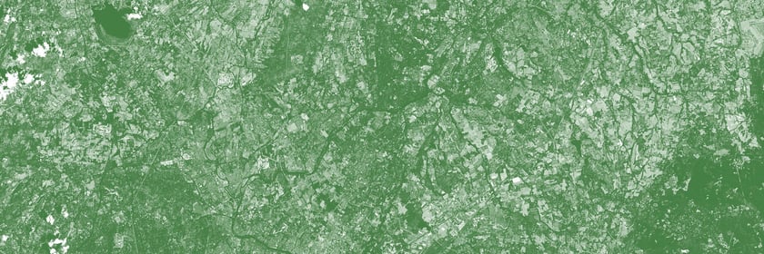
Cover Story: Accurate canopy height maps are essential for estimating forest biomass and carbon, but northern regions often lack dense LiDAR coverage and reliable cloud-free imagery. We developed a probabilistic deep learning framework combining seasonal Landsat, Sentinel-1 C-band SAR, ALOS-PALSAR-2 L-band SAR, and limited GEDI LiDAR samples to map canopy height and pixel-level uncertainty across Ontario’s managed forests at 30 m resolution. The Laplace-loss ResUNet ensemble achieved an RMSE of 3.65 m against independent airborne LiDAR, reduced systematic bias, and outperformed the tested global canopy height products across forest classes. Its confidence layer identifies areas where predictions are less certain, supporting forest monitoring, carbon mapping, and management. View this paper
  • Issues are regarded as officially published after their release is announced to the table of contents alert mailing list .
  • You may sign up for email alerts to receive table of contents of newly released issues.
  • PDF is the official format for papers published in both, html and pdf forms. To view the papers in pdf format, click on the "PDF Full-text" link, and use the free Adobe Reader to open them.

Articles (210)

  • Article
  • Open Access
1 Citations
552 Views
35 Pages

Integrating Multi-Source Geoscientific Data via Geologically Constrained Feature Engineering for Gold Prospectivity Mapping: A Case Study of Jiaoxibei, China

  • Yajie Feng,
  • Yongzhi Wang,
  • Yigao Cheng,
  • Jiahui Zheng and ,
  • Shaohui Wang,
  • Zhaofeng An and
  • Zheng Ji
  • + 2 authors+ 0 author

5 August 2026

The Jiaoxibei gold cluster is one of the most significant gold-producing regions in China and retains substantial regional prospecting potential. However, the superposition of multiple mineralization events has resulted in strong spatial coupling, mu...

(This article belongs to the Special Issue Remote Sensing for Mineral Exploration: Current Progress and Future Vision)
  • Article
  • Open Access
528 Views
24 Pages

SPFMamba: A Mamba-Based Network with Semantic Prompt and Frequency-Adaptive Fusion for Remote Sensing Image Semantic Segmentation

  • Manlin Wang,
  • Xifu Sun,
  • Jiahang Liu,
  • Yue Ni and ,
  • Jian Cui and
  • Ji Luan
  • + 1 author+ 0 author

5 August 2026

Modern remote sensing images (RSIs) provide increasingly fine spatial detail, making pronounced scale variations and complex spatial distributions of land-cover classes more apparent and thereby increasing the difficulty of semantic segmentation. Rec...

(This article belongs to the Special Issue Artificial Intelligence and Machine Learning for Multi-Modal and Multi-Spectral Remote Sensing Image Processing)
  • Article
  • Open Access
567 Views
29 Pages

5 August 2026

Negative sample selection is a major source of uncertainty in landslide susceptibility assessment (LSA), because areas without recorded landslides cannot be directly regarded as stable. Small baseline subset interferometric synthetic aperture radar (...

(This article belongs to the Special Issue InSAR for Geohazard Monitoring: From Deformation Detection to Risk Assessment)
  • Article
  • Open Access
473 Views
21 Pages

Research on an Absolute Radiometric Calibration Method Based on a Point Source Array

  • Qiang Wang,
  • Weiwei Xu,
  • Xiaolong Si,
  • Shiwei Bao and ,
  • Liming Zhang and
  • Jianjun Li
  • + 1 author+ 0 author

5 August 2026

Factors such as the optical point spread function (PSF), intrapixel sensitivity (IPS), and interpixel crosstalk of an imaging system can cause the response to point sources to vary with position, directly affecting the absolute radiometric calibratio...

(This article belongs to the Special Issue Calibration and Validation of Remote Sensing Satellites)
  • Editorial
  • Open Access
553 Views
9 Pages

5 August 2026

Recent advances in Earth observation and machine learning have significantly enhanced the capacity to monitor agricultural systems and terrestrial vegetation across spatial and temporal scales. This editorial synthesizes the contributions of eleven s...

(This article belongs to the Special Issue Machine Learning for Applications in Agriculture and Vegetation Using Remote Sensing)
  • Article
  • Open Access
555 Views
19 Pages

Can UAV-Derived Maize Canopy Traits Inform Soil Mineral Nitrogen Estimation? Linking Above- and Below-Ground Nitrogen Dynamics in Black Soils

  • Zhongqi Li,
  • Yusheng Zhong,
  • Zhidan Zhang,
  • Mingshuang Zhang and ,
  • Bangwei Zhang,
  • Guanghao Guo,
  • Yaqun Liu,
  • Yadong Yang,
  • Liyue Guo and
  • Zhaohai Zeng
  • + 5 authors+ 0 author

5 August 2026

Accurately characterizing crop–soil nitrogen dynamics is essential for precision nitrogen management in maize production, yet soil mineral nitrogen (soil Nmin) remains difficult to monitor under field conditions. This study evaluated whether UA...

(This article belongs to the Section Remote Sensing in Agriculture and Vegetation)
  • Article
  • Open Access
507 Views
30 Pages

4 August 2026

Accurate rainfall input is critical for reliable flood simulation, particularly in semi-arid watersheds with pronounced spatiotemporal precipitation heterogeneity. This study developed a radar–gauge rainfall fusion framework to improve HEC-HMS...

(This article belongs to the Section Remote Sensing in Geology, Geomorphology and Hydrology)
  • Article
  • Open Access
582 Views
19 Pages

Satellite Detection of Diffuse Tectonic CO2 Degassing in the East African Rift

  • Cristina Flesia,
  • Andrei Starkov,
  • Alessio Casagli,
  • Samantha Remigi and
  • Maria Luce Frezzotti

4 August 2026

Understanding the processes behind Earth’s CO2 degassing is crucial for clarifying how carbon is cycled by geologic processes on our planet. Earth’s carbon degassing results from magmatic and metamorphic processes controlled by large-scal...

(This article belongs to the Special Issue Remote Sensing Application in the Carbon Flux Modelling)
  • Article
  • Open Access
513 Views
30 Pages

Field-Scale Evapotranspiration of Flood-Irrigated Rice with Automated METRIC on Google Earth Engine in an Arid Region of Northern Peru

  • José Huanuqueño-Murillo,
  • Javier Quille-Mamani,
  • Cesar Vilca-Gamarra,
  • Roxana Peña-Amaro and ,
  • David Quispe-Tito,
  • Walter Campos-Ugaz,
  • Jorge Panta-Cosmópolis and
  • Lia Ramos-Fernández
  • + 3 authors+ 0 author

4 August 2026

Irrigation water management in arid systems requires spatially distributed estimates of crop evapotranspiration (ET) that fixed crop coefficients cannot provide. The actual ET of flood-irrigated rice (Oryza sativa L.) on the arid northern coast of Pe...

(This article belongs to the Section Environmental Remote Sensing)
  • Article
  • Open Access
399 Views
32 Pages

Design and Analysis of a Compact Airborne Hyperspectral Imager for Vegetation Photosynthesis and Stress Monitoring

  • Qun Zhou,
  • Yuchen Lin,
  • Ruirui Dong,
  • Yuwei Wang and ,
  • Wenxiu Zhang,
  • Cong Zhao and
  • Xin Ye
  • + 2 authors+ 0 author

4 August 2026

Solar-induced chlorophyll fluorescence (SIF) provides a direct proxy for vegetation photosynthesis-related information; however, under stress conditions, its relationship with photosynthesis should be interpreted together with absorbed photosynthetic...

(This article belongs to the Section Remote Sensing in Agriculture and Vegetation)
  • Article
  • Open Access
2 Citations
500 Views
32 Pages

Consistent Photometric Enhancement Network for Remote Sensing Change Detection

  • Pengcheng Han,
  • Zhenyu Xia,
  • Lin Chen,
  • Boni Hu and ,
  • Naoufel Werghi and
  • Shuhui Bu
  • + 1 author+ 0 author

4 August 2026

Change detection performance in remote sensing is highly sensitive to illumination variations between bi-temporal images. In real-world scenarios, low-light conditions and inconsistent brightness often lead to degraded feature representations and unr...

(This article belongs to the Special Issue Advanced Change Detection and Anomaly Detection in Remote Sensing)
  • Article
  • Open Access
372 Views
15 Pages

4 August 2026

Vegetation above the soil surface can have a considerable influence on ground-penetrating radar (GPR) measurements, especially when shallow buried objects are to be detected. Plant water content, biomass, and the structural arrangement of leaves and...

(This article belongs to the Special Issue Ground Penetrating Radar (GPR) Applications in Earth, Moon and Planetary Exploration (Second Edition))
  • Article
  • Open Access
366 Views
24 Pages

Industrial Dominance of Urban NO2 and Associated Health Risks: A Multi-Source Analysis in the Southern Region of Rio de Janeiro State

  • Silvânia A. Carvalho,
  • Diogo M. de Souza,
  • Rogério M. de Almeida,
  • Alexandre Cacheffo and ,
  • Gregori de Arruda Moreira,
  • Juana Andújar-Maqueda,
  • Pablo Ortiz-Amezcua,
  • Fábio J. da S. Lopes,
  • Lucas Alados-Arboledas and
  • Juan Luis Guerrero-Rascado
  • + 5 authors+ 0 author

4 August 2026

Driven by regional demand for stringent emission controls and the associated public health impacts, this study investigates tropospheric NO2 concentrations in Volta Redonda, a major metallurgical hub in Rio de Janeiro State. Initially, TROPOMI data w...

(This article belongs to the Section Atmospheric Remote Sensing)
  • Article
  • Open Access
418 Views
31 Pages

Few-Shot SAR Object Detection with Prior Class Perceptron and Cross-Entropy

  • Shengjie Lei,
  • Ziqi Wu,
  • Xinyi Cai,
  • Yongli Mu and ,
  • Liqian Wei and
  • Zhiyong Wei
  • + 1 author+ 0 author

4 August 2026

Few-Shot Synthetic Aperture Radar (SAR) object detection aims to identify and localize unseen categories using only a small number of annotated support samples. However, performance is fundamentally constrained by two coupled challenges: speckle nois...

  • Article
  • Open Access
475 Views
21 Pages

4 August 2026

Infrared dim and small target detection has drawn increasing attention due to its importance in both military and civil applications. Multi-frame approaches exploit temporal information across consecutive frames and generally achieve better performan...

(This article belongs to the Special Issue Infrared Small Target Detection: Methods and Applications)
  • Article
  • Open Access
414 Views
29 Pages

4 August 2026

The peak height of the F2 layer (hmF2) is a key parameter describing the vertical structure of the ionosphere. It is important for high-frequency radio communication planning and space-weather background assessment, particularly at high latitudes. To...

(This article belongs to the Special Issue Satellite and Ground Monitoring and Measurements of Ionospheric and Geo Magnetic Disturbances and Space Weather Events)
  • Article
  • Open Access
543 Views
38 Pages

4 August 2026

Radar-based Quantitative Precipitation Estimation (QPE) in semi-arid Mediterranean climates is critically challenged by systematic underestimation of shallow precipitation, yet gauge–radar merging frameworks tailored to such environments remain...

(This article belongs to the Special Issue Artificial Intelligence-Based Remote Sensing for Weather and Climate)
  • Review
  • Open Access
958 Views
45 Pages

Exploring Marine Atmospheric Ducts: Current Sensing and Emerging Trends

  • Jin-Peng Zhang,
  • Yu-Jing Li,
  • Han-Jie Ji,
  • Huai-Yun Peng and ,
  • Xiang-Ming Guo and
  • Yu-Sheng Zhang
  • + 1 author+ 0 author

4 August 2026

Tropospheric refraction significantly impacts the propagation of ultrashort- and microwave-frequency radio waves over marine environments. Atmospheric ducting, the most common super-refractive structure, allows radio waves to travel over the horizon....

(This article belongs to the Special Issue Observations of Atmospheric and Oceanic Processes by Remote Sensing)
  • Article
  • Open Access
434 Views
38 Pages

4 August 2026

Hyperspectral infrared sounders provide valuable observations for numerical weather prediction (NWP), but their native nadir spatial resolution of approximately 12–16 km is coarser than the approximately 4 km grid spacing commonly used in conve...

  • Systematic Review
  • Open Access
2,352 Views
53 Pages

4 August 2026

Change detection (CD) is a fundamental remote sensing task that identifies surface modifications from multi-temporal imagery of the same area, with applications in urban monitoring, agriculture, forest disturbance mapping, disaster assessment, and la...

  • Technical Note
  • Open Access
427 Views
22 Pages

4 August 2026

As China’s first commercial low Earth orbit meteorological constellation, Tianmu-1 (TM) radio occultation (RO) provides high-density observations, with approximately 30,000 profiles per day globally, offering new opportunities for research in o...

(This article belongs to the Special Issue Tianmu-1 Constellation: Advancements in Atmospheric, Ionospheric and Surface Remote Sensing Using GNSS-RO and GNSS-R)
  • Article
  • Open Access
2 Citations
482 Views
30 Pages

4 August 2026

Identifying reliable earthquake precursors remains a major challenge in geophysics. Among the most widely investigated candidates are seismicity-based indicators, such as the Gutenberg–Richter b-value, and ionospheric disturbances expressed thr...

(This article belongs to the Special Issue Remote Sensing of Lithosphere–Atmosphere–Ionosphere Coupling Prior to Earthquakes and Other Natural Hazards: Second Edition)
  • Article
  • Open Access
843 Views
26 Pages

A Comprehensive Machine Learning Approach for Crop Classification Using Multi-Sensor Satellite Datasets and Multiple Vegetation Indices

  • Oybek Tukhtamishov,
  • Mohamed Fawzy,
  • Karem Abdelmohsen,
  • Arpad Barsi and ,
  • Rustambek Kodirov,
  • Lorant Foldvary and
  • Zokhid Mamatkulov
  • + 2 authors+ 0 author

4 August 2026

Accurate crop classification is essential for sustainable agriculture activities and food security studies. Recent advancements in remote sensing data acquisition and analysis techniques enable various solutions for cropland detection; however, relia...

(This article belongs to the Special Issue Machine Learning for Applications in Agriculture and Vegetation Using Remote Sensing (Second Edition))
  • Article
  • Open Access
509 Views
31 Pages

4 August 2026

Detecting ships near the coast in Synthetic Aperture Radar (SAR) images is an important task. However, achieving accurate detection in these scenarios remains a significant challenge. The complex coastal topologies and multiple scattering effects fre...

(This article belongs to the Special Issue Advanced Methods and Applications in SAR (Synthetic Aperture Radar) Image Target Detection and Recognition)
  • Article
  • Open Access
571 Views
42 Pages

Principal Component Analysis of IASI Measurements for the Detection of Extreme Atmospheric Composition Events: Methodology and Applications

  • Sarah Pipien,
  • Pascal Prunet,
  • Claude Camy-Peyret,
  • Dominique Jolivet and ,
  • Nicolas Pascal,
  • Jonas Wilzewski and
  • Anne Boynard
  • + 2 authors+ 0 author

4 August 2026

Extreme atmospheric events are rare phenomena characterized by unusual intensity or chemical composition compared to the atmospheric background state. Many such events, in the context of global warming, pose threats to human health, thereby making th...

(This article belongs to the Section Atmospheric Remote Sensing)
  • Article
  • Open Access
349 Views
35 Pages

4 August 2026

Multi-label classification of very-high-resolution remote sensing scenes is difficult not only because multiple land-cover categories coexist in one image, but also because their discriminative evidence is spatially uneven: boundaries, elongated stru...

(This article belongs to the Special Issue Deep Learning-Based Interpretation and Processing of Remote Sensing Images)
  • Article
  • Open Access
501 Views
25 Pages

4 August 2026

Surface deformation in rapidly urbanizing coastal cities is often shaped by the interplay between hydrogeological setting and development disturbance, yet these controls remain insufficiently constrained in tropical coastal environments. Using 119 as...

(This article belongs to the Section Urban Remote Sensing)
  • Review
  • Open Access
869 Views
34 Pages

4 August 2026

SAR and InSAR are fundamental sensing modalities for all-weather, day-and-night Earth observation because they operate independently of solar illumination and retain sensitivity to scene structure under conditions that often limit optical imaging. Re...

(This article belongs to the Special Issue Signal Processing, Image Processing and Fusion Techniques in Remote Sensing)
  • Article
  • Open Access
610 Views
21 Pages

Penetration Depth Investigation of L-Band and S-Band SAR Signals into Soils and Hard Ground Surfaces

  • Guanxin Liu,
  • Wei Peng,
  • Xiaoli Ding,
  • Haiqiang Fu and ,
  • Jun Zhu,
  • Rong Zhao,
  • Yang Liu and
  • Songbo Wu
  • + 3 authors+ 0 author

4 August 2026

Understanding the penetrability of synthetic aperture radar (SAR) signals into near-surface materials is a prerequisite for using SAR observations to infer subsurface physical properties. However, direct measurements of penetration depth under contro...

  • Technical Note
  • Open Access
1 Citations
659 Views
22 Pages

Recommendations for Low-Noise Data Acquisition with UAV-Mounted Multi-Channel Magnetometer Systems

  • Andreas Stele,
  • Sandra E. Hahn,
  • Christian Seisenbacher,
  • Georg Häussler and
  • Roland Linck

4 August 2026

We present the results of tests conducted with a state-of-the-art drone-based multi-channel magnetometer system (SENSYS MagDrone R4) developed for efficient high-resolution near-surface surveys. The primary aim is to advance the application of this t...

  • Article
  • Open Access
530 Views
49 Pages

4 August 2026

Rockfall hazards are frequently observed within mountainous road networks. Significant uncertainties regarding the optimal selection of evaluation units and spatial modeling scales are still being identified in this field. A comprehensive comparative...

(This article belongs to the Special Issue Recent Advances in InSAR for Deformation Monitoring and Earth Surface Process Analysis)
  • Article
  • Open Access
466 Views
22 Pages

Robust Individual Tree Parameter Estimation in Cold–Temperate Secondary Forests Using ULS–HLS Data and the RSQ-Tree Framework

  • Yutong Liu,
  • Chengxing Ling,
  • Hua Liu,
  • Guanjun Lian and ,
  • Xia Liu,
  • Feng Zhao and
  • Shiyu Zhao
  • + 2 authors+ 0 author

4 August 2026

Accurate quantification of individual-tree parameters is essential for improving the quality of natural secondary forests; however, conventional measurements remain challenging because of canopy overlap and interference from tall shrubs. Despite the...

(This article belongs to the Section Forest Remote Sensing)
  • Article
  • Open Access
501 Views
28 Pages

4 August 2026

The Raša Fault is a prominent seismically active strike-slip fault within the Dinaric Fault System in SW Slovenia, seismotectonically estimated to be capable of producing earthquakes up to Mw = 7.4. Since the surface exposure of fault-related...

(This article belongs to the Special Issue Multiplatform Remote Sensing Techniques for Active Tectonics, Seismotectonics, and Volcanic Hazard Assessment (Second Edition))
  • Article
  • Open Access
403 Views
28 Pages

4 August 2026

The Tibetan Plateau ozone valley is a prominent summertime ozone minimum in the Northern Hemisphere upper troposphere–lower stratosphere (UTLS), with implications for regional radiative balance and climate. Although previous studies emphasized...

(This article belongs to the Special Issue Remote Sensing Data Refinement and Utilization for Advanced Atmospheric Observations)
  • Article
  • Open Access
435 Views
29 Pages

4 August 2026

Extreme climate events can disturb vegetation dynamics and alter ecosystem stability. This study investigated the evolution of extreme climatic conditions and vegetation greenness across the Yangtze River Basin during 1982–2022 by integrating C...

(This article belongs to the Special Issue Hydrometeorological Modelling Based on Remotely Sensed Data)
  • Article
  • Open Access
415 Views
25 Pages

Analysis of Area Changes and Driving Factors in Chirui Lake

  • Siqi Feng,
  • Bo-Hui Tang,
  • Yong Pang,
  • Langlang Yang and ,
  • Zujian Zou,
  • Xingsheng Yue and
  • Honghao Liu
  • + 2 authors+ 0 author

3 August 2026

Changes in lake area directly reflect the state of regional hydrological cycles and ecological balance. However, the lack of long-term monitoring data and the complexity of driving factors make it difficult to formulate effective management strategie...

  • Article
  • Open Access
395 Views
20 Pages

Frequency-Domain Modeling and Removal of Platform Jitter Stripes in GF-7 DSMs for Flat Terrains

  • Fan Mo,
  • Yongjian Li,
  • Song Ji,
  • Junfeng Xie and ,
  • Dazhao Fan,
  • Danchao Gong,
  • Yang Dong,
  • Jiaxuan Song,
  • Hao Ye and
  • Ziti Zhang
  • + 9 authors+ 4 authors

3 August 2026

Platform jitter in stereo mapping satellites introduces periodic stripe artifacts into digital surface models (DSMs), degrading geometric quality, while existing detection methods usually depend on disparity maps or high-frequency attitude data. This...

(This article belongs to the Special Issue High-Resolution Remote Sensing Image Processing and Applications)
  • Article
  • Open Access
524 Views
29 Pages

Spatiotemporal Dynamics and Driving Mechanisms of Impervious Surface Expansion in Changsha County Using Landsat Time-Series

  • Yitian Cao,
  • Lihong Zhu,
  • Yiman Li,
  • Qing Xia and ,
  • Qiong Zheng,
  • Zishuo Wu and
  • Xiaoyin Yang
  • + 2 authors+ 0 author

3 August 2026

Long-term monitoring of impervious surface dynamics is essential for understanding urbanization processes and supporting sustainable land-use planning. However, existing studies often lack comprehensive analyses that integrate both spatial patterns a...

  • Article
  • Open Access
408 Views
24 Pages

Future Scenario Simulation and Optimization of Ecological Security Patterns Under Policy Drivers: A Case Study of the Henan Section of the Yellow River Basin, China

  • Weichen Mu,
  • Yanglong Chen,
  • Chenghang Li,
  • Fen Qin and ,
  • Yang Liu,
  • Wanlong Li,
  • Fengxue Ruan,
  • Jinjin Du and
  • Zhenzhen Liu
  • + 4 authors+ 0 author

3 August 2026

Understanding the spatiotemporal dynamics of land-use and cover change (LUCC) and ecosystem service (ES) responses is essential for assessing ecological functions in regional landscapes. However, conventional LUCC simulations often rely on historical...

(This article belongs to the Special Issue Remote Sensing Monitoring of Urban Vegetation)
  • Article
  • Open Access
384 Views
30 Pages

3 August 2026

Accurate liquid water path estimates derived from backscattered solar radiation require knowledge of the vertical structure of cloud droplet effective radius, yet standard bispectral retrievals assume a vertically homogeneous cloud and overestimate l...

(This article belongs to the Special Issue Satellite Remote Sensing of Weather, Water and Climate Couplings and Phenomena (Second Edition))
  • Article
  • Open Access
468 Views
22 Pages

FIRE-BYOL: A Real-Time Grassland Active-Fire Detection Algorithm Fusing VIIRS Fire Products and Himawari-8/9 Data

  • Yuang He,
  • Wala Du,
  • Shan Yu,
  • Zhimin Hong and ,
  • Byambakhuu Gantumur,
  • Endon Garmaev,
  • Mingyue Li and
  • Daoting Zhang
  • + 3 authors+ 0 author

3 August 2026

Frequent grassland fires on the Mongolian Plateau endanger the regional environment, human safety, and property, creating a demand for near-real-time active-fire detection with high spatiotemporal resolution. While remote sensing serves as the primar...

  • Article
  • Open Access
511 Views
32 Pages

3 August 2026

Synthetic aperture interferometric radiometers (SAIRs) have emerged as a promising technology for high-resolution remote sensing and target detection by synthesizing spatially distributed antenna elements into a large virtual aperture. To achieve hig...

  • Article
  • Open Access
500 Views
25 Pages

Impact of Clouds on Infrared and Microwave Sounding Retrieval and an Objective Correction Method for Numerical Weather Prediction

  • Shen-Cha Hsu,
  • Chian-Yi Liu,
  • Kao-Shen Chung,
  • Yen-Chih Shen and ,
  • Chien-Ben Chou,
  • Yu-Cheng Chang and
  • Yu-Chun Chen
  • + 2 authors+ 0 author

3 August 2026

Numerical weather simulations and forecasts are highly sensitive to environmental conditions. This is especially true in Taiwan, an ocean-surrounded island, during its transition season. Atmospheric temperature and moisture profiles retrieved from sp...

(This article belongs to the Special Issue Advances in Multi-Source Remote Sensing, Space-Based Observations, Data Assimilation and Deep Learning for Localized Extreme Weather: Understanding Remote Sensing)
  • Article
  • Open Access
832 Views
40 Pages

Analysis of Diagnostic Absorption Troughs in Clay Alteration Within the Xiangshan Uranium Deposit Based on ZY1-02E Satellite Hyperspectral Imagery

  • Ziwei Yan,
  • Zhichun Wu,
  • Haibo Zhao,
  • Yifan Huang and ,
  • Fusheng Guo,
  • Hualiang Li,
  • Yaozu Qin,
  • Hui Liang and
  • Yidan Zhu
  • + 4 authors+ 0 author

3 August 2026

The Xiangshan Uranium Deposit located in Jiangxi Province represents the largest volcanic-hosted uranium deposit in Asia and serves as a critical uranium production base in China. Clay alteration serves as a key prospecting indicator for this deposit...

  • Technical Note
  • Open Access
455 Views
17 Pages

SPIF: A Spatio-Temporal Polarity Interaction Filter for Reliable Event Selection

  • Jiaxu He,
  • Zhan Sun,
  • Juncheng Li,
  • Hao Chen and ,
  • Junxiang Ma and
  • Bo Zhou
  • + 1 author+ 0 author

3 August 2026

Event cameras provide high temporal resolution and sparse asynchronous output for small-target monitoring. However, distant weak targets often generate sparse and fragmented events that are easily obscured by responses from background structures and...

(This article belongs to the Section Remote Sensing Image Processing)
  • Article
  • Open Access
357 Views
21 Pages

Sparse Rational Polynomial Coefficient Estimation Method via Low-Rank Matrix Constraint

  • Congzhen Hu,
  • Jiajie He,
  • Tianyu Yan,
  • Pu Wang and ,
  • Wei An and
  • Yingqian Wang
  • + 1 author+ 0 author

3 August 2026

The rational function model (RFM) is an important general imaging model in remote sensing image geometric processing, which is composed of many rational polynomial coefficients (RPCs). However, due to the correlation among the high-order polynomials,...

(This article belongs to the Section Remote Sensing Image Processing)
  • Article
  • Open Access
361 Views
54 Pages

3 August 2026

Urban heat and extreme-temperature risks increasingly constrain sustainable planning in semi-arid grassland towns. Taking Xi Ujimqin Banner as a case study, this research develops a remote-sensing-informed diagnosis-to-allocation framework for heat-r...

(This article belongs to the Section Environmental Remote Sensing)
  • Article
  • Open Access
534 Views
25 Pages

RFM-UNet: Hybrid Frequency–Mamba UNet for Remote-Sensing Road Extraction

  • Pu Song,
  • Peng Yu,
  • Xiaojing Zhong,
  • Shuizhen Wu and ,
  • Junbin Tong,
  • Yuanrong He,
  • Lujun Zhang,
  • Guangchun Li and
  • Mengmeng Li
  • + 4 authors+ 0 author

3 August 2026

Road-network extraction from very high-resolution (VHR) remote-sensing imagery remains a challenging task owing to the structural sparsity, topological complexity, and severe occlusions of road networks. Conventional graph-based approaches preserve t...

  • Article
  • Open Access
413 Views
27 Pages

3 August 2026

Accurate identification of urban functional zones is critically important for urban planning and sustainable development. However, existing deep learning methods exhibit limited cross-city generalization capabilities, rendering them inadequate for la...

  • Article
  • Open Access
461 Views
28 Pages

GeoAdapt: Fine-Grained Keypoint Localization via Deformable Feature Refinement for Ground-Based Optical Remote Sensing

  • Yingwei Xia,
  • Tian Yu,
  • Wang Xi,
  • Fan Wang and ,
  • Yong Liu,
  • Nanhao Liang and
  • Wen Zhang
  • + 2 authors+ 0 author

3 August 2026

Ground-based optical remote sensing of aerial targets at kilometer-scale standoff distances requires accurate keypoint localization for six-degree-of-freedom (6-DoF) pose recovery under variable illumination, motion blur, and atmospheric degradation....

(This article belongs to the Section Remote Sensing Image Processing)

of 5

XFacebookLinkedIn
Remote Sens. - ISSN 2072-4292