Next Issue
Volume 10, January
Previous Issue
Volume 9, November


Drones, Volume 9, Issue 12 (December 2025) – 69 articles

Cover Story (view full-size image): 
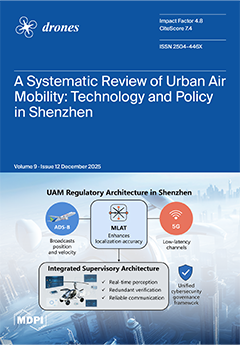
This systematic review analyzes UAM development in Shenzhen, focusing on eVTOL drones’ technological challenges and low-altitude policies. It identifies multi-dimensional technical bottlenecks in eVTOL design, including aerodynamics, structure, energy, navigation, and safety redundancy. The study reveals how Shenzhen’s policy framework—characterized by efficient flight approvals, vertiport construction, and multi-level governance—creates a synergistic ecosystem to address these challenges. The paper concludes with targeted recommendations across technology R&D, infrastructure, industrial ecology, and regional coordination, offering a practical roadmap to support Shenzhen’s exploration toward becoming a potential benchmark for urban low-altitude mobility. View this paper
  • Issues are regarded as officially published after their release is announced to the table of contents alert mailing list.
  • You may sign up for e-mail alerts to receive table of contents of newly released issues.
  • PDF is the official format for papers published in both, html and pdf forms. To view the papers in pdf format, click on the "PDF Full-text" link, and use the free Adobe Reader to open them.
Order results
Result details
Section
Select all
Export citation of selected articles as:
22 pages, 7973 KB  
Article
Timescale-Separation-Based Source Seeking for USV
by Chenxi Gong, Hexuan Wang, Chongqing Chen and Zhenghong Jin
Drones 2025, 9(12), 879; https://doi.org/10.3390/drones9120879 - 18 Dec 2025
Viewed by 244
Abstract
The primary objective of this study is to enable an unmanned surface vehicle (USV) to autonomously approach the extremum of an unknown scalar field using only real-time field measurements. To this end, a source-seeking method based on timescale separation is developed within a [...] Read more.
The primary objective of this study is to enable an unmanned surface vehicle (USV) to autonomously approach the extremum of an unknown scalar field using only real-time field measurements. To this end, a source-seeking method based on timescale separation is developed within a hierarchical control framework that divides the closed-loop system into a slow and a fast subsystem. The slow subsystem governs the gradual evolution of the USV pose and generates reference heading and surge commands from local scalar field information, providing a directional cue toward the field extremum. The fast subsystem applies actuator-level control inputs that ensure these references are tracked with sufficient accuracy through rapid corrective actions. A Lyapunov-based analysis is carried out to study the stability properties of the coupled slow–fast dynamics and to establish conditions under which convergence can be guaranteed in the presence of model nonlinearities and external disturbances. Numerical simulations are conducted to illustrate the resulting system behavior and to verify that the proposed framework maintains stable seeking performance under typical operating conditions. Full article
(This article belongs to the Special Issue Advances in Intelligent Coordination Control for Autonomous UUVs)
Show Figures

Figure 1

29 pages, 9586 KB  
Article
L1 Adaptive Nonsingular Fast Terminal Super-Twisting Control for Quadrotor UAVs Under Unknown Disturbances
by Shunsuke Komiyama, Kenji Uchiyama and Kai Masuda
Drones 2025, 9(12), 878; https://doi.org/10.3390/drones9120878 - 18 Dec 2025
Viewed by 330
Abstract
Quadrotor UAVs benefit from control strategies that can deliver rapid convergence and strong robustness in order to fully exploit their high agility. Finite-time control based on terminal sliding modes has been recognized as an effective alternative to classical sliding mode control, which only [...] Read more.
Quadrotor UAVs benefit from control strategies that can deliver rapid convergence and strong robustness in order to fully exploit their high agility. Finite-time control based on terminal sliding modes has been recognized as an effective alternative to classical sliding mode control, which only guarantees asymptotic convergence. Its enhanced variant, nonsingular fast terminal sliding mode control, eliminates singularities and achieves accelerated convergence; however, chattering-induced high-frequency oscillations remain a major concern. To address this issue, this study introduces a hybrid control framework that combines the super-twisting algorithm with L1 adaptive control. The super-twisting component preserves the robustness of sliding mode control while mitigating chattering, whereas L1 adaptive control provides rapid online estimation and compensation of model uncertainties and unknown disturbances. The resulting scheme is implemented in a quadrotor flight-control architecture and evaluated through numerical simulations. The results show that the proposed controller offers faster convergence and enhanced robustness relative to existing approaches, particularly in the presence of wind perturbations, periodic obstacle-avoidance maneuvers, and abrupt partial loss of propeller thrust. Full article
Show Figures

Figure 1

36 pages, 7794 KB  
Article
Design and Performance Study of Small Multirotor UAVs with Adjunctive Folding-Wing Range Extender
by Ronghao Zhang, Yang Lu, Xice Xu, Heyang Zhang and Kai Guan
Drones 2025, 9(12), 877; https://doi.org/10.3390/drones9120877 - 18 Dec 2025
Viewed by 373
Abstract
Small multi-rotor UAVs face endurance limitations during long-range missions due to high rotor energy consumption and limited battery capacity. This paper proposes a folding-wing range extender integrating a sliding-rotating two-degree-of-freedom folding wing—which, when deployed, quadruples the fuselage length yet folds within its profile—and [...] Read more.
Small multi-rotor UAVs face endurance limitations during long-range missions due to high rotor energy consumption and limited battery capacity. This paper proposes a folding-wing range extender integrating a sliding-rotating two-degree-of-freedom folding wing—which, when deployed, quadruples the fuselage length yet folds within its profile—and a tail-thrust propeller. The device can be rapidly installed on host small multi-rotor UAVs. During cruise, it utilizes wing unloading and incoming horizontal airflow to reduce rotor power consumption, significantly extending range while minimally impacting portability, operational convenience, and maneuverability. To evaluate its performance, a 1-kg-class quadrotor test platform and matching folding-wing extender were developed. An energy consumption model was established using Blade Element Momentum Theory, followed by simulation analysis of three flight conditions. Results show that after installation, the required rotor power decreases substantially with increasing speed, while total system power growth slows noticeably. Although the added weight and drag increase low-speed power consumption, net range extension emerges near 15 m/s and intensifies with speed. Subsequent parametric sensitivity analysis and mission profile analysis indicate that weight reduction and aerodynamic optimization can effectively enhance the device’s performance. Furthermore, computational fluid dynamics (CFD) analysis confirms the effectiveness of the dihedral wing design in mitigating mutual interference between the rotor and the wing. Flight tests covering five conditions validated the extender’s effectiveness, demonstrating at 20 m/s cruise: 20% reduction in total power, 25% improvement in endurance/range, 34% lower specific power, and 52% higher equivalent lift-to-drag ratio compared to the baseline UAV. Full article
(This article belongs to the Section Drone Design and Development)
Show Figures

Figure 1

26 pages, 32319 KB  
Article
UAV LiDAR-Based Automated Detection of Maize Lodging in Complex Agroecosystems
by Yajin Wang, Fengbao Yang and Linna Ji
Drones 2025, 9(12), 876; https://doi.org/10.3390/drones9120876 - 18 Dec 2025
Viewed by 237
Abstract
Maize lodging poses a significant challenge to agricultural production, severely constraining yield improvement and mechanized harvesting efficiency. Under modern agricultural practices characterized by high-density planting and multi-variety intercropping, there is an urgent need for precise and efficient monitoring technologies to address lodging issues. [...] Read more.
Maize lodging poses a significant challenge to agricultural production, severely constraining yield improvement and mechanized harvesting efficiency. Under modern agricultural practices characterized by high-density planting and multi-variety intercropping, there is an urgent need for precise and efficient monitoring technologies to address lodging issues. This study utilized unmanned aerial vehicle (UAV) light detection and ranging (LiDAR) to acquire high-precision point cloud data of field maize at full maturity. An innovative method was proposed to automatically identify structural differences induced by lodging by analyzing canopy structural similarity across multiple height thresholds through point cloud stratification. This approach enables automated monitoring of maize lodging in complex field environments. The experimental results demonstrate the following: (1) High-precision point cloud data effectively capture canopy structural differences caused by lodging. Based on the structural similarity change curve, the height threshold for lodging can be automatically identified (optimal threshold: 1.76 m), with a deviation of only 2.3% between the calculated lodging area and the manually measured reference (ground truth). (2) Sensitivity analysis of the height threshold shows that when the threshold fluctuates within a ±5 cm range (1.71–1.81 m), the calculation deviation of the lodging area remains below 10% (maximum deviation = 8.2%), indicating strong robustness of the automatically selected threshold. (3) Although UAV flight altitude influences point cloud quality (e.g., low altitude: 25 m, high altitude: 80 m), the height threshold derived from low-altitude flights can be extrapolated to high-altitude monitoring to some extent. In this study, the resulting deviation in lodging area calculation was only 5.3%. Full article
Show Figures

Figure 1

38 pages, 3484 KB  
Article
From Prompts to Paths: Large Language Models for Zero-Shot Planning in Unmanned Ground Vehicle Simulation
by Kelvin Olaiya, Giovanni Delnevo, Chan-Tong Lam, Giovanni Pau and Paola Salomoni
Drones 2025, 9(12), 875; https://doi.org/10.3390/drones9120875 - 18 Dec 2025
Viewed by 673
Abstract
This paper explores the capability of Large Language Models (LLMs) to perform zero-shot planning through multimodal reasoning, with a particular emphasis on applications to Unmanned Ground Vehicles (UGVs) and unmanned platforms in general. We present a modular system architecture that integrates a general-purpose [...] Read more.
This paper explores the capability of Large Language Models (LLMs) to perform zero-shot planning through multimodal reasoning, with a particular emphasis on applications to Unmanned Ground Vehicles (UGVs) and unmanned platforms in general. We present a modular system architecture that integrates a general-purpose LLM with visual and spatial inputs for adaptive planning to iteratively guide UGV behavior. Although the framework is demonstrated in a ground-based setting, it directly extends to other unmanned systems, where semantic reasoning and adaptive planning are increasingly critical for autonomous mission execution. To assess performance, we employ a continuous evaluation metric that jointly considers distance and orientation, offering a more informative and fine-grained alternative to binary success measures. We evaluate a foundational LLM (i.e., Gemini 2.0 Flash, Google DeepMind) on a suite of zero-shot navigation and exploration tasks in simulated environments. Unlike prior LLM-robot systems that rely on fine-tuning or learned waypoint policies, we evaluate a purely zero-shot, stepwise LLM planner that receives no task demonstrations and reasons only from the sensed data. Our findings show that LLMs exhibit encouraging signs of goal-directed spatial planning and partial task completion, even in a zero-shot setting. However, inconsistencies in plan generation across models highlight the need for task-specific adaptation or fine-tuning. These findings highlight the potential of LLM-based multimodal reasoning to enhance autonomy in UGV and drone navigation, bridging high-level semantic understanding with robust spatial planning. Full article
(This article belongs to the Special Issue Advances in Guidance, Navigation, and Control)
Show Figures

Figure 1

18 pages, 2820 KB  
Article
A Lightweight Feature Enhancement Model for UAV Detection in Real-World Scenarios
by Yanan Han, Xufei Yan, Yuan Li, Danyang Li, Xiaochao Liu, Haishan Huang and Dawei Bie
Drones 2025, 9(12), 874; https://doi.org/10.3390/drones9120874 - 18 Dec 2025
Viewed by 367
Abstract
Real-time Unmanned Aerial Vehicle (UAV) detection is a growing research field centered on advanced computer vision and deep learning algorithms. However, the rise of unmanned aerial vehicles (UAVs) has sparked numerous concerns due to their potential for malicious use in illegal activities. To [...] Read more.
Real-time Unmanned Aerial Vehicle (UAV) detection is a growing research field centered on advanced computer vision and deep learning algorithms. However, the rise of unmanned aerial vehicles (UAVs) has sparked numerous concerns due to their potential for malicious use in illegal activities. To address these concerns, Vision-based object detection approaches for UAVs have recently been developed. Nonetheless, UAV detection in real-world scenarios, such as images with diverse backgrounds and various perspectives, remains underexplored. To fill this gap, we present a new UAV detection dataset called the real-world scenarios dataset (RWSD). This dataset leverages real-world footage and is constructed under challenging conditions, including complex backgrounds, varying UAV sizes, different perspectives, and multiple UAV types. It aims to support the development of robust UAV detection algorithms that can perform well in diverse and realistic conditions. YOLO, a popular one-stage object detection approach, is widely employed for UAV detection across different environments due to its efficiency and simplicity. However, this series of detectors encounters challenges in real-world scenarios, such as excessive computation and suboptimal detection rates. In this study, we propose a lightweight feature enhancement model (LFEM) to address these limitations. Specifically, we base our model on YOLOv5, introducing the Ghost module to improve UAV detection with fewer floating-point operations (FLOPs). Additionally, we incorporate the SIMAM module to enhance feature representation, particularly for real-world scenarios. Extensive experiments on the RWSD, UAVDT, and DOTAv1.0 datasets demonstrate the effectiveness of our approach. Our proposed LFEM achieves an impressive 93.2% mAP50, outperforming baseline models while maintaining a lightweight profile. Comparative and ablation studies further confirm that our algorithm is a promising and efficient solution for practical UAV detection tasks. Full article
Show Figures

Figure 1

25 pages, 19350 KB  
Article
VLM-Guided and Spatially Consistent Cross-View Matching and Localization of UGVs in UAV-Stitched Map
by Yusheng Yang, Xinxu Ma, Ziluan Jiang, Pengfei Sun, Xun Zhao, Yangmin Xie and Wei Qian
Drones 2025, 9(12), 873; https://doi.org/10.3390/drones9120873 - 17 Dec 2025
Viewed by 298
Abstract
In Global Navigation Satellite System (GNSS)-denied urban environments, unmanned ground vehicles (UGVs) face significant difficulties in maintaining reliable localization due to occlusion and structural complexity. Unmanned aerial vehicles (UAVs), with their global perspective, provide complementary information for cross-view matching and localization of UGVs. [...] Read more.
In Global Navigation Satellite System (GNSS)-denied urban environments, unmanned ground vehicles (UGVs) face significant difficulties in maintaining reliable localization due to occlusion and structural complexity. Unmanned aerial vehicles (UAVs), with their global perspective, provide complementary information for cross-view matching and localization of UGVs. However, robust cross-view matching and localization are hindered by geometric distortions, semantic inconsistencies, and the lack of stable spatial anchors, limiting the effectiveness of conventional methods. To overcome these challenges, we proposed a cross-view matching and localization (CVML) framework that contains two components. The first component is the Vision-Language Model (VLM)-guided and spatially consistent cross-view matching network (VSCM-Net), which integrates two novel attention modules. One is the VLM-guided positional correction module that leverages semantic cues to refine the projected UGV image within the UAV map, and the other is the shape-aware attention module that enforces topological consistency across ground and aerial views. The second component is a ground-to-aerial mapping module that projects cross-view correspondences from the UGV image onto the UAV-stitched map, thereby localizing the capture position of the UGV image and enabling accurate trajectory-level localization and navigation. Extensive experiments on public and self-collected datasets demonstrate that the proposed method achieves superior accuracy, robustness, and real-world applicability compared with state-of-the-art methods in both cross-view image matching and localization. Full article
(This article belongs to the Special Issue UAV Detection, Classification, and Tracking)
Show Figures

Figure 1

21 pages, 5421 KB  
Article
Seamless Quantification of Wet and Dry Riverscape Topography Using UAV Topo-Bathymetric LiDAR
by Craig John MacDonell, Richard David Williams, Jon White and Kenny Roberts
Drones 2025, 9(12), 872; https://doi.org/10.3390/drones9120872 - 17 Dec 2025
Viewed by 326
Abstract
Quantifying riverscape topography is challenging because riverscapes comprise of both wet and dry surfaces. Advances have been made in demonstrating the capability of mounting topo-bathymetric LiDAR (Light Detection and Ranging) sensors on crewed, occupied aircraft to quantify riverscape topography. However, only recently has [...] Read more.
Quantifying riverscape topography is challenging because riverscapes comprise of both wet and dry surfaces. Advances have been made in demonstrating the capability of mounting topo-bathymetric LiDAR (Light Detection and Ranging) sensors on crewed, occupied aircraft to quantify riverscape topography. However, only recently has miniaturisation of electronic components enabled topo-bathymetric LiDAR to be mounted on consumer-grade Unoccupied Aerial Vehicles (UAVs). We evaluate the capability of a demonstration YellowScan Navigator topo-bathymetric, full waveform LiDAR sensor, mounted on a DJI Matrice 600 UAV, to survey a 1 km long reach of the braided River Feshie, Scotland. Ground-truth data, with centimetre accuracy, were collected across wet areas using an echo-sounder, and in wet and dry areas using RTK-GNSS (Real-Time Kinematic Global Navigation Satellite System). The processed point cloud had a density of 62 points/m2. Ground-truth mean errors (and standard deviation) across dry gravel bars were 0.06 ± 0.04 m, along shallow channel beds were −0.03 ± 0.12 m and for deep channels were −0.08 m ± 0.23 m. Geomorphic units with a concave three-dimensional shape (pools, troughs), associated with deeper water, had larger negative errors and wider ranges of residuals than planar or convex units. The case study demonstrates the potential of using UAV topo-bathymetric LiDAR to enhance survey efficiency but a need to evaluate spatial error distribution. Full article
Show Figures

Figure 1

35 pages, 8987 KB  
Article
A Method for UAV Path Planning Based on G-MAPONet Reinforcement Learning
by Jian Deng, Honghai Zhang, Yuetan Zhang, Mingzhuang Hua and Yaru Sun
Drones 2025, 9(12), 871; https://doi.org/10.3390/drones9120871 - 17 Dec 2025
Viewed by 286
Abstract
To address the issues of efficiency and robustness in UAV trajectory planning under complex environments, this paper proposes a Graph Multi-Head Attention Policy Optimization Network (G-MAPONet) algorithm that integrates Graph Attention (GAT), Multi-Head Attention (MHA), and Group Relative Policy Optimization (GRPO). The algorithm [...] Read more.
To address the issues of efficiency and robustness in UAV trajectory planning under complex environments, this paper proposes a Graph Multi-Head Attention Policy Optimization Network (G-MAPONet) algorithm that integrates Graph Attention (GAT), Multi-Head Attention (MHA), and Group Relative Policy Optimization (GRPO). The algorithm adopts a three-layer architecture of “GAT layer for local feature perception–MHA for global semantic reasoning–GRPO for policy optimization”, comprehensively achieving the goals of dynamic graph convolution quantization and global adaptive parallel decoupled dynamic strategy adjustment. Comparative experiments in multi-dimensional spatial environments demonstrate that the Gat_Mha combined mechanism exhibits significant superiority compared to single attention mechanisms, which verifies the efficient representation capability of the dual-layer hybrid attention mechanism in capturing environmental features. Additionally, ablation experiments integrating Gat, Mha, and GRPO algorithms confirm that the dual-layer fusion mechanism of Gat and Mha yields better improvement effects. Finally, comparisons with traditional reinforcement learning algorithms across multiple performance metrics show that the G-MAPONet algorithm reduces the number of convergence episodes (NCE) by an average of more than 19.14%, increases the average reward (AR) by over 16.20%, and successfully completes all dynamic path planning (PPTC) tasks; meanwhile, the algorithm’s reward values and obstacle avoidance success rate are significantly higher than those of other algorithms. Compared with the baseline APF algorithm, its reward value is improved by 8.66%, and the obstacle avoidance repetition rate is also enhanced, which further verifies the effectiveness of the improved G-MAPONet algorithm. In summary, through the dual-layer complementary mode of GAT and MHA, the G-MAPONet algorithm overcomes the bottlenecks of traditional dynamic environment modeling and multi-scale optimization, enhances the decision-making capability of UAVs in unstructured environments, and provides a new technical solution for trajectory planning in intelligent logistics and distribution. Full article
Show Figures

Figure 1

28 pages, 2278 KB  
Article
A Flexible Combinatorial Auction Algorithm (FCAA) for Multi-Task Collaborative Scheduling of Heterogeneous UAVs
by Leiming He, Xudong Gong, Jiangan Zheng, Yue Wang and Yunsen Cui
Drones 2025, 9(12), 870; https://doi.org/10.3390/drones9120870 - 16 Dec 2025
Viewed by 235
Abstract
To address the inefficiency of collaborative scheduling of heterogeneous Unmanned Aerial Vehicles under resource constraints, particularly in large-scale multi-tasking scenarios, an improved Flexible Combinatorial Auction Algorithm is proposed, leveraging the bidding mechanism of simultaneous ascending auctions. This algorithm is designed with a candidate [...] Read more.
To address the inefficiency of collaborative scheduling of heterogeneous Unmanned Aerial Vehicles under resource constraints, particularly in large-scale multi-tasking scenarios, an improved Flexible Combinatorial Auction Algorithm is proposed, leveraging the bidding mechanism of simultaneous ascending auctions. This algorithm is designed with a candidate solution generation mechanism and an addition mechanism, which collectively reduce the number of candidate solutions generated prior to combinatorial auctions. It allows tasks to flexibly combine resources and submit bids. By calculating each candidate solution’s benefit based on real-time resource prices, it dynamically adjusts their priorities to search for the overall optimal multi-task scheduling scheme. It effectively addresses the inability of traditional auction algorithms to dynamically form resource clusters via flexible resource combination to collaboratively complete tasks. Meanwhile, it overcomes the technical bottleneck that existing heuristic algorithms struggle to handle highly complex heterogeneous resource scheduling cases. Simulation experiments show that in small-scale multi-tasking scenarios, the FCAA achieves a scheduling success rate of over 88%, with the maximum solution benefit proportion reaching 83.9%; in multi-tasking scenarios, it achieves a scheduling success rate of 98%, with the maximum solution benefit proportion reaching 93%. Its time efficiency and solution quality are significantly superior to those of traditional algorithms, providing an efficient and stable solution for heterogeneous resource scheduling problems in complex operational environments. Full article
Show Figures

Figure 1

21 pages, 20270 KB  
Article
A Depth-Guided Local Outlier Rejection Methodology for Robust Feature Matching in Urban UAV Images
by Geonseok Lee, Junhee Youn and Kanghyeok Choi
Drones 2025, 9(12), 869; https://doi.org/10.3390/drones9120869 - 16 Dec 2025
Viewed by 221
Abstract
Urban UAV imagery presents challenges for reliable feature matching owing to complex 3D structures and depth discontinuities. Conventional 2D-based outlier rejection methods often fail to maintain geometric consistency under significant altitude variations or viewpoint differences, resulting in the rejection of valid correspondences. To [...] Read more.
Urban UAV imagery presents challenges for reliable feature matching owing to complex 3D structures and depth discontinuities. Conventional 2D-based outlier rejection methods often fail to maintain geometric consistency under significant altitude variations or viewpoint differences, resulting in the rejection of valid correspondences. To overcome these limitations, a depth-guided local outlier rejection methodology is proposed which integrates monocular depth estimation, DBSCAN-based clustering, and local geometric model estimation. Depth information estimated from single UAV images is combined with feature correspondences to form pseudo-3D coordinates, enabling spatially localized registration. The proposed method was quantitatively evaluated in terms of Precision, Recall, F1-score, and Number of Matches, and was applied as a depth-guided front-end to three representative 2D-based outlier rejection schemes (RANSAC, LMedS, and MAGSAC++). Across all image sets, the depth-guided variants consistently achieved higher Recall and F1-score than their conventional 2D counterparts, while maintaining comparable Precision and keeping mismatches low. These results indicate that introducing depth-guided pseudo-3D constraints into the outlier rejection stage enhances geometric stability and correspondence reliability in complex urban UAV imagery. Accordingly, the proposed methodology provides a practical and scalable solution for accurate registration in depth-varying urban environments. Full article
Show Figures

Figure 1

25 pages, 981 KB  
Review
GIS-Enabled Truck–Drone Hybrid Systems for Agricultural Last-Mile Delivery: A Multidisciplinary Review with Insights from a Rural Region
by Imran Badshah, Raj Bridgelall and Emmanuel Anu Thompson
Drones 2025, 9(12), 868; https://doi.org/10.3390/drones9120868 - 16 Dec 2025
Viewed by 469
Abstract
Efficient last-mile delivery remains a critical challenge for rural agricultural logistics, globally, particularly in cold-climate regions with dispersed agricultural operations. Truck–drone hybrids can reduce delivery times but face payload limits, cold-weather battery loss, and beyond-visual-line-of-sight regulations. This review evaluates the potential of GIS-enabled [...] Read more.
Efficient last-mile delivery remains a critical challenge for rural agricultural logistics, globally, particularly in cold-climate regions with dispersed agricultural operations. Truck–drone hybrids can reduce delivery times but face payload limits, cold-weather battery loss, and beyond-visual-line-of-sight regulations. This review evaluates the potential of GIS-enabled truck–drone hybrid systems to overcome infrastructural, environmental, and operational barriers in such settings. This study uses the state of North Dakota (USA) as a representative case because of its cold climate, low density, and weak connectivity. These conditions require different routing and system assumptions than typical regions. The study conducts a systematic review of 81 high-quality publications. It identifies seven interconnected research domains: GIS analytics, truck–drone coordination, smart agriculture integration, rural implementation, sustainability assessment, strategic design, and data security. The findings stipulate that GIS enhances hybrid logistics through route optimization, launch site planning, and real-time monitoring. Additionally, this study emphasizes the rural, low-density context and identifies specific gaps related to cold-weather performance, restrictions to line-of-sight operations, and economic feasibility in ultra-low-density delivery networks. The study concludes with a roadmap for research and policy development to enable practical deployment in cold-climate agricultural regions. Full article
Show Figures

Figure 1

18 pages, 10407 KB  
Article
Multi-Object Tracking with Distributed Drones’ RGB Cameras Considering Object Localization Uncertainty
by Xin Liao, Bohui Fang, Weiyu Shao, Wenxing Fu and Tao Yang
Drones 2025, 9(12), 867; https://doi.org/10.3390/drones9120867 - 16 Dec 2025
Viewed by 301
Abstract
Reliable 3D multi-object tracking (MOT) using distributed drones remains challenging due to the lack of active sensing and the ambiguity in associating detections from different views. This paper presents a passive sensing framework that integrates multi-view data association and 3D MOT for aerial [...] Read more.
Reliable 3D multi-object tracking (MOT) using distributed drones remains challenging due to the lack of active sensing and the ambiguity in associating detections from different views. This paper presents a passive sensing framework that integrates multi-view data association and 3D MOT for aerial objects. First, object localization is achieved via triangulation using two onboard RGB cameras. To mitigate false positive objects caused by crossing bearings, spatial–temporal cues derived from 2D image detections and tracking results are exploited to establish a likelihood-based association matrix, enabling robust multi-view data association. Subsequently, optimized process and observation noise covariance matrices are formulated to quantitatively model localization uncertainty, and a Mahalanobis distance-based data association is introduced to improve the consistency of 3D tracking. Both simulation and real-world experiments demonstrate that the proposed approach achieves accurate and stable tracking performance under passive sensing conditions. Full article
Show Figures

Figure 1

21 pages, 26183 KB  
Article
Lithological Mapping from UAV Imagery Based on Lightweight Semantic Segmentation Methods
by Jingzhi Liu, Zhen Wei, Xiangkuan Gong, Minjia Sun, Yuanfeng Cheng, Yingying Zhang and Zizhao Zhang
Drones 2025, 9(12), 866; https://doi.org/10.3390/drones9120866 - 15 Dec 2025
Viewed by 237
Abstract
Traditional geological mapping is often time-consuming, labor-intensive, and restricted by rugged terrain. This study addresses these challenges by proposing a novel methodology for automated lithological identification in the Ququleke area of the eastern Kunlun Mountains, which pioneers the integration of portable UAV oblique [...] Read more.
Traditional geological mapping is often time-consuming, labor-intensive, and restricted by rugged terrain. This study addresses these challenges by proposing a novel methodology for automated lithological identification in the Ququleke area of the eastern Kunlun Mountains, which pioneers the integration of portable UAV oblique photogrammetry with a Coordinate Attention-enhanced DeepLabV3+ (CA-DeepLabV3+) semantic segmentation framework for geological mapping. Using a DJI Mavic 3M quadcopter, high-resolution oblique photogrammetric orthophotos were captured to build a pixel-level lithology dataset containing four classes: sandstone, diorite, marble, and Quaternary sediments. The CA-DeepLabV3+ model, adapted from the DeepLabV3+ encoder–decoder framework, integrates a lightweight MobileNetV2 backbone and a Coordinate Attention mechanism to strengthen spatial position encoding and fine-scale feature extraction, crucial for detailed lithological discrimination. Experimental evaluation demonstrates that the proposed model achieves an overall accuracy of 97.95%, mean accuracy of 97.80%, and mean intersection over union of 95.71%, representing a 5.48% improvement in mean intersection over union (mIoU) over the standard DeepLabV3+. These results indicate that combining UAV oblique photogrammetry with the CA-DeepLabV3+ network enables accurate lithological mapping in complex terrains. The proposed method provides an efficient and scalable solution for geological mapping and mineral resource exploration, highlighting the potential of low-altitude UAV remote sensing for field-based geological investigations. Full article
Show Figures

Figure 1

24 pages, 8935 KB  
Article
Application of UAVs and Machine Learning Methods for Mapping and Assessing Salinity in Agricultural Fields in Southern Kazakhstan
by Ravil I. Mukhamediev
Drones 2025, 9(12), 865; https://doi.org/10.3390/drones9120865 - 15 Dec 2025
Viewed by 279
Abstract
Soil salinization is an important negative factor that reduces the fertility of irrigated arable land. The fields in southern Kazakhstan are at high risk of salinization due to the dry arid climate. In some cases, even the top layer of soil has a [...] Read more.
Soil salinization is an important negative factor that reduces the fertility of irrigated arable land. The fields in southern Kazakhstan are at high risk of salinization due to the dry arid climate. In some cases, even the top layer of soil has a significant degree of salinization. The use of a UAV equipped with a multispectral camera can help in the rapid and highly detailed mapping of salinity in cultivated arable land. This article describes the process of preparing the labeled data for assessing the salinity of the top layer of soil and the comparative results achieved due to using machine learning methods in two different districts. During an expedition to the fields of the Turkestan region of Kazakhstan, fields were surveyed using a multispectral camera mounted on a UAV; simultaneously, the soil samples were collected. The electrical conductivity of the soil samples was then measured in laboratory conditions, and a set of programs was developed to configure machine learning models and to map the obtained results subsequently. A comparative analysis of the results shows that local conditions have a significant impact on the quality of the models in different areas of the region, resulting in differences in the composition and significance of the model input parameters. For the fields of the Zhetisay district, the best result was achieved using the extreme gradient boosting regressor model (linear correlation coefficient Rp = 0.86, coefficient of determination R2 = 0.42, mean absolute error MAE = 0.49, mean square error MSE = 0.63). For the fields in the Shardara district, the best results were achieved using the support vector machines model (Rp = 0.82, R2 = 0.22, MAE = 0.41, MSE = 0.46). This article presents the results, discusses the limitations of the developed technology for operational salinity mapping, and outlines the tasks for future research. Full article
(This article belongs to the Special Issue Advances of UAV in Precision Agriculture—2nd Edition)
Show Figures

Figure 1

25 pages, 4850 KB  
Article
Aeroacoustic Source Mechanisms of Fixed-Wing VTOL Configuration at Takeoff Hover
by Paruchuri Chaitanya, Thomas Corbishley, Sergi Palleja-Cabre, Minki Cho, Amin Karimian, Phillip Joseph, Deepak C. Akiwate, Oliver Westcott and Swathi Krishna
Drones 2025, 9(12), 864; https://doi.org/10.3390/drones9120864 - 15 Dec 2025
Viewed by 297
Abstract
This paper presents an experimental and analytical investigation into the dominant noise generation mechanisms of unmanned Fixed-wing Vertical Take-Off and Landing (VTOL) propeller–wing configurations during takeoff. This paper reports the velocity measurements made in the close vicinity of a scale-model propeller adjacent to [...] Read more.
This paper presents an experimental and analytical investigation into the dominant noise generation mechanisms of unmanned Fixed-wing Vertical Take-Off and Landing (VTOL) propeller–wing configurations during takeoff. This paper reports the velocity measurements made in the close vicinity of a scale-model propeller adjacent to a flat plate or wing, aimed at understanding and characterising its dominant noise generation mechanisms. This paper identifies two main interaction mechanisms. The first is a purely acoustical phenomenon whereby the wing acts as an image source causing strong interference between the direct and image noise sources due to the propeller. The second is a significant noise increase resulting from the unsteady blade loading that occurs when the blade passes over the wing at lower vertical separation distances. Other, more minor noise sources from the propeller and the wing are also discussed in this paper. Full article
Show Figures

Figure 1

28 pages, 15281 KB  
Article
Development and Validation of a Custom Stochastic Microscale Wind Model for Urban Air Mobility Applications
by D S Nithya, Francesca Monteleone, Giuseppe Quaranta, Man Liang and Vincenzo Muscarello
Drones 2025, 9(12), 863; https://doi.org/10.3390/drones9120863 - 15 Dec 2025
Viewed by 343
Abstract
Urban air mobility operations, such as flying Uncrewed Aerial Vehicles (UAVs) and small passenger aircraft in and around cities, will be inherently susceptible to the turbulent wind conditions in urban environments. Therefore, understanding UAM aircraft performance under microscale wind disturbances is critical. Gaining [...] Read more.
Urban air mobility operations, such as flying Uncrewed Aerial Vehicles (UAVs) and small passenger aircraft in and around cities, will be inherently susceptible to the turbulent wind conditions in urban environments. Therefore, understanding UAM aircraft performance under microscale wind disturbances is critical. Gaining such insight is non-trivial due to the lack of sufficient UAM aircraft operational data and the complexities involved in flight testing UAM aircraft. A viable solution to overcome this hindrance is through simulation-based flight testing, data collection, and performance assessment. To support this effort, the present paper establishes a custom Stochastic microscale Wind Model (SWM) capable of efficiently generating high-resolution, spatio-temporally varying urban wind fields. The SWM is validated against wind tunnel test data, and subsequently, the findings are employed to guide targeted refinements of urban wake simulation. Furthermore, to incorporate realistic atmospheric conditions and demonstrate the ability to generate location-specific wind fields, the SWM is coupled with the mesoscale Weather Research and Forecasting (WRF) model. This integrated approach is demonstrated through a case study focused on a potential vertiport site in Milan, Italy, illustrating its utility for assessing operational area-specific UAM aircraft performance and vertiport emplacement. Full article
(This article belongs to the Special Issue Urban Air Mobility Solutions: UAVs for Smarter Cities)
Show Figures

Figure 1

23 pages, 2121 KB  
Article
Synergetic Technology Evaluation of Aerodynamic and Performance-Enhancing Technologies on a Tactical BWB UAV
by Stavros Kapsalis, Pericles Panagiotou and Kyros Yakinthos
Drones 2025, 9(12), 862; https://doi.org/10.3390/drones9120862 - 15 Dec 2025
Viewed by 286
Abstract
The current study presents a holistic technology evaluation and integration methodology for enhancing the aerodynamic efficiency and performance of a tactical, fixed-wing Blended-Wing-Body (BWB) Unmanned Aerial Vehicle (UAV) through the synergetic integration of several aerodynamic and performance-enhancing technologies. Based upon several individual technology [...] Read more.
The current study presents a holistic technology evaluation and integration methodology for enhancing the aerodynamic efficiency and performance of a tactical, fixed-wing Blended-Wing-Body (BWB) Unmanned Aerial Vehicle (UAV) through the synergetic integration of several aerodynamic and performance-enhancing technologies. Based upon several individual technology investigations conducted in the framework of the EURRICA (Enhanced Unmanned aeRial vehicle platfoRm using integrated Innovative layout Configurations And propulsion technologies) research project for BWB UAVs, a structured Technology Identification, Evaluation, and Selection (TIES) is conducted. That is, a synergetic examination is made involving technologies from three domains: configuration layout, flow control techniques, and hybrid-electric propulsion systems. Six technology alternatives, slats, wing fences, Dielectric Barrier Discharge (DBD) plasma actuators, morphing elevons, hybrid propulsion system and a hybrid solar propulsion system, are assessed using a deterministic Multi-Attribute Decision Making (MADM) framework based on Technique for Order Preference by Similarity to Ideal Solution (TOPSIS). Evaluation metrics include stall velocity (Vs), takeoff distance (sg), gross takeoff weight (GTOW), maximum allowable GTOW, and fuel consumption reduction. Results demonstrate that certain configurations yield significant improvements in low-speed performance and endurance, while the corresponding technology assumptions and constraints are, respectively, discussed. Notably, the configuration combining slats, morphing control surfaces, fences, and hybrid propulsion achieves the highest ranking under a performance-future synergy scenario, leading to over 25% fuel savings and more than 100 kg allowable GTOW increase. These findings provide quantitative evidence for the potential of several technologies in future UAV developments, even when a novel configuration, such as BWB, is used. Full article
Show Figures

Figure 1

24 pages, 5526 KB  
Article
Multi-Dimensional Guidance System with Adaptive Algorithm and Lightweight Model for AUV Underwater Optical Docking
by Wei Zhu, Kai Sun and Yiyang Li
Drones 2025, 9(12), 861; https://doi.org/10.3390/drones9120861 - 14 Dec 2025
Viewed by 300
Abstract
Underwater optical docking is essential for enabling autonomous underwater vehicles (AUVs) to maintain long-duration operations through standardized energy replenishment and data exchange. However, existing optical docking guidance still faces challenges including discontinuous guidance space, fluctuating beacon visibility, and limited real-time feasibility on resource-constrained [...] Read more.
Underwater optical docking is essential for enabling autonomous underwater vehicles (AUVs) to maintain long-duration operations through standardized energy replenishment and data exchange. However, existing optical docking guidance still faces challenges including discontinuous guidance space, fluctuating beacon visibility, and limited real-time feasibility on resource-constrained AUV platforms. This study proposes a three-layer underwater optical guidance framework designed to enhance both stability and deployment feasibility. First, a multi-dimensional beacon configuration is developed to provide stage-based optical guidance, supported by a spatial simulation tool that evaluates beacon placement and effective detection regions. Second, an adaptive spatiotemporal guidance algorithm is introduced, integrating Kalman-based prediction and correction mechanisms to maintain consistent beacon tracking under dynamic underwater conditions. Third, a lightweight optical beacon detection model is implemented to reduce computational cost while preserving sufficient detection accuracy for real-time onboard processing. Pool and lake experiments demonstrate that the proposed framework achieves continuous optical guidance over a range of 0–35 m, significantly improving guidance stability and perception continuity compared with conventional approaches. Full article
(This article belongs to the Special Issue Advances in Autonomous Underwater Drones: 2nd Edition)
Show Figures

Figure 1

17 pages, 4452 KB  
Article
SAUCF: A Framework for Secure, Natural-Language-Guided UAS Control
by Nihar Shah, Varun Aggarwal and Dharmendra Saraswat
Drones 2025, 9(12), 860; https://doi.org/10.3390/drones9120860 - 14 Dec 2025
Viewed by 353
Abstract
Precision agriculture increasingly recognizes the transformative potential of unmanned aerial systems (UASs) for crop monitoring and field assessment, yet research consistently highlights significant usability barriers as the main constraints to widespread adoption. Complex mission planning processes, including detailed flight plan creation and way [...] Read more.
Precision agriculture increasingly recognizes the transformative potential of unmanned aerial systems (UASs) for crop monitoring and field assessment, yet research consistently highlights significant usability barriers as the main constraints to widespread adoption. Complex mission planning processes, including detailed flight plan creation and way point management, pose substantial technical challenges that mainly affect non-expert operators. Farmers and their teams generally prefer user-friendly, straightforward tools, as evidenced by the rapid adoption of GPS guidance systems, which underscores the need for simpler mission planning in UAS operations. To enhance accessibility and safety in UAS control, especially for non-expert operators in agriculture and related fields, we propose a Secure UAS Control Framework (SAUCF): a comprehensive system for natural-language-driven UAS mission management with integrated dual-factor biometric authentication. The framework converts spoken user instructions into executable flight plans by leveraging a language-model-powered mission planner that interprets transcribed voice commands and generates context-aware operational directives, including takeoff, location monitoring, return-to-home, and landing operations. Mission orchestration is performed through a large language model (LLM) agent, coupled with a human-in-the-loop supervision mechanism that enables operators to review, adjust, or confirm mission plans before deployment. Additionally, SAUCF offers a manual override feature, allowing users to assume direct control or interrupt missions at any stage, ensuring safety and adaptability in dynamic environments. Proof-of-concept demonstrations on a UAS plat-form with on-board computing validated reliable speech-to-text transcription, biometric verification via voice matching and face authentication, and effective Sim2Real transfer of natural-language-driven mission plans from simulation environments to physical UAS operations. Initial evaluations showed that SAUCF reduced mission planning time, minimized command errors, and simplified complex multi-objective workflows compared to traditional waypoint-based tools, though comprehensive field validation remains necessary to confirm these preliminary findings. The integration of natural-language-based interaction, real-time identity verification, human-in-the-loop LLM orchestration, and manual override capabilities allows SAUCF to significantly lower the technical barrier to UAS operation while ensuring mission security, operational reliability, and operator agency in real-world conditions. These findings lay the groundwork for systematic field trials and suggest that prioritizing ease of operation in mission planning can drive broader deployment of UAS technologies. Full article
(This article belongs to the Section Artificial Intelligence in Drones (AID))
Show Figures

Figure 1

18 pages, 968 KB  
Article
UAV-Assisted Cooperative Charging and Data Collection Strategy for Heterogeneous Wireless Sensor Networks
by Yuanxue Xin, Liang Li, Yue Ning, Yi Yang and Pengfei Shi
Drones 2025, 9(12), 859; https://doi.org/10.3390/drones9120859 - 13 Dec 2025
Viewed by 304
Abstract
Unmanned Aerial Vehicles (UAVs) are playing an increasingly crucial role in large-scale Wireless Sensor Networks (WSNs) due to their high mobility and flexible deployment capabilities. To enhance network sustainability and profitability, this paper proposes a coordinated charging and data-collection system that integrates a [...] Read more.
Unmanned Aerial Vehicles (UAVs) are playing an increasingly crucial role in large-scale Wireless Sensor Networks (WSNs) due to their high mobility and flexible deployment capabilities. To enhance network sustainability and profitability, this paper proposes a coordinated charging and data-collection system that integrates a green energy base station, Wireless Charging Vehicles (WCVs), and UAVs, ensuring full coverage of all sensor nodes in the target region. On the other hand, the economic feasibility of charging strategies is an essential factor, which is usually neglected. Thus, we further design a joint optimization algorithm to simultaneously maximize system profit and node survivability. To this end, we design a cylindrical-sector-based charging sequence for WCVs. In particular, we develop a dynamic cluster head selection algorithm that accounts for buffer size, residual energy, and inter-node distance. This scheme prevents cluster-head running out of energy before the charging devices arrive, thereby ensuring reliable data transmission. Simulation results demonstrate that the proposed strategy not only maximizes overall profit but also significantly improves node survivability and enhances the sustainability of the wireless sensor network. Full article
(This article belongs to the Section Drone Communications)
Show Figures

Figure 1

57 pages, 57176 KB  
Article
Conceptual Development of Terminal Airspace Integration Procedures of Large Uncrewed Aircraft Systems at Non-Towered Airports
by Tim Felix Sievers, Jordan Sakakeeny, Husni Idris, Niklas Peinecke, Vishwanath Bulusu, Enno Nagel and Devin Jack
Drones 2025, 9(12), 858; https://doi.org/10.3390/drones9120858 - 13 Dec 2025
Viewed by 248
Abstract
Uncrewed aircraft systems are expected to revitalize traffic activities at under-utilized airports. These airports are often located in uncontrolled airspace and do not have an operating control tower to provide separation services for approaching aircraft. This presents unique challenges for the integration of [...] Read more.
Uncrewed aircraft systems are expected to revitalize traffic activities at under-utilized airports. These airports are often located in uncontrolled airspace and do not have an operating control tower to provide separation services for approaching aircraft. This presents unique challenges for the integration of uncrewed aircraft at non-towered airports. This paper offers a methodology to systematically assess traffic activities and quantify flight behaviors of crewed aircraft using historical flight data. To integrate uncrewed traffic in high-density traffic scenarios or during off-nominal flight situations, this paper assesses the concept of a holding stack above the traffic pattern airspace to handle increased traffic uncertainty and to provide safe integration procedures. Twelve non-towered airport environments, relevant for initial uncrewed cargo operations across Germany, California, and Texas, are investigated to assess concept feasibility and real-world implementation. Based on the interaction of various quantitative measures, results are presented on the feasibility of holding stacks in the terminal airspace and the influence of crewed aircraft’s historical flight behavior on different integration procedures for uncrewed aircraft. The analysis of various measures suggests that six airports are comparatively suitable candidates for holding layers above the airport traffic pattern, with holding altitudes to start between 2500 and 3500 feet above the ground. Full article
Show Figures

Figure 1

32 pages, 8121 KB  
Article
Numerical Investigation of the Wind Field Disturbance Around Small Rotorcraft Uncrewed Aerial Vehicles
by Garrison C. Page and Sean C. C. Bailey
Drones 2025, 9(12), 857; https://doi.org/10.3390/drones9120857 - 13 Dec 2025
Viewed by 333
Abstract
Accurate in situ wind measurements from rotorcraft uncrewed aerial vehicles (UAVs) can be impacted by the disturbed flow generated by the rotors. However, the extent of this disturbance depends on flight mode, ambient wind, and vehicle configuration, making optimal sensor placement or devising [...] Read more.
Accurate in situ wind measurements from rotorcraft uncrewed aerial vehicles (UAVs) can be impacted by the disturbed flow generated by the rotors. However, the extent of this disturbance depends on flight mode, ambient wind, and vehicle configuration, making optimal sensor placement or devising appropriate corrections nontrivial. This study uses steady-state Reynolds-averaged Navier–Stokes (RANS) simulations with an actuator disk model to characterize the flow field around representative quadcopter, hexacopter, and octocopter UAVs under conditions representing hover, ascent, and descent, for different thrust, and with and without crosswind of different magnitude. The results show that the size and shape of the disturbance field vary strongly with flight mode, with descent producing the largest region of disturbed air around the vehicle and ascent the smallest. Crosswinds advect and distort the disturbance region and reduce its vertical extent by sweeping the rotor wash downstream. The disturbance field geometry was found to scale primarily with overall aircraft size and was largely independent of rotor configuration. The effect of differing the rotor thrust was found to approximately scale using a length scale based on the volume flow rate of air through the the rotor plane. Based on these results, to maintain measurement errors below 0.5 m/s, recommended anemometer locations are at least 2.5 aircraft radii from the UAV central axis for hovering conditions when the weight of the aircraft relative to the area swept by the rotors is near 10 kg per square meter. This recommended distance is expected to scale linearly with this ratio, and will reduce under crosswind conditions or when measurements are made during ascent. Full article
(This article belongs to the Section Drone Design and Development)
Show Figures

Graphical abstract

19 pages, 4065 KB  
Article
STK: A Salted Temporal Key Scheme for Dynamic Swarm Security
by Zhongtao Zou, Ting Yang and Ping Wang
Drones 2025, 9(12), 856; https://doi.org/10.3390/drones9120856 - 13 Dec 2025
Viewed by 237
Abstract
Securing the reintegration of outlier nodes in dynamic UAV networks is challenging. This challenge arises from the lack of time-sensitive access control in existing key management schemes. We propose the Salted Temporal Key scheme (STK), which combines blockchain-based dynamic key management with temporal [...] Read more.
Securing the reintegration of outlier nodes in dynamic UAV networks is challenging. This challenge arises from the lack of time-sensitive access control in existing key management schemes. We propose the Salted Temporal Key scheme (STK), which combines blockchain-based dynamic key management with temporal validation. This work addresses the absence of a time-sensitive admission policy by coupling reintegration cost to a UAV’s verifiable disconnection time: short-term outliers reintegrate quickly, while long-duration, high-risk outliers face increasing barriers. STK binds reintegration difficulty to the block-broadcast interval τ, making reintegration a computational challenge proportional to the number of missed consensus cycles. Experiments on swarms with 50–100 nodes show that STK efficiently manages reintegration latency, providing scalable and adaptable security for decentralized UAV networks. The results demonstrate that by adjusting τ, operators can isolate UAVs with excessive delays and ensure reliable swarm communication. STK offers a flexible, non-interactive solution, significantly enhancing security and scalability for UAV swarm reintegration in diverse environments. Full article
(This article belongs to the Special Issue IoT-Enabled UAV Networks for Secure Communication)
Show Figures

Figure 1

31 pages, 4849 KB  
Article
Cooperative Multi-UAV Search for Prioritized Targets Under Constrained Communications
by Wenying Dou, Peng Yang, Zhiwei Zhang and Zihao Wang
Drones 2025, 9(12), 855; https://doi.org/10.3390/drones9120855 - 12 Dec 2025
Viewed by 366
Abstract
Multi-UAV search missions for prioritized targets under constrained communications suffer from weak communication-decision integration, limited global perception synchronization, and delayed mission response. This paper formulates multi-UAV collaboration search as a multi-objective optimization problem to balance communication overhead and search performance. A Cooperative Hierarchical [...] Read more.
Multi-UAV search missions for prioritized targets under constrained communications suffer from weak communication-decision integration, limited global perception synchronization, and delayed mission response. This paper formulates multi-UAV collaboration search as a multi-objective optimization problem to balance communication overhead and search performance. A Cooperative Hierarchical Target Search under Constrained Communications (CHTS-CC) algorithm is proposed to address the problem. The algorithm incorporates a Cluster-Consistent Information Fusion with Event Trigger (CCIF-ET) method, which enables intra-cluster information fusion. When clusters connect, a single merge that applies joint weighting by cluster scale and uncertainty reduces communication overhead. Furthermore, a Dynamic Preemptive Task Allocation (DPTA) mechanism reallocates UAV resources based on target priority and estimated time of arrival (ETA), enhancing responsiveness to high-priority targets. Simulation results show that when all UAVs and communication links operate normally, CCIF-ET reduces total confirmation time by 8.73% compared to the uncoordinated baseline and maintains a 24.43% advantage during single-UAV failures. In scenarios with obstacles, failures, and dynamic targets, CHTS-CC reduced mission completion steps by 34.78%, 32.35%, and 55.45% compared to the non-allocation baseline. The average detection time for high-priority targets decreased by 28.48%, 29.41%, and 58.82%, respectively, demonstrating the effectiveness of the proposed algorithm. Full article
Show Figures

Figure 1

30 pages, 8648 KB  
Article
Research on Dynamic Center-of-Mass Reconfiguration for Enhancement of UAV Performances Based on Simulations and Experiment
by Anas Ahmed, Guangjin Tong and Jing Xu
Drones 2025, 9(12), 854; https://doi.org/10.3390/drones9120854 - 12 Dec 2025
Viewed by 871
Abstract
The stability of unmanned aerial vehicles (UAVs) during propulsion failure remains a critical safety challenge. This study presents a center-of-mass (CoM) correction device, a compact, under-slung, and dual-axis prismatic stage, which can reposition a dedicated shifting mass within the UAV frame [...] Read more.
The stability of unmanned aerial vehicles (UAVs) during propulsion failure remains a critical safety challenge. This study presents a center-of-mass (CoM) correction device, a compact, under-slung, and dual-axis prismatic stage, which can reposition a dedicated shifting mass within the UAV frame to generate stabilizing gravitational torques by the closed-loop feedback from the inertial measurement unit (IMU). Two major experiments were conducted to evaluate the feasibility of the system. In a controlled roll test with varying payloads, the device produced a corrective torque up to 1.2375 N·m, reducing maximum roll deviations from nearly 90° without the device to less than 5° with it. In a dynamic free-fall simulation, the baseline UAV exhibited rapid tumbling and inverted impacts, whereas with the CoM system activated, the UAV maintained a near-level attitude to achieve the upright recovery and greatly reduced structural stress prior to ground contact. The CoM device, as a fail-safe stabilizer, can also enhance maneuverability by increasing control authority, enable a faster speed response and more efficient in-air braking without reliance on the rotor thrust, and achieve comprehensive energy saving, at about 7% of the total power budget. In summary, the roll stabilization and free-fall results show that the CoM device can work as a practical pathway toward the safer, more agile, and energy-efficient UAV platforms for civil, industrial, and defense applications. Full article
(This article belongs to the Special Issue Advanced Flight Dynamics and Decision-Making for UAV Operations)
Show Figures

Figure 1

20 pages, 3515 KB  
Article
Modeling, Control, and Validation of an Unmanned Gyroplane Based on Aerodynamic Identification
by Yue Feng, Xiaoqian Cheng, Zonghua Sun, Chuanhao Yu, Weihan Wu, Haitao Zhang and Jun Yang
Drones 2025, 9(12), 853; https://doi.org/10.3390/drones9120853 - 12 Dec 2025
Viewed by 309
Abstract
The autonomous operation of unmanned gyroplanes is constrained by the limited fidelity of aerodynamic models and control challenges posed by unique flight characteristics. To address these issues, a comprehensive methodology for unmanned gyroplane modeling and autonomous flight control is proposed. High-fidelity aerodynamic models [...] Read more.
The autonomous operation of unmanned gyroplanes is constrained by the limited fidelity of aerodynamic models and control challenges posed by unique flight characteristics. To address these issues, a comprehensive methodology for unmanned gyroplane modeling and autonomous flight control is proposed. High-fidelity aerodynamic models were developed through a modified parameter identification structure, and the longitudinal and lateral modal characteristics of the prototype gyroplane were subsequently analyzed. Targeting the control coupling, delayed pitch response, and throttle-airspeed nonlinearities, a novel autonomous flight control strategy is proposed for unmanned gyroplanes. Precise energy management and longitudinal-lateral decoupling were achieved through feedforward trim compensation, pitch-damping augmentation, and coordinated allocation of throttle and rotor tilt. Comparative analysis verified the high accuracy of the identified aerodynamic models, with the coefficient of determination between measured and simulated attitude responses exceeding 0.92. Furthermore, flight tests were conducted on an unmanned gyroplane prototype, including climb and descent maneuvers, climb to level flight transitions, and turning trajectory tracking. The results show that the proposed autonomous control strategy achieves precise tracking of altitude, airspeed, and trajectory, with airspeed errors remaining within 1.5 m/s. Full article
Show Figures

Figure 1

18 pages, 1457 KB  
Article
Research on Multi-Modal Fusion Detection Method for Low-Slow-Small UAVs Based on Deep Learning
by Zhengtang Liu, Yongjie Zou, Zhenzhen Hu, Han Xue, Meng Li and Bin Rao
Drones 2025, 9(12), 852; https://doi.org/10.3390/drones9120852 - 11 Dec 2025
Viewed by 455
Abstract
Addressing the technical challenges in detecting Low-Slow-Small Unmanned Aerial Vehicle (LSS-UAV) cluster targets, such as weak signals and complex environmental interference coupling with strong features, this paper proposes a visible-infrared multi-modal fusion detection method based on deep learning. The method utilizes deep learning [...] Read more.
Addressing the technical challenges in detecting Low-Slow-Small Unmanned Aerial Vehicle (LSS-UAV) cluster targets, such as weak signals and complex environmental interference coupling with strong features, this paper proposes a visible-infrared multi-modal fusion detection method based on deep learning. The method utilizes deep learning techniques to separately identify morphological features in visible light images and thermal radiation features in infrared images. A hierarchical multi-modal fusion framework integrating feature-level and decision-level fusion is designed, incorporating an Environment-Aware Dynamic Weighting (EADW) mechanism and Dempster-Shafer evidence theory (D-S evidence theory). This framework effectively leverages the complementary advantages of feature-level and decision-level fusion. This effectively enhances the detection and recognition capability, as well as the system robustness, for LSS-UAV cluster targets in complex environments. Experimental results demonstrate that the proposed method achieves a detection accuracy of 93.5% for LSS-UAV clusters in complex urban environments, representing an average improvement of 18.7% compared to single-modal methods, while the false alarm rate is reduced to 4.2%. Furthermore, the method demonstrates strong environmental adaptability, maintaining high performance under challenging conditions such as nighttime and haze. This method provides an efficient and reliable technical solution for LSS-UAV cluster target detection. Full article
Show Figures

Figure 1

34 pages, 12758 KB  
Article
Robust Dual-Loop MPC for Variable-Mass Feeding UAVs with Lyapunov Small-Gain Guarantees
by Haixia Qi, Xiaohao Li, Wei Xu, Youheng Yi, Xiwen Luo and Xing Mao
Drones 2025, 9(12), 851; https://doi.org/10.3390/drones9120851 - 11 Dec 2025
Viewed by 410
Abstract
Feeding unmanned aerial vehicles (UAVs) in aquaculture face critical challenges due to time-varying mass, strong coupling, and environmental disturbances, which hinder the effectiveness of conventional control strategies. This paper proposes a robust dual-loop model predictive control (MPC) framework optimized by an adaptive niche [...] Read more.
Feeding unmanned aerial vehicles (UAVs) in aquaculture face critical challenges due to time-varying mass, strong coupling, and environmental disturbances, which hinder the effectiveness of conventional control strategies. This paper proposes a robust dual-loop model predictive control (MPC) framework optimized by an adaptive niche radius genetic algorithm (ANRGA). The outer loop employs MPC for position regulation using virtual acceleration inputs, while the inner loop applies MPC for attitude stabilization with dynamic inertia adaptation. To overcome the limitations of manual weight tuning, ANRGA adaptively optimizes the weighting factors, preventing premature convergence and improving global search capability. System stability is theoretically ensured through Lyapunov analysis and the small-gain theorem, even under variable-mass dynamics. MATLAB simulations under representative trajectories—including spiral, figure-eight, and feeding cruise paths—demonstrate that the proposed ANRGA-MPC-MPC achieves position errors below 0.5 m, enhances response speed by approximately 58% compared with conventional MPC, and outperforms benchmark controllers in terms of accuracy, robustness, and convergence. These results confirm the feasibility of the proposed method for precise and energy-efficient UAV feeding operations, providing a promising control strategy for intelligent aquaculture applications. Full article
(This article belongs to the Section Drones in Ecology)
Show Figures

Figure 1

26 pages, 13353 KB  
Article
WA-LPA*: An Energy-Aware Path-Planning Algorithm for UAVs in Dynamic Wind Environments
by Fangjia Lian, Bangjie Li, Qisong Yang, Hongwei Zhu and Desong Du
Drones 2025, 9(12), 850; https://doi.org/10.3390/drones9120850 - 11 Dec 2025
Viewed by 421
Abstract
Energy optimization is crucial for unmanned aerial vehicle (UAV) path planning, particularly in complex wind-field environments. Most existing path-planning algorithms rely on simplified energy consumption models, which often fail to adequately capture the effects of wind fields. To address this limitation, a wind-adaptive [...] Read more.
Energy optimization is crucial for unmanned aerial vehicle (UAV) path planning, particularly in complex wind-field environments. Most existing path-planning algorithms rely on simplified energy consumption models, which often fail to adequately capture the effects of wind fields. To address this limitation, a wind-adaptive lifelong planning A* algorithm (WA-LPA*) is proposed for energy-aware path planning in dynamic wind environments. WA-LPA* constructs a composite heuristic function incorporating wind-field alignment factors and integrates a hierarchical height-aware optimization strategy. Meanwhile, an adaptive replanning mechanism is designed based on the change characteristics of the wind field. Simulation experiments conducted across representative scenarios demonstrate that, compared to conventional algorithms that neglect wind-field effects, WA-LPA* achieves energy efficiency improvements of 5.9–29.4%. Full article
Show Figures

Figure 1

Previous Issue
Next Issue
Back to TopTop