You are currently viewing a new version of our website. To view the old version click .

Remote Sensing, Volume 15, Issue 21

November-1 2023 - 188 articles

Cover Story: 
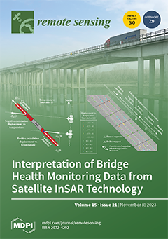
This paper presents a study on applying satellite Interferometric Synthetic Aperture Radar (InSAR) technology for the remote monitoring of road bridges and interpreting the results from a structural standpoint. The study focuses on the multi-span prestressed concrete A22 Po River Bridge in Italy. It utilises X-Band COSMO-SkyMed SAR images acquired over eight years. The results demonstrate the effectiveness of InSAR-based SHM in detecting temperature-induced displacements and identifying different bridge spans simply by studying the sign of the correlation between displacements and temperature variation. They also highlighted an unexpected behaviour in a bridge portion previously retrofitted to prevent scour. These results are significant with a view to using satellite InSAR-based bridge health monitoring on a large scale. View this paper
  • Issues are regarded as officially published after their release is announced to the table of contents alert mailing list .
  • You may sign up for email alerts to receive table of contents of newly released issues.
  • PDF is the official format for papers published in both, html and pdf forms. To view the papers in pdf format, click on the "PDF Full-text" link, and use the free Adobe Reader to open them.

Articles (188)

  • Article
  • Open Access
20 Citations
4,895 Views
26 Pages

A Hybrid Algorithm with Swin Transformer and Convolution for Cloud Detection

  • Chengjuan Gong,
  • Tengfei Long,
  • Ranyu Yin,
  • Weili Jiao and
  • Guizhou Wang

6 November 2023

Cloud detection is critical in remote sensing image processing, and convolutional neural networks (CNNs) have significantly advanced this field. However, traditional CNNs primarily focus on extracting local features, which can be challenging for clou...

  • Article
  • Open Access
7 Citations
3,999 Views
21 Pages

Assessment of Leica CityMapper-2 LiDAR Data within Milan’s Digital Twin Project

  • Marica Franzini,
  • Vittorio Marco Casella and
  • Bruno Monti

6 November 2023

The digital twin is one of the most promising technologies for realizing smart cities in terms of planning and management. For this purpose, Milan, Italy, has started a project to acquire aerial nadir and oblique images and LiDAR and terrestrial mobi...

  • Article
  • Open Access
6 Citations
2,700 Views
24 Pages

6 November 2023

Interferometric synthetic aperture radar (InSAR) technology has become one of the mainstream techniques for active landslide identification over a large area. However, the method for interpreting anomalous deformation areas derived from InSAR data is...

  • Article
  • Open Access
6 Citations
2,384 Views
21 Pages

Combination of UAV Photogrammetry and Field Inventories Enables Description of Height–Diameter Relationship within Semi-Arid Silvopastoral Systems

  • Arvin Fakhri,
  • Hooman Latifi,
  • Kyumars Mohammadi Samani,
  • Zahed Shakeri,
  • Hamed Naghavi and
  • Fabian Ewald Fassnacht

6 November 2023

Pollarding oak trees is a traditional silvopastoral technique practiced across wide areas of the northern Zagros mountains, a unique and vast semi-arid forest area with a strong cultural and ecological significance. So far, the effects of pollarding...

  • Article
  • Open Access
3 Citations
1,892 Views
21 Pages

6 November 2023

During gravity field modeling, the conventional acceleration approach rarely incorporates KBR inter-satellite range rate data from the GRACE mission. To propose an improved acceleration method, this study introduces initial orbital position and veloc...

  • Communication
  • Open Access
2 Citations
2,406 Views
14 Pages

Shadow-Based False Target Identification for SAR Images

  • Haoyu Zhang,
  • Sinong Quan,
  • Shiqi Xing,
  • Junpeng Wang,
  • Yongzhen Li and
  • Ping Wang

6 November 2023

In radar electronic countermeasures, as the difference between jamming and targets continues to decrease, traditional methods that are implemented based on classical features are currently unable to meet the requirements of jamming detection. Compare...

  • Article
  • Open Access
3 Citations
1,649 Views
17 Pages

6 November 2023

A multi-hypothesis marginal multi-target Bayes filter for heavy-tailed observation noise is proposed to track multiple targets in the presence of clutter, missed detection, and target appearing and disappearing. The proposed filter propagates the exi...

  • Article
  • Open Access
10 Citations
3,918 Views
31 Pages

Data-Driven Landslide Spatial Prediction and Deformation Monitoring: A Case Study of Shiyan City, China

  • Yifan Sheng,
  • Guangli Xu,
  • Bijing Jin,
  • Chao Zhou,
  • Yuanyao Li and
  • Weitao Chen

6 November 2023

Landslide susceptibility mapping (LSM) is significant for landslide risk assessment. However, there remains no consensus on which method is optimal for LSM. This study implements a dynamic approach to landslide hazard mapping by integrating spatio-te...

  • Article
  • Open Access
10 Citations
2,573 Views
18 Pages

6 November 2023

Open-pit mining activities inevitably affect the surrounding ecological environment. Therefore, it is crucial to clarify the disturbance characteristics of open-pit mining activities on the surrounding vegetation and scientifically implement ecologic...

  • Article
  • Open Access
8 Citations
2,553 Views
25 Pages

6 November 2023

Precipitation products play an important role in monitoring rainstorm processes. This study takes a rare historical event of extreme, heavy precipitation that occurred in Henan Province, China, in July 2021 as a research case. By analyzing the distri...

of 19

Get Alerted

Add your email address to receive forthcoming issues of this journal.

XFacebookLinkedIn
Remote Sens. - ISSN 2072-4292