Skip Content
You are currently on the new version of our website. Access the old version .

Remote Sensing, Volume 13, Issue 21

2021 November-1 - 301 articles

Cover Story: 
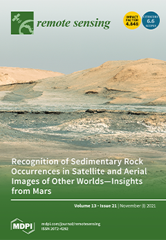
Sedimentary rocks provide vital records of past events and environments. The first step toward study of the sedimentary record of other worlds is to learn to recognize their landscape expressions. More than 99.97% of Mars has been imaged from orbit at scales of 0.25–6.0 m/pixel. These images, combined with exploration of sedimentary rock landscapes in Gale crater by the Curiosity rover, reveal that Mars has a more expansive sedimentary rock record than previously understood. This record, like this view of several kilometers of sedimentary strata exposed on Aeolis Mons in Gale crater, awaits further exploration and discovery. The mosaicked images were acquired atop Vera Rubin ridge by the Mastcam-100 camera onboard the Curiosity rover on 1 November 2018 (mosaic mcam10082; credit NASA/JPL-Caltech/Malin Space Science Systems).View this paper
  • Issues are regarded as officially published after their release is announced to the table of contents alert mailing list .
  • You may sign up for email alerts to receive table of contents of newly released issues.
  • PDF is the official format for papers published in both, html and pdf forms. To view the papers in pdf format, click on the "PDF Full-text" link, and use the free Adobe Reader to open them.

Articles (301)

  • Technical Note
  • Open Access
9 Citations
3,145 Views
12 Pages

8 November 2021

We present an algorithm for computing ice drift in the marginal ice zone (MIZ), based on partial shape recognition. With the high spatial resolution of Sentinel-1 and Sentinel-2 images, and the low sensitivity to atmospheric influences of Sentinel-1,...

  • Article
  • Open Access
17 Citations
6,500 Views
23 Pages

Resilience of the Central Indian Forest Ecosystem to Rainfall Variability in the Context of a Changing Climate

  • Beependra Singh,
  • Chockalingam Jeganathan,
  • Virendra Singh Rathore,
  • Mukunda Dev Behera,
  • Chandra Prakash Singh,
  • Parth Sarathi Roy and
  • Peter M. Atkinson

8 November 2021

Understanding the spatio-temporal pattern of natural vegetation helps decoding the responses to climate change and interpretation on forest resilience. Satellite remote sensing based data products, by virtue of their synoptic and repetitive coverage,...

  • Article
  • Open Access
45 Citations
4,781 Views
17 Pages

Research and Analysis of Ecological Environment Quality in the Middle Reaches of the Yangtze River Basin between 2000 and 2019

  • Shengqing Zhang,
  • Peng Yang,
  • Jun Xia,
  • Kunlun Qi,
  • Wenyu Wang,
  • Wei Cai and
  • Nengcheng Chen

8 November 2021

Ecological environment quality is a long-term continuous concept that is affected by various environmental factors. Its assessment has important implications for implementing the planning and protection of dynamic regional ecosystems. Therefore, this...

  • Article
  • Open Access
21 Citations
5,551 Views
26 Pages

Predicting Equivalent Water Thickness in Wheat Using UAV Mounted Multispectral Sensor through Deep Learning Techniques

  • Adama Traore,
  • Syed Tahir Ata-Ul-Karim,
  • Aiwang Duan,
  • Mukesh Kumar Soothar,
  • Seydou Traore and
  • Ben Zhao

8 November 2021

The equivalent water thickness (EWT) is an important biophysical indicator of water status in crops. The effective monitoring of EWT in wheat under different nitrogen and water treatments is important for irrigation management in precision agricultur...

  • Article
  • Open Access
33 Citations
10,702 Views
30 Pages

Drone-Based Autonomous Motion Planning System for Outdoor Environments under Object Detection Uncertainty

  • Juan Sandino,
  • Frederic Maire,
  • Peter Caccetta,
  • Conrad Sanderson and
  • Felipe Gonzalez

8 November 2021

Recent advances in autonomy of unmanned aerial vehicles (UAVs) have increased their use in remote sensing applications, such as precision agriculture, biosecurity, disaster monitoring, and surveillance. However, onboard UAV cognition capabilities for...

  • Communication
  • Open Access
25 Citations
5,163 Views
10 Pages

8 November 2021

Peak ground displacement (PGD) and peak ground velocity (PGV) are critical parameters during earthquake early warning, as they can provide rapid magnitude estimation before rupture end. In this study, we used the high-rate Global Navigation Satellite...

  • Technical Note
  • Open Access
54 Citations
5,108 Views
14 Pages

8 November 2021

The monitoring and maintenance of the Inner Mongolia section of the Yellow River Basin is of great significance to the safety and development of China’s Yellow River Economic Belt and to the protection of the Yellow River ecology. In this study, we c...

  • Article
  • Open Access
2 Citations
2,349 Views
20 Pages

Vector Fuzzy c-Spherical Shells (VFCSS) over Non-Crisp Numbers for Satellite Imaging

  • Iman Abaspur Kazerouni,
  • Hadi Mahdipour,
  • Gerard Dooly and
  • Daniel Toal

8 November 2021

The conventional fuzzy c-spherical shells (FCSS) clustering model is extended to cluster shells involving non-crisp numbers, in this paper. This is achieved by a vectorized representation of distance, between two non-crisp numbers like the crisp numb...

  • Technical Note
  • Open Access
12 Citations
5,958 Views
17 Pages

Estimation of Boreal Forest Growing Stock Volume in Russia from Sentinel-2 MSI and Land Cover Classification

  • W. Gareth Rees,
  • Jack Tomaney,
  • Olga Tutubalina,
  • Vasily Zharko and
  • Sergey Bartalev

8 November 2021

Growing stock volume (GSV) is a fundamental parameter of forests, closely related to the above-ground biomass and hence to carbon storage. Estimation of GSV at regional to global scales depends on the use of satellite remote sensing data, although ac...

  • Article
  • Open Access
40 Citations
8,629 Views
18 Pages

8 November 2021

Widespread harmful cyanobacterial bloom is one of the most pressing concerns in lakes and reservoirs, resulting in a lot of negative ecological consequences and threatening public health. Ocean color instruments with low spatial resolution have been...

  • Article
  • Open Access
22 Citations
8,405 Views
19 Pages

Monitoring Mining Activities Using Sentinel-1A InSAR Coherence in Open-Pit Coal Mines

  • Lili Wang,
  • Liao Yang,
  • Weisheng Wang,
  • Baili Chen and
  • Xiaolin Sun

8 November 2021

Long-term continuous monitoring of the mining activities in open-pit coal mines is conducive to planning and management of the mining operations. Additionally, this faciliatates assessment on their environmental impact and supervises illegal mining b...

  • Article
  • Open Access
27 Citations
5,291 Views
26 Pages

8 November 2021

Grassland ecosystems are a significant part of the global ecosystem and support the livelihoods of millions of people. The Inner Mongolia grassland is the largest temperate grassland in the world, and an important ecological barrier for China, but du...

  • Review
  • Open Access
108 Citations
21,238 Views
24 Pages

8 November 2021

Automation, including machine learning technologies, are becoming increasingly crucial in agriculture to increase productivity. Machine vision is one of the most popular parts of machine learning and has been widely used where advanced automation and...

  • Article
  • Open Access
32 Citations
4,867 Views
19 Pages

Spatiotemporal Characterization of the Urban Expansion Patterns in the Yangtze River Delta Region

  • Ziqi Yu,
  • Longqian Chen,
  • Long Li,
  • Ting Zhang,
  • Lina Yuan,
  • Ruiyang Liu,
  • Zhiqiang Wang,
  • Jinyu Zang and
  • Shuai Shi

8 November 2021

Characterizing urban expansion patterns is of great significance to planning and decision-making for urban agglomeration development. This study examined the urban expansion in the entire Yangtze River Delta Region (YRDR) with its land-use data of si...

  • Article
  • Open Access
9 Citations
3,228 Views
18 Pages

Precise Relative Orbit Determination for Chinese TH-2 Satellite Formation Using Onboard GPS and BDS2 Observations

  • Bin Yi,
  • Defeng Gu,
  • Kai Shao,
  • Bing Ju,
  • Houzhe Zhang,
  • Xianping Qin,
  • Xiaojun Duan and
  • Zhiyong Huang

8 November 2021

TH-2 is China’s first short-range satellite formation system used to realize interferometric synthetic aperture radar (InSAR) technology. In order to achieve the mission goal of InSAR processing, the relative orbit must be determined with high accura...

  • Article
  • Open Access
6 Citations
3,423 Views
23 Pages

8 November 2021

Aeolian transport affects beach and foredune pre-storm morphologies, which directly contribute to storm responses. However, significant spatiotemporal variation exists within beach-dune systems regarding how biotic and abiotic factors affect topograp...

  • Article
  • Open Access
28 Citations
5,526 Views
19 Pages

Assessing Grapevine Nutrient Status from Unmanned Aerial System (UAS) Hyperspectral Imagery

  • Robert Chancia,
  • Terry Bates,
  • Justine Vanden Heuvel and
  • Jan van Aardt

8 November 2021

This study aimed to identify the optimal sets of spectral bands for monitoring multiple grapevine nutrients in vineyards. We used spectral data spanning 400–2500 nm and leaf samples from 100 Concord grapevine canopies, lab-analyzed for six key nutrie...

  • Article
  • Open Access
2 Citations
2,857 Views
22 Pages

8 November 2021

Water vapor is one of the most important greenhouse gases in the world. There are many techniques that can measure water vapor directly or remotely. In this work, we first study the Global Positioning System (GPS)- and the Global Navigation Satellite...

  • Article
  • Open Access
5 Citations
4,435 Views
22 Pages

Clouds’ Microphysical Properties and Their Relationship with Lightning Activity in Northeast Brazil

  • Lizandro Pereira de Abreu,
  • Weber Andrade Gonçalves,
  • Enrique Vieira Mattos,
  • Pedro Rodrigues Mutti,
  • Daniele Torres Rodrigues and
  • Marcos Paulo Araújo da Silva

8 November 2021

The Northeast region of Brazil (NEB) has a high rate of deaths from lightning strikes (18% of the country’s total). The region has states, such as Piauí, with high mortality rates (1.8 deaths per million), much higher than the national rate (0.8) and...

  • Article
  • Open Access
9 Citations
4,382 Views
19 Pages

7 November 2021

The small baseline subset of spaceborne interferometric synthetic aperture radar (SBAS-InSAR) technology has become a classical method for monitoring slow deformations through time series analysis with an accuracy in the centimeter or even millimeter...

  • Article
  • Open Access
49 Citations
8,639 Views
25 Pages

7 November 2021

Mapping and monitoring the spatio-temporal variations of the Surface Urban Heat Island (SUHI) and thermal comfort of metropolitan areas are vital to obtaining the necessary information about the environmental conditions and promoting sustainable citi...

  • Review
  • Open Access
39 Citations
14,148 Views
25 Pages

Mapping of Coral Reefs with Multispectral Satellites: A Review of Recent Papers

  • Teo Nguyen,
  • Benoît Liquet,
  • Kerrie Mengersen and
  • Damien Sous

7 November 2021

Coral reefs are an essential source of marine biodiversity, but they are declining at an alarming rate under the combined effects of global change and human pressure. A precise mapping of coral reef habitat with high spatial and time resolutions has...

  • Article
  • Open Access
6 Citations
4,299 Views
17 Pages

7 November 2021

The complex valley networks that cross the Martian surface offer geomorphologic evidence of the presence of liquid water at some point in its history. However, the derivation of both temporal and hydrological dimensions of this climate phase is far f...

  • Article
  • Open Access
13 Citations
3,616 Views
21 Pages

7 November 2021

Convolutional neural networks (CNNs) have been widely used in hyperspectral image classification in recent years. The training of CNNs relies on a large amount of labeled sample data. However, the number of labeled samples of hyperspectral data is re...

  • Review
  • Open Access
68 Citations
10,411 Views
33 Pages

6 November 2021

Three-dimensional reconstruction technology has demonstrated broad application potential in the industrial, construction, medical, forestry, agricultural, and pastural sectors in the last few years. High-quality digital point cloud information exists...

  • Article
  • Open Access
11 Citations
3,420 Views
19 Pages

6 November 2021

This study investigates the potential of observations with improved frequency and latency time of upcoming altimetry missions on the accuracy of flood forecasting and early warnings. To achieve this, we assessed the skill of the forecasts of a distri...

  • Article
  • Open Access
10 Citations
5,091 Views
23 Pages

Assessing Changes in Terrestrial Water Storage Components over the Great Artesian Basin Using Satellite Observations

  • Pankaj R. Kaushik,
  • Christopher E. Ndehedehe,
  • Ryan M. Burrows,
  • Mark R. Noll and
  • Mark J. Kennard

6 November 2021

The influence of climate change and anthropogenic activities (e.g., water withdrawals) on groundwater basins has gained attention recently across the globe. However, the understanding of hydrological stores (e.g., groundwater storage) in one of the l...

  • Article
  • Open Access
10 Citations
4,989 Views
22 Pages

6 November 2021

A reliable framework for SINS/SAR/GPS integrated positioning systems is proposed for the case that sensors are in critical environments. Credibility is used to describe the difference between the true error and the initial setting standard deviation....

  • Article
  • Open Access
26 Citations
5,411 Views
19 Pages

6 November 2021

Accurate and timely land surface phenology (LSP) provides essential information for investigating the responses of terrestrial ecosystems to climate changes and quantifying carbon and surface energy cycles on the Earth. LSP has been widely investigat...

  • Article
  • Open Access
6 Citations
4,635 Views
19 Pages

6 November 2021

Regional or continental-scale land cover mapping requires various amounts of months of multi-temporal satellite data to pick phenological variation in vegetation, enhancing differentiability among surface cover types and improving accuracy. However,...

  • Article
  • Open Access
5 Citations
3,867 Views
27 Pages

Evaluation of Surface Upward Longwave Radiation in the CMIP6 Models with Ground and Satellite Observations

  • Jiawen Xu,
  • Xiaotong Zhang,
  • Chunjie Feng,
  • Shuyue Yang,
  • Shikang Guan,
  • Kun Jia,
  • Yunjun Yao,
  • Xianhong Xie,
  • Bo Jiang and
  • Xiang Zhao
  • + 1 author

6 November 2021

Surface upward longwave radiation (SULR) is an indicator of thermal conditions over the Earth’s surface. In this study, we validated the simulated SULR from 51 Coupled Model Intercomparison Project (CMIP6) general circulation models (GCMs) through a...

  • Article
  • Open Access
7 Citations
3,213 Views
27 Pages

6 November 2021

Terrestrial evapotranspiration (ET) is a critical component of water and energy cycles, and improving global land evapotranspiration is one of the challenging works in the development of land surface models (LSMs). In this study, we apply a bias corr...

  • Article
  • Open Access
11 Citations
5,595 Views
24 Pages

A Multidisciplinary Approach for the Mapping, Automatic Detection and Morphometric Analysis of Ancient Submerged Coastal Installations: The Case Study of the Ancient Aegina Harbour Complex

  • Nikos Georgiou,
  • Xenophon Dimas,
  • Elias Fakiris,
  • Dimitris Christodoulou,
  • Maria Geraga,
  • Despina Koutsoumpa,
  • Kalliopi Baika,
  • Pari Kalamara,
  • George Ferentinos and
  • George Papatheodorou

6 November 2021

The documentation of underwater cultural heritage (UCH) is the basis for sustainable maritime development including its protection, preservation, and incorporation in coastal zone management plans. In this study, we present a multidisciplinary, non-i...

  • Article
  • Open Access
7 Citations
3,736 Views
17 Pages

6 November 2021

Accurate knowledge of photosynthetic capacity is critical for understanding the carbon cycle under climate change. Despite the fact that deep neural network (DNN) models are increasingly applied across a wide range of fields, there are very few attem...

  • Article
  • Open Access
22 Citations
6,242 Views
25 Pages

Disturbance Mapping in Arctic Tundra Improved by a Planning Workflow for Drone Studies: Advancing Tools for Future Ecosystem Monitoring

  • Isabell Eischeid,
  • Eeva M. Soininen,
  • Jakob J. Assmann,
  • Rolf A. Ims,
  • Jesper Madsen,
  • Åshild Ø. Pedersen,
  • Francesco Pirotti,
  • Nigel G. Yoccoz and
  • Virve T. Ravolainen

6 November 2021

The Arctic is under great pressure due to climate change. Drones are increasingly used as a tool in ecology and may be especially valuable in rapidly changing and remote landscapes, as can be found in the Arctic. For effective applications of drones,...

  • Article
  • Open Access
167 Citations
11,126 Views
22 Pages

5 November 2021

Deep learning methods have achieved considerable progress in remote sensing image building extraction. Most building extraction methods are based on Convolutional Neural Networks (CNN). Recently, vision transformers have provided a better perspective...

  • Article
  • Open Access
12 Citations
6,190 Views
22 Pages

5 November 2021

Accurate estimation of spatiotemporal precipitation dynamics is crucial for flash flood forecasting; however, it is still a challenge in Andean-Amazon sub-basins due to the lack of suitable rain gauge networks. This study proposes a framework to impr...

  • Article
  • Open Access
17 Citations
3,353 Views
17 Pages

5 November 2021

Under the circumstance of global climate change, the evolution of thermal environments has attracted more attention, for which the surface urban heat island (SUHI) is one of the major concerns. In this research, we focused on the spatiotemporal patte...

  • Communication
  • Open Access
7 Citations
2,650 Views
9 Pages

Retrieval of Firn Thickness by Means of Polarisation Phase Differences in L-Band SAR Data

  • Giuseppe Parrella,
  • Irena Hajnsek and
  • Konstantinos P. Papathanassiou

5 November 2021

The knowledge of glacier zones’ extent and their temporal variations is fundamental for the retrieval of surface mass balance of glaciers and ice sheets. In this context, a key parameter is the firn line (FL), the lower boundary of the percolation zo...

  • Article
  • Open Access
57 Citations
5,445 Views
19 Pages

Climate Change Decreased Net Ecosystem Productivity in the Arid Region of Central Asia

  • Jingjing Zhang,
  • Xingming Hao,
  • Haichao Hao,
  • Xue Fan and
  • Yuanhang Li

5 November 2021

Numerous studies have confirmed that climate change leads to a decrease in the net ecosystem productivity (NEP) of terrestrial ecosystems and alters regional carbon source/sink patterns. However, the response mechanism of NEP to climate change in the...

  • Article
  • Open Access
12 Citations
5,507 Views
24 Pages

Modelling of Vegetation Dynamics from Satellite Time Series to Determine Proglacial Primary Succession in the Course of Global Warming—A Case Study in the Upper Martell Valley (Eastern Italian Alps)

  • Bettina Knoflach,
  • Katharina Ramskogler,
  • Lauren Talluto,
  • Florentin Hofmeister,
  • Florian Haas,
  • Tobias Heckmann,
  • Madlene Pfeiffer,
  • Livia Piermattei,
  • Camillo Ressl and
  • Johann Stötter
  • + 3 authors

5 November 2021

Satellite-based long-term observations of vegetation cover development in combination with recent in-situ observations provide a basis to better understand the spatio-temporal changes of vegetation patterns, their sensitivity to climate drivers and t...

  • Article
  • Open Access
8 Citations
3,426 Views
18 Pages

Wind Direction Retrieval Using Support Vector Machine from CYGNSS Sea Surface Data

  • Yun Zhang,
  • Xu Chen,
  • Wanting Meng,
  • Jiwei Yin,
  • Yanling Han,
  • Zhonghua Hong and
  • Shuhu Yang

5 November 2021

In view of the difficulty of wind direction retrieval in the case of the large space and time span of the global sea surface, a method of sea surface wind direction retrieval using a support vector machine (SVM) is proposed. This paper uses the space...

  • Article
  • Open Access
37 Citations
7,643 Views
23 Pages

Shallow-Water Benthic Habitat Mapping Using Drone with Object Based Image Analyses

  • Bisman Nababan,
  • La Ode Khairum Mastu,
  • Nurul Hazrina Idris and
  • James P. Panjaitan

5 November 2021

Spatial information on benthic habitats in Wangiwangi island waters, Wakatobi District, Indonesia was very limited in recent years. However, this area is one of the marine tourism destinations and one of the Indonesia’s triangle coral reef regions wi...

  • Article
  • Open Access
14 Citations
3,957 Views
20 Pages

5 November 2021

Emissivity information derived from thermal infrared (TIR) hyperspectral imagery has the advantages of both high spatial and spectral resolutions, which facilitate the detection and identification of the subtle spectral features of ground targets. De...

  • Article
  • Open Access
36 Citations
3,320 Views
15 Pages

5 November 2021

In recent years, the deep neural network has shown a strong presence in classification tasks and its effectiveness has been well proved. However, the framework of DNN usually requires a large number of samples. Compared to the training sets in classi...

  • Article
  • Open Access
4 Citations
3,782 Views
16 Pages

Horizontal Visibility in Forests

  • Mait Lang,
  • Andres Kuusk,
  • Kersti Vennik,
  • Aive Liibusk,
  • Kristina Türk and
  • Allan Sims

5 November 2021

The important variable of horizontal visibility within forest stands is gaining increasing attention in studies and applications involving terrestrial laser scanning (TLS), photographic measurements of forest structure, and autonomous mobility. We in...

  • Article
  • Open Access
6 Citations
3,451 Views
24 Pages

Accuracy of Copernicus Altimeter Water Level Data in Italian Rivers Accounting for Narrow River Sections

  • Cristina Deidda,
  • Carlo De Michele,
  • Ali Nadir Arslan,
  • Silvano Pecora and
  • Nicolas Taburet

5 November 2021

Information about water level is essential for hydrological monitoring and flood/drought risk assessment. In a large part of Italian river network, in situ instruments for measuring water level are rare or lacking. Here we consider the satellite meas...

  • Article
  • Open Access
8 Citations
4,808 Views
27 Pages

4 November 2021

This paper introduces a genetic algorithm (GA) and a beam tracing algorithm incorporated within a dual parallel computing framework to optimize urban aerial laser scanning (ALS) missions to maximize vertical façade data capture, as needed for many th...

  • Article
  • Open Access
8 Citations
3,339 Views
20 Pages

Region-Based Convolutional Neural Network for Wind Turbine Wake Characterization in Complex Terrain

  • Jeanie A. Aird,
  • Eliot W. Quon,
  • Rebecca J. Barthelmie,
  • Mithu Debnath,
  • Paula Doubrawa and
  • Sara C. Pryor

4 November 2021

We present a proof of concept of wind turbine wake identification and characterization using a region-based convolutional neural network (CNN) applied to lidar arc scan images taken at a wind farm in complex terrain. We show that the CNN successfully...

  • Review
  • Open Access
62 Citations
7,745 Views
29 Pages

Earth Observation Data-Driven Cropland Soil Monitoring: A Review

  • Nikolaos Tziolas,
  • Nikolaos Tsakiridis,
  • Sabine Chabrillat,
  • José A. M. Demattê,
  • Eyal Ben-Dor,
  • Asa Gholizadeh,
  • George Zalidis and
  • Bas van Wesemael

4 November 2021

We conducted a systematic review and inventory of recent research achievements related to spaceborne and aerial Earth Observation (EO) data-driven monitoring in support of soil-related strategic goals for a three-year period (2019–2021). Scaling, res...

of 7

Get Alerted

Add your email address to receive forthcoming issues of this journal.

XFacebookLinkedIn
Remote Sens. - ISSN 2072-4292