Next Issue
Volume 18, January-2
Previous Issue
Volume 17, December-2
 
 
water-logo

Journal Browser

Journal Browser

Water, Volume 18, Issue 1 (January-1 2026) – 134 articles

Cover Story (view full-size image): 
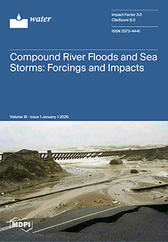
Coastal areas are strategically significant from ecological, anthropic, and economic perspectives, but they are also susceptible to forces that cause inundations. Multiple forcings occurring in close succession in both space and time amplify the effects of a single force, forming a compound event. One example is an atmospheric disturbance that extends from the sea to the mainland, causing a sea storm and a river flood due to heavy rainfall, such as that which occurred in 2015 in Calabria, Southern Italy. This paper focuses on compound river floods and sea storms generated by atmospheric disturbances regardless of their exceptional or nontypical typology. The analysis includes their forcings, correlation, and effects, and is carried out in Calabria, which is an interesting case study due to its peculiarities, which favor the formation of compound events and increase their risk. View this paper
  • Issues are regarded as officially published after their release is announced to the table of contents alert mailing list.
  • You may sign up for e-mail alerts to receive table of contents of newly released issues.
  • PDF is the official format for papers published in both, html and pdf forms. To view the papers in pdf format, click on the "PDF Full-text" link, and use the free Adobe Reader to open them.
Order results
Result details
Section
Select all
Export citation of selected articles as:
20 pages, 8380 KB  
Article
Numerical Study on the Permeability Evolution Within Fault Damage Zones
by Yulong Gu, Jiyuan Zhao, Debin Kong, Guoqing Ji, Lihong Shi, Hongtao Li and Zhenguo Mao
Water 2026, 18(1), 134; https://doi.org/10.3390/w18010134 - 5 Jan 2026
Viewed by 358
Abstract
This study investigates the permeability evolution in floor fault damage zones under stress–seepage–damage coupling, with a focus on water inrush risks caused by confined water upward conduction during deep mining. A stochastic fracture geometry model of the fault damage zone was developed using [...] Read more.
This study investigates the permeability evolution in floor fault damage zones under stress–seepage–damage coupling, with a focus on water inrush risks caused by confined water upward conduction during deep mining. A stochastic fracture geometry model of the fault damage zone was developed using the discrete fracture network (DFN) model and the Monte Carlo method. Based on geological data from a mining area in Shandong, a multiphysics-coupled numerical model under mining-induced conditions was established with COMSOL Multiphysics. The simulations visually reveal the dynamic evolution of damage propagation patterns in the floor strata during working face advancement. Results indicate that the damage zone stabilizes after the working face advances to 80 m, with its morphology exhibiting strong spatial correlation to regions of high seepage velocity. Moreover, increasing confined water pressure plays a critical role in driving flow field evolution. Full article
(This article belongs to the Topic Human Impact on Groundwater Environment, 2nd Edition)
Show Figures

Figure 1

22 pages, 9564 KB  
Article
Multi-Factor Driving Force Analysis of Soil Salinization in Desert–Oasis Regions Using Satellite Data
by Rui Gao, Yao Guan, Xinghong He, Jian Wang, Debao Fan, Yuan Ma, Fan Luo and Shiyuan Liu
Water 2026, 18(1), 133; https://doi.org/10.3390/w18010133 - 5 Jan 2026
Viewed by 327
Abstract
Understanding the spatiotemporal evolution of soil salinization is essential for elucidating its driving mechanisms and supporting sustainable land and water management in arid regions. In this study, the Alar Reclamation Area in Xinjiang, a typical desert–oasis transition zone, was selected to investigate the [...] Read more.
Understanding the spatiotemporal evolution of soil salinization is essential for elucidating its driving mechanisms and supporting sustainable land and water management in arid regions. In this study, the Alar Reclamation Area in Xinjiang, a typical desert–oasis transition zone, was selected to investigate the drivers of spatiotemporal variation in soil salinization. GRACE gravity satellite observations for the period 2002–2022 were used to estimate groundwater storage (GWS) fluctuations. Contemporaneous Landsat multispectral imagery was employed to derive the normalized difference vegetation index (NDVI) and a salinity index (SI), which were further integrated to construct the salinization detection index (SDI). Pearson correlation analysis, variance inflation factor analysis, and a stepwise regression framework were employed to identify the dominant factors controlling the occurrence and evolution of soil salinization. The results showed that severe salinization was concentrated along the Tarim River and in low-lying downstream zones, while salinity levels in the middle and upper parts of the reclamation area had generally declined or shifted to non-salinized conditions. SDI exhibited a strong negative correlation with NDVI (p ≤ 0.01) and a significant positive correlation with both irrigation quota and GWS (p ≤ 0.01). A pronounced collinearity was observed between GWS and irrigation quota. NDVI and GWS were identified as the principal drivers governing spatial–temporal variations in SDI. The resulting regression model (SDI = 0.946 − 0.959 × NDVI + 0.318 × GWS) established a robust quantitative relationship between SDI, NDVI and GWS, characterized by a high coefficient of determination (R2 = 0.998). These statistics indicated the absence of multicollinearity (variance inflation factor, VIF < 5) and autocorrelation (Durbin–Watson ≈ 1.876). These findings provide a theoretical basis for the management of saline–alkali lands in the upper Tarim River region and offer scientific support for regional ecological sustainability. Full article
(This article belongs to the Special Issue Synergistic Management of Water, Fertilizer, and Salt in Arid Regions)
Show Figures

Figure 1

19 pages, 1960 KB  
Article
Temporal Variability of Bioindicators and Microbial Source-Tracking Markers over 24 Hours in River Water
by Niva Sthapit, Yuquan Xu, Yadpiroon Siri, Eiji Haramoto and Sakiko Yaegashi
Water 2026, 18(1), 132; https://doi.org/10.3390/w18010132 - 5 Jan 2026
Viewed by 543
Abstract
With increasing contamination in aquatic ecosystems, effective monitoring is crucial to preserve biodiversity and protect public health. This study quantified bioindicators (red swamp crayfish (Pcla), Genji-firefly (Lcr2), Ayu fish (Paa), and caddisfly (Sma)), microbial source [...] Read more.
With increasing contamination in aquatic ecosystems, effective monitoring is crucial to preserve biodiversity and protect public health. This study quantified bioindicators (red swamp crayfish (Pcla), Genji-firefly (Lcr2), Ayu fish (Paa), and caddisfly (Sma)), microbial source tracking markers (ruminants (BacR), pigs (Pig2Bac), and humans (gyrB)), and a fecal indicator bacterium (Escherichia coli (sfmD)) using quantitative PCR on river water samples collected every 2 h between 21 and 22 July 2023 (from the Omo and Bingushi Rivers in Yamanashi Prefecture, Japan). Initially, the optimal filter sizes of 1.0, 0.65, and 0.22 µm were evaluated, where the 0.65 µm filter yielded higher Paa concentrations (Kruskal–Wallis test, p < 0.05) and was used subsequently. BacR and Paa exhibited 100% detection in the Omo (13/13) and Bingushi (13/13) Rivers with concentrations of 5.0 log10 and 5.5 log10 copies/L, respectively. These concentrations were used to assess 24 h temporal variability, but no significant fluctuations or cyclical trends between morning, afternoon, evening, and night were observed in either river. The BacR–Paa pair exhibited perfect positive detection correlation (Φ = 1.0) and complete similarity (Jaccard Index = 1.0), but a moderate negative correlation of mean concentrations highlights the importance of considering habitat overlaps and behavioral synchronicity. Full article
(This article belongs to the Section Biodiversity and Functionality of Aquatic Ecosystems)
Show Figures

Graphical abstract

22 pages, 5307 KB  
Article
Proposed Application of a Tree-Based Model for a Priority Scenario Restoration Plan for a Water Distribution Network
by Samantha Louise N. Jarder and Lessandro Estelito O. Garciano
Water 2026, 18(1), 131; https://doi.org/10.3390/w18010131 - 5 Jan 2026
Viewed by 482
Abstract
Hazard impacts are increasing in complexity as the world population grows. No universal strategies are available to minimize or eliminate the impacts of all scenarios. In this paper, a priority scenario-based strategy methodology is proposed using a Decision Tree (DT) machine learning tool. [...] Read more.
Hazard impacts are increasing in complexity as the world population grows. No universal strategies are available to minimize or eliminate the impacts of all scenarios. In this paper, a priority scenario-based strategy methodology is proposed using a Decision Tree (DT) machine learning tool. This approach identifies the parameters and combinations that contribute to high impact and loss from a hazard event conditioned on a priority scenario. The method is applied to a local water distribution network under seismic hazards. The priority scenarios in this study are vulnerability (VPS), damage (DPS), and cost (CPS). Each priority scenario identifies different affected areas. Some areas were repeatedly affected in different priority scenarios, showing an overlap of effects and making them a high crucial priority. Based on the analysis, a priority-based map was generated, highlighting areas that should be given priority for restoration or protection. The DTs were compared with other ML tools and Tree-based models to ascertain the best tool that determines the affected parameters. Competition tests compared the results from the ML tools and showed acceptable predictions; however, the DT was demonstrated to be the most ideal tool for this proposed method, showing an r2 of 0.6745, 0.9259, and 0.7343 for VPS, DPS, and CPS, respectively. Full article
(This article belongs to the Topic Geospatial AI: Systems, Model, Methods, and Applications)
Show Figures

Figure 1

25 pages, 5847 KB  
Article
Conjunctive-Use Frameworks Driven by Surface Water Operations: Integrating Concentrated and Distributed Strategies for Groundwater Recharge and Extraction
by Chia-Wen Wu, Frederick N.-F. Chou and Yu-Wen Chen
Water 2026, 18(1), 130; https://doi.org/10.3390/w18010130 - 5 Jan 2026
Viewed by 468
Abstract
This study develops a conjunctive-use framework that couples a surface water allocation model with the MODFLOW groundwater model to evaluate the interactions between surface water operations and groundwater recharge and pumping. The framework enables coordinated surface–groundwater management through iterative feedback between allocation decisions [...] Read more.
This study develops a conjunctive-use framework that couples a surface water allocation model with the MODFLOW groundwater model to evaluate the interactions between surface water operations and groundwater recharge and pumping. The framework enables coordinated surface–groundwater management through iterative feedback between allocation decisions and groundwater responses. Three representative managed aquifer recharge cases in Taiwan are examined, each reflecting a distinct operational logic: (1) a space-for-time strategy that extends wet-season benefits through distributed recharge using irrigation surplus; (2) a centralized support–distributed feedback approach in subsidence-prone areas, where concentrated surface water is delivered to targeted zones while maintaining flexibility for upstream allocation; and (3) a time-for-volume mechanism that converts short-duration flood events into stable, long-term baseflow supply. The simulation results show that these strategies reduce downstream irrigation deficit ratios (e.g., from 0.58 to 0.22), raise groundwater levels by up to approximately 3.5 m in subsidence-sensitive zones, and substantially enhance drought resilience by reducing extreme reservoir depletion during prolonged dry periods. Overall, the proposed framework provides quantitative evidence and a practical planning tool for surface water-oriented conjunctive use, supporting more sustainable and resilient multi-source water management. Full article
(This article belongs to the Section Water Resources Management, Policy and Governance)
Show Figures

Figure 1

13 pages, 1943 KB  
Article
Water Inrush in Roof Bed Separation Due to Extra-Thick Seam Mining and Its Control
by Lihua Ping, Shuangcheng Tang, Baolei Xie, Qiqing Wang, Zexuan Liao, Wei Qiao, Haiyue Lin, Zhiwen Xue and Guanyu Zhao
Water 2026, 18(1), 129; https://doi.org/10.3390/w18010129 - 5 Jan 2026
Viewed by 216
Abstract
This paper takes a fully caving face in a coal mine in western China as an example and analyzes several water-inrush cases in the roof-bed separation of the first mining face. Various causes and characteristics of water inrush in bed separation are also [...] Read more.
This paper takes a fully caving face in a coal mine in western China as an example and analyzes several water-inrush cases in the roof-bed separation of the first mining face. Various causes and characteristics of water inrush in bed separation are also analyzed. The bed separation closure distance in the working face mining was calculated using the thin-slab theory. The results show that the roof-bed separation first closure distance was about 250–300 m, and the cycle closure distance was about 150–175 m. Moreover, a water-in-bed separation-disaster prevention method was proposed by conducting a ground straight-through diversion borehole, which is used for dewatering in bed separation. Furthermore, the groundwater level supplying the roof-bed separation was observed. The results show that the ground straight-through diversion borehole was good for dewatering the bed separation before the closure of the bed separation. This measure eliminated the danger of water inrush in roof-bed separation, which ensures the safe mining of the working face. This study, through the integration of theoretical analysis and engineering practice, proposes and validates a prevention and control technology for water hazards in roof-bed separation based on ground straight-through diversion boreholes, providing a reliable technical approach for safe mining under similar geological conditions. Full article
(This article belongs to the Section Hydrogeology)
Show Figures

Figure 1

32 pages, 25756 KB  
Article
Study on Spatio-Temporal Changes and Driving Factors of Soil and Water Conservation Ecosystem Services in the Source Region of the Yellow River
by Xiaoqing Li, Xingnian Zhang, Keding Sheng, Fengqiuli Zhang, Tongde Chen and Binzu Yan
Water 2026, 18(1), 128; https://doi.org/10.3390/w18010128 - 5 Jan 2026
Viewed by 314
Abstract
This study takes the source region of the Yellow River from 2000 to 2024 as the research area, and integrates multi-source remote sensing, long-term meteorological observation, and land use data from 2000 to 2024. Using GIS spatial analysis, the standard ellipse model, and [...] Read more.
This study takes the source region of the Yellow River from 2000 to 2024 as the research area, and integrates multi-source remote sensing, long-term meteorological observation, and land use data from 2000 to 2024. Using GIS spatial analysis, the standard ellipse model, and a geographic detector, this study systematically depicts the spatio-temporal heterogeneity and multi-scale evolution trend of soil and water conservation services, and then quantifies the spatial differentiation of the contribution rate of climate fluctuation, land use transformation, and human activity intensity to service change. The results showed the following: (1) The land use pattern in the source region of the Yellow River showed a one-way transformation of “grassland dominated, forest land increased alone, and the rest decreased”. The net increase in forest land 204.3 km2 was all from the transformation of grassland. The vegetation coverage increased by 9.9%, and the low-value area of soil and water conservation services in the northwest continued to expand. (2) The overall moving distance of the center of gravity of soil and water conservation service capacity is not significant compared with the spatial scale of the source area of the Yellow River. The standard deviation ellipse of each year also did not show systematic and large changes in area, shape, or direction. (3) Annual mean temperature (Q = 0.590) and vegetation coverage (Q = 0.527) are the most influential single factors, while the interaction between annual mean temperature and precipitation (bidirectional enhancement) is the most stable synergistic driving combination. The single-factor Q values of topography and human activities were <0.10. (4) Climate and economic factors are the key factors driving the spatial differentiation of soil and water conservation service capacity, and the role of each driving factor has an optimal range to reduce the risk of soil erosion. The optimal range of population density is 7~9 person/km2, the optimal range of average GDP is 11,900~14,100 yuan/km2, the optimal range of annual average temperature is 1.71~3.47 °C, the optimal range of annual precipitation is 682~730 mm, the optimal range of vegetation coverage is 81.7~100%, and the optimal range of altitude is 3390~3740 m. The optimal range of slope is 18.3~24.3°. The optimal range of soil moisture is 26.7~29.4%. The optimal range of grazing intensity is 0.352~0.652. The study proposes countermeasures such as strict control of development in high-value areas of soil and water conservation services and key ecological restoration in low-value areas, the establishment of breeding bases and catchment areas in low-precipitation areas to cope with climate change, the optimization of grazing strategies, so as to provide scientific support for the stability of alpine grassland ecosystem services, and the high-quality development of the Yellow River Basin. Full article
(This article belongs to the Special Issue Soil Erosion and Soil and Water Conservation, 2nd Edition)
Show Figures

Figure 1

17 pages, 15732 KB  
Article
Pre-Filter Regulation Strategies and Deactivation Mechanisms of Filter Media in Water Treatment
by Chaochang Jiang, Xiaowei Lei, Renpeng Zhou, Bingzhi Liu, Junxia Liu, Wei Song and Zhihong Wang
Water 2026, 18(1), 127; https://doi.org/10.3390/w18010127 - 5 Jan 2026
Viewed by 290
Abstract
In the context of micro-polluted water sources, the performance decline of filtration units is a major challenge for the operational management of water supply plants. Therefore, it is necessary to systematically analyze the mechanism underlying the decline in filter media activity and optimize [...] Read more.
In the context of micro-polluted water sources, the performance decline of filtration units is a major challenge for the operational management of water supply plants. Therefore, it is necessary to systematically analyze the mechanism underlying the decline in filter media activity and optimize the pre-filtration treatment. This study focuses on waterworks, aiming to enhance filtration performance through filter media modification and a combined coagulant-oxidant strategy. A key innovation of this work is the development of a macro-microscopic correlation evaluation system. The results showed that the modified filter media increased the turbidity removal rate by 10.48% compared to the unmodified media. Furthermore, the combined coagulation–pre-oxidation scheme increased the removal rates for turbidity and UV254 by 3.24% and 19.03%, respectively, compared to the single-process scheme. Combined with filter media characterization results, the deactivation mechanism of filter media can be inferred. During the high-algae period, microorganisms on the filter media generate anaerobic Extracellular Polymeric Substances (EPS), which form a biofilm with bacteria and adhere to the filter media. The viscous matrix of these EPS then encapsulates inorganic substances, resulting in hard-to-remove clumps. These clumps clog pores and hinder the adsorption of subsequent pollutants, ultimately leading to continuous deterioration in filter media performance until failure. Full article
Show Figures

Figure 1

17 pages, 2512 KB  
Article
Water Quality and Phytoplankton Control Epilithic Algal Communities in Small Subtropical Rural Rivers
by Jinfu Liu, Zhihao Xie, Jie Zhu, Yezhi Huang, Xinyu Chen, Shiyu Zhou, Guangshun Liu, Muyan Xia, Yuwei Chen, Wei Li and Liancong Luo
Water 2026, 18(1), 126; https://doi.org/10.3390/w18010126 - 5 Jan 2026
Viewed by 320
Abstract
To elucidate the driving factors and regulatory mechanisms of epilithic algal communities in subtropical rural rivers, we investigated the water physicochemical parameters, sediment characteristics, phytoplankton, macroinvertebrates, and epilithic algal communities in the Shilipu and Xiabu Rivers during the summer period (June and August [...] Read more.
To elucidate the driving factors and regulatory mechanisms of epilithic algal communities in subtropical rural rivers, we investigated the water physicochemical parameters, sediment characteristics, phytoplankton, macroinvertebrates, and epilithic algal communities in the Shilipu and Xiabu Rivers during the summer period (June and August 2023). A total of 131 epilithic algal species belonging to five phyla were identified, with Cyanobacteria, Chlorophyta, and Bacillariophyta constituting the dominant groups. Core dominant species included Lyngbya sp. C. Agardh, 1824, Oscillatoria sp. Vauch., 1803, and Gomphonema sp. Agardh, 1824. Epilithic algal communities exhibited significant monthly differences, with both biomass and abundance being significantly higher (p < 0.05) in August than in June. Environmental factors, encompassing both abiotic and biotic parameters, collectively explained 56.76% and 56.99% of the variation in epilithic algal abundance and biomass, respectively. Water physicochemical parameters and phytoplankton biomass emerged as the core driving factors. Both showed highly significant positive correlations with epilithic algal abundance (R = 0.26, p < 0.001; R = 0.27, p < 0.001) and biomass (R = 0.21, p < 0.001; R = 0.27, p < 0.001). Sediment factors exerted a mild regulatory effect (abundance: R = 0.13, p < 0.05; biomass: R = 0.17, p < 0.01) by releasing nutrients to supplement the water column. The impact of macroinvertebrates was weak and biomass-dependent, showing only a weakly significant positive correlation with epilithic algal biomass (R = 0.12, p < 0.05). This study reveals the synergistic regulatory effects of abiotic and biotic factors on epilithic algal communities in subtropical rural rivers, where elevated external nutrient input attenuates the competitive effects of phytoplankton and the grazing pressure of macroinvertebrates. This provides a scientific basis for the ecological monitoring and restoration of similar river systems. Full article
(This article belongs to the Special Issue Wetland Water Quality Monitoring and Assessment)
Show Figures

Figure 1

46 pages, 1959 KB  
Review
Optical Sensor Systems for Antibiotic Detection in Water Solutions
by Olga I. Guliy and Viktor D. Bunin
Water 2026, 18(1), 125; https://doi.org/10.3390/w18010125 - 5 Jan 2026
Viewed by 424
Abstract
Antibiotics are persistent organic pollutants that pose a serious problem for water resources, ultimately having a detrimental effect on human and animal health. The most important aspect of controlling and preventing the spread of antibiotics and their degradation products is continuous screening and [...] Read more.
Antibiotics are persistent organic pollutants that pose a serious problem for water resources, ultimately having a detrimental effect on human and animal health. The most important aspect of controlling and preventing the spread of antibiotics and their degradation products is continuous screening and monitoring of environmental samples. Optical sensing technologies represent a large group of sensors that allow short-term detection of antibiotics in non-laboratory settings. This article reviews the advances in optical sensing systems (colorimetric, fluorescent, surface-enhanced Raman spectra-based, surface plasmon resonance-based, localized surface plasmon resonance-based, photonic crystal-based, fiber optic, molecularly imprinted polymer-based and electro-optical platforms) for the detection of antibacterial drugs in water. Special attention is paid to the evaluation of the analytic characteristics of optical sensors for the analysis of antibiotics. Particular attention is paid to electro-optical sensing and to the unique possibility of its use in antibiotic determination. Potential strategies are considered for amplifying the recorded signals and improving the performance of sensor systems. The main trends in optical sensing for antibiotic analysis and the prospects for the commercial application of optical sensors are described. Full article
Show Figures

Figure 1

25 pages, 1829 KB  
Article
A Water Resources Scheduling Model for Complex Water Networks Considering Multi-Objective Coordination
by Hui Bu, Chun Pan, Chunyang Liu, Yu Zhu, Zhuowei Yin, Zhengya Liu and Yu Zhang
Water 2026, 18(1), 124; https://doi.org/10.3390/w18010124 - 5 Jan 2026
Viewed by 313
Abstract
Complex water networks face prominent contradictions among flood control, water supply, and ecological protection, and traditional scheduling models struggle to address multi-dimensional water security challenges. To solve this problem, this study proposes a multi-objective coordinated water resources scheduling model for complex water networks, [...] Read more.
Complex water networks face prominent contradictions among flood control, water supply, and ecological protection, and traditional scheduling models struggle to address multi-dimensional water security challenges. To solve this problem, this study proposes a multi-objective coordinated water resources scheduling model for complex water networks, taking the Taihu Lake Basin as a typical case. First, a multi-objective optimization indicator system covering flood control, water supply, and aquatic ecological environment was constructed, including 12 key indicators such as drainage efficiency of key outflow hubs and water supply guarantee rate. Second, a dynamic variable weighting strategy was adopted to convert the multi-objective optimization problem into a single-objective one by adjusting indicator weights according to different scheduling periods. Finally, a combined solving mode integrating a basin water quantity-quality model and a joint scheduling decision model was established, optimized using the particle swarm optimization (PSO) algorithm. Under the 1991-Type 100-Year Return Period Rainfall scenario, three scheduling schemes were designed: a basic scheduling scheme and two enhanced discharge schemes modified by lowering the drainage threshold of the Xinmeng River Project. Simulation and decision results show that the enhanced discharge scheme with the lowest drainage threshold achieves the optimal performance with an objective function value of 98.8. Compared with the basic scheme, it extends the flood season drainage days of the Jiepai Hub from 32 to 43 days, increases the average flood season discharge of the Xinmeng River to the Yangtze River by 9.5%, and reduces the maximum water levels of Wangmuguan, Fangqian, Jintan, and Changzhou (III) stations by 5 cm, 5 cm, 4 cm, and 4 cm, respectively. This model effectively overcomes technical bottlenecks such as conflicting multi-objectives and complex water system structures, providing theoretical and technical support for multi-objective coordinated scheduling of water resources in complex water networks. Full article
Show Figures

Figure 1

17 pages, 4496 KB  
Article
Integrated Effects of Irrigation Amounts, Fertilizer Types, and Tillage Practices on Crop Growth, Yield, and Fruit Quality of Processing Tomato
by Ruyue Zheng, Junwei Tan, Guanhua Huang and Zailin Huo
Water 2026, 18(1), 123; https://doi.org/10.3390/w18010123 - 5 Jan 2026
Viewed by 238
Abstract
Irrigation effects on processing tomato have been comprehensively studied, whereas the integrated effects of irrigation and agronomic measures lack systematic investigations. This study employed a two-year field experiment to investigate the interactive effects of irrigation, fertilizer, and tillage practices on the crop growth, [...] Read more.
Irrigation effects on processing tomato have been comprehensively studied, whereas the integrated effects of irrigation and agronomic measures lack systematic investigations. This study employed a two-year field experiment to investigate the interactive effects of irrigation, fertilizer, and tillage practices on the crop growth, total yield, and fruit quality of processing tomato. The experimental treatments comprised three irrigation levels (full irrigation, mild water deficit, and moderate water deficit), combined with two fertilizer strategies (synthetic fertilizer only and partial substitution of synthetic fertilizer with manure), and two tillage practices (ridge planting and flat planting). It was found that the partial organic fertilizer substitution and the ridge planting significantly improved the total tomato yield by 13.11% and 75.54% on average, respectively, compared to the synthetic fertilizer application and flat planting, although they led to more salt accumulation in the top soil layer. However, the extent of the increase greatly varied over different irrigation levels and years. The mild water deficit led to a yield increase of 9.22% compared to full irrigation, while the moderate water deficit resulted in an obvious yield loss of 25.95%. Moreover, the ridge planting, the partial organic fertilizer substitution, and water deficit had strong positive effects on the fruit quality and the tillage–irrigation interaction had strong effects on the fruit quality, but it showed negligible effects on the tomato yield. In contrast, the tomato yield was very sensitive to the fertilizer–irrigation interaction, while the fruit quality showed nonsignificant sensitivity to the tillage–irrigation interaction. Finally, the combination of ridge planting, partial organic fertilizer substitution, and a mild water deficit was highlighted as a sustainable cropping production system for processing tomato to achieve an enhanced total yield and fruit quality. Full article
(This article belongs to the Section Water, Agriculture and Aquaculture)
Show Figures

Figure 1

25 pages, 3743 KB  
Article
Virtual Water and Agricultural Sustainability: Unraveling the Trade–Water Nexus in Ecuador’s Crop Sector Through Empirical Modeling
by Eliana Ivanova Cuero Espinoza, Qudus Adeyi, Golden Odey, Hwa-Seok Hwang and Kyung-Sook Choi
Water 2026, 18(1), 122; https://doi.org/10.3390/w18010122 - 4 Jan 2026
Viewed by 647
Abstract
Freshwater scarcity increasingly constrains agricultural sustainability and global food security, particularly where crop production and trade shape national water balances. This study quantifies Ecuador’s green (soil moisture/rainfall) and blue (surface and groundwater) virtual water flows associated with seven strategic crops (banana, cocoa, pineapple, [...] Read more.
Freshwater scarcity increasingly constrains agricultural sustainability and global food security, particularly where crop production and trade shape national water balances. This study quantifies Ecuador’s green (soil moisture/rainfall) and blue (surface and groundwater) virtual water flows associated with seven strategic crops (banana, cocoa, pineapple, maize, rice, barley and potato) from 2000 to 2023 using the Hoekstra–Mekonnen accounting framework, and FAOSTAT production and bilateral trade data. Furthermore, Logarithmic Mean Divisia Index (LMDI) decomposition analysis was applied to identify the key drivers influencing virtual water trade, including economic growth, population, product structure, and water intensity. Results reveal that Ecuador operates as a persistent net exporter of virtual water, with export flows dominated by green water, reflecting the country’s reliance on rainfall-supported production. Virtual water exports increased from 3000 to >15,000 Mm3·yr−1 over the study period, while imports remained substantially smaller, confirming Ecuador’s structurally export-oriented agricultural economy. The LMDI outcomes show that export growth is driven primarily by economic expansion (8.28 × 10⁸ m3) and shifts in the crop export mix, partially offset by improvements in water intensity. These findings highlight Ecuador’s vulnerability to trade-related water pressures and demonstrate the value of virtual water indicators for guiding water governance and SDG-aligned trade strategies, thereby promoting the decoupling of economic growth from water resource consumption and connecting virtual water trade to domestic water scarcity. Full article
(This article belongs to the Section Water Use and Scarcity)
Show Figures

Figure 1

22 pages, 4352 KB  
Article
Grading Evaluation of Grouting Seal Quality for Recharge Channels in Water-Hazardous Aquifers of Extremely Complex Mines
by Jianggen He, Hankun Li, Yaolong Huang, Shiyuan Tian, Junchao Yue, Hongwei Meng, Qi Wang and Xinyi Wang
Water 2026, 18(1), 121; https://doi.org/10.3390/w18010121 - 4 Jan 2026
Viewed by 246
Abstract
Grouting to seal the recharge channels of water-bearing aquifers is an effective method for reducing mine water inflow. Evaluating effectiveness and establishing a hierarchical classification system are crucial for assessing project quality. Taking the grouting seal project of the Cambrian limestone aquifer recharge [...] Read more.
Grouting to seal the recharge channels of water-bearing aquifers is an effective method for reducing mine water inflow. Evaluating effectiveness and establishing a hierarchical classification system are crucial for assessing project quality. Taking the grouting seal project of the Cambrian limestone aquifer recharge channels at Mine No.7 in the Pingdingshan Coalfield as a case study, this paper first comprehensively evaluates the grouting seal effectiveness based on the difference in dynamic water recharge to goaf before and after grouting, derived from long-term pumping test data. Further, six indicator factors—grout volume, grout volume per unit time, grout volume per unit thickness, final borehole pressure, penetration depth into Cambrian limestone, and variation in rock mechanical strength—were selected. Weights for these factors were determined by integrating the Analytic Hierarchy Process, entropy weight method, and composite weighting method. The TOPSIS model was applied to classify and rank the grouting seal effectiveness in six recharge channels. Results indicate that post-grouting water recharge from goaf decreased by 240.78 m3/h during dry season and 878.57 m3/h during wet season, confirming high-quality grouting seal. The grouting seal quality of the six recharge channels was ranked from highest to lowest as follows: NO.3 > NO.2 > NO.6 > NO.1 > NO.5 > NO.4. The evaluation results corresponded with the actual karst fissure development and distribution of goaf in the exposed recharge channels. Full article
Show Figures

Figure 1

26 pages, 16941 KB  
Article
Study on the Influence Mechanism of Extreme Precipitation on Rice Yield in Hunan from 2000 to 2023 and the Countermeasures of Agricultural Production
by Fengqiuli Zhang, Yuman Zhang, Keding Sheng, Tongde Chen, Jianjun Li, Lingling Wang, Chunjing Zhao, Jiarong Hou and Xingshuai Mei
Water 2026, 18(1), 120; https://doi.org/10.3390/w18010120 - 4 Jan 2026
Viewed by 298
Abstract
Hunan Province from 2000 to 2023 is the study area. Based on NOAA precipitation data and county-level rice yield statistics in Hunan Province, the Mann–Kendall test, extreme precipitation indices, and wavelet analysis examine the spatial and temporal evolution characteristics of extreme precipitation and [...] Read more.
Hunan Province from 2000 to 2023 is the study area. Based on NOAA precipitation data and county-level rice yield statistics in Hunan Province, the Mann–Kendall test, extreme precipitation indices, and wavelet analysis examine the spatial and temporal evolution characteristics of extreme precipitation and its multi-scale impact on rice yield. The results show that the extreme precipitation in Hunan Province showed a stable pattern of fluctuation, and the main extreme precipitation indexes had no significant change trend. The spatial distribution showed a pattern of “high value in central-northern Hunan and stable in southern Hunan”, and the precipitation was concentrated in June–August. The rice yield showed the characteristics of “stable increase in the core area, intensified fluctuation in the transition area, and continuous shrinkage in the marginal area”, and the Dongting Lake Plain was a high-yield and stable area. Multi-scale analysis shows significant coupling between extreme precipitation and yield: in the 4–8-year cycle, the peak value of precipitation lags behind the response of 1–2 years, and changes synchronously in a short period. The response of rice to extreme precipitation showed a threshold-type nonlinear characteristic. Moderate wetting was beneficial to stable yield, while the yield decreased significantly when the intensity or continuous precipitation exceeded the threshold. Hunan’s rice system has strong climate resilience but requires a multi-scale climate-adaptive agricultural system via engineering, technology, and policy for long-term stability and sustainable grain production. Full article
Show Figures

Figure 1

42 pages, 1739 KB  
Review
A Review of the Advances and Emerging Approaches in Hydrological Forecasting: From Traditional to AI-Powered Models
by Kevin Paolo V. Robles, Jerose G. Solmerin, Gerald Christian E. Pugat and Cris Edward F. Monjardin
Water 2026, 18(1), 119; https://doi.org/10.3390/w18010119 - 4 Jan 2026
Viewed by 824
Abstract
Hydrological forecasting has evolved rapidly in response to intensifying climate variability, increasing data availability, and advances in computational modeling. This review synthesizes developments from 2006 to 2025, examining four major forecasting domains: statistical approaches, physically based models, data-driven machine learning and deep learning [...] Read more.
Hydrological forecasting has evolved rapidly in response to intensifying climate variability, increasing data availability, and advances in computational modeling. This review synthesizes developments from 2006 to 2025, examining four major forecasting domains: statistical approaches, physically based models, data-driven machine learning and deep learning techniques, and hybrid or emerging physics–AI frameworks. Recent literature shows a decisive shift toward integrated, data-rich systems that leverage remote sensing, IoT networks, and artificial intelligence to overcome limitations in traditional forecasting. While hybrid and physics-informed AI models achieve notable improvements in accuracy, lead time, and scalability, persistent challenges remain, especially regarding data scarcity, model interpretability, cross-basin generalization, climate non-stationarity, and operational computational demands. This review highlights these limitations and outlines future directions needed to strengthen hydrological forecasting as a tool for climate adaptation, early warning systems, and long-term water resource planning. By consolidating methodological advances and emerging gaps, the study provides insights into how hydrological forecasting can transition toward more resilient, transparent, and decision-oriented frameworks. Full article
Show Figures

Figure 1

19 pages, 2821 KB  
Article
Assessment of Atmospheric Acidifying Pollutant Trends and Their Potential Impact on Aquatic Carbon Stability in a Semi-Arid Basin: The Case of Konya
by Aziz Uğur Tona and Vahdettin Demir
Water 2026, 18(1), 118; https://doi.org/10.3390/w18010118 - 3 Jan 2026
Viewed by 405
Abstract
The behavior of the carbon cycle within the Land-Ocean Aquatic Continuum (LOAC) is shaped not only by aquatic processes but also by chemical interactions occurring at the atmosphere–water interface. In particular, the transport of acid rain precursors such as SO2 and NO [...] Read more.
The behavior of the carbon cycle within the Land-Ocean Aquatic Continuum (LOAC) is shaped not only by aquatic processes but also by chemical interactions occurring at the atmosphere–water interface. In particular, the transport of acid rain precursors such as SO2 and NOx to surface waters via deposition can alter the water’s pH balance, thereby affecting Dissolved Inorganic Carbon (DIC) fractions and CO2 emission potential. In this study, air quality measurements from three monitoring stations (Bosna, Karatay, and Meram) in Konya province of Türkiye, along with precipitation and temperature data from a representative meteorological station for the period 2021–2023, were analyzed using the Mann–Kendall Trend Test. Additionally, seasonal pH values of groundwater were examined, and their trends were compared with those of the other variables. The findings reveal striking differences on a station basis. At the Bosna station, while NO (Z = 10.80), NO2 (Z = 9.47), and NOx (Z = 10.04) showed strong increasing trends, O3 decreased significantly (Z = −15.14). At the Karatay station, significant increasing trends were detected for CO (Z = 10.01), PM10 (Z = 8.59), SO2 (Z = 5.55), and NOx (Z = 2.44), whereas O3 exhibited a negative trend (Z = −6.54). At the Meram station, a significant decrease was observed in CO (Z = −11.63), while NO2 showed an increasing trend (Z = 3.03). Analysis of meteorological series indicated no significant trend in precipitation (Z = −0.04), but a distinct increase in temperature (Z = 2.90, p < 0.01). These findings suggest that the increasing NOx load in the Konya atmosphere accelerates O3 consumption and, combined with rising temperatures, creates a potential for change in the carbon chemistry of aquatic systems. The results demonstrate that atmospheric pollutant trends constitute an indirect but significant pressure factor on the aquatic carbon cycle in semi-arid regions and highlight the necessity of integrating atmospheric processes into carbon budget analyses within the scope of LOAC. Full article
(This article belongs to the Special Issue Research on the Carbon and Water Cycle in Aquatic Ecosystems)
Show Figures

Figure 1

18 pages, 21143 KB  
Article
The Influence of Hydrogeological and Anthropogenic Factors on PFAS Distribution in Deep Multilayer Alluvial Aquifer: The Case Study of Parma Plain, Northern Italy
by Laura Ducci, Riccardo Pinardi, Federica Di Francesco, Chiara Meo, Pietro Rizzo, Somayeh Rezaei Kalvani, Stefano Segadelli, Maria Teresa De Nardo and Fulvio Celico
Water 2026, 18(1), 117; https://doi.org/10.3390/w18010117 - 3 Jan 2026
Viewed by 503
Abstract
Few hydrogeological studies have focused on possible per- and poly-fluoroalkyl substance (PFAS) contamination in groundwater with particular attention to the role of hydraulic interconnections and to the interdigitations present between shallow and deep aquifer layers in heterogeneous alluvial systems. In general, deeper groundwater [...] Read more.
Few hydrogeological studies have focused on possible per- and poly-fluoroalkyl substance (PFAS) contamination in groundwater with particular attention to the role of hydraulic interconnections and to the interdigitations present between shallow and deep aquifer layers in heterogeneous alluvial systems. In general, deeper groundwater is considered chemically safer and less impacted by contamination, especially in multilayer aquifers characterized by low permeability apparently confining horizons. Therefore, this research analyzed PFAS in groundwater at depths ranging from 20 to 120 m below ground level, combining stratigraphic, hydrogeological, and chemical data with GIS mapping to identify industrial activities potentially contributing to PFAS contamination using the cross-checking methodology. During the second survey, the monitoring network was extended along a hydrogeological transect, including two springs located upstream and downstream of the deep wells, to assess PFAS concentration in shallow groundwater and the possible transfer along the groundwater flow path. The intra-site comparative analysis reveals, for the same sampling locations, a differentiation in the PFAS profiles detected across the two monitoring campaigns, indicating a temporal evolution in the chemical composition. Furthermore, chemical results show the presence of PFAS exclusively in deep monitoring wells, confirming a spatially heterogeneous distribution within the aquifer system. These results highlight both the temporal and spatial evolution of PFAS concentration, suggesting a complex contaminant migration pathway along preferential gravel and sand horizons in deeper aquifer layers. The conceptual hydrogeological model confirmed hydraulic interconnections among aquifer layers and identified zones of higher vulnerability to contamination. The analysis of possible PFAS migration pathways at the basin scale raised some questions about the influence of wells features and management practices on PFAS distribution in shallow and deep groundwater. The findings of this research contribute to environmental sustainability, providing initial insights for measuring and managing the presence and pathways of PFAS in deep alluvial aquifers. Full article
(This article belongs to the Section Hydrogeology)
Show Figures

Figure 1

16 pages, 1763 KB  
Article
Adsorption of Phosphonates to Iron- or Aluminum-Based Flocculants in Wastewater Treatment
by Konrad Malk, Ramona Riedel, Christoph Hinz, Thomas Fischer and Marion Martienssen
Water 2026, 18(1), 116; https://doi.org/10.3390/w18010116 - 3 Jan 2026
Viewed by 418
Abstract
In this study, we investigated the impact of varying iron (Fe) and aluminum (Al) contents on the adsorption of phosphonates to activated sludge. Phosphonates originating from household applications account for up to 40% of the non-reactive dissolved phosphorus in domestic sewage treatment plants [...] Read more.
In this study, we investigated the impact of varying iron (Fe) and aluminum (Al) contents on the adsorption of phosphonates to activated sludge. Phosphonates originating from household applications account for up to 40% of the non-reactive dissolved phosphorus in domestic sewage treatment plants and thus can contribute to the eutrophication of water bodies. Although these substances are not readily degradable, substantial quantities, ranging from 40% to more than 90%, are removed by sludge adsorption. The results demonstrate a strong correlation between the adsorption of aminophosphonates and the Fe3+ content of the sludge. The maximum phosphonate loadings were 5.94 mmol g−1 Fe3+ for ATMP, 4.94 mmol g−1 Fe3+ for EDTMP, 4.74 mmol g−1 Fe3+ for DTPMP, and 2.25 mmol g−1 Fe3+ for glyphosate. In contrast to pure ferric hydride flocs, the adsorption of phosphonates was approximately threefold higher when the hydroxides were located within activated sludge flocs. It is concluded that native sludge flocs provide larger iron surfaces than ferric hydroxide alone. Based on the weight of the adsorbents, aluminum salts were four times less efficient than ferric salts. In sludge without ferric or aluminum hydroxides, phosphonate adsorption was negligible. Full article
(This article belongs to the Section Wastewater Treatment and Reuse)
Show Figures

Figure 1

17 pages, 3902 KB  
Article
Assessing Rating Curves in River Gauging Stations for Computing Design Extreme Events for Several Return Periods
by Rafael A. Florian-Noriega, Teresa Guarda, Oscar E. Coronado-Hernández, Alfonso Arrieta-Pastrana and Jairo R. Coronado-Hernández
Water 2026, 18(1), 115; https://doi.org/10.3390/w18010115 - 3 Jan 2026
Viewed by 419
Abstract
Rating curves are derived from the combined measurement of water levels and discharges in rivers. This curve is used to convert observed water levels into flow rates, thereby generating discharge time series. Traditionally, rating curves are computed using exponential regression, which often neglects [...] Read more.
Rating curves are derived from the combined measurement of water levels and discharges in rivers. This curve is used to convert observed water levels into flow rates, thereby generating discharge time series. Traditionally, rating curves are computed using exponential regression, which often neglects the underlying hydraulic conditions. Consequently, such curves may provide reasonable estimates of average flow but become unreliable under extreme conditions (e.g., high water levels). This research proposes a strategy for estimating discharge at high water levels using hydraulic modelling to support designers and practitioners in interpreting the upper range of the stage–discharge relationship. The methodology was applied to assess the rating curve for high flows in the Magdalena River at the Magangué reach (Bolívar, Colombia). Daily discharge records from 1974 to 2023 were analysed. The maximum historical discharge recorded was 11,127 m3/s (in 2010), while the mean annual peak discharge was 7904 m3/s. The proposed methodology yielded Manning’s roughness coefficients ranging from 0.046 to 0.052 and achieved satisfactory performance, with a Nash–Sutcliffe Efficiency (NSE) of 0.99. Results demonstrated that the traditional regression-based method tends to underestimate maximum discharges relative to a properly calibrated upper section of the rating curve. The analysis revealed systematic underestimation by the conventional approach, with discrepancies of up to 4.2% in determining maximum discharges. These findings emphasise the importance of incorporating hydraulic modelling to refine rating curves for high-flow conditions, thereby improving the reliability of design discharges. Full article
Show Figures

Figure 1

26 pages, 6559 KB  
Article
Effects of Short, Flexible Fibers on Clogging and Erosion in a Sewage Pump
by Shuihua Zheng, Yiliang Li, Liuming Wang, Zenan Sun, Xueyan Zhao and Cheng Zhang
Water 2026, 18(1), 114; https://doi.org/10.3390/w18010114 - 2 Jan 2026
Viewed by 338
Abstract
Sewage pumps often handle complex multiphase flows containing rigid solid particles and flexible fibrous debris. These fibers can deform, entangle, and alter the flow, leading to clogging and the uneven erosion of pump components. In this study, we use coupled CFD–DEM simulations (validated [...] Read more.
Sewage pumps often handle complex multiphase flows containing rigid solid particles and flexible fibrous debris. These fibers can deform, entangle, and alter the flow, leading to clogging and the uneven erosion of pump components. In this study, we use coupled CFD–DEM simulations (validated by experiments) to analyze how short flexible fibers move within a model sewage pump and how they influence pump erosion. We show that fibers injected near the inlet center tend to remain in the impeller region longer, especially as fiber diameter increases, causing greater contact with the impeller surface. When fibers coexist with sand-like particles, fibers become trapped near the impeller inlet and deflect incoming particles, creating additional collisions and irregular erosion patterns. In general, fibers alone induce minimal erosion, but their interaction with particles substantially amplifies impeller wear, producing more random pitting as fiber concentration rises. These findings highlight how fiber–particle interactions must be considered for reliable pump operation and design. Full article
(This article belongs to the Special Issue Hydrodynamics in Pumping and Hydropower Systems, 2nd Edition)
Show Figures

Figure 1

18 pages, 2146 KB  
Article
Source Apportionment and Ecological Risk Assessment of Metal Elements in the Upper Reaches of the Yarlung Tsangpo River
by Guiming Zhang, Hao Dong, Jiangyi Zhang, Guangliang Wu, Huiguo Sun and Zhifang Xu
Water 2026, 18(1), 113; https://doi.org/10.3390/w18010113 - 2 Jan 2026
Viewed by 329
Abstract
Heavy metal (HM) pollution in the southern Tibetan Plateau has attracted global attention. Prior studies have noted HM enrichment and water issues in Tibetan rivers, but seasonal variation, sources, and controlling factors remain unclear. This study measured HM levels in high-frequency river water [...] Read more.
Heavy metal (HM) pollution in the southern Tibetan Plateau has attracted global attention. Prior studies have noted HM enrichment and water issues in Tibetan rivers, but seasonal variation, sources, and controlling factors remain unclear. This study measured HM levels in high-frequency river water and suspended particulate matter (SPM) at the Lhaze on the Yarlung Tsangpo River (YTR), assessing pollution and ecological risks. The results showed that the overall surface water quality was excellent. The SPM overall showed a low potential ecological risk. Nevertheless, pollution risks were observed for As and B in river water samples during the dry season. Additionally, As and B were found to be in moderate-to-heavy pollution levels for SPM samples, and there was a moderate potential ecological risk for As during the dry season. The source identification results revealed geothermal spring input as the primary factor contributing to the ecological risks of As and B in the YTR water. While rock weathering dominates the origins of Al, Mn, and Fe in river water, with contributions ranging from 64% to 90% of their total amounts, water availability during weathering reactions in the dry and wet seasons serves as the primary control factor for their release, mobility in the YTR basin, and concentration in the river water. As an erosion product, SPM exhibited no significant seasonal changes in metal element concentrations and showed a moderate correlation with water discharge, indicating a stable HM ecological impact from the erosion process in the YTR basin. Full article
(This article belongs to the Section Water Quality and Contamination)
Show Figures

Figure 1

24 pages, 2705 KB  
Article
Tracing the Economic Transfer and Distribution of Total Body Water: A Structural Path Decomposition Analysis of Chinese Sectors
by Yuan Chen, Yu Song and Zuxu Chen
Water 2026, 18(1), 112; https://doi.org/10.3390/w18010112 - 2 Jan 2026
Viewed by 456
Abstract
Within the context of China’s green economy aimed at sustainable development, research on the linkage between water resources and industry has garnered considerable attention in the academic community. However, the impact of total body water (TBW) transfer and allocation embodied in the labor [...] Read more.
Within the context of China’s green economy aimed at sustainable development, research on the linkage between water resources and industry has garnered considerable attention in the academic community. However, the impact of total body water (TBW) transfer and allocation embodied in the labor force—the primary economic actors—has not been addressed in the economic sector. On methodology, the “EEIO-SDA-SPD-II” (ISSI) model employed in this study encompasses measurements methods, such as an environmentally extended input–output model (EEIO), structural decomposition analysis (SDA), structural path decomposition (SPD), and the imbalance index (II), to explore the crucial paths, driving factors, and distribution of water transfer in TWB spanning 15 Chinese industries between 2007 and 2022. The findings indicate that the shifts in TBW in the manufacturing sector are more discernible when viewed through the lens of social driving factors. The construction business exhibits the most significant increase in male total body water (MTBW), whereas the education sector reflects the rapid growth in female total body water (FTBW). Pertaining to final demand, domestic consumption constitutes the primary contributor category to the increase in TWB, followed by fixed capital formation and exports. According to the SPD results, the construction sector exerts the greatest influence on the transfer of MTBW, while the education sector is characterized by the highest path coefficient value for FTBW. In contrast, the manufacturing sector shows the most pronounced initial path. Based on the imbalance index analysis, agriculture derives the greatest economic gains from TBW input, whereas the education sector yields the lowest. Full article
(This article belongs to the Section Water Resources Management, Policy and Governance)
Show Figures

Figure 1

19 pages, 5023 KB  
Article
Hydroxylamine-Assisted Reactivation of Salinity-Inhibited Partial Denitrification/Anammox Systems: Performance Recovery, Functional Microbial Shifts, and Mechanistic Insights
by Jinyan Wang, Qingliang Su, Shenbin Cao, Xiaoyan Fan and Rui Du
Water 2026, 18(1), 111; https://doi.org/10.3390/w18010111 - 2 Jan 2026
Viewed by 442
Abstract
Salinity shock severely impairs the partial denitrification/anammox (PD/A) process, leading to prolonged functional deterioration and slow reactivation of anaerobic ammonium-oxidizing bacteria (anammox). To develop an effective strategy for mitigating salinity-induced inhibition, this study systematically examined the role of exogenous hydroxylamine (NH2OH) [...] Read more.
Salinity shock severely impairs the partial denitrification/anammox (PD/A) process, leading to prolonged functional deterioration and slow reactivation of anaerobic ammonium-oxidizing bacteria (anammox). To develop an effective strategy for mitigating salinity-induced inhibition, this study systematically examined the role of exogenous hydroxylamine (NH2OH) in accelerating PD/A recovery using short-term batch assays and long-term reactor operation. Hydroxylamine exhibited a clear concentration-dependent effect on system reactivation. In batch tests, low-dose hydroxylamine (10 mg/L) markedly enhanced anammox activity, increasing the ammonium oxidation rate to 5.5 mg N/(g VSS·h), representing a 42.5% increase, indicating its potential to stimulate key nitrogen-transforming pathways following salinity stress. During continuous operation, hydroxylamine at 5 mg/L proved optimal for restoring reactor performance, achieving stable nitrogen removal with 87% NH4+-N removal efficiency. The nitrite transformation ratio (NTR) reached approximately 80% within 13 cycles, 46 cycles ahead of the control, while simultaneously promoting the enrichment of key functional microbial taxa, including Thauera and Candidatus Brocadia. Hydroxylamine addition also triggered the production of tyrosine- and tryptophan-like proteins within extracellular polymeric substances, which enhanced protective and metabolic functionality during recovery. In contrast, a higher hydroxylamine dosage (10 mg/L) resulted in persistent NO2-N accumulation, substantial suppression of Candidatus Brocadia (declining from 0.67% to 0.09%), and impaired system stability, highlighting a dose-sensitive threshold between stimulation and inhibition. Overall, this study demonstrates that controlled low-level hydroxylamine supplementation can effectively reactivate salinity-inhibited PD/A systems by enhancing nitrogen conversion, reshaping functional microbial communities, and reinforcing stress-response mechanisms. These findings provide mechanistic insight and practical guidance for improving the resilience and engineering application of PD/A processes treating saline wastewater. Full article
(This article belongs to the Section Wastewater Treatment and Reuse)
Show Figures

Figure 1

17 pages, 2013 KB  
Article
Predictive Rehabilitation of Clean Water Customer Connections Leveraging Machine Learning Algorithms and Failure Time Series Data
by Milad Latifi, Shahab Sharafodin and MohammadAmin Gheibi
Water 2026, 18(1), 110; https://doi.org/10.3390/w18010110 - 2 Jan 2026
Viewed by 450
Abstract
Failures in clean water service lines can disrupt supply, increase operational costs, and reduce customer satisfaction. This study develops a machine learning framework to predict such failures, providing a proactive tool for utility asset management. A case study was conducted on a water [...] Read more.
Failures in clean water service lines can disrupt supply, increase operational costs, and reduce customer satisfaction. This study develops a machine learning framework to predict such failures, providing a proactive tool for utility asset management. A case study was conducted on a water distribution network in Tehran, serving approximately 205,000 customers, with 11 years of service line data and over 88,000 recorded failures. Service line attributes, including length, diameter, material, age, demand, and pressure, were combined with historical failure data to train Random Forest, Extreme Gradient Boosting, and Long Short-Term Memory models. Model performance was assessed using F1-score, AUC-ROC, and AUC-PRC. A novel metric was introduced to quantify failure reduction when prioritising replacements. The results demonstrate that machine learning can effectively capture complex relationships between service line features and failures, offering significant benefits for tactical maintenance planning. This research underscores the potential of predictive approaches to improve reliability and reduce costs. Full article
(This article belongs to the Special Issue Advances in Management and Optimization of Urban Water Networks)
Show Figures

Figure 1

23 pages, 6265 KB  
Article
Spatio-Temporal Evaluation and Attribution Analysis of Urban Flood Resilience in the Beijing–Tianjin–Hebei Region: A Multi-Method Coupling Approach
by Yafeng Yang, Shaohua Wang, Ru Zhang, Fang Wan, Yiyang Li and Zongzhi Wang
Water 2026, 18(1), 109; https://doi.org/10.3390/w18010109 - 1 Jan 2026
Viewed by 563
Abstract
Urban floods increasingly threaten the mega-regions’ sustainable development, yet the pace and causes of change in urban flood resilience (UFR) remain elusive. This study proposes a new index system for UFR from three dimensions: resistance, recovery, and adaptability. The system includes 18 indicators [...] Read more.
Urban floods increasingly threaten the mega-regions’ sustainable development, yet the pace and causes of change in urban flood resilience (UFR) remain elusive. This study proposes a new index system for UFR from three dimensions: resistance, recovery, and adaptability. The system includes 18 indicators across natural, economic, social, and infrastructure aspects. A comprehensive evaluation model combining entropy weighting, Criteria Importance Through Intercriteria Correlation (CRITIC), and VlseKriterijumska Optimizacija I Kompromisno Resenje (VIKOR) methods is developed and validated for the Beijing–Tianjin–Hebei (BTH) region of China, covering 2011–2022. Spatial dependence is diagnosed with global and local Moran’s I statistics, while an Extreme Gradient Boosting-Shapley Additive Explanations (XGBoost-SHAP) isolates the contribution of each driver. The results indicate that UFR in the BTH region exhibited a generally increasing but fluctuating trend. Spatially, UFR displays a pronounced gradient, with higher levels concentrated in the northwest and lower levels in the southeast. Significant spatial autocorrelation is observed, spatial autocorrelation strength ranging from 0.330 to 0.404. Key drivers contributing to UFR include urban slope, hydrological station density, per capita park green space area, and population density, all with SHAP importance values exceeding 0.02 (ranging from 0.0012 to 0.1343). These indicators collectively play a dominant role in shaping the region’s resilience dynamics, highlighting their crucial influence on sustainable urban development. Full article
(This article belongs to the Special Issue Flood Risk Assessment on Reservoirs)
Show Figures

Figure 1

16 pages, 1019 KB  
Article
Investigation of the Impact of Wastewater from Waste Oil In-Stallation on the Activated Sludge Process, to Ensure the Proper Operation of Municipal Wastewater Treatment Plant
by Agnieszka Bluszcz, Krzysztof Barbusiński, Barbara Pieczykolan and Mohamed Alwaeli
Water 2026, 18(1), 108; https://doi.org/10.3390/w18010108 - 1 Jan 2026
Viewed by 396
Abstract
The study evaluated the feasibility of using the activated sludge process to treat real wastewater from used oil installations containing petroleum hydrocarbons, boron (B), and adsorbable organic halides (AOX). The aim was to determine the maximum ratio of this wastewater that could be [...] Read more.
The study evaluated the feasibility of using the activated sludge process to treat real wastewater from used oil installations containing petroleum hydrocarbons, boron (B), and adsorbable organic halides (AOX). The aim was to determine the maximum ratio of this wastewater that could be added to the influent without impairing treatment efficiency. Tested shares ranged from 0.50% to 1.90%. An initial 1.30% of the tested share caused process instability, reflected in the elevated total nitrogen (TN) levels in treated wastewater. After reducing the share to 0.50%, an adaptation of the activated sludge was observed, manifested by a decrease in TN concentration to below 15.0 mg N/L. For the most favorable share of 1.60% (0.38 ± 0.10 kgBOD5/kgMLSS d, 0.51 ± 0.14 kgCOD/kgMLSS d), the removal efficiencies of chemical oxygen demand (COD), biochemical oxygen demand (BOD5), TN, and total phosphorus (TP) were 95.0% ± 1.5, 99.1% ± 0.2, 89.3% ± 2.7, and 94.0% ± 5.0, respectively. Increasing the share to 1.90% decreased treatment efficiency and exceedances of COD, BOD5, TN, and TP occurred. At this ratio, an increase in ammonium nitrogen (NH4+-N) and TN concentrations was observed, indicating the inhibition of nitrification. However, the average concentrations of mineral oil index, AOX and B in the treated wastewater remained within permissible levels throughout the study. Full article
Show Figures

Figure 1

14 pages, 7422 KB  
Article
Morphometric Analysis and Evolutionary Implications of Badland Basins in Southern Italy
by Marco Piccarreta, Giacomo Prosser and Mario Bentivenga
Water 2026, 18(1), 107; https://doi.org/10.3390/w18010107 - 1 Jan 2026
Cited by 1 | Viewed by 446
Abstract
This study introduces the Badland Dissection Index (BDI), a new morphometric parameter that quantifies the internal dissection and drainage maturity of badland basins. The index was applied to 87 calanchi basins developed on marine clays in the Ionian sector of Basilicata (southern Italy). [...] Read more.
This study introduces the Badland Dissection Index (BDI), a new morphometric parameter that quantifies the internal dissection and drainage maturity of badland basins. The index was applied to 87 calanchi basins developed on marine clays in the Ionian sector of Basilicata (southern Italy). BDI values range from 0.13 to 0.62, with approximately 65% of the basins exhibiting values lower than 0.30, indicating mature geomorphic stages dominated by organized fluvial incision. Pearson correlation analysis shows that BDI is strongly correlated with compactness and shape indices (r = −0.71 with circularity ratio, r = 0.74 with Gravelius compactness index, GCI), and moderately with relief (r = 0.46 with Melton ratio), highlighting the primary control exerted by basin geometry on badland dissection. A principal component analysis shows that compactness-related variables and BDI dominate the first component, which explains 38.6% of the variance, while hydrological indices define an independent second component; together the first two components account for 57.4% of total variance. A multiple regression model confirms GCI as the dominant predictor of BDI (R2 = 0.58), with relief variables playing a secondary role. Owing to its simplicity, limited data requirements and clear geomorphic meaning, BDI provides a robust and scalable tool for comparing badland morphodynamics across semiarid settings and for monitoring landscape evolution where only medium-resolution topographic data are available. Full article
(This article belongs to the Special Issue Impact of Climate Changes on Humid and Arid Geomorphic Systems)
Show Figures

Figure 1

21 pages, 2450 KB  
Article
Unraveling Nitrate Source Dynamics in Megacity Rivers Using an Integrated Machine Learning–Bayesian Isotope Framework
by Jie Ren, Guilin Han, Xiaolong Liu, Xi Gao and Shitong Zhang
Water 2026, 18(1), 106; https://doi.org/10.3390/w18010106 - 1 Jan 2026
Viewed by 499
Abstract
Rapid urbanization has intensified nitrate pollution in megacity rivers, posing severe challenges to urban water governance and sustainable nitrate management. This study presents nitrate dual-isotope signatures (δ15N-NO3 and δ18O-NO3) from surface water samples collected [...] Read more.
Rapid urbanization has intensified nitrate pollution in megacity rivers, posing severe challenges to urban water governance and sustainable nitrate management. This study presents nitrate dual-isotope signatures (δ15N-NO3 and δ18O-NO3) from surface water samples collected during the wet season from the Yongding River (YDR) and Chaobai River (CBR) in the Beijing–Tianjin–Hebei megacity region of North China. Average concentrations of nitrate (as NO3) were 8.5 mg/L in YDR and 12.7 mg/L in CBR. The δ15N-NO3 and δ18O-NO3 values varied from 6.1‰ to 19.1‰ and −1.1‰ to 10.6‰, respectively. The spatial distribution of NO3/Cl ratios and isotopic data indicated mixed sources, primarily sewage and manure in downstream sections and agricultural inputs in upstream areas. Isotopic evidence revealed widespread nitrification processes and could have potentially localized denitrification under low-oxygen conditions in the lower YDR. Bayesian mixing model (MixSIAR) results indicated that sewage and manure constituted the main nitrate sources (49.4%), followed by soil nitrogen (23.7%), chemical fertilizers (19.2%), and atmospheric deposition from rainfall (7.7%). The self-organizing map (SOM) further revealed three nitrate regimes, including natural and agricultural, mixed, and sewage dominated conditions, indicating a clear downstream gradient of increasing anthropogenic influence. The results suggest that efficient nitrogen management in megacity rivers requires improving biological nutrient removal in wastewater treatment, regulating fertilizer application in upstream areas, and maintaining ecological base flow for natural denitrification. This integrated framework provides a quantitative basis for nitrate control and supports sustainable water governance in highly urbanized watersheds. Full article
Show Figures

Figure 1

16 pages, 2459 KB  
Article
Hydrochemical Evolution and Pollution Source Apportionment of Groundwater in Arid Regions: A Case Study of the Datong River Basin, Northwest China
by Tao Liu, Jian Kang, Youwei Yu, Yue Qi and Zizhao Zhang
Water 2026, 18(1), 105; https://doi.org/10.3390/w18010105 - 1 Jan 2026
Viewed by 312
Abstract
Understanding hydrochemical evolution and apportioning pollution sources are prerequisites for effective groundwater protection at the regional scale; nevertheless, the governing processes and anthropogenic drivers in arid regions remain poorly constrained. Here, we present a comprehensive geochemical survey of the Datong River Basin, a [...] Read more.
Understanding hydrochemical evolution and apportioning pollution sources are prerequisites for effective groundwater protection at the regional scale; nevertheless, the governing processes and anthropogenic drivers in arid regions remain poorly constrained. Here, we present a comprehensive geochemical survey of the Datong River Basin, a representative arid catchment in north-western China. Thirty-seven groundwater samples were analyzed with hydrochemical methods and Positive-Matrix Factorization (PMF) to delineate natural controls and contaminant sources. Results showed that the aquifer is dominated by HCO3–Ca(Mg) water controlled predominantly by silicate and carbonate weathering, modified locally by evapo-concentration and human activities. Water-quality indices classify 70.3% of the samples as excellent, but spatially restricted degradation is evident. PMF resolved three independent sources: a natural end-member enriched in Mn, Na+ and Cl; a mixed source reflecting domestic wastewater, agricultural fertilizers and rock weathering; and an industrial source dominated by Fe. The mixed source contributes most major ions and chemical oxygen demand (COD), whereas the industrial source accounts for 75.7% of total Fe. These findings provide a robust scientific basis for groundwater management and pollution mitigation in arid regions under similar hydrogeological settings. Full article
Show Figures

Figure 1

Previous Issue
Back to TopTop