Next Issue
Volume 14, August
Previous Issue
Volume 14, June


Atmosphere, Volume 14, Issue 7 (July 2023) – 140 articles

Cover Story (view full-size image): 
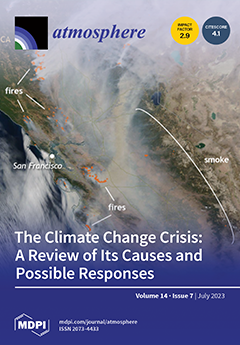
Notwithstanding decades of international research and debate and increasingly ominous scientific warnings since the first IPCC assessment (in 1990), the failure of climate change mitigation through carbon emissions reduction is depressingly clear. Many reasons have been identified for our collective failure to bend the global emissions curve. These reasons include economic, geo-political, psychological and sociological factors. This review discusses societal progress to address the climate crisis since the landmark 2015 COP21 meeting and examines the likelihood of keeping warming below 1.5C and what remaining actions may yet be taken to ameliorate the problem. View this paper
  • Issues are regarded as officially published after their release is announced to the table of contents alert mailing list.
  • You may sign up for e-mail alerts to receive table of contents of newly released issues.
  • PDF is the official format for papers published in both, html and pdf forms. To view the papers in pdf format, click on the "PDF Full-text" link, and use the free Adobe Reader to open them.
Order results
Result details
Section
Select all
Export citation of selected articles as:
15 pages, 3043 KiB  
Article
Impacts of UHI on Heating and Cooling Loads in Residential Buildings in Cities of Different Sizes in Beijing–Tianjin–Hebei Region in China
by Fanchao Meng, Guoyu Ren and Ruixue Zhang
Atmosphere 2023, 14(7), 1193; https://doi.org/10.3390/atmos14071193 - 24 Jul 2023
Cited by 1 | Viewed by 1122
Abstract
The heating and cooling energy consumption levels of urban buildings account for a large and rapidly growing proportion of the total end-use energy consumption of society. The urban heat island (UHI) effect is an important factor influencing the spatiotemporal variations in the heating [...] Read more.
The heating and cooling energy consumption levels of urban buildings account for a large and rapidly growing proportion of the total end-use energy consumption of society. The urban heat island (UHI) effect is an important factor influencing the spatiotemporal variations in the heating and cooling energy consumption levels of buildings. However, there is a lack of research on the impact of the UHI on the heating and cooling energy consumption of buildings in cities of different sizes in the Beijing–Tianjin–Hebei urban agglomeration, which is the most urbanized region in northern China. We selected rural reference stations using the remote sensing method, and applied an hourly data set from automatic weather stations, to examine the impact of the UHI on the typical residential building heating and cooling loads in three cities of varied sizes in the Beijing–Tianjin–Hebei urban agglomeration through building energy simulation. The main conclusions were as follows. As the UHI intensity (UHII) increased, the heating load difference between urban and rural areas decreased, while the cooling load difference between urban and rural areas increased in the cities. The average daily heating loads in the urban areas of Beijing, Tianjin, and Shijiazhuang were 8.14, 10.71, and 2.79% lower than those in their rural areas, respectively, while the average daily cooling loads in the urban areas were 6.88, 6.70, and 0.27% higher than those in their rural areas, respectively. Moreover, the absolute hourly load differences between urban and rural areas were significantly larger during the heating periods than during the cooling periods, with the former characterized by being strong at night and weak during the day. During the peak energy load period, the contribution of the UHI to the peak load of residential buildings varied between the cities. During the stable high-load period, from 18:00 to 07:00 the next day in the heating periods (from 18:00 to 05:00 the next day in the cooling periods), the hourly loads in the urban areas of Beijing, Tianjin, and Shijiazhuang were 3.15 (2.48), 3.88 (1.51), and 1.07% (1.09%) lower (higher) than those in their rural areas, respectively. Our analysis highlights the necessity to differentiate the energy supplies for the heating and cooling of urban buildings in different sized cities in the region. Full article
(This article belongs to the Special Issue Urban Heat Islands and Global Warming (2nd Edition))
Show Figures

Figure 1

17 pages, 3380 KiB  
Article
Hybrid Deep Learning Model for Mean Hourly Irradiance Probabilistic Forecasting
by Vateanui Sansine, Pascal Ortega, Daniel Hissel and Franco Ferrucci
Atmosphere 2023, 14(7), 1192; https://doi.org/10.3390/atmos14071192 - 24 Jul 2023
Cited by 2 | Viewed by 995
Abstract
For grid stability, operation, and planning, solar irradiance forecasting is crucial. In this paper, we provide a method for predicting the Global Horizontal Irradiance (GHI) mean values one hour in advance. Sky images are utilized for training the various forecasting models along with [...] Read more.
For grid stability, operation, and planning, solar irradiance forecasting is crucial. In this paper, we provide a method for predicting the Global Horizontal Irradiance (GHI) mean values one hour in advance. Sky images are utilized for training the various forecasting models along with measured meteorological data in order to account for the short-term variability of solar irradiance, which is mostly caused by the presence of clouds in the sky. Additionally, deep learning models like the multilayer perceptron (MLP), convolutional neural networks (CNN), long short-term memory (LSTM), or their hybridized forms are widely used for deterministic solar irradiance forecasting. The implementation of probabilistic solar irradiance forecasting, which is gaining prominence in grid management since it offers information on the likelihood of different outcomes, is another task we carry out using quantile regression. The novelty of this paper lies in the combination of a hybrid deep learning model (CNN-LSTM) with quantile regression for the computation of prediction intervals at different confidence levels. The training of the different machine learning algorithms is performed over a year’s worth of sky images and meteorological data from the years 2019 to 2020. The data were measured at the University of French Polynesia (17.5770° S, 149.6092° W), on the island of Tahiti, which has a tropical climate. Overall, the hybrid model (CNN-LSTM) is the best performing and most accurate in terms of deterministic and probabilistic metrics. In addition, it was found that the CNN, LSTM, and ANN show good results against persistence. Full article
(This article belongs to the Special Issue Problems of Meteorological Measurements and Studies)
Show Figures

Figure 1

25 pages, 11887 KiB  
Article
Spider Lightning Characterization: Integrating Optical, NLDN, and GLM Detection
by Gilbert Green and Naomi Watanabe
Atmosphere 2023, 14(7), 1191; https://doi.org/10.3390/atmos14071191 - 24 Jul 2023
Viewed by 1199
Abstract
Here, we investigate the characteristics of spider lightning analyzing individual lightning flashes as well as the overall electric storm system. From July to November 2022, optical camera systems captured the visually spectacular spider lightning in Southwest Florida. The aspects and activities of the [...] Read more.
Here, we investigate the characteristics of spider lightning analyzing individual lightning flashes as well as the overall electric storm system. From July to November 2022, optical camera systems captured the visually spectacular spider lightning in Southwest Florida. The aspects and activities of the discharges were analyzed by merging the video images with lightning flash data from the National Detection Lightning Network (NLDN) and the Geostationary Lightning Mapper (GLM). Spider lightning discharges primarily occurred during the later stages of the overall lightning activity when there was a decrease in the flash count and flash locations were drifting apart. The propagation path of the spider discharge was predominantly luminous and exhibited an extended duration, ranging from 300 ms to 1720 ms, with most of the path remaining continuously illuminated. Occasionally, observed discharges produced cloud-to-ground flashes (CG) along their propagation paths. This study represents the first attempt to utilize video images, NLDN, and GLM data to investigate the correlation between visual observed spider lightning events and detection networks. These combined datasets facilitated the characterization of the observed spider lightning discharges. Full article
(This article belongs to the Special Issue Lightning Flashes: Detection, Forecasting and Hazards)
Show Figures

Figure 1

16 pages, 10032 KiB  
Article
A Comparative Analysis between Radar and Human Observations of the Giant Hail Event of 30 August 2022 in Catalonia
by Tomeu Rigo and Carme Farnell
Atmosphere 2023, 14(7), 1190; https://doi.org/10.3390/atmos14071190 - 24 Jul 2023
Viewed by 909
Abstract
Three facts characterise the hailstorm of 30 August 2022 in the Catalan village of La Bisbal d’Empordà and its surroundings: first, the most dramatic, the death of a child hit by a hailstone; second, the damage to most of the roofs and cars [...] Read more.
Three facts characterise the hailstorm of 30 August 2022 in the Catalan village of La Bisbal d’Empordà and its surroundings: first, the most dramatic, the death of a child hit by a hailstone; second, the damage to most of the roofs and cars in the town; finally, the highest recorded amount of hail (more than 10 cm) in Catalonia in at least the last 30 years. This research focuses on the radar field comparison and the observations provided by an electronic survey of the study area. The results reveal that weather radar underestimated the hail size because of different factors. Conversely, some reporters provided an inaccurate hour. The difference of three months between the hail event and the electronic survey is the probable cause of this mistake in the time estimation. However, the survey delay helped to avoid answers with larger hail sizes than those provided by the official spotters. Full article
(This article belongs to the Section Meteorology)
Show Figures

Figure 1

15 pages, 3188 KiB  
Article
Influence of the Madden–Julian Oscillation (MJO) on Tropical Cyclones Affecting Tonga in the Southwest Pacific
by Moleni Tu’uholoaki, Antonio Espejo, Krishneel K. Sharma, Awnesh Singh, Moritz Wandres, Herve Damlamian and Savin Chand
Atmosphere 2023, 14(7), 1189; https://doi.org/10.3390/atmos14071189 - 24 Jul 2023
Viewed by 1329
Abstract
The modulating influence of the Madden–Julian oscillation (MJO) on tropical cyclones (TCs) has been examined globally, regionally, and subregionally, but its impact on the island scale remains unclear. This study investigates how TC activity affecting the Tonga region is being modulated by the [...] Read more.
The modulating influence of the Madden–Julian oscillation (MJO) on tropical cyclones (TCs) has been examined globally, regionally, and subregionally, but its impact on the island scale remains unclear. This study investigates how TC activity affecting the Tonga region is being modulated by the MJO, using the Southwest Pacific Enhanced Archive of Tropical Cyclones (SPEArTC) and the MJO index. In particular, this study investigates how the MJO modulates the frequency and intensity of TCs affecting the Tonga region relative to the entire study period (1970–2019; hereafter referred to as all years), as well as to different phases of the El Niño southern oscillation (ENSO) phenomenon. Results suggest that the MJO strongly modulates TC activity affecting the Tonga region. The frequency and intensity of TCs is enhanced during the active phases (phases six to eight) in all years, including El Niño and ENSO-neutral years. The MJO also strongly influences the climatological pattern of genesis of TCs affecting the Tonga region, where more (fewer) cyclones form in the active (inactive) phases of the MJO and more genesis points are clustered (scattered) near (away from) the Tonga region. There were three regression curves that best described the movement of TCs in the region matching the dominant steering mechanisms in the Southwest Pacific region. The findings of this study can provide climatological information for the Tonga Meteorological Service (TMS) and disaster managers to better understand the TC risk associated with the impact of the MJO on TCs affecting the Tonga region and support its TC early warning system. Full article
(This article belongs to the Special Issue Weather and Climate Extremes: Observations, Modeling, and Impacts)
Show Figures

Figure 1

14 pages, 3023 KiB  
Article
Spatiotemporal Characteristics of Drought in Northwest China Based on SPEI Analysis
by Yongqin Peng, Tao Peng and Yan Li
Atmosphere 2023, 14(7), 1188; https://doi.org/10.3390/atmos14071188 - 23 Jul 2023
Cited by 4 | Viewed by 1062
Abstract
Drought has a direct impact on regional agricultural production, ecological environment, and economic development. The northwest region of China is an important agricultural production area, but it is also one of the most serious areas of water shortage due to drought and little [...] Read more.
Drought has a direct impact on regional agricultural production, ecological environment, and economic development. The northwest region of China is an important agricultural production area, but it is also one of the most serious areas of water shortage due to drought and little rain. It is of great significance to make full use of agricultural resources to clarify the temporal and spatial distribution characteristics of the drought regime in Northwest China. Based on the Standardized Precipitation Evapotranspiration Index (SPEI), this paper used the methods of Mann–Kendall non-parameter trend, mutation test, and Morlet wavelet analysis to explore the drought characteristics in Northwest China from 1961 to 2017. The results showed that the spatial distribution of SPEI on annual and seasonal scales differed slightly in different regions, but from northwest to southeast, the distribution was generally wetter to drier. The drought intensity (Sij) had a step-like distribution with a range of 1.14–1.98. Based on Sij analysis, the frequency of drought in Northwest China was moderate, followed by extreme drought, severe drought, and light drought. The inter-annual drought station proportion (Pj) ranged from 7.4% to 84.1%. A total of 25, 18, 7, and 5 years of pan-regional drought, regional drought, partial region drought, and local drought occurred, respectively, based on Pj analysis. Moreover, from the whole study period, the regional drought changes tended to cause humidification to different degrees. The results of Morlet wavelet analysis showed that there were multiple time scales of 33–52, 11–19, and 4–7 years of SPEI in the entire time domain, and dry and wet trends occurred. The results of the present research can provide a reference for the efficient utilization of water resources, drought monitoring and early warning, drought prevention, and drought relief in Northwest China. Full article
(This article belongs to the Special Issue Climate Extremes in China)
Show Figures

Figure 1

12 pages, 3465 KiB  
Article
Comprehensive Efficiency Evaluation of Aircraft Artificial Cloud Seeding in Hunan Province, China, Based on Numerical Simulation Catalytic Method
by Xiecheng Wan, Sheng Zhou and Zhichao Fan
Atmosphere 2023, 14(7), 1187; https://doi.org/10.3390/atmos14071187 - 23 Jul 2023
Viewed by 1907
Abstract
Aircraft cloud seeding refers to the use of equipment on aircraft to release chemicals into clouds, changing their physical and chemical properties to increase rainfall or snowfall. The purpose of precipitation enhancement is to alleviate drought and water scarcity issues. Due to the [...] Read more.
Aircraft cloud seeding refers to the use of equipment on aircraft to release chemicals into clouds, changing their physical and chemical properties to increase rainfall or snowfall. The purpose of precipitation enhancement is to alleviate drought and water scarcity issues. Due to the complexity of the technology, the precise control of factors such as cloud characteristics and chemical release amounts is necessary. Therefore, a scientific evaluation of the potential of aircraft cloud seeding can help to improve the effectiveness of the process, and is currently a technical challenge in weather modification. This study used the mesoscale numerical model WRF coupled with a catalytic process to simulate and evaluate the seven aircraft cloud seeding operations conducted in Hunan Province in 2021. The results show that WRF can effectively evaluate the effectiveness of cloud seeding. When the water vapor conditions are suitable, the airborne dispersion of silver iodide (AgI) can significantly increase the content of large particles of high-altitude ice crystals, snow, and graupel, resulting in an increase in low-level rainwater content and, correspondingly, an increase in ground precipitation. When the water vapor conditions are insufficient, the dispersion of AgI does not trigger effective precipitation, consistent with the results of station observations and actual flight evaluations. This study provides an effective method for scientifically evaluating the potential and effectiveness of aircraft cloud seeding operations. Full article
(This article belongs to the Special Issue Atmospheric Ice Nucleating Particles, Cloud and Precipitation)
Show Figures

Figure 1

15 pages, 1787 KiB  
Article
Computational Domain Size Effects on Large-Eddy Simulations of Precipitating Shallow Cumulus Convection
by Oumaima Lamaakel, Ravon Venters, Joao Teixeira and Georgios Matheou
Atmosphere 2023, 14(7), 1186; https://doi.org/10.3390/atmos14071186 - 22 Jul 2023
Cited by 1 | Viewed by 1393
Abstract
Idealized large-eddy simulations of shallow convection often utilize horizontally periodic computational domains. The development of precipitation in shallow cumulus convection changes the spatial structure of convection and creates large-scale organization. However, the limited periodic domain constrains the horizontal variability of the atmospheric boundary [...] Read more.
Idealized large-eddy simulations of shallow convection often utilize horizontally periodic computational domains. The development of precipitation in shallow cumulus convection changes the spatial structure of convection and creates large-scale organization. However, the limited periodic domain constrains the horizontal variability of the atmospheric boundary layer. Small computational domains cannot capture the mesoscale boundary layer organization and artificially constrain the horizontal convection structure. The effects of the horizontal domain size on large-eddy simulations of shallow precipitating cumulus convection are investigated using four computational domains, ranging from 40×40km2 to 320×320km2 and fine grid resolution (40 m). The horizontal variability of the boundary layer is captured in computational domains of 160×160km2. Small LES domains (≤40 km) cannot reproduce the mesoscale flow features, which are about 100km long, but the boundary layer mean profiles are similar to those of the larger domains. Turbulent fluxes, temperature and moisture variances, and horizontal length scales are converged with respect to domain size for domains equal to or larger than 160×160km2. Vertical velocity flow statistics, such as variance and spectra, are essentially identical in all domains and show minor dependence on domain size. Characteristic horizontal length scales (i.e., those relating to the mesoscale organization) of horizontal wind components, temperature and moisture reach an equilibrium after about hour 30. Full article
(This article belongs to the Section Atmospheric Techniques, Instruments, and Modeling)
Show Figures

Figure 1

12 pages, 3466 KiB  
Article
Why Does a Stronger El Niño Favor Developing towards the Eastern Pacific while a Stronger La Niña Favors Developing towards the Central Pacific?
by Jiahui Yu, Tim Li and Leishan Jiang
Atmosphere 2023, 14(7), 1185; https://doi.org/10.3390/atmos14071185 - 22 Jul 2023
Cited by 1 | Viewed by 1334
Abstract
By decomposing observed El Niño and La Niña events into a strong group and a weak group, respectively, we discovered that the strong La Niña group has its peak center more towards the west compared to the weak La Niña group, whereas the [...] Read more.
By decomposing observed El Niño and La Niña events into a strong group and a weak group, respectively, we discovered that the strong La Niña group has its peak center more towards the west compared to the weak La Niña group, whereas the strong El Niño group has its peak center more towards the east compared to the weak El Niño group. The cause of this structure asymmetry is investigated through an ocean mixed-layer heat budget analysis. It was found that the asymmetry is closely linked to the longitudinal distribution of SST anomaly (SSTA) skewness along the equator, and is fundamentally caused by nonlinear dynamic heating, especially nonlinear horizontal temperature advection. It was demonstrated that near the equatorial central Pacific, the anomalous zonal and meridional currents generate negative nonlinear zonal and meridional temperature advection anomalies for both the El Niño and La Niña events, thus favoring a stronger La Niña and a weaker El Niño. Over the eastern Pacific, due to the dominant geostrophic zonal current anomalies and the southward shift of SSTA centers, nonlinear horizontal temperature advection anomalies tend to be positive for both the El Niño and La Niña, thus favoring a stronger growth of El Niño than La Niña. Nonlinear vertical temperature advection anomalies play minor roles in the central Pacific and tend to partially offset the nonlinear horizontal advection effect in the equatorial eastern Pacific. Full article
(This article belongs to the Section Meteorology)
Show Figures

Figure 1

17 pages, 9898 KiB  
Article
Variability of River Runoff in Poland and Its Connection to Solar Variability
by Dariusz Wrzesiński, Leszek Sobkowiak, Ileana Mares, Venera Dobrica and Constantin Mares
Atmosphere 2023, 14(7), 1184; https://doi.org/10.3390/atmos14071184 - 22 Jul 2023
Cited by 2 | Viewed by 855
Abstract
The aim of this research was to determine relationships between solar activity and variability of discharges of three Central European rivers: the Vistula, Odra and Warta in Poland in the multi-annual period of 1901–2020. Changes in precipitation and air temperature at Poznań meteorological [...] Read more.
The aim of this research was to determine relationships between solar activity and variability of discharges of three Central European rivers: the Vistula, Odra and Warta in Poland in the multi-annual period of 1901–2020. Changes in precipitation and air temperature at Poznań meteorological station in the same period were also analyzed. The long-term variations in river runoff were investigated both from the point of view of temporal variability in relation to climate variations in the study area, and from the point of view of linear/non-linear links to solar activity, as described by the Wolf sunspot number. The wavelet transform analysis was used to highlight the frequency-time distribution of the coherences between solar and discharge variability. It was found that most of the links between solar activity and discharges were non-linear. Full article
(This article belongs to the Section Climatology)
Show Figures

Figure 1

16 pages, 511 KiB  
Communication
Climate Change: An Issue That Should Be Part of Workers’ Information and Training Duties Envisaged by EU Directives on Occupational Health and Safety
by Carlo Grandi, Andrea Lancia and Maria Concetta D’Ovidio
Atmosphere 2023, 14(7), 1183; https://doi.org/10.3390/atmos14071183 - 21 Jul 2023
Cited by 1 | Viewed by 1001
Abstract
The impact of climate change on the physical environment, ecosystems, and human societies is increasingly recognized as the most important global challenge. Climate change may alter, among others, the thermal environment, the occurrence of extreme weather events, and the human exposure to physical, [...] Read more.
The impact of climate change on the physical environment, ecosystems, and human societies is increasingly recognized as the most important global challenge. Climate change may alter, among others, the thermal environment, the occurrence of extreme weather events, and the human exposure to physical, chemical, and biological pollutants, thus affecting human health with several potential outcomes. The impact of climate change on occupational health and safety has been receiving increasing attention in last years. In the European Union, the health and safety of workers is under the rule of Directive 89/391 and its daughters. In a changing climate, compliance with all requirements of the existing EU regulation entails an additional effort to implement preventive and protective measures. A central role in workers’ health protection is played by proper workers’ information and training, which is partly in charge of the occupational physicians. This paper provides a basic proposal on topics related to climate change to update workers’ information and training and to integrate the curricula of occupational physicians. Importantly, suitable information and training may contribute to promoting workers’ health and to implement adaptation measures, which are part of the individual, societal, and global responses to climate change. Full article
(This article belongs to the Special Issue Aerobiology and Health Impacts)
Show Figures

Figure 1

14 pages, 10287 KiB  
Article
Application of the Self-Organizing Map Method in February Temperature and Precipitation Pattern over China: Comparison between 2021 and 2022
by Zengping Zhang, Yu Gu, Zhikuan Wang, Siyuan Luo, Siyuan Sun, Shuting Wang and Guolin Feng
Atmosphere 2023, 14(7), 1182; https://doi.org/10.3390/atmos14071182 - 21 Jul 2023
Viewed by 928
Abstract
In this study, we compared two anomalous wet February periods in 2021 and 2022 in China. The same anomalies appeared in the spatial distribution of precipitation, with anomalous precipitation centered over the southeast coast. However, temperature discrepancies appeared in most of China, with [...] Read more.
In this study, we compared two anomalous wet February periods in 2021 and 2022 in China. The same anomalies appeared in the spatial distribution of precipitation, with anomalous precipitation centered over the southeast coast. However, temperature discrepancies appeared in most of China, with anomalously high temperatures in 2021 and lower temperatures in 2022. Both instances of increased precipitation were attributed to warm and moist advection from the south, with transport in 2021 being partly enhanced by the South China Sea cyclone, whereas transport in 2022 was mainly due to the subtropical western North Pacific anticyclone. Therefore, in this study, we aimed to compare and analyze temperature and precipitation anomalies in February 2021 and 2022 using the self-organizing map method. Warm events in East Asia and cold events in Siberia and the Tibetan Plateau types were obtained by mode 1, which contained 2021. Mode 6 exhibited opposite warm types in Siberia and cold types in southern Asia, including February temperature and precipitation anomalies in 2022. Based on the results of this study, we can conclude that precipitation anomalies in February 2021 and 2022 occurred under different temperature and circulation anomalies, and both were influenced by La Niña events. Autumn sea ice loss in the Barents Sea contributed significantly to warm and rainy events in February 2021. However, the cold and rainy events of February 2022 were closely related to the strengthening of the Siberian High. Full article
(This article belongs to the Special Issue Extreme Climate in Arid and Semi-arid Regions)
Show Figures

Figure 1

16 pages, 4024 KiB  
Article
Development and Application of a Novel Snow Peak Sighting Forecast System over Chengdu
by Chengwei Lu, Ting Chen, Xinyue Yang, Qinwen Tan, Xue Kang, Tianyue Zhang, Zihang Zhou, Fumo Yang, Xi Chen and Yuancheng Wang
Atmosphere 2023, 14(7), 1181; https://doi.org/10.3390/atmos14071181 - 21 Jul 2023
Viewed by 923
Abstract
As air quality has improved rapidly in recent years, the public has become more interested in whether a famous snow peak, Yaomei Feng on the Tibetan Plateau, can be seen from Chengdu, a megacity located on the western plain of the Sichuan Basin, [...] Read more.
As air quality has improved rapidly in recent years, the public has become more interested in whether a famous snow peak, Yaomei Feng on the Tibetan Plateau, can be seen from Chengdu, a megacity located on the western plain of the Sichuan Basin, east of the plateau. Therefore, a threshold-method-based forecasting system for snow peak sighting was developed in this study. Variables from numerical models, including cloud–water mixing ratio, cloud cover over snow peak, water mixing ratio, PM2.5 concentration, and ground solar radiation, were used in the snow peak sighting forecast system. Terrain occlusion rate of each model grid was calculated. Monte Carlo simulations were applied for threshold determination. A WRF-CMAQ hindcast was conducted for 2020, owing to insufficient observation data, hindcast results on the snow peak sighting were compared with posts collected from social media. Estimations showed that the snow peak sighting forecast system performed well in reflecting the monthly trend of snow peak sightings, and the hindcast results matched the daily observations, especially from May to August. Accuracy of the snow peak sighting forecast model was 78.9%, recall value was 57.1%, and precision was 24.4%. Full article
(This article belongs to the Section Atmospheric Techniques, Instruments, and Modeling)
Show Figures

Figure 1

20 pages, 3476 KiB  
Review
The Impact of Shipping on Air Quality in the Port Cities of the Mediterranean Area: A Review
by Domenico Toscano
Atmosphere 2023, 14(7), 1180; https://doi.org/10.3390/atmos14071180 - 21 Jul 2023
Cited by 6 | Viewed by 2247
Abstract
Shipping emissions contribute significantly to air pollution at the local and global scales and will do so even more in the future because global maritime transport volumes are projected to increase. The Mediterranean Sea contains the major routes for short sea shipping within [...] Read more.
Shipping emissions contribute significantly to air pollution at the local and global scales and will do so even more in the future because global maritime transport volumes are projected to increase. The Mediterranean Sea contains the major routes for short sea shipping within Europe and between Europe and East Asia. For this reason, concern about maritime emissions from Mediterranean harbours has been increasing on the EU and IMO (International Maritime Organization, London, UK) agenda, also supporting the implementation of a potential Mediterranean Emission Control Area (MedECA). Many studies are concerned with the impact of ship emissions in port cities. Studies of the contributions of ship emissions to air quality at the local scale include several monitoring and modelling techniques. This article presents a detailed review of the contributions of ship emissions of NO2, SO2, PM10, and PM2.5 on air quality in the main ports in the Mediterranean area. The review extracts and summarises information from published research. The results show a certain variability that suggests the necessity of harmonisation among methods and input data in order to compare results. The analysis illustrates the effects of this pollution source on air quality in urban areas, which could be useful for implementing effective mitigation strategies. Full article
(This article belongs to the Special Issue Advances in Urban Air Pollution Observation and Simulation)
Show Figures

Figure 1

18 pages, 6585 KiB  
Article
Impact of Temperature Extremes on Carbon Emissions from Crop Production in Hebei Province, China
by Shuai Shao and Hongwu Qiao
Atmosphere 2023, 14(7), 1179; https://doi.org/10.3390/atmos14071179 - 21 Jul 2023
Viewed by 869
Abstract
The study investigated the impact of temperature extremes on carbon emissions (CE) from crop production. (1) Background: Many scholars have studied climate extremes. However, the research on the relationship between temperature extremes and CE is not extensive, which deserves attention. (2) Methods: The [...] Read more.
The study investigated the impact of temperature extremes on carbon emissions (CE) from crop production. (1) Background: Many scholars have studied climate extremes. However, the research on the relationship between temperature extremes and CE is not extensive, which deserves attention. (2) Methods: The study adopted a fixed-effect model to analyze the impact of temperature extremes on CE from crop production, and the moderating effect was tested using total factor productivity (TFP) in agriculture. (3) Results: Temperature extremes in Hebei Province were mainly reflected in a decline in the cold day index (TX10p) and a rise in the warm spell duration index (WSDI) and the number of summer days (SU25). Additionally, TX10p was positively correlated with CE. For every 1% reduction in TX10p, CE dropped by 0.237%. There was no significant correlation between WSDI and CE. Finally, the agricultural TFP had a significant moderating effect on CE, with each 1% increase resulting in a corresponding 0.081% decrease in CE. (4) Conclusions: The results indicated a warming trend in Hebei Province, which resulted in a decrease in the number of winter days, and reduced CE from crop production. The improvement of input efficiency in agricultural production factors helped moderate the CE. Full article
(This article belongs to the Section Biometeorology)
Show Figures

Figure 1

20 pages, 13271 KiB  
Article
Velocity Fluctuations Spectra in Experimental Data on Rayleigh–Taylor Mixing
by Kurt C. Williams and Snezhana I. Abarzhi
Atmosphere 2023, 14(7), 1178; https://doi.org/10.3390/atmos14071178 - 21 Jul 2023
Viewed by 827
Abstract
Rayleigh–Taylor (RT) interfacial mixing plays an important role in nature and technology, including atmospheric flows. In this work, we identify the physics properties of Rayleigh–Taylor mixing through the analysis of unprocessed experimental data. We consider the fluctuations spectra of the specific kinetic energy [...] Read more.
Rayleigh–Taylor (RT) interfacial mixing plays an important role in nature and technology, including atmospheric flows. In this work, we identify the physics properties of Rayleigh–Taylor mixing through the analysis of unprocessed experimental data. We consider the fluctuations spectra of the specific kinetic energy of each of the velocity components, and identify their spectral shapes, by employing the group theory guided foundations and the rigorous statistical method. We find the spectral shape parameters, including their mean values and relative errors, and apply the Anderson–Darling test to inspect the residuals and the goodness-of-fit. We scrupulously study the effect of the fitting window and identify, for each velocity component, the best fit interval, where the relative errors are small and the goodness of fit is excellent. We reveal that the fluctuations spectra in RT mixing experiments can be described by a compound function, being a product of a power-law and an exponential. The data analysis results unambiguously discovered the dynamic anisotropy and the dynamic bias of RT mixing and displayed the necessity to improve the design of experiments on RT mixing. Full article
Show Figures

Figure 1

19 pages, 4625 KiB  
Article
Reproducing High Spatiotemporal Resolution Precipitable Water Distributions Using Numerical Prediction Data
by Shin Akatsuka
Atmosphere 2023, 14(7), 1177; https://doi.org/10.3390/atmos14071177 - 21 Jul 2023
Viewed by 721
Abstract
Water vapor is an important greenhouse gas that affects regional climatic and weather processes. Atmospheric water vapor content is highly variable spatially and temporally, and continuous quantification over a wide area is problematic. However, existing methods for measuring precipitable water (PW) have advantages [...] Read more.
Water vapor is an important greenhouse gas that affects regional climatic and weather processes. Atmospheric water vapor content is highly variable spatially and temporally, and continuous quantification over a wide area is problematic. However, existing methods for measuring precipitable water (PW) have advantages and disadvantages in terms of spatiotemporal resolution. This study uses high temporal resolution numerical prediction data and high spatial resolution elevation to reproduce PW distributions with high spatiotemporal resolution. This study also focuses on the threshold for elevation correction, improving temporal resolution, and reproducing PW distributions in near real time. Results show that using the water vapor content in intervals between the ground surface and 1000-hPa isobaric surface as the threshold value for elevation correction and generating hourly numerical prediction data using the Akima spline interpolation method enabled the reproduction of hourly PW distributions for 75% of the global navigation satellite system observation stations in the target region throughout the year with a root mean square error of 3 mm or less. These results suggest that using the mean value of monthly correction coefficients for the past years enables the reproduction of PW distributions in near real time following the acquisition of numerical prediction data. Full article
(This article belongs to the Section Meteorology)
Show Figures

Figure 1

3 pages, 193 KiB  
Editorial
Climate Change and Its Impacts on Terrestrial Ecosystems: Recent Advances and Future Directions
by Cheng Li, Fan Yang, Qitao Xiao and Yao Gao
Atmosphere 2023, 14(7), 1176; https://doi.org/10.3390/atmos14071176 - 21 Jul 2023
Cited by 1 | Viewed by 1935
Abstract
With the increasing concentration of greenhouse gases in the atmosphere, climate change is now an indisputable fact and has strong impacts on various terrestrial ecosystems (e [...] Full article
19 pages, 4496 KiB  
Article
Volatility of a Ship’s Emissions in the Baltic Sea Using Modelling and Measurements in Real-World Conditions
by Oskari Kangasniemi, Pauli Simonen, Jana Moldanová, Hilkka Timonen, Luis M. F. Barreira, Heidi Hellén, Jukka-Pekka Jalkanen, Elisa Majamäki, Barbara D’Anna, Grazia Lanzafame, Brice Temime-Roussel, Johan Mellqvist, Jorma Keskinen and Miikka Dal Maso
Atmosphere 2023, 14(7), 1175; https://doi.org/10.3390/atmos14071175 - 20 Jul 2023
Viewed by 1163
Abstract
Shipping emissions are a major source of particulate matter in the atmosphere. The volatility of gaseous and particulate phase ship emissions are poorly known despite their potentially significant effect on the evolution of the emissions and their secondary organic aerosol (SOA) formation potential. [...] Read more.
Shipping emissions are a major source of particulate matter in the atmosphere. The volatility of gaseous and particulate phase ship emissions are poorly known despite their potentially significant effect on the evolution of the emissions and their secondary organic aerosol (SOA) formation potential. An approach combining a genetic optimisation algorithm with volatility modelling was used on volatility measurement data to study the volatility distribution of a ship engine’s emissions in real-world conditions. The fuels used were marine gas oil (MGO) and methanol. The engine was operated with 50% and 70% loads with and without active NOx after-treatment with selective catalytic reduction (SCR). The volatility distributions were extended to higher volatilities by combining the speciation information of the gas phase volatile organic compounds with particle phase volatility distributions and organic carbon measurements. These measurements also provided the emission factors of the gas and particle phase emissions. The results for the particle phase volatility matched well with the existing results placing most of the volatile organic mass in the intermediate volatile organic compounds (IVOC). The IVOCs also dominated the speciated gas phase. Partitioning of the emissions in the gas and particle phases was affected significantly by the total organic mass concentration, underlining the importance of the effect of the dilution on the phase of the emissions. Full article
(This article belongs to the Special Issue Atmospheric Shipping Emissions and Their Environmental Impacts)
Show Figures

Figure 1

20 pages, 1559 KiB  
Article
Classification of Weather Conditions Based on Supervised Learning for Swedish Cities
by Mohamad Safia, Rodi Abbas and Mohammad Aslani
Atmosphere 2023, 14(7), 1174; https://doi.org/10.3390/atmos14071174 - 20 Jul 2023
Viewed by 5191
Abstract
Weather forecasting has always been challenging due to the atmosphere’s complex and dynamic nature. Weather conditions such as rain, clouds, clear skies, and sunniness are influenced by several factors, including temperature, pressure, humidity, wind speed, and direction. Physical and complex models are currently [...] Read more.
Weather forecasting has always been challenging due to the atmosphere’s complex and dynamic nature. Weather conditions such as rain, clouds, clear skies, and sunniness are influenced by several factors, including temperature, pressure, humidity, wind speed, and direction. Physical and complex models are currently used to determine weather conditions, but they have their limitations, particularly in terms of computing time. In recent years, supervised machine learning methods have shown great potential in predicting weather events accurately. These methods use historical weather data to train a model, which can then be used to predict future weather conditions. This study enhances weather forecasting by employing four supervised machine learning techniques—artificial neural networks (ANNs), support vector machines (SVMs), random forest (RF), and k-nearest neighbors (KNN)—on three distinct datasets obtained from the Weatherstack database. These datasets, with varying temporal spans and uncertainty levels in their input features, are used to train and evaluate the methods. The results show that the ANN has superior performance across all datasets. Furthermore, when compared to Weatherstack’s weather prediction model, all methods demonstrate significant improvements. Interestingly, our models show variance in performance across different datasets, particularly those with predicted rather than observed input features, underscoring the complexities of handling data uncertainty. The study provides valuable insights into the use of supervised machine learning techniques for weather forecasting and contributes to the development of more precise prediction models. Full article
(This article belongs to the Section Atmospheric Techniques, Instruments, and Modeling)
Show Figures

Figure 1

12 pages, 2070 KiB  
Article
Inhibition of Dust Re-Deposition for Filter Cleaning Using a Multi-Pulsing Jet
by Quanquan Wu, Xiaohai Li, Zhenqiang Xing, Qin Kuang, Jianlong Li, Shan Huang, Hong Huang, Zhifei Ma and Daishe Wu
Atmosphere 2023, 14(7), 1173; https://doi.org/10.3390/atmos14071173 - 20 Jul 2023
Cited by 1 | Viewed by 862
Abstract
The re-deposition of detached dust during online pulse-jet cleaning is an important issue encountered during filter regeneration. To reduce dust re-deposition, multi-pulsing jet cleaning schemes were designed and experimentally tested. A pilot-scale pulse-jet cleaning dust collector was built with one vertically installed pleated [...] Read more.
The re-deposition of detached dust during online pulse-jet cleaning is an important issue encountered during filter regeneration. To reduce dust re-deposition, multi-pulsing jet cleaning schemes were designed and experimentally tested. A pilot-scale pulse-jet cleaning dust collector was built with one vertically installed pleated filter cartridge. The effects of pulse duration and interval on the pulse pressure were tested, and the dust re-deposition rate and mechanism were studied and analyzed. It was found that, for the single-pulsing jet, the pulse duration had a critical value of approximately 0.080 s in this test, above which the pulse pressure remained at approximately 0.75 kPa and did not increase further. For the multi-pulsing jet with a small pulse interval (less than approximately 0.10 s), the pulse flows superimposed and reached a higher pulse pressure with a slight inhibition of dust re-deposition. For the multi-pulsing jet with a long pulse interval (over 0.15 s), dust re-deposition was clearly inhibited. The re-deposition rate decreased from 63.8% in the single-pulsing scheme to 24.4% in the multi (five)-pulsing scheme with the same total pulse duration of 0.400 s. The multi-pulsing scheme lengthens the duration of reverse pulse flow, resulting in more elapsed time for the detached dust to freely fall, and inhibiting the re-deposition of dust. The elapsed time in the five-pulsing jet scheme with the recommended pulse duration of 0.080 s and interval of 0.25 s was 2.8 times higher than that of the single-pulsing jet with the same total pulse duration. Full article
(This article belongs to the Section Air Pollution Control)
Show Figures

Figure 1

19 pages, 4763 KiB  
Article
Seasonal Distribution and Source Apportionment of Chemical Compositions in PM2.5 in Nanchang, Inland Area of East China
by Hong Huang, Xin Yin, Yuan Tang, Changwei Zou, Jianlong Li, Chenglong Yu and Fangxu Zhu
Atmosphere 2023, 14(7), 1172; https://doi.org/10.3390/atmos14071172 - 20 Jul 2023
Cited by 2 | Viewed by 1250
Abstract
PM2.5 was sampled in four seasons of 2021 in Nanchang. Organic carbon (OC), elemental carbon (EC), and water-soluble ions were the main chemical compositions in PM2.5. The annual average of OC/PM2.5 and EC/PM2.5 was 17.1% and 2.1%, respectively, [...] Read more.
PM2.5 was sampled in four seasons of 2021 in Nanchang. Organic carbon (OC), elemental carbon (EC), and water-soluble ions were the main chemical compositions in PM2.5. The annual average of OC/PM2.5 and EC/PM2.5 was 17.1% and 2.1%, respectively, while nine water-soluble ions were 56.7%. The order of each ion percentage in PM2.5 was NO3 > SO42− > K+ > Na+ > NH4+ > Cl > NO2 > Ca2+ > Mg2+. The OC/EC (6.54, 13.17, 8.95, 7.99) and Char-EC/Soot-EC (0.88, 0.64, 1.32, 3.74) indicated that the carbon aerosols mainly originated from coal combustion, biomass combustion, and motor-vehicle emissions. High concentrations of Cl and Ca2+ in spring were associated with dust sources. A good correlation between Na+, SO42−, and NO3 suggests the formation of Na2SO4 and NaNO3. The results of PM2.5 source apportionment by positive matrix factorisation (PMF) showed five main sources: motor-vehicle sources (18–33%), secondary sources (16–36%), coal combustion sources (16–30%), biomass-combustion sources (10–28%), and dust sources (5–7%). Backward trajectory clustering analysis showed PM2.5 in spring and autumn were more influenced by medium distance and local air but mainly influenced by local sources in winter. Full article
(This article belongs to the Special Issue Characteristics and Control of Particulate Matter)
Show Figures

Figure 1

24 pages, 51226 KiB  
Article
Downscaling of Regional Air Quality Model Using Gaussian Plume Model and Random Forest Regression
by Marcin Kawka, Joanna Struzewska and Jacek W. Kaminski
Atmosphere 2023, 14(7), 1171; https://doi.org/10.3390/atmos14071171 - 20 Jul 2023
Viewed by 1493
Abstract
High PM10 concentrations are still a significant problem in many parts of the world. In many countries, including Poland, 50 μg/m3 is the permissible threshold for a daily average PM10 concentration. The number of people affected by [...] Read more.
High PM10 concentrations are still a significant problem in many parts of the world. In many countries, including Poland, 50 μg/m3 is the permissible threshold for a daily average PM10 concentration. The number of people affected by this threshold’s exceedance is challenging to estimate and requires high-resolution concentration maps. This paper presents an application of random forests for downscaling regional model air quality results. As policymakers and other end users are eager to receive detailed-resolution PM10 concentration maps, we propose a technique that utilizes the results of a regional CTM (GEM-AQ, with 2.5 km resolution) and a local Gaussian plume model. As a result, we receive a detailed, 250 m resolution PM10 distribution, which represents the complex emission pattern in a foothill area in southern Poland. The random forest results are highly consistent with the GEM-AQ and observed concentrations. We also discuss different strategies of training random forest on data using additional features and selecting target variables. Full article
(This article belongs to the Special Issue Machine Learning in Air Pollution)
Show Figures

Figure 1

14 pages, 7481 KiB  
Article
Vulnerability Identification and Analysis of Contributors to Desertification in Inner Mongolia
by Yang Chen, Long Ma, Tingxi Liu, Xing Huang and Guohua Sun
Atmosphere 2023, 14(7), 1170; https://doi.org/10.3390/atmos14071170 - 19 Jul 2023
Viewed by 974
Abstract
Desertification vulnerability and contributing factors are of global concern. This study analyzed the spatial and temporal distribution of net primary productivity (NPP), precipitation, and temperature from 1985 to 2015. The rain use efficiency (RUE) of vegetation was selected as an indicator; and desertification [...] Read more.
Desertification vulnerability and contributing factors are of global concern. This study analyzed the spatial and temporal distribution of net primary productivity (NPP), precipitation, and temperature from 1985 to 2015. The rain use efficiency (RUE) of vegetation was selected as an indicator; and desertification vulnerability and contributors were evaluated with the Mann–Kendall test (M–K test) and the Thornthwaite–Memorial model. The results showed that NPP was lower in that years that had lower precipitation and higher temperatures, and vice versa. NPP was spatially consistent with precipitation distribution and roughly opposite to the spatial distribution of the annual change rate of temperature. The desertification vulnerability decreased from west to east, among which both the western sub–region (WSR) and the central sub–region (CSR) had the largest proportion of regions with high desertification vulnerability. On the other hand, the eastern sub–region (ESR) mostly comprises areas with extremely low or low desertification vulnerability. The vulnerability contributors for desertification differed among each sub–region. The desertified regions in WSR and ESR were mainly influenced by human activity (HA), but primarily driven by the combined impact of Precipitation–Temperature (PT) and HA in CSR. The south–east part of the CSR was only affected by HA, whereas the lesser affected regions in the study area were affected by PT and HA simultaneously. The study provides recommendations for the improvement of regional ecological environments to prevent future disasters. Full article
Show Figures

Figure 1

17 pages, 4101 KiB  
Article
Assessing the Impact of Climate Change on the Biodeterioration Risk in Historical Buildings of the Mediterranean Area: The State Archives of Palermo
by Elena Verticchio, Francesca Frasca, Donatella Matè, Federico Maria Giammusso, Matilde Sani, Maria Letizia Sebastiani, Maria Carla Sclocchi and Anna Maria Siani
Atmosphere 2023, 14(7), 1169; https://doi.org/10.3390/atmos14071169 - 19 Jul 2023
Cited by 4 | Viewed by 946
Abstract
The growing sensitivity towards environmental sustainability, particularly in the light of climate change, requires a reflection on the role that historical buildings can play in heritage conservation. This research proposed an interdisciplinary approach combining climate and biological expertise to evaluate the biodeterioration risk [...] Read more.
The growing sensitivity towards environmental sustainability, particularly in the light of climate change, requires a reflection on the role that historical buildings can play in heritage conservation. This research proposed an interdisciplinary approach combining climate and biological expertise to evaluate the biodeterioration risk associated with different IPCC outdoor climate scenarios. Conduction heat transfer functions and dose–response functions were used to model the indoor climate of a historical building and the related climate-induced risk of mould and pest proliferation. The approach was applied to a case study in the Mediterranean area, i.e., the State Archives of Palermo (Italy) housed in a 15th-century convent. In 2018, a survey conducted by ICPAL-MiC experts warned about past infestations and risks deriving from climate conditions. An environmental monitoring campaign conducted in 2021 allowed for the characterisation of the buffering effect in a historical building in response to the outdoor climate and the simulation of future indoor climate. Since indoor temperature and mixing ratio are expected to raise in future scenarios, it was found that there is an increased risk of insects’ proliferation, combined with a decreased risk of spore germination and mould growth. Such evidence-based evaluation allows for the design of tailored preventive conservation measures to enhance the durability of both the archival collections and the building. Full article
(This article belongs to the Special Issue Microclimate of the Heritage Buildings)
Show Figures

Graphical abstract

18 pages, 8332 KiB  
Article
Application and Improvement of the Particle Swarm Optimization Algorithm in Source-Term Estimations for Hazardous Release
by Jinshu Lu, Mengqing Huang, Wenfeng Wu, Yonghui Wei and Chong Liu
Atmosphere 2023, 14(7), 1168; https://doi.org/10.3390/atmos14071168 - 19 Jul 2023
Viewed by 867
Abstract
Hazardous gas release can pose severe hazards to the ecological environment and public safety. The source-term estimation of hazardous gas leakage serves a crucial role in emergency response and safety management practices. Nevertheless, the precision of a forward diffusion model and atmospheric diffusion [...] Read more.
Hazardous gas release can pose severe hazards to the ecological environment and public safety. The source-term estimation of hazardous gas leakage serves a crucial role in emergency response and safety management practices. Nevertheless, the precision of a forward diffusion model and atmospheric diffusion conditions have a significant impact on the performance of the method for estimating source terms. This work proposes the particle swarm optimization (PSO) algorithm coupled with the Gaussian dispersion model for estimating leakage source parameters. The method is validated using experimental cases of the prairie grass field dispersion experiment with various atmospheric stability classes. The results prove the effectiveness of this method. The effects of atmospheric diffusion conditions on estimation outcomes are also investigated. The estimated effect in extreme atmospheric diffusion conditions is not as good as in other diffusion conditions. Accordingly, the Gaussian dispersion model is improved by adding linear and polynomial correction coefficients to it for its inapplicability under extreme diffusion conditions. Finally, the PSO method coupled with improved models is adapted for the source-term parameter estimation. The findings demonstrate that the estimation performance of the PSO method coupled with improved models is significantly improved. It was also found that estimated performances of source parameters of two correction models were significantly distinct under various atmospheric stability classes. There is no single optimal model; however, the model can be selected according to practical diffusion conditions to enhance the estimated precision of source-term parameters. Full article
(This article belongs to the Section Air Quality and Human Health)
Show Figures

Figure 1

15 pages, 1595 KiB  
Article
Estimation of Road Transportation Emissions in Colombia from 2010 to 2021
by Laura Mantilla-Romo, Yiniva Camargo-Caicedo, Sindy Bolaño-Diaz, Fredy Tovar-Bernal and Angélica Garrido-Galindo
Atmosphere 2023, 14(7), 1167; https://doi.org/10.3390/atmos14071167 - 19 Jul 2023
Viewed by 1214
Abstract
This work aimed to estimate the emissions associated with the transport sector in Colombia during the 2010–2021 period for the following four groups of pollutants: greenhouse gases or GHG (CO2, CH4, N2O), ozone precursors (CO, NMVOC, NO [...] Read more.
This work aimed to estimate the emissions associated with the transport sector in Colombia during the 2010–2021 period for the following four groups of pollutants: greenhouse gases or GHG (CO2, CH4, N2O), ozone precursors (CO, NMVOC, NOx), acidifying gases (NH3, SO2), and aerosols (PM, BC), based on the data provided by the Ministry of Mines and Energy. The estimate of emissions from road transportation was calculated using a standardized method with a top-down approach consistent with the 2006 IPCC Guidelines for National GHG Inventories and the EEA/EMEP Emission Inventory Guidebook 2019. Total annual emissions and the emissions for regions were estimated, and a comparison was made between estimated emissions and the emissions calculated by the Emissions Database for Global Atmospheric Research (EDGAR). Total annual emissions by road transport showed a progressive increase except for the annual emissions in 2020, which registered a reduction due to the COVID-19 lockdown. The highest yearly emissions were reported in 2021, with the most significant contributions by GHG (33,109.29 Gg CO2, 201.55 Gg CO2 Eq. CH4, and 512.43 Gg CO2 Eq. N2O). The Andean region was the one with the highest contributions of total emissions within the four groups of pollutants (57–66%), followed by the Caribbean (12–20%) and the Pacific region (14–18%). The most-used fuel was gasoline, with an increase of 103% for personal cars and motorcycles throughout the study period. These results contribute to decision-making at local, regional, and national levels regarding energy transition opportunities and strategies to adopt in the transport sector. Full article
(This article belongs to the Special Issue Traffic Related Emission)
Show Figures

Figure 1

3 pages, 167 KiB  
Editorial
CO2 Geological Storage and Utilization
by Liang Huang
Atmosphere 2023, 14(7), 1166; https://doi.org/10.3390/atmos14071166 - 19 Jul 2023
Cited by 2 | Viewed by 884
Abstract
With increasing greenhouse gas emissions caused by human activities, climate change is affecting the survival and development of human society [...] Full article
(This article belongs to the Special Issue CO2 Geological Storage and Utilization)
27 pages, 7064 KiB  
Article
Intelligent Identification and Verification of Flutter Derivatives and Critical Velocity of Closed-Box Girders Using Gradient Boosting Decision Tree
by Neyu Chen, Yaojun Ge and Claudio Borri
Atmosphere 2023, 14(7), 1165; https://doi.org/10.3390/atmos14071165 - 18 Jul 2023
Cited by 1 | Viewed by 1058
Abstract
Flutter derivatives (FDs) of the bridge deck are basic aerodynamic parameters by which flutter analysis determines critical flutter velocity (CFV), and they are traditionally identified by sectional model wind tunnel tests or computational fluid dynamics (CFD) numerical simulation. Based on some wind tunnel [...] Read more.
Flutter derivatives (FDs) of the bridge deck are basic aerodynamic parameters by which flutter analysis determines critical flutter velocity (CFV), and they are traditionally identified by sectional model wind tunnel tests or computational fluid dynamics (CFD) numerical simulation. Based on some wind tunnel testing results and numerical simulation data, the machine learning models for identifying FDs of closed-box girders are trained and developed via a gradient boosting decision tree in this study. The models can explore the underlying input–output transfer relationship of datasets and realize rapid intelligent identification of FDs without wind tunnel tests or numerical simulation. This method also provides a convenient and feasible option for expanding datasets of FDs, and the distribution of FDs can be analyzed through the post-interpretation of trained models. Combined with FD sensitivity analysis, the models can be verified by the calculation error of CFV. In addition, the proposed method can help determine the appropriate shape of the box girder cross-section in the preliminary design stage of long-span bridges and provide the necessary reference for aerodynamic shape optimization by modifying the local geometric features of the cross-section. Full article
(This article belongs to the Special Issue Advances in Computational Wind Engineering and Wind Energy)
Show Figures

Figure 1

20 pages, 2328 KiB  
Review
Impact of Modern Vehicular Technologies and Emission Regulations on Improving Global Air Quality
by Sai Sudharshan Ravi, Sergey Osipov and James W. G. Turner
Atmosphere 2023, 14(7), 1164; https://doi.org/10.3390/atmos14071164 - 18 Jul 2023
Cited by 5 | Viewed by 4153
Abstract
Over the past few decades, criteria emissions such as carbon monoxide (CO), hydrocarbons (HCs), nitrogen oxides (NOx) and particulate matter (PM) from transportation have decreased significantly, thanks to stricter emission standards and the widespread adoption of cleaner technologies. While air quality is a [...] Read more.
Over the past few decades, criteria emissions such as carbon monoxide (CO), hydrocarbons (HCs), nitrogen oxides (NOx) and particulate matter (PM) from transportation have decreased significantly, thanks to stricter emission standards and the widespread adoption of cleaner technologies. While air quality is a complex problem that is not solely dependent on transportation emissions, it does play a significant role in both regional and global air quality levels. Emission standards such as Euro 1–6 in Europe, Corporate Average Fuel Economy (CAFE) regulations, Tier I—III standards in the US and the low emission vehicle (LEV) program in California have all played a huge role in bringing down transportation emissions and hence improving air quality overall. This article reviews the effect of emissions from transportation, primarily focusing on criteria emissions from road transport emissions and highlights the impact of some of the novel technological advances that have historically helped meet these strict emission norms. The review also notes how modern road engine vehicles emissions compare with national and international aviation and shipping and discusses some of the suggested Euro 7 emissions standards and their potential to improve air quality. Full article
Show Figures

Figure 1

Previous Issue
Next Issue
Back to TopTop