Skip to Content
You are currently on the new version of our website. Access the old version .

Geosciences, Volume 10, Issue 9

2020 September - 54 articles

Cover Story: 
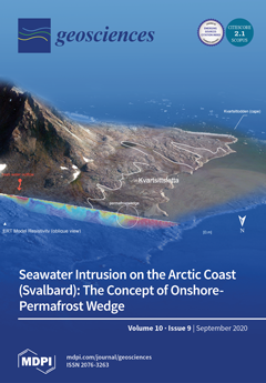
Geophysical measurements on the west coast of Svalbard indicate that the border between the unfrozen seabed and the frozen ground onshore is not delimited by the shoreline. A zone of coastal unfrozen ground is located under a thin layer of permafrost reaching toward the sea. The author proposes to name the structure detected in the coastal zone as a “permafrost wedge”, extending an identification of the permafrost base between the coast and the glaciers of Svalbard. View this paper
  • Issues are regarded as officially published after their release is announced to the table of contents alert mailing list .
  • You may sign up for email alerts to receive table of contents of newly released issues.
  • PDF is the official format for papers published in both, html and pdf forms. To view the papers in pdf format, click on the "PDF Full-text" link, and use the free Adobe Reader to open them.

Articles (54)

  • Article
  • Open Access
5 Citations
3,725 Views
33 Pages

22 September 2020

Geochemical characteristics of middle ocean ridge basalts (MORBs) testify partial melting of spinel-peridotite mixed with a few amounts of garnet-pyroxenite. The latter can be considered either autochthonous products of the crystallization of partial...

  • Article
  • Open Access
24 Citations
5,044 Views
30 Pages

21 September 2020

Morphometric analysis can be used to investigate catchment dynamics and tectonic processes responsible for the development of drainage catchments and to support flood risk assessment. In this study, a comparative GIS-based morphometric analysis betwe...

  • Article
  • Open Access
9 Citations
3,507 Views
21 Pages

Storm-Induced Boulder Displacements: Inferences from Field Surveys and Hydrodynamic Equations

  • Marco Delle Rose,
  • Corrado Fidelibus,
  • Paolo Martano and
  • Luca Orlanducci

19 September 2020

The storm of 12–13 November 2019 provoked the displacements of boulders on a central Mediterranean rocky coast; with reference to a selected area, prone to boulder production and geomorphologically monitored for years, a field-oriented study ap...

  • Review
  • Open Access
19 Citations
5,341 Views
19 Pages

19 September 2020

Thermochronometry is widely used to track exhumation, the motion of rock towards Earth’s surface, and to gain fresh insights into geodynamic and geomorphic processes. Applications require models to reconstruct a rock’s cooling history as...

  • Article
  • Open Access
31 Citations
7,578 Views
13 Pages

Natural Radioactivity of Laterite and Volcanic Rock Sample for Radioactive Mineral Exploration in Mamuju, Indonesia

  • Ilsa Rosianna,
  • Eka Djatnika Nugraha,
  • Heri Syaeful,
  • Sugili Putra,
  • Masahiro Hosoda,
  • Naofumi Akata and
  • Shinji Tokonami

19 September 2020

Mamuju is a region of Indonesia with relatively high exposure to natural radiation. Since 2012, Mamuju has been a uranium and thorium exploration area. Several mapping studies of the region have been carried out to depict NORM (naturally occurring ra...

  • Review
  • Open Access
23 Citations
16,156 Views
31 Pages

A Review of Tsunami Hazards in the Makran Subduction Zone

  • Amin Rashidi,
  • Denys Dutykh,
  • Zaher Hossein Shomali,
  • Nasser Keshavarz Farajkhah and
  • Mohammadsadegh Nouri

18 September 2020

The uncertain tsunamigenic potential of the Makran Subduction Zone (MSZ) has made it an interesting natural laboratory for tsunami-related studies. This study aims to review the recent activities on tsunami hazard in the Makran subduction zone with a...

  • Article
  • Open Access
7 Citations
3,314 Views
17 Pages

18 September 2020

Knowledge about extreme groundwater levels is needed to avoid structural or environmental damage by groundwater flooding. Typically, distributions of extreme groundwater levels are generated by interpolation between results derived from local extreme...

  • Article
  • Open Access
6 Citations
3,183 Views
13 Pages

17 September 2020

Cuttings/cores’ Headspace Isotope and Composition Analysis (HICA) provides an effective way to calculate the nano pore throat size and distributions much like nitrogen and CO2 adsorption BET/BJH analysis, and it could also provide information a...

  • Review
  • Open Access
12 Citations
4,864 Views
25 Pages

17 September 2020

Through time, the wide area between southeastern Tuscany, northeastern Latium, and western Umbria has been revealed as a crucial area for understanding the evolution of Neogene basins in northern Apennine. In this study, the results of twenty years o...

  • Article
  • Open Access
17 Citations
4,949 Views
21 Pages

16 September 2020

Morphodynamic processes on Earth are a result of sediment displacements by the flow of water or the action of wind. An essential part of sediment transport takes place with permanent or intermittent contact with the bed. In the past, numerous approac...

  • Article
  • Open Access
5 Citations
4,532 Views
21 Pages

16 September 2020

The petrographic composition and grain shape variability of beach gravels in the Pogorzelica–Dziwnów coast section (363.0 to 391.4 km of coastline), southern Baltic Sea, Poland were analyzed herein to characterize the lithodynamics and t...

  • Article
  • Open Access
11 Citations
4,232 Views
20 Pages

16 September 2020

The variability of currently available remote sensing datasets raises the question of which specific processing methods should be used for feature detection and feature extraction in both large and small-scale overhead images. In some cases, particul...

  • Review
  • Open Access
16 Citations
4,725 Views
18 Pages

15 September 2020

In the last 40 years, several models based on very different methodological approaches have been proposed to interpret the complex geodynamic evolution of the central-western Mediterranean area and, in particular, of the Cenozoic basins. The persiste...

  • Article
  • Open Access
11 Citations
4,430 Views
13 Pages

Quantitative Analysis of Pore Space Structure in Dry and Wet Soil by Integral Geometry Methods

  • Dmitriy Ivonin,
  • Timofey Kalnin,
  • Eugene Grachev and
  • Evgeny Shein

14 September 2020

We present a methodology for a numerical analysis of three-dimensional tomographic images in this paper. The methodology is based on integral geometry, topology, and morphological analysis methods. It involves calculating cumulative and non-cumulativ...

  • Article
  • Open Access
10 Citations
5,204 Views
12 Pages

11 September 2020

The advances and retreats of ice sheets during Pleistocene significantly changed high- and mid-latitude landscapes and hydrological systems, albeit differently, in North America and Europe. On the southern margin of the Last Glacial Maximum (LGM) in...

  • Article
  • Open Access
33 Citations
9,649 Views
22 Pages

11 September 2020

The application of unsaturated soil mechanics in routine geotechnical engineering applications requires the determination of unsaturated soil properties. Unfortunately, the cost of direct measurement of unsaturated soil properties goes beyond the fin...

  • Article
  • Open Access
3 Citations
4,244 Views
26 Pages

10 September 2020

Low-grade mylonitic shear zones are commonly characterized by strain partitioning, with alternating low strain protomylonite and high strain mylonite and ultramylonite, where the shearing is most significant. In this paper the capo Castello shear zon...

  • Article
  • Open Access
5 Citations
2,839 Views
13 Pages

10 September 2020

Currently, global climate change (GCC) and the urban heat island (UHI) phenomena are becoming serious problems, partly due to the artificial construction of the land surface. When sunlight reaches the land surface, some of it is absorbed and some is...

  • Article
  • Open Access
14 Citations
5,692 Views
18 Pages

6 September 2020

The 1963 Vajont landslide is a reference example of large rockslides involving clay interbeds emplaced in sedimentary rock masses in correspondence with the basal rupture zone (thinly stratified cherty limestone of the Fonzaso Formation dated to Midd...

  • Article
  • Open Access
6 Citations
2,878 Views
27 Pages

6 September 2020

The paper investigates the role of atmospheric circulation in the surface layer in forming the Arctic ice structure. For the analysis, the empirical orthogonal function (EOF) method of decomposition of the surface wind field is used, and the reaction...

  • Article
  • Open Access
6 Citations
3,977 Views
10 Pages

5 September 2020

Analyzing the results of triaxial compression tests under drained conditions for Erksak sand published in the literature, the stress–dilatancy relationships were described using the frictional state concept. At all phases of shearing, the linea...

  • Article
  • Open Access
16 Citations
4,339 Views
11 Pages

Ionosonde Data Analysis in Relation to the 2016 Central Italian Earthquakes

  • Alessandro Ippolito,
  • Loredana Perrone,
  • Angelo De Santis and
  • Dario Sabbagh

5 September 2020

Ionospheric characteristics and crustal earthquakes that occurred in 2016 next to the town of Amatrice, Italy are studied together with the previous events that took place from 1984 to 2009 in Central Italy. The earthquakes with M larger than 5.5 and...

  • Article
  • Open Access
21 Citations
5,944 Views
17 Pages

Soil Heating at High Temperatures and Different Water Content: Effects on the Soil Microorganisms

  • Ana Barreiro,
  • Alba Lombao,
  • Angela Martín,
  • Javier Cancelo-González,
  • Tarsy Carballas and
  • Montserrat Díaz-Raviña

5 September 2020

Soil properties determining the thermal transmissivity, the heat duration and temperatures reached during soil heating are key factors driving the fire-induced changes in soil microbial communities. The aim of the present study is to analyze, under l...

  • Article
  • Open Access
6 Citations
5,938 Views
26 Pages

5 September 2020

The authors of the presented paper tested the possible use of geophysical methods in the field of archaeological and constructional-historical research. It focused on the historical center of Prague, where we took measurements in the built-up areas c...

  • Article
  • Open Access
1 Citations
2,924 Views
23 Pages

5 September 2020

In this study, the spatial distribution of lignin-derived phenols, bulk elemental composition and different phosphorus (P) species in surface sediments along six rivers discharging into Zhejiang coast, Southeast China, were investigated to improve th...

  • Article
  • Open Access
5 Citations
3,500 Views
11 Pages

Fast Sampling Field Deployable Mud Gas Carbon Isotope Analyzer

  • Sheng Wu,
  • Andrei Deev,
  • Yan Zhuang,
  • Le Lu,
  • Zhengyou Wang,
  • Yongchun Tang and
  • Andrew Sneddon

4 September 2020

We report the details of a field deployable mud gas carbon isotope analyzer for mud gas analysis based on coupling a gas chromatograph with a mid-infrared spectrometer using a quantum cascade laser and hollow waveguide. The GC–IR2 (gas chromatograph–...

  • Article
  • Open Access
3 Citations
3,642 Views
23 Pages

4 September 2020

A simplified nonlinear dispersive Boussinesq system of the Benjamin–Bona–Mahony (BBM)-type, initially derived by Mitsotakis (2009), is employed here in order to model the generation and propagation of surface water waves over variable bot...

  • Article
  • Open Access
38 Citations
4,584 Views
22 Pages

4 September 2020

The objective of this study was to evaluate the performance of satellite rainfall estimates (Climate Hazards Group Infrared Precipitation with Stations version 2 (CHIRPSv2) and Multi-Source Weighted-Ensemble Precipitation version 2 (MSWEPv2) from 198...

  • Article
  • Open Access
48 Citations
9,861 Views
17 Pages

Volcanic Geomorphology: A Review of Worldwide Research

  • Paúl Carrión-Mero,
  • Néstor Montalván-Burbano,
  • Nataly Paz-Salas and
  • Fernando Morante-Carballo

3 September 2020

The purpose of this article is to provide an overview of academic research on volcanic geomorphology, through the use of bibliometric analysis and bibliographic visualization maps for the discernment of its growing interest by the academy in the last...

  • Article
  • Open Access
6 Citations
6,077 Views
23 Pages

3 September 2020

This study presented whole-rock elemental and Sr-Nd isotope geochemistry data with the purpose to decipher the origin and evolution of the Miocene Elmadağ Volcanic Complex, Central Anatolia (Ankara, Turkey). Volcanic products spanned in composition f...

  • Article
  • Open Access
19 Citations
5,491 Views
11 Pages

3 September 2020

Numerous hydrogeological studies on the coastal zone describe the intrusion of sea water inland, salting underground aquifers. The phenomenon is commonly observed in the coasts outside polar areas. However, the impact of sea water has so far not been...

  • Article
  • Open Access
11 Citations
4,454 Views
26 Pages

2 September 2020

The strontium isotope signature (87Sr/86Sr) of calcite precipitated in rock fractures and faults is a frequently used tool to trace paleofluid flow. However, bedrock fracture networks, such as in Precambrian cratons, have often undergone multiple fra...

  • Article
  • Open Access
51 Citations
9,652 Views
16 Pages

Migration of Natural Hydrogen from Deep-Seated Sources in the São Francisco Basin, Brazil

  • Frédéric-Victor Donzé,
  • Laurent Truche,
  • Parisa Shekari Namin,
  • Nicolas Lefeuvre and
  • Elena F. Bazarkina

2 September 2020

Hydrogen gas is seeping from the sedimentary basin of São Franciso, Brazil. The seepages of H2 are accompanied by helium, whose isotopes reveal a strong crustal signature. Geophysical data indicates that this intra-cratonic basin is characteri...

  • Article
  • Open Access
7 Citations
4,414 Views
20 Pages

A complex system of mono- and polymineralic centimeter-thick veins occurs within the ultrabasic amphibolites of Montigiu Nieddu hill in northeastern Sardinia, and they are filled with garnet, amphibole, chlorite, and epidote. Some garnet-rich veins a...

  • Article
  • Open Access
43 Citations
9,855 Views
11 Pages

Plastic Hotspot Mapping in Urban Water Systems

  • Paolo Tasseron,
  • Hestia Zinsmeister,
  • Liselotte Rambonnet,
  • Auke-Florian Hiemstra,
  • Daniël Siepman and
  • Tim van Emmerik

Reducing plastic pollution in rivers, lakes, and oceans is beneficial to aquatic animals and human livelihood. To achieve this, reliable observations of the abundance, spatiotemporal variation, and composition of plastics in aquatic ecosystems are cr...

  • Article
  • Open Access
3 Citations
3,368 Views
18 Pages

The lithobiont community encrusting an early Pleistocene palaeocliff cropping out north of Augusta (SE Sicily, Italy) was investigated based on field observations and laboratory inspection of two rocky samples. Bryozoans, serpulids, brachiopods and b...

  • Article
  • Open Access
6 Citations
6,715 Views
22 Pages

The Cretaceous sandstones of the Bredasdorp Basin were investigated to recognize their composition, provenance, and tectonic setting. Ninety-two samples of sandstones from exploration wells E-AH1, E-AJ1, E-BA1, E-BB1, and E-D3 were investigated using...

  • Article
  • Open Access
13 Citations
6,622 Views
19 Pages

Temporal Variability of Sediments, Dissolved Solids and Dissolved Organic Matter Fluxes in the Congo River at Brazzaville/Kinshasa

  • Guy Dieudonne Moukandi N’kaya,
  • Didier Orange,
  • Sandra Murielle Bayonne Padou,
  • Pankyes Datok and
  • Alain Laraque

For three decades, the solid and dissolved fluxes of the Congo River have been regularly monitored on a monthly basis, despite 12 years of deficiencies (1994–2005). Two programs successively carried out these follow-ups: PEGI/GBF (1987–19...

  • Article
  • Open Access
4 Citations
3,637 Views
26 Pages

Seismic wave-propagation simulations are limited in their frequency content by two main factors: (1) the resolution of the seismic wave-speed structure of the region in which the seismic waves are propagated through; and (2) the extent of our underst...

  • Article
  • Open Access
12 Citations
4,225 Views
19 Pages

Application of Nonhydraulic Delineation Method of Flood Hazard Areas Using LiDAR-Based Data

  • J. Carl Ureta,
  • Hamdi A. Zurqani,
  • Christopher J. Post,
  • Joan Ureta and
  • Marzieh Motallebi

Fluvial dynamics are an important aspect of land-use planning as well as ecosystem conservation. Lack of floodplain and flood inundation maps can cause severe implication on land-use planning and development as well as in disaster management. However...

  • Article
  • Open Access
9 Citations
12,261 Views
26 Pages

This article presents the results of multidisciplinary research undertaken in 2016–2019 at the German Nazi Treblinka I Forced Labour Camp. Housing 20,000 prisoners, Treblinka I was established in 1941 as a part of a network of objects such as f...

  • Article
  • Open Access
3 Citations
3,406 Views
10 Pages

Characterization of the Petrophysical Properties of the Timahdit Oil Shale Layers in Morocco

  • Hanane Sghiouri El Idrissi,
  • Abderrahim Samaouali,
  • Younes El Rhaffari,
  • Salah El Alami and
  • Yves Geraud

In this work, we study the variability of the lithological composition and organic matter content of samples were taken from the different layers M, X and Y of the Timahdit oil shale in Morocco, in order to experimentally analyze the impact of this v...

  • Article
  • Open Access
12 Citations
5,647 Views
15 Pages

Trash Dance: Anthropogenic Litter and Organic Matter Co-Accumulate on Urban Beaches

  • Raúl F. Lazcano,
  • Anna E. S. Vincent and
  • Timothy J. Hoellein

Anthropogenic litter (i.e., trash, AL) on beaches has negative ecological and economic impacts. Beach AL is likely moved together with coarse particulate organic matter (CPOM, algae, leaves), but no previous studies have assessed AL and CPOM co-distr...

  • Article
  • Open Access
2 Citations
3,317 Views
16 Pages

Earthquake Environmental Effects (EEEs) are a common occurrence following moderate to strong seismic events. EEEs are described in literary sources even for earthquakes that occurred hundreds of years ago, but their potential for hazard assessment is...

  • Article
  • Open Access
19 Citations
6,249 Views
32 Pages

Mapping of GIS-Flood Hazard Using the Geomorphometric-Hazard Model: Case Study of the Al-Shamal Train Pathway in the City of Qurayyat, Kingdom of Saudi Arabia

  • Ashraf Abdelkarim,
  • Seham S. Al-Alola,
  • Haya M. Alogayell,
  • Soha A. Mohamed,
  • Ibtesam I. Alkadi and
  • Ismail Y. Youssef

Drainage basins in dry and semiarid environments are exposed to sudden, irregular flooding that poses a threat to urban areas and infrastructure. The associated risk is exacerbated by land use changes. Geomorphometric analyses of drainage basins base...

  • Article
  • Open Access
14 Citations
4,984 Views
19 Pages

The attention to deep-seated gravitational slope deformations (DSGSDs) has steadily increased in the last few decades, because such features are ubiquitous in mountain areas. Their geomorphological surface expression, especially when related to the e...

  • Article
  • Open Access
39 Citations
5,110 Views
31 Pages

Soil Liquefaction Assessment Using Soft Computing Approaches Based on Capacity Energy Concept

  • Zhixiong Chen,
  • Hongrui Li,
  • Anthony Teck Chee Goh,
  • Chongzhi Wu and
  • Wengang Zhang

Soil liquefaction is one of the most complicated phenomena to assess in geotechnical earthquake engineering. The conventional procedures developed to determine the liquefaction potential of sandy soil deposits can be categorized into three main group...

  • Case Report
  • Open Access
4 Citations
4,172 Views
13 Pages

Urban Engineered Slope Collapsed in Rome on February 14th, 2018: Results from Remote Sensing Monitoring

  • Francesca Bozzano,
  • Carlo Esposito,
  • Paolo Mazzanti,
  • Federico Innocca and
  • Saverio Romeo

On February 14th, 2018, in the North-Western sector of the Municipality of Rome (Central Italy), in the framework of an excavation for building construction, a portion of a piling wall piling wall collapsed in an already densely urbanized area. Soil...

  • Article
  • Open Access
11 Citations
5,819 Views
21 Pages

In this study, 110 tidewater glaciers from Spitsbergen were studied to characterize the frontal zone using morphometric indicators. In addition, their time variability was also determined based on features of the active phase of glacier surges. Lands...

of 2

Get Alerted

Add your email address to receive forthcoming issues of this journal.

XFacebookLinkedIn
Geosciences - ISSN 2076-3263