Next Issue
Volume 15, December-2
Previous Issue
Volume 15, November-2
 
 
water-logo

Journal Browser

Journal Browser

Water, Volume 15, Issue 23 (December-1 2023) – 168 articles

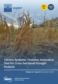
Cover Story (view full-size image): Droughts are a complex hazard with multiple, and often dramatic, impacts, depending on the environmental and societal contexts. In order to enhance our understanding of the interdisciplinary dynamics of droughts—an essential step to improve anticipation and crisis management by stakeholders—we develop a innovative cross-disciplinary analysis tool: the chrono-systemic timeline. This instrument provides a comprehensive visual representation of the crisis, simultaneously offering temporal and multi-sectoral perspectives through the integration of environmental, economic, social and political data. When applied to the 2018 drought in Wallonia (Belgium), the chrono-systemic timeline revealed many interdisciplinary connections and enables the management strategies to be criticised and adjusted in order to address future droughts effectively. View this paper
  • Issues are regarded as officially published after their release is announced to the table of contents alert mailing list.
  • You may sign up for e-mail alerts to receive table of contents of newly released issues.
  • PDF is the official format for papers published in both, html and pdf forms. To view the papers in pdf format, click on the "PDF Full-text" link, and use the free Adobe Reader to open them.
Order results
Result details
Section
Select all
Export citation of selected articles as:
28 pages, 48992 KiB  
Article
Waterborne Disease Risk Assessment and Mapping for a Floating Village by Combining 3D Hydraulic Simulation and Quantitative Microbial Risk Assessment
by Takashi Nakamura, Hideto Fujii, Toru Watanabe, Sarann Ly, Sambo Lun, Yoichi Fujihara, Keisuke Hoshikawa, Kazuhiko Miyanaga and Chihiro Yoshimura
Water 2023, 15(23), 4199; https://doi.org/10.3390/w15234199 - 4 Dec 2023
Cited by 1 | Viewed by 1888
Abstract
Spatiotemporal changes in waterborne disease risk were evaluated for the Chhnok Tru floating village in the Tonle Sap Lake by combining a hydraulic simulation and quantitative microbial risk assessment (QMRA). First, a three-dimensional (3D) hydraulic simulation was performed, and the transport of Escherichia [...] Read more.
Spatiotemporal changes in waterborne disease risk were evaluated for the Chhnok Tru floating village in the Tonle Sap Lake by combining a hydraulic simulation and quantitative microbial risk assessment (QMRA). First, a three-dimensional (3D) hydraulic simulation was performed, and the transport of Escherichia coli (E. coli) was simulated. Prior to the simulation, by coupling satellite imagery analysis using the normalized difference water index (NDWI) and a sounding survey using an acoustic Doppler current profiler (ADCP), a new digital elevation model was generated for the complex channel network with high resolution. The results of the 3D hydraulic simulation revealed the flow regime and nonuniform pathogen distribution in the floating village. QMRA was performed for the village using the E. coli distribution calculated by the 3D hydraulic model. Subsequently, the disease risk in the village was visualized through an effective and easy-to-understand disease risk map. To demonstrate the usefulness of the hydraulic-simulation-based disease risk map, the map was used to quantitatively compare simple policies by evaluating their reduction in disease risk. Full article
(This article belongs to the Special Issue Challenges to Interdisciplinary Application of Hydrodynamic Models)
Show Figures

Figure 1

13 pages, 4221 KiB  
Article
Study on Calculating Appropriate Impact Assessment for LID Facility Using A-I-R Curve
by Youngseok Song, Yoonkyung Park, Moojong Park and Jingul Joo
Water 2023, 15(23), 4198; https://doi.org/10.3390/w15234198 - 4 Dec 2023
Viewed by 1065
Abstract
Low impact development (LID) facilities are designed to maintain water circulation functions on the surface and subsurface. LID facilities can be applied to various areas and are expected to have both short-term and long-term effects, making them widely installed in urban areas. In [...] Read more.
Low impact development (LID) facilities are designed to maintain water circulation functions on the surface and subsurface. LID facilities can be applied to various areas and are expected to have both short-term and long-term effects, making them widely installed in urban areas. In this study, our objective is to calculate the A-I-R (Area ratio-rainfall Intensity-Runoff reduction rate) curve by applying design standards to tree filter boxes, garden plant pots, infiltration ditches, and rain barrels among various LID facilities. The analysis was conducted by constructing a SWMM-LID model and analyzing 209 items, considering the area ratio (A) and rainfall intensity (I) of the LID facilities. The runoff reduction rate (R) varies by LID facility according to the A-I-R curve. It reaches up to 100.0% for rain barrels, up to 30.0% for infiltration ditches, up to 20.0% for garden plant pot, and up to 12.0% for tree filter boxes. If the A-I-R curve of the LID facility is applied to the design standards, it is expected to facilitate the design of the facility’s size and inlet according to the target reduction rate. Full article
Show Figures

Figure 1

20 pages, 4606 KiB  
Article
Profiling of Antibiotic Residues in Soil and Vegetables Irrigated Using Pharmaceutical-Contaminated Water in the Delhi Stretch of the Yamuna River, India
by Suriyah Akhter, Mohd Aadil Bhat, Abeer Hashem, Elsayed Fathi Abd_Allah, Sirajuddin Ahmed, Weqar Ahmad Siddiqi, Isma Kulsoom and Fahim Un Nisa
Water 2023, 15(23), 4197; https://doi.org/10.3390/w15234197 - 4 Dec 2023
Cited by 4 | Viewed by 1956
Abstract
The movement of emerging pollutants, particularly antibiotics, from surface water to crops through the process of plant uptake poses a significant public concern related to the agricultural utilization of untreated water and biosolids. It is essential to consider the potential risk of inadvertent [...] Read more.
The movement of emerging pollutants, particularly antibiotics, from surface water to crops through the process of plant uptake poses a significant public concern related to the agricultural utilization of untreated water and biosolids. It is essential to consider the potential risk of inadvertent human exposure and the accumulation of drug residues in fresh food crops, particularly in the case of various green vegetables. Nowadays, environmental research is mainly focusing on the bioaccumulation and threat posed by pharmaceutical residues, especially antibiotics and personal care products in the soil–plant ecosystem. In the present study, the concentration of pharmaceuticals in soil samples collected from agricultural fields irrigated with Yamuna water were evaluated using suitable extraction and sophisticated instrumentation techniques. Out of the five sampling locations, the highest concentration of ofloxacin was reported at Site-V (0.265 µg/mg) during the premonsoon period and the lowest concentration (0.014 µg/mg) during the postmonsoon at Site-II, in terms of the average concentration; this could be due to the combined effect of anthropogenic activities, surface water runoff, and the combined load of drains in the vicinity. For the quantification of the selected antibiotics in a green leafy vegetable (Spinach oleracea), the concentration of ofloxacin was found to be the highest at Okhla barrage Site-V (5.586 µg/mg) during the premonsoon period, with the lowest concentration observed at Site-I, from 1.382 µg/mg to 1.698 µg/mg, during the postmonsoon period. The higher concentration of ofloxacin in crops is because of its susceptibility to being absorbed at the soil’s surface. Plant absorption of antibiotics is influenced primarily by the biological characteristics of the plant, encompassing factors like the lipid and carbohydrate composition of the plant roots. Additionally, the physiochemical properties of the drugs, including molecular size, Kow, and pKa, play a significant role in this process. The antibiotics showed greater variation in their concentration during the premonsoon than in the postmonsoon period, which may be because of precipitation, dilution, and the leaching effect of the soil. For all three of the drugs studied, the concentrations followed the order of ofloxacin > amoxicillin > erythromycin. Thus, the effective management of contaminated soils and vegetables must consider continuous monitoring and risk assessment of high-priority antibiotics to prevent negative effects on the natural environment and human health. Full article
(This article belongs to the Section Water Quality and Contamination)
Show Figures

Figure 1

9 pages, 762 KiB  
Editorial
Climate, Water, Soil
by Vasileios A. Tzanakakis and Andreas N. Angelakis
Water 2023, 15(23), 4196; https://doi.org/10.3390/w15234196 - 4 Dec 2023
Cited by 1 | Viewed by 1392
Abstract
“Climate” is a complex concept [...] Full article
(This article belongs to the Special Issue Climate, Water, and Soil)
Show Figures

Figure 1

16 pages, 4895 KiB  
Article
The Predictability of the 30 October 2020 İzmir-Samos Tsunami Hydrodynamics and Enhancement of Its Early Warning Time by LSTM Deep Learning Network
by Ali Rıza Alan, Cihan Bayındır, Fatih Ozaydin and Azmi Ali Altintas
Water 2023, 15(23), 4195; https://doi.org/10.3390/w15234195 - 4 Dec 2023
Cited by 2 | Viewed by 1303
Abstract
Although tsunamis occur less frequently compared to some other natural disasters, they can be extremely devastating in the nearshore environment if they occur. An earthquake of magnitude 6.9 Mw occurred on 30 October 2020 at 12:51 p.m. UTC (2:51 p.m. GMT+03:00) and its [...] Read more.
Although tsunamis occur less frequently compared to some other natural disasters, they can be extremely devastating in the nearshore environment if they occur. An earthquake of magnitude 6.9 Mw occurred on 30 October 2020 at 12:51 p.m. UTC (2:51 p.m. GMT+03:00) and its epicenter was approximately 23 km south of İzmir province of Turkey, off the Greek island of Samos. The tsunami event triggered by this earthquake is known as the 30 October 2020 İzmir-Samos (Aegean) tsunami, and in this paper, we study the hydrodynamics of this tsunami using some of these artificial intelligence (AI) techniques applied to observational data. More specifically, we use the tsunami time series acquired from the UNESCO data portal at different stations of Bodrum, Syros, Kos, and Kos Marina. Then, we investigate the usage and shortcomings of the Long Short Term Memory (LSTM) DL technique for the prediction of the tsunami time series and its Fourier spectra. More specifically we study the predictability of the offshore water surface elevation dynamics, their spectral frequency and amplitude features, possible prediction success and enhancement of the accurate early prediction time scales. The uses and applicability of our findings and possible research directions are also discussed. Full article
(This article belongs to the Section Oceans and Coastal Zones)
Show Figures

Figure 1

15 pages, 2882 KiB  
Article
Performance of LSTM over SWAT in Rainfall-Runoff Modeling in a Small, Forested Watershed: A Case Study of Cork Brook, RI
by Shiva Gopal Shrestha and Soni M. Pradhanang
Water 2023, 15(23), 4194; https://doi.org/10.3390/w15234194 - 4 Dec 2023
Cited by 3 | Viewed by 2717
Abstract
The general practice of rainfall-runoff model development towards physically based and spatially explicit representations of hydrological processes is data-intensive and computationally expensive. Physically based models such as the Soil Water Assessment tool (SWAT) demand spatio-temporal data and expert knowledge. Also, the difficulty and [...] Read more.
The general practice of rainfall-runoff model development towards physically based and spatially explicit representations of hydrological processes is data-intensive and computationally expensive. Physically based models such as the Soil Water Assessment tool (SWAT) demand spatio-temporal data and expert knowledge. Also, the difficulty and complexity is compounded in the smaller watershed due to data constraint and models’ inability to generalize hydrologic processes. Data-driven models can bridge this gap with their mathematical formulation. Long Short-Term Memory (LSTM) is a data-driven model with Recurrent Neural Network (RNN) architecture, which is better suited to solve time series problems. Studies have shown that LSTM models have competitive performance in watershed hydrology studies. In this study, a comparative analysis of SWAT and LSTM models in the Cork Brook watershed shows that results from LSTM were competitive to SWAT in flow prediction with NSE of 0.6 against 0.63, respectively, given the limited availability of data. LSTM models do not overestimate the high flows like SWAT. However, both these models struggle with low values estimation. Although interpretability, explainability, and use of models across different datasets or events outside of the training data may be challenging, LSTM models are robust and efficient. Full article
Show Figures

Figure 1

16 pages, 9185 KiB  
Article
Optimized Irrigated Water Management Using Numerical Flow Modeling Coupled with Finite Element Model: A Case Study of Rechna Doab, Pakistan
by Muhammad Sanaullah, Xiuquan Wang, Sajid Rashid Ahmad, Kamran Mirza, Muhammad Qasim Mahmood and Muhammad Kamran
Water 2023, 15(23), 4193; https://doi.org/10.3390/w15234193 - 4 Dec 2023
Cited by 1 | Viewed by 1243
Abstract
The fate of agriculture in Pakistan is predominantly concerned with excessive water mining threats to the subsurface water resources. The current study integrates the Visual MODFLOW-2000 application to estimate the water balance of an aquifer bounded by the Chenab River in the West [...] Read more.
The fate of agriculture in Pakistan is predominantly concerned with excessive water mining threats to the subsurface water resources. The current study integrates the Visual MODFLOW-2000 application to estimate the water balance of an aquifer bounded by the Chenab River in the West and the Ravi River in the East, which covers an area of about 2.98 million hectares. An assimilated method of groundwater flow is employed to characterize the flow dynamics of the Rechna Doab aquifer. The Digital Elevation Model (DEM) produced by the Shuttle Radar Topography Mission (SRTM) and a mesh of discretized cell size (2500 m) were incorporated into the model design. The conceptual model of the alluvial aquifer involves trifold vertical boundaries (an initial fold thickness set up to 150 m). The model input parameters are precipitation, seepage through irrigation, return flow, recharge, hydraulic conductivity and evapotranspiration. Empirical relations are established (at the basin scale) for the discharge input of irrigation canals. Model results confirm that groundwater flow follows the topographic configuration of the study area (i.e., northeast to southwest), and the seepage from irrigating canals and rainfall appeared to be the main source of groundwater recharge among various resources. The zone budget study under steady state simulation showed that the total direct recharge to the aquifer is calculated as 522,910 acre foot. The simulated water balance of the studied aquifer reflects more fluctuations in river leakage. The predictive optimized model reflects an adaptation of canal lining and installation of additional tube wells that will minimize canal seepage by 70% and lead to the reclamation of 37,000 acres of water-logged land for normal cropping. Full article
Show Figures

Figure 1

16 pages, 1644 KiB  
Review
Wastewater-Based Epidemiology: Assessing Illicit Drug Usage and Impact through an Innovative Approach
by Rongnan Yi, Taotao Zeng, Junhao Chen, Dongxian Liu, Xiaojing Yang, Mingming Zhao and Zeyan Zhou
Water 2023, 15(23), 4192; https://doi.org/10.3390/w15234192 - 4 Dec 2023
Cited by 2 | Viewed by 2942
Abstract
The abuse of illicit drugs, which is usually associated with violent crimes and public health issues, has evolved into a significant problem that the whole of society must address collectively. With the benefits of high productivity, convenience, objectivity, and semi-real time, wastewater-based epidemiology [...] Read more.
The abuse of illicit drugs, which is usually associated with violent crimes and public health issues, has evolved into a significant problem that the whole of society must address collectively. With the benefits of high productivity, convenience, objectivity, and semi-real time, wastewater-based epidemiology (WBE) has been demonstrated to be a powerful tool and has been utilized on a global scale for monitoring illicit drug use. In this review, we briefly introduce the development and application of WBE. Then, the stability of biomarkers is summarized, and methods to improve stability are introduced. We highlight recent advances in analytical techniques, from three aspects of chromatography–mass spectrometry, optical methods, and electrochemical strategies. The research progress of illicit drug abuse assessment based on WBE is summarized. Finally, we summarize the research hotspots and challenges on illicit drug abuse assessment based on WBE. Full article
(This article belongs to the Special Issue Wastewater-Based Epidemiology (WBE) Research)
Show Figures

Figure 1

19 pages, 6807 KiB  
Article
The Chemical Weathering of Rocks and Its Carbon Sink Effect in the Naqu River Basin of the Nujiang River Source Area, Southwest China
by Suming Ren, Heng Zhao, Xinli Hou, Honglu Zhang, Fuqiang Wang and Pingping Kang
Water 2023, 15(23), 4191; https://doi.org/10.3390/w15234191 - 4 Dec 2023
Viewed by 1234
Abstract
Carbon plays an important role in global climate change. The mechanisms of carbon sources and carbon sinks have also received wide attention from society, and the physical and chemical characteristics of riverine ions can reflect the chemical weathering of rocks and carbon sink [...] Read more.
Carbon plays an important role in global climate change. The mechanisms of carbon sources and carbon sinks have also received wide attention from society, and the physical and chemical characteristics of riverine ions can reflect the chemical weathering of rocks and carbon sink capacity of river basins. Based on the data on river, rainwater, and rock samples from 2019, this study used various methods, such as ion ratio diagrams and ternary diagrams, to analyze the chemical characteristics of water; the chemical weathering and carbon sink effects of rocks were also calculated while assuming three scenarios based on the main sources of ions in the Naqu River. The results showed that for the whole catchment, the main ion sources in the river were: carbonate rock chemical weathering > silicate rock chemical weathering > evaporite dissolution > atmospheric precipitation input. According to the calculations, in the three scenarios, the carbonate weathering rates were 16.84, 11.32, and 14.08 t/km2/yr, and the carbon sink capacities were 66.47, 121.13, and 93.80 mol/km2/yr, respectively; the evaporite weathering rates were 2.20, 9.63, and 5.92 t/km2/yr, respectively. The silicate chemical weathering rate and carbon sink capacity did not change significantly in either scenario, with 6.82 t/km2/yr and 248.6 mol/km2/yr, respectively. This study quantified the ion sources in the Naqu River basin and accurately analyzed their chemical genesis, which helps in understanding the role of the rivers of the Qinghai–Tibet Plateau in the global carbon cycle and global climate change, in addition to providing a reference for the scientific development of the Nujing River. Full article
Show Figures

Figure 1

18 pages, 4984 KiB  
Article
Adsorption of Sunscreen Compounds from Wastewater Using Commercial Activated Carbon: Detailed Kinetic and Thermodynamic Analyses
by Stefania Gheorghe, Vasile Ion Iancu, Ioana Alexandra Ionescu, Florinela Pirvu, Iuliana Claudia Paun, Luoana Florentina Pascu and Florentina Laura Chiriac
Water 2023, 15(23), 4190; https://doi.org/10.3390/w15234190 - 4 Dec 2023
Cited by 1 | Viewed by 1506
Abstract
Sunscreen compounds are one of the most toxic substances detected in the aqueous environment. However, these molecules are continuously utilized in a various range of products to provide protection against UV radiation. The removal of three sunscreen compounds, 4-hydroxybenzophenone (4-HBP), 2,4-dihydroxybenzophenone [...] Read more.
Sunscreen compounds are one of the most toxic substances detected in the aqueous environment. However, these molecules are continuously utilized in a various range of products to provide protection against UV radiation. The removal of three sunscreen compounds, 4-hydroxybenzophenone (4-HBP), 2,4-dihydroxybenzophenone (BP-1) and oxybenzone (BP-3), by commercial activated carbon (AC) was investigated using batch adsorption experiments. Different operational characteristics, such as adsorbent dosing, interaction time, solution pH and starting sunscreen compound concentration, were studied. The adsorption capacity of the AC material was assessed using a liquid chromatograph associated with a mass spectrometer detector (LC–MS/MS). Two isotherm models were utilized to explained the target compound adsorption phenomenon (Langmuir and Freundlich), while pseudo-first and -second kinetic orders and thermodynamics were utilized to examine the adsorption mechanism. The maximum adsorption capacities determined from the Langmuir isotherms were established as 43.8 mg/g for 4-HBP, 48.8 mg/g for BP-3 and 41.1 mg/g for BP-1. The thermodynamic parameters revealed the following: a negative ΔG° (<20 KJ/mol) and ΔH° and a positive ΔS° of the targeted sunscreen compounds adsorbed onto AC suggest a spontaneous and exothermic adsorption process, favored by lower temperature, proving that the physical sorption mechanism prevailed. Effective adsorption of 4-HBP, BP-3 and BP-1 from real wastewater samples proved the viability of sunscreen compound removal using commercial AC material. This paper offers promising results on a sustainable, economical and environmentally friendly method for removal of ubiquitous sunscreen compounds from wastewater, as a possible enhancement of treatment processes. Full article
Show Figures

Figure 1

14 pages, 3890 KiB  
Article
Three-Dimensional Static and Dynamic Analyses of an Embedded Concrete-Face Rockfill Dam
by Pengfei Qu, Junrui Chai and Zengguang Xu
Water 2023, 15(23), 4189; https://doi.org/10.3390/w15234189 - 4 Dec 2023
Cited by 3 | Viewed by 1175
Abstract
Concrete-face rockfill dams have gradually become the preferred dam type in the engineering community. This study presents a hydropower station in China as a case study to introduce a new type of embedded concrete-face rockfill dam. The static and dynamic stress–strain characteristics of [...] Read more.
Concrete-face rockfill dams have gradually become the preferred dam type in the engineering community. This study presents a hydropower station in China as a case study to introduce a new type of embedded concrete-face rockfill dam. The static and dynamic stress–strain characteristics of the proposed and conventional concrete-face rockfill dams were compared, and the optimal height of the embedded concrete body at the hydropower station was determined. The results indicate that, under static conditions, the embedded concrete body could reduce deformation upstream and downstream of the rockfill body, eliminate tensile stress along the concrete-face slab slope, reduce concrete-face slab deflection, and increase the maximum deflection area to 0.47 times the dam height. The inhibitory effect of the embedded concrete body on the stress and strain of the dam body became more evident as the size of the embedded body increased. Although the embedded concrete body did not enhance the dynamic and superposed static–dynamic stress states of the embedded concrete body and rockfill, the stress and strain increase in the dynamic state were within a controllable range. Through a sensitivity analysis and considering the terrain conditions and engineering cost of the hydropower station, the height of the embedded concrete body is recommended to be 0.4 times the dam height. Full article
(This article belongs to the Special Issue Hydrological Simulation for Erosion and Infiltration)
Show Figures

Figure 1

14 pages, 18907 KiB  
Article
Effect of Flow on the Energy Conversion Characteristics of Multiphase Pumps Based on Energy Transport Theory
by Manqi Tang, Guangtai Shi, Wenjuan Lv, Xiaodong Peng and Zongliu Huang
Water 2023, 15(23), 4188; https://doi.org/10.3390/w15234188 - 4 Dec 2023
Viewed by 1067
Abstract
Multiphase pumps operate under different flow conditions with different work performance. In order to reveal the energy conversion regulations in multiphase pumps under different flows, this paper presents an analysis of the effects of different flows on the pressure propulsion power, Lamb vector [...] Read more.
Multiphase pumps operate under different flow conditions with different work performance. In order to reveal the energy conversion regulations in multiphase pumps under different flows, this paper presents an analysis of the effects of different flows on the pressure propulsion power, Lamb vector dispersion, and vortex enstrophy dissipation in the pressurization unit of a multiphase pump based on energy transport theory. It is found that at different flows, the pressure propulsion power near the impeller inlet decreases sharply, the pressure propulsion power is mainly located in the first half of the impeller near the suction side of the blade, and with the increase in the flow, the pressure propulsion power in the pressurization unit increases gradually, as well as its energy loss, while the Lamb vector dispersion gradually increases and the area of scattering region tends to be narrow under the small impeller tip clearance, while the Lamb vector dispersion region area slowly decreases with the flow rate when the impeller tip clearance is larger. The effect of flow on the vortex enstrophy dissipation in the multiphase pump is mainly located in the middle of the impeller near the blade pressure surface, and as the flow increases, the value of the vortex enstrophy dissipation in the impeller pressurization unit increases accordingly, and the vortex enstrophy dissipation in the first half of the impeller is even more chaotic. The investigation results have significant theoretical meaning for the deep mastery of the energy conversion characteristics in multiphase pumps. Full article
(This article belongs to the Special Issue Design and Optimization of Fluid Machinery)
Show Figures

Figure 1

18 pages, 4554 KiB  
Article
Effect of Deficit Irrigation on Growth Parameters of the Salvia splendens L. Plant
by Işık Sezen, Sevda Yağanoğlu, Elif Akpınar Külekçi and Ayşe Karahan
Water 2023, 15(23), 4187; https://doi.org/10.3390/w15234187 - 4 Dec 2023
Viewed by 1311
Abstract
This study aims to investigate alterations in the developmental parameters of Salvia splendens L., a commonly utilized seasonal flower associated with excessive water consumption in urban green spaces, through the implementation of deficit irrigation practices. Four distinct irrigation treatments, which entailed maintaining the [...] Read more.
This study aims to investigate alterations in the developmental parameters of Salvia splendens L., a commonly utilized seasonal flower associated with excessive water consumption in urban green spaces, through the implementation of deficit irrigation practices. Four distinct irrigation treatments, which entailed maintaining the evaporation pot’s water level at 100% (control), 75%, 50%, and 25% of the pot’s water-holding capacity, were established. This study scrutinized 18 growth parameters to assess the impact of varying water application levels. The findings of this research revealed that Salvia splendens L. plants exhibited more substantial improvements in 17 out of 18 assessed parameters when subjected to 75% water application (representing a 25% reduction in water supply) in comparison to 100% water application (with no reduction). Notably, the only parameter negatively affected by reduced water availability in Salvia splendens L. was the diameter of the flowers. Thus, it is recommended to reduce water application by 25% when cultivating Salvia splendens L. in urban areas. Such a measure is expected to yield substantial water conservation benefits in urban landscaping. Consequently, it is advisable to promote the frequent utilization of Salvia splendens L. plants in urban green spaces, given their robust development even under conditions of water scarcity. Full article
(This article belongs to the Special Issue Agricultural Practices to Improve Irrigation Sustainability)
Show Figures

Figure 1

18 pages, 7427 KiB  
Article
Photodegradation of Methylene Blue and Crystal Violet by Zr-Modified Engelhard Titanium Silicate 10
by Hristina Lazarova, Rusi Rusew, Kostadin Iliev, Liliya Tsvetanova, Borislav Barbov and Boris Shivachev
Water 2023, 15(23), 4186; https://doi.org/10.3390/w15234186 - 4 Dec 2023
Viewed by 1342
Abstract
The present work focuses on the removal of dyes from polluted water, and, more precisely, the targets are crystal violet (CV) and methylene blue (MB). For this purpose, a series of Zr-modified catalysts based on microporous Engelhard Titanium Silicate 10 (ETS-10) were developed [...] Read more.
The present work focuses on the removal of dyes from polluted water, and, more precisely, the targets are crystal violet (CV) and methylene blue (MB). For this purpose, a series of Zr-modified catalysts based on microporous Engelhard Titanium Silicate 10 (ETS-10) were developed and synthesized. Aiming at improvement in the photodegradation efficiency and stability of ETS-10, Zr centers replacing part of Ti ones were introduced during the synthesis procedure. The obtained Na-K-ETS-10/xZr catalysts were characterized by X-ray powder diffraction (XRD), wavelength dispersive X-ray fluorescence (WDXRF), N2 physisorption and Fourier transform infrared spectroscopy (FTIR). The photocatalytic properties of Na-K-ETS-10/xZr- (x = 5, 10, 15 and 20 wt% Zr) catalysts were studied in terms of water purification from crystal violet and methylene blue. The Na-K-ETS-10/xZr wt% x = 6 catalyst appeared to be the most efficient in the photodegradation of CV and MB, removing nearly 100% of the dyes. Kinetic studies showed that the removal of CV and MB is a rapid process and one, which obeys the non-linear pseudo-second-order model. Full article
Show Figures

Figure 1

19 pages, 2026 KiB  
Article
Mitigating Ammonia, Methane, and Carbon Dioxide Emissions from Stored Pig Slurry Using Chemical and Biological Additives
by Oumaima El bied, Martire Angélica Terrero Turbí, Amalia García-Valero, Ángel Faz Cano and José A. Acosta
Water 2023, 15(23), 4185; https://doi.org/10.3390/w15234185 - 4 Dec 2023
Cited by 4 | Viewed by 1880
Abstract
This study addresses the challenge of mitigating ammonia and greenhouse gas (GHG) emissions from stored pig slurry using chemical and biological additives. The research employs dynamic chambers to evaluate the effectiveness of these additives. Chemical agents (sulfuric acid) and biological additives (DAB bacteria) [...] Read more.
This study addresses the challenge of mitigating ammonia and greenhouse gas (GHG) emissions from stored pig slurry using chemical and biological additives. The research employs dynamic chambers to evaluate the effectiveness of these additives. Chemical agents (sulfuric acid) and biological additives (DAB bacteria) containing specific microbial strains are tested (a mixture of Rhodopseudomonas palustris, Bacillus subtilis, Bacillus amyloliquefaciens, Bacillus licheniformis, Nitrosomona europea, Nictobacter winogradaskyi, and nutritional substrate). Controlled experiments simulate storage conditions and measure emissions of ammonia, methane, and carbon dioxide. Through statistical analysis of the results, this study evaluates the additives’ impact on emission reduction. Sulfuric acid demonstrated a reduction of 92% in CH4, 99% in CO2, and 99% in NH3 emissions. In contrast, the biological additives showed a lesser impact on CH4, with an 8% reduction, but more substantial reductions of 71% for CO2 and 77% for NH3.These results shed light on the feasibility of employing these additives to mitigate environmental impacts in pig slurry management and contribute to sustainable livestock practices by proposing strategies to reduce the ecological consequences of intensive animal farming. Full article
(This article belongs to the Section Wastewater Treatment and Reuse)
Show Figures

Figure 1

18 pages, 5162 KiB  
Article
Confining Stress Response to Hydraulic Fracturing Volumetric Opening on the Representative Volume Element (RVE) Scale
by Shuaifang Guo, Yunxing Cao, Li Wang, Xinsheng Zhang, Wenying Zhang, Haixiao Lin, Zhengzheng Cao and Bingbing Meng
Water 2023, 15(23), 4184; https://doi.org/10.3390/w15234184 - 4 Dec 2023
Viewed by 1175
Abstract
Confining stress response is considered an accompanying behavior of hydraulic fracturing. Along these lines, an evaluation model of confining stress response was presented in this work. It was established on a rock representative volume element (RVE) and based on the hydraulic volumetric opening [...] Read more.
Confining stress response is considered an accompanying behavior of hydraulic fracturing. Along these lines, an evaluation model of confining stress response was presented in this work. It was established on a rock representative volume element (RVE) and based on the hydraulic volumetric opening model, which stems from the theories of poroelasticity, breakdown damage, and hydraulic fracture mechanics. From the extracted outcomes, it was demonstrated that the confinement of the stress response depends on the matching among the characteristic parameters (εb,εs,m) of the rock breakdown, the volumetric opening, and channel flow regimes of the fracturing fluid. Examples in four limiting fracturing regimes show that (1) the confinement of the stress response is strongly determined by the existence of various fracturing regimes and takes place in a different manner during fracture initiation and opening. More specifically, during fracturing initiation, the ratio of the confining stress response to the far-field stress (Pcmax/σh) is 2.0500 in the M regime, 1.9600 in the M˜ regime, 2.7126 in the K regime, and 1.7448 in the K˜ regime, while when the fracture is opened, these values (PC/σh) are 1.8994, 1.8314, 1.6378, and 1.2846, respectively. (2) The impact of the confined stress response to the fluid pressure is also affected by the fracturing regimes; e.g., in both M and M˜ regimes, the peak confinement stress responses lag behind peak pore pressures, but in the K and K˜ regimes, lag off disappears. (3) The pore volumetric opening (Vpe) leads to an increase in the confining stress response, while the fracture opening (Vpd) leads to a reduction in the confining stress response. Full article
Show Figures

Figure 1

12 pages, 891 KiB  
Editorial
Managed Aquifer Recharge: A Key to Sustainability
by Enrique Fernández Escalante, Catalin Stefan, Christopher J. Brown and Adam Hutchinson
Water 2023, 15(23), 4183; https://doi.org/10.3390/w15234183 - 4 Dec 2023
Viewed by 1753
Abstract
“Managed Aquifer Recharge: A Key to Sustainability” is the title of the fourth Special Issue presented by the journal Water (MDPI), dedicated to the 11th International Symposium on Managed Aquifer Recharge (ISMAR 11) that was held between 11 and 15 April 2022 in [...] Read more.
“Managed Aquifer Recharge: A Key to Sustainability” is the title of the fourth Special Issue presented by the journal Water (MDPI), dedicated to the 11th International Symposium on Managed Aquifer Recharge (ISMAR 11) that was held between 11 and 15 April 2022 in Long Beach, California, USA [...] Full article
(This article belongs to the Special Issue Managed Aquifer Recharge: A key to Sustainability)
Show Figures

Figure 1

16 pages, 2824 KiB  
Article
Acute and Subchronic Exposure of the Common Carp (Cyprinus carpio) to Herbicide S-Metolachlor
by Božidar Rašković, Vesna Poleksić, Gorica Vuković, Bojana Špirović Trifunović, Gavrilo Božić, Dejana Ćupić Miladinović, Zoran Marković and Dragica Brkić
Water 2023, 15(23), 4182; https://doi.org/10.3390/w15234182 - 4 Dec 2023
Viewed by 1427
Abstract
S-metolachlor is one of the most frequently used herbicides worldwide. However, toxicity studies of this herbicide to aquatic organisms are scarce. In the present study, two experiments were conducted to test the effects of S-metolachlor on common carp, one of the [...] Read more.
S-metolachlor is one of the most frequently used herbicides worldwide. However, toxicity studies of this herbicide to aquatic organisms are scarce. In the present study, two experiments were conducted to test the effects of S-metolachlor on common carp, one of the most economically important fish species, with a distribution throughout the world: (1) 96 h acute semi-static toxicity test, aiming to determine LC50; (2) a subchronic semi-static test that lasted 28 days, in which juvenile carp were exposed to 3%, 8%, and 25% of previously determined LC50—0.5 mg·L−1, 1.4 mg·L−1, and 4.1 mg·L−1, respectively. Several biomarkers were employed to assess fish responses to toxicants. Blood biochemistry analysis and nuclear alterations of erythrocytes did not show any difference among experimental groups. Semi-quantitative histopathological analysis revealed mild alterations in the gills and liver, where oedema of secondary epithelium of gills and leukocyte infiltration in liver were significantly higher in fish exposed to 1.4 mg·L−1 and 4.1 mg·L−1. Histopathological indices in liver, as well as the total histopathological index, also showed significantly higher scores in the same groups. Bioconcentration factors of S-metolachlor ranged from 3.2 to 9.4, depending on the experimental group. Full article
Show Figures

Figure 1

14 pages, 2740 KiB  
Article
Influence of Climatic Factors on the Water Footprint of Dairy Cattle Production in Hungary—A Case Study
by István Waltner, Attila Ribács, Borbála Gémes and András Székács
Water 2023, 15(23), 4181; https://doi.org/10.3390/w15234181 - 4 Dec 2023
Cited by 2 | Viewed by 1272
Abstract
Our study aims to provide a look at how the production of dairy cattle is affecting water resources in Hungary. Utilizing the AquaCrop model and field data from a selected field in Hungary, we focused on the evapotranspiration (ET) and water [...] Read more.
Our study aims to provide a look at how the production of dairy cattle is affecting water resources in Hungary. Utilizing the AquaCrop model and field data from a selected field in Hungary, we focused on the evapotranspiration (ET) and water footprint (WF) of maize (the dominant component of silage mixes), while for other feed crops, we obtained data from scientific literature sources. We also considered drinking and servicing water consumption of dairy cattle, utilizing observations from a specific farm, as well as estimating potential heat stress at the country level. Our findings indicated increasing trends of crop ET as well as biomass production for maize, without significant correlations between the two parameters. Spatiotemporal analysis revealed a significant rise in the number of days with potential heat stress based on temperature-humidity indices, manifesting in practically the entire area of Hungary. Thus, while crop ET rates and corresponding crop water use values (4989–5342 m3/ha) did not show substantial changes, maize WF in silage cultivation rose from 261.9 m3/t dry biomass in 2002 to 378.0 m3/t dry biomass in 2020. Feed and water intake was subsequently recorded on a cattle farm and assessed as green and blue water use. Drinking (blue) water uptake, ranging between 74.7 and 101.9 L/dairy cow/day, moderately correlated with temperature-humidity indices as heat stress indicators (r2 = 0.700–0.767, p < 0.05). Servicing water was not recorded daily, but was calculated as a daily average (18 L/dairy cow/day), and was also considered in blue water usage. In contrast, feed consumption at the cattle farm corresponded to 13,352 ± 4724 L green water/dairy cow/day. Our results indicate that while the WF of animal feed remains a dominant factor in the total water use of dairy cattle farms, drinking water consumption and related costs of adaptive measures (such as adaptive breeding, modified housing, and technological measures) are expected to increase due to potential heat stress, particularly in selected regions where farmers should focus more on housing and technological solutions, as well as selecting for thermotolerance. Full article
Show Figures

Figure 1

18 pages, 5152 KiB  
Article
The Effect of Soluble Sugar Degradation on the Evaporation of Compacted Clay
by Yuliang Guo, Liwen Cao, Zihaohan Sang and Rui Zhang
Water 2023, 15(23), 4180; https://doi.org/10.3390/w15234180 - 4 Dec 2023
Viewed by 1224
Abstract
In arid climates, evaporation and water loss in surface soil can lead to the development of shrinkage cracks in the soil. The crack network in contaminated soil sites can become a rapid pathway for the infiltration and transport of contaminations, thereby increasing the [...] Read more.
In arid climates, evaporation and water loss in surface soil can lead to the development of shrinkage cracks in the soil. The crack network in contaminated soil sites can become a rapid pathway for the infiltration and transport of contaminations, thereby increasing the range of soil contamination. Dense contaminated clay samples were prepared by using glucose as a representative soluble sugar of domestic source contaminations. Through indoor evaporation simulation tests, the effect of soluble sugar anaerobic degradation on the water loss, deformation, and crack growth of compacted clay was analyzed, and the mechanism of this effect was revealed. The results showed that glucose increased the water-holding capacity of clay, while the anaerobic degradation of glucose decreased the water-holding capacity of clay. Although glucose anaerobic degradation reduced the overall deformation of dense clay, it promoted the development of evaporative cracks on the surface of dense clay. Soluble sugar anaerobic degradation mainly affected the evaporative cracking of clay by “forming hydrogen bonds to reduce the rate of evaporative water loss in clay” and “generating CO2 to alter the structure of the clay”. Full article
(This article belongs to the Section Soil and Water)
Show Figures

Figure 1

15 pages, 2301 KiB  
Article
Estimating the Economic Effect of the South-to-North Water Transfer Project on Beijing—An Applied Computable General Equilibrium Analysis
by Yinsheng Xu, Yanjie Bi, Jing Zhao and Jingjing Duan
Water 2023, 15(23), 4179; https://doi.org/10.3390/w15234179 - 4 Dec 2023
Viewed by 1456
Abstract
What exactly is the contribution of the South-to-North Water Transfer Project (SNWTP)? This is a subject of much debate. There are concerns about the possible effects on the macroeconomy. Most previous studies have tried to answer this question. In order to answer this [...] Read more.
What exactly is the contribution of the South-to-North Water Transfer Project (SNWTP)? This is a subject of much debate. There are concerns about the possible effects on the macroeconomy. Most previous studies have tried to answer this question. In order to answer this question quantitatively, it is necessary to separate the effect of SNWTP from many influencing factors. A computable general equilibrium model (SICGE) was built to estimate the economic effect of the South-to-North Water Transfer Project on Beijing. This CGE model was modified by joining the subdivided water substitution module, the total water constraints module, and the water-capital substitution module. Two scenarios were set: one with SNWTP and one without SNWTP. The what-if scenario (without SNWTP) indicates that the water reduction poses a direct threat to economic growth. Employment, capital, and GDP are lower, largely due to water shortages suffered by many industries by comparative analysis with or without SNWTP. The water utilization for the water-intensive industry will decrease the most, and its output will also decrease the most. Without SNWTP, groundwater extraction will increase, which suggests that SNWTP water will tentatively replace groundwater. Full article
(This article belongs to the Special Issue China Water Forum 2023)
Show Figures

Figure 1

23 pages, 5441 KiB  
Review
Statistical Methods and Models for Pollutant Control in Municipal Surface Waters
by Irina Meghea
Water 2023, 15(23), 4178; https://doi.org/10.3390/w15234178 - 3 Dec 2023
Cited by 2 | Viewed by 1349
Abstract
This paper aims to systematize a series of statistical methods of analysis and control and proposes some forecast models for surface water pollution both in and near a large city. The monitoring data of heavy metals, nitrites, and phosphates collected for three years [...] Read more.
This paper aims to systematize a series of statistical methods of analysis and control and proposes some forecast models for surface water pollution both in and near a large city. The monitoring data of heavy metals, nitrites, and phosphates collected for three years are processed using different statistical tools. It is demonstrated that they are under statistical control, and appropriate mathematical models are formulated to allow for forecasting and understanding of the causes of the appearance and perpetuation of certain phenomena. A comparative analysis is made, and the generalization of some methods is considered as an analysis and control tool. Full article
(This article belongs to the Special Issue Wastewater Treatment Methods, Techniques and Processes)
Show Figures

Figure 1

14 pages, 2427 KiB  
Article
Research on Subsidence Prediction Method of Water-Conducting Fracture Zone of Overlying Strata in Coal Mine Based on Grey Theory Model
by Jinjun Li, Zhihao He, Chunde Piao, Weiqi Chi and Yi Lu
Water 2023, 15(23), 4177; https://doi.org/10.3390/w15234177 - 2 Dec 2023
Cited by 3 | Viewed by 1236
Abstract
The development height and settlement prediction of water-conducting fracture zones caused by coal seam mining play an important role in the stability of overburden aquifers and the safety of roadways. Based on the engineering geological data of the J60 borehole in the Daliuta [...] Read more.
The development height and settlement prediction of water-conducting fracture zones caused by coal seam mining play an important role in the stability of overburden aquifers and the safety of roadways. Based on the engineering geological data of the J60 borehole in the Daliuta Coal Mine and the mining conditions of the 2−2 coal seam, China, this study established a similar material test model of mining overburden. The deformation characteristics of overlying strata in the mining process of coal seam were studied by using distributed optical fiber sensing technology, and the development height of water flowing fractured zone was determined. According to the equidistant sampling characteristics of Brillouin optical time domain reflection technology and the principle of the grey theory model, the settlement prediction model of the water-conducting fracture zone was established. By analyzing and comparing the prediction accuracy of the GM (1, 1) model, grey progressive model, and metabolic model, the optimal method for settlement prediction of the water-conducting fracture zone was discussed. The results show that, for the metabolic model, with the increase in the number of test sets and the decrease in the number of prediction sets, the mean square error ratio c and the small error probability p of the prediction accuracy evaluation parameters display a downward trend. The accuracy is related to the sudden change in the settlement of the water-conducting fracture zone caused by the breaking of the key stratum of the overlying rock. The optimal time of test sets selected for the best settlement prediction model is 7~8, and that of prediction sets selected is 5~6. For the GM (1, 1) model and the grey progressive model, the prediction accuracy of mining overburden subsidence is grade 4, which is not suitable for settlement prediction of water-flowing fractured zones. Full article
Show Figures

Figure 1

15 pages, 2613 KiB  
Article
Asset Management of Wastewater Interceptors Adjacent to Bodies of Water
by Mohammad Damen Bani Fawwaz, Mohammad Najafi and Vinayak Kaushal
Water 2023, 15(23), 4176; https://doi.org/10.3390/w15234176 - 2 Dec 2023
Viewed by 1177
Abstract
Pipeline asset management derives from pipelines’ physical conditions, condition rating, and serviceability through investigating, monitoring, and analyzing the rupture history. The remaining asset life and structural condition of the pipeline network running near and under bodies of water are often hard to predict. [...] Read more.
Pipeline asset management derives from pipelines’ physical conditions, condition rating, and serviceability through investigating, monitoring, and analyzing the rupture history. The remaining asset life and structural condition of the pipeline network running near and under bodies of water are often hard to predict. In case of a pipeline failure, major damage may occur to the surrounding environment, adding up to disruptions in service and repair costs. This paper develops multinomial logistic regression (MLR) and binary logistic regression models to predict how the bodies of water could affect the soil surrounding wastewater interceptors. The models were developed based on data from the City of Fort Worth, Texas. This study concludes that the pipe diameter, pipe age, location of the pipeline with reference to bodies of water (far or near), and the pipe material are the most significant variables that affect the surrounding conditions and remaining life of wastewater interceptors. In future, a clearer perception through increased software development and machine learning for managing pipeline asset management would provide impacts on different parameters on pipelines’ expected life. Full article
Show Figures

Figure 1

13 pages, 5152 KiB  
Article
Monitoring of the Surface Water Regime of the Sava River Alluvium in Serbia Using Geographic Information System (GIS) Techniques
by Vesna Nikolić Jokanović, Dušan Jokanović, Radovan Savić, Tijana Vulević, Aleksandar Andjelković, Katarina Lazarević, Ranka Kovačević and Natalija Momirović
Water 2023, 15(23), 4175; https://doi.org/10.3390/w15234175 - 2 Dec 2023
Cited by 1 | Viewed by 1222
Abstract
In the spacious inundation area on the left bank of the lower course of the Sava River in Serbia, there is an abandoned meander Special Nature Reserve, “Obedska bara”, which represents a very important floodplain in this part of Europe. This area is [...] Read more.
In the spacious inundation area on the left bank of the lower course of the Sava River in Serbia, there is an abandoned meander Special Nature Reserve, “Obedska bara”, which represents a very important floodplain in this part of Europe. This area is characterized by an exceptional wealth of biodiversity with a significant presence of rare and endangered species of national and international importance. Hydrological conditions in the mentioned area were analyzed from the aspect of surface water movement in nature and conditions altered by human factors (after the construction of the road network, canals, etc.). The movement of surface water, i.e., the filling and emptying of the investigated area, parallel to the water level of the Sava River, is shown using a digital terrain model. Our simulation of the change in surface water level within the studied area included the display of underwater areas, both with the formation of a flood wave (i.e., increasing water level of the Sava) and with the outflow of water from the pond when the water level in the Sava was reduced in both scenarios (natural and conditions altered by human factors). GIS and terrain digitalization were used for geospatial and hydrological analyses and, based on this, maps that display endangered areas could be made. The obtained results show that the largest human impact was recorded at the water level of the Sava River 74 m above sea level. The aforementioned water regime changes were shown to negatively affect dominant vegetation, such as pedunculate oak and ash. Full article
(This article belongs to the Section Soil and Water)
Show Figures

Figure 1

25 pages, 11492 KiB  
Article
Influence of Natural and Social Economic Factors on Landscape Pattern Indices—The Case of the Yellow River Basin in Henan Province
by Suming Ren, Heng Zhao, Honglu Zhang, Fuqiang Wang and Huan Yang
Water 2023, 15(23), 4174; https://doi.org/10.3390/w15234174 - 2 Dec 2023
Cited by 2 | Viewed by 1243
Abstract
The Yellow River Basin holds significance as a vital ecological shield and economic hub within China. Adapting land utilization practices and optimizing landscape patterns are of paramount significance in preserving the ecological equilibrium of the Yellow River Basin while fostering high-quality economic development. [...] Read more.
The Yellow River Basin holds significance as a vital ecological shield and economic hub within China. Adapting land utilization practices and optimizing landscape patterns are of paramount significance in preserving the ecological equilibrium of the Yellow River Basin while fostering high-quality economic development. In this study, we selected the Yellow River Basin in Henan Province as our research area. We use a land use transition matrix and FRAGSTATS 4.2 software to analyze changes in land use and landscape patterns within the study area from 1990 to 2020. Furthermore, Geographical Detector is employed to explore the impact of different natural and social economic factors that have influenced the progress of the landscape surface pattern in the study area. Finally, to identify the zonal aggregation effects of primary components in connection with landscaping feature indices at the city dimension, we use bivariate local spatial autocorrelation. The results are as follows: (1) In terms of land use change characteristics, the area of cultivated land, grassland, shrubs, and bare land shows a decreasing tendency, the area of construction land and forest land shows an increasing tendency, and the water area fluctuates and changes. Most of the cultivated land is shifted to construction land, followed by forest land, construction land, and cultivated land mainly transferred from grassland. (2) At the level of type in terms of shifting landscape patterns, cultivated land, forest land, water, and construction land have a more complex landscape shape, reduced fragmentation, and better natural connectivity. At the overall level, the overall landscape pattern indices are relatively stable, with more patch types and a more balanced distribution. (3) The findings regarding influencing factors reveal that the primary industry output value, population, secondary industry output value, and temperature are the principal driving forces behind the progress of the landscape surface pattern. The main drivers have changed over time in different regions. As indicated by the findings from bivariate local spatial autocorrelation analysis, at the city scale, the leading cause of landscape fragmentation in Luoyang is the primary industry output value, while in Xinxiang, landscape fragmentation is primarily driven by the secondary industry output value and temperature. In this study, we introduce the bivariate local spatial autocorrelation method to analyze the clustering effects of key influencing factors and landscape patterns at the city scale. This is crucial for the harmonized growth of land use planning and the urban economy in the Yellow River Basin. Full article
Show Figures

Figure 1

16 pages, 6686 KiB  
Article
Evolution of Water-Conducting Fracture in Weakly Cemented Strata in Response to Mining Activity: Insights from Experimental Investigation and Numerical Simulation
by Quanhui Liu, Chenyao Zhou, Dan Ma, Yong Liu, Guanshi Wang and Zhen Huang
Water 2023, 15(23), 4173; https://doi.org/10.3390/w15234173 - 2 Dec 2023
Cited by 1 | Viewed by 1128
Abstract
The accurate prediction of the vertical extent of water-conducting fracture (WCF) zones in weakly cemented strata is particularly significant in preventing and controlling water hazards in western coal mines. The evolution of fractures in weakly cemented strata affected by mining disturbances was comprehensively [...] Read more.
The accurate prediction of the vertical extent of water-conducting fracture (WCF) zones in weakly cemented strata is particularly significant in preventing and controlling water hazards in western coal mines. The evolution of fractures in weakly cemented strata affected by mining disturbances was comprehensively analyzed by physical similarity models, numerical simulations, and field investigations. Results indicated that the development progress of water-conducting fractures can be divided into three phases: initial slow generation, subsequent rapid development, and eventual stabilization. The numerical simulation results revealed that in the initial stage of working face mining, the development of the plastic zone is limited, and there is minimal failure in the overlying strata; therefore, fractures are slowly produced without penetrating through the strata. When the plastic zone fully encompasses the entire main roof, it triggers severe shear failure in the overlying strata, resulting in rapid fracture propagation and penetration. Once the fracture height reaches a stable state, there is no further increase in the maximum vertical displacement of key strata, indicating the extensive collapse and compaction of the overburden as well as the stabilization of the fracture heights. A modified prediction equation for WCF in weakly cemented strata was obtained by correcting the traditional empirical formula based on field investigations. This modified prediction equation enhances the accuracy in predicting fracture heights and provides a theoretical reference to address the issue of the inaccurate prediction of the water-conducting fracture height in western mine rock strata. Full article
Show Figures

Figure 1

17 pages, 16394 KiB  
Article
Monitoring Water and Soil Salinity across Mentor Marsh to Investigate Their Temporal and Spatial Variability
by Suresh Sharma and Rajesh Bhatt
Water 2023, 15(23), 4172; https://doi.org/10.3390/w15234172 - 1 Dec 2023
Cited by 1 | Viewed by 1214
Abstract
In this study, the surface water salinity of Mentor Marsh, located in Northern Ohio, USA, was monitored for 3 years by establishing 10 monitoring stations, whereas sporadic surface water salinity data were recorded at more than 30 locations in the marsh for 5 [...] Read more.
In this study, the surface water salinity of Mentor Marsh, located in Northern Ohio, USA, was monitored for 3 years by establishing 10 monitoring stations, whereas sporadic surface water salinity data were recorded at more than 30 locations in the marsh for 5 years. In addition, eight additional monitoring stations were established for recording the soil salinity at various temporal scales, whereas spatially distributed soil salinity was measured across the marsh in more than 500 locations to develop the salinity mapping in the soil using the Kriging-Gaussian method. Our analysis suggested that the water salinity in the winter was generally higher than in the summer. While the majority of the sites reported higher soil salinity characterized by high variability during the winter season, some sites reported a higher soil salinity in summer with less variability. The analysis revealed that the salt used on the road for the deicing purpose during the snowfall period was the primary reason for the increase in the salinity concentration in water in the western basin of Mentor Marsh, whereas the salt fill sites and brine well were primarily responsible for the higher salinity concentration in the eastern basin. Also, the drainage from the Morton Salt Company was a contributing factor to the sudden spike in some of the stations of the eastern basin. Both the surface water and soil salinity were relatively higher in the eastern basin than in the western basin. Apparently, salinity from the brine well field and salt fill sites seem to be more considerable than the road salt. Full article
Show Figures

Figure 1

17 pages, 3020 KiB  
Article
Hydrochemical Characteristics and Quality Evaluation of Groundwater in Jinta Basin, Northwest China
by Xiaoyan Wang, Shuangbao Han, Mengnan Zhang, Sai Wang, Dechao Yin, Xi Wu, Huqun Cui and Yonghui An
Water 2023, 15(23), 4171; https://doi.org/10.3390/w15234171 - 1 Dec 2023
Cited by 2 | Viewed by 1370
Abstract
The ecological environment of the northwest inland basin is fragile. The groundwater environment is a crucial influencing factor for the harmonious and sustainable development of the local social economy and the ecological environment. It is significant to investigate the groundwater chemical characteristics, water [...] Read more.
The ecological environment of the northwest inland basin is fragile. The groundwater environment is a crucial influencing factor for the harmonious and sustainable development of the local social economy and the ecological environment. It is significant to investigate the groundwater chemical characteristics, water quality, and the factors that influence groundwater chemistry for groundwater resources development and construction of the ecological environment. In this study, the Jinta Basin (JB), Gansu Province, was the selected study area. Three hundred and fifty groups of shallow groundwater samples in the JB were collected and analyzed, and the characteristics and controlling factors of groundwater were determined by using Piper diagram, Gibbs plot, ion ratio relationship, and factor analysis. Single index evaluation method, comprehensive evaluation method, and entropy-weighted water quality index method were used to evaluate the water quality of the groundwater. The results indicated that the shallow pore water in the JB was alkaline as a whole; the ranges of total dissolved solids (TDS) in the Beidahe River impact area (BIA), the transition area (TA) and the Heihe River impact area (HIA) were 328.4–12,400 mg·L−1, 372.70–3774.0 mg·L−1, and 366.30–75,200.0 mg·L−1, respectively; the major anions and cations of the shallow pore water were SO42−/Cl and Mg2+/Na+, respectively. The Piper diagram illustrated that the hydrochemical type of groundwater in the JB were mainly HCO3·SO4-Mg type, SO4·HCO3-Mg type, SO4-Mg·Na type, SO4·Cl-Na·Mg type, and Cl-Na type. The overall water quality of the shallow groundwater in the JB was relatively poor, mainly falling into Class IV-V water quality. Sulfate, total hardness (TH), TDS, chloride and sodium were the main influencing factors of water quality. The chemical characteristics of groundwater in the JB were controlled by a variety of natural factors, including rock weathering, evaporative concentration, and cation exchange, among which the main controlling factors of shallow pore water were leaching, evaporative concentration and anthropogenic activities (contribution rate of 73.94%), and sulfate rock and carbonate rock dissolution (contribution rate of 14.91%). Full article
(This article belongs to the Special Issue Soil-Groundwater Pollution Investigations)
Show Figures

Figure 1

20 pages, 16091 KiB  
Article
Water Quality Evaluation of Groundwater and Dam Reservoir Water: Application of the Water Quality Index to Study Sites in Greece
by Kyriaki Kalaitzidou, Maria Margarita Ntona, Eythimia Zavridou, Stefanos Tzeletas, Thomas Patsialis, Andreas Kallioras, Anastasios Zouboulis, Christina Virgiliou, Manassis Mitrakas and Nerantzis Kazakis
Water 2023, 15(23), 4170; https://doi.org/10.3390/w15234170 - 1 Dec 2023
Cited by 2 | Viewed by 2926
Abstract
To detect the degradation of clean water, it is necessary to characterize its quality through water quality indices using seasonal water sampling and analysis. In the present study, the initialization of the monitoring by surface and dam water sampling was conducted in multiple [...] Read more.
To detect the degradation of clean water, it is necessary to characterize its quality through water quality indices using seasonal water sampling and analysis. In the present study, the initialization of the monitoring by surface and dam water sampling was conducted in multiple areas of Greece, including the Eastern Thermaikos Gulf, Mouriki, and Marathonas basins, during both the dry and wet periods of 2022. The dam reservoirs were also monitored by capturing their orthomosaic mapping. The classification of the samples according to the Canadian Council of Ministers of Environment Water Quality Index (CCME WQI) showed that all dam water samples examined and Mouriki area samples have excellent water quality in terms of physical and chemical characteristics. However, some samples from the Eastern Thermaikos Gulf and Marathonas basins suffer from seawater intrusion, which is indicated by the high concentration levels of Na+ and Cl, and anthropogenic activities shown by the elevated concentrations of NO3. Moreover, the high concentration of As in samples from the Eastern Thermaikos Gulf is attributed to geothermal fluids. The importance of Cl, NO3, and As presence in water quality at the studied areas is also verified by the sensitivity analysis performed, pointing out the requirement of sustainable management. Full article
(This article belongs to the Section Hydrogeology)
Show Figures

Figure 1

Previous Issue
Back to TopTop