Next Issue
Volume 12, April
Previous Issue
Volume 12, February


Water, Volume 12, Issue 3 (March 2020) – 308 articles

Cover Story (view full-size image): 
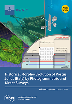
The study reconstructs the amount of vertical ground movements occurred in the archaeological area of Portus Julius (Gulf of Pozzuoli) and the morpho-evolution of this ancient coastal sector during the last 2.1 ky BP. By measuring the submersion of structural elements belonging to a former fish tank, several roman pilae and ancient floors, two different relative sea levels of -3.10 m and -4.7/-5.20 m were detected, respectively related to the beginning and the end of the 1st century BCE. Additionally, a photogrammetric survey of the fish tank was carried out in order to produce a 3D model of the most reliable sea level marker. View this paper.
  • Issues are regarded as officially published after their release is announced to the table of contents alert mailing list.
  • You may sign up for e-mail alerts to receive table of contents of newly released issues.
  • PDF is the official format for papers published in both, html and pdf forms. To view the papers in pdf format, click on the "PDF Full-text" link, and use the free Adobe Reader to open them.
Order results
Result details
Section
Select all
Export citation of selected articles as:
12 pages, 3562 KiB  
Article
Sensitivity Analysis of a Groundwater Infiltration Model and Sea-Level Rise Applications for Coastal Sewers
by Elise Budd, Roger W Babcock, Jr., Daniele Spirandelli, Suwan Shen and Adrienne Fung
Water 2020, 12(3), 923; https://doi.org/10.3390/w12030923 - 24 Mar 2020
Cited by 4 | Viewed by 2894
Abstract
Groundwater elevations in coastal cities will be affected by climate-change-induced sea level rise (SLR) and wastewater collection systems will experience increased groundwater infiltration (GWI) due to greater submergence of sewer pipes. Commercial sewer hydraulics models consider GWI to be a constant quantity estimated [...] Read more.
Groundwater elevations in coastal cities will be affected by climate-change-induced sea level rise (SLR) and wastewater collection systems will experience increased groundwater infiltration (GWI) due to greater submergence of sewer pipes. Commercial sewer hydraulics models consider GWI to be a constant quantity estimated via a low-flow monitoring campaign and are incapable of predicting future flows due to changes in GW elevations. A global sensitivity analyses conducted for a two-dimensional GWI pipe flow model found the most important input parameters are groundwater head and surrounding soil hydraulic conductivity. Two case studies were conducted considering a range of pipe defect severity to estimate increases in GWI associated with predictions of future SLR. The findings are that SLR will begin to have noticeable impacts in terms of increased average dry weather flow (ADWF) as soon as 2030 (3–10%) and will increase dramatically in the future (10–29% by 2050, and 50% or more by 2100). Daily and seasonal tide ranges affect the normal diurnal flow variations by between 3% and 10%. The estimation methodology and case studies described here illustrate the coming future importance of SLR effects on GWI in coastal collection systems that should be included in facilities planning and design. Full article
(This article belongs to the Section Hydraulics and Hydrodynamics)
Show Figures

Figure 1

14 pages, 2947 KiB  
Article
Comparison of Bottom-Up and Top-Down Procedures for Water Demand Reconstruction
by Diana Fiorillo, Enrico Creaco, Francesco De Paola and Maurizio Giugni
Water 2020, 12(3), 922; https://doi.org/10.3390/w12030922 - 24 Mar 2020
Cited by 7 | Viewed by 3102
Abstract
This paper presents a comparison between two procedures for the generation of water demand time series at both single user and nodal scales, a top-down and a bottom-up procedure respectively. Both procedures are made up of two phases. The top-down procedure adopted includes [...] Read more.
This paper presents a comparison between two procedures for the generation of water demand time series at both single user and nodal scales, a top-down and a bottom-up procedure respectively. Both procedures are made up of two phases. The top-down procedure adopted includes a non-parametric disaggregation based on the K-nearest neighbours approach. Therefore, once the temporal aggregated water demand patterns have been defined (first phase), the disaggregation is used to generate water demand time series at lower levels of spatial aggregation (second phase). In the bottom-up procedure adopted, demand time series for each user and for each time step are generated applying a beta probability distribution with tunable bounds or a gamma distribution with shift parameter (first phase). Then, a Copula based re-sort is applied to the demand time series generated to impose existing rank cross-correlations between users and at all temporal lags (second phase). For the sake of comparison, two case studies were considered, both of which are related to a smart water network in Naples (Italy). The results obtained show that the bottom-up procedure performs significantly better than the top-down procedure in terms of rank-cross correlations at fine scale. However, the top-down procedure showed a better performance in terms of skewness and rank cross-correlation when the aggregated demands were considered. Finally, the level of aggregation in nodes was found to affect the performance of both the procedures considered. Full article
Show Figures

Figure 1

16 pages, 2304 KiB  
Article
Hydrologic and Pollutant Removal Performance of Media Layers in Bioretention
by Feikai Yang, Dafang Fu, Shuang Liu, Chris Zevenbergen and Rajendra Prasad Singh
Water 2020, 12(3), 921; https://doi.org/10.3390/w12030921 - 24 Mar 2020
Cited by 11 | Viewed by 3401
Abstract
The current study was aimed to investigate the filler layer structure in modified bioretention systems. Three different structural layers in bioretention were proposed to evaluate their hydrologic performance and pollutant removal efficiency under different rainfall intensities. These layers were as follows: all three [...] Read more.
The current study was aimed to investigate the filler layer structure in modified bioretention systems. Three different structural layers in bioretention were proposed to evaluate their hydrologic performance and pollutant removal efficiency under different rainfall intensities. These layers were as follows: all three layers (filter, transition, and drainage layers), without transition layer, and without drainage layer. Synthetic stormwater was used for experimental purpose in current work. Results revealed that compared with “all three layers”, runoff control rate of “without transition layer” and “without drainage layer” was reduced by 0 to 7.4%, 0 to 10.1%, and outflow start time was advanced by 6 to 8 min and 1.5 to 4.5 min, respectively. Moreover, CODcr (chemical oxygen demand), NH4+-N (ammonium nitrogen), TN (total nitrogen) and TP (total phosphorus) removal rates were 86.0%, 85.4%, 71.8%, and 68.0%, respectively. Particle size distribution of the fillers revealed that during operation, particle moved downward were mainly within 0.16–0.63 mm size. Findings showed that transition and drainage layer played an important role in runoff control, and total height of the filler layer should not be less than 800 mm. Filter layer effectively reduce runoff pollution but the thickness of the filter layer should not be less than 500 mm. Whereas, transition layer has the function of preventing the filler loss of the filter layer; therefore, proper measures must be taken into consideration during structural optimization. Full article
(This article belongs to the Special Issue Urban Rainwater and Flood Management)
Show Figures

Figure 1

16 pages, 3920 KiB  
Article
Microphysical Characteristics of Winter Precipitation in Eastern China from 2014 to 2019
by Kang Pu, Xichuan Liu, Hongbing He, Yu Sun, Shuai Hu and Yi Wu
Water 2020, 12(3), 920; https://doi.org/10.3390/w12030920 - 24 Mar 2020
Cited by 6 | Viewed by 2408
Abstract
To improve solid precipitation monitoring in the hydrology and meteorology field, 1-min precipitation data observed by the PARticle SIze VELocity (PARSIVEL) disdrometer in Nanjing, eastern China, from February 2014 to February 2019 for all days with solid precipitation, were used to study the [...] Read more.
To improve solid precipitation monitoring in the hydrology and meteorology field, 1-min precipitation data observed by the PARticle SIze VELocity (PARSIVEL) disdrometer in Nanjing, eastern China, from February 2014 to February 2019 for all days with solid precipitation, were used to study the microphysical characteristics of winter precipitation. In this study, the empirical V-D (velocity–diameter) relationships and observed surface temperature are used for matching precipitation types, and the precipitation data are divided into rain, graupel, wet snow and dry snow. The results show that dry snow and wet snow have maximum Dm (mass-weighted mean diameter) and minimum log10Nw (normalized intercept parameter), while rain shows the opposite. Additionally, the μ-Λ (shape parameter–slope parameter) curve of dry snow and wet snow is very close, and the μ value of dry snow and wet snow is higher than that of graupel and higher than that of rain for the same Λ value. Furthermore, the Ze-S (equivalent reflectivity factor–precipitation intensity) relationships among different types of precipitation are significantly different. If only the Ze-S relationship of rain is used for quantitative precipitation estimation (QPE), then, for small precipitation intensity, solid precipitation will be overestimated, while, for large precipitation intensity, it will be underestimated. Full article
(This article belongs to the Section Hydrology)
Show Figures

Figure 1

23 pages, 10460 KiB  
Article
Seepage Characteristics of a Single Ascending Relief Well Dewatering an Overlying Aquifer
by Wenxue Wang, Boris Faybishenko, Tong Jiang, Jinyu Dong and Yang Li
Water 2020, 12(3), 919; https://doi.org/10.3390/w12030919 - 24 Mar 2020
Cited by 4 | Viewed by 3529
Abstract
The application of groundwater relief, i.e., dewatering, ascending wells, drilled upward from the mining tunnel into the overlying aquifer, is common in underground mining engineering. In this study, the seepage characteristics of single ascending partially and fully penetrating relief wells are investigated using [...] Read more.
The application of groundwater relief, i.e., dewatering, ascending wells, drilled upward from the mining tunnel into the overlying aquifer, is common in underground mining engineering. In this study, the seepage characteristics of single ascending partially and fully penetrating relief wells are investigated using a series of laboratory sand-tank experiments and numerical simulations. The seepage characteristics of ascending wells dewatering an overlying aquifer are different from those of conventional pumping wells descending from the ground surface into the underlying aquifer, because of the pronounced influence of the seepage face boundary condition along the seepage boundary of the ascending dewatering well. The seepage face of the ascending well is formed as the well casing remains open and water is discharged under the action of gravity through the well casing. The results of laboratory sand-tank experiments and modeling show that when the degree of penetration of an ascending relief well does not exceed a critical value, the effect of the seepage face cannot be ignored. In particular, the seepage flux increases as the degree of penetration increases following an exponential function, and the relationship between the seepage flux and the well radius can be described using a power law function. The results of numerical simulations are used to develop a series of type curves to evaluate the effects of the critical degree of penetration for different well radii and different aquifer water levels. Modified versions of the Dupuit and Dupuit–Thiem formulae for a single ascending partially well for the degree of penetration less than the critical one for the unconfined, confined, and confined-unconfined aquifers are developed. Full article
(This article belongs to the Special Issue Water Flow, Solute and Heat Transfer in Groundwater)
Show Figures

Figure 1

25 pages, 9180 KiB  
Article
SPH Simulation of Interior and Exterior Flow Field Characteristics of Porous Media
by Shijie Wu, Matteo Rubinato and Qinqin Gui
Water 2020, 12(3), 918; https://doi.org/10.3390/w12030918 - 24 Mar 2020
Cited by 9 | Viewed by 3789
Abstract
At the present time, one of the most relevant challenges in marine and ocean engineering and practice is the development of a mathematical modeling that can accurately replicate the interaction of water waves with porous coastal structures. Over the last 60 years, multiple [...] Read more.
At the present time, one of the most relevant challenges in marine and ocean engineering and practice is the development of a mathematical modeling that can accurately replicate the interaction of water waves with porous coastal structures. Over the last 60 years, multiple techniques and solutions have been identified, from linearized solutions based on wave theories and constant friction coefficients to very sophisticated Eulerian or Lagrangian solvers of the Navier-Stokes (NS) equations. In order to explore the flow field interior and exterior of the porous media under different working conditions, the Smooth Particle Hydrodynamics (SPH) numerical simulation method was used to simulate the flow distribution inside and outside a porous media applied to interact with the wave propagation. The flow behavior is described avoiding Euler’s description of the interface problem between the Euler mesh and the material selected. Considering the velocity boundary conditions and the cyclical circulation boundary conditions at the junction of the porous media and the water flow, the SPH numerical simulation is used to analyze the flow field characteristics, as well as the longitudinal and vertical velocity distribution of the back vortex flow field and the law of eddy current motion. This study provides innovative insights on the mathematical modelling of the interaction between porous structures and flow propagation. Furthermore, there is a good agreement (within 10%) between the numerical results and the experimental ones collected for scenarios with porosity of 0.349 and 0.475, demonstrating that SPH can simulate the flow patterns of the porous media, the flow through the inner and outer areas of the porous media, and the flow field of the back vortex region. Results obtained and the new mathematical approach used can help to effectively simulate with high-precision the changes along the water depth, for a better design of marine and ocean engineering solutions adopted to protect coastal areas. Full article
Show Figures

Figure 1

26 pages, 47030 KiB  
Article
Interplay between Fingering Instabilities and Initial Soil Moisture in Solute Transport through the Vadose Zone
by Luis Cueto-Felgueroso, María José Suarez-Navarro, Xiaojing Fu and Ruben Juanes
Water 2020, 12(3), 917; https://doi.org/10.3390/w12030917 - 24 Mar 2020
Cited by 4 | Viewed by 3746
Abstract
Modeling water flow and solute transport in the vadose zone is essential to understanding the fate of soil pollutants and their travel times towards groundwater bodies. It also helps design better irrigation strategies to control solute concentrations and fluxes in semiarid and arid [...] Read more.
Modeling water flow and solute transport in the vadose zone is essential to understanding the fate of soil pollutants and their travel times towards groundwater bodies. It also helps design better irrigation strategies to control solute concentrations and fluxes in semiarid and arid regions. Heterogeneity, soil texture and wetting front instabilities determine the flow patterns and solute transport mechanisms in dry soils. When water is already present in the soil, the flow of an infiltration pulse depends on the spatial distribution of soil water and on its mobility. We present numerical simulations of passive solute transport during unstable infiltration of water into sandy soils that are prone to wetting front instability. We study the impact of the initial soil state, in terms of spatial distribution of water content, on the infiltration of a solute-rich water pulse. We generate random fields of initial moisture content with spatial structure, through multigaussian fields with prescribed correlation lengths. We characterize the patterns of water flow and solute transport, as well as the mass fluxes through the soil column. Our results indicate a strong interplay between preferential flow and channeling due to fingering and the spatial distribution of soil water at the beginning of infiltration. Fingering and initial water saturation fields have a strong effect on solute diffusion and dilution into the ambient water during infiltration, suggesting an effective separation between mobile and inmobile transport domains that are controlled by the preferential flow paths due to fingering. Full article
(This article belongs to the Special Issue Groundwater and Contaminant Transport)
Show Figures

Figure 1

14 pages, 5636 KiB  
Article
Image-Based Bed Material Mapping of a Large River
by Alexander A. Ermilov, Sándor Baranya and Gergely T. Török
Water 2020, 12(3), 916; https://doi.org/10.3390/w12030916 - 24 Mar 2020
Cited by 8 | Viewed by 3625
Abstract
The composition or bed material plays a crucial role in the physical hydromorphological processes of fluvial systems. However, conventional bed material sampling methods provide only pointwise information, which can be inadequate when investigating large rivers of inhomogeneous bed material characteristics. In this study, [...] Read more.
The composition or bed material plays a crucial role in the physical hydromorphological processes of fluvial systems. However, conventional bed material sampling methods provide only pointwise information, which can be inadequate when investigating large rivers of inhomogeneous bed material characteristics. In this study, novel, image-based approaches are implemented to gain areal information of the bed surface composition using two different techniques: monocular and stereo computer vision. Using underwater videos, captured in shorter reaches of the Hungarian Danube River, a comparison of the bed material grain size distributions from conventional physical samplings and the ones reconstructed from the images is carried out. Moreover, an attempt is made to quantify bed surface roughness, using the so-called Structure from Motion image analysis method. Practical aspects of the applicability of image-based bed material mapping are discussed and future improvements towards an automatized mapping methodology are outlined. Full article
Show Figures

Figure 1

18 pages, 5124 KiB  
Article
Study on the Single-Multi-Objective Optimal Dispatch in the Middle and Lower Reaches of Yellow River for River Ecological Health
by Tao Bai, Xia Liu, Yan-ping HA, Jian-xia Chang, Lian-zhou Wu, Jian Wei and Jin Liu
Water 2020, 12(3), 915; https://doi.org/10.3390/w12030915 - 24 Mar 2020
Cited by 9 | Viewed by 3076
Abstract
Given the increasingly worsening ecology issues in the lower Yellow River, the Xiaolangdi reservoir is chosen as the regulation and control target, and the single and multi-objective operation by ecology and power generation in the lower Yellow River is studied in this paper. [...] Read more.
Given the increasingly worsening ecology issues in the lower Yellow River, the Xiaolangdi reservoir is chosen as the regulation and control target, and the single and multi-objective operation by ecology and power generation in the lower Yellow River is studied in this paper. This paper first proposes the following three indicators: the ecological elasticity coefficient (f1), the power generation elasticity coefficient (f2), and the ecological power generation profit and loss ratio (k). This paper then conducts a multi-target single dispatching study on ecology and power generation in the lower Yellow River. A genetic algorithm (GA) and an improved non-dominated genetic algorithm (NSGA-II) combining constraint processing and feasible space search techniques were used to solve the single-objective model with the largest power generation and the multi-objective optimal scheduling model considering both ecology and power generation. The calculation results show that: (1) the effectiveness of the NSGA-Ⅱcombined with constraint processing and feasible spatial search technology in reservoir dispatching is verified by an example; (2) compared with the operation model of maximizing power generation, the power generation of the target model was reduced by 0.87%, the ecological guarantee rate was increased by 18.75%, and the degree of the impact of ecological targets on the operating results was quantified; (3) in each typical year, the solution spatial distribution and dimensions of the single-target and multi-target models of change are represented by the Pareto-front curve, and a multi-objective operation plan is generated for decision makers to choose; (4) the f1, f2, and k indicators are selected to analyze the sensitivity of the five multi-objective plans and to quantify the interaction between ecological targets and power generation targets. Ultimately, this paper discusses the conversion relationship and finally recommends the best equilibrium solution in the multi-objective global equilibrium solution set. The results provide a decision-making basis for the multi-objective dispatching of the Xiaolangdi reservoir and have important practical significance for further improving the ecological health of the lower Yellow River. Full article
(This article belongs to the Special Issue Advances in Hydrologic Forecasts and Water Resources Management )
Show Figures

Figure 1

13 pages, 3940 KiB  
Article
Study on the Ecological Operation and Watershed Management of Urban Rivers in Northern China
by Guangyi Deng, Xiaohan Yao, Haibo Jiang, Yingyue Cao, Yang Wen, Wenjia Wang, She Zhao and Chunguang He
Water 2020, 12(3), 914; https://doi.org/10.3390/w12030914 - 24 Mar 2020
Cited by 4 | Viewed by 2950
Abstract
Small- and medium-sized rivers are facing a serious degradation of ecological function in water resource-scarce regions of Northern China. Reservoir ecological operation can restore the damaged river ecological environment. Research on reservoir ecological operation and watershed management of urban rivers is limited in [...] Read more.
Small- and medium-sized rivers are facing a serious degradation of ecological function in water resource-scarce regions of Northern China. Reservoir ecological operation can restore the damaged river ecological environment. Research on reservoir ecological operation and watershed management of urban rivers is limited in cold regions of middle and high latitudes. In this paper, the urban section of the Yitong River was selected as the research object in Changchun, Northern China. The total ecological water demand and reservoir operation water (79.35 × 10⁶ m3 and 15.52 × 10⁶ m3, respectively) were calculated by the ecological water demand method, and a reservoir operation scheme was established to restore the ecological function of the urban section of the river. To examine the scientific basis and rationality of the operation scheme, the water quality of the river and physical habitat after carrying out the scheme were simulated by the MIKE 11 one-dimensional hydrodynamic-water quality model and the Physical Habitat Simulation Model (PHABSIM). The results indicate that the implementation of the operation scheme can improve the ecological environment of the urban section of the Yitong River. A reform scheme was proposed for the management of the Yitong River Basin based on the problems in the process of carrying out the operation schemes, including clarifying department responsibility, improving laws and regulations, strengthening service management, and enhancing public participation. Full article
(This article belongs to the Special Issue Water Supply and Water Scarcity)
Show Figures

Figure 1

19 pages, 2190 KiB  
Article
Spatial Changes in Invertebrate Structures as a Factor of Strong Human Activity in the Bed and Catchment Area of a Small Urban Stream
by Robert Czerniawski, Łukasz Sługocki, Tomasz Krepski, Anna Wilczak and Katarzyna Pietrzak
Water 2020, 12(3), 913; https://doi.org/10.3390/w12030913 - 24 Mar 2020
Cited by 7 | Viewed by 2928
Abstract
The threats to small urban streams lead to a decrease in their water quality and dysregulate their ecological balance, thereby affecting the biodiversity and causing degradation of indicators that determine the ecological potential. The aim of our study was to determine the impact [...] Read more.
The threats to small urban streams lead to a decrease in their water quality and dysregulate their ecological balance, thereby affecting the biodiversity and causing degradation of indicators that determine the ecological potential. The aim of our study was to determine the impact of abiotic conditions induced by intensive human activity on the community structures of invertebrates (zooplankton and macroinvertebrates) in the small urban stream Bukówka in the Szczecin agglomeration (NW Poland). This stream exhibits the same characteristics as a large river, in which the mass of live organic matter increases with their length. The composition of invertebrates (zooplankton and macroinvertebrates) was strongly influenced by the changes caused by humans in the stream bed. The construction of small reservoirs and bed regulation in this small urban streams had a similar effect on the quality of the water and ecological potential as in large rivers, but at a lower scale. Full article
(This article belongs to the Special Issue Water Quality of Freshwater Ecosystems in a Temperate Climate)
Show Figures

Figure 1

19 pages, 10113 KiB  
Article
Uncertainty Quantification in Machine Learning Modeling for Multi-Step Time Series Forecasting: Example of Recurrent Neural Networks in Discharge Simulations
by Tianyu Song, Wei Ding, Haixing Liu, Jian Wu, Huicheng Zhou and Jinggang Chu
Water 2020, 12(3), 912; https://doi.org/10.3390/w12030912 - 23 Mar 2020
Cited by 16 | Viewed by 3934
Abstract
As a revolutionary tool leading to substantial changes across many areas, Machine Learning (ML) techniques have obtained growing attention in the field of hydrology due to their potentials to forecast time series. Moreover, a subfield of ML, Deep Learning (DL) is more concerned [...] Read more.
As a revolutionary tool leading to substantial changes across many areas, Machine Learning (ML) techniques have obtained growing attention in the field of hydrology due to their potentials to forecast time series. Moreover, a subfield of ML, Deep Learning (DL) is more concerned with datasets, algorithms and layered structures. Despite numerous applications of novel ML/DL techniques in discharge simulation, the uncertainty involved in ML/DL modeling has not drawn much attention, although it is an important issue. In this study, a framework is proposed to quantify uncertainty contributions of the sample set, ML approach, ML architecture and their interactions to multi-step time-series forecasting based on the analysis of variance (ANOVA) theory. Then a discharge simulation, using Recurrent Neural Networks (RNNs), is taken as an example. Long Short-Term Memory (LSTM) network, a state-of-the-art DL approach, was selected due to its outstanding performance in time-series forecasting, and compared with simple RNN. Besides, novel discharge forecasting architecture is designed by combining the expertise of hydrology and stacked DL structure, and compared with conventional design. Taking hourly discharge simulations of Anhe (China) catchment as a case study, we constructed five sample sets, chose two RNN approaches and designed two ML architectures. The results indicate that none of the investigated uncertainty sources are negligible and the influence of uncertainty sources varies with lead-times and discharges. LSTM demonstrates its superiority in discharge simulations, and the ML architecture is as important as the ML approach. In addition, some of the uncertainty is attributable to interactions rather than individual modeling components. The proposed framework can both reveal uncertainty quantification in ML/DL modeling and provide references for ML approach evaluation and architecture design in discharge simulations. It indicates uncertainty quantification is an indispensable task for a successful application of ML/DL. Full article
(This article belongs to the Section Hydrology)
Show Figures

Figure 1

19 pages, 5504 KiB  
Article
An Assessment of the Influence of Uncertainty in Temporally Evolving Streamflow Forecasts on Riverine Inundation Modeling
by Youcan Feng, David R. Judi and Cynthia L. Rakowski
Water 2020, 12(3), 911; https://doi.org/10.3390/w12030911 - 23 Mar 2020
Viewed by 2300
Abstract
Continental-scale river forecasting platforms forecast streamflow at reaches that can be used as boundary conditions to drive a local-scale flood inundation model. Uncertainty accumulated during this process stems not only from any part of the forecasting chain but can also be caused by [...] Read more.
Continental-scale river forecasting platforms forecast streamflow at reaches that can be used as boundary conditions to drive a local-scale flood inundation model. Uncertainty accumulated during this process stems not only from any part of the forecasting chain but can also be caused by the daily variations in weather forcing that keeps evolving as the event advances. This work aims to examine the influence of the evolving forecast streamflow on predicting the maximum inundation for extreme floods. A diagnostic case study was made on the basis of a hindcast of Hurricane Matthew striking the eastern U.S. in 2016. The U.S. National Water Model was one-way coupled to a hydrodynamic inundation model through a developed automated workflow. Although the river forcing has significantly mismatched hydrographs versus observations, the simulated peak water surface elevations and maximum extents were validated to be comparable with the observations, which indicates that the inundation model may not be sensitive to the inherited uncertainty from the weather forcing. Moreover, the uncertainty of the forecast streamflow time series caused only one order of magnitude fewer variations in inundation prediction; this dampening effect may become clearer for extreme events with large areas inundated. In addition, the forecast total volume of stream discharge appears to be an important metric for assessing the performance of river forcing for inundation mapping, as a linear correlation between the total volume and the accuracy of the predicted peak water surface elevation and maximum extent was found, with the coefficients of determination all above 0.8. Extra best-practice experience of running similar operational tasks demonstrated the tradeoff between the cost and accuracy gain. Full article
(This article belongs to the Special Issue Research on Mathematical Models of Floods)
Show Figures

Figure 1

17 pages, 4871 KiB  
Article
Distribution Characteristics and Spatial Differences of Phosphorus in the Main Stream of the Urban River Stretches of the Middle and Lower Reaches of the Yangtze River
by Lei Dong, Li Lin, Xianqiang Tang, Zhuo Huang, Liangyuan Zhao, Min Wu and Rui Li
Water 2020, 12(3), 910; https://doi.org/10.3390/w12030910 - 23 Mar 2020
Cited by 10 | Viewed by 3251
Abstract
Excessive phosphorus is the main problem of water pollution in the main stream of the Yangtze River, while it is not clear about the distribution characteristics and spatial differences of phosphorus in the urban river stretches of the middle and lower reaches of [...] Read more.
Excessive phosphorus is the main problem of water pollution in the main stream of the Yangtze River, while it is not clear about the distribution characteristics and spatial differences of phosphorus in the urban river stretches of the middle and lower reaches of the Yangtze River. In this study, a field survey in June 2014 revealed that the average particulate phosphorus (PP) concentration ranged from 0.195 mg/L to 0.105 mg/L from Wuhan (WH) in the middle reaches of the Yangtze River to Shanghai (SH, 1081 km from WH) in the lower reaches of the Yangtze River, and the average PP-to-the total phosphorus (TP) ratio decreased from 85.71% in WH to 45.65% in SH, while the average soluble reactive phosphate (SRP) concentration ranged from 0.033 to 0.125 mg/L, and the average SRP-to-total dissolved phosphorus (TDP) ratio increased from 60.73% in WH to 88.28% in SH. In general, PP was still an important form of TP in the middle and lower reaches of the Yangtze River. The concentrations of PP and SRP at different sampling locations and water depths in the same monitoring section showed differences, which might be related to the transportation and sedimentation of suspended sediment (SS) and differences in the location of urban sewage outlets. Historical data showed that the concentration and particle size of the SS decreased over time, while the discharge of wastewater also increased over time in the Yangtze River Basin. The measured results showed that there was a significant positive correlation between SS and PP. As a result, the concentration of SRP might increase in the middle and lower reaches of the Yangtze River. If the SRP concentration is not properly controlled, the degree of eutrophication of water body could significantly increase in the Yangtze River estuary, the riparian zone of the urban river stretches, the tributary slow-flow section, and the corresponding lakes connected with the Yangtze River. Full article
(This article belongs to the Special Issue Water Quality Assessments for Urban Water Environment)
Show Figures

Graphical abstract

19 pages, 81859 KiB  
Article
Numerical Simulation of Unstable Preferential Flow during Water Infiltration into Heterogeneous Dry Soil
by Luis Cueto-Felgueroso, María José Suarez-Navarro, Xiaojing Fu and Ruben Juanes
Water 2020, 12(3), 909; https://doi.org/10.3390/w12030909 - 23 Mar 2020
Cited by 12 | Viewed by 4354
Abstract
Water infiltration and unsaturated flow through heterogeneous soil control the distribution of soil moisture in the vadose zone and the dynamics of groundwater recharge, providing the link between climate, biogeochemical soil processes and vegetation dynamics. Infiltration into dry soil is hydrodynamically unstable, leading [...] Read more.
Water infiltration and unsaturated flow through heterogeneous soil control the distribution of soil moisture in the vadose zone and the dynamics of groundwater recharge, providing the link between climate, biogeochemical soil processes and vegetation dynamics. Infiltration into dry soil is hydrodynamically unstable, leading to preferential flow through narrow wet regions (fingers). In this paper we use numerical simulation to study the interplay between fingering instabilities and soil heterogeneity during water infiltration. We consider soil with heterogeneous intrinsic permeability. Permeabilities are random, with point Gaussian statistics, and vary smoothly in space due to spatial correlation. The key research question is whether the presence of moderate or strong heterogeneity overwhelms the fingering instability, recovering the simple stable displacement patterns predicted by most simplified model of infiltration currently used in hydrological models from the Darcy to the basin scales. We perform detailed simulations of constant-rate infiltration into soils with isotropic and anisotropic intrinsic permeability fields. Our results demonstrate that soil heterogeneity does not suppress fingering instabilities, but it rather enhances its effect of preferential flow and channeling. Fingering patterns strongly depend on soil structure, in particular the correlation length and anisotropy of the permeability field. While the finger size and flow dynamics are only slightly controlled by correlation length in isotropic fields, layering leads to significant finger meandering and bulging, changing arrival times and wetting efficiencies. Fingering and soil heterogeneity need to be considered when upscaling the constitutive relationships of multiphase flow in porous media (relative permeability and water retention curve) from the finger to field and basin scales. While relative permeabilities remain unchanged upon upscaling for stable displacements, the inefficient wetting due to fingering leads to relative permeabilities at the field scale that are significantly different from those at the Darcy scale. These effective relative permeability functions also depend, although less strongly, on heterogeneity and soil structure. Full article
(This article belongs to the Section Hydrology)
Show Figures

Figure 1

26 pages, 17508 KiB  
Article
What Controls the Flushing Efficiency and Particle Transport Pathways in a Tropical Estuary? Cochin Estuary, Southwest Coast of India
by Sebin John, K.R. Muraleedharan, C. Revichandran, S. Abdul Azeez, G. Seena and Pierre W. Cazenave
Water 2020, 12(3), 908; https://doi.org/10.3390/w12030908 - 23 Mar 2020
Cited by 24 | Viewed by 5212
Abstract
Estuaries with poor flushing and longer residence time retain effluents and pollutants, ultimately resulting in eutrophication, a decline in biodiversity and, finally, deterioration of water quality. Cochin Estuary (CE), southwest coast of India, is under the threat of nutrient enrichment by the anthropogenic [...] Read more.
Estuaries with poor flushing and longer residence time retain effluents and pollutants, ultimately resulting in eutrophication, a decline in biodiversity and, finally, deterioration of water quality. Cochin Estuary (CE), southwest coast of India, is under the threat of nutrient enrichment by the anthropogenic interventions and terrestrial inputs through land runoff. The present study used the FVCOM hydrodynamic model coupled with the Lagrangian particle module (passive) to estimate the residence time and to delineate site-specific transport pathways in the CE. The back and forth movements and residence time of particles was elucidated by using metrics such as path length, net displacement and tortuosity. Spatio-temporal patterns of the particle distribution in the CE showed a similar trend during monsoon and post-monsoon with an average residence time of 25 and 30 days, respectively. During the low river discharge period (pre-monsoon), flood-ebb velocities resulted in a minimum net transport of the water and longer residence time of 90 days compared to that of the high discharge period (monsoon). During the pre-monsoon, particle released at the southern upstream (station 15) traversed a path length of 350 km in 90 days before being flushed out through the Fortkochi inlet, where the axial distance was only 35 km. This indicates that the retention capacity of pollutants within the system is very high and can adversely affect the water quality of the ecosystem. However, path length (120 km) and residence time (7.5 days) of CE were considerably reduced during the high discharge period. Thus the reduced path length and the lower residence time can effectively transport the pollutants reaching the system, which will ultimately restore the healthy ecosystem. This is a pioneer attempt to estimate the flushing characteristics and residence time of the CE by integrating the hydrodynamics and Lagrangian particle tracking module of FVCOM. This information is vital for the sustainable management of sensitive ecosystems. Full article
(This article belongs to the Section Hydrology)
Show Figures

Figure 1

23 pages, 9960 KiB  
Article
Bottom-Up Assessment of Climate Risk and the Robustness of Proposed Flood Management Strategies in the American River, CA
by Kara DiFrancesco, Alix Gitelman and David Purkey
Water 2020, 12(3), 907; https://doi.org/10.3390/w12030907 - 23 Mar 2020
Cited by 6 | Viewed by 3266
Abstract
The hydrologic nonstationarity and uncertainty associated with climate change requires new decision-making methods to incorporate climate change impacts into flood frequency and flood risk analyses. To aid decision-making under climate change, we developed a bottom-up approach for assessing the performance of flood management [...] Read more.
The hydrologic nonstationarity and uncertainty associated with climate change requires new decision-making methods to incorporate climate change impacts into flood frequency and flood risk analyses. To aid decision-making under climate change, we developed a bottom-up approach for assessing the performance of flood management systems under climate uncertainty and nonstationarity. The developed bottom-up approach was applied to the American River, CA, USA flood management system by first identifying the sensitivity and vulnerability of the system to different climates. To do this, we developed a climate response surface by calculating and plotting Expected Annual Damages (EAD, $/year) under different flood regimes. Next, we determined a range of plausible future climate change and flood frequency scenarios by applying Bayesian statistical methods to projected future flows derived from a Variable Infiltration Capacity (VIC) model forced with Global Circulation Model (GCM) output. We measured system robustness as the portion of plausible future scenarios under which the current flood system could meet its performance goal. Using this approach, we then evaluated the robustness of four proposed management strategies in the 2012 Central Valley Flood Protection Plan in terms of both flood risk and cost-effectiveness, to assess the performance of the strategies in the face of climate risks. Results indicated that the high sensitivity of the expected damages to changes in flood regimes makes the system extremely vulnerable to a large portion of the plausible range of future flood conditions. The management strategy that includes a combination of nature-based flood management actions along with engineered structures yields the greatest potential to increase system robustness in terms of maintaining EAD below an acceptable risk threshold. However, this strategy still leaves the system vulnerable to a wide range of plausible future conditions. As flood frequency regimes increase in intensity from the current conditions, the cost-effectiveness of the management strategies increases, to a point, before decreasing. This bottom up analysis demonstrated a viable decision-making approach for water managers in the face of uncertain and changing future conditions. Neglecting to use such an approach and omitting climate considerations from water resource planning could lead to strategies that do not perform as expected or which actually lead to mal-adaptations, increasing vulnerability to climate change. Full article
Show Figures

Figure 1

21 pages, 7585 KiB  
Article
Analysis of the Bioaugmentation Potential of Pseudomonas putida OR45a and Pseudomonas putida KB3 in the Sequencing Batch Reactors Fed with the Phenolic Landfill Leachate
by Justyna Michalska, Artur Piński, Joanna Żur and Agnieszka Mrozik
Water 2020, 12(3), 906; https://doi.org/10.3390/w12030906 - 23 Mar 2020
Cited by 15 | Viewed by 3178
Abstract
The treatment of landfill leachate could be challenging for the biological wastewater treatment systems due to its high toxicity and the presence of poorly biodegradable contaminants. In this study, the bioaugmentation technology was successfully applied in sequencing batch reactors (SBRs) fed with the [...] Read more.
The treatment of landfill leachate could be challenging for the biological wastewater treatment systems due to its high toxicity and the presence of poorly biodegradable contaminants. In this study, the bioaugmentation technology was successfully applied in sequencing batch reactors (SBRs) fed with the phenolic landfill leachate by inoculation of the activated sludge (AS) with two phenol-degrading Pseudomonas putida OR45a and Pseudomonas putida KB3 strains. According to the results, the SBRs bioaugmented with Pseudomonas strains withstood the increasing concentrations of the leachate. This resulted in the higher removal efficiency of the chemical oxygen demand (COD) of 79–86%, ammonia nitrogen of 87–88% and phenolic compounds of 85–96% as compared to 45%, 64%, and 50% for the noninoculated SBR. Simultaneously, the bioaugmentation of the AS allowed to maintain the high enzymatic activity of dehydrogenases, nonspecific esterases, and catalase in this ecosystem, which contributed to the higher functional capacity of indigenous microorganisms than in the noninoculated AS. Herein, the stress level experienced by the microorganisms in the SBRs fed with the leachate computed based on the cellular ATP measurements showed that the abundance of exogenous Pseudomonas strains in the bioreactors contributed to the reduction in effluent toxicity, which was reflected by a decrease in the stress biomass index to 32–45% as compared to the nonbioaugmented AS (76%). Full article
(This article belongs to the Special Issue Microbial Action in Wastewater and Sludge)
Show Figures

Figure 1

20 pages, 6798 KiB  
Article
Removal of Ciprofloxacin with Aluminum-Pillared Kaolin Sodium Alginate Beads (CA-Al-KABs): Kinetics, Isotherms, and BBD Model
by Yuying Hu, Cheng Pan, Xiaohuan Zheng, Susu Liu, Fengping Hu, Li Xu, Gaoping Xu and Xiaoming Peng
Water 2020, 12(3), 905; https://doi.org/10.3390/w12030905 - 23 Mar 2020
Cited by 24 | Viewed by 3551
Abstract
In recent years, the problem of water pollution caused by antibiotics has attracted wide attention. The common use of antibiotics represents a threat to both human health and environmental safety. The modification of kaolin clay is promising due to its high efficiency, easy [...] Read more.
In recent years, the problem of water pollution caused by antibiotics has attracted wide attention. The common use of antibiotics represents a threat to both human health and environmental safety. The modification of kaolin clay is promising due to its high efficiency, easy operation, and low cost. In this study, a novel material, aluminum-pillared kaolin sodium alginate beads (CA-Al-KABs), was synthesized by gelling and solidification processes. The structure and chemical properties were characterized by various analytical methods. The influencing factors (such as adsorbent dosage, contacting time, pH, ion strength, temperature, and initial concentration) and adsorption mechanism of ciprofloxacin (CIP) were studied. Furthermore, adsorption kinetics, adsorption isotherms, and a Box–Behnken design (BBD) model were conducted. Moreover, CA-Al-KABs’ adsorption efficiency towards other antibiotics were also evaluated. The adsorption experiments showed that the acidic environment (pH = 4) was more favorable for the adsorption of ciprofloxacin. The adsorption kinetics of ciprofloxacin by CA-Al-KABs microspheres were confirmed to be more suitable with the pseudo-first-order kinetics model. The Langmuir isotherm model showed that the maximum adsorption capacity of CA-Al-KABs microspheres to ciprofloxacin was 68.36 mg/g at 308.15 K. The adsorption driving force of CIP near CA-Al-KABs may be the electrostatic attraction. Further, CIP could also form complexes with Ca2+ and Al—Al—OH on CA-Al-KABs, and thus CIP was attracted to the adsorbent. Adsorption thermodynamics showed that the adsorption process was exothermic, feasible, and spontaneous. In addition, the adsorption performance on other antibiotics indicated CA-Al-KABs’ broad application in the treatment of antibiotic wastewater. Full article
(This article belongs to the Section Wastewater Treatment and Reuse)
Show Figures

Graphical abstract

21 pages, 5618 KiB  
Article
Multi-Site Statistical Downscaling Method Using GCM-Based Monthly Data for Daily Precipitation Generation
by Xin Su, Weiwei Shao, Jiahong Liu and Yunzhong Jiang
Water 2020, 12(3), 904; https://doi.org/10.3390/w12030904 - 23 Mar 2020
Cited by 12 | Viewed by 3410
Abstract
Global Climate Models (GCMs) can provide essential meteorological data as inputs for simulating and assessing the impact of climate change on catchment hydrology. However, downscaling of GCM outputs is often required due to their coarse spatial and temporal resolution. As an effective downscaling [...] Read more.
Global Climate Models (GCMs) can provide essential meteorological data as inputs for simulating and assessing the impact of climate change on catchment hydrology. However, downscaling of GCM outputs is often required due to their coarse spatial and temporal resolution. As an effective downscaling method, stochastic weather generators can reproduce daily sequences with statistically similar statistical characteristics. Most weather generators can only simulate single-site meteorological data, which are spatially uncorrelated. Therefore, this study introduces a method for multi-site precipitation downscaling based on a combination of a single-site stochastic weather generator, CLIGEN (CLImate GENerator), and a modified shuffle procedure constrained with multi-model ensemble GCM monthly precipitation outputs. The applicability of the downscaling method is demonstrated in the Huangfuchuan Basin (arid to semi-arid climate) for a historical period (1976–2005) and a projection period (2021–2070, historical, the representative concentration path (RCP) 2.6, RCP4.5, RCP4.8 scenarios) to generate spatially correlated daily precipitation. The results show that the proposed downscaling method can accurately simulate the mean of daily, monthly and annual precipitation and the wet spell lengths, and the inter-station correlation among 10 sites in the basin. In addition, this combination method generated the projected precipitation and showed an increasing trend for future years. These findings could help us better cope with the potential risks of climate change. Full article
(This article belongs to the Section Hydrology)
Show Figures

Figure 1

13 pages, 1558 KiB  
Article
Detection of Cyanotoxin-Producing Genes in a Eutrophic Reservoir (Billings Reservoir, São Paulo, Brazil)
by Matheus S. F. Ribeiro, Andrea Tucci, Matheus P. Matarazzo, Cristina Viana-Niero and Cristina S. F. Nordi
Water 2020, 12(3), 903; https://doi.org/10.3390/w12030903 - 23 Mar 2020
Cited by 16 | Viewed by 3719
Abstract
CyanoHABs (cyanobacterial harmful algal blooms) are blooms of cyanobacteria capable of producing cyanotoxins, a large group of secondary metabolites that are toxic to most eukaryotes. In this work, the main aim was to evaluate the presence of multiple genes from each of the [...] Read more.
CyanoHABs (cyanobacterial harmful algal blooms) are blooms of cyanobacteria capable of producing cyanotoxins, a large group of secondary metabolites that are toxic to most eukaryotes. In this work, the main aim was to evaluate the presence of multiple genes from each of the clusters responsible for biosynthesis of cyanotoxins (cylindrospermopsin, microcystin and saxitoxin) in total DNA obtained from sixteen environmental water samples by PCR. Microcystin gene mcyE was amplified in all analyzed samples. Among the cylindrospermopsin genes analyzed, only the cyrC gene was amplified from DNA obtained from three of sixteen samples. Of the three different saxitoxin genes analyzed, sxtB and sxtI were present in four and three of the sixteen samples studied, respectively, and sxtA did not show any positive result. Based on our results, we suggest caution when using only one gene from the full clusters responsible for biosynthesis of cyanotoxins, given that it may not be sufficient to confirm or exclude the toxigenic potential of a sample. Full article
(This article belongs to the Section Water Quality and Contamination)
Show Figures

Figure 1

20 pages, 5250 KiB  
Article
Pipeline Scour Rates Prediction-Based Model Utilizing a Multilayer Perceptron-Colliding Body Algorithm
by Mohammad Ehteram, Ali Najah Ahmed, Lloyd Ling, Chow Ming Fai, Sarmad Dashti Latif, Haitham Abdulmohsin Afan, Fatemeh Barzegari Banadkooki and Ahmed El-Shafie
Water 2020, 12(3), 902; https://doi.org/10.3390/w12030902 - 23 Mar 2020
Cited by 23 | Viewed by 3767
Abstract
In this research, the advanced multilayer perceptron (MLP) models are utilized to predict the free rate of expansion that usually occurs around the pipeline (PL) because of waves. The MLP model was structured by integrating it with three optimization algorithms: particle swarm optimization [...] Read more.
In this research, the advanced multilayer perceptron (MLP) models are utilized to predict the free rate of expansion that usually occurs around the pipeline (PL) because of waves. The MLP model was structured by integrating it with three optimization algorithms: particle swarm optimization (PSO), whale algorithm (WA), and colliding bodies’ optimization (CBO). The sediment size, wave characteristics, and PL geometry were used as the inputs for the applied models. Moreover, the scour rate, vertical scour rate along the pipeline, and scour rate at both right and left sides of the pipeline were predicted as the model outputs. Results of the three suggested models, MLP-CBO, MLP-WA, and MLP-PSO, for both testing and training sessions were assessed based on different statistical indices. The results indicated that the MLP-CBO model performed better in comparison to the MLP-PSO, MLP-WA, regression, and empirical models. The MLP-CBO can be used as a powerful soft-computing model for predictions. Full article
(This article belongs to the Special Issue Machine Learning Applied to Hydraulic and Hydrological Modelling)
Show Figures

Figure 1

1 pages, 158 KiB  
Correction
Correction: Zhao, X. et al. Eco-Efficiency of End-of-Pipe Systems: An Extended Environmental Cost Efficiency Framework for Wastewater Treatment. Water 2020, 12, 454
by Xinyue Zhao, Chaofan Zhang and Shunwen Bai
Water 2020, 12(3), 901; https://doi.org/10.3390/w12030901 - 23 Mar 2020
Viewed by 1796
Abstract
The authors wish to make the following corrections to this paper [...] Full article
(This article belongs to the Section Wastewater Treatment and Reuse)
20 pages, 2279 KiB  
Article
Studying Unimodal, Bimodal, PDI and Bimodal-PDI Variants of Multiple Soil Water Retention Models: I. Direct Model Fit Using the Extended Evaporation and Dewpoint Methods
by Amir Haghverdi, Mohsen Najarchi, Hasan Sabri Öztürk and Wolfgang Durner
Water 2020, 12(3), 900; https://doi.org/10.3390/w12030900 - 22 Mar 2020
Cited by 19 | Viewed by 4073
Abstract
This study focuses on the reliable parametrization of the full Soil Water Retention Curve (SWRC) from saturation to oven-dryness using high resolution but limited range measured water retention data by the Hydraulic Property Analyzer (HYPROP) system. We studied the performance of five unimodal [...] Read more.
This study focuses on the reliable parametrization of the full Soil Water Retention Curve (SWRC) from saturation to oven-dryness using high resolution but limited range measured water retention data by the Hydraulic Property Analyzer (HYPROP) system. We studied the performance of five unimodal water retention models including the Brooks and Corey model (BC model), the Fredlund and Xing model (FX model), the Kosugi model (K model), the van Genuchten constrained model with four free parameters (VG model), and the van Genuchten unconstrained model with five free parameters (VGm model). In addition, eleven alternative expressions including Peters–Durner–Iden (PDI), bimodal, and bimodal-PDI variants of the original models were evaluated. We used a data set consisting of 94 soil samples from Turkey and the United States with high-resolution measured data (a total of 9264 measured water retention data pairs) mainly via the HYPROP system and supplemented for some samples with measured dry-end data using the WP4C instrument. Among unimodal expressions, the FX and the K models with the Mean Absolute Error (MAE) values equal to 0.005 cm3 cm−3 and 0.015 cm3 cm−3 have the highest and the lowest accuracy, respectively. Overall, the alternative variants provided a better fit than the unimodal expressions. The unimodal models, except for the FX model, fail to provide reliable dry-end estimations using HYPROP data (average MAE: 0.041 cm3 cm−3, average r: 0.52). Our results suggested that only models that account for the zero water content at the oven dryness and properly shift from the middle range to dry-end (i.e., the FX model and PDI variants) can adequately represent the full SWRC using typical data obtained via the HYPROP system. Full article
(This article belongs to the Special Issue Water Retention and Movement in Soils and Horticultural Substance)
Show Figures

Figure 1

17 pages, 2137 KiB  
Article
Urban Flood Prediction Using Deep Neural Network with Data Augmentation
by Hyun Il Kim and Kun Yeun Han
Water 2020, 12(3), 899; https://doi.org/10.3390/w12030899 - 22 Mar 2020
Cited by 35 | Viewed by 7457
Abstract
Data-driven models using an artificial neural network (ANN), deep learning (DL) and numerical models are applied in flood analysis of the urban watershed, which has a complex drainage system. In particular, data-driven models using neural networks can quickly present the results and be [...] Read more.
Data-driven models using an artificial neural network (ANN), deep learning (DL) and numerical models are applied in flood analysis of the urban watershed, which has a complex drainage system. In particular, data-driven models using neural networks can quickly present the results and be used for flood forecasting. However, not a lot of data with actual flood history and heavy rainfalls are available, it is difficult to conduct a preliminary analysis of flood in urban areas. In this study, a deep neural network (DNN) was used to predict the total accumulative overflow, and because of the insufficiency of observed rainfall data, 6 h of rainfall were surveyed nationwide in Korea. Statistical characteristics of each rainfall event were used as input data for the DNN. The target value of the DNN was the total accumulative overflow calculated from Storm Water Management Model (SWMM) simulations, and the methodology of data augmentation was applied to increase the input data. The SWMM is one-dimensional model for rainfall-runoff analysis. The data augmentation allowed enrichment of the training data for DNN. The data augmentation was applied ten times for each input combination, and the practicality of the data augmentation was determined by predicting the total accumulative overflow over the testing data and the observed rainfall. The prediction result of DNN was compared with the simulated result obtained using the SWMM model, and it was confirmed that the predictive performance was improved on applying data augmentation. Full article
Show Figures

Figure 1

16 pages, 5375 KiB  
Article
Hydraulic Conductivity Estimation Using Low-Flow Purging Data Elaboration in Contaminated Sites
by Francesco Maria De Filippi, Silvia Iacurto, Flavia Ferranti and Giuseppe Sappa
Water 2020, 12(3), 898; https://doi.org/10.3390/w12030898 - 22 Mar 2020
Cited by 7 | Viewed by 5158
Abstract
Hydrogeological characterization is required when investigating contaminated sites, and hydraulic conductivity is an important parameter that needs to be estimated. Before groundwater sampling, well water level values are measured during low-flow purging to check the correct driving of the activity. However, these data [...] Read more.
Hydrogeological characterization is required when investigating contaminated sites, and hydraulic conductivity is an important parameter that needs to be estimated. Before groundwater sampling, well water level values are measured during low-flow purging to check the correct driving of the activity. However, these data are generally considered only as an indicator of an adequate well purging. In this paper, water levels and purging flow rates were considered to estimate hydraulic conductivity values in an alluvial aquifer, and the obtained results were compared with traditional hydraulic conductivity test results carried on in the same area. To test the applicability of this method, data coming from 59 wells located in the alluvial aquifer of Malagrotta waste disposal site, a large area of 160 ha near Rome, were analyzed and processed. Hydraulic conductivity values were estimated by applying the Dupuit’s hypothesis for steady-state radial flow in an unconfined aquifer, as these are the hydraulic conditions in pumping wells for remediation purposes. This study aims to show that low-flow purging procedures in monitoring wells—carried out before sampling for groundwater characterization—represent an easy and inexpensive method for soil hydraulic conductivity estimation with good feasibility, if correctly carried on. Full article
(This article belongs to the Special Issue Advances in Groundwater and Surface Water Monitoring and Management)
Show Figures

Figure 1

14 pages, 3529 KiB  
Article
Calibration of a Distributed Hydrological Model in a Data-Scarce Basin Based on GLEAM Datasets
by Xin Jin and Yanxiang Jin
Water 2020, 12(3), 897; https://doi.org/10.3390/w12030897 - 22 Mar 2020
Cited by 30 | Viewed by 3948
Abstract
The calibration of hydrological models is often complex in regions with scarce data, and generally only uses site-based streamflow data. However, this approach will yield highly generalised values for all model parameters and hydrological processes. It is therefore necessary to obtain more spatially [...] Read more.
The calibration of hydrological models is often complex in regions with scarce data, and generally only uses site-based streamflow data. However, this approach will yield highly generalised values for all model parameters and hydrological processes. It is therefore necessary to obtain more spatially heterogeneous observation data (e.g., satellite-based evapotranspiration (ET)) to calibrate such hydrological models. Here, soil and water assessment tool (SWAT) models were built to evaluate the advantages of using ET data derived from the Global Land surface Evaporation Amsterdam Methodology (GLEAM) to calibrate the models for the Bayinhe River basin in northwest China, which is a typical data-scarce basin. The result revealed the following: (1) A great effort was required to calibrate the SWAT models for the study area to obtain an improved model performance. (2) The SWAT model performance for simulating the streamflow and water balance was reliable when calibrated with streamflow only, but this method of calibration grouped the hydrological processes together and caused an equifinality issue. (3) The combination of the streamflow and GLEAM-based ET data for calibrating the SWAT model improved the model performance for simulating the streamflow and water balance. However, the equifinality issue remained at the hydrologic response unit (HRU) level. Full article
(This article belongs to the Special Issue Advanced Hydrologic Modeling in Watershed-Scale)
Show Figures

Figure 1

29 pages, 2835 KiB  
Article
Studying Unimodal, Bimodal, PDI and Bimodal-PDI Variants of Multiple Soil Water Retention Models: II. Evaluation of Parametric Pedotransfer Functions Against Direct Fits
by Amir Haghverdi, Hasan Sabri Öztürk and Wolfgang Durner
Water 2020, 12(3), 896; https://doi.org/10.3390/w12030896 - 22 Mar 2020
Cited by 10 | Viewed by 3039
Abstract
A high-resolution soil water retention data set (81 repacked soil samples with 7729 observations) measured by the HYPROP system was used to develop and evaluate the performance of regression parametric pedotransfer functions (PTFs). A total of sixteen soil hydraulic models were evaluated including [...] Read more.
A high-resolution soil water retention data set (81 repacked soil samples with 7729 observations) measured by the HYPROP system was used to develop and evaluate the performance of regression parametric pedotransfer functions (PTFs). A total of sixteen soil hydraulic models were evaluated including five unimodal water retention expressions of Brooks and Corey (BC model), Fredlund and Xing (FX model), Kosugi (K model), van Genuchten with four free parameters (VG model) and van Genuchten with five free parameters (VGm model). In addition, eleven bimodal, Peters–Durner–Iden (PDI) and bimodal-PDI variants of the original expressions were studied. Six modeling scenarios (S1 to S6) were examined with different combinations of the following input predictors: soil texture (percentages of sand, silt and clay), soil bulk density, organic matter content, percent of stable aggregates and saturated water content (θs). Although a majority of the model parameters showed low correlations with basic soil properties, most of the parametric PTFs provided reasonable water content estimations. The VGm parametric PTF with an RMSE of 0.034 cm3 cm−3 was the best PTF when all input predictors were considered. When averaged across modeling scenarios, the PDI variant of the K model with an RMSE of 0.045 cm3 cm−3 showed the highest performance. The best performance of all models occurred at S6 when θs was considered as an additional input predictor. The second-best performance for 11 out of the 16 models belonged to S1 with soil textural components as the only inputs. Our results do not recommend the development of parametric PTFs using bimodal variants because of their poor performance, which is attributed to their high number of free parameters. Full article
(This article belongs to the Special Issue Water Retention and Movement in Soils and Horticultural Substance)
Show Figures

Figure 1

16 pages, 4826 KiB  
Article
Real Values of Local Resistance Coefficients during Water Flow through Welded Polypropylene T-Junctions
by Marek Kalenik, Marek Chalecki and Piotr Wichowski
Water 2020, 12(3), 895; https://doi.org/10.3390/w12030895 - 22 Mar 2020
Cited by 4 | Viewed by 5027
Abstract
The paper presents results of investigation of the local resistance coefficient ζ in welded polypropylene T-junctions with the internal diameter 13.2 mm. The investigations were performed on an independently constructed test rig. The scope of investigations encompassed the T-junctions, which were (1) properly [...] Read more.
The paper presents results of investigation of the local resistance coefficient ζ in welded polypropylene T-junctions with the internal diameter 13.2 mm. The investigations were performed on an independently constructed test rig. The scope of investigations encompassed the T-junctions, which were (1) properly warmed up and properly pressed, (2) poorly warmed up and poorly pressed, or (3) excessively warmed up and excessively pressed. The local resistance coefficients ζ determined by measurements according to the standard PN-EN 1267:2012(Designation of the Polish Standard) were compared to those determined with use of the nomograms recommended for designing water supply systems and installations. Real values of the coefficients ζ, obtained in measurements were significantly higher than those read from the nomograms. The local resistance coefficients ζ in welded polypropylene T-junctions depend on water flow velocity and the manufacturing precision of a T-junction joint. Full article
(This article belongs to the Section Hydraulics and Hydrodynamics)
Show Figures

Graphical abstract

21 pages, 7985 KiB  
Article
Emerald Growth: A New Framework Concept for Managing Ecological Quality and Ecosystem Services of Transitional Waters
by Davide Tagliapietra, Ramūnas Povilanskas, Artūras Razinkovas-Baziukas and Julius Taminskas
Water 2020, 12(3), 894; https://doi.org/10.3390/w12030894 - 22 Mar 2020
Cited by 17 | Viewed by 3670
Abstract
The aim of the present paper is to propose and elaborate on the concept of Emerald Growth as a new framework concept for managing ecological quality and ecosystem services of transitional waters. The research approach combines the longstanding experience of the authors of [...] Read more.
The aim of the present paper is to propose and elaborate on the concept of Emerald Growth as a new framework concept for managing ecological quality and ecosystem services of transitional waters. The research approach combines the longstanding experience of the authors of this article in the investigation of transitional waters of Europe with an analysis of relevant European Union directives and a comparative case study of two European coastal lagoons. The concept includes and reassesses traditional knowledge of the environment of lagoons and estuaries as an engine for sustainable development, but also proposes locally tailored approaches for the renewal of these unique areas. The investigation results show that the Emerald Growth concept enables to extricate better specific management aspects of ecosystem services of transitional waters that fill-in the continuum between the terrestrial (Green Growth) and the maritime areas (Blue Growth). It results from adjusting of both Green Growth and Blue Growth concepts, drivers, indicators and planning approaches regarding durable ways of revitalising coastal communities and their prospects for sustainable development. We conclude that the Emerald Growth concept offers a suitable framework for better dealing with complex and complicated issues pertinent to the sustainable management of transitional waters. Full article
(This article belongs to the Special Issue Environmental Flows, Ecological Quality and Ecosystem Services)
Show Figures

Graphical abstract

Previous Issue
Next Issue
Back to TopTop