Next Issue
Volume 11, July
Previous Issue
Volume 11, May


Water, Volume 11, Issue 6 (June 2019) – 203 articles

Cover Story (view full-size image): 
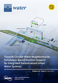
The current centralized model of urban water management faces multiple challenges at the supply and the demand side. These challenges highlight the need to progress towards the decentralization of urban water, where multiple distributed technologies (water-aware appliances, rainwater harvesting, greywater recycling, sustainable urban drainage) are applied in an integrated fashion to design more resilient neighbourhoods. To support design and management decisions towards the circular, decentralized water systems of the future, a simulation-based framework is presented for the Dutch neighbourhood of SUPERLOCAL, combining urban water cycle modelling with key performance indicators that convey useful information for stakeholders. View this paper.
  • Issues are regarded as officially published after their release is announced to the table of contents alert mailing list.
  • You may sign up for e-mail alerts to receive table of contents of newly released issues.
  • PDF is the official format for papers published in both, html and pdf forms. To view the papers in pdf format, click on the "PDF Full-text" link, and use the free Adobe Reader to open them.
Order results
Result details
Section
Select all
Export citation of selected articles as:
16 pages, 1026 KiB  
Article
Reducing Impacts of Contamination in Water Distribution Networks: A Combined Strategy Based on Network Partitioning and Installation of Water Quality Sensors
by Carlo Ciaponi, Enrico Creaco, Armando Di Nardo, Michele Di Natale, Carlo Giudicianni, Dino Musmarra and Giovanni Francesco Santonastaso
Water 2019, 11(6), 1315; https://doi.org/10.3390/w11061315 - 25 Jun 2019
Cited by 37 | Viewed by 4318
Abstract
This paper proposes a combined management strategy for monitoring water distribution networks (WDNs). This strategy is based on the application of water network partitioning (WNP) for the creation of district metered areas (DMAs) and on the installation of sensors for water quality monitoring. [...] Read more.
This paper proposes a combined management strategy for monitoring water distribution networks (WDNs). This strategy is based on the application of water network partitioning (WNP) for the creation of district metered areas (DMAs) and on the installation of sensors for water quality monitoring. The proposed methodology was tested on a real WDN, showing that boundary pipes, at which flowmeters are installed to monitor flow, are good candidate locations for sensor installation, when considered along with few other nodes detected through topological criteria on the partitioned WDN. The option of considering only these potential locations, instead of all WDN nodes, inside a multi-objective optimization process, helps in reducing the search space of possible solutions and, ultimately, the computational burden. The solutions obtained with the optimization are effective in reducing affected population and detection time in contamination scenarios, and in increasing detection likelihood and redundancy of the monitoring system. Last but most importantly, these solutions offer benefits in terms of management and costs. In fact, installing a sensor alongside the flowmeter present between two adjacent DMAs yields managerial advantages associated with the closeness of the two devices. Furthermore, economic benefits due to the possibility of sharing some electronical components for data acquisition, saving, and transmission are derived. Full article
(This article belongs to the Special Issue Smart Urban Water Networks)
Show Figures

Figure 1

24 pages, 1776 KiB  
Article
Assessing the Impact of Cyanuric Acid on Bather’s Risk of Gastrointestinal Illness at Swimming Pools
by Richard A. Falk, Ernest R. Blatchley III, Thomas C. Kuechler, Ellen M. Meyer, Stanley R. Pickens and Laura M. Suppes
Water 2019, 11(6), 1314; https://doi.org/10.3390/w11061314 - 25 Jun 2019
Cited by 7 | Viewed by 10572
Abstract
Current regulatory codes for swimming pool disinfection separately regulate free chlorine (FC) and cyanuric acid (CYA). It is well-known that CYA affects disinfection rates by reversibly binding to FC in aqueous solutions. However, limits for these regulated parameters have neither systematically accounted for [...] Read more.
Current regulatory codes for swimming pool disinfection separately regulate free chlorine (FC) and cyanuric acid (CYA). It is well-known that CYA affects disinfection rates by reversibly binding to FC in aqueous solutions. However, limits for these regulated parameters have neither systematically accounted for this chemistry nor been based on the risk of gastrointestinal illness. This study was intended to determine the minimum concentration of FC relative to CYA based on the risk of gastrointestinal illness from normal fecal sloughing of selected pathogens and to find a simple regulatory rule for jointly managing FC and CYA for consistent disinfection. Literature data on CYA’s effect on microbial inactivation rates were reanalyzed based on the equilibria governing hypochlorous acid (HOCl) concentration. A model was developed that considers the rates of pathogen introduction into pool water, disinfection, turbulent diffusive transport, and pathogen uptake by swimmers to calculate the associated risk of illness. Model results were compared to U.S. Environmental Protection Agency (EPA) untreated recreational water acceptable gastrointestinal illness risk. For Cryptosporidium, correlation between log inactivation and Chick–Watson Ct was far better when C refers to HOCl concentration than to FC (r = −0.96 vs. −0.06). The HOCl concentration had a small variation (± 1.8%) at a constant CYA/FC ratio for typical FC and CYA ranges in swimming pools. In 27 U.S. states, the allowed FC and CYA results in HOCl concentrations spanning more than a factor of 500. Using conservative values for a high bather load pool with 2 mg/L FC and 90 mg/L CYA, the model predicted a 0.071 annual probability of infection for Giardia, exceeding the EPA regulatory 0.036 limit for untreated recreational waters. FC and CYA concentrations in swimming pools should be jointly regulated as a ratio. We recommend a maximum CYA/FC ratio of 20. Full article
Show Figures

Figure 1

17 pages, 2254 KiB  
Article
Bank Processes and Revetment Erosion of a Large Lowland River: Case Study of the Lower Tisza River, Hungary
by Tímea Kiss, Gabriel J. Amissah and Károly Fiala
Water 2019, 11(6), 1313; https://doi.org/10.3390/w11061313 - 25 Jun 2019
Cited by 11 | Viewed by 4671
Abstract
Stone and concrete revetments are widely constructed to control bank erosion and thus stabilize river banks. The consequences include accelerated erosion at unrevetted downstream channel sections and in-channel incision at revetted sections. The studied section of the Tisza River (Hungary) was revetted along [...] Read more.
Stone and concrete revetments are widely constructed to control bank erosion and thus stabilize river banks. The consequences include accelerated erosion at unrevetted downstream channel sections and in-channel incision at revetted sections. The studied section of the Tisza River (Hungary) was revetted along 49% of its banks in the 20th century with stepped-block and placed-rock revetments. We therefore aimed (1) to study the effects of revetment constructions on channel processes and (2) to evaluate the state and collapse of revetments using a DEM of the channel and ADCP measurements. In the late 19th century, the river had an equilibrium meandering channel, with alternating eroding and aggrading banks. Currently, erosional processes dominate. Thus, 65% of the total channel length is affected by bank erosion. The revetments reduced the active lateral erosional processes only temporarily, as 58% of the revetments, mainly placed-rock, are already damaged. The flow characteristics at the revetted sections were found to depend on the rate and type of revetment collapse. Large pools developed in front of the revetments, playing an important role in initiating their erosion. The placed-rock revetments can collapse by slides or by stones falling into the pool one-by-one. In this case, a knickpoint develops, propagating upstream. Thus, the collapse and accelerated bank erosion also propagate upstream. The increased hazard created by the failure of the revetments requires the re-planning of bank stabilization practices. Full article
(This article belongs to the Section Hydraulics and Hydrodynamics)
Show Figures

Graphical abstract

20 pages, 3301 KiB  
Article
Scenario Analysis of Initial Water-Rights Allocation to Improve Regional Water Productivities
by Tienan Li, Xueting Zeng, Cong Chen, Xiangmin Kong, Junlong Zhang, Ying Zhu, Fan Zhang and He Dong
Water 2019, 11(6), 1312; https://doi.org/10.3390/w11061312 - 25 Jun 2019
Cited by 4 | Viewed by 2391
Abstract
In this study, an initial water-rights allocation (IWRA) model is proposed for adjusting the traditional initial water-rights empowerment model based on previous water intake permits, with the aim of improving the productivity of water resources under population growth and economic development. A stochastic [...] Read more.
In this study, an initial water-rights allocation (IWRA) model is proposed for adjusting the traditional initial water-rights empowerment model based on previous water intake permits, with the aim of improving the productivity of water resources under population growth and economic development. A stochastic scenario with Laplace criterion mixed fuzzy programming (SSLF) is developed into an IWRA model to deal with multiple uncertainties and complexities, which includes dynamic water demand, changing water policy, adjusted tradable water rights, the precise risk attitude of policymakers, development of the economy, and their interactions. SSLF not only deals with fuzziness in probability distributions with high satisfaction degrees, but also reflects the risk attitudes of policymakers with the Laplace criterion, which can handle the probability of scenario occurrence under the supposition of no data available. The developed IWRA model with the SSLF method is applied to a practical case in an alpine region of China. The results of adjusted initial water rights, optimal water-right allocation, changed industrial structure, and system benefits under various scenarios associated with risk attitudes and water productivity improvement were obtained and analyzed. It was found that the current initial water-rights allocation scheme based on previous intake water permits is not efficient, and this can be modified by the IWRA model. Based on the strategies of drinking safety and ecological security, the main tradeoff between agricultural and industrial water rights can facilitate optimization of the current initial water-rights allocation. This can assist policymakers in producing an effective plan to promote water productivity and water resource management in a robust and reliable manner. Full article
(This article belongs to the Section Water Resources Management, Policy and Governance)
Show Figures

Figure 1

13 pages, 3239 KiB  
Article
The Problem of Water Use in Rural Areas of Southwestern Spain: A Local Perspective
by Manuel Pulido, Jesús Barrena-González, Alberto Alfonso-Torreño, Rafael Robina-Ramírez and Saskia Keesstra
Water 2019, 11(6), 1311; https://doi.org/10.3390/w11061311 - 25 Jun 2019
Cited by 9 | Viewed by 3718
Abstract
Water is a key strategic resource, particularly in Mediterranean climate-type areas with impermeable rocks and shallow soils like Southwestern Spain. The region of Extremadura is commonly known by its large surface occupied by big dams (30% of water dammed in Spain) although this [...] Read more.
Water is a key strategic resource, particularly in Mediterranean climate-type areas with impermeable rocks and shallow soils like Southwestern Spain. The region of Extremadura is commonly known by its large surface occupied by big dams (30% of water dammed in Spain) although this theoretical abundance of water does not hide other problems of use. In this study, we have interviewed 132 people from the municipality of Arroyo de San Serván in order to know what the problems related to water use are, especially those that concern local people the most. Regarding the use of water at home, 90% of interviewees spend less than 60 EUR per month for water and their mean degree of satisfaction about the service is 3.7 out of 7. The reason for this low value can be the excessive content of calcium and bad taste according to 82.1%. Therefore, 64.2% of people do not usually drink water from the tap. Around two thirds of these local people usually buy water in the supermarket or drink filtered water. Concerning agricultural activities, local people gave great importance to irrigation as a source of employment (5.6/7) and inputs (4.5/7), although their satisfaction decreases about the current price of water for agriculture (0.02 EUR m−3). In addition, they are really worried about the overuse of fertilizers and herbicides (5.4/7) and they think about the necessity of taking measures to reduce these problems (6.1/7) as well as to reduce some management problems such as supply cuts. In the last few years, private (swimming pools) and public leisure facilities (swimming pool and spa) have been built in spite of not being considered important by local people (3.6–4.0/7). Nevertheless, about 60% of them consider these common facilities very positive in terms of employment, tourism attractions and entertainment for local people. Full article
(This article belongs to the Section Water Resources Management, Policy and Governance)
Show Figures

Figure 1

22 pages, 6333 KiB  
Article
Designing the National Network for Automatic Monitoring of Water Quality Parameters in Greece
by Angeliki Mentzafou, Yiannis Panagopoulos and Elias Dimitriou
Water 2019, 11(6), 1310; https://doi.org/10.3390/w11061310 - 25 Jun 2019
Cited by 26 | Viewed by 4511
Abstract
Water quality indices that describe the status of water are commonly used in freshwater vulnerability assessment. The design of river water quality monitoring programs has always been a complex process and despite the numerous methodologies employed by experts, there is still no generally [...] Read more.
Water quality indices that describe the status of water are commonly used in freshwater vulnerability assessment. The design of river water quality monitoring programs has always been a complex process and despite the numerous methodologies employed by experts, there is still no generally accepted, holistic and practical approach to support all the phases and elements related. Here, a Geographical Information System (GIS)-based multicriteria decision analysis approach was adopted so as to contribute to the design of the national network for monitoring of water quality parameters in Greece that will additionally fulfill the urgent needs for an operational, real-time monitoring of the water resources. During this cost-effective and easily applied procedure the high priority areas were defined by taking into consideration the most important conditioning factors that impose pressures on rivers and the special conditions that increase the need for monitoring locally. The areas of increased need for automatic monitoring of water quality parameters are highlighted and the output map is validated. The sites in high priority areas are proposed for the installation of automatic monitoring stations and the installation and maintenance budget is presented. Finally, the proposed network is contrasted with the current automatic monitoring network in Greece. Full article
(This article belongs to the Special Issue Assessing Surface and Ground- Water Vulnerability and Pollution Risk)
Show Figures

Figure 1

14 pages, 1566 KiB  
Article
Residual Maintenance Using Sodium Hypochlorite, Sodium Dichloroisocyanurate, and Chlorine Dioxide in Laboratory Waters of Varying Turbidity
by Karin Gallandat, David Stack, Gabrielle String and Daniele Lantagne
Water 2019, 11(6), 1309; https://doi.org/10.3390/w11061309 - 25 Jun 2019
Cited by 11 | Viewed by 6740
Abstract
Sodium hypochlorite (NaOCl) and sodium dichloroisocyanurate (NaDCC) are commonly used for household water treatment (HWT); chlorine dioxide (ClO2) is a potential new HWT option. We compared the residual maintenance of NaOCl, NaDCC, and ClO2 over 24 hours using recommended dosages [...] Read more.
Sodium hypochlorite (NaOCl) and sodium dichloroisocyanurate (NaDCC) are commonly used for household water treatment (HWT); chlorine dioxide (ClO2) is a potential new HWT option. We compared the residual maintenance of NaOCl, NaDCC, and ClO2 over 24 hours using recommended dosages (2 and 4 mg/L) in waters of varying turbidity (0–300 NTU, from kaolin clay or creek-bottom sediments) and total organic carbon (TOC) concentrations (0–100 mg/L), for a total of 324 reactors. NaOCl and NaDCC had similar free chlorine decay rates, and ClO2 decayed more rapidly across all of the tested conditions. Little variability was observed across clay-based turbidity levels and TOC concentrations. With a dosage of 2 mg/L, a residual ≥0.2 mg/L was maintained at 30 NTU for NaOCl and 100 NTU for NaDCC; for ClO2, 4 mg/L were required to maintain ≥0.2 mg/L under all conditions except at zero turbidity. Comparisons with data from the literature suggest that the three compounds would inactivate E. coli, rotavirus, and Giardia cysts within 1 hour under all conditions, except 300 NTU for NaOCl and NaDCC. All three disinfectants are similarly efficacious for this usage; however, differences are seen in decay rates that may influence disinfectant selection depending on water storage time. Full article
(This article belongs to the Special Issue Water, Sanitation, and Hygiene in Humanitarian Contexts)
Show Figures

Figure 1

15 pages, 1423 KiB  
Article
Evaluation of Mercury Transformation and Benthic Organisms Uptake in a Creek Sediment of Pearl River Estuary, China
by Long Chen, Feng Li, Wenrou Huang, Zhi Li and Mingguang Chen
Water 2019, 11(6), 1308; https://doi.org/10.3390/w11061308 - 25 Jun 2019
Cited by 4 | Viewed by 4258
Abstract
A large fraction of mercury contaminant in the environment is from industrial production, and it potentially impairs human health once entering the food chain. Millions of people reside in the Pearl River Delta region, and water quality in the estuary directly affects their [...] Read more.
A large fraction of mercury contaminant in the environment is from industrial production, and it potentially impairs human health once entering the food chain. Millions of people reside in the Pearl River Delta region, and water quality in the estuary directly affects their drinking water safety. Considering the highly intense anthropogenic activities and industrial productions, we attempted to measure the sediment mercury concentration in the Pearl River estuary. In this work, samples of a creek sediment within this region were collected and mercury concentrations were quantified. Total mercury, simultaneously extracted mercury, methylmercury, and bio-accumulated mercury were individually assayed. Results indicated that total mercury concentrations of investigated sites ranged from 1.073 to 4.450 µg/g dry sediment. The mercury in the sediment also transformed into more toxic methylmercury, which then adversely affected benthos biodiversity. Correlation analysis revealed that, mercury was accumulated into benthic microorganisms, mainly through the uptake of methylmercury. High concentrations of acid-volatile sulfide in the sediment indicated the presence of active sulfate-reducing bacteria, which could also catalytically transform inorganic mercury into methylmercury. Correlation analysis further showed that sulfate-reducing bacteria activity accounted for methylmercury formation. Full article
(This article belongs to the Section Oceans and Coastal Zones)
Show Figures

Graphical abstract

22 pages, 7549 KiB  
Article
Human-Induced Alterations to Land Use and Climate and Their Responses for Hydrology and Water Management in the Mekong River Basin
by Venkataramana Sridhar, Hyunwoo Kang and Syed A. Ali
Water 2019, 11(6), 1307; https://doi.org/10.3390/w11061307 - 25 Jun 2019
Cited by 48 | Viewed by 6242
Abstract
The Mekong River Basin (MRB) is one of the significant river basins in the world. For political and economic reasons, it has remained mostly in its natural condition. However, with population increases and rapid industrial growth in the Mekong region, the river has [...] Read more.
The Mekong River Basin (MRB) is one of the significant river basins in the world. For political and economic reasons, it has remained mostly in its natural condition. However, with population increases and rapid industrial growth in the Mekong region, the river has recently become a hotbed of hydropower development projects. This study evaluated these changing hydrological conditions, primarily driven by climate as well as land use and land cover change between 1992 and 2015 and into the future. A 3% increase in croplands and a 1–2% decrease in grasslands, shrublands, and forests was evident in the basin. Similarly, an increase in temperature of 1–6 °C and in precipitation of 15% was projected for 2015–2099. These natural and climate-induced changes were incorporated into two hydrological models to evaluate impacts on water budget components, particularly streamflow. Wet season flows increased by up to 10%; no significant change in dry season flows under natural conditions was evident. Anomaly in streamflows due to climate change was present in the Chiang Saen and Luang Prabang, and the remaining flow stations showed up to a 5% increase. A coefficient of variation <1 suggested no major difference in flows between the pre- and post-development of hydropower projects. The results suggested an increasing trend in streamflow without the effect of dams, while the inclusion of a few major dams resulted in decreased river streamflow of 6% to 15% possibly due to irrigation diversions and climate change. However, these estimates fall within the range of uncertainties in natural climate variability and hydrological parameter estimations. This study offers insights into the relationship between biophysical and anthropogenic factors and highlights that management of the Mekong River is critical to optimally manage increased wet season flows and decreased dry season flows and handle irrigation diversions to meet the demand for food and energy production. Full article
Show Figures

Graphical abstract

12 pages, 1781 KiB  
Article
Migration of Non-Native Predator Asp (Leuciscus aspius) from a Reservoir Poses a Potential Threat to Native Species in Tributaries
by Nikola Pfauserová, Ondřej Slavík, Pavel Horký, Jitka Kolářová and Tomáš Randák
Water 2019, 11(6), 1306; https://doi.org/10.3390/w11061306 - 25 Jun 2019
Cited by 10 | Viewed by 4074
Abstract
The introduction of non-native species and human-altered habitats are currently the main threats to freshwater ecosystems. Due to predation and competition, biological invaders can cause extinctions and imperil the status of native species, and this phenomenon is enhanced by habitat alteration, for example, [...] Read more.
The introduction of non-native species and human-altered habitats are currently the main threats to freshwater ecosystems. Due to predation and competition, biological invaders can cause extinctions and imperil the status of native species, and this phenomenon is enhanced by habitat alteration, for example, dam construction. In addition to river fragmentation caused by dam construction, the impact of non-native species migrating from reservoirs on native assemblages in their tributaries should be considered from a long-term perspective. The present study focused on asp (Leuciscus aspius), an artificially introduced piscivorous cyprinid that became established in the Lipno Reservoir (Czech Republic). Asp regularly occur in a tributary, the Vltava River, where twenty-five individuals were captured, radio-tagged, and tracked for five consecutive years. Asp occurrence in the tributary was highest during spring due to the upstream migration of spawning fish, and this was interconnected with a movement activity peak in March when the temperature reached 6 °C. The fish migrated a maximum distance of 31 km, and the probability of asp occurrence in the tributary was sex-dependent, with more females than males. Some individuals occupied the Vltava River not only for spawning but remained until the temperatures dropped below 10 °C. This study shows how non-native predators use reservoirs for wintering but feed and spawn in tributaries. Full article
(This article belongs to the Special Issue Effects of Species Introduction on Aquatic Communities)
Show Figures

Figure 1

20 pages, 7032 KiB  
Article
Lower Danube Water Quality Quantified through WQI and Multivariate Analysis
by Catalina Iticescu, Lucian P. Georgescu, Gabriel Murariu, Catalina Topa, Mihaela Timofti, Violeta Pintilie and Maxim Arseni
Water 2019, 11(6), 1305; https://doi.org/10.3390/w11061305 - 24 Jun 2019
Cited by 56 | Viewed by 4224
Abstract
The aim of the present paper is to quantify water quality in the Lower Danube Region by using a series of multivariate techniques and the Water Quality Index (WQI). In this paper were measured 18 parameters upstream and downstream the city of Galati [...] Read more.
The aim of the present paper is to quantify water quality in the Lower Danube Region by using a series of multivariate techniques and the Water Quality Index (WQI). In this paper were measured 18 parameters upstream and downstream the city of Galati along the Danube River, namely: pH, Dissolved Oxygen (DO), Chemical Oxygen Demand (COD), Biochemical Oxygen Demand (BOD), N-NH4+, N-NO2, N-NO3, N total, P-PO43−, SO42−, Cl, Fe-total, Cr-total, Pb2+, Ni2+, Mn2+, Zn2+, As2+, in the interval winter 2013–winter 2016. The samples were either analyzed on the field, or sent for testing to the laboratory. The physicochemical parameters mentioned above were analyzed in accordance with the Romanian and International standards in force. The WQI was calculated according to Weighted Arithmetic Water Quality Index Method. The interdependencies between the selected physicochemical parameters were used for determining potential sources of pollution. Monitoring water quality dynamics in the period mentioned above favoured a series of relevant conclusions about the anthropic influence on water quality. Water quality was assessed by processing the measurements results, by calculating the water quality index (WQI), and by using the principal component analyses (PCA) and the response surface method (RSM) with the aim of correlating the indices for the physico-chemical parameters. Full article
(This article belongs to the Section Water Quality and Contamination)
Show Figures

Figure 1

13 pages, 4326 KiB  
Article
Optimization Study for the Desorption of Methylene Blue Dye from Clay Based Adsorbent Coating
by Momina, Mohd Rafatullah, Suzylawati Ismail and Anees Ahmad
Water 2019, 11(6), 1304; https://doi.org/10.3390/w11061304 - 24 Jun 2019
Cited by 54 | Viewed by 5468
Abstract
Batch desorption experiments of methylene blue (MB) dye from a clay adsorbent coating were carried out to evaluate the maximum desorption conditions. Combination of thermal and chemical regeneration techniques were used for the desorption process. The desorption of MB was found to be [...] Read more.
Batch desorption experiments of methylene blue (MB) dye from a clay adsorbent coating were carried out to evaluate the maximum desorption conditions. Combination of thermal and chemical regeneration techniques were used for the desorption process. The desorption of MB was found to be 70% using an HCl solvent after heating adsorbent coating at 160 °C. The optimization study was carried out to identity the optimum desorption conditions using MINITAB 14 software. The individual and interaction effects of three factors, temperature, dye concentration and contact time for desorption of dye were determine by applying response surface methodology (RSM). The optimization results showed that all three factors have main effects whereas the interaction of concentration–time is significant as compared to other interactions. The findings exhibit a maximum desorption efficiency 23 mg/g at 60 °C for 100 mg/L of dye and 150 min of contact time. Full article
Show Figures

Graphical abstract

27 pages, 2548 KiB  
Review
Current Practice and Recommendations for Modelling Global Change Impacts on Water Resource in the Himalayas
by Andrea Momblanch, Ian P. Holman and Sanjay K. Jain
Water 2019, 11(6), 1303; https://doi.org/10.3390/w11061303 - 24 Jun 2019
Cited by 21 | Viewed by 5216
Abstract
Global change is expected to have a strong impact in the Himalayan region. The climatic and orographic conditions result in unique modelling challenges and requirements. This paper critically appraises recent hydrological modelling applications in Himalayan river basins, focusing on their utility to analyse [...] Read more.
Global change is expected to have a strong impact in the Himalayan region. The climatic and orographic conditions result in unique modelling challenges and requirements. This paper critically appraises recent hydrological modelling applications in Himalayan river basins, focusing on their utility to analyse the impacts of future climate and socio-economic changes on water resource availability in the region. Results show that the latter are only represented by land use change. Distributed, process-based hydrological models coupled with temperature-index melt models are predominant. The choice of spatial discretisation is critical for model performance due to the strong influence of elevation on meteorological variables and snow/ice accumulation and melt. However, the sparsity and limited reliability of point weather data, and the biases and low resolution of gridded datasets, hinder the representation of the meteorological complexity. These data limitations often limit the selection of models and the quality of the outputs by forcing the exclusion of processes that are significant to the local hydrology. The absence of observations for water stores and fluxes other than river flows prevents multi-variable calibration and increases the risk of equifinality. The uncertainties arising from these limitations are amplified in climate change analyses and, thus, systematic assessment of uncertainty propagation is required. Based on these insights, transferable recommendations are made on directions for future data collection and model applications that may enhance realism within models and advance the ability of global change impact assessments to inform adaptation planning in this globally important region. Full article
(This article belongs to the Section Hydrology)
Show Figures

Figure 1

10 pages, 3070 KiB  
Article
Analysis of Drought-Sensitive Areas and Evolution Patterns through Statistical Simulations of the Indian Ocean Dipole Mode
by Qing-Gang Gao, Vonevilay Sombutmounvong, Lihua Xiong, Joo-Heon Lee and Jong-Suk Kim
Water 2019, 11(6), 1302; https://doi.org/10.3390/w11061302 - 23 Jun 2019
Cited by 6 | Viewed by 3594
Abstract
In this study, we investigated extreme droughts in the Indochina peninsula and their relationship with the Indian Ocean Dipole (IOD) mode. Areas most vulnerable to drought were analyzed via statistical simulations of the IOD based on historical observations. Results of the long-term trend [...] Read more.
In this study, we investigated extreme droughts in the Indochina peninsula and their relationship with the Indian Ocean Dipole (IOD) mode. Areas most vulnerable to drought were analyzed via statistical simulations of the IOD based on historical observations. Results of the long-term trend analysis indicate that areas with increasing spring (March–May) rainfall are mainly distributed along the eastern coast (Vietnam) and the northwestern portions of the Indochina Peninsula (ICP), while Central and Northern Laos and Northern Cambodia have witnessed a reduction in spring rainfall over the past few decades. This trend is similar to that of extreme drought. During positive IOD years, the frequency of extreme droughts was reduced throughout Vietnam and in the southwestern parts of China, while increased drought was observed in Cambodia, Central Laos, and along the coastline adjacent to the Myanmar Sea. Results for negative IOD years were similar to changes observed for positive IOD years; however, the eastern and northern parts of the ICP experienced reduced droughts. In addition, the results of the statistical simulations proposed in this study successfully simulate drought-sensitive areas and evolution patterns of various IOD changes. The results of this study can help improve diagnostic techniques for extreme droughts in the ICP. Full article
Show Figures

Figure 1

14 pages, 5759 KiB  
Article
Drought Assessment using GRACE Terrestrial Water Storage Deficit in Mongolia from 2002 to 2017
by Wenjun Yu, Yanzhong Li, Yanping Cao and Tayler Schillerberg
Water 2019, 11(6), 1301; https://doi.org/10.3390/w11061301 - 22 Jun 2019
Cited by 23 | Viewed by 4613
Abstract
Climate warming can result in increases in the frequency and magnitude of drought events, leading to water shortages and socioeconomic losses. Gravity Recovery and Climate Experiment (GRACE) satellite data have been used to monitor and estimate drought events. However, there is little information [...] Read more.
Climate warming can result in increases in the frequency and magnitude of drought events, leading to water shortages and socioeconomic losses. Gravity Recovery and Climate Experiment (GRACE) satellite data have been used to monitor and estimate drought events. However, there is little information on detecting the characteristics of droughts in Mongolia due to sparse observations. In this study, we estimate the drought conditions in Mongolia using GRACE terrestrial water storage data during 2002–2017. Water storage deficit (WSD) is used to identify the drought event and calculate the water storage deficit index (WSDI). The WSDI was compared with the standardized precipitation index (SPI) and the standardized precipitation evapotranspiration index (SPEI). The results showed that there were two turning points of WSD in 2007 and 2012. Eight drought events were identified and the most severe drought occurred in 2007–2009 lasting for 38 months with a WSDI of −0.98 and a total WSD of −290.8 mm. Overall, the WSD and WSDI were effective in analyzing and assessing the drought severity in a region where hydrological observations are lacking. Full article
(This article belongs to the Section Hydrology)
Show Figures

Figure 1

20 pages, 2557 KiB  
Article
Assessment of Climate Change Impacts in the North Adriatic Coastal Area. Part II: Consequences for Coastal Erosion Impacts at the Regional Scale
by Valentina Gallina, Silvia Torresan, Alex Zabeo, Jonathan Rizzi, Sandro Carniel, Mauro Sclavo, Lisa Pizzol, Antonio Marcomini and Andrea Critto
Water 2019, 11(6), 1300; https://doi.org/10.3390/w11061300 - 21 Jun 2019
Cited by 19 | Viewed by 5046
Abstract
Coastal erosion is an issue of major concern for coastal managers and is expected to increase in magnitude and severity due to global climate change. This paper analyzes the potential consequences of climate change on coastal erosion (e.g., impacts on beaches, wetlands and [...] Read more.
Coastal erosion is an issue of major concern for coastal managers and is expected to increase in magnitude and severity due to global climate change. This paper analyzes the potential consequences of climate change on coastal erosion (e.g., impacts on beaches, wetlands and protected areas) by applying a Regional Risk Assessment (RRA) methodology to the North Adriatic (NA) coast of Italy. The approach employs hazard scenarios from a multi-model chain in order to project the spatial and temporal patterns of relevant coastal erosion stressors (i.e., increases in mean sea-level, changes in wave height and variations in the sediment mobility at the sea bottom) under the A1B climate change scenario. Site-specific environmental and socio-economic indicators (e.g., vegetation cover, geomorphology, population) and hazard metrics are then aggregated by means of Multi-Criteria Decision Analysis (MCDA) with the aim to provide an example of exposure, susceptibility, risk and damage maps for the NA region. Among seasonal exposure maps winter and autumn depict the worse situation in 2070–2100, and locally around the Po river delta. Risk maps highlight that the receptors at higher risk are beaches, wetlands and river mouths. The work presents the results of the RRA tested in the NA region, discussing how spatial risk mapping can be used to establish relative priorities for intervention, to identify hot-spot areas and to provide a basis for the definition of coastal adaptation and management strategies. Full article
(This article belongs to the Special Issue Effect of Climate Change on Coastal Hydrodynamics)
Show Figures

Figure 1

17 pages, 5804 KiB  
Article
Temporal Effects of Groundwater on Physical and Biotic Components of a Karst Stream
by Tao Tang, Shuhan Guo, Lu Tan, Tao Li, Ryan M. Burrows and Qinghua Cai
Water 2019, 11(6), 1299; https://doi.org/10.3390/w11061299 - 21 Jun 2019
Cited by 4 | Viewed by 3373
Abstract
Although most lotic ecosystems are groundwater dependent, our knowledge on the relatively long-term ecological effects of groundwater discharge on downstream reaches remains limited. We surveyed four connected reaches of a Chinese karst stream network for 72 consecutive months, with one reach, named Hong [...] Read more.
Although most lotic ecosystems are groundwater dependent, our knowledge on the relatively long-term ecological effects of groundwater discharge on downstream reaches remains limited. We surveyed four connected reaches of a Chinese karst stream network for 72 consecutive months, with one reach, named Hong Shi Zi (HSZ), evidently affected by groundwater. We tested whether, compared with other reaches, HSZ had (1) milder water temperature and flow regimes, and (2) weaker influences of water temperature and flow on benthic algal biomass represented by chlorophyll a (Chl. a) concentrations. We found that the maximum monthly mean water temperature in HSZ was 0.6 °C lower than of the adjacent upstream reach, and the minimum monthly mean water temperature was 1.0 °C higher than of the adjacent downstream reach. HSZ had the smallest coefficient of variation (CV) for water temperature but the largest CV for discharge. Water temperature and discharge displayed a significant 12-month periodicity in all reaches not directly groundwater influenced. Only water temperature displayed such periodicity in HSZ. Water temperature was an important predictor of temporal variation in Chl. a in all reaches, but its influence was weakest in HSZ. Our findings demonstrate that longer survey data can provide insight into groundwater–surface water interactions. Full article
(This article belongs to the Special Issue Groundwater-Surface Water Interactions)
Show Figures

Figure 1

20 pages, 3331 KiB  
Article
Copula-Based Drought Analysis Using Standardized Precipitation Evapotranspiration Index: A Case Study in the Yellow River Basin, China
by Fei Wang, Zongmin Wang, Haibo Yang, Yong Zhao, Zezhong Zhang, Zhenhong Li and Zafar Hussain
Water 2019, 11(6), 1298; https://doi.org/10.3390/w11061298 - 21 Jun 2019
Cited by 28 | Viewed by 4751
Abstract
Drought is a complex natural phenomenon that occurs throughout the world. Analyzing and grasping the occurrence and development of drought events is of great practical significance for preventing drought disasters. In this study, the Standardized Precipitation Evapotranspiration Index (SPEI) was adopted as a [...] Read more.
Drought is a complex natural phenomenon that occurs throughout the world. Analyzing and grasping the occurrence and development of drought events is of great practical significance for preventing drought disasters. In this study, the Standardized Precipitation Evapotranspiration Index (SPEI) was adopted as a drought index to quantitatively analyze the temporal evolution, spatial distribution, and gridded trend characteristics of drought in the Yellow River basin (YRB) during 1961–2015. The duration and severity of drought events were extracted based on run theory, and the best-fitted Copula models were used to combine the drought duration and severity to analyze the drought return period. The results indicated that: (1) the drought showed a non-significant upward trend in the YRB from 1961 to 2015, and drought events became more serious after the 1990s; (2) the month and season with the most serious drought was June and summer, with an average SPEI value of −0.94 and −0.70; (3) the seasons with an increasing drought trend were spring, summer, and autumn; (4) the most serious drought lasted for 16 months in the YRB, with drought severity of 12.44 and drought return period of 115.18 years; and (5) Frank-copula was found to be the best-fitted one in the YRB. The research results can reveal the evolution characteristics of drought, and provide reference and basis for drought resistance and reduction in the YRB. Full article
(This article belongs to the Section Hydrology)
Show Figures

Graphical abstract

19 pages, 6955 KiB  
Article
A Model for Selecting the Most Cost-Effective Pressure Control Device for More Sustainable Water Supply Networks
by Irene Fernández García, Daniele Novara and Aonghus Mc Nabola
Water 2019, 11(6), 1297; https://doi.org/10.3390/w11061297 - 21 Jun 2019
Cited by 32 | Viewed by 4644
Abstract
Pressure Reducing Valves (PRV) have been widely used as a device to control pressure at nodes in water distribution networks and thus reduce leakages. However, an energy dissipation takes place during PRV operation. Thus, micro-hydropower turbines and, more precisely, Pump As Turbines (PAT) [...] Read more.
Pressure Reducing Valves (PRV) have been widely used as a device to control pressure at nodes in water distribution networks and thus reduce leakages. However, an energy dissipation takes place during PRV operation. Thus, micro-hydropower turbines and, more precisely, Pump As Turbines (PAT) could be used as both leakage control and energy generating devices, thus contributing to a more sustainable water supply network. Studies providing clear guidelines for the determination of the most cost-effective device (PRV or PAT) analysing a wide database and considering all the costs involved, the water saving and the eventual power generation, have not been carried out to date. A model to determine the most cost-effective device has been developed, taking into account the Net Present Value (NPV). The model has been applied to two case studies: A database with 156 PRVs sites located in the UK; and a rural water supply network in Ireland with three PRVs. The application of the model showed that although the investment cost associated to the PRV installation is lower in the majority of cases, the NPV over the lifespan of the PAT is higher than the NPV associated with the PRV operation. Furthermore, the ratio between the NPV and the water saved over the lifespan of the PAT/PRV also offered higher values (from 6% to 29%) for the PAT installation, making PATs a more cost-effective and more sustainable means of pressure control in water distribution networks. Finally, the development of less expensive turbines and/or PATs adapted to work under different flow-head conditions will tip the balance toward the installation of these devices even further. Full article
(This article belongs to the Special Issue New Challenges in Water Systems)
Show Figures

Figure 1

16 pages, 8797 KiB  
Article
Impacts of Spatial Heterogeneity and Temporal Non-Stationarity on Intensity-Duration-Frequency Estimates—A Case Study in a Mountainous California-Nevada Watershed
by Huiying Ren, Z. Jason Hou, Mark Wigmosta, Ying Liu and L. Ruby Leung
Water 2019, 11(6), 1296; https://doi.org/10.3390/w11061296 - 21 Jun 2019
Cited by 14 | Viewed by 3425
Abstract
Changes in extreme precipitation events may require revisions of civil engineering standards to prevent water infrastructures from performing below the designated guidelines. Climate change may invalidate the intensity-duration-frequency (IDF) computation that is based on the assumption of data stationarity. Efforts in evaluating non-stationarity [...] Read more.
Changes in extreme precipitation events may require revisions of civil engineering standards to prevent water infrastructures from performing below the designated guidelines. Climate change may invalidate the intensity-duration-frequency (IDF) computation that is based on the assumption of data stationarity. Efforts in evaluating non-stationarity in the annual maxima series are inadequate, mostly due to the lack of long data records and convenient methods for detecting trends in the higher moments. In this study, using downscaled high resolution climate simulations of the historical and future periods under different carbon emission scenarios, we tested two solutions to obtain reliable IDFs under non-stationarity: (1) identify quasi-stationary time windows from the time series of interest to compute the IDF curves using data for the corresponding time windows; (2) introduce a parameter representing the trend in the means of the extreme value distributions. Focusing on a mountainous site, the Walker Watershed, the spatial heterogeneity and variability of IDFs or extremes are evaluated, particularly in terms of the terrain and elevation impacts. We compared observations-based IDFs that use the stationarity assumption with the two approaches that consider non-stationarity. The IDFs directly estimated based on the traditional stationarity assumption may underestimate the 100-year 24-h events by 10% to 60% towards the end of the century at most grids, resulting in significant under-designing of the engineering infrastructure at the study site. Strong spatial heterogeneity and variability in the IDF estimates suggest a preference for using high resolution simulation data for the reliable estimation of exceedance probability over data from sparsely distributed weather stations. Discrepancies among the three IDFs analyses due to non-stationarity are comparable to the spatial variability of the IDFs, underscoring a need to use an ensemble of non-stationary approaches to achieve unbiased and comprehensive IDF estimates. Full article
(This article belongs to the Section Hydrology)
Show Figures

Figure 1

17 pages, 3138 KiB  
Article
Interplays between State and Flux Hydrological Variables across Vadose Zones: A Numerical Investigation
by Zhaoxin Wang, Tiejun Wang and Yonggen Zhang
Water 2019, 11(6), 1295; https://doi.org/10.3390/w11061295 - 20 Jun 2019
Cited by 4 | Viewed by 3526
Abstract
Knowledge of both state (e.g., soil moisture) and flux (e.g., actual evapotranspiration (ETa) and groundwater recharge (GR)) hydrological variables across vadose zones is critical for understanding ecohydrological and land-surface processes. In this study, a one-dimensional process-based vadose zone [...] Read more.
Knowledge of both state (e.g., soil moisture) and flux (e.g., actual evapotranspiration (ETa) and groundwater recharge (GR)) hydrological variables across vadose zones is critical for understanding ecohydrological and land-surface processes. In this study, a one-dimensional process-based vadose zone model with generated soil hydraulic parameters was utilized to simulate soil moisture, ETa, and GR. Daily hydrometeorological data were obtained from different climate zones to drive the vadose zone model. On the basis of the field phenomenon of soil moisture temporal stability, reasonable soil moisture spatiotemporal structures were reproduced from the model. The modeling results further showed that the dependence of ETa and GR on soil hydraulic properties varied considerably with climatic conditions. In particular, the controls of soil hydraulic properties on ETa and GR greatly weakened at the site with an arid climate. In contrast, the distribution of mean relative difference (MRD) of soil moisture was still significantly correlated with soil hydraulic properties (most notably residual soil moisture content) under arid climatic conditions. As such, the correlations of MRD with ETa and GR differed across different climate regimes. In addition, the simulation results revealed that samples with average moisture conditions did not necessarily produce average values of ETa and GR (and vice versa), especially under wet climatic conditions. The loose connection between average state and flux hydrological variables across vadose zones is partly because of the high non-linearity of subsurface processes, which leads to the complex interactions of soil moisture, ETa, and GR with soil hydraulic properties. This study underscores the importance of using soil moisture information from multiple sites for inferring areal average values of ETa and GR, even with the knowledge of representative sites that can be used to monitor areal average moisture conditions. Full article
(This article belongs to the Special Issue Water Flow, Solute and Heat Transfer in Groundwater)
Show Figures

Figure 1

12 pages, 237 KiB  
Article
From Sharing the Burden of Scarcity to Markets: Ill-Fitting Water Property Rights and the Pressure of Economic Transition in South Asia
by Lin Crase, Bethany Cooper and Michael Burton
Water 2019, 11(6), 1294; https://doi.org/10.3390/w11061294 - 20 Jun 2019
Cited by 4 | Viewed by 2816
Abstract
In this paper, we consider the process of transition from an equitable distribution of water to support semi-subsistence outcomes to market-oriented agriculture. We examine the stresses placed on water institutions as farmers adjust production to become more market-oriented and consider the relationship between [...] Read more.
In this paper, we consider the process of transition from an equitable distribution of water to support semi-subsistence outcomes to market-oriented agriculture. We examine the stresses placed on water institutions as farmers adjust production to become more market-oriented and consider the relationship between farmers and irrigation officials under different scenarios. The paper is used to highlight some of the challenges pertaining to property rights but also considers the dangers of simply transposing solutions from full-market agriculture in developed economies to developing nations and countries in transition. In this context the role of Participatory Irrigation Management is scrutinized. We argue that this approach can potentially accommodate greater flexibility and market orientation in agriculture but ultimately the beneficiary-benefactor relationship between irrigation officials and farmers in parts of South Asia needs to be seriously challenged. Full article
26 pages, 2513 KiB  
Article
Self-Adaptive Models for Water Distribution System Design Using Single-/Multi-Objective Optimization Approaches
by Young Hwan Choi and Joong Hoon Kim
Water 2019, 11(6), 1293; https://doi.org/10.3390/w11061293 - 20 Jun 2019
Cited by 3 | Viewed by 3516
Abstract
This study compares the performance of self-adaptive optimization approaches in efficient water distribution systems (WDS) design and presents a guide for the selection of the appropriate method employing optimization utilizing the characteristic of each technique formulation. To this end, this study performs three [...] Read more.
This study compares the performance of self-adaptive optimization approaches in efficient water distribution systems (WDS) design and presents a guide for the selection of the appropriate method employing optimization utilizing the characteristic of each technique formulation. To this end, this study performs three types of analyses. First, the sensitivity analysis of each self-adaptive approach is conducted on single/multi-objective mathematical benchmark problems with various problem types (e.g., using solution shape or many local optimal solutions). Second, based on the applications and results of the mathematical problem, the performance of the algorithm is verified in the WDS design problem considering the minimum cost and the maximum system resilience under the single/multi-objective optimization framework. Third, the characteristics of search operators in the self-adaptive approach are compared according to the presence or absence of additional parameters and operators. Moreover, various performance indices are employed to compare the quantitative evaluation of each algorithm. Each algorithm is found to exhibit different characteristics depending on the problem scale and solution type. These results are expected to benefit future research in the formulation of new approaches and developments. Hence, this study provides rigorous testing of the performance of newly proposed algorithms in a highly simplified manner. Full article
Show Figures

Figure 1

20 pages, 3899 KiB  
Article
Probabilistic Assessment of Correlations of Water Levels in Polish Coastal Lakes with Sea Water Level with the Application of Archimedean Copulas
by Katarzyna Plewa, Adam Perz, Dariusz Wrzesiński and Leszek Sobkowiak
Water 2019, 11(6), 1292; https://doi.org/10.3390/w11061292 - 20 Jun 2019
Cited by 8 | Viewed by 3066
Abstract
The hydrology of coastal lakes differs significantly from that of inland water bodies due to the influence of the neighboring sea. Observed climatic changes are expected to enhance the effect of the sea on coastal lake ecosystems, which makes research on sea–lake interactions [...] Read more.
The hydrology of coastal lakes differs significantly from that of inland water bodies due to the influence of the neighboring sea. Observed climatic changes are expected to enhance the effect of the sea on coastal lake ecosystems, which makes research on sea–lake interactions even more significant. In this study, on the basis of maximum annual and monthly values of water level, dependencies among the water levels of six lakes located along the southern coast of the Baltic Sea in Poland, and the Baltic Sea water levels were analyzed. First, the Spearman rank correlation and the linear regression method were applied. Then, selected copulas were used to find joint distributions of the studied time series. In the next stage, the degrees of synchronous and asynchronous occurrences of maximum water levels in lakes and the sea were calculated. The study revealed that correlations between the maximum annual water levels in coastal lakes and in the Baltic Sea in the selected gauge stations were very strong and statistically significant. These results were confirmed by a synchronicity analysis carried out with the help of a copula function. The highest relationship was detected in the case of Lake Resko Przymorskie (correlation coefficient 0.86, synchronicity 75.18%), while the lowest were observed in Lakes Jamno (0.62 and 58.20%, respectively) and Bukowo (0.60 and 56.82%, respectively). The relation strength between maximum water levels of the sea and coastal lakes may increase in the future due to sea level rises caused by climate warming. Full article
(This article belongs to the Special Issue Effects of Oceanic-Atmospheric Oscillations on Rivers)
Show Figures

Figure 1

14 pages, 2855 KiB  
Article
Evaluating the Hydrologic Benefits of a Bioswale in Brunswick County, North Carolina (NC), USA
by Rebecca A. Purvis, Ryan J. Winston, William F. Hunt, Brian Lipscomb, Karthik Narayanaswamy, Andrew McDaniel, Matthew S. Lauffer and Susan Libes
Water 2019, 11(6), 1291; https://doi.org/10.3390/w11061291 - 20 Jun 2019
Cited by 9 | Viewed by 5688
Abstract
Bioswales are a promising stormwater control measure (SCM) for roadway runoff management, but few studies have assessed performance on a field scale. A bioswale is a vegetated channel with underlying engineered media and a perforated underdrain to promote improved hydrologic and water quality [...] Read more.
Bioswales are a promising stormwater control measure (SCM) for roadway runoff management, but few studies have assessed performance on a field scale. A bioswale is a vegetated channel with underlying engineered media and a perforated underdrain to promote improved hydrologic and water quality treatment. A bioswale with a rip-rap lined forebay was constructed along state highway NC 211 in Bolivia, North Carolina, USA, and monitored for 12 months. Thirty-seven of the 39 monitored rain events exfiltrated into underlying soils, resulting in no appreciable overflow or underdrain volume. The bioswale completely exfiltrated a storm event of 86.1 mm. The one event to have underdrain-only flow was 4.8 mm. The largest and third-largest rainfall depth events (82.6 and 146 mm, respectively) had a large percentage (85%) of volume exfiltrated, but also had appreciable overflow and underdrain volumes exiting the bioswale, resulting in no peak flow mitigation. Overall, this bioswale design was able to capture and manage storms larger than the design storm (38 mm), showing the positive hydrologic performance that can be achieved by this bioswale. The high treatment capabilities were likely due to the high infiltration rate of the media and the underlying soil, longer forebay underlain with media, gravel detention layer with an underdrain, and shallow slope. Full article
Show Figures

Figure 1

13 pages, 5950 KiB  
Article
Tsunami Intrusion and River Ice Movement
by Jiajia Pan and Hung Tao Shen
Water 2019, 11(6), 1290; https://doi.org/10.3390/w11061290 - 20 Jun 2019
Cited by 2 | Viewed by 2464
Abstract
A two-dimensional wave model coupled with ice dynamics is developed to evaluate ice effects on shallow water wave propagation on a beach and in a channel. The nonlinear Boussinesq equations with ice effects are derived and solved by the hybrid technique of the [...] Read more.
A two-dimensional wave model coupled with ice dynamics is developed to evaluate ice effects on shallow water wave propagation on a beach and in a channel. The nonlinear Boussinesq equations with ice effects are derived and solved by the hybrid technique of the Godunov-type finite volume method and finite difference method with the third-order Runge–Kutta method for time integration. The shock capturing method enables the model to simulate complex flows over irregular topography. The model is capable of simulating wave propagations accurately, including non-hydrostatic water pressure and wave dispersions. The ice dynamic module utilizes a Lagrangian discrete parcel method, based on smoothed particle hydrodynamics. The Boussinesq wave model is validated with an analytical solution of water surface oscillation in a parabolic container, an analytical solitary wave propagation in a flat channel, and experimental data on tsunami wave propagations. The validated model is then applied to investigate the interaction between ice and tsunami wave propagation, in terms of ice attenuation on tsunami wave propagations over a beach, ice deposition on the beach driven by the tsunami wave, and ice jam formation and release in a coastal channel with the intrusion of the tsunami wave. The simulated results demonstrated the interactions between tsunami waves and surface ice, including the maximum run up, ice movement along the beach, and ice jamming in a channel. Full article
(This article belongs to the Section Hydraulics and Hydrodynamics)
Show Figures

Figure 1

17 pages, 15205 KiB  
Article
Optimal Allocation Model of Water Resources Based on the Prospect Theory
by Huaxiang He, Aiqi Chen, Mingwan Yin, Zhenzhen Ma, Jinjun You, Xinmin Xie, Zhizhang Wang and Qiang An
Water 2019, 11(6), 1289; https://doi.org/10.3390/w11061289 - 20 Jun 2019
Cited by 14 | Viewed by 4344
Abstract
The rational allocation of water resources in the basin/region can be better assisted and performed using a suitable water resources allocation model. Rule-based and optimization-based simulation methods are utilized to solve medium- and long-term water resources allocation problems. Since rule-based allocation methods requires [...] Read more.
The rational allocation of water resources in the basin/region can be better assisted and performed using a suitable water resources allocation model. Rule-based and optimization-based simulation methods are utilized to solve medium- and long-term water resources allocation problems. Since rule-based allocation methods requires more experience from expert practice than optimization-based allocation methods, it may not be utilized by users that lack experience. Although the optimal solution can be obtained via the optimization-based allocation method, the highly skilled expert experience is not taken into account. To overcome this deficiency and employ the advantages of both rule-based and optimization-based simulation methods, this paper proposes the optimal allocation model of water resources where the highly skilled expert experience has been considered therein. The “prospect theory” is employed to analyze highly skilled expert behavior when decision-making events occur. The cumulative prospect theory value is employed to express the highly skilled expert experience. Then, the various elements of the cumulative prospect theory value can be taken as the variables or parameters in the allocation model. Moreover, the optimal water allocation model developed by the general algebraic modeling system (GAMS) has been improved by adding the decision reversal control point and defining the inverse objective function and other constraints. The case study was carried out in the Wuyur River Basin, northeast of China, and shows that the expert experience considered as the decision maker’s preference can be expressed in the improved optimal allocation model. Accordingly, the improved allocation model will contribute to improving the rationality of decision-making results and helping decision-makers better address the problem of water shortage. Full article
Show Figures

Figure 1

19 pages, 6783 KiB  
Article
Parsimonious Modeling of Snow Accumulation and Snowmelt Processes in High Mountain Basins
by Ismael Orozco, Félix Francés and Jesús Mora
Water 2019, 11(6), 1288; https://doi.org/10.3390/w11061288 - 20 Jun 2019
Cited by 4 | Viewed by 3457
Abstract
The success of hydrological modeling of a high mountain basin depends in most case on the accurate quantification of the snowmelt. However, mathematically modeling snowmelt is not a simple task due to, on one hand, the high number of variables that can be [...] Read more.
The success of hydrological modeling of a high mountain basin depends in most case on the accurate quantification of the snowmelt. However, mathematically modeling snowmelt is not a simple task due to, on one hand, the high number of variables that can be relevant and can change significantly in space and, in the other hand, the low availability of most of them in practical engineering. Therefore, this research proposes to modify the original equation of the classical degree-day model to introduce the spatial and temporal variability of the degree-day factor. To evaluate the effects of the variability in the hydrological modeling and the snowmelt modeling at the cell and hillslope scale. We propose to introduce the spatial and temporal variability of the degree-day factor using maps of radiation indices. These maps consider the position of the sun according to the time of year, solar radiation, insolation, topography and shaded-relief topography. Our priority has been to keep the parsimony of the snowmelt model that can be implemented in high mountain basins with limited observed input. The snowmelt model was included as a new module in the TETIS distributed hydrological model. The results show significant improvements in hydrological modeling in the spring period when the snowmelt is more important. At cell and hillslope scale errors are diminished in the snowpack, improving the representation of the flows and storages that intervene in high mountain basins. Full article
Show Figures

Figure 1

17 pages, 2528 KiB  
Article
River Bathymetry Model Based on Floodplain Topography
by Ludek Bures, Petra Sychova, Petr Maca, Radek Roub and Stepan Marval
Water 2019, 11(6), 1287; https://doi.org/10.3390/w11061287 - 20 Jun 2019
Cited by 11 | Viewed by 4304
Abstract
An appropriate digital elevation model (DEM) is required for purposes of hydrodynamic modelling of floods. Such a DEM describes a river’s bathymetry (bed topography) as well as its surrounding area. Extensive measurements for creating accurate bathymetry are time-consuming and expensive. Mathematical modelling can [...] Read more.
An appropriate digital elevation model (DEM) is required for purposes of hydrodynamic modelling of floods. Such a DEM describes a river’s bathymetry (bed topography) as well as its surrounding area. Extensive measurements for creating accurate bathymetry are time-consuming and expensive. Mathematical modelling can provide an alternative way for representing river bathymetry. This study explores new possibilities in mathematical depiction of river bathymetry. A new bathymetric model (Bathy-supp) is proposed, and the model’s ability to represent actual bathymetry is assessed. Three statistical methods for the determination of model parameters were evaluated. The best results were achieved by the random forest (RF) method. A two-dimensional (2D) hydrodynamic model was used to evaluate the influence of the Bathy-supp model on the hydrodynamic modelling results. Also presented is a comparison of the proposed model with another state-of-the-art bathymetric model. The study was carried out on a reach of the Otava River in the Czech Republic. The results show that the proposed model’s ability to represent river bathymetry exceeds that of his current competitor. Use of the bathymetric model may have a significant impact on improving the hydrodynamic model results. Full article
(This article belongs to the Special Issue Advances in Hydraulics and Hydroinformatics)
Show Figures

Figure 1

13 pages, 3472 KiB  
Article
Comparison of Biodegradation of Fats and Oils by Activated Sludge on Experimental and Real Scales
by Pedro Cisterna-Osorio and Patricia Arancibia-Avila
Water 2019, 11(6), 1286; https://doi.org/10.3390/w11061286 - 20 Jun 2019
Cited by 12 | Viewed by 5078
Abstract
Fats and oils are the most common pollutants in wastewater, and are usually eliminated through physical processes in wastewater treatment plants, generating large amounts of fats and residual oils that are difficult to dispose of and handle. The degradation of fatty wastewater was [...] Read more.
Fats and oils are the most common pollutants in wastewater, and are usually eliminated through physical processes in wastewater treatment plants, generating large amounts of fats and residual oils that are difficult to dispose of and handle. The degradation of fatty wastewater was studied in a real wastewater treatment plant and a laboratory scale treatment unit. The wastewater treatment plant, located in Chile, was designed for a population of 200,000 inhabitants. It includes an aerobic digester that receives fat and oils retained in a degreaser and treats the fats and oils together with biomass. The biodegradation of fats and oils was analyzed in both wastewater treatment systems. Key parameters were monitored such as the concentration of fats and oils in the influents and effluents, mass loading, and the efficiency of biodegradation. The mass loading range was similar in both wastewater treatment systems. In the experimental activated sludge plant, the biodegradation of fats and oils reached levels in the range of 64% to 75%. For the wastewater treatment plant with an aerobic digester, the levels of biodegradation of fats and oils ranged from 69% to 92%. Therefore, considering the efficiency of the elimination of fats and oils, the results indicated that physical treatment should be replaced with biological treatment so that the CO2 generated by the biodegradation will be incorporated into the carbon cycle and the mass of fats and oils in landfills will be reduced. Full article
(This article belongs to the Special Issue Wastewater Treatment: Review, Key Challenges, and New Perspectives)
Show Figures

Figure 1

Previous Issue
Next Issue
Back to TopTop