Next Issue
Volume 8, June
Previous Issue
Volume 8, April
 
 
remotesensing-logo

Journal Browser

Journal Browser

Remote Sens., Volume 8, Issue 5 (May 2016) – 84 articles

Cover Story (view full-size image): 
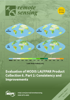
Leaf Area Index (LAI) and Fraction of Photosynthetically Active Radiation absorbed by vegetation (FPAR) are important parameters in most global models. Global LAI/FPAR products were generated using measurements from Moderate Resolution Imaging Spectroradiometer (MODIS) instruments from 2000.
The science team aims to refine the datasets by updating product cohorts. Collection 6 (C6), as the latest version, has been distributed since 2015. We compare C6 and C5 to check for consistency and discuss the improvements of C6. Global and seasonal comparisons indicate good continuity and consistency for all biome types.
Moreover, inter-annual anomalies of C5 and C6 at regional scale agree well, which imbues confidence in the new dataset. C6 benefits from the improved calibration algorithm which reduces the sensor degradation effect. Thus, some C5-based analysis should be revisited using C6 data. View this paper
  • Issues are regarded as officially published after their release is announced to the table of contents alert mailing list.
  • You may sign up for e-mail alerts to receive table of contents of newly released issues.
  • PDF is the official format for papers published in both, html and pdf forms. To view the papers in pdf format, click on the "PDF Full-text" link, and use the free Adobe Reader to open them.
Order results
Result details
Section
Select all
Export citation of selected articles as:

Research

Jump to: Other

17 pages, 3690 KiB  
Article
Assessing Future Vegetation Trends and Restoration Prospects in the Karst Regions of Southwest China
by Xiaowei Tong, Kelin Wang, Martin Brandt, Yuemin Yue, Chujie Liao and Rasmus Fensholt
Remote Sens. 2016, 8(5), 357; https://doi.org/10.3390/rs8050357 - 27 Apr 2016
Cited by 142 | Viewed by 9335
Abstract
To alleviate the severe rocky desertification and improve the ecological conditions in Southwest China, the national and local Chinese governments have implemented a series of Ecological Restoration Projects since the late 1990s. In this context, remote sensing can be a valuable tool for [...] Read more.
To alleviate the severe rocky desertification and improve the ecological conditions in Southwest China, the national and local Chinese governments have implemented a series of Ecological Restoration Projects since the late 1990s. In this context, remote sensing can be a valuable tool for conservation management by monitoring vegetation dynamics, projecting the persistence of vegetation trends and identifying areas of interest for upcoming restoration measures. In this study, we use MODIS satellite time series (2001–2013) and the Hurst exponent to classify the study area (Guizhou and Guangxi Provinces) according to the persistence of future vegetation trends (positive, anti-persistent positive, negative, anti-persistent negative, stable or uncertain). The persistence of trends is interrelated with terrain conditions (elevation and slope angle) and results in an index providing information on the restoration prospects and associated uncertainty of different terrain classes found in the study area. The results show that 69% of the observed trends are persistent beyond 2013, with 57% being stable, 10% positive, 5% anti-persistent positive, 3% negative, 1% anti-persistent negative and 24% uncertain. Most negative development is found in areas of high anthropogenic influence (low elevation and slope), as compared to areas of rough terrain. We further show that the uncertainty increases with the elevation and slope angle, and areas characterized by both high elevation and slope angle need special attention to prevent degradation. Whereas areas with a low elevation and slope angle appear to be less susceptible and relevant for restoration efforts (also having a high uncertainty), we identify large areas of medium elevation and slope where positive future trends are likely to happen if adequate measures are utilized. The proposed framework of this analysis has been proven to work well for assessing restoration prospects in the study area, and due to the generic design, the method is expected to be applicable for other areas of complex landscapes in the world to explore future trends of vegetation. Full article
(This article belongs to the Special Issue Remote Sensing of Land Degradation and Drivers of Change)
Show Figures

Graphical abstract

18 pages, 41270 KiB  
Article
Remote Sensing-Based Exploration of Structurally-Related Mineralizations around Mount Isa, Queensland, Australia
by Sandra Jakob, Richard Gloaguen and Carsten Laukamp
Remote Sens. 2016, 8(5), 358; https://doi.org/10.3390/rs8050358 - 25 Apr 2016
Cited by 19 | Viewed by 8755
Abstract
Hyperspectral imaging is a powerful tool for mineral mapping and increasingly used in poorly-accessible areas. It only requires a limited amount of validation sample points, but can fail to discriminate spectrally-similar features. In this manuscript, we show that we improve the identification of [...] Read more.
Hyperspectral imaging is a powerful tool for mineral mapping and increasingly used in poorly-accessible areas. It only requires a limited amount of validation sample points, but can fail to discriminate spectrally-similar features. In this manuscript, we show that we improve the identification of interesting targets by including geomorphological data in the spectral mapping scheme. We jointly use geomorphic and spectral features to locate gossanous ironstone ridges as an indicator for possible Pb-Zn-Ag-mineralization and provide an application around Mount Isa and George Fisher/Hilton mine, Queensland, Australia. We combine hyperspectral HyMap data using mixture tuned matched filtering with topographical indices, such as maximum curvature and the topographical position index. As it is often the case with structurally-controlled mineralization, the amount of training sites is limited, and supervised classification methods cannot be implemented. Therefore, we implement expert knowledge in a decision tree to take advantage of the relationship between mineralization, alteration and structure. Optimized rock sampling and spectral measurements provided data for validation. We are able to map sets of gossanous ridges with a minimum of validation points, not only within the Mount Isa mining area itself, but also outside the commonly-accepted host rocks. The ridges are parallel to north-south trending geomorphological features and probably associated with the Paroo fault zone. Similarities between the ridges were confirmed by field observations, spectral measurements and a qualitative rock sample analysis. We identified new mineralized ridges that we could subsequently attribute to a poorly-known and sub-economic deposit known as the Mount Novit Pb-Zn-deposit. Full article
Show Figures

Graphical abstract

16 pages, 4901 KiB  
Article
Evaluation of MODIS LAI/FPAR Product Collection 6. Part 1: Consistency and Improvements
by Kai Yan, Taejin Park, Guangjian Yan, Chi Chen, Bin Yang, Zhao Liu, Ramakrishna R. Nemani, Yuri Knyazikhin and Ranga B. Myneni
Remote Sens. 2016, 8(5), 359; https://doi.org/10.3390/rs8050359 - 26 Apr 2016
Cited by 189 | Viewed by 13040
Abstract
As the latest version of Moderate Resolution Imaging Spectroradiometer (MODIS) Leaf Area Index (LAI) and Fraction of Photosynthetically Active Radiation (FPAR) products, Collection 6 (C6) has been distributed since August 2015. This collection is evaluated in this two-part series with the goal of [...] Read more.
As the latest version of Moderate Resolution Imaging Spectroradiometer (MODIS) Leaf Area Index (LAI) and Fraction of Photosynthetically Active Radiation (FPAR) products, Collection 6 (C6) has been distributed since August 2015. This collection is evaluated in this two-part series with the goal of assessing product accuracy, uncertainty and consistency with the previous version. In this first paper, we compare C6 (MOD15A2H) with Collection 5 (C5) to check for consistency and discuss the scale effects associated with changing spatial resolution between the two collections and benefits from improvements to algorithm inputs. Compared with C5, C6 benefits from two improved inputs: (1) L2G–lite surface reflectance at 500 m resolution in place of reflectance at 1 km resolution; and (2) new multi-year land-cover product at 500 m resolution in place of the 1 km static land-cover product. Global and seasonal comparison between C5 and C6 indicates good continuity and consistency for all biome types. Moreover, inter-annual LAI anomalies at the regional scale from C5 and C6 agree well. The proportion of main radiative transfer algorithm retrievals in C6 increased slightly in most biome types, notably including a 17% improvement in evergreen broadleaf forests. With same biome input, the mean RMSE of LAI and FPAR between C5 and C6 at global scale are 0.29 and 0.091, respectively, but biome type disagreement worsens the consistency (LAI: 0.39, FPAR: 0.102). By quantifying the impact of input changes, we find that the improvements of both land-cover and reflectance products improve LAI/FPAR products. Moreover, we find that spatial scale effects due to a resolution change from 1 km to 500 m do not cause any significant differences. Full article
(This article belongs to the Special Issue Remote Sensing of Vegetation Structure and Dynamics)
Show Figures

Graphical abstract

21 pages, 11915 KiB  
Article
Designing an Experiment to Investigate Subpixel Mapping as an Alternative Method to Obtain Land Use/Land Cover Maps
by Yong Ge, Yu Jiang, Yuehong Chen, Alfred Stein, Dong Jiang and Yuanxin Jia
Remote Sens. 2016, 8(5), 360; https://doi.org/10.3390/rs8050360 - 26 Apr 2016
Cited by 15 | Viewed by 7212
Abstract
Various subpixel mapping (SPM) methods have been proposed as downscaling techniques to reduce uncertainty in classifying mixed pixels. Such methods can provide category maps of a higher spatial resolution than the original input images. The aim of this study was to explore and [...] Read more.
Various subpixel mapping (SPM) methods have been proposed as downscaling techniques to reduce uncertainty in classifying mixed pixels. Such methods can provide category maps of a higher spatial resolution than the original input images. The aim of this study was to explore and validate the potential of SPM as an alternative method for obtaining land use/land cover (LULC) maps of regions where high-spatial-resolution LULC maps are unavailable. An experimental design was proposed to evaluate the feasibility of SPM for providing the alternative LULC maps. A case study was implemented in the Jingjinji region of China. SPM results for spatial resolutions of 500–100 m were derived from a single 1-km synthetic fraction image using two representative SPM methods. The 1-km synthetic fraction image was assumed to be error free. Accuracy assessment and analysis showed that overall accuracies of the SPM results were reduced from about 85% to 75% with increasing spatial resolution, and that producer’s accuracies varied considerably from about 62% to 93%. SPM performed best when handling areal features in comparison with linear and point features. The highest accuracies were achieved for areas with the lowest complexity. The study concluded that the results from SPM could provide an alternative LULC data source with acceptable accuracy, especially in areas with low complexity and with a large proportion of areal features. Full article
Show Figures

Graphical abstract

15 pages, 1995 KiB  
Article
Geostatistical Analysis of CH4 Columns over Monsoon Asia Using Five Years of GOSAT Observations
by Min Liu, Liping Lei, Da Liu and Zhao-Cheng Zeng
Remote Sens. 2016, 8(5), 361; https://doi.org/10.3390/rs8050361 - 26 Apr 2016
Cited by 13 | Viewed by 6005
Abstract
The aim of this study is to evaluate the Greenhouse gases Observation SATellite (GOSAT) column-averaged CH4 dry air mole fraction (XCH4) data by using geostatistical analysis and conducting comparisons with model simulations and surface emissions. Firstly, we propose the use [...] Read more.
The aim of this study is to evaluate the Greenhouse gases Observation SATellite (GOSAT) column-averaged CH4 dry air mole fraction (XCH4) data by using geostatistical analysis and conducting comparisons with model simulations and surface emissions. Firstly, we propose the use of a data-driven mapping approach based on spatio-temporal geostatistics to generate a regular and gridded mapping dataset of XCH4 over Monsoon Asia using five years of XCH4 retrievals by GOSAT from June 2009 to May 2014. The prediction accuracy of the mapping approach is assessed by using cross-validation, which results in a significantly high correlation of 0.91 and a small mean absolute prediction error of 8.77 ppb between the observed dataset and the prediction dataset. Secondly, with the mapping data, we investigate the spatial and temporal variations of XCH4 over Monsoon Asia and compare the results with previous studies on ground and other satellite observations. Thirdly, we compare the mapping XCH4 with model simulations from CarbonTracker-CH4 and find their spatial patterns very consistent, but GOSAT observations are more able to capture the local variability of XCH4. Finally, by correlating the mapping data with surface emission inventory, we find the geographical distribution of high CH4 values correspond well with strong emissions as indicated in the inventory map. Over the five-year period, the two datasets show a significant high correlation coefficient (0.80), indicating the dominant role of surface emissions in determining the distribution of XCH4 concentration in this region and suggesting a promising statistical way of constraining surface CH4 sources and sinks, which is simple and easy to implement using satellite observations over a long term period. Full article
Show Figures

Graphical abstract

21 pages, 9208 KiB  
Article
Improved Early Crop Type Identification By Joint Use of High Temporal Resolution SAR And Optical Image Time Series
by Jordi Inglada, Arthur Vincent, Marcela Arias and Claire Marais-Sicre
Remote Sens. 2016, 8(5), 362; https://doi.org/10.3390/rs8050362 - 26 Apr 2016
Cited by 246 | Viewed by 17333
Abstract
High temporal and spatial resolution optical image time series have been proven efficient for crop type mapping at the end of the agricultural season. However, due to cloud cover and image availability, crop identification earlier in the season is difficult. The recent availability [...] Read more.
High temporal and spatial resolution optical image time series have been proven efficient for crop type mapping at the end of the agricultural season. However, due to cloud cover and image availability, crop identification earlier in the season is difficult. The recent availability of high temporal and spatial resolution SAR image time series, opens the possibility of improving early crop type mapping. This paper studies the impact of such SAR image time series when used in complement of optical imagery. The pertinent SAR image features, the optimal working resolution, the effect of speckle filtering and the use of temporal gap-filling of the optical image time series are assessed. SAR image time series as those provided by the Sentinel-1 satellites allow significant improvements in terms of land cover classification, both in terms of accuracy at the end of the season and for early crop identification. Haralik textures (Entropy, Inertia), the polarization ratio and the local mean together with the VV imagery were found to be the most pertinent features. Working at at 10 m resolution and using speckle filtering yield better results than other configurations. Finally it was shown that the use of SAR imagery allows to use optical data without gap-filling yielding results which are equivalent to the use of gap-filling in the case of perfect cloud screening, and better results in the case of cloud screening errors. Full article
Show Figures

Graphical abstract

14 pages, 844 KiB  
Article
Discriminating between Native Norway Spruce and Invasive Sitka Spruce—A Comparison of Multitemporal Landsat 8 Imagery, Aerial Images and Airborne Laser Scanner Data
by Marius Hauglin and Hans Ole Ørka
Remote Sens. 2016, 8(5), 363; https://doi.org/10.3390/rs8050363 - 26 Apr 2016
Cited by 24 | Viewed by 6744
Abstract
Invasive species can be considered a threat to biodiversity, and remote sensing has been proposed as a tool for detection and monitoring of invasive species. In this study, we test the ability to discriminate between two tree species of the same genera, using [...] Read more.
Invasive species can be considered a threat to biodiversity, and remote sensing has been proposed as a tool for detection and monitoring of invasive species. In this study, we test the ability to discriminate between two tree species of the same genera, using data from Landsat 8 satellite imagery, aerial images, and airborne laser scanning. Ground observations from forest stands dominated by either Norway spruce (Picea abies) or Sitka spruce (Picea sitchensis) were coupled with variables derived from each of the three sets of remote sensing data. Random forest, support vector machine, and logistic regression classification models were fit to the data, and the classification accuracy tested by performing a cross-validation. Classification accuracies were compared for different combinations of remote sensing data and classification methods. The overall classification accuracy varied from 0.53 to 0.79, with the highest accuracy obtained using logistic regression with a combination of data derived from Landsat imagery and aerial images. The corresponding kappa value was 0.58. The contribution to the classification accuracy from using airborne data in addition to Landsat imagery was not substantial in this study. The classification accuracy varied between models using data from individual Landsat images. Full article
(This article belongs to the Special Issue Remote Sensing of Vegetation Structure and Dynamics)
Show Figures

Graphical abstract

14 pages, 2429 KiB  
Article
Impact of Climate Change on Vegetation Growth in Arid Northwest of China from 1982 to 2011
by Rong Zhang, Zu-Tao Ouyang, Xiao Xie, Hai-Qiang Guo, Dun-Yan Tan, Xiang-Ming Xiao, Jia-Guo Qi and Bin Zhao
Remote Sens. 2016, 8(5), 364; https://doi.org/10.3390/rs8050364 - 27 Apr 2016
Cited by 45 | Viewed by 7325
Abstract
Previous studies have concluded that the increase in vegetation in the arid northwest of China is related to precipitation rather than temperature. However, these studies neglected the effects of climate warming on water availability that arise through changes in the melting characteristics of [...] Read more.
Previous studies have concluded that the increase in vegetation in the arid northwest of China is related to precipitation rather than temperature. However, these studies neglected the effects of climate warming on water availability that arise through changes in the melting characteristics of this snowy and glaciated region. Here, we characterized vegetation changes using the newly improved third-generation Global Inventory Modeling and Mapping Studies Normalized Difference Vegetation Index (GIMMS-3g NDVI) from 1982 to 2011. We analyzed the temperature and precipitation trends based on data from 51 meteorological stations across Northwest China and investigated changes in the glaciers using Gravity Recovery and Climate Experiment (GRACE) data. Our results indicated an increasing trend in vegetation greenness in Northwest China, and this increasing trend was mostly associated with increasing winter precipitation and summer temperature. We found that the mean annual temperature increased at a rate of 0.04 °C per year over the past 30 years, which induced rapid glacial melting. The total water storage measured by GRACE decreased by up to 8 mm yr−1 and primarily corresponded to the disappearance of glaciers. Considering the absence of any observed increase in precipitation in the growing season, the vegetation growth may have benefited from the melting of glaciers in high-elevation mountains (i.e., the Tianshan Mountains). Multiple regression analysis showed that temperature was positively correlated with NDVI and that gravity was negatively correlated with NDVI; together, these variables explained 84% of the NDVI variation. Our findings suggest that both winter precipitation and warming-induced glacial melting increased water availability to the arid vegetation in this region, resulting in enhanced greenness. Full article
Show Figures

Graphical abstract

18 pages, 4089 KiB  
Article
Land Cover Characterization in West Sudanian Savannas Using Seasonal Features from Annual Landsat Time Series
by Jinxiu Liu, Janne Heiskanen, Ermias Aynekulu, Eduardo Eiji Maeda and Petri K. E. Pellikka
Remote Sens. 2016, 8(5), 365; https://doi.org/10.3390/rs8050365 - 28 Apr 2016
Cited by 35 | Viewed by 7094
Abstract
With the increasing temporal resolution of medium spatial resolution data, seasonal features are becoming more readily available for land cover characterization. However, in the tropical regions, images can be severely contaminated by clouds during the rainy season and fires during the dry season, [...] Read more.
With the increasing temporal resolution of medium spatial resolution data, seasonal features are becoming more readily available for land cover characterization. However, in the tropical regions, images can be severely contaminated by clouds during the rainy season and fires during the dry season, with possible effects to seasonal features. In this study, we evaluated the performance of seasonal features based on an annual Landsat time series (LTS) of 35 images for land cover characterization in West Sudanian savanna woodlands. First, the burnt areas were detected and removed. Second, the reflectance seasonality was modelled using a harmonic model, and model parameters were used as inputs for land cover classification and tree crown cover prediction using the random forest algorithm. Furthermore, to study the sensitivity of the approach to the burnt areas, we repeated the analyses without the first step. Our results showed that seasonal features improved classification accuracy significantly from 68.7% and 66.1% to 76.2%, and decreased root mean square error (RMSE) of tree crown cover predictions from 11.7% and 11.4% to 10.4%, in comparison to the dry and rainy season single date images, respectively. The burnt areas biased the seasonal parameters in near-infrared and shortwave infrared bands, and decreased the accuracy of classification and tree crown cover prediction, suggesting that burnt areas should be removed before fitting the harmonic model. We conclude that seasonal features from annual LTS improved land cover characterization performance, and the harmonic model, provided a simple method for computing annual seasonal features with burnt area removal. Full article
(This article belongs to the Special Issue Monitoring of Land Changes)
Show Figures

Graphical abstract

23 pages, 8459 KiB  
Article
Uncertainties in Tidally Adjusted Estimates of Sea Level Rise Flooding (Bathtub Model) for the Greater London
by Ali P. Yunus, Ram Avtar, Steven Kraines, Masumi Yamamuro, Fredrik Lindberg and C. S. B. Grimmond
Remote Sens. 2016, 8(5), 366; https://doi.org/10.3390/rs8050366 - 28 Apr 2016
Cited by 51 | Viewed by 11179
Abstract
Sea-level rise (SLR) from global warming may have severe consequences for coastal cities, particularly when combined with predicted increases in the strength of tidal surges. Predicting the regional impact of SLR flooding is strongly dependent on the modelling approach and accuracy of topographic [...] Read more.
Sea-level rise (SLR) from global warming may have severe consequences for coastal cities, particularly when combined with predicted increases in the strength of tidal surges. Predicting the regional impact of SLR flooding is strongly dependent on the modelling approach and accuracy of topographic data. Here, the areas under risk of sea water flooding for London boroughs were quantified based on the projected SLR scenarios reported in Intergovernmental Panel on Climate Change (IPCC) fifth assessment report (AR5) and UK climatic projections 2009 (UKCP09) using a tidally-adjusted bathtub modelling approach. Medium- to very high-resolution digital elevation models (DEMs) are used to evaluate inundation extents as well as uncertainties. Depending on the SLR scenario and DEMs used, it is estimated that 3%–8% of the area of Greater London could be inundated by 2100. The boroughs with the largest areas at risk of flooding are Newham, Southwark, and Greenwich. The differences in inundation areas estimated from a digital terrain model and a digital surface model are much greater than the root mean square error differences observed between the two data types, which may be attributed to processing levels. Flood models from SRTM data underestimate the inundation extent, so their results may not be reliable for constructing flood risk maps. This analysis provides a broad-scale estimate of the potential consequences of SLR and uncertainties in the DEM-based bathtub type flood inundation modelling for London boroughs. Full article
(This article belongs to the Special Issue Uncertainties in Remote Sensing)
Show Figures

Graphical abstract

19 pages, 6971 KiB  
Article
Assessment of the Impact of Reservoirs in the Upper Mekong River Using Satellite Radar Altimetry and Remote Sensing Imageries
by Kuan-Ting Liu, Kuo-Hsin Tseng, C. K. Shum, Chian-Yi Liu, Chung-Yen Kuo, Ganming Liu, Yuanyuan Jia and Kun Shang
Remote Sens. 2016, 8(5), 367; https://doi.org/10.3390/rs8050367 - 28 Apr 2016
Cited by 23 | Viewed by 8733
Abstract
Water level (WL) and water volume (WV) of surface-water bodies are among the most crucial variables used in water-resources assessment and management. They fluctuate as a result of climatic forcing, and they are considered as indicators of climatic impacts on water resources. Quantifying [...] Read more.
Water level (WL) and water volume (WV) of surface-water bodies are among the most crucial variables used in water-resources assessment and management. They fluctuate as a result of climatic forcing, and they are considered as indicators of climatic impacts on water resources. Quantifying riverine WL and WV, however, usually requires the availability of timely and continuous in situ data, which could be a challenge for rivers in remote regions, including the Mekong River basin. As one of the most developed rivers in the world, with more than 20 dams built or under construction, Mekong River is in need of a monitoring system that could facilitate basin-scale management of water resources facing future climate change. This study used spaceborne sensors to investigate two dams in the upper Mekong River, Xiaowan and Jinghong Dams within China, to examine river flow dynamics after these dams became operational. We integrated multi-mission satellite radar altimetry (RA, Envisat and Jason-2) and Landsat-5/-7/-8 Thematic Mapper (TM)/Enhanced Thematic Mapper plus (ETM+)/Operational Land Imager (OLI) optical remote sensing (RS) imageries to construct composite WL time series with enhanced spatial resolutions and substantially extended WL data records. An empirical relationship between WL variation and water extent was first established for each dam, and then the combined long-term WL time series from Landsat images are reconstructed for the dams. The R2 between altimetry WL and Landsat water area measurements is >0.95. Next, the Tropical Rainfall Measuring Mission (TRMM) data were used to diagnose and determine water variation caused by the precipitation anomaly within the basin. Finally, the impact of hydrologic dynamics caused by the impoundment of the dams is assessed. The discrepancy between satellite-derived WL and available in situ gauge data, in term of root-mean-square error (RMSE) is at 2–5 m level. The estimated WV variations derived from combined RA/RS imageries and digital elevation model (DEM) are consistent with results from in situ data with a difference at about 3%. We concluded that the river level downstream is affected by a combined operation of these two dams after 2009, which has decreased WL by 0.20 m·year−1 in wet seasons and increased WL by 0.35 m·year−1 in dry seasons. Full article
(This article belongs to the Special Issue Remote Sensing in Tibet and Siberia)
Show Figures

Graphical abstract

21 pages, 5685 KiB  
Article
Texture Retrieval from VHR Optical Remote Sensed Images Using the Local Extrema Descriptor with Application to Vineyard Parcel Detection
by Minh-Tan Pham, Grégoire Mercier, Oliver Regniers and Julien Michel
Remote Sens. 2016, 8(5), 368; https://doi.org/10.3390/rs8050368 - 28 Apr 2016
Cited by 17 | Viewed by 6639
Abstract
In this article, we develop a novel method for the detection of vineyard parcels in agricultural landscapes based on very high resolution (VHR) optical remote sensing images. Our objective is to perform texture-based image retrieval and supervised classification algorithms. To do that, the [...] Read more.
In this article, we develop a novel method for the detection of vineyard parcels in agricultural landscapes based on very high resolution (VHR) optical remote sensing images. Our objective is to perform texture-based image retrieval and supervised classification algorithms. To do that, the local textural and structural features inside each image are taken into account to measure its similarity to other images. In fact, VHR images usually involve a variety of local textures and structures that may verify a weak stationarity hypothesis. Hence, an approach only based on characteristic points, not on all pixels of the image, is supposed to be relevant. This work proposes to construct the local extrema-based descriptor (LED) by using the local maximum and local minimum pixels extracted from the image. The LED descriptor is formed based on the radiometric, geometric and gradient features from these local extrema. We first exploit the proposed LED descriptor for the retrieval task to evaluate its performance on texture discrimination. Then, it is embedded into a supervised classification framework to detect vine parcels using VHR satellite images. Experiments performed on VHR panchromatic PLEIADES image data prove the effectiveness of the proposed strategy. Compared to state-of-the-art methods, an enhancement of about 7% in retrieval rate is achieved. For the detection task, about 90% of vineyards are correctly detected. Full article
Show Figures

Graphical abstract

19 pages, 3238 KiB  
Article
Evaluation of Radiometric and Atmospheric Correction Algorithms for Aboveground Forest Biomass Estimation Using Landsat 5 TM Data
by Pablito M. López-Serrano, José J. Corral-Rivas, Ramón A. Díaz-Varela, Juan G. Álvarez-González and Carlos A. López-Sánchez
Remote Sens. 2016, 8(5), 369; https://doi.org/10.3390/rs8050369 - 29 Apr 2016
Cited by 85 | Viewed by 13510
Abstract
Solar radiation is affected by absorption and emission phenomena during its downward trajectory from the Sun to the Earth’s surface and during the upward trajectory detected by satellite sensors. This leads to distortion of the ground radiometric properties (reflectance) recorded by satellite images, [...] Read more.
Solar radiation is affected by absorption and emission phenomena during its downward trajectory from the Sun to the Earth’s surface and during the upward trajectory detected by satellite sensors. This leads to distortion of the ground radiometric properties (reflectance) recorded by satellite images, used in this study to estimate aboveground forest biomass (AGB). Atmospherically-corrected remote sensing data can be used to estimate AGB on a global scale and with moderate effort. The objective of this study was to evaluate four atmospheric correction algorithms (for surface reflectance), ATCOR2 (Atmospheric Correction for Flat Terrain), COST (Cosine of the Sun Zenith Angle), FLAASH (Fast Line-of-sight Atmospheric Analysis of Spectral Hypercubes) and 6S (Second Simulation of Satellite Signal in the Solar), and one radiometric correction algorithm (for reflectance at the sensor) ToA (Apparent Reflectance at the Top of Atmosphere) to estimate AGB in temperate forest in the northeast of the state of Durango, Mexico. The AGB was estimated from Landsat 5 TM imagery and ancillary information from a digital elevation model (DEM) using the non-parametric multivariate adaptive regression splines (MARS) technique. Field reference data for the model training were collected by systematic sampling of 99 permanent forest growth and soil research sites (SPIFyS) established during the winter of 2011. The following predictor variables were identified in the MARS model: Band 7, Band 5, slope (β), Wetness Index (WI), NDVI and MSAVI2. After cross-validation, 6S was found to be the optimal model for estimating AGB (R2 = 0.71 and RMSE = 33.5 Mg·ha−1; 37.61% of the average stand biomass). We conclude that atmospheric and radiometric correction of satellite images can be used along with non-parametric techniques to estimate AGB with acceptable accuracy. Full article
Show Figures

Graphical abstract

19 pages, 4433 KiB  
Article
Linking Land Surface Phenology and Vegetation-Plot Databases to Model Terrestrial Plant α-Diversity of the Okavango Basin
by Rasmus Revermann, Manfred Finckh, Marion Stellmes, Ben J. Strohbach, David Frantz and Jens Oldeland
Remote Sens. 2016, 8(5), 370; https://doi.org/10.3390/rs8050370 - 29 Apr 2016
Cited by 23 | Viewed by 8823
Abstract
In many parts of Africa, spatially-explicit information on plant α-diversity, i.e., the number of species in a given area, is missing as baseline information for spatial planning. We present an approach on how to combine vegetation-plot databases and remotely-sensed land surface phenology [...] Read more.
In many parts of Africa, spatially-explicit information on plant α-diversity, i.e., the number of species in a given area, is missing as baseline information for spatial planning. We present an approach on how to combine vegetation-plot databases and remotely-sensed land surface phenology (LSP) metrics to predict plant α-diversity on a regional scale. We gathered data on plant α-diversity, measured as species density, from 999 vegetation plots sized 20 m × 50 m covering all major vegetation units of the Okavango basin in the countries of Angola, Namibia and Botswana. As predictor variables, we used MODIS LSP metrics averaged over 12 years (250-m spatial resolution) and three topographic attributes calculated from the SRTM digital elevation model. Furthermore, we tested whether additional climatic data could improve predictions. We tested three predictor subsets: (1) remote sensing variables; (2) climatic variables; and (3) all variables combined. We used two statistical modeling approaches, random forests and boosted regression trees, to predict vascular plant α-diversity. The resulting maps showed that the Miombo woodlands of the Angolan Central Plateau featured the highest diversity, and the lowest values were predicted for the thornbush savanna in the Okavango Delta area. Models built on the entire dataset exhibited the best performance followed by climate-only models and remote sensing-only models. However, models including climate data showed artifacts. In spite of lower model performance, models based only on LSP metrics produced the most realistic maps. Furthermore, they revealed local differences in plant diversity of the landscape mosaic that were blurred by homogenous belts as predicted by climate-based models. This study pinpoints the high potential of LSP metrics used in conjunction with biodiversity data derived from vegetation-plot databases to produce spatial information on a regional scale that is urgently needed for basic natural resource management applications. Full article
(This article belongs to the Special Issue Remote Sensing of Biodiversity)
Show Figures

Graphical abstract

16 pages, 43126 KiB  
Article
Continuous 1985–2012 Landsat Monitoring to Assess Fire Effects on Meadows in Yosemite National Park, California
by Christopher E. Soulard, Christine M. Albano, Miguel L. Villarreal and Jessica J. Walker
Remote Sens. 2016, 8(5), 371; https://doi.org/10.3390/rs8050371 - 29 Apr 2016
Cited by 45 | Viewed by 10752
Abstract
To assess how montane meadow vegetation recovered after a wildfire that occurred in Yosemite National Park, CA in 1996, Google Earth Engine image processing was applied to leverage the entire Landsat Thematic Mapper archive from 1985 to 2012. Vegetation greenness (normalized difference vegetation [...] Read more.
To assess how montane meadow vegetation recovered after a wildfire that occurred in Yosemite National Park, CA in 1996, Google Earth Engine image processing was applied to leverage the entire Landsat Thematic Mapper archive from 1985 to 2012. Vegetation greenness (normalized difference vegetation index (NDVI)) was summarized every 16 days across the 28-year Landsat time series for 26 meadows. Disturbance event detection was hindered by the subtle influence of low-severity fire on meadow vegetation. A hard break (August 1996) was identified corresponding to the Ackerson Fire, and monthly composites were used to compare NDVI values and NDVI trends within burned and unburned meadows before, immediately after, and continuously for more than a decade following the fire date. Results indicate that NDVI values were significantly lower at 95% confidence level for burned meadows following the fire date, yet not significantly lower at 95% confidence level in the unburned meadows. Burned meadows continued to exhibit lower monthly NDVI in the dormant season through 2012. Over the entire monitoring period, the negative-trending, dormant season NDVI slopes in the burned meadows were also significantly lower than unburned meadows at 90% confidence level. Lower than average NDVI values and slopes in the dormant season compared to unburned meadows, coupled with photographic evidence, strongly suggest that evergreen vegetation was removed from the periphery of some meadows after the fire. These analyses provide insight into how satellite imagery can be used to monitor low-severity fire effects on meadow vegetation. Full article
Show Figures

Graphical abstract

18 pages, 7662 KiB  
Article
Automatic Forest Mapping at Individual Tree Levels from Terrestrial Laser Scanning Point Clouds with a Hierarchical Minimum Cut Method
by Bisheng Yang, Wenxia Dai, Zhen Dong and Yang Liu
Remote Sens. 2016, 8(5), 372; https://doi.org/10.3390/rs8050372 - 3 May 2016
Cited by 83 | Viewed by 10121
Abstract
Laser scanning technology plays an important role in forest inventory, as it enables accurate 3D information capturing in a fast and environmentally-friendly manner. The goal of this study is to develop methods for detecting and discriminating individual trees from TLS point clouds of [...] Read more.
Laser scanning technology plays an important role in forest inventory, as it enables accurate 3D information capturing in a fast and environmentally-friendly manner. The goal of this study is to develop methods for detecting and discriminating individual trees from TLS point clouds of five plots in a boreal coniferous forest. The proposed hierarchical minimum cut method adopts the detected trunk points that are recognized according to pole like shape segmentation as foreground seed points and other points as background seed points, respectively. It constructs the undirected weighted graph of the foreground and background seed points to deduce a cost function for tree crown point segmentation with the decreasing ranking of tree trunk heights. The intermediate results lead to global optimization segmentation of individual trees in a hierarchical order. Finally, the structure metrics of the detected individual trees are calculated and checked with field observations. Plots with different attributes were selected to verify the proposed method, and the experimental studies show that the proposed method is efficient and robust for extracting individual trees from TLS point clouds in terms of the recall of 90.42%. Full article
Show Figures

Graphical abstract

13 pages, 4997 KiB  
Article
An Automatic Target Detection Algorithm for Swath Sonar Backscatter Imagery, Using Image Texture and Independent Component Analysis
by Elias Fakiris, George Papatheodorou, Maria Geraga and George Ferentinos
Remote Sens. 2016, 8(5), 373; https://doi.org/10.3390/rs8050373 - 29 Apr 2016
Cited by 45 | Viewed by 7892
Abstract
In the present paper, a methodological scheme, bringing together common Acoustic Seabed Classification (ASC) systems and a powerful data decomposition approach, called Independent Component Analysis (ICA), is demonstrated regarding its suitability for detecting small targets in Side Scan Sonar imagery. Traditional ASC systems [...] Read more.
In the present paper, a methodological scheme, bringing together common Acoustic Seabed Classification (ASC) systems and a powerful data decomposition approach, called Independent Component Analysis (ICA), is demonstrated regarding its suitability for detecting small targets in Side Scan Sonar imagery. Traditional ASC systems extract numerous texture descriptors, leading to a large feature vector, the dimensionality of which is reduced by means of data decomposition techniques, usually Principal Component Analysis (PCA), prior to classification. However, in the target detection issue, data decomposition should point towards finding components that represent sub-ordinary image information (i.e., small targets) rather than a dominant one. ICA has long been proved to be suitable for separating targets from a background, and this study represents a novel exhibition of its applicability to Side Scan Sonar (SSS) images. The present study attempts to build a fully automated target detection approach that combines image based feature extraction, ICA, and unsupervised classification. The suitability of the proposed approach has been demonstrated using an SSS data-set containing more than 70 manmade targets, most of them metallic, validated through a marine magnetic survey or ground truthing inspection. The method exhibited very good performance as it was able to detect more than 77% of the targets and it produced less than seven false alarms per km2. Moreover, it was compared to cases where, in the exact same methodological scheme, no decomposition technique is used, or PCA is employed instead of ICA, achieving the highest detection rate, but, more importantly, producing more than six times less false alarms, thus proving that ICA successfully manages to maximize target to background separation. Full article
Show Figures

Graphical abstract

25 pages, 10584 KiB  
Article
Impact of MODIS Quality Control on Temporally Aggregated Urban Surface Temperature and Long-Term Surface Urban Heat Island Intensity
by Lech Gawuc and Joanna Struzewska
Remote Sens. 2016, 8(5), 374; https://doi.org/10.3390/rs8050374 - 13 May 2016
Cited by 30 | Viewed by 8047
Abstract
Surface Urban Heat Island (SUHI) is a phenomenon of high spatial and temporal variability. However, studies that investigate urban land surface temperature (LST) observed in different seasons frequently utilize a single satellite measurement and do not incorporate temporal composites. Temporally aggregated data increase [...] Read more.
Surface Urban Heat Island (SUHI) is a phenomenon of high spatial and temporal variability. However, studies that investigate urban land surface temperature (LST) observed in different seasons frequently utilize a single satellite measurement and do not incorporate temporal composites. Temporally aggregated data increase clear sky coverage, which is important in many aspects of urban climatology. However, it is critical to account for possible errors and quality of the data that are utilized. The objective of this paper is to analyze the impact of MODIS Quality Control (QC) and the view angle on temporally aggregated urban surface temperature and long-term SUHI intensity. To achieve this, a weighted arithmetic mean was utilized whose weights were based on the view angle of satellite observation and the MODIS QC flags; namely, LST retrieval errors and emissivity errors. In order to investigate the impact of the MODIS QC on long-term LST composites, five exponential powers were applied to weights during the temporal aggregation process, resulting in five thresholds of best quality pixel promotion. It was found that there are significant differences between temporal composites that take into account the MODIS QC and the view angle and those that do not (obtained by means of a simple arithmetic mean with no weights applied), in terms of spatial distribution and density distribution of urban and rural LST. The differences were more distinctive in spring or daytime cases than in autumn or nighttime cases. The impact of the MODIS QC and the view angle on temporal composites was highest in the city center. Ten SUHI indicators were utilized. It was found that the impact on long-term SUHI intensity is weaker than on the spatial pattern of LST and that SUHI indicators are inconsistent. Full article
Show Figures

Graphical abstract

29 pages, 22151 KiB  
Article
An Object-Based Image Analysis Approach for Detecting Penguin Guano in very High Spatial Resolution Satellite Images
by Chandi Witharana and Heather J. Lynch
Remote Sens. 2016, 8(5), 375; https://doi.org/10.3390/rs8050375 - 30 Apr 2016
Cited by 40 | Viewed by 9572
Abstract
The logistical challenges of Antarctic field work and the increasing availability of very high resolution commercial imagery have driven an interest in more efficient search and classification of remotely sensed imagery. This exploratory study employed geographic object-based analysis (GEOBIA) methods to classify guano [...] Read more.
The logistical challenges of Antarctic field work and the increasing availability of very high resolution commercial imagery have driven an interest in more efficient search and classification of remotely sensed imagery. This exploratory study employed geographic object-based analysis (GEOBIA) methods to classify guano stains, indicative of chinstrap and Adélie penguin breeding areas, from very high spatial resolution (VHSR) satellite imagery and closely examined the transferability of knowledge-based GEOBIA rules across different study sites focusing on the same semantic class. We systematically gauged the segmentation quality, classification accuracy, and the reproducibility of fuzzy rules. A master ruleset was developed based on one study site and it was re-tasked “without adaptation” and “with adaptation” on candidate image scenes comprising guano stains. Our results suggest that object-based methods incorporating the spectral, textural, spatial, and contextual characteristics of guano are capable of successfully detecting guano stains. Reapplication of the master ruleset on candidate scenes without modifications produced inferior classification results, while adapted rules produced comparable or superior results compared to the reference image. This work provides a road map to an operational “image-to-assessment pipeline” that will enable Antarctic wildlife researchers to seamlessly integrate VHSR imagery into on-demand penguin population census. Full article
Show Figures

Graphical abstract

12 pages, 4153 KiB  
Article
Continent-Wide 2-D Co-Seismic Deformation of the 2015 Mw 8.3 Illapel, Chile Earthquake Derived from Sentinel-1A Data: Correction of Azimuth Co-Registration Error
by Bing Xu, Zhiwei Li, Guangcai Feng, Zeyu Zhang, Qijie Wang, Jun Hu and Xingguo Chen
Remote Sens. 2016, 8(5), 376; https://doi.org/10.3390/rs8050376 - 4 May 2016
Cited by 23 | Viewed by 9142
Abstract
In this study, we mapped the co-seismic deformation of the 2015 Mw 8.3 Illapel, Chile earthquake with multiple Sentinel-1A TOPS data frames from both ascending and descending geometries. To meet the requirement of very high co-registration precision, an improved spectral diversity method was [...] Read more.
In this study, we mapped the co-seismic deformation of the 2015 Mw 8.3 Illapel, Chile earthquake with multiple Sentinel-1A TOPS data frames from both ascending and descending geometries. To meet the requirement of very high co-registration precision, an improved spectral diversity method was proposed to correct the co-registration slope error in the azimuth direction induced by multiple Sentinel-1A TOPS data frames. All phase jumps that appear in the conventional processing method have been corrected after applying the proposed method. The 2D deformation fields in the east-west and vertical directions are also resolved by combing D-InSAR and Offset Tracking measurements. The results reveal that the east-west component dominated the 2D displacement, where up to 2 m displacement towards the west was measured in the coastal area. Vertical deformations ranging between −0.25 and 0.25 m were found. The 2D displacements imply the collision of the Nazca plate squeezed the coast, which shows good accordance with the geological background of the region. Full article
(This article belongs to the Special Issue Earth Observations for Geohazards)
Show Figures

Graphical abstract

25 pages, 14320 KiB  
Article
Satellite Retrievals of Karenia brevis Harmful Algal Blooms in the West Florida Shelf Using Neural Networks and Comparisons with Other Techniques
by Ahmed El-habashi, Ioannis Ioannou, Michelle C. Tomlinson, Richard P. Stumpf and Sam Ahmed
Remote Sens. 2016, 8(5), 377; https://doi.org/10.3390/rs8050377 - 4 May 2016
Cited by 30 | Viewed by 8120
Abstract
We describe the application of a Neural Network (NN) previously developed by us, to the detection and tracking, of Karenia brevis Harmful Algal Blooms (KB HABs) that plague the coasts of the West Florida Shelf (WFS) using Visible Infrared Imaging Radiometer Suite [...] Read more.
We describe the application of a Neural Network (NN) previously developed by us, to the detection and tracking, of Karenia brevis Harmful Algal Blooms (KB HABs) that plague the coasts of the West Florida Shelf (WFS) using Visible Infrared Imaging Radiometer Suite (VIIRS) satellite observations. Previous approaches for the detection of KB HABs in the WFS primarily used observations from the Moderate Resolution Imaging Spectroradiometer Aqua (MODIS-A) satellite. They depended on the remote sensing reflectance signal at the 678 nm chlorophyll fluorescence band (Rrs678) needed for both the normalized fluorescence height (nFLH) and Red Band Difference algorithms (RBD) currently used. VIIRS which has replaced MODIS-A, unfortunately does not have a 678 nm fluorescence channel so we customized the NN approach to retrieve phytoplankton absorption at 443 nm (aph443) using only Rrs measurements from existing VIIRS channels at 486, 551 and 671 nm. The aph443 values in these retrieved VIIRS images, can in turn be correlated to chlorophyll-a concentrations [Chla] and KB cell counts. To retrieve KB values, the VIIRS NN retrieved aph443 images are filtered by applying limiting constraints, defined by (i) low backscatter at Rrs 551 nm and (ii) a minimum aph443 value known to be associated with KB HABs in the WFS. The resulting filtered residual images, are then used to delineate and quantify the existing KB HABs. Comparisons with KB HABs satellite retrievals obtained using other techniques, including nFLH, as well as with in situ measurements reported over a four year period, confirm the viability of the NN technique, when combined with the filtering constraints devised, for effective detection of KB HABs. Full article
(This article belongs to the Special Issue Remote Sensing in Coastal Environments)
Show Figures

Graphical abstract

16 pages, 5861 KiB  
Article
Evaluation of Stray Light Correction for GOCI Remote Sensing Reflectance Using in Situ Measurements
by Wonkook Kim, Jeong-Eon Moon, Jae-Hyun Ahn and Young-Je Park
Remote Sens. 2016, 8(5), 378; https://doi.org/10.3390/rs8050378 - 4 May 2016
Cited by 8 | Viewed by 5311
Abstract
The Geostationary Ocean Color Imager (GOCI) is the world’s first ocean color sensor in geostationary orbit. Although the GOCI has shown excellent radiometric performance with little long-term radiometric degradation and a high signal-to-noise ratio, there are radiometric artefacts in GOCI Level 1 products [...] Read more.
The Geostationary Ocean Color Imager (GOCI) is the world’s first ocean color sensor in geostationary orbit. Although the GOCI has shown excellent radiometric performance with little long-term radiometric degradation and a high signal-to-noise ratio, there are radiometric artefacts in GOCI Level 1 products caused by stray light detected within the GOCI optics. To correct the radiometric bias, we developed an image-based correction algorithm called the correction of the interslot discrepancy using the minimum noise fraction transform (CIDUM) in a previous study and evaluated its performance with respect to the physical radiometric quantity stored in Level 1 products, i.e., top-of-atmosphere radiance. This study evaluated the performance of the CIDUM algorithm in terms of remote sensing reflectance, which is one of the most important products in ocean color remote sensing. The resultant CIDUM-corrected remote sensing reflectance products were validated using both relative (within the image) and absolute references (in situ measurements). Image validation showed that CIDUM corrected the bias in remote sensing reflectance (up to 20%) and reduced the bias to ≤5% in the tested image. In situ validation showed that relative uncertainty was reduced by around 10% within the visible bands and the correlation between the in situ and GOCI radiometric data was enhanced. Full article
Show Figures

Graphical abstract

17 pages, 8061 KiB  
Article
Evaluation of PERSIANN-CDR for Meteorological Drought Monitoring over China
by Hao Guo, Anming Bao, Tie Liu, Sheng Chen and Felix Ndayisaba
Remote Sens. 2016, 8(5), 379; https://doi.org/10.3390/rs8050379 - 4 May 2016
Cited by 87 | Viewed by 9408
Abstract
In this paper, Precipitation Estimation from Remotely Sensed Information using Artificial Neural Networks–Climate Data Record (PERSIANN-CDR) is analyzed for the assessment of meteorological drought. The evaluation is conducted over China at 0.5° spatial resolution against a ground-based gridded China monthly Precipitation Analysis Product [...] Read more.
In this paper, Precipitation Estimation from Remotely Sensed Information using Artificial Neural Networks–Climate Data Record (PERSIANN-CDR) is analyzed for the assessment of meteorological drought. The evaluation is conducted over China at 0.5° spatial resolution against a ground-based gridded China monthly Precipitation Analysis Product (CPAP) from 1983 to 2014 (32 years). The Standardized Precipitation Index (SPI) at various time scales (1 month to 12 months) is calculated for detecting drought events. The results show that PERSIANN-CDR depicts similar drought behavior as the ground-based CPAP in terms of capturing the spatial and temporal patterns of drought events over eastern China, where the intensity of gauge networks and the frequency of droughts are high. 6-month SPI shows the best agreement with CPAP in identifying drought months. However, large differences between PERSIANN-CDR and CPAP in depicting drought patterns and identifying specific drought events are found over northwestern China, particularly in Xinjiang and Qinghai-Tibet Plateau region. Factors behind this may be due to the relatively sparse gauge networks, the complicated terrain and the performance of PERSIANN algorithm. Full article
(This article belongs to the Special Issue Satellite Climate Data Records and Applications)
Show Figures

Graphical abstract

21 pages, 38557 KiB  
Article
Physical Layer Definition for a Long-Haul HF Antarctica to Spain Radio Link
by Rosa Ma Alsina-Pagès, Marcos Hervás, Ferran Orga, Joan Lluís Pijoan, David Badia and David Altadill
Remote Sens. 2016, 8(5), 380; https://doi.org/10.3390/rs8050380 - 4 May 2016
Cited by 15 | Viewed by 7288
Abstract
La Salle and the Observatori de l’Ebre (OE) have been involved in a remote sensing project in Antarctica for the last 11 years. The OE has been monitoring the geomagnetic activity for more than twenty years and also the ionospheric activity of the [...] Read more.
La Salle and the Observatori de l’Ebre (OE) have been involved in a remote sensing project in Antarctica for the last 11 years. The OE has been monitoring the geomagnetic activity for more than twenty years and also the ionospheric activity of the last ten years in the Spanish Antarctic Station Juan Carlos I (ASJI) (62.7 ° S, 299.6 ° E). La Salle is finishing the design and testing of a low-power communication system between the ASJI and Cambrils (41.0 ° N, 1.0 ° E) with a double goal: (i) the transmission of data from the sensors located at the ASJI and (ii) the performance of an oblique ionospheric sounding of a 12,760 km HF link. Previously, La Salle has already performed sounding and modulation tests to describe the channel performance in terms of availability, Signal-to-Noise Ratio (SNR), Doppler spread and delay spread. This paper closes the design of the physical layer, by means of the channel error study and the synchronization performance, and concludes with a new physical layer proposal for the Oblique Ionosphere Sounder. Narrowband and wideband frames have been defined to be used when the oblique sounder performs as an ionospheric sensor. Finally, two transmission modes have been defined for the modem performance: the High Robustness Mode (HRM) for low SNR hours and the High Throughput Mode (HTM) for the high SNR hours. Full article
Show Figures

Graphical abstract

16 pages, 5783 KiB  
Article
A Multi-View Dense Point Cloud Generation Algorithm Based on Low-Altitude Remote Sensing Images
by Zhenfeng Shao, Nan Yang, Xiongwu Xiao, Lei Zhang and Zhe Peng
Remote Sens. 2016, 8(5), 381; https://doi.org/10.3390/rs8050381 - 4 May 2016
Cited by 41 | Viewed by 8559
Abstract
This paper presents a novel multi-view dense point cloud generation algorithm based on low-altitude remote sensing images. The proposed method was designed to be especially effective in enhancing the density of point clouds generated by Multi-View Stereo (MVS) algorithms. To overcome the limitations [...] Read more.
This paper presents a novel multi-view dense point cloud generation algorithm based on low-altitude remote sensing images. The proposed method was designed to be especially effective in enhancing the density of point clouds generated by Multi-View Stereo (MVS) algorithms. To overcome the limitations of MVS and dense matching algorithms, an expanded patch was set up for each point in the point cloud. Then, a patch-based Multiphoto Geometrically Constrained Matching (MPGC) was employed to optimize points on the patch based on least square adjustment, the space geometry relationship, and epipolar line constraint. The major advantages of this approach are twofold: (1) compared with the MVS method, the proposed algorithm can achieve denser three-dimensional (3D) point cloud data; and (2) compared with the epipolar-based dense matching method, the proposed method utilizes redundant measurements to weaken the influence of occlusion and noise on matching results. Comparison studies and experimental results have validated the accuracy of the proposed algorithm in low-altitude remote sensing image dense point cloud generation. Full article
Show Figures

Graphical abstract

26 pages, 17382 KiB  
Article
Fast and Accurate Plane Segmentation of Airborne LiDAR Point Cloud Using Cross-Line Elements
by Teng Wu, Xiangyun Hu and Lizhi Ye
Remote Sens. 2016, 8(5), 383; https://doi.org/10.3390/rs8050383 - 5 May 2016
Cited by 19 | Viewed by 7969
Abstract
Plane segmentation is an important step in feature extraction and 3D modeling from light detection and ranging (LiDAR) point cloud. The accuracy and speed of plane segmentation are two issues difficult to balance, particularly when dealing with a massive point cloud with millions [...] Read more.
Plane segmentation is an important step in feature extraction and 3D modeling from light detection and ranging (LiDAR) point cloud. The accuracy and speed of plane segmentation are two issues difficult to balance, particularly when dealing with a massive point cloud with millions of points. A fast and easy-to-implement algorithm of plane segmentation based on cross-line element growth (CLEG) is proposed in this study. The point cloud is converted into grid data. The points are segmented into line segments with the Douglas-Peucker algorithm. Each point is then assigned to a cross-line element (CLE) obtained by segmenting the points in the cross-directions. A CLE determines one plane, and this is the rationale of the algorithm. CLE growth and point growth are combined after selecting the seed CLE to obtain the segmented facets. The CLEG algorithm is validated by comparing it with popular methods, such as RANSAC, 3D Hough transformation, principal component analysis (PCA), iterative PCA, and a state-of-the-art global optimization-based algorithm. Experiments indicate that the CLEG algorithm runs much faster than the other algorithms. The method can produce accurate segmentation at a speed of 6 s per 3 million points. The proposed method also exhibits good accuracy. Full article
(This article belongs to the Special Issue Airborne Laser Scanning)
Show Figures

Graphical abstract

12 pages, 2586 KiB  
Article
Changes in Global Grassland Productivity during 1982 to 2011 Attributable to Climatic Factors
by Qingzhu Gao, Mark W. Schwartz, Wenquan Zhu, Yunfan Wan, Xiaobo Qin, Xin Ma, Shuo Liu, Matthew A. Williamson, Casey B. Peters and Yue Li
Remote Sens. 2016, 8(5), 384; https://doi.org/10.3390/rs8050384 - 6 May 2016
Cited by 28 | Viewed by 7846
Abstract
Open, Grass- and Forb-Dominated (OGFD) ecosystems, including tundra, tropical grasslands and savanna, provide habitat for both wild and domesticated large ungulate herbivores. These ecosystems exist across a wide temperature gradient from the Arctic regions to the Equator, but are confined to a narrow [...] Read more.
Open, Grass- and Forb-Dominated (OGFD) ecosystems, including tundra, tropical grasslands and savanna, provide habitat for both wild and domesticated large ungulate herbivores. These ecosystems exist across a wide temperature gradient from the Arctic regions to the Equator, but are confined to a narrow set of moisture conditions that range from arid deserts to forest-dominated systems. Primary productivity in OGFD ecosystems appears extremely sensitive to environmental change. We compared global trends in the annual maximum and mean values of the Normalized Difference Vegetation Index (NDVI) and identified the key bioclimatic indices that controlled OGFD productivity changes in various regions for the period from 1982 to 2011. We found significantly increased or decreased annual maximum NDVI values of 36.3% and 4.6% for OGFD ecosystems, respectively. Trends in the annual mean NDVI are similar for most OGFD ecosystems and show greater area decreases and smaller area increases than trends in the annual maximum NDVI in global OGFD ecosystems during the study period. Ecosystems in which the productivity significantly increased were distributed mainly in the Arctic, mid-eastern South America, central Africa, central Eurasia and Oceania, while those with decreasing trends in productivity were mainly on the Mongolian Plateau. Temperature increases tended to improve productivity in colder OGFD ecosystems; and precipitation is positively correlated with productivity changes in grassland and savannas, but negatively correlated with changes in the Arctic tundra. Simple bioclimatic indices explain 42% to 55% of productivity changes in OGFD systems worldwide, and the main climatic predictors of productivity differed significantly between regions. In light of future climate change, the findings of this study will help support management of global OGFD ecosystems. Full article
Show Figures

Graphical abstract

22 pages, 16125 KiB  
Article
A 30 m Resolution Surface Water Mask Including Estimation of Positional and Thematic Differences Using Landsat 8, SRTM and OpenStreetMap: A Case Study in the Murray-Darling Basin, Australia
by Gennadii Donchyts, Jaap Schellekens, Hessel Winsemius, Elmar Eisemann and Nick Van de Giesen
Remote Sens. 2016, 8(5), 386; https://doi.org/10.3390/rs8050386 - 6 May 2016
Cited by 181 | Viewed by 26631
Abstract
Accurate maps of surface water are essential for many environmental applications. Surface water maps can be generated by combining measurements from multiple sources. Precise estimation of surface water using satellite imagery remains a challenging task due to the sensor limitations, complex land cover, [...] Read more.
Accurate maps of surface water are essential for many environmental applications. Surface water maps can be generated by combining measurements from multiple sources. Precise estimation of surface water using satellite imagery remains a challenging task due to the sensor limitations, complex land cover, topography, and atmospheric conditions. As a complementary dataset, in the case of hilly landscapes, a drainage network can be extracted from high-resolution digital elevation models. Additionally, Volunteered Geographic Information (VGI) initiatives, such as OpenStreetMap, can also be used to produce high-resolution surface water masks. In this study, we derive a high-resolution water mask using Landsat 8 imagery and OpenStreetMap as well as (potential) a drainage network using 30 m SRTM. Our approach to derive a surface water mask from Landsat 8 imagery comprises the use of a lower 15% percentile of Landsat 8 Top of Atmosphere (TOA) reflectance from 2013 to 2015. We introduce a new non-parametric unsupervised method based on the Canny edge filter and Otsu thresholding to detect water in flat areas. For hilly areas, the method is extended with an additional supervised classification step used to refine the water mask. We applied the method across the Murray-Darling basin, Australia. Differences between our new Landsat-based water mask and the OpenStreetMap water mask regarding positional differences along the rivers and overall coverage were analyzed. Our results show that about 50% of the OpenStreetMap linear water features can be confirmed using the water mask extracted from Landsat 8 imagery and the drainage network derived from SRTM. We also show that the observed distances between river features derived from OpenStreetMap and Landsat 8 are mostly smaller than 60 m. The differences between the new water mask and SRTM-based linear features and hilly areas are slightly larger (110 m). The overall agreement between OpenStreetMap and Landsat 8 water masks is about 30%. Full article
Show Figures

Graphical abstract

18 pages, 12381 KiB  
Article
Monitoring the Topography of a Dynamic Tidal Inlet Using UAV Imagery
by Nathalie Long, Bastien Millescamps, Benoît Guillot, Frédéric Pouget and Xavier Bertin
Remote Sens. 2016, 8(5), 387; https://doi.org/10.3390/rs8050387 - 6 May 2016
Cited by 112 | Viewed by 11966
Abstract
Unmanned Aerial Vehicles (UAVs) are being increasingly used to monitor topographic changes in coastal areas. Compared to Light Detection And Ranging (LiDAR) data or Terrestrial Laser Scanning data, this solution is low-cost and easy to use, while allowing the production of a Digital [...] Read more.
Unmanned Aerial Vehicles (UAVs) are being increasingly used to monitor topographic changes in coastal areas. Compared to Light Detection And Ranging (LiDAR) data or Terrestrial Laser Scanning data, this solution is low-cost and easy to use, while allowing the production of a Digital Surface Model (DSM) with a similar accuracy. Three campaigns were carried out within a three-month period at a lagoon-inlet system (Bonne-Anse Bay, La Palmyre, France), with a flying wing (eBee) combined with a digital camera. Ground Control Points (GCPs), surveyed by the Global Navigation Satellite System (GNSS) and post-processed by differential correction, allowed georeferencing DSMs. Using a photogrammetry process (Structure From Motion algorithm), DSMs and orthomosaics were produced. The DSM accuracy was assessed against the ellipsoidal height of a GNSS profile and Independent Control Points (ICPs) and the root mean square discrepancies were about 10 and 17 cm, respectively. Compared to traditional topographic surveys, this solution allows the accurate representation of bedforms with a wavelength of the order of 1 m and a height of 0.1 m. Finally, changes identified between both main campaigns revealed erosion/accretion areas and the progradation of a sandspit. These results open new perspectives to validate detailed morphological predictions or to parameterize bottom friction in coastal numerical models. Full article
(This article belongs to the Special Issue Remote Sensing in Coastal Environments)
Show Figures

Graphical abstract

16 pages, 3160 KiB  
Article
Comparison of Canopy Volume Measurements of Scattered Eucalypt Farm Trees Derived from High Spatial Resolution Imagery and LiDAR
by Niva Kiran Verma, David W. Lamb, Nick Reid and Brian Wilson
Remote Sens. 2016, 8(5), 388; https://doi.org/10.3390/rs8050388 - 5 May 2016
Cited by 43 | Viewed by 15843
Abstract
Studies estimating canopy volume are mostly based on laborious and time-consuming field measurements; hence, there is a need for easier and convenient means of estimation. Accordingly, this study investigated the use of remotely sensed data (WorldView-2 and LiDAR) for estimating tree height, canopy [...] Read more.
Studies estimating canopy volume are mostly based on laborious and time-consuming field measurements; hence, there is a need for easier and convenient means of estimation. Accordingly, this study investigated the use of remotely sensed data (WorldView-2 and LiDAR) for estimating tree height, canopy height and crown diameter, which were then used to infer the canopy volume of remnant eucalypt trees at the Newholme/Kirby ‘SMART’ farm in north-east New South Wales. A regression model was developed with field measurements, which was then applied to remote-sensing-based measurements. LiDAR estimates of tree dimensions were generally lower than the field measurements (e.g., 6.5% for tree height) although some of the parameters (such as tree height) may also be overestimated by the clinometer/rangefinder protocols used. The WorldView-2 results showed both crown projected area and crown diameter to be strongly correlated to canopy volume, and that crown diameter yielded better results (Root Mean Square Error RMSE 31%) than crown projected area (RMSE 42%). Although the better performance of LiDAR in the vertical dimension cannot be dismissed, as suggested by results obtained from this study and also similar studies conducted with LiDAR data for tree parameter measurements, the high price and complexity associated with the acquisition and processing of LiDAR datasets mean that the technology is beyond the reach of many applications. Therefore, given the need for easier and convenient means of tree parameters estimation, this study filled a gap and successfully used 2D multispectral WorldView-2 data for 3D canopy volume estimation with satisfactory results compared to LiDAR-based estimation. The result obtained from this study highlights the usefulness of high resolution data for canopy volume estimations at different locations as a possible alternative to existing methods. Full article
(This article belongs to the Special Issue Remote Sensing of Forest Health)
Show Figures

Graphical abstract

21 pages, 9195 KiB  
Article
Retrieving Precipitable Water Vapor Data Using GPS Zenith Delays and Global Reanalysis Data in China
by Peng Jiang, Shirong Ye, Dezhong Chen, Yanyan Liu and Pengfei Xia
Remote Sens. 2016, 8(5), 389; https://doi.org/10.3390/rs8050389 - 6 May 2016
Cited by 65 | Viewed by 8232
Abstract
GPS has become a very effective tool to remotely sense precipitable water vapor (PWV) information, which is important for weather forecasting and nowcasting. The number of geodetic GNSS stations set up in China has substantially increased over the last few decades. However, GPS [...] Read more.
GPS has become a very effective tool to remotely sense precipitable water vapor (PWV) information, which is important for weather forecasting and nowcasting. The number of geodetic GNSS stations set up in China has substantially increased over the last few decades. However, GPS PWV derivation requires surface pressure to calculate the precise zenith hydrostatic delay and weighted mean temperature to map the zenith wet delay to precipitable water vapor. GPS stations without collocated meteorological sensors can retrieve water vapor using standard atmosphere parameters, which lead to a decrease in accuracy. In this paper, a method of interpolating NWP reanalysis data to site locations for generating corresponding meteorological elements is explored over China. The NCEP FNL dataset provided by the NCEP (National Centers for Environmental Prediction) and over 600 observed stations from different sources was selected to assess the quality of the results. A one-year experiment was performed in our study. The types of stations selected include meteorological sites, GPS stations, radio sounding stations, and a sun photometer station. Compared with real surface measurements, the accuracy of the interpolated surface pressure and air temperature both meet the requirements of GPS PWV derivation in most areas; however, the interpolated surface air temperature exhibits lower precision than the interpolated surface pressure. At more than 96% of selected stations, PWV differences caused by the differences between the interpolation results and real measurements were less than 1.0 mm. Our study also indicates that relief amplitude exerts great influence on the accuracy of the interpolation approach. Unsatisfactory interpolation results always occurred in areas of strong relief. GPS PWV data generated from interpolated meteorological parameters are consistent with other PWV products (radio soundings, the NWP reanalysis dataset, and sun photometer PWV data). The differences between them were approximately 1~3 mm at most at our selected stations, and GPS data processing is the main factor influencing the agreement of the GPS PWV results with those of other methods. Full article
Show Figures

Graphical abstract

24 pages, 10673 KiB  
Article
Evaluation of HY-2A Scatterometer Wind Vectors Using Data from Buoys, ERA-Interim and ASCAT during 2012–2014
by Jianyong Xing, Jiancheng Shi, Yonghui Lei, Xiang-Yu Huang and Zhiquan Liu
Remote Sens. 2016, 8(5), 390; https://doi.org/10.3390/rs8050390 - 7 May 2016
Cited by 17 | Viewed by 6155
Abstract
The first Chinese operational Ku-band scatterometer on board Haiyang-2A (HY-2A), launched in August 2011, is designed for monitoring the global ocean surface wind. This study estimates the quality of the near-real-time (NRT) retrieval wind speed and wind direction from the HY-2A scatterometer for [...] Read more.
The first Chinese operational Ku-band scatterometer on board Haiyang-2A (HY-2A), launched in August 2011, is designed for monitoring the global ocean surface wind. This study estimates the quality of the near-real-time (NRT) retrieval wind speed and wind direction from the HY-2A scatterometer for 36 months from 2012 to 2014. We employed three types of sea-surface wind data from oceanic moored buoys operated by the National Data Buoy Center (NDBC) and the Tropical Atmospheric Ocean project (TAO), the European Centre for Medium Range Weather Forecasting (ECMWF) reanalysis data (ERA-Interim), and the advanced scatterometer (ASCAT) to calculate the error statistics including mean bias, root mean square error (RMSE), and standard deviation. In addition, the rain effects on the retrieval winds were investigated using collocated Climate Prediction Center morphing method (CMORPH) precipitation data. All data were collocated with the HY-2A scatterometer wind data for comparison. The quality performances of the HY-2A NRT wind vectors data (especially the wind speeds) were satisfactory throughout the service period. The RMSEs of the HY-2A wind speeds relative to the NDBC, TAO, ERA-Interim, and ASCAT data were 1.94, 1.73, 2.25, and 1.62 m·s−1, respectively. The corresponding RMSEs of the wind direction were 46.63°, 43.11°, 39.93°, and 47.47°, respectively. The HY-2A scatterometer overestimated low wind speeds, especially under rainy conditions. Rain exerted a diminishing effect on the wind speed retrievals with increasing wind speed, but its effect on wind direction was robust at low and moderate wind speeds. Relative to the TAO buoy data, the RMSEs without rain effect were reduced to 1.2 m·s−1 and 39.68° for the wind speed direction, respectively, regardless of wind speed. By investigating the objective laws between rain and the retrieval winds from HY-2A, we could improve the quality of wind retrievals through future studies. Full article
Show Figures

Graphical abstract

14 pages, 2521 KiB  
Article
Variability and Changes in Climate, Phenology, and Gross Primary Production of an Alpine Wetland Ecosystem
by Xiaoming Kang, Yanbin Hao, Xiaoyong Cui, Huai Chen, Sanxiang Huang, Yangong Du, Wei Li, Paul Kardol, Xiangming Xiao and Lijuan Cui
Remote Sens. 2016, 8(5), 391; https://doi.org/10.3390/rs8050391 - 6 May 2016
Cited by 67 | Viewed by 8815
Abstract
Quantifying the variability and changes in phenology and gross primary production (GPP) of alpine wetlands in the Qinghai–Tibetan Plateau under climate change is essential for assessing carbon (C) balance dynamics at regional and global scales. In this study, in situ eddy covariance (EC) [...] Read more.
Quantifying the variability and changes in phenology and gross primary production (GPP) of alpine wetlands in the Qinghai–Tibetan Plateau under climate change is essential for assessing carbon (C) balance dynamics at regional and global scales. In this study, in situ eddy covariance (EC) flux tower observations and remote sensing data were integrated with a modified, satellite-based vegetation photosynthesis model (VPM) to investigate the variability in climate change, phenology, and GPP of an alpine wetland ecosystem, located in Zoige, southwestern China. Two-year EC data and remote sensing vegetation indices showed that warmer temperatures corresponded to an earlier start date of the growing season, increased GPP, and ecosystem respiration, and hence increased the C sink strength of the alpine wetlands. Twelve-year long-term simulations (2000–2011) showed that: (1) there were significantly increasing trends for the mean annual enhanced vegetation index (EVI), land surface water index (LSWI), and growing season GPP (R2 ≥ 0.59, p < 0.01) at rates of 0.002, 0.11 year−1 and 16.32 g·C·m−2·year−1, respectively, which was in line with the observed warming trend (R2 = 0.54, p = 0.006); (2) the start and end of the vegetation growing season (SOS and EOS) experienced a continuous advancing trend at a rate of 1.61 days·year−1 and a delaying trend at a rate of 1.57 days·year−1 from 2000 to 2011 (p ≤ 0.04), respectively; and (3) with increasing temperature, the advanced SOS and delayed EOS prolonged the wetland’s phenological and photosynthetically active period and, thereby, increased wetland productivity by about 3.7–4.2 g·C·m−2·year−1 per day. Furthermore, our results indicated that warming and the extension of the growing season had positive effects on carbon uptake in this alpine wetland ecosystem. Full article
(This article belongs to the Special Issue What can Remote Sensing Do for the Conservation of Wetlands?)
Show Figures

Graphical abstract

23 pages, 9636 KiB  
Article
Characterizing Pavement Surface Distress Conditions with Hyper-Spatial Resolution Natural Color Aerial Photography
by Su Zhang, Christopher D. Lippitt, Susan M. Bogus and Paul R. H. Neville
Remote Sens. 2016, 8(5), 392; https://doi.org/10.3390/rs8050392 - 9 May 2016
Cited by 29 | Viewed by 7127
Abstract
Roadway pavement surface distress information is critical for effective pavement asset management, and subsequently, transportation management agencies at all levels (i.e., federal, state, and local) dedicate a large amount of time and money to routinely evaluate pavement surface distress conditions as [...] Read more.
Roadway pavement surface distress information is critical for effective pavement asset management, and subsequently, transportation management agencies at all levels (i.e., federal, state, and local) dedicate a large amount of time and money to routinely evaluate pavement surface distress conditions as the core of their asset management programs. However, currently adopted ground-based evaluation methods for pavement surface conditions have many disadvantages, like being time-consuming and expensive. Aircraft-based evaluation methods, although getting more attention, have not been used for any operational evaluation programs yet because the acquired images lack the spatial resolution to resolve finer scale pavement surface distresses. Hyper-spatial resolution natural color aerial photography (HSR-AP) provides a potential method for collecting pavement surface distress information that can supplement or substitute for currently adopted evaluation methods. Using roadway pavement sections located in the State of New Mexico as an example, this research explored the utility of aerial triangulation (AT) technique and HSR-AP acquired from a low-altitude and low-cost small-unmanned aircraft system (S-UAS), in this case a tethered helium weather balloon, to permit characterization of detailed pavement surface distress conditions. The Wilcoxon Signed Rank test, Mann-Whitney U test, and visual comparison were used to compare detailed pavement surface distress rates measured from HSR-AP derived products (orthophotos and digital surface models generated from AT) with reference distress rates manually collected on the ground using standard protocols. The results reveal that S-UAS based hyper-spatial resolution imaging and AT techniques can provide detailed and reliable primary observations suitable for characterizing detailed pavement surface distress conditions comparable to the ground-based manual measurement, which lays the foundation for the future application of HSR-AP for automated detection and assessment of detailed pavement surface distress conditions. Full article
Show Figures

Graphical abstract

13 pages, 9666 KiB  
Article
InSAR-Based Mapping of Tidal Inundation Extent and Amplitude in Louisiana Coastal Wetlands
by Talib Oliver-Cabrera and Shimon Wdowinski
Remote Sens. 2016, 8(5), 393; https://doi.org/10.3390/rs8050393 - 7 May 2016
Cited by 40 | Viewed by 11378
Abstract
The Louisiana coast is among the most productive coastal areas in the US and home to the largest coastal wetland area in the nation. However, Louisiana coastal wetlands have been disappearing at an alarming rate due to natural and anthropogenic processes, including sea [...] Read more.
The Louisiana coast is among the most productive coastal areas in the US and home to the largest coastal wetland area in the nation. However, Louisiana coastal wetlands have been disappearing at an alarming rate due to natural and anthropogenic processes, including sea level rise, land subsidence and infrastructure development. Wetland loss occurs mainly along the tidal zone, which varies in width and morphology along the Louisiana shoreline. In this study, we use Interferometric Synthetic Aperture Radar (InSAR) observations to detect the extent of the tidal inundation zone and evaluate the interaction between tidal currents and coastal wetlands. Our data consist of ALOS and Radarsat-1 observations acquired between 2006–2011 and 2003–2008, respectively. Interferometric processing of the data provides detailed maps of water level changes in the tidal zone, which are validated using sea level data from a tide gauge station. Our results indicate vertical tidal changes up to 30 cm and horizontal tidal flow limited to 5–15 km from open waters. The results also show that the tidal inundation is disrupted by various man-made structures, such as canals and roads, which change the natural tidal flow interaction with the coast. Full article
(This article belongs to the Special Issue What can Remote Sensing Do for the Conservation of Wetlands?)
Show Figures

Graphical abstract

20 pages, 14774 KiB  
Article
Changes in Aerosol Optical and Micro-Physical Properties over Northeast Asia from a Severe Dust Storm in April 2014
by Li Fang, Shupeng Wang, Tao Yu, Xingfa Gu, Xingying Zhang, Weihe Wang and Suling Ren
Remote Sens. 2016, 8(5), 394; https://doi.org/10.3390/rs8050394 - 9 May 2016
Cited by 18 | Viewed by 5565
Abstract
This study focuses on analyzing the changes to aerosol properties caused by the dust storm called “China’s Great Wall of Dust” that originated from the Taklimakan Desert in April 2014. IDDI (Infrared Difference Dust Index) images from FY-2E and true color composite images [...] Read more.
This study focuses on analyzing the changes to aerosol properties caused by the dust storm called “China’s Great Wall of Dust” that originated from the Taklimakan Desert in April 2014. IDDI (Infrared Difference Dust Index) images from FY-2E and true color composite images from FY-3C MERSI (Medium Resolution Spectral Imager) show the breakout and transport path of the dust storm. Three-hourly ground-based measurements from MICAPS (Meteorological Information Comprehensive Analysis and Process System) suggest that anticyclonic circulation occupying the Southern Xinjiang basin and cyclonic circulation in Mongolia form a dipole pressure system that leads to strong northwesterly winds (13.7–20 m/s), which favored the breakout of the dust storm. IDDI results indicate that the dust storm breakout occurred at ~2:00 UTC on 23 April in the Taklimakan Desert. Four-day forward air mass trajectories with the HYSPLIT (Hybrid Single Particle Lagrangian Integrated Trajectory) model gives the simulation results of the dust transport paths and dust vertical distributions, which are consistent with the corresponding aerosol vertical distributions derived from CALIPSO. The Aerosol Index (AI) data of TOU (Total Ozone Unit) aboard FY-3B are first used to study the areas affected by the dust storm. From the AI results, the dust-affected areas agree well with the synoptic meteorological condition analysis, which supports that the synoptic meteorological conditions are the main reason for the breakout and transport of the dust storm. Anomalies of the average MODIS (Moderate Resolution Imaging Spectroradiometer) AOD (Aerosol Optical Depth) distributions over northeast Asia during the dust storm to the average of the values in April between 2010 and 2014 are calculated as a percent. The results indicate high aerosol loading with a spatially-averaged anomaly of 121% for dusty days between 23 April and 25 April. Aerosol Robotic Network (AERONET) retrievals of VSD (Volume Size Distribution) and SSA (Single Scattering Albedo) show that while the aerosol properties in Dalanzadgad, which is closer to the dust source, were influenced primarily by coarse dust particles, the aerosol properties in Beijing were mostly contributed by fine dust particles that transported over longer distances and at high atmospheric levels. Full article
Show Figures

Graphical abstract

24 pages, 9499 KiB  
Article
Evaluation of MODIS Gross Primary Production across Multiple Biomes in China Using Eddy Covariance Flux Data
by Hongji Zhu, Aiwen Lin, Lunche Wang, Yu Xia and Ling Zou
Remote Sens. 2016, 8(5), 395; https://doi.org/10.3390/rs8050395 - 13 May 2016
Cited by 41 | Viewed by 8257
Abstract
MOD17A2 provides near real-time estimates of gross primary production (GPP) globally. In this study, MOD17A2 GPP was evaluated using eddy covariance (EC) flux measurements at eight sites in five various biome types across China. The sensitivity of MOD17A2 to meteorological data and leaf [...] Read more.
MOD17A2 provides near real-time estimates of gross primary production (GPP) globally. In this study, MOD17A2 GPP was evaluated using eddy covariance (EC) flux measurements at eight sites in five various biome types across China. The sensitivity of MOD17A2 to meteorological data and leaf area index/fractional photosynthetically active radiation (LAI/FPAR) products were examined by introducing site meteorological measurements and improved Global Land Surface Satellite (GLASS) LAI products. We also assessed the potential error contributions from land cover and maximum light use efficiency (εmax). The results showed that MOD17A2 agreed well with flux measurements of annual GPP (R2 = 0.76) when all biome types were considered as a whole. However, MOD17A2 was ineffective for estimating annual GPP at mixed forests, evergreen needleleaf forests and croplands, respectively. Moreover, MOD17A2 underestimated flux derived GPP during the summer (R2 = 0.46). It was found that the meteorological data used in MOD17A2 failed to properly estimate the site measured vapor pressure deficits (VPD) (R2 = 0.31). Replacing the existing LAI/FPAR data with GLASS LAI products reduced MOD17A2 GPP uncertainties. Though land cover presented the fewest errors, εmax prescribed in MOD17A2 were much lower than inferred εmax calculated from flux data. Thus, the qualities of meteorological data and LAI/FPAR products need to be improved, and εmax should be adjusted to provide better GPP estimates using MOD17A2 for Chinese ecosystems. Full article
(This article belongs to the Special Issue Remote Sensing of Biogeochemical Cycles)
Show Figures

Graphical abstract

23 pages, 8769 KiB  
Article
Improving Multiyear Sea Ice Concentration Estimates with Sea Ice Drift
by Yufang Ye, Mohammed Shokr, Georg Heygster and Gunnar Spreen
Remote Sens. 2016, 8(5), 397; https://doi.org/10.3390/rs8050397 - 10 May 2016
Cited by 40 | Viewed by 7605
Abstract
Multiyear ice (MYI) concentration can be retrieved from passive or active microwave remote sensing observations. One of the algorithms that combines both observations is the Environmental Canada Ice Concentration Extractor (ECICE). However, factors such as ridging, snow wetness and metamorphism can cause significant [...] Read more.
Multiyear ice (MYI) concentration can be retrieved from passive or active microwave remote sensing observations. One of the algorithms that combines both observations is the Environmental Canada Ice Concentration Extractor (ECICE). However, factors such as ridging, snow wetness and metamorphism can cause significant changes in brightness temperature and backscatter, leading to misidentification of FYI as MYI, hence increasing the estimated MYI concentrations suddenly. This study introduces a correction scheme to restore the MYI concentrations under these conditions. The correction utilizes ice drift records to constrain the MYI changes and uses two thresholds of passive microwave radiometric parameters to account for snow wetness and metamorphism. The correction is applied to MYI concentration retrievals from ECICE with inputs from QuikSCAT and AMSR-E observations, acquired over the Arctic region in a series of winter seasons (October to May) from 2002 to 2009. Qualitative comparison with the Radarsat-1 SAR images and quantitative comparison against results from previous studies show that the correction works well by removing the anomalous high MYI concentrations. On average, the correction reduces the estimated MYI area by 5.2 × 10⁵ km2 (14.3%) except for the April–May time frame, when the reduction is larger as the warmer weather prompts the condition of the anomalous snow radiometric signature. Due to the long-lasting (i.e., from one to several weeks) effect of the warm spells on FYI, the correction could be important in climatological research and operational applications. Full article
(This article belongs to the Special Issue Sea Ice Remote Sensing and Analysis)
Show Figures

Graphical abstract

18 pages, 14060 KiB  
Article
A New Method for Earth Observation Data Analytics Based on Symbolic Machine Learning
by Martino Pesaresi, Vasileios Syrris and Andreea Julea
Remote Sens. 2016, 8(5), 399; https://doi.org/10.3390/rs8050399 - 11 May 2016
Cited by 63 | Viewed by 12883
Abstract
This work introduces a new classification method in the remote sensing domain, suitably adapted to dealing with the challenges posed by the big data processing and analytics framework. The method is based on symbolic learning techniques, and it is designed to work in [...] Read more.
This work introduces a new classification method in the remote sensing domain, suitably adapted to dealing with the challenges posed by the big data processing and analytics framework. The method is based on symbolic learning techniques, and it is designed to work in complex and information-abundant environments, where relationships among different data layers are assessed in model-free and computationally-effective modalities. The two main stages of the method are the data reduction-sequencing and the association analysis. The former refers to data representation; the latter searches for systematic relationships between data instances derived from images and spatial information encoded in supervisory signals. Subsequently, a new measure named the evidence-based normalized differential index, inspired by the probability-based family of objective interestingness measures, evaluates these associations. Additional information about the computational complexity of the classification algorithm and some critical remarks are briefly introduced. An application of land cover mapping where the input image features are morphological and radiometric descriptors demonstrates the capacity of the method; in this instructive application, a subset of eight classes from the Corine Land Cover is used as the reference source to guide the training phase. Full article
Show Figures

Graphical abstract

23 pages, 9550 KiB  
Article
The Variations of Land Surface Phenology in Northeast China and Its Responses to Climate Change from 1982 to 2013
by Jianjun Zhao, Yanying Wang, Zhengxiang Zhang, Hongyan Zhang, Xiaoyi Guo, Shan Yu, Wala Du and Fang Huang
Remote Sens. 2016, 8(5), 400; https://doi.org/10.3390/rs8050400 - 12 May 2016
Cited by 71 | Viewed by 8531
Abstract
Northeast China is located at high northern latitudes and is a typical region of relatively high sensitivity to global climate change. Studies of the land surface phenology in Northeast China and its response to climate change are important for understanding global climate change. [...] Read more.
Northeast China is located at high northern latitudes and is a typical region of relatively high sensitivity to global climate change. Studies of the land surface phenology in Northeast China and its response to climate change are important for understanding global climate change. In this study, the land surface phenology parameters were calculated using the third generation dataset from the Global Inventory Modeling and Mapping Studies (GIMMS 3g) that was collected from 1982 to 2013 were estimated to analyze the variations of the land surface phenology in Northeast China at different scales and to discuss the internal relationships between phenology and climate change. We examined the phonological changes of all ecoregions. The average start of the growing season (SOS) did not exhibit a significant trend throughout the study area; however, the end of the growing season (EOS) was significantly delayed by 4.1 days or 0.13 days/year (p < 0.05) over the past 32 years. The SOS for the Hulunbuir Plain, Greater Khingan Mountains and Lesser Khingan Mountains was earlier, and the SOS for the Sanjing, Songnen and Liaohe Plains was later. In addition, the EOS of the Greater Khingan Mountains, Lesser Khingan Mountains and Changbai Mountains was later than the EOS of the Liaohe Plain. The spring temperature had the greatest impact on the SOS. Precipitation had an insignificant impact on forest SOS and a relatively large impact on grassland SOS. The EOS was affected by both temperature and precipitation. Furthermore, although temperature had a lag effect on the EOS, no significant lag effect was observed for the SOS. Full article
(This article belongs to the Special Issue Monitoring of Land Changes)
Show Figures

Graphical abstract

16 pages, 5742 KiB  
Article
Estimating Tree Frontal Area in Urban Areas Using Terrestrial LiDAR Data
by Yitong Jiang, Qihao Weng, James H. Speer and Steven Baker
Remote Sens. 2016, 8(5), 401; https://doi.org/10.3390/rs8050401 - 11 May 2016
Cited by 1 | Viewed by 5950
Abstract
Surface roughness parameters, such as roughness length and displacement height, impact the estimation of surface moisture, and the frontal areas of buildings and trees are two components that contribute to surface roughness in urban areas. Research on tree frontal area has not been [...] Read more.
Surface roughness parameters, such as roughness length and displacement height, impact the estimation of surface moisture, and the frontal areas of buildings and trees are two components that contribute to surface roughness in urban areas. Research on tree frontal area has not been conducted in urban areas before, and we hope to fill that gap in the literature with this study by using Terrestrial Light Detection and Ranging (LiDAR) data to estimate tree frontal areas in Warren Township, Indianapolis, IN, USA. We first estimated the frontal areas of individual trees based on their morphology, then calibrated a regression model to estimate the tree frontal area in 30 m pixels using parameters derived from LiDAR data and tree inventory data. The parameters included tree crown base area, height, width, conditions, defects, maintenances, genera, and land use. The validation shows that R2 yielded values ranging from 0.84 to 0.88, and RMSEs varied with tree category. The tree categories were identified based on the height and broadness of the canopy, which indicated the degree of resistance to air flow. This type of model can be used to empirically determine local roughness values at the tree-level for any city with a complete tree inventory. With the strong correlation between trees’ frontal area and crown base area, this model may also be used to determine local roughness value at 30 m resolution with NLCD (National Land Cover Database) tree canopy cover data as a component. A proper tree categorization according to the vertical air resistance, e.g., height and canopy density, was effective to reduce the RMSE in tree frontal area estimation. Geometric parameters, such as height, crown base height, and crown base area extracted from Airborne LiDAR, which demand less storage and computation capacity, may also be sufficient for tree frontal area estimation in the areas where Terrestrial LiDAR is not available. Full article
Show Figures

Graphical abstract

24 pages, 51155 KiB  
Article
Mapping Wetlands in Zambia Using Seasonal Backscatter Signatures Derived from ENVISAT ASAR Time Series
by Stefan Schlaffer, Marco Chini, Denise Dettmering and Wolfgang Wagner
Remote Sens. 2016, 8(5), 402; https://doi.org/10.3390/rs8050402 - 12 May 2016
Cited by 48 | Viewed by 10518
Abstract
Wetlands are considered a challenging environment for mapping approaches based on Synthetic Aperture Radar (SAR) data due to their often complex internal structures and the diverse backscattering mechanisms caused by vegetation, soil moisture and flood dynamics contributing to the resulting imagery. In this [...] Read more.
Wetlands are considered a challenging environment for mapping approaches based on Synthetic Aperture Radar (SAR) data due to their often complex internal structures and the diverse backscattering mechanisms caused by vegetation, soil moisture and flood dynamics contributing to the resulting imagery. In this study, a time series of >100 SAR images acquired by ENVISAT during a time period of ca. two years over the Kafue River basin in Zambia was compared to water heights derived from radar altimetry and surface soil moisture from a reanalysis dataset. The backscatter time series were analyzed using a harmonic model to characterize the seasonality in C-band backscatter caused by the interaction of flood and soil moisture dynamics. As a result, characteristic seasonal signatures could be derived for permanent water bodies, seasonal open water, persistently flooded vegetation and seasonally flooded vegetation. Furthermore, the analysis showed that the influence of local incidence angle could be accounted for by a linear shift in backscatter averaged over time, even in wetland areas where the dominant scattering mechanism can change depending on the season. The retrieved harmonic model parameters were then used in an unsupervised classification to detect wetland backscattering classes at the regional scale. A total area of 7800 km2 corresponding to 7.6% of the study area was classified as either one of the wetland backscattering classes. The results demonstrate the value of seasonality parameters extracted from C-band SAR time series for wetland mapping. Full article
(This article belongs to the Special Issue What can Remote Sensing Do for the Conservation of Wetlands?)
Show Figures

Graphical abstract

25 pages, 26581 KiB  
Article
Using NDVI and EVI to Map Spatiotemporal Variation in the Biomass and Quality of Forage for Migratory Elk in the Greater Yellowstone Ecosystem
by Erica L. Garroutte, Andrew J. Hansen and Rick L. Lawrence
Remote Sens. 2016, 8(5), 404; https://doi.org/10.3390/rs8050404 - 11 May 2016
Cited by 134 | Viewed by 18382
Abstract
The Normalized Difference Vegetation Index (NDVI) and the Enhanced Vegetation Index (EVI) have gained considerable attention in ecological research and management as proxies for landscape-scale vegetation quantity and quality. In the Greater Yellowstone Ecosystem (GYE), these indices are especially important for mapping spatiotemporal [...] Read more.
The Normalized Difference Vegetation Index (NDVI) and the Enhanced Vegetation Index (EVI) have gained considerable attention in ecological research and management as proxies for landscape-scale vegetation quantity and quality. In the Greater Yellowstone Ecosystem (GYE), these indices are especially important for mapping spatiotemporal variation in the forage available to migratory elk (Cervus elaphus). Here, we examined how the accuracy of using MODIS-derived NDVI and EVI as proxies for forage biomass and quality differed across elevation-related phenology and land use gradients, determined if polynomial NDVI/EVI, site, and season effects improved these models, and then mapped spatiotemporal variation in the abundance of high quality forage available to elk across the Upper Yellowstone River Basin (UYRB) of the GYE. Models with a polynomial NDVI effect explained 19%–55% more variation in biomass than the linear NDVI and EVI models. Models with linear season effect explained 14%–20% more variation in chlorophyll, 37%–69% more variation in crude protein, and 26%–50% more variation in in vitro dry matter digestibility (IVDMD) than the linear NDVI and EVI models. Linear NDVI models explained more variation in biomass and quality across the UYRB than the linear EVI models. The accuracy of these models was lowest in grasslands with late onset of growth, in irrigated agriculture, and after the peak in biomass. Forage biomass and quality varied across the elevation-related phenology and land use gradients in the UYRB throughout the season. At their seasonal peak, the abundance of high quality forage for elk was 50% greater in grasslands with late onset of growth and 200% greater in irrigated agriculture than in all other grasslands, suggesting that these grasslands play an especially important role in the movement and fitness of migratory elk. These results provide novel information on the utility of NDVI and EVI for mapping spatiotemporal patterns of forage biomass and quality. Full article
(This article belongs to the Special Issue Remote Sensing of Biodiversity)
Show Figures

Graphical abstract

22 pages, 4225 KiB  
Article
First in-Flight Radiometric Calibration of MUX and WFI on-Board CBERS-4
by Cibele Pinto, Flávio Ponzoni, Ruy Castro, Larry Leigh, Nischal Mishra, David Aaron and Dennis Helder
Remote Sens. 2016, 8(5), 405; https://doi.org/10.3390/rs8050405 - 11 May 2016
Cited by 26 | Viewed by 9696
Abstract
Brazil and China have a long-term joint space based sensor program called China-Brazil Earth Resources Satellite (CBERS). The most recent satellite of this program (CBERS-4) was successfully launched on 7 December 2014. This work describes a complete procedure, along with the associated uncertainties, [...] Read more.
Brazil and China have a long-term joint space based sensor program called China-Brazil Earth Resources Satellite (CBERS). The most recent satellite of this program (CBERS-4) was successfully launched on 7 December 2014. This work describes a complete procedure, along with the associated uncertainties, used to calculate the in-flight absolute calibration coefficients for the sensors Multispectral Camera (MUX) and Wide-Field Imager (WFI) on-board CBERS-4. Two absolute radiometric calibration techniques were applied: (i) reflectance-based approach and (ii) cross-calibration method. A specific site at Algodones Dunes region located in the southwestern portion of the United States of America was used as a reference surface. Radiometric ground and atmospheric measurements were carried out on 9 March 2015, when CBERS-4 passed over the region. In addition, a cross-calibration between both MUX and WFI on-board CBERS-4 and the Operational Land Imager (OLI) on-board Landsat-8 was performed using the Libya-4 Pseudo Invariant Calibration Site. The gain coefficients are now available: 1.68, 1.62, 1.59 and 1.42 for MUX and 0.379, 0.498, 0.360 and 0.351 for WFI spectral bands blue, green, red and NIR, respectively, in units of (W/(m2·sr·μm))/DN. These coefficients were determined with uncertainties lower than 3.5%. As a validation of these radiometric coefficients, cross-calibration was also undertaken. An evaluation of radiometric consistency was performed between the two instruments (MUX and WFI) on-board CBERS-4 and with the well calibrated Landsat-7 ETM+. Results show that the reflectance values match in all the analogous spectral bands within the specified calibration uncertainties. Full article
Show Figures

Graphical abstract

6 pages, 923 KiB  
Article
Analysis of Sentinel-1 Radiometric Stability and Quality for Land Surface Applications
by Mohammad El Hajj, Nicolas Baghdadi, Mehrez Zribi and Sébastien Angelliaume
Remote Sens. 2016, 8(5), 406; https://doi.org/10.3390/rs8050406 - 11 May 2016
Cited by 42 | Viewed by 6620
Abstract
Land monitoring using temporal series of Synthetic Aperture Radar (SAR) images requires radiometrically well calibrated sensors. In this paper, the radiometric stability of the new SAR Sentinel-1A “S-1A” sensor was first assessed by analyzing temporal variations of the backscattering coefficient (σ°) returned from [...] Read more.
Land monitoring using temporal series of Synthetic Aperture Radar (SAR) images requires radiometrically well calibrated sensors. In this paper, the radiometric stability of the new SAR Sentinel-1A “S-1A” sensor was first assessed by analyzing temporal variations of the backscattering coefficient (σ°) returned from invariant targets. Second, the radiometric level of invariant targets was compared from S-1A and Radarsat-2 “RS-2” data. The results show three stable sub-time series of S-1A data. The first (between 1 October 2014 and 19 March 2015) and third (between 25 November 2015 and 1 February 2016) sub-time series have almost the same mean σ°-values (a difference lower than 0.3 dB). The mean σ°-value of the second sub-time series (between 19 March 2015 and 25 November 2015) is higher than that of the first and the third sub-time series by roughly 0.9 dB. Moreover, our results show that the stability of each sub-time series is better than 0.48 dB. In addition, the results show that S-1A images of the first and third sub-time series appear to be well calibrated in comparison to RS-2 data, with a difference between S-1A and RS-2 lower than 0.3 dB. However, the S-1A images of the second sub-time series have σ°-values that are higher than those from RS-2 by roughly 1 dB. Full article
Show Figures

Graphical abstract

15 pages, 4232 KiB  
Article
Detection and Segmentation of Small Trees in the Forest-Tundra Ecotone Using Airborne Laser Scanning
by Marius Hauglin and Erik Næsset
Remote Sens. 2016, 8(5), 407; https://doi.org/10.3390/rs8050407 - 11 May 2016
Cited by 17 | Viewed by 5669
Abstract
Due to expected climate change and increased focus on forests as a potential carbon sink, it is of interest to map and monitor even marginal forests where trees exist close to their tolerance limits, such as small pioneer trees in the forest-tundra ecotone. [...] Read more.
Due to expected climate change and increased focus on forests as a potential carbon sink, it is of interest to map and monitor even marginal forests where trees exist close to their tolerance limits, such as small pioneer trees in the forest-tundra ecotone. Such small trees might indicate tree line migrations and expansion of the forests into treeless areas. Airborne laser scanning (ALS) has been suggested and tested as a tool for this purpose and in the present study a novel procedure for identification and segmentation of small trees is proposed. The study was carried out in the Rollag municipality in southeastern Norway, where ALS data and field measurements of individual trees were acquired. The point density of the ALS data was eight points per m2, and the field tree heights ranged from 0.04 to 6.3 m, with a mean of 1.4 m. The proposed method is based on an allometric model relating field-measured tree height to crown diameter, and another model relating field-measured tree height to ALS-derived height. These models are calibrated with local field data. Using these simple models, every positive above-ground height derived from the ALS data can be related to a crown diameter, and by assuming a circular crown shape, this crown diameter can be extended to a crown segment. Applying this model to all ALS echoes with a positive above-ground height value yields an initial map of possible circular crown segments. The final crown segments were then derived by applying a set of simple rules to this initial “map” of segments. The resulting segments were validated by comparison with field-measured crown segments. Overall, 46% of the field-measured trees were successfully detected. The detection rate increased with tree size. For trees with height >3 m the detection rate was 80%. The relatively large detection errors were partly due to the inherent limitations in the ALS data; a substantial fraction of the smaller trees was hit by no or just a few laser pulses. This prevents reliable detection of changes at an individual tree level, but monitoring changes on an area level could be a possible application of the method. The results further showed that some variation must be expected when the method is used for repeated measurements, but no significant differences in the mean number of segmented trees were found over an intensively measured test area of 11.4 ha. Full article
(This article belongs to the Special Issue Airborne Laser Scanning)
Show Figures

Graphical abstract

20 pages, 5053 KiB  
Article
Identifying Categorical Land Use Transition and Land Degradation in Northwestern Drylands of Ethiopia
by Worku Zewdie and Elmar Csaplovics
Remote Sens. 2016, 8(5), 408; https://doi.org/10.3390/rs8050408 - 12 May 2016
Cited by 32 | Viewed by 7760
Abstract
Land use transition in dryland ecosystems is one of the major driving forces to landscape change that directly impacts the welfare of humans. In this study, the support vector machine (SVM) classification algorithm and cross tabulation matrix analysis are used to identify systematic [...] Read more.
Land use transition in dryland ecosystems is one of the major driving forces to landscape change that directly impacts the welfare of humans. In this study, the support vector machine (SVM) classification algorithm and cross tabulation matrix analysis are used to identify systematic and random processes of change. The magnitude and prevailing signals of land use transitions are assessed taking into account net change and swap change. Moreover, spatiotemporal patterns and the relationship of precipitation and the Normalized Difference Vegetation Index (NDVI) are explored to evaluate landscape degradation. The assessment showed that 44% of net change and about 54% of total change occurred during the study period, with the latter being due to swap change. The conversion of over 39% of woodland to cropland accounts for the existence of the highest loss of valuable ecosystem of the region. The spatial relationship of NDVI and precipitation also showed R2 of below 0.5 over 55% of the landscape with no significant changes in the precipitation trend, thus representing an indicative symptom of land degradation. This in-depth analysis of random and systematic landscape change is crucial for designing policy intervention to halt woodland degradation in this fragile environment. Full article
(This article belongs to the Special Issue Monitoring of Land Changes)
Show Figures

Graphical abstract

18 pages, 12061 KiB  
Article
Monitoring of Non-Linear Ground Movement in an Open Pit Iron Mine Based on an Integration of Advanced DInSAR Techniques Using TerraSAR-X Data
by José Claudio Mura, Waldir R. Paradella, Fabio F. Gama, Guilherme G. Silva, Mauricio Galo, Paulo O. Camargo, Arnaldo Q. Silva and Aristotelina Silva
Remote Sens. 2016, 8(5), 409; https://doi.org/10.3390/rs8050409 - 12 May 2016
Cited by 21 | Viewed by 5919
Abstract
This work presents an investigation to determine ground deformation based on an integration of DInSAR Time-Series (DTS) and Persistent Scatterer Interferometry (PSI) techniques aiming at detecting high rates of linear and non-linear ground movement. The combined techniques were applied in an open pit [...] Read more.
This work presents an investigation to determine ground deformation based on an integration of DInSAR Time-Series (DTS) and Persistent Scatterer Interferometry (PSI) techniques aiming at detecting high rates of linear and non-linear ground movement. The combined techniques were applied in an open pit iron mine located in Carajás Mineral Province (Brazilian Amazon region), using a set of 33 TerraSAR-X-1 images acquired from March 2012 to April 2013 when, due to a different deformation behavior during the dry and wet seasons in the Amazon region, a non-linear deformation was detected. The DTS analysis was performed on a stack of multi-look unwrapped interferograms using an extension of the SVD (Singular Value Decomposition), where a set of additional weighted constraints on the acceleration of the displacement was incorporated to control the smoothness of the time-series solutions, whose objective was to correct the atmospheric phase artifacts. The height errors and the deformation history provided by the DTS technique were used as previous information to perform the PSI analysis. This procedure improved the capability of the PSI technique to detect non-linear movement as well as to increase the numbers of point density of the final results. The results of the combined techniques are presented and compared with total station/prisms and ground-based radar (GBR) measurements. Full article
Show Figures

Graphical abstract

27 pages, 4158 KiB  
Article
Long Term Validation of Land Surface Temperature Retrieved from MSG/SEVIRI with Continuous in-Situ Measurements in Africa
by Frank-M. Göttsche, Folke-S. Olesen, Isabel F. Trigo, Annika Bork-Unkelbach and Maria A. Martin
Remote Sens. 2016, 8(5), 410; https://doi.org/10.3390/rs8050410 - 13 May 2016
Cited by 122 | Viewed by 9157
Abstract
Since 2005, the Land Surface Analysis Satellite Application Facility (LSA SAF) operationally retrieves Land Surface Temperature (LST) for the Spinning Enhanced Visible and Infrared Imager (SEVIRI) on board Meteosat Second Generation (MSG). The high temporal resolution of the Meteosat satellites and their long [...] Read more.
Since 2005, the Land Surface Analysis Satellite Application Facility (LSA SAF) operationally retrieves Land Surface Temperature (LST) for the Spinning Enhanced Visible and Infrared Imager (SEVIRI) on board Meteosat Second Generation (MSG). The high temporal resolution of the Meteosat satellites and their long term availability since 1977 make their data highly valuable for climate studies. In order to ensure that the LSA SAF LST product continuously meets its target accuracy of 2 °C, it is validated with in-situ measurements from four dedicated LST validation stations. Three stations are located in highly homogenous areas in Africa (semiarid bush, desert, and Kalahari semi-desert) and typically provide thousands of monthly match-ups with LSA SAF LST, which are used to perform seasonally resolved validations. An uncertainty analysis performed for desert station Gobabeb yielded an estimate of total in-situ LST uncertainty of 0.8 ± 0.12 °C. Ignoring rainy seasons, the results for the period 2009–2014 show that LSA SAF LST consistently meets its target accuracy: the highest mean root-mean-square error (RMSE) for LSA SAF LST over the African stations was 1.6 °C while mean absolute bias was 0.1 °C. Nighttime and daytime biases were up to 0.7 °C but had opposite signs: when evaluated together, these partially compensated each other. Full article
Show Figures

Graphical abstract

19 pages, 4378 KiB  
Article
Radiometric cross Calibration of Gaofen-1 WFV Cameras Using Landsat-8 OLI Images: A Simple Image-Based Method
by Juan Li, Lian Feng, Xiaoping Pang, Weishu Gong and Xi Zhao
Remote Sens. 2016, 8(5), 411; https://doi.org/10.3390/rs8050411 - 13 May 2016
Cited by 25 | Viewed by 8468
Abstract
WFV (Wide Field of View) cameras on-board Gaofen-1 satellite (gaofen means high resolution) provide unparalleled global observations with both high spatial and high temporal resolutions. However, the accuracy of the radiometric calibration remains unknown. Using an improved cross calibration method, the WFV cameras [...] Read more.
WFV (Wide Field of View) cameras on-board Gaofen-1 satellite (gaofen means high resolution) provide unparalleled global observations with both high spatial and high temporal resolutions. However, the accuracy of the radiometric calibration remains unknown. Using an improved cross calibration method, the WFV cameras were re-calibrated with well-calibrated Landsat-8 OLI (Operational Land Imager) data as reference. An objective method was proposed to guarantee the homogeneity and sufficient dynamic coverage for calibration sites and reference sensors. The USGS spectral library was used to match the most appropriate hyperspectral data, based on which the spectral band differences between WFV and OLI were adjusted. The TOA (top-of-atmosphere) reflectance of the cross-calibrated WFV agreed very well with that of OLI, with the mean differences between the two sensors less than 5% for most of the reflectance ranges of the four spectral bands, after accounting for the spectral band difference between the two sensors. Given the calibration error of 3% for Landsat-8 OLI TOA reflectance, the uncertainty of the newly-calibrated WFV should be within 8%. The newly generated calibration coefficients established confidence when using Gaofen-1 WFV observations for their further quantitative applications, and the proposed simple cross calibration method here could be easily extended to other operational or planned satellite missions. Full article
Show Figures

Graphical abstract

16 pages, 2183 KiB  
Article
Analysis of Red and Far-Red Sun-Induced Chlorophyll Fluorescence and Their Ratio in Different Canopies Based on Observed and Modeled Data
by Micol Rossini, Michele Meroni, Marco Celesti, Sergio Cogliati, Tommaso Julitta, Cinzia Panigada, Uwe Rascher, Christiaan Van der Tol and Roberto Colombo
Remote Sens. 2016, 8(5), 412; https://doi.org/10.3390/rs8050412 - 13 May 2016
Cited by 58 | Viewed by 9515
Abstract
Sun-induced canopy chlorophyll fluorescence in both the red (FR) and far-red (FFR) regions was estimated across a range of temporal scales and a range of species from different plant functional types using high resolution radiance spectra collected on the [...] Read more.
Sun-induced canopy chlorophyll fluorescence in both the red (FR) and far-red (FFR) regions was estimated across a range of temporal scales and a range of species from different plant functional types using high resolution radiance spectra collected on the ground. Field measurements were collected with a state-of-the-art spectrometer setup and standardized methodology. Results showed that different plant species were characterized by different fluorescence magnitude. In general, the highest fluorescence emissions were measured in crops followed by broadleaf and then needleleaf species. Red fluorescence values were generally lower than those measured in the far-red region due to the reabsorption of FR by photosynthetic pigments within the canopy layers. Canopy chlorophyll fluorescence was related to plant photosynthetic capacity, but also varied according to leaf and canopy characteristics, such as leaf chlorophyll concentration and Leaf Area Index (LAI). Results gathered from field measurements were compared to radiative transfer model simulations with the Soil-Canopy Observation of Photochemistry and Energy fluxes (SCOPE) model. Overall, simulation results confirmed a major contribution of leaf chlorophyll concentration and LAI to the fluorescence signal. However, some discrepancies between simulated and experimental data were found in broadleaf species. These discrepancies may be explained by uncertainties in individual species LAI estimation in mixed forests or by the effect of other model parameters and/or model representation errors. This is the first study showing sun-induced fluorescence experimental data on the variations in the two emission regions and providing quantitative information about the absolute magnitude of fluorescence emission from a range of vegetation types. Full article
(This article belongs to the Special Issue Field Spectroscopy and Radiometry)
Show Figures

Graphical abstract

31 pages, 30039 KiB  
Article
Application of Open Source Coding Technologies in the Production of Land Surface Temperature (LST) Maps from Landsat: A PyQGIS Plugin
by Milton Isaya Ndossi and Ugur Avdan
Remote Sens. 2016, 8(5), 413; https://doi.org/10.3390/rs8050413 - 13 May 2016
Cited by 122 | Viewed by 20835
Abstract
This paper presents a Python QGIS (PyQGIS) plugin, which has been developed for the purpose of producing Land Surface Temperature (LST) maps from Landsat 5 TM, Landsat 7 ETM+ and Landsat 8 TIRS, Thermal Infrared (TIR) imagery. The plugin has been developed purposely [...] Read more.
This paper presents a Python QGIS (PyQGIS) plugin, which has been developed for the purpose of producing Land Surface Temperature (LST) maps from Landsat 5 TM, Landsat 7 ETM+ and Landsat 8 TIRS, Thermal Infrared (TIR) imagery. The plugin has been developed purposely to ease the process of LST extraction from Landsat Visible, Near Infrared (VNIR) and TIR imagery. It has the ability to estimate Land Surface Emissivity (LSE), calculating at-sensor radiance, calculating brightness temperature and performing correction of brightness temperature against atmospheric interference though the Plank function, Mono Window Algorithm (MWA), Single Channel Algorithm (SCA) and the Radiative Transfer Equation (RTE). Using the plugin, LST maps of Moncton, New Brunswick, Canada have been produced for Landsat 5 TM, Landsat 7 ETM+ and Landsat 8 TIRS. The study put much more emphasis on the examination of LST derived from the different algorithms of LST extraction from VNIR and TIR satellite imagery. In this study, the best LST values derived from Landsat 5 TM were obtained from the RTE and the Planck function with RMSE of 2.64 °C and 1.58 °C, respectively. While the RTE and the Planck function produced the best results for Landsat 7 ETM+ with RMSE of 3.75 °C and 3.58 °C respectively and for Landsat 8 TIRS LST retrieval, the best results were obtained from the Planck function and the SCA with RMSE of 2.07 °C and 3.06 °C, respectively. Full article
Show Figures

Graphical abstract

24 pages, 2676 KiB  
Article
Comparison of XH2O Retrieved from GOSAT Short-Wavelength Infrared Spectra with Observations from the TCCON Network
by Eric Dupuy, Isamu Morino, Nicholas M. Deutscher, Yukio Yoshida, Osamu Uchino, Brian J. Connor, Martine De Mazière, David W. T. Griffith, Frank Hase, Pauli Heikkinen, Patrick W. Hillyard, Laura T. Iraci, Shuji Kawakami, Rigel Kivi, Tsuneo Matsunaga, Justus Notholt, Christof Petri, James R. Podolske, David F. Pollard, Markus Rettinger, Coleen M. Roehl, Vanessa Sherlock, Ralf Sussmann, Geoffrey C. Toon, Voltaire A. Velazco, Thorsten Warneke, Paul O. Wennberg, Debra Wunch and Tatsuya Yokotaadd Show full author list remove Hide full author list
Remote Sens. 2016, 8(5), 414; https://doi.org/10.3390/rs8050414 - 17 May 2016
Cited by 23 | Viewed by 10761 | Correction
Abstract
Understanding the atmospheric distribution of water (H 2 O) is crucial for global warming studies and climate change mitigation. In this context, reliable satellite data are extremely valuable for their global and continuous coverage, once their quality has been assessed. Short-wavelength infrared spectra [...] Read more.
Understanding the atmospheric distribution of water (H 2 O) is crucial for global warming studies and climate change mitigation. In this context, reliable satellite data are extremely valuable for their global and continuous coverage, once their quality has been assessed. Short-wavelength infrared spectra are acquired by the Thermal And Near-infrared Sensor for carbon Observation-Fourier Transform Spectrometer (TANSO-FTS) aboard the Greenhouse gases Observing Satellite (GOSAT). From these, column-averaged dry-air mole fractions of carbon dioxide, methane and water vapor (XH 2 O) have been retrieved at the National Institute for Environmental Studies (NIES, Japan) and are available as a Level 2 research product. We compare the NIES XH 2 O data, Version 02.21, with retrievals from the ground-based Total Carbon Column Observing Network (TCCON, Version GGG2014). The datasets are in good overall agreement, with GOSAT data showing a slight global low bias of −3.1% ± 24.0%, good consistency over different locations (station bias of −1.53% ± 10.35%) and reasonable correlation with TCCON (R = 0.89). We identified two potential sources of discrepancy between the NIES and TCCON retrievals over land. While the TCCON XH 2 O amounts can reach 6000–7000 ppm when the atmospheric water content is high, the correlated NIES values do not exceed 5500 ppm. This could be due to a dry bias of TANSO-FTS in situations of high humidity and aerosol content. We also determined that the GOSAT-TCCON differences directly depend on the altitude difference between the TANSO-FTS footprint and the TCCON site. Further analysis will account for these biases, but the NIES V02.21 XH 2 O product, after public release, can already be useful for water cycle studies. Full article
Show Figures

Graphical abstract

24 pages, 12875 KiB  
Article
Three-Dimensional Reconstruction of Building Roofs from Airborne LiDAR Data Based on a Layer Connection and Smoothness Strategy
by Yongjun Wang, Hao Xu, Liang Cheng, Manchun Li, Yajun Wang, Nan Xia, Yanming Chen and Yong Tang
Remote Sens. 2016, 8(5), 415; https://doi.org/10.3390/rs8050415 - 16 May 2016
Cited by 16 | Viewed by 7913
Abstract
A new approach for three-dimensional (3-D) reconstruction of building roofs from airborne light detection and ranging (LiDAR) data is proposed, and it includes four steps. Building roof points are first extracted from LiDAR data by using the reversed iterative mathematic morphological (RIMM) algorithm [...] Read more.
A new approach for three-dimensional (3-D) reconstruction of building roofs from airborne light detection and ranging (LiDAR) data is proposed, and it includes four steps. Building roof points are first extracted from LiDAR data by using the reversed iterative mathematic morphological (RIMM) algorithm and the density-based method. The corresponding relations between points and rooftop patches are then established through a smoothness strategy involving “seed point selection, patch growth, and patch smoothing.” Layer-connection points are then generated to represent a layer in the horizontal direction and to connect different layers in the vertical direction. Finally, by connecting neighboring layer-connection points, building models are constructed with the second level of detailed data. The key contributions of this approach are the use of layer-connection points and the smoothness strategy for building model reconstruction. Experimental results are analyzed from several aspects, namely, the correctness and completeness, deviation analysis of the reconstructed building roofs, and the influence of elevation to 3-D roof reconstruction. In the two experimental regions used in this paper, the completeness and correctness of the reconstructed rooftop patches were about 90% and 95%, respectively. For the deviation accuracy, the average deviation distance and standard deviation in the best case were 0.05 m and 0.18 m, respectively; and those in the worst case were 0.12 m and 0.25 m. The experimental results demonstrated promising correctness, completeness, and deviation accuracy with satisfactory 3-D building roof models. Full article
(This article belongs to the Special Issue Airborne Laser Scanning)
Show Figures

Graphical abstract

19 pages, 5117 KiB  
Article
Remote Estimation of Vegetation Fraction and Flower Fraction in Oilseed Rape with Unmanned Aerial Vehicle Data
by Shenghui Fang, Wenchao Tang, Yi Peng, Yan Gong, Can Dai, Ruhui Chai and Kan Liu
Remote Sens. 2016, 8(5), 416; https://doi.org/10.3390/rs8050416 - 16 May 2016
Cited by 81 | Viewed by 10359
Abstract
This study developed an approach for remote estimation of Vegetation Fraction (VF) and Flower Fraction (FF) in oilseed rape, which is a crop species with conspicuous flowers during reproduction. Canopy reflectance in green, red, red edge and NIR bands was obtained by a [...] Read more.
This study developed an approach for remote estimation of Vegetation Fraction (VF) and Flower Fraction (FF) in oilseed rape, which is a crop species with conspicuous flowers during reproduction. Canopy reflectance in green, red, red edge and NIR bands was obtained by a camera system mounted on an unmanned aerial vehicle (UAV) when oilseed rape was in the vegetative growth and flowering stage. The relationship of several widely-used Vegetation Indices (VI) vs. VF was tested and found to be different in different phenology stages. At the same VF when oilseed rape was flowering, canopy reflectance increased in all bands, and the tested VI decreased. Therefore, two algorithms to estimate VF were calibrated respectively, one for samples during vegetative growth and the other for samples during flowering stage. The results showed that the Visible Atmospherically Resistant Index (VARIgreen) worked most accurately for estimating VF in flower-free samples with an Root Mean Square Error (RMSE) of 3.56%, while the Enhanced Vegetation Index (EVI2) was the best in flower-containing samples with an RMSE of 5.65%. Based on reflectance in green and NIR bands, a technique was developed to identify whether a sample contained flowers and then to choose automatically the appropriate algorithm for its VF estimation. During the flowering season, we also explored the potential of using canopy reflectance or VIs to estimate FF in oilseed rape. No significant correlation was observed between VI and FF when soil was visible in the sensor’s field of view. Reflectance at 550 nm worked well for FF estimation with coefficient of determination (R2) above 0.6. Our model was validated in oilseed rape planted under different nitrogen fertilization applications and in different phenology stages. The results showed that it was able to predict VF and FF accurately in oilseed rape with RMSE below 6%. Full article
Show Figures

Graphical abstract

18 pages, 9088 KiB  
Article
Retrieval of Aerosol Fine-Mode Fraction from Intensity and Polarization Measurements by PARASOL over East Asia
by Yang Zhang, Zhengqiang Li, Lili Qie, Ying Zhang, Zhihong Liu, Xingfeng Chen, Weizhen Hou, Kaitao Li, Donghui Li and Hua Xu
Remote Sens. 2016, 8(5), 417; https://doi.org/10.3390/rs8050417 - 16 May 2016
Cited by 30 | Viewed by 8279
Abstract
The fine-mode fraction (FMF) of aerosol optical depth (AOD) is a key optical parameter that represents the proportion of fine particles relative to total aerosols in the atmosphere. However, in comparison to ground-based measurements, the FMF is still difficult to retrieve from satellite [...] Read more.
The fine-mode fraction (FMF) of aerosol optical depth (AOD) is a key optical parameter that represents the proportion of fine particles relative to total aerosols in the atmosphere. However, in comparison to ground-based measurements, the FMF is still difficult to retrieve from satellite observations, as attempted by a Moderate-resolution Imaging Spectroradiometer (MODIS) algorithm. In this paper, we introduce the retrieval of FMF based on Polarization and Anisotropy of Reflectances for Atmospheric Science coupled with Observations from a Lidar (PARASOL) data. This method takes advantage of the coincident multi-angle intensity and polarization measurements from a single satellite platform. In our method, we use intensity measurements to retrieve the total AOD and polarization measurements to retrieve the fine-mode AOD. The FMF is then calculated as the ratio of the retrieved fine-mode AOD to the total AOD. The important processes in our method include the estimation of the surface intensity and polarized reflectance by using two semi-empirical models, and the building of two sets of aerosol retrieval lookup tables for the intensity and polarized measurements via the 6SV radiative transfer code. We apply this method to East Asia, and comparisons of the retrieved FMFs for the Beijing, Xianghe and Seoul_SNU sites with those of the Aerosol Robotic Network (AERONET) ground-based observations produce correlation coefficients (R2) of 0.838, 0.818, and 0.877, respectively. However, the comparison results are relatively poor (R2 = 0.537) in low-AOD areas, such as the Osaka site, due to the low signal-to-noise ratio of the satellite observations. Full article
Show Figures

Graphical abstract

18 pages, 2875 KiB  
Article
Moho Density Contrast in Central Eurasia from GOCE Gravity Gradients
by Mehdi Eshagh, Matloob Hussain, Robert Tenzer and Mohsen Romeshkani
Remote Sens. 2016, 8(5), 418; https://doi.org/10.3390/rs8050418 - 17 May 2016
Cited by 28 | Viewed by 6543
Abstract
Seismic data are primarily used in studies of the Earth’s inner structure. Since large parts of the world are not yet sufficiently covered by seismic surveys, products from the Earth’s satellite observation systems have more often been used for this purpose in recent [...] Read more.
Seismic data are primarily used in studies of the Earth’s inner structure. Since large parts of the world are not yet sufficiently covered by seismic surveys, products from the Earth’s satellite observation systems have more often been used for this purpose in recent years. In this study we use the gravity-gradient data derived from the Gravity field and steady-state Ocean Circulation Explorer (GOCE), the elevation data from the Shuttle Radar Topography Mission (SRTM) and other global datasets to determine the Moho density contrast at the study area which comprises most of the Eurasian plate (including parts of surrounding continental and oceanic tectonic plates). A regional Moho recovery is realized by solving the Vening Meinesz-Moritz’s (VMM) inverse problem of isostasy and a seismic crustal model is applied to constrain the gravimetric solution. Our results reveal that the Moho density contrast reaches minima along the mid-oceanic rift zones and maxima under the continental crust. This spatial pattern closely agrees with that seen in the CRUST1.0 seismic crustal model as well as in the KTH1.0 gravimetric-seismic Moho model. However, these results differ considerably from some previously published gravimetric studies. In particular, we demonstrate that there is no significant spatial correlation between the Moho density contrast and Moho deepening under major orogens of Himalaya and Tibet. In fact, the Moho density contrast under most of the continental crustal structure is typically much more uniform. Full article
(This article belongs to the Special Issue Remote Sensing in Tibet and Siberia)
Show Figures

Graphical abstract

25 pages, 11803 KiB  
Article
Building Point Detection from Vehicle-Borne LiDAR Data Based on Voxel Group and Horizontal Hollow Analysis
by Yu Wang, Liang Cheng, Yanming Chen, Yang Wu and Manchun Li
Remote Sens. 2016, 8(5), 419; https://doi.org/10.3390/rs8050419 - 17 May 2016
Cited by 48 | Viewed by 11498
Abstract
Information extraction and three-dimensional (3D) reconstruction of buildings using the vehicle-borne laser scanning (VLS) system is significant for many applications. Extracting LiDAR points, from VLS, belonging to various types of building in large-scale complex urban environments still retains some problems. In this paper, [...] Read more.
Information extraction and three-dimensional (3D) reconstruction of buildings using the vehicle-borne laser scanning (VLS) system is significant for many applications. Extracting LiDAR points, from VLS, belonging to various types of building in large-scale complex urban environments still retains some problems. In this paper, a new technical framework for automatic and efficient building point extraction is proposed, including three main steps: (1) voxel group-based shape recognition; (2) category-oriented merging; and (3) building point identification by horizontal hollow ratio analysis. This article proposes a concept of “voxel group” based on the voxelization of VLS points: each voxel group is composed of several voxels that belong to one single real-world object. Then the shapes of point clouds in each voxel group are recognized and this shape information is utilized to merge voxel group. This article puts forward a characteristic nature of vehicle-borne LiDAR building points, called “horizontal hollow ratio”, for efficient extraction. Experiments are analyzed from two aspects: (1) building-based evaluation for overall experimental area; and (2) point-based evaluation for individual building using the completeness and correctness. The experimental results indicate that the proposed framework is effective for the extraction of LiDAR points belonging to various types of buildings in large-scale complex urban environments. Full article
Show Figures

Graphical abstract

17 pages, 3186 KiB  
Article
Diatom Phenology in the Southern Ocean: Mean Patterns, Trends and the Role of Climate Oscillations
by Mariana A. Soppa, Christoph Völker and Astrid Bracher
Remote Sens. 2016, 8(5), 420; https://doi.org/10.3390/rs8050420 - 16 May 2016
Cited by 41 | Viewed by 9992
Abstract
Diatoms are the major marine primary producers in the Southern Ocean and a key component of the carbon and silicate biogeochemical cycle. Using 15 years of satellite-derived diatom concentration from September to April (1997–2012), we examine the mean patterns and the interannual variability [...] Read more.
Diatoms are the major marine primary producers in the Southern Ocean and a key component of the carbon and silicate biogeochemical cycle. Using 15 years of satellite-derived diatom concentration from September to April (1997–2012), we examine the mean patterns and the interannual variability of the diatom bloom phenology in the Southern Ocean. Mean spatial patterns of timing and duration of diatom blooms are generally associated with the position of the Southern Antarctic Circumpolar Current Front and of the maximum sea ice extent. In several areas the anomalies of phenological indices are found to be correlated with ENSO and SAM. Composite maps of the anomalies reveal distinct spatial patterns and opposite events of ENSO and SAM have similar effects on the diatom phenology. For example, in the Ross Sea region, a later start of the bloom and lower diatom biomass were observed associated with El Niño and negative SAM events; likely influenced by an increase in sea ice concentration during these events. Full article
Show Figures

Graphical abstract

34 pages, 8021 KiB  
Article
Development, Production and Evaluation of Aerosol Climate Data Records from European Satellite Observations (Aerosol_cci)
by Thomas Popp, Gerrit De Leeuw, Christine Bingen, Christoph Brühl, Virginie Capelle, Alain Chedin, Lieven Clarisse, Oleg Dubovik, Roy Grainger, Jan Griesfeller, Andreas Heckel, Stefan Kinne, Lars Klüser, Miriam Kosmale, Pekka Kolmonen, Luca Lelli, Pavel Litvinov, Linlu Mei, Peter North, Simon Pinnock, Adam Povey, Charles Robert, Michael Schulz, Larisa Sogacheva, Kerstin Stebel, Deborah Stein Zweers, Gareth Thomas, Lieuwe Gijsbert Tilstra, Sophie Vandenbussche, Pepijn Veefkind, Marco Vountas and Yong Xueadd Show full author list remove Hide full author list
Remote Sens. 2016, 8(5), 421; https://doi.org/10.3390/rs8050421 - 16 May 2016
Cited by 161 | Viewed by 15236
Abstract
Producing a global and comprehensive description of atmospheric aerosols requires integration of ground-based, airborne, satellite and model datasets. Due to its complexity, aerosol monitoring requires the use of several data records with complementary information content. This paper describes the lessons learned while developing [...] Read more.
Producing a global and comprehensive description of atmospheric aerosols requires integration of ground-based, airborne, satellite and model datasets. Due to its complexity, aerosol monitoring requires the use of several data records with complementary information content. This paper describes the lessons learned while developing and qualifying algorithms to generate aerosol Climate Data Records (CDR) within the European Space Agency (ESA) Aerosol_cci project. An iterative algorithm development and evaluation cycle involving core users is applied. It begins with the application-specific refinement of user requirements, leading to algorithm development, dataset processing and independent validation followed by user evaluation. This cycle is demonstrated for a CDR of total Aerosol Optical Depth (AOD) from two subsequent dual-view radiometers. Specific aspects of its applicability to other aerosol algorithms are illustrated with four complementary aerosol datasets. An important element in the development of aerosol CDRs is the inclusion of several algorithms evaluating the same data to benefit from various solutions to the ill-determined retrieval problem. The iterative approach has produced a 17-year AOD CDR, a 10-year stratospheric extinction profile CDR and a 35-year Absorbing Aerosol Index record. Further evolution cycles have been initiated for complementary datasets to provide insight into aerosol properties (i.e., dust aerosol, aerosol absorption). Full article
(This article belongs to the Special Issue Satellite Climate Data Records and Applications)
Show Figures

Graphical abstract

17 pages, 8316 KiB  
Article
Early Drought Detection by Spectral Analysis of Satellite Time Series of Precipitation and Normalized Difference Vegetation Index (NDVI)
by Mattijn Van Hoek, Li Jia, Jie Zhou, Chaolei Zheng and Massimo Menenti
Remote Sens. 2016, 8(5), 422; https://doi.org/10.3390/rs8050422 - 17 May 2016
Cited by 42 | Viewed by 11559
Abstract
The time lag between anomalies in precipitation and vegetation activity plays a critical role in early drought detection as agricultural droughts are caused by precipitation shortages. The aim of this study is to explore a new approach to estimate the time lag between [...] Read more.
The time lag between anomalies in precipitation and vegetation activity plays a critical role in early drought detection as agricultural droughts are caused by precipitation shortages. The aim of this study is to explore a new approach to estimate the time lag between a forcing (precipitation) and a response (NDVI) signal in the frequency domain by applying cross-spectral analysis. We prepared anomaly time series of image data on TRMM3B42 precipitation (accumulated over antecedent durations of 10, 60, and 150 days) and NDVI, reconstructed and interpolated MOD13A2 and MYD13A2 to daily interval using a Fourier series method to model time series affected by gaps and outliers (iHANTS) for a dry and a wet year in a drought-prone area in the northeast region of China. Then, the cross-spectral analysis was applied pixel-wise and only the phase lag of the annual component of the forcing and response signal was extracted. The 10-day antecedent precipitation was retained as the best representation of forcing. The estimated phase lag was interpreted using maps of land cover and of available soil water-holding capacity and applied to investigate the difference in phenology responses between a wet and dry year. In both the wet and dry year, we measured consistent phase lags across land cover types. In the wet year with above-average precipitation, the phase lag was rather similar for all land cover types, i.e., 7.6 days for closed to open grassland and 14.5 days for open needle-leaved deciduous or evergreen forest. In the dry year, the phase lag increased by 7.0 days on average, but with specific response signals for the different land cover types. Interpreting the phase lag against the soil water-holding capacity, we observed a slightly higher phase lag in the dry year for soils with a higher water-holding capacity. The accuracy of the estimated phase lag was assessed through Monte Carlo simulations and presented reliable estimates for the annual component. Full article
Show Figures

Graphical abstract

17 pages, 4715 KiB  
Article
MODIS-Based Mapping of Secchi Disk Depth Using a Qualitative Algorithm in the Shallow Arabian Gulf
by Muna. R. Al Kaabi, Jun Zhao and Hosni Ghedira
Remote Sens. 2016, 8(5), 423; https://doi.org/10.3390/rs8050423 - 17 May 2016
Cited by 30 | Viewed by 7738
Abstract
Regionally calibrated algorithms for water quality are strongly needed, especially for optically complex waters such as coastal areas in the Arabian Gulf. In this study, a regional qualitative algorithm was proposed to retrieve seawater transparency, with Secchi disk depth (SDD) as a surrogate, [...] Read more.
Regionally calibrated algorithms for water quality are strongly needed, especially for optically complex waters such as coastal areas in the Arabian Gulf. In this study, a regional qualitative algorithm was proposed to retrieve seawater transparency, with Secchi disk depth (SDD) as a surrogate, in the Arabian Gulf. A two-step process was carried out, first estimating the diffuse attenuation coefficient of downwelling irradiance at 490 nm (Kd_490) from MODIS/Aqua imagery and then SDD based on empirical correlations with Kd_490. Three satellite derived Kd products were tested and assessed against a set of in situ measurements, and one from a semi-analytical algorithm based on inherent optical properties gave the best performance with a R2 of 0.62. Comparisons between the performances of SDD models developed in this study and those established in other regions indicated higher accuracy of our proposed model for the Gulf region. The potential factors causing uncertainties of the proposed algorithm were also discussed. Seasonal and inter-annual variations of SDD over the entire Gulf were demonstrated using a 14-year time series of MODIS/Aqua data from 2002 to 2015. High SDD values were generally observed in summer while low values were found in winter. Inter-annual variations of SDD did not shown any significant trend with exceptions during algal bloom outbreaks that resulted in low SDD. Full article
Show Figures

Graphical abstract

17 pages, 2439 KiB  
Article
PATMOS-x Cloud Climate Record Trend Sensitivity to Reanalysis Products
by Michael J. Foster, Andrew Heidinger, Michael Hiley, Steve Wanzong, Andi Walther and Denis Botambekov
Remote Sens. 2016, 8(5), 424; https://doi.org/10.3390/rs8050424 - 18 May 2016
Cited by 5 | Viewed by 6234
Abstract
Continuous satellite-derived cloud records now extend over three decades, and are increasingly used for climate applications. Certain applications, such as trend detection, require a clear understanding of uncertainty as it relates to establishing statistical significance. The use of reanalysis products as sources of [...] Read more.
Continuous satellite-derived cloud records now extend over three decades, and are increasingly used for climate applications. Certain applications, such as trend detection, require a clear understanding of uncertainty as it relates to establishing statistical significance. The use of reanalysis products as sources of ancillary data could be construed as one such source of uncertainty, as there has been discussion regarding the suitability of reanalysis products for trend detection. Here we use three reanalysis products: Climate Forecast System Reanalysis (CFSR), Modern Era Retrospective Analysis for Research and Applications (MERRA) and European Center for Medium range Weather Forecasting (ECMWF) ERA-Interim (ERA-I) as sources of ancillary data for the Pathfinder Atmospheres Extended/Advanced Very High Resolution Radiometer (PATMOS-x/AVHRR) Satellite Cloud Climate Data Record (CDR), and perform inter-comparisons to determine how sensitive the climatology is to choice of ancillary data source. We find differences among reanalysis fields required for PATMOS-x processing, which translate to small but not insignificant differences in retrievals of cloud fraction, cloud top height and cloud optical depth. The retrieval variability due to choice of reanalysis product is on the order of one third the size of the retrieval uncertainty, making it a potentially significant factor in trend detection. Cloud fraction trends were impacted the most by choice of reanalysis while cloud optical depth trends were impacted the least. Metrics used to determine the skill of the reanalysis products for use as ancillary data found no clear best choice for use in PATMOS-x. We conclude use of reanalysis products as ancillary data in the PATMOS-x/AVHRR Cloud CDR do not preclude its use for trend detection, but for that application uncertainty in reanalysis fields should be better represented in the PATMOS-x retrieval uncertainty. Full article
(This article belongs to the Special Issue Satellite Climate Data Records and Applications)
Show Figures

Graphical abstract

21 pages, 10395 KiB  
Article
An ESTARFM Fusion Framework for the Generation of Large-Scale Time Series in Cloud-Prone and Heterogeneous Landscapes
by Kim Knauer, Ursula Gessner, Rasmus Fensholt and Claudia Kuenzer
Remote Sens. 2016, 8(5), 425; https://doi.org/10.3390/rs8050425 - 19 May 2016
Cited by 67 | Viewed by 12088
Abstract
Monitoring the spatio-temporal development of vegetation is a challenging task in heterogeneous and cloud-prone landscapes. No single satellite sensor has thus far been able to provide consistent time series of high temporal and spatial resolution for such areas. In order to overcome this [...] Read more.
Monitoring the spatio-temporal development of vegetation is a challenging task in heterogeneous and cloud-prone landscapes. No single satellite sensor has thus far been able to provide consistent time series of high temporal and spatial resolution for such areas. In order to overcome this problem, data fusion algorithms such as the Enhanced Spatial and Temporal Adaptive Reflectance Fusion Model (ESTARFM) have been established and frequently used in recent years to generate high-resolution time series. In order to make it applicable to larger scales and to increase the input data availability especially in cloud-prone areas, an ESTARFM framework was developed in this study introducing several enhancements. An automatic filling of cloud gaps was included in the framework to make best use of available, even partly cloud-covered Landsat images. Furthermore, the ESTARFM algorithm was enhanced to automatically account for regional differences in the heterogeneity of the study area. The generation of time series was automated and the processing speed was accelerated significantly by parallelization. To test the performance of the developed ESTARFM framework, MODIS and Landsat-8 data were fused for generating an 8-day NDVI time series for a study area of approximately 98,000 km2 in West Africa. The results show that the ESTARFM framework can accurately produce high temporal resolution time series (average MAE (mean absolute error) of 0.02 for the dry season and 0.05 for the vegetative season) while keeping the spatial detail in such a heterogeneous, cloud-prone region. The developments introduced within the ESTARFM framework establish the basis for large-scale research on various geoscientific questions related to land degradation, changes in land surface phenology or agriculture. Full article
Show Figures

Graphical abstract

21 pages, 11246 KiB  
Article
Automatic Registration Method for Optical Remote Sensing Images with Large Background Variations Using Line Segments
by Xiaolong Shi and Jie Jiang
Remote Sens. 2016, 8(5), 426; https://doi.org/10.3390/rs8050426 - 19 May 2016
Cited by 25 | Viewed by 6328
Abstract
Image registration is an essential step in the process of image fusion, environment surveillance and change detection. Finding correct feature matches during the registration process proves to be difficult, especially for remote sensing images with large background variations (e.g., images taken pre and [...] Read more.
Image registration is an essential step in the process of image fusion, environment surveillance and change detection. Finding correct feature matches during the registration process proves to be difficult, especially for remote sensing images with large background variations (e.g., images taken pre and post an earthquake or flood). Traditional registration methods based on local intensity probably cannot maintain steady performances, as differences are significant in the same area of the corresponding images, and ground control points are not always available in many disaster images. In this paper, an automatic image registration method based on the line segments on the main shape contours (e.g., coastal lines, long roads and mountain ridges) is proposed for remote sensing images with large background variations because the main shape contours can hold relatively more invariant information. First, a line segment detector called EDLines (Edge Drawing Lines), which was proposed by Akinlar et al. in 2011, is used to extract line segments from two corresponding images, and a line validation step is performed to remove meaningless and fragmented line segments. Then, a novel line segment descriptor with a new histogram binning strategy, which is robust to global geometrical distortions, is generated for each line segment based on the geometrical relationships,including both the locations and orientations of theremaining line segments relative to it. As a result of the invariance of the main shape contours, correct line segment matches will have similar descriptors and can be obtained by cross-matching among the descriptors. Finally, a spatial consistency measure is used to remove incorrect matches, and transformation parameters between the reference and sensed images can be figured out. Experiments with images from different types of satellite datasets, such as Landsat7, QuickBird, WorldView, and so on, demonstrate that the proposed algorithm is automatic, fast (4 ms faster than the second fastest method, i.e., the rotation- and scale-invariant shape context) and can achieve a recall of 79.7%, a precision of 89.1% and a root mean square error (RMSE) of 1.0 pixels on average for remote sensing images with large background variations. Full article
Show Figures

Graphical abstract

16 pages, 6477 KiB  
Article
Landsat ETM+ and SRTM Data Provide Near Real-Time Monitoring of Chimpanzee (Pan troglodytes) Habitats in Africa
by Samuel M. Jantz, Lilian Pintea, Janet Nackoney and Matthew C. Hansen
Remote Sens. 2016, 8(5), 427; https://doi.org/10.3390/rs8050427 - 20 May 2016
Cited by 27 | Viewed by 11758
Abstract
All four chimpanzee sub-species populations are declining due to multiple factors including human-caused habitat loss. Effective conservation efforts are therefore needed to ensure their long-term survival. Habitat suitability models serve as useful tools for conservation planning by depicting relative environmental suitability in geographic [...] Read more.
All four chimpanzee sub-species populations are declining due to multiple factors including human-caused habitat loss. Effective conservation efforts are therefore needed to ensure their long-term survival. Habitat suitability models serve as useful tools for conservation planning by depicting relative environmental suitability in geographic space over time. Previous studies mapping chimpanzee habitat suitability have been limited to small regions or coarse spatial and temporal resolutions. Here, we used Random Forests regression to downscale a coarse resolution habitat suitability calibration dataset to estimate habitat suitability over the entire chimpanzee range at 30-m resolution. Our model predicted habitat suitability well with an r2 of 0.82 (±0.002) based on 50-fold cross validation where 75% of the data was used for model calibration and 25% for model testing; however, there was considerable variation in the predictive capability among the four sub-species modeled individually. We tested the influence of several variables derived from Landsat Enhanced Thematic Mapper Plus (ETM+) that included metrics of forest canopy and structure for four three-year time periods between 2000 and 2012. Elevation, Landsat ETM+ band 5 and Landsat derived canopy cover were the strongest predictors; highly suitable areas were associated with dense tree canopy cover for all but the Nigeria-Cameroon and Central Chimpanzee sub-species. Because the models were sensitive to such temporally based predictors, our results are the first to highlight the value of integrating continuously updated variables derived from satellite remote sensing into temporally dynamic habitat suitability models to support near real-time monitoring of habitat status and decision support systems. Full article
(This article belongs to the Special Issue Remote Sensing of Biodiversity)
Show Figures

Graphical abstract

13 pages, 6315 KiB  
Article
Advantages of Using Microwave Satellite Soil Moisture over Gridded Precipitation Products and Land Surface Model Output in Assessing Regional Vegetation Water Availability and Growth Dynamics for a Lateral Inflow Receiving Landscape
by Tiexi Chen, Tim R. McVicar, Guojie Wang, Xing Chen, Richard A. M. De Jeu, Yi Y. Liu, Hong Shen, Fangmin Zhang and Albertus J. Dolman
Remote Sens. 2016, 8(5), 428; https://doi.org/10.3390/rs8050428 - 20 May 2016
Cited by 19 | Viewed by 8836
Abstract
To improve the understanding of water–vegetation relationships, direct comparative studies assessing the utility of satellite remotely sensed soil moisture, gridded precipitation products, and land surface model output are needed. A case study was investigated for a water-limited, lateral inflow receiving area in northeastern [...] Read more.
To improve the understanding of water–vegetation relationships, direct comparative studies assessing the utility of satellite remotely sensed soil moisture, gridded precipitation products, and land surface model output are needed. A case study was investigated for a water-limited, lateral inflow receiving area in northeastern Australia during December 2008 to May 2009. In January 2009, monthly precipitation showed strong positive anomalies, which led to strong positive soil moisture anomalies. The precipitation anomalies disappeared within a month. In contrast, the soil moisture anomalies persisted for months. Positive anomalies of Normalized Difference Vegetation Index (NDVI) appeared in February, in response to water supply, and then persisted for several months. In addition to these temporal characteristics, the spatial patterns of NDVI anomalies were more similar to soil moisture patterns than to those of precipitation and land surface model output. The long memory of soil moisture mainly relates to the presence of clay-rich soils. Modeled soil moisture from four of five global land surface models failed to capture the memory length of soil moisture and all five models failed to present the influence of lateral inflow. This case study indicates that satellite-based soil moisture is a better predictor of vegetation water availability than precipitation in environments having a memory of several months and thus is able to persistently affect vegetation dynamics. These results illustrate the usefulness of satellite remotely sensed soil moisture in ecohydrology studies. This case study has the potential to be used as a benchmark for global land surface model evaluations. The advantages of using satellite remotely sensed soil moisture over gridded precipitation products are mainly expected in lateral-inflow and/or clay-rich regions worldwide. Full article
Show Figures

Graphical abstract

24 pages, 22323 KiB  
Article
Production of the Japan 30-m Land Cover Map of 2013–2015 Using a Random Forests-Based Feature Optimization Approach
by Ram C. Sharma, Ryutaro Tateishi, Keitarou Hara and Kotaro Iizuka
Remote Sens. 2016, 8(5), 429; https://doi.org/10.3390/rs8050429 - 20 May 2016
Cited by 25 | Viewed by 8647
Abstract
Achieving more timely, accurate and transparent information on the distribution and dynamics of the world’s land cover is essential to understanding the fundamental characteristics, processes and threats associated with human-nature-climate interactions. Higher resolution (~30–50 m) land cover mapping is expected to advance the [...] Read more.
Achieving more timely, accurate and transparent information on the distribution and dynamics of the world’s land cover is essential to understanding the fundamental characteristics, processes and threats associated with human-nature-climate interactions. Higher resolution (~30–50 m) land cover mapping is expected to advance the understanding of the multi-dimensional interactions of the human-nature-climate system with the potentiality of representing most of the biophysical processes and characteristics of the land surface. However, mapping at 30-m resolution is complicated with existing manual techniques, due to the laborious procedures involved with the analysis and interpretation of huge volumes of satellite data. To cope with this problem, an automated technique was explored for the production of a high resolution land cover map at a national scale. The automated technique consists of the construction of a reference library by the optimum combination of the spectral, textural and topographic features and predicting the results using the optimum random forests model. The feature-rich reference library-driven automated technique was used to produce the Japan 30-m resolution land cover (JpLC-30) map of 2013–2015. The JpLC-30 map consists of seven major land cover types: water bodies, deciduous forests, evergreen forests, croplands, bare lands, built-up areas and herbaceous. The resultant JpLC-30 map was compared to the existing 50-m resolution JAXA High Resolution Land-Use and Land-Cover (JHR LULC) map with reference to Google Earth™ images. The JpLC-30 map provides more accurate and up-to-date land cover information than the JHR LULC map. This research recommends an effective utilization of the spectral, textural and topographic information to increase the accuracy of automated land cover mapping. Full article
Show Figures

Graphical abstract

16 pages, 3161 KiB  
Article
Tree Root Automatic Recognition in Ground Penetrating Radar Profiles Based on Randomized Hough Transform
by Wentao Li, Xihong Cui, Li Guo, Jin Chen, Xuehong Chen and Xin Cao
Remote Sens. 2016, 8(5), 430; https://doi.org/10.3390/rs8050430 - 20 May 2016
Cited by 83 | Viewed by 10067
Abstract
As a nondestructive geophysical tool, Ground penetrating radar (GPR) has been applied in tree root study in recent years. With increasing amounts of GPR data collected for roots, it is imperative to develop an efficient automatic recognition of roots in GPR images. However, [...] Read more.
As a nondestructive geophysical tool, Ground penetrating radar (GPR) has been applied in tree root study in recent years. With increasing amounts of GPR data collected for roots, it is imperative to develop an efficient automatic recognition of roots in GPR images. However, few works have been completed on this topic because of the complexity in root recognition problem. Based on GPR datasets from both controlled and in situ experiments, the randomized Hough transform (RHT) algorithm was evaluated in root object recognition for different center frequencies (400 MHz, 900 MHz, and 2000 MHz) in this paper. Reasonable accuracy was obtained (both a high recognition rate and a low false alarm rate) in these datasets, which shows it is feasible to apply the RHT algorithm for root recognition. Furthermore, we evaluated the influence of root and soil factors on the recognition. We found that the performance of RHT algorithm is mainly affected by root interval length, root orientation, and clutter noise of soil. The recognition results by RHT could be applied for large scale root system distribution study in belowground ecology. Further studies should be conducted to reduce clutter noise and improve the recognition of the complex root reflections. Full article
Show Figures

Graphical abstract

13 pages, 1861 KiB  
Article
Study of the Effect of Temporal Sampling Frequency on DSCOVR Observations Using the GEOS-5 Nature Run Results (Part II): Cloud Coverage
by Daniel Holdaway and Yuekui Yang
Remote Sens. 2016, 8(5), 431; https://doi.org/10.3390/rs8050431 - 20 May 2016
Cited by 8 | Viewed by 4932
Abstract
This is the second part of a study on how temporal sampling frequency affects satellite retrievals in support of the Deep Space Climate Observatory (DSCOVR) mission. Continuing from Part 1, which looked at Earth’s radiation budget, this paper presents the effect of sampling [...] Read more.
This is the second part of a study on how temporal sampling frequency affects satellite retrievals in support of the Deep Space Climate Observatory (DSCOVR) mission. Continuing from Part 1, which looked at Earth’s radiation budget, this paper presents the effect of sampling frequency on DSCOVR-derived cloud fraction. The output from NASA’s Goddard Earth Observing System version 5 (GEOS-5) Nature Run is used as the “truth”. The effect of temporal resolution on potential DSCOVR observations is assessed by subsampling the full Nature Run data. A set of metrics, including uncertainty and absolute error in the subsampled time series, correlation between the original and the subsamples, and Fourier analysis have been used for this study. Results show that, for a given sampling frequency, the uncertainties in the annual mean cloud fraction of the sunlit half of the Earth are larger over land than over ocean. Analysis of correlation coefficients between the subsamples and the original time series demonstrates that even though sampling at certain longer time intervals may not increase the uncertainty in the mean, the subsampled time series is further and further away from the “truth” as the sampling interval becomes larger and larger. Fourier analysis shows that the simulated DSCOVR cloud fraction has underlying periodical features at certain time intervals, such as 8, 12, and 24 h. If the data is subsampled at these frequencies, the uncertainties in the mean cloud fraction are higher. These results provide helpful insights for the DSCOVR temporal sampling strategy. Full article
(This article belongs to the Special Issue Uncertainties in Remote Sensing)
Show Figures

Graphical abstract

15 pages, 11945 KiB  
Article
Monitoring Cultural Heritage Sites with Advanced Multi-Temporal InSAR Technique: The Case Study of the Summer Palace
by Panpan Tang, Fulong Chen, Xiaokun Zhu and Wei Zhou
Remote Sens. 2016, 8(5), 432; https://doi.org/10.3390/rs8050432 - 21 May 2016
Cited by 50 | Viewed by 8722
Abstract
Cultural heritage sites are rare and irreplaceable wealth of human civilization. The majority of them are becoming unstable due to a combination of human and natural disturbances. High-precision, efficient deformation monitoring facilitates the early recognition of potential risks and enables preventive diagnosis of [...] Read more.
Cultural heritage sites are rare and irreplaceable wealth of human civilization. The majority of them are becoming unstable due to a combination of human and natural disturbances. High-precision, efficient deformation monitoring facilitates the early recognition of potential risks and enables preventive diagnosis of heritage sites. In this study, an advanced Multi-Temporal Interferometric Synthetic Aperture Radar (MTInSAR) approach was developed by jointly analyzing Persistent Scatterers (PSs) and Distributed Scatterers (DSs) using high-resolution SAR images. Taking the World Heritage Site of Summer Palace in Beijing as the experimental site, deformation resulting from PSs/DSs showed that overall the site was generally stable except for specific areas and/or monuments. Urbanization (construction and demolition) triggered new subsidence in the vicinity of East and South Gate of the site. Slight to moderate (mm/cm-level) instabilities of ruins and monuments on Longevity Hill were detected, perhaps due to a combination of destructive anthropogenic activities and long-term natural decay. Subsidence was also detected along the Kunming Lakeside and was probably attributable to variation of the groundwater level, excessive visitor numbers as well as lack of maintenance. This study presents the potential of the MTInSAR approach for the monitoring and conservation of cultural heritage sites. Full article
(This article belongs to the Special Issue Remote Sensing for Cultural Heritage)
Show Figures

Graphical abstract

16 pages, 2209 KiB  
Article
Spatiotemporal Variability in Start and End of Growing Season in China Related to Climate Variability
by Quansheng Ge, Junhu Dai, Huijuan Cui and Huanjiong Wang
Remote Sens. 2016, 8(5), 433; https://doi.org/10.3390/rs8050433 - 23 May 2016
Cited by 40 | Viewed by 7170
Abstract
Satellite-derived vegetation phenophases are frequently used to study the response of ecosystems to climate change. However, limited studies have identified the common phenological variability across different climate and vegetation zones. Using NOAA/Advanced Very High Resolution Radiometer (AVHRR) Normalized Difference Vegetation Index (NDVI) dataset, [...] Read more.
Satellite-derived vegetation phenophases are frequently used to study the response of ecosystems to climate change. However, limited studies have identified the common phenological variability across different climate and vegetation zones. Using NOAA/Advanced Very High Resolution Radiometer (AVHRR) Normalized Difference Vegetation Index (NDVI) dataset, we estimated start of growing season (SOS) and end of growing season (EOS) for Chinese vegetation during the period 1982–2012 based on the Midpoint method. Subsequently, the empirical orthogonal function (EOF) analysis was applied to extract the main patterns of phenophases and their annual variability. The impact of climate parameters such as temperature and precipitation on phenophases was investigated using canonical correlation analysis (CCA). The first EOF mode of phenophases exhibited widespread earlier or later SOS and EOS signals for almost the whole country. The attendant time coefficients revealed an earlier SOS between 1996 and 2008, but a later SOS in 1982–1995 and 2009–2012. Regarding EOS, it was clearly happening later in recent years, mainly after 1993. The preseason temperature contributed to such spatiotemporal phenological change significantly. The first pair of CCA patterns for phenology and preseason temperature was found to be similar and its time coefficients were highly correlated to each other (correlation coefficient >0.7). These results indicate that there is a substantial amount of common variance in SOS and EOS across different vegetation types that is related to large-scale modes of climate variability. Full article
Show Figures

Graphical abstract

22 pages, 4536 KiB  
Article
Mapping Paddy Rice in China in 2002, 2005, 2010 and 2014 with MODIS Time Series
by Kersten Clauss, Huimin Yan and Claudia Kuenzer
Remote Sens. 2016, 8(5), 434; https://doi.org/10.3390/rs8050434 - 23 May 2016
Cited by 94 | Viewed by 12150
Abstract
Rice is an important food crop and a large producer of green-house relevant methane. Accurate and timely maps of paddy fields are most important in the context of food security and greenhouse gas emission modelling. During their life-cycle, rice plants undergo a phenological [...] Read more.
Rice is an important food crop and a large producer of green-house relevant methane. Accurate and timely maps of paddy fields are most important in the context of food security and greenhouse gas emission modelling. During their life-cycle, rice plants undergo a phenological development that influences their interaction with waves in the visible light and infrared spectrum. Rice growth has a distinctive signature in time series of remotely-sensed data. We used time series of MODIS (Moderate Resolution Imaging Spectroradiometer) products MOD13Q1 and MYD13Q1 and a one-class support vector machine to detect these signatures and classify paddy rice areas in continental China. Based on these classifications, we present a novel product for continental China that shows rice areas for the years 2002, 2005, 2010 and 2014 at 250-m resolution. Our classification has an overall accuracy of 0.90 and a kappa coefficient of 0.77 compared to our own reference dataset for 2014 and correlates highly with rice area statistics from China’s Statistical Yearbooks (R2 of 0.92 for 2010, 0.92 for 2005 and 0.90 for 2002). Moderate resolution time series analysis allows accurate and timely mapping of rice paddies over large areas with diverse cropping schemes. Full article
Show Figures

Graphical abstract

16 pages, 5317 KiB  
Article
Impact of Satellite Remote Sensing Data on Simulations of Coastal Circulation and Hypoxia on the Louisiana Continental Shelf
by Dong S. Ko, Richard W. Gould, Bradley Penta and John C. Lehrter
Remote Sens. 2016, 8(5), 435; https://doi.org/10.3390/rs8050435 - 23 May 2016
Cited by 6 | Viewed by 8027
Abstract
We estimated surface salinity flux and solar penetration from satellite data, and performed model simulations to examine the impact of including the satellite estimates on temperature, salinity, and dissolved oxygen distributions on the Louisiana continental shelf (LCS) near the annual hypoxic zone. Rainfall [...] Read more.
We estimated surface salinity flux and solar penetration from satellite data, and performed model simulations to examine the impact of including the satellite estimates on temperature, salinity, and dissolved oxygen distributions on the Louisiana continental shelf (LCS) near the annual hypoxic zone. Rainfall data from the Tropical Rainfall Measurement Mission (TRMM) were used for the salinity flux, and the diffuse attenuation coefficient (Kd) from Moderate Resolution Imaging Spectroradiometer (MODIS) were used for solar penetration. Improvements in the model results in comparison with in situ observations occurred when the two types of satellite data were included. Without inclusion of the satellite-derived surface salinity flux, realistic monthly variability in the model salinity fields was observed, but important inter-annual variability was missed. Without inclusion of the satellite-derived light attenuation, model bottom water temperatures were too high nearshore due to excessive penetration of solar irradiance. In general, these salinity and temperature errors led to model stratification that was too weak, and the model failed to capture observed spatial and temporal variability in water-column vertical stratification. Inclusion of the satellite data improved temperature and salinity predictions and the vertical stratification was strengthened, which improved prediction of bottom-water dissolved oxygen. The model-predicted area of bottom-water hypoxia on the Louisiana shelf, an important management metric, was substantially improved in comparison to observed hypoxic area by including the satellite data. Full article
(This article belongs to the Special Issue Remote Sensing in Coastal Environments)
Show Figures

Graphical abstract

17 pages, 4939 KiB  
Article
Hierarchical Coding Vectors for Scene Level Land-Use Classification
by Hang Wu, Baozhen Liu, Weihua Su, Wenchang Zhang and Jinggong Sun
Remote Sens. 2016, 8(5), 436; https://doi.org/10.3390/rs8050436 - 23 May 2016
Cited by 48 | Viewed by 6454
Abstract
Land-use classification from remote sensing images has become an important but challenging task. This paper proposes Hierarchical Coding Vectors (HCV), a novel representation based on hierarchically coding structures, for scene level land-use classification. We stack multiple Bag of Visual Words (BOVW) coding layers [...] Read more.
Land-use classification from remote sensing images has become an important but challenging task. This paper proposes Hierarchical Coding Vectors (HCV), a novel representation based on hierarchically coding structures, for scene level land-use classification. We stack multiple Bag of Visual Words (BOVW) coding layers and one Fisher coding layer to develop the hierarchical feature learning structure. In BOVW coding layers, we extract local descriptors from a geographical image with densely sampled interest points, and encode them using soft assignment (SA). The Fisher coding layer encodes those semi-local features with Fisher vectors (FV) and aggregates them to develop a final global representation. The graphical semantic information is refined by feeding the output of one layer into the next computation layer. HCV describes the geographical images through a high-level representation of richer semantic information by using a hierarchical coding structure. The experimental results on the 21-Class Land Use (LU) and RSSCN7 image databases indicate the effectiveness of the proposed HCV. Combined with the standard FV, our method (FV + HCV) achieves superior performance compared to the state-of-the-art methods on the two databases, obtaining the average classification accuracy of 91.5% on the LU database and 86.4% on the RSSCN7 database. Full article
Show Figures

Graphical abstract

15 pages, 1688 KiB  
Article
Simulation of the Impact of a Sensor’s PSF on Mixed Pixel Decomposition: 1. Nonuniformity Effect
by Chao Xu, Zhaoli Liu and Guanglei Hou
Remote Sens. 2016, 8(5), 437; https://doi.org/10.3390/rs8050437 - 21 May 2016
Cited by 4 | Viewed by 5477
Abstract
The nonuniformity of the spatial response to surface radiation is a fundamental characteristic of all airborne and spaceborne sensors that inevitably introduces uncertainty into the estimation of object proportions by the spectral unmixing of mixed pixels. Simulated data of the surface radiation distribution [...] Read more.
The nonuniformity of the spatial response to surface radiation is a fundamental characteristic of all airborne and spaceborne sensors that inevitably introduces uncertainty into the estimation of object proportions by the spectral unmixing of mixed pixels. Simulated data of the surface radiation distribution and a TM (thematic mapper) response matrix were developed and utilized to imitate the generation of mixed pixels and the extraction of the object proportion via a Monte Carlo simulation, and then, the nonuniformity effect of a sensor’s PSF (point spread function) was explored. The following conclusions were drawn: (1) given a nonuniform spatial response of a sensor to a surface scene with a constant object proportion and various object distribution patterns, the mixed pixel DN (digital number) of a remotely-sensed image becomes a random variable, which causes a PSF nonuniform effect on the object proportion extraction; (2) for the estimated object proportion, the corresponding true object proportion appears with a random variation; its upper and lower bounds take on an asymmetrical spindle shape; and models of these bound curves at any probability level were established; (3) there exists a negative linear relationship between the bias of the spectral unmixing and the estimated proportion; the bias is zero at an estimated proportion of 50%, and when the estimated proportions are approximately 100% and 0%, the object proportion is overestimated by 0.78% and underestimated by 0.78%, respectively; (4) the relationship between the standard deviation of the spectral unmixing and the estimated proportion follows a symmetrical polynomial function opening downward; the standard deviation reaches a maximum of 4.4% at the estimated proportion of 50%, and when the estimated proportion is approximately 100% or 0%, the standard deviation is a minimum, 1.05%. The above findings contribute to a comprehensive understanding of the PSF nonuniformity effect, have the potential to compensate for the bias of proportion estimation and present its confidence interval at any probability level. Full article
(This article belongs to the Special Issue Uncertainties in Remote Sensing)
Show Figures

Graphical abstract

17 pages, 2961 KiB  
Article
Evaluation of the Chinese Fine Spatial Resolution Hyperspectral Satellite TianGong-1 in Urban Land-Cover Classification
by Xueke Li, Taixia Wu, Kai Liu, Yao Li and Lifu Zhang
Remote Sens. 2016, 8(5), 438; https://doi.org/10.3390/rs8050438 - 21 May 2016
Cited by 37 | Viewed by 7699
Abstract
The successful launch of the Chinese high spatial resolution hyperspectral satellite TianGong-1 (TG-1) opens up new possibilities for applications of remotely-sensed satellite imagery. One of the main goals of the TG-1 mission is to provide observations of surface attributes at local and landscape [...] Read more.
The successful launch of the Chinese high spatial resolution hyperspectral satellite TianGong-1 (TG-1) opens up new possibilities for applications of remotely-sensed satellite imagery. One of the main goals of the TG-1 mission is to provide observations of surface attributes at local and landscape spatial scales to map urban land cover accurately using the hyperspectral technique. This study attempted to evaluate the TG-1 datasets for urban feature analysis, using existing data over Beijing, China, by comparing the TG-1 (with a spatial resolution of 10 m) to EO-1 Hyperion (with a spatial resolution of 30 m). The spectral feature of TG-1 was first analyzed and, thus, finding out optimal hyperspectral wavebands useful for the discrimination of urban areas. Based on this, the pixel-based maximum likelihood classifier (PMLC), pixel-based support vector machine (PSVM), hybrid maximum likelihood classifier (HMLC), and hybrid support vector machine (HSVM) were implemented, as well as compared in the application of mapping urban land cover types. The hybrid classifier approach, which integrates the pixel-based classifier and the object-based segmentation approach, was demonstrated as an effective alternative to the conventional pixel-based classifiers for processing the satellite hyperspectral data, especially the fine spatial resolution data. For TG-1 imagery, the pixel-based urban classification was obtained with an average overall accuracy of 89.1%, whereas the hybrid urban classification was obtained with an average overall accuracy of 91.8%. For Hyperion imagery, the pixel-based urban classification was obtained with an average overall accuracy of 85.9%, whereas the hybrid urban classification was obtained with an average overall accuracy of 86.7%. Overall, it can be concluded that the fine spatial resolution satellite hyperspectral data TG-1 is promising in delineating complex urban scenes, especially when using an appropriate classifier, such as the hybrid classifier. Full article
Show Figures

Graphical abstract

17 pages, 19404 KiB  
Article
Mass Flux Solution in the Tibetan Plateau Using Mascon Modeling
by Tianyi Chen, Yunzhong Shen and Qiujie Chen
Remote Sens. 2016, 8(5), 439; https://doi.org/10.3390/rs8050439 - 23 May 2016
Cited by 14 | Viewed by 6073
Abstract
Mascon modeling is used in this paper to produce the mass flux solutions in the Tibetan Plateau. In the mascon modeling, the pseudo observations and their covariance matrices are derived from the GRACE monthly gravity field models. The sampling density of the pseudo [...] Read more.
Mascon modeling is used in this paper to produce the mass flux solutions in the Tibetan Plateau. In the mascon modeling, the pseudo observations and their covariance matrices are derived from the GRACE monthly gravity field models. The sampling density of the pseudo observations is determined based on the eigenvalues of the covariance matrices. In the Tibetan Plateau, the sampling density of per 1.5° is the most appropriate among all choices. The mass flux variations from 2003 to 2014 are presented in this paper, which show large mass loss (about −15.5 Gt/year) in Tianshan, North India, and Eastern Himalaya, as well as strong positive signals (about 9 Gt/year) in the Inner Tibetan Plateau. After the glacier isostatic adjustment effects from Pau-5-AUT model are removed, the mass change rates in the Tibetan Plateau derived from CSR RL05, JPL RL05, GFZ RL05a, and Tongji-GRACE02 monthly models are −6.41 ± 4.74 Gt/year, −5.87 ± 4.88 Gt/year, −6.08 ± 4.65 Gt/year, and −11.50 ± 4.79 Gt/year, respectively, which indicate slight mass loss in this area. Our results confirm that mascon modeling is efficient in the recovery of time-variable gravity signals in the Tibetan Plateau. Full article
(This article belongs to the Special Issue Remote Sensing in Tibet and Siberia)
Show Figures

Graphical abstract

20 pages, 9396 KiB  
Article
Error-Component Analysis of TRMM-Based Multi-Satellite Precipitation Estimates over Mainland China
by Bin Yong, Bo Chen, Yudong Tian, Zhongbo Yu and Yang Hong
Remote Sens. 2016, 8(5), 440; https://doi.org/10.3390/rs8050440 - 23 May 2016
Cited by 61 | Viewed by 7590
Abstract
The Tropical Rainfall Measuring Mission (TRMM) Multi-Satellite Precipitation Analysis (TMPA) products have been widely used, but their error and uncertainty characteristics over diverse climate regimes still need to be quantified. In this study, we focused on a systematic evaluation of TMPA’s error characteristics [...] Read more.
The Tropical Rainfall Measuring Mission (TRMM) Multi-Satellite Precipitation Analysis (TMPA) products have been widely used, but their error and uncertainty characteristics over diverse climate regimes still need to be quantified. In this study, we focused on a systematic evaluation of TMPA’s error characteristics over mainland China, with an improved error-component analysis procedure. We performed the analysis for both the TMPA real-time and research product suite at a daily scale and 0.25° × 0.25° resolution. Our results show that, in general, the error components in TMPA exhibit rather strong regional and seasonal differences. For humid regions, hit bias and missed precipitation are the two leading error sources in summer, whereas missed precipitation dominates the total errors in winter. For semi-humid and semi-arid regions, the error components of two real-time TMPA products show an evident topographic dependency. Furthermore, the missed and false precipitation components have the similar seasonal variation but they counter each other, which result in a smaller total error than the individual components. For arid regions, false precipitation is the main problem in retrievals, especially during winter. On the other hand, we examined the two gauge-correction schemes, i.e., climatological calibration algorithm (CCA) for real-time TMPA and gauge-based adjustment (GA) for post-real-time TMPA. Overall, our results indicate that the upward adjustments of CCA alleviate the TMPA’s systematic underestimation over humid region but, meanwhile, unfavorably increased the original positive biases over the Tibetan plateau and Tianshan Mountains. In contrast, the GA technique could substantially improve the error components for local areas. Additionally, our improved error-component analysis found that both CCA and GA actually also affect the hit bias at lower rain rates (particularly for non-humid regions), as well as at higher ones. Finally, this study recommends that future efforts should focus on improving hit bias of humid regions, false error of arid regions, and missed snow events in winter. Full article
(This article belongs to the Special Issue Uncertainties in Remote Sensing)
Show Figures

Graphical abstract

Other

Jump to: Research

18 pages, 16160 KiB  
Technical Note
A Generic Framework for Using Multi-Dimensional Earth Observation Data in GIS
by Yunfeng Jiang, Min Sun and Chaowei Yang
Remote Sens. 2016, 8(5), 382; https://doi.org/10.3390/rs8050382 - 4 May 2016
Cited by 18 | Viewed by 7895
Abstract
Earth Observation (EO) data are critical for many Geographic Information System (GIS)-based decision support systems to provide factual information. However, it is challenging for GIS to understand traditional EO data formats (e.g., Hierarchical Data Format (HDF)) given the different contents and formats in [...] Read more.
Earth Observation (EO) data are critical for many Geographic Information System (GIS)-based decision support systems to provide factual information. However, it is challenging for GIS to understand traditional EO data formats (e.g., Hierarchical Data Format (HDF)) given the different contents and formats in the two domains. To address this gap between EO data and GIS, the barriers and strategies of integrating various types of EO data with GIS are explored, especially with the popular Geospatial Data Abstraction Library (GDAL) that is used by many GISs to access EO data. The research investigates four key technical aspects: (i) designing a generic plug-in framework for consuming different types of EO data; (ii) implementing the framework to fix the errors in GIS when using GDAL to understand EO data; and (iii) developing extension for commercial and open source GIS (i.e., ArcGIS and QGIS) to demonstrate the usability of the proposed framework and its implementation in GDAL. A series of EO data products collected from NASA’s Atmospheric Scientific Data Center (ASDC) are used in the tests and the results prove the proposed framework is efficient to solve different problems in interpreting EO data without compromising their original content. Full article
Show Figures

Graphical abstract

17 pages, 5948 KiB  
Technical Note
Mapping Deforestation and Forest Degradation Patterns in Western Himalaya, Pakistan
by Faisal Mueen Qamer, Khuram Shehzad, Sawaid Abbas, MSR Murthy, Chen Xi, Hammad Gilani and Birendra Bajracharya
Remote Sens. 2016, 8(5), 385; https://doi.org/10.3390/rs8050385 - 6 May 2016
Cited by 89 | Viewed by 25976
Abstract
The Himalayan mountain forest ecosystem has been degrading since the British ruled the area in the 1850s. Local understanding of the patterns and processes of degradation is desperately required to devise management strategies to halt this degradation and provide long-term sustainability. This work [...] Read more.
The Himalayan mountain forest ecosystem has been degrading since the British ruled the area in the 1850s. Local understanding of the patterns and processes of degradation is desperately required to devise management strategies to halt this degradation and provide long-term sustainability. This work comprises a satellite image based study in combination with national expert validation to generate sub-district level statistics for forest cover over the Western Himalaya, Pakistan, which accounts for approximately 67% of the total forest cover of the country. The time series of forest cover maps (1990, 2000, 2010) reveal extensive deforestation in the area. Indeed, approximately 170,684 ha of forest has been lost, which amounts to 0.38% per year clear cut or severely degraded during the last 20 years. A significant increase in the rate of deforestation is observed in the second half of the study period, where much of the loss occurs at the western borders along with Afghanistan. The current study is the first systematic and comprehensive effort to map changes to forest cover in Northern Pakistan. Deforestation hotspots identified at the sub-district level provide important insight into deforestation patterns, which may facilitate the development of appropriate forest conservation and management strategies in the country. Full article
(This article belongs to the Special Issue Remote Sensing of Land Degradation and Drivers of Change)
Show Figures

Graphical abstract

24 pages, 27530 KiB  
Technical Note
Multiple Constraints Based Robust Matching of Poor-Texture Close-Range Images for Monitoring a Simulated Landslide
by Gang Qiao, Huan Mi, Tiantian Feng, Ping Lu and Yang Hong
Remote Sens. 2016, 8(5), 396; https://doi.org/10.3390/rs8050396 - 10 May 2016
Cited by 8 | Viewed by 6534
Abstract
Landslides are one of the most destructive geo-hazards that can bring about great threats to both human lives and infrastructures. Landslide monitoring has been always a research hotspot. In particular, landslide simulation experimentation is an effective tool in landslide research to obtain critical [...] Read more.
Landslides are one of the most destructive geo-hazards that can bring about great threats to both human lives and infrastructures. Landslide monitoring has been always a research hotspot. In particular, landslide simulation experimentation is an effective tool in landslide research to obtain critical parameters that help understand the mechanism and evaluate the triggering and controlling factors of slope failure. Compared with other traditional geotechnical monitoring approaches, the close-range photogrammetry technique shows potential in tracking and recording the 3D surface deformation and failure processes. In such cases, image matching usually plays a critical role in stereo image processing for the 3D geometric reconstruction. However, the complex imaging conditions such as rainfall, mass movement, illumination, and ponding will reduce the texture quality of the stereo images, bringing about difficulties in the image matching process and resulting in very sparse matches. To address this problem, this paper presents a multiple-constraints based robust image matching approach for poor-texture close-range images particularly useful in monitoring a simulated landslide. The Scale Invariant Feature Transform (SIFT) algorithm was first applied to the stereo images for generation of scale-invariate feature points, followed by a two-step matching process: feature-based image matching and area-based image matching. In the first feature-based matching step, the triangulation process was performed based on the SIFT matches filtered by the Fundamental Matrix (FM) and a robust checking procedure, to serve as the basic constraints for feature-based iterated matching of all the non-matched SIFT-derived feature points inside each triangle. In the following area-based image-matching step, the corresponding points of the non-matched features in each triangle of the master image were predicted in the homologous triangle of the searching image by using geometric constraints, followed by a refinement course with similarity constraint and robust checking. A series of temporal Single-Lens Reflex (SLR) and High-Speed Camera (HSC) stereo images captured during the simulated landslide experiment performed on the campus of Tongji University, Shanghai, were employed to illustrate the proposed method, and the dense and reliable image matching results were obtained. Finally, a series of temporal Digital Surface Models (DSM) in the landslide process were constructed using the close-range photogrammetry technique, followed by the discussion of the landslide volume changes and surface elevation changes during the simulation experiment. Full article
Show Figures

Graphical abstract

16 pages, 12809 KiB  
Technical Note
LiCHy: The CAF’s LiDAR, CCD and Hyperspectral Integrated Airborne Observation System
by Yong Pang, Zengyuan Li, Hongbo Ju, Hao Lu, Wen Jia, Lin Si, Ying Guo, Qingwang Liu, Shiming Li, Luxia Liu, Binbin Xie, Bingxiang Tan and Yuanyong Dian
Remote Sens. 2016, 8(5), 398; https://doi.org/10.3390/rs8050398 - 13 May 2016
Cited by 107 | Viewed by 11687
Abstract
We describe the design, implementation and performance of a novel airborne system, which integrates commercial waveform LiDAR, CCD (Charge-Coupled Device) camera and hyperspectral sensors into a common platform system. CAF’s (The Chinese Academy of Forestry) LiCHy (LiDAR, CCD and Hyperspectral) Airborne Observation System [...] Read more.
We describe the design, implementation and performance of a novel airborne system, which integrates commercial waveform LiDAR, CCD (Charge-Coupled Device) camera and hyperspectral sensors into a common platform system. CAF’s (The Chinese Academy of Forestry) LiCHy (LiDAR, CCD and Hyperspectral) Airborne Observation System is a unique system that permits simultaneous measurements of vegetation vertical structure, horizontal pattern, and foliar spectra from different view angles at very high spatial resolution (~1 m) on a wide range of airborne platforms. The horizontal geo-location accuracy of LiDAR and CCD is about 0.5 m, with LiDAR vertical resolution and accuracy 0.15 m and 0.3 m, respectively. The geo-location accuracy of hyperspectral image is within 2 pixels for nadir view observations and 5–7 pixels for large off-nadir observations of 55° with multi-angle modular when comparing to LiDAR product. The complementary nature of LiCHy’s sensors makes it an effective and comprehensive system for forest inventory, change detection, biodiversity monitoring, carbon accounting and ecosystem service evaluation. The LiCHy system has acquired more than 8000 km2 of data over typical forests across China. These data are being used to investigate potential LiDAR and optical remote sensing applications in forest management, forest carbon accounting, biodiversity evaluation, and to aid in the development of similar satellite configurations. This paper describes the integration of the LiCHy system, the instrument performance and data processing workflow. We also demonstrate LiCHy’s data characteristics, current coverage, and potential vegetation applications. Full article
Show Figures

Graphical abstract

18 pages, 11205 KiB  
Technical Note
A Spatio-Temporal Model for Forest Fire Detection Using HJ-IRS Satellite Data
by Lei Lin, Yu Meng, Anzhi Yue, Yuan Yuan, Xiaoyi Liu, Jingbo Chen, Mengmeng Zhang and Jiansheng Chen
Remote Sens. 2016, 8(5), 403; https://doi.org/10.3390/rs8050403 - 11 May 2016
Cited by 22 | Viewed by 7758
Abstract
Fire detection based on multi-temporal remote sensing data is an active research field. However, multi-temporal detection processes are usually complicated because of the spatial and temporal variability of remote sensing imagery. This paper presents a spatio-temporal model (STM) based forest fire detection method [...] Read more.
Fire detection based on multi-temporal remote sensing data is an active research field. However, multi-temporal detection processes are usually complicated because of the spatial and temporal variability of remote sensing imagery. This paper presents a spatio-temporal model (STM) based forest fire detection method that uses multiple images of the inspected scene. In STM, the strong correlation between an inspected pixel and its neighboring pixels is considered, which can mitigate adverse impacts of spatial heterogeneity on background intensity predictions. The integration of spatial contextual information and temporal information makes it a more robust model for anomaly detection. The proposed algorithm was applied to a forest fire in 2009 in the Yinanhe forest, Heilongjiang province, China, using two-month HJ-1B infrared camera sensor (IRS) images. A comparison of detection results demonstrate that the proposed algorithm described in this paper are useful to represent the spatio-temporal information contained in multi-temporal remotely sensed data, and the STM detection method can be used to obtain a higher detection accuracy than the optimized contextual algorithm. Full article
Show Figures

Graphical abstract

Previous Issue
Next Issue
Back to TopTop