Next Issue
Volume 14, December
Previous Issue
Volume 14, October


ISPRS Int. J. Geo-Inf., Volume 14, Issue 11 (November 2025) – 47 articles

Cover Story (view full-size image): 
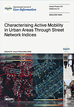
In the context of active mobility, a key component for the achievement of sustainable urban development, this study presents a framework for measuring active mobility conditions at the city scale, utilising global open data through the calculation of mode-specific street network indices. To achieve this, pedestrian, cycling, driving, and public transport networks are extracted from OpenStreetMap and refined to compute 50 indicators across eight index types, which measure network characteristics like compactness and straightness, as well as functional characteristics such as proximity or cycling comfort. Applied to 176 cities worldwide, the resulting indicators, published as open data, showed that higher-income cities, especially in Europe, tend to exhibit more compact, connected, and better-mapped environments that foster active mobility. View this paper
  • Issues are regarded as officially published after their release is announced to the table of contents alert mailing list.
  • You may sign up for e-mail alerts to receive table of contents of newly released issues.
  • PDF is the official format for papers published in both, html and pdf forms. To view the papers in pdf format, click on the "PDF Full-text" link, and use the free Adobe Reader to open them.
Order results
Result details
Select all
Export citation of selected articles as:
28 pages, 4616 KB  
Article
Analysis of Semi-Global Factors Influencing the Prediction of Crash Severity
by Johannes Frank, Cédric Roussel and Klaus Böhm
ISPRS Int. J. Geo-Inf. 2025, 14(11), 454; https://doi.org/10.3390/ijgi14110454 - 19 Nov 2025
Viewed by 398
Abstract
As road users and means of transport in Germany become more diverse, we must better understand the causes and influencing factors of serious crashes. The aim of this work is to develop an AI-supported analysis approach that identifies and clearly visualizes the causes [...] Read more.
As road users and means of transport in Germany become more diverse, we must better understand the causes and influencing factors of serious crashes. The aim of this work is to develop an AI-supported analysis approach that identifies and clearly visualizes the causes of crashes and their impact on crash severity in the urban area of the city of Mainz. The machine learning models predict crash severity and use Shapley values as explainability methods to make the underlying patterns understandable for urban planners, safety personnel, and other stakeholders. A particular challenge lies in presenting these complex relationships in a user-friendly way through visualizations and interactive maps. Full article
(This article belongs to the Special Issue Cartography and Geovisual Analytics)
Show Figures

Figure 1

22 pages, 2861 KB  
Article
CerMapp: A Cloud-Based Geospatial Prototype for National Wildlife Disease Surveillance
by Tommaso Orusa, Annalisa Viani, Alessio Di Lorenzo and Riccardo Orusa
ISPRS Int. J. Geo-Inf. 2025, 14(11), 453; https://doi.org/10.3390/ijgi14110453 - 19 Nov 2025
Viewed by 341
Abstract
CerMapp is a multi-platform and system application designed to address a critical gap in veterinary public health: the lack of a standardized, national-scale geodatabase for wildlife diseases. This gap has long hindered the effective application of GIS and remote sensing in spatial epidemiology. [...] Read more.
CerMapp is a multi-platform and system application designed to address a critical gap in veterinary public health: the lack of a standardized, national-scale geodatabase for wildlife diseases. This gap has long hindered the effective application of GIS and remote sensing in spatial epidemiology. Currently deployed at the prototype level in Aosta Valley, NW Italy, the application’s core innovation is its ability to generate a structured, analysis-ready data repository, which serves as a foundational resource for One Health initiatives. Developed by the National Reference Center for Wildlife Diseases on the ESRI ArcGIS Survey123 platform v.3.24, CerMapp enables veterinarians, foresters, and wildlife professionals to easily collect and georeference field data, including species, health status, and photographic evidence using flexible methods such as Global Navigation Satellite System or manual map entry. Data collected via CerMapp are stored in a centralized geodatabase, facilitating risk analyses and detailed geospatial studies. This data can be integrated with remote sensing information processed on cloud platforms like Google Earth Engine or within traditional GIS software, contributing to a comprehensive and novel wildlife health registry. By promoting the rational and standardized collection of essential geospatial data, CerMapp data may support predictive disease modeling, risk assessment, and habitat suitability mapping for wildlife diseases, zoonoses, and vector-borne pathogens. Its scalable, user-friendly design ensures alignment with existing national systems like the Italian Animal Disease Information System (SIMAN), making advanced geospatial analysis accessible without requiring specialized digital skills from field operators or complex IT maintenance from institutions. Full article
Show Figures

Figure 1

24 pages, 6466 KB  
Article
Machine Learning Insights into Supply–Demand Mismatch, Interactions and Driving Mechanisms of Ecosystem Services Across Scales: A Case Study of Xingtai, China
by Zhenyu Wang, Ruohan Wang, Keyu Luo, Sen Liang and Miaomiao Xie
ISPRS Int. J. Geo-Inf. 2025, 14(11), 452; https://doi.org/10.3390/ijgi14110452 - 19 Nov 2025
Viewed by 354
Abstract
To reveal the cross-scale trade-offs and synergies of ecosystem services (ESs) in resource-based cities, this study took Xingtai City, Hebei Province, as a case. Six ESs—water yield (WY), soil retention (SDR), habitat quality (HQ), urban cooling (UC), net primary productivity (NPP), and PM [...] Read more.
To reveal the cross-scale trade-offs and synergies of ecosystem services (ESs) in resource-based cities, this study took Xingtai City, Hebei Province, as a case. Six ESs—water yield (WY), soil retention (SDR), habitat quality (HQ), urban cooling (UC), net primary productivity (NPP), and PM2.5 removal—were quantified at the 1 km grid, township, and county scales. Using Spearman correlation, geographically weighted regression (GWR), and the XGBoost-SHAP framework, we analyzed the spatiotemporal evolution of the ecosystem service supply–demand ratio (ESDR) from 2000 to 2020 and identified the dominant driving mechanisms. The results indicate the following: (1) The mean ESDR in Xingtai decreased sharply from 0.14 in 2000 to 0.008 in 2020, a decline of 94.3%, showing a pronounced “high in the western mountains–low in the eastern plains” gradient pattern and an increasingly severe supply–demand imbalance. (2) Synergistic relationships dominated among the six ESs, accounting for over 80%. Strong synergies were observed between supply-related services such as WY–SDR and HQ–NPP, with correlation coefficients ranging from 0.65 to 0.88, whereas weak trade-offs (<20%) occurred between UC and PM2.5 removal in urbanized areas, which diminished with coarser spatial scales. (3) Population density (Pop), elevation (DEM), cropland proportion (Crop), and vegetation index (NDVI) were identified as the key driving factors, with a combined contribution of 71.4%. NDVI exhibited the strongest positive effect on ecosystem service supply (mean SHAP value = 0.24), while Pop and built-up land proportion showed significant negative effects once exceeding the thresholds of 400 persons/km2 and 35%, respectively, indicating nonlinear and threshold-dependent responses. This study quantitatively reveals the spatiotemporal synergy patterns and complex driving mechanisms of ecosystem services in resource-based cities, providing scientific evidence for differentiated ecological restoration and multi-scale governance, and offering essential insights for enhancing regional sustainability. Full article
Show Figures

Figure 1

27 pages, 5753 KB  
Article
DDDMNet: A DSM Difference Normalization Module Network for Urban Building Change Detection
by Yihang Fu, Yuejin Li and Shijie Zhang
ISPRS Int. J. Geo-Inf. 2025, 14(11), 451; https://doi.org/10.3390/ijgi14110451 - 16 Nov 2025
Viewed by 454
Abstract
Urban building change detection (UBCD) is essential for urban planning, land-use monitoring, and smart city analytics, yet bi-temporal optical methods remain limited by spectral confusion, occlusions, and weak sensitivity to structural change. To overcome these challenges, we propose DDDMNet, a lightweight deep learning [...] Read more.
Urban building change detection (UBCD) is essential for urban planning, land-use monitoring, and smart city analytics, yet bi-temporal optical methods remain limited by spectral confusion, occlusions, and weak sensitivity to structural change. To overcome these challenges, we propose DDDMNet, a lightweight deep learning framework that fuses multi-source inputs—including DSM, dnDSM, DOM, and NDVI—to jointly model geometric, spectral, and environmental cues. A core component of the network is the DSM Difference Normalization Module (DDDM), which explicitly normalizes elevation differences and directs the model to focus on height-related structural variations such as rooftop additions and demolition. Embedded into a TinyCD backbone, DDDMNet achieves efficient inference with low memory cost while preserving detail-level change fidelity. Across LEVIR-CD, WHU-CD, and DSIFN, DDDMNet achieves up to 93.32% F1-score, 89.05% Intersection over Union (IoU), and 99.61% Overall Accuracy (OA), demonstrating consistently strong performance across diverse benchmarks. Ablation analysis further shows that removing multi-source fusion, DDDM, dnDSM, or morphological refinement causes notable drops in performance—for example, removing DDDM reduces IoU from 88.12% to 74.62%, underscoring its critical role in geometric normalization. These results demonstrate that DDDMNet is not only accurate but also practically deployable, offering strong potential for scalable 3D city updates and long-term urban monitoring under diverse data conditions. Full article
Show Figures

Figure 1

18 pages, 4501 KB  
Article
Benford’s Law and Transport Infrastructure: The Analysis of the Main Road Network’s Higher-Level Segments in the EU
by Monika Ivanova, Erika Feckova Skrabulakova, Ales Jandera, Zuzana Sarosiova and Tomas Skovranek
ISPRS Int. J. Geo-Inf. 2025, 14(11), 450; https://doi.org/10.3390/ijgi14110450 - 15 Nov 2025
Viewed by 374
Abstract
Benford’s Law, also known as the First-Digit Law, describes the non-uniform distribution of leading digits in many naturally occurring datasets. This phenomenon can be observed in data such as financial transactions, tax records, or demographic indicators, but the application of Benford’s Law to [...] Read more.
Benford’s Law, also known as the First-Digit Law, describes the non-uniform distribution of leading digits in many naturally occurring datasets. This phenomenon can be observed in data such as financial transactions, tax records, or demographic indicators, but the application of Benford’s Law to data from the field of transport infrastructure remains largely underexplored. As interest in using statistical distributions to identify spatial and regional patterns grows, this paper explores the applicability of Benford’s Law to anthropogenic geographic data, particularly whether the lengths of higher-level segments of the main road network across European Union member states follow Benford’s Law. To evaluate the conformity of the data from all European Union countries with Benford’s distribution, Pearson’s χ2 test of association, the p-value, and the Kolmogorov–Smirnov test were used. The results consistently show low χ2 values and high p-values, indicating a strong agreement between observed and expected distributions. The relationship between the distribution of higher-level segment lengths and the leading digits of these lengths was studied as well. The findings suggest that the length distribution of the main road networks’ higher-level segments closely follows Benford’s Law, emphasizing its potential as a simple yet effective tool for assessing the reliability and consistency of geographic and infrastructure datasets within the European context. Full article
Show Figures

Figure 1

23 pages, 9109 KB  
Article
A Spatial Planning Model for Obnoxious Facilities with Spatially Informed Constraints
by Changwha Oh and Hyun Kim
ISPRS Int. J. Geo-Inf. 2025, 14(11), 449; https://doi.org/10.3390/ijgi14110449 - 15 Nov 2025
Viewed by 369
Abstract
This research aims to develop a novel spatial optimization model for locating obnoxious facilities. While various obnoxious facility location problems (OFLP) have been introduced, the optimal spatial arrangements in existing models may not adequately reflect the real-world conditions, such as the distribution of [...] Read more.
This research aims to develop a novel spatial optimization model for locating obnoxious facilities. While various obnoxious facility location problems (OFLP) have been introduced, the optimal spatial arrangements in existing models may not adequately reflect the real-world conditions, such as the distribution of population and locational restrictions across areas in a region, often offering extreme peripheral or clustered recommendations that ignore such conditions. To address this gap, this research introduces an alternative location model named the Spatially Informed Obnoxious Location (SI-OBNOX) model. The SI-OBNOX model was developed to address the extreme spatial arrangements produced by existing models by incorporating a unique set of constraints derived from the spatial characteristics of a planning region. The constraints integrate spatial–statistical measures into the model formulation to restrict extreme facility location behaviors, resulting in more reasonably distributed obnoxious facility sites while avoiding residential areas for them. The findings demonstrate that the spatial arrangements generated by the SI-OBNOX model outperform those of existing OFLPs in terms of three planning-related indices, namely separation, externality, and proximity, based on a case study of the East Tennessee region. The SI-OBNOX model can be adapted to other planning contexts where it is necessary to locate undesirable yet essential facilities for public welfare. Full article
Show Figures

Figure 1

21 pages, 1964 KB  
Article
Urban Grid Population Inflow Prediction via POI-Enhanced Conditional Diffusion with Dual-Dimensional Attention
by Zhiming Gui, Yuanchao Zhong and Zhenji Gao
ISPRS Int. J. Geo-Inf. 2025, 14(11), 448; https://doi.org/10.3390/ijgi14110448 - 15 Nov 2025
Viewed by 348
Abstract
Accurate prediction of urban grid-scale population inflow is crucial for smart city management and emergency response. However, existing methods struggle to model spatial heterogeneity and quantify prediction uncertainty, limiting their accuracy and decision-support capabilities. This paper proposes PDCDM (POI-enhanced Dual-Dimensional Conditional Diffusion Model), [...] Read more.
Accurate prediction of urban grid-scale population inflow is crucial for smart city management and emergency response. However, existing methods struggle to model spatial heterogeneity and quantify prediction uncertainty, limiting their accuracy and decision-support capabilities. This paper proposes PDCDM (POI-enhanced Dual-Dimensional Conditional Diffusion Model), which integrates urban functional semantic awareness with conditional diffusion modeling. The model captures urban functional attributes through multi-scale Point of Interest (POI) feature representations and incorporates them into the diffusion generation process. A dual-dimensional Transformer architecture is employed to decouple the modeling of temporal dependencies and inter-grid interactions, enabling adaptive fusion of grid-level features with dynamic temporal patterns. Building upon this dual-dimensional modeling framework, the conditional diffusion mechanism generates probabilistic predictions with explicit uncertainty quantification. Real-world urban dataset validation demonstrates that PDCDM significantly outperforms existing state-of-the-art methods in prediction accuracy and uncertainty quantification. Comprehensive ablation studies validate the effectiveness of each component and confirm the model’s practicality in complex urban scenarios. Full article
(This article belongs to the Special Issue Spatial Data Science and Knowledge Discovery)
Show Figures

Figure 1

27 pages, 14163 KB  
Article
Characterising Active Mobility in Urban Areas Through Street Network Indices
by Juan Pablo Duque Ordoñez and Maria Antonia Brovelli
ISPRS Int. J. Geo-Inf. 2025, 14(11), 447; https://doi.org/10.3390/ijgi14110447 - 13 Nov 2025
Viewed by 701
Abstract
In the context of sustainable development, the concept of active mobility plays a key role in modern urban areas. To evaluate active mobility in these areas, we formulate a framework for characterising active mobility by calculating street network indices using global, free, and [...] Read more.
In the context of sustainable development, the concept of active mobility plays a key role in modern urban areas. To evaluate active mobility in these areas, we formulate a framework for characterising active mobility by calculating street network indices using global, free, and open data. This framework comprises the download and processing of pedestrian, cycling, driving, and public transport street networks from OpenStreetMap, the selection of street network indices from the academic literature, and their implementation and calculation. A total of 50 indicators are reported for each urban area distributed in eight index types, including thematic variables, proximity to Points of Interest (POIs), proximity to public transport, intersection density, street density, street length, link–node ratio, circuity, slope, and orientation entropy. To test the framework, we calculate street network indices for pedestrian and cycling networks for the urban areas of 176 cities from around the world. The resulting dataset is published as open data. An analysis of the calculated indices indicates that cities in higher-income economies generally exhibit better conditions for active mobility, especially in Europe, attributed to better map completeness, and to more compact and connected urban areas where it is easier to access amenities and public transport. Full article
Show Figures

Figure 1

42 pages, 18461 KB  
Article
A Similarity Metric Method for Contour Line Groups Considering Terrain Features
by Haoyue Qian, Zejun Zuo, Lin Yang, Yu Wang and Shunping Zhou
ISPRS Int. J. Geo-Inf. 2025, 14(11), 446; https://doi.org/10.3390/ijgi14110446 - 11 Nov 2025
Viewed by 413
Abstract
Contour lines, as the primary elements of fundamental geospatial data, have long been a research focus for similarity measurement. With the evolution of cartographic generalization, the representation of contour lines across varying scales must maintain the consistency of specific information. Typically, the rationality [...] Read more.
Contour lines, as the primary elements of fundamental geospatial data, have long been a research focus for similarity measurement. With the evolution of cartographic generalization, the representation of contour lines across varying scales must maintain the consistency of specific information. Typically, the rationality of the generated results is assessed based on their similarity values. However, current measurements for measuring contour similarity predominantly focus on geometric and topological aspects, and are often less concerned with the terrain-specific similarities that are intrinsic to contour lines. Contour line groups contain a wealth of topographic information, and the similarity of their terrain features reflects both the variations in relief and the intrinsic nature of landform development. In this study, we propose a novel metric for assessing the similarity of contour line groups by considering topographic features, aiming to evaluate the similarity of contour line groups from a holistic perspective. First, we analyze and define the geometric, topological, and topographic similarity calculation metrics for contour line groups. Next, we apply the Analytic Hierarchy Process using ten criteria, which are encompassed by these three similarity metrics. To validate the effectiveness of the proposed metric, we select hillock areas within Suide County, China, as a case study for examining the similarity of contour line groups. The results demonstrate that the proposed metric provides a more precise quantitative framework for delineating the subtle differences and similarities among multi-source and multi-scale contour line groups within the overall similarity. Moreover, the metric also establishes a foundation for the quantitative assessment of surface morphology and the classification of geomorphological types. Full article
Show Figures

Figure 1

18 pages, 2640 KB  
Article
Long-Term LULC Monitoring in El Jadida, Morocco (1985–2020): A Machine Learning-Based Comparative Analysis
by Ikram El Mjiri, Abdelmejid Rahimi, Abdelkrim Bouasria, Mohammed Bounif and Wardia Boulanouar
ISPRS Int. J. Geo-Inf. 2025, 14(11), 445; https://doi.org/10.3390/ijgi14110445 - 10 Nov 2025
Viewed by 589
Abstract
Recent advancements in remote sensing and geospatial processing tools have ushered in a new era of mapping and monitoring landscape changes across various scales. This progress is critical for understanding and anticipating the underlying drivers of environmental change. In particular, large-scale Land Use [...] Read more.
Recent advancements in remote sensing and geospatial processing tools have ushered in a new era of mapping and monitoring landscape changes across various scales. This progress is critical for understanding and anticipating the underlying drivers of environmental change. In particular, large-scale Land Use and Land Cover (LULC) mapping has become an indispensable tool for territorial planning and monitoring. This study aims to map and evaluate LULC changes in the El Jadida region of Morocco between 1985 and 2020. Utilizing multispectral Landsat imagery, we applied and compared three supervised machine learning classification algorithms: Random Forest (RF), Support Vector Machine (SVM), and Neural Network (NNET). Model performance was assessed using statistical metrics, including overall accuracy, the Kappa coefficient, and the F1 score. The results indicate that the RF algorithm was the most effective, achieving an overall accuracy of 90.3% and a Kappa coefficient of 0.859, outperforming both NNET (81.3%; Kappa = 0.722) and SVM (80.2%; Kappa = 0.703). Analysis of explanatory variables underscored the decisive contribution of the NDWI, NDBI, and SWIR and thermal bands in discriminating land cover classes. The spatio-temporal analysis reveals significant urban expansion, primarily at the expense of agricultural land, while forested areas and water bodies remained relatively stable. This trend highlights the growing influence of anthropogenic pressure on landscape structure and underscores its implications for sustainable resource management and land use planning. The findings demonstrate the high efficacy of machine learning, particularly the RF algorithm, for accurate LULC mapping and change detection in the El Jadida region. This study provides a critical evidence base for regional planners to address the ongoing loss of agricultural land to urban expansion. Full article
Show Figures

Figure 1

25 pages, 19876 KB  
Article
Choreme-Based Spatial Analysis and Tourism Assessment in the Oltenia de sub Munte Geopark, Romania
by Amalia Niță and Ionuț-Adrian Drăguleasa
ISPRS Int. J. Geo-Inf. 2025, 14(11), 444; https://doi.org/10.3390/ijgi14110444 - 9 Nov 2025
Viewed by 942
Abstract
The chorematic method represents an innovative and contemporary approach for organizing tourist space, supporting the sustainable regional development of the future UNESCO Geopark, and guiding research, evaluation, and tourism monitoring activities in the area. This study applies Geographic Information System (GIS) techniques to [...] Read more.
The chorematic method represents an innovative and contemporary approach for organizing tourist space, supporting the sustainable regional development of the future UNESCO Geopark, and guiding research, evaluation, and tourism monitoring activities in the area. This study applies Geographic Information System (GIS) techniques to develop a chorematic model illustrating the influence of county capitals, using Oltenia de sub Munte—an aspiring UNESCO Geopark in Romania—as a case study. The area’s complex geographical characteristics make it an ideal context for demonstrating the capabilities of GIS-based spatial analysis, including the use of the Reilly–Converse gravity model, which posits that a city’s influence increases with its population size and decreases with distance. The theoretical and methodological framework integrates spatial analysis and statistical visualization through the use of thematic maps and diagrams to explore the chorematic model and to assess tourism supply and demand. Accordingly, spatial representations based on chorematic modeling are presented, and the dynamics of tourism demand and supply from 2015 to 2024 are analyzed, focusing on the number of tourist arrivals, overnight stays, and the overall tourism offer within the Oltenia de sub Munte Geopark. Full article
Show Figures

Figure 1

22 pages, 3516 KB  
Article
Hurricane Precipitation Intensity as a Function of Geometric Shape: The Evolution of Dvorak Geometries
by Ivan Gonzalez Garcia, Alfonso Gutierrez-Lopez, Ana Marcela Herrera Navarro and Hugo Jimenez-Hernandez
ISPRS Int. J. Geo-Inf. 2025, 14(11), 443; https://doi.org/10.3390/ijgi14110443 - 8 Nov 2025
Viewed by 362
Abstract
The Dvorak technique has represented a fundamental tool for understanding the power of tropical cyclones based on their shape and geometric evolution. However, it should be noted that the Dvorak technique is purely morphological in nature and was developed for wind, not precipitation. [...] Read more.
The Dvorak technique has represented a fundamental tool for understanding the power of tropical cyclones based on their shape and geometric evolution. However, it should be noted that the Dvorak technique is purely morphological in nature and was developed for wind, not precipitation. The role of shape methods in precipitation prediction remains uncertain, particularly in the context of modern multi-sensor capabilities. This uncertainty forms the motivation for the present study. In an attempt to enrich Dvorak’s technique, this study proposes a novel hypothesis. This study tests the hypothesis that higher precipitation intensity is associated with more organized cloud-system morphology, as captured by simple geometric descriptors and indicative of dynamically coherent convection. A total of 3419 cloud-system objects (after size filter) were utilized to establish geometric relationships in each of them. For the case study of Hurricane Patricia over the Mexican coast in 2015, 3858 geometric shapes were processed. The cloud-system morphology was derived from geostationary imagery (GOES-13) and collocated with satellite precipitation estimates in order to isolate intense-rainfall objects (>50 mm/h). For each object, simple geometric descriptors were computed, and shape variability was summarised via Principal Component Analysis (PCA). The present study sought to evaluate the associations with rain-rate metrics (mean, mode, maximum) using rank correlations and k-means clustering. Furthermore, sensitivity analyses were conducted on the rain threshold and minimum object size. A Shape Descriptor: ratio between perimeter and diameter was identified as a promising tool to enhance early prediction models of extreme rainfall, contributing to enhanced meteorological risk management. The study indicates that cloud shape can serve as a valuable indicator in the classification and forecasting of intense cloud systems. Full article
(This article belongs to the Special Issue Cartography and Geovisual Analytics)
Show Figures

Figure 1

14 pages, 11890 KB  
Article
Spatiotemporal Analysis of Skier Versus Snowboarder Injury Patterns: A GIS-Based Comparative Study at a Large West Coast Resort
by Matt Bisenius and Ming-Chih Hung
ISPRS Int. J. Geo-Inf. 2025, 14(11), 442; https://doi.org/10.3390/ijgi14110442 - 8 Nov 2025
Viewed by 375
Abstract
GPS tracking has made ski injury data abundant, yet few studies have mapped where incidents actually occur or how those patterns differ between skiers and snowboarders. To address this gap, we analyzed 8719 GPS-located incidents (4196 skier; 4523 snowboarder) spanning four seasons (2017–2022, [...] Read more.
GPS tracking has made ski injury data abundant, yet few studies have mapped where incidents actually occur or how those patterns differ between skiers and snowboarders. To address this gap, we analyzed 8719 GPS-located incidents (4196 skier; 4523 snowboarder) spanning four seasons (2017–2022, excluding 2019–2020 due to COVID-19) at a large West Coast resort in California. Incidents were aggregated into 45 m hexagons and analyzed using Getis–Ord Gi* hot spot analysis, Local Outlier Analysis (LOA), and a space–time cube with time-series clustering. Hot spot analysis identified both activity-specific and overlapping high-injury concentrations at the 99% confidence level (p < 0.01). The LOA revealed no spatial overlap between skier and snowboarder High-High classifications (areas with high incident counts surrounded by other high-count areas) at the 95% confidence level. Temporal analysis exposed distinct patterns by activity: Time Series Clustering revealed skier incidents concentrated at holiday-sensitive locations versus stable zones, while snowboarder incidents separated into sustained high-activity versus baseline areas. These findings indicate universal safety strategies may be insufficient; targeted, activity-specific interventions may warrant investigation. The methodology provides a reproducible framework for spatial injury surveillance applicable across the ski industry. Full article
Show Figures

Figure 1

29 pages, 9255 KB  
Article
Exploratory Learning of Amis Indigenous Culture and Local Environments Using Virtual Reality and Drone Technology
by Yu-Jung Wu, Tsu-Jen Ding, Jen-Chu Hsu, Kuo-Liang Ou and Wernhuar Tarng
ISPRS Int. J. Geo-Inf. 2025, 14(11), 441; https://doi.org/10.3390/ijgi14110441 - 8 Nov 2025
Viewed by 572
Abstract
Virtual reality (VR) creates immersive environments that allow users to interact with digital content, fostering a sense of presence and engagement comparable to real-world experiences. VR360 technology, combined with affordable head-mounted displays such as Google Cardboard, enhances accessibility and provides an intuitive learning [...] Read more.
Virtual reality (VR) creates immersive environments that allow users to interact with digital content, fostering a sense of presence and engagement comparable to real-world experiences. VR360 technology, combined with affordable head-mounted displays such as Google Cardboard, enhances accessibility and provides an intuitive learning experience. Drones, or unmanned aerial vehicles (UAVs), are operated through remote control systems and have diverse applications in civilian, commercial, and scientific domains. Taiwan’s Indigenous cultures emphasize environmental conservation, and integrating this knowledge into education supports both biodiversity and cultural preservation. The Amis people, who primarily reside along Taiwan’s eastern coast and central mountain regions, face educational challenges due to geographic isolation and socioeconomic disadvantage. This study integrates VR360 and drone technologies to develop a VR learning system for elementary science education that incorporates Amis culture and local environments. A teaching experiment was conducted to evaluate its impact on learning effectiveness and student responses. Results show that students using the VR system outperformed the control group in cultural and scientific knowledge, experienced reduced cognitive load, and reported greater learning motivation. These findings highlight the potential of VR and drone technologies to improve learning outcomes, promote environmental and cultural awareness, and reduce educational barriers for Indigenous students in remote or socioeconomically disadvantaged communities. Full article
(This article belongs to the Topic 3D Documentation of Natural and Cultural Heritage)
Show Figures

Figure 1

19 pages, 3176 KB  
Article
Collaborative Feminist Cartography in Geographical Education: Mapping Gender Representation in Street Naming (Las Calles de las Mujeres)
by María Sebastián López, Ondrej Kratochvíl, José Antonio Mérida Donoso, Juan Mar-Beguería and Rafael De Miguel González
ISPRS Int. J. Geo-Inf. 2025, 14(11), 440; https://doi.org/10.3390/ijgi14110440 - 7 Nov 2025
Viewed by 650
Abstract
Collaborative mapping has emerged in recent decades as a key practice for producing open geospatial knowledge and fostering critical citizenship. However, several studies have shown that these platforms may reproduce existing gender inequalities, both in terms of participation and representation. This article examines [...] Read more.
Collaborative mapping has emerged in recent decades as a key practice for producing open geospatial knowledge and fostering critical citizenship. However, several studies have shown that these platforms may reproduce existing gender inequalities, both in terms of participation and representation. This article examines the potential of collaborative feminist cartography as a strategy for making inequalities visible and promoting gender equality in public space. Methodologically, the study focuses on the project Las Calles de las Mujeres, developed by Geochicas OSM, combining quantitative analysis of street naming in urban development with qualitative implementation in educational contexts. A global overview of 32 cities in 11 countries is provided, with a detailed case study of 11 Spanish cities. Results confirm the persistence of a significant gender gap in urban toponymy: streets named after men not only outnumber those dedicated to women but are also on average longer, more central, and symbolically more prominent. Educational experiences in Spain provide learning outcomes and demonstrate that collaborative mapping strengthens spatial thinking, digital competence, and critical awareness, linking geography education to the Sustainable Development Goals (SDG 5 and SDG 11). The article concludes that feminist mapping initiatives are simultaneously pedagogical, social, and political tools, capable of fostering more inclusive and sustainable cities. Full article
Show Figures

Figure 1

30 pages, 3314 KB  
Article
Spatio-Temporal Variability and Environmental Associations of Emergency Department Demand: A Longitudinal Analysis in Zaragoza, Spain (2011–2024)
by Jorge Blanco Prieto, Marina Ferreras González and Oscar Cosido Cobos
ISPRS Int. J. Geo-Inf. 2025, 14(11), 439; https://doi.org/10.3390/ijgi14110439 - 7 Nov 2025
Viewed by 386
Abstract
Emergency department (ED) overcrowding has become a critical public health issue worldwide, driven by increasing demand and limited healthcare resources. This study analyzes the spatio-temporal variability of ED visits at Royo Villanova Hospital (Zaragoza, Spain) from 2011 to 2024, integrating clinical, demographic, environmental, [...] Read more.
Emergency department (ED) overcrowding has become a critical public health issue worldwide, driven by increasing demand and limited healthcare resources. This study analyzes the spatio-temporal variability of ED visits at Royo Villanova Hospital (Zaragoza, Spain) from 2011 to 2024, integrating clinical, demographic, environmental, and socioeconomic data. Using geospatial tools and machine learning models (XGBoost with SHAP interpretation), we identify key patterns in ED demand across time and space. Results show that the hour of the day is the most influential variable across all diagnoses, while temperature, humidity, and air pollutants (NO2, SO2, O3) significantly affect respiratory and injury-related visits. Spatial analysis reveals persistent high-demand clusters in specific health zones, with proximity to the hospital playing a major role. The COVID-19 pandemic caused structural shifts in demand, particularly in pediatric care. Our findings highlight the need for tailored, diagnosis-specific predictive models and support the use of geospatial and environmental data for proactive ED resource planning. This approach enhances the capacity of health systems to anticipate demand surges and allocate resources efficiently. Full article
Show Figures

Figure 1

23 pages, 2480 KB  
Article
Context-Aware Anomaly Detection of Pedestrian Trajectories in Urban Back Streets Using a Variational Autoencoder
by Juyeon Cho and Youngok Kang
ISPRS Int. J. Geo-Inf. 2025, 14(11), 438; https://doi.org/10.3390/ijgi14110438 - 5 Nov 2025
Viewed by 612
Abstract
Detecting anomalous pedestrian behaviors is critical for enhancing safety in dense urban environments, particularly in complex back streets where movement patterns are irregular and context-dependent. While extensive research has been conducted on trajectory-based anomaly detection for vehicles, ships, and aircraft, few studies have [...] Read more.
Detecting anomalous pedestrian behaviors is critical for enhancing safety in dense urban environments, particularly in complex back streets where movement patterns are irregular and context-dependent. While extensive research has been conducted on trajectory-based anomaly detection for vehicles, ships, and aircraft, few studies have focused on pedestrians, whose behaviors are strongly influenced by surrounding spatial and environmental conditions. This study proposes a pedestrian anomaly detection framework based on a Variational Autoencoder (VAE), designed to identify and interpret abnormal trajectories captured by large-scale Closed-Circuit Television (CCTV) systems in urban back streets. The framework extracts 14 movement features across point, trajectory, and grid levels, and employs the VAE to learn normal movement patterns and detect deviations from them. A total of 1.88 million trajectories were analyzed, and approximately 1.05% were identified as anomalous. These were further categorized into three behavioral types—wandering, slow-linear, and stationary—through clustering analysis. Contextual interpretation revealed that anomaly types differ substantially by time of day, spatial configuration, and weather conditions. The final optimized model achieved an accuracy of 97.80% and an F1-score of 94.63%, demonstrating its strong capability to detect abnormal pedestrian movement while minimizing false alarms. By integrating deep learning with contextual urban analytics, this study contributes to data-driven frameworks for real-time pedestrian safety monitoring and spatial risk assessment in complex urban environments. Full article
(This article belongs to the Topic Artificial Intelligence Models, Tools and Applications)
Show Figures

Figure 1

21 pages, 439 KB  
Article
DCal-Rec: A Spatio-Temporal Distribution Calibration Framework for Next-POI Recommendation
by Meihui Shi, Peng Zhang, Jinlian Du and Zhi Cai
ISPRS Int. J. Geo-Inf. 2025, 14(11), 437; https://doi.org/10.3390/ijgi14110437 - 4 Nov 2025
Viewed by 464
Abstract
The rapid expansion of mobile user behavior data has made next-Point-of-Interest (POI) recommendation increasingly vital for enhancing personalized location-based services. However, the non-uniform spatio-temporal distribution of user behavior poses significant challenges to recommendation performance. Most existing methods neglect this fundamental issue at the [...] Read more.
The rapid expansion of mobile user behavior data has made next-Point-of-Interest (POI) recommendation increasingly vital for enhancing personalized location-based services. However, the non-uniform spatio-temporal distribution of user behavior poses significant challenges to recommendation performance. Most existing methods neglect this fundamental issue at the distribution level, while conventional data augmentation strategies fall short in optimizing spatio-temporal distribution properties. To tackle this problem, we propose a spatio-temporal Distribution Calibration framework for next-POI Recommendation (DCal-Rec), which optimizes behavioral sequence distributions through disentangled spatial and temporal operator pools. This is combined with a dual-constraint mechanism that incorporates both distribution and interest information to maintain semantic consistency. Furthermore, a multi-channel contrastive learning paradigm is introduced to jointly optimize the recommendation and contrastive tasks under a unified training objective, thereby improving the model’s generalization capability. Experimental results on three public real-world datasets demonstrate that DCal-Rec significantly outperforms baseline methods across various evaluation metrics. Full article
Show Figures

Figure 1

27 pages, 6963 KB  
Article
How Does Built Environment Influence Housing Prices in Large-Scale Areas? An Interpretable Machine Learning Method by Considering Multi-Dimensional Accessibility
by Ziyi Wang, Yu Wang, Xinyu Xia, Shaozhu Chen and Wei Jiang
ISPRS Int. J. Geo-Inf. 2025, 14(11), 436; https://doi.org/10.3390/ijgi14110436 - 4 Nov 2025
Viewed by 867
Abstract
The housing prices are crucial to the sustainable development of the real estate market. Nowadays, few academic attempts have focused on the impact of multi-dimensional accessibility on housing prices in a large-scale area. This study utilized machine learning methods to extract indicators of [...] Read more.
The housing prices are crucial to the sustainable development of the real estate market. Nowadays, few academic attempts have focused on the impact of multi-dimensional accessibility on housing prices in a large-scale area. This study utilized machine learning methods to extract indicators of the visual environment from street view images. The indicators were combined with multiple sources of spatiotemporal geographic big data, such as second-hand housing data and online map POIs, to quantify the factors of housing prices. Both the hedonic price model and random forest were constructed, with Shapley additive explanations applied to interpret the results. Our work took Shanghai as a case study, and the results indicate that the random forest exhibits superior performance compared to the hedonic price model. The location accessibility (e.g., distance to the CBD) is paramount, and functional accessibility (e.g., to subways and finance facilities) exhibits nonlinear thresholds. We further uncovered the characteristics of the nonlinear relationship between visual environmental factors and housing prices. Our findings can deepen the understanding of housing price variation in the spatial dimension and provide the theoretical basis for ensuring the optimization of urban planning. Full article
Show Figures

Figure 1

18 pages, 2861 KB  
Article
A Geometric Attribute Collaborative Method in Multi-Scale Polygonal Entity Matching Scenario: Integrating Sentence-BERT and Three-Branch Attention Network
by Zhuang Sun, Po Liu, Liang Zhai and Zutao Zhang
ISPRS Int. J. Geo-Inf. 2025, 14(11), 435; https://doi.org/10.3390/ijgi14110435 - 3 Nov 2025
Viewed by 488
Abstract
The cross-scale fusion and consistent representation of cross-source heterogeneous vector polygon data are fundamental tasks in the field of GIS, and they play an important role in areas such as the refined management of natural resources, territorial spatial planning, and the urban emergency [...] Read more.
The cross-scale fusion and consistent representation of cross-source heterogeneous vector polygon data are fundamental tasks in the field of GIS, and they play an important role in areas such as the refined management of natural resources, territorial spatial planning, and the urban emergency response. However, the existing methods suffer from two key limitations: the insufficient utilization of semantic information, especially non-standardized attributes, and the lack of differentiated modeling for 1:1, 1:M, and M:N matching relationships. To address these issues, this study proposes a geometric–attribute collaborative matching method for multi-scale polygonal entities. First, matching relationships are classified into 1:1, 1:M, and M:N based on the intersection of polygons. Second, geometric similarities including spatial overlap, size, shape, and orientation are computed for each relationship type. Third, semantic similarity is enhanced by fine-tuning the pre-trained Sentence-BERT model, which effectively captures the complex semantic information from non-standardized descriptions. Finally, a three-branch attention network is constructed to specifically handle the three matching relationships, with adaptive feature weighting via attention mechanisms. The experimental results on datasets from Tunxi District, Huangshan City, China show that the proposed method outperforms the existing approaches including geometry–attribute fusion and BPNNs in precision, recall, and F1-score, with improvements of 3.38%, 1.32%, and 2.41% compared to the geometry–attribute method, and 2.91%, 0.27%, and 1.66% compared to BPNNs, respectively. A generalization experiment on Hefei City data further validates its robustness. This method effectively enhances the accuracy and adaptability of multi-scale polygonal entity matching, providing a valuable tool for multi-source GIS database integration. Full article
Show Figures

Figure 1

28 pages, 3429 KB  
Article
Multimodal Spatiotemporal Deep Fusion for Highway Traffic Accident Prediction in Toronto: A Case Study and Roadmap
by Danya Qutaishat and Songnian Li
ISPRS Int. J. Geo-Inf. 2025, 14(11), 434; https://doi.org/10.3390/ijgi14110434 - 3 Nov 2025
Viewed by 747
Abstract
A proactive traffic safety approach provides a forward-looking method for managing traffic and preventing accidents by identifying high-risk conditions before they occur. Previous studies have often focused on historical crash data or demographic factors, relying on limited single-source inputs and neglecting spatial, temporal, [...] Read more.
A proactive traffic safety approach provides a forward-looking method for managing traffic and preventing accidents by identifying high-risk conditions before they occur. Previous studies have often focused on historical crash data or demographic factors, relying on limited single-source inputs and neglecting spatial, temporal, and environmental interactions. This study develops a multimodal spatiotemporal deep fusion framework for predicting traffic accidents in Toronto, Canada, by integrating spatial, temporal, environmental, and lighting features within a proactive modeling structure. Three fusion approaches were investigated: (1) environmental feature fusion, (2) extended fusion incorporating lighting and road surface conditions, and (3) a double-stage fusion combining all feature types. The double-stage fusion achieved the best performance, reducing RMSE from 0.50 to 0.41 and outperforming conventional models across multiple error metrics. The framework supports fine-grained hotspot analysis, improves proactive traffic safety management, and provides a transferable roadmap for applying deep fusion in real-world intelligent transportation and urban planning systems. Full article
Show Figures

Figure 1

28 pages, 5513 KB  
Article
An Agent-Based System for Location Privacy Protection in Location-Based Services
by Omar F. Aloufi, Ahmed S. Alfakeeh and Fahad M. Alotaibi
ISPRS Int. J. Geo-Inf. 2025, 14(11), 433; https://doi.org/10.3390/ijgi14110433 - 3 Nov 2025
Viewed by 471
Abstract
Location-based services (LBSs) are a crucial element of the Internet of Things (IoT) and have garnered significant attention from both researchers and users, driven by the rise of wireless devices and a growing user base. However, the use of LBS-enabled applications carries several [...] Read more.
Location-based services (LBSs) are a crucial element of the Internet of Things (IoT) and have garnered significant attention from both researchers and users, driven by the rise of wireless devices and a growing user base. However, the use of LBS-enabled applications carries several risks, as users must provide their real locations with each query. This can expose them to potential attacks from the LBS server, leading to serious issues like the theft of personal information. Consequently, protecting location privacy is a vital concern. To address this, location dummy-based methods are employed to safeguard the location privacy of LBS users. However, location dummy-based approaches also suffer from problems such as low resistance against inference attacks and the generation of strong dummy locations, an issue that is considered an open problem. Moreover, generating many location dummies to achieve a high privacy protection level leads to high network overhead and requires high computational capabilities on the mobile devices of the LBS users, and such devices are limited. In this paper, we introduce the Caching-Aware Double-Dummy Selection (CaDDSL) algorithm to protect the location privacy of LBS users against homogeneity location and semantic location inference attacks, which may be applied by the LBS server as a malicious party. Then, we enhance the CaDDSL algorithm via encapsulation with agents to solve the tradeoff between generating many dummies and large network overhead by proposing the Cache-Aware Overhead-Aware Dummy Selection (CaOaDSL) algorithm. Compared to three well-known approaches, namely GridDummy, CirDummy, and Dest-Ex, our approach showed better performance in terms of communication cost, cache hit ratio, resistance against inference attacks, and network overhead. Full article
Show Figures

Figure 1

17 pages, 11914 KB  
Article
Evaluation of Metro Station Accessibility Based on Combined Weights and GRA-TOPSIS Method
by Tao Wu, Yichong Shi, Ye Zhou and Zhihan Chen
ISPRS Int. J. Geo-Inf. 2025, 14(11), 432; https://doi.org/10.3390/ijgi14110432 - 3 Nov 2025
Viewed by 596
Abstract
Assessing the accessibility of urban metro stations is essential for optimizing metro system planning and improving travel efficiency for residents. This study proposes an innovative evaluation framework—the CWM-GRA-TOPSIS model—for comprehensive metro station accessibility assessment. First, a multi-dimensional indicator system is established, encompassing three [...] Read more.
Assessing the accessibility of urban metro stations is essential for optimizing metro system planning and improving travel efficiency for residents. This study proposes an innovative evaluation framework—the CWM-GRA-TOPSIS model—for comprehensive metro station accessibility assessment. First, a multi-dimensional indicator system is established, encompassing three key dimensions, to-metro accessibility, by-metro accessibility, and land use accessibility, which are further refined into 14 secondary indicators for detailed analysis. A Combination Weighting Method (CWM) is then introduced, integrating the Analytic Hierarchy Process (AHP) for subjective weighting and the Criteria Importance Through Intercriteria Correlation (CRITIC) method for objective weighting, with their integration optimized through Game Theory. Subsequently, the overall accessibility of metro stations is evaluated and ranked using a hybrid Grey Relational Analysis (GRA) and Technique for Order Preference by Similarity to Ideal Solution (TOPSIS) approach. The proposed method is applied to Wuhan, China, to demonstrate its effectiveness and applicability. Results show that the CWM-GRA-TOPSIS model, by balancing objectivity and practical relevance, provides a more reliable and systematic approach for identifying accessibility disparities and formulating targeted improvement strategies for urban metro systems. Full article
(This article belongs to the Topic Spatial Decision Support Systems for Urban Sustainability)
Show Figures

Figure 1

22 pages, 1208 KB  
Article
Geo-MRC: Dynamic Boundary Inference in Machine Reading Comprehension for Nested Geographic Named Entity Recognition
by Yuting Zhang, Jingzhong Li, Pengpeng Li, Tao Liu, Ping Du and Xuan Hao
ISPRS Int. J. Geo-Inf. 2025, 14(11), 431; https://doi.org/10.3390/ijgi14110431 - 2 Nov 2025
Viewed by 537
Abstract
Geographic Named Entity Recognition (Geo-NER) is a crucial task for extracting geography-related entities from unstructured text, and it plays an essential role in geographic information extraction and spatial semantic understanding. Traditional approaches typically treat Geo-NER as a sequence labeling problem, where each token [...] Read more.
Geographic Named Entity Recognition (Geo-NER) is a crucial task for extracting geography-related entities from unstructured text, and it plays an essential role in geographic information extraction and spatial semantic understanding. Traditional approaches typically treat Geo-NER as a sequence labeling problem, where each token is assigned a single label. However, this formulation struggles to handle nested entities effectively. To overcome this limitation, we propose Geo-MRC, an improved model based on a Machine Reading Comprehension (MRC) framework that reformulates Geo-NER as a question-answering task. The model identifies entities by predicting their start positions, end positions, and lengths, enabling precise detection of overlapping and nested entities. Specifically, it constructs a unified input sequence by concatenating a type-specific question (e.g., “What are the location names in the text?”) with the context. This sequence is encoded using BERT, followed by feature extraction and fusion through Gated Recurrent Units (GRU) and multi-scale 1D convolutions, which improve the model’s sensitivity to both multi-level semantics and local contextual information. Finally, a feed-forward neural network (FFN) predicts whether each token corresponds to the start or end of an entity and estimates the span length, allowing for dynamic inference of entity boundaries. Experimental results on multiple public datasets demonstrate that Geo-MRC consistently outperforms strong baselines, with particularly significant gains on datasets containing nested entities. Full article
Show Figures

Figure 1

22 pages, 11352 KB  
Article
InSAR Reveals Coseismic Deformation and Coulomb Stress Changes of the 2025 Tingri Earthquake: Implications for Regional Hazard Assessment
by Anan Chen, Zhen Wu, Huiwen Zhang, Jianjian Wu, Zifei Ping and Jiayan Liao
ISPRS Int. J. Geo-Inf. 2025, 14(11), 430; https://doi.org/10.3390/ijgi14110430 - 1 Nov 2025
Viewed by 882
Abstract
Normal faults play a key role in accommodating extensional deformation within the South Tibet Rift. The MS 6.8 Tingri earthquake of 7 January 2025 therefore provides a rare opportunity to investigate how these normal faults accommodate east–west extension driven by India–Eurasia convergence. [...] Read more.
Normal faults play a key role in accommodating extensional deformation within the South Tibet Rift. The MS 6.8 Tingri earthquake of 7 January 2025 therefore provides a rare opportunity to investigate how these normal faults accommodate east–west extension driven by India–Eurasia convergence. Using Sentinel-1 synthetic aperture radar (SAR) imagery, we measured coseismic surface deformation and inverted the slip distribution, revealing a maximum line-of-sight (LOS) displacement of 1.85 m. Combining Bayesian inference with joint fault-slip inversion, we constrain the seismogenic fault as a west-dipping normal fault (strike 183°, dip 42.5°, rake ~–115°), exhibiting a maximum slip of 5.36 m at shallow depth. The derived moment magnitude (MW 7.12, seismic moment 3.32 × 10¹⁹ N·m) agrees well with the USGS estimate (MW 7.1). Coulomb stress modeling suggests stress decreases along fault flanks and significant stress loading (>0.01 MPa) at rupture terminations and adjacent north–south trending faults, implying elevated aftershock potential and possible fault triggering. GNSS velocity fields and strain rate inversion indicate a regional stress regime with a principal compressive axis (σ1) oriented ~341° (NNW) and extensional axis (σ3) at ~73° (ESE), consistent with east–west extension and north–south shortening. The fault exhibits oblique-normal slip, attributed to the non-orthogonal orientation of the fault plane relative to the stress field, resulting in right-lateral shear. Within the framework of the paired general-shear (PGS) deformation, this oblique slip reflects localized extensional deformation within a distributed dextral shear zone. These findings support a model of strain partitioning under regional shear and provide insights into fault segmentation and kinematics in rift systems. Full article
Show Figures

Figure 1

40 pages, 11595 KB  
Article
An Automated Workflow for Generating 3D Solids from Indoor Point Clouds in a Cadastral Context
by Zihan Chen, Frédéric Hubert, Christian Larouche, Jacynthe Pouliot and Philippe Girard
ISPRS Int. J. Geo-Inf. 2025, 14(11), 429; https://doi.org/10.3390/ijgi14110429 - 31 Oct 2025
Viewed by 739
Abstract
Accurate volumetric modeling of indoor spaces is essential for emerging 3D cadastral systems, yet existing workflows often rely on manual intervention or produce surface-only models, limiting precision and scalability. This study proposes and validates an integrated, largely automated workflow (named VERTICAL) that converts [...] Read more.
Accurate volumetric modeling of indoor spaces is essential for emerging 3D cadastral systems, yet existing workflows often rely on manual intervention or produce surface-only models, limiting precision and scalability. This study proposes and validates an integrated, largely automated workflow (named VERTICAL) that converts classified indoor point clouds into topologically consistent 3D solids served as materials for land surveyor’s cadastral analysis. The approach sequentially combines RANSAC-based plane detection, polygonal mesh reconstruction, mesh optimization stage that merges coplanar faces, repairs non-manifold edges, and regularizes boundaries and planar faces prior to CAD-based solid generation, ensuring closed and geometrically valid solids. These modules are linked through a modular prototype (called P2M) with a web-based interface and parameterized batch processing. The workflow was tested on two condominium datasets representing a range of spatial complexities, from simple orthogonal rooms to irregular interiors with multiple ceiling levels, sloped roofs, and internal columns. Qualitative evaluation ensured visual plausibility, while quantitative assessment against survey-grade reference models measured geometric fidelity. Across eight representative rooms, models meeting qualitative criteria achieved accuracies exceeding 97% for key metrics including surface area, volume, and ceiling geometry, with a height RMSE around 0.01 m. Compared with existing automated modeling solutions, the proposed workflow has the ability of dealing with complex geometries and has comparable accuracy results. These results demonstrate the workflow’s capability to produce topologically consistent solids with high geometric accuracy, supporting both boundary delineation and volume calculation. The modular, interoperable design enables integration with CAD environments, offering a practical pathway toward an automated and reliable core of 3D modeling for cadastre applications. Full article
Show Figures

Figure 1

22 pages, 6748 KB  
Article
Automated 3D Reconstruction of Interior Structures from Unstructured Point Clouds
by Youssef Hany, Wael Ahmed, Adel Elshazly, Ahmad M. Senousi and Walid Darwish
ISPRS Int. J. Geo-Inf. 2025, 14(11), 428; https://doi.org/10.3390/ijgi14110428 - 31 Oct 2025
Viewed by 1027
Abstract
The automatic reconstruction of existing buildings has gained momentum through the integration of Building Information Modeling (BIM) into architecture, engineering, and construction (AEC) workflows. This study presents a hybrid methodology that combines deep learning with surface-based techniques to automate the generation of 3D [...] Read more.
The automatic reconstruction of existing buildings has gained momentum through the integration of Building Information Modeling (BIM) into architecture, engineering, and construction (AEC) workflows. This study presents a hybrid methodology that combines deep learning with surface-based techniques to automate the generation of 3D models and 2D floor plans from unstructured indoor point clouds. The approach begins with point cloud preprocessing using voxel-based downsampling and robust statistical outlier removal. Room partitions are extracted via DBSCAN applied in the 2D space, followed by structural segmentation using the RandLA-Net deep learning model to classify key building components such as walls, floors, ceilings, columns, doors, and windows. To enhance segmentation fidelity, a density-based filtering technique is employed, and RANSAC is utilized to detect and fit planar primitives representing major surfaces. Wall-surface openings such as doors and windows are identified through local histogram analysis and interpolation in wall-aligned coordinate systems. The method supports complex indoor environments including Manhattan and non-Manhattan layouts, variable ceiling heights, and cluttered scenes with occlusions. The approach was validated using six datasets with varying architectural characteristics, and evaluated using completeness, correctness, and accuracy metrics. Results show a minimum completeness of 86.6%, correctness of 84.8%, and a maximum geometric error of 9.6 cm, demonstrating the robustness and generalizability of the proposed pipeline for automated as-built BIM reconstruction. Full article
Show Figures

Figure 1

27 pages, 6006 KB  
Article
Accelerating Computation for Estimating Land Surface Temperature: An Efficient Global–Local Regression (EGLR) Framework
by Jiaxin Liu, Qing Luo and Huayi Wu
ISPRS Int. J. Geo-Inf. 2025, 14(11), 427; https://doi.org/10.3390/ijgi14110427 - 31 Oct 2025
Viewed by 453
Abstract
Rapid urbanization elevates land surface temperature (LST) through complex urban spatial relationships, intensifying the urban heat island (UHI) effect. This necessitates efficient methods to analyze surface urban heat island (SUHI) factors to help develop mitigation strategies. In this study, we propose an efficient [...] Read more.
Rapid urbanization elevates land surface temperature (LST) through complex urban spatial relationships, intensifying the urban heat island (UHI) effect. This necessitates efficient methods to analyze surface urban heat island (SUHI) factors to help develop mitigation strategies. In this study, we propose an efficient global–local regression (EGLR) framework by integrating XGBoost-SHAP with global–local regression (GLR), enabling accelerated estimation of LST. In a case study of Wuhan, the EGLR reduces the computation time of GLR by 44.21%. The main contribution of computational efficiency improvement lies in the procedure of Moran eigenvector selecting executed by XGBoost-SHAP. Results of validation experiments also show significant time decrease of the EGLR for a larger sample size; in addition, transplanting the framework of the EGLR to two machine learning models not only reduces the executing time, but also increases model fitting. Furthermore, the inherent merits of XGBoost-SHAP and GLR also enables the EGLR to simultaneously capture nonlinear causal relationships and decompose spatial effects. Results identify population density as the most sensitive LST-increasing factor. Impervious surface percentage, building height, elevation, and distance to the nearest water body are positively correlated with LST, while water area, normalized difference vegetation index, and the number of bus stops have significant negative relationships with LST. In contrast, the impact of the number of points of interest, gross domestic product, and road length on LST is not significant overall. Full article
Show Figures

Figure 1

27 pages, 24393 KB  
Article
FireRisk-Multi: A Dynamic Multimodal Fusion Framework for High-Precision Wildfire Risk Assessment
by Ke Yuan, Zhiruo Zhu, Yutong Pang, Jing Pang, Chunhui Hou and Qian Tang
ISPRS Int. J. Geo-Inf. 2025, 14(11), 426; https://doi.org/10.3390/ijgi14110426 - 31 Oct 2025
Viewed by 680
Abstract
Wildfire risk assessment requires integrating heterogeneous geospatial data to capture complex environmental dynamics. This study develops a hierarchical multimodal fusion framework combining high-resolution aerial imagery, historical fire data, topography, meteorology, and vegetation indices within Google Earth Engine. We introduce three progressive fusion levels: [...] Read more.
Wildfire risk assessment requires integrating heterogeneous geospatial data to capture complex environmental dynamics. This study develops a hierarchical multimodal fusion framework combining high-resolution aerial imagery, historical fire data, topography, meteorology, and vegetation indices within Google Earth Engine. We introduce three progressive fusion levels: a single-modality baseline (NAIP-WHP), fixed-weight fusion (FIXED), and a novel geographically adaptive dynamic-weight approach (FUSED) that adjusts feature contributions based on regional characteristics like human activity intensity or aridity. Machine learning benchmarking across 49 U.S. regions reveals that Support Vector Machines (SVM) applied to the FUSED dataset achieve optimal performance, with an AUC-ROC of 92.1%, accuracy of 83.3%, and inference speed of 1.238 milliseconds per sample. This significantly outperforms the fixed-weight fusion approach, which achieved an AUC-ROC of 78.2%, and the single-modality baseline, which achieved 73.8%, representing relative improvements of 17.8% and 24.8%, respectively. The 10 m resolution risk heatmaps demonstrate operational viability, achieving an 86.27% hit rate in Carlsbad Caverns, NM. SHAP-based interpretability analysis reveals terrain dominance and context-dependent vegetation effects, aligning with wildfire ecology principles. Full article
Show Figures

Figure 1

19 pages, 1895 KB  
Article
Cross-Context Aggregation for Multi-View Urban Scene and Building Facade Matching
by Yaping Yan and Yuhang Zhou
ISPRS Int. J. Geo-Inf. 2025, 14(11), 425; https://doi.org/10.3390/ijgi14110425 - 31 Oct 2025
Viewed by 473
Abstract
Accurate and robust feature matching across multi-view urban imagery is fundamental for urban mapping, 3D reconstruction, and large-scale spatial alignment. Real-world urban scenes involve significant variations in viewpoint, illumination, and occlusion, as well as repetitive architectural patterns that make correspondence estimation challenging. To [...] Read more.
Accurate and robust feature matching across multi-view urban imagery is fundamental for urban mapping, 3D reconstruction, and large-scale spatial alignment. Real-world urban scenes involve significant variations in viewpoint, illumination, and occlusion, as well as repetitive architectural patterns that make correspondence estimation challenging. To address these issues, we propose the Cross-Context Aggregation Matcher (CCAM), a detector-free framework that jointly leverages multi-scale local features, long-range contextual information, and geometric priors to produce spatially consistent matches. Specifically, CCAM integrates a multi-scale local enhancement branch with a parallel self- and cross-attention Transformer, enabling the model to preserve detailed local structures while maintaining a coherent global context. In addition, an independent positional encoding scheme is introduced to strengthen geometric reasoning in repetitive or low-texture regions. Extensive experiments demonstrate that CCAM outperforms state-of-the-art methods, achieving up to +31.8%, +19.1%, and +11.5% improvements in AUC@{5°, 10°, 20°} over detector-based approaches and up to 1.72% higher precision compared with detector-free counterparts. These results confirm that CCAM delivers reliable and spatially coherent matches, thereby facilitating downstream geospatial applications. Full article
Show Figures

Figure 1

Previous Issue
Next Issue
Back to TopTop