You are currently viewing a new version of our website. To view the old version click .

ISPRS International Journal of Geo-Information

ISPRS International Journal of Geo-Information is an international, peer-reviewed, open access journal on geo-information.
The journal is owned by the International Society for Photogrammetry and Remote Sensing (ISPRS) and is published monthly online by MDPI. 
Quartile Ranking JCR - Q2 (Geography, Physical | Remote Sensing | Computer Science, Information Systems)

All Articles (5,636)

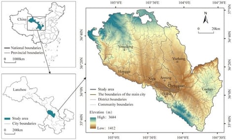
Saline–alkali soils represent a significant reserve of arable land, playing a vital role in ensuring national food security. Given that saline–alkali soil has low soil organic matter (SOM) and soil nutrient contents, and that soil quality degradation poses a threat to regional high-quality agricultural development and ecological balance, this study took coastal saline–alkali land as a case study. It adopted the extreme gradient boosting (XGB) model optimized by the tree-structured Parzen estimator (TPE) algorithm, combined with in situ hyperspectral (ISH) and spaceborne hyperspectral (SBH) data, to predict and map soil organic matter and four soil nutrients: alkali nitrogen (AN), available phosphorus (AP), and available potassium (AK). From the research outputs, one can deduce that superior predictive efficacy is exhibited by the TPE-XGB construct, employing in situ hyperspectral datasets. Among these, available phosphorus (R2 = 0.67) exhibits the highest prediction accuracy, followed by organic matter (R2 = 0.65), alkali-hydrolyzable nitrogen (R2 = 0.56), and available potassium (R2 = 0.51). In addition, the spatial continuity mapping results based on spaceborne hyperspectral data show that SOM, AN, AP, and AK in soil nutrients in the study area are concentrated in the northern, eastern, southern, and riverbank and estuarine delta areas, respectively. The variability of soil nutrients from large to small is phosphorus, potassium, nitrogen, and organic matter. The SHAP (SHapley Additive exPlanations) analysis results reveal that the bands with the greatest contribution to the fitting of SOM, AN, AP, and AK are 612 nm, 571 nm, 1493 nm, and 1308 nm, respectively. Extending into realms of hierarchical partitioning (HP) and variation partitioning (VP), it is discerned that climatic factors (CLI) alongside vegetative aspects (VEG) wield dominant influence upon the spatial differentiation manifest in nutrients. Meanwhile, comparatively diminished are the contributions possessed by terrain (TER) and soil property (SOIL). In summary, this study effectively assessed the significant variation patterns of soil nutrient distribution in coastal saline–alkali soils using the TPE-XGB model, providing scientific basis for the sustainable advancement of agricultural development in saline–alkali coastal regions.

15 October 2025

Overview of the study area and sampling sites in the Yellow River Delta.

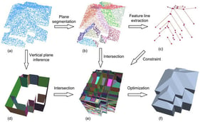
The estimation of the area susceptible to rock failure and the prediction of its movement process are pivotal for hazard mitigation, yet they are also challenging. In this study, we proposed a novel integrated method combining field investigation, remote sensing, and three-dimensional discrete element method (DEM) simulation to achieve our goal. The field investigation and remote sensing analysis are used for the purpose of ascertaining the deformation phenomenon and the structure of the rock slope, identifying the potential failure position and area of the slope. Subsequently, a three-dimensional DEM simulation is employed to quantitatively assess the potential rock failure-affected area and movement process, based on the above potential failure information. The simulation results demonstrate that potential rock failure persists for approximately 30 s, and its movement process can be categorized into two distinct stages: acceleration and deceleration. The initial acceleration stage is characterized by a duration of 10 s, culminating in a peak average velocity of 13 m/s. The subsequent deceleration stage extends for a duration of 20 s. Notably, the maximum attainable velocity for the segment of rock mass under consideration is estimated to be 50 m/s. Furthermore, the model demonstrates the variation in fracture energy, friction energy, and kinetic energy over time. The potential affected area is 140,000 m2, and approximately 8000 m2 of residential construction will be destroyed if a rock failure occurs. It is imperative to implement measures aimed at the prevention of rock failure in order to mitigate the risk of such an occurrence.

15 October 2025

Location of rock slope.

On the Use of LLMs for GIS-Based Spatial Analysis

  • Roberto Pierdicca,
  • Nikhil Muralikrishna and
  • Flavio Tonetto
  • + 1 author

This paper presents an approach integrating Large Language Models (LLMs), specifically GPT-4 and the open-source DeepSeek-R1, into Geographic Information System (GIS) workflows to enhance the accessibility, flexibility, and efficiency of spatial analysis tasks. We designed and implemented a system capable of interpreting natural language instructions provided by users and translating them into automated GIS workflows through dynamically generated Python scripts. An interactive graphical user interface (GUI), built using CustomTkinter, was developed to enable intuitive user interaction with GIS data and processes, reducing the need for advanced programming or technical expertise. We conducted an empirical evaluation of this approach through a comparative case study involving typical GIS tasks such as spatial data validation, data merging, buffer analysis, and thematic mapping using urban datasets from Pesaro, Italy. The performance of our automated system was directly compared against traditional manual workflows executed by 10 experienced GIS analysts. The results from this evaluation indicate a substantial reduction in task completion time, decreasing from approximately 1 h and 45 min in the manual approach to roughly 27 min using our LLM-driven automation, without compromising analytical quality or accuracy. Furthermore, we systematically evaluated the system’s factual reliability using a diverse set of geospatial queries, confirming robust performance for practical GIS tasks. Additionally, qualitative feedback emphasized improved usability and accessibility, particularly for users without specialized GIS training. These findings highlight the significant potential of integrating LLMs into GISs, demonstrating clear advantages in workflow automation, user-friendliness, and broader adoption of advanced spatial analysis methodologies.

14 October 2025

Flowchart illustrating the main components and workflow of our proposed GIS.

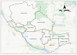
The vitality of areas around tourist attractions plays a crucial role in promoting the sustainable development of both tourism and the regional economy. However, there is a lack of comprehensive studies on the methods for mining vitality around attraction perimeters, and existing approaches are often inadequate to meet the evolving needs of contemporary tourism development. To address this gap, we proposed a method for inferring vitality around attractions based on a knowledge graph. Our approach began by analyzing the functional and morphological characteristics of the areas surrounding the attractions, followed by the design of a vitality calculation model for these regions. Next, we developed a knowledge graph structure tailored for vitality reasoning around the attractions and established reasoning rules based on this graph. Finally, we conducted experiments to apply the vitality inference method to the main urban area of Kaifeng City as a case study. The results indicated that our method could effectively reason about vitality around the attractions. Notably, the vitality levels around the attractions in Kaifeng’s main urban area exhibited clear spatial differentiation. Attractions such as the Yang Family’s Tianbo Mansion, the Millennium City Park, and Lord Bao’s Memorial Temple showed higher vitality values, largely due to their advantageous functional integration and synergistic morphological characteristics.

13 October 2025

Surrounding vitality reasoning of attractions supported by knowledge graph.

News & Conferences

Issues

Open for Submission

Editor's Choice

Reprints of Collections

Advances in Multi-Scale Geographic Environmental Monitoring
Reprint

Advances in Multi-Scale Geographic Environmental Monitoring

Theory, Methodology and Applications Volume II
Editors: Jingzhe Wang, Yangyi Wu, Yinghui Zhang, Ivan Lizaga, Zipeng Zhang
Advances in Multi-Scale Geographic Environmental Monitoring
Reprint

Advances in Multi-Scale Geographic Environmental Monitoring

Theory, Methodology and Applications Volume I
Editors: Jingzhe Wang, Yangyi Wu, Yinghui Zhang, Ivan Lizaga, Zipeng Zhang

Get Alerted

Add your email address to receive forthcoming issues of this journal.

XFacebookLinkedIn
ISPRS International Journal of Geo-Information - ISSN 2220-9964Creative Common CC BY license