
Journal Description
Journal of Marine Science and Engineering
is an international, peer-reviewed, open access journal on marine science and engineering, published semimonthly online by MDPI. The Australia New Zealand Marine Biotechnology Society (ANZMBS) is affiliated with JMSE and its members receive discounts on the article processing charges.
- Open Access— free for readers, with article processing charges (APC) paid by authors or their institutions.
- High Visibility: indexed with Scopus, SCIE (Web of Science), Ei Compendex, GeoRef, Inspec, AGRIS, and other databases.
- Journal Rank: JCR - Q2 (Oceanography) / CiteScore - Q1 (Ocean Engineering)
- Rapid Publication: manuscripts are peer-reviewed and a first decision is provided to authors approximately 15 days after submission; acceptance to publication is undertaken in 2.6 days (median values for papers published in this journal in the first half of 2026).
- Recognition of Reviewers: reviewers who provide timely, thorough peer-review reports receive vouchers entitling them to a discount on the APC of their next publication in any MDPI journal, in appreciation of the work done.
- Journal Clusters of Water Resources: Water, Journal of Marine Science and Engineering, Hydrology, Resources, Oceans, Limnological Review, Coasts and Hydropower.
Impact Factor:
3.2 (2025);
5-Year Impact Factor:
3.2 (2025)
Latest Articles
UADet: Redefining Marine Debris Detection in Degraded Underwater Scenes with Adaptive Feature and Boundary Refinement
J. Mar. Sci. Eng. 2026, 14(16), 1532; https://doi.org/10.3390/jmse14161532 - 18 Aug 2026
Abstract
Underwater marine debris detection is important for marine environmental monitoring, robotic inspection, and debris removal. However, reliable detection remains challenging because underwater images often suffer from low illumination, color distortion, turbidity, cluttered backgrounds, and weak boundaries. These factors reduce feature reliability and hinder
[...] Read more.
Underwater marine debris detection is important for marine environmental monitoring, robotic inspection, and debris removal. However, reliable detection remains challenging because underwater images often suffer from low illumination, color distortion, turbidity, cluttered backgrounds, and weak boundaries. These factors reduce feature reliability and hinder accurate localization, especially for small, occluded, or low-visibility debris. To address these challenges, this paper proposes UADet, an adaptive detector for marine debris detection in degraded underwater scenes. UADet integrates two complementary components: Underwater Degradation-aware Feature Modulation (UDFM) and Visibility-aware Boundary Distribution Refinement (VBDR). UDFM extracts lightweight image-level degradation cues and modulates multi-scale features to improve robustness under varying underwater conditions. VBDR incorporates object scale and an appearance-based proxy for local visual difficulty into boundary distribution learning and matching cost, providing adaptive localization supervision for small objects and objects with weak visual evidence. Experiments are conducted on TrashCan and J-Litter, and UADet is compared with representative real-time detectors, including YOLOv8s, YOLOv10s, YOLOv11s, and RT-DETR. The results show that UADet achieves the best performance on both datasets, with 72.74% mAP@0.5, 81.36% precision, and 69.36% recall on TrashCan, and 48.02% mAP@0.5, 70.13% precision, and 55.61% recall on J-Litter. Compared with the strongest baseline, UADet improves mAP@0.5 by 3.12 percentage points on TrashCan and 4.83 percentage points on J-Litter. Ablation and qualitative analyses demonstrate that UDFM and VBDR provide complementary improvements. These results indicate that modeling underwater degradation and boundary uncertainty improves the robustness and reliability of marine debris detection in challenging underwater environments.
Full article
(This article belongs to the Section Ocean Engineering)
Open AccessReview
A Comprehensive Review of Oil Spill Fate Models and Operational Tools: Capabilities and Applicability to the Caspian Sea
by
Aziz Kudaikulov, Tangnur Amanzholov, Abdurashid Aliuly, Abzal Seitov, Bakytzhan Assilbekov, Alibek Kuljabekov, Spartak Shabilov, Dinmukhambet Baimbetov, Samal Syrlybekkyzy and Aidarkhan Kaltayev
J. Mar. Sci. Eng. 2026, 14(16), 1531; https://doi.org/10.3390/jmse14161531 - 18 Aug 2026
Abstract
The Caspian Sea’s unique environment and intense hydrocarbon extraction make it a high-risk, understudied region for oil spill modelling. This review assesses the physical, chemical, and biological processes governing oil spill transport and fate, and evaluates the principal numerical tools available for the
[...] Read more.
The Caspian Sea’s unique environment and intense hydrocarbon extraction make it a high-risk, understudied region for oil spill modelling. This review assesses the physical, chemical, and biological processes governing oil spill transport and fate, and evaluates the principal numerical tools available for the Caspian Sea context. The weathering processes are reviewed from foundational formulations to operational implementations. Key research challenges identified include the absence of photo-oxidation from operational models, limited laboratory data for Caspian crude oil types, and simplified biodegradation parameterizations. Hydrodynamic forcing uncertainty, arising from the lack of a dedicated operational ocean model, remains the dominant source of trajectory forecast error. Seven operational oil spill modelling tools and the ROMS hydrodynamic platform are reviewed. Only OSCAR and MIKE 21 have documented applications to the Caspian Sea, representing a significant regional gap. ROMS is identified as the most suitable hydrodynamic platform for future operational forecasting. Finally, the integration of machine learning and deep learning methods, including neural network trajectory prediction and SAR detection, is discussed as a promising frontier for improving forecast accuracy in this data-sparse environment.
Full article
(This article belongs to the Section Ocean Engineering)
Open AccessArticle
Preliminary Exploration of Resistance, Wave-Making and Pressure Distribution of Amphibious Assault Vehicle Clusters in Different Formations
by
Sixing Guo, Yutao Tian, Yuting Li, Zehan Chen, Kexin Xie, Yixuan Zeng and Dapeng Zhang
J. Mar. Sci. Eng. 2026, 14(16), 1530; https://doi.org/10.3390/jmse14161530 - 18 Aug 2026
Abstract
Amphibious assault vehicles serve as core equipment for coastal defense and amphibious operations worldwide, with irreplaceable strategic value. Featuring outstanding comprehensive performance, modern amphibious assault vehicles can maintain stable navigation under Sea States 3–4 and adapt to complex nearshore hydrological environments, emerging as
[...] Read more.
Amphibious assault vehicles serve as core equipment for coastal defense and amphibious operations worldwide, with irreplaceable strategic value. Featuring outstanding comprehensive performance, modern amphibious assault vehicles can maintain stable navigation under Sea States 3–4 and adapt to complex nearshore hydrological environments, emerging as the primary platform for mechanized landing operations of the Marine Corps. Cluster navigation is an inevitable tactical form in the operational application of amphibious assault vehicles. When multiple vehicles sail in formation, the wave-making and water pressure effects induced by individual vehicles generate prominent wave interference drag within the formation, which significantly impacts the overall navigation efficiency and stability. Based on the nearshore combat background of amphibious landing, this paper investigates different formation layouts of amphibious assault vehicle clusters to determine the optimal configuration for group navigation. First, a numerical simulation and a physical experiment are combined; a certain type of amphibious assault vehicle is taken as the prototype for 3D geometric modeling via SOLIDWORKS. Then, adopting the CFD numerical simulation method, with navigation speed and optimal inter-vehicle spacing fixed, variables including formation layout and number of vehicles are controlled to simulate the flow field characteristics and total resistance of different cluster formations in calm water. Meanwhile, 3D printing technology is applied to manufacture scaled-down models for towing tank tests. The experimental results are in good agreement with numerical simulations, revealing the fundamental hydrodynamic laws of formation navigation. Under optimal inter-vehicle spacing, the longitudinal tandem formation achieves the best drag-reduction effect, while the double-column staggered formation (diamond/V formation) can effectively suppress wave interference drag and improve the overall hydrodynamic performance and tactical coordination. The research provides a solid theoretical basis and data support for optimizing formation sailing strategies, enhancing cluster navigation stability and safety, and improving maritime maneuver efficiency. It is also of universal reference value for the tactical deployment of amphibious combat equipment globally.
Full article
(This article belongs to the Special Issue Coupled Hydrodynamics and Innovative Mooring Systems for Offshore Floating Structures)
Open AccessArticle
Ship Sub-Trajectories Clustering: A Comparative Study on DBSCAN and Spectral Clustering with Dimensionality Reduction
by
Golnoosh Toosi, Xing Wu and Victor A. Zaloom
J. Mar. Sci. Eng. 2026, 14(16), 1529; https://doi.org/10.3390/jmse14161529 - 18 Aug 2026
Abstract
Maritime transportation, handling over 80% of global trade, is critical to the world economy. Automatic Identification System (AIS) data provides extensive static and dynamic information of vessels, enabling trajectory reconstruction and vessel behavior analysis. Recently, trajectory clustering has become a key method for
[...] Read more.
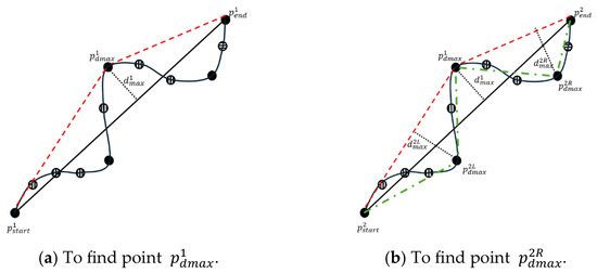
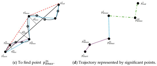
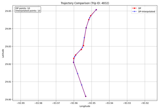
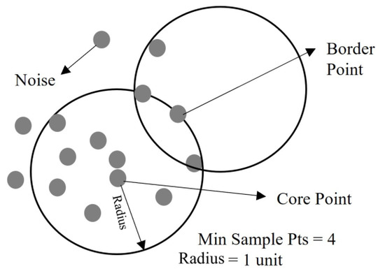
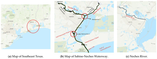
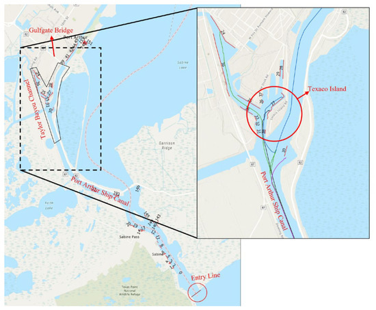
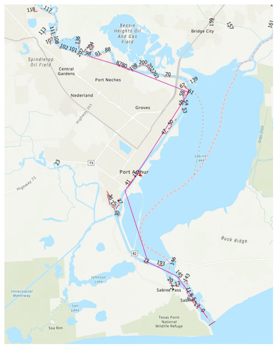
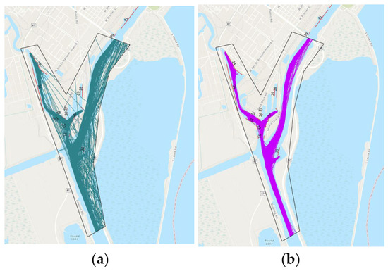
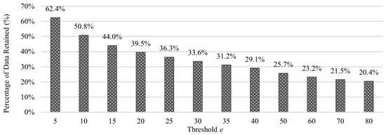
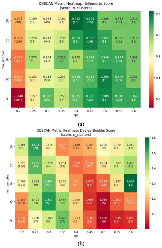
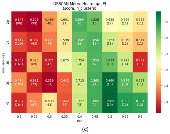
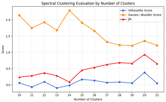
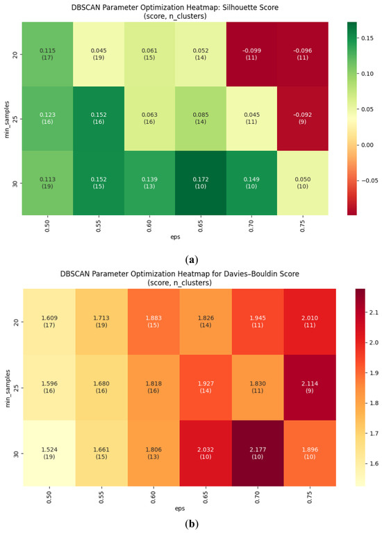
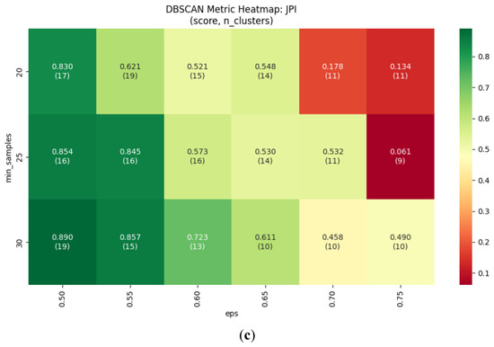
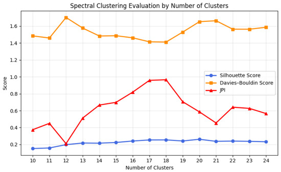
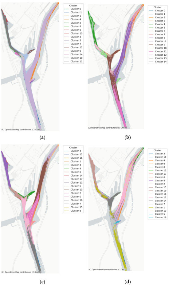
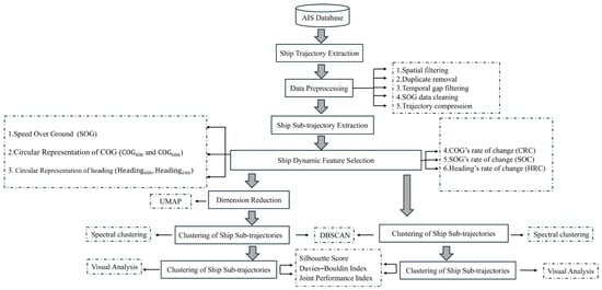
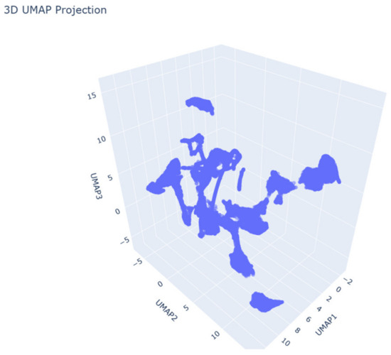
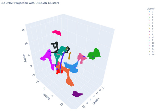
Maritime transportation, handling over 80% of global trade, is critical to the world economy. Automatic Identification System (AIS) data provides extensive static and dynamic information of vessels, enabling trajectory reconstruction and vessel behavior analysis. Recently, trajectory clustering has become a key method for analyzing maritime traffic, offering valuable insights to improve traffic management and operational efficiency. This research aims to investigate how to effectively cluster ship sub-trajectories derived from AIS data by comparing two machine learning clustering algorithms, Density-based spatial clustering of applications with noise (DBSCAN) and spectral clustering, with a focus on improving data quality, extracting key dynamic features, and evaluating the effect of dimensionality reduction on clustering performance. Clustering sub-trajectories can help reveal localized navigation patterns and movement behaviors. The study implemented the proposed methods for tankers and cargo ships (with AIS data from 2022) in a Y-shaped channel in the Sabine-Neches Waterway (SNWW) in Southeast Texas, where the busiest docks are located. Finally, clustering performance was evaluated with the silhouette coefficient (SC), Davies–Bouldin Index (DBI), and Joint Performance Index (JPI), respectively. Experimental results show that DBSCAN effectively identifies dense, overlapping trajectory clusters and labels noise, while the spectral clustering algorithm detects subtle behavioral differences but struggles with less cohesive clusters, and does not explicitly handle noise.
Full article
(This article belongs to the Special Issue Autonomous Ship and Harbor Maneuvering: Modeling and Control)
►▼
Show Figures

Figure 1
Open AccessArticle
Wind-Resistance Stability Analysis of a Magnetic Adhesion Wall-Climbing Obstacle-Crossing Robot for Offshore Wind Turbines
by
Jun Liu, Shaojie Jing, Yongsheng Yang and Shiteng Yang
J. Mar. Sci. Eng. 2026, 14(16), 1528; https://doi.org/10.3390/jmse14161528 - 18 Aug 2026
Abstract
►▼
Show Figures
To address the challenges of adsorption instability and obstacle-crossing difficulties faced by wall-climbing robots in the harsh operation and maintenance (O&M) environment of offshore wind turbine (OWT) towers, this paper presents the design of a magnetic-adhesive wall-climbing robot with a planetary-gear configuration and
[...] Read more.
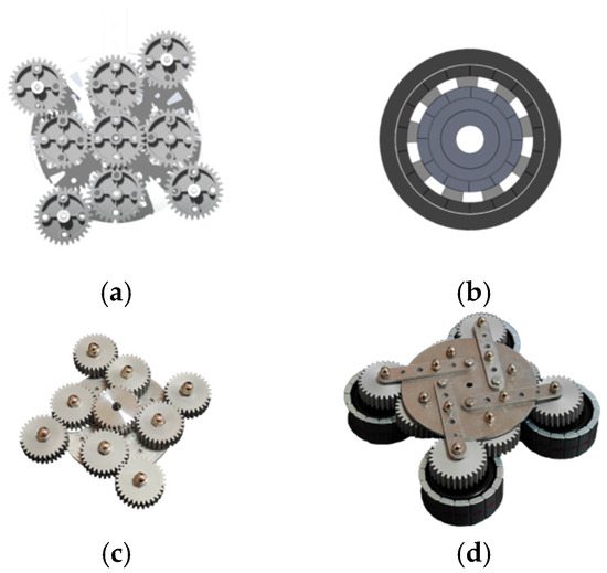
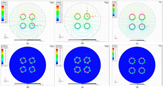
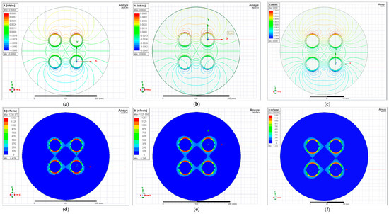
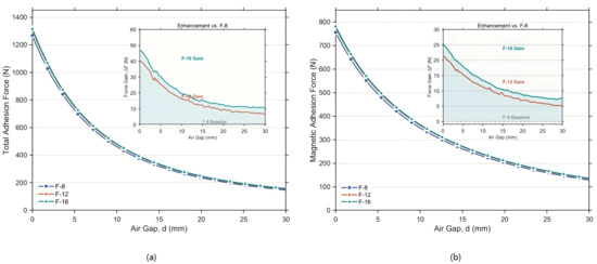
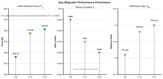
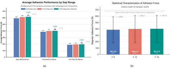
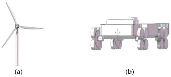
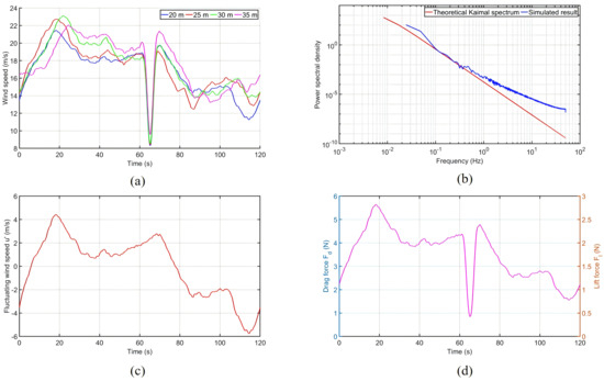
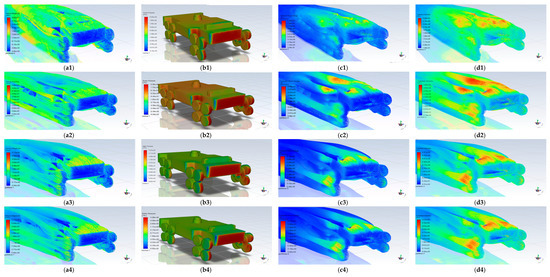
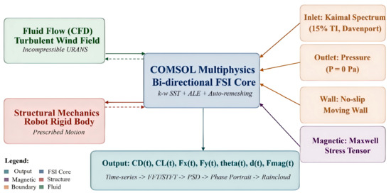
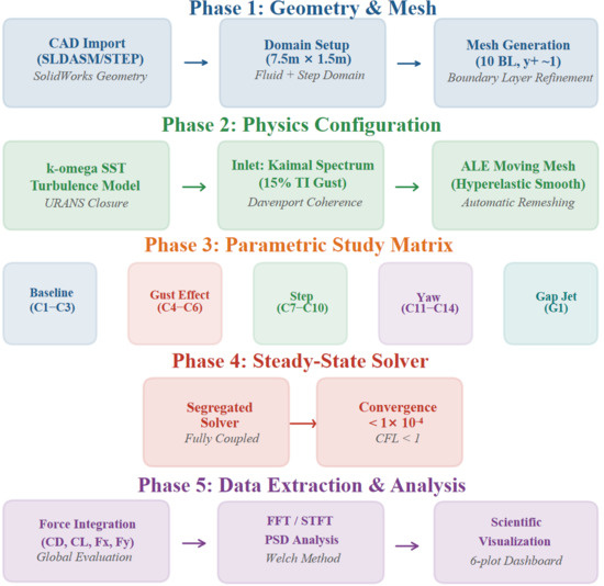
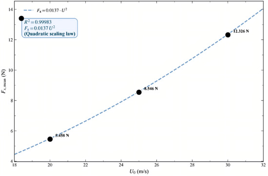
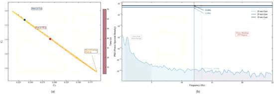
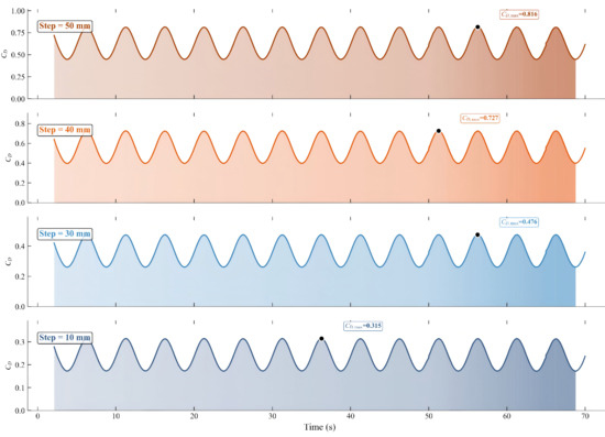
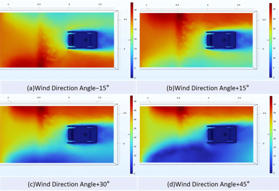
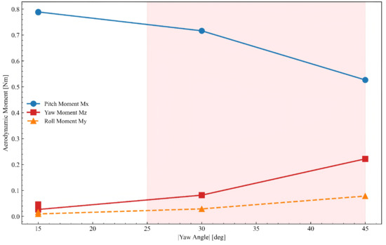
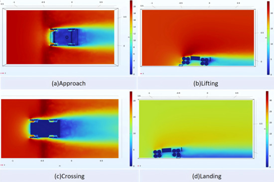
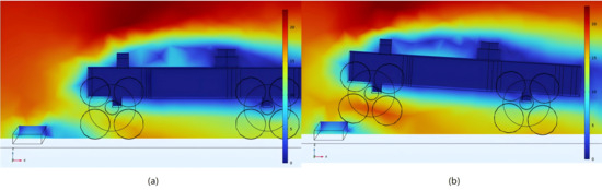
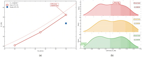
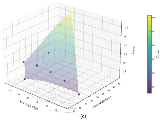
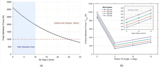
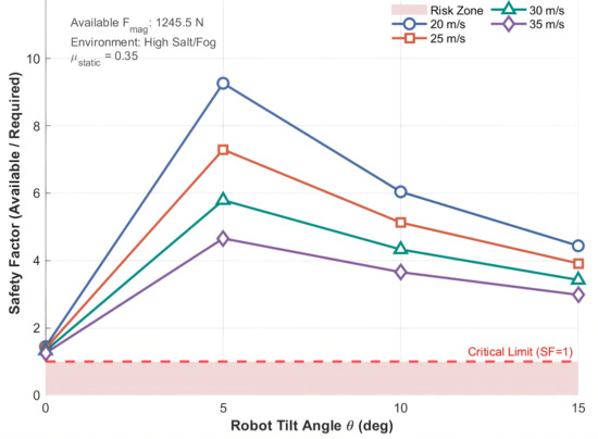
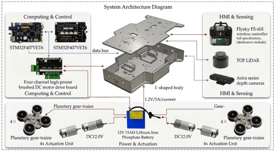
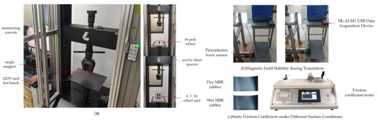
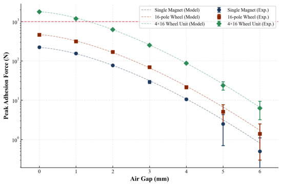
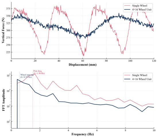
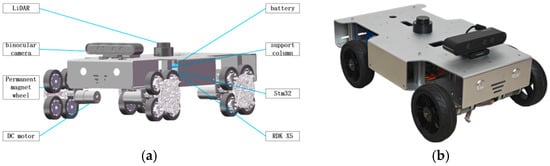
To address the challenges of adsorption instability and obstacle-crossing difficulties faced by wall-climbing robots in the harsh operation and maintenance (O&M) environment of offshore wind turbine (OWT) towers, this paper presents the design of a magnetic-adhesive wall-climbing robot with a planetary-gear configuration and investigates its wind resistance stability. First, the magnetic circuit layout is optimized through finite element analysis, revealing that the F-16 continuous planetary configuration (16 poles) effectively suppresses magnetic flux leakage and forms an integrated magnetic pad, maintaining adsorption force at a large air gap of 20 mm, thereby enhancing magnetic robustness during obstacle crossing and making it the optimal choice for high-load offshore conditions. Second, an unsteady flow field model based on the Kaimal turbulence spectrum is constructed to analyze aerodynamic loads. Fluid–structure interaction (FSI) simulations demonstrate that at a height of 30 m, the turbulence integral scale matches the robot dimensions, and combined with the Venturi effect of gap jet flow, this leads to peak turbulence intensity and pitching moment, creating a hazardous, pronounced aerodynamic amplification condition. Finally, an anti-slip stability model is established, revealing that vertical wall climbing represents the critical loading scenario; the magnetic adhesion system must deliver a total adsorption force of no less than 1000 N to resist a 35 m/s wind speed under low-friction conditions, providing a quantitative design basis for anti-wind safety. This study integrates magnetic circuit optimization, turbulence-resolved aerodynamics, and macroscopic anti-slip mechanics, offering theoretical support and engineering guidance for the safe deployment of intelligent O&M equipment for offshore wind power. Bench-scale measurements of magnetic adhesion force, friction coefficient, and translation force fluctuation support the exponential-decay magnetic model and the multi-wheel phase-interleaving concept; however, the current 4 × 16-pole prototype delivers ~627 N at the 2 mm working gap, below the 1000 N design target. The design methodology is therefore validated, while the current physical configuration requires further iteration of the working gap or magnet grade before it can be considered operationally adequate.
Full article

Figure 1
Open AccessArticle
A Ship Yaw-Angle Separation Method Based on Empirical Mode Decomposition and Multi-Dimensional Physical–Statistical Evaluation
by
Maorong Chen, Fan Yang, Hongtao Cai, Xiongbin Wu, Yunfeng Zhang, Liang Yu and Yilin Luo
J. Mar. Sci. Eng. 2026, 14(16), 1527; https://doi.org/10.3390/jmse14161527 - 18 Aug 2026
Abstract
The yaw-angle signal output by shipboard attitude sensors (e.g., inertial navigation systems) is a composite of the heading and wave-induced yaw (WIY). The heading reflects large-scale directional changes due to maneuvering or voyage planning, exhibiting slowly varying, trend-like characteristics; WIY is the oscillatory
[...] Read more.
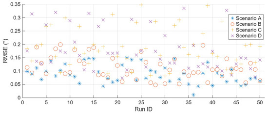
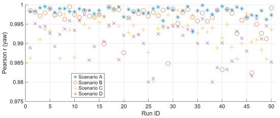
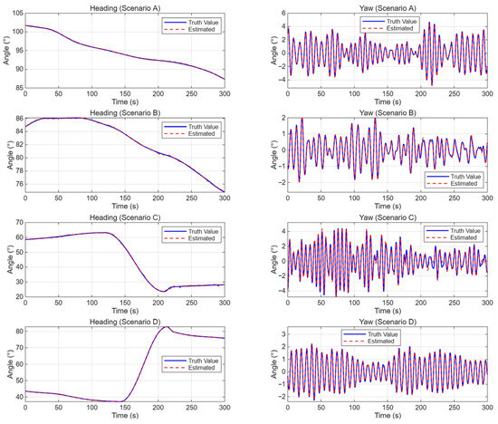
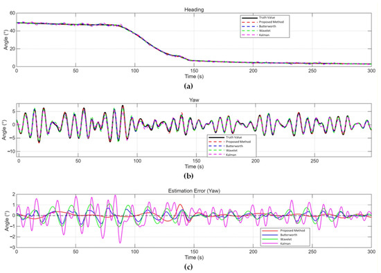
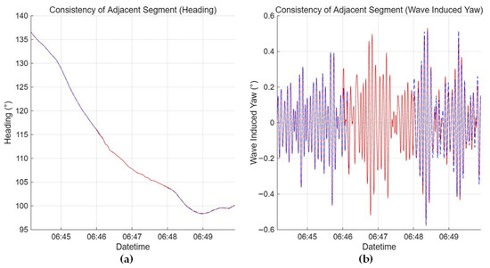
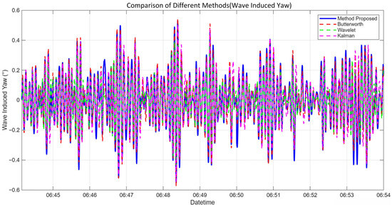
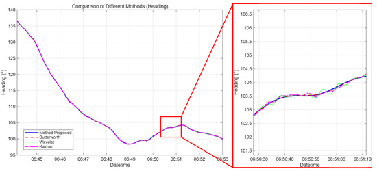
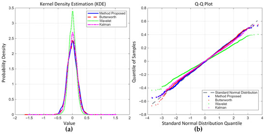
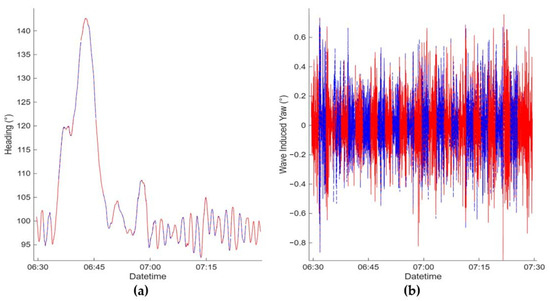
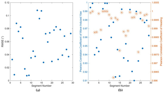
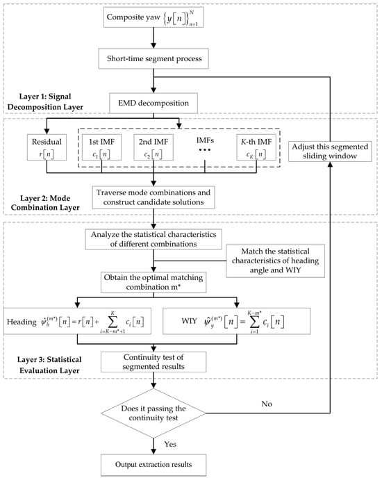
The yaw-angle signal output by shipboard attitude sensors (e.g., inertial navigation systems) is a composite of the heading and wave-induced yaw (WIY). The heading reflects large-scale directional changes due to maneuvering or voyage planning, exhibiting slowly varying, trend-like characteristics; WIY is the oscillatory motion caused by random wave–hull interaction, approximately following a zero-mean normal distribution. Accurately and adaptively separating these two components from the composite yaw-angle signal is a key technical challenge in ship motion monitoring or wave parameter inversion. This paper proposes a heading–WIY separation method based on Empirical Mode Decomposition (EMD) and multi-dimensional physical–statistical evaluation. The method adaptively decomposes the composite yaw signal via EMD and automatically determines the optimal mode combination through statistical evaluation. Moreover, a short-time segment processing strategy and overlap-region continuity checks are introduced to overcome heading trend variations over long time scales. The method is validated using a multi-scenario simulation dataset encompassing four conditions and various sea states, as well as at-sea collected data. Results demonstrate high extraction accuracy without requiring a system dynamics model or scenario-specific parameter tuning across all conditions. And the proposed method performs better in comparison to the conventional methods, particularly under conditions of spectral overlapped or high sea states.
Full article
(This article belongs to the Special Issue Novel Advances in Offshore Sensor Systems)
►▼
Show Figures

Figure 1
Open AccessArticle
A Hierarchical Spatiotemporal Index for Bathymetric Data in Approach Channels
by
Quanbo Xin, Fangzheng Wang, Yongchao Wang and Chunning Ji
J. Mar. Sci. Eng. 2026, 14(16), 1526; https://doi.org/10.3390/jmse14161526 - 18 Aug 2026
Abstract
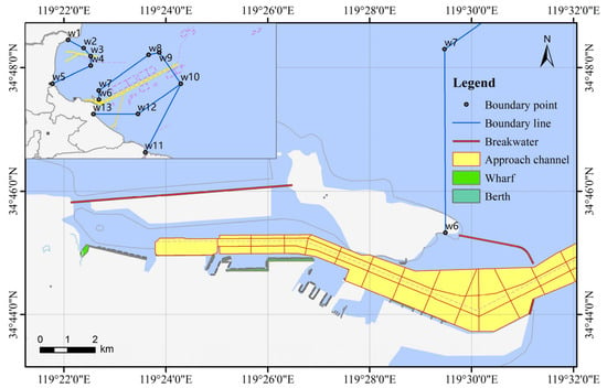
Approach channels are affected by sedimentation and scour, resulting in continuous changes in underwater topography. Such processes tend to generate shallow spots and inadequate navigable dimensions, posing safety hazards that undermine both waterway resilience and navigation capacity. To address these issues, this paper
[...] Read more.
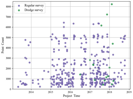
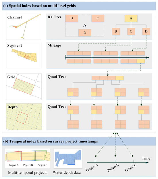
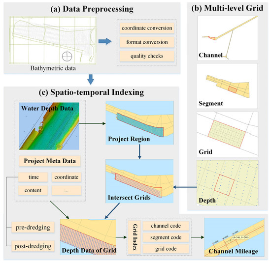
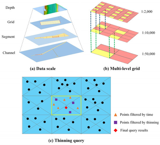
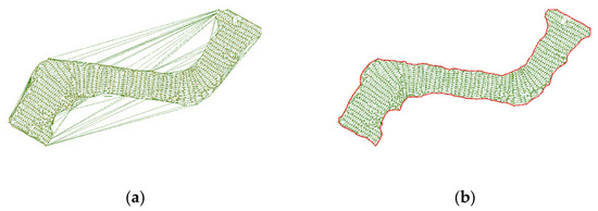
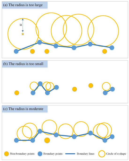
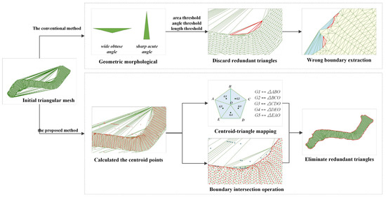
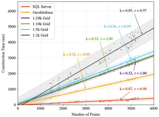
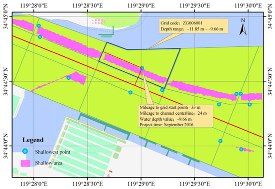
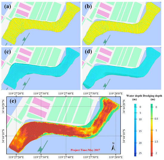
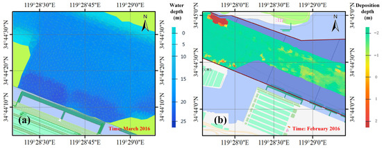
Approach channels are affected by sedimentation and scour, resulting in continuous changes in underwater topography. Such processes tend to generate shallow spots and inadequate navigable dimensions, posing safety hazards that undermine both waterway resilience and navigation capacity. To address these issues, this paper proposes a multi-level grid-based spatiotemporal indexing method for bathymetric data, aiming to support resilience-oriented management by improving the effectiveness of bathymetric data management. First, a channel-segment-section partitioning strategy is designed to construct hierarchical progressive grids for the efficient organization of massive bathymetric data. Second, a multi-dimensional spatiotemporal integrated query method is developed to meet diverse analytical and retrieval requirements. Third, a digital depth model (DDM) construction method is introduced that integrates boundary-constrained terrain reconstruction with efficient mesh optimization, enabling underwater terrain representation that adapts to the elongated and irregular morphology of approach channels. The contribution of this work lies not in proposing new individual algorithms but in the tailored integration of these techniques to address the specific challenges of approach-channel bathymetric data. Experimental results demonstrate that the proposed method achieves high construction efficiency across different storage and query schemes. The method enhances the retrieval and analytical capabilities of bathymetric data in representative application scenarios, such as shallow spot identification, critical section analysis, dredging analysis, and erosion–deposition evolution. Consequently, these improvements provide technical support for resilience-oriented channel management and ensure navigational safety.
Full article
(This article belongs to the Special Issue Resilience and Capacity of Waterway Transportation)
►▼
Show Figures

Figure 1
Open AccessArticle
Attitude and Heading Calibration After IMU Reinstallation in Rotational Inertial Navigation Systems Using an Interleaved Rotation-Dwell Sequence
by
Haoyu Bu, Feng Zha, Hongyang He, Jingshu Li, Chenyang Zhang and Qun Zheng
J. Mar. Sci. Eng. 2026, 14(16), 1525; https://doi.org/10.3390/jmse14161525 - 17 Aug 2026
Abstract
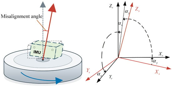
To address the degradation in attitude accuracy caused by mismatched rotation-axis tilt parameters after inertial measurement unit (IMU) reinstallation in rotational inertial navigation systems (RINSs) on large marine platforms, an interleaved rotation-dwell attitude-and-heading calibration method is proposed. First, a relative attitude-and-heading model incorporating
[...] Read more.
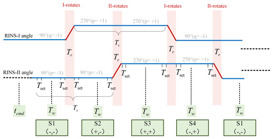
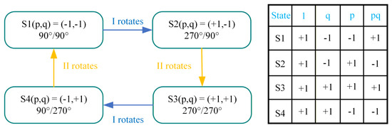
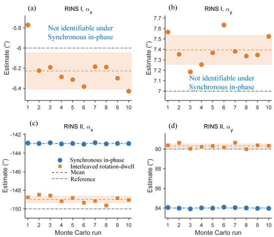
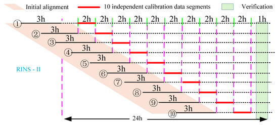
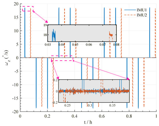
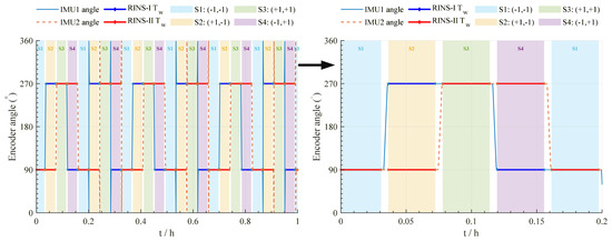
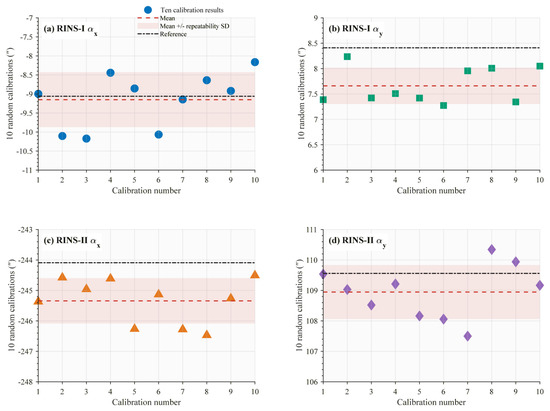
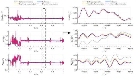
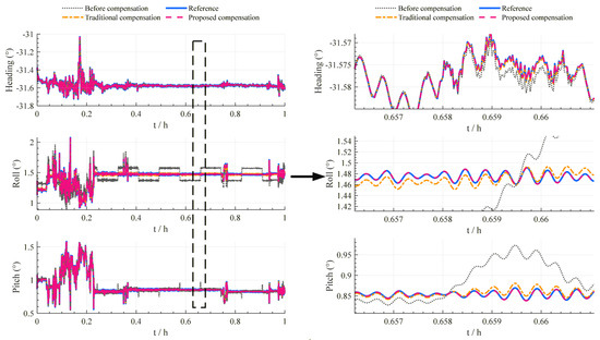
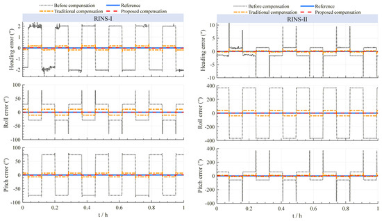
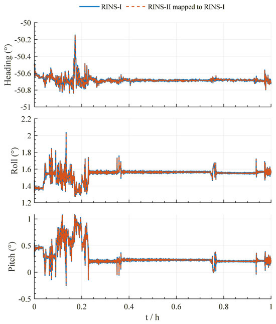
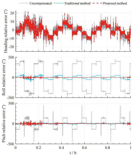
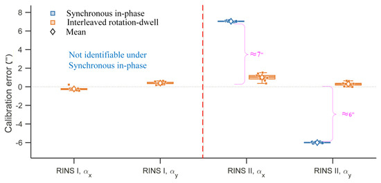
To address the degradation in attitude accuracy caused by mismatched rotation-axis tilt parameters after inertial measurement unit (IMU) reinstallation in rotational inertial navigation systems (RINSs) on large marine platforms, an interleaved rotation-dwell attitude-and-heading calibration method is proposed. First, a relative attitude-and-heading model incorporating the combined effects of the rotation-axis tilt errors of the two systems is established, with the horizontal error mapping induced by the relative heading between their base frames explicitly considered. Second, a four-state interleaved rotation-dwell sequence is designed, and the rotation-axis tilt parameters of the two RINSs are separated in closed form through Hadamard orthogonal projection. Simulations verify the parameter-decoupling capability of the proposed method. Experimental results show that, compared to a filtering-based self-calibration method for a single RINS, the proposed method reduces the roll and pitch root-mean-square errors (RMSE) by 90.29% and 41.80%, respectively. After compensation for the rotation-axis tilt errors, relative heading alignment between the two systems is achieved by estimating the residual heading bias. The proposed method provides a system-level solution for attitude-and-heading calibration after IMU reinstallation under moving-base field conditions.
Full article
(This article belongs to the Section Ocean Engineering)
►▼
Show Figures

Figure 1
Open AccessEditorial
Advancements in Maritime Safety and Risk Assessment
by
Xinjian Wang
J. Mar. Sci. Eng. 2026, 14(16), 1524; https://doi.org/10.3390/jmse14161524 - 17 Aug 2026
Abstract
Maritime safety and risk assessment have become increasingly important as the shipping industry moves towards larger vessel systems, denser traffic networks, cleaner fuels, autonomous navigation and data-driven decision support [...]
Full article
(This article belongs to the Special Issue Advancements in Maritime Safety and Risk Assessment)
Open AccessArticle
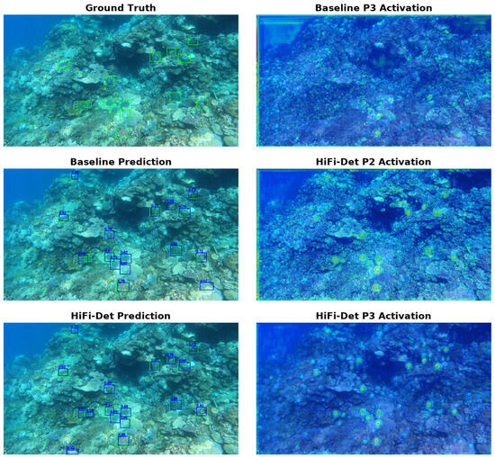
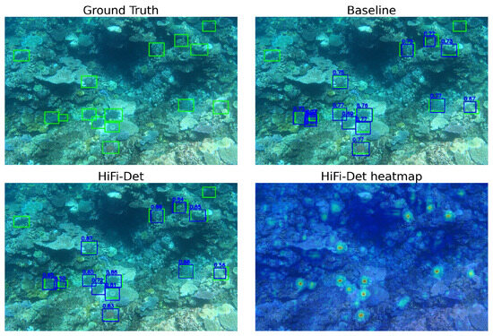
HiFi-Det: Collaborative Multi-Scale Frequency-Domain Feature Optimization for Crown-of-Thorns Starfish Detection in Complex Underwater Environments
by
Sirong Qian, Yuewen Huang, Meng Wang, Houlei Jia, Xiaoyong Mei and Fudan Zheng
J. Mar. Sci. Eng. 2026, 14(16), 1523; https://doi.org/10.3390/jmse14161523 - 17 Aug 2026
Abstract
Outbreaks of the Crown-of-Thorns Starfish (COTS, Acanthaster spp.) are a leading biological driver of coral cover loss, making timely and accurate population monitoring essential for reef management. Conventional diver-based surveys are labor-intensive and prone to missed detections, motivating automated detection from underwater imagery.
[...] Read more.
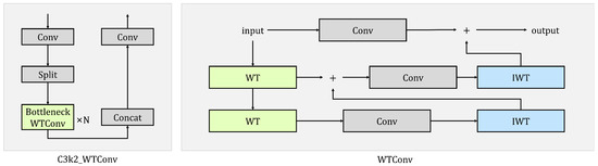
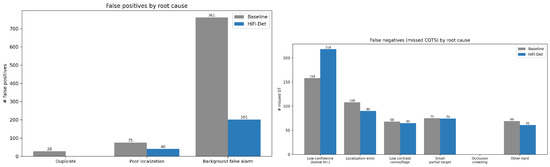
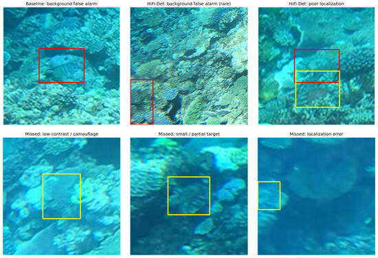
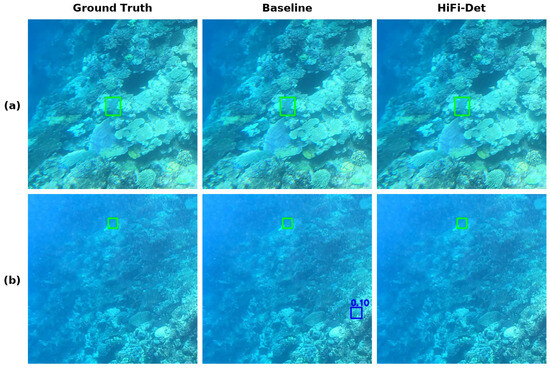
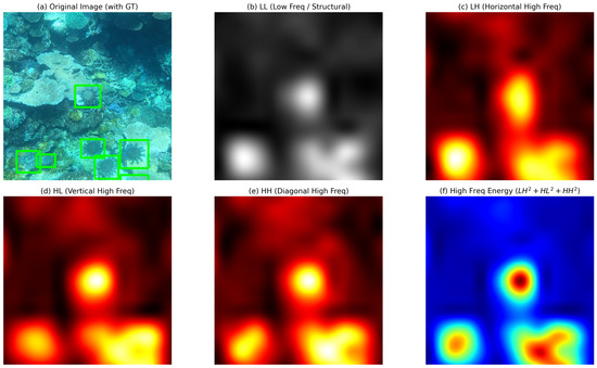
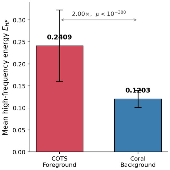
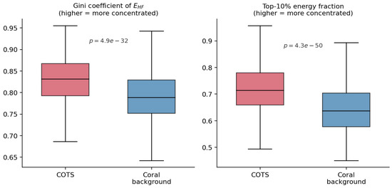
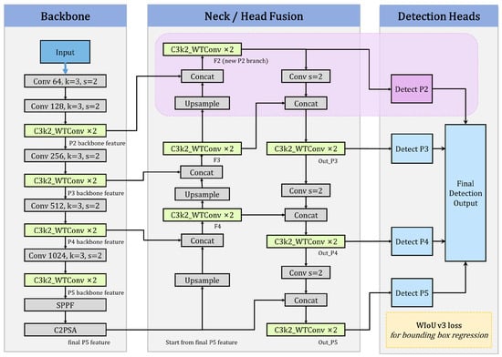
Outbreaks of the Crown-of-Thorns Starfish (COTS, Acanthaster spp.) are a leading biological driver of coral cover loss, making timely and accurate population monitoring essential for reef management. Conventional diver-based surveys are labor-intensive and prone to missed detections, motivating automated detection from underwater imagery. However, COTS detection in complex underwater scenes still faces three major challenges. First, COTS individuals are often very small and carry limited discriminative information, making them inherently difficult to detect. Second, low underwater contrast and complex coral textures blur target boundaries and cause targets to be easily confused with the background. Third, ecological monitoring values recall more highly than precision—missing a COTS individual is far more costly than a false alarm—yet the recall of existing detectors remains insufficient. To address these challenges, we propose HiFi-Det (High-resolution Frequency-integration Detector), a collaborative multi-scale frequency-domain feature optimization method built on YOLO11. HiFi-Det integrates three complementary enhancements: a high-resolution detection branch that strengthens feature representation for small targets; wavelet transform convolution (WTConv) modules in the backbone and neck that apply band-separated processing in the wavelet domain to improve discrimination of COTS targets from low-contrast, textured coral backgrounds; and a WIoUv3 bounding box regression loss that dynamically focuses on ordinary-quality samples to improve recall while maintaining precision. On the public Great Barrier Reef dataset, HiFi-Det attains 81.02% F2 and 87.54% mAP@50, surpassing the YOLO11 baseline by 3.00% and 2.57%, respectively, while keeping the parameter count essentially unchanged relative to the YOLO11s baseline (within 3%), so that the accuracy gains are obtained without inflating model size. Ablation studies confirm the synergy of the three components: the high-resolution branch preserves spatial details, WTConv suppresses background textures, and WIoUv3 further curbs false positives while sustaining high recall. Applying the same recipe to a larger YOLO11m backbone yields HiFi-Det-m, which likewise improves over that backbone in both F2 and recall, indicating that the approach is a transferable recipe rather than a single fixed architecture. These results show that task-specific architectural and training designs can effectively adapt generic detectors to the demands of underwater ecological monitoring.
Full article
(This article belongs to the Section Marine Biology)
►▼
Show Figures

Figure 1
Open AccessArticle
Auto-Berthing Control of Marine Vessels Under Cyber Attacks
by
Jianqiang Shi, Sicheng Guo, Zhaokun Wang, Han Liang, Peibo Shi, Mingyu Wang and Guichen Zhang
J. Mar. Sci. Eng. 2026, 14(16), 1522; https://doi.org/10.3390/jmse14161522 - 17 Aug 2026
Abstract
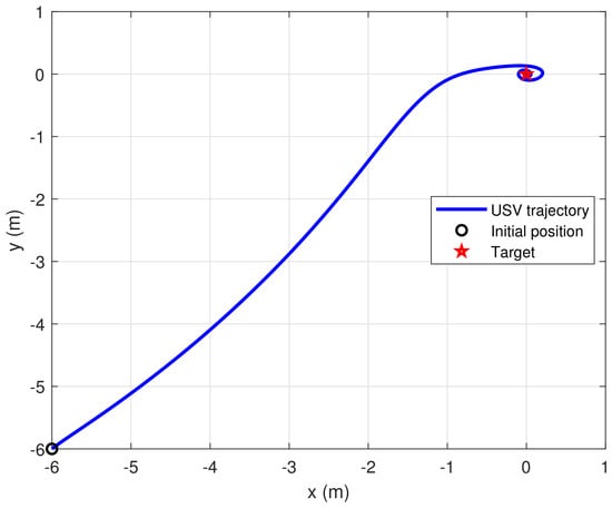
This paper studies the automatic berthing control of an unmanned surface vessel under cyber attacks. An adaptive neural-network-based fault-tolerant control method is developed. Unknown vessel dynamics, external disturbances, measurement noise, and cyber attacks are considered at the same time. First, the signal scaling,
[...] Read more.
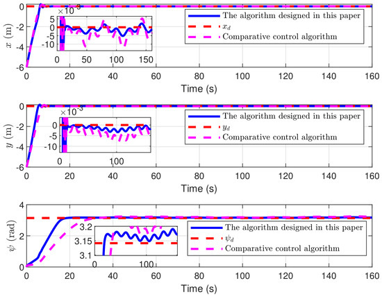
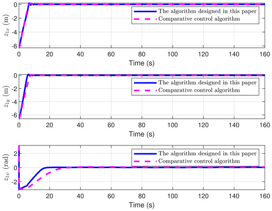
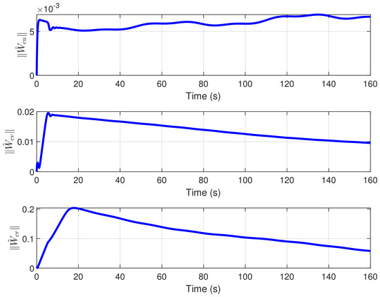
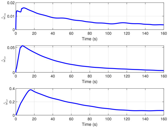
This paper studies the automatic berthing control of an unmanned surface vessel under cyber attacks. An adaptive neural-network-based fault-tolerant control method is developed. Unknown vessel dynamics, external disturbances, measurement noise, and cyber attacks are considered at the same time. First, the signal scaling, bias, and power-type distortion caused by cyber attacks are described by a unified nonlinear measurement model. The model has a known structure and unknown parameters. It converts different attack effects into structured uncertainties. Based on the corrupted position and attitude measurements, the tracking errors are defined. The vessel heading is reconstructed by integrating the unaffected yaw-rate signal. A Nussbaum-type function is introduced to handle the unknown gain in the measurement channel. A first-order filter is used to generate a smooth approximation of the virtual control signal. A neural network is then employed to approximate the unknown vessel dynamics. Adaptive laws are designed to estimate the composite uncertainties and external disturbances. Lyapunov analysis shows that all closed-loop signals remain bounded. The berthing tracking errors ultimately converge to a compact set around the origin. Finally, a berthing simulation with time-varying cyber attacks, measurement noise, and marine disturbances is conducted to evaluate the proposed method.
Full article
(This article belongs to the Topic Advanced Technologies and Applications for Unmanned Systems)
►▼
Show Figures

Figure 1
Open AccessArticle
Engineering Observability Assessment of Underwater-Vehicle Wake-Induced Magnetic Fields Under Ocean-Wave Magnetic Backgrounds
by
Hexing Zheng, Haitao Gu, Tianzhu Gao and Kexin Zhang
J. Mar. Sci. Eng. 2026, 14(16), 1521; https://doi.org/10.3390/jmse14161521 - 17 Aug 2026
Abstract
►▼
Show Figures
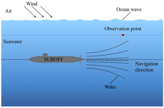
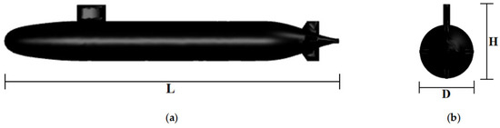
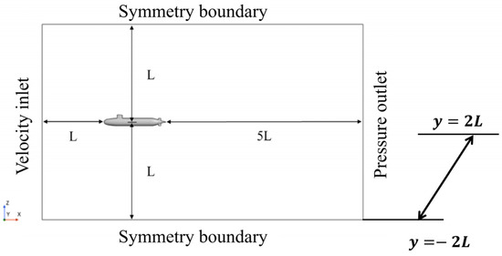
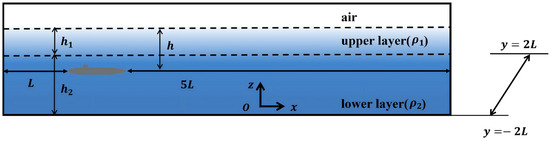
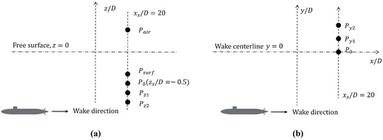
Wake-induced magnetic fields provide a potential non-acoustic signature for underwater-vehicle sensing, but their weak amplitudes can be masked by ocean-wave magnetic backgrounds. This study evaluates their engineering observability under representative wind–wave conditions. The wake-induced field at fixed observation points was calculated from CFD-derived
[...] Read more.
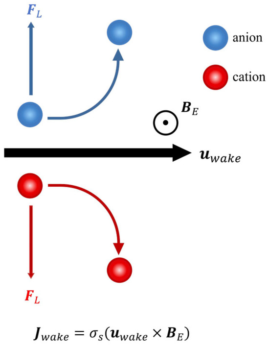
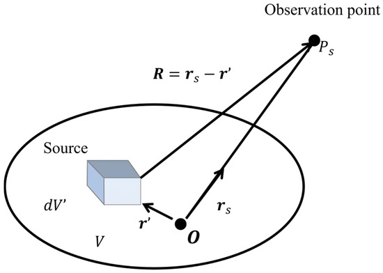
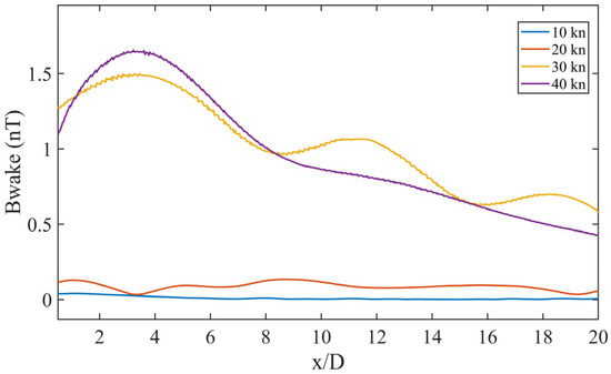
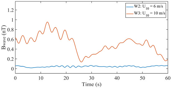
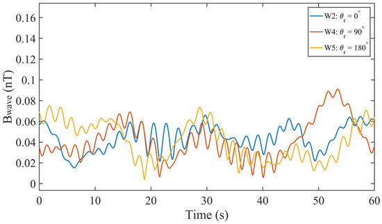
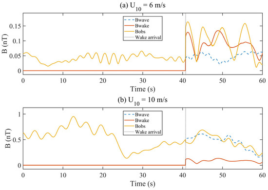
Wake-induced magnetic fields provide a potential non-acoustic signature for underwater-vehicle sensing, but their weak amplitudes can be masked by ocean-wave magnetic backgrounds. This study evaluates their engineering observability under representative wind–wave conditions. The wake-induced field at fixed observation points was calculated from CFD-derived wake velocities of an engineering-scale fully appended SUBOFF model using discrete Biot–Savart summation. The ocean-wave background was computed using a JONSWAP spectrum and linear wave theory, and a peak-to-background-rms SNR was used as the observability indicator. Results show that speed and diving depth strongly control the target signal. At the baseline point, increasing speed from 10 to 40 kn raised from 0.0406 to 1.65 nT and SNR from −1.01 to 31.2 dB under W2. Increasing diving depth from to reduced from 0.129 to 0.0204 nT and SNR from 9.03 to −6.99 dB. Wind speed dominated the wave background: at m/s, reached 0.542 nT and the Case 2 SNR decreased to −12.5 dB. Sensor placement affected both signal and background; deeper underwater sensors improved observability, whereas aerial observations suffered from weak wake-signal amplitudes. Wake-field observability is therefore jointly governed by wake source strength, ocean-wave magnetic background, and observation geometry.
Full article

Figure 1
Open AccessArticle
RA-SIDO: Robust and Adaptive Sonar–Inertial–Depth Odometry for Consistent Underwater Acoustic 3D Mapping
by
Yabei Guo, Huigang Wang, Wei Qiang, Runhe Yao and Zhizhen Xie
J. Mar. Sci. Eng. 2026, 14(16), 1520; https://doi.org/10.3390/jmse14161520 - 17 Aug 2026
Abstract
Autonomous acoustic remote sensing of underwater infrastructure is challenging due to the physical characteristics of 3D sonar and the geometric degeneracy commonly encountered in feature-poor underwater environments. Accurate localization is essential for integrating sequential sonar observations into globally consistent 3D maps; however, existing
[...] Read more.
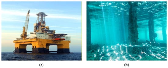
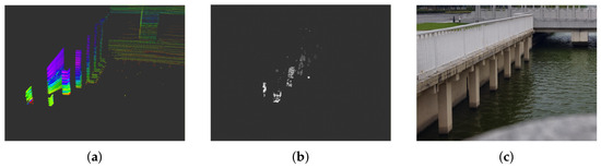
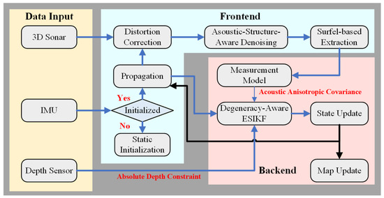
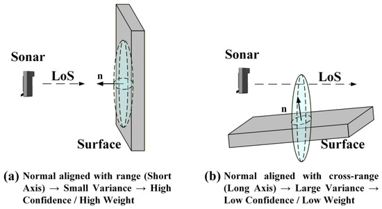
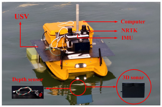
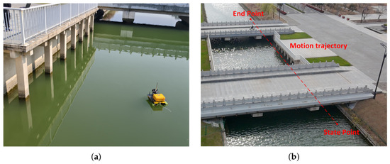
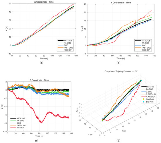
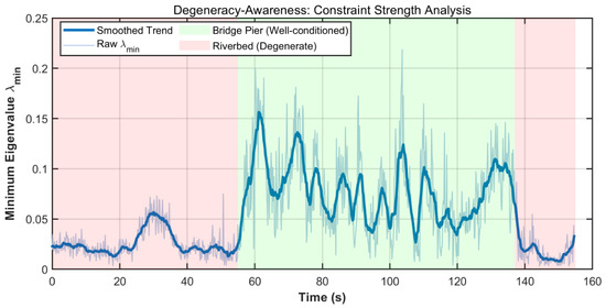
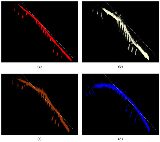
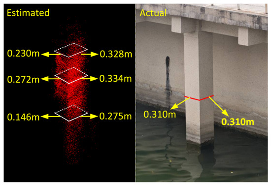
Autonomous acoustic remote sensing of underwater infrastructure is challenging due to the physical characteristics of 3D sonar and the geometric degeneracy commonly encountered in feature-poor underwater environments. Accurate localization is essential for integrating sequential sonar observations into globally consistent 3D maps; however, existing odometry methods often rely on isotropic noise assumptions despite the highly directional nature of acoustic sensing. This mismatch may cause unreliable measurements to be over-trusted, leading to severe trajectory drift and distortion in sonar-derived 3D reconstructions. To address these challenges, we propose RA-SIDO, a robust and adaptive tightly coupled 3D sonar–inertial–depth odometry framework based on the Error-State Iterated Kalman Filter (ESIKF), which fuses measurements from a 3D sonar, an inertial measurement unit (IMU), and a depth sensor for reliable underwater acoustic mapping. The proposed method introduces two mechanisms to handle sonar-specific uncertainties: (1) a physics-based anisotropic acoustic measurement model that distinguishes high-resolution radial range measurements from highly uncertain cross-range angular measurements; (2) an online degeneracy-awareness module that continuously evaluates the minimum eigenvalue of the translational information matrix and dynamically adjusts sensor fusion weights to avoid over-trusting ill-conditioned constraints. Real-world experiments were conducted with an unmanned surface vehicle in underwater infrastructure inspection scenarios. RA-SIDO achieved an ATE RMSE of , reducing the error by compared with SIDO, the strongest baseline. In addition, the proposed method effectively suppresses longitudinal slip and produces globally consistent 3D acoustic maps of submerged structures. These results validate the potential of RA-SIDO as a robust localization and mapping solution for underwater remote sensing, infrastructure inspection, and acoustic 3D reconstruction in challenging aquatic environments.
Full article
(This article belongs to the Section Ocean Engineering)
►▼
Show Figures

Figure 1
Open AccessArticle
Design of an Underwater Acoustic Target-Detection System for Buoy Platforms
by
Yong Lyu, Zhilin Liu and Shiquan Ma
J. Mar. Sci. Eng. 2026, 14(16), 1519; https://doi.org/10.3390/jmse14161519 - 17 Aug 2026
Abstract
To address the need for low-power, real-time underwater acoustic signal processing and autonomous target detection on deep-sea unmanned mobile platforms, such as profiling acoustic buoys and underwater gliders, this study developed an embedded Linux-based signal processing system for buoy platforms. Conventional digital signal
[...] Read more.
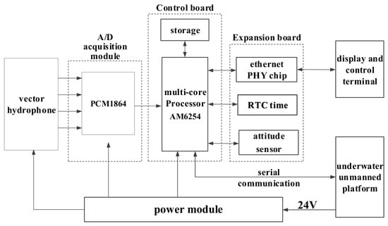
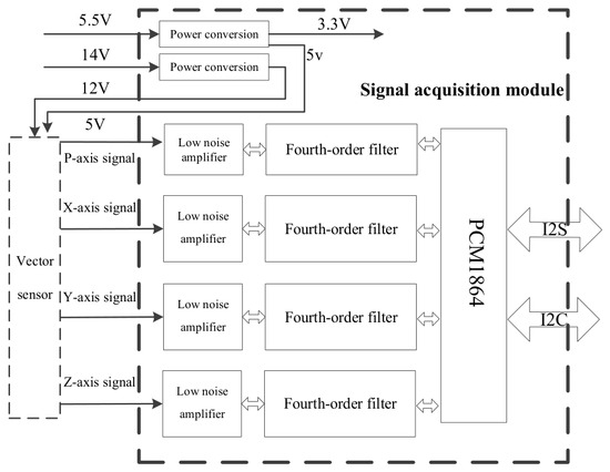
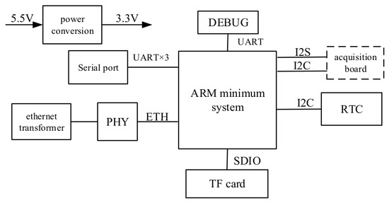
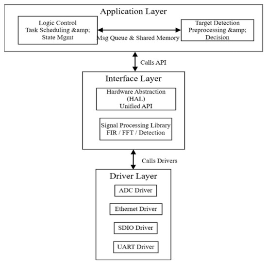
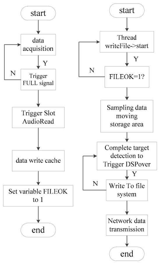
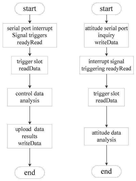
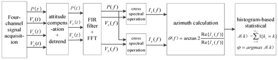
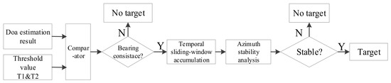
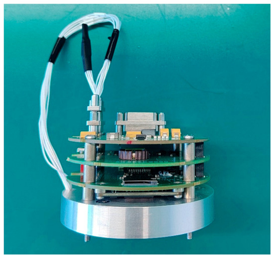
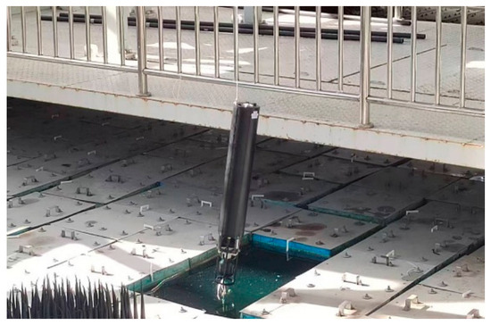
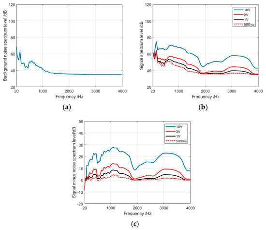
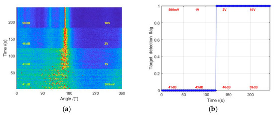
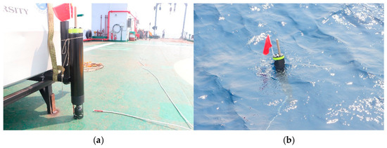
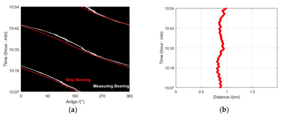
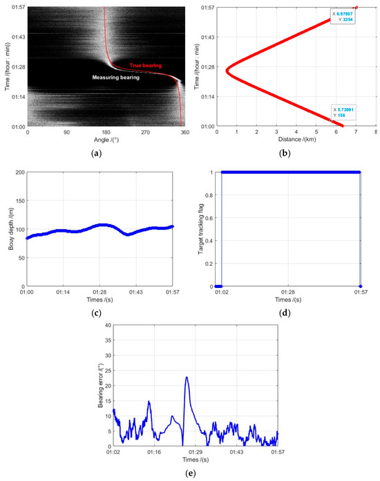
To address the need for low-power, real-time underwater acoustic signal processing and autonomous target detection on deep-sea unmanned mobile platforms, such as profiling acoustic buoys and underwater gliders, this study developed an embedded Linux-based signal processing system for buoy platforms. Conventional digital signal processing hardware platforms are often constrained by large size, high power consumption, and limited data communication capability. The proposed system adopts a compact, low-power architecture and a multithreaded processing framework based on the AM6254 heterogeneous multicore processor. It acquires four-channel vector-hydrophone signals together with attitude data from an inertial navigation module and performs band-pass filtering, fast Fourier transform (FFT), direction-of-arrival (DOA) estimation, and constant false alarm rate (CFAR) detection for autonomous target detection. The measured typical power consumption was approximately 2.3 W. Anechoic-tank and sea-trial results showed the lowest tested spectral level at which autonomous detection was achieved was 54 dB at 1 kHz, corresponding to an average in-band level of 46 dB. Under sea state 3, the system maintained continuous bearing tracking after target acquisition for a surface target traveling at 7 kn, up to a range of approximately 7 km, and provided unambiguous bearing estimation. These results demonstrate the target-detection capability and practical applicability of the system under representative operating conditions and indicate its potential for marine environmental monitoring and unmanned-platform observation and detection.
Full article
(This article belongs to the Special Issue Advanced Research in Underwater Acoustic Signal Processing)
►▼
Show Figures

Figure 1
Open AccessArticle
Relative Localization of a Floating Recovery Target in an Unmanned Surface Platform-Assisted UAV–ROV Search-and-Recovery System Under High Sea States
by
Hongkun Zhou, Yunfei Ding, Hanlin Gao, Gang Wang, Tong Ge and Ying Zhang
J. Mar. Sci. Eng. 2026, 14(16), 1518; https://doi.org/10.3390/jmse14161518 - 17 Aug 2026
Abstract
This study addresses target-to-ROV relative localization in an unmanned surface platform-assisted UAV–ROV search-and-recovery system. Because the submerged ROV is not assumed to be visible from the air, the UAV observes the floating target and a GNSS-equipped ROV-associated surface buoy in the same image.
[...] Read more.
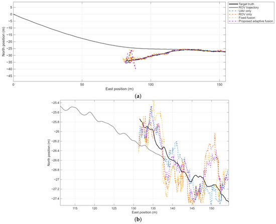
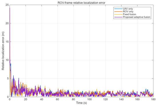
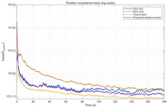
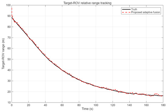
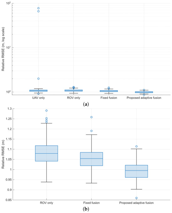
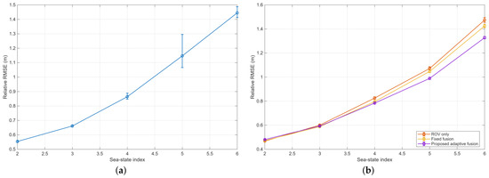
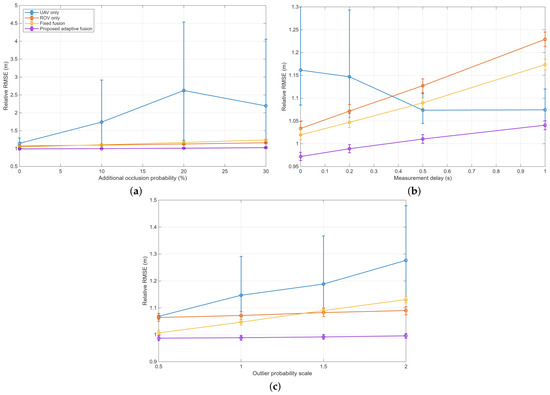
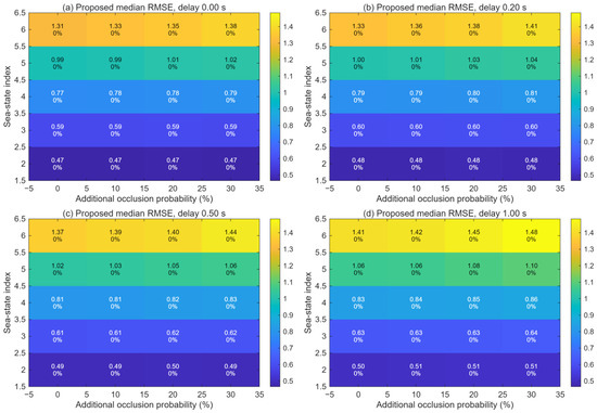
This study addresses target-to-ROV relative localization in an unmanned surface platform-assisted UAV–ROV search-and-recovery system. Because the submerged ROV is not assumed to be visible from the air, the UAV observes the floating target and a GNSS-equipped ROV-associated surface buoy in the same image. The buoy position and target-to-buoy image displacement are combined to construct a world-frame target-position measurement, whose covariance accounts for buoy GNSS uncertainty and correlated image-projection errors. An upward-looking ROV imaging sonar provides range–bearing measurements. A delay-aware extended Kalman filter fuses the asynchronous observations using sea-state- and confidence-dependent covariance adaptation and normalized-innovation gating. ROV acoustic/inertial navigation uncertainty is propagated into the sonar measurement covariance and the reported relative-state covariance, avoiding duplication of the same navigation error in the aerial channel. The method is evaluated using a JONSWAP-based temporal disturbance model, Monte Carlo simulations, and single-factor and joint sea-state–occlusion–delay sensitivity tests. Under the nominal sea-state-5 condition, the proposed method achieves a mean ROV-frame relative RMSE of 0.992 m, compared with 1.083 m for ROV-only localization and 1.054 m for fixed-covariance fusion, with no run exceeding the 5 m divergence threshold. The results demonstrate improved relative-localization robustness within the simulated environment.
Full article
(This article belongs to the Section Ocean Engineering)
►▼
Show Figures

Figure 1
Open AccessArticle
A Time Series Prediction Method for Ocean Sound Speed Profiles Based on Improved TCN Neural Network and Its Application in Seafloor Geodetic Positioning
by
Yueyuan Ma, Shuang Zhao, Baojin Li and Linhao Li
J. Mar. Sci. Eng. 2026, 14(16), 1517; https://doi.org/10.3390/jmse14161517 - 17 Aug 2026
Abstract
Ocean sound speed profile (SSP) is a key parameter for underwater acoustic detection, remote sensing, and seafloor geodetic positioning, and its temporal prediction is essential for improving acoustic positioning accuracy. Conventional direct measurements are inefficient and spatially sparse, while statistical and acoustic inversion
[...] Read more.
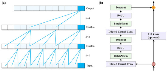
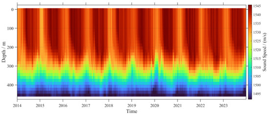
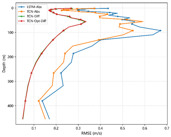
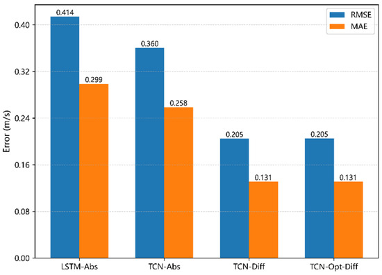
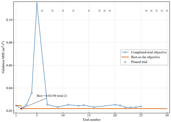
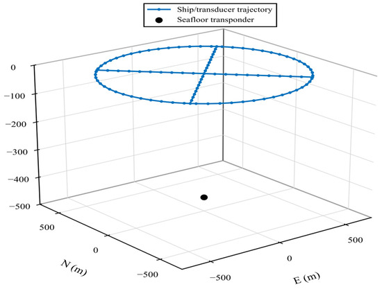
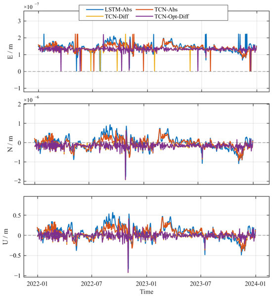
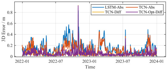
Ocean sound speed profile (SSP) is a key parameter for underwater acoustic detection, remote sensing, and seafloor geodetic positioning, and its temporal prediction is essential for improving acoustic positioning accuracy. Conventional direct measurements are inefficient and spatially sparse, while statistical and acoustic inversion methods fail to capture the strong nonlinear evolution of the sound speed field. Among existing time series models, LSTM, a recurrent network for time series forecasting, lacks an explicit receptive field. In contrast, the original TCN, a temporal convolutional network with dilated convolutions, poorly captures local fine structures and relies heavily on empirical tuning. To overcome these limitations, we propose an improved TCN-based SSP prediction method and apply it to seafloor geodetic positioning. The approach first constructs a sound speed increment field via first-order time differencing to remove global trends and highlight local variations. It then employs Optuna (version 4.9.0), a Bayesian sampling-based automatic optimization framework, to automatically tune key TCN parameters within a predefined search space, reducing reliance on manual tuning. The predicted high-resolution sound speed time series is finally used for ray tracing positioning to enhance seafloor geodetic accuracy. Experiments on the GLORYS12V1 reanalysis dataset show that LSTM and the original TCN achieve root mean square error (RMSE) and mean absolute error (MAE) values of 0.414 and 0.299 m/s, as well as 0.360 and 0.258 m/s, respectively, whereas our improved TCN reduces these to 0.205 and 0.131 m/s, substantially outperforming both baselines. In simulated Global Navigation Satellite System–Acoustics (GNSS-A) seafloor positioning, the 3D positioning RMSE drops to about 0.075 m, with improved stability. The proposed method offers an effective solution for accurate SSP time series forecasting and high-precision seafloor geodesy.
Full article
(This article belongs to the Section Ocean Engineering)
►▼
Show Figures

Figure 1
Open AccessArticle
Innovative Mooring Line Tension Reduction Technique for FOWTs
by
Ying Luo and Kevin Huang
J. Mar. Sci. Eng. 2026, 14(16), 1516; https://doi.org/10.3390/jmse14161516 - 16 Aug 2026
Abstract
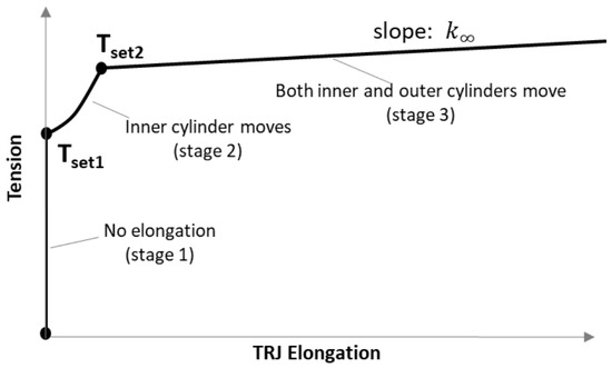
The high cost of mooring systems, driven by extreme peak tensions during storm conditions, remains a significant barrier to the commercialization of floating offshore wind turbines (FOWTs). This paper proposes an innovative active tension-regulating joint (TRJ) for FOWT mooring lines. The TRJ consists
[...] Read more.
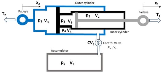
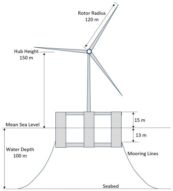
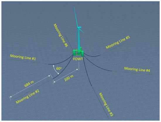
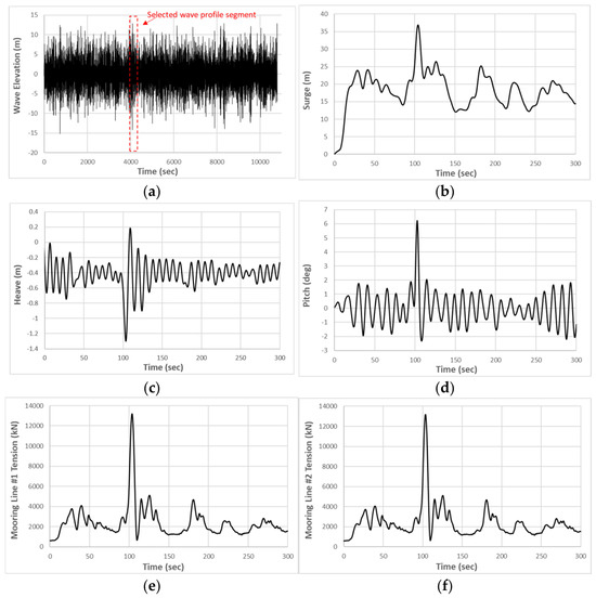
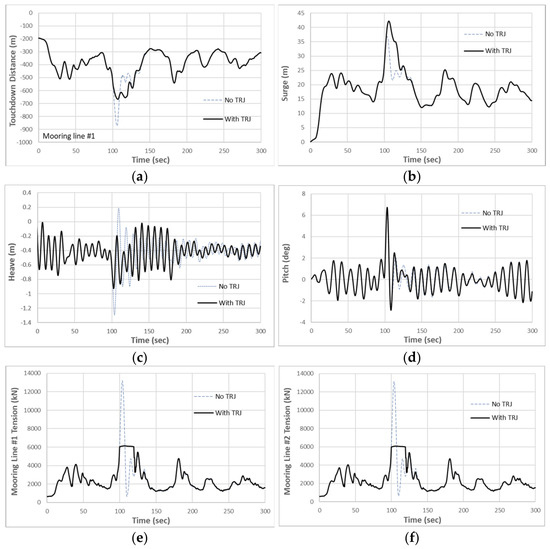
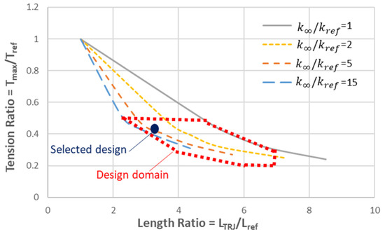
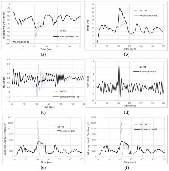
The high cost of mooring systems, driven by extreme peak tensions during storm conditions, remains a significant barrier to the commercialization of floating offshore wind turbines (FOWTs). This paper proposes an innovative active tension-regulating joint (TRJ) for FOWT mooring lines. The TRJ consists of nested cylinders and an actively controlled accumulator, designed to release additional line length under high tension and to recover it under low tension, thereby reducing extreme dynamic peaks. A finite element scheme is also developed for efficient line dynamics analysis. The TRJ concept is applied to a benchmark IEA 15-MW semi-submersible FOWT in 100 m water depth under 50-year return period environmental conditions. The simulation results demonstrate that the TRJ reduces the maximum mooring line tension by approximately 53% and the maximum suspended line length by over 23%. This active control technique enables the downsizing of mooring components and a significant cost reduction.
Full article
(This article belongs to the Section Ocean Engineering)
►▼
Show Figures

Figure 1
Open AccessArticle
Full-Field Hull Fatigue Mapping Across Environmental Bins for a Semi-Submersible Floating Offshore Wind Turbine
by
Glib Ivanov, Gwo-An Chang, Ding Peng Liu and Kai-Tung Ma
J. Mar. Sci. Eng. 2026, 14(16), 1515; https://doi.org/10.3390/jmse14161515 - 16 Aug 2026
Abstract
Fatigue assessment of floating offshore wind turbines (FOWTs) remains challenging because fatigue-sensitive regions may occur outside conventional predefined hotspots. This study applies a previously numerically verified full-field fatigue-screening workflow combining Unit Load Response, submodeling, and Virtual Test Rig concepts to the TaidaFloat semi-submersible
[...] Read more.
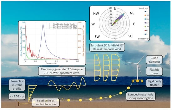
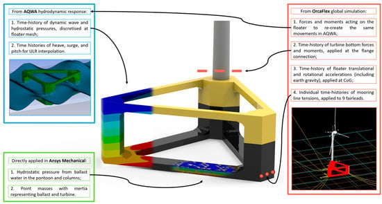
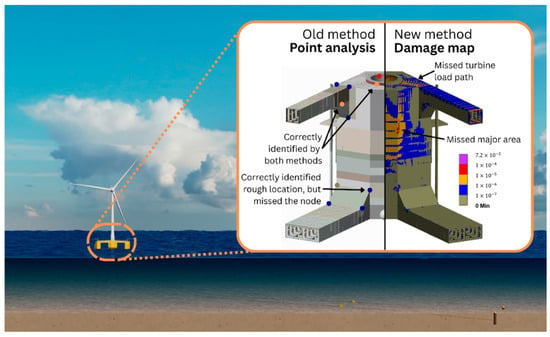
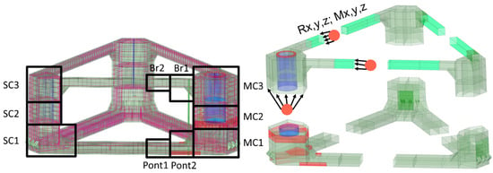
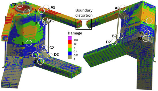
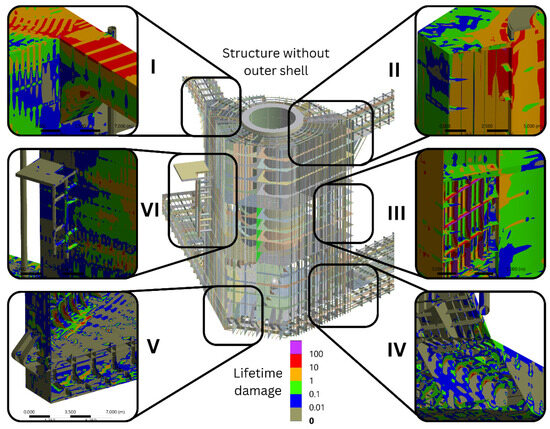
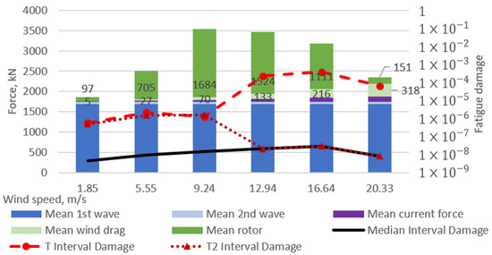
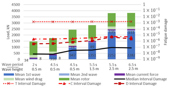
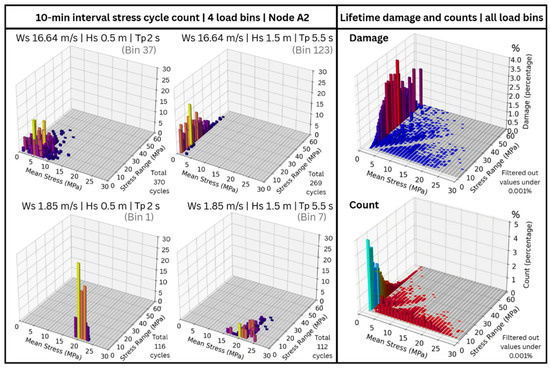
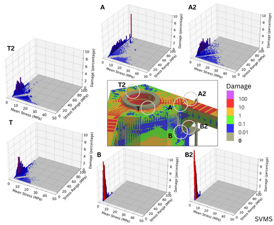
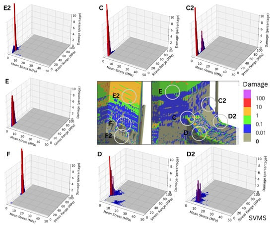
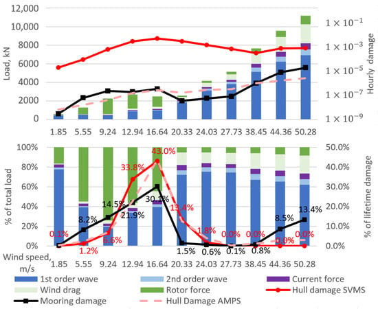
Fatigue assessment of floating offshore wind turbines (FOWTs) remains challenging because fatigue-sensitive regions may occur outside conventional predefined hotspots. This study applies a previously numerically verified full-field fatigue-screening workflow combining Unit Load Response, submodeling, and Virtual Test Rig concepts to the TaidaFloat semi-submersible FOWT under Taiwan Strait environmental conditions. Reconstructed nodal stress histories are used to map hull fatigue and evaluate occurrence-weighted contributions from 182 environmental bins, including operational and typhoon conditions. The results identify fatigue-sensitive regions not only at conventional column–bracing and column–pontoon connections but also in the upper main column and along the turbine–hull load path. Upper column fatigue is mainly associated with turbine-induced bending, whereas lower column and waterline-adjacent regions are more sensitive to wave-induced global hull bending. Frequently occurring near-rated operational conditions dominate the occurrence-weighted hull fatigue contribution, while selected typhoon conditions produce high short-term damage but limited long-term contributions within the four-year dataset. Approximately 94.6% of hull fatigue damage is captured by 28% of the bins, and a common hull–mooring set captures 97.0% of both contributions using 62% of the bins. These findings support hotspot screening and environmental-bin prioritization rather than detailed or certification-level fatigue life prediction.
Full article
(This article belongs to the Special Issue Analysis of Strength, Fatigue, and Vibration in Marine Structures)
►▼
Show Figures

Figure 1
Open AccessArticle
Regulation of Diel Size Spectrum Variation by Dissolved Inorganic Nutrients in Starved Mixotroph Mesodinium rubrum
by
Yi Wu, Wenguang Zhang, Kehan Yi, Xiaogang Xing, Pengbin Wang, Qian Liu and Mengmeng Tong
J. Mar. Sci. Eng. 2026, 14(16), 1514; https://doi.org/10.3390/jmse14161514 - 16 Aug 2026
Abstract
The obligate mixotroph Mesodinium rubrum significantly impacts coastal ecosystems, yet its population control in oligotrophic waters remains unclear. Integrating field observations from Coast of Sanya (South China Sea) with laboratory nutrient manipulation, we investigated how dissolved inorganic nutrients and prey availability regulate cell
[...] Read more.
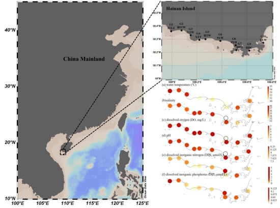
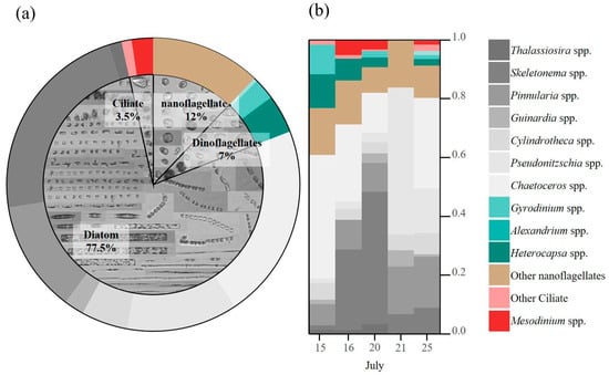
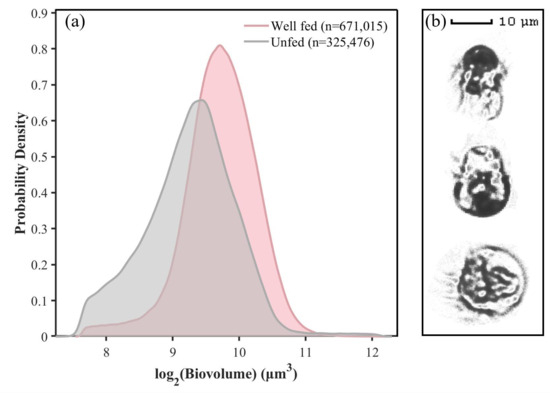
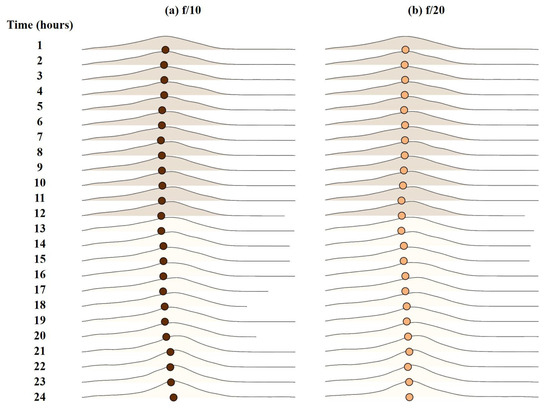
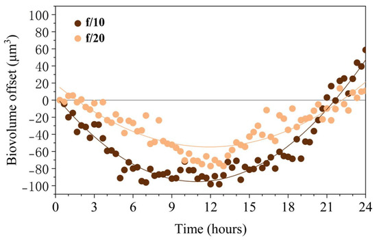
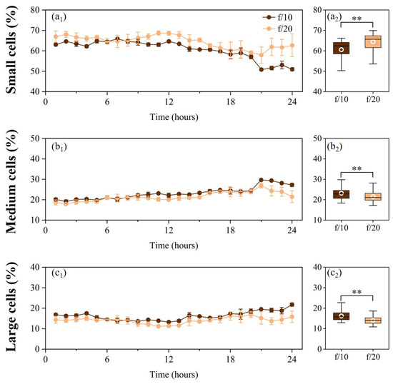
The obligate mixotroph Mesodinium rubrum significantly impacts coastal ecosystems, yet its population control in oligotrophic waters remains unclear. Integrating field observations from Coast of Sanya (South China Sea) with laboratory nutrient manipulation, we investigated how dissolved inorganic nutrients and prey availability regulate cell cycle progression, using biovolume as a proxy for cycle transitions. Nutrient starvation arrested cells at the small (newly divided) stage. Inorganic replenishment triggered rapid somatic growth and consistent diel biovolume oscillations, expanding in light and shrinking in darkness. However, without cryptophyte prey, cells failed to progress beyond the medium (actively growing) stage and could not accumulate into the large (pre-division) size class, revealing a decoupled regulatory mechanism. Dissolved inorganic nutrients drive cell size expansion (somatic growth), whereas prey-derived organelles serve as a critical prerequisite for division. Field data confirmed that the virtual absence of cryptophytes in Sanya waters restricts M. rubrum to consistently low levels. Our findings demonstrate that population dynamics of this specialist mixotroph transcend traditional nutrient-driven paradigms, underscoring the irreplaceable role of prey in sustaining photosynthetic metabolism and triggering population expansion in oligotrophic systems.
Full article
(This article belongs to the Section Marine Ecology)
►▼
Show Figures

Figure 1
Open AccessArticle
Reliability-Based Time-Reserve Assessment of Bulk Carrier Accidents Triggered by Solid Bulk Cargo Liquefaction and Dynamic Separation
by
Sergey S. Kubrin, Sergey I. Kondratyev, Evgeniy V. Khekert, Viktor V. Kondratiev, Natalia Nikolaevna Bryukhanova, Vitaliy A. Gladkikh, Boris V. Malozyomov, Nikita V. Martyushev, Roman V. Klyuev and Antonina I. Karlina
J. Mar. Sci. Eng. 2026, 14(16), 1513; https://doi.org/10.3390/jmse14161513 - 16 Aug 2026
Abstract
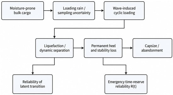
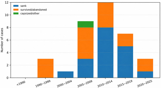
Liquefaction and dynamic separation of moisture-sensitive solid bulk cargoes may remain latent for much of a voyage and then manifest as a sustained heel, leaving a comparatively short interval for emergency action. This study develops an exploratory reliability-based analysis of accident chronology using
[...] Read more.
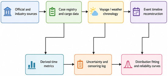
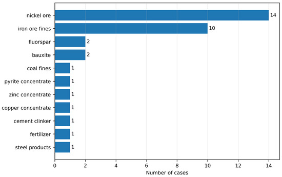
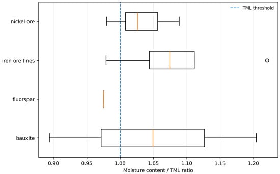
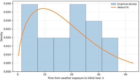
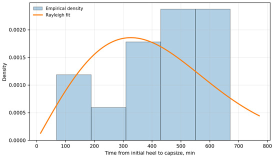
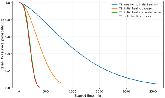
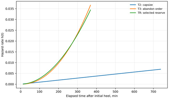
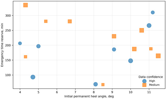
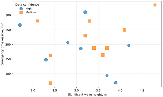
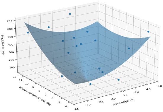
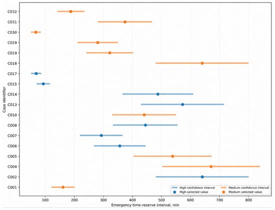
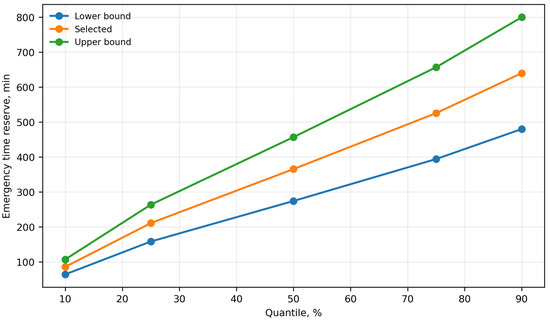
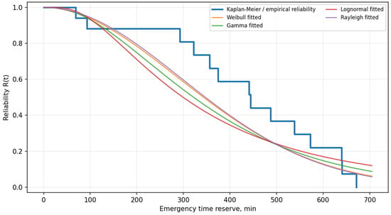
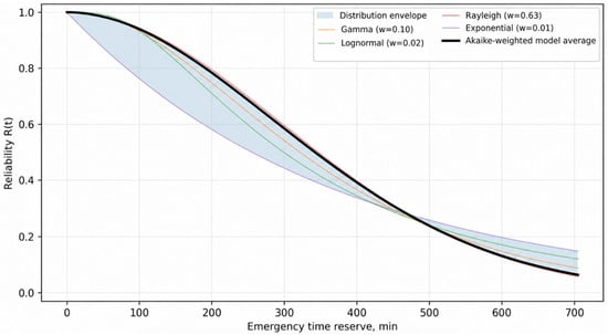
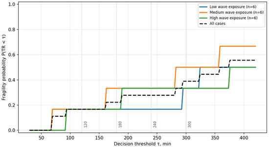
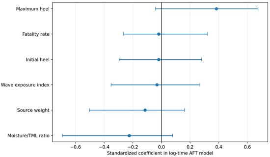
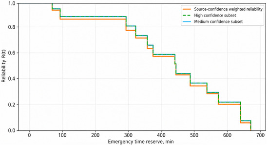
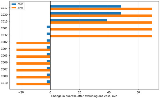
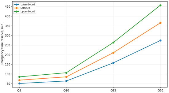
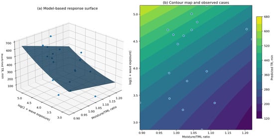
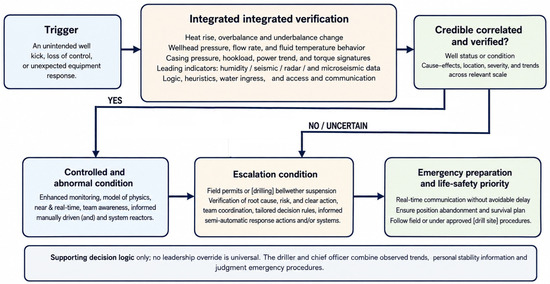
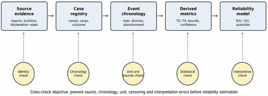
Liquefaction and dynamic separation of moisture-sensitive solid bulk cargoes may remain latent for much of a voyage and then manifest as a sustained heel, leaving a comparatively short interval for emergency action. This study develops an exploratory reliability-based analysis of accident chronology using a source-traceable registry of 35 casualties and incidents. Eighteen cases provided post-heel information suitable for the principal emergency time reserve analysis; the observations comprised exact, approximate, reconstructed, interval-censored, and right-censored times. Descriptive statistics calculated from the selected central values and censoring bounds yielded a mean emergency time reserve TR of 200.99 min, a median of 192.20 min, and a range of 67.50–335.10 min. In likelihood-based fitting that retained censoring, the Weibull model achieved the lowest AIC (212.51) and BIC (215.18), with Kolmogorov–Smirnov D = 0.097 (p = 0.989). The fitted lower-tail quantiles were Q10 = 105.40 min and Q25 = 147.99 min, substantially shorter than the descriptive mean. Robustness was examined using nonparametric estimators, Akaike-weighted model averaging, source-confidence weighting, leave-one-out analysis, and alternative interval assumptions. The contribution is a reproducible framework for converting heterogeneous casualty narratives into uncertainty-qualified lower-tail time-reserve evidence and non-prescriptive bridge–team decision support. The framework is not a physical stability model and cannot replace ship-specific GM/GZ calculations, approved loading and stability information, or the master’s judgement.
Full article
(This article belongs to the Special Issue Reliability and Risk Analysis for Ships and Offshore Structures)
►▼
Show Figures

Figure 1
Journal Menu
► ▼ Journal Menu-
- JMSE Home
- Aims & Scope
- Editorial Board
- Reviewer Board
- Topical Advisory Panel
- Early Career Editorial Board
- Instructions for Authors
- Special Issues
- Topics
- Sections
- Article Processing Charge
- Indexing & Archiving
- Editor’s Choice Articles
- Most Cited & Viewed
- Journal Statistics
- Journal History
- Journal Awards
- Society Collaborations
- Conferences
- Editorial Office
Journal Browser
► ▼ Journal BrowserHighly Accessed Articles
Latest Books
E-Mail Alert
News
16 March 2026
Meet Us Virtually at the 2nd International Online Conference on Marine Science and Engineering, 23–25 November 2026
17 August 2026
Meet Us at the Aquaculture Europe 2026, 28 September–1 October 2026, Ljubljana, Slovenia
Topics
Topic in
Coasts, Energies, JMSE, Sustainability, Future Transportation
Maritime Transportation in the Blue Economy and Green Shipping Technology
Topic Editors: Chungkuk Jin, Junghwan Choi, Won-Ju Lee, Hokeun KangDeadline: 15 September 2026
Topic in
Applied Sciences, Energies, JMSE, Processes, Resources, Gases
Exploitation and Underground Storage of Oil and Gas
Topic Editors: Jianjun Liu, Rui Song, Liuke Huang, Yao Wang, Mingyang Wu, Gang HuiDeadline: 30 September 2026
Topic in
Applied Sciences, Buildings, Designs, Infrastructures, JMSE
Resilient Civil Infrastructure, 2nd Edition
Topic Editors: De-Cheng Feng, Ji-Gang Xu, Xu-Yang CaoDeadline: 31 October 2026
Topic in
Applied Sciences, Electronics, JMSE, Signals, Telecom, Sensors
Advances in Underwater Signal Processing and Communication: Challenges, Innovations, and Applications
Topic Editors: Jaehak Chung, Hojun Lee, Yongcheol KimDeadline: 30 November 2026
Conferences
Special Issues
Special Issue in
JMSE
Advanced Design and Analysis of Floating Offshore Systems
Guest Editors: Wei Huang, Yushun Lian, Gang Ma, Binbin Li, Dongsheng QiaoDeadline: 20 August 2026
Special Issue in
JMSE
Seagrass Conservation Blue Carbon and Restoration
Guest Editor: Valentina CostaDeadline: 20 August 2026
Special Issue in
JMSE
Sustainable Marine Aquaculture and Fishery
Guest Editor: Gulnihal OzbayDeadline: 20 August 2026
Special Issue in
JMSE
Coastal Disaster Assessment and Response—2nd Edition
Guest Editor: Deniz Velioglu SogutDeadline: 20 August 2026