Next Issue
Volume 16, September-1
Previous Issue
Volume 16, August-1
 
 
water-logo

Journal Browser

Journal Browser

Water, Volume 16, Issue 16 (August-2 2024) – 143 articles

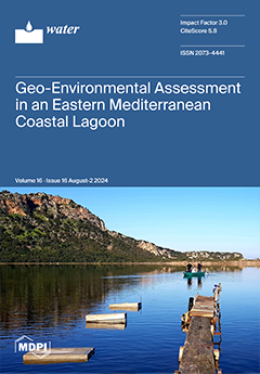
Cover Story (view full-size image): This study investigates the geo-environmental status of the bottom of Gialova lagoon, a highly vulnerable site of the EU’s Natura 2000 network. The results show that sedimentation is mainly controlled by the bottom morphology, hydrodynamic variations, and biogenic productivity of the lagoon. Fine-grained, detrital sediments are related to high organic matter and heavy metal loads and contradict the deposition of coarser, bioclastic sediments. A sulfide-rich geochemical phase was indicated, representing occasionally anoxic conditions, while a Mn–oxyhydroxides phase reflects increased manganese content with several compounded elements. Multiple sources of phosphorus comprise the phosphate geochemical phase. The lagoon bottom shows moderate metal-pollution levels only in Mo and Pb. The maximum contamination and environmental stress concern two small-sized, shallow basins within the lagoon. View this paper
  • Issues are regarded as officially published after their release is announced to the table of contents alert mailing list.
  • You may sign up for e-mail alerts to receive table of contents of newly released issues.
  • PDF is the official format for papers published in both, html and pdf forms. To view the papers in pdf format, click on the "PDF Full-text" link, and use the free Adobe Reader to open them.
Order results
Result details
Section
Select all
Export citation of selected articles as:
23 pages, 16937 KiB  
Article
Study on the Characteristics of Flow over a Seawall and Its Impact on Pedestrians under Solitary Wave Action
by Yadong Hou, Xizeng Zhao, Gang Tao, Zhaoyuan Huang, Nanhui Xu and Zequan Leng
Water 2024, 16(16), 2357; https://doi.org/10.3390/w16162357 - 22 Aug 2024
Cited by 2 | Viewed by 1384
Abstract
In response to the incident of tourists falling into the sea due to waves on the seawall berm at Macau Road, Qingdao, during the passage of Typhoon “Songda” in 2022, a combination of numerical simulations and physical model experiments was performed to investigate [...] Read more.
In response to the incident of tourists falling into the sea due to waves on the seawall berm at Macau Road, Qingdao, during the passage of Typhoon “Songda” in 2022, a combination of numerical simulations and physical model experiments was performed to investigate the mechanics of the event, with emphasis on the wave flow characteristics and the flow evolution process on the seawall berm as well as the force exerted on a human body-equivalent cylinder model. The study found that the thickness of the return flow was significantly greater than that of the overtopping flow on the landward part of the berm. The recoil forces applied to the model on the berm were larger than the impact forces, and the ratio tended towards 1 as the wave height increased. In addition, the stability of pedestrians on the seawall berm was analyzed. The instability conditions for pedestrians in cross-wave flows differed slightly from those in floods. Full article
(This article belongs to the Special Issue Wave–Structure Interaction in Coastal and Ocean Engineering)
Show Figures

Figure 1

25 pages, 67157 KiB  
Article
Impact of Utilizing High-Resolution PlanetScope Imagery on the Accuracy of LULC Mapping and Hydrological Modeling in an Arid Region
by Chithrika Alawathugoda, Gilbert Hinge, Mohamed Elkollaly and Mohamed A. Hamouda
Water 2024, 16(16), 2356; https://doi.org/10.3390/w16162356 - 22 Aug 2024
Cited by 3 | Viewed by 1805
Abstract
Accurate land-use and land-cover (LULC) mapping is crucial for effective watershed management and hydrological modeling in arid regions. This study examines the use of high-resolution PlanetScope imagery for LULC mapping, change detection, and hydrological modeling in the Wadi Ham watershed, Fujairah, UAE. The [...] Read more.
Accurate land-use and land-cover (LULC) mapping is crucial for effective watershed management and hydrological modeling in arid regions. This study examines the use of high-resolution PlanetScope imagery for LULC mapping, change detection, and hydrological modeling in the Wadi Ham watershed, Fujairah, UAE. The authors compared LULC maps derived from Sentinel-2 and PlanetScope imagery using maximum likelihood (ML) and random forest (RF) classifiers. Results indicated that the RF classifier applied to PlanetScope 8-band imagery achieved the highest overall accuracy of 97.27%. Change detection analysis from 2017 to 2022 revealed significant transformations, including a decrease in vegetation from 3.371 km2 to 1.557 km2 and an increase in built-up areas from 3.634 km2 to 6.227 km2. Hydrological modeling using the WMS-GSSHA model demonstrated the impact of LULC map accuracy on simulated runoff responses, with the most accurate LULC dataset showing a peak discharge of 1160 CMS at 930 min. In contrast, less accurate maps showed variations in peak discharge timings and magnitudes. The 2022 simulations, reflecting urbanization, exhibited increased runoff and earlier peak flow compared to 2017. These findings emphasize the importance of high-resolution, accurate LULC data for reliable hydrological modeling and effective watershed management. The study supports UAE’s 2030 vision for resilient communities and aligns with UN Sustainability Goals 11 (Sustainable Cities and Communities) and 13 (Climate Action), highlighting its broader relevance and impact. Full article
(This article belongs to the Special Issue Remote Sensing for Hydrology)
Show Figures

Figure 1

15 pages, 3212 KiB  
Article
Degradation of Oxytetracycline in Saturated Porous Media by In Situ Chemical Oxidation Using Oxygen-Doped Graphitic Carbon Nitride and Peroxymonosulfate: Laboratory-Scale Column Experiments
by Thanh-Tuan Nguyen, Do-Gun Kim and Seok-Oh Ko
Water 2024, 16(16), 2355; https://doi.org/10.3390/w16162355 - 22 Aug 2024
Viewed by 1095
Abstract
Oxytetracycline (OTC) is frequently detected in groundwater and soil, posing substantial risks to the subsurface environment via persistence, phytotoxicity, changing bacterial communities, and antibiotic resistance. In situ chemical oxidation (ISCO) is one of the best alternatives for removing OTC from groundwater. However, its [...] Read more.
Oxytetracycline (OTC) is frequently detected in groundwater and soil, posing substantial risks to the subsurface environment via persistence, phytotoxicity, changing bacterial communities, and antibiotic resistance. In situ chemical oxidation (ISCO) is one of the best alternatives for removing OTC from groundwater. However, its feasibility has rarely been investigated using columns for which optimal conditions can be obtained for practical applications. Thus, a system consisting of oxygen-doped graphitic carbon nitride (OgCN) and peroxymonosulfate (PMS) (OgCN/PMS) was tested for OTC removal using continuous-flow experiments with columns packed with sand and glass beads (GBs). The sand column exhibited better adsorption and degradation of OTC than the GB column in pulse injection experiments, regardless of whether OgCN was packed. Additional experiments were performed using a column saturated with the OTC solution and another filled with deionized water to simulate ISCO, using GB as the medium, to evaluate the net OTC removal by catalytic oxidation, excluding adsorption. Performance improved with increased OgCN packing, PMS dosage, retention time, and pH. Anions slightly affected the performance due to scavenging and propagation of radicals. These findings indicate the high potential of OgCN/PMS for ISCO and the usefulness of column experiments in field applications. Full article
(This article belongs to the Section Soil and Water)
Show Figures

Figure 1

12 pages, 6392 KiB  
Article
A Study on the Optimal Speed Ratio of Rotating Annular Flume Based on the OpenFOAM Simulation
by Sijin Chen, Zhonglian Jiang, Shijun Chen, Zhen Yu and Hui Sun
Water 2024, 16(16), 2354; https://doi.org/10.3390/w16162354 - 22 Aug 2024
Viewed by 1089
Abstract
The rotating annular flume has been widely adopted to generate quasi-steady and uniform flow, thus serving for the investigation of sediment motion characteristics. This complex flow structure is significantly associated with the rotational speed ratio. The present study aims to explore the optimal [...] Read more.
The rotating annular flume has been widely adopted to generate quasi-steady and uniform flow, thus serving for the investigation of sediment motion characteristics. This complex flow structure is significantly associated with the rotational speed ratio. The present study aims to explore the optimal speed ratio based on the OpenFOAM simulation. In this paper, the physical properties of a rotating annular flume with different speed ratios are investigated and analyzed in terms of bottom shear stress, turbulent velocity ratio, cross-sectional secondary flow, and vector field by interFoam, a built-in solver of the open-source CFD program OpenFOAM. The RNG k-epsilon model has been adopted to solve multiphase flow problems. The results demonstrate that the optimal speed ratio differs with the specific evaluation criterion. Given the uniform distribution of bottom shear stress, the turbulence velocity ratio, and the minimum secondary flow as the evaluation criteria, the corresponding optimal speed ratios are determined as 1.2, 1.7, and 1.7, respectively. The conclusion is generally consistent with the results derived by other scholars. Computational fluid dynamics programs have been proven as practical tools for investigating complex hydrodynamic characteristics. The present study shares useful insights into the optimal rotational speed ratio of a rotating annular flume. The OpenFOAM-based numerical model will provide guidance for experimental research using rotating annular flumes. Full article
(This article belongs to the Section Hydraulics and Hydrodynamics)
Show Figures

Figure 1

19 pages, 10731 KiB  
Article
Characteristics of Soil Physical Properties and Spatial Distribution of Soil Erosion on Ridge-Slope Farmland in the Black Soil Areas of Northeast China
by Siyu Wei, Yu Fu, Binhui Liu, Yanling Zhang, Shuai Shao and Xiaoya Zhang
Water 2024, 16(16), 2353; https://doi.org/10.3390/w16162353 - 22 Aug 2024
Viewed by 1173
Abstract
To explore the spatial distribution characteristics of soil physical properties and soil erosion in sloping farmland with ridges in the black soil areas of northeast China, sloping farmland with ridges built with woven bags (RW) along the contour lines was selected as the [...] Read more.
To explore the spatial distribution characteristics of soil physical properties and soil erosion in sloping farmland with ridges in the black soil areas of northeast China, sloping farmland with ridges built with woven bags (RW) along the contour lines was selected as the research object, and another sloping farmland was selected as the control (CK). Soil samples were collected from both RW and CK at uniform spatial intervals to measure key indicators of soil properties in the surface layer (0–15 cm), including soil water-holding capacity, soil structure, and annual average soil loss (A). The results showed that: (i) RW exhibited a significantly higher overall field water-holding capacity compared to CK, with soil moisture characteristics more evenly distributed spatially. Soil bulk weight, fractal dimension, and soil aggregate destruction in RW were reduced by 1.09%, 0.65%, and 4.61%, respectively, compared to CK. Additionally, soil total porosity, capillary porosity, mean weight diameter (MWD), and geometric mean diameter (GWD) were more evenly distributed spatially in RW. (ii) On the up-slope, soil water content and DR>0.25 in RW had a higher increase than those of CK. On the mid-slope, soil field water-holding capacity, capillary porosity, MWD, and GWD in RW had a higher increase than those in CK. On the down-slope, RW had a 7.67–10.79% increase in soil water content, saturated water-holding capacity, field water-holding capacity, and capillary water-holding capacity compared to CK, with total soil porosity and soil capillary porosity increasing by 2.84% and 15.51%, respectively. (iii) Annual average soil loss (A) of RW was reduced by 61.85–99.64% compared to CK, based on the China Soil Loss Equation (CSLE). (vi) Soil water-holding capacity and soil structure characteristics of RW showed benefits compared to CK, with the benefits ranging from 1.01 to 1.09, while the benefit of A reached 2.46. This study is significant for understanding the spatial distribution of soil erosion on sloped farmland in black soil areas and for the effective application of soil and water conservation measures. Full article
Show Figures

Figure 1

24 pages, 6641 KiB  
Article
Key Parameters for Assessing the Deterioration of Reinforced Concrete Pipes in Water Networks
by Enrique Bonet, Maria Niubó, Maria Teresa Yubero and Pura Alfonso
Water 2024, 16(16), 2352; https://doi.org/10.3390/w16162352 - 22 Aug 2024
Cited by 1 | Viewed by 1536
Abstract
Water utilities are facing significant challenges, such as supplying, with less water resources, more and more water due to population growth, amid the current scenario of climate change. In this context, urban water systems represent a crucial component of global public infrastructure for [...] Read more.
Water utilities are facing significant challenges, such as supplying, with less water resources, more and more water due to population growth, amid the current scenario of climate change. In this context, urban water systems represent a crucial component of global public infrastructure for water utilities, with municipalities entrusted with the responsibility of managing and enhancing them for both current and future generations. The main challenge arises when these infrastructures inevitably age and deteriorate, significantly increasing water losses. Since it is unrealistic and unnecessary to rehabilitate and/or replace all pipes in an existing water distribution system, this manuscript is focused on identifying the independent key parameters which can be used to detect reinforced concrete pipe deterioration. To this end, the variables that affect mechanical properties are narrowed down, and the most significant factors crucial for pipe failure are identified. In this process, reinforced concrete pipe samples were collected to characterize them based on a set of potential key parameters. All potential key parameters were analyzed, with the objectives of identifying which key parameters were significant for the model and determining the interactions among them. All data were stored in a dataset which was used to generate a predictive model to estimate average concrete strength and pipe condition assessment versus independent key parameters. The predictive model, utilizing a design of experiments (DoE) and based on the analysis of variance (ANOVA), could estimate the average concrete strength with an accuracy of around 90%, and the external porosity was found to be the main factor. On the other hand, it was also possible to estimate a range of porosity values for the purpose of maintaining the reinforced concrete pipe in optimal condition. Full article
(This article belongs to the Section Urban Water Management)
Show Figures

Figure 1

20 pages, 2758 KiB  
Article
Impact of an Integral Management System with Constructed Wetlands in Pig Slurry Traceability and GHG/NH3 Emissions
by Melisa Gómez-Garrido, Martire Angélica Terrero Turbí, Oumaima El bied and Ángel Faz Cano
Water 2024, 16(16), 2351; https://doi.org/10.3390/w16162351 - 21 Aug 2024
Viewed by 1368
Abstract
The sustainable management of pig slurry (PS) in intensive farms is essential to reduce adverse environmental impacts and reduce the ecological footprint. If not managed properly, PS can release GHG/NH3 gases into the atmosphere and contaminate waters. This study evaluates the impact [...] Read more.
The sustainable management of pig slurry (PS) in intensive farms is essential to reduce adverse environmental impacts and reduce the ecological footprint. If not managed properly, PS can release GHG/NH3 gases into the atmosphere and contaminate waters. This study evaluates the impact of an integral management system with physical and biological stages to mitigate the impact of PS. The system resulted in effective PS traceability, studying its physicochemical properties. The synergism in the whole system allowed a decrease in the most analyzed parameters during the autumn, spring, and summer. The pretreatment contributed significantly to obtaining an appreciable percentage of reduction in the constructed wetlands of SS (99–100%), COD (56–87%), TN (50–57%), and PO43− (88–100%). The emission values (g/m2/day) were 0–2.14 (CH4), 0–473.76 (CO2), 0–179.77 (H2O), 0–0.265 (N2O), and 0–0.195 (NH3), highlighting the raw, separated and manure fractions with the highest values. It is concluded that the system proves to be a practical, low-cost, and efficient technique for the treatment of PS. It significantly reduces the concentration of nutrients, and the intercepted byproducts can be valuable for application to the soil. In addition, the system effectively reduces GHG/NH3 emissions in decanted, purified, and wetland PS fractions. Full article
Show Figures

Figure 1

11 pages, 2108 KiB  
Article
Research on Sediment Deposition Characteristics and the Vegetation Restoration of Ecological Riverbanks in the Deep Waterway Regulation Scheme of Yangtze River
by Jinpeng Li, Xuexia Wang and Lei Wu
Water 2024, 16(16), 2350; https://doi.org/10.3390/w16162350 - 21 Aug 2024
Cited by 1 | Viewed by 1132
Abstract
In order to explore the sediment deposition characteristic of ecological riverbanks associated with vegetation restoration in the deep waterway regulation scheme of Yangtze River, two kinds of typical ecological riverbanks and a traditional riprap riverbank (TRR) in engineering areas were investigated. The vegetation [...] Read more.
In order to explore the sediment deposition characteristic of ecological riverbanks associated with vegetation restoration in the deep waterway regulation scheme of Yangtze River, two kinds of typical ecological riverbanks and a traditional riprap riverbank (TRR) in engineering areas were investigated. The vegetation community characteristics, sediment aggregate compositions, nutrient contents, total organic carbon (TOC), sediment microbial biomass carbon (MBC), sediment microbial biomass nitrogen (MBN), and sediment microbial biomass phosphorus (MBP) were determined. The results indicated that the ecological restoration effect of the lattice gabion ballasted vegetation mat riverbank (LGBVR) was best, followed by the mesh grid riverbank (MGR), and that of the TRR was relatively poor. In different ecological riverbanks, the sediment aggregated compositions were not significantly varied. The sediment contents of NH4+-N, available phosphorus (AP), and TOC in ecological riverbank areas were relatively higher than those of the TRR. In the LGBVR, the sediment contents of MBC were relatively higher than those of the others. The sediment deposition characteristics and ecological restoration effects in the study area should be monitored for a long time. Full article
Show Figures

Figure 1

16 pages, 1475 KiB  
Article
Effects of Domestic Pollution on European Brook Lamprey Ammocoetes in a Lowland River: Insights from Microbiological Analysis
by Grzegorz Zięba, Magdalena Moryl, Dominika Drzewiecka, Mirosław Przybylski, Kacper Pyrzanowski and Joanna Grabowska
Water 2024, 16(16), 2349; https://doi.org/10.3390/w16162349 - 21 Aug 2024
Cited by 1 | Viewed by 1154
Abstract
This study investigates the impact of water faecal contamination on highly threatened European brook lamprey larvae (Lampetra planeri). Water samples and the midgut contents of lampreys collected from a small lowland river upstream (site 1) and downstream from a wastewater treatment [...] Read more.
This study investigates the impact of water faecal contamination on highly threatened European brook lamprey larvae (Lampetra planeri). Water samples and the midgut contents of lampreys collected from a small lowland river upstream (site 1) and downstream from a wastewater treatment plant (WWTP) discharge (site 2) were analysed to check how the faecal microbial load of the habitat is reflected in the intestines of larval lampreys. The counts of viable mesophiles, psychrophiles, Escherichia coli and faecal streptococci as bacterial indicators of microbial (including faecal) water contamination were estimated. Microbial composition and abundance in larval midgut contents depended on the numbers of various microorganisms in the water environment. At site 2, the water was heavily microbiologically contaminated throughout the year by sewage inflow from the WWTP, and the amounts of studied bacteria were also high in the midgut of lampreys inhabiting site 2 regardless of the season. At site 1, water quality was better, and the levels of tested microbial indicators were lower in the intestines of the lampreys living there. The numbers of bacteria dependent on water temperature were growing in warmer seasons both in water and in intestines. Sewage pollution negatively influenced the condition of lampreys in site 2, where they exhibited lower body condition than in site 1. Full article
(This article belongs to the Special Issue Freshwater Species: Status, Monitoring and Assessment)
Show Figures

Figure 1

16 pages, 10412 KiB  
Article
Effects of Freeze−Thaw Cycles on Available Nitrogen Content in Soils of Different Crops
by Qianfeng Wang, Mo Chen, Xiaoyang Yuan and Yuanyuan Liu
Water 2024, 16(16), 2348; https://doi.org/10.3390/w16162348 - 21 Aug 2024
Cited by 1 | Viewed by 1030
Abstract
In order to study the effect of freeze−thaw cycles on the content of available nitrogen in soils of different crops and obtain an in-depth understanding of changes in soil fertility and soil environment in cold regions, a laboratory simulation experiment was conducted with [...] Read more.
In order to study the effect of freeze−thaw cycles on the content of available nitrogen in soils of different crops and obtain an in-depth understanding of changes in soil fertility and soil environment in cold regions, a laboratory simulation experiment was conducted with different freeze−thaw times, temperature differences, and periods. The changes in available nitrogen concentrations in the 0–15 cm and 15–30 cm layers of corn, vegetable, and paddy soils were measured by the alkaline-hydrolysis diffusion method. The results were as follows. (1) The freeze−thaw process had significant effects on the available nitrogen content in the three soils. Under the treatment with different numbers of freeze−thaw cycles, the available nitrogen content in the 0–15 cm layers of corn soil, vegetable soil, and paddy soil reached the maximum values at the 8th, 1st, and 3rd freeze−thaw cycle, at 156.92 mg/kg, 479.17 mg/kg and 181.75 mg/kg, respectively; the available nitrogen content decreased slowly after reaching the maximum value. (2) Under the freeze−thaw temperature-difference treatment, the available nitrogen concentration in the 0–15 cm layers of corn soil, vegetable soil, and paddy soil reached the maximum value at a temperature difference of 30 °C, at 147 mg/kg, 476 mg/kg and 172.5 mg/kg, respectively, and the available nitrogen content of the 15–30 cm soil layers changed slightly. (3) Under different freeze−thaw periods, the magnitudes of the changes in soil available nitrogen concentration in 0–15 cm of corn soil and paddy soil were, in descending order, short-term freezing and long-term melting > long-term freezing and long-term melting > short-term freezing and short-term melting > long-term freezing and short-term melting. The soil available nitrogen concentration at different depths in the vegetable soil reached the maximum value under the treatment with long-term freezing and short-term melting. (4) The available nitrogen content of paddy soil under the high-water-content condition was higher than that of paddy soil under the low-water-content condition, and the change in available nitrogen content was more obvious under the high-water-content condition under different freeze−thaw period treatments; the opposite was true for corn soil and vegetable soil. Simulation studies on rapid changes in soil nitrogen content during tests that simulate winter freeze−thaw conditions are important for understanding crop growth, the application of nitrogen fertilizer in spring, and the prevention of surface-water pollution from agricultural runoff. Full article
Show Figures

Figure 1

20 pages, 5364 KiB  
Review
Management of Thermal Hazards in Deep Mines in China: Applications and Prospects of Mine Cooling Technology
by Bo You, Yuansen Chen, Ming Yang, Ke Gao, Daxiong Cui and Man Lu
Water 2024, 16(16), 2347; https://doi.org/10.3390/w16162347 - 21 Aug 2024
Viewed by 1760
Abstract
With the continuous development of the mining industry and advancements in deep mining technology, mine environment optimization has become key to ensuring safety and improving the efficiency of mining. The high-temperature environment, particularly in deep mines, not only poses a serious threat to [...] Read more.
With the continuous development of the mining industry and advancements in deep mining technology, mine environment optimization has become key to ensuring safety and improving the efficiency of mining. The high-temperature environment, particularly in deep mines, not only poses a serious threat to miners’ health but also significantly reduces operational efficiency. These issues have been determined based on the current application status and development trends of mine cooling technology, including traditional mechanical and non-mechanical cooling technologies, as well as emerging roadway insulation materials and mine cooling clothing applications. By comparing the advantages and disadvantages of each technology, the main challenges related to the use of current mine cooling technologies are pointed out, including the low energy efficiency ratio, high cost, and difficult implementation. Finally, this paper looks forward to the future development directions of mine cooling technologies, emphasizing the importance of intelligent, energy-saving, and environment-improving comprehensive system management and, in turn, promoting the progress and application of mine environment optimization technology and supporting safe and efficient deep mining. Full article
Show Figures

Figure 1

19 pages, 3833 KiB  
Article
Utilizing Artificial Intelligence Techniques for a Long–Term Water Resource Assessment in the ShihMen Reservoir for Water Resource Allocation
by Hsuan-Yu Lin, Shao-Huang Lee, Jhih-Huang Wang and Ming-Jui Chang
Water 2024, 16(16), 2346; https://doi.org/10.3390/w16162346 - 21 Aug 2024
Cited by 2 | Viewed by 1388
Abstract
Accurate long–term water resource supply simulation and demand estimation are crucial for effective water resource allocation. This study proposes advanced artificial intelligence (AI)–based models for both long–term water resource supply simulation and demand estimation, specifically focusing on the ShihMen Reservoir in Taiwan. A [...] Read more.
Accurate long–term water resource supply simulation and demand estimation are crucial for effective water resource allocation. This study proposes advanced artificial intelligence (AI)–based models for both long–term water resource supply simulation and demand estimation, specifically focusing on the ShihMen Reservoir in Taiwan. A Long Short–Term Memory (LSTM) network model was developed to simulate daily reservoir inflow. The climate factors from the Taiwan Central Weather Bureau’s one–tiered atmosphere–ocean coupled climate forecast system (TCWB1T1) were downscaled using the K–Nearest Neighbors (KNN) method and integrated with the reservoir inflow model to forecast inflow six months ahead. Additionally, Multilayer Perceptron (MLP) and Gated Recurrent Unit (GRU) were employed to estimate agricultural and public water demand, integrating both hydrological and socio–economic factors. The models were trained and validated using historical data, with the LSTM model demonstrating a strong ability to capture seasonal variations in inflow patterns and the MLP and GRU models effectively estimating water demand. The results highlight the models’ high accuracy and robustness, offering valuable insights into regional water resource allocation. This research provides a framework for integrating AI–driven models with Decision Support Systems (DSSs) to enhance water resource management, especially in regions vulnerable to climatic variability. Full article
(This article belongs to the Section Water Resources Management, Policy and Governance)
Show Figures

Figure 1

15 pages, 13489 KiB  
Article
Remote Sensing-Based Analysis of Precipitation Events: Spatiotemporal Characterization across China
by Zhihua Zhu, Chutong Peng, Xue Li, Ruihao Zhang, Xuejun Dai, Baolin Jiang and Jinxing Chen
Water 2024, 16(16), 2345; https://doi.org/10.3390/w16162345 - 21 Aug 2024
Viewed by 1079
Abstract
Precipitation occurs in individual events, but the event characteristics of precipitation are often neglected. This work seeks to identify the precipitation events on both spatial and temporal scales, explore the event characteristics of precipitation, and reveal the relationships between the different characteristics of [...] Read more.
Precipitation occurs in individual events, but the event characteristics of precipitation are often neglected. This work seeks to identify the precipitation events on both spatial and temporal scales, explore the event characteristics of precipitation, and reveal the relationships between the different characteristics of precipitation events. To do this, we combined the Forward-in-Time (FiT) algorithm with the gridded hourly precipitation product to detect precipitation events in time and space over China. The identified precipitation events were analyzed to determine their characteristics. The results indicate that precipitation events can be detected and identified in time and space scales based on the FiT algorithm and the gridded hourly precipitation product. The precipitation total, duration, and intensity of these events decrease gradually from the southern (eastern) coastal regions to northern (western) inland areas of China. The event precipitation totals are strongly correlated with event duration and event maximum intensity; the totals are more strongly correlated with event maximum intensity and event intensity in the regions with lower precipitation than the regions with higher precipitation. More than 90% of precipitation events are shorter than 6 h, and events with long duration normally occur in temperate monsoon (TM) and subtropical/tropical monsoon (ST) climate zones. Heavy precipitation events with a duration longer than 7 h generally occur more than seven times per year in TM and ST climate zones. Our results suggest that precipitation analyses should sufficiently consider the characteristics of events across different regions. Full article
(This article belongs to the Special Issue Analysis of Extreme Precipitation Under Climate Change)
Show Figures

Figure 1

18 pages, 2974 KiB  
Article
Degradation of Procion Golden Yellow H-R Dye Using Ultrasound Combined with Advanced Oxidation Process
by Rahat F. Momin, Kalyani R. Deshmukh and Parag R. Gogate
Water 2024, 16(16), 2344; https://doi.org/10.3390/w16162344 - 21 Aug 2024
Cited by 3 | Viewed by 1441
Abstract
The current study aims to degrade Procion Golden Yellow H-R through ultrasound-induced cavitation coupled with various oxidants. A comprehensive investigation was conducted to examine the impact of parameters, specifically pH, power, and frequency, on the extent of degradation. The primary aim was to [...] Read more.
The current study aims to degrade Procion Golden Yellow H-R through ultrasound-induced cavitation coupled with various oxidants. A comprehensive investigation was conducted to examine the impact of parameters, specifically pH, power, and frequency, on the extent of degradation. The primary aim was to optimize degradation by solely utilizing a cavitation reactor where only 23.8% degradation was observed under the established optimum conditions of pH 2.5, frequency of 22 kHz, and power of 200 W. The investigation of the combined process of cavitation with H2O2, Fenton reagent (H2O2/Fe2+), NaOCl, and potassium persulphate (KPS) was subsequently conducted under optimized conditions. The combined operations greatly enhanced degradation with the use of H2O2 loading of 0.1 g/L leading to 53.3% degradation and the H2O2/Fe2+ ratio of 1:0.25 resulting in 94.6% degradation, while the NaOCl quantum of 0.075 g/L yielded 90% degradation and the KPS quantity of 2 g/L resulted in 97.5% degradation in the specific combinations. A toxicity test on two bacterial strains, Staphylococcus aureus and Escherichia coli, was carried out using the original dye solution and after treatment. The various individual and combination processes were compared using the parameters of cavitational yield and total treatment cost. The study elucidates that combining ultrasonic cavitation with KPS is an effective method for treating wastewater containing Procion Golden Yellow H-R dye, especially when implemented at a larger scale of operation. Full article
(This article belongs to the Special Issue Advanced Technologies for Wastewater Treatment and Water Reuse)
Show Figures

Figure 1

1 pages, 140 KiB  
Retraction
RETRACTED: Radulescu, V. Environmental Conditions and the Fish Stocks Situation in the Black Sea, between Climate Change, War, and Pollution. Water 2023, 15, 1012
by Victorita Radulescu
Water 2024, 16(16), 2343; https://doi.org/10.3390/w16162343 - 20 Aug 2024
Viewed by 904
Abstract
This journal retracts the article “Environmental Conditions and the Fish Stocks Situation in the Black Sea, between Climate Change, War, and Pollution” [...] Full article
11 pages, 3519 KiB  
Article
PFOA and PFOS Pollution in Surface Waters and Surface Water Fish
by Bahar Ikizoglu
Water 2024, 16(16), 2342; https://doi.org/10.3390/w16162342 - 20 Aug 2024
Cited by 1 | Viewed by 2741
Abstract
Perfluoroalkyl and poly-fluoroalkyl substances (PFAS) are among the synthetic chemicals employed by various industries since the 1950s and the most critical persistent organic pollutants (POPs) that led to emerging concerns due to high persistency, toxicity, mobility, and environmental bioaccumulation. Although there are more [...] Read more.
Perfluoroalkyl and poly-fluoroalkyl substances (PFAS) are among the synthetic chemicals employed by various industries since the 1950s and the most critical persistent organic pollutants (POPs) that led to emerging concerns due to high persistency, toxicity, mobility, and environmental bioaccumulation. Although there are more than 5000 types of PFASs, perfluorooctanoic acid (PFOA) and perfluorosulfonic acid (PFOS) are the two chemicals whose employment is highly restricted and banned by the Stockholm Convention. In the present study, certain water resources in the Marmara Region, the most densely populated and industrial region in Turkey, and the waters of Turkey’s two largest drinking water reserves, Beyşehir and Eğirdir lakes, were investigated. The study was carried out in two seasons, spring and autumn. The lowest and highest PFOA concentrations were determined between 1.77 ± 0.1 and 6.71 ± 2.9 ng/L in all surface waters, and the highest PFOS concentrations were between <LOQ and 3.27 ng/L. PFOA concentrations were higher when compared to PFOS concentrations in all water sources, and PFOA and PFOS concentrations were lower in spring compared to autumn. In some commercially procured fish from water resources, 7.48 ng/g PFOS was detected in Küçükçekmece Lake pike, and 2.5 ng/g PFOA was identified in Eğirdir Lake trout. PFOA and PFOS were not detected in other fish tissues. Full article
(This article belongs to the Special Issue Toxic Pollutants in Water: Health Risk Assessment and Removal)
Show Figures

Figure 1

14 pages, 1423 KiB  
Article
On the Role of Freshwater Budgets in the Formation of Salinity Extremes in the Ocean Interior
by Valery Sosnin and Grigory Dolgikh
Water 2024, 16(16), 2341; https://doi.org/10.3390/w16162341 - 20 Aug 2024
Viewed by 824
Abstract
We propose interpreting the vertical structure of waters not only in space but also over time, taking into account the continuous variability of the ocean and the independence of temperature and salinity parameters. This approach allows us to consider, in real conditions, the [...] Read more.
We propose interpreting the vertical structure of waters not only in space but also over time, taking into account the continuous variability of the ocean and the independence of temperature and salinity parameters. This approach allows us to consider, in real conditions, the entire spectrum of short- and long-term extrema of both characteristics, either separately or together at the same depth. Vertical distributions of temperature and salinity transform separately and independently of each other under the influence of heat and freshwater budgets, which change at different time scales. Each of the parameters has its own active layers with corresponding time scales. Changes in the signs of heat and freshwater budgets and subsequent changes in the characteristics of the surface layer cause the appearance and disappearance of separate extrema of temperature and salinity in the water column. Using a salinity field as an example, we have shown that each of the extrema, in their vertical distribution from the near-surface to the intermediate depths, is a temporary phenomenon with various lifetime scales and is located at the lower boundary of the corresponding active layers. In some areas of the ocean, temperature and salinity extrema exist together at the same depth. Volumes of water with such characteristics and explicit boundaries should be considered water masses. Full article
(This article belongs to the Section Oceans and Coastal Zones)
Show Figures

Figure 1

13 pages, 4955 KiB  
Article
Research on Horizontal Well Multi-Fracture Propagation Law under the Synergistic Effect of Complex Natural Fracture and Reservoir Heterogeneity
by Huan Zhao, Wei Li, Tiansu He, Jianbo Wang, Mingxiu Zhang, Siqi Wang and Fulu Chen
Water 2024, 16(16), 2340; https://doi.org/10.3390/w16162340 - 20 Aug 2024
Viewed by 891
Abstract
Conventional fracturing design generally only considers the propagation of a single fracture in homogeneous storage, but the heterogeneity characteristics of the reservoir and the development of complex natural fractures will affect the fracturing effect. In order to study the horizontal well fracture propagation [...] Read more.
Conventional fracturing design generally only considers the propagation of a single fracture in homogeneous storage, but the heterogeneity characteristics of the reservoir and the development of complex natural fractures will affect the fracturing effect. In order to study the horizontal well fracture propagation law under the synergistic effect of complex natural fracture reservoir heterogeneity, the globally embedded cohesive element finite model is established, and the heterogeneous reservoirs are built by Python programming. The influencing factors of multi-fracture propagation with heterogeneous reservoirs are analyzed, including the in situ stress difference, the injection rate of fracturing fluid, the perforation spacing, and the perforating clusters number. The results show that the heterogeneity and the natural fracture of the reservoir will affect the in situ stress distribution and propagation direction. When the in situ stress difference is low, the reservoir heterogeneity and natural fractures have a great influence on the fracture morphology. With the increase in injection rate, the fracture length and fracture width increase. With the in situ stress difference increase, the fracture deflection angle decreases. With the increase in fracturing fluid injection rate, the fracture length increases. The number of hydraulic fractures communicating with natural fractures increases with the natural fracture number and the number of perforation clusters under the synergistic effect of complex natural fracture and reservoir heterogeneity. Full article
Show Figures

Figure 1

27 pages, 8836 KiB  
Article
Improving Urban Stormwater Management Using the Hydrological Model of Water Infiltration by Rain Gardens Considering the Water Column
by Maryna Kravchenko, Grzegorz Wrzesiński, Katarzyna Pawluk, Marzena Lendo-Siwicka, Anna Markiewicz, Tetiana Tkachenko, Viktor Mileikovskyi, Olga Zhovkva, Sylwia Szymanek and Konrad Piechowicz
Water 2024, 16(16), 2339; https://doi.org/10.3390/w16162339 - 20 Aug 2024
Cited by 1 | Viewed by 2202
Abstract
Implementing rain garden (RG) designs is widespread worldwide to reduce peak flow rates, promote stormwater infiltration, and treat pollutants. However, inadequate RG design degrades its hydrological behaviour, requiring the development and validation of an appropriate hydrological model for the design and analysis of [...] Read more.
Implementing rain garden (RG) designs is widespread worldwide to reduce peak flow rates, promote stormwater infiltration, and treat pollutants. However, inadequate RG design degrades its hydrological behaviour, requiring the development and validation of an appropriate hydrological model for the design and analysis of structures. This study aimed to improve a hydrological infiltration model based on Darcy’s law by taking into account the height of the water column (HWC) at the surface of the RG and the filtration coefficients of soil materials. The model was tested by simulating the hydrological characteristics of a rain garden based on a single rain event of critical intensity (36 mm/h). Using the validated model, design curves were obtained that predict the performance of the RG as a function of the main design parameters of the structure: water column height, ratio of catchment area to structure area, layer thickness, and soil filtration coefficient. The hydrological efficiency of the RG was evaluated in terms of the time of complete saturation, filling of the structure with water, and determining the change in HWC caused by changes in the parameters. The filtration coefficient and thickness of the upper and intermediate infiltration layers of the RG are the main parameters that affect the depth of saturation of the layers of the structure and the HWC on the surface. The model is not very sensitive to the model parameters related to the lower gravel layer. If the top layer’s thickness increases by 10 cm, it takes longer to fill the structure with water, and the HWC on the surface reaches 0.341 m. The rain garden’s performance improves when the filtration coefficient of the top layer is 7.0 cm/h. Complete saturation and filling of the structure with rainwater do not occur within 7200 s, and the water column reaches a height of 0.342 m at this filtration coefficient. However, the rain garden’s effectiveness decreases if the filtration coefficient of the upper and intermediate layers exceeds 15 cm/h and 25 cm/h, respectively, or if the catchment area to RG area ratio decreases to values below 15. The modelling results confirm that considering the HWC in RG hydrological models is essential for designing structures to minimise the risk of overflow during intense rainfall events. Full article
Show Figures

Figure 1

21 pages, 10034 KiB  
Article
Spatial and Seasonal Variations in Iron and the Response of Chlorophyll-a in Zhanjiang Bay, China
by Zi-Liang Chen, Li-Lan Shi, De-Meng Peng, Chun-Liang Chen, Ji-Biao Zhang and Peng Zhang
Water 2024, 16(16), 2338; https://doi.org/10.3390/w16162338 - 20 Aug 2024
Cited by 3 | Viewed by 1261
Abstract
Iron (Fe) is a crucial trace element in marine ecosystems, playing a vital role in regulating marine primary productivity and driving marine biogeochemical cycling processes. However, understanding seasonal iron variations and the response of chlorophyll-a (Chl-a) to coastal waters remains limited. The aim [...] Read more.
Iron (Fe) is a crucial trace element in marine ecosystems, playing a vital role in regulating marine primary productivity and driving marine biogeochemical cycling processes. However, understanding seasonal iron variations and the response of chlorophyll-a (Chl-a) to coastal waters remains limited. The aim of this study was to find out about the spatial and seasonal variations in iron concentrations and their impact on chlorophyll-a levels in Zhanjiang Bay. We conducted seasonal monitoring of surface seawater for iron in 2019, alongside assessments of terrestrial iron inputs during three precipitation seasons. The monitoring results showed that the iron content in Zhanjiang Bay ranged from 0.83 to 339.2 μg·L−1 with an average of 54.34 ± 75.91 μg·L−1. The annual average iron content in the central bay is higher than that in the bay mouth and inner bay. The iron content in autumn is much higher than that in other seasons, which may be due to the influence of river dredging. Correlation analysis revealed that temperature and pH are the main factors affecting the iron content in Zhanjiang Bay and the spatial distribution of iron is influenced by rainfall, river inputs, and human activities, particularly channel dredging. Iron content and chlorophyll-a were negatively correlated between different seasons, which was more significant with the increase in iron content. This may mean that the increase in iron concentration may inhibit the synthesis of chlorophyll-a, thus affecting primary productivity. We need to carry out more research experiments to verify this hypothesis. This study reveals the spatial and temporal changes in iron in urban coastal waters and its relationship with environmental factors, which is of great significance for understanding the marine biogeochemical cycle of iron in coastal eutrophic waters and specifying effective environmental management strategies. Full article
Show Figures

Graphical abstract

19 pages, 10015 KiB  
Article
Significant Rise in Sava River Water Temperature in the City of Zagreb Identified across Various Time Scales
by Ognjen Bonacci, Ana Žaknić-Ćatović and Tanja Roje-Bonacci
Water 2024, 16(16), 2337; https://doi.org/10.3390/w16162337 - 20 Aug 2024
Cited by 2 | Viewed by 1315
Abstract
The study analyzed available data series of the Sava River’s water temperature measured at the Zagreb gauging station. Official data from the Croatian Meteorological and Hydrological Service (DHMZ) in Zagreb were utilized. Over the 73 years from 1948 to 2020, there are only [...] Read more.
The study analyzed available data series of the Sava River’s water temperature measured at the Zagreb gauging station. Official data from the Croatian Meteorological and Hydrological Service (DHMZ) in Zagreb were utilized. Over the 73 years from 1948 to 2020, there are only 53 years with complete measurement records. Despite this limiting fact, it was considered important to analyze the behavior of the Sava River’s water temperatures in Zagreb over the past 70 years, during which a significant increase in air temperatures has been observed in the region, particularly in the city of Zagreb. Analyses were conducted on the characteristic (minimum, mean, and maximum) water temperatures over timescales of years, months, and days. The relationship between water temperatures (TW) and air temperatures (TA) measured at the Grič Observatory and the flows (Q) of the Sava River in Zagreb were investigated. A trend of rising water temperatures was observed throughout the entire period from 1948 to 2020, with the intensity significantly increasing in the recent period starting from 1988. The trend of rising air temperatures is the primary driver of the increase in the water temperatures of the Sava River in Zagreb. However, the impact of reduced water flow, especially during the warm season, should not be overlooked. This effect is amplified by the observed trend of decreasing minimum flows of the Sava during the warm season, from June to September. As a result, the most significant rise in water temperatures of the Sava River in Zagreb occurs during prolonged low-water summer periods, particularly in July. A strong trend has been observed in the increasing number of days per year with mean daily water temperatures of the Sava River exceeding 20 °C. This higher water temperature occurs increasingly earlier in the year, lasts longer, and ends later, often extending into September. Full article
Show Figures

Figure 1

17 pages, 9693 KiB  
Article
Influence of Valvular Structures on the Flow Characteristics in an Island-Type Fishway
by Mengxue Dong, Guorui Zeng, Maosen Xu, Jiegang Mou and Yunqing Gu
Water 2024, 16(16), 2336; https://doi.org/10.3390/w16162336 - 20 Aug 2024
Cited by 1 | Viewed by 1120
Abstract
Fishways act as ecological corridors, enabling migratory fish species to surmount barriers such as weirs or dams, which are crucial for the restoration of river ecosystems. The island-type fishway is a novel design that utilizes a combination of island structures and valvular configurations [...] Read more.
Fishways act as ecological corridors, enabling migratory fish species to surmount barriers such as weirs or dams, which are crucial for the restoration of river ecosystems. The island-type fishway is a novel design that utilizes a combination of island structures and valvular configurations to dissipate the kinetic energy of water flow, decelerate the water velocity, and thus reduce the challenge faced by fish attempting to ascend the watercourse. The impact of valvular configurations on the hydrodynamic characteristics within an island-type fishway was explored. The results showed that the main high-velocity flow exhibits a nearly “S”-shaped characteristic, while a low-velocity region develops downstream of the valvular. The valvular configuration has a significant effect on the internal flow dynamics of the island-type fishway. Specifically, the smaller the valvular arc angle, the broader the high-velocity main flow becomes, and the smaller the area of the low-velocity region. When the valvular arc angle is set at 180°, the area dominated by low flow velocities maintains a coverage of over 60%. As the valvular arc angle decreases, turbulent kinetic energy rises, leading to an approximate 70% increase in the maximum turbulent kinetic energy across different water layers relative to the model with the initial angle setting. Within the range of valvular arc angles studied, an island-type fishway with a 180° valvular arc angle is most conducive to supporting the upstream migration of fish. This study can provide a reference for the further development of island-type fishways. Full article
Show Figures

Figure 1

22 pages, 4097 KiB  
Article
Water Level Predictions at Both Entrances of a Sea Strait by Using Machine Learning
by Furkan Altaş and Mehmet Öztürk
Water 2024, 16(16), 2335; https://doi.org/10.3390/w16162335 - 20 Aug 2024
Cited by 1 | Viewed by 1255
Abstract
In this study, we employed a novel machine learning (ML) methodology to predict water levels (WLs) from their constituent components at both entrances of a sea strait, namely the Bosphorus. The principal components of WLs in the strait are mean sea level pressure [...] Read more.
In this study, we employed a novel machine learning (ML) methodology to predict water levels (WLs) from their constituent components at both entrances of a sea strait, namely the Bosphorus. The principal components of WLs in the strait are mean sea level pressure (MSLP), wind speeds (W, U, V), discharges from the Danube River (Q), and tidal conditions (T). Following the application of the t-test, SFS, PCA, and VIF analyses, and the consideration of a range of ML techniques (including Linear Regression (LR), Regression Trees (RT), Support Vector Machine Regression (SVMR), Gaussian Process Regression (GPR), and Artificial Neural Networks (ANNs)), the number of predictors was reduced in order to obtain the most flexible and accurate regression model. As a consequence of this process, MSLP, W, and Q were retained, while the remaining variables (tide) were excluded. Furthermore, the order of importance for the optimal regression model was identified as Q_lagged, MSLP, V_lagged, and U at the north entrance model, while at the south entrance model, the order was MSLP, Q_lagged, U, and V. The models were trained using 80%, 50%, and 33% of the data, respectively. The model trained on 80% of the data yielded the most accurate predictions, with a correlation coefficient of R ≅ 0.95 and a root mean square error (RMSE) of 0.02 m. The model demonstrated a markedly superior predictive capacity compared to previous studies in the region, which is attributed to two factors that are regarded as the novelty of the study. The first factor was the random selection of training data from each month of the year, which allowed for the representation of the general pattern of water level (WL) behaviours. The second factor was the selection of the physically most meaningful inputs, which were selected according to the results of the significance and multicollinearity check. Furthermore, the predicted and measured WLs were employed as boundary conditions in a hydrodynamic model to evaluate the predictive capacity of the predicted WLs on the current results in the strait in comparison to the use of observed WLs. The 80% data-trained model exhibited similar current velocities to the observed WL model used, whereas the 50% and 30% data-trained models yielded slightly different results. Full article
(This article belongs to the Section Oceans and Coastal Zones)
Show Figures

Figure 1

15 pages, 3397 KiB  
Article
Study on Influencing Factors and Chemical Kinetics in the High-Concentration Simultaneous Nitrification and Denitrification (SND) Process
by Benfu Luo, Yuhang Liu, Qiang Zhang, Yujing Yan, Haixing He, Yin Wang, Xi Yang, Jinyin Li, Weiwei Huang, Jiaran Xu and Weiheng Huang
Water 2024, 16(16), 2334; https://doi.org/10.3390/w16162334 - 20 Aug 2024
Viewed by 1159
Abstract
High concentrations of activated sludge are an excellent biological treatment; in particular, simultaneous nitrification and denitrification play a huge role in nitrogen removal. However, the influencing factors of SND have not been fully elucidated. The effects of sludge concentration and dissolved oxygen (DO) [...] Read more.
High concentrations of activated sludge are an excellent biological treatment; in particular, simultaneous nitrification and denitrification play a huge role in nitrogen removal. However, the influencing factors of SND have not been fully elucidated. The effects of sludge concentration and dissolved oxygen (DO) concentration on the performance of SND in a high-concentration activated sludge reactor assisted by chemical agents were investigated, and the SND reaction effect was de-termined by analyzing the along-stream changes of elemental nitrogen in the reactor. The results showed that the SND phenomenon in the reactor was most obvious when the system activated sludge concentration (MLSS) was maintained at 7–9 g/L and DO concentration at 1–2 mg/L. When MLSS decreases within the range of 5–9 g/L, the nitrification reaction improves, but the SND phe-nomenon decreases or even disappears; the SND phenomenon diminishes with increasing DO con-centration. Thus, high sludge concentrations and low dissolved oxygen concentrations are im-portant influences associated with SND and promote unconventional nitrogen removal pathways. In addition, the average value of MLVSS/MLSS for the high-concentration activated sludge process was 0.586, which indicates that the system has a higher activated sludge volume and better sludge activity, which is very effective in enhancing SND. In addition, this study also further investigated the influencing factors of SND in the high-concentration method by exploring the kinetic modeling of the SND reaction in the high-concentration method. Full article
(This article belongs to the Section Wastewater Treatment and Reuse)
Show Figures

Figure 1

19 pages, 3298 KiB  
Article
Trait Composition and Assemblage Structure Analyses of Lacustrine Fishes: Synthesizing a Proposal for Better Fishing Practices
by Gustavo Díaz, Evelyn Habit, Roberto Urrutia, Aliro Manosalva, Ricardo O. Barra and Ricardo Figueroa
Water 2024, 16(16), 2333; https://doi.org/10.3390/w16162333 - 20 Aug 2024
Viewed by 1560
Abstract
Fish provide ecosystem services and contribute to human well-being through fishing. In Chile, subsistence fishing provides food to local communities, whereas recreational fishing contributes to economic income via tourism. In the Lanalhue coastal lake basin, unregulated subsistence fishing and formal recreational fishing primarily [...] Read more.
Fish provide ecosystem services and contribute to human well-being through fishing. In Chile, subsistence fishing provides food to local communities, whereas recreational fishing contributes to economic income via tourism. In the Lanalhue coastal lake basin, unregulated subsistence fishing and formal recreational fishing primarily target large fish species to ensure satisfactory catches and food provision. However, the development of unplanned fishing activities and lack of scientific knowledge can lead to socioecological conflicts and tension between users. To address this issue, this study focuses on improving fishing practices through the analysis of fish assemblages of the Lanalhue lake basin. The life cycle traits of each fish species were analyzed, as well as their abundance and biomass in each habitat. Twelve fish species were identified, and their distribution and abundance explain the differences in fish assemblage composition and structure among habitats. To promote better fishing practices, we propose four target species and specific management actions. These include defining fishing seasons, delineating fishing sites, and establishing fishing quotas. This approach, considering both community structure and functional aspects of fish assemblages, can serve as a valuable guide for developing sustainable fishing practices in the Lanalhue coastal lake basin. Full article
(This article belongs to the Section Biodiversity and Functionality of Aquatic Ecosystems)
Show Figures

Figure 1

16 pages, 12528 KiB  
Article
A Ground-Penetrating Radar-Based Study of the Structure and Moisture Content of Complex Reconfigured Soils
by Yunlan He, Lulu Fang, Suping Peng, Wen Liu and Changhao Cui
Water 2024, 16(16), 2332; https://doi.org/10.3390/w16162332 - 19 Aug 2024
Cited by 2 | Viewed by 1684
Abstract
To increase the detection accuracy of soil structure and moisture content in reconstituted soils under complex conditions, this study utilizes a 400 MHz ground-penetrating radar (GPR) to examine a study area consisting of loess, sandy loam, red clay, and mixed soil. The research [...] Read more.
To increase the detection accuracy of soil structure and moisture content in reconstituted soils under complex conditions, this study utilizes a 400 MHz ground-penetrating radar (GPR) to examine a study area consisting of loess, sandy loam, red clay, and mixed soil. The research involves analyzing the single-channel waveforms and two-dimensional images of GPR, preprocessing the data, obtaining envelope information via amplitude envelope detection, and performing a Hilbert transformation. This study employs a least squares fitting approach to the instantaneous phase envelope to ascertain the thickness of various soil layers. By utilizing the average envelope amplitude (AEA) method, a correlation between the radar’s early signal amplitude envelope and the soil’s shallow dielectric constant is established to invert the moisture content of the soil. The analysis integrates soil structure and moisture distribution data to investigate soil structure characteristics and moisture content performance under diverse soil properties and depths. The findings indicate that the envelope detection method effectively identifies stratification boundaries across different soil types; the AEA method is particularly efficacious in inverting the moisture content of reconstituted soils up to 3 m deep, with an average relative error ranging from 2.81% to 7.41%. Notably, moisture content variations in stratified reconstituted soils are more pronounced than those in mixed soil areas, displaying a marked stepwise increase with depth. The moisture content trends in the vertical direction of the same soil profile are generally consistent. This research offers a novel approach to studying reconstituted soils under complex conditions, confirming the viability of the envelope detection and AEA methods for intricate soil investigations and broadening the application spectrum of GPR in soil studies. Full article
(This article belongs to the Special Issue Innovative Technologies for Mine Water Treatment)
Show Figures

Figure 1

15 pages, 4526 KiB  
Article
Human Activities Impacts on Runoff and Ecological Flow in the Huangshui River of the Yellow River Basin, China
by Lanxin Liu, Lijuan Fan, Jing Hu and Chunhui Li
Water 2024, 16(16), 2331; https://doi.org/10.3390/w16162331 - 19 Aug 2024
Cited by 1 | Viewed by 1155
Abstract
This study analyzed 61 years of hydrological data from the Minhe and Xiangtang Hydrological Stations (1956–2016) to examine hydrological changes and ecological flow assurance rates in the Huangshui River Basin, China. Using the Mann–Kendall trend test, IHA/RVA method, and ecological flow calculation methods, [...] Read more.
This study analyzed 61 years of hydrological data from the Minhe and Xiangtang Hydrological Stations (1956–2016) to examine hydrological changes and ecological flow assurance rates in the Huangshui River Basin, China. Using the Mann–Kendall trend test, IHA/RVA method, and ecological flow calculation methods, the study revealed the following results: (1) After 1994, increased human activity in the Datong River led to a measured runoff decrease compared to natural runoff. Although human activities in the Huangshui River’s main stream were present before 1972, after 1972, these activities intensified, resulting in a more pronounced decrease in the measured runoff. (2) Ecological flow analysis indicated that the main stream of the Huangshui River and the Datong River have ecological flow assurance rates of 100% for all but a few months, where the rates are 98%. The water volume is sufficiently abundant to meet ecological water demands. Full article
(This article belongs to the Special Issue Advances in Ecohydrology in Arid Inland River Basins)
Show Figures

Figure 1

15 pages, 4565 KiB  
Article
Graywater Treatment Efficiency and Nutrient Removal Using Moving Bed Biofilm Reactor (MBBR) Systems: A Comprehensive Review
by Hajar Nourredine and Matthias Barjenbruch
Water 2024, 16(16), 2330; https://doi.org/10.3390/w16162330 - 19 Aug 2024
Cited by 1 | Viewed by 2434
Abstract
Using wastewater in response to water-related challenges from climate variation has gained significance. Various sophisticated technologies have been developed to meet the demand for wastewater treatment and reuse. Graywater, an intrinsic component of wastewater, is acknowledged for its practical potential in the context [...] Read more.
Using wastewater in response to water-related challenges from climate variation has gained significance. Various sophisticated technologies have been developed to meet the demand for wastewater treatment and reuse. Graywater, an intrinsic component of wastewater, is acknowledged for its practical potential in the context of reuse. Decentralized wastewater treatment systems, exemplified by Moving Bed Biofilm Reactors (MBBRs), have emerged as efficient alternatives in urban settings. By comparing the physicochemical analyses conducted in the three treatment units and evaluating the treatment efficiency of each unit, we will first establish the validity of the MBBR system for treating and recycling graywater, achieving up to 98% elimination rates for BOD5. Subsequently, the possibility of optimizing the system will be explored by evaluating the different treatment stages of MBBR reactors. Full article
(This article belongs to the Section Wastewater Treatment and Reuse)
Show Figures

Figure 1

17 pages, 2132 KiB  
Article
Going with the Flow: How Local Water User Associations Have Shaped Water Resource Management in Chile
by Elisa Blanco and Guillermo Donoso
Water 2024, 16(16), 2329; https://doi.org/10.3390/w16162329 - 19 Aug 2024
Viewed by 1684
Abstract
Effective and sustainable water resource management requires flexibility and adaptation to local contexts. Our study analyzes the emergence and evolution of local water self-governing associations, reviewing how their struggles and conflicts, both with the public sector and among locals themselves, have been pivotal [...] Read more.
Effective and sustainable water resource management requires flexibility and adaptation to local contexts. Our study analyzes the emergence and evolution of local water self-governing associations, reviewing how their struggles and conflicts, both with the public sector and among locals themselves, have been pivotal to achieving agreements and actions towards sustainable water management. Using an adapted version of the Combined Institutional Analysis and Development (IAD) and social–ecological system (SES) framework, also known as CIS, we conducted a comparative analysis of two distinct Chilean cases. This research highlights the critical role of historical factors alongside institutional support, political landscapes, and financial realities in shaping current water management practices. The findings suggest that when the actors are aligned and actions are taken to support local water user management, more efficient, sustainable, and less conflict-ridden water resource management occurs. Furthermore, this study reveals how the experiences, struggles, and successes of these local user associations have shaped national policies, particularly regarding the development of monitoring mechanisms and the promotion of public–private cooperation in water governance. These efforts have not only fostered more resilient water management systems but have also demonstrated the power of grassroots organizations in shaping broader sustainable policies. Full article
Show Figures

Figure 1

38 pages, 8849 KiB  
Article
Modification and Improvement of the Churchill Equation for Friction Factor Calculation in Pipes
by Holger Manuel Benavides-Muñoz
Water 2024, 16(16), 2328; https://doi.org/10.3390/w16162328 - 19 Aug 2024
Viewed by 3296
Abstract
Accurate prediction of the friction factor is fundamental for designing and calibrating fluid transport systems. While the Colebrook–White equation is the benchmark for precision due to its physical basis, its implicit nature hinders practical applications. Explicit correlations like Churchill’s equation are commonly used [...] Read more.
Accurate prediction of the friction factor is fundamental for designing and calibrating fluid transport systems. While the Colebrook–White equation is the benchmark for precision due to its physical basis, its implicit nature hinders practical applications. Explicit correlations like Churchill’s equation are commonly used but often sacrifice accuracy. This study introduces two novel modifications to Churchill’s equation to enhance predictive capabilities. Developed through a rigorous analysis of 240 test cases and validated against a dataset of 21,000 experiments, the proposed Churchill B(Re) and Churchill B(V,ε) models demonstrate significantly improved accuracy compared to the original Churchill equation. The development of these functions was achieved through generalized reduced gradient (GRG) nonlinear optimization. This optimized equation offers a practical and precise alternative to the Colebrook–White equation. The mean relative errors (MRE) for the modified models, Churchill B(Re) and Churchill B(V,ε), are 0.025% and 0.807%, respectively, indicating a significant improvement over the original equation introduced by Churchill in 1973, which exhibits an MRE of 0.580%. Similarly, the mean absolute errors (MAE) are 0.0008% and 0.0154%, respectively, compared to 0.0291% for the original equation. Beyond practical applications, this research contributes to a deeper understanding of friction factor phenomena and establishes a framework for refining other empirical correlations in the field. Full article
(This article belongs to the Section Hydraulics and Hydrodynamics)
Show Figures

Figure 1

Previous Issue
Back to TopTop