Next Issue
Volume 17, January
Previous Issue
Volume 16, November


Atmosphere, Volume 16, Issue 12 (December 2025) – 102 articles

Cover Story (view full-size image): 
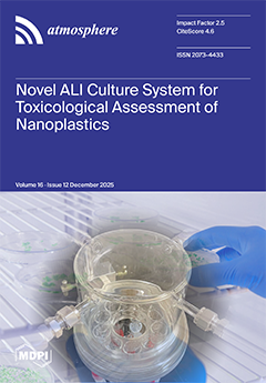
The presence of micro- and nano-plastics in the atmosphere has become evident, necessitating risk assessments for the human respiratory system. Although submerged culture systems of pulmonary epithelial cells are often used to evaluate the safety of fine particles, some plastics float in culture media owing to their low density and are thus not exposed to cells. In this study, we developed a novel air–liquid interface (ALI) system, comprising a donut-shaped culture plate placed inside a cylindrical exposure chamber. Aerosol generated by a nebulizer can be introduced into the chamber with the aerosol mass concentration being controlled. Using this ALI system, we demonstrated that nano-polystyrene particles induce oxidative stress and an inflammatory reaction, resulting in a decrease in alveolar barrier function. View this paper
  • Issues are regarded as officially published after their release is announced to the table of contents alert mailing list.
  • You may sign up for e-mail alerts to receive table of contents of newly released issues.
  • PDF is the official format for papers published in both, html and pdf forms. To view the papers in pdf format, click on the "PDF Full-text" link, and use the free Adobe Reader to open them.
Order results
Result details
Section
Select all
Export citation of selected articles as:
16 pages, 3242 KB  
Article
A Comparative Study of Pilot Reports and In Situ EDR Measurements of Aircraft Turbulence
by Jingyuan Shao, Yi Li, Yan Yu Leung, Zhenyu Yu, Kaijun Wu, Wenhan Gu, Yiqin Bai, Pak-Wai Chan and Zibo Zhuang
Atmosphere 2025, 16(12), 1414; https://doi.org/10.3390/atmos16121414 - 18 Dec 2025
Viewed by 405
Abstract
Accurate characterization of aircraft turbulence is vital for aviation safety and efficiency. This study leverages 2021 data from nationwide Pilot Reports (PIREPs) and China Eastern Airlines’ in situ Eddy Dissipation Rate (EDR) measurements to systematically compare these two primary turbulence monitoring sources. We [...] Read more.
Accurate characterization of aircraft turbulence is vital for aviation safety and efficiency. This study leverages 2021 data from nationwide Pilot Reports (PIREPs) and China Eastern Airlines’ in situ Eddy Dissipation Rate (EDR) measurements to systematically compare these two primary turbulence monitoring sources. We quantify their consistencies and discrepancies in capturing turbulence intensity and spatiotemporal patterns to assess their respective value and limitations. The findings indicate that while the diurnal and monthly variation trends of turbulence distributions are generally consistent between the two datasets, significant differences exist in intensity distribution, vertical profiles, and spatial patterns. By examining 242 turbulence events concurrently recorded by both China Eastern Airlines’ EDR and pilot reports, the study identifies a spatial discrepancy within 40 km and an average reporting delay of approximately two minutes in PIREPs, with the delay becoming more pronounced as turbulence intensity increases. Furthermore, pilot-reported “severe” turbulence corresponds to EDR values notably lower than the ICAO standard, revealing a systematic overestimation bias. Full article
(This article belongs to the Special Issue Aviation Meteorology: Developments and Latest Achievements)
Show Figures

Figure 1

19 pages, 3797 KB  
Article
Explaining Street-Level Thermal Variability Through Semantic Segmentation and Explainable AI: Toward Climate-Responsive Building and Urban Design
by Yuseok Lee, Minjun Kim and Eunkyo Seo
Atmosphere 2025, 16(12), 1413; https://doi.org/10.3390/atmos16121413 - 18 Dec 2025
Viewed by 251
Abstract
Understanding outdoor thermal environments at fine spatial scales is essential for developing climate-responsive urban and building design strategies. This study investigates the determinants of local air temperature deviations in Seoul, Korea, using high-resolution in situ sensor data integrated with multi-source urban and building [...] Read more.
Understanding outdoor thermal environments at fine spatial scales is essential for developing climate-responsive urban and building design strategies. This study investigates the determinants of local air temperature deviations in Seoul, Korea, using high-resolution in situ sensor data integrated with multi-source urban and building information. Hourly temperature records from 436 road-embedded sensors (March 2024–February 2025) were transformed into relative metrics representing deviations from the network-wide mean and were combined with semantic indicators derived from street-view imagery—Green View Index (GVI), Road View Index (RVI), Building View Index (BVI), Sky View Index (SVI), and Street Enclosure Index (SEI)—along with land-cover and building attributes such as impervious surface area (ISA), gross floor area (GFA), building coverage ratio (BCR), and floor area ratio (FAR). Employing an eXtreme Gradient Boosting (XGBoost)–Shapley Additive exPlanations (SHAP) framework, the study quantifies nonlinear and interactive relationships among morphological, environmental, and visual factors. SEI, BVI, and ISA emerged as dominant contributors to localized heating, while RVI, GVI, and SVI enhanced cooling potential. Seasonal contrasts reveal that built enclosure and vegetation visibility jointly shape micro-scale heat dynamics. The findings demonstrate how high-resolution, observation-based data can guide climate-responsive design strategies and support thermally adaptive urban planning. Full article
(This article belongs to the Special Issue Urban Adaptation to Heat and Climate Change)
Show Figures

Figure 1

24 pages, 9228 KB  
Article
Identification and Analysis of Compound Extreme Climate Events in the Huangshui River Basin, 1960–2022
by Zhihui Niu, Qiong Chen, Fenggui Liu, Ziqian Zhang, Weidong Ma, Qiang Zhou and Yanan Shi
Atmosphere 2025, 16(12), 1412; https://doi.org/10.3390/atmos16121412 - 18 Dec 2025
Viewed by 237
Abstract
With the increasing volatility and extremity of global climate change, the frequency, intensity, and associated impacts of compound extreme climate events have escalated substantially. To investigate the temporal trends and characteristics of such events, we identified compound extreme climate events in the Huangshui [...] Read more.
With the increasing volatility and extremity of global climate change, the frequency, intensity, and associated impacts of compound extreme climate events have escalated substantially. To investigate the temporal trends and characteristics of such events, we identified compound extreme climate events in the Huangshui River Basin, located in the northeastern Qinghai–Tibet Plateau, using daily mean temperature and precipitation records from eight meteorological stations. Compound warm–wet, warm–dry, cold–wet, and cold–dry events from 1960 to 2022 were detected based on cumulative distribution functions, and their long-term trends and intensity structures were examined. The results show that: (1) Warm–dry events dominate the basin, with an average annual frequency of 32.84 days per year, occurring frequently across all seasons; cold–dry events rank second (22.38 days per year) and are particularly frequent in winter. (2) Warm–dry events are highly concentrated in the river valley region (e.g., Minhe station), whereas cold–dry and warm–wet events mainly occur in the low-mountain areas (e.g., Huangyuan and Datong). (3) From 1960 to 2022, warm–dry and warm–wet events exhibit a highly significant increasing trend (p < 0.001), cold–dry events show a significant decreasing trend, and cold–wet events display no statistically significant trend. (4) In terms of intensity, all four types of compound events—warm–wet, warm–dry, cold–wet, and cold–dry—are dominated by weak to moderate grades. Overall, the basin is undergoing a compound-risk transition from historically “cold–dry dominated” conditions toward a regime characterized by “warm–dry predominance with emerging warm–wet events.” By identifying compound extreme climate events and analyzing their spatiotemporal variability and intensity characteristics, this study provides scientific support for disaster prevention, daily management, and risk mitigation in climate-sensitive regions. It also offers a useful reference for developing strategies to address compound extreme events induced by climate change and for implementing regional risk-prevention measures. Full article
(This article belongs to the Section Climatology)
Show Figures

Figure 1

22 pages, 2246 KB  
Article
Spatiotemporal Evolution Patterns of the Regional Meteorological Environment, Air Pollution and Its Synergistic Health Effects in the Yangtze River Delta Region, China
by Congjian Chen, Jie Cao, Fei Wang and Yang Cao
Atmosphere 2025, 16(12), 1411; https://doi.org/10.3390/atmos16121411 - 18 Dec 2025
Viewed by 395
Abstract
Over the past decade, China’s industrialization and urbanization have accelerated rapidly, leading to the extensive consumption of fossil fuels and the accumulation of atmospheric pollutants, which pose significant health risks to the population. This study analyses the spatiotemporal evolution patterns of major air [...] Read more.
Over the past decade, China’s industrialization and urbanization have accelerated rapidly, leading to the extensive consumption of fossil fuels and the accumulation of atmospheric pollutants, which pose significant health risks to the population. This study analyses the spatiotemporal evolution patterns of major air pollutants over the past decade based on data from meteorological- and environmental-factor monitoring from various observation stations in the Yangtze River Delta region of China from 2018 to 2024, as well as air pollution monitoring and statistical data such as mortality rates of weather-sensitive diseases and socioeconomic attributes of patients. Based on mathematical models, a quantitative ‘dose–response’ relationship is established among meteorological factors, air pollution factors and mortality rates of sensitive diseases within the region. (1) PM2.5 and ozone are the primary air pollutants in the Yangtze River Delta region, with significant self-correlation characteristics in pollutants observed in coastal areas and regions around provincial capitals. (2) The synergistic effects of temperature + NO2 and relative humidity + SO2 significantly impact mortality from sensitive diseases, while the cumulative lag effect of relative humidity on respiratory diseases exhibits a V-shaped temporal variation. (3) Pollutant cumulative lag effects are pronounced, with a 10 μg/m3 increase in PM2.5 leading to a 0.93% and 0.71% rise in the mortality risks of non-accidental and circulatory system diseases over the lag period of 15 days, compared to a single-day lag, showing an additional 0.06% and 0.04% increase, respectively. Full article
(This article belongs to the Section Air Quality)
Show Figures

Figure 1

17 pages, 3987 KB  
Article
Modeling and Simulation of Urban Heat Islands in Thimphu Thromde Using Artificial Neural Networks
by Sangey Pasang, Chimi Wangmo, Rigzin Norbu, Thinley Zangmo Sherpa, Tenzin Phuntsho and Rigtshel Lhendup
Atmosphere 2025, 16(12), 1410; https://doi.org/10.3390/atmos16121410 - 18 Dec 2025
Viewed by 288
Abstract
Urban Heat Islands (UHIs) are urbanized areas that experience significantly higher temperatures than their surroundings, contributing to thermal discomfort, increased air pollution, heightened public health risks, and greater energy demand. In Bhutan, where urban expansion is concentrated within narrow valley systems, the formation [...] Read more.
Urban Heat Islands (UHIs) are urbanized areas that experience significantly higher temperatures than their surroundings, contributing to thermal discomfort, increased air pollution, heightened public health risks, and greater energy demand. In Bhutan, where urban expansion is concentrated within narrow valley systems, the formation and intensification of UHIs present emerging challenges for climate-resilient urban development. Thimphu, in particular, is experiencing rapid urban growth and densification, making it highly susceptible to UHI effects. Therefore, the aim of this study was to evaluate and simulate UHI conditions for Thimphu Thromde. We carried out the simulation using a GIS, multi-temporal Landsat imagery, and an Artificial Neural Network model. Land use and land cover classes were mapped through supervised classification in the GIS, and surface temperatures associated with each class were derived from thermal bands of Landsat data. These temperature values were normalized to identify existing UHI patterns. An Artificial Neural Network (ANN) model was then applied to simulate future UHI distribution under expected land use change scenarios. The results indicate that, by 2031, built-up areas in Thimphu Thromde are expected to increase to 72.82%, while vegetation cover is projected to decline to 23.52%. Correspondingly, both UHI and extreme UHI zones are projected to expand, accounting for approximately 14.26% and 6.08% of the total area, respectively. Existing hotspots, particularly dense residential areas, commercial centers, and major institutional or public spaces, are expected to intensify. In addition, new UHI zones are likely to develop along the urban fringe, where expansion is occurring around the current hotspots. These study findings will be useful for Thimphu Thromde authorities in deciding the mitigation measures and pre-emptive strategies required to reduce UHI effects. Full article
(This article belongs to the Special Issue Urban Heat Islands, Global Warming and Effects)
Show Figures

Graphical abstract

20 pages, 2711 KB  
Article
Validation Testing of Continuous Laser Methane Monitoring at Operational Oil and Gas Production Facilities
by Caroline B. Alden, Doug Chipponeri, David Youngquist, Brad Krough, Amanda Makowiecki, David Wilson and Gregory B. Rieker
Atmosphere 2025, 16(12), 1409; https://doi.org/10.3390/atmos16121409 - 18 Dec 2025
Viewed by 329
Abstract
Methane emissions at oil and gas facilities can be measured in real time with continuous monitoring systems that alert operators of upset conditions, including fugitive emissions. We report on extensive operator field testing of a continuous laser monitoring system in ~year-long deployments at [...] Read more.
Methane emissions at oil and gas facilities can be measured in real time with continuous monitoring systems that alert operators of upset conditions, including fugitive emissions. We report on extensive operator field testing of a continuous laser monitoring system in ~year-long deployments at 46 oil and gas sites in two U.S. basins. The operator assessed periods of non-alerts with daily optical gas imaging sweeps to confirm emission status. Detection precision was 98% and false positive and negative rates were 3%. Quantification of challenge-controlled release tests at active oil and gas sites yielded a measured versus true emissions curve with slope = 1.2, R2 = 0.90. Repeatability test measurements of four production facilities with two different laser systems showed 33.9% average quantification agreement. Separate third-party blind controlled release testing at two state-of-the-art test facilities yielded 100% true positive rate (0 false negatives). Combining the third-party blind tests with field tests, emission rate quantification uncertainty was +/−41% across five orders of magnitude. These varied evaluation approaches validate the measurement system and operator integration of data for measurement and monitoring of upstream oil and gas emissions and demonstrate a test regime for vetting of monitoring and measurement technologies in active oil and gas operations. Full article
Show Figures

Figure 1

15 pages, 5332 KB  
Article
Assessing Catastrophic Historical Floods in a Small Stream: The Case of Tripero River (Villafranca de los Barros, Spain)
by José Manuel Vaquero, Javier Vaquero-Martínez, Víctor Manuel Sánchez Carrasco, Alejandro Jesús Pérez Aparicio and María Cruz Gallego
Atmosphere 2025, 16(12), 1408; https://doi.org/10.3390/atmos16121408 - 17 Dec 2025
Viewed by 270
Abstract
This study investigates five catastrophic historical floods of the Tripero stream, a small tributary of the Guadiana River that flows through Villafranca de los Barros (Extremadura, Spain), occurring between 1865 and 1952. Despite their devastating impacts on the local population and infrastructure, these [...] Read more.
This study investigates five catastrophic historical floods of the Tripero stream, a small tributary of the Guadiana River that flows through Villafranca de los Barros (Extremadura, Spain), occurring between 1865 and 1952. Despite their devastating impacts on the local population and infrastructure, these events have received little scientific attention. By combining historical documentary evidence with meteorological reanalysis data from the Twentieth Century Reanalysis (20CRv3), this research reconstructs the circumstances and atmospheric mechanisms associated with each event. The results reveal a notable diversity of synoptic configurations, reflecting both seasonal variability and the distinct meteorological origins of the floods. The 1865 and 1876 events were associated with large-scale Atlantic disturbances—the former linked to a cut-off low and moisture transport resembling an atmospheric river, and the latter to a strongly negative North Atlantic Oscillation (NAO) phase and other atmospheric river, producing widespread flooding across southwestern Iberia. In contrast, the floods of 1903, 1949, and 1952 were triggered by intense convective activity, typical of late spring and summer thunderstorms, fueled by local moisture and instability. The combination of historical sources and modern reanalysis provides valuable insights into the climatological context of extreme hydrometeorological events in small Mediterranean basins, contributing to improved understanding of local flood risks in historically understudied regions. Full article
Show Figures

Figure 1

38 pages, 11071 KB  
Article
Accuracy Assessment of Remote Sensing-Derived Evapotranspiration Products Against Eddy Covariance Measurements in Tensift Al-Haouz Semi-Arid Region, Morocco
by Yassine Manyari, Mohamed Hakim Kharrou, Vincent Simonneaux, Saïd Khabba, Lionel Jarlan, Jamal Ezzahar and Salah Er-Raki
Atmosphere 2025, 16(12), 1407; https://doi.org/10.3390/atmos16121407 - 17 Dec 2025
Viewed by 271
Abstract
Evapotranspiration (ET) is challenging to measure directly, motivating the use of remote sensing products as alternatives. We evaluated five high-resolution (≤1 km) global ET products (SSEBop, MOD16, ETMonitor, PMLv2, and FAO’s WaPOR) against five eddy covariance (EC) measurements in Morocco’s semi-arid Tensift Al-Haouz [...] Read more.
Evapotranspiration (ET) is challenging to measure directly, motivating the use of remote sensing products as alternatives. We evaluated five high-resolution (≤1 km) global ET products (SSEBop, MOD16, ETMonitor, PMLv2, and FAO’s WaPOR) against five eddy covariance (EC) measurements in Morocco’s semi-arid Tensift Al-Haouz region, with observations spanning from 2006 to 2019. These five products were selected because they offer the finest spatial resolution (around 1 km or less) among freely downloadable global ET datasets, making them well-suited for comparison with local EC flux tower data. The study area was chosen for its reliable ground-truth EC stations, extensive knowledge of local irrigation practices, and a semi-arid climate that provides a rigorous testbed for ET model evaluation in water-limited conditions. Precipitation observations were included to assess each product’s sensitivity to soil moisture and precipitation-driven ET variations, particularly to identify which models respond to rainfall and irrigation inputs (i.e., differences between rainfed and irrigated fields). Results indicate that PMLv2 achieved the best agreement with EC (R2 up to 0.65, RMSE as low as 0.4 mm/day, and PBIAS under 10% at most sites), followed by WaPOR and SSEBop which captured seasonal ET patterns (R2 ~0.3–0.5) with moderate bias (~20–30%). In contrast, ETMonitor and MOD16 underperformed, showing larger errors (RMSE ~1–2.5 mm/day) and substantial underestimation biases (e.g., MOD16 PBIAS ~50–80% in irrigated sites). These findings underscore the impact of algorithmic differences and highlight PMLv2, SSEBop, and WaPOR as more reliable options for estimating ET in semi-arid agricultural regions lacking in situ measurements. Full article
Show Figures

Figure 1

5 pages, 171 KB  
Editorial
From Exposure to Equity: Understanding Air Quality Impacts on Environment and Human Health
by Marco Dettori
Atmosphere 2025, 16(12), 1406; https://doi.org/10.3390/atmos16121406 - 16 Dec 2025
Viewed by 327
Abstract
In recent years, the discussion around air quality has shifted from a technical concern to a central theme in environmental and public health policy [...] Full article
(This article belongs to the Topic Impacts of Air Quality on Environment and Human Health)
20 pages, 3687 KB  
Article
Evaluation of Cloud Fraction Data for Modelling Daily Surface Solar Radiation: Application to the Lake Baikal Region
by Dmitry Golubets, Nadezhda Voropay, Egor Dyukarev and Ilya Aslamov
Atmosphere 2025, 16(12), 1405; https://doi.org/10.3390/atmos16121405 - 16 Dec 2025
Viewed by 343
Abstract
Accurately modelling surface solar radiation (SSR) is essential for environmental research but remains a significant challenge in topographically complex regions like Lake Baikal, where ground measurements are sparse. This study evaluates the performance of various open-access cloud cover products—from satellite sensors (AVHRR, MODIS) [...] Read more.
Accurately modelling surface solar radiation (SSR) is essential for environmental research but remains a significant challenge in topographically complex regions like Lake Baikal, where ground measurements are sparse. This study evaluates the performance of various open-access cloud cover products—from satellite sensors (AVHRR, MODIS) and ground-based observations—for modelling daily SSR totals, using a physical radiation model validated against in-situ measurements from 10 coastal stations. The results demonstrate that the choice of cloud data critically impacts model accuracy. The AVHRR satellite product yields the most reliable estimates (R2 = 0.54, RMSE = 4.538 MJ/m2), significantly outperforming both ground-based cloudiness observations and the ERA5 reanalysis dataset. This finding underscores that spatially continuous satellite data provide a superior representation of cloud attenuation for regional modelling than point-based ground observations or reanalysis. Consequently, a physical model driven by high-quality satellite cloud masks is recommended as an effective methodology for generating reliable SSR fields. Full article
Show Figures

Figure 1

17 pages, 3312 KB  
Article
Characterization of VOCs at Shaoxing in the Winter Campaign: Sources and Chemical Reactivity
by Dongfeng Shi, Yan Lyu, Junpeng Song, Qing Ren, Xing Chen, Liyong Hu, Wenting Zhuge, Kewen Hu, Dongmei Cai, Xianda Gong and Jianmin Chen
Atmosphere 2025, 16(12), 1404; https://doi.org/10.3390/atmos16121404 - 14 Dec 2025
Viewed by 348
Abstract
Despite recent improvements in particulate matter (PM) pollution, haze events still frequently occur in many regions of China. Volatile organic compounds (VOCs), as key precursors in atmospheric photochemistry, play a crucial role in haze formation. To elucidate their contributions, high-resolution hourly VOC measurements [...] Read more.
Despite recent improvements in particulate matter (PM) pollution, haze events still frequently occur in many regions of China. Volatile organic compounds (VOCs), as key precursors in atmospheric photochemistry, play a crucial role in haze formation. To elucidate their contributions, high-resolution hourly VOC measurements were conducted in Shaoxing, an industrial city in eastern China, during a winter field campaign from 1 December 2023 to 15 January 2024. The VOC groups were dominated by alkanes (31.5–53.8%), followed by alkenes (7.1–15.1%) and aromatics (6.7–14.1%). Positive Matrix Factorization (PMF) analysis resolved six major VOC sources: vehicle emissions (VE, 33.8%), combustion sources (CS, 20.0%), industrial emissions (IE, 13.4%), gasoline evaporation (GE, 14.6%), solvent usage (SU, 6.9%), and biogenic activities (BA, 12.6%). Based on the PMF results, we further evaluated the source-specific contributions of VOCs to OH radical loss rate (LOH), ozone formation potential (OFP), and secondary organic aerosol potential (SOAP). During the haze episode, GE was the dominant driver of LOH (33%), while IE (23%), GE (22%), and VE (20%) were major SOAP contributors. In contrast, during the other periods, CS contributed most to both OFP (24%) and SOAP (28%), followed by VE (22–23%). Overall, our study highlights the critical role of anthropogenic activities in driving secondary pollution and suggests that sector-specific mitigation strategies hold significant potential for local haze abatement. Full article
(This article belongs to the Section Air Quality)
Show Figures

Figure 1

26 pages, 17747 KB  
Article
GAN Predictability for Urban Environmental Performance: Learnability Mechanisms, Structural Consistency, and Efficiency Bounds
by Chenglin Wang, Shiliang Wang, Sixuan Ren, Wenjing Luo, Wenxin Yi and Mei Qing
Atmosphere 2025, 16(12), 1403; https://doi.org/10.3390/atmos16121403 - 13 Dec 2025
Viewed by 247
Abstract
Generative adversarial networks (GANs) can rapidly predict urban environmental performance. However, most existing studies focus on a single target and lack cross-performance comparisons under unified conditions. Under unified urban-form inputs and training settings, this study employs the conditional adversarial model pix2pix to predict [...] Read more.
Generative adversarial networks (GANs) can rapidly predict urban environmental performance. However, most existing studies focus on a single target and lack cross-performance comparisons under unified conditions. Under unified urban-form inputs and training settings, this study employs the conditional adversarial model pix2pix to predict four targets—the Universal Thermal Climate Index (UTCI), annual global solar radiation (Rad), sunshine duration (SolarH), and near-surface wind speed (Wind)—and establishes a closed-loop evaluation framework spanning pixel, structural/region-level, cross-task synergy, complexity, and efficiency. The results show that (1) the overall ranking in accuracy and structural consistency is SolarH ≈ Rad > UTCI > Wind; (2) per-epoch times are similar, whereas convergence epochs differ markedly, indicating that total time is primarily governed by convergence difficulty; (3) structurally, Rad/SolarH perform better on hot-region overlap and edge alignment, whereas Wind exhibits larger errors at corners and canyons; (4) in terms of learnability, texture variation explains errors far better than edge count; and (5) cross-task synergy is higher in low-value regions than in high-value regions, with Wind clearly decoupled from the other targets. The distinctive contribution lies in a unified, reproducible evaluation framework, together with learnability mechanisms and applicability bounds, providing fast and reliable evidence for performance-oriented planning and design. Full article
(This article belongs to the Section Atmospheric Techniques, Instruments, and Modeling)
Show Figures

Figure 1

25 pages, 2629 KB  
Article
Assessment of Landfill Gas Dispersion and Health Risks Using AERMOD and TROPOMI Satellite Data: A Case Study of the Thohoyandou Landfill, South Africa
by Prince Obinna Njoku, Joshua N. Edokpayi and Rachel Makungo
Atmosphere 2025, 16(12), 1402; https://doi.org/10.3390/atmos16121402 - 13 Dec 2025
Viewed by 185
Abstract
Landfills are vital waste management techniques in South Africa but are significant sources of greenhouse gases (GHGs) and air pollutants that can threaten nearby communities. This study provides a novel integrated assessment approach by combining high-resolution TROPOMI satellite observations with AERMOD dispersion modelling. [...] Read more.
Landfills are vital waste management techniques in South Africa but are significant sources of greenhouse gases (GHGs) and air pollutants that can threaten nearby communities. This study provides a novel integrated assessment approach by combining high-resolution TROPOMI satellite observations with AERMOD dispersion modelling. This study investigates the dispersion characteristics and potential health impacts of landfill gas (LFG) emissions from the Thohoyandou landfill. Unlike previous studies that rely solely on modelling or field measurements, this work offers the first satellite-validated landfill gas dispersion analysis in South Africa. The modelling results indicated that the highest hourly concentrations reached 456,056 µg/m3 for CH4 and 735,108 µg/m3 for CO2, while annual maximum concentrations were 15,699 µg/m3 and 30,590 µg/m3, respectively. Health risk assessments were performed for 26 volatile organic compounds and hazardous air pollutants (VOCs/HAPs) using the USEPA methodology. Most individual hazard quotient (HQ) values were below 1, except for 1,1,2-trichloroethane (HQ = 1.27). The cumulative HQ of 1.86 suggested a potential non-carcinogenic risk for nearby residents. Carcinogenic risk analysis identified 13 compounds, with hydrogen sulphide posing the highest probability of cancer risk. The findings reveal that LFG emissions may adversely affect air quality and present both non-carcinogenic and carcinogenic health risks to populations living or working near the landfill. Full article
(This article belongs to the Special Issue Air Pollution Exposure and Health Impact Assessment (3rd Edition))
Show Figures

Figure 1

33 pages, 7724 KB  
Article
Energy Partitioning and Air Temperature Anomalies Above Urban Surfaces: A High-Resolution PALM-4U Study
by Daniela Cava, Luca Mortarini, Tony Christian Landi, Oxana Drofa, Giorgio Veratti, Edoardo Fiorillo, Umberto Giostra and Daiane de Vargas Brondani
Atmosphere 2025, 16(12), 1401; https://doi.org/10.3390/atmos16121401 - 12 Dec 2025
Viewed by 256
Abstract
Urban heat islands intensify heat stress and degrade air quality in densely built areas, yet the physical processes governing near-surface thermal variability remain poorly quantified. This study applies the coupled MOLOCH and PALM model system 6.0 (PALM-4U) over Bologna (Italy) during a summer [...] Read more.
Urban heat islands intensify heat stress and degrade air quality in densely built areas, yet the physical processes governing near-surface thermal variability remain poorly quantified. This study applies the coupled MOLOCH and PALM model system 6.0 (PALM-4U) over Bologna (Italy) during a summer 2023 heatwave to resolve meter-scale atmospheric dynamics within the Urban Canopy Layer and Roughness Sublayer at 2 m horizontal resolution. The coupled configuration was validated against in situ meteorological observations and Landsat-8 LST data, showing improved agreement in air temperature and wind speed compared to standalone mesoscale simulations. Results reveal pronounced diurnal and vertical variability of wind speed, turbulent kinetic energy, and friction velocity, with maxima between two/three times the median building height (hc). Distinct surface-dependent contrasts emerge: asphalt and roofs act as strong daytime heat sources (Bowen ratio βasphalt ≈ 4.8) and nocturnal heat reservoirs at pedestrian level (z ≈ 0.07 hc), while vegetation sustains daytime latent heat fluxes (βvegetation ≈ 0.6÷0.8) and cooler surface and near-surface air (Temperature anomaly of surface ΔTs ≈ −9 °C and air ΔTair ≈ −0.3 °C). Thermal anomalies decay with height, vanishing above z ≈ 2.5 hc due to turbulent mixing. These findings provide insight into fine-scale energy exchanges driving intra-urban thermal heterogeneity and support climate-resilient urban design. Full article
(This article belongs to the Section Biosphere/Hydrosphere/Land–Atmosphere Interactions)
Show Figures

Figure 1

16 pages, 3889 KB  
Article
Assessment of 15 CMIP6 Models in Simulating the East Asian Winter Monsoon and Its Relationship with ENSO
by Yiqiong Tang and Mengyu Li
Atmosphere 2025, 16(12), 1400; https://doi.org/10.3390/atmos16121400 - 12 Dec 2025
Viewed by 365
Abstract
The East Asian winter monsoon (EAWM) is a critical component of the boreal winter global climate system, exerting profound influences on weather and climate anomalies across East Asia. This study systematically evaluates the capability of 15 Coupled Model Intercomparison Project Phase 6 (CMIP6) [...] Read more.
The East Asian winter monsoon (EAWM) is a critical component of the boreal winter global climate system, exerting profound influences on weather and climate anomalies across East Asia. This study systematically evaluates the capability of 15 Coupled Model Intercomparison Project Phase 6 (CMIP6) models in simulating the typical associated circulation, temporal characteristics, and the relationship with the El Niño–Southern Oscillation (ENSO) during the historical period of 1951–2013. Results indicate that the multi-model ensemble demonstrates considerable fidelity in reproducing the climatological spatial patterns of key EAWM systems, including the Siberian High, Aleutian Low, and low-level meridional winds. However, a systematic eastward shift is identified in the simulated sea level pressure anomaly centers over the North Pacific. In terms of temporal variability, most models realistically capture the dominant interdecadal periodicity of 15–20 years found in observations after 11-year low-passed filter. Four models reproduce a similar bimodal periodicity. Regarding the ENSO–EAWM relationship, approximately 80% of the evaluated models successfully capture the observed negative correlation, although its strength is consistently underestimated across the model ensemble. More notably, only three CMIP6 models faithfully capture the observed intrinsic asymmetry in the ENSO–EAWM relationship (i.e., the stronger impact of El Niño compared to La Niña). Full article
Show Figures

Figure 1

19 pages, 19402 KB  
Article
The Response of Maximum Freezing Depth in the Permafrost Region of the Source Region of the Yellow River to Ground Temperature Change
by Xinyu Bai and Wei Wang
Atmosphere 2025, 16(12), 1399; https://doi.org/10.3390/atmos16121399 - 12 Dec 2025
Viewed by 294
Abstract
The source region of the Yellow River on the Tibetan Plateau constitutes a critical ecological security barrier and a key water-conservation region, where permafrost dynamics exercise primary control over ecosystem stability and hydrological processes. Although observations document intensifying freeze–thaw processes under climate warming, [...] Read more.
The source region of the Yellow River on the Tibetan Plateau constitutes a critical ecological security barrier and a key water-conservation region, where permafrost dynamics exercise primary control over ecosystem stability and hydrological processes. Although observations document intensifying freeze–thaw processes under climate warming, the historical and future evolution of maximum freezing depth, abbreviated as MFD, in the source region of the Yellow River remains poorly constrained. Using ground-temperature and meteorological records from 15 stations for 1981–2014, we estimated MFD with a Stefan-type formulation, assessed trend significance using the Mann–Kendall test and Sen’s slope, and characterized changes through 2100 using CMIP6 projections under four shared socioeconomic pathways: SSP1-2.6, SSP2-4.5, SSP3-7.0, and SSP5-8.5. We found a strong inverse association between MFD and annual mean ground temperature, such that a 1 °C increase corresponds to an average decrease of approximately 13.2 cm. Historically, MFD has progressively shallowed and exhibits a clear meridional gradient—deeper in the north and shallower in the south; low-value zones declined from 0.75 to 0.50 m, whereas high-value zones decreased from 2.92 to 2.83 m. Across future scenarios, MFD continues to shallow; the strongest signal occurs under SSP5-8.5, yielding an additional decline of approximately 42 percent relative to the historical baseline, with degradation most pronounced at lower elevations. These findings provide actionable guidance for understanding ecohydrological processes and for water resource management in the source region of the Yellow River under climate warming. Full article
Show Figures

Figure 1

17 pages, 1542 KB  
Article
Evidence of the Influence of Land Use and Land Cover on Extreme Rainfall in Natal, Northeast of Brazil
by Thiago de Paula Nunes Mesquita, Cláudio Moisés Santos e Silva, Itauan Dayvison Gomes de Medeiros, Keila Rego Mendes, Thales Nunes Martins de Sá, Glenda Yasmin Pereira de Carvalho, Cláudia Luana Brandão, Valéria Lopes, João Ikaro Alves de Moura Sá, Pablo Eli Soares de Oliveira, Carlos da Hora, Fernando Antônio Carneiro de Medeiros, Daniele Tôrres Rodrigues, Gabriel Víctor Silva do Nascimento, Maxsuel Bezerra do Nascimento and Gabriel Brito Costa
Atmosphere 2025, 16(12), 1398; https://doi.org/10.3390/atmos16121398 - 12 Dec 2025
Viewed by 435
Abstract
This study investigates the influence of land use and land cover (LULC) on the distribution of extreme rainfall in the tropical coastal city of Natal, Brazil. Hourly precipitation data from eight automatic rain gauges (2014–2023) were quality-controlled, with only days containing 24 h [...] Read more.
This study investigates the influence of land use and land cover (LULC) on the distribution of extreme rainfall in the tropical coastal city of Natal, Brazil. Hourly precipitation data from eight automatic rain gauges (2014–2023) were quality-controlled, with only days containing 24 h continuous records retained. Rainfall events were classified into light (<5 mm), normal (5–10 mm), intense (40–50 mm), and extreme (>50 mm) categories, and for each category daily accumulation, duration, intensity, and maximum hourly peaks were calculated. Seasonal and spatial differences across administrative zones were assessed using multivariate analysis of variance (MANOVA). The LULC changes were evaluated from the MapBiomas Collection 9 dataset. Results show that between 1985 and 2020, the proportion of urbanized (non-vegetated) surfaces increased from 27.7% (42.3 km2) to 64.3% (99.7 km2), mainly in the North and West zones, replacing agricultural and vegetated areas. The East and North zones, the most urbanized areas, recorded higher daily averages of extreme rainfall in the dry season (85–88 mm) than in the wet season (78–82 mm), with maximum peaks up to 26 mm/h and durations exceeding 17 h. These findings demonstrate that rapid urban expansion intensifies rainfall extremes, underscoring the importance of incorporating LULC monitoring (e.g., MapBiomas) and spatial planning into climate adaptation strategies for medium-sized cities. Full article
(This article belongs to the Section Biosphere/Hydrosphere/Land–Atmosphere Interactions)
Show Figures

Figure 1

16 pages, 906 KB  
Article
Cardiovascular Impacts of Air Pollution in a Coal-Burning Region: A Decade of Hospital Data from Western Macedonia, Greece
by Vasileios Vasilakopoulos, Ioannis Kanonidis, George Fragulis, Christina-Ioanna Papadopoulou and Stergios Ganatsios
Atmosphere 2025, 16(12), 1397; https://doi.org/10.3390/atmos16121397 - 11 Dec 2025
Viewed by 822
Abstract
Air pollution constitutes a major environmental determinant of cardiovascular morbidity and mortality worldwide. Western Macedonia, Greece, has historically hosted the largest lignite mining and combustion complex in Southeastern Europe, creating a unique exposure environment. This study investigates the relationship between air pollutant concentrations [...] Read more.
Air pollution constitutes a major environmental determinant of cardiovascular morbidity and mortality worldwide. Western Macedonia, Greece, has historically hosted the largest lignite mining and combustion complex in Southeastern Europe, creating a unique exposure environment. This study investigates the relationship between air pollutant concentrations and cardiovascular hospital admissions over a ten-year period in this lignite-dependent region. Daily concentrations of particulate matter (PM10), sulfur dioxide (SO2), nitric oxide (NO), nitrogen dioxide (NO2), and total nitrogen oxides (NOx) were collected from regional monitoring stations for the winters of 2011–2021, while corresponding daily cardiovascular hospital admissions were obtained from the regional hospitals of Kozani, Ptolemaida, Florina, and Grevena. Spearman’s rank correlations and Friedman’s non-parametric tests were applied to assess temporal and spatial associations between pollutant levels and hospital admissions. A marked decline in air pollutant concentrations, particularly PM10 and SO2, was observed across the decade, coinciding with a significant reduction in cardiovascular hospitalizations. Specifically, PM10 levels fell from ~75 μg/m3 to ~30 μg/m3 in Florina and from ~53 μg/m3 to ~11 μg/m3 in Ptolemaida, while SO2 concentrations decreased by more than 90% across all sites. Cardiovascular admissions declined by 20–40% depending on the region over the same period. Significant but modest positive correlations were detected between PM10 and admissions in Florina (ρ = 0.138, p = 0.017), SO2 in Ptolemaida (ρ = 0.122, p = 0.034), and NO2 in Kozani (ρ = 0.115, p = 0.045). Regions located near lignite combustion sites consistently exhibited higher pollutant levels and hospitalization rates. The study provides quantitative evidence linking air pollution from lignite combustion to adverse cardiovascular outcomes. The parallel decline in both pollution levels and hospital admissions underscores the cardiovascular benefits of emission reduction and the ongoing energy transition in Western Macedonia. Continuous air quality monitoring and preventive public health measures remain essential for safeguarding cardiovascular health in former coal-based regions. Full article
(This article belongs to the Section Air Quality and Health)
Show Figures

Figure 1

20 pages, 5046 KB  
Article
Spatiotemporal Distribution Characteristics and Concentration Prediction of Pollutants in Open-Pit Coal Mines
by Tengfeng Wan, Huicheng Lei, Qingfei Wang, Nan Zhou, Bingbing Ma, Jingliang Tan, Li Cao and Xuan Xu
Atmosphere 2025, 16(12), 1396; https://doi.org/10.3390/atmos16121396 - 11 Dec 2025
Viewed by 253
Abstract
Open-pit coal mining is characterized by multiple pollution sources, diverse types, and extensive affected areas, leading to complex air pollution with wide diffusion. Traditional fixed monitoring methods cannot address these limitations. Taking a coal mine in Xinjiang as a case study, this study [...] Read more.
Open-pit coal mining is characterized by multiple pollution sources, diverse types, and extensive affected areas, leading to complex air pollution with wide diffusion. Traditional fixed monitoring methods cannot address these limitations. Taking a coal mine in Xinjiang as a case study, this study developed a drone-mounted mobile atmospheric monitoring system, focusing on nitrogen dioxide (NO2) and suspended particulate matter (PM2.5 and PM10) to explore their distribution, diffusion patterns, and influencing factors. The results show distinct seasonal pollutant characteristics: NO2 and ozone (O3) dominate in summer, while particulate matter prevails in winter. The temporal distribution exhibits a bimodal pattern, with high levels in the early morning and evening hours. Spatially, higher pollutant concentrations accumulate vertically below ground level, while lower levels are observed above it. Horizontally, elevated concentrations are found along northern transport corridors; however, these levels become more uniform at greater heights. A spatiotemporal prediction model integrating convolutional neural network (CNN) and long short-term memory (LSTM) network was successfully applied to real-time pollutant prediction in open-pit coal mining areas. This study provides a reliable mobile monitoring solution for open-pit coal mine air pollution and offers valuable insights for targeted pollution control in similar mining areas. Full article
(This article belongs to the Section Air Quality)
Show Figures

Figure 1

20 pages, 5810 KB  
Article
A Time-Dependent Intrinsic Correlation Analysis to Identify Teleconnection Between Climatic Oscillations and Extreme Climatic Indices Across the Southern Indian Peninsula
by Ali Danandeh Mehr, Athira Ajith, Adarsh Sankaran, Mohsen Maghrebi, Rifat Tur, Adithya Sandhya Saji, Ansalna Nizar and Misna Najeeb Pottayil
Atmosphere 2025, 16(12), 1395; https://doi.org/10.3390/atmos16121395 - 11 Dec 2025
Viewed by 266
Abstract
Large-scale climatic oscillations (COs) modulate extreme climate events (ECEs) globally and can trigger the Indian summer monsoons and associated ECEs. In this study, we introduced a Time-dependent Intrinsic Correlation (TDIC) analysis to quantify teleconnections between five major COs—the El Niño–Southern Oscillation (ENSO), Atlantic [...] Read more.
Large-scale climatic oscillations (COs) modulate extreme climate events (ECEs) globally and can trigger the Indian summer monsoons and associated ECEs. In this study, we introduced a Time-dependent Intrinsic Correlation (TDIC) analysis to quantify teleconnections between five major COs—the El Niño–Southern Oscillation (ENSO), Atlantic Multidecadal Oscillation (AMO), Indian Ocean Dipole (IOD), North Atlantic Oscillation (NAO), and Pacific Decadal Oscillation (PDO)—and multiple extreme climate indices (ECIs) over the southern Indian Peninsula. Complete ensemble empirical mode decomposition with adaptive noise (CEEMDAN) was employed to decompose COs and ECIs into intrinsic mode functions across varying timescales, enabling a dynamic TDIC assessment. The results revealed statistically significant correlations between COs and ECIs, with the strongest influences in low-frequency modes (>10 years). Distinct COs predominantly modulate specific ECIs (e.g., ENSO with monsoon rainfall extremes; AMO and PDO with temperature extremes). These findings advance the understanding of Indian climate system dynamics and support the development of improved ECE forecasting models. Full article
(This article belongs to the Special Issue Atmosphere-Ocean Interactions: Observations, Theory, and Modeling)
Show Figures

Figure 1

11 pages, 2584 KB  
Article
Climate Reconstruction of the Beijing Area over 650 Years Ago Based on Textual Research
by Haiming Liu and Haiyan Bi
Atmosphere 2025, 16(12), 1394; https://doi.org/10.3390/atmos16121394 - 10 Dec 2025
Viewed by 397
Abstract
Research on historical climate plays a crucial referential role in understanding the climate and its variation patterns in specific regions and periods, as well as in predicting future climate change. This study focuses on woody plants recorded in Xijin Zhi Jiyi (Collected Fragments [...] Read more.
Research on historical climate plays a crucial referential role in understanding the climate and its variation patterns in specific regions and periods, as well as in predicting future climate change. This study focuses on woody plants recorded in Xijin Zhi Jiyi (Collected Fragments of the Xijin Zhi), a historical document depicting Beijing’s general condition over 650 years ago. Using textual research methods, 11 out of 19 recorded woody plant names were identified to species level, 3 to genus level, 1 to family level, 1 was identified as a non-native species, and 3 remained uncertain. Based on this identification, climate-related studies were carried out on the 11 species-confirmed woody plants using data from the Atlas of Woody Plants in China: Distribution and Climate and the Coexistence Approach. Six key climate parameters were determined. Statistical analysis indicates that over 650 years ago, mean annual temperature in Beijing was 0.04 °C higher than today. However, during the hottest month, temperatures were 6.82% cooler than modern values, while in the coldest month, they were 138.14% warmer. Precipitation in Beijing was 88.49% higher overall than present levels. In the warmest season, rainfall was 313.55% greater, and in the coldest season, it was 1313.67% higher. These results suggest that Beijing’s climate over 650 years ago was slightly warmer overall with less variability in temperature compared to the modern era. Precipitation was significantly higher than today. In general, the Beijing region had a warm and humid climate during that period. Full article
(This article belongs to the Section Climatology)
Show Figures

Figure 1

22 pages, 15657 KB  
Article
Spatiotemporal Dynamics and Climate–Human Drivers of Vegetation NPP in Northern Xinjiang, China, from 2001 to 2022
by Mengdie Wen, Dong Cui, Zhicheng Jiang, Wenxin Liu, Haijun Yang, Zezheng Liu and Ying Wang
Atmosphere 2025, 16(12), 1393; https://doi.org/10.3390/atmos16121393 - 10 Dec 2025
Viewed by 222
Abstract
Net Primary Productivity (NPP) stands as a crucial metric for evaluating the condition and performance of terrestrial ecosystems. This study focuses on northern Xinjiang, China, as the research site. By employing the Carnegie Ames Stanford Approach (CASA) model alongside meteorological data, we examined [...] Read more.
Net Primary Productivity (NPP) stands as a crucial metric for evaluating the condition and performance of terrestrial ecosystems. This study focuses on northern Xinjiang, China, as the research site. By employing the Carnegie Ames Stanford Approach (CASA) model alongside meteorological data, we examined the spatiotemporal variations in vegetation NPP from 2001 to 2022. The model utilized monthly NDVI, climate drivers, and vegetation type raster data as inputs, while the Mann–Kendall test, We utilized Theil–Sen trend analysis and residual analysis to investigate how climatic factors and human activities drove NPP changes. Results show that from 2001 to 2022, vegetation NPP in northern Xinjiang generally rose with fluctuations, averaging 127.96 gC·m−2·a−1 annually and growing linearly at 0.58 gC·m−2·a−1. Spatially, NPP displayed a pattern of “high in the west and low in the east, high in mountainous areas and low in deserts.” High NPP areas are mainly clustered in the Ili River Valley and adjacent mountainous regions, encompassing eastern and southwestern Ili Prefecture, northern Tianshan slopes, Balq Mountains, and southern Borokunu foothills, where hydrothermal conditions are relatively advantageous. In the last 22 years, the mean temperature in northern Xinjiang showed a fluctuating upward trend, precipitation exhibited a fluctuating downward trend, and solar radiation demonstrated a significant declining trend. Partial correlation analysis revealed that, compared with temperature and solar radiation, precipitation had a stronger positive correlation with NPP. Residual analysis showed that in areas where vegetation NPP exhibited recovery, human activities were the dominant driving factor, accounting for 23.58% of the total area, whereas the influence of climate change was relatively minor. Conversely, in regions where vegetation NPP degraded, climate change exerted a greater impact than human activities. This research clarifies the combined impacts of climate and human actions on ecosystem productivity in arid areas, offering a scientific foundation and reference for ecological protection and regional carbon control in such regions. This provides a scientific basis for formulating rational response strategies to restore vegetation and enhance the quality of ecosystems in arid regions. Full article
(This article belongs to the Section Biosphere/Hydrosphere/Land–Atmosphere Interactions)
Show Figures

Figure 1

14 pages, 1155 KB  
Article
Administrative-District-Level Risk Indices for Typhoon-Induced Wind and Rainfall: Case Studies in Seoul and Busan, South Korea
by Hana Na and Woo-Sik Jung
Atmosphere 2025, 16(12), 1392; https://doi.org/10.3390/atmos16121392 - 10 Dec 2025
Viewed by 460
Abstract
Typhoon-induced hazards in South Korea exhibit strong spatial heterogeneity, requiring localized assessments to support impact-based early warning. This study develops a district-level typhoon hazard framework by integrating high-resolution meteorological fields with structural and hydrological vulnerability indicators. Two impact-oriented indices were formulated: the Strong [...] Read more.
Typhoon-induced hazards in South Korea exhibit strong spatial heterogeneity, requiring localized assessments to support impact-based early warning. This study develops a district-level typhoon hazard framework by integrating high-resolution meteorological fields with structural and hydrological vulnerability indicators. Two impact-oriented indices were formulated: the Strong Wind Risk Index (SWI), based on 3 s gust wind intensity and building-age fragility, and the Heavy Rainfall Risk Index (HRI), combining probable maximum precipitation with permeability and river-network density. Hazard levels were classified into four categories, Attention, Caution, Warning, and Danger, using district-specific percentile thresholds consistent with the THIRA methodology. Nationwide analysis across 250 districts revealed a pronounced coastal–inland gradient: mean SWI and HRI values in Busan were approximately 1.9 and 6.3 times higher than those in Seoul, respectively. Sub-district mapping further identified localized hotspots driven by topographic exposure and structural vulnerability. By establishing statistically derived, region-specific thresholds, this framework provides an operational foundation for integrating localized hazard interpretation into Korea’s Typhoon Ready System (TRS). The results strengthen the scientific basis for adaptive, evidence-based early warning and climate-resilient disaster-risk governance. Full article
(This article belongs to the Section Meteorology)
Show Figures

Figure 1

17 pages, 3949 KB  
Article
Contribution of Leading Natural Climate Variability Modes to Winter SAT Changes in the Arctic in the Early 20th Century
by Daria D. Bokuchava, Vladimir A. Semenov, Tatiana A. Aldonina, Mirseid Akperov and Ekaterina Y. Shtol
Atmosphere 2025, 16(12), 1391; https://doi.org/10.3390/atmos16121391 - 9 Dec 2025
Viewed by 316
Abstract
The causes of Arctic surface air temperature rise and the corresponding sea ice decline in the early 20th century are still a matter of debate. One hypothesis, considering the major contribution of the internal variability to the early warming event, is the leading [...] Read more.
The causes of Arctic surface air temperature rise and the corresponding sea ice decline in the early 20th century are still a matter of debate. One hypothesis, considering the major contribution of the internal variability to the early warming event, is the leading one. This study aims to assess the contributions of the Northern Hemisphere’s leading natural variability modes to winter temperature changes in the Arctic during 20th century. Two methodologies were compared to remove externally forced signals from Arctic SAT observations—linear detrending and subtracting the multi-model ensemble mean, thereby isolating internal variability. The study introduces a novel perspective on regional evaluation across four equal-area Arctic sectors (European, Asian, Pacific, and North Atlantic), uncovering a heterogeneous spatial pattern of the Arctic SAT modulation by climate indices. Statistical analysis reveals northern extratropical modes explain 66% (median) of total variance, with dominance of AMO index in HadCRUT5 detrended observations and only 30% with PDO index prominent in observations-CMIP6 residuals. It is revealed that forced-signal removal data outperforms the detrending procedure in isolating unforced internal dynamics. AMO’s susceptibility to external forcings like greenhouse gases/aerosols is also underscored by the results of the study. Future directions advocate dynamic approaches like large initial-condition ensembles prescribing sea surface temperature/sea ice or isolating modes for causal attribution beyond statistical links. Full article
(This article belongs to the Section Climatology)
Show Figures

Graphical abstract

18 pages, 3669 KB  
Article
Tree Ring Width of Styphnolobium japonicum Reveals Summer Maximum Temperature Variations in Northwestern Yan Mountains over the Past 433 Years
by Shengxiang Mao, Long Ma, Bolin Sun, Qiang Zhang, Xing Huang, Chang Lu, Ziyue Zhang and Jiamei Yuan
Atmosphere 2025, 16(12), 1390; https://doi.org/10.3390/atmos16121390 - 9 Dec 2025
Viewed by 250
Abstract
In the context of global warming, hydroclimatic conditions in the monsoon marginal zone are governed by two primary drivers: the East Asian monsoon and the westerly winds. As a sensitive indicator of climatic change, this region experiences disproportionately amplified adverse effects of climate [...] Read more.
In the context of global warming, hydroclimatic conditions in the monsoon marginal zone are governed by two primary drivers: the East Asian monsoon and the westerly winds. As a sensitive indicator of climatic change, this region experiences disproportionately amplified adverse effects of climate change are markedly amplified, positioning it as a focal area for climatological research. However, the limited temporal coverage of instrumental records poses significant challenges for understanding historical hydroclimatic variability and its underlying mechanisms. To address this limitation, tree-ring width indices derived from 73 cores of Styphnolobium japonicum ((L.) Schott (1830)) are hereby employed to reconstruct summer maximum temperatures over a 433-year period in the central monsoon fringe zone—specifically, the northwestern Yan Mountains. Results confirm a strong correlation between the tree-ring width index of Styphnolobium japonicum and local summer maximum temperatures (r = 0.770, p < 0.01). Compared to the 19th century, the frequency of temperature fluctuations has increased substantially, with four abrupt regime shifts identified in the reconstructed series (1707, 1817, 1878, and 1994). Spectral analysis reveals cyclical patterns at interannual (2–7 years), decadal (10–30 years), and multidecadal (50 years) timescales. These oscillations align closely with known climate modes, including the EI Niño–Southern Oscillation (ENSO), the Pacific Decadal Oscillation (PDO), and the Atlantic Multidecadal Oscillation (AMO). Among them, the AMO presents particularly strong coherence with the reconstructed temperature variability. These outcomes improve insights into long-term temperature dynamics in the region and highlight the value of dendroclimatic proxies in reconstructing past climate conditions. Full article
(This article belongs to the Section Climatology)
Show Figures

Figure 1

15 pages, 3892 KB  
Article
The Impact of Climate Change on Changes in the Onset and Termination of Growing Seasons and the Area of Agriculturally Usable Land in Slovakia
by Ivana Dobiašová, Ján Čimo, Martin Minárik, Monika Božiková and Andrej Tárník
Atmosphere 2025, 16(12), 1389; https://doi.org/10.3390/atmos16121389 - 9 Dec 2025
Viewed by 301
Abstract
The projected climate change in Slovakia is expected to have a significant impact on temperature and moisture conditions in agricultural production, as well as on phenological patterns and soil properties. These alterations have the potential to diminish crop yields in regions experiencing summer [...] Read more.
The projected climate change in Slovakia is expected to have a significant impact on temperature and moisture conditions in agricultural production, as well as on phenological patterns and soil properties. These alterations have the potential to diminish crop yields in regions experiencing summer heat, augment soil evaporation, and elevate the probability of drought. The objective of this study was to evaluate and revise the spatial extent of vegetation zones and agricultural land. A detailed analysis of the past 30 years revealed that the growing season has become both earlier in the year and later in the year in terms of its onset and cessation. Projections indicate that, by 2091–2100, the great growing season (GGS) will be 25–30 days longer and the main growing season (MGS) 20 days longer than at present. The results indicate that the extended growing seasons will encompass larger areas and gradually shift to higher altitudes. At present, the 220–240-day category of the GGS spatial domain is dominant (1.7–2.3 million hectares), while durations of the GGS exceeding 260 days, which were absent in the 1971–1980 period, are expected to increase the area of the growing season by approximately 55,000 hectares by 2100. For the MGS, the 160–190-day category remains prevalent (approximately 2.5 million hectares), with only moderate future increases of up to 220 days being expected. It is anticipated that extended durations will remain constrained, encompassing less than 50,000 hectares. Full article
(This article belongs to the Special Issue Vegetation and Climate Relationships (3rd Edition))
Show Figures

Figure 1

27 pages, 16405 KB  
Article
Analyzing the Influence of Saint Patrick’s Day Geomagnetic Storm on the Maximum Usable Frequency (MUF) in the Brazilian Equatorial and Low-Latitude Ionosphere
by Onyinye G. Nwankwo, Fabio Becker-Guedes and Claudia M. N. Candido
Atmosphere 2025, 16(12), 1388; https://doi.org/10.3390/atmos16121388 - 9 Dec 2025
Viewed by 309
Abstract
The variation in the maximum usable frequency (MUF) during geomagnetic disturbances is a key parameter for high-frequency (HF) radio communications. This study investigates MUF variability and related ionospheric parameters during the first geomagnetic superstorm of solar cycle 24, on 17 March 2015 (the [...] Read more.
The variation in the maximum usable frequency (MUF) during geomagnetic disturbances is a key parameter for high-frequency (HF) radio communications. This study investigates MUF variability and related ionospheric parameters during the first geomagnetic superstorm of solar cycle 24, on 17 March 2015 (the Saint Patrick’s Day storm). Using Digisondes at Sao Luis (equatorial) and Campo Grande (low-latitude, near the southern crest of the Equatorial Ionization Anomaly), we analyzed storm-time changes in the F region. During the main phase, two episodes of eastward Prompt Penetration Electric Fields produced rapid uplifts of the F2-layer peak height at São Luis, reaching altitudes up to 520 km, accompanied by MUF decreases of approximately 25% relative to quiet-day values. In contrast, Campo Grande exhibited a more subdued response, with MUF deviations generally remaining within 15–20% of quiet-time conditions. During the recovery phase, the likely occurrence of a westward disturbance dynamo electric field was inferred from suppression of the Pre-Reversal Enhancement and decreased F-layer heights at São Luis. Comparative analysis highlights distinct regional responses: São Luis showed strong storm-time deviations, while Campo Grande remained comparatively stable under the impacts of Equatorial Ionization Anomaly effects. These results provide quantitative evidence of localized geomagnetic storm impacts on MUF in the Brazilian sector, offering insights that may improve space weather monitoring and HF propagation forecasting. Full article
(This article belongs to the Section Upper Atmosphere)
Show Figures

Figure 1

19 pages, 5720 KB  
Article
A Method for Building the Grid-Based Atmospheric Weighted Mean Temperature Model Considering the Hourly NSTLR
by Longfei Duan, Hao Tian, Jie Zuo, Caiya Yue and Na Wang
Atmosphere 2025, 16(12), 1387; https://doi.org/10.3390/atmos16121387 - 8 Dec 2025
Viewed by 213
Abstract
The weighted mean temperature (Tm) is a critical parameter for converting zenith wet delay (ZWD) to precipitable water vapor (PWV) in Global Navigation Satellite System (GNSS) meteorology. Unlike conventional approaches, this study develops a novel high-precision atmospheric Tm grid model [...] Read more.
The weighted mean temperature (Tm) is a critical parameter for converting zenith wet delay (ZWD) to precipitable water vapor (PWV) in Global Navigation Satellite System (GNSS) meteorology. Unlike conventional approaches, this study develops a novel high-precision atmospheric Tm grid model with enhanced spatiotemporal resolution through the incorporation of hourly near-surface temperature lapse rates (NSTLR). The core methodology encompasses two principal components: regional estimation of hourly NSTLR variations and establishment of a corresponding Tm grid model. Validation was conducted using ERA5 reanalysis datasets and in situ measurements from 109 meteorological stations across Shandong Province and Sichuan Province, China. Compared with no environmental lapse rate (ELR) correction and constant ELR correction, the accuracy of the constructed Tm grid model improved by 31.59% and 11.51%, respectively. Notably, in high-altitude areas, the improvements were even more substantial, reaching 58.65% and 21.28%, respectively. Therefore, the Tm model constructed in this study has significant practical significance for building ground-based meteorological observation systems, especially for regions with significant terrain variations. Full article
(This article belongs to the Section Atmospheric Techniques, Instruments, and Modeling)
Show Figures

Figure 1

25 pages, 9777 KB  
Article
Climatology and Formation Environments of Heavy Snowfall Events in the Ural Region (Russia)
by Andrey Shikhov, Nikolay Kalinin and Evgeniya Pishchal’nikova
Atmosphere 2025, 16(12), 1386; https://doi.org/10.3390/atmos16121386 - 8 Dec 2025
Viewed by 531
Abstract
Heavy snowfall events in the Ural region have drawn significant attention due to their substantial frequency, the region’s relatively high population density and its developed network of roads and power lines. This study summarizes the main characteristics of the hazardous heavy snowfall (HHS) [...] Read more.
Heavy snowfall events in the Ural region have drawn significant attention due to their substantial frequency, the region’s relatively high population density and its developed network of roads and power lines. This study summarizes the main characteristics of the hazardous heavy snowfall (HHS) events (≥20 mm 12 h−1) that have occurred in the Ural region between 1981 and 2025, as well as in related synoptic-scale environments, for the first time. The dataset consists of 116 HHS reports, with 12-hourly snowfall intensities ranging from 20 mm to 47.6 mm. The main characteristics of these events (snowfall amount, spatial distribution, inter-annual and seasonal variability and trends, associated weather phenomena, and related damage) are examined based on the data from weather stations, the ERA5 reanalysis, scientific literature, and media reports. While there is no statistically significant trend in HHS events, the frequency of the most damaging late spring and early autumn snowfalls has decreased. Using 72 h backward trajectories according to the NOAA HYSPLIT model and the ERA5 reanalysis, we classified the HHS events into five types according to air mass origin, and performed a composite analysis for each type. The main finding is that 46% of HHS reports are related to cyclones forming over the Caspian and Aral seas, resulting in a higher frequency of HHS events to the east of the Ural Mountains compared to the western part of the region. Full article
(This article belongs to the Section Climatology)
Show Figures

Figure 1

22 pages, 8085 KB  
Article
Estimation of High-Temporal-Resolution PM2.5 Concentration from 2019 to 2023 Using an Interpretable Deep Learning Model
by Bo Li, Xiaoyang Chen, Wenhao Zhang, Tong Li, Meiling Xing, Jinyu Yang and Zhihua Han
Atmosphere 2025, 16(12), 1385; https://doi.org/10.3390/atmos16121385 - 8 Dec 2025
Viewed by 298
Abstract
The FY-4A satellite represents a new generation of geostationary platforms, providing high-temporal-resolution observations over China. However, challenges remain in effectively leveraging the FY-4A satellite data for high-temporal-resolution PM2.5 concentration estimation, particularly regarding the unclear key parameters required for accurate estimation and the [...] Read more.
The FY-4A satellite represents a new generation of geostationary platforms, providing high-temporal-resolution observations over China. However, challenges remain in effectively leveraging the FY-4A satellite data for high-temporal-resolution PM2.5 concentration estimation, particularly regarding the unclear key parameters required for accurate estimation and the limited interpretability of models. This study utilizes an interpretable deep learning framework that integrates FY-4A Top-of-Atmosphere (TOA) reflectance data, meteorological variables, and auxiliary data to estimate surface high-temporal-resolution PM2.5 concentrations from 2019 to 2023. A multicollinearity test was applied to optimize feature selection, while the SHapley Additive exPlanations (SHAP) method was used to enhance model interpretability. The results indicate that parameters such as TOA02, TOA03, TOA04, and boundary layer height (BLH) significantly influence model performance across years. The model demonstrates strong predictive ability in the Beijing–Tianjin–Hebei (BTH) region, achieving an average R2 of 0.83. Root mean square error (RMSE) values remained below 15 µg/m3, aligning well with ground-based monitoring data. These findings demonstrate that combining high temporal satellite data with interpretable deep learning provides a reliable approach for long-term, high-temporal-resolution PM2.5 monitoring in regions. Full article
Show Figures

Figure 1

Previous Issue
Next Issue
Back to TopTop