You are currently on the new version of our website. Access the old version .

Remote Sensing, Volume 14, Issue 3

2022 February-1 - 375 articles

Cover Story: 
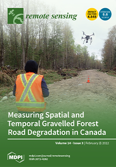
The degradation of forest roads in Canada was documented by identifying relevant spatiotemporal variables with (1) predictive models of gravel forest road degradation, and (2) using topography, roughness, and vegetation indices obtained from Airborne Laser Scanning and Sentinel-2 optical data to spatialise it. The field approach (n = 207) showed that after five years without maintenance, the rate of degradation on a road, regardless of its width, increased exponentially, exacerbated by a high slope gradient and loss of road surface. The remote sensing approach performed gives us valuable tools to document the state of gravel forest road degradation, providing us a piece of critical information for maintaining and sustaining access to Canada’s boreal forest. View this paper
  • Issues are regarded as officially published after their release is announced to the table of contents alert mailing list .
  • You may sign up for email alerts to receive table of contents of newly released issues.
  • PDF is the official format for papers published in both, html and pdf forms. To view the papers in pdf format, click on the "PDF Full-text" link, and use the free Adobe Reader to open them.

Articles (375)

  • Article
  • Open Access
8 Citations
5,606 Views
25 Pages

A Voxel-Based Individual Tree Stem Detection Method Using Airborne LiDAR in Mature Northeastern U.S. Forests

  • Jeff L. Hershey,
  • Marc E. McDill,
  • Douglas A. Miller,
  • Brennan Holderman and
  • Judd H. Michael

8 February 2022

This paper describes a new method for detecting individual tree stems that was designed to perform well in the challenging hardwood-dominated, mixed-species forests common to the northeastern U.S., where canopy height-based methods have proven unreli...

  • Article
  • Open Access
39 Citations
6,210 Views
18 Pages

Spatiotemporal Hybrid Random Forest Model for Tea Yield Prediction Using Satellite-Derived Variables

  • S Janifer Jabin Jui,
  • A. A. Masrur Ahmed,
  • Aditi Bose,
  • Nawin Raj,
  • Ekta Sharma,
  • Jeffrey Soar and
  • Md Wasique Islam Chowdhury

8 February 2022

Crop yield forecasting is critical for enhancing food security and ensuring an appropriate food supply. It is critical to complete this activity with high precision at the regional and national levels to facilitate speedy decision-making. Tea is a bi...

  • Article
  • Open Access
6 Citations
4,059 Views
16 Pages

Spatio-Temporal Quality Indicators for Differential Interferometric Synthetic Aperture Radar Data

  • Yismaw Wassie,
  • S. Mohammad Mirmazloumi,
  • Michele Crosetto,
  • Riccardo Palamà,
  • Oriol Monserrat and
  • Bruno Crippa

8 February 2022

Satellite-based interferometric synthetic aperture radar (InSAR) is an invaluable technique in the detection and monitoring of changes on the surface of the earth. Its high spatial coverage, weather friendly and remote nature are among the advantages...

  • Technical Note
  • Open Access
16 Citations
3,204 Views
16 Pages

8 February 2022

A full-polarimetric ground penetrating radar (FP-GPR) uses an antenna array to detect subsurface anomalies. Compared to the traditional GPR, FP-GPR can obtain more abundant information about the subsurface. However, in field FP-GPR measurements, the...

  • Feature Paper
  • Article
  • Open Access
10 Citations
5,110 Views
25 Pages

8 February 2022

Forest disturbances reduce the extent of natural habitats, biodiversity, and carbon sequestered in forests. With the implementation of the international framework Reduce Emissions from Deforestation and forest Degradation (REDD+), it is important to...

  • Article
  • Open Access
7 Citations
3,274 Views
20 Pages

8 February 2022

In the terrestrial cryosphere, freeze/thaw (FT) state transitions play an important and measurable role in climatic, hydrological, ecological, and biogeochemical processes in permafrost landscapes. Active and passive microwave remote sensing has show...

  • Article
  • Open Access
6 Citations
3,357 Views
24 Pages

8 February 2022

Fusing hyperspectral and panchromatic remote sensing images can obtain the images with high resolution in both spectral and spatial domains. In addition, it can complement the deficiency of high-resolution hyperspectral and panchromatic remote sensin...

  • Article
  • Open Access
6 Citations
4,639 Views
21 Pages

8 February 2022

The mistletoe Phoradendron velutinum (P. velutinum) is a pest that spreads rapidly and uncontrollably in Mexican forests, becoming a serious problem since it is a cause of the decline of 23.3 million hectares of conifers and broadleaves in the countr...

  • Article
  • Open Access
50 Citations
9,667 Views
17 Pages

Early Detection of Basal Stem Rot Disease in Oil Palm Tree Using Unmanned Aerial Vehicle-Based Hyperspectral Imaging

  • Junichi Kurihara,
  • Voon-Chet Koo,
  • Cheaw Wen Guey,
  • Yang Ping Lee and
  • Haryati Abidin

8 February 2022

Early detection of basal stem rot (BSR) disease in oil palm trees is important for the sustainable production of palm oil in the limited land for plantation in Southeast Asia. However, previous studies based on satellite and aircraft hyperspectral re...

  • Article
  • Open Access
19 Citations
3,336 Views
18 Pages

8 February 2022

Anomaly targets in a hyperspectral image (HSI) are often multi-pixel, rather than single-pixel, objects. Therefore, algorithms using a test point vector may ignore the spatial characteristics of the test point. In addition, hyperspectral anomaly dete...

of 38

Get Alerted

Add your email address to receive forthcoming issues of this journal.

XFacebookLinkedIn
Remote Sens. - ISSN 2072-4292