Next Issue
Volume 17, September-2
Previous Issue
Volume 17, August-2
 
 
remotesensing-logo

Journal Browser

Journal Browser

Remote Sens., Volume 17, Issue 17 (September-1 2025) – 208 articles

Cover Story (view full-size image): 
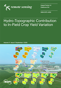
How do hydro-topographic variables influence crop yield in-field? This study investigates the contribution of hydro-topographic variables to spatial yield variability using high-resolution surface DEM and ground-penetrating radar–derived subsurface DEM from 2016 to 2023 corn and soybean fields. Topographic variables (DEM, slope, aspect) and hydrological variables (flow accumulation, depth, distance) were analyzed to explain yield spatial patterns. Additional integration with remote sensing data (vegetation index) and meteorological data further demonstrated their value for yield prediction. The findings highlight the importance of hydro-topographic information, together with temporal RS and climate factors, for understanding in-field variability and supporting sustainable crop management strategies. View this paper
  • Issues are regarded as officially published after their release is announced to the table of contents alert mailing list.
  • You may sign up for e-mail alerts to receive table of contents of newly released issues.
  • PDF is the official format for papers published in both, html and pdf forms. To view the papers in pdf format, click on the "PDF Full-text" link, and use the free Adobe Reader to open them.
Order results
Result details
Section
Select all
Export citation of selected articles as:
40 pages, 2253 KB  
Systematic Review
Airborne and Spaceborne Hyperspectral Remote Sensing in Urban Areas: Methods, Applications, and Trends
by José Antonio Gámez García, Giacomo Lazzeri and Deodato Tapete
Remote Sens. 2025, 17(17), 3126; https://doi.org/10.3390/rs17173126 - 8 Sep 2025
Viewed by 1445
Abstract
This study provides a comprehensive and systematic review of hyperspectral remote sensing in urban areas, with a focus on the evolving roles of airborne and spaceborne platforms. The main objective is to assess the state of the art and identify current trends, challenges, [...] Read more.
This study provides a comprehensive and systematic review of hyperspectral remote sensing in urban areas, with a focus on the evolving roles of airborne and spaceborne platforms. The main objective is to assess the state of the art and identify current trends, challenges, and opportunities arising from the scientific literature (the gray literature was intentionally not included). Despite the proven potential of hyperspectral imaging to discriminate between urban materials with high spectral similarity, its application in urban environments remains underexplored compared to natural settings. A systematic review of 1081 peer-reviewed articles published between 1993 and 2024 was conducted using the Scopus database, resulting in 113 selected publications. Articles were categorized by scope (application, method development, review), sensor type, image processing technique, and target application. Key methods include Spectral Unmixing, Machine Learning (ML) approaches such as Support Vector Machines and Random Forests, and Deep Learning (DL) models like Convolutional Neural Networks. The review reveals a historical reliance on airborne data due to their higher spatial resolution and the availability of benchmark datasets, while the use of spaceborne data has increased notably in recent years. Major urban applications identified include land cover classification, impervious surface detection, urban vegetation mapping, and Local Climate Zone analysis. However, limitations such as lack of training data and underutilization of data fusion techniques persist. ML methods currently dominate due to their robustness with small datasets, while DL adoption is growing but remains constrained by data and computational demands. This review highlights the growing maturity of hyperspectral remote sensing in urban studies and its potential for sustainable urban planning, environmental monitoring, and climate adaptation. Continued improvements in satellite missions and data accessibility will be key to transitioning from theoretical research to operational applications. Full article
(This article belongs to the Special Issue Application of Photogrammetry and Remote Sensing in Urban Areas)
Show Figures

Figure 1

20 pages, 4975 KB  
Article
Mapping High-Resolution Carbon Emission Spatial Distribution Combined with Carbon Satellite and Muti-Source Data
by Liu Cui, Hui Yang, Maria Martin, Yina Qiao, Veit Ulrich and Alexander Zipf
Remote Sens. 2025, 17(17), 3125; https://doi.org/10.3390/rs17173125 - 8 Sep 2025
Viewed by 949
Abstract
Carbon satellites, as the most direct means of observing carbon dioxide globally, offer credible and scientifically robust methods for estimating carbon emissions. To enhance the accuracy and timeliness of urban-scale carbon emission estimates, this study proposes an innovative model that integrates top-down carbon [...] Read more.
Carbon satellites, as the most direct means of observing carbon dioxide globally, offer credible and scientifically robust methods for estimating carbon emissions. To enhance the accuracy and timeliness of urban-scale carbon emission estimates, this study proposes an innovative model that integrates top-down carbon satellite data with high-resolution spatial proxies, including points of interest, road networks, and population distribution. The K-means clustering method was employed to study the relationship between carbon emissions and XCO2 anomalies. Based on this, the local adaptive carbon emission estimation model was constructed. Further, by integrating the spatial distribution and weights of proxy data, carbon emissions were reallocated to generate a high-resolution urban carbon emission map at a 1 km × 1 km resolution. Taking Urumqi, the XCO2 background concentration ranged from approximately 408 ppm to 415 ppm in 2020, and the corresponding XCO2 ranged from −1.58 ppm to 1.13 ppm. The total carbon emission estimated by the local adaptive model amounted to approximately 58.26718 million tons in 2020, close to the EDGAR dataset, with most monthly relative error within ±10%. The Pearson correlation coefficient between the ODIAC dataset and spatially redistributed carbon emission was 0.192, and their comparison showed that high carbon emission areas in the spatially redistributed carbon emission aligned closely with urban industrial parks and commercial centers, offering a more detailed representation of urban carbon emission spatial characteristics. This method contributed to exploring the potential of carbon satellites for quantitatively measuring anthropogenic emissions and offers improved insights into monitoring urban-scale carbon dioxide emissions. Full article
Show Figures

Figure 1

20 pages, 3823 KB  
Article
SA-Encoder: A Learnt Spatial Autocorrelation Representation to Inform 3D Geospatial Object Detection
by Tianyang Chen, Wenwu Tang, Shen-En Chen and Craig Allan
Remote Sens. 2025, 17(17), 3124; https://doi.org/10.3390/rs17173124 - 8 Sep 2025
Viewed by 519
Abstract
Contextual features play a critical role in geospatial object detection by characterizing the surrounding environment of objects. In existing deep learning-based studies of 3D point cloud classification and segmentation, these features have been represented through geometric descriptors, semantic context (i.e., modeled by an [...] Read more.
Contextual features play a critical role in geospatial object detection by characterizing the surrounding environment of objects. In existing deep learning-based studies of 3D point cloud classification and segmentation, these features have been represented through geometric descriptors, semantic context (i.e., modeled by an attention-based mechanism), global-level context (i.e., through global aggregation), and textural representation (e.g., RGB, intensity, and other attributes). Even though contextual features have been widely explored, spatial contextual features that explicitly capture spatial autocorrelation and neighborhood dependency have received limited attention in object detection tasks. This gap is particularly relevant in the context of GeoAI, which calls for mutual benefits between artificial intelligence and geographic information science. To bridge this gap, this study presents a spatial autocorrelation encoder, namely SA-Encoder, designed to inform 3D geospatial object detection by capturing spatial autocorrelation representation as types of spatial contextual features. The study investigated the effectiveness of such spatial contextual features by estimating the performance of a model trained on them alone. The results suggested that the derived spatial autocorrelation information can help adequately identify some large objects in an urban-rural scene, such as buildings, terrain, and large trees. We further investigated how the spatial autocorrelation encoder can inform model performance in a geospatial object detection task. The results demonstrated significant improvements in detection accuracy across varied urban and rural environments when we compared the results to models without considering spatial autocorrelation as an ablation experiment. Moreover, the approach also outperformed the models trained by explicitly feeding traditional spatial autocorrelation measures (i.e., Matheron’s semivariance). This study showcases the advantage of the adaptiveness of the neural network-based encoder in deriving a spatial autocorrelation representation. This advancement bridges the gap between theoretical geospatial concepts and practical AI applications. Consequently, this study demonstrates the potential of integrating geographic theories with deep learning technologies to address challenges in 3D object detection, paving the way for further innovations in this field. Full article
(This article belongs to the Section AI Remote Sensing)
Show Figures

Figure 1

18 pages, 14367 KB  
Article
The Driving Mechanism and Spatio-Temporal Nonstationarity of Oasis Urban Green Landscape Pattern Changes in Urumqi
by Lei Shi, Xinhan Zhang and Ümüt Halik
Remote Sens. 2025, 17(17), 3123; https://doi.org/10.3390/rs17173123 - 8 Sep 2025
Viewed by 694
Abstract
The green landscapes of oasis cities play an important role in maintaining ecological security. However, these ecosystems face increasing threats from desertification and fragmentation, driven by intensifying climate change and rapid urbanization. Understanding the characteristics and driving mechanisms behind changes in green landscape [...] Read more.
The green landscapes of oasis cities play an important role in maintaining ecological security. However, these ecosystems face increasing threats from desertification and fragmentation, driven by intensifying climate change and rapid urbanization. Understanding the characteristics and driving mechanisms behind changes in green landscape patterns is crucial for advancing sustainable urban green space management. This study explores the spatio-temporal changes in the green landscape pattern in Urumqi during 1990–2020 using a random forest classifier. This study also applies geographical detectors and geographically weighted regression to comprehensively determine the driving mechanism and spatio-temporal nonstationarity. The results are as follows: (1) The landscape types are primarily dominated by unused land, urban green spaces, and construction land, accounting for more than 80%. The areas of urban green spaces, water bodies, cropland, and unused land decreased by 0.38%, 37.41%, 0.57%, and 4.58%, respectively, from 1990 to 2020. With rapid urbanization, construction land exhibited a significant expansion trend, and the degree of fragmentation of urban green spaces increased spatially over these 30 years. (2) From 1990 to 2020, each landscape index exhibited fluctuating characteristics. Overall, the Shannon’s diversity and evenness indices of the urban green landscapes exhibited an increasing trend. The contagion and connectivity indices exhibited a decreasing trend, decreasing from 50.894 and 99.311 in 1990 to 46.584 and 99.048 in 2020, respectively. (3) During these 30 years, the dynamics of urban greenery were affected by a combination of natural and social factors, with elevation determining the overall urban green distribution pattern. Precipitation and temperature dominate the urban green space changes in the north and south of Urumqi. Socioeconomic factors such as GDP, population, river distance, and town distance regulate the urban green space changes in the central built-up area. Full article
Show Figures

Graphical abstract

41 pages, 7601 KB  
Article
Hybrid Deep Neural Architectures with Evolutionary Optimization and Explainable AI for Drought Susceptibility Assessment
by Jinping Liu, Jie Li and Yanqun Ren
Remote Sens. 2025, 17(17), 3122; https://doi.org/10.3390/rs17173122 - 8 Sep 2025
Viewed by 842
Abstract
This study presents a novel ensemble deep-learning framework integrating Convolutional Neural Networks (CNN), self-attention mechanisms, and Long Short-Term Memory (LSTM) networks, designed to generate high-resolution drought susceptibility maps for the Oroqen Autonomous Banner of Inner Mongolia. The model was further enhanced through two [...] Read more.
This study presents a novel ensemble deep-learning framework integrating Convolutional Neural Networks (CNN), self-attention mechanisms, and Long Short-Term Memory (LSTM) networks, designed to generate high-resolution drought susceptibility maps for the Oroqen Autonomous Banner of Inner Mongolia. The model was further enhanced through two metaheuristic optimization techniques—Differential Evolution (DE) and Biogeography-Based Optimization (BBO)—which tuned hyperparameters including CNN filters, LSTM units, and learning rate. Model evaluation—quantified via predictive accuracy (RMSE = 0.22 and MAE = 0.12), goodness-of-fit (R2 = 0.79), and classification discrimination [Area Under the Receiver Operating Characteristic curve (AUROC) = 0.91]—revealed that the BBO-optimized ensemble achieved the best overall performance on the test set, outperforming the DE-enhanced (AUROC = 0.86) and baseline models (AUROC = 0.80). Pairwise z-statistics confirmed the statistical superiority of the BBO-enhanced ensemble with a p-value < 0.001. The final susceptibility map—classified into five levels using the Jenks natural breaks method—identified western rangelands and transitional ecotones as high-susceptibility zones, while eastern areas were marked by lower susceptibility. The resulting outputs offer decision-makers and land managers an interpretable, high-precision tool to guide drought preparedness, implement resource allocation strategies, and design early-warning systems. This research establishes a scalable, interpretable, and statistically robust approach for drought susceptibility assessment in vulnerable landscapes. Full article
(This article belongs to the Special Issue Remote Sensing and Geoinformatics in Sustainable Development)
Show Figures

Figure 1

20 pages, 12556 KB  
Article
Accuracy Comparison and Synergistic Strategies of Seven High-Resolution Cropland Maps (1–10 m) in China
by Xinqin Peng, Lanhui Li, Xin Cao, Fangzhou Li, Mingjun Ding, Longlong Liu, Shuimei Fu, Yuanzhuo Sun, Chen Zhang, Wei Liu, Ying Yuan, Mei Sun and Fuliang Deng
Remote Sens. 2025, 17(17), 3121; https://doi.org/10.3390/rs17173121 - 8 Sep 2025
Viewed by 836
Abstract
Accurate assessment of cropland maps is crucial for ensuring food security, effective agricultural management, and environmental monitoring. With the widespread application of high-resolution (≤10 m) remote sensing imagery and the advancement of machine learning techniques, numerous high-resolution cropland maps have been developed. However, [...] Read more.
Accurate assessment of cropland maps is crucial for ensuring food security, effective agricultural management, and environmental monitoring. With the widespread application of high-resolution (≤10 m) remote sensing imagery and the advancement of machine learning techniques, numerous high-resolution cropland maps have been developed. However, comprehensive evaluations of their accuracy remain limited. We utilized 163,861 validation samples and national land survey statistical data to conduct a multi-scale comparison of the accuracy of seven cropland maps (one 1 m and six 10 m maps) in China. Additionally, five synergistic strategies were employed to generate more accurate fused cropland maps. Validation results showed that the overall accuracy (OA) of the seven maps ranged from 0.79 to 0.91, with ESA-WorldCover (ESA-WC) exhibiting the highest OA, followed by AI Earth China land cover classification dataset (AIEC), ESRI Land Cover (ESRI-LC), and Cropland Use Intensity in China (China-CUI), while Sino-LC1 showed the lowest performance. Spatially, ESA-WC achieved the highest accuracy in nearly 60% of provinces, followed by AIEC and ESRI-LC, each accounting for approximately 20%. AIEC performed best in western provinces, whereas ESRI-LC dominated in the middle and lower reaches of the Yangtze River. Area consistency assessments revealed that, on average, the seven maps overestimated cropland areas by 20% compared to statistical data. Among these, ESA-WC showed the highest proportion of provinces with relative errors within ±20%, but this proportion was only 50%. Moreover, the OA of the fused maps exceeded 0.92, with county-level R2 values compared to statistical data reaching 0.98, significantly improving the reliability of cropland products in over 60% of provincial administrative regions. Based on these results, effective synergistic strategies for high-resolution cropland mapping are proposed. Full article
Show Figures

Figure 1

24 pages, 4589 KB  
Article
Semantic Segmentation of Clouds and Cloud Shadows Using State Space Models
by Zhixuan Zhang, Ziwei Hu, Min Xia, Ying Yan, Rui Zhang, Shengyan Liu and Tao Li
Remote Sens. 2025, 17(17), 3120; https://doi.org/10.3390/rs17173120 - 8 Sep 2025
Viewed by 807
Abstract
In remote sensing image processing, cloud and cloud shadow detection is of great significance, which can solve the problems of cloud occlusion and image distortion, and provide support for multiple fields. However, the traditional convolutional or Transformer models and the existing studies combining [...] Read more.
In remote sensing image processing, cloud and cloud shadow detection is of great significance, which can solve the problems of cloud occlusion and image distortion, and provide support for multiple fields. However, the traditional convolutional or Transformer models and the existing studies combining the two have some shortcomings, such as insufficient feature fusion, high computational complexity, and difficulty in taking into account local and long-range dependent information extraction. In order to solve these problems, this paper proposes the MCloud model based on Mamba architecture is proposed, which takes advantage of its linear computational complexity to effectively model long-range dependencies and local features through the coordinated work of state space and convolutional support and the Mamba-convolutional fusion module. Experiments show that MCloud have the leading segmentation performance and generalization ability on multiple datasets, and provides more accurate and efficient solutions for cloud and cloud shadow detection. Full article
Show Figures

Figure 1

25 pages, 7488 KB  
Article
YOLO-UAVShip: An Effective Method and Dateset for Multi-View Ship Detection in UAV Images
by Youguang Li, Yichen Tian, Chao Yuan, Kun Yu, Kai Yin, Huiping Huang, Guang Yang, Fan Li and Zengguang Zhou
Remote Sens. 2025, 17(17), 3119; https://doi.org/10.3390/rs17173119 - 8 Sep 2025
Viewed by 940
Abstract
Maritime unmanned aerial vehicle (UAV) ship detection faces challenges including variations in ship pose and appearance under multiple viewpoints, occlusion and confusion in dense scenes, complex backgrounds, and the scarcity of ship datasets from UAV tilted perspectives. To overcome these obstacles, this study [...] Read more.
Maritime unmanned aerial vehicle (UAV) ship detection faces challenges including variations in ship pose and appearance under multiple viewpoints, occlusion and confusion in dense scenes, complex backgrounds, and the scarcity of ship datasets from UAV tilted perspectives. To overcome these obstacles, this study introduces a high-quality dataset named Marship-OBB9, comprising 11,268 drone-captured images and 18,632 instances spanning nine typical ship categories. The dataset systematically reflects the characteristics of maritime scenes under diverse scales, viewpoints, and environmental conditions. Based upon this dataset, we propose a novel detection network named YOLO11-UAVShip. First, an oriented bounding box detection mechanism is incorporated to precisely fit ship contours and reduce background interference. Second, a newly designed CK_DCNv4 module, integrating deformable convolution v4 (DCNv4) and a C3k2 backbone structure, is developed to enhance geometric feature extraction under aerial oblique view. Additionally, for ships with large aspect ratios, SGKLD effectively addresses the localization challenges in dense environments, achieving robust position regression. Comprehensive experimental evaluation demonstrates that the proposed method yields a 2.1% improvement in mAP@0.5 and a 2.3% increase in recall relative to baseline models on the Marship-OBB9 dataset. While maintaining real-time inference speed, our approach greatly enhances detection accuracy and robustness. This work provides a practical and deployable solution for intelligent ship detection in UAV imagery. Full article
(This article belongs to the Special Issue Remote Sensing for Maritime Monitoring)
Show Figures

Graphical abstract

24 pages, 6409 KB  
Article
SAR Ship Target Instance Segmentation Based on SISS-YOLO
by Yan Xue, Lili Zhan, Zhangshuo Liu and Xiujie Bing
Remote Sens. 2025, 17(17), 3118; https://doi.org/10.3390/rs17173118 - 8 Sep 2025
Viewed by 873
Abstract
Maritime transportation, fishing, scientific research, and other activities rely on various types of ships and platforms, making precise monitoring of ships at sea essential. Synthetic Aperture Radar (SAR) is minimally affected by weather conditions and darkness and is used for ship detection in [...] Read more.
Maritime transportation, fishing, scientific research, and other activities rely on various types of ships and platforms, making precise monitoring of ships at sea essential. Synthetic Aperture Radar (SAR) is minimally affected by weather conditions and darkness and is used for ship detection in maritime environments. This study analyzes the differences in backscatter characteristics among various ship types in SAR images and proposes SISS-YOLO, an enhanced model based on YOLOv8. The proposed method addresses the challenge of ship instance segmentation in SAR images involving multiple polarizations, scenarios, and classes. First, the backbone structure was optimized by incorporating additional pooling layers and refining the activation functions. Second, the Coordinate Attention (CA) module was integrated into the C2F template, embedding spatial position information into the channel attention mechanism. Third, a slide loss function was adopted to address the class imbalance across ship categories. The experiments were conducted on the OpenSARShip2.0 dataset, which includes cargo, tanker, passenger and engineering ships. The results show that the SISS-YOLO achieves a mask precision of 88.3%, a mask recall of 86.4% and a mask mAP50 of 93.4% for engineering ships. Compared with YOLOv8m, SISS-YOLO achieved improvements of 15.7% in mask precision and 8.8% in mask recall. The model trained on the OpenSARShip2.0 dataset was directly applied to the FUSAR-Ship1.0 dataset, demonstrating a degree of robustness. When applied to SAR data, the SISS-YOLO model achieves high detection accuracy, demonstrating generalization. Full article
Show Figures

Figure 1

28 pages, 3442 KB  
Review
UAV Image-Based 3D Reconstruction Technology in Landslide Disasters: A Review
by Yong Chen, Xu Liu, Bai Zhu, Daming Zhu, Xiaoqing Zuo and Qingquan Li
Remote Sens. 2025, 17(17), 3117; https://doi.org/10.3390/rs17173117 - 8 Sep 2025
Viewed by 4146
Abstract
Global geological conditions are complex and variable, characterized by frequent plate movements, earthquakes, and volcanic eruptions. Coupled with significant climate differences, various factors interact to trigger frequent landslide disasters, resulting in substantial losses of life and property. Therefore, landslide monitoring is crucial. Traditional [...] Read more.
Global geological conditions are complex and variable, characterized by frequent plate movements, earthquakes, and volcanic eruptions. Coupled with significant climate differences, various factors interact to trigger frequent landslide disasters, resulting in substantial losses of life and property. Therefore, landslide monitoring is crucial. Traditional monitoring technologies face limitations when dealing with complex terrains and meeting the demands for high timeliness, while unmanned aerial vehicles (UAVs), with their maneuverability, high resolution, and ability to operate in hazardous environments, have been widely applied in landslide monitoring. This paper provides a comprehensive review of UAV-based 3D reconstruction for landslides, detailing the characteristics and application cases of UAVs, explaining the functions and limitations of sensors such as optical sensors and light detection and ranging (LiDAR), and exploring 3D reconstruction methods based on UAV imagery, LiDAR, and hybrid approaches. It analyzes the applications of UAV 3D reconstruction in landslide emergency investigation, monitoring, and disaster assessment. The paper identifies the technical challenges faced in these applications and proposes corresponding solutions. In addition, UAV-based 3D reconstruction technology—with its centimeter-level spatial resolution—enables the precise delineation of landslide extent and hazard potential, thereby enhancing monitoring accuracy and improving the efficiency of emergency investigations. This technology provides strong technical support for landslide research and prevention, with significant implications for reducing landslide disaster losses. Full article
Show Figures

Figure 1

27 pages, 10633 KB  
Article
Deep Learning-Based Collapsed Building Mapping from Post-Earthquake Aerial Imagery
by Hongrui Lyu, Haruki Oshio and Masashi Matsuoka
Remote Sens. 2025, 17(17), 3116; https://doi.org/10.3390/rs17173116 - 7 Sep 2025
Viewed by 989
Abstract
Rapid building damage assessments are vital for an effective earthquake response. In Japan, traditional Earthquake Damage Certification (EDC) surveys—followed by the issuance of Disaster Victim Certificates (DVCs)—are often inefficient. With advancements in remote sensing technologies and deep learning algorithms, their combined application has [...] Read more.
Rapid building damage assessments are vital for an effective earthquake response. In Japan, traditional Earthquake Damage Certification (EDC) surveys—followed by the issuance of Disaster Victim Certificates (DVCs)—are often inefficient. With advancements in remote sensing technologies and deep learning algorithms, their combined application has been explored for large-scale automated damage assessment. However, the scarcity of remote sensing data on damaged buildings poses significant challenges to this task. In this study, we propose an Uncertainty-Guided Fusion Module (UGFM) integrated into a standard decoder architecture, with a Pyramid Vision Transformer v2 (PVTv2) employed as the encoder. This module leverages uncertainty outputs at each stage to guide the feature fusion process, enhancing the model’s sensitivity to collapsed buildings and increasing its effectiveness under diverse conditions. A training and in-domain testing dataset was constructed using post-earthquake aerial imagery of the severely affected areas in Noto Prefecture. The model approximately achieved a recall of 79% with a precision of 68% for collapsed building extraction on this dataset. We further evaluated the model on an out-of-domain dataset comprising aerial images of Mashiki Town in Kumamoto Prefecture, where it achieved an approximate recall of 66% and a precision of 77%. In a quantitative analysis combining field survey data from Mashiki, the model attained an accuracy exceeding 87% in identifying major damaged buildings, demonstrating that the proposed method offers a reliable solution for initial assessment of major damage and its potential to accelerate DVC issuance in real-world disaster response scenarios. Full article
Show Figures

Graphical abstract

22 pages, 6748 KB  
Article
Spatial Analysis of Bathymetric Data from UAV Photogrammetry and ALS LiDAR: Shallow-Water Depth Estimation and Shoreline Extraction
by Oktawia Specht
Remote Sens. 2025, 17(17), 3115; https://doi.org/10.3390/rs17173115 - 7 Sep 2025
Viewed by 1109
Abstract
The shoreline and seabed topography are key components of the coastal zone and are essential for hydrographic surveys, shoreline process modelling, and coastal infrastructure management. The development of unmanned aerial vehicles (UAVs) and optoelectronic sensors, such as photogrammetric cameras and airborne laser scanning [...] Read more.
The shoreline and seabed topography are key components of the coastal zone and are essential for hydrographic surveys, shoreline process modelling, and coastal infrastructure management. The development of unmanned aerial vehicles (UAVs) and optoelectronic sensors, such as photogrammetric cameras and airborne laser scanning (ALS) using light detection and ranging (LiDAR) technology, has enabled the acquisition of high-resolution bathymetric data with greater accuracy and efficiency than traditional methods using echo sounders on manned vessels. This article presents a spatial analysis of bathymetric data obtained from UAV photogrammetry and ALS LiDAR, focusing on shallow-water depth estimation and shoreline extraction. The study area is Lake Kłodno, an inland waterbody with moderate ecological status. Aerial imagery from the photogrammetric camera was used to model the lake bottom in shallow areas, while the LiDAR point cloud acquired through ALS was used to determine the shoreline. Spatial analysis of support vector regression (SVR)-based bathymetric data showed effective depth estimation down to 1 m, with a reported standard deviation of 0.11 m and accuracy of 0.22 m at the 95% confidence, as reported in previous studies. However, only 44.5% of 1 × 1 m grid cells met the minimum point density threshold recommended by the National Oceanic and Atmospheric Administration (NOAA) (≥5 pts/m2), while 43.7% contained no data. In contrast, ALS LiDAR provided higher and more consistent shoreline coverage, with an average density of 63.26 pts/m2, despite 27.6% of grid cells being empty. The modified shoreline extraction method applied to the ALS data achieved a mean positional accuracy of 1.24 m and 3.36 m at the 95% confidence level. The results show that UAV photogrammetry and ALS laser scanning possess distinct yet complementary strengths, making their combined use beneficial for producing more accurate and reliable maps of shallow waters and shorelines. Full article
Show Figures

Figure 1

21 pages, 25636 KB  
Article
SARFT-GAN: Semantic-Aware ARConv Fused Top-k Generative Adversarial Network for Remote Sensing Image Denoising
by Haotian Sun, Ruifeng Duan, Guodong Sun, Haiyan Zhang, Feixiang Chen, Feng Yang and Jia Cao
Remote Sens. 2025, 17(17), 3114; https://doi.org/10.3390/rs17173114 - 7 Sep 2025
Cited by 1 | Viewed by 722
Abstract
Optical remote sensing images play a pivotal role in numerous applications, notably feature recognition and scene semantic segmentation. Nevertheless, their efficacy is frequently compromised by various noise types, which detrimentally impact practical usage. We have meticulously crafted a novel attention module amalgamating Adaptive [...] Read more.
Optical remote sensing images play a pivotal role in numerous applications, notably feature recognition and scene semantic segmentation. Nevertheless, their efficacy is frequently compromised by various noise types, which detrimentally impact practical usage. We have meticulously crafted a novel attention module amalgamating Adaptive Rectangular Convolution (ARConv) with Top-k Sparse Attention. This design dynamically modifies feature receptive fields, effectively mitigating superfluous interference and enhancing multi-scale feature extraction. Concurrently, we introduce a Semantic-Aware Discriminator, leveraging visual-language prior knowledge derived from the Contrastive Language–Image Pretraining (CLIP) model, steering the generator towards a more realistic texture reconstruction. This research introduces an innovative image denoising model termed the Semantic-Aware ARConv Fused Top-k Generative Adversarial Network (SARFT-GAN). Addressing shortcomings in traditional convolution operations, attention mechanisms, and discriminator design, our approach facilitates a synergistic optimization between noise suppression and feature preservation. Extensive experiments on RRSSRD, SECOND, a private Jilin-1 set, and real-world NWPU-RESISC45 images demonstrate consistent gains. Across three noise levels and four scenarios, SARFT-GAN attains state-of-the-art perceptual quality—achieving the best FID in all 12 settings and strong LPIPS—while remaining competitive on PSNR/SSIM. Full article
Show Figures

Figure 1

33 pages, 6850 KB  
Article
TWDTW-Based Maize Mapping Using Optimal Time Series Features of Sentinel-1 and Sentinel-2 Images
by Haoran Yan, Ruozhen Wang, Jiaqian Lian, Xinyue Duan, Liping Wan, Jiao Guo and Pengliang Wei
Remote Sens. 2025, 17(17), 3113; https://doi.org/10.3390/rs17173113 - 6 Sep 2025
Viewed by 1873
Abstract
Time-Weighted Dynamic Time Warping (TWDTW), adapted from speech recognition, is used in agricultural remote sensing to model crop growth, particularly under limited ground sample conditions. However, most related studies rely on full-season or empirically selected features, overlooking the systematic optimization of features at [...] Read more.
Time-Weighted Dynamic Time Warping (TWDTW), adapted from speech recognition, is used in agricultural remote sensing to model crop growth, particularly under limited ground sample conditions. However, most related studies rely on full-season or empirically selected features, overlooking the systematic optimization of features at each observation time to improve TWDTW’s performance. This often introduces a large amount of redundant information that is irrelevant to crop discrimination and increases computational complexity. Therefore, this study focused on maize as the target crop and systematically conducted mapping experiments using Sentinel-1/2 images to evaluate the potential of integrating TWDTW with optimally selected multi-source time series features. The optimal multi-source time series features for distinguishing maize from non-maize were determined using a two-step Jeffries Matusita (JM) distance-based global search strategy (i.e., twelve spectral bands, Normalized Difference Vegetation Index, Enhanced Vegetation Index, and the two microwave backscatter coefficients collected during the maize jointing to tasseling stages). Then, based on the full-season and optimal multi-source time series features, we compared TWDTW with two widely used temporal machine learning models in agricultural remote sensing community. The results showed that TWDTW outperformed traditional supervised temporal machine learning models. In particular, compared with TWDTW driven by the full-season optimal multi-source features, TWDTW using the optimal multi-source time series features improved user accuracy by 0.43% and 2.30%, and producer accuracy by 7.51% and 2.99% for the years 2020 and 2021, respectively. Additionally, it reduced computational costs to only 25% of those driven by the full-season scheme. Finally, maize maps of Yangling District from 2020 to 2023 were produced by optimal multi-source time series features-based TWDTW. Their overall accuracies remained consistently above 90% across the four years, and the average relative error between the maize area extracted from remote sensing images and that reported in the statistical yearbook was only 6.61%. This study provided guidance for improving the performance of TWDTW in large-scale crop mapping tasks, which is particularly important under conditions of limited sample availability. Full article
Show Figures

Figure 1

21 pages, 1686 KB  
Article
Sparse-Gated RGB-Event Fusion for Small Object Detection in the Wild
by Yangsi Shi, Miao Li, Nuo Chen, Yihang Luo, Shiman He and Wei An
Remote Sens. 2025, 17(17), 3112; https://doi.org/10.3390/rs17173112 - 6 Sep 2025
Viewed by 2034
Abstract
Detecting small moving objects under challenging lighting conditions, such as overexposure and underexposure, remains a critical challenge in computer vision applications including surveillance, autonomous driving, and anti-UAV systems. Traditional RGB-based detectors often suffer from degraded object visibility and highly dynamic illumination, leading to [...] Read more.
Detecting small moving objects under challenging lighting conditions, such as overexposure and underexposure, remains a critical challenge in computer vision applications including surveillance, autonomous driving, and anti-UAV systems. Traditional RGB-based detectors often suffer from degraded object visibility and highly dynamic illumination, leading to suboptimal performance. To address these limitations, we propose a novel RGB-Event fusion framework that leverages the complementary strengths of RGB and event modalities for enhanced small object detection. Specifically, we introduce a Temporal Multi-Scale Attention Fusion (TMAF) module to encode motion cues from event streams at multiple temporal scales, thereby enhancing the saliency of small object features. Furthermore, we design a Sparse Noisy Gated Attention Fusion (SNGAF) module, inspired by the mixture-of-experts paradigm, which employs a sparse gating mechanism to adaptively combine multiple fusion experts based on input characteristics, enabling flexible and robust RGB-Event feature integration. Additionally, we present RGBE-UAV, which is a new RGB-Event dataset tailored for small moving object detection under diverse exposure conditions. Extensive experiments on our RGBE-UAV and public DSEC-MOD datasets demonstrate that our method outperforms existing state-of-the-art RGB-Event fusion approaches, validating its effectiveness and generalization under complex lighting conditions. Full article
Show Figures

Figure 1

25 pages, 6923 KB  
Article
Integration of SBAS-InSAR and KTree-AIDW for Surface Subsidence Monitoring in Grouting Mining Areas
by Shuaiqi Yan, Junjie Chen, Weitao Yan, Chunsu Zhao, Haoyang Li and Hongtao Peng
Remote Sens. 2025, 17(17), 3111; https://doi.org/10.3390/rs17173111 - 6 Sep 2025
Viewed by 826
Abstract
Small Baseline Subset Interferometric Synthetic Aperture Radar (SBAS-InSAR) technology, with its advantages in large-scale and high-precision deformation monitoring, has become an essential tool for monitoring surface subsidence in coal mining areas. To address the issue of missing deformation values resulting from interferometric decoherence [...] Read more.
Small Baseline Subset Interferometric Synthetic Aperture Radar (SBAS-InSAR) technology, with its advantages in large-scale and high-precision deformation monitoring, has become an essential tool for monitoring surface subsidence in coal mining areas. To address the issue of missing deformation values resulting from interferometric decoherence when using InSAR technology for surface subsidence monitoring in mining areas, this study proposes a combined approach integrating SBAS-InSAR with KTree Adaptive Inverse Distance Weighting (KTree-AIDW). The method constructs a dynamic neighborhood search mechanism through the KTree algorithm, considering the spatial heterogeneity between the interpolation points and adjacent sample points, and optimizes the weight distribution of heterogeneous sample points. The study is based on Sentinel-1 data with a 12-day revisit cycle, focusing on the 2021 grouting working face of the Liangbei Mine in Yuzhou, Henan Province, China. The results show the following: (1) Along both the strike and dip lines, the correlation coefficient between the SBAS-InSAR + KTree-AIDW results and leveling result is 0.95, with an overall root mean square error (RMSE) of 22.08 mm and a relative root mean square error (RRMSE) of 9.48%. The Mean Absolute Error (MAE) of characteristic points in the decoherence region is 19.05 mm, indicating a significantly improved accuracy in the decoherence region compared to traditional methods. (2) The cumulative maximum subsidence in the study area reached 233 mm, with an average maximum subsidence rate of 171 mm/yr. The maximum positive/negative inclines were 2.4 mm/m and −2.9 mm/m; the maximum positive/negative curvatures were ±0.18 mm/m2. The surface structures are within the threshold values specified for Class I damage. The proposed method effectively addresses the decoherence issue that leads to missing deformation data in mining areas, providing a novel technical approach to accurate surface subsidence monitoring under grouting and backfilling conditions. Full article
(This article belongs to the Special Issue Advances in Surface Deformation Monitoring Using SAR Interferometry)
Show Figures

Figure 1

19 pages, 20899 KB  
Article
Spatiotemporal Dynamics of Roadside Water Accumulation and Its Hydrothermal Impacts on Permafrost Stability: Integrating UAV and GPR
by Minghao Liu, Bingyan Li, Yanhu Mu, Jing Luo, Fei Yin and Fan Yu
Remote Sens. 2025, 17(17), 3110; https://doi.org/10.3390/rs17173110 - 6 Sep 2025
Viewed by 907
Abstract
The Gonghe–Yushu Expressway (GYE) traverses the degrading permafrost region of the Qinghai–Xizang Plateau, where climate warming has resulted in widespread water ponding, posing significant engineering challenges. However, the spatiotemporal dynamics of this water accumulation and its impacts on permafrost embankment stability remain inadequately [...] Read more.
The Gonghe–Yushu Expressway (GYE) traverses the degrading permafrost region of the Qinghai–Xizang Plateau, where climate warming has resulted in widespread water ponding, posing significant engineering challenges. However, the spatiotemporal dynamics of this water accumulation and its impacts on permafrost embankment stability remain inadequately understood. This study integrates high-resolution unmanned aerial vehicle (UAV) remote sensing with ground-penetrating radar (GPR) to characterize the spatial patterns of water ponding and to quantify the spatial distribution, seasonal dynamics, and hydrothermal effects of roadside water on permafrost sections of the GYE. UAV-derived point cloud models, optical 3D models, and thermal infrared imagery reveal that approximately one-third of the 228 km study section of GYE exhibits water accumulation, predominantly occurring near the embankment toe in flat terrain or poorly drained areas. Seasonal monitoring showed a nearly 90% reduction in waterlogged areas from summer to winter, closely corresponding to climatic variations. Statistical analysis demonstrated significantly higher embankment distress rates in waterlogged areas (14.3%) compared to non-waterlogged areas (5.7%), indicating a strong correlation between surface water and accelerated permafrost degradation. Thermal analysis confirmed that waterlogged zones act as persistent heat sources, intensifying permafrost thaw and consequent embankment instability. GPR surveys identified notable subsurface disturbances beneath waterlogged sections, including a significant lowering of the permafrost table under the embankment and evidence of soil loosening due to hydrothermal erosion. These findings provide valuable insights into the spatiotemporal evolution of water accumulation along transportation corridors and inform the development of climate-adaptive strategies to mitigate water-induced risks in degrading permafrost regions. Full article
(This article belongs to the Special Issue Remote Sensing of Water Dynamics in Permafrost Regions)
Show Figures

Graphical abstract

17 pages, 3525 KB  
Article
Lateral Responses of Coastal Intertidal Meta-Ecosystems to Sea-Level Rise: Lessons from the Yangtze Estuary
by Yu Gao, Bing-Jiang Zhou, Bin Zhao, Jiquan Chen, Neil Saintilan, Peter I. Macreadie, Anirban Akhand, Feng Zhao, Ting-Ting Zhang, Sheng-Long Yang, Si-Kai Wang, Jun-Lin Ren and Ping Zhuang
Remote Sens. 2025, 17(17), 3109; https://doi.org/10.3390/rs17173109 - 6 Sep 2025
Viewed by 1120
Abstract
Understanding the spatiotemporal dynamics of coastal intertidal meta-ecosystems in response to sea-level rise (SLR) is essential for understanding the interactions between terrestrial and aquatic meta-ecosystems. However, given that annual SLR changes are typically measured in millimeters, ecosystems may take decades to exhibit noticeable [...] Read more.
Understanding the spatiotemporal dynamics of coastal intertidal meta-ecosystems in response to sea-level rise (SLR) is essential for understanding the interactions between terrestrial and aquatic meta-ecosystems. However, given that annual SLR changes are typically measured in millimeters, ecosystems may take decades to exhibit noticeable shifts. As a result, the extent of lateral responses at a single point is constrained by the fragmented temporal and spatial scales. We integrated the tidal inundation gradient of a coastal meta-ecosystem—comprising a high-elevation flat (H), low-elevation flat (L), and mudflat—to quantify the potential application of inferring the spatiotemporal impact of environmental features, using China’s Yangtze Estuary, which is one of the largest and most dynamic estuaries in the world. We employed both flood ratio data and tidal elevation modeling, underscoring the utility of spatial modeling of the role of SLR. Our results show that along the tidal inundation gradient, SLR alters hydrological dynamics, leading to environmental changes such as reduced aboveground biomass, increased plant diversity, decreased total soil, carbon, and nitrogen, and a lower leaf area index (LAI). Furthermore, composite indices combining the enhanced vegetation index (EVI) and the land surface water index (LSWI) were used to characterize the rapid responses of vegetation and soil between sites to predict future ecosystem shifts in environmental properties over time due to SLR. To effectively capture both vegetation characteristics and the soil surface water content, we propose the use of the ratio and difference between the EVI and LSWI as a composite indicator (ELR), which effectively reflects vegetation responses to SLR, with high-elevation sites driven by tides and high ELRs. The EVI-LSWI difference (ELD) was also found to be effective for detecting flood dynamics and vegetation along the tidal inundation gradient. Our findings offer a heuristic scenario of the response of coastal intertidal meta-ecosystems in the Yangtze Estuary to SLR and provide valuable insights for conservation strategies in the context of climate change. Full article
(This article belongs to the Special Issue Remote Sensing of Coastal, Wetland, and Intertidal Zones)
Show Figures

Figure 1

19 pages, 10558 KB  
Article
Ionospheric Disturbances from the 2022 Hunga-Tonga Volcanic Eruption: Impacts on TEC Spatial Gradients and GNSS Positioning Accuracy Across the Japan Region
by Zhihao Fu, Xuhui Shen, Qinqin Liu and Ningbo Wang
Remote Sens. 2025, 17(17), 3108; https://doi.org/10.3390/rs17173108 - 6 Sep 2025
Viewed by 885
Abstract
The Hunga-Tonga volcanic eruption on 15 January 2022, produced significant atmospheric and ionospheric disturbances that may degrade global navigation satellite system (GNSS) and precise point positioning (PPP) accuracy. Using data from the GEONET GNSS network and Soratena barometric pressure sensors across Japan, we [...] Read more.
The Hunga-Tonga volcanic eruption on 15 January 2022, produced significant atmospheric and ionospheric disturbances that may degrade global navigation satellite system (GNSS) and precise point positioning (PPP) accuracy. Using data from the GEONET GNSS network and Soratena barometric pressure sensors across Japan, we analyzed the eruption’s effects through the gradient ionospheric index (GIX) and the rate of TEC index (ROTI) to characterize the propagation and effects of these disturbances on ionospheric total electron content (TEC) gradients. Our analysis identified two separate ionospheric disturbance events. The first event, coinciding with the arrival of atmospheric Lamb waves, was characterized by wave-like pressure anomalies, differential TEC (dTEC) fluctuations, and modest horizontal gradients of vertical TEC (VTEC). In contrast, the second, more pronounced disturbance was driven by equatorial plasma bubbles (EPBs), which generated severe ionospheric irregularities and large TEC gradients. Further analysis revealed that these two disturbances had markedly different impacts on GNSS positioning accuracy. The Lamb wave–induced disturbance mainly caused moderate TEC fluctuations with limited effects on positioning accuracy, and mid-latitude stations maintained both average and 95th percentile positioning (ppp,P95) errors below 0.1 m throughout the event. In contrast, the EPB-driven disturbance had a substantial impact on low-latitude regions, where the average horizontal PPP error peaked at 0.5 m and the horizontal and vertical ppp,P95 errors exceeded 1 m. Our findings reveal two episodes of spatial-gradient enhancement and successfully estimate the propagation speed and direction of the Lamb waves, supporting the potential application of ionospheric gradient monitoring in forecasting GNSS performance degradation. Full article
Show Figures

Figure 1

41 pages, 37922 KB  
Article
Monitoring Policy-Driven Urban Restructuring and Logistics Agglomeration in Zhengzhou Through Multi-Source Remote Sensing: An NTL-POI Integrated Spatiotemporal Analysis
by Xiuyan Zhao, Zeduo Zou, Jie Li, Xiaodie Yuan and Xiong He
Remote Sens. 2025, 17(17), 3107; https://doi.org/10.3390/rs17173107 - 6 Sep 2025
Viewed by 771
Abstract
This study leverages multi-source remote sensing data—Nighttime Light (NTL) imagery and POI (Point of Interest) datasets—to quantify the spatiotemporal interaction between urban spatial restructuring and logistics industry evolution in Zhengzhou, China. Using calibrated NPP/VIIRS NTL data (2012–2022) and fine-grained POI data, we (1) [...] Read more.
This study leverages multi-source remote sensing data—Nighttime Light (NTL) imagery and POI (Point of Interest) datasets—to quantify the spatiotemporal interaction between urban spatial restructuring and logistics industry evolution in Zhengzhou, China. Using calibrated NPP/VIIRS NTL data (2012–2022) and fine-grained POI data, we (1) identified urban functional spaces through kernel density-based spatial grids weighted by public awareness parameters; (2) extracted built-up areas via the dynamic adaptive threshold segmentation of NTL gradients; (3) analyzed logistics agglomeration dynamics using emerging spatiotemporal hotspot analysis (ESTH) and space–time cube models. The results show that Zhengzhou’s urban form transitioned from a monocentric to a polycentric structure, with NTL trajectories revealing logistics hotspots expanding along air–rail multimodal corridors. POI-derived functional spaces shifted from single-dominant to composite patterns, while ESTH detected policy-driven clusters in Airport Economic Zones and market-driven suburban cold chain hubs. Bivariate LISA confirmed the spatial synergy between logistics growth and urban expansion, validating the “policy–space–industry” interaction framework. This research demonstrates how integrated NTL-POI remote sensing techniques can monitor policy impacts on urban systems, providing a replicable methodology for sustainable logistics planning. Full article
Show Figures

Figure 1

19 pages, 3185 KB  
Article
Phenological Characteristics of the Yellow Sea Spring Bloom: A Comparative Evaluation of Multiple Diagnostic Methods
by Kangjie Jin, Chen Dong, Xihan Liu, Yan Sun, Jibo Liu and Lei Lin
Remote Sens. 2025, 17(17), 3106; https://doi.org/10.3390/rs17173106 - 6 Sep 2025
Viewed by 803
Abstract
The phenological characteristics of the spring phytoplankton bloom in the mid- and high-latitude oceans, including its initiation, duration, and intensity, can be assessed using various diagnostic methods. However, there is currently a lack of systematic comparisons among these different methods. To elucidate the [...] Read more.
The phenological characteristics of the spring phytoplankton bloom in the mid- and high-latitude oceans, including its initiation, duration, and intensity, can be assessed using various diagnostic methods. However, there is currently a lack of systematic comparisons among these different methods. To elucidate the differences in spring bloom characteristics derived from different approaches and to identify suitable methods for shelf seas, this study comprehensively compares and evaluates the multiple methods for characterizing the spring bloom in the central Yellow Sea, based on satellite-derived chlorophyll-a (Chl-a) data from 2003 to 2020. The methods examined include concentration threshold (CT), cumulative concentration threshold (CCT), rate of change (RoC), and curve-fitting methods for determining bloom initiation; threshold and symmetric methods for estimating duration; and peak, mean, integral, and relative intensity index methods for assessing intensity. The results show that the bloom initiation determined by the CT method occurs earliest (average: Day of Year (DOY) 64), whereas the RoC method identifies a notably later initiation (average: DOY 100), approximately 40 days later. The CCT method yields an intermediate bloom initiation (average: DOY 70), with minimal interannual variability. Notably, curve-fitting methods often produce outliers (e.g., DOY 1) due to the fluctuations in Chl-a time series during winter. The threshold method yields a shorter bloom duration (average: 70 days), while the symmetric method results in a duration of more than 10 days longer. The four intensity assessment methods indicate that bloom intensity initially increased and subsequently decreased from 2003 to 2020, but the peak year varies depending on the method used. Overall, the CCT, symmetric, and relative index methods are more suitable for the Yellow Sea, as their computational results exhibit fewer outliers and relatively low standard deviations. The interannual variations in spring bloom characteristics assessed by different methods display distinct patterns and weak correlations, indicating that methodological choices can lead to divergent interpretations of spring bloom dynamics. Therefore, it is essential to carefully select methods based on research objectives and dataset characteristics. Full article
(This article belongs to the Special Issue Satellite Remote Sensing for Ocean and Coastal Environment Monitoring)
Show Figures

Figure 1

26 pages, 20545 KB  
Article
Impact of Assimilating FY-4B/GIIRS Radiances on Typhoon “Doksuri” and Typhoon “Gaemi” Forecasts
by Shiyuan Tao, Yi Yu, Haokun Bai, Weimin Zhang, Yanlai Zhao, Hongze Leng and Pinqiang Wang
Remote Sens. 2025, 17(17), 3105; https://doi.org/10.3390/rs17173105 - 6 Sep 2025
Viewed by 986
Abstract
The Geostationary Interferometric Infrared Sounder (GIIRS) on board FengYun-4B (FY-4B), a Chinese second-generation hyperspectral infrared, enables the provision of critical data for forecasting high-impact weather events such as typhoons. To evaluate the reliability of FY-4B/GIIRS data, this study conducted three comparative assimilation trials [...] Read more.
The Geostationary Interferometric Infrared Sounder (GIIRS) on board FengYun-4B (FY-4B), a Chinese second-generation hyperspectral infrared, enables the provision of critical data for forecasting high-impact weather events such as typhoons. To evaluate the reliability of FY-4B/GIIRS data, this study conducted three comparative assimilation trials for both Typhoon Gaemi and Typhoon Doksuri, assimilating observations from the Infrared Atmospheric Sounding Interferometer (IASI), Advanced Microwave Sounding Unit-A (AMSU-A), and FY-4B/GIIRS, respectively. Results demonstrate that the assimilation of GIIRS observations yields more stable forecasts of the wind field at 300 hPa and 500 hPa compared to AMSU-A and IASI, with biases within ±6 m/s relative to NCEP FNL data. However, GIIRS assimilation produces systematic underprediction of vertical velocity, whereas AMSU-A forecasts align more closely with reanalysis. For track forecasts, the GIIRS-assimilated trajectory exhibits closer alignment with observations than AMSU-A and IASI experiments, maintaining biases below 50 km throughout 48 h forecast period of Gaemi. This study provides valuable experience for the application of FY-4B/GIIRS data assimilation. Full article
Show Figures

Figure 1

29 pages, 6873 KB  
Review
Digital Twin Technology for Urban Flood Risk Management: A Systematic Review of Remote Sensing Applications and Early Warning Systems
by Mohammed Hlal, Jean-Claude Baraka Munyaka, Jérôme Chenal, Rida Azmi, El Bachir Diop, Mariem Bounabi, Seyid Abdellahi Ebnou Abdem, Mohamed Adou Sidi Almouctar and Meriem Adraoui
Remote Sens. 2025, 17(17), 3104; https://doi.org/10.3390/rs17173104 - 5 Sep 2025
Cited by 2 | Viewed by 4241
Abstract
Digital Twin (DT) technology has emerged as a transformative tool in urban flood risk management (UFRM), enabling real-time data integration, predictive modeling, and decision support. This systematic review synthesizes existing literature to evaluate the scientific impact, technological advancements, and practical applications of DTs [...] Read more.
Digital Twin (DT) technology has emerged as a transformative tool in urban flood risk management (UFRM), enabling real-time data integration, predictive modeling, and decision support. This systematic review synthesizes existing literature to evaluate the scientific impact, technological advancements, and practical applications of DTs in UFRM. Using the PRISMA 2020 framework, we retrieved 1085 records (Scopus = 85; Web of Science = 1000), merged and deduplicated them using DOI and fuzzy-matched titles, screened titles/abstracts, and assessed full texts. This process yielded 85 unique peer-reviewed studies published between 2018 and 2025. Key findings highlight the role of remote sensing (e.g., satellite imagery, IoT sensors) in enhancing DT accuracy, the integration of machine learning for predictive analytics, and case studies demonstrating reduced flood response times by up to 40%. Challenges such as data interoperability and computational demands are discussed, alongside future directions for scalable, AI-driven DT frameworks. This review identifies key technical and governance challenges while recommending the development of modular, AI-driven DT frameworks, particularly tailored for resource-constrained regions. Full article
(This article belongs to the Special Issue Remote Sensing in Hazards Monitoring and Risk Assessment)
Show Figures

Figure 1

20 pages, 16247 KB  
Article
Effects of Rain and Sediment-Laden Winds on Earthen Archaeological Sites from Morphometry: A Case Study from Huaca Chotuna (8th–16th Century AD), Lambayeque, Peru
by Luigi Magnini, Maria Ilaria Pannaccione Apa, Robert F. Gutierrez Cachay, Marco Fernández Manayalle, Carlos E. Wester La Torre and Guido Ventura
Remote Sens. 2025, 17(17), 3103; https://doi.org/10.3390/rs17173103 - 5 Sep 2025
Viewed by 1112
Abstract
Earthen archaeological sites are particularly vulnerable to rain and winds, whose effects may compromise their integrity. The Huaca Chotuna (HC; 8th–16th Century AD) is an adobe platform in Peru’s semi-arid Lambayeque region, and it is in an area with exposure to rain and [...] Read more.
Earthen archaeological sites are particularly vulnerable to rain and winds, whose effects may compromise their integrity. The Huaca Chotuna (HC; 8th–16th Century AD) is an adobe platform in Peru’s semi-arid Lambayeque region, and it is in an area with exposure to rain and winds associated with the El Niño Southern Oscillation (ENSO) events. Here we present the results from an orthophotogrammetric and morphometric study aimed at quantifying the effects of erosion and deposition at the HC. The novelty of our approach consists of merging topographic, hydrological, and wind parameters to recognize the sector of the HC with exposure to potentially damaging natural climatic phenomena. We identify zones affected by erosion and deposition processes. Results of a diffusion model aimed to estimate the HC sectors where these processes will act in the next century are also presented. Gully erosion from rainfall indicates a vertical erosion rate of approximately 0.2 m/century, demonstrating the low preservation potential of the HC. Rainwater also deteriorates adobe bricks and triggers water/mud flows. Conversely, sediment-laden winds contribute to the partial burial of the HC. The findings highlight significant hazards to the HC’s structural integrity, including gravity instability. The interdisciplinary methodology we adopt offers a key framework for assessing and protecting other earthen sites globally against the escalating impacts of climate change. Full article
(This article belongs to the Topic 3D Documentation of Natural and Cultural Heritage)
Show Figures

Graphical abstract

21 pages, 13741 KB  
Article
Individual Tree Species Classification Using Pseudo Tree Crown (PTC) on Coniferous Forests
by Kongwen (Frank) Zhang, Tianning Zhang and Jane Liu
Remote Sens. 2025, 17(17), 3102; https://doi.org/10.3390/rs17173102 - 5 Sep 2025
Viewed by 929
Abstract
Coniferous forests in Canada play a vital role in carbon sequestration, wildlife conservation, climate change mitigation, and long-term sustainability. Traditional methods for classifying and segmenting coniferous trees have primarily relied on the direct use of spectral or LiDAR-based data. In 2024, we introduced [...] Read more.
Coniferous forests in Canada play a vital role in carbon sequestration, wildlife conservation, climate change mitigation, and long-term sustainability. Traditional methods for classifying and segmenting coniferous trees have primarily relied on the direct use of spectral or LiDAR-based data. In 2024, we introduced a novel data representation method, pseudo tree crown (PTC), which provides a pseudo-3D pixel-value view that enhances the informational richness of images and significantly improves classification performance. While our original implementation was successfully tested on urban and deciduous trees, this study extends the application of PTC to Canadian conifer species, including jack pine, Douglas fir, spruce, and aspen. We address key challenges such as snow-covered backgrounds and evaluate the impact of training dataset size on classification results. Classification was performed using Random Forest, PyTorch (ResNet50), and YOLO versions v10, v11, and v12. The results demonstrate that PTC can substantially improve individual tree classification accuracy by up to 13%, reaching the high 90% range. Full article
Show Figures

Figure 1

17 pages, 6224 KB  
Article
Assessing Umbellularia californica Basal Resprouting Response Post-Wildfire Using Field Measurements and Ground-Based LiDAR Scanning
by Dawson Bell, Michelle Halbur, Francisco Elias, Nancy Pearson, Daniel E. Crocker and Lisa Patrick Bentley
Remote Sens. 2025, 17(17), 3101; https://doi.org/10.3390/rs17173101 - 5 Sep 2025
Viewed by 846
Abstract
In many hardwood forests, resprouting is a common response to disturbance and basal resprouts may represent a substantial component of the forest understory, especially post-wildfire. Despite this, resprouts are often overlooked in biomass assessments and drivers of resprouting responses in certain species are [...] Read more.
In many hardwood forests, resprouting is a common response to disturbance and basal resprouts may represent a substantial component of the forest understory, especially post-wildfire. Despite this, resprouts are often overlooked in biomass assessments and drivers of resprouting responses in certain species are still unknown. These knowledge gaps are problematic as the contribution of resprouts to understory fuel loads are needed for wildfire risk modeling and effective forest stewardship. Here, we validated the handheld mobile laser scanning (HMLS) of basal resprout volume and field measurements of stem count and clump height as methods to estimate the mass of California Bay Laurel (Umbellularia californica) basal resprouts at Pepperwood and Saddle Mountain Preserves, Sonoma County, California. In addition, we examined the role of tree size and wildfire severity in predicting post-wildfire resprouting response. Both field measurements (clump height and stem count) and remote sensing (HMLS-derived volume) effectively estimated dry mass (total, leaf and wood) of U. californica resprouts, but underestimated dry mass for a large resprout. Tree size was a significant factor determining post-wildfire resprouting response at Pepperwood Preserve, while wildfire severity significantly predicted post-wildfire resprout size at Saddle Mountain. These site differences in post-wildfire basal resprouting predictors may be related to the interactions between fire severity, tree size, tree crown topkill, and carbohydrate mobilization and point to the need for additional demographic and physiological research. Monitoring post-wildfire changes in U. californica will deepen our understanding of resprouting dynamics and help provide insights for effective forest stewardship and wildfire risk assessment in fire-prone northern California forests. Full article
Show Figures

Figure 1

24 pages, 32280 KB  
Article
Spectral Channel Mixing Transformer with Spectral-Center Attention for Hyperspectral Image Classification
by Zhenming Sun, Hui Liu, Ning Chen, Haina Yang, Jia Li, Chang Liu and Xiaoping Pei
Remote Sens. 2025, 17(17), 3100; https://doi.org/10.3390/rs17173100 - 5 Sep 2025
Viewed by 1015
Abstract
In recent years, the research trend of HSI classification has focused on the innovative integration of deep learning and Transformer architecture to enhance classification performance through multi-scale feature extraction, attention mechanism optimization, and spectral–spatial collaborative modeling. However, due to the excessive computational complexity [...] Read more.
In recent years, the research trend of HSI classification has focused on the innovative integration of deep learning and Transformer architecture to enhance classification performance through multi-scale feature extraction, attention mechanism optimization, and spectral–spatial collaborative modeling. However, due to the excessive computational complexity and the large number of parameters of the Transformer, there is an expansion bottleneck in long sequence tasks, and the collaborative optimization of the algorithm and hardware is required. To better handle this issue, our paper proposes a method which integrates RWKV linear attention with Transformer through a novel TC-Former framework, combining TimeMixFormer and HyperMixFormer architectures. Specifically, TimeMixFormer has optimized the computational complexity through time decay weights and gating design, significantly improving the processing efficiency of long sequences and reducing the computational complexity. HyperMixFormer employs a gated WKV mechanism and dynamic channel weighting, combined with Mish activation and time-shift operations, to optimize computational overhead while achieving efficient cross-channel interaction, significantly enhancing the discriminative representation of spectral features. The pivotal characteristic of the proposed method lies in its innovative integration of linear attention mechanisms, which enhance HSI classification accuracy while achieving lower computational complexity. Evaluation experiments on three public hyperspectral datasets confirm that this framework outperforms the previous state-of-the-art algorithms in classification accuracy. Full article
(This article belongs to the Section Remote Sensing Image Processing)
Show Figures

Figure 1

19 pages, 10060 KB  
Article
Hyperspectral Imaging-Based Marine Oil Spills Remote Sensing System Design and Implementation
by Zhanchao Wang, Min Huang, Zixuan Zhang, Wenhao Zhao, Lulu Qian, Zhengyang Shi, Guangming Wang, Yixin Zhao and Shaoshuai He
Remote Sens. 2025, 17(17), 3099; https://doi.org/10.3390/rs17173099 - 5 Sep 2025
Viewed by 3629
Abstract
Offshore drilling platforms leak hundreds of thousands of tons of oil every year causing immeasurable damage to the marine environment, therefore it is important to be able to monitor for oil leakage. A hyperspectral camera, as an advanced device integrating spectral technology and [...] Read more.
Offshore drilling platforms leak hundreds of thousands of tons of oil every year causing immeasurable damage to the marine environment, therefore it is important to be able to monitor for oil leakage. A hyperspectral camera, as an advanced device integrating spectral technology and imaging technology, can keenly capture the differences in spectral reflectance of different types of oil and seawater. This study presents the design of a hyperspectral camera covering the 400 nm–900 nm spectral band (90 bands total) and establishes a monitoring system comprising a high-precision inertial navigation system, a stabilization system, and a data acquisition system. Furthermore, this study conducted a field flight experiment using a Cessna aircraft, acquiring hyperspectral data with a one m spatial resolution of a drilling platform around the South China sea at 3000 m altitude, which effectively delineated the spectral characteristics of the oil spill area. The detection system developed in this study provides a robust means for oil spill monitoring on drilling platforms in remote sensing of the marine environment. Full article
Show Figures

Figure 1

19 pages, 10111 KB  
Article
Threshold Extraction and Early Warning of Key Ecological Factors for Grassland Degradation Risk
by Jingbo Li, Wei Liang, Min Xu, Haijing Tian, Xiaotong Gao, Yujie Yang, Ruichen Hu, Yu Zhang and Chunxiang Cao
Remote Sens. 2025, 17(17), 3098; https://doi.org/10.3390/rs17173098 - 5 Sep 2025
Cited by 1 | Viewed by 1002
Abstract
Grassland degradation poses a serious threat to ecosystem stability and the sustainable development of human societies. In this study, we propose a framework for grassland degradation risk assessments and early warning based on key ecological factors (KEFs) in Xilingol. The NDVI, NPP, and [...] Read more.
Grassland degradation poses a serious threat to ecosystem stability and the sustainable development of human societies. In this study, we propose a framework for grassland degradation risk assessments and early warning based on key ecological factors (KEFs) in Xilingol. The NDVI, NPP, and grass yield were selected as KEFs to represent vegetation coverage, ecosystem productivity, and actual biomass, respectively. By constructing a grassland degradation index (GDI) and integrating K-means clustering, the average curvature, and a gravity center shift analysis, we quantified the degradation risk levels and identified the threshold values for different grassland types. The results showed the following: (1) the grass yield was the most sensitive indicator of grassland degradation in Xilingol, with high-risk thresholds decreasing from 115.67 g·m−2 in the temperate meadow steppes (TMSs) to 73.27 g·m−2 in the temperate typical steppes (TTSs), and further to 32.30 g·m−2 in the temperate desert steppes (TDSs); (2) the TDSs exhibited the highest curvature value (2.81 × 10⁻⁴) in the initial stage, indicating a higher likelihood of rapid early-stage degradation, whereas the TMSs and TTSs reached peak curvature in the latest stages; and (3) the TTSs had the largest proportion of high-risk areas (33.02%), with a northeast–southwest distribution and a probable westward expansion trend. This study provides a practical framework for grassland degradation risk assessments and early warning, offering valuable guidance for ecosystem management and sustainable land use. Full article
(This article belongs to the Special Issue Remote Sensing in Applied Ecology (Second Edition))
Show Figures

Figure 1

21 pages, 11683 KB  
Article
A Generative Adversarial Network for Pixel-Scale Lunar DEM Generation from Single High-Resolution Image and Low-Resolution DEM Based on Terrain Self-Similarity Constraint
by Tianhao Chen, Yexin Wang, Jing Nan, Chenxu Zhao, Biao Wang, Bin Xie, Wai-Chung Liu, Kaichang Di, Bin Liu and Shaohua Chen
Remote Sens. 2025, 17(17), 3097; https://doi.org/10.3390/rs17173097 - 5 Sep 2025
Viewed by 916
Abstract
Lunar digital elevation models (DEMs) are a fundamental data source for lunar research and exploration. However, high-resolution DEM products for the Moon are only available in some local areas, which makes it difficult to meet the needs of scientific research and missions. To [...] Read more.
Lunar digital elevation models (DEMs) are a fundamental data source for lunar research and exploration. However, high-resolution DEM products for the Moon are only available in some local areas, which makes it difficult to meet the needs of scientific research and missions. To this end, we have previously developed a deep learning-based method (LDEMGAN1.0) for single-image lunar DEM reconstruction. To address issues such as loss of detail in LDEMGAN1.0, this study leverages the inherent structural self-similarity of different DEM data from the same lunar terrain and proposes an improved version, named LDEMGAN2.0. During the training process, the model computes the self-similarity graph (SSG) between the outputs of the LDEMGAN2.0 generator and the ground truth, and incorporates the self-similarity loss (SSL) constraint into the network generator loss to guide DEM reconstruction. This improves the network’s capacity to capture both local and global terrain structures. Using the LROC NAC DTM product (2 m/pixel) as the ground truth, experiments were conducted in the Apollo 11 landing area. The proposed LDEMGAN2.0 achieved mean absolute error (MAE) of 1.49 m, root mean square error (RMSE) of 2.01 m, and structural similarity index measure (SSIM) of 0.86, which is 46.0%, 33.4%, and 11.6% higher than that of LDEMGAN1.0. Both qualitative and quantitative evaluations demonstrate that LDEMGAN2.0 enhances detail recovery and reduces reconstruction artifacts. Full article
(This article belongs to the Special Issue Planetary Geologic Mapping and Remote Sensing (Second Edition))
Show Figures

Graphical abstract

Previous Issue
Back to TopTop