You are currently viewing a new version of our website. To view the old version click .

Remote Sensing, Volume 17, Issue 16

August-2 2025 - 171 articles

Cover Story: 
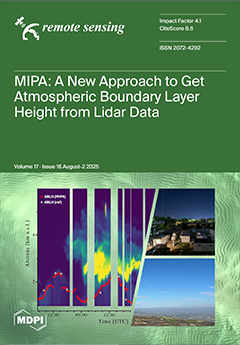
MIPA (Morphological Image Processing Approach) is a novel algorithm developed at CNR-IMAA within the framework of ACTRIS for retrieving Atmospheric Boundary Layer Height (ABLH) from Lidar observations. The algorithm has been tested on multiple datasets, generally showing good agreement with established ABLH retrieval techniques. Unlike traditional methods that analyze Lidar data profile by profile, MIPA adopts a fully image-based strategy: it processes entire Lidar time series as two-dimensional images, therefore accounting for temporal correlations in ABLH determination. By combining morphological filtering and object-oriented analysis, MIPA achieves robustness across different sensors and wavelengths. This opens the way to improved characterization of ABLH at continental and even global scales through multi-sensor approaches. View this paper
  • Issues are regarded as officially published after their release is announced to the table of contents alert mailing list .
  • You may sign up for email alerts to receive table of contents of newly released issues.
  • PDF is the official format for papers published in both, html and pdf forms. To view the papers in pdf format, click on the "PDF Full-text" link, and use the free Adobe Reader to open them.

Articles (171)

  • Technical Note
  • Open Access
1,084 Views
20 Pages

Air Moving-Target Detection Based on Sub-Aperture Segmentation and GoDec+ Decomposition with Spaceborne SAR Time-Series Imagery

  • Yanping Wang,
  • Yunzhen Jia,
  • Wenjie Shen,
  • Yun Lin,
  • Yang Li,
  • Lei Liu,
  • Aichun Wang,
  • Hongyu Liu and
  • Qingjun Zhang

21 August 2025

Air moving-target detection is crucial for national defense, civil aviation, and airspace supervision. Spaceborne synthetic aperture radar (SAR) provides high-resolution, continuous observations for this task, but faces challenges including target at...

  • Article
  • Open Access
1,161 Views
18 Pages

21 August 2025

Accurate mapping of seafloor morphological features, such as pockmarks, is essential for marine spatial planning, geological hazard assessment, and environmental monitoring. Traditional manual delineation methods are often subjective and inefficient...

  • Article
  • Open Access
907 Views
25 Pages

21 August 2025

Global warming has intensified the hydrological cycle, resulting in more frequent extreme precipitation events and altered spatiotemporal precipitation patterns in urban areas, thereby increasing the risk of urban flooding and threatening socio-econo...

  • Article
  • Open Access
1 Citations
1,121 Views
20 Pages

21 August 2025

High-precision Sea Surface Temperature (SST) prediction is critical for understanding ocean–atmosphere interactions and climate anomaly monitoring. We propose GRU_EKAN, a novel hybrid model where Gated Recurrent Units (GRUs) capture temporal de...

  • Article
  • Open Access
1,457 Views
20 Pages

Leaf Area Index Estimation of Grassland Based on UAV-Borne Hyperspectral Data and Multiple Machine Learning Models in Hulun Lake Basin

  • Dazhou Wu,
  • Saru Bao,
  • Yi Tong,
  • Yifan Fan,
  • Lu Lu,
  • Songtao Liu,
  • Wenjing Li,
  • Mengyong Xue,
  • Bingshuai Cao and
  • Quan Li
  • + 3 authors

21 August 2025

Leaf area index (LAI) is a crucial parameter reflecting the crown structure of the grassland. Accurately obtaining LAI is of great significance for estimating carbon sinks in grassland ecosystems. However, spectral noise interference and pronounced s...

  • Article
  • Open Access
3,467 Views
21 Pages

21 August 2025

Monitoring freshwater resources is essential for assessing the impacts of drought, water management and global warming. Spaceborne LiDAR altimeters allow researchers to obtain water height information, while water area and precipitation data can be o...

  • Article
  • Open Access
1,124 Views
21 Pages

A Web-Based National-Scale Coastal Tidal Flat Extraction System Using Multi-Algorithm Integration on AI Earth Platform

  • Shiqi Shen,
  • Qianqian Su,
  • Hui Lei,
  • Zhifeng Yu,
  • Pengyu Cheng,
  • Wenxuan Gu and
  • Bin Zhou

21 August 2025

As coastal tidal flats—ecosystems of high ecological significance and socio-economic value—face accelerating degradation driven by climate change and intensified anthropogenic disturbances, there is an urgent need for efficient, automated...

  • Article
  • Open Access
1,306 Views
22 Pages

21 August 2025

Bathymetry, the measurement of water depth and underwater terrain, is vital for scientific, commercial, and environmental applications. Traditional methods like shipborne echosounders are costly and inefficient in shallow waters due to limited spatia...

  • Article
  • Open Access
2,478 Views
28 Pages

21 August 2025

The digitization and semantic enrichment of built environments traditionally rely on costly and labor-intensive processes, which hinder scalability, adaptability, and real-time deployment in real-world applications. This research presents a novel, fu...

  • Article
  • Open Access
1,684 Views
27 Pages

21 August 2025

Synthetic Aperture Radar (SAR) technology offers unparalleled advantages by delivering high-quality images under all-weather conditions, enabling effective flood monitoring. This capability provides massive remote sensing data for flood mapping, whil...

of 18

Get Alerted

Add your email address to receive forthcoming issues of this journal.

XFacebookLinkedIn
Remote Sens. - ISSN 2072-4292