Next Issue
Volume 14, December
Previous Issue
Volume 14, October


Land, Volume 14, Issue 11 (November 2025) – 197 articles

Cover Story (view full-size image): 
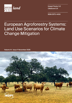
Agroforestry systems play an important role in Europe’s transition toward climate-resilient and sustainable land use. This study mapped over 9 million hectares of silvopastoral and silvoarable systems across the EU, the UK, and Switzerland—predominantly clustered in the Mediterranean region—using high-resolution spatial data. By integrating land cover mapping with greenhouse gas inventories based on the latest guidance from the Intergovernmental Penal on Climate Change, the study quantifies a net carbon sink of 31.8 Mt CO2 eq annually. Beyond current inventories, modelling indicates that expanding agroforestry to just 30% of suitable land could sequester an additional 49 Mt CO2 eq annually and support the planting of 1.7 billion trees. These findings demonstrate that broader adoption of these systems could substantially enhance net CO2 removals and support climate mitigation targets. View this paper
  • Issues are regarded as officially published after their release is announced to the table of contents alert mailing list.
  • You may sign up for e-mail alerts to receive table of contents of newly released issues.
  • PDF is the official format for papers published in both, html and pdf forms. To view the papers in pdf format, click on the "PDF Full-text" link, and use the free Adobe Reader to open them.
Order results
Result details
Section
Select all
Export citation of selected articles as:
25 pages, 15622 KB  
Article
Incorporating Future Ecosystem Services to Assess the Progress of Sustainable Development Goals in Southern Jiangsu, China
by Haiying Pan, Xu Han, Junjun Zhu, Ligang Lv and Xiaorui Wang
Land 2025, 14(11), 2295; https://doi.org/10.3390/land14112295 - 20 Nov 2025
Viewed by 352
Abstract
Urban expansion in southern Jiangsu is intensifying the conflict between ecological protection and economic growth, hindering the implementation of the Sustainable Development Goals (SDGs). However, we have not yet seen the development of a framework combining land use/land cover (LULC) simulation, ecosystem service [...] Read more.
Urban expansion in southern Jiangsu is intensifying the conflict between ecological protection and economic growth, hindering the implementation of the Sustainable Development Goals (SDGs). However, we have not yet seen the development of a framework combining land use/land cover (LULC) simulation, ecosystem service (ES) quantification, and SDG assessment; there is an especially limited understanding of future ES dynamics and their potential to support the SDGs. In this study, we used the PLUS and InVEST models to simulate and quantify carbon storage (CS), water yield (WY), soil conservation (SC), and habitat quality (HQ) in southern Jiangsu, China, under four 2030 scenarios: business as usual scenario (BAUS), ecological protection redline scenario (EPRS), cropland protection scenario (CPS), and economic development scenario (EDS). Additionally, we assessed the contributions of these ESs in advancing SDGs, guided by the ES-SDG target-SDG linkages. The results revealed a pronounced trade-off between WY and HQ, where the EDS, promoting the highest WY increase (+4.54%), caused the most severe degradation in CS (−5.86%) and HQ (−4.39%). In contrast, the EPRS optimally balanced multiple ESs, enhancing CS (+1.62%) and WY (+2.26%) over the BAUS. Spatially, ESs and the derived SDG index were superior in forested and agricultural clusters compared to urban cores. Overall, the SDG index declined most under the EDS and improved most under the EPRS, highlighting the EPRS as the most sustainable pathway. The sustainability performance regarding SDG 7 (Affordable and Clean Energy) and SDG 12 (Responsible Consumption and Production) was higher than that regarding SDG 6 (Clean Water and Sanitation), with Changzhou and Zhenjiang exceeding Suzhou. This study examined the contribution of ESs to the SDGs through four 2030 scenarios, offering insights to guide regional sustainable development. Full article
Show Figures

Figure 1

25 pages, 1465 KB  
Article
Research on Enhancing Urban Land Use Efficiency Through Digital Technology
by Yunpeng Fu and Ning Wang
Land 2025, 14(11), 2294; https://doi.org/10.3390/land14112294 - 20 Nov 2025
Viewed by 330
Abstract
Based on panel data from China’s prefecture-level cities spanning 2009–2023, this study thoroughly examines the impact of digital technologies on urban land use efficiency and its underlying mechanisms. Findings reveal that advancements in digital technologies significantly enhance urban land use efficiency. This conclusion [...] Read more.
Based on panel data from China’s prefecture-level cities spanning 2009–2023, this study thoroughly examines the impact of digital technologies on urban land use efficiency and its underlying mechanisms. Findings reveal that advancements in digital technologies significantly enhance urban land use efficiency. This conclusion remains robust after undergoing a series of stability tests and endogeneity treatments, demonstrating its reliability. Further heterogeneity analysis revealed regional variations and structural characteristics in the impact of digital technologies. The study found that digital technologies most significantly boosted land use efficiency in western regions and cities with higher levels of centralization. Meanwhile, in cities with higher levels of land industrialization and digital workforce capabilities, the positive impact of digital technologies is more pronounced. The analysis of intermediary mechanisms from both micro-level resource allocation and macro-level structural transformation perspectives reveals that digital technologies effectively enhance urban land use efficiency through four dimensions: increasing the number of startups, strengthening innovation support intensity, elevating green technology levels, and driving industrial structure upgrading. Additionally, the study examined synergistic mechanisms and found that government signaling and environmental policy intensity can all significantly amplify the enabling effects of digital technologies, providing multiple drivers for enhancing urban land use efficiency. Full article
Show Figures

Figure 1

28 pages, 7237 KB  
Article
Research on Restorative Benefits and Stress Relief Approaches in Urban Green Space for Different Stress Threshold Groups
by Yujiao Li, Zihan Xu and Jie Yang
Land 2025, 14(11), 2293; https://doi.org/10.3390/land14112293 - 20 Nov 2025
Viewed by 678
Abstract
Urban green spaces, as vital land use components, play a crucial role in promoting public mental health and well-being. This study investigates the differential restorative benefits and stress relief pathways in urban green spaces for populations with varying stress thresholds. This study employed [...] Read more.
Urban green spaces, as vital land use components, play a crucial role in promoting public mental health and well-being. This study investigates the differential restorative benefits and stress relief pathways in urban green spaces for populations with varying stress thresholds. This study employed a controlled experiment (pre-test–free activity–post-test) with 120 park users, integrating subjective scales (DASS-21, SRRS, etc.). We innovatively stratified participants by stress threshold to analyze recovery mechanisms. Key findings reveal: (1) Park visits were associated with significant restorative benefits across all stress groups (p < 0.05), yet the recovery patterns and potential pathways appear to be stress-threshold-dependent. (2) Our findings suggest distinct patterns: low-stress individuals benefit via cognitive-behavioral routes (environmental awareness, dynamic activities), while medium-high stress groups rely more on physiological regulation (environmental enclosure, static relaxation). (3) Crucially, these mechanisms suggest stratified landscape design strategies: multi-sensory interactive spaces for low-stress, static rest areas for medium-stress, and low-interference, high-enclosure meditative environments for high-stress individuals. However, given the single-group pre-post design, observed benefits should be interpreted as associations and plausible pathways rather than definitive causal effects. By introducing stress threshold stratification into restorative landscape research, this study provides actionable, evidence-based guidelines for optimizing urban green space planning and design. It offers a crucial scientific foundation for creating healthier, more inclusive, and sustainable urban environments that effectively address diverse mental health needs and contribute to public health promotion through sustainable land use practices. Full article
(This article belongs to the Special Issue Urban Spatial Planning for Health and Well-Being)
Show Figures

Figure 1

28 pages, 4549 KB  
Article
Research on Cultivated Land Use System Resilience in Major Grain-Producing Areas Under the “Resource–Utilization–Production–Ecology” Framework: A Case Study of the Songnen Plain, China
by Xinxin Guo, Yunfeng Liu, Yuanyuan Liu, Tongtong Ma, Yajun Cai, Guoming Du and Shengtao Yang
Land 2025, 14(11), 2292; https://doi.org/10.3390/land14112292 - 20 Nov 2025
Viewed by 416
Abstract
Clarifying the spatiotemporal evolution pattern of cultivated land use system resilience (CLUSR) in major grain-producing areas and identifying the key obstacles constraining its enhancement is of great significance for promoting the sustainable development of cultivated land use systems and ensuring regional food security. [...] Read more.
Clarifying the spatiotemporal evolution pattern of cultivated land use system resilience (CLUSR) in major grain-producing areas and identifying the key obstacles constraining its enhancement is of great significance for promoting the sustainable development of cultivated land use systems and ensuring regional food security. Taking the Songnen Plain, a typical major grain-producing area in China, as the study area, we constructed a CLUSR evaluation index system based on the “Resources–Utilization–Production–Ecology” (RUPE) framework and analyzed the spatiotemporal dynamics of CLUSR. Furthermore, we identified the primary factors impeding CLUSR enhancement. The results were as follows: (1) From 2005 to 2020, CLUSR values in the Songnen Plain ranged from 0.3353 to 0.4256, indicating a moderately low level overall but showing an upward trend. Across subsystems, the mean resilience scores followed the order ESR (0.121) > RER (0.114) > GPSR (0.090) > CLUR (0.055). (2) Spatially, CLUSR exhibited a distinct “high in the east and low in the west” pattern, with significant growth in the northwestern region. High–High clusters were primarily concentrated in the southeastern part of the study area, while Low–Low clusters exhibited a divergent spatial pattern. (3) From an indicator perspective, agricultural output value per unit of cultivated area, water coverage degree, agricultural labor input, agricultural mechanization level, cultivated land area, per capita yield of grain, and agricultural capital investment were identified as the dominant obstacles to CLUSR improvement. From a subsystem perspective, grain production stability and cultivated land use subsystems were the primary factors limiting CLUSR improvement in the Songnen Plain. (4) At the county level, obstacle factors were classified into three types: single, dual, and multiple obstacles. Nearly half of the counties were facing multiple constraints simultaneously. This study provides theoretical and practical implications for the formulation of cultivated land use policies in the Songnen Plain and other major grain-producing areas worldwide, thereby contributing to the sustainable utilization of cultivated land. Full article
Show Figures

Figure 1

20 pages, 2077 KB  
Article
The Impact of Whole Region Comprehensive Land Consolidation on Ecological Vulnerability: Evidence from Township Panel Data in Zhejiang Province
by Honggang Lu, Haibin Shi, Bei Li and Dingde Xu
Land 2025, 14(11), 2291; https://doi.org/10.3390/land14112291 - 20 Nov 2025
Cited by 1 | Viewed by 379
Abstract
A systematic assessment of the impact and mechanisms of Land Consolidation policy on ecological environment can provide valuable insights for optimizing territorial spatial development and restoring ecological functions, both in China and globally. Utilizing 2015–2022 township-level panel data from Zhejiang Province, this study [...] Read more.
A systematic assessment of the impact and mechanisms of Land Consolidation policy on ecological environment can provide valuable insights for optimizing territorial spatial development and restoring ecological functions, both in China and globally. Utilizing 2015–2022 township-level panel data from Zhejiang Province, this study employs satellite remote sensing to construct an Ecological Vulnerability (EV) index. We empirically examine the impact of Whole Region Comprehensive Land Consolidation (WRCLC) on EV and its transmission channels by applying a multi-period Difference-in-Differences (DID) model and a mediating effect model. The results indicate that the implementation of WRCLC pilot policies significantly reduces EV, a finding that remains robust after parallel trend tests, placebo tests, and other robustness checks. The mediating effects within the “Element-Pattern-Effect” framework indicate that the transition of land elements toward ecological functions and the absence of significant land use conflicts at the pattern level are key mechanisms driving these outcomes. Furthermore, the study reveals that WRCLC exerts a significant negative spatial spillover effect on adjacent areas. It is therefore recommended to promote this policy, providing valuable insights for land consolidation initiatives in other Chinese provinces and developing countries worldwide. Full article
(This article belongs to the Section Land Socio-Economic and Political Issues)
Show Figures

Figure 1

26 pages, 174853 KB  
Article
Understanding Flash Droughts in Greece: Implications for Sustainable Water and Agricultural Management
by Evangelos Leivadiotis, Evangelia Farsirotou, Ourania Tzoraki, Silvia Kohnová and Aris Psilovikos
Land 2025, 14(11), 2290; https://doi.org/10.3390/land14112290 - 20 Nov 2025
Viewed by 467
Abstract
Flash droughts—characterized by their sudden development, severity, and short duration—impose considerable challenges on the soil–water complex of agricultural systems, especially under the Mediterranean climate. Though gaining increasing global significance, Mediterranean flash droughts are still understudied. This study examines the spatiotemporal variability of flash [...] Read more.
Flash droughts—characterized by their sudden development, severity, and short duration—impose considerable challenges on the soil–water complex of agricultural systems, especially under the Mediterranean climate. Though gaining increasing global significance, Mediterranean flash droughts are still understudied. This study examines the spatiotemporal variability of flash droughts in Greece for the period 1990–2024 using 5-day (pentad) ERA5-Land root-zone soil moisture (0–100 cm) at 0.25° resolution. A percentile-threshold approach detected flash drought events, and their main features—including frequency, duration, magnitude, intensity, decline rate, recovery rate, and recovery duration—were evaluated at the annual and seasonal levels. Findings indicate that Central Greece and Thessaly face the highest frequency and longevity of flash droughts, while Western Greece and Peloponnese and Western Macedonia are characterized by rapid development but intense recovery. An innovative empirical classification framework founded on decline and recovery rates indicated that Mild Fast Recovery events prevail in northern and central Greece, while Intense but Recovering events dominate in western and southern Greece. These results offer new perspectives on how flash droughts impact soil–water availability and agricultural resilience, providing a data-driven platform to aid sustainable water management, early warning systems, and adaptation strategies for Mediterranean agriculture in conditions of climate variability. Full article
Show Figures

Figure 1

24 pages, 39791 KB  
Article
Urban Physical Examination and Hypernetwork Analysis for Shenzhen, China: A Livability-Driven Sustainable Development Study
by Kai Peng, Junzheng Li, Yaqi Zhou, Rui Wang, Miao Li and Yang Wang
Land 2025, 14(11), 2289; https://doi.org/10.3390/land14112289 - 19 Nov 2025
Viewed by 646
Abstract
Rapid global urbanization has intensified the need for cities to transition from growth-oriented models to sustainable development frameworks that prioritize livability, environmental quality, and social equity, positioning urban physical examination as an essential methodology for guiding this transformation. This study analyzes the spatial–temporal [...] Read more.
Rapid global urbanization has intensified the need for cities to transition from growth-oriented models to sustainable development frameworks that prioritize livability, environmental quality, and social equity, positioning urban physical examination as an essential methodology for guiding this transformation. This study analyzes the spatial–temporal evolution of Shenzhen’s sustainable urban transformation from 2020 to 2024, employing urban physical examination methodologies combined with hypernetwork analysis to evaluate livability enhancement strategies. The research develops an economic vitality index incorporating urban points of interest density, Habitat Environment Index, and land surface temperature. Through spatial optimization analysis and hypernetwork modeling, the study examines the evolution of Shenzhen’s economic vitality and sustainable development patterns, with a particular focus on the impacts of economic centralization on regional sustainability and habitability. Results show Shenzhen’s economic vitality index increased by 10.47% from 2020 to 2024. However, regional disparities persist, with western and central regions displaying higher vitality than eastern coastal areas. The hypernetwork analysis reveals clustering patterns in livable spaces, with connectivity indicators ranging from 3.75 to 3.86. The uneven distribution of public facilities in Longgang and Yantian Districts highlights the need for improved resource allocation. These findings provide evidence-based support for sustainable urban space strategies in rapidly developing cities, emphasizing the importance of equitable resource allocation and community-centered planning approaches. Full article
Show Figures

Figure 1

25 pages, 3683 KB  
Article
How Do Sense of Place and Perceived Restorativeness Affect Psychological Benefits from Urban Green Spaces for Older Adults? A Cross-Sectional Study
by Fan Zhang, Gang Zhou, Kuo-Hsun Wen, Tianyin Jiang and Gwon-Soo Bahn
Land 2025, 14(11), 2288; https://doi.org/10.3390/land14112288 - 19 Nov 2025
Viewed by 556
Abstract
With the intensifying trend of population aging, the positive effects of Urban Green Space (UGS) on Psychological Well-being (PW) among older adults have garnered increasing attention. Previous studies examined the unidirectional pathways through which objective UGS exposure indicators influenced PW via Sense of [...] Read more.
With the intensifying trend of population aging, the positive effects of Urban Green Space (UGS) on Psychological Well-being (PW) among older adults have garnered increasing attention. Previous studies examined the unidirectional pathways through which objective UGS exposure indicators influenced PW via Sense of Place (SOP) or Perceived Restorativeness (PR). However, little empirical work has addressed how UGS exposure affects PW in older adults through a dual mediation pathway encompassing both SOP and PR. To address this gap, this study investigated representative urban parks in Fuzhou, China. Using the Normalized Difference Vegetation Index (NDVI) and Normalized Difference Water Index (NDWI) as objective exposure indicators, along with survey data capturing older adults’ perceived characteristics (PC) of UGS, SOP, and PR, we developed a multilevel structural equation model to explore how NDVI, NDWI, and PC influence PW through the dual mediators of SOP and PR. Results indicated that (1) NDVI and PC influence PW either directly or indirectly via the mediators SOP and PR, with PC exhibiting a significantly stronger effect than NDVI; (2) NDWI has no significant effect on SOP and PW, but it indirectly influences PW through PR; (3) PR moderated the link between SOP and PW; (4) under the dual-pathway mechanism, PR contributes more substantially to PW than SOP. This study enriches the understanding of how UGS contributes to PW and advocates for integrating exposure characteristics, place qualities, and restorative elements into the framework of age-friendly city planning to guide targeted health interventions for the elderly. Moreover, SOP–PR insights from an East Asian city inform global aging urbanism. Full article
Show Figures

Figure 1

34 pages, 1615 KB  
Review
A Semi-Systematic Global Review to Understand the Key Components Essential for Advancing the Actual Design, Planning, and Implementation of Blue–Green Infrastructure in Indian Cities
by Vedanti Kelkar, Björn Helm and Peter Krebs
Land 2025, 14(11), 2287; https://doi.org/10.3390/land14112287 - 19 Nov 2025
Viewed by 592
Abstract
Cities in developing nations such as India have undergone unregulated growth and uneven urbanization, fostering economic expansion while exacerbating spatial, social, and economic inequalities. This urbanization has significantly degraded water bodies and green spaces, affecting human health and well-being. Blue–green infrastructure (BGI) has [...] Read more.
Cities in developing nations such as India have undergone unregulated growth and uneven urbanization, fostering economic expansion while exacerbating spatial, social, and economic inequalities. This urbanization has significantly degraded water bodies and green spaces, affecting human health and well-being. Blue–green infrastructure (BGI) has emerged as a promising solution for addressing environmental challenges, stormwater management, social well-being, and urban heat mitigation. However, developing countries such as India lack adequate knowledge of their design, planning, and implementation under specific local conditions. This study employs a semi-systematic literature review to identify essential components for BGI implementation in developing nations, with contextual references to India. Among the 797 studies reviewed in total, with 42 studies selected for the final review, only 26% focused on developing countries such as China, with none specifically addressing India. Furthermore, this review discusses global city and country cases across the Global South and Global North to obtain pertinent information from empirical applications worldwide. In total, 32 country cases are analyzed globally, comprising an even larger number of city cases. This review has derived eight thematic areas critical for BGI implementation: spatial configuration, plans and policies, best practices, BGI features and components, stakeholder perceptions, barriers to adoption, local government capacity, and scientific research. Each thematic area is analyzed in relation to stormwater management functions. This study emphasizes that these areas can guide urban planners and researchers in designing effective BGI strategies tailored to specific contexts. By bridging the knowledge gap in India’s development journey, this research underscores the importance of integrating BGI into urban planning to achieve the Sustainable Development Goals and address the adverse effects of rapid urbanization. Full article
Show Figures

Figure 1

28 pages, 3955 KB  
Article
Integrating Ecosystem Services into Urban Carbon Dynamics: A Dual-Scale Spatial Analysis of Land Use, Emissions, and Planning
by Carmelina Bevilacqua, Poya Sohrabi and Nourhan Hamdy
Land 2025, 14(11), 2286; https://doi.org/10.3390/land14112286 - 19 Nov 2025
Viewed by 409
Abstract
Integrating ecosystem services into urban planning requires analytical tools that connect spatial land-use data with environmental performance. This paper applies a multi-scale, data-driven approach to assess urban carbon dynamics using spatial units that reflect both ecological functions and planning relevance. The study examines [...] Read more.
Integrating ecosystem services into urban planning requires analytical tools that connect spatial land-use data with environmental performance. This paper applies a multi-scale, data-driven approach to assess urban carbon dynamics using spatial units that reflect both ecological functions and planning relevance. The study examines the Reggio Calabria Functional Urban Area (FUA) in Southern Italy, using Copernicus Urban Atlas land-use data to characterize spatial patterns and estimate CO2 emissions and sequestration using parameters derived from established literature and institutional sources. A Spatial Durbin Model (SDM) identifies land uses with direct and spillover effects, revealing how spatial organization shapes urban carbon outcomes. Results reveal a net emission imbalance of approximately 1.85 billion kg CO2 per year, confirming the region’s role as a net emitter. Transport corridors and discontinuous low-density urban areas show the strongest positive SDM coefficients (+3.48 and +0.78 kg CO2 m−2 yr−1, respectively). Forests and agricultural lands show negative effects, indicating potential sequestration functions, though not statistically significant. This suggests that natural and semi-natural land uses contribute little to measurable CO2 reduction within the FUA. Emissions and sinks display a polarized spatial pattern, with coastal urban zones acting as hotspots and inland areas serving as potential sinks. These findings underscore the need to strengthen ecological connectivity and integrate green infrastructure within dense urban areas to enhance mitigation capacity. The proposed framework shows how spatially explicit, hierarchical analysis can bridge ecosystem services and urban planning, offering a replicable basis for data-informed, climate-responsive strategies. Full article
(This article belongs to the Special Issue Feature Papers on Land Use, Impact Assessment and Sustainability)
Show Figures

Figure 1

30 pages, 21379 KB  
Article
Exploring the Relationship Between Rural Development and Marginalization: An Empirical Study from Linhai City, Zhejiang Province, China
by Zhichao Hu, Xiaohan Fan, Jing Wang, Changjiang Kang, Zhifeng Zhao and Yage Li
Land 2025, 14(11), 2285; https://doi.org/10.3390/land14112285 - 19 Nov 2025
Viewed by 439
Abstract
The study focuses on the multidimensional attributes of rural marginalization and their differentiated impact on rural development levels. Based on a systematic review and summary of research findings, this study elucidates the conceptual implications of rural development levels and rural marginalization and deconstructs [...] Read more.
The study focuses on the multidimensional attributes of rural marginalization and their differentiated impact on rural development levels. Based on a systematic review and summary of research findings, this study elucidates the conceptual implications of rural development levels and rural marginalization and deconstructs rural marginalization into five dimensions. Considering Linhai City in Zhejiang Province, China, as the research object, a measurement model for rural development levels was constructed comprising basic and enhancement factors. An influencing factor set was established based on the perspective of marginalization. Spatial autocorrelation and multiscale geographically weighted regression models were comprehensively employed to measure and analyze rural development levels and their influencing factors. The main findings are as follows: (1) the concept of rural marginalization is defined from five dimensions: spatial, technological, policy, social, and infrastructural, and a quantitative evaluation system is established; (2) through quantitative analysis using Linhai City as an example, it is found that the influence of marginalization across different dimensions on rural development exhibits significant spatial variability, meaning that the impact of marginalization on rural development levels is influenced by multiple factors. These findings suggest that, while formulating rural development policies, we should fully consider the actual and external circumstances of different villages, adopt tailored strategies based on local conditions, and avoid implementing one-size-fits-all policies. Full article
Show Figures

Figure 1

29 pages, 26979 KB  
Article
The Effect of Urban Greenspace on Land Surface Temperatures: A Spatial Analysis in Sheffield, UK
by Rozanne Vallivattam, Zhixin Liu and Paul Brindley
Land 2025, 14(11), 2284; https://doi.org/10.3390/land14112284 - 19 Nov 2025
Viewed by 585
Abstract
With the intensification of climate change and the urban heat island effect, there is growing awareness of the role of urban greening in improving the urban climate. The aim of this study is to explore how various characteristics of green spaces—including type, configuration [...] Read more.
With the intensification of climate change and the urban heat island effect, there is growing awareness of the role of urban greening in improving the urban climate. The aim of this study is to explore how various characteristics of green spaces—including type, configuration (size and shape), location, and distance from the urban centre—affect their cooling effect. Landsat remote sensing land surface temperature data were analysed through Geographic Information Systems, using Sheffield as a case study. The results show that the cooling effect of woodland was significantly stronger than that of grassland and urban parks, with a cooling intensity reaching up to 2.93 °C, and a cooling extent that can reach up to 500 m beyond its boundary. When closer to the city centre, both the shape and size of green spaces show a positive correlation with their cooling effect, but this relationship becomes less evident as the distance from the city centre increases. The size of a woodland had a greater effect in terms of a reduction in land surface temperature than the shape of the woodland. The findings of this study can provide a better framework for landscape architects and urban planners to plan for climate change and propose stronger green strategies to mitigate the urban heat island effect. Full article
(This article belongs to the Special Issue Urban Form and the Urban Heat Island Effect (Second Edition))
Show Figures

Figure 1

30 pages, 38403 KB  
Article
Satisfaction Evaluation and Typological Optimization of Traditional Village Human Settlements from the Perspective of Villager Participation: A Northeast China Case Study
by Huaizhi Qi, Hideaki Kanai and Fucun Cao
Land 2025, 14(11), 2283; https://doi.org/10.3390/land14112283 - 19 Nov 2025
Viewed by 461
Abstract
To address demand–supply mismatches in traditional village human settlements (TVHSs), this study builds on existing human settlement research by introducing cultural landscape theory and constructing a comprehensive framework that includes the hard (infrastructure, living environment, ecological environment, and environmental sanitation) and soft environment [...] Read more.
To address demand–supply mismatches in traditional village human settlements (TVHSs), this study builds on existing human settlement research by introducing cultural landscape theory and constructing a comprehensive framework that includes the hard (infrastructure, living environment, ecological environment, and environmental sanitation) and soft environment (social services, economic environment, and cultural environment). Villagers’ and experts’ perceptions of importance are integrated through a hierarchical weighting system combining AHP, CRITIC, and GRA. In addition, cluster analyses, the importance–satisfaction (IS) model, the obstacle degree model, and mediation analyses are employed to identify village classifications, determine optimization indicators, and assess mechanism effects. The findings indicate the following: (1) The overall satisfaction with TVHSs in Northeast China is moderate, with a stepwise decline from northeast to southwest, and the economic environment significantly lags behind other dimensions. (2) Four village classifications are identified—demonstration, basic-level development, potential-focused, and priority improvement. (3) The optimization indicators across classifications include toilet conditions, village cleanliness, school accessibility, and access to medical services, resulting in strategies such as “cultural landscape empowerment” and “telemedicine coverage”. (4) Mediation analyses show that improvements in the hard environment enhance overall satisfaction both directly and indirectly through social services and the economic environment. These findings highlight the close link between satisfaction and regional development, underscoring the need for dynamic monitoring and greater emphasis on the cultural dimension to support TVHS optimization and rural revitalization. Full article
Show Figures

Figure 1

2 pages, 139 KB  
Correction
Correction: Yao et al. Soil Organic Carbon Content and Density in Response to Pika Outbreaks Along the Altitudinal Gradient in Alpine Meadows of the Qinghai–Tibet Plateau, West China. Land 2025, 14, 981
by Wenzhi Yao, Jing Zhang and Xilai Li
Land 2025, 14(11), 2282; https://doi.org/10.3390/land14112282 - 19 Nov 2025
Viewed by 182
Abstract
In the original publication [1], there were mistakes in affiliations, Tables 2 and 3 as published [...] Full article
21 pages, 7308 KB  
Article
The “Third Landscape” and the Rural–Urban Spaces in the South of the Community of Madrid, in the Field of Sustainability: A Case Study
by Ignacio Sotelo Pérez, María Sotelo Pérez and José Antonio Sotelo Navalpotro
Land 2025, 14(11), 2281; https://doi.org/10.3390/land14112281 - 18 Nov 2025
Viewed by 461
Abstract
The present research aims to analyze, assess, and interpret the territorial reality of the south of the Community of Madrid, with the case study of Aranjuez, revealing the interrelationship between urban growth, its link with the mechanisms that operate in the real estate [...] Read more.
The present research aims to analyze, assess, and interpret the territorial reality of the south of the Community of Madrid, with the case study of Aranjuez, revealing the interrelationship between urban growth, its link with the mechanisms that operate in the real estate sector, the processes of transformation of rural areas into spaces where rurbanization and marginal urbanization related to the reclassification of land (generally rural) prevail, based on the application of a novel interpretive methodology of the so-called “Third Landscape”, based on the “Key Performance Indicators (KPIs)”, applied to formal, socioeconomic, functional, environmental paradigms, among others. Thus, throughout the study, we address the Third Landscape and elements such as Lost Spaces, Garbage Spaces, Shadow Places, etc., in short, vacant lots or residual spaces (formless and unused anti-spaces), which are framed around the conceptualization of the Third Landscape, of that of no man’s land, which no one uses, whose maintenance is unknown, and which currently predominates in the rural and rururban world of Aranjuez. With all this, the motivation for the research and, therefore, its results, is based on the knowledge of the regeneration and adaptation of the nature of the study area in marginal and unplanned spaces—such as roadside ditches, vacant lots, and urban interstices—promoting the foundations for future territorial development models, as well as territorial planning processes that allow for urban regeneration, ecological design, and the socioeconomic enhancement of a city in expansion and transformation. Full article
Show Figures

Figure 1

29 pages, 21383 KB  
Article
Land Use Simulation and Carbon Storage Driving Mechanisms in Resource-Based Regions Under SSP-RCP Scenarios: An Integrated PLUS-InVEST and GWR-SEM Modeling Approach
by Tonghui Yu, Mengting Yang, Xinyu Li, Xuan Zhu, Mengru Wang and Jiqiang Niu
Land 2025, 14(11), 2280; https://doi.org/10.3390/land14112280 - 18 Nov 2025
Viewed by 409
Abstract
Amid China’s dual-carbon goals and widening regional disparities, land-use/cover change (LUCC)-induced volatility in carbon storage (CS) has emerged as a binding constraint on emission reduction and the low-carbon transition in resource-based regions. Yet integrated historical-scenario assessments and rigorous evidence on spatial-heterogeneity mechanisms remain [...] Read more.
Amid China’s dual-carbon goals and widening regional disparities, land-use/cover change (LUCC)-induced volatility in carbon storage (CS) has emerged as a binding constraint on emission reduction and the low-carbon transition in resource-based regions. Yet integrated historical-scenario assessments and rigorous evidence on spatial-heterogeneity mechanisms remain limited, which hampers targeted spatial governance. Using Shanxi Province, a resource-based province, as the study area, this study develops a coupled PLUS-InVEST framework under SSP-RCP scenarios. It integrates spatial autocorrelation, geographically weighted regression (GWR), and structural equation modeling (SEM) to characterize spatiotemporal responses of CS to LUCC and to identify underlying drivers. The results indicate that: (1) Regional CS follows an inverted U-shaped trajectory, initially increasing due to ecological restoration projects and subsequently declining owing to industrial development and urban expansion; (2) By 2030, forestland expansion under SSP126 is projected to enhance CS, whereas accelerated urbanization under SSP585 is expected to intensify CS losses; (3) Significant spatial clustering of CS remains consistent from historical periods to future projections, underscoring its sensitivity to topography, vegetation patterns, and human activities; and (4) CS is jointly shaped by natural and anthropogenic drivers, with DEM and slope providing stable protection, while population density and transport-network configuration cause ongoing disturbances. The study provides an integrated historical-scenario assessment and reveals the underlying mechanisms for resource-based regions, offering quantitative evidence to support optimization of the Ecological Conservation Redline, managing urban growth boundaries, and implementing zoned ecological restoration. Full article
(This article belongs to the Special Issue Land Space Optimization and Governance)
Show Figures

Figure 1

18 pages, 3778 KB  
Article
The Potential of Basic Education Accessibility Across Administrative Boundaries Using a Multi-Scenario Comparative Analysis: How Can Education Equity in the Qinghai–Tibet Plateau Be Better Achieved?
by Yiran Du, Jinglong Duan and Yi Miao
Land 2025, 14(11), 2279; https://doi.org/10.3390/land14112279 - 18 Nov 2025
Viewed by 365
Abstract
Ensuring equitable access to basic education is a core issue for promoting balanced regional development and sustainable educational outcomes. As a vast and sparsely populated region with relatively slow development, the Qinghai–Tibet Plateau faces particular challenges in ensuring educational accessibility and equity. Using [...] Read more.
Ensuring equitable access to basic education is a core issue for promoting balanced regional development and sustainable educational outcomes. As a vast and sparsely populated region with relatively slow development, the Qinghai–Tibet Plateau faces particular challenges in ensuring educational accessibility and equity. Using a 100 m × 100 m travel time cost raster constructed from OSM road networks and the cost-distance method, together with local spatial autocorrelation, Lorenz curve, and Gini coefficients, as well as the Geodetector method, this study examines the spatial equity and factors influencing the accessibility of primary and secondary schools across 2798 townships at three time points (2016, 2020, and 2024) under three scenarios: Scenario 1 (nearby schooling), Scenario 2 (schooling within the prefecture-level city), and Scenario 3 (schooling within the county). The results show that: (1) Overall accessibility improved from 2016 to 2024, with primary schools being more accessible than secondary schools. Western townships, although initially disadvantaged, experienced the most notable gains. However, accessibility declined markedly when administrative-boundary constraints were imposed, with the greatest losses observed in ultra-high-altitude remote areas such as Ngari and Nagqu. (2) Spatial equity also improved, but when administrative boundaries were imposed, population-weighted inequities became even more pronounced than disparities in accessibility itself. Equity declined most sharply under county-level constraints, with pronounced impacts on both primary and secondary schooling. (3) Spatial variations in accessibility were jointly driven by multiple factors. In Scenario 1, road network density and population density had the strongest explanatory power. Under administrative boundary constraints, however, county type and ethnic autonomy became increasingly influential. In conclusion, in ultra-high-altitude areas where natural conditions remain difficult to overcome, improving educational equity depends less on transport expansion or facility provision and more on relaxing county-level boundary restrictions that constrain access to services. These findings may provide useful evidence to inform targeted policy interventions and resource allocation strategies aimed at promoting equitable access to basic education in underdeveloped and high-altitude regions. Full article
Show Figures

Figure 1

15 pages, 2743 KB  
Article
Delineation and Intensity Classification of Freeze–Thaw Erosion in the Western Section of Northern China’s Agro-Pastoral Transition Zone Under Controlling Factors
by Xiaoyan Ma, Weidong Ma, Fenggui Liu, Qiong Chen, Baicheng Niu and Qiang Zhou
Land 2025, 14(11), 2278; https://doi.org/10.3390/land14112278 - 18 Nov 2025
Viewed by 309
Abstract
Global warming has intensified freeze–thaw activity in high-latitude and high-altitude regions; along the western sector of the farming–pastoral ecotone in northern China, pronounced seasonal freeze–thaw cycles now pose a severe threat to land resources. This study aims to quantitatively reveal the spatial differentiation [...] Read more.
Global warming has intensified freeze–thaw activity in high-latitude and high-altitude regions; along the western sector of the farming–pastoral ecotone in northern China, pronounced seasonal freeze–thaw cycles now pose a severe threat to land resources. This study aims to quantitatively reveal the spatial differentiation patterns of freeze–thaw erosion in the western segment and its influencing factors. This study begins with the fundamental concepts of freeze–thaw erosion, grounded in soil mechanical fragmentation and gravitational migration. Critical slope is used as the identification criterion to delineate freeze–thaw erosion zones. Building upon this foundation, a Random Forest model is employed to calculate the weighting factors influencing freeze–thaw erosion in the western segment of the northern agro-pastoral transition zone, thereby constructing a graded evaluation model for freeze–thaw erosion intensity. Results indicate the following: (1) Freeze–thaw erosion exhibits no discernible distribution pattern in the western segment, appearing scattered, while non-freeze–thaw erosion is primarily concentrated in the northern region. (2) Freeze–thaw erosion intensity ranges from 1.48 to 4.58 in the western segment. The total area of the study region is 151,000 km2, the affected area spans 122,400 km2, accounting for 81.11% of the total regional area. (3) Regionally, the Hehuang Valley exhibits predominantly strong and severe erosion, while the northern Loess Plateau shows mostly slight erosion. The southern Loess Plateau features light and moderate erosion with scattered instances of severe erosion. (4) Vegetation coverage and soil moisture are the primary contributing factors to freeze–thaw erosion. This study proposes, for the first time, a method that couples annual freeze–thaw day cycles with a critical slope threshold to delineate freeze–thaw erosion zones, demonstrating broad applicability. It systematically uncovers the spatial heterogeneity of freeze–thaw erosion in the western sector, substantially advancing scientific understanding of the process and providing a theoretical basis for its targeted management. Full article
Show Figures

Figure 1

23 pages, 3172 KB  
Article
Machine Learning-Based Spatial Prediction of Soil Erosion Susceptibility Using Geo-Environmental Variables in Karst Landscapes of Southwest China
by Binglan Yang, Yiqiu Li, Man Li, Ou Deng, Guangbin Yang and Xinyong Lei
Land 2025, 14(11), 2277; https://doi.org/10.3390/land14112277 - 18 Nov 2025
Viewed by 394
Abstract
Soil erosion poses a significant threat to the sustainability of land systems in karst mountainous regions, where steep slopes, shallow soils, and intensive human activities exacerbate land degradation, undermining both the productive functions and ecological services of land resources. This study evaluated soil [...] Read more.
Soil erosion poses a significant threat to the sustainability of land systems in karst mountainous regions, where steep slopes, shallow soils, and intensive human activities exacerbate land degradation, undermining both the productive functions and ecological services of land resources. This study evaluated soil erosion susceptibility in the karst-dominated Qingshui River watershed, Southwest China, and identified key drivers of land degradation to support targeted land management strategies. Four machine learning models, BPANN, BRTs, RF, and SVR were trained using twelve geo-environmental variables representing lithological, topographic, pedological, hydrological, and anthropogenic factors. Variable importance analysis revealed that annual precipitation, land use type, distance to roads, slope, and aspect consistently had the greatest influence on soil erosion patterns. Model performance assessment indicated that BRTs achieved the highest predictive accuracy (RMSE = 0.161, MAE = 0.056), followed by RF, BPANN, and SVR. Spatial susceptibility maps showed that high and very high erosion risk zones were mainly concentrated in the central and southeastern areas with steep slopes and exposed carbonate rocks, while low-risk zones were located in flatter, vegetated southwestern regions. These results confirm that hydrological conditions, topography, and anthropogenic activities are the primary drivers of soil erosion in karst landscapes. Importantly, the findings provide actionable insights for land and landscape management—such as optimizing land use, restoring vegetation on steep slopes, and regulating human activities in sensitive areas—to mitigate erosion, preserve land quality, and enhance the sustainability of karst land systems. Full article
Show Figures

Figure 1

19 pages, 11066 KB  
Article
Exploring the Spatially Heterogeneous Relationships Between Biodiversity Maintenance Function and Socio-Ecological Drivers in Liaoning Province, China
by Yajun Qiao, Zhi Wang, Haonan Zhang, Kun Liu and Wanggu Xu
Land 2025, 14(11), 2276; https://doi.org/10.3390/land14112276 - 17 Nov 2025
Viewed by 295
Abstract
Biodiversity maintenance function (BMF) denotes the capacity of ecosystems to sustain genetic, species, ecosystem, and landscape diversity. Assessing the spatial distribution and underlying drivers of BMF at the regional scale is essential for biodiversity management. However, research on the socio-ecological drivers of BMF [...] Read more.
Biodiversity maintenance function (BMF) denotes the capacity of ecosystems to sustain genetic, species, ecosystem, and landscape diversity. Assessing the spatial distribution and underlying drivers of BMF at the regional scale is essential for biodiversity management. However, research on the socio-ecological drivers of BMF from a geographical perspective remains scarce. Therefore, this study developed an integrated assessment framework encompassing climatic factors, species richness, vegetation status, ecosystem protection, and anthropogenic disturbance. We analyzed the BMF spatial patterns across Liaoning Province, China, and identified the dominant drivers and their spatial heterogeneity using multi-scale geographically weighted regression and geographical detector. The results show that (1) the eastern/western mountainous regions and Liaohe River estuary are critical BMF zones for prioritized conservation; (2) BMF spatial variation is mainly shaped by precipitation, temperature, slope, and forestland/farmland proportion, with factor interactions amplifying their impacts; (3) drivers show distinct spatial heterogeneity. Specifically, precipitation, slope, and NDVI exert homogeneous effects, whereas elevation, temperature, farmland/wetland proportion, and GDP exhibit pronounced heterogeneity. Natural factors generally exert positive effects, while the farmland/urban proportion tends to exert negative impacts—for example, farmland’s negative influence is stronger in the west, whereas the forestland and temperature exert more positive effects in the east. The results enhance the methodological framework for elucidating the spatial relationships between BMF and drivers, providing a scientific basis for biodiversity conservation and ecosystem management in Liaoning Province and similar regions. Full article
Show Figures

Figure 1

16 pages, 1140 KB  
Article
Tianchuang in National Parks of China: Its Concept, Causes, and Consequences
by Rong Tao, Tianjiao Li and Xujiao Zhang
Land 2025, 14(11), 2275; https://doi.org/10.3390/land14112275 - 17 Nov 2025
Viewed by 346
Abstract
In global national parks, many land parcels, despite being inside park boundaries, have incompatible land uses with their surroundings and are normally not integrated into the park’s unified management. These non-contiguous management spaces present common and persistent spatial management challenges. In China, such [...] Read more.
In global national parks, many land parcels, despite being inside park boundaries, have incompatible land uses with their surroundings and are normally not integrated into the park’s unified management. These non-contiguous management spaces present common and persistent spatial management challenges. In China, such spaces are called Tianchuang, a relatively new phenomenon that is underexplored in current research. Therefore, this study explores Tianchuang’s concept, causes, and consequences through policy and literature, and it compares Tianchuang with international cases to situate China’s experience in a global perspective. The findings are as follows. Firstly, originating from functional conflicts and historical legacies, Tianchuang are land parcels that retain their original usage, not ecologically coherent with the overall protected area and temporarily not incorporated into unified management. Secondly, there are three typical approaches to deal with land parcels that have incompatible land uses with their surroundings, including withdrawal, boundary adjustment, and Tianchuang. Compared with the other two approaches, Tianchuang serves as a way to balance ecological protection and local development, and as a transitional method for potential integration into unified management. Thirdly, by alleviating short-term institutional and social conflicts, Tianchuang creates challenges for ecosystem integrity and connectivity, management responsibilities, and community trust. Finally, through cross-national comparisons with U.S. inholdings, Australian indigenous co-management, and Nigerian GGNP enclaves, the uniqueness of Tianchuang in China is highlighted as a proactive policy design under centralized governance that balances efficiency and flexibility, with potential for unified management in the future. This study provides theoretical support for China’s national park Tianchuang governance and contributes Chinese insights in terms of non-contiguous management spaces in national parks for global protected area governance. Full article
(This article belongs to the Special Issue National Parks and Natural Protected Area Systems)
Show Figures

Figure 1

21 pages, 3832 KB  
Article
Restoration Potential of Vegetation: Soil Nutrient Responses and Heavy Metal Distribution in Coal Mine Tailings
by George Popescu, Cosmin Alin Popescu, Adina Horablaga, Florin Crista, Lucian Dragomir, Casiana Mihut, Adina Berbecea and Isidora Radulov
Land 2025, 14(11), 2274; https://doi.org/10.3390/land14112274 - 17 Nov 2025
Viewed by 279
Abstract
Coal mining leaves behind extensive tailing dumps that pose long-term ecological and soil degradation challenges. This study evaluates the restoration potential of vegetation on coal mine tailings in the Jiu Valley, Romania, focusing on soil nutrient dynamics and the heavy metal distribution. Field [...] Read more.
Coal mining leaves behind extensive tailing dumps that pose long-term ecological and soil degradation challenges. This study evaluates the restoration potential of vegetation on coal mine tailings in the Jiu Valley, Romania, focusing on soil nutrient dynamics and the heavy metal distribution. Field sampling was conducted across three vegetation types—unvegetated (UV), herbaceous (HV), and arboreal (AV, Robinia pseudoacacia)—at two intervals: three and six years post-plantation. Soil samples were analyzed for their pH, organic carbon, macronutrients, micronutrients, and heavy metals using standardized spectrometric and titrimetric methods. Between 2021 and 2024, AV plots showed a 9.5% increase in total nitrogen and a 5.2% rise in organic carbon, alongside a 6.9% reduction in soil pH. HV plots exhibited a 10.6% increase in magnesium availability and a 2.8% decrease in copper concentrations, indicating active nutrient cycling. In contrast, UV soils retained 68% higher total potassium and 24% more zinc than vegetated plots, likely due to limited biological uptake. Lead concentrations remained below the EU threshold of 60 mg kg−1, while nickel levels exceeded recommended limits across all variants, peaking at 76.08 mg kg−1. The vegetation type significantly influenced nutrient mobilization and metal stabilization, with arboreal cover demonstrating the most consistent ameliorative effects. These findings underscore the role of targeted revegetation—particularly with Robinia pseudoacacia—in improving soil quality and mitigating ecological risks in post-mining landscapes. Full article
(This article belongs to the Special Issue Land Use and Management for Waste Disposal and Wastewater Treatment)
Show Figures

Figure 1

27 pages, 3054 KB  
Article
Between Memory and Everyday Life: Urban Design and the Role of Citizens in the Management of the Memorial Park “October in Kragujevac”
by Aleksandra Djukic, Emilija Jović, Jovana Stefanović, Lazar Mandić and Veroljub Trifunović
Land 2025, 14(11), 2273; https://doi.org/10.3390/land14112273 - 17 Nov 2025
Viewed by 565
Abstract
The Memorial Park, “October in Kragujevac,” in addition to its memorial and symbolic value, is one of the largest memorial and landscape-designed city parks in Southeastern Europe. Methods of management, maintenance, landscaping, artistic design, construction, and space use by residents have changed over [...] Read more.
The Memorial Park, “October in Kragujevac,” in addition to its memorial and symbolic value, is one of the largest memorial and landscape-designed city parks in Southeastern Europe. Methods of management, maintenance, landscaping, artistic design, construction, and space use by residents have changed over time. This research employs both quantitative and qualitative methods. Critical analysis of primary sources, mainly urban planning documents, is used to understand changes in management models and maintenance patterns. A survey was also conducted via a mobile application (Viber group: “City and Me KG”) among residents to assess their willingness to participate in managing and maintaining the space, as well as attitudes toward program content planned for specific areas. The first part outlines the urban development timeline of the Memorial Park and presents various models of management, maintenance, and use that arose due to historical events, government, and social systems. The park’s evolution relative to the city’s growth is depicted, showing its transition from peripheral space to the central urban park. The second part explores citizens’ interest in urban management and participatory design, along with attitudes toward possible changes to existing features and adding new elements for daily use, without compromising heritage, symbolism, or respect for victims. The survey also examines recognition of the park’s ecological microclimate and ecosystem functions within the city. The results suggest the potential for a new management strategy and creation of open urban spaces—landscape-designed memorial parks that meet community needs within cultural and ecological systems. Full article
(This article belongs to the Special Issue Evaluating and Managing Historic Landscapes)
Show Figures

Figure 1

28 pages, 6073 KB  
Article
Assessing Service Accessibility and Optimizing the Spatial Layout of Elderly Canteens: A Case Study of Nanjing, China
by Xiaoli Wei, Xu Yuan and Yong Xie
Land 2025, 14(11), 2272; https://doi.org/10.3390/land14112272 - 17 Nov 2025
Viewed by 396
Abstract
Equitable accessibility to elderly canteens is critical for addressing the challenges of an aging population. Using Nanjing as a case study, this paper constructed an integrated framework that fuses GIS spatial analysis with interpretable machine learning to diagnose, evaluate, and optimize the service [...] Read more.
Equitable accessibility to elderly canteens is critical for addressing the challenges of an aging population. Using Nanjing as a case study, this paper constructed an integrated framework that fuses GIS spatial analysis with interpretable machine learning to diagnose, evaluate, and optimize the service network’s spatial layout. The study found that the existing design is a direct manifestation of the conflict between “market logic” and “social demand.” First, Nanjing’s elderly canteen service suffers from a severe spatial mismatch and inequality of opportunity. Approximately 80% of the elderly population resides in areas that share less than 15% of the canteen resources. Second, a multi-modal accessibility analysis revealed the phenomenon of “false equity.” The high service coverage under the car accessibility model masks the systemic service deprivation faced by the majority of seniors who rely on walking and micromobility. Third, this study proposed and validated a data-driven “stock activation” strategy. An XGBoost model, guided by a “demand-oriented and spatially efficient” decision-making logic, identified 161 high-potential optimization sites. At the same time, the framework also diagnosed its own strategic boundaries by identifying “resource vacuums” where a lack of convertible stock necessitates alternative solutions, such as new builds. Full article
Show Figures

Figure 1

30 pages, 14267 KB  
Article
Dynamics of Meteorological and Agricultural Drought in the Karnali River Basin, Nepal
by Kumar Aryal, Dhiraj Pradhananga, Deepak Aryal, Nir Y. Krakauer and Rajesh Sigdel
Land 2025, 14(11), 2271; https://doi.org/10.3390/land14112271 - 17 Nov 2025
Viewed by 401
Abstract
Drought poses significant threats to the Himalayan region, but comprehensive assessments incorporating meteorological, agricultural, and ecological dimensions are scarce. This work uses 30 years of observational and satellite data to provide a multidimensional drought analysis for the Karnali River Basin in western Nepal [...] Read more.
Drought poses significant threats to the Himalayan region, but comprehensive assessments incorporating meteorological, agricultural, and ecological dimensions are scarce. This work uses 30 years of observational and satellite data to provide a multidimensional drought analysis for the Karnali River Basin in western Nepal based on ground station precipitation records, reanalysis data, and satellite vegetation index (NDVI). Principal component analysis was used to develop composite meteorological and agricultural drought indices for an assessment of drought propagation across domains. Averaged over the basin, results reveal a persistent long-term greening trend (+12% in NDVI over 25 years), which contrasts with a slight but significant increase (0.031/yr) in long-term meteorological drought severity (SPI12) and a non-significant declining tendency in soil moisture (−0.0024/yr). Mountainous regions were hotspots, with drought frequency surpassing 12%, whereas the Terai lowlands were more resilient. Vegetation responses lagged soil moisture anomalies by about a month. The composite indices were moderately correlated (r = 0.55). They revealed that meteorological droughts were very volatile (52% normal conditions), while agricultural drought evolved more slowly with greater permanence (64% normal conditions). These results highlight dimensions of growing drought threats in this basin and suggest that the development of integrated drought surveillance frameworks is a key to early warning systems, agricultural planning, and adaptive water resource management of mountain regions in the world under a changing climate. Full article
(This article belongs to the Section Land–Climate Interactions)
Show Figures

Graphical abstract

25 pages, 6321 KB  
Article
Modeling Spatiotemporal Dynamics and Driving Mechanisms of Ecosystem Services Bundles in Resource-Based Cities: Supply–Demand Mismatch in Xingtai, China
by Ruohan Wang, Keyu Luo, Qiuhua He, Le Xia, Zhenyu Wang, Chen Yang and Miaomiao Xie
Land 2025, 14(11), 2270; https://doi.org/10.3390/land14112270 - 17 Nov 2025
Viewed by 366
Abstract
The sustainable development of resource-based cities faces challenges due to the imbalance between ecosystem service supply and demand. This study examines Xingtai, a typical resource-based city located in northern China, using ecosystem service bundle theory to analyze the supply–demand relationships of six ecosystem [...] Read more.
The sustainable development of resource-based cities faces challenges due to the imbalance between ecosystem service supply and demand. This study examines Xingtai, a typical resource-based city located in northern China, using ecosystem service bundle theory to analyze the supply–demand relationships of six ecosystem services—water yield, soil retention, habitat quality, urban cooling, PM2.5 removal, and carbon sequestration—from 2000 to 2020. Based on the ratio of supply–demand, we identify ecosystem service bundles and explore their driving factors using redundancy analysis (RDA) and the geographically and temporally weighted regression (GTWR) model. Results show a clear “mountain–plain” supply gradient, with high supply in the western Taihang Mountains and low supply in urbanized eastern plains. Demand follows a “center-high, periphery-low” pattern, with urban centers showing higher demand for urban cooling and PM2.5 removal. A severe supply–demand imbalance exists: soil retention, PM2.5 removal, habitat quality, and carbon sequestration are undersupplied in urbanized areas, while water yield and urban cooling are oversupplied in the western mountains. Natural factors (precipitation and temperature) shape western mountain supply, while human activities (GDP and nighttime light) drive demand polarization in the east. GTWR results reveal that urban GDP growth and land expansion intensify demand, while stable supply in mountain areas relies on precipitation and forest cover. This study provides scientific support for the sustainable development of resource-based cities. Full article
Show Figures

Figure 1

21 pages, 2081 KB  
Article
Evaluation of Perceived Effectiveness in Ecological Products Value Realisation: A Case Study of the Beijing–Tianjin–Hebei (BTH) Region
by Shuo Lei, Xinting Gao, Qin Qiao, Yongwei Han, Jin Huang and Wenting Zhang
Land 2025, 14(11), 2269; https://doi.org/10.3390/land14112269 - 17 Nov 2025
Viewed by 355
Abstract
A scientifically robust evaluation system for ecological products value realisation is urgently needed in China. Approaches that rely solely on objective indicators face significant challenges due to data limitations and regional heterogeneity. This study innovatively constructed an experts’ perceived effectiveness evaluation scale for [...] Read more.
A scientifically robust evaluation system for ecological products value realisation is urgently needed in China. Approaches that rely solely on objective indicators face significant challenges due to data limitations and regional heterogeneity. This study innovatively constructed an experts’ perceived effectiveness evaluation scale for ecological products value realisation, establishing a dual mechanism of “objective data + expert experience calibration” and covering the entire chain of “ecological background–economic conversion–social well-being–benefit feedback”. This framework was applied to the Beijing–Tianjin–Hebei (BTH) region, with results indicating that the perceived effectiveness index for value realisation of material-supply-oriented ecological products (MSEPs), regulatory service-oriented ecological products (RSEPs), and cultural service-oriented ecological products (CSEPs) was 0.7054, 0.6482, and 0.6052, respectively. Significant regional differences exist. Beijing holds a central and leading role, while effectiveness in the northern mountainous areas of Hebei Province is stronger than in the central and southern regions. Regions with weaker performance should prioritise leadership strategies over comprehensive development, as disparities arising from regional differentiation call for more sophisticated coordination mechanisms. The study offers new insights for policy decision-making and optimisation, enhancing both the applicability and precision of evaluation methods. Nonetheless, the designed scales remain exploratory and warrant verification through a broader empirical basis. Full article
Show Figures

Figure 1

21 pages, 854 KB  
Article
Circular Economy and Urban Land Green Total Factor Productivity: Evidence from Chinese Prefecture-Level Cities
by Dong Li, Chong Liu and Yan Jiao
Land 2025, 14(11), 2268; https://doi.org/10.3390/land14112268 - 17 Nov 2025
Viewed by 356
Abstract
This study explores how China’s National Circular Economy Demonstration City (NCEDC) policy affects the green total factor productivity of urban land (UL-GTFP), using the program as an exogenous policy intervention. Based on panel data for 278 cities from 2003 to 2023 and verified [...] Read more.
This study explores how China’s National Circular Economy Demonstration City (NCEDC) policy affects the green total factor productivity of urban land (UL-GTFP), using the program as an exogenous policy intervention. Based on panel data for 278 cities from 2003 to 2023 and verified through multiple robustness checks, the results show that the NCEDC policy significantly promotes UL-GTFP, with its positive effects gradually emerging and remaining stable over time. The policy improves land-use efficiency mainly by enhancing resource allocation, driving industrial upgrading, and advancing market-oriented reforms. The effects are more evident in cities with larger land areas, stronger digital infrastructure, and vary across eastern, central, and western regions. Moreover, positive spatial spillovers indicate that pilot cities can boost UL-GTFP in surrounding areas through technology diffusion and industrial linkages. Overall, the findings highlight that circular economy policies can optimize land use and spatial structure, offering practical guidance for regionally tailored strategies to advance sustainable urban transformation. Full article
Show Figures

Figure 1

32 pages, 988 KB  
Review
Unveiling Participation Dynamics: A Comparative Study of Green Infrastructure Practices
by Mingwei Yuan and Jin-Oh Kim
Land 2025, 14(11), 2267; https://doi.org/10.3390/land14112267 - 17 Nov 2025
Viewed by 467
Abstract
Outcomes for urban green infrastructure (GI) and low-impact development (LID) vary; thus, we ask when and how public participation affects performance. We apply a four-dimensional framework—breadth (who participates), depth (decision influence), identity (values/place attachment), and potential (incentives/capacity)—to conduct a literature review of Web [...] Read more.
Outcomes for urban green infrastructure (GI) and low-impact development (LID) vary; thus, we ask when and how public participation affects performance. We apply a four-dimensional framework—breadth (who participates), depth (decision influence), identity (values/place attachment), and potential (incentives/capacity)—to conduct a literature review of Web of Science, Scopus, and Google Scholar. After deduplication and screening, 107 English-language studies were coded and compared across cases. Across contexts, early and representative engagement combined with clearly specified decision rights was associated with designs better aligned with local hydrologic and social conditions. Processes that attend to identity were consistently linked to stewardship behaviors. Institutionalized incentives and capacity, such as dedicated funding, defined roles, and feedback mechanisms, coincided with more durable operations and maintenance (O&M). Conversely, broad outreach without decision influence or feedback tended to remain tokenistic, with technical complexity and resource limits attenuating public influence. Effects appeared configurational rather than linear, with particular combinations of the four dimensions more often associated with success. Embedding codesign and feedback across the project lifecycle, pairing equity safeguards with community partnerships, and resourcing participation through clearly defined roles and incentives may help translate participation into resilient ecological and social outcomes. Full article
(This article belongs to the Section Land Planning and Landscape Architecture)
Show Figures

Figure 1

23 pages, 1491 KB  
Article
Determination of Soil Thermal Properties Across Seasons in Alkaline–Nonalkaline Soils of Igdır, Türkiye
by Resat Mikail, Erhan Erdel, Amrakh I. Mamedov, Elman Hazar and Fariz Mikailsoy
Land 2025, 14(11), 2266; https://doi.org/10.3390/land14112266 - 17 Nov 2025
Viewed by 430
Abstract
Climate, which has important effects on pedogenesis, affects soils and its structure and mass transport through temperature and precipitation. Soil salinity or alkalinity, which is caused by the effects of climate, parent material, topography, and anthropogenic factors, is one of the important problems [...] Read more.
Climate, which has important effects on pedogenesis, affects soils and its structure and mass transport through temperature and precipitation. Soil salinity or alkalinity, which is caused by the effects of climate, parent material, topography, and anthropogenic factors, is one of the important problems of arid and semi-arid regions and has negative effects on soil quality, requiring specific attention due to limited research. In this study, thermal properties were calculated using various classical and improved models in winter, spring, summer, and fall for alkaline and non-alkaline soil. For this purpose, temperature sensors were placed at depths of 0, 0.05, 0.10, 0.15, 0.20, and 0.40 m in non-alkaline and alkaline lands, and temperature data were collected from the sensors for 365 days. This study showed that (i) the thermal properties of both soils vary depending on the seasons of the year, and (ii) the thermal properties (thermal conductivity, thermal conductivity coefficient, thermal conductivity, attenuation depth, thermal conductivity coefficient, speed and length of the heat wave) were lower in the alkaline soil. These results could be used for consideration of climate change mitigation in similar semi-arid zones. Full article
(This article belongs to the Special Issue Salinity Monitoring and Modelling at Different Scales: 2nd Edition)
Show Figures

Figure 1

Previous Issue
Next Issue
Back to TopTop