Next Issue
Volume 17, October-2
Previous Issue
Volume 17, September-2
 
 
water-logo

Journal Browser

Journal Browser

Water, Volume 17, Issue 19 (October-1 2025) – 125 articles

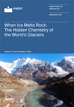
Cover Story (view full-size image): Glaciers act as natural laboratories where Earth’s cold chemistry unfolds, and they have a profound impact on the planet. Glacier melting patterns shape global hydrology, regulate Earth’s climate, and drive global biogeochemical cycles, releasing nutrients that nourish ecosystems. By compiling available data from 40 glaciers worldwide, we found cationic denudation rates (CDRs) spanning 46 to 4160 meq m−2 yr−1. Himalayan and Northwest American glaciers exhibited the highest CDRs, with the Himalayan denudation rate exceeding the global mean by more than fourfold. A strikingly high mean chemical weathering intensity (CWI = 801 meq m−3) from the Himalayan glaciers reflects their vast geochemical diversity. We hypothesize that glacier retreat enhances the downward progression of the weathering reaction front intensifying Earth’s ongoing transformation. View this paper
  • Issues are regarded as officially published after their release is announced to the table of contents alert mailing list.
  • You may sign up for e-mail alerts to receive table of contents of newly released issues.
  • PDF is the official format for papers published in both, html and pdf forms. To view the papers in pdf format, click on the "PDF Full-text" link, and use the free Adobe Reader to open them.
Order results
Result details
Section
Select all
Export citation of selected articles as:
22 pages, 486 KB  
Article
Estimating Household Water Demand and Affordability Under Intermittent Supply: An Econometric Analysis with a Water–Energy Nexus Perspective for Pimpri-Chinchwad, India
by Yuanzao Zhu, Christian Klassert, Bernd Klauer and Erik Gawel
Water 2025, 17(19), 2917; https://doi.org/10.3390/w17192917 - 9 Oct 2025
Viewed by 298
Abstract
Urban water utilities in rapidly developing regions face growing challenges in ensuring continuous supply. Intermittent public water supply leads to unreliable and inequitable access, compelling households to adopt energy-intensive coping strategies. This creates a nexus between water and energy demand at the household [...] Read more.
Urban water utilities in rapidly developing regions face growing challenges in ensuring continuous supply. Intermittent public water supply leads to unreliable and inequitable access, compelling households to adopt energy-intensive coping strategies. This creates a nexus between water and energy demand at the household level. Few econometric analyses of household water demand have explicitly addressed this demand-side nexus in developing regions. Using survey data from the city of Pimpri-Chinchwad, India, where intermittent water supply is prevalent, we analyze household expenditures related to water access and estimate a piped water demand function with a Discrete-Continuous Choice model. We find that electricity expenditures for accessing water exceed water bills for approximately one-third of households. Including these costs in affordability calculations reveals hidden financial burdens, particularly for middle-income households. Water and electricity prices, income, and household size significantly influence water demand, with an income elasticity of 0.177 and water price elasticities ranging from 0 to −0.876. The cross-price elasticity of −0.097 indicates weak complementarity between electricity and piped water, suggesting electricity price changes do affect water use but are insufficient to drive substantial behavioral shifts. Targeted price increases in high-consumption blocks are more effective at curbing overuse, while simultaneous increases in water and electricity prices may heighten household vulnerability. These findings highlight the need for integrated, nexus-aware demand management strategies, particularly in regions with intermittent supply. Full article
(This article belongs to the Section Water Use and Scarcity)
Show Figures

Figure 1

28 pages, 2149 KB  
Article
Thermodynamic Experiments and Modelling of Cyclopentane Hydrates in the Presence of NaBr, KBr, K2SO4, NaBr–KBr, NaCl–NaBr, KCl–KBr, Na2SO4–K2SO4, and CaCl2–MgCl2
by Trung-Kien Pham, Quynh-Trang Thi Hoang, Cham-Anh Thi Le, Thi-Huyen Tran, Koemhong Bun, Ngoc-Tuyet Thi Le, Van-Son Ho, Van-Hieu Ngo, Quang-Duyen Le, Madina Naukanova, Muhammad Abuhuraira, Ana Cameirao, Jérôme Douzet, Jean-Michel Herri and Baptiste Bouillot
Water 2025, 17(19), 2916; https://doi.org/10.3390/w17192916 - 9 Oct 2025
Viewed by 271
Abstract
Water shortage has been a serious issue for many years. Hydrate-based desalination (HBD) technology is a potential candidate for this solution. The present study investigates the use of Cyclopentane (CP) as a hydrate former for desalination through crystallization at low temperatures and atmospheric [...] Read more.
Water shortage has been a serious issue for many years. Hydrate-based desalination (HBD) technology is a potential candidate for this solution. The present study investigates the use of Cyclopentane (CP) as a hydrate former for desalination through crystallization at low temperatures and atmospheric pressure. The primary objective of this work is to provide phase equilibrium data for CP hydrates (CPH) in the presence of novel salt systems, including NaBr, KBr, K2SO4, NaBr–KBr, NaCl–NaBr, KCl–KBr, Na2SO4–K2SO4, and CaCl2–MgCl2. Phase equilibrium temperatures were determined using both rapid and slow dissociation procedures. The van der Waals and Platteeuw-based Kihara (Kihara) approach, Hu-Lee-Sum (HLS) correlation, Standard Freezing Point Depression (SFPD) approach, and Activity-Based Occupancy Correlation (ABOC) were applied to model these new experimental data. The experimental results demonstrate that the differences between the quick and slow procedure data range from 0 °C to 1.2 °C. In addition, the increasing salt concentration enhances the inhibitory effect on hydrate formation. Furthermore, the influence of cations on the equilibrium temperature follows the decreasing order of Mg2+ > Ca2+ > Na+ > K+. In terms of halide anions, Br exhibits a stronger impact on equilibrium temperature compared to Cl. The thermodynamic modeling results (for all four models) show good agreement with the experimental data with the average absolute deviation (AAD) of less than or equal to 0.79 °C. The ABOC approach proves to be the most effective among the four methods evaluated for accurately reproducing the equilibrium temperature of CPH, with AAD less than or equal to 0.38 °C. Full article
(This article belongs to the Section Wastewater Treatment and Reuse)
Show Figures

Figure 1

26 pages, 6711 KB  
Article
Vegetation–Debris Synergy in Alternate Sandbar Morphodynamics: Flume Experiments on the Impacts of Density, Layout, and Debris Geometry
by Saqib Habib, Muhammad Rizwan and Norio Tanaka
Water 2025, 17(19), 2915; https://doi.org/10.3390/w17192915 - 9 Oct 2025
Viewed by 187
Abstract
Predicting how vegetation–debris interactions reshape alternate sandbars under a steady subcritical flow remains poorly understood in laboratory-to-field scaling. This study quantified how vegetation density and layout interact with debris geometry to control scouring and deposition and developed an empirical tool to predict normalized [...] Read more.
Predicting how vegetation–debris interactions reshape alternate sandbars under a steady subcritical flow remains poorly understood in laboratory-to-field scaling. This study quantified how vegetation density and layout interact with debris geometry to control scouring and deposition and developed an empirical tool to predict normalized bed-level changes. Flume experiments investigated how vegetation–debris interactions regulate the hydromorphodynamics of non-migrating alternate sandbars under a steady subcritical flow (Q = 0.003 m3/s; slope = 1/200). Vegetation patches were configured in two spatial layouts—upstream (apex) and river line (edge), at varying densities, with and without debris (I-type: wall-like; U-type: horseshoe-shaped). Results indicated that dense upstream vegetation combined with I-type debris produced the strongest morphodynamic response, generating maximum scour, corresponding to the maximum bed-elevation changes (Δz) normalized by water depth (h) (dimensionless Δz/h) values of −1.55 and 1.05, and sustaining more than 70% of the downstream morphodynamic amplitude. In contrast, U-type debris promoted distributed deposition with a milder scour, while sparse vegetation yielded weaker, more transient responses. Debris geometry-controlled flow partitioning: the I-type enhanced frontal acceleration, whereas the U-type facilitated partial penetration and redistribution. To integrate these findings into predictive frameworks, an empirical regression model was developed to estimate Δz/h from the vegetation density, distribution, and debris geometry, with an additional blockage index to capture synergistic effects. The model achieved 87.5% prediction within ±20% error, providing a practical tool for anticipating scour and deposition intensity across eco-hydraulic configurations. These insights advance intelligent water management by linking morphodynamic responses with predictive modeling, supporting flood-resilient river engineering, adaptive channel stability assessments, and nature-based solutions. Full article
Show Figures

Figure 1

20 pages, 3146 KB  
Article
Identification of Driving Factors of Long-Term Terrestrial Water Storage Anomaly Trend Changes in the Yangtze River Basin Based on Multisource Data and Geographical Detector Method
by Qin Li, Song Ye, Ying Wang, Yingjie Qu, Zhengli Yao, Bocheng Liao and Junke Wang
Water 2025, 17(19), 2914; https://doi.org/10.3390/w17192914 - 9 Oct 2025
Viewed by 144
Abstract
Terrestrial water storage anomaly (TWSA) plays a vital role in regulating the global water cycle and freshwater availability. Understanding the drivers behind long-term TWSA changes is critical, yet disentangling natural and anthropogenic influences remains challenging. This study employs the Geographical Detector method and [...] Read more.
Terrestrial water storage anomaly (TWSA) plays a vital role in regulating the global water cycle and freshwater availability. Understanding the drivers behind long-term TWSA changes is critical, yet disentangling natural and anthropogenic influences remains challenging. This study employs the Geographical Detector method and multisource data to quantify the individual and interactive effects of multiple drivers on TWSA trends across the upper, middle, and lower reaches of the Yangtze River Basin (YRB). In the upper YRB, temperature, snow water equivalent, vegetation, precipitation, and reservoir storage are the primary contributors. In the middle YRB, precipitation, temperature, and soil moisture dominate. Although nighttime light (a proxy for urbanization) alone explains only 1.94% of the variation in this region, its interaction with precipitation increases explanatory power to 56.3%, highlighting a strong nonlinear effect. In the lower YRB, precipitation and runoff are the leading factors, while nighttime light again exhibits enhanced influence through interactions. These findings reveal the spatial heterogeneity and synergistic nature of TWSA drivers and underscore the need to consider both natural variability and human-induced processes when assessing long-term water storage dynamics. The results offer valuable insights for sustainable water resource management in the context of climate change and rapid urban development. Full article
Show Figures

Figure 1

16 pages, 2061 KB  
Article
A Relationship Between Nutrients in a Mid-Forest Eutrophic Lake
by Józef Antonowicz, Michał Rybak and Tomasz Wróblewski
Water 2025, 17(19), 2913; https://doi.org/10.3390/w17192913 - 9 Oct 2025
Viewed by 226
Abstract
In 2023, studies were carried out on the aquatic environment of the forest lake Łętowskie. The studies covered the horizontal and vertical planes and seasonal dynamics. Lake Łętowskie is a lake with an area of 402 ha, which distinguishes it from other lakes [...] Read more.
In 2023, studies were carried out on the aquatic environment of the forest lake Łętowskie. The studies covered the horizontal and vertical planes and seasonal dynamics. Lake Łętowskie is a lake with an area of 402 ha, which distinguishes it from other lakes in Pomerania due to its large area. In three quarters of the lake shore border forests, changes in surface and volume have been observed in the lakes over the last century, which has affected the chemistry of the water. The aims of this study were to determine the dependencies between the concentration of biogenic substances in the near-bottom layer and subsurface water and analyze the dependencies between chemical parameters in the water of the mid-forest lake Łętowskie. In the water samples obtained, including the surface layer (SW) and the near-bottom layer (NBL), the concentrations of N-NO3, N-NO2, N-NH4, N-tot, N-org, P-PO4, P-tot, P-org, and O2, electrolytic conductivity, pH, Ca, and Mg were determined. Statistical analyses were carried out, including tests and multidimensional PCA and cluster analysis. A significant effect of forests on the chemical composition of lake water was observed. The conducted studies of Łętowskie Lake indicate that the NBL experiences seasonal dynamics, where phosphorus and nitrogen compounds are transformed, which causes trophic changes in the lake. Based on multidimensional cluster analysis, differences between the SW and the NBL were shown. In Łętowskie Lake, the level of biogenic substances in the water is significantly influenced by processes occurring inside the lake as a result of the exchange of matter between the NBL and bottom sediments. This exchange in shallower areas of the lake is influenced by winds, especially in exposed locations: this was observed for P-tot, P-PO4, P-org, Ca, N-NO3 and N-NH4, N-tot, and N-org. The conducted studies are important for supporting the protection of the Landscape Area “Łętowskie Lake and the vicinity of Kępice” to preserve the existing values of the natural environment and maintain the ecological balance of natural systems. Current scientific publications on the hydrochemical data of Łętowskie Lake are currently lacking, and the available data needs to be updated. Full article
(This article belongs to the Section Biodiversity and Functionality of Aquatic Ecosystems)
Show Figures

Figure 1

16 pages, 6738 KB  
Article
Effects of Coal Fly Ash Addition on the Carbon Mineralization of Agricultural Soil Under Different Moisture Conditions
by Mumin Rao, Heng Jiang, Xiangbo Zou, Dequn Ma, Jiong Cheng, Xinyu Jiang, Zaijian Yuan and Bin Huang
Water 2025, 17(19), 2912; https://doi.org/10.3390/w17192912 - 9 Oct 2025
Viewed by 196
Abstract
Laboratory incubation experiments were conducted to investigate the effects of coal fly ash (FA) amendment (0%, 2.5%, 7.5%, and 15%) and moisture regimes (40%, 70%, and 100% water holding capacity (WHC)) on the mineralization of carbon (C) in an acidic agricultural soil. The [...] Read more.
Laboratory incubation experiments were conducted to investigate the effects of coal fly ash (FA) amendment (0%, 2.5%, 7.5%, and 15%) and moisture regimes (40%, 70%, and 100% water holding capacity (WHC)) on the mineralization of carbon (C) in an acidic agricultural soil. The results showed that the soil C mineralization intensity initially increased and subsequently decreased throughout the incubation period, with the mineralization dynamics well described by the first-order kinetic model (0.9633 ≤ R2 ≤ 0.9972). Carbon mineralization increased with the application rate of FA, while moisture effect followed the order 70% WHC > 100% WHC > 40% WHC. Indicators showing highly significant correlations with total C mineralization amount included FA application rate, pH, water-soluble organic carbon, (WSOC) and cellulase (CEL) activity. Specific bacterial (Acidobacteriota, Gemmatimonadota, Pseudomonadota, and Actinobacteriota) and fungal phyla (Chytridiomycota, Glomeromycota, and Olpidiomycota) exhibited stronger correlations with C mineralization. The microbial taxa exhibiting significant responses to FA and moisture conditions were not consistent. Although the addition of high proportions of FA, especially with adequate moisture conditions, can enhance soil microbial activity and C mineralization, the potential risks of soil C loss and the accumulation of toxic elements necessitate the prudent implementation of elevated FA application rates in practical scenarios. Full article
(This article belongs to the Section Soil and Water)
Show Figures

Figure 1

26 pages, 9429 KB  
Article
Groundwater Vulnerability Assessment in the Huangshui River Basin Under Representative Environmental Change
by Tao Ma, Kexin Zhou, Jing Wu, Ziqi Wang, Shengnan Li and Yudong Lu
Water 2025, 17(19), 2911; https://doi.org/10.3390/w17192911 - 9 Oct 2025
Viewed by 195
Abstract
The Huangshui River Basin is located in the transition zone between the Loess Plateau and the Qinghai–Tibet Plateau, characterized by a fragile hydrological and ecological environment. Groundwater serves as a vital water source for local economic development and human livelihood. With the acceleration [...] Read more.
The Huangshui River Basin is located in the transition zone between the Loess Plateau and the Qinghai–Tibet Plateau, characterized by a fragile hydrological and ecological environment. Groundwater serves as a vital water source for local economic development and human livelihood. With the acceleration of urbanisation and climate change, groundwater resources face challenges such as pollution and over-exploitation. This study employs an improved DRASTIC model, tailored to the characteristics of the groundwater system in the Huangshui River Valley of the upper Yellow River, to integrate groundwater resources, groundwater environment, and ecological environment systems. Improving the DRASTIC model for groundwater vulnerability assessment. A two-tiered evaluation system with nine indicator parameters was proposed, including six groundwater quality vulnerability indicators and five groundwater quantity vulnerability indicators. Fuzzy analytic hierarchy process and entropy weight method were used to determine the weights, and Geographic Information System (GIS) spatial analysis was employed to evaluate groundwater vulnerability in the Huangshui River basin in 2006 and 2021. The results indicate that the proportion of areas with high groundwater quality vulnerability increased from 10.7% in 2006 to 31.57% in 2021, while the proportion of areas with high groundwater quantity vulnerability decreased from 22.33% to 14.02%. Overall, groundwater quality vulnerability in the Huangshui River basin is increasing, while groundwater quantity vulnerability is decreasing. Based on the evaluation results of water quality and quantity vulnerability, protection zoning maps for water quality and quantity were compiled, and preventive measures and recommendations for water quality and quantity protection zones were proposed. Human activities have a significant impact on groundwater vulnerability, with land use types and groundwater extraction coefficients having the highest weights. This study provides a scientific basis for the protection and sustainable use of groundwater in the Huangshui River basin. Full article
(This article belongs to the Section Hydrogeology)
Show Figures

Figure 1

21 pages, 3449 KB  
Article
Synthesis and Characterization of Chromium Ion-Imprinted Biochar for Selective Removal of Cr(VI) from Wastewater
by Xinchi Zong, Tianliang Duan, Linyan Chen, Zhengwei Luo, Hui Jiang and Wenhua Geng
Water 2025, 17(19), 2910; https://doi.org/10.3390/w17192910 - 9 Oct 2025
Viewed by 214
Abstract
The escalating issue of water pollution driven by rapid industrialization necessitates the development of advanced remediation technologies. In this study, a novel method for producing chromium (Cr(VI)) ion-imprinted biochar (Cr(VI)-IIP-PEI@NBC) from wheat residue was proposed. After acid-oxidative modifications, polyethyleneimine (PEI) and glutaraldehyde (GA) [...] Read more.
The escalating issue of water pollution driven by rapid industrialization necessitates the development of advanced remediation technologies. In this study, a novel method for producing chromium (Cr(VI)) ion-imprinted biochar (Cr(VI)-IIP-PEI@NBC) from wheat residue was proposed. After acid-oxidative modifications, polyethyleneimine (PEI) and glutaraldehyde (GA) were employed as the functional monomer and crosslinker, respectively, to enhance the biochar’s selectivity and adsorption capacity. Under optimized conditions (pH 2.0, 55 °C), the adsorbent achieved a maximum Cr(VI) uptake of 212.63 mg/g, which was 2.3 times higher than that of the non-imprinted biochar. The material exhibited exceptional specificity (99.64%) for Cr(VI) and maintained >80% adsorption efficiency after five regeneration cycles, demonstrating excellent reusability. Comprehensive structural characterization via Fourier transform infrared spectroscopy (FT-IR), thermal gravimetric analysis (TGA), Brunner–Emmet–Teller measurements (BET), and Scanning Electron Microscopy (SEM) confirmed successful Cr(VI) imprinting in the biochar and its high thermal stability and mesoporous architecture, elucidating the mechanisms behind its superior performance. This study presents a sustainable and high-performance adsorbent for the efficient treatment of chromium-contaminated wastewater, with significant potential for industrial applications. Full article
(This article belongs to the Section Wastewater Treatment and Reuse)
Show Figures

Figure 1

22 pages, 7879 KB  
Review
Effectiveness of Small Hydropower Plants Dismantling in the Chishui River Watershed and Recommendations for Follow-Up Studies
by Wenzhuo Gao, Zhigang Wang, Ke Wang, Xianxun Wang, Xiao Li and Qunli Jiang
Water 2025, 17(19), 2909; https://doi.org/10.3390/w17192909 - 9 Oct 2025
Viewed by 236
Abstract
With the characteristic of “decentralized distribution and local power supply”, small hydropower (SHP) in China has become a core means of solving the problem of insufficient power supply in rural and remote mountainous areas, effectively promoting the improvement of local livelihoods. However, for [...] Read more.
With the characteristic of “decentralized distribution and local power supply”, small hydropower (SHP) in China has become a core means of solving the problem of insufficient power supply in rural and remote mountainous areas, effectively promoting the improvement of local livelihoods. However, for a long time, SHP has had many problems, such as irrational development, old equipment, and poor economic efficiency, resulting in some rivers with connectivity loss and reduced biodiversity, etc. The Chishui River Watershed is an ecologically valuable river in the upper reaches of the Yangtze River. As an important habitat for rare fish in the upper reaches of the Yangtze River and the only large-scale tributary that maintains a natural flow pattern, the SHP plants’ dismantling and ecological restoration practices in the Chishui River Watershed can set a model for regional sustainable development. This paper adopts the methods of literature review, field research, and case study analysis, combined with the comparison of ecological conditions before and after the dismantling, to systematically analyze the effectiveness and challenges of SHP rectification in the Chishui River Watershed. The study found that after dismantling 88.2% of SHP plants in ecologically sensitive areas, the number of fish species upstream and downstream of the original dam site increased by about 6.67% and 70%, respectively; the natural hydrological connectivity has been restored to the downstream of the Tongzi River, the Gulin River and other rivers, but there are short-term problems such as sediment underflow, increased economic pressure, and the gap of alternative energy sources; the retained power stations have achieved the success and challenges of power generation and ecological management ecological flow control and comprehensive utilization, achieving a balance between power generation and ecological protection. Based on the above findings, the author proposes dynamic monitoring and interdisciplinary tracking research to fill the gap of systematic data support and long-term effect research in the SHP exit mechanism, and the results can provide a reference for the green transition of SHP. Full article
(This article belongs to the Section Water Resources Management, Policy and Governance)
Show Figures

Figure 1

17 pages, 1608 KB  
Article
Sludge-Derived Hercynite–Carbon as a Low-Cost Catalyst for Efficient Degradation of Refractory Pollutants in Wastewater
by Md Manik Mian, Jiaxin Zhu, Xiangzhe Jiang and Shubo Deng
Water 2025, 17(19), 2908; https://doi.org/10.3390/w17192908 - 9 Oct 2025
Viewed by 273
Abstract
Developing a robust Fenton-like catalyst through a feasible method is a significant challenge and is crucial for sustainability in wastewater treatment. Herein, we report a novel dual-phase H2O2 activation for OH generation via both heterogeneous surface-mediated reactions and homogeneous [...] Read more.
Developing a robust Fenton-like catalyst through a feasible method is a significant challenge and is crucial for sustainability in wastewater treatment. Herein, we report a novel dual-phase H2O2 activation for OH generation via both heterogeneous surface-mediated reactions and homogeneous radical propagation pathways. Mechanistic investigations revealed that the surface Fe2+/Fe3+ redox cycle was the primary driver of catalysis at pH 5. Notably, the catalyst produced fewer secondary pollutants than Fenton reactions and was effective in treating pollutants with high concentrations. The oxidative performance of the PAS-ISe was comparable to that of commercial FeSO4·7H2O in terms of chemical oxygen demand (COD) removal efficiency and reaction kinetics. Besides, the utility of the catalyst was 2-75-fold greater than that of state-of-the-art Fenton or photo-Fenton-like catalysts. A detailed techno-economic analysis confirmed the feasibility of this strategy and significant cost advantages over existing heterogeneous catalyst synthesis methods. This study concurrently proposes a low-cost approach to valorizing hazardous sludge and effectively treating industrial wastewater, which may support circular economic principles. Full article
(This article belongs to the Section Wastewater Treatment and Reuse)
Show Figures

Figure 1

9 pages, 201 KB  
Editorial
Yellow River Basin Management Under Pressure: Present State, Restoration and Protection III: Lessons from a Special Issue
by Qiting Zuo, Xiangyi Ding, Guotao Cui and Wei Zhang
Water 2025, 17(19), 2907; https://doi.org/10.3390/w17192907 - 9 Oct 2025
Viewed by 278
Abstract
This Special Issue is the third edition following the publication of the first issue of “Yellow River Basin Management under Pressure: Present State, Restoration and Protection” in 2022 and the second issue in 2023 [...] Full article
19 pages, 5201 KB  
Article
Mechanisms of Heavy Rainfall over the Southern Anhui Mountains: Assessment for Disaster Risk
by Mingxin Sun, Hongfang Zhu, Dongyong Wang, Yaoming Ma and Wenqing Zhao
Water 2025, 17(19), 2906; https://doi.org/10.3390/w17192906 - 8 Oct 2025
Viewed by 261
Abstract
Heavy rainfall events in the southern Anhui region are the main meteorological disasters, often leading to floods and secondary disasters. This article explores the mechanisms supporting extreme precipitation by studying the spatiotemporal characteristics of heavy rainfall events during 2022–2024 and their related atmospheric [...] Read more.
Heavy rainfall events in the southern Anhui region are the main meteorological disasters, often leading to floods and secondary disasters. This article explores the mechanisms supporting extreme precipitation by studying the spatiotemporal characteristics of heavy rainfall events during 2022–2024 and their related atmospheric circulation patterns. Using high-resolution precipitation data, ERA5 and GDAS reanalysis datasets, and the Hybrid Single-Particle Lagrangian Integrated Trajectory (HYSPLIT) model analysis, the main sources and transport pathways of water that cause heavy rainfall in the region were determined. The results indicate that large-scale circulation systems, including the East Asian monsoon (EAM), the Western Pacific subtropical high (WPSH), the South Asian high (SAH), and the Tibetan Plateau monsoon (PM), play a decisive role in regulating water vapor flux and convergence in southern Anhui. Southeast Asia, the South China Sea, the western Pacific, and inland China are the main sources of water vapor, with multi-level and multi-channel transport. The uplift effect of mountainous terrain further enhances local precipitation. The Indian Ocean basin mode (IOBM) and zonal index are also closely related to the spatiotemporal changes in rainfall and disaster occurrence. The rainstorm disaster risk assessment based on principal component analysis, the information entropy weight method, and multiple regression shows that the power index model fitted by multiple linear regression is the best for the assessment of disaster-causing rainstorm events. The research results provide a scientific basis for enhancing early warning and disaster prevention capabilities in the context of climate change. Full article
(This article belongs to the Special Issue Water-Related Disasters in Adaptation to Climate Change)
Show Figures

Figure 1

19 pages, 3211 KB  
Article
Internal Wave Responses to Interannual Climate Variability Across Aquatic Layers
by Jinichi Koue
Water 2025, 17(19), 2905; https://doi.org/10.3390/w17192905 - 8 Oct 2025
Viewed by 200
Abstract
Internal waves play a critical role in material transport, vertical mixing, and energy dissipation within stratified aquatic systems. Their dynamics are strongly modulated by thermal stratification and surface meteorological forcing. This study examines the influence of interannual meteorological variability from 1980 to 2010 [...] Read more.
Internal waves play a critical role in material transport, vertical mixing, and energy dissipation within stratified aquatic systems. Their dynamics are strongly modulated by thermal stratification and surface meteorological forcing. This study examines the influence of interannual meteorological variability from 1980 to 2010 on internal wave behavior using a series of numerical simulations in Lake Biwa in Japan. In each simulation, air temperature, wind speed, or precipitation was perturbed by ±2 standard deviations relative to the climatological mean. Power spectral analysis of simulated velocity fields was conducted for the surface, thermocline, and bottom layers, focusing on super-inertial (6–16 h), near-inertial (~16–30 h), and sub-inertial (>30 h) frequency bands. The results show that higher air temperatures intensify stratification and enhance near-inertial internal waves, particularly within the thermocline, whereas cooler conditions favor sub-inertial wave dominance. Increased wind speeds amplify internal wave energy across all layers, with the strongest effect occurring in the high-frequency band due to intensified wind stress and vertical shear, while weaker winds suppress wave activity. Precipitation variability primarily affects surface stratification, exerting more localized and weaker impacts. These findings highlight the non-linear, depth-dependent responses of internal waves to atmospheric drivers and improve understanding of the coupling between climate variability and internal wave energetics. The insights gained provide a basis for more accurate predictions and sustainable management of stratified aquatic ecosystems under future climate scenarios. Full article
(This article belongs to the Special Issue Advances in Surface Water and Groundwater Simulation in River Basin)
Show Figures

Figure 1

16 pages, 2293 KB  
Article
Material Conversion, Microbial Community Composition, and Metabolic Functional Succession During Algal Sludge Composting
by Manting Zhou, Wenjing Zhu, Zhenrong Zheng, Hainan Wu, Haibing Cong and Shaoyuan Feng
Water 2025, 17(19), 2904; https://doi.org/10.3390/w17192904 - 8 Oct 2025
Viewed by 298
Abstract
Although bacterial and fungal communities play essential roles in organic matter degradation and humification during composting, their composition, interactions, abiotic compost properties, and succession patterns remain unclear. In this study, the succession of bacterial and fungal communities during algal sludge composting was explored [...] Read more.
Although bacterial and fungal communities play essential roles in organic matter degradation and humification during composting, their composition, interactions, abiotic compost properties, and succession patterns remain unclear. In this study, the succession of bacterial and fungal communities during algal sludge composting was explored using 16S and ITS rRNA amplicon sequencing. The compost rapidly entered the thermophilic phase (>50 °C) within the first phase. During the composting process, the diversity of bacterial and fungal communities did not show a significant response to the different composting phases. The physicochemical parameters and microbial community structures changed significantly during the thermophilic and cooling phases, particularly in the former, and gradually stabilized as the compost matured. Integrated random forest and network analyses suggested that the bacteria genera Geobacillus and Parapedobacter, along with the fungus genus Gilmaniella, could serve as potential biomarkers for different composting phases. The functional activity of the bacterial communities was obviously higher during the thermophilic phase than during the other phases, while fungal activity remained relatively high during both the thermophilic and cooling phases. Structural Equation Modeling (SEM) further indicated that bacterial communities primarily mediated nitrogen transformation and humification processes, while fungal communities mainly contributed to humification. These results cast a new light on understanding about microbial function during aerobic algal sludge composting. Full article
Show Figures

Figure 1

15 pages, 4175 KB  
Article
Mapping the Impact of Salinity Derived by Shrimp Culture Ponds Using the Frequency-Domain EM Induction Method
by Albert Casas-Ponsatí, José A. Beltrão-Sabadía, Evanimek B. Sabino da Silva, Lucila C. Monte-Egito, Anderson de Medeiros-Souza, Josefina C. Tapias, Alex Sendrós and Francisco Pinheiro Lima-Filho
Water 2025, 17(19), 2903; https://doi.org/10.3390/w17192903 - 7 Oct 2025
Viewed by 271
Abstract
This study investigates groundwater salinization in a section of a coastal aquifer in Rio Grande do Norte, Brazil, using frequency-domain electromagnetic (FDEM) measurements. With the global expansion of shrimp farming in ecologically sensitive coastal regions, there is an urgent need to assess associated [...] Read more.
This study investigates groundwater salinization in a section of a coastal aquifer in Rio Grande do Norte, Brazil, using frequency-domain electromagnetic (FDEM) measurements. With the global expansion of shrimp farming in ecologically sensitive coastal regions, there is an urgent need to assess associated risks and promote sustainable management practices. A key concern is the prolonged flooding of shrimp ponds, which accelerates saltwater infiltration into surrounding areas. To better delineate salinization plumes, we analyzed direct groundwater salinity measurements from 14 wells combined with 315 subsurface apparent conductivity measurements obtained using the FDEM method. Correlating these datasets improved the accuracy of salinity mapping, as evidenced by reduced variance in kriging interpolation. By integrating hydrogeological, hydrogeochemical, and geophysical approaches, this study provides a comprehensive characterization of groundwater salinity in the study area. Hydrogeological investigations delineated aquifer properties and flow dynamics; hydrogeochemical analyses identified salinity levels and water quality indicators; and geophysical surveys provided spatially extensive conductivity measurements essential for detecting and mapping saline intrusions. The combined insights from these methodologies enable a more precise assessment of salinity sources and support the development of more effective groundwater management strategies. Our findings demonstrate the effectiveness of integrating geophysical surveys with hydrogeological and hydrogeochemical data, confirming that shrimp farm ponds are a significant source of groundwater contamination. This combined methodology offers a low-impact, cost-effective approach that can be applied to other coastal regions facing similar environmental challenges. Full article
(This article belongs to the Section Hydrogeology)
Show Figures

Figure 1

32 pages, 19967 KB  
Article
Monitoring the Recovery Process After Major Hydrological Disasters with GIS, Change Detection and Open and Free Multi-Sensor Satellite Imagery: Demonstration in Haiti After Hurricane Matthew
by Wilson Andres Velasquez Hurtado and Deodato Tapete
Water 2025, 17(19), 2902; https://doi.org/10.3390/w17192902 - 7 Oct 2025
Viewed by 361
Abstract
Recovery from disasters is the complex process requiring coordinated measures to restore infrastructure, services and quality of life. While remote sensing is a well-established means for damage assessment, so far very few studies have shown how satellite imagery can be used by technical [...] Read more.
Recovery from disasters is the complex process requiring coordinated measures to restore infrastructure, services and quality of life. While remote sensing is a well-established means for damage assessment, so far very few studies have shown how satellite imagery can be used by technical officers of affected countries to provide crucial, up-to-date information to monitor the reconstruction progress and natural restoration. To address this gap, the present study proposes a multi-temporal observatory method relying on GIS, change detection techniques and open and free multi-sensor satellite imagery to generate thematic maps documenting, over time, the impact and recovery from hydrological disasters such as hurricanes, tropical storms and induced flooding. The demonstration is carried out with regard to Hurricane Matthew, which struck Haiti in October 2016 and triggered a humanitarian crisis in the Sud and Grand’Anse regions. Synthetic Aperture Radar (SAR) amplitude change detection techniques were applied to pre-, cross- and post-disaster Sentinel-1 image pairs from August 2016 to September 2020, while optical Sentinel-2 images were used for verification and land cover classification. With regard to inundated areas, the analysis allowed us to determine the needed time for water recession and rural plain areas to be reclaimed for agricultural exploitation. With regard to buildings, the cities of Jérémie and Les Cayes were not only the most impacted areas, but also were those where most reconstruction efforts were made. However, some instances of new settlements located in at-risk zones, and thus being susceptible to future hurricanes, were found. This result suggests that the thematic maps can support policy-makers and regulators in reducing risk and making the reconstruction more resilient. Finally, to evaluate the replicability of the proposed method, an example at a country-scale is discussed with regard to the June 2023 flooding event. Full article
(This article belongs to the Special Issue Applications of GIS and Remote Sensing in Hydrology and Hydrogeology)
Show Figures

Figure 1

25 pages, 2838 KB  
Review
Exposure and Toxicity Factors in Health Risk Assessment of Heavy Metal(loid)s in Water
by Jelena Vesković and Antonije Onjia
Water 2025, 17(19), 2901; https://doi.org/10.3390/w17192901 - 7 Oct 2025
Viewed by 507
Abstract
Heavy metal(loid) (HM) contamination in water arises from various anthropogenic activities and natural processes, posing risks to human health through ingestion and dermal absorption. Although numerous studies have assessed health risks associated with HMs in water, inconsistencies in the selection of exposure and [...] Read more.
Heavy metal(loid) (HM) contamination in water arises from various anthropogenic activities and natural processes, posing risks to human health through ingestion and dermal absorption. Although numerous studies have assessed health risks associated with HMs in water, inconsistencies in the selection of exposure and toxicity factors limit comparability and reliability across studies. To address this gap, the aim of this review was to provide a comprehensive synthesis of exposure and toxicity factors used in health risk assessment (HRA) of HMs in water. The objectives were to evaluate the variability in ingestion, body weight, exposure duration and frequency, and dermal contact parameters, as well as in reference doses and cancer slope factors and to propose standardized values and statistical distributions for more consistent risk estimation. A systematic search of the Scopus database retrieved 806 studies, from which highly cited articles (≥100 citations) and recent publications (2023–2025) were prioritized for analysis. The findings revealed substantial variability in factors and showed that probabilistic approaches, particularly Monte Carlo simulation, were increasingly applied and provided more reliable estimates than traditional deterministic methods. The highest agreement was observed for exposure frequency for ingestion (365 days/year) and skin surface area (18,000 cm2), each applied in 75.5% of cases. By identifying inconsistencies in current practices and proposing standardized exposure and toxicity values and distributions for water, this review is expected to offer practical recommendations to improve the robustness, reliability, and comparability of HRAs, ultimately informing more effective policy-making and water management practices. Full article
(This article belongs to the Special Issue Groundwater Quality and Human Health Risk, 2nd Edition)
Show Figures

Figure 1

18 pages, 5504 KB  
Article
High-Resolution Interoperable Human-Friendly Naming System for Hydrographic Features and Model Elements (HRI-HydroName)
by Brian Miles, Haitham Saad and Emad Habib
Water 2025, 17(19), 2900; https://doi.org/10.3390/w17192900 - 7 Oct 2025
Viewed by 237
Abstract
Recent years have seen the growth of hydrologic and hydraulic models operating at varying spatial resolutions at regional scales, which emphasizes the need for consistent naming methodologies to enhance model interoperability and integration across domains, sub-models, and modeling frameworks. This paper introduces HRI-HydroName, [...] Read more.
Recent years have seen the growth of hydrologic and hydraulic models operating at varying spatial resolutions at regional scales, which emphasizes the need for consistent naming methodologies to enhance model interoperability and integration across domains, sub-models, and modeling frameworks. This paper introduces HRI-HydroName, a high-resolution, interoperable, and human-friendly model naming system designed to complement the Hydrologic Unit Code (HUC) watershed naming convention and support high spatial resolution model development and interoperability. HRI-HydroName assigns hierarchical codes, beginning with a watershed mnemonic, to stream segments, control structures, and model components, yielding unique, yet readable, identifiers that embed basin and network context. This systematic framework addresses software identifier constraints while ensuring each name clearly indicates its watershed and connectivity, facilitating the seamless merging of sub-models into larger integrated models without naming conflicts. The paper demonstrates a proof-of-concept application of HRI-HydroName to an HUC8-scale model of the Amite River Basin (LA); this illustrative example generates consistent names for elements and highlights interoperability. HRI-HydroName improves model clarity, reproducibility, and composability by providing standardized, interpretable identifiers, thereby supporting efficient multi-model integration in regional flood modeling. The paper discusses implementation challenges and suggests solutions for software utilities to support streamlined adoption and usability by different stakeholders. Full article
(This article belongs to the Section Hydrology)
Show Figures

Figure 1

29 pages, 1463 KB  
Review
AI-Enabled Membrane Bioreactors: A Review of Control Architectures and Operating-Parameter Optimization for Nitrogen and Phosphorus Removal
by Mingze Xu and Di Liu
Water 2025, 17(19), 2899; https://doi.org/10.3390/w17192899 - 7 Oct 2025
Viewed by 477
Abstract
Stricter requirements on nutrient removal in wastewater treatment are being imposed by rapid urbanization and tightening water-quality standards. Despite their excellent solid–liquid separation and effective biological treatment, MBRs in conventional operation remain hindered by membrane fouling, limited robustness to influent variability, and elevated [...] Read more.
Stricter requirements on nutrient removal in wastewater treatment are being imposed by rapid urbanization and tightening water-quality standards. Despite their excellent solid–liquid separation and effective biological treatment, MBRs in conventional operation remain hindered by membrane fouling, limited robustness to influent variability, and elevated energy consumption. In recent years, precise process control and resource-oriented operation have been enabled by the integration of artificial intelligence (AI) with MBRs. Advances in four areas are synthesized in this review: optimization of MBR control architectures, intelligent adaptation to multi-source wastewater, regulation of membrane operating parameters, and enhancement of nitrogen and phosphorus removal. According to reported studies, increases in total nitrogen and total phosphorus removal have been achieved by AI-driven strategies while energy use and operating costs have been reduced; under heterogeneous influent and dynamic operating conditions, stronger generalization and more effective real-time regulation have been demonstrated relative to traditional approaches. For large-scale deployment, key challenges are identified as improvements in model interpretability and applicability, the overcoming of data silos, and the realization of multi-objective collaborative optimization. Addressing these challenges is regarded as central to the realization of robust, scalable, and low-carbon intelligent wastewater treatment. Full article
Show Figures

Figure 1

25 pages, 2810 KB  
Review
Fishways in Portugal: Status, Main Findings and Research Needs
by José M. Santos, Ana L. Quaresma, Filipe Romão, Susana D. Amaral, Daniel Mameri, Marta Santo, Jorge Bochechas, Ana Telhado, Francisco N. Godinho, João Pádua, Paulo J. Pinheiro, Ana T. Silva, Teresa Viseu, Pedro R. Almeida, Teresa Ferreira, António N. Pinheiro and Paulo Branco
Water 2025, 17(19), 2898; https://doi.org/10.3390/w17192898 - 7 Oct 2025
Viewed by 420
Abstract
Anthropogenic barriers fragment Portuguese rivers, threatening endemic freshwater fish communities. This study compiled national inventories and peer-reviewed research (2002–2024) to quantify fishway implementation, evolution and typology, while evaluating fish performance from published research. One hundred fishways built between 1950 and 2024 were recorded, [...] Read more.
Anthropogenic barriers fragment Portuguese rivers, threatening endemic freshwater fish communities. This study compiled national inventories and peer-reviewed research (2002–2024) to quantify fishway implementation, evolution and typology, while evaluating fish performance from published research. One hundred fishways built between 1950 and 2024 were recorded, half of which were constructed after the implementation of the Water Framework Directive in Portugal (29 Dec 2005), tripling the annual construction rate. Fishways were found to be associated mainly with weirs (46%) and small hydropower plants (44%), with typology being dominated by the pool-type design (67%), nature-like facilities (18%), fish locks and combined systems (6% each), fish lifts (2%) and a single eel pass. Forty scientific contributions addressed fishway effectiveness; three-quarters dealt with pool-type facilities, while 12.5% and 10% focused on nature-like fishways and lifts, respectively. Experimental and field studies highlighted species-specific hydraulic preferences, the benefits of vertical slot and multislot configurations, and the potential of retrofitting fishways with macro-rugosities (i.e., fixed structural elements placed on the bottom) to improve non-salmonid fish passage. However, low attraction efficiency, limited multi-season monitoring and risks of aiding invasive species remain a concern. Research needs are proposed, including the refinement of species-specific hydrodynamic criteria, and the development of standardized efficiency metrics and of selective passage solutions, to advance fishway performance under Mediterranean hydrological constraints. Full article
(This article belongs to the Section Ecohydrology)
Show Figures

Figure 1

22 pages, 12074 KB  
Article
Influence of Speed Bumps on Hydraulic Efficiency of Grated Inlets
by Beniamino Russo and Jackson Tellez-Álvarez
Water 2025, 17(19), 2897; https://doi.org/10.3390/w17192897 - 7 Oct 2025
Viewed by 240
Abstract
In the context of the growing promotion of sustainable urban mobility policies, traffic calming is one of the main actions adopted by local, regional, and national administrations to support the liveability and vitality of residential and commercial areas through improvements in non-motorists’ safety, [...] Read more.
In the context of the growing promotion of sustainable urban mobility policies, traffic calming is one of the main actions adopted by local, regional, and national administrations to support the liveability and vitality of residential and commercial areas through improvements in non-motorists’ safety, mobility, and comfort. Traffic calming is achieved through the implementation of several actions and physical features such as speed bumps. These elements are generally accompanied by surface drainage elements (grated inlets) located upstream. The presence of speed bumps modifies the hydraulic performance of the inlets. This work aimed to evaluate, by experimental tests, the effects produced by the presence of two different speed bumps on two grated inlets commonly used in Barcelona. The results indicate that the hydraulic efficiency of grated inlets located upstream of speed bumps increases with respect to conventional situations (without speed bumps). These increments are relevant (up to 60%) for flat areas and streets with longitudinal slopes of up to 4–6%, but can be neglected for steep roads (more than 6%). The increase in grate inlet hydraulic performance means modifications in terms of inlet spacing, with significant economic savings for local administrations in charge of the design, implementation, and maintenance of surface drainage systems. Full article
(This article belongs to the Section Urban Water Management)
Show Figures

Figure 1

19 pages, 2109 KB  
Article
Machine Learning Optimization of SWRO Membrane Performance in Wave-Powered Desalination for Sustainable Water Treatment
by Lukka Thuyavan Yogarathinam, Sani I. Abba, Jamilu Usman, Abdulhayat M. Jibrin and Isam H. Aljundi
Water 2025, 17(19), 2896; https://doi.org/10.3390/w17192896 - 7 Oct 2025
Viewed by 328
Abstract
Wave-powered desalination systems integrate reverse osmosis (RO) with renewable ocean energy, providing a sustainable and environmentally responsible approach to freshwater production. This study aims to investigate wave-powered RO desalination using supervised and deep machine learning (ML) models to predict the effects of variable [...] Read more.
Wave-powered desalination systems integrate reverse osmosis (RO) with renewable ocean energy, providing a sustainable and environmentally responsible approach to freshwater production. This study aims to investigate wave-powered RO desalination using supervised and deep machine learning (ML) models to predict the effects of variable feed flow on permeate recovery and salt rejection under dynamic hydrodynamic conditions. Multiple ML models, including Gaussian process regression (GPR), support vector machines (SVMs), multi-layer perceptron (MLP), linear regression (LR), and decision trees (DTs) were systematically assessed for the prediction of permeate recovery and salt rejection (%) using three distinct input configurations: limited physicochemical features (M1), flow- and salinity-related parameters (M2), and a comprehensive variable set incorporating temperature (M3). GPR achieved near-perfect predictive accuracy R2 values (~1.00) with minimal errors for permeate recovery and salt rejection, attributed to its flexible kernel and probabilistic design. MLP and SVM also performed well, though they showed greater sensitivity to feature complexity. In contrast, DT models exhibited limited generalization and higher error rates, particularly when key features were excluded. Sensitivity analyses revealed that feed pressure (FP) and brine salinity (BS) were dominant positive influencers of permeate recovery and salt rejection. In contrast, brine flow (BF) and permeate salinity (PS) had negative impacts. Full article
(This article belongs to the Special Issue Novel Methods in Wastewater and Stormwater Treatment)
Show Figures

Figure 1

18 pages, 3818 KB  
Article
The Differences in Water Consumption Between Pinus and Salix in the Mu Us Sandy Land, a Semiarid Region of Northwestern China
by Ming Zhao, Jie Fang, Jianhui Huang, Da Lei and Zhenguo Xing
Water 2025, 17(19), 2895; https://doi.org/10.3390/w17192895 - 6 Oct 2025
Viewed by 317
Abstract
The water consumption processes of vegetation play an important role in water resource management in semiarid regions, while the difference in water consumption between native and exotic species is unclear. In this study, the exotic Pinus sylvestris L. var. mongholica Litv. (Pinus [...] Read more.
The water consumption processes of vegetation play an important role in water resource management in semiarid regions, while the difference in water consumption between native and exotic species is unclear. In this study, the exotic Pinus sylvestris L. var. mongholica Litv. (Pinus) and the native Salix psammophila (Salix) in Mu Us Sandy Land were selected as the research objects, and their water consumption characteristics were studied via in situ experiment and stable isotopes (δ2H and δ18O). Results revealed that vegetation water consumption caused spatial variation in soil moisture, allowing the soil profile to be divided into active, stable, capillary support and saturated zones. Pinus primarily used water from the active and stable zones, whereas Salix relied more on the capillary support and saturated zones. Water consumption patterns also varied seasonally, for example, at the beginning of growth (May–June), Salix and Pinus mainly use shallow soil water and begin to use deep soil water and groundwater with growth. During July–September, they absorb soil water mainly in the active zone and stable zone. Both Salix and Pinus can freely switch water sources between deep and shallow layers according to water demand. The seasonal fluctuations in precipitation and groundwater level were the main factors driving the seasonal changes in the water consumption of the two vegetation types. Pinus has better strategies to adapt to droughts than Salix, but its water consumption is higher than that of Salix. Therefore, proper management is needed to control the reasonable density of Pinus plantation to balance the water consumption of vegetation and groundwater recharge. The results can provide a scientific basis for the reasonable vegetation reconstruction in the Mu Us Sandy Land. Full article
Show Figures

Figure 1

17 pages, 3013 KB  
Article
Synthesis and Characterization of Rosa Canina-Fe3O4/Chitosan Nanocomposite and Treatment of Safranin O Dye from Wastewater
by Tugba Ceylan, İlknur Tosun Satır and Bediha Akmeşe
Water 2025, 17(19), 2894; https://doi.org/10.3390/w17192894 - 5 Oct 2025
Viewed by 224
Abstract
In response to the increasing demand for environmentally friendly and cost-effective adsorbents in wastewater treatment, this study reports the green synthesis, characterization, and application of a magnetic epichlorohydrin Rosa canina (m-ECH-RC) nanocomposite for removing Safranin O (SO), a commonly used cationic dye in [...] Read more.
In response to the increasing demand for environmentally friendly and cost-effective adsorbents in wastewater treatment, this study reports the green synthesis, characterization, and application of a magnetic epichlorohydrin Rosa canina (m-ECH-RC) nanocomposite for removing Safranin O (SO), a commonly used cationic dye in textile effluents. The synthesized material was characterized using Brunauer–Emmett–Teller (BET), Fourier transform infrared spectroscopy (FT-IR), scanning electron microscopy (SEM), X-ray diffraction (XRD), and zeta potential analyses to reveal its surface morphology, pore structure, functional groups, crystallinity, and colloidal stability. Adsorption performance was systematically tested under various conditions, including pH, adsorbent dose, contact time, ionic strength, and initial dye concentration. Kinetic analyses revealed that the adsorption process of Safranin O dye mainly obeys pseudo-second-order kinetics, but intraparticle and film diffusion also contribute to the process. As a result of the Isotherm analysis, it was found that the adsorption process conformed to the Langmuir model. Testing on real textile wastewater samples demonstrated a removal efficiency of 75.09% under optimized conditions. Reusability experiments further revealed that the material maintained high adsorption–desorption performance for up to five cycles, emphasizing its potential for practical use. These findings suggest that m-ECH-RC is a viable and sustainable adsorbent for treating dye-laden industrial effluents. Full article
(This article belongs to the Section Wastewater Treatment and Reuse)
Show Figures

Figure 1

21 pages, 4114 KB  
Article
Maintaning the Durability of the Effects of Urban Lake Restoration—New Challenges
by Jolanta Katarzyna Grochowska and Renata Augustyniak-Tunowska
Water 2025, 17(19), 2893; https://doi.org/10.3390/w17192893 - 5 Oct 2025
Viewed by 418
Abstract
The main aim of this study was to analyze the excessive biomass of invasive alien aquatic plants reducing the water quality of a lake which was restored in the past. This study was conducted on Długie Lake (26.8 ha, 17.3 m, Masurian Lake [...] Read more.
The main aim of this study was to analyze the excessive biomass of invasive alien aquatic plants reducing the water quality of a lake which was restored in the past. This study was conducted on Długie Lake (26.8 ha, 17.3 m, Masurian Lake District, northeastern Poland), which was completely degraded by raw wastewater inflow. After the long-term restoration (1987–2003) and recovery of submerged macrophyte meadows, the invasion of Elodea nuttallii—an invasive alien aquatic plant (IAAP)—was observed due to the increasing water temperature in recent years, impairing the functioning, biodiversity, and ecosystem services of this urban lake, as well as causing the deterioration of lake water quality. Therefore, an excessive biomass of E. nuttallii has been removed from the lake since 2022. The analysis of physico-chemical water quality parameters showed that consecutive excessive biomass macrophyte gradual removal (three times during the growing season) helps to limit the excessive growth of E. nuttallii and also removes nutrient loads from the ecosystem. Removing excess aquatic vegetation also helps maintain the lake’s aesthetic and recreational value. Currently, the total phosphorus concentration in lake water did not exceed 0.3 mg P/L and total nitrogen did not exceed 2.0 mg N/L. Chlorophyll a contents oscillated in the range of 5 to 9 µg/L, and Secchi disk visibility exceeded 3 m. Full article
Show Figures

Graphical abstract

19 pages, 3706 KB  
Article
Microstructural Comparison of the Mineralization Within Borsec and Tusnad Public Springs
by Simona Elena Avram, Lucian Barbu Tudoran, Gheorghe Borodi and Ioan Petean
Water 2025, 17(19), 2892; https://doi.org/10.3390/w17192892 - 4 Oct 2025
Viewed by 395
Abstract
Mineral water content strongly depends on the geologic layer characteristics. Therefore, the aim of the present study is to make a comparison between two renowned mineral water sources in Romania, Borsec and Tusnad. Two public springs were selected from each location: Boldizsar (about [...] Read more.
Mineral water content strongly depends on the geologic layer characteristics. Therefore, the aim of the present study is to make a comparison between two renowned mineral water sources in Romania, Borsec and Tusnad. Two public springs were selected from each location: Boldizsar (about 6600 L/day) and Lazar (about 500 L/day) from Borsec and Mikes (about 5000 L/day) and Young’s spring (about 600 L/day) from Tusnad. All investigated springs are naturally carbonated. Water properties were measured in situ and in laboratory for the collected samples; the results found that Borsec mineral water has a pH of about 7.5, while Tusnad mineral water is slightly acid (pH = 6.5). TDS strongly depends on the spring’s flow (for instance, Boldizsar has a TDS of about 900 mg/L, while Lazar has a TDS of about 1529 mg/L due to its high mineralization, while Young’s spring has a TDS of 165 mg/L due to its low mineralization, although it has low flow). Borsec mineral water has a lower salinity of about 1.22 PSU, while Tusnad water has a salinity of about 2 PSU, caused by a high amount of Na and Fe ions. Mineral waters dissolve ions from the geological layers, which react with carbonic acid during drying, generating specific crystallized compounds. The crystallized matter was investigated using XRD coupled with mineralogical optical microscopy (MOM); their microstructural features were observed using SEM coupled with elemental spectroscopy. Borsec water generates mainly Ca, Mg, and Na minerals like calcite, aragonite, pseudo-dolomite, natron, and traces of halite. Tusnad mineral waters have significant amounts of Ca, but also have Fe and much more Cl, since calcite and aragonite are mixed up with large amounts of halite and iron compounds. It looks like the presence of iron ions in the Tusnad mineral water collected from Mikes and Young’s spring explains the acidic pH. All these aspects are useful for further investigation regarding specific therapeutic purposes like chronic colitis and biliary lithiasis symptom amelioration (Boldizsar), chronic colitis, and enterocolitis symptoms (Lazar). Tusnad waters, like the water from Mikes spring, are recommended for anemia and neurasthenia, while Young’s spring is recommended for renal lithiasis amelioration. Full article
Show Figures

Figure 1

18 pages, 4823 KB  
Article
Spatial Structure and Optimal Sampling Intervals of Soil Moisture at Different Depths in a Typical Karst Demonstration Zone
by Hui Yin, Bo Xiong, Xiaomin Lao, Zhongcheng Jiang, Yi’an Wu and Tongyu Wang
Water 2025, 17(19), 2891; https://doi.org/10.3390/w17192891 - 4 Oct 2025
Viewed by 361
Abstract
Related studies analyzing the spatial structure of soil moisture from both horizontal and vertical directions, as well as the spacing interval distances of soil moisture sampling points in typical karst demonstration zones, are relatively rare. This study applied classical statistics, geostatistics, and “3S” [...] Read more.
Related studies analyzing the spatial structure of soil moisture from both horizontal and vertical directions, as well as the spacing interval distances of soil moisture sampling points in typical karst demonstration zones, are relatively rare. This study applied classical statistics, geostatistics, and “3S” technology to analyze the spatial structure, influencing factors, and spacing interval distances of soil moisture sampling points in the Guohua Demonstration Zone. The results showed that Moran’s I indices of soil moisture at different soil depths in the Guohua Demonstration Zone presented positive spatial correlation, and the spatial distribution of soil moisture at different soil depths showed a distinct spatial clustering pattern, with few spatially isolated zones. The spatial autocorrelation distance for soil moisture at 5 cm and 10 cm soil depths was 2400 m, while the autocorrelation distances for soil moisture at 20 cm and 30 cm soil depths were 2200 m and 2000 m, respectively. The spatial range value for soil moisture at a soil depth of 20 cm in the Guohua Demonstration Zone was the largest (Range = 6318.0 m), while the spatial range value for soil moisture at a soil depth of 30 cm was the smallest (Range = 646.0 m). The minimum value (threshold: 646.0 m) between the spatial autocorrelation distance and the spatial range of soil moisture at different soil depths in the Guohua Demonstration Zone could serve as an appropriate spacing interval distance of soil moisture sampling points. Soil moisture at different soil depths in the Guohua Demonstration Zone was primarily influenced by rock desertification, vegetation cover, soil layer thickness, and elevation. The synergistic effect of “rocky desertification + vegetation”, “rocky desertification + soil thickness”, and “vegetation + soil thickness” had a greater influence on soil moisture. Through high-density soil moisture sampling points in typical karst areas, the study results strengthened the application research on soil moisture in typical karst areas, providing scientific references for studies on the spatial structure, influencing factors, and appropriate spacing interval distance of soil moisture sampling points in karst areas. Full article
(This article belongs to the Section Soil and Water)
Show Figures

Figure 1

20 pages, 8591 KB  
Communication
Impact of Channel Confluence Geometry on Water Velocity Distributions in Channel Junctions with Inflows at Angles α = 45° and α = 60°
by Aleksandra Mokrzycka-Olek, Tomasz Kałuża and Mateusz Hämmerling
Water 2025, 17(19), 2890; https://doi.org/10.3390/w17192890 - 4 Oct 2025
Viewed by 436
Abstract
Understanding flow dynamics in open-channel node systems is crucial for designing effective hydraulic engineering solutions and minimizing energy losses. This study investigates how junction geometry—specifically the lateral inflow angle (α = 45° and 60°) and the longitudinal bed slope (I = 0.0011 to [...] Read more.
Understanding flow dynamics in open-channel node systems is crucial for designing effective hydraulic engineering solutions and minimizing energy losses. This study investigates how junction geometry—specifically the lateral inflow angle (α = 45° and 60°) and the longitudinal bed slope (I = 0.0011 to 0.0051)—influences the water velocity distribution and hydraulic losses in a rigid-bed Y-shaped open-channel junction. Experiments were performed in a 0.3 m wide and 0.5 m deep rectangular flume, with controlled inflow conditions simulating steady-state discharge scenarios. Flow velocity measurements were obtained using a PEMS 30 electromagnetic velocity probe, which is capable of recording three-dimensional velocity components at a high spatial resolution, and electromagnetic flow meters for discharge control. The results show that a lateral inflow angle of 45° induces stronger flow disturbances and higher local loss coefficients, especially under steeper slope conditions. In contrast, an angle of 60° generates more symmetric velocity fields and reduces energy dissipation at the junction. These findings align with the existing literature and highlight the significance of junction design in hydraulic structures, particularly under high-flow conditions. The experimental data may be used for calibrating one-dimensional hydrodynamic models and optimizing the hydraulic performance of engineered channel outlets, such as those found in hydropower discharge systems or irrigation networks. Full article
(This article belongs to the Section Hydraulics and Hydrodynamics)
Show Figures

Figure 1

19 pages, 4228 KB  
Article
Complex Effects of Functional Groups on the Cotransport Behavior of Functionalized Fe3O4 Magnetic Nanospheres and Tetracycline in Porous Media
by Yiqun Cui, Ming Wu, Meng Chen and Yanru Hao
Water 2025, 17(19), 2889; https://doi.org/10.3390/w17192889 - 4 Oct 2025
Viewed by 345
Abstract
In this study, four types of Fe3O4-based magnetic nanospheres were functionalized with distinct surface groups to examine how surface chemistry influences their co-transport with tetracycline (TC) in porous media. The functional groups investigated are carboxyl (−COOH), epoxy (−EPOXY), silanol [...] Read more.
In this study, four types of Fe3O4-based magnetic nanospheres were functionalized with distinct surface groups to examine how surface chemistry influences their co-transport with tetracycline (TC) in porous media. The functional groups investigated are carboxyl (−COOH), epoxy (−EPOXY), silanol (−SiOH), and amino (−NH2). Particles bearing −COOH, −EPOXY, or −SiOH are negatively charged, facilitating their transport through porous media, whereas −NH2-modified particles acquire a positive charge, leading to strong electrostatic attraction to the negatively charged TC and quartz sand, and consequently substantial retention with reduced mobility. Adsorption of TC onto Fe3O4-MNPs is predominantly chemisorptive, driven by ligand exchange and the formation of coordination complexes between the ionizable carboxyl and amino groups of TC and the surface hydroxyls of Fe3O4-MNPs. Additional contributions arise from electrostatic interactions, hydrogen bonding, hydrophobic effects, and cation–π interactions. Moreover, the carboxylate moiety of TC can coordinate to surface Fe centers via its oxygen atoms. Molecular dynamics simulations reveal a hierarchy of adsorption energies for TC on the differently modified surfaces: Fe3O4-NH2 > Fe3O4-EPOXY > Fe3O4-COOH > Fe3O4-SiOH, consistent with experimental findings. The results underscore that tailoring the surface properties of engineered nanoparticles substantially modulates their environmental fate and interactions, offering insights into the potential ecological risks associated with these nanomaterials. Full article
Show Figures

Graphical abstract

18 pages, 4261 KB  
Article
Research on Evolutionary Patterns of Water Source–Water Use Systems from a Synergetic Perspective: A Case Study of Henan Province, China
by Shengyan Zhang, Tengchao Li, Henghua Gong, Shujie Hu, Zhuoqian Li, Ninghao Wang, Yuqin He and Tianye Wang
Water 2025, 17(19), 2888; https://doi.org/10.3390/w17192888 - 3 Oct 2025
Viewed by 517
Abstract
China faces the persistent challenge of uneven spatiotemporal water resource distribution, constraining economic and social development while exacerbating regional disparities. Achieving co-evolution between water source systems and water use systems is thus a critical proposition in water resources management. Based on synergetics theory, [...] Read more.
China faces the persistent challenge of uneven spatiotemporal water resource distribution, constraining economic and social development while exacerbating regional disparities. Achieving co-evolution between water source systems and water use systems is thus a critical proposition in water resources management. Based on synergetics theory, this study takes Henan Province, a typical water-scarce social–ecological system, as the research object, and constructs a quantitative analysis framework for supply–demand bidirectional synergy. It systematically reveals the evolution patterns of water resource systems under the mutual feedback mechanism between water sources and water use. Findings indicate that between 2012 and 2022, the synergy degree of Henan’s water resource system increased by nearly 40%, exhibiting significant spatiotemporal differentiation: spatially “lower north, higher south”, and dynamically shifting from demand-constrained to supply-optimized. Specifically, the water source system’s order degree showed a “higher northwest, lower southeast” spatial pattern. Since the operation of the South-to-North Water Diversion Middle Route Project, the provincial average order degree increased significantly (annual growth rate of 0.01 units), though with distinct regional disparities. The water use system’s order degree also exhibited “lower north, higher south” pattern but achieved greater growth (annual growth rate of 0.03 units), with narrowing north–south gaps driven by improved management efficiency and technological capacity. This study innovatively integrates water source systems and water use systems into a unified analytical framework, systematically elucidating the intrinsic evolution mechanisms of water resource systems from the perspective of supply–demand mutual feedback. It provides theoretical and methodological support for advancing systematic water resource governance. Full article
Show Figures

Figure 1

Previous Issue
Back to TopTop