Next Issue
Volume 10, January
Previous Issue
Volume 9, November
error_outline You can access the new MDPI.com website here. Explore and share your feedback with us.


Urban Sci., Volume 9, Issue 12 (December 2025) – 57 articles

Cover Story (view full-size image): 
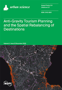
Tourism today represents a strategic engine of economic growth. It has shown remarkable resilience and recovery capacity, generating employment and supporting local development, yet it is increasingly associated with pronounced spatial imbalances. In many destinations, tourism concentrates in hotspot areas, producing a “gravitational” effect that intensifies congestion, overtourism, seasonality, and pressure on local resources. Drawing on the concept of anti-gravity, tourism is reinterpreted as a spatial system articulated through specialized tourism ecosystems that can be actively rebalanced. Anti-gravity tourism frames strategies aimed at redistributing flows, mitigating excessive concentration, and promoting more balanced and sustainable territorial configurations across different spatial scales. View this paper
  • Issues are regarded as officially published after their release is announced to the table of contents alert mailing list.
  • You may sign up for e-mail alerts to receive table of contents of newly released issues.
  • PDF is the official format for papers published in both, html and pdf forms. To view the papers in pdf format, click on the "PDF Full-text" link, and use the free Adobe Reader to open them.
Order results
Result details
Section
Select all
Export citation of selected articles as:
29 pages, 11844 KB  
Article
Green Transition and Livability in Communist-Inherited Large Housing Estates in Romania: Compatibility of Collective Habitat to the Requirements of the European Green Deal
by Vlad Cumpănaș and Nicolae Popa
Urban Sci. 2025, 9(12), 548; https://doi.org/10.3390/urbansci9120548 - 18 Dec 2025
Viewed by 303
Abstract
Increasing the level of livability in cities is a topical area both in EU policies and in local urban development, as well as in scientific studies. The aim of this article is to assess the degree if livability of the large housing estates [...] Read more.
Increasing the level of livability in cities is a topical area both in EU policies and in local urban development, as well as in scientific studies. The aim of this article is to assess the degree if livability of the large housing estates (LHEs) built during the socialist period in the main regional cities of Romania and how adequately they meet the requirements of current urban life. The research focused on assessing the accessibility of these neighborhoods to green spaces and other types of public facilities and services of interest, also taking into account the typology of LHEs. For this, we used mixed research methods, namely GIS remote sensing, fieldwork, and questionnaire surveys, with the results being digitally processed and mapped. This comparative research allowed us to see to what extent each type of neighborhood lends itself to the application of the European Green Deal principles (EGD). In this sense, we mapped the transformations undergone by urban green spaces, as a major dimension of sustainability, and we created an LHE accessibility index, using eight groups of indicators. Based on this index, we assessed the degree of livability and the compatibility of LHEs with some of the EGD principles. We believe that this study can be applied in other regions with similar characteristics, for the analysis of territorial accessibility of public services, in the creation of quality of life registers, or for the planning of spatial components of green cities. Full article
Show Figures

Graphical abstract

35 pages, 3980 KB  
Article
Influence of Technological and Socioeconomic Factors on Affordable and Sustainable Housing Development
by Manali Deshmukh, Radhakrishnan Shanthi Priya and Ramalingam Senthil
Urban Sci. 2025, 9(12), 547; https://doi.org/10.3390/urbansci9120547 - 18 Dec 2025
Viewed by 562
Abstract
An effective housing policy must ensure affordability for individuals across all income levels by integrating advanced technological innovations with comprehensive socioeconomic strategies. Affordable housing fosters social inclusion, whereas sustainability supports long-term environmental protection and economic stability. The success and long-term sustainability of affordable [...] Read more.
An effective housing policy must ensure affordability for individuals across all income levels by integrating advanced technological innovations with comprehensive socioeconomic strategies. Affordable housing fosters social inclusion, whereas sustainability supports long-term environmental protection and economic stability. The success and long-term sustainability of affordable housing initiatives are heavily influenced by current socioeconomic conditions, emphasizing the need for context-specific, inclusive, and sustainable housing solutions. Benchmarks are crucial in affordable housing to determine if it is climate-positive, aligning with the goals of the United Nations’ Sustainable Development Goal 11.1, which seeks to provide affordable and sustainable housing for everyone by 2030. This study uses the Scopus database to perform a scientometric analysis of 595 publications (2015–2024) on sustainability and affordability in housing. Using R-Studio 2025.05.1 + 513.pro3 and VOSviewer 1.6.20, it examines bibliographic trends, research gaps, and collaboration patterns across countries and journals. This study highlights performance thresholds related to economic, environmental, energy, territorial, and climatic factors. However, cost and ecological objectives can cause conflict with each other practically, and hence a balanced approach including green practices, efficient materials, and subsidies is crucial. There is a need for policymakers to address market gaps to prevent socially exclusive or environmentally harmful outcomes, maintain long-term urban resilience, and ensure sustained urban resilience and equitable access to affordable, sustainable housing by 2030. Integrating sustainable materials, circular and climate-resilient design, smart technologies, inclusive governance, and evidence-based policies is crucial for advancing affordable, equitable, and resilient housing. This approach guides future research and policy toward long-term social, economic, and environmental benefits. The findings and recommendations promote sustainable, affordable housing, emphasizing the need for further research on climate-resilient, energy-efficient, and cost-effective building solutions. Full article
Show Figures

Figure 1

19 pages, 1622 KB  
Article
Personalized Guidance Information and Travel Choice Behavior During Metro Service Disruptions: Evidence from Beijing, China
by Shasha Liu, Shiji Chen, Dingyuan Yu, Yuanfang Zhu, Enjian Yao and Mingyang Hao
Urban Sci. 2025, 9(12), 546; https://doi.org/10.3390/urbansci9120546 - 18 Dec 2025
Viewed by 275
Abstract
Guidance information plays an important role in influencing metro passengers’ travel choices and enhancing their travel experience during unplanned service disruptions. However, limited research has examined passengers’ behavioral responses to personalized guidance information in such contexts. This study aims to fill the gap [...] Read more.
Guidance information plays an important role in influencing metro passengers’ travel choices and enhancing their travel experience during unplanned service disruptions. However, limited research has examined passengers’ behavioral responses to personalized guidance information in such contexts. This study aims to fill the gap and explore the impact of personalized guidance information on passengers’ travel choice behavior during unplanned metro service disruptions. First, we reconstruct the decision-making process of metro passengers under disruption scenarios and design personalized guidance strategies, followed by a stated preference survey to collect preference data. Using data from Beijing, China, a hybrid utility–regret model is developed to analyze how the content and frequency of personalized guidance information affect passengers’ travel choice preferences. The results show that recommended plans with explanatory information are more likely to be adopted, particularly when explanations are framed from the passenger’s perspective. A single notification serves as a timely reminder, whereas overly frequent messages may trigger annoyance and reduce effectiveness. These findings provide practical implications for the design of personalized guidance strategies, thereby mitigating the impacts of metro service disruptions. Full article
Show Figures

Figure 1

26 pages, 4263 KB  
Article
Health and Environmental Drivers of Urban Park Visitation Inequalities During COVID-19: Evidence from Las Vegas
by Zheng Zhu, Shuqi Hu and Beiyu Lin
Urban Sci. 2025, 9(12), 545; https://doi.org/10.3390/urbansci9120545 - 18 Dec 2025
Viewed by 202
Abstract
Urban parks are essential components of sustainable cities, providing vital health, social, and environmental benefits. Using weekly smartphone-based visitation data for 182 parks in Las Vegas from 2019 to 2022, this study quantifies how the COVID-19 pandemic altered park use and identifies the [...] Read more.
Urban parks are essential components of sustainable cities, providing vital health, social, and environmental benefits. Using weekly smartphone-based visitation data for 182 parks in Las Vegas from 2019 to 2022, this study quantifies how the COVID-19 pandemic altered park use and identifies the socio-economic, environmental, and infrastructural determinants of these changes. Park visitation in Las Vegas showed a marked early pandemic decline followed by uneven recovery, with socially vulnerable neighborhoods lagging behind. Ordinary Least Squares (OLS) and Random Forest (RF) models were used to capture both linear and nonlinear relationships. The RF model explained 81% of the variance in standardized visitation (R2 = 0.81, RMSE = 0.0415), substantially outperforming the OLS benchmark (R2 = 0.24, RMSE = 0.0656). Domain-specific RF models show that socio-economic variables alone achieve an R2 of 0.88, compared with about 0.70 for housing, environmental/health, and lighting variables, while demographic variables explain only 0.39, indicating that social vulnerability is the dominant driver of visitation inequalities. Phase-specific analyses further reveal that RF performance increases from R2 = 0.84 before the pandemic to R2 = 0.87 after it, as park visitation becomes more strongly coupled with socio-economic and health-related burdens. After COVID-19, poverty, uninsured rates, and asthma prevalence emerge as the most influential predictors, while the relative importance of demographic composition and environmental exposure diminishes. These findings demonstrate that pandemic-era inequalities in park visitation are driven primarily by reinforced socio-economic and health vulnerabilities, underscoring the need for targeted, equity-oriented green-infrastructure interventions in disadvantaged neighborhoods. Full article
(This article belongs to the Special Issue Human, Technologies, and Environment in Sustainable Cities)
Show Figures

Figure 1

15 pages, 549 KB  
Review
How Can We Measure Urban Green Spaces’ Qualities and Features? A Review of Methods, Tools and Frameworks Oriented Toward Public Health
by Andrea Rebecchi, Erica Isa Mosca, Stefano Capolongo, Maddalena Buffoli and Silvia Mangili
Urban Sci. 2025, 9(12), 544; https://doi.org/10.3390/urbansci9120544 - 17 Dec 2025
Viewed by 488
Abstract
Urban Green Spaces (UGSs) are essential for ecological sustainability and public health, offering benefits such as air pollution reduction, urban cooling, and recreational opportunities. However, existing evaluation tools remain inconsistent, often assessing isolated dimensions like accessibility or aesthetics without fully integrating health considerations. [...] Read more.
Urban Green Spaces (UGSs) are essential for ecological sustainability and public health, offering benefits such as air pollution reduction, urban cooling, and recreational opportunities. However, existing evaluation tools remain inconsistent, often assessing isolated dimensions like accessibility or aesthetics without fully integrating health considerations. A systematic approach is needed to understand how these tools measure UGS quality and their relevance to health outcomes. This study employs a literature review (PRISMA framework) to analyze UGS evaluation tools with a focus on quality and health implications. A search in Scopus and Web of Science identified 14 relevant studies. Data extraction examined tool structure, assessed dimensions, data collection methods, geographic applications, and integration of health indicators. The review identified 13 distinct tools varying in complexity and methodology, from standardized checklists to GIS-based analyses. While key dimensions included accessibility, safety, aesthetics, and biodiversity, health-related factors were inconsistently integrated. Few tools explicitly assessed physical, mental, or social health outcomes. Technological innovations, such as Google Street View and AI-based analysis, emerged as enhancements for UGS evaluation. Despite methodological advances, gaps remain in linking UGS quality assessments to health outcomes. The lack of standardized health metrics limits applicability in urban planning. Future research should focus on interdisciplinary frameworks integrating environmental and health indicators to support the creation of sustainable and health-promoting UGS. Full article
Show Figures

Figure 1

29 pages, 944 KB  
Review
Climate Change, Nature-Based Tourism, and Aging: Assessing Vulnerability and Resilience in Urban and Natural Protected Areas—Semi-Systematic Review
by Izidora Marković Vukadin, Mira Zovko, Ante Mandić and Damjan Zovko
Urban Sci. 2025, 9(12), 543; https://doi.org/10.3390/urbansci9120543 - 17 Dec 2025
Viewed by 585
Abstract
Climate change poses increasing risks to the ecological and social foundations of Nature-Based Tourism (NBT), particularly within urbanized and protected landscapes. This study examines how the existing literature conceptualizes climate vulnerability and resilience across Urban Protected Areas (UPAs) and Natural Protected Areas (NPAs), [...] Read more.
Climate change poses increasing risks to the ecological and social foundations of Nature-Based Tourism (NBT), particularly within urbanized and protected landscapes. This study examines how the existing literature conceptualizes climate vulnerability and resilience across Urban Protected Areas (UPAs) and Natural Protected Areas (NPAs), addressing an identified gap in comparative NBT scholarship. Using a semi-systematic literature review of 72 peer-reviewed studies published between 2010 and 2025, guided by PRISMA procedures, the analysis synthesizes conceptual framings, methodological orientations, and thematic trends across ecological, social, and demographic dimensions. Results reveal a persistent geographical bias toward the Global North and a strong emphasis on NPAs (67%), where resilience is primarily understood as an ecological or governance attribute. In contrast, UPA studies increasingly adopt participatory, health-adaptive, and accessibility-oriented approaches, though only about 10% explicitly consider aging populations. Comparative synthesis highlights distinct methodological preferences and a continued underrepresentation of health, well-being, and equity dimensions within current adaptation frameworks. The literature indicates that advancing climate-resilient tourism depends on hybrid models that link urban innovation, ecosystem restoration, and inclusive governance. Integrating regenerative tourism principles, traditional ecological knowledge, and health-adaptive infrastructure emerges as a promising direction for promoting socially equitable and ecologically robust adaptation strategies in protected areas affected by accelerating climate change. Full article
(This article belongs to the Special Issue City and Ageing: A Challenge for Urban Planning)
Show Figures

Figure 1

26 pages, 9830 KB  
Article
City Walk Neighborhood Selection and Route Design from the Perspective of Placeness: A Case Study of Singapore
by Yi Wei and Huasheng Zhu
Urban Sci. 2025, 9(12), 542; https://doi.org/10.3390/urbansci9120542 - 17 Dec 2025
Viewed by 360
Abstract
City walk is an emerging form of short-term urban activity in which participants explore city streets and alleys to perceive distinctive cultural symbols, social connections, and spatial organizations of a place. This practice provides a new pathway for understanding urban placeness. Drawing on [...] Read more.
City walk is an emerging form of short-term urban activity in which participants explore city streets and alleys to perceive distinctive cultural symbols, social connections, and spatial organizations of a place. This practice provides a new pathway for understanding urban placeness. Drawing on both humanistic and structuralist geographical theories of placeness, this study applies the Latent Dirichlet Allocation (LDA) topic model to identify latent themes in online textual data and constructs an evaluation framework for placeness together with a set of indicators for selecting city walk neighborhoods. Taking Singapore as a case study, the research identifies neighborhoods with high potential for city walk experiences and visualizes walking routes using ArcGIS10.8.1 network analysis tools. The case study demonstrates the feasibility and applicability of the proposed methodological framework, offering practical insights for urban design and place-based spatial planning. Full article
Show Figures

Figure 1

17 pages, 12279 KB  
Article
Spatiotemporal Assessment of Urban Heat Vulnerability and Linkage Between Pollution and Heat Islands: A Case Study of Toulouse, France
by Aiman Mazhar Qureshi, Khairi Sioud, Anass Zaaoumi, Olivier Debono, Harshit Bhatia and Mohamed Amine Ben Taher
Urban Sci. 2025, 9(12), 541; https://doi.org/10.3390/urbansci9120541 - 16 Dec 2025
Viewed by 238
Abstract
Urban heat vulnerability is an increasing public health concern, particularly in rapidly urbanizing regions of southern France. This study aims to quantify and map the Heat Vulnerability Index (HVI) for Toulouse and to analyze its temporal trends to identify high-risk zones and influencing [...] Read more.
Urban heat vulnerability is an increasing public health concern, particularly in rapidly urbanizing regions of southern France. This study aims to quantify and map the Heat Vulnerability Index (HVI) for Toulouse and to analyze its temporal trends to identify high-risk zones and influencing factors. The assessment integrates recent years’ remote sensing data of pollutant emissions, land use/land cover and land surface temperature, statistical data of climate-related mortalities, and socioeconomic and demographic factors. Following a detailed analysis of recent real-time air quality and weather data from multiple monitoring stations across the city of Toulouse, it was observed that Urban Pollution Island (UPI) and Urban Heat Island (UHI) are closely interlinked phenomena. Their combined effects can significantly elevate the annual mortality risk rate by an average of 2%, as calculated using AirQ+ particularly, in densely populated urban areas. Remote sensing data was processed using Google Earth Engine and all factors were grouped into three key categories: heat exposure, heat sensitivity, and adaptive capacity to derive HVI. Temporal HVI maps were generated and analyzed to identify recent trends, revealing a persistent increase in vulnerability across the city. Comparative results show that 2022 was the most critical summer period, especially evident in areas with limited vegetation and extensive use of heat-absorptive materials in buildings and pavements. The year 2024 indicates resiliency and adaptation although some areas remain highly vulnerable. These findings highlight the urgent need for targeted mitigation strategies to improve public health, enhance urban resilience, and promote overall human well-being. This research provides valuable insights for urban planners and municipal authorities in designing greener, more heat-resilient environments. Full article
Show Figures

Figure 1

29 pages, 1460 KB  
Systematic Review
Exploring the Intersection of Environmental Justice and Urban Green Space Planning: A Systematic Review
by Dillip Kumar Das
Urban Sci. 2025, 9(12), 540; https://doi.org/10.3390/urbansci9120540 - 16 Dec 2025
Viewed by 537
Abstract
While urban green spaces (UGS) are essential sources of environmental, social, and health benefits, their inequitable distribution is representative of deeply entrenched socio-economic and racial inequalities that exacerbate environmental justice (EJ) challenges in the planning of UGS. Based on a systematic literature review [...] Read more.
While urban green spaces (UGS) are essential sources of environmental, social, and health benefits, their inequitable distribution is representative of deeply entrenched socio-economic and racial inequalities that exacerbate environmental justice (EJ) challenges in the planning of UGS. Based on a systematic literature review and case studies, this paper examines the intersection of EJ and UGS issues, including evidence of environmental racism, procedural exclusion of marginalised groups, the process of green gentrification, and the marginalisation of vulnerable populations. Results show that greening efforts often favour higher-income neighbourhoods at the expense of the most vulnerable residents in low-income areas. Utilising an EJ framework, including distributive, procedural, and recognitional dimensions, strategies for equitable urban greening include community-led planning and inclusive zoning, targeted funding, and nature-based solutions to address EJ concerns. This paper emphasises the importance of embedding justice and inclusion into the core of urban sustainability processes, noting that planning frameworks must give precedence to social equity if ecological goals are to result in fair access for all. Full article
Show Figures

Figure 1

17 pages, 5293 KB  
Article
Modeling the Spatial Impact of Short-Term Rentals on House Prices: The Case of Athens, Greece
by Polixeni Iliopoulou, Vassilios Krassanakis and Kallis Kappelos
Urban Sci. 2025, 9(12), 539; https://doi.org/10.3390/urbansci9120539 - 13 Dec 2025
Viewed by 443
Abstract
The purpose of this study is to explore the spatial impact of short-term rental activity on house prices in the city of Athens, Greece. It is well established that the increasing number of short-term rentals has a number of consequences on the functions [...] Read more.
The purpose of this study is to explore the spatial impact of short-term rental activity on house prices in the city of Athens, Greece. It is well established that the increasing number of short-term rentals has a number of consequences on the functions and living standards in several cities around the world. An aspect that is not studied very often is the effect of short-term rentals on house prices and, especially, the spatial distribution of this effect. In this paper, spatial regression models are presented, incorporating several of the commonly employed house characteristics, such as structural and locational characteristics, with the addition of the short-term rentals as an explanatory factor. Geographically Weighted Regression (GWR) models, in particular, produce the geographic distribution of regression coefficients, allowing for the study of the short-term rentals’ influence on house prices at the local level. Furthermore, spatial regression models are compared to global linear models. Although global models indicate that short-term rentals have an overall positive contribution on house prices, Geographically Weighted Regression, through the local regression coefficients, reveals spatial patterns with mixed effects, both positive and negative. The greater positive impact is observed in the area around the historical center of the city where short-term rentals’ presence is intense. Full article
Show Figures

Figure 1

14 pages, 2123 KB  
Article
Groundwater Nitrate Contamination and Age-Specific Health Risks in Semi-Urban Northeastern Areas of Saudi Arabia
by Al Mamun, Amira Salman Alazmi, Maha Alruwaili, Sagar Bhandari and Hatim O. Sharif
Urban Sci. 2025, 9(12), 538; https://doi.org/10.3390/urbansci9120538 - 13 Dec 2025
Viewed by 294
Abstract
Nitrate in groundwater (GW) poses a public-health concern in semi-urban northeastern Saudi Arabia, where households rely on untreated wells. We measured nitrate in 45 wells spanning treated/untreated commercial stations, private domestic wells, and agricultural wells, and linked contamination severity to age-specific risks using [...] Read more.
Nitrate in groundwater (GW) poses a public-health concern in semi-urban northeastern Saudi Arabia, where households rely on untreated wells. We measured nitrate in 45 wells spanning treated/untreated commercial stations, private domestic wells, and agricultural wells, and linked contamination severity to age-specific risks using the Nitrate Pollution Index (NPI), Chronic Daily Intake (CDI), and Hazard Quotient (HQ). Nitrate ranged from 12 to 380 mg·L−1 (35% > 50 mg·L−1 World Health Organization (WHO) guideline), with untreated private and agricultural wells most affected. Based on NPI, 65% of wells were “clean”, while 18% showed significant to very significant pollution. Infants and children had the highest exposure: CDI frequently exceeded the oral reference dose (1.6 mg·kg−1·d−1), and HQ > 1 occurred in 56% (infants) and 51% (children) of samples from untreated sources. Treated stations consistently achieved lower nitrate and HQ < 1. Sensitivity analysis identified nitrate concentration as the dominant risk driver, followed by ingestion rate, with body weight mitigating the dose. The findings suggest that monitoring based solely on compliance may underestimate risks in sensitive age groups, thereby advocating for immediate actions such as fertilizer management, septic system upgrades, extension of treatment to vulnerable households, and community monitoring. The integrated NPI–CDI–HQ framework provides a replicable methodology for associating groundwater contamination with demographic-specific health risks in arid, water-stressed regions. Full article
Show Figures

Graphical abstract

24 pages, 1345 KB  
Article
Spatial Patterns of ICT Access in Argentine Households: Regional and Departmental Analysis (2022)
by Víctor Francisco Loyola and Javier Rosero Garcia
Urban Sci. 2025, 9(12), 537; https://doi.org/10.3390/urbansci9120537 - 12 Dec 2025
Viewed by 301
Abstract
Access to Information and Communication Technologies (ICTs) is a critical component for social inclusion and population development. This study aimed to analyze ICT access in Argentine households, considering its distribution according to deprivation conditions and area of residence (urban–rural) at the regional level, [...] Read more.
Access to Information and Communication Technologies (ICTs) is a critical component for social inclusion and population development. This study aimed to analyze ICT access in Argentine households, considering its distribution according to deprivation conditions and area of residence (urban–rural) at the regional level, and incorporating a spatial association perspective at the departmental level. The percentage of households with Internet access, computers (or tablets), and cell phones with connectivity was examined at the regional level, according to household deprivation type and area of residence. At the departmental level, the analysis was conducted through thematic maps and the estimation of spatial autocorrelation patterns (global and local Moran’s Index). Indicators were constructed using data from the 2022 Population, Household, and Housing Census. Results revealed significant disparities in ICT access, attributable to deprivation conditions and the geographic distribution of households. Spatial autocorrelation patterns with low ICT access were mainly identified in the Northwest (NOA) and Northeast (NEA) regions, while the highest coverage levels were concentrated in the Buenos Aires Metropolitan Area (AMBA), the Pampeana, and Patagonia regions. The evidence highlights the need to design public policies aimed at reducing digital divides. Full article
Show Figures

Figure 1

19 pages, 6353 KB  
Perspective
Measuring the Performance of the Built Environment: An Investigation of Evaluation Methods
by Guanyu Chen, Jacky Bowring and Shannon Davis
Urban Sci. 2025, 9(12), 536; https://doi.org/10.3390/urbansci9120536 - 12 Dec 2025
Cited by 1 | Viewed by 266
Abstract
As landscape architecture shifts toward evidence-based practices, the Landscape Architecture Foundation (LAF)’s Case Study Investigation (CSI) initiative has been instrumental in driving the growth of Landscape Performance Evaluation (LPE) and enhancing disciplinary rigour. This paper reflects on our CSI case study, evaluating Te [...] Read more.
As landscape architecture shifts toward evidence-based practices, the Landscape Architecture Foundation (LAF)’s Case Study Investigation (CSI) initiative has been instrumental in driving the growth of Landscape Performance Evaluation (LPE) and enhancing disciplinary rigour. This paper reflects on our CSI case study, evaluating Te Whāriki, a master-planned residential landscape in New Zealand. We adopt a methodological reflexivity approach, critically examining the challenges faced and insights gained during the evaluation, providing a comprehensive reflection on the current practical challenges and potential future research directions in the field of LPE. This research reflects upon the methodological reliability of LPE approaches, challenging stereotypes surrounding “measured” and “estimated” methods. Our study emphasises the importance of improving input data quality, explores the trade-off between accuracy and cost, and introduces the concept of a universal currency for landscape benefits. By offering our reflections, this paper aims to stimulate further conversations and catalyse ongoing iterations in the evaluation framework and methodological exploration within this evolving field. Full article
(This article belongs to the Section Urban Planning and Design)
Show Figures

Figure 1

27 pages, 1423 KB  
Article
Integrating Fuzzy Delphi and Rough Set Analysis for ICH Festival Planning and Urban Place Branding
by Bei Yao Lin, Hongbo Zhao, Cheng Cheong Lei and Gwo-Hshiung Tzeng
Urban Sci. 2025, 9(12), 535; https://doi.org/10.3390/urbansci9120535 - 12 Dec 2025
Viewed by 356
Abstract
Folk festivals and other intangible cultural heritage have received widespread attention, and their socio-cultural value can be used to promote tourism, strengthen local identity, and build city brands. However, it remains unclear how these intangible cultural heritage festivals transform their multi-dimensional and multi-configuration [...] Read more.
Folk festivals and other intangible cultural heritage have received widespread attention, and their socio-cultural value can be used to promote tourism, strengthen local identity, and build city brands. However, it remains unclear how these intangible cultural heritage festivals transform their multi-dimensional and multi-configuration material characteristics into economic benefits and image enhancement. This study proposes a practical decision-making framework aimed at understanding how different festival design and governance strategies can work synergistically under different cultural conditions. Based primarily on a literature review and expert questionnaire survey, this study identified six stable materialized practice modules: productization, spatialization, experientialization, digitalization, branding/communication, and co-creation governance. At the same time, this framework also incorporates two other conditional intervention properties: classicism and novelty. The interactions between these modules shape people’s understanding of intangible cultural heritage festivals. Subsequently, this study used a multimodal national dataset that included official statistics, industry reports, e-commerce and social media data, questionnaires, and expert ratings to construct module scores and cultural attributes for 167 festival case studies. Through rough set analysis (RSA), this study simplifies the attributes and extracts clear “if-then” rules, establishing a configurational causal relationship between module configuration and classic/novel conditions to form high economic benefits and enhance local image. The findings of this study reveal a robust core built around spatialization, digitalization, and co-creative governance, with brand promotion/communication yielding benefits depending on the specific context. This further confirms that classicism reinforces the legitimacy and effectiveness of rituals/spaces and governance pathways, while novelty amplifies the impact of digitalization and immersive interaction. In summary, this study constructs an integrated and easy-to-understand process that links indicators, weights, and rules, and provides operational support for screening schemes and resource allocation in festival event combinations and venue brand governance. Full article
Show Figures

Figure 1

32 pages, 22096 KB  
Article
Reconversion of Universal Expos’ Ex-Sites, an Urban Project for Seville
by Attila Simo, Anamaria Andreea Anghel, Flaviu Mihai Frigura-Iliasa and Elvis Alexandru Dogaru
Urban Sci. 2025, 9(12), 534; https://doi.org/10.3390/urbansci9120534 - 12 Dec 2025
Viewed by 726
Abstract
The capacity of exhibitions to transform a city extends over a long period. The expo area is converted into a unique scenario for architecture, diversity, technology, mobility, and culture during the event itself. After the exhibition is over, work continues with the architectural [...] Read more.
The capacity of exhibitions to transform a city extends over a long period. The expo area is converted into a unique scenario for architecture, diversity, technology, mobility, and culture during the event itself. After the exhibition is over, work continues with the architectural transformations necessary to reconfigure the place into one that responds to the needs of the city and its inhabitants. The collateral actions of urban development through exhibitions involve the regeneration of different areas of the city, such as emblematic areas, and the reconfiguration of its operational systems such as transport, telecommunications, various networks, etc. Universal Expositions have historically served as catalysts for large-scale urban transformation, leaving behind complex spatial, architectural, and infrastructural legacies. However, the long-term integration of former expo sites into the contemporary city remains uneven and insufficiently documented, particularly in the case of Seville, which hosted both the 1929 Ibero-American Exposition and the 1992 Universal Exposition. This research employs a mixed qualitative methodology combining archival investigation, cartographic and photographic analysis, field observation, and research by design. Based on these findings, the paper presents an original architectural and landscape intervention for the degraded area of Isla de la Cartuja, proposing a multifunctional center and botanical garden, a recreational complex that reactivates an abandoned section of the former American Garden. This study contributes to worldwide discussions on mega-event legacies by offering a structured post-expo evaluation framework, identifying lessons for future regeneration processes, and demonstrating how research by design can support the sustainable transformation of such a former event landscape. Full article
Show Figures

Figure 1

29 pages, 5161 KB  
Article
Visibility and Reachability of Interwar Modernism (Kaunas Case)
by Kestutis Zaleckis, Ausra Mlinkauskiene, Indre Grazuleviciute-Vileniske and Marius Ivaskevicius
Urban Sci. 2025, 9(12), 533; https://doi.org/10.3390/urbansci9120533 - 11 Dec 2025
Viewed by 377
Abstract
This article presents a novel methodology for assessing the visibility and reachability of cultural heritage objects within urban structures, tested through a pilot study in Kaunas New Town (Naujamiestis), Lithuania. While heritage protection policies usually emphasize architectural composition, details, and external visual protection [...] Read more.
This article presents a novel methodology for assessing the visibility and reachability of cultural heritage objects within urban structures, tested through a pilot study in Kaunas New Town (Naujamiestis), Lithuania. While heritage protection policies usually emphasize architectural composition, details, and external visual protection zones, interior urban views and functional spatial dynamics remain underexplored. Building upon Space Syntax theory and John Peponis’s concepts of distributive and correlative situational codes, this study integrates detailed visibility analysis with graph-based accessibility modeling. Visibility was quantified through a raster-based viewshed analysis of building footprints and street-based observation points, producing a normalized visibility index. Reachability was examined using a new graph indicator based on the ratio of reachable polygon area to perimeter (A2/P), further weighted by the area of adjacent buildings to reflect the potential for urban activity. Validation against independent datasets (population, companies, and points of interest) confirmed the superior explanatory power of the proposed indicator over traditional centralities. By combining visibility and reachability in a bivariate matrix, the model provides insights into heritage objects’ dual roles as landmarks, everyday hubs, or hidden sites, and offers predictive capacity for evaluating urban transformations and planning interventions. Full article
Show Figures

Figure 1

22 pages, 3337 KB  
Article
Proposal for a Data Model for a Multipurpose Cadastre in Chile Based on Land Administration Model ISO 19152 for Natural Disaster and Risk Management
by Daniel Flores-Rozas and Miguel-Ángel Manso-Callejo
Urban Sci. 2025, 9(12), 532; https://doi.org/10.3390/urbansci9120532 - 11 Dec 2025
Viewed by 329
Abstract
The mitigation of natural hazards is a persistent challenge in Chile, where recurrent events such as summer forest fires and winter floods cause severe material and human losses. Municipalities, as key actors in disaster management, often face difficulties due to fragmented territorial information [...] Read more.
The mitigation of natural hazards is a persistent challenge in Chile, where recurrent events such as summer forest fires and winter floods cause severe material and human losses. Municipalities, as key actors in disaster management, often face difficulties due to fragmented territorial information and the lack of standardized tools to support decision-making. This study applies the Land Administration Domain Model (ISO 19152) International Standard to design a multipurpose cadastre adapted to the Chilean context. The methodological approach integrates cadastral data with hazard and risk information, structuring it into standardized sub-packages that facilitate spatial analysis, interoperability, and municipal planning. The proposed model demonstrates its capacity to identify risk-prone areas, link property units with hazard data, and generate reliable inputs for disaster risk reduction plans. A prototype decision-support panel illustrates how the integration of cadastral and risk data can improve access to territorial information and support local governance. The contribution of this research is twofold: first, it establishes a standardized framework for territorial information management based on ISO 19152; second, it provides municipalities with a practical tool to strengthen disaster preparedness and response, promoting more resilient and sustainable communities. Full article
Show Figures

Figure 1

25 pages, 1102 KB  
Article
An Integrative Decision-Making Framework for Sustainable Urban Water Governance: The Case of Yerevan City
by Khoren Mkhitaryan, Armen Karakhanyan, Anna Sanamyan, Erika Kirakosyan and Gohar Manukyan
Urban Sci. 2025, 9(12), 531; https://doi.org/10.3390/urbansci9120531 - 11 Dec 2025
Viewed by 300
Abstract
Sustainable urban water governance in rapidly transforming cities requires integrative decision-making frameworks capable of balancing social equity, economic efficiency, and environmental resilience. This study develops an Integrative Decision-Making Framework (IDMF) for optimizing urban water policy in Yerevan, Armenia, built upon AI- and GIS-assisted [...] Read more.
Sustainable urban water governance in rapidly transforming cities requires integrative decision-making frameworks capable of balancing social equity, economic efficiency, and environmental resilience. This study develops an Integrative Decision-Making Framework (IDMF) for optimizing urban water policy in Yerevan, Armenia, built upon AI- and GIS-assisted diagnostics and incorporating a Governance Readiness Index (GRI) together with spatial hotspot overlay analysis. The framework employs an AHP–TOPSIS multi-criteria structure to evaluate five policy alternatives—leakage reduction, demand-side management, decentralized reuse, green–blue infrastructure, and data-driven governance—based on normalized quantitative indicators across social, economic, and ecological domains. Results show that Leakage Reduction (A1) and Data-Driven Governance (A5) consistently rank as the top-performing strategies across both baseline and sensitivity scenarios, while equity-prioritized weightings enhance social outcomes without significantly compromising economic performance. The approach also demonstrates robustness under ±10–20% weight variations. Acknowledging limitations related to data availability and expert-based judgments, the study outlines the minimum governance and data-readiness conditions required for transferability. The IDMF thus advances decision-support science in urban water management by integrating governance feasibility with spatial diagnostics and provides adaptable guidance for mid-income cities facing institutional and environmental constraints. Full article
Show Figures

Figure 1

22 pages, 1072 KB  
Article
Assessing Logistic and Railway Readiness in the NELBEC: A Composite Index for Belt and Road Integration
by Mariana Sepulveda, Ruben Dario Posada, Abraham Londoño-Pineda, Jose Alejandro Cano and Stephan Weyers
Urban Sci. 2025, 9(12), 530; https://doi.org/10.3390/urbansci9120530 - 10 Dec 2025
Viewed by 306
Abstract
The Belt and Road Initiative (BRI), launched in 2013, is one of the most ambitious global projects of the 21st century, aiming to enhance connectivity and trade between Asia and Europe. Within this framework, the New Eurasia Land Bridge Economic Corridor (NELBEC) stands [...] Read more.
The Belt and Road Initiative (BRI), launched in 2013, is one of the most ambitious global projects of the 21st century, aiming to enhance connectivity and trade between Asia and Europe. Within this framework, the New Eurasia Land Bridge Economic Corridor (NELBEC) stands out as a key transcontinental route where railway logistics plays a central role. However, few studies have systematically assessed the readiness of participating countries to integrate effectively into this corridor. This study aims to develop and apply a composite index to evaluate and compare the logistics and railway readiness of Russia, Belarus, Kazakhstan, and Poland within the NELBEC. The methodology integrates the World Bank’s Logistics Performance Index (LPI) with railway-specific indicators derived from academic literature and institutional datasets. All indicators were normalized, weighted through expert consultation, and aggregated into two dimensions: logistics readiness and railway readiness. The results show that Russia exhibits the highest overall readiness, driven by strong railway capacity but weaker logistics performance, followed by Poland, with advanced infrastructure and efficient customs procedures. Kazakhstan and Belarus present lower readiness levels due to limited terminal capacity and outdated infrastructure. The findings offer policymakers and regional planners a tool to help them make decisions, identify infrastructure bottlenecks, prioritize investments, and design policies that will lead to a more sustainable integration into the BRI. Full article
Show Figures

Figure 1

18 pages, 723 KB  
Article
What’s Missing in Australia’s 1.2 Million Homes Agenda? The Cultural Dimension
by Hossein Omrany
Urban Sci. 2025, 9(12), 529; https://doi.org/10.3390/urbansci9120529 - 10 Dec 2025
Viewed by 524
Abstract
Australia’s National Housing Accord commits governments to delivering 1.2 million well-located homes by 2029, a target that has redefined housing strategy around scale and speed. Yet this quantitative focus risks overlooking the social and cultural dimensions of adequacy. This paper argues that housing [...] Read more.
Australia’s National Housing Accord commits governments to delivering 1.2 million well-located homes by 2029, a target that has redefined housing strategy around scale and speed. Yet this quantitative focus risks overlooking the social and cultural dimensions of adequacy. This paper argues that housing policy framed solely around affordability and supply cannot deliver sustainable or inclusive outcomes in a nation as culturally diverse as Australia. Therefore, we introduce the concept of cultural adaptability as the capacity of housing systems to recognise and accommodate diverse household structures, spatial practices, and community values as a structural dimension of ‘adequacy’. Furthermore, this paper conceptualises a multi-level framework spanning strategic, regulatory, and delivery systems to guide the integration of cultural adaptability within Australia’s housing agenda. The paper concludes by recommending pathways for empirical, analytical, and institutional research to improve cultural adaptability within the Australian housing system. Full article
Show Figures

Figure 1

24 pages, 21660 KB  
Article
Assessment of Ecological Suitability for Highway Under-Bridge Areas: A Methodological Integration of Multi-Criteria Decision-Making and Optimized Backpropagation Neural Networks
by Yiwei Han, Shuhong Huang, Siyan Zhao, Xinyu Zhang, Yanbing Chen, Zhenhai Wu, Yuanhao Huang, Wei Ren and Donghui Peng
Urban Sci. 2025, 9(12), 528; https://doi.org/10.3390/urbansci9120528 - 10 Dec 2025
Viewed by 304
Abstract
Highway under-bridge areas represent a valuable land resource while simultaneously constituting a sensitive ecological zone. Achieving a balance between its redevelopment and ecological preservation constitutes a critical challenge within the field of ecological engineering. Although prior research has addressed urban elevated underbridge space, [...] Read more.
Highway under-bridge areas represent a valuable land resource while simultaneously constituting a sensitive ecological zone. Achieving a balance between its redevelopment and ecological preservation constitutes a critical challenge within the field of ecological engineering. Although prior research has addressed urban elevated underbridge space, investigations specifically focusing on highway underpasses remain limited. The absence of standardized criteria for assessing the suitability of these spaces has resulted in uncoordinated and fragmented utilization. In response, this study proposes a comprehensive evaluation framework that integrates multi-criteria decision-making (MCDM) methodologies with optimized backpropagation neural networks, specifically genetic-algorithm-optimized BP (GA-BP) and particle-swarm-optimization-optimized BP (PSO-BP). The model incorporates indicators spanning physical characteristics, environmental factors, safety considerations, and accessibility metrics, and is applied to an empirical dataset comprising 134 highway bridge underpasses in Fuzhou City. The results indicate that (1) both the GA-BP and PSO-BP models enhance convergence speed and classification accuracy, with the GA-BP model demonstrating superior stability and suitability for classifying underpass suitability; (2) the principal determinants of suitability include traffic accessibility, safety parameters, and spatial relationships with adjacent water bodies and agricultural lands; and (3) underpasses characterized as hub-type, single-sided road-adjacent, and cross-connection configurations exhibit greater potential for redevelopment. This investigation represents the first integration of MCDM and optimized neural network techniques in this context, offering a robust tool to support the scientific planning and ecological conservation of underbridge space environments. Full article
Show Figures

Figure 1

23 pages, 8428 KB  
Article
Relationships Between Urban Form, Microclimate, and Energy Efficiency in Hot Climates
by Ioana C. Giurgiu and Daniela A. Ottmann
Urban Sci. 2025, 9(12), 527; https://doi.org/10.3390/urbansci9120527 - 10 Dec 2025
Viewed by 311
Abstract
Urban areas across the globe face increased pressures to adapt to variations in energy demands and increased impacts of urban heat islands (UHIs). Urban form links closely to both energy consumption and microclimate, with factors such as density and sky view factors having [...] Read more.
Urban areas across the globe face increased pressures to adapt to variations in energy demands and increased impacts of urban heat islands (UHIs). Urban form links closely to both energy consumption and microclimate, with factors such as density and sky view factors having a marked impact on wind reduction, surface temperatures, and outdoor comfort. Although both relationships have been widely studied independently, emerging research highlights important trade-offs between outdoor thermal comfort and energy performance. It also shows that the impacts of urban form vary significantly by climate and context. This has led to calls for a more standardized analysis approach, with some authors advocating for multi-objective optimization implementations. In hot climates, where UHI impacts are expected to be more pronounced under climate change, identifying trade-offs is challenging due to a lack of data covering urban morphology and energy modelling. This paper presents a standardized analysis method combining key urban morphology, microclimate, outdoor comfort, and energy indicators. The method’s potential to reveal relationships between urban form and performance indicators and its suitability for integration with multi-objective optimization are evaluated. For this purpose, a comparative analysis of three hot climate case studies is conducted: Al Fahidi (Dubai, UAE), Al Balad (Jeddah, SA), and Masdar City (Abu Dhabi, UAE). The analysis integrates spatial mapping of wind and surface temperature patterns, capturing day–night variations and interactions between three-dimensional form, spatial wind, surface temperature, and outdoor comfort patterns. Full article
Show Figures

Figure 1

22 pages, 3149 KB  
Article
Accessibility and Spatial Conditions in Northern Italian Metropolitan Areas: Considerations for Governance After Ten Years of Metropolitan Cities
by Valeria Vitulano, Giulio Gabriele Pantaloni, Antonio Bocca and Francesco Bruzzone
Urban Sci. 2025, 9(12), 526; https://doi.org/10.3390/urbansci9120526 - 10 Dec 2025
Viewed by 339
Abstract
In a context of environmental and socio-economic challenges, metropolitan areas represent a fundamental territorial scale for addressing cohesion, competitiveness, and sustainability, key priorities in European territorial development. Accessibility to services is crucial, as it reflects the right to full citizenship, particularly in territories [...] Read more.
In a context of environmental and socio-economic challenges, metropolitan areas represent a fundamental territorial scale for addressing cohesion, competitiveness, and sustainability, key priorities in European territorial development. Accessibility to services is crucial, as it reflects the right to full citizenship, particularly in territories where attractive urban centres coexist with peripheral areas. Balancing these dynamics is a major challenge for metropolitan governance and planning, especially in Italy, where Metropolitan Cities (MCs) have been institutionalised for over a decade. This paper examines spatial structure, accessibility, and governance through a comparative analysis of three Italian MCs in the Po Valley macro-region, a polycentric system along the Mediterranean Corridor of the Trans-European Transport Network. Despite overall interconnections, the MCs display different settlement and accessibility patterns. The Metropolitan City of Turin is selected as a case study for its territorial diversity, metropolitan-mountainous character, misalignment between administrative and functional boundaries, and accessibility limitations. The research examines current planning instruments and governance-government arrangements of the case study in addressing these challenges. Findings, framed within the decadal review of Italian MCs, emphasise the need for greater coordination between plans, policies and programmes, combined with strengthened inter-municipal collaboration and territorial representation, to support a multi-level governance framework capable of coherent, effective, and balanced metropolitan development. Full article
Show Figures

Figure 1

27 pages, 16614 KB  
Article
Urban Sprawl and Drinking Water Services in an African City: The Case of Bukavu in DR Congo
by Didier Mugisho Nyambwe, Sylvain Kulimushi Matabaro, John Baptist Mulengezi Mushegerha, John Kashinzwe Kibekenge, Patrick Bukenya and John Baptist Nzukizi Mudumbi
Urban Sci. 2025, 9(12), 525; https://doi.org/10.3390/urbansci9120525 - 10 Dec 2025
Viewed by 719
Abstract
This study evaluates urban growth and access to drinking water in Bukavu from 1980 to 2024, combining diachronic Landsat image analysis, demographic and geospatial data, and household surveys. Bukavu’s population rose from 280,000 to over 2 million, with an annual growth rate of [...] Read more.
This study evaluates urban growth and access to drinking water in Bukavu from 1980 to 2024, combining diachronic Landsat image analysis, demographic and geospatial data, and household surveys. Bukavu’s population rose from 280,000 to over 2 million, with an annual growth rate of 4.57%, doubling every 16 years. The urbanized area expanded from 17 km2 in 1984 to nearly 50 km2 in 2024, with progressive densification in risk-prone zones such as steep slopes and wetlands. Theoretical access to drinking water is 61%, falling below 20% in informal neighborhoods. REGIDESO produces 25,000–30,000 m3/day, while the estimated demand is 70,000–72,000 m3/day, creating a deficit of over 30,000 m3/day. Households rely on public standpipes (45%), unimproved sources (33%), and the parallel market (44%), with average collection times of 45 min. High-density areas show elevated health risks, with 57% of water samples contaminated by Salmonella and 36% contaminated by E. coli. Land tenure insecurity affects 29.7% of households. Statistical analysis indicates strong correlations between distance and collection time (r = 0.963) and moderate correlations with disease occurrence (distance r = 0.582; time r = 0.411). These findings demonstrate that rapid urban sprawl, informal settlement, and weak institutional capacity significantly constrain water access, contributing to health risks and highlighting broader implications for African cities experiencing similar growth patterns. Full article
Show Figures

Graphical abstract

20 pages, 3213 KB  
Article
“Anti-Gravity Tourism Planning”: An Analytical Approach to Manage Tourism Congestion, Seasonality and Overtourism
by Rachele Vanessa Gatto and Francesco Scorza
Urban Sci. 2025, 9(12), 524; https://doi.org/10.3390/urbansci9120524 - 9 Dec 2025
Viewed by 1017
Abstract
Tourism today represents a strategic engine of economic growth, contributing substantially to GDP, employment, and export revenues. Accounting for approximately 10% of global GDP, the sector plays a significant role in tourism-intensive countries. Tourism has shown remarkable resilience and recovery capacity in the [...] Read more.
Tourism today represents a strategic engine of economic growth, contributing substantially to GDP, employment, and export revenues. Accounting for approximately 10% of global GDP, the sector plays a significant role in tourism-intensive countries. Tourism has shown remarkable resilience and recovery capacity in the post-COVID era, reaffirming its status not only as an economic sector but also as a spatial phenomenon. Due to its inherent place-based nature, tourism cannot be outsourced: it relies on the unique cultural, environmental, and territorial assets of specific locations. While this makes tourism a powerful driver of local development, it also presents challenges related to environmental stress, cultural commodification, and social tensions, especially in over-visited destinations such as Venice, Barcelona, or Lisbon. This paper introduces the concept of “anti-gravity tourism”, a novel framework inspired by physics, to describe planning strategies aimed at counteracting the gravitational pull exerted by mass tourism hotspots. Using the STESY model, the study applies spatial analysis to four case study areas, identifying Destination Areas (DAs) through clustering techniques and developing spatial design proposals aligned with the principles of the New Urban Agenda (NUA). The results highlight how “anti-gravity” strategies can be operationalized through context-sensitive planning tools to mitigate overtourism, support territorial equity, and maximize positive externalities. Ultimately, the paper argues for a paradigm shift towards tourism policies that ensure long-term sustainability by balancing economic growth with social inclusion and environmental stewardship. Full article
Show Figures

Figure 1

19 pages, 3812 KB  
Article
Optimizing Impervious Surface Distribution and Rainwater Harvesting for Urban Flood Resilience in Semi-Arid Regions
by Andam Mustafa, Michał Szydłowski and Shuokr Qarani Aziz
Urban Sci. 2025, 9(12), 523; https://doi.org/10.3390/urbansci9120523 - 9 Dec 2025
Viewed by 575
Abstract
Flooding poses significant risks to urban areas, especially in regions vulnerable to climate change, where developing countries are disproportionately affected. Compared to rural areas, urban zones are more severely impacted by natural disasters, particularly flooding. The influence of surface cover types on runoff [...] Read more.
Flooding poses significant risks to urban areas, especially in regions vulnerable to climate change, where developing countries are disproportionately affected. Compared to rural areas, urban zones are more severely impacted by natural disasters, particularly flooding. The influence of surface cover types on runoff and flood risk is examined in two different neighborhoods of Erbil, Kurdistan Region of Iraq, one representing a newly developed area and the other an older established neighborhood. A newly developed area is compared with an older quarter to assess how different surface compositions impervious versus permeable affect hydrological responses and flood generation. The Soil Conservation Service Curve Number (SCS-CN) method was employed to estimate runoff under varying rainfall scenarios. The findings demonstrate that the implementation of impervious surfaces results in an approximately twofold increase in runoff generation during rainfall events, primarily due to the substantial reduction in infiltration and surface storage capacity. The study also highlights the potential of household-level rainwater harvesting and the redevelopment of low-density neighborhoods with multi-story buildings as effective strategies to reduce runoff and enhance urban resilience. These findings underscore the importance of integrating permeable materials, green infrastructure, and water harvesting measures into urban planning. The research offers valuable insights for urban planners, policymakers, and developers aiming to reduce flood risks in rapidly urbanizing areas, particularly in cities like Erbil that face the dual challenges of urban expansion and climate change. Full article
Show Figures

Figure 1

18 pages, 5155 KB  
Article
Urban Renewal and the Right to a Home in the Neoliberal Era: Legislation, Governmental Planning Guidelines and Research
by Hadas Shadar
Urban Sci. 2025, 9(12), 522; https://doi.org/10.3390/urbansci9120522 - 8 Dec 2025
Viewed by 388
Abstract
The article straddles the intersection of legislation, planning guidelines, and housing policy studies in the neoliberal era. Its objective is to examine the right to a home within urban renewal projects. It addresses the gap between residents’ experience of housing as “home” and [...] Read more.
The article straddles the intersection of legislation, planning guidelines, and housing policy studies in the neoliberal era. Its objective is to examine the right to a home within urban renewal projects. It addresses the gap between residents’ experience of housing as “home” and private developers’ view of housing as strictly an investment. This raises the question: how do laws, planning guidelines, and scholarly studies reflect the meaning of home? This question is examined through the Israeli case study. The method is parallel and interpretive content analysis of laws, guidelines, and research spanning more than a decade. The results indicate that in response to rapid population growth, urban renewal in Israel relies heavily on demolition and rebuilding. Low-rise buildings accommodating mainly disadvantaged populations are replaced by high-rises, to which these populations are expected to return. The conclusion is that the neoliberal perspective dominates the discourse. Despite the financial and human costs associated with high-rise living, the relevant literature pays insufficient attention to the loss of the right to a home. Accordingly, financial compensation for disadvantaged populations is recommended by legislation and research, along with limiting residents’ responsibility to their apartment as a planning solution for the eroded right to a home. Full article
(This article belongs to the Special Issue Urban Regeneration: A Rethink)
Show Figures

Figure 1

17 pages, 253 KB  
Article
Barriers to Sustainable Economic Development for a Middle-Sized City in Western Province of Newfoundland and Labrador, Canada
by Morteza Haghiri and Seyedeh Anahita Mireslami
Urban Sci. 2025, 9(12), 521; https://doi.org/10.3390/urbansci9120521 - 8 Dec 2025
Viewed by 330
Abstract
The United Nations Sustainable Development Goals (SDGs) set the criteria for sustainable economic development. These goals encompass four dimensions, including social, human, economic, and environment, of which the last two goals (i.e., economic and environment) were contemplated in this study. A case study [...] Read more.
The United Nations Sustainable Development Goals (SDGs) set the criteria for sustainable economic development. These goals encompass four dimensions, including social, human, economic, and environment, of which the last two goals (i.e., economic and environment) were contemplated in this study. A case study for Corner Brook, a middle-sized city, located in the western region of the province of Newfoundland and Labrador, Canada, revealed that the current urban water use pricing mechanism is not matched with the SDGs, which reflects impediments to the city’s achievements to become a sustainable economic development community. Residents are billed a fixed rate for water use rather than a tiered or usage-based rate. This is not a resilient policy, as it fails to conserve water resources, ultimately leading to wasting freshwater produce, inhibiting economic growth, creating social exclusion, and degrading natural resources. We recommend changing the current flat-rate based water billing mechanism to either increasing block tariffs or two-part tariffs, adjusted by seasonal rates; issuing governmental policies, such as rebates, subsidies, and lower property taxes to entice residents’ willingness-to-install water meters on their premises; encouraging provisions such as using rain barrels to help cut down water consumption; and raising public knowledge through social media on how high per capita water use is in the region, including how much it costs to install water meters. These recommendations will also help provincial and municipal policymakers pursue the SDGs. Full article
23 pages, 9870 KB  
Article
Transition Characteristics and Drivers of Land Use Functions in the Resource-Based Region: A Case Study of Shenmu City, China
by Chao Lei, Martin Phillips and Xuan Li
Urban Sci. 2025, 9(12), 520; https://doi.org/10.3390/urbansci9120520 - 7 Dec 2025
Viewed by 323
Abstract
Resource-based regions play an indispensable role as strategic bases for national energy and raw material supply in the global industrialization and urbanization process. However, intensive and large-scale natural resource exploitation—particularly mineral extraction—often triggers dramatic land use/cover changes, leading to a series of problems [...] Read more.
Resource-based regions play an indispensable role as strategic bases for national energy and raw material supply in the global industrialization and urbanization process. However, intensive and large-scale natural resource exploitation—particularly mineral extraction—often triggers dramatic land use/cover changes, leading to a series of problems including cultivated land degradation, ecological function deterioration, and human settlement environment degradation. However, a systematic understanding of the functional transitions within the land use system and their drivers in such regions remains limited. This study takes Shenmu City, a typical resource-based city in the ecologically vulnerable Loess Plateau, as a case study to systematically analyze the transition characteristics and driving mechanisms of land use functions from 2000 to 2020. By constructing an integrated “element–structure–function” analytical framework and employing a suite of methods, including land use transfer matrix, Spearman correlation analysis, and random forest with SHAP interpretation, we reveal the complex spatiotemporal evolution patterns of production–living–ecological functions and their interactions. The results demonstrate that Shenmu City has undergone rapid land use transformation, with the total transition area increasing from 27,394.11 ha during 2000–2010 to 43,890.21 ha during 2010–2020. Grassland served as the primary transition source, accounting for 66.5% of the total transition area, while artificial surfaces became the main transition destination, receiving 38.6% of the transferred area. The human footprint index (SHAP importance: 4.011) and precipitation (2.025) emerged as the dominant factors driving land use functional transitions. Functional interactions exhibited dynamic changes, with synergistic relationships predominating but showing signs of weakening in later periods. The findings provide scientific evidence and a transferable analytical framework for territorial space optimization and ecological restoration management not only in Shenmu but also in analogous resource-based regions facing similar development–environment conflicts. Full article
Show Figures

Figure 1

19 pages, 2252 KB  
Article
Biodiversity Performance of Living Wall Systems in Urban Environments: A UK Case Study of Plant Selection and Substrate Effects on Multi-Taxa Communities
by Paul Henry Lunt, James Buckley, Suzanne Mitchell, Gabriel Thomas, Elek Churella and Thomas Richard Murphy
Urban Sci. 2025, 9(12), 519; https://doi.org/10.3390/urbansci9120519 - 6 Dec 2025
Viewed by 352
Abstract
Urban densification threatens biodiversity, yet conventional greenspace expansion is constrained by limited land availability. Living wall systems (LWS) offer potential biodiversity enhancement through vertical green infrastructure, though their ecological value remains underexplored. This study evaluated the biodiversity performance of three LWS in Plymouth, [...] Read more.
Urban densification threatens biodiversity, yet conventional greenspace expansion is constrained by limited land availability. Living wall systems (LWS) offer potential biodiversity enhancement through vertical green infrastructure, though their ecological value remains underexplored. This study evaluated the biodiversity performance of three LWS in Plymouth, UK, using multi-taxa surveys to assess invertebrate communities, bird assemblages, and bat activity. A scoping review of 2638 publications revealed limited research on LWS biodiversity, with only 27% of biodiversity-focused papers referencing specific species. Field surveys employed standardised protocols including flower-visiting pollinator observations, spider assessments, soil invertebrate extraction using Tullgren funnels, acoustic bird monitoring, and bat emergence surveys across soil-based and hydroponic systems. Results demonstrated that soil-based LWS supported significantly higher invertebrate diversity than hydroponic systems, with 481 soil invertebrates recorded across 19 families. Plant species composition strongly influenced biodiversity outcomes, with Hedera helix, Erigeron karvinskianus, and Lonicera japonica attracting the most pollinator species (5 each). Bird abundance was significantly higher at LWS sites compared to control areas, with confirmed breeding by three species. However, current UK Biodiversity Net Gain frameworks undervalue LWS contributions due to their classification as artificial habitats. These findings indicate that appropriately designed soil-based LWS can deliver meaningful urban biodiversity benefits when integrated with strategic plant selection and species-based valuation approaches. Full article
Show Figures

Graphical abstract

Previous Issue
Next Issue
Back to TopTop