1. Introduction
Cities concentrate more than half of the world’s population (58.3%—United Nations) [
1], and the share of the urban sector continues to grow. The city has come to be perceived as the most paroxysmal form of anthropogenic impact on nature [
2], as a result of the complexity of the artificialization processes characteristic especially of the big city. The artificialization of the environment continues to grow both in regions of old urbanization, such as those in Central and Western Europe or Anglo-Saxon America, and in developing regions, where the phenomenon of metropolitanization has taken on an unprecedented scale [
3]. The artificialization process, however, evolves unevenly, in the context of dichotomous socio-economic developments. On the one hand, increasingly large territories are depopulated and tend to be renaturalized [
4,
5], widening the area of coverage of peripheral regions. On the other hand, central places increase their attractiveness, become overcrowded, devour local natural ecosystems, and create fragile artificial environments [
6] that are vulnerable and poorly resilient.
Such developments raise multiple spatial planning and resource management problems. On the one hand, the potential of regions that have become peripheral is naturally neglected, for which the creation of infrastructures and the maintenance of public or private services become unsustainable [
4] due to the decreasing number of beneficiaries and the decrease in profitability below the threshold of social efficiency. On the other hand, in endodynamic areas with high human concentrations, competition for resources increases the cost of living [
7,
8], and the population, having become a prisoner of specific amenities (jobs, higher stable incomes, access to services, connectivity, etc.), accumulates frustrations, tensions, and dysfunctions in their relationship with the city [
9] that thwart some of the advantages of those amenities. These grievances are exacerbated by the reduction in biodiversity and the shrinking of natural areas, under the pressure of over-urbanization, which place the local population in artificial, polluted, and stressful contexts. Characterized by reduced natural resilience, these risk weakening the resilience of the inhabitants, both individuals (psycho-physiological) and groups (socio-cultural).
The process of artificialization of space has a great impact in densely built neighborhoods, with multi-story buildings supported on urban slabs, in which the street network is large out of necessity because it serves a high-density population. In modern neighborhoods of this type, financial resources allow the creation of mixed spaces, in which there is also room for green–blue surfaces [
10], in balanced compositions and with attractive urban design, but also with a positive impact on moderating urban heat islands and pollution islands with which they are often associated [
11]. In contrast, in many of the old collective housing districts designed during the period of accelerated industrialization in the first half of the 20th century, the urban layout may be less adapted to the current demands of urban life, especially since the economic activities that led to their construction have changed, with industry playing a much more limited role in the life of cities today [
12]. This is what happens in the old working-class districts of cities in former socialist countries.
These districts were built with a certain temporal lag compared to the West, starting from the mid-20th century, when the territorial polarization of the population, through industrialization, also imposed itself in the countries of Eastern Europe, where the Soviet Union had installed communist regimes. Their societies, characterized by accentuated ruralism (with the exception of the German Democratic Republic and Czechoslovakia), were subjected to a rapid process of industrialization that led to rural exodus. Favored also by the communalization of agricultural land, which will reduce the subsistence base for rural residents, but also by the modest performances of cooperative agriculture [
13], this exodus accelerated and led to the strong growth of the urban population, housed in collective housing units, initially in precarious conditions, which later improved [
14].
This rapid evolution, achieved under the conditions of a centralized economy, induced great pressure on the urban real estate stock, which was initially resolved in the 1950s by nationalizing properties and placing newcomers in the homes of former owners [
15]. It was an ideologically based measure to weaken the levers of resistance of the wealthy classes against the newly installed communist regime [
16]. The measure also targeted economic and urban objectives specific to socialist society. Later, especially starting in the 1960s, systematic programs for the construction of new housing were launched, gradually taking shape in large neighborhoods of large housing estates (LHEs), usually built in connection with large industrial areas in expansion [
17].
These neighborhoods still host a significant part of the urban population, and their adaptation to the specifics of today’s society must take into account the transition of dominant activities in the urban environment, the consequences of climate change, the need to increase energy efficiency, the challenges of remote activities, the change in intra-urban mobility, etc., and in the future, the multiple implications of the use of AI. Integrated planning of residential, service, and recreational functions [
18] gives residential complexes from the socialist period the ability to become spaces with a high degree of livability [
19,
20]. Green space, to which we have reserved special attention in this study, if it meets the quality criteria (proximity, natural character, well-groomed appearance) [
21], is presented as an amplifier for increasing the quality of life in cities [
22]. A similar role is played by the accessibility that residents of large housing estates have to other types of spaces and public services.
The EGD umbrella addresses several elements that are of interest to green spaces within the LHE, part of the sustainable development policy. The EU Strategy for Biodiversity 2030 [
23] and the EU Strategy on Adaptation to Climate Change [
24] stipulate the expansion of green infrastructure and urban green spaces, the creation of ecological corridors, and the improvement of the quality of green spaces, while the Sustainable Urban Mobility & Zero Pollution Action Plan [
25] proposes reducing car traffic and developing green recreational spaces such as urban gardens and new planted areas. The EGD, through the Renovation Wave for Europe component [
26] and the Energy Performance of Buildings Plan [
27], aims to modernize residential buildings to make them more energy efficient. Recently, the strategies of the case study cities have also focused on the rehabilitation of community spaces in socialist-era LHEs which have fallen into disrepair.
In this article, our main goal is to evaluate the suitability of large housing estates inherited from the socialist period in the main regional cities of Romania, to the requirements of the European Green Deal, from the perspective of the accessibility of green spaces and other types of public facilities and services of interest. The evaluation takes into account possible divergences between the urban planning practices that governed the construction of the neighborhoods, their subsequent transformations, and the demands of current housing.
For this, we have formulated four specific objectives, which will allow us to both contextualize the functioning of large housing estates in the post-socialist city and to analyze them concretely at the level of several regional cities in Romania, with a focus on the transformations induced by the modernization process of urban life. These objectives are the following:
Establishing a structural-urban typology of the large housing estates inherited from the socialist period in the main regional cities of Romania and their compatibility with the Green Deal requirements.
Staging the evolution and assessing the landscape quality of the green spaces in the large housing estates and evaluating the accessibility of parks for the inhabitants of the regional cities of Romania, as major factors of the level of livability.
Assessing the degree of livability of large housing estates built during the socialist period, through a composite accessibility index.
Overall assessment of the suitability of LHEs for implementing the environmental and energy requirements of the European Green Deal.
In this approach, we start with the following working hypotheses:
The current livability of the large housing estates from the socialist period is dependent on the urban planning concepts that presided over their construction and on the subsequent evolutions of the urban body.
The large housing estates had relatively generous and accessible green spaces, which diminished over time, in terms of surface area and quality, as urban planning norms and the authority’s capacity to correctly manage the local land fund changed.
The current degree of livability of the large housing estates from the socialist period is strongly marked by the accessibility to quality public spaces and services, within which the green dimension is increasingly appreciated.
Due to the density of the habitat and its good connection to public spaces of interest, LHEs inherited from the socialist period are urban complexes suitable for implementing EGD requirements.
Collective housing estates built during the socialist period, with very similar structural and morphological types, can be found in almost all large- and medium-sized cities in Romania. Even their relative proportions do not differ greatly from one city to another [
28], but their spatial arrangement presents particular configurations, determined by the local geographical context, as well as by the coherence and consistency of the architectural heritage inherited from previous eras. In general, cities in the center and west of the country have a more solid architectural heritage, while in the south and east, traditional urban architecture has been more fragile.
Under these circumstances, in order to capture both common and specific elements—with a regional character—we chose as case studies the six largest cities with a regional polarizing role in Romania (Brașov, Cluj-Napoca, Constanța, Craiova, Iași, and Timișoara), each with between 230,000 and 300,000 inhabitants (
Figure 1). We started from the premise that these cities are large enough to accommodate all types of LHEs built under the communist regime, are located in different regions, which ensures the representativeness of the study, and form the most dynamic urban agglomerations in Romania, where the impact of liberal developments over the last 35 years has produced effects that are worth analyzing. We exempted Bucharest, the country’s capital, from this analysis, considering that its size and complexity (1.7 million inhabitants, 25% of the national GDP) do not justify a comparative approach with regional cities.
The six cities selected have a prestigious historical past. Serving as regional capitals during the first two decades of the communist regime and continuing as county capitals after 1968, which stimulated investment, as they were heavily industrialized during the socialist period. This led to rapid population growth (
Table 1), which was accommodated by the construction of a significant number of housing estates, some of which were very large. We should mention that the industrial and demographic expansion of cities was so evident also because, in Romania, the level of urbanization was among the lowest in Europe. It increased from 23.6% in 1948 to 54.3% in 1990 [
29], an evolution to which the pro-natalist policy promoted by the communist regime after 1967 also contributed. The obvious detachment of the cities selected by us for analysis is also explained by the fact that they are home to the oldest and most prestigious universities in Romania, which attracted young people from different regions of the country and placed a well-qualified workforce on the local market, thus stimulating investments, especially those in the manufacturing industry. In addition, these cities are still recognized today as major university and business centers in Romania, continuing to emphasize their polarizing role in the regions to which they belong. However, after 1990, the restructuring of the economy and the closure of many industrial units, including in the six selected large regional cities, have restricted the availability of jobs, with the workforce moving towards the supply from other countries. This explains the urban decline after 1990, also accentuated by the sharp drop in birth rates, from 16‰ in 1989 to below 10‰ in 2020–2024, against the backdrop of an aging population.
Each of the six case studies has a different distribution of residential estates from the socialist period within the current built-up area (
Figure 2), depending on the geographical position of the city, the local characteristics of the natural environment, and the configuration and quality of the pre-socialist urban fabric, but also due to the fact that, during their construction, each county design institute had a certain degree of autonomy in planning urban development and municipal infrastructure. According to data from the Statistical Yearbook of Romania (1991) [
30], the value of global industrial production increased at the national level 39.7 times during the period 1950–1985, at an average annual rate of 12.3%. The counties where the cities analyzed are located had similar increases, higher in the previously weakly industrialized counties (Iași, Dolj, Constanța, with industries 98 times to 55 times stronger than at the beginning of the period considered) and lower in the counties with an industrial tradition (Cluj, Timiș, 25 times each).
2. Materials and Methods
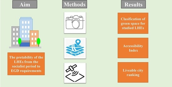
By their very nature, LHEs (large housing estates) are complex socio-territorial entities, requiring the use of both technical and social investigation research methods [
18]. In order to verify the validity of the working hypotheses and achieve the proposed objectives, our research was based on both quantitative and qualitative methods. The methodological approach included specific activities of information gathering, data collection and processing, classification, and item-based mapping, applied in the city of Timișoara as a control case study, then in Cluj-Napoca, Iași, Craiova, Brașov, and Constanța, in order to identify similarities and possible differentiated trajectories.
The working methods and tools were applied specifically for each set of hypotheses and objectives. To establish the structural-urban typology of the LHEs built during the socialist period, we focused initially on bibliographic and netnographic analysis. This allowed us to classify these LHEs into four distinct morphological types, according to construction stages (see
Figure 3), and to verify the extent to which they are synchronous or not with the stages identified by researchers in other countries of the communist bloc [
31,
32,
33,
34]. These models have their own characteristics of construction and territorial organization, respectively, with specific references to green space and local public services.
In order to evaluate the level of compatibility of these neighborhoods with the requirements of the European Green Deal (EGD) [
35,
36] regarding urban green space, we combined netnographic analysis [
16,
28,
31,
33] with field observation, carried out systematically in Timișoara, and with remote sensing methods accessible thanks to Google Earth Pro and Google Streetview software, used for all six cities analyzed. To demonstrate the status and role of green space for each model, we then selected specific neighborhoods for each chronological stage in each case study, which resulted in a series of comparable maps. Based on the analysis of the results, it was possible to synthesize urban green space and its relationship with the built fabric of the large housing estate.
In the case of the second set of objectives and hypotheses, concerning the evolution of green spaces in the context of LHE inherited from the socialist period, we also used direct and indirect observation, respectively, and GIS analysis, methods that have been successfully used in other recent studies [
19,
37,
38,
39]. GIS analysis was used for the creation of the database and as an input for map making. As concrete results obtained by this method we mention accessibility maps, maps for detecting changes in green spaces and comparative maps. The research started with the case study of Timisoara. Here, we have captured the main types of transformations through systematic field observations carried out in the municipality of Timișoara. Visits to the LHE in Timișoara were made iteratively between 2022 and 2024 and involved the use of thematic field observation sheets and the photographic method. The observation focused on both real estate planning elements and spaces connected to apartment buildings intended for traffic, services, or local ecological balance. During these visits, we inventoried the current situation of public and interstitial green spaces, which was compared with data from Timișoara City Hall. In order to obtain relevant results on the evolution of green space in the analyzed cities, we used both evolving satellite images from Google Earth Pro 7.3.3 software, covering the period 2003–2006 until 2024. The satellite images from the period 2003–2006 were of a good enough resolution to achieve direct observation and mapping of green spaces. The mentioned remote sensing data are of several types such as high-resolution satellite imagery provided by companies like Maxar Technologies with satellites like WorldView-3, GeoEye-1, and QuickBird. These data have a panchromatic resolution of the order of decimeters and a multispectral resolution of less than one meter, resulting in very high clarity [
40]. The satellite images were compared with the 2005 orthophoto map of the National Administration of Cadastre and Real Estate Publicity (ANCPI), available on the ArcGIS Online platform of the institution [
41]. In addition to these images from Google Earth, we used historical images available on Google Streeview. In some cities, the year 2009 still exists, but most of them are only available after 2011. For mapping, we used QGIS 3.22 software, with applications on habitat units from each case study and each systematization model. Processing these data resulted in three change maps.
All this information allowed us to classify the transformations of public green space into three major trends: conservation of green spaces, restriction in favor of other uses (with several types of losses), and enhancement through landscaping. These were mapped in QGIS 3.22 software, by habitat complexes in each case study and each systematization model.
In order to verify the trend of reducing green spaces and their public accessibility for residents of LHEs, we divided our methodological approach into two main directions. First, based on the green city development strategies developed by each municipality studied, we analyzed four indicators that we considered essential, namely the area of urban green space (in ha), the area of green space per capita (in sq m), the number of public parks, and the area occupied by them (in ha). It should be noted, however, that the available data on green space areas does not contain information on their structure, except for urban parks, for which separate data is available. We considered that the range of values covered by these indicators, as well as the territorial distribution of green spaces in relation to the concentration of LHEs, are fundamental elements for assessing both the level of livability, in terms of access to green spaces, and the suitability of the neighborhoods and cities analyzed for the implementation of the EGD objectives.
In the third hypothesis, we assert that the livability virtues of large housing estates are determined both by the urban and architectural characteristics of each apartment block complex and by their residents’ access to public spaces and services of interest. In the context of this hypothesis, we created an accessibility index (Iacc), through which we assessed the distance–time between the LHEs in each city analyzed and eight types of spaces of interest, namely green spaces (parks), recreational spaces (children’s playgrounds), educational, medical, cultural, sports, supermarkets, and public transport stations. These places of interest were mapped using the OpenStreetMap (open source) database. Of course, there are other factors that contribute to the livability of a residential complex. For this research, however, we focused on those that are directly related to the verification of the advanced hypotheses and that we were able to analyze spatially, based on the available data. The vectorial data was accessed through an open source plugin QSM and was processed and cleaned for unnecessary items.
In the third hypothesis, we assert that the livability virtues of apartment block neighborhoods are determined both by the urban and architectural characteristics of each LHE and by their residents’ access to public spaces and services of interest. In the context of this hypothesis, we created an accessibility index (Iacc), through which we assessed the distance–time between the LHEs in each city analyzed and eight types of spaces of interest, namely green spaces (parks), recreational spaces (children playgrounds), educational, medical, cultural, sport facilities, supermarkets, and public transport stations. These places of interest were mapped using the OpenStreetMap (open source) database. Of course, there are other factors that contribute to the livability of a residential complex. For this research, however, we focused on those that are directly related to the verification of the advanced hypotheses and that we were able to analyze spatially, based on the available data.
We based our practical application on geospatial data from the six cities, imported into QGIS software and updated or supplemented with the situation on the ground using Google Streetview and Google Earth. We then ran the Service Area function from the Network Analysis package to obtain the degree of accessibility of spaces and services of interest in relation to LHEs. The “cost” element was set by distance–time barriers of 5, 10, or 15 min, and the support network used to assess accessibility was the street and pedestrian network obtained from the OpenStreetMap platform. We thus used methodological procedures that have been sequentially validated in other studies of this type [
19,
39,
42,
43,
44].
By interpolating the data obtained, we classified the LHE in terms of accessibility to each area of interest, as follows: very good accessibility (up to 5 minutes’ walk), good accessibility (up to 10 min), average accessibility (up to 15 min), and poor accessibility (over 15 min). The choice of the three isochrones was made based on several studies, which consider that distances of 400 m (5 min) [
45] and 800 m (10 min) [
19,
46] are optimal and acceptable for accessing most types of places of interest, such as parks, schools, or nearby medical facilities (kindergartens, family doctors’ offices, etc.). On the other hand, the World Health Organization [
47] and the OECD [
48] consider the maximum acceptable distance to be 1200 m on foot, or 15 min between the place of interest and the home. As a result, it is not only the presence of facilities and services of interest that is important, but also their territorial distribution [
49].
Based on these principles, we performed interpolations for each public space/service considered and classified the neighborhoods according to their dominant spatial position in relation to them, giving them scores of 3 (very good accessibility), 2 (good accessibility), 1 (satisfactory), and 0 (poor accessibility) for each of the variables considered. Since each residential complex has different degrees of accessibility in relation to the spaces of interest, we calculated the average accessibility and assigned them a score based on this. Based on these scores, we then calculated the arithmetic mean for each of the six cities selected for analysis. The main limitation of this index was by far the lack of population data at a neighborhood level, and as such, we had to approach the index starting from the interest areas and the large housing estates, and not the other way around. If data on the population were available, a customized index could be made at the neighborhood level, scoring each apartment block and thus creating a more accurate quality of life barometer.
The results obtained were interpreted comparatively between the six cities, in the context of national and international specialist literature.
3. Results and Discussions
3.1. Typology of Large Housing Estates from the Socialist Period
The large housing estates from the socialist period are not a uniform construction, but rather the result of a set of concepts, ideas, and urban planning programs carried out over the nearly five decades of the socialist period. The literature treats them as a monolith, under colloquial names that vary from country to country: Plattenbau in Germany, Panelak in the Czech Republic and Slovakia, panelhaz in Hungary, panelki in Bulgaria, Blocuri in Romania, Blok in the former Yugoslavia, Wielka płyta in Poland, and Bloki in the USSR [
33,
39,
50,
51,
52].
The planning and construction of LHEs were important processes in the urban development of the former socialist republics. Housing built between 1960 and 1990 came to account for a large proportion of the total housing stock in each country, namely 48% in the German Democratic Republic, 49% in Romania, 52% in Hungary, 55% in Bulgaria, 61% in Poland, and 66% in Czechoslovakia [
53], with a large proportion of these concentrated in large housing estates. Although similar, these figures reflect differences in urbanization, economic capacity, and housing strategies in each country.
The differences become even more pronounced when one considers that each national planning agency treated the concepts of apartment block construction in a nuanced manner, developing its own planning models, based on national doctrine, which also evolved over time. It was often not the ideological consequences that mattered, but the need to adapt projects to the existing situation on the ground. However, this adaptation was dependent on political wishes on the one hand and the national economic situation on the other. One of the elements that differentiates the former socialist states is the density and quality of the complexes. For example, the German Democratic Republic, Czechoslovakia, and Hungary built high-quality residential complexes, while Romania and Bulgaria pursued lower-quality developments, but much denser residential complexes [
34,
54,
55].
In Romania, four models of systematization [
28] have been identified, which succeeded one another over time, influenced or not by Soviet models (
Figure 3), namely the following:
The housing estates from the period 1945–1950, inspired by the garden city model, form small groups of individual, duplex, or multi-family dwellings, with abundant green spaces between them. Not very dense and without services or other related facilities, they are integrated into the urban fabric, but are less significant because they are isolated in the current city.
After 1950, the
cvartal model (the city block unit) was introduced, consisting of multi-story apartment blocks. The neighborhood is characterized by a structure organized in geometric shapes, with multi-family condominiums and green spaces located in the centers of the neighborhoods, where pedestrian walkways take priority over car traffic. Due to the limited vacant space in the pre-existing neighborhoods, the location of the
city block was somewhat difficult [
31], so the model was abandoned [
16].
Between 1960 and 1975, the
micro-district model introduced by the Soviets in 1959 was adopted [
14,
16,
46,
56]. The model was inspired by the theory of neighborhood unit developed by Clarence Perry in 1929 [
57], which combines the principles of the garden city (a concept developed by Ebenizer Howard in 1898 [
58] with those of post-war modernism (resulting from the ideas of Le Corbusier during the inter-war period). All these elements were filtered through the lens of economics and rationalism imposed by the Soviet regime and, in particular, by Nikita Khrushchev’s modernist policy, which was also accepted in Romania at the time. It was the first time that an urban complex was developed from the outset with various community services, such as schools, kindergartens, shopping centers, polyclinics, and recreational spaces. Green space is present in the form of planted areas and green pedestrian walkways generously arranged between the blocks, while car traffic is pushed towards the outer arteries [
59]. The abundance of green spaces in these models creates a higher quality environment compared to the Living Complex model (see page 15). Based on these premises, the micro-district model prompted planners and builders to deliver estates with good urban quality and remarkable livability features. Moreover, the presence of these green spaces would facilitate the creation of interconnected green islands or green–blue infrastructure, in accordance with EGD guidelines. For the time being, such developments have not been implemented. The micro-district concept was complemented by a model of systematization in scaled stages, namely the housing group, the micro-district, the neighborhood, and the sector [
31], with the clarification that these scaled stages are not found in their entirety in all cities.
This model, versatile and adaptable to the reality on the field, applied during a period of economic dynamism and political stability, coincides with the large-scale construction of collective housing, both in Romania [
60] and internationally [
61]. In all the cities studied, this model forms the greenest type of LHE, with good access to public services.
The housing developments built between 1975 and 1990 took the form of housing complexes, which were characterized by a much higher density of buildings. This was a new model of housing estate, resulting from the separation of Romanian urban planning from the rhetoric of planning in the USSR and other European socialist countries. Against the backdrop of political demands for more judicious use of land, seen as state property, in 1974, the communist regime in Romania drafted the Law on Territorial Systematization [
62] and, a year later, the Street Law [
63]. The housing complex thus promotes a model unique to Romanian cities, in which certain elements of the micro-district are preserved, but substantial changes are introduced. Firstly, there is a return to city blocks surrounded by streets intended for car traffic, to the detriment of the free placement of buildings. Residential buildings are densely built (the livable surface area increased steadily during the socialist period, from approximately 6 m
2 in 1960 to 11.5 m
2 in 1989 [
29]) and based on standard models (the typical blocks were designed by the Research Institute for Standardized Projects and were intended for identical projects, in order to speed up the design and construction process for housing [
64,
65]) replicated in most cities, and service spaces are frequently located on the ground floor of blocks, especially along main streets. Compared to estates from previous iterations, the appearance is less organized and green space is greatly reduced, which affects livability, and is concentrated along the street grid.
The new developments are more densely built than those constructed before 1975, with some older developments even being “crammed” by the addition of new residential spaces. By reducing the distance between buildings (to 20 m), increasing the proportion of streets at the expense of alleys (which has led to their being filled with cars in recent decades), reducing the proportion of green spaces, and minimizing the space allocated to commerce and services, the quality of life has suffered.
Measures to limit construction outside built-up areas introduced after 1974 led, in the first phase, to the introduction of groups of blocks in the available spaces of the pre-socialist built environment (the expropriation of garden parcels and the construction of large housing estates on them was a common practice in Romanian cities), and then, in the 1980s, to the demolition of some of the pre-socialist neighborhoods (architect Peter Derer [
28] identified three modalities for developing LHEs within the urban fabric: greenfield development, insertion into the existing urban fabric, and replacement of the existing fabric). The construction of new complexes by replacing (demolishing) the old fabric resulted in more organized residential neighborhoods, but from a social point of view, it caused real traumas (the project for the Civic Center in Bucharest, or the People’s Palace, led to the complete disappearance of 5.9 square kilometers (2.5%) of the city’s historic center) and irreparable losses to the local heritage [
60,
66].
On the other hand, the housing complexes built between 1975 and 1990 also show improvements in terms of housing and urban planning, either as a result of the increase in the living space of the apartments or because the local demolition of the pre-existing urban fabric allowed for the elimination of systematization constraints. In isolated cases, the construction of new neighborhoods on previously undeveloped land was also permitted. Some of the new neighborhoods are thus better organized.
However, the period between 1975 and 1990, when the housing complex model was adopted, coincided with a remarkable volume of construction (Between 1971 and 1991, over 58,400 apartment blocks were built, 94.1% of which were in urban areas (Population and Housing Census [
67]), far exceeding all previous and subsequent periods. The blocks built during this period account for 60.57% of the total number of blocks existing in Romania at the time of the census.), but also with a period of economic hardship towards the end, which led to a decline in the number and quality of public services in these neighborhoods and, implicitly, in livability.
Although, in principle, LHEs had their own style in each socialist state, as discussed on page 9, we can observe parallels in planning. We can clearly see similarities between the first Romanian models and those abroad, and then the differences in the case of the housing complex, considered the furthest from Soviet and Eastern European patterns. For example, in the USSR, the term micro-district was used from 1950 to 1991 and was qualitatively improved by increasing the density and quality of LHE [
68,
69,
70].
3.2. The Regressive Dynamics of Green Spaces in Large Apartment Block Neighborhoods in the Post-Socialist Period
Green spaces within cities and municipalities are defined in Romanian legislation as a mosaic network or a system of natural ecosystems, whose specific characteristics are determined by the presence of vegetation. Urban green spaces consist of the following types of land: parks, squares, tree-lined boulevards and streets, and vacant, unproductive land within built-up areas [
71]. The administration of publicly owned green spaces is carried out by local public authorities and other bodies empowered for this purpose. The administration of green spaces on privately owned land is carried out by their owners, in compliance with the provisions of the normative acts in force [
71].
The green spaces around the blocks of flats in residential complexes built during the socialist period are a less analyzed element. Their evolution has gone through stages and aspects common to all major cities in Romania and has followed three major trends: conservation of green spaces, restriction in favor of other uses, and enhancement through landscaping. We will detail the developments specific to the first two trends below, while the third will be addressed in the next section of the article.
Firstly, after the fall of the communist regime, green spaces were neglected due to an insufficiently coherent institutional structure and regulatory provisions whose enforcement was no longer monitored. The authority responsible for maintaining these spaces before 1989 was transferred to homeowners’ associations or local authorities, but without a clear delineation of responsibilities and, in most cases, without a clear legal framework [
72]. This slowed down investments in the maintenance and redevelopment of green spaces in apartment block areas. Homeowners’ associations either carried out small works on their own or allowed the space to deteriorate. In parallel with abandonment and degradation, uncontrolled interventions took place on green spaces, in many cases leading to their loss (
Figure 4). All the cities presented in the study case experienced this transformation, mostly due to the poorly regulated legal framework that has not kept pace with urban development. The successful transformation of these spaces was influenced by the ability of local authorities (pages 14–15).
The first significant interventions on green spaces in the large housing estates took place immediately after 1990 [
73]. Based on Law 18/1991 [
74], local authorities simultaneously began a process of concession, sale, or lease of land for various uses. The vacant green spaces inside the estates were exploited through these schemes. The buildings have a variety of uses, from housing and commercial spaces to car parks and places of worship. The latter are quite significant today, although these buildings were absent from the housing estates (
Figure 5A,D,E) because the communist regime discouraged religious practices and symbols [
75].
Other structures that are quite common within LHEs are individual garage lots. Built in most of the estates in the early years after the December 1989 Revolution, these spaces led to the loss of significant amounts of green space around the blocks. Over time, however, the individual garage lots lost their primary purpose, becoming storage spaces, and began to be demolished in the last decade. Analyzing case studies, in Brașov, Constanța, Craiova, and Iași, local authorities have removed the vast majority of garages, while Cluj-Napoca and especially Timișoara still have a significant number of such buildings (
Figure 4).
The creation of modern public parking lots, especially since the mid-2000s, has been achieved both by utilizing green spaces around residential buildings and by removing the aforementioned rows of garages. The development of car parks around residential complexes was followed by a process of charging for parking spaces (Timișoara, Cluj-Napoca) or renting them on an annual basis (Iași, Constanța, Brașov).
Figure 5.
The evolution of the lost green space for the housing estates built between 1945 and 1960 (processing în QGIS 3.22, basemap: Google Maps Satellite).
Figure 5.
The evolution of the lost green space for the housing estates built between 1945 and 1960 (processing în QGIS 3.22, basemap: Google Maps Satellite).
Analyzing the selected estates from the case studies (
Figure 5,
Figure 6 and
Figure 7), each model was affected differently by the loss of green space. The complexes built before 1960 largely retained their green spaces intact (
Figure 5). In the case of the micro-districts studied (1960–1975), they either suffered minimal losses (
Figure 6A), replaced part of the green space with parking spaces (
Figure 6B,C,E,F), or developed recreational infrastructure (
Figure 6C).
Of the three models, the greatest loss of green space was recorded in residential complexes built between 1975 and 1990 (the “Housing Complex” model), for several reasons. Firstly, the green space available in this model is located not on the street, but behind the residential buildings in the gaps between the blocks, providing a central location for various other types of developments (
Figure 7). Secondly, in some complexes built in the last decade of the communist period, the landscaping of the green space was not completed (according to historical Google Earth analysis;
Figure 7), which encouraged its neglect or loss in favor of other uses. Among the types of losses recorded in housing complexes, the largest share is accounted for by green spaces replaced by garages and, currently, public parking lots (
Figure 7).
Another category, which does not represent a loss per se, is the transformation of green spaces into recreational areas, especially children’s playgrounds, developed after 2000. Analyzing the location of children’s playgrounds in the six case studies, using GIS mapping, we note that the largest number of such spaces is in the municipality of Cluj-Napoca with 194 units, followed by Iași with 117. The figures drop significantly in Brașov, with 54, Craiova with 33, and Constanța with 32, while Timișoara has only 27 such spaces.
The loss of green space in the LHEs inherited from the socialist era has reduced the potential of these complexes to meet EGD requirements over time. With the exception of areas where massive construction has taken place, these losses are not irreversible, and in some of the cities analyzed, the process of reconsidering spontaneous developments and “renaturing” these areas is well underway to align with EGD strategies (page 3; 22–23).
Figure 6.
The evolution of the lost green space for the housing estates built between 1960 and 1975 (processing în QGIS 3.22, basemap: Google Maps Satellite).
Figure 6.
The evolution of the lost green space for the housing estates built between 1960 and 1975 (processing în QGIS 3.22, basemap: Google Maps Satellite).
Figure 7.
The evolution of the lost green space for the housing estates built between 1975 and 1990 (processing în QGIS 3, basemap: Google Maps Satellite).
Figure 7.
The evolution of the lost green space for the housing estates built between 1975 and 1990 (processing în QGIS 3, basemap: Google Maps Satellite).
3.3. The Landscape Quality of Green Space as a Factor in Increasing Livability in the Large Housing Estates
Urban green space is a major priority in sustainable development, public health, and climate change adaptation policies [
76,
77]. National, European, and international policies are oriented toward the conservation and development of green space.
Green space within LHEs is a significant resource that can help increase livability [
33,
78]. Not all the changes that took place after 1989 were negative, as there were also situations where green spaces were maintained or even improved through various private initiatives or at the level of homeowners’ associations (
Figure 6). Such interventions took many forms: ornamental planting and decorative landscaping, planting fruit trees, vines or vegetables, protective fencing, or maintenance activities such as caring for pergolas, benches, hedges, and grass (
Figure 8). These interventions were not carried out according to a landscaping plan, but they created a recreational and social component, in addition to the esthetic aspect.
However, equally important are the initiatives of local public authorities to reconsider the status of the housing estates within the urban landscape and to include them in integrated public space development projects. From the thermal insulation and renovation of buildings to the redesign of pedestrian and motorized access, the demolition of improvised constructions, and the landscaping of green spaces, all these projects are in line with EGD requirements. However, the process is a long one, given that, for example, by 2024, only 10 to 15% of the blocks in the cities analyzed had been thermally rehabilitated, an action made more difficult by the fact that the vast majority of them do not belong to the public domain. On the other hand, green spaces are mostly publicly owned, so they are easier to include in integrated development projects.
Based on the available data, our study addressed four relevant indicators regarding urban green space, namely the total area of green space outside the built-up area of each city analyzed, the ratio of public green space per inhabitant, and the number and area of public parks.
The indicator for the total area of green space within the administrative area of each city shows clear contrasts. Cities with large administrative areas, located in mountainous and hilly areas, are naturally favored over those located on plains and low plateaus. Thus, Brașov has by far the largest green area, being located in a mountainous area where the administrative boundaries of the city extend deep into the countryside. It is followed by Cluj-Napoca and Iași, cities surrounded by hills with forested slopes, then by Craiova and Timișoara, cities on the plains. In last place is Constanța, located on the Black Sea coast, on the edge of an arid plateau (
Table 2). These green spaces outside the built-up area are important as ecological balancing environments, but also for leisure activities (weekend walks, outdoor sports, etc.), especially for those who live in LHEs.
Regarding the green space coefficient per inhabitant, the European Commission recommends 26 square meters [
80]. The cities analyzed in this study have different situations in this regard (see
Figure 9). The highest value is for the city of Brașov (118.5 m
2/inhabitant), followed by Timișoara. Brașov stands out from this point of view because it also includes a forested mountain area, located to the south, with a large share in its administrative area (see
Table 2). The other regional cities have similar values, slightly above the recommended average (Cluj-Napoca, Craiova, and Iași, which are close to the minimum threshold). Only Constanța is below the recommended threshold. These differences are due, on the one hand, to the specific natural conditions of each city and, on the other hand, to local urban planning policies.
For the daily needs of the urban population and for the livability of each neighborhood, the topological characteristics of public parks located within the city limits are of greater relevance. The area of these parks, which is very important for ensuring optimal green space that is accessible to the population, is largest in Craiova (150 hectares), followed by Constanța (110 hectares), Timișoara (101 hectares), Cluj-Napoca (62 hectares), Iași (36 hectares), and Brașov (with only 32 hectares) (data extracted from sustainable urban development strategies developed at the national level to guide the harmonious evolution of localities [
84]). The hierarchy is somewhat reversed compared to that resulting from the analysis of green space area in the administrative area: cities with green surroundings have reserved less space for parks within the built-up area. On the contrary, those located in natural areas marked by aridity have set up public parks inside, near densely populated neighborhoods.
According to data obtained from Greencomunity.ro [
81] and local sustainable urban strategies (sustainable urban development strategies are developed at the national level to guide the harmonious evolution of localities [
84]), the number of parks is the same for Timișoara and Cluj-Napoca, each with 25, followed by Craiova with 13 parks, Brașov and Constanța with 11 each, and Iași with 10 parks. Theoretically, a larger number of parks allows for a more balanced distribution within the built-up area and, therefore, better coverage of the needs of the population in the neighborhoods. In reality, however, serving the population also depends heavily on the location of the parks in relation to the neighborhoods studied.
3.4. The Landscape Quality of Green Space as a Factor in Increasing Livability in the Large Housing Estates
Analyzing the distribution of parks in the six case studies, both those existing during the socialist period that are still preserved today and those developed later, we find a relatively optimal location in relation to the LHEs. There are some exceptions in each case study, such as in the northern part of Timișoara, in the southeast of Cluj-Napoca, in the west and southwest of Iași, in the southwest of Craiova, in the east of Brașov, or in the north of Constanța (
Figure 10 and
Figure 11), where there are neighborhoods with no parks nearby.
The distribution of parks in relation to large housing estates built during the socialist period has a significant effect on their livability, given their proximity and accessibility. Based on the methodology explained in the second section of this article, we calculated the degree of accessibility of parks in relation to large residential complexes in the case study cities. We found very good and good accessibility of neighborhoods in almost all the cities analyzed (which have many urban areas from which at least one park can be reached in less than 5 or 10 min) (
Figure 11). The largest urban area in absolute terms that is optimally served (good and very good accessibility to parks) is in Craiova (536.13 ha), followed by Iași, Brașov, Timișoara, and Cluj-Napoca, then Constanța (with only 367.6 ha) (
Figure 10).
The largest urban areas located far from parks (with reduced accessibility) are found in Constanța (108.33 ha), followed by Craiova, Cluj-Napoca, Iași, Brașov, and Timișoara. In percentage terms, the municipalities of Iași (75%), Brașov (74%), and Craiova (70%) have the best accessibility to parks in relation to residential areas (good and very good accessibility). On the other hand, neighborhoods located far from parks, and therefore with reduced accessibility, have higher shares in Constanța (15%) and Craiova (14%), while Timișoara (5%) and Brașov (7%) have the smallest urban areas located more than a 15 min walk from the nearest park (
Figure 10).
These hierarchies and disparities appear dry, but they make sense when we use them to assess the livability of each city’s large housing estates. We emphasize that, during the socialist period, parks had a clearly defined role as spaces for ecological balance and recreation for citizens, but with little impact on real estate initiatives, which belonged to the state. In today’s city, green space is a remarkable attraction for investors in quality real estate, to which water areas are added. This change relativizes Constanța’s position at the bottom of the rankings, as the city benefits from its location on the seashore. Furthermore, the presence of the Siutghiol lagoon in the north of the city has stimulated investment in quality housing, with most of the new residential complexes in Constanța municipality appearing here in the last 15 years.
3.5. Disparities in the Accessibility Index (Iacc) of the Large Housing Estates
The characteristics, territorial distribution, and accessibility of green spaces are an important aspect that we used to assess the livability of LHEs built during the socialist period. However, in order to have a more complete picture, we also took into account other indicators, based on which we constructed a composite accessibility index (detailed in the methodology), which we consider relevant in assessing the livability of neighborhoods. The database and information developed for this research highlights that in each of the six cities studied, there are privileged apartment block neighborhoods with a good level of livability and disadvantaged neighborhoods with a rather repulsive character (
Table 3).
On average, the best situation characterizes cities with large neighborhoods (Cluj-Napoca Iacc = 2.04 Constanța Iacc = 1.86, Craiova Iacc = 1.82), whose large size was naturally mitigated or accompanied by facilities and services located in the vicinity or within the built-up area. The large number of users was ensured ab initio by the large size of the habitat, and the proximity of municipal facilities and public services avoided unproductive travel. These neighborhoods are therefore still well served by public transport, have nearby medical facilities, include schools, shopping centers, sports facilities, etc., and often have parks nearby, some of which are large.
Cities with scattered housing estates, built among existing neighborhoods or settlement centers, rank lower (Timișoara 1.66, Iași 1.72). Their amenities and connections are more sporadic because they do not have the critical mass necessary to justify investment and make their use “profitable”. Brașov presents a special case (average index 1.68), with large, relatively grouped blocks of flats, but located outside the old, pre-socialist city, whose compact habitat is well preserved and concentrates many of the city’s higher-level municipal facilities (
Figure 12).
At the neighborhood level, disparities are much greater, with livability indices ranging from Iacc = 2.63 (Mănăștur Est and Mărăști Sud estates in Cluj-Napoca) to Iacc = 0.57 (Noua Dârste in Brașov), out of a maximum possible score of Iacc = 3. We note that in all the cities analyzed, there are neighborhoods with Iacc values > 2, which are close to the performance of the best-ranked neighborhoods. In contrast, two cities, Constanța and Craiova, have no neighborhoods with Iacc < 1, which would place them at the bottom of the ranking, revealing smaller gaps between local livability levels (
Table 3).
The spatial distribution of values by neighborhood reveals certain contrasts related to how the variables we considered are associated and moderate each other. Both in the category of neighborhoods with a high synthetic accessibility index and in that of neighborhoods with a low index, there are complexes built in the 1980s or 1970s, as well as some older complexes from the 1960s. Some are favored by good access to transport services, others are not, but have parks nearby. Some score better in terms of commercial services, while others are better equipped in terms of education or healthcare. The neighborhoods with the lowest scores are usually small and located in peripheral areas (
Figure 12).
The final ranking compiled based on the accessibility index (
Figure 12) places neighborhoods in an order that tends to be confirmed—at least partially—by the specific disparities in the real estate market in each city. In fact, in recent years, the average sale price of apartments built during the socialist period has been on the rise. The highest level is in Cluj-Napoca, about 40% above that of the country’s capital, Bucharest, with prices rising above average more recently in Brașov and Constanța as well. Lower values, albeit rising, remain in Timișoara, Craiova, and Iași (According to a study conducted periodically by real estate data integrator STORIA [
85], in February 2025, the highest average price for apartments built during the socialist period was in Cluj-Napoca (over EUR 3000/m
2), followed by Brașov (EUR 2140). In the other cities we analyzed, average prices ranged between EUR 1750 and EUR 1950/m
2 [
85].
In cities that are attractive due to their location in high-quality natural areas, the trend is for prices for apartments in new buildings to be up to 5% higher than those built during the socialist period. This is the case in Brașov and Constanța, the former located in a mountainous tourist area and the latter on the Black Sea coast. In Craiova, prices are also higher for new apartments, due to the lower supply of such properties on the market (according to Storia Real Estate Agency [
85]).
Finally, we would like to point out that in the case of Iași, Timișoara, and Cluj-Napoca, the balance between old and new real estate is also influenced by large-scale real estate investments that have been made in the surrounding areas, which already account for 25–30% of the population of the respective urban agglomerations (according to 2021 census data processed by us). As a result, the pressure on new real estate in these three cities is lower.
3.6. The Suitability of LHEs for the Requirements of the European Green Deal
The relationship between the requirements of the Green Deal and the ability of the LHEs inherited from the socialist period to meet them, through good livability, is one of interdependence. The Green Deal aims to regulate the enhancement of green space and responsible energy management, to be offered equitably to the urban population. The degree of livability is, in this case, an indicator of the quality of living, in which access to green space is a necessary but not sufficient component. Comparing the results obtained in this study with those in the specialized literature or in national and EU programmatic documents, we observe certain discrepancies. Studies have identified differences between Romania’s Green Deal targets and those at the European level [
86], or differences between EU states [
87].
However, the strategies designed by the Romanian state, such as the “Urban Policy of Romania 2022–2035” [
88] or the “National Housing Strategy 2022–2050” [
89], contain many measures recommended by the EGD. Among these measures, we mention supporting green space as health infrastructure and increasing the quality of life (Housing Strategy), developing green–blue infrastructure (Urban Policy), and reducing the heat island (Urban Policy), respectively, involving communities in planning green spaces (Housing Strategy and Urban Policy).
Analyzing the Action Plans for the “Green City” [
90,
91,
92,
93,
94,
95], we see many elements through which the Green Deal targets (emission reduction, sustainable mobility, energy efficiency, or increased urban resilience) are transposed at the local level through a series of measures, often preparing projects that were easily fundable, such as the energy rehabilitation of buildings, the modernization of thermal infrastructure, and the modernization of public transport. Many of these projects have been included in various European funding programs such as the NPRR (National Recovery and Resilience Plan) or other funding programs. There are similarities between all the plans, but there are also some particular approaches. The Municipality of Cluj-Napoca was selected in 2023 within the European Commission’s Mission “100 smart and climate-neutral cities by 2030”, assuming the clear direction of accelerating climate neutrality and a clear accent on participation [
90]. The municipalities of Brașov, Craiova, Iași, and Timișoara have developed their own strategies within the “Green Cities Action Plan” [
91,
92,
93,
94,
95] to focus on particular issues. Timișoara focuses on energy efficiency, Craiova tackles air quality, Iași wants to improve traffic pollution, and Constanța and Brașov, which have an important touristic component, have particular measures added. The analyzed cities have also carried out specific and impactful local projects, including the park development projects in Timișoara [
96,
97,
98], “adopt a green space” program in Constanța [
99], and the URBFORDAN initiative and urban forests in Cluj-Napoca [
100].
Accessible and modern urban green space can bring related benefits to the quality of life in LHE, as evidenced by the Green Deal strategies developed by the six case studies, as well as other documents addressing quality of life in Romania. A common element in these strategies is air pollution. Consulting the urban development strategies of the six cities [
77,
78,
101,
102,
103,
104] analyzed, a high degree of pollution is noted in these cities, and some LHEs are mentioned as vulnerable areas.
Another element addressed in these strategies is noise pollution, which also affects LHEs located on major traffic arteries, according to the noise maps available in the case study cities [
105,
106,
107,
108,
109,
110]. These issues affecting quality of life will see a slight improvement with the expansion of green space planting projects, undertaken as part of the green city strategies, which will also influence LHEs. Another pillar aims to increase safety within LHEs. An analysis of the Green Deal strategies in each city highlights road and pedestrian safety, as well as greater accessibility to public transport (a measure observed in urban development strategies). Accessibility and safety also respond to the concept of the 15 min city, found in several strategies, including Romania’s Urban Policy [
88].
All these projects and strategies do not specifically target LHE or certain areas, but are carried out either at the city level (in the case of urban strategies) or where there is sufficient interest (in the case of specific projects), not necessarily where interventions are necessary [
17,
26,
29,
31]. Even so, the vast majority of LHEs from the socialist period are presented as suitable for being transformed into livable spaces, while also satisfying the equitable access to green spaces recommended by the EGD.
4. Conclusions
In this article, we analyzed the suitability of large housing estates inherited from the socialist period in the main regional cities of Romania to the requirements of current urban planning and the European Green Deal. The research involved three directions: the analysis of the development models of LHE in Romania from the perspective of their livability, in relation to the role reserved for green space; the analysis of the transformations of green space within LHE in the post-socialist period and; the assessment of the accessibility of LHE to public facilities and services, especially urban parks. We considered that all these are basic conditions for the current level of livability of LHE, which forms the main material heritage of Romanian cities, preserved from the socialist period.
In our analysis, we started from the hypothesis that the reservation of interstitial green space in ensuring a high level of livability in apartment building neighborhoods [
28,
30]. Detailed research at the level of the six case studies led to only partial validation of the first hypothesis, because it demonstrated that, in the practice of urban development, the initial models were not fully respected, being adapted to the geographical conditions and urban constraints of each city.
During implementation, there were partial overlaps between successive models, new additions, revisions, and reconsiderations, which led to denser buildings and fewer green spaces in neighborhoods, especially after 1974. As a result, the most densely built neighborhoods also have the lowest potential for implementing the ecological requirements of the EGD.
We then assessed how significant the transformations of green spaces were in each model. We found that interstitial green spaces underwent fewer changes in complexes that were designed from the outset to be green and relatively protected from traffic (garden blocks, micro-districts). From this point of view, at the city level, livability is good where public parks have been preserved or developed near neighborhoods, and the municipality has allowed restrictions only for the placement of light or temporary structures that are easy to dismantle. They can now rehabilitate their parks or even multiply them to increase the satisfaction of their residents. The second hypothesis is therefore verified.
The third hypothesis considered the livability of socialist neighborhoods, based on the accessibility of residential complexes to places of interest and public services (education, health, transportation, recreation, etc.). The configurations obtained are quite different from those based strictly on the relationship between neighborhoods and parks. However, the large differences between neighborhoods, observed when analyzing each indicator separately, become less pronounced when the indicators are aggregated into a summary formula. As a result, the third hypothesis is verified, but the levels of differentiation between neighborhoods are less pronounced than we initially expected.
Following the research on the evolution and current state of LHE in the six major Romanian regional cities, a series of recommendations for local development policies emerge. Local authorities should take into account that, although LHE inherited from the socialist period are perceived predominantly negatively by the public, they continue to concentrate the majority of the urban population in Romania. In addition, due to the way they were conceived, associating residential massiveness with the proximity of services and green spaces, LHE lends itself very well to the implementation of the European Green Deal principles. In most of the cities analyzed, the creation of green–blue corridors is an achievable objective (Timișoara, Cluj-Napoca, Craiova, Brașov). Urban parks can be networked through interstitial green spaces and green alignments along rivers and drainage channels, where biodiversity must be protected.
Also, the concept of the 15 min city, recently affirmed in the specialized literature and in current urban practice, is relatively easy to implement, since most LHEs have been planned so that their population has most of the necessary public services and utilities, including schools, neighborhood medical centers, agri-food markets, service units, parks, or public markets (neighborhood centers). Local urban planning structures only need to provide for rehabilitation and urban development projects, so that they remain attractive to the population, in competition with hypermarkets and malls that tend to empty the functional units in the neighborhoods of activity.
These neighborhoods are also best suited for the specialization of urban mobility by type of user, with the generalization of the reservation of special lanes for electric public transport (trams, trolleybuses, electric buses, urban trains) and the transition from individual motorized travel to ecological travel (pedestrian, assisted by non-motorized vehicles, etc.). To achieve the expected results, persuasive actions to shape ecological behaviors are indispensable. Hence the need to promote integrated civic education policies by associating authorities with educational structures and innovative NGO initiatives.
The study we conducted may be useful for the sequential analysis of the impact of implementing the Green Deal targets in Romanian cities or other European cities since, by including areas with weak points (disadvantaged neighborhoods), the authorities have to harmonize them with appropriate strategies and urban acupuncture projects [
111]. On the livability side, the study allowed the identification of livable neighborhoods in terms of the quality of green space and access to public services, even creating a preliminary register of livability. The study is applicable to any type of LHE from the socialist period, as long as the construction period and its specifics are known.
The geographical reality that was the subject of our research is very complex, and not all avenues of reflection can be addressed in this article. As a result, there remain topics that will be explored more thoroughly in other studies, such as the articulation between top-down objectives and participatory initiatives, the contribution of citizen science to the development of green cities, or the combination of transformations brought about over time to living spaces, with policies to optimize public services, in order to increase the livability level of LHEs. One of the major obstacles to increasing research performance in this field is the insufficiency of data at the intraurban level and the low reliability of the available information, which is difficult to correlate from one source to another. To the extent that such information would become accessible to Romanian cities, future work could integrate relevant municipal datasets, which would thus lead to the refinement of accessibility indices.


