Skip to Content

Remote Sensing, Volume 15, Issue 18

2023 September-2 - 282 articles

Cover Story: 
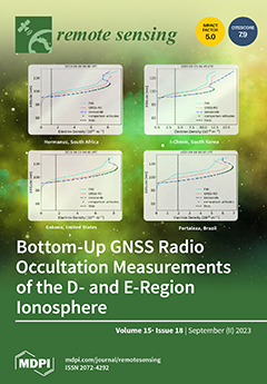
With recent expansions in Global Navigation Satellite System (GNSS) Radio Occultation (RO) constellations, which provide over 20,000 daily measurements, improved Electron Density Profile (EDP) extraction methods will enable truly global ionosphere monitoring. While many studies have focused on the GNSS-RO estimates of the F-region, only a few have focused on E-region electron densities, which play a vital role in ionospheric conductivity. In this study, a new bottom-up approach for estimating the D- and E-region electron density profiles is compared with the ionosonde and FIRI estimates. The results show general agreement between the ionosonde and GNSS-RO observations in the E-region, and the D-to-E-region transition in the RO profiles match the FIRI trends, substantiating this bottom-up approach to global studies of the lower ionosphere. View this paper
  • Issues are regarded as officially published after their release is announced to the table of contents alert mailing list .
  • You may sign up for email alerts to receive table of contents of newly released issues.
  • PDF is the official format for papers published in both, html and pdf forms. To view the papers in pdf format, click on the "PDF Full-text" link, and use the free Adobe Reader to open them.

Articles (282)

  • Article
  • Open Access
3 Citations
2,054 Views
20 Pages

21 September 2023

Convolutional neural networks (CNNs) have shown outstanding feature extraction capability and become a hot topic in the field of hyperspectral image (HSI) classification. However, most of the prior works usually focus on designing deeper or wider net...

  • Article
  • Open Access
9 Citations
2,255 Views
24 Pages

Spatiotemporal Analysis of Ecosystem Status in China’s National Key Ecological Function Zones

  • Xiongyi Zhang,
  • Quanqin Shao,
  • Bing Wang,
  • Xiang Niu,
  • Jia Ning,
  • Meiqi Chen,
  • Tingjing Zhang,
  • Guobo Liu,
  • Shuchao Liu and
  • Haibo Huang
  • + 1 author

21 September 2023

The National Key Ecological Function Zones (NKEFZ) serve as crucial ecological security barriers in China, playing a vital role in enhancing ecosystem services. This study employed the theoretical framework of ecological benefits assessment in major...

  • Article
  • Open Access
12 Citations
3,637 Views
20 Pages

21 September 2023

Strawberry anthracnose, caused by Colletotrichum spp., is a major disease that causes tremendous damage to cultivated strawberry plants (Fragaria × ananassa Duch.). Examining and distinguishing plants potentially carrying the pathogen is one of...

  • Article
  • Open Access
2 Citations
3,321 Views
19 Pages

Remote Sensing and Deep Learning to Understand Noisy OpenStreetMap

  • Munazza Usmani,
  • Francesca Bovolo and
  • Maurizio Napolitano

21 September 2023

The OpenStreetMap (OSM) project is an open-source, community-based, user-generated street map/data service. It is the most popular project within the state of the art for crowdsourcing. Although geometrical features and tags of annotations in OSM are...

  • Article
  • Open Access
10 Citations
2,639 Views
21 Pages

Ecological Water Requirement of Vegetation and Water Stress Assessment in the Middle Reaches of the Keriya River Basin

  • Ranran Wang,
  • Abudoukeremujiang Zayit,
  • Xuemin He,
  • Dongyang Han,
  • Guang Yang and
  • Guanghui Lv

21 September 2023

Desert oases are vital for maintaining the ecological balance in arid regions’ inland river basins. However, fine-grained assessments of water stress in desert oasis ecosystems are limited. In our study, we aimed to evaluate the water stress in...

  • Article
  • Open Access
16 Citations
4,767 Views
22 Pages

A Fusion Encoder with Multi-Task Guidance for Cross-Modal Text–Image Retrieval in Remote Sensing

  • Xiong Zhang,
  • Weipeng Li,
  • Xu Wang,
  • Luyao Wang,
  • Fuzhong Zheng,
  • Long Wang and
  • Haisu Zhang

21 September 2023

In recent years, there has been a growing interest in remote sensing image–text cross-modal retrieval due to the rapid development of space information technology and the significant increase in the volume of remote sensing image data. Remote s...

  • Article
  • Open Access
3 Citations
2,524 Views
23 Pages

A Version Control System for Point Clouds

  • Carlos J. Ogayar-Anguita,
  • Alfonso López-Ruiz,
  • Rafael J. Segura-Sánchez and
  • Antonio J. Rueda-Ruiz

21 September 2023

This paper presents a novel version control system for point clouds, which allows the complete editing history of a dataset to be stored. For each intermediate version, this system stores only the information that changes with respect to the previous...

  • Article
  • Open Access
3 Citations
3,442 Views
14 Pages

21 September 2023

Forests are essential for sustaining ecosystems, regulating the climate, and providing economic benefits to human society. However, activities such as commercial practices, fuelwood collection, and land use changes have resulted in severe forest degr...

  • Article
  • Open Access
2,376 Views
22 Pages

21 September 2023

While recent advances in the field of neural rendering have shown impressive 3D reconstruction performance, it is still a challenge to accurately capture the appearance and geometry of a scene by using neural rendering, especially for remote sensing...

  • Article
  • Open Access
3 Citations
3,812 Views
24 Pages

21 September 2023

With growing global concern for food and water insecurity, an efficient method to monitor irrigation projects is essential, especially in the developing world where irrigation performance is often suboptimal. In Nepal, the irrigated area has not been...

  • Article
  • Open Access
12 Citations
2,547 Views
16 Pages

21 September 2023

It is crucial to evaluate the expansion of urban entities to implement sustainable urban planning strategies in China. Thus, this study attempted to extract and evaluate the growth of urban entities 270 prefecture cities in mainland China (2000&ndash...

  • Article
  • Open Access
14 Citations
3,304 Views
23 Pages

Regional-Scale Monitoring of Wheat Stripe Rust Using Remote Sensing and Geographical Detectors

  • Mingxian Zhao,
  • Yingying Dong,
  • Wenjiang Huang,
  • Chao Ruan and
  • Jing Guo

21 September 2023

Realizing the high-precision monitoring of wheat stripe rust over a large area is of great significance in ensuring the safety of wheat production. Existing studies have mostly focused on the fusion of multi-source data and the construction of key mo...

  • Article
  • Open Access
2 Citations
3,580 Views
19 Pages

21 September 2023

The ocean surface current influences the roughness of the sea surface, subsequently affecting the scatterometer’s measurement of wind speed. In this study, the effect of surface currents on ASCAT-retrieved winds is investigated based on in-situ...

  • Article
  • Open Access
6 Citations
4,063 Views
17 Pages

20 September 2023

TBD (Track-Before-Detect) algorithms allow the detection and tracking of objects of which the signal is lost in the background noise. The use of convolutional neural networks (ConvNN) allows to obtain more effective algorithms than the previous, beca...

  • Article
  • Open Access
12 Citations
7,585 Views
18 Pages

20 September 2023

3D reconstruction of urban scenes is an important research topic in remote sensing. Neural Radiance Fields (NeRFs) offer an efficient solution for both structure recovery and novel view synthesis. The realistic 3D urban models generated by NeRFs have...

  • Article
  • Open Access
4 Citations
3,694 Views
19 Pages

20 September 2023

This work reports an information-based landmarks assisted simultaneous localization and mapping (InfoLa-SLAM) in large-scale scenes using single-line lidar. The solution employed two novel designs. The first design was a keyframe selection method bas...

  • Article
  • Open Access
25 Citations
3,367 Views
17 Pages

Analysis of Ionospheric Disturbances during X-Class Solar Flares (2021–2022) Using GNSS Data and Wavelet Analysis

  • Charbeth López-Urias,
  • G. Esteban Vazquez-Becerra,
  • Karan Nayak and
  • Rebeca López-Montes

20 September 2023

The influence of solar activity on the ionosphere, a critical area of investigation due to its relevance to the Sun–Earth relationship, has been extensively examined through various methodologies. The ability of solar events to induce disturban...

  • Article
  • Open Access
12 Citations
3,598 Views
23 Pages

20 September 2023

Recently, considerable efforts have been devoted to the estimation of soil properties using optical payloads mounted on drones or satellites. Nevertheless, many studies focus on diverse pretreatments and modeling techniques, while there continues to...

  • Article
  • Open Access
7 Citations
2,622 Views
23 Pages

20 September 2023

Hyperspectral sensors mounted on unmanned aerial vehicles (UAV) offer the prospect of high-resolution multi-temporal spectral analysis for a range of remote-sensing applications. However, although accurate onboard navigation sensors track the moment-...

  • Article
  • Open Access
4 Citations
2,579 Views
23 Pages

20 September 2023

Object detection in remote sensing images (RSIs) has become crucial in recent years. However, researchers often prioritize detecting small objects, neglecting medium- to large-sized ones. Moreover, detecting objects hidden in shadows is challenging....

  • Article
  • Open Access
46 Citations
4,540 Views
21 Pages

20 September 2023

The inspection and monitoring of structural conditions are crucial for the maintenance of semi-rigid base pavement. To achieve the inverse calculation of material parameters and obtain the mechanical response of asphalt pavement, a method of modulus...

  • Article
  • Open Access
9 Citations
4,345 Views
21 Pages

20 September 2023

For high-precision Global Navigation Satellite Systems (GNSS) positioning based on carrier-phase measurements, knowledge of the GNSS receiver antenna electrical signal reception characteristics, i.e., phase center, is crucial. Numerous studies have l...

  • Article
  • Open Access
2 Citations
2,724 Views
14 Pages

The Effects of Precipitation Event Characteristics and Afforestation on the Greening in Arid Grasslands, China

  • Xuan Guo,
  • Qun Guo,
  • Zhongmin Hu,
  • Shenggong Li,
  • Qingwen Min,
  • Songlin Mu,
  • Chengdong Xu and
  • Linli Sun

20 September 2023

Global greening and its relationship with climate change remain the hot topics in recent years, and are of critical importance for understanding the interactions between the terrestrial ecosystem carbon cycle and the climate system. China, especially...

  • Article
  • Open Access
7 Citations
2,240 Views
20 Pages

Multi-Scale Engineering Geological Zonation for Linear Projects in Mountainous Regions: A Case Study of National Highway 318 Chengdu-Shigatse Section

  • Yongchao Li,
  • Shengwen Qi,
  • Bowen Zheng,
  • Xianglong Yao,
  • Songfeng Guo,
  • Yu Zou,
  • Xiao Lu,
  • Fengjiao Tang,
  • Xinyi Guo and
  • Khan Zada
  • + 1 author

20 September 2023

In response to the challenges of long crossing distances and difficult site selection for linear engineering projects in mountainous areas, this article proposes a multi-scale engineering geological zoning (EGZ) method. This method is based on the li...

  • Article
  • Open Access
13 Citations
3,517 Views
20 Pages

20 September 2023

Poverty is a social issue of global concern. Although socioeconomic indicators can easily reflect poverty status, the coarse statistical scales and poor timeliness have limited their applications. While spatial big data with reasonable timeliness, ea...

  • Article
  • Open Access
40 Citations
6,395 Views
18 Pages

Multi-Task Learning for UAV Aerial Object Detection in Foggy Weather Condition

  • Wenxuan Fang,
  • Guoqing Zhang,
  • Yuhui Zheng and
  • Yuwen Chen

20 September 2023

Adverse weather conditions such as haze and snowfall can degrade the quality of captured images and affect performance of drone detection. Therefore, it is challenging to locate and identify targets in adverse weather scenarios. In this paper, a nove...

  • Article
  • Open Access
15 Citations
3,757 Views
21 Pages

Deep Reinforcement Learning for Flipper Control of Tracked Robots in Urban Rescuing Environments

  • Hainan Pan,
  • Xieyuanli Chen,
  • Junkai Ren,
  • Bailiang Chen,
  • Kaihong Huang,
  • Hui Zhang and
  • Huimin Lu

20 September 2023

Tracked robots equipped with flippers and LiDAR sensors have been widely used in urban search and rescue. Achieving autonomous flipper control is important in enhancing the intelligent operation of tracked robots within complex urban rescuing environ...

  • Article
  • Open Access
8 Citations
2,810 Views
23 Pages

Using Film-Mulched Drip Irrigation to Improve the Irrigation Water Productivity of Cotton in the Tarim River Basin, Central Asia

  • Jianyu Zhu,
  • Yaning Chen,
  • Zhi Li,
  • Weili Duan,
  • Gonghuan Fang,
  • Chuan Wang,
  • Ganchang He and
  • Wei Wei

20 September 2023

Climate change has significantly influenced water resource patterns in arid regions. Applying effective water-saving measures to improve irrigation efficiency and evaluate their future water-saving capabilities is crucial for ensuring the sustainable...

  • Article
  • Open Access
7 Citations
3,379 Views
20 Pages

20 September 2023

Deep learning has achieved significant success in various synthetic aperture radar (SAR) imagery interpretation tasks. However, automatic aircraft detection is still challenging due to the high labeling cost and limited data quantity. To address this...

  • Article
  • Open Access
15 Citations
3,353 Views
25 Pages

20 September 2023

Investigating the spatiotemporal variation characteristics of aerosol optical depth (AOD) and its driving factors is essential for assessing atmospheric environmental quality and alleviating air pollution. Based on a 22-year high-resolution AOD datas...

  • Article
  • Open Access
8 Citations
7,229 Views
30 Pages

20 September 2023

The water conservation service of an ecosystem reflects the sustainability of regional water resources and is significant to human survival and sustainable development. However, global climate warming and intensified human activities pose substantial...

  • Article
  • Open Access
6 Citations
2,644 Views
18 Pages

Recognition of Severe Convective Cloud Based on the Cloud Image Prediction Sequence from FY-4A

  • Qi Chen,
  • Xiaobin Yin,
  • Yan Li,
  • Peinan Zheng,
  • Miao Chen and
  • Qing Xu

20 September 2023

Severe convective weather is hugely destructive, causing significant loss of life and social and economic infrastructure. Based on the U-Net network with the attention mechanism, the recurrent convolution, and the residual module, a new model is prop...

  • Article
  • Open Access
6 Citations
4,102 Views
28 Pages

19 September 2023

Multispectral and hyperspectral image fusion (MHF) aims to reconstruct high-resolution hyperspectral images by fusing spatial and spectral information. Unlike the traditional canonical polyadic decomposition and Tucker decomposition models, the block...

  • Article
  • Open Access
9 Citations
3,044 Views
20 Pages

19 September 2023

Change detection with heterogeneous remote sensing images (Hete-CD) plays a significant role in practical applications, particularly in cases where homogenous remote sensing images are unavailable. However, directly comparing bitemporal heterogeneous...

  • Article
  • Open Access
9 Citations
2,553 Views
16 Pages

19 September 2023

High-speed railways in the Beijing–Tianjin–Hebei (BTH) Plain are gradually becoming more widespread, covering a greater area. The operational safety of high-speed railways is influenced by the continuous development of land subsidence. It...

  • Article
  • Open Access
3 Citations
3,303 Views
19 Pages

19 September 2023

Precipitation fluctuations in the Pearl River Basin (PRB) have a significant impact on river runoff, causing huge economic losses and casualties. However, future precipitation variations in the PRB remain unclear. Therefore, we explored the projected...

  • Technical Note
  • Open Access
6 Citations
2,481 Views
12 Pages

19 September 2023

With the rapid development of multi-mode and multi-frequency GNSSs (including GPS, GLONASS, BDS, Galileo, and QZSS), more observations for research on ionosphere can be provided. The Global Ionospheric Map (GIM) products are generated based on the ob...

  • Article
  • Open Access
12 Citations
3,315 Views
21 Pages

19 September 2023

Strong earthquakes induce a large number of secondary disasters, such as landslides, which bring serious challenges to post-disaster emergency rescue, and the rapid and accurate assessment of earthquake-induced landslide disasters is crucial for post...

  • Article
  • Open Access
3 Citations
2,189 Views
19 Pages

Automated Determination of the Volume of Loose Engineering Deposits Using Terrestrial Laser Scanning

  • Bo Lu,
  • Jichen Zhu,
  • Yunfeng Ge,
  • Qian Chen,
  • Zhongxu Wen,
  • Geng Liu and
  • Liangquan Li

19 September 2023

A new method for automatic volume determination of loose engineering deposits (LEDs) using point clouds collected by terrestrial laser scanning is proposed. The method starts with a problem of lacking bottom surface point clouds when scanning LEDs, a...

  • Article
  • Open Access
3 Citations
2,631 Views
21 Pages

19 September 2023

The design of transmitting waveforms is an effective way to improve the detection performance of sonar systems. For the problem of high-range sidelobe when designing reverberation-resistant waveforms, this paper proposes a high-resolution wideband co...

  • Article
  • Open Access
3 Citations
2,185 Views
20 Pages

19 September 2023

The Beijing Climate Center of the China Meteorological Administration (BCC/CMA) has developed a gauge-satellite-model merged gridded daily precipitation dataset with complete global coverage, called BCC Merged Estimation of Precipitation (BMEP). Usin...

  • Article
  • Open Access
3 Citations
2,325 Views
19 Pages

19 September 2023

Satellite products have mediocre performance in precipitation estimation, while rain gauges are incapable of describing continuous spatial precipitation distributions. To obtain spatially continuous and accurate precipitation data, this paper propose...

  • Article
  • Open Access
2 Citations
1,680 Views
17 Pages

19 September 2023

Forest fires are a seasonal phenomenon in Greece, reoccurring annually and causing adverse impacts on both human-made and natural environments. Our case study focuses on the devastating fire that took place in July 2018 in the second-housing area of...

  • Article
  • Open Access
2 Citations
2,722 Views
18 Pages

Exploiting Remote Sensing Imagery for Vehicle Detection and Classification Using an Artificial Intelligence Technique

  • Masoud Alajmi,
  • Hayam Alamro,
  • Fuad Al-Mutiri,
  • Mohammed Aljebreen,
  • Kamal M. Othman and
  • Ahmed Sayed

19 September 2023

Remote sensing imagery involves capturing and examining details about the Earth’s surface from a distance, often using satellites, drones, or other aerial platforms. It offers useful data with which to monitor and understand different phenomena...

  • Article
  • Open Access
12 Citations
2,505 Views
16 Pages

Remote Sensing-Based Classification of Winter Irrigation Fields Using the Random Forest Algorithm and GF-1 Data: A Case Study of Jinzhong Basin, North China

  • Qiaomei Su,
  • Jin Lv,
  • Jinlong Fan,
  • Weili Zeng,
  • Rong Pan,
  • Yuejiao Liao,
  • Ying Song,
  • Chunliang Zhao,
  • Zhihao Qin and
  • Pierre Defourny

19 September 2023

Irrigation is one of the key agricultural management practices of crop cultivation in the world. Irrigation practice is traceable on satellite images. Most irrigated area mapping methods were developed based on time series of NDVI or backscatter coef...

  • Article
  • Open Access
16 Citations
15,781 Views
23 Pages

Unexpected Expansion of Rare-Earth Element Mining Activities in the Myanmar–China Border Region

  • Emmanuel Chinkaka,
  • Julie Michelle Klinger,
  • Kyle Frankel Davis and
  • Federica Bianco

19 September 2023

Mining for rare earth elements is rapidly increasing, driven by current and projected demands for information and energy technologies. Following China’s Central Government’s 2012 strategy to shift away from mining in favor of value-added...

  • Article
  • Open Access
8 Citations
2,984 Views
17 Pages

19 September 2023

Determining residue cover on agricultural land is an important task. Residue cover helps reduce soil erosion and helps sequester carbon. Many studies have used either spectral indices or classification techniques to map residue cover using satellite...

  • Article
  • Open Access
5 Citations
2,985 Views
25 Pages

Assessing the Accuracy of Multi-Temporal GlobeLand30 Products in China Using a Spatiotemporal Stratified Sampling Method

  • Yali Gong,
  • Huan Xie,
  • Shicheng Liao,
  • Yao Lu,
  • Yanmin Jin,
  • Chao Wei and
  • Xiaohua Tong

18 September 2023

The new type of multi-temporal global land use data with multiple classes is able to provide information on both the different land covers and their temporal changes; furthermore, it is able to contribute to many applications, such as those involving...

  • Article
  • Open Access
19 Citations
4,034 Views
21 Pages

Surging Glaciers in High Mountain Asia between 1986 and 2021

  • Xiaojun Yao,
  • Sugang Zhou,
  • Meiping Sun,
  • Hongyu Duan and
  • Yuan Zhang

18 September 2023

High Mountain Asia (HMA) is one of the concentrated areas of surging glaciers in the world. The dynamic movement of surging glaciers not only reshapes the periglacial landscape but also has the potential to directly or indirectly trigger catastrophic...

  • Article
  • Open Access
5 Citations
3,037 Views
30 Pages

18 September 2023

Protected areas (PAs) play a crucial role in safeguarding biological resources and preserving ecosystems. However, the lack of standardized and highly operational criteria for evaluating their conservation effectiveness, particularly across different...

of 6

XFacebookLinkedIn
Remote Sens. - ISSN 2072-4292