



-
Impacts of Climatic Phenomena and Terrain on December 2021 Extreme Rainfall over Peninsular Malaysia -
Machine Learning in Climate Downscaling: A Critical Review of Methodologies, Physical Consistency, and Operational Applications -
Long-Term VOC Transport in a Thick Heterogeneous Vadose Zone and Perched Aquifers: Jerusalem Mountains Industrial Site -
Leakage Modelling in Water Distribution Networks: A Novel Framework for Embedding FAVAD Formulation into EPANET 2.2 -
Distributive Disturbances: Examining Community Exposure to Drinking Water Contaminants Amidst the Jackson, Mississippi (USA) Water Crisis
Journal Description
Water
Water
is a peer-reviewed, open access journal on water science and technology, including the ecology and management of water resources, published semimonthly online by MDPI. Water collaborates with the Stockholm International Water Institute (SIWI). In addition, the American Institute of Hydrology (AIH), Polish Limnological Society (PLS) and Japanese Society of Physical Hydrology (JSPH) are affiliated with Water and their members receive a discount on the article processing charges.
- Open Access— free for readers, with article processing charges (APC) paid by authors or their institutions.
- High Visibility: indexed within Scopus, SCIE (Web of Science), Ei Compendex, GEOBASE, GeoRef, PubAg, AGRIS, CAPlus / SciFinder, Inspec, and other databases.
- Journal Rank: JCR - Q2 (Water Resources) / CiteScore - Q1 (Aquatic Science)
- Rapid Publication: manuscripts are peer-reviewed and a first decision is provided to authors approximately 18.9 days after submission; acceptance to publication is undertaken in 2.7 days (median values for papers published in this journal in the second half of 2025).
- Recognition of Reviewers: reviewers who provide timely, thorough peer-review reports receive vouchers entitling them to a discount on the APC of their next publication in any MDPI journal, in appreciation of the work done.
- Companion journals for Water include: Hydropower and Freshwater.
- Journal Clusters of Water Resources: Water, Journal of Marine Science and Engineering, Hydrology, Resources, Oceans, Limnological Review, Coasts.
Impact Factor:
3.0 (2024);
5-Year Impact Factor:
3.3 (2024)
Latest Articles
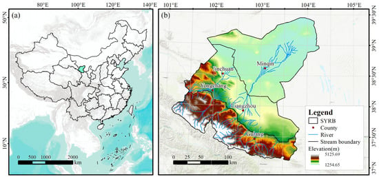
Eco-Socioeconomic Coordination and Driving Mechanisms in an Inland River Basin Under a Major Water Transfer Project: A Case Study of the Shiyang River Basin
Water 2026, 18(11), 1293; https://doi.org/10.3390/w18111293 (registering DOI) - 26 May 2026
Abstract
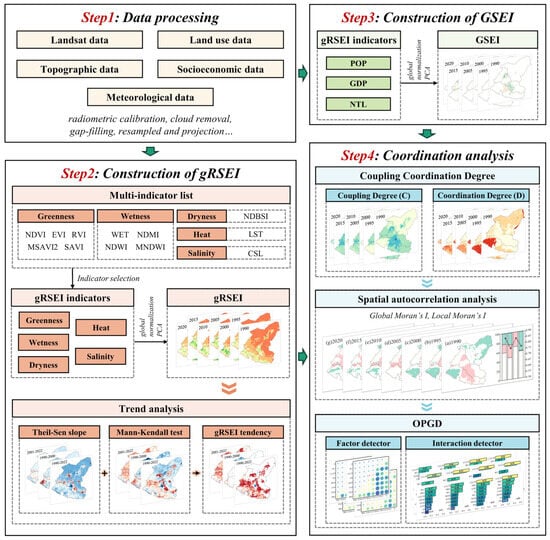
Arid inland river basins are constrained by severe water scarcity and fragile ecosystems. Although large-scale water transfer projects are critical interventions, studies of their comprehensive impacts on eco-socioeconomic systems remain limited. To address this gap, this study proposes an integrated assessment framework. A
[...] Read more.
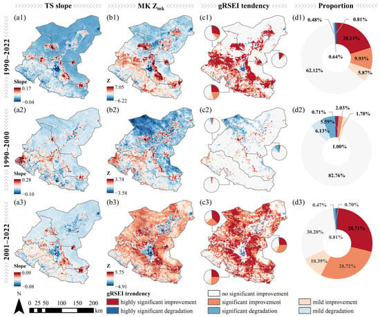
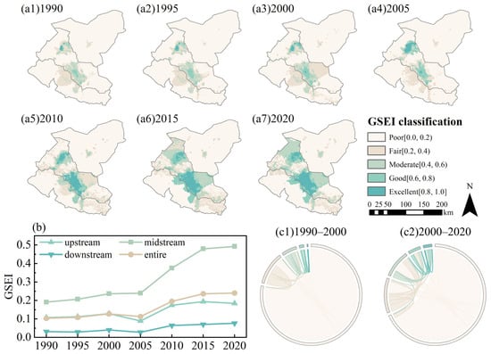
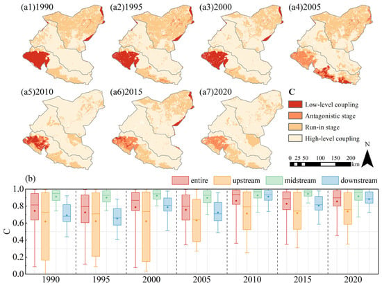
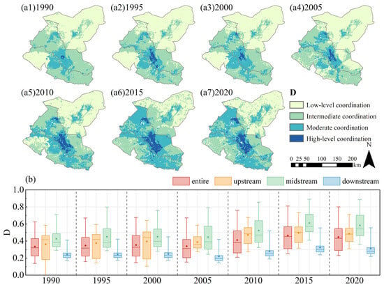
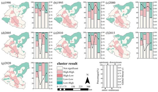
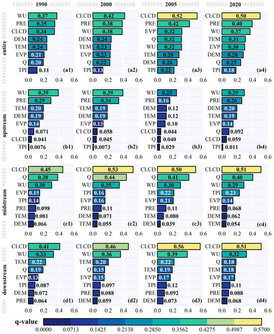
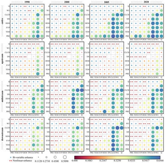
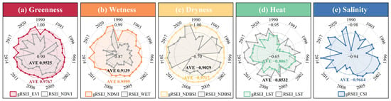
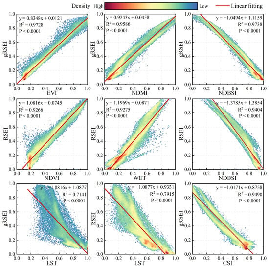
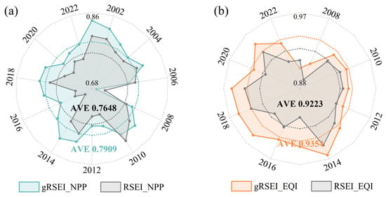
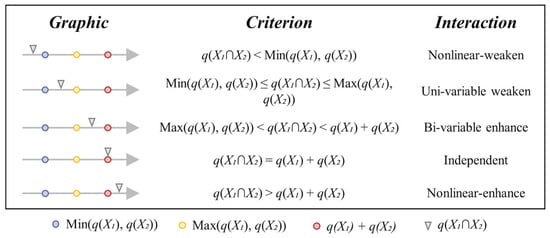
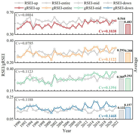
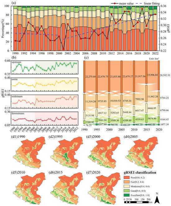
Arid inland river basins are constrained by severe water scarcity and fragile ecosystems. Although large-scale water transfer projects are critical interventions, studies of their comprehensive impacts on eco-socioeconomic systems remain limited. To address this gap, this study proposes an integrated assessment framework. A global Remote Sensing Ecological Index (gRSEI) was developed by incorporating a salinity indicator, employing optimal indicator selection, and utilizing a full-period global normalization strategy. A Gridded Socioeconomic Index (GSEI) was constructed by integrating nighttime light (NTL), population (POP), and gross domestic product (GDP) data. The coupling coordination degree (CCD) model, spatial autocorrelation analysis, and the optimal parameters-based geographical detector (OPGD) were applied to analyze spatial patterns across subregions. Focusing on the Shiyang River Basin (SYRB), this study analyzed the spatiotemporal responses and coupling coordination of the eco-socioeconomic system to the 2001 Jingdian Phase II Water Transfer Project. Results indicate that ecological quality improved significantly after the water transfer, with gRSEI increasing from 0.225 to 0.334. Socioeconomic development also improved overall. The eco-socioeconomic system exhibited high coupling but moderate coordination. The coupling degree (C) and coordination degree (D) increased from 0.824 and 0.370 to 0.852 and 0.442, respectively, with clear regional heterogeneity. The water transfer project shifted the dominant driver of coordinated development from water-related factors to land cover. This study provides a practical framework for assessing ecological and socioeconomic dynamics and their interactions in arid basins under major water transfer project interventions.
Full article
(This article belongs to the Special Issue Advancing Sustainable Hydrological Modelling and Smart Water Resource Management)
►
Show Figures
Open AccessArticle
Study on the Objective Improvement of Optimal Threshold Selection Algorithm Based on ECMWF Ensemble Model Precipitation Forecasts
by
Jin Li, Linfeng Zhang, Xiaoqian Ma, Hao Yang, Jiawen Zheng and Hongke Cai
Water 2026, 18(11), 1292; https://doi.org/10.3390/w18111292 - 26 May 2026
Abstract
To address the limitation where the traditional Optimal Threshold Selection (OTS) scheme achieves a high Threat Score (TS) at the expense of an increased False Alarm Rate (FAR), this study develops an Objective Improvement of Optimal Threshold Selection (OIOTS) scheme based on the
[...] Read more.
To address the limitation where the traditional Optimal Threshold Selection (OTS) scheme achieves a high Threat Score (TS) at the expense of an increased False Alarm Rate (FAR), this study develops an Objective Improvement of Optimal Threshold Selection (OIOTS) scheme based on the European Centre for Medium-Range Weather Forecasts (ECMWF) ensemble precipitation forecasts. The correction performance is verified using high-resolution observations during the post-flood season in Guangdong Province. The results indicate that (1) optimal quantiles exhibit significant spatial heterogeneity and decrease sharply with increasing precipitation intensity, confirming the necessity of grid-specific correction over uniform provincial thresholds. (2) The Optimal Precipitation (OP) threshold remains stable across different lead times but shows distinct regional characteristics influenced by topography, whereas the corresponding Probability Threshold (PT) demonstrates a downward trend as the lead time extends. (3) Verification reveals that, compared with the OTS scheme, the OIOTS scheme effectively rectifies the high FAR inherent in the optimal quantile method while maintaining a comparable TS. By minimizing the absolute difference between TS and FAR, the OIOTS scheme achieves a superior balance between detection accuracy and error suppression, with its FAR showing a significant downward trend as precipitation magnitude and lead time increase. Given its high computational efficiency and robust performance, the proposed scheme offers a reliable solution for operational meteorological forecasting.
Full article
(This article belongs to the Special Issue Impacts of Climate Change on Water Resources: Assessment and Modeling, 3rd Edition)
Open AccessArticle
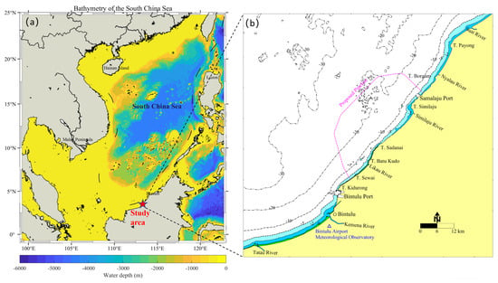
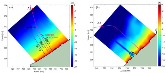
Integrated Assessment of Storm-Induced Seabed Morphodynamics and Liquefaction for Offshore Pipeline Burial Design in a Tropical Coastal Zone
by
Honglin Niu, Chenghao Wang, Yabin Sun, Na Zhang and Zhangyi Zhao
Water 2026, 18(11), 1291; https://doi.org/10.3390/w18111291 - 26 May 2026
Abstract
Offshore pipeline landfall sections in tropical coastal zones are often exposed to dynamic hydrodynamic forcing, which may induce seabed erosion and wave-driven liquefaction and thereby affect burial stability. This study presents an integrated assessment of seabed stability for an offshore gas pipeline along
[...] Read more.
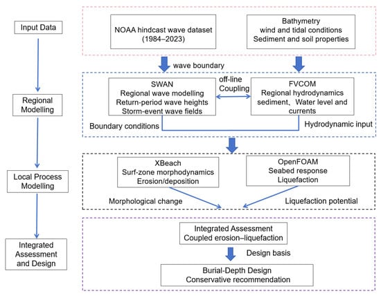
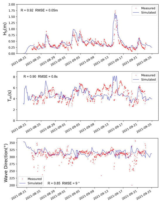
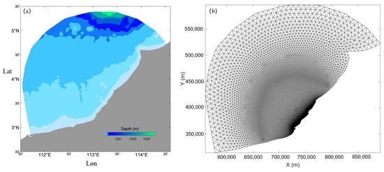
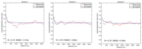
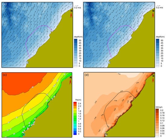
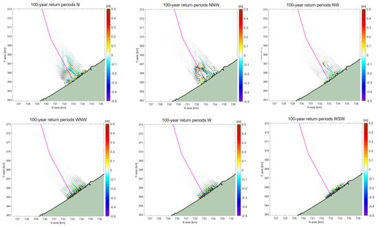
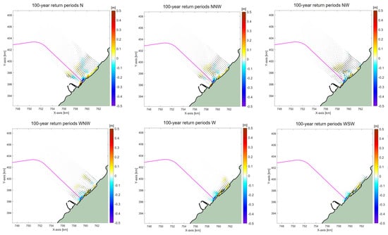
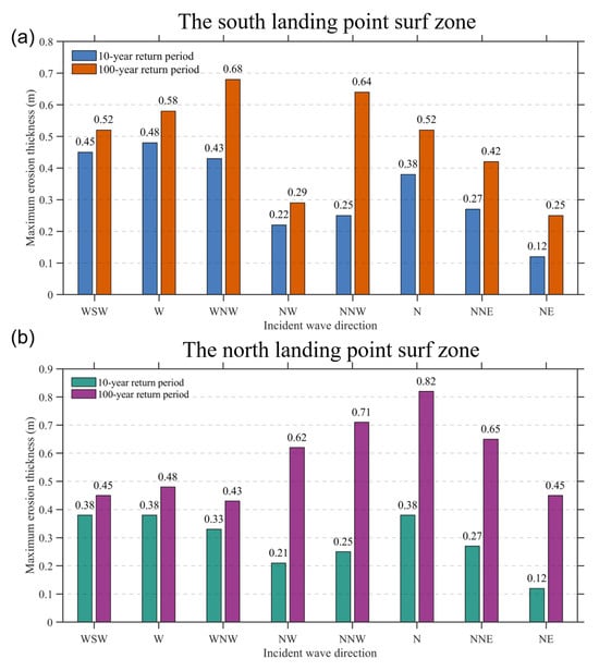
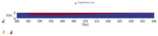
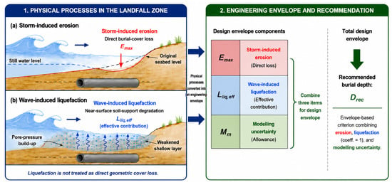
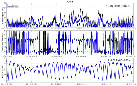
Offshore pipeline landfall sections in tropical coastal zones are often exposed to dynamic hydrodynamic forcing, which may induce seabed erosion and wave-driven liquefaction and thereby affect burial stability. This study presents an integrated assessment of seabed stability for an offshore gas pipeline along the Sarawak coast of the South China Sea, aiming to support burial-depth design in the nearshore surf zone. A multi-model framework was applied to simulate regional hydrodynamics, sediment transport, storm-induced seabed morphodynamics, and wave-induced liquefaction. Model performance was evaluated using field observations, bathymetric survey data, and laboratory experimental results. The results indicate that the seabed remains generally stable under normal environmental conditions, whereas extreme storm-wave forcing may induce localized surf-zone erosion and shallow seabed weakening. Under the 100-year storm-wave scenarios, the maximum simulated erosion depth reaches approximately 0.82 m, and the potential liquefaction response is mainly confined to the upper approximately 1.0 m of the seabed. These results suggest that storm-induced morphodynamic cover loss and wave-induced degradation of near-surface soil support should be evaluated jointly. Based on this integrated process envelope, a minimum burial depth of 2 m is recommended as a conservative engineering requirement for the examined landfall conditions. This process-integrated assessment workflow offers an applicable reference for the design and risk mitigation of analogous offshore pipeline projects in tropical coastal zones.
Full article
(This article belongs to the Special Issue Advanced Research on Marine Geology and Sedimentology, 2nd Edition)
►▼
Show Figures

Figure 1
Open AccessArticle
Assessment of Regional-Scale Freshwater Availability Towards Sustainable Management in the Context of Climate Change
by
Alessia Flammini, Jacopo Dari, Francesco Leopardi, Arash Rahi, Giovanni Braca, Stefano Mariani, Renato Morbidelli and Carla Saltalippi
Water 2026, 18(11), 1290; https://doi.org/10.3390/w18111290 - 26 May 2026
Abstract
Freshwater availability is a key indicator of climate change in areas like the Mediterranean with growing water crises. The Umbria region in central Italy, experiencing rising temperatures and declining rainfall, is a prime local case study for assessing the impact of climate change
[...] Read more.
Freshwater availability is a key indicator of climate change in areas like the Mediterranean with growing water crises. The Umbria region in central Italy, experiencing rising temperatures and declining rainfall, is a prime local case study for assessing the impact of climate change on freshwater. In this study, we exploit two well-established, spatially distributed datasets (BIGBANG v8 and ERA5-Land) to compute net freshwater (NF) available in the region as the difference between water input (precipitation) and consumption by evapotranspiration. Both datasets show a declining regional NF trend from 1951 to 2023, with −2.03 mm/year and −1.30 mm/year rates, respectively. The decline is more marked in areas with higher average NF such as mountainous areas. Despite differences in spatial resolution, spatially averaged magnitudes from the two datasets are highly correlated (r = 0.84). They both successfully capture major drought events observed in the region since the 2000s. In addition, the study compares amounts of freshwater potentially available against anthropogenic uses to develop sustainable water management policies. Information on different water uses and estimates from modelling platforms were collected in the region. This study aims to be a proof of concept for a reliable approach serving to develop policies for sustainable water use.
Full article
(This article belongs to the Special Issue Impacts of Climate Change on Water Resources and Water Risks, 3rd Edition)
Open AccessArticle
Hydrodynamic Response and Safety Thresholds for Ships in Ultra-Confined Ship Lift Chambers: A Large-Scale Experimental Study
by
Lei Wang, Yaan Hu, Zhanhui Liu, Yongle Li, Muhammad Shahid Khan and Chen Fang
Water 2026, 18(11), 1289; https://doi.org/10.3390/w18111289 - 26 May 2026
Abstract
Ship transit in vertical ship lift chambers represents a highly confined flow regime characterized by extreme blockage (N < 2), where ship-induced piston effects can significantly influence navigational safety and structural loads. This study presents an experimental investigation of the unsteady hydrodynamic responses
[...] Read more.
Ship transit in vertical ship lift chambers represents a highly confined flow regime characterized by extreme blockage (N < 2), where ship-induced piston effects can significantly influence navigational safety and structural loads. This study presents an experimental investigation of the unsteady hydrodynamic responses of a 1000 t class ship operating in the Baise vertical ship lift. A 1:10 large-scale physical model was constructed to reproduce the ship lift chamber and auxiliary lock geometry under Froude similarity. Tests were conducted for prototype water depths of 3.7–3.9 m and sailing velocities between 0.4 and 1.1 m/s. Ship sinkage, free-surface oscillations, and dynamic chamber weight variations were synchronously measured. Results revealed a profound process asymmetry: the exit maneuver induced significantly higher sinkage (0.92 m at 1.1 m/s) and chamber weight fluctuations (810 t) than the entry process due to restricted return flow replenishment. A non-dimensional predictive P–K relationship was derived with a regression coefficient α = 1.9121. Based on safety margins and mechanical load limits, critical speed thresholds were established at 0.6 m/s for exit and 0.7 m/s for entry to ensure a minimum safety clearance of 0.48 m even under docking error conditions.
Full article
(This article belongs to the Special Issue Recent Advances in Hydraulic Machinery and Its Application in Marine Engineering)
Open AccessArticle
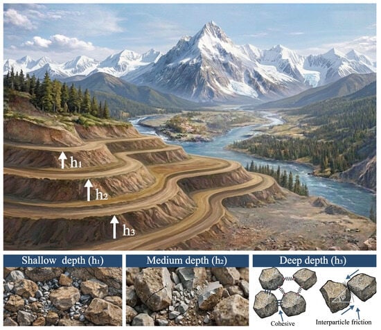
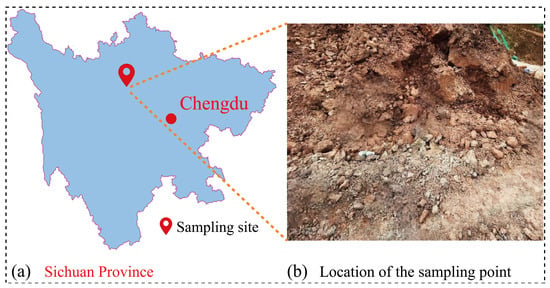
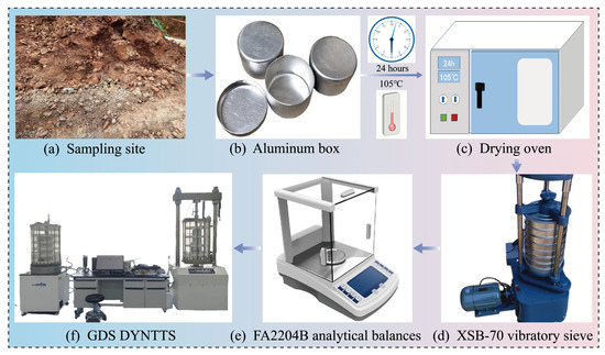
Depth-Dependent Variations in Fragmentation and Shear Strength of Gravelly Soil Under Shallow Overburden and Groundwater Conditions
by
Hang Gong, Hongbo Huang, Jin Ren, Guanzhong Wu, Ran Tang, Huajin Li, Jianhui Dong and Peng Feng
Water 2026, 18(11), 1288; https://doi.org/10.3390/w18111288 - 26 May 2026
Abstract
The mechanical behavior of gravelly soils in shallow overburden environments is significantly modulated by groundwater fluctuations, which govern the in situ moisture distribution and, consequently, control particle fragmentation processes and the evolution of shear strength. Fragmentation was quantitatively characterized through particle size distribution,
[...] Read more.
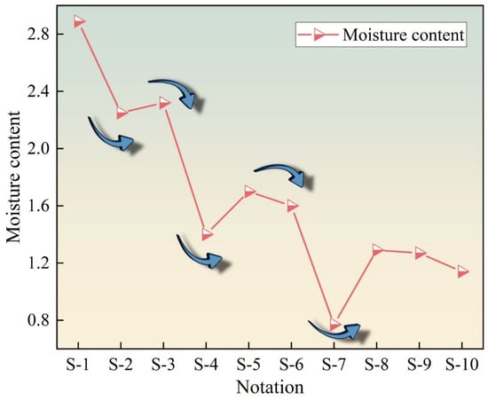
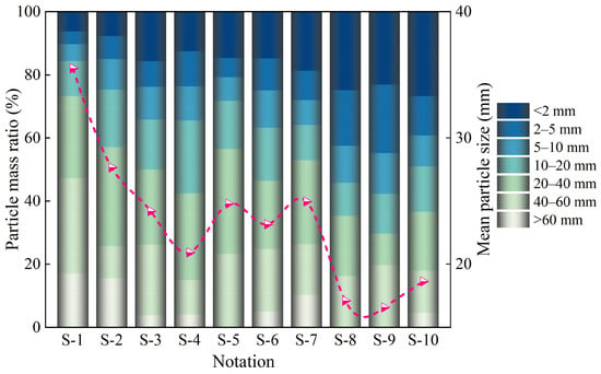
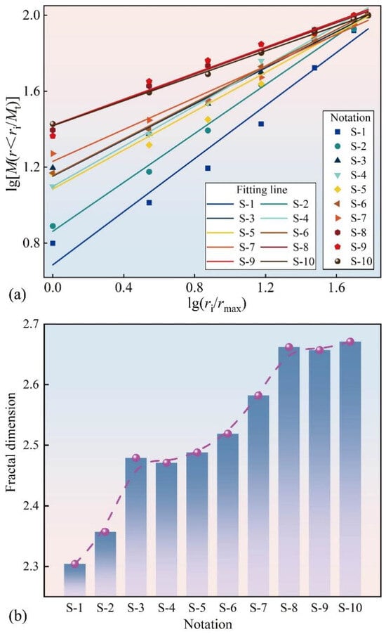
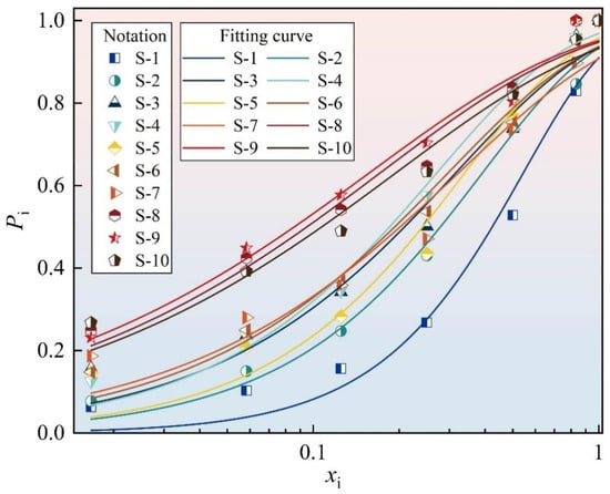
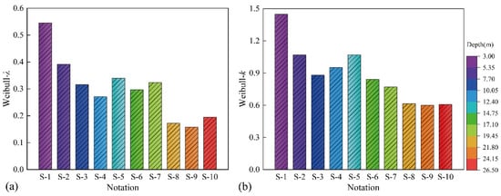
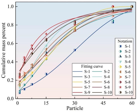
The mechanical behavior of gravelly soils in shallow overburden environments is significantly modulated by groundwater fluctuations, which govern the in situ moisture distribution and, consequently, control particle fragmentation processes and the evolution of shear strength. Fragmentation was quantitatively characterized through particle size distribution, fractal dimension, mean particle size, and statistical parameters derived from Weibull and generalized extreme value distributions. Shear strength was evaluated via consolidated–drained triaxial tests. The results demonstrate a clear depth dependency of the soil’s physical and mechanical properties. As the sampling depth increased from 3.0 m to 26.5 m, the natural moisture content decreased from 2.89% to 0.77%. Fractal analysis reveals that the fractal dimension of the particles increased from 2.304 to 2.671, reflecting an intensified fragmentation process at greater depths. Triaxial test results indicate that with increasing depth, the internal friction angle increased from 28.63° to 40°, while the cohesion decreased from 18.59 kPa to 5.47 kPa. These quantitative variations suggest that the coupled effects of groundwater variation and overburden pressure collectively govern the evolution of fragmentation characteristics and the divergent trends observed in shear strength components.
Full article
(This article belongs to the Special Issue AI-Empowered Landslide Susceptibility Assessment with Soil–Water Interactions)
►▼
Show Figures

Figure 1

Open AccessArticle
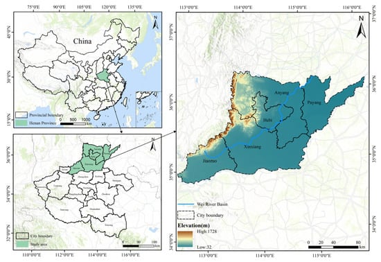
Scale Measurement of Agricultural Water Transfer from the Perspective of Food Security: Evidence from the Wei River Basin in Henan Province
by
Jiahao Li, Xiruo Wang, Shuchang Gu and Lina Zhang
Water 2026, 18(11), 1287; https://doi.org/10.3390/w18111287 - 26 May 2026
Abstract
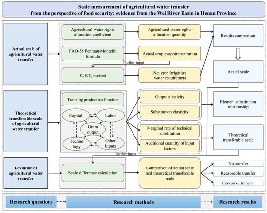
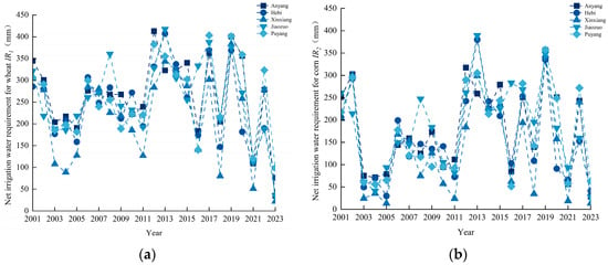
To measure the scale of agricultural water transfer (AWT) from the perspective of food security, this paper establishes an integrated framework for quantifying its actual scale, theoretical transferable scale, and deviation. Based on panel data from 2001 to 2023 of five cities (Anyang,
[...] Read more.
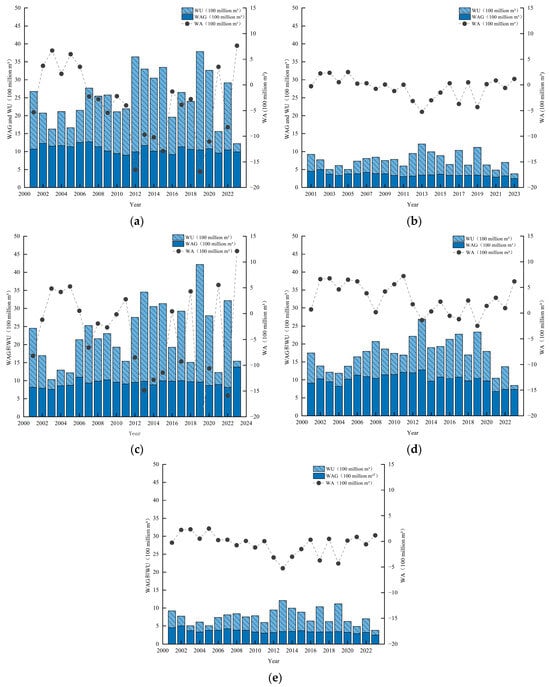
To measure the scale of agricultural water transfer (AWT) from the perspective of food security, this paper establishes an integrated framework for quantifying its actual scale, theoretical transferable scale, and deviation. Based on panel data from 2001 to 2023 of five cities (Anyang, Hebi, Xinxiang, Jiaozuo, Puyang) of the Wei River Basin in Henan Province, China, the actual transfer scale is derived by comparing agricultural water right allocations with net crop irrigation requirements calculated via the FAO 56 Penman Monteith formula; the theoretical transferable scale is estimated using a translog production function grounded in factor substitution theory. By contrasting the two scales, deviations and excessive transfer scenarios are identified. The results show that (1) actual AWT occurred in 59.13% of the city–year observations, exhibiting clear phase-based fluctuations, with positive transfer scale ranging from 0.046 to 13.983 × 10⁸ m3. The largest positive transfer occurred in Puyang in 2002, and Puyang, Jiaozuo, and Xinxiang were the main outflow areas. Factor combinations could release transferable water in 45.22% of the city–year observations, wherein pesticide/fertilizer, agricultural machinery, and grain sown area serve as the main substitutes. Theoretical transferable scale ranged from −60.150 to 186.374 × 10⁸ m3, with a mean of 1.718 × 10⁸ m3 and a median of −0.108 × 10⁸ m3, indicating unstable factor-substitution capacity. (2) Excessive transfer was identified when the actual transfer scale was positive and exceeded the theoretical transferable scale. Under this criterion, 47.82% of observations were excessive transfers, 11.33% were reasonable transfers, and 40.85% showed no transfer. Jiaozuo and Puyang were the core excessive transfer areas, each showing excessive transfer in 16 of the 23 years, while Xinxiang has shown a rising trend in recent years; Anyang, by contrast, effectively controls excesses through water saving technologies. The findings highlight the need for dynamic monitoring, city-specific regulation, and advanced water-saving technologies to balance water allocation with food security.
Full article
(This article belongs to the Special Issue The Water–Energy–Food Nexus: Toward Integrated Solutions for Sustainability)
►▼
Show Figures

Figure 1

Open AccessArticle
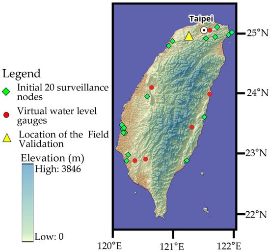
A Cyber-Physical System for Real-Time Flood Monitoring: Integration of Semantic Segmentation and Edge Computing in Taiwan
by
Yao-Min Fang, Tung-Sheng Tsai and Fu-Jen Chien
Water 2026, 18(11), 1286; https://doi.org/10.3390/w18111286 - 26 May 2026
Abstract
Global climate change and extreme precipitation events increasingly challenge urban infrastructure resilience, particularly in topographically vulnerable regions like Taiwan. Traditional flood monitoring relies heavily on the manual visual interpretation of extensive surveillance networks, a process that imposes high cognitive loads and risks delayed
[...] Read more.
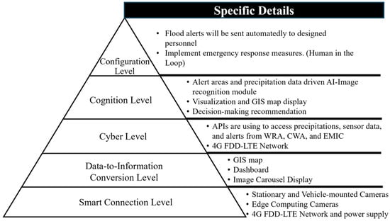
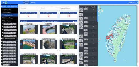
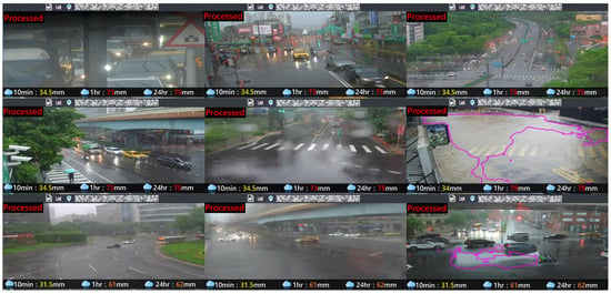
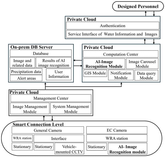
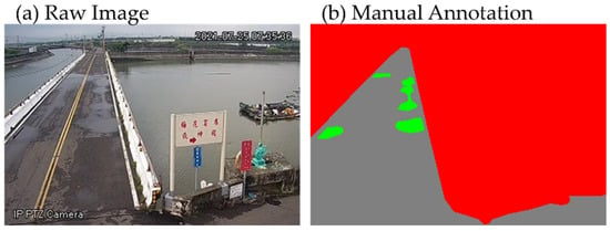
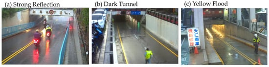
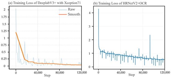
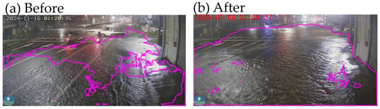
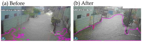
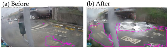
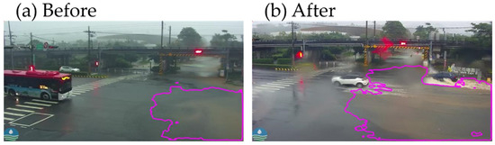
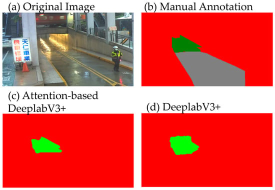
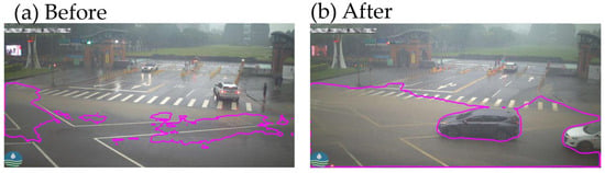
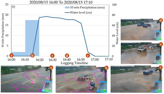
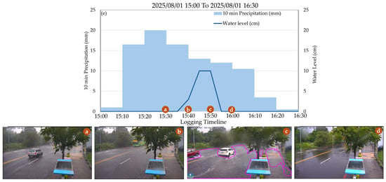
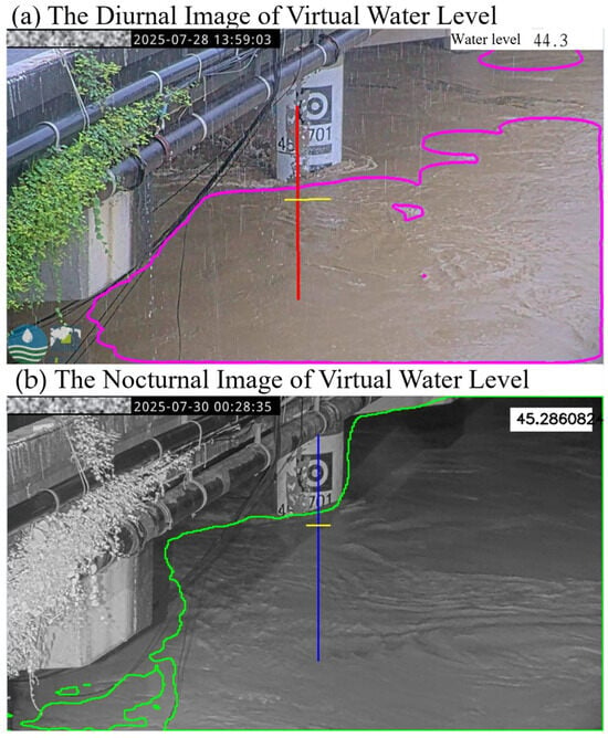
Global climate change and extreme precipitation events increasingly challenge urban infrastructure resilience, particularly in topographically vulnerable regions like Taiwan. Traditional flood monitoring relies heavily on the manual visual interpretation of extensive surveillance networks, a process that imposes high cognitive loads and risks delayed emergency responses. This study presents a comprehensive Cyber-Physical System (CPS) architecture for an automated Water Image Monitoring Platform. Integrating approximately 10,000 cameras and multi-modal data—including precipitation records and spatial alerts—the platform leverages advanced semantic segmentation (DeepLabV3+ with Xception71) to delineate inundation boundaries. To ensure robustness under adverse conditions such as low illumination, fog, and specular glare, we implemented targeted optimizations, including HSV pre-processing, Deblur GAN architectures, and attention mechanisms. Results demonstrate a significant performance evolution, with the event recall rate rising from 88% in 2022 to 99.7% by 2025. A key driver of this success is the synergy between stationary nodes and vehicle-mounted CCTV units, which provide critical dynamic geographic coverage. Furthermore, the deployment of edge computing reduced warning latency 10 times—from 19.2 to 2 s—while virtual water level gauges maintained a mean error within ±10 cm. Despite these gains, a Human-in-the-Loop (HITL) architecture remains strategically necessary for ethical accountability and error filtering. This CPS provides a foundational model for autonomous, resilient urban disaster management.
Full article
(This article belongs to the Section Urban Water Management)
►▼
Show Figures

Figure 1
Open AccessArticle
Enhancing Efficiency of Water–Energy–Food Nexus Through Irrigation and Phosphorus Management in Maize Production: A Case Study of Semi-Arid Region
by
Junaid Nawaz Chauhdary, Hong Li, Zawar Hussain, Muhammad Zaman, Muhammad Akhlaq and Bahromjon Bahodirovich Xalilov
Water 2026, 18(11), 1285; https://doi.org/10.3390/w18111285 - 26 May 2026
Abstract
The declining productivity, fertilizer inefficiencies, and rising energy cum production costs are the key issues in crop production, especially in semi-arid regions with alkaline soils. Integration of crop management strategies needs to be adopted to address these issues within the water–energy–food nexus (WEFN).
[...] Read more.
The declining productivity, fertilizer inefficiencies, and rising energy cum production costs are the key issues in crop production, especially in semi-arid regions with alkaline soils. Integration of crop management strategies needs to be adopted to address these issues within the water–energy–food nexus (WEFN). For this purpose, a case study was conducted in semi-arid region of central Punjab, Pakistan, to evaluate the interactive effects of irrigation water source [canal water (CW) and tubewell water (TW)], phosphorus fertilizer source [diammonium phosphate (DAP) vs. phosphoric acid_25% (PA)], and fertilizer application levels [100% and 80% of recommended dose of fertilizer (RDF)] on maize productivity, energy efficiency and economic performance. The experiment comprises eight treatments under raised bed planting (RBP) and one control treatment under ridge-furrow sowing (RFS). Each treatment had three replicates, and the experiment was laid out under a randomized complete block design (RCBD). Maize growth, yield, water productivity, energy efficiency, and economic performance were analyzed using field measurements, energy equivalents, and partial budget analysis. The T1 (RBP+CW+PA+100%RDF) produced the highest maize yield, and it varied from 6.36 to 7.90 t ha−1 under other treatments. CW significantly showed better water productivity (1.14–1.37 kg m−3) than that under TW (1.13–1.31 kg m−3); however, total energy input was higher under TW-based treatments (29,269–41,033 MJ t ha−1) than that under CW-based treatments (24,129–29,681 MJ ha−1). This results in lower energy productivity under TW-based treatments compared with CW-based treatments (0.17–0.23 kg MJ−1 vs. 0.25–0.31 kg MJ−1, respectively). Moreover, T2 (RBP+CW+PA+80%RDF) produced the highest energy use efficiency (0.59). Economic analysis revealed that production costs were nearly 15–17% higher under TW-based treatments, mainly due to the cost associated with groundwater pumping, and it reduced net profit to USD 1134–1385 ha−1. Better net profits were achieved by CW-based treatments (USD 1244–1593 ha−1), while those produced by BCR ranged from 3.11 to 3.69, with the highest value under T2 (RBP+CW+PA+80%RDF). Overall, irrigation water source emerged as the dominant driver of WEFN performance, while phosphoric acid significantly improved phosphorus availability, energy productivity, and economic returns, particularly under reduced fertilizer input. This study evidenced better maize productivity, less energy consumption, and improved farm profitability in semi-arid irrigated systems through the integration of canal water irrigation with optimized phosphorus management.
Full article
(This article belongs to the Special Issue Water Management and Water-Saving Irrigation in Agricultural Areas)
Open AccessArticle
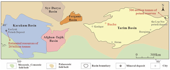
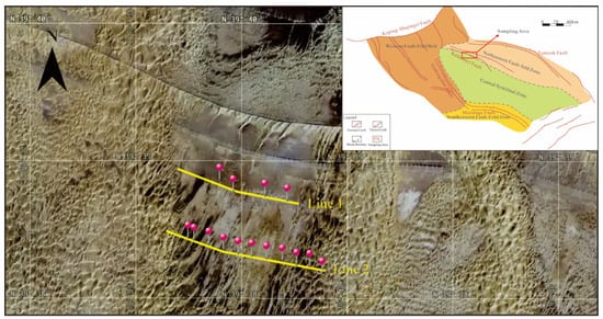
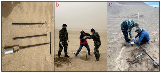
Hydrochemical Characteristics and Potash Formation Indications of Subsurface Brine in the Central Bachu Uplift, Tarim Basin
by
Wenbin Hou, Xinzhong Zhan, Yu Zhou, Chenglin Liu, Junyang Li, Hao Lin, Fojun Yao and Songyuang Zhang
Water 2026, 18(11), 1284; https://doi.org/10.3390/w18111284 - 26 May 2026
Abstract
In recent years, the distribution of potassium salt resources in the Central Asia–Tarim Basin salt lake chain has shown an asymmetric pattern, and exploration efforts in the northwestern Tarim Basin have not seen significant progress. This study focuses on the central Bachu Uplift
[...] Read more.
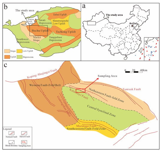
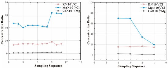
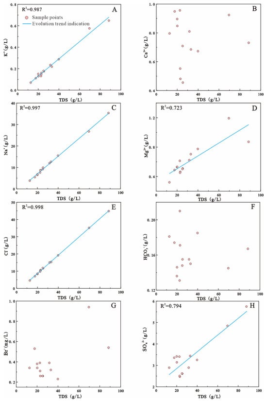
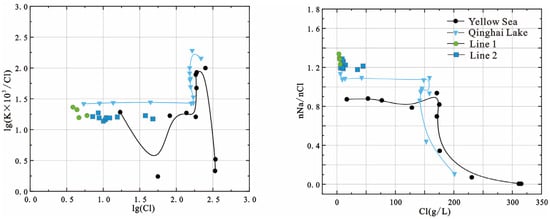
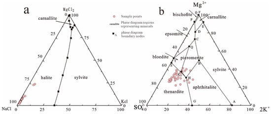
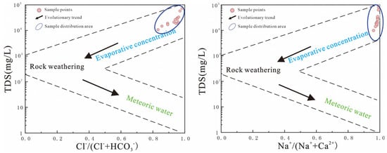
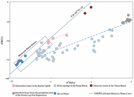
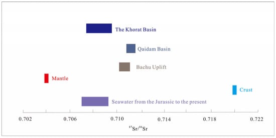
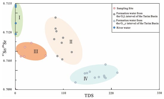
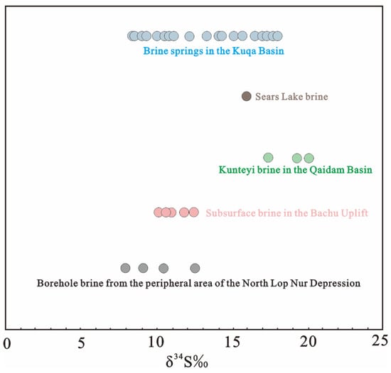
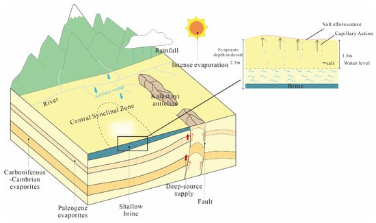
In recent years, the distribution of potassium salt resources in the Central Asia–Tarim Basin salt lake chain has shown an asymmetric pattern, and exploration efforts in the northwestern Tarim Basin have not seen significant progress. This study focuses on the central Bachu Uplift within the Central Asia–Tarim Basin salt lake chain. The characteristics of subsurface brines and indicators of potash formation are investigated. By examining various potassium exploration indices, such as the potassium–chlorine coefficient and magnesium–chlorine coefficient, along with comprehensive analysis of hydrogen–oxygen, sulfur, and strontium isotopes, this research serves to evaluate the potential for potash formation in the central Bachu Uplift. Analysis shows a brine salinity of 12.69–88.46 g/L and a potassium concentration of 0.07–0.65 g/L. The hydrochemical coefficients indicate a high nNa/nCl value, with low K × 103/Cl values. All brine samples plot within the halite phase field of the 25 °C Na+,K+,Mg2+//C1−-H2O Quaternary metastable phase diagram, clustering towards the Na-rich end. This indicates that the brine likely originated from halite dissolution. In the Na+,K+,Mg2+//C1−,SO42−-H2O Quinary metastable phase diagram, the majority of samples project within the mirabilite phase field, trending toward the sylvite field. This suggests that the shallow subsurface brine may still be in the early to middle stages of sylvite deposition. Hydrogen and oxygen isotopes indicate that the brine samples were influenced by water–rock interaction and strong evaporative concentration; strontium isotopes reveal their marine–continental transitional characteristics; and sulfur isotopes suggest that the sulfur in the samples was derived from the weathering of Meso-Cenozoic gypsum in the western Tarim Basin. This integrated evidence implies that the brines in the central Bachu Uplift contain a deep-seated potassium anomaly, with fault zones likely conveying information about deep potash resources. This provides preliminary evidence for potassium exploration in the area and holds significant indicative value for identifying key prospective targets.
Full article
(This article belongs to the Section Hydrogeology)
►▼
Show Figures

Figure 1

Open AccessArticle
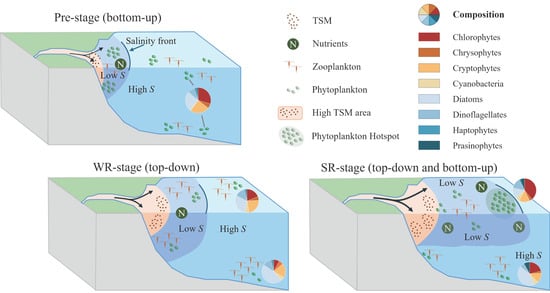
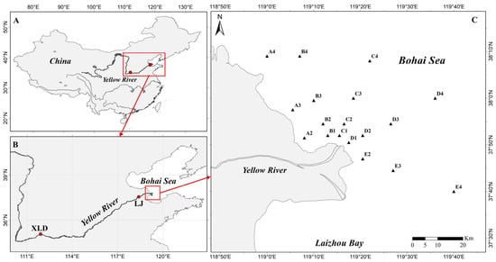
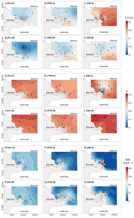
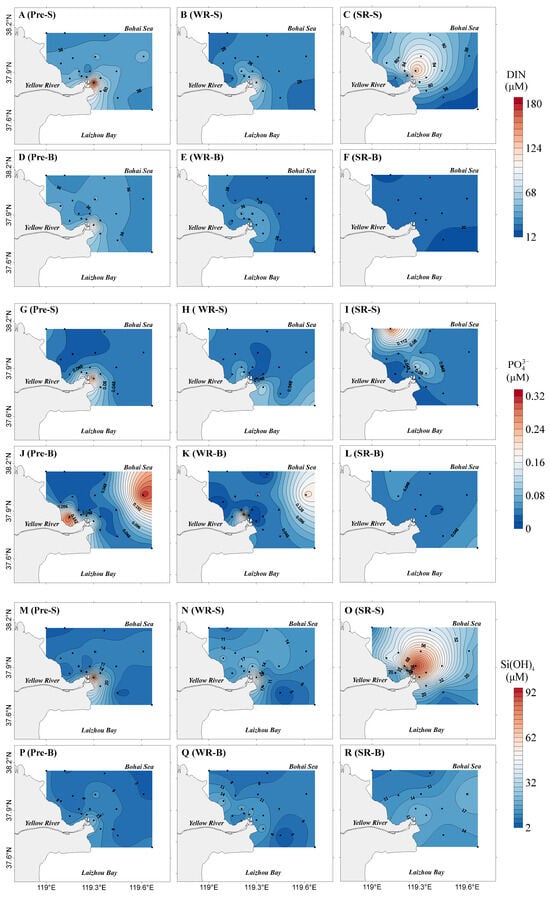
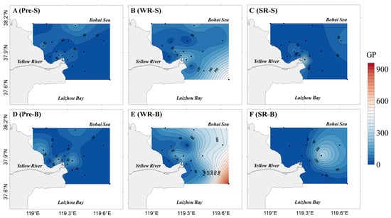
Predator Release and Physical Forcing Drive Phytoplankton Hotspots in the Yellow River Estuary During Water-Sediment Regulation Scheme
by
Yibin Wang, Ju Wang, Ruiting Shen, Wenqi Qiao, Zhenbo Lv and Jingjing Zhang
Water 2026, 18(11), 1283; https://doi.org/10.3390/w18111283 - 26 May 2026
Abstract
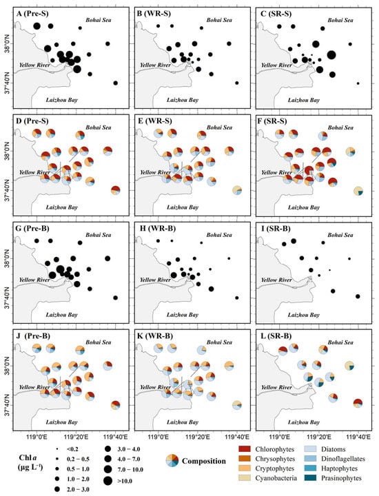
The Water-Sediment Regulation Scheme (WSRS) rapidly delivers large amounts of water, sediment, and nutrients to the Yellow River Estuary (YRE) in summer (wet season). However, how these abrupt environmental changes affect phytoplankton distribution through bottom-up versus top-down control mechanisms remains poorly understood. In
[...] Read more.
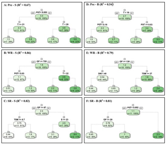
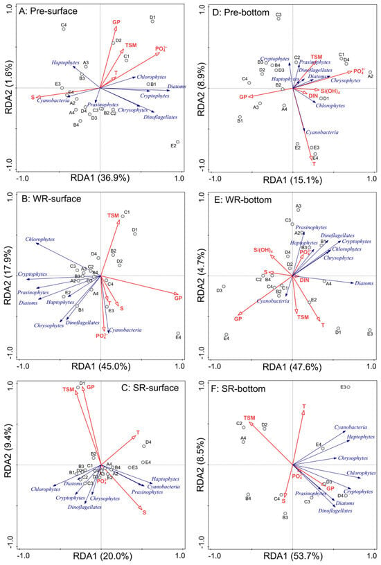
The Water-Sediment Regulation Scheme (WSRS) rapidly delivers large amounts of water, sediment, and nutrients to the Yellow River Estuary (YRE) in summer (wet season). However, how these abrupt environmental changes affect phytoplankton distribution through bottom-up versus top-down control mechanisms remains poorly understood. In this study, we examined the spatiotemporal distribution of environmental drivers, grazing pressure, and phytoplankton communities in surface and bottom layers of the YRE during WSRS. Our results indicate that the WSRS transitioned phytoplankton distribution from a relatively uniform pattern pre-WSRS to a highly heterogeneous one during the sediment regulation stage. Before WSRS, phytoplankton abundance peaked near the river mouth and was co-dominated by chlorophytes, cryptophytes, and diatoms in both layers. During the water regulation stage, abundance decreased across layers, with the surface community incorporating more dinoflagellates and the bottom layer transitioning toward higher diatom and lower chlorophyte proportions. Subsequently, vertical stratification intensified during the sediment regulation stage, characterized by a chlorophytes-dominated surface hotspot (with abundance 6.8-fold higher than pre-WSRS levels) in contrast to a depauperate bottom layer. Regression tree and redundancy analysis results showed that WSRS shifts phytoplankton regulation from a bottom-up state in the pre-stage to top-down dominance during the water regulation stage, and finally to a vertically stratified regulatory state in the SR stage, with top-down control in the surface layer and bottom-up control in the bottom layer. Our findings highlight that trophic interactions and physical processes play more critical roles than previously recognized in regulating phytoplankton distribution in estuaries subjected to high-intensity hydrological disturbances.
Full article
(This article belongs to the Section Biodiversity and Functionality of Aquatic Ecosystems)
►▼
Show Figures

Graphical abstract
Open AccessArticle
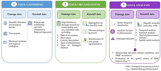
Damaging Hydrogeological Events and Associated Rainfall Conditions Along the Ionian Coast of Calabria (Southern Italy)
by
Graziella Emanuela Scarcella and Olga Petrucci
Water 2026, 18(11), 1282; https://doi.org/10.3390/w18111282 - 26 May 2026
Abstract
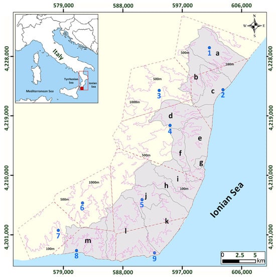
This study aims to characterize rainfall-triggered phenomena, including floods, landslides, and urban flooding, defined as damaging hydrogeological events (DHEs), through the integration of the scientific literature and historical documentary sources, and to analyze their rainfall-triggering conditions. The analysis focuses on a sector of
[...] Read more.
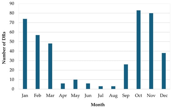
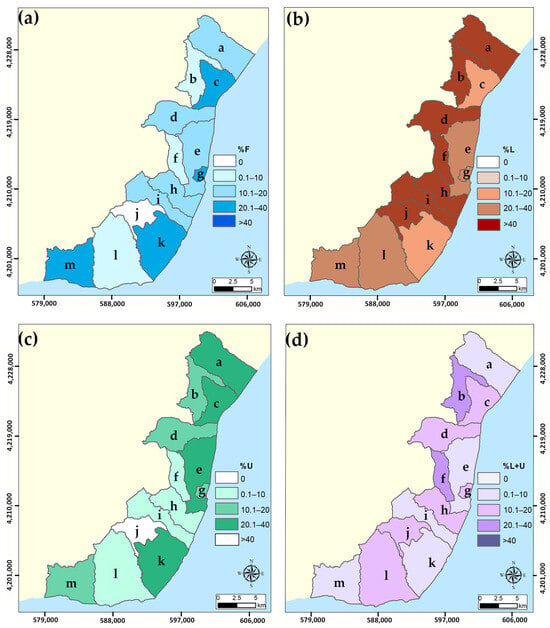
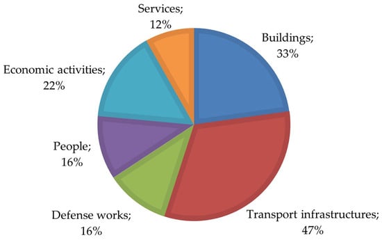
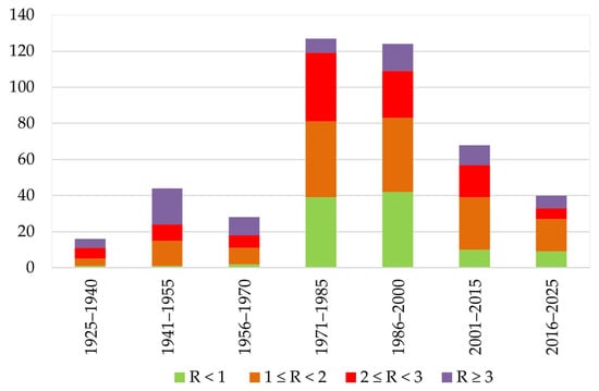
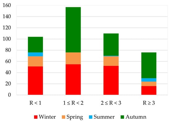
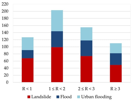
This study aims to characterize rainfall-triggered phenomena, including floods, landslides, and urban flooding, defined as damaging hydrogeological events (DHEs), through the integration of the scientific literature and historical documentary sources, and to analyze their rainfall-triggering conditions. The analysis focuses on a sector of the Ionian coast of Calabria (southern Italy) in the period 1925–2025. The identified DHEs were organized into 463 damage records (DRs), enabling a municipal-scale analysis at monthly temporal resolutions. To characterize the rainfall conditions associated with DHEs, we identified a rainfall indicator (R), defined as the ratio between the monthly rainfall observed during a DHE and the corresponding long-term climatological average rainfall. Results show that DHEs occur more frequently during autumn (46%) and winter (41%) and are mainly associated with moderate (1< R < 2) to strong rainfall anomalies (R > 3). Summer events, although limited in number, are often (43%) associated with very strong rainfall anomalies (R > 3). Spatial analysis highlights a heterogeneous distribution of DHEs in the study area, with some municipalities showing a greater occurrence of multiple phenomena. Landslides are the most frequent phenomenon, occurring in 29% of cases in combination with other processes and across a wide range of precipitation conditions. Floods are most often (over 60%) associated with moderate to strong anomalies, while urban flooding exhibits intermediate behavior. Stronger-rainfall-anomaly conditions are generally associated with DHE impacts with wider spatial extents. The study suggests that the proposed indicator may provide a useful framework for the first-order characterization of rainfall conditions associated with DHEs in contexts characterized by the limited availability of long-term data or in similar climatic areas.
Full article
(This article belongs to the Section Hydrogeology)
►▼
Show Figures

Figure 1
Open AccessEditorial
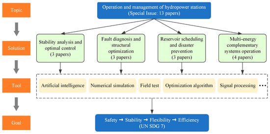
Research Status of the Operation and Management of a Hydropower Station: From Safety to Efficiency
by
Dong Liu and Yanhe Xu
Water 2026, 18(11), 1281; https://doi.org/10.3390/w18111281 - 26 May 2026
Abstract
With the implementation of global carbon reduction initiatives, the penetration of renewable energy sources, such as wind and solar energy, into power grids continues to rise, placing an increasingly heavy regulation burden on hydropower [...]
Full article
(This article belongs to the Special Issue Research Status of Operation and Management of Hydropower Station)
►▼
Show Figures

Figure 1
Open AccessArticle
Hydrochemical Characteristics and Formation Mechanisms of Drinking Natural Mineral Water in Ningbo City
by
Yuli Wang, Yi Wei, Shenglei Wang and Yusong Wang
Water 2026, 18(11), 1280; https://doi.org/10.3390/w18111280 - 25 May 2026
Abstract
Ningbo City is endowed with abundant mineral water resources. Investigating their chemical characteristics and formation mechanisms is essential for understanding hydrochemical evolution and supporting sustainable resource utilization. Based on hydrochemical data from 12 drinking natural mineral water sources in Ningbo City, this study
[...] Read more.
Ningbo City is endowed with abundant mineral water resources. Investigating their chemical characteristics and formation mechanisms is essential for understanding hydrochemical evolution and supporting sustainable resource utilization. Based on hydrochemical data from 12 drinking natural mineral water sources in Ningbo City, this study investigates the hydrochemical features and genesis of mineral water by integrating statistical analysis, hydrochemical diagrams, ionic ratios, and mineral equilibrium modeling. The results indicate that metasilicic acid (as H2SiO3) and strontium (Sr) are the principal characteristic components of the drinking natural mineral water in Ningbo City, with concentrations of 32.87–60.8 mg/L and 0.05–4.59 mg/L, respectively. The mineral waters are neutral to slightly alkaline and weakly mineralized, with the pH values ranging from 6.70 to 8.16, and total dissolved solids (TDS) contents of 76.8–767.2 mg/L. The predominant hydrochemical facies are HCO3-Ca-Na, HCO3-Ca, HCO3-Na-Ca. Their chemical composition is mainly governed by rock weathering, whilst also being influenced by cation exchange and mineral dissolution–precipitation equilibrium. H2SiO3 is mainly derived from the weathering and hydrolysis of silicate minerals such as plagioclase. Sr enrichment is associated with the dissolution of Sr-bearing silicate minerals and certain sulphate minerals, as well as prolonged water–rock interaction. The Sr- and Si-rich aquifers provide the material basis for the enrichment of Sr and H2SiO3 in groundwater. Structural fractures and weathering fractures provide transport pathways and storage spaces for groundwater, facilitating the migration and enrichment of these characteristic components. The mechanism of mineral water emergence can be summarized as of the tectonic fracture-controlled circulation-leaching type.
Full article
(This article belongs to the Section Hydrogeology)
Open AccessArticle
Study of Bed Erosion in an Open-Channel from Laboratory Measurements to Eulerian–Eulerian Two-Phase Modeling
by
Alaa-Eddine Ennazii, Anthony Beaudoin, Rafik Ouchene, Guillaume Gomit, Sebastien Jarny and Damien Calluaud
Water 2026, 18(11), 1279; https://doi.org/10.3390/w18111279 - 25 May 2026
Abstract
This study develops an end-to-end workflow, from laboratory measurements to Eulerian–Eulerian two-phase simulations with SedFoam, to investigate bed erosion in free-surface open-channel flow over a deformable granular bed. Experiments were conducted with a calibrated non-cohesive deposit of epoxy-coated spherical beads under steady, fully
[...] Read more.
This study develops an end-to-end workflow, from laboratory measurements to Eulerian–Eulerian two-phase simulations with SedFoam, to investigate bed erosion in free-surface open-channel flow over a deformable granular bed. Experiments were conducted with a calibrated non-cohesive deposit of epoxy-coated spherical beads under steady, fully turbulent, subcritical conditions. Particle Image Velocimetry provided mean-flow and turbulence data, while a 3D camera workflow supplied bed-elevation fields and time-resolved maps of sediment rearrangement. These datasets were used to constrain a staged numerical strategy in which single-phase hydrodynamics were first reproduced and then extended to live-bed morphodynamics. Validation over a rigid bed showed that the 2006 k– closure, combined with a rough-wall treatment, reproduced the measured mean-velocity profiles and provided acceptable turbulent kinetic energy levels, yielding dynamically consistent near-bed shear conditions. In live-bed conditions, the simulations reproduced the streamwise organization of scour and deposition, predicted cumulative erosion rates of the correct order of magnitude, and captured bedform migration consistent with time-resolved bed reconstructions. The numerical results were compared with repeated experiments while accounting for run-to-run variability and the metrological limits of the 3D camera. This work proposes a transferable experimental–numerical methodology for assessing the predictive capability of live-bed morphodynamic simulations, in which hydraulic characterization, three-dimensional bed monitoring, erosion/deposition metrics, and repeated experiments are combined within a common comparison procedure.
Full article
(This article belongs to the Section Water Erosion and Sediment Transport)
Open AccessReview
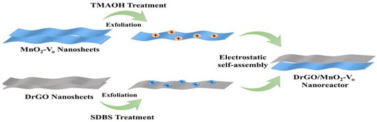
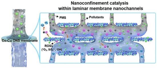
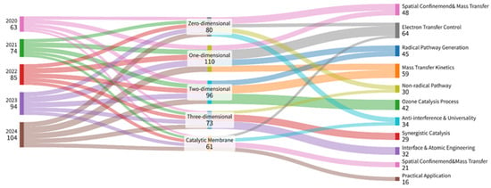
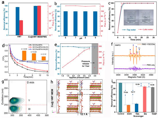
Multidimensional Nanoconfined Catalysts in Advanced Oxidation Processes: Mechanisms, Performance, and Limitations
by
Yunqian Han, Yiwen Peng, Min Huang, Aobo He, Zhenshen Li, Qiao Wang and Fuyi Cui
Water 2026, 18(11), 1278; https://doi.org/10.3390/w18111278 - 25 May 2026
Abstract
Water pollution caused by the continuous emergence of organic contaminants poses increasing challenges to conventional treatment technologies. Although advanced oxidation processes (AOPs) based on nanoconfined materials show great promise, their practical application remains constrained by short radical lifetimes, mass transfer limitations, and catalyst
[...] Read more.
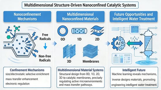
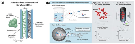
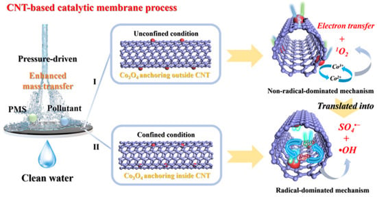
Water pollution caused by the continuous emergence of organic contaminants poses increasing challenges to conventional treatment technologies. Although advanced oxidation processes (AOPs) based on nanoconfined materials show great promise, their practical application remains constrained by short radical lifetimes, mass transfer limitations, and catalyst deactivation. This review systematically summarizes the critical role of nanoconfinement effects in AOPs. Through size exclusion and electrostatic regulation, confined spaces promote reactant enrichment and interference exclusion, while confined mass transfer and capillary-driven effects accelerate reaction kinetics. Particular emphasis is placed on multidimensional nanoconfined systems, ranging from zero-dimensional to three-dimensional structures and catalytic membranes, and on how structural design improves reaction microenvironments and active-site accessibility. The synergistic integration of confined structures with external fields, such as electric fields, is further discussed, highlighting their ability to regulate the electronic structure of active sites and shift reaction pathways from non-selective radical oxidation to efficient and highly selective non-radical routes. By optimizing parameters such as pH and catalyst-to-oxidant ratio, nanoconfined systems can achieve efficient pollutant degradation under near-neutral conditions while maintaining strong anti-interference capability and stability in real water matrices containing natural organic matter and inorganic ions.
Full article
(This article belongs to the Special Issue Advanced Oxidation Technologies for Water and Wastewater Treatment)
►▼
Show Figures

Graphical abstract
Open AccessArticle
Assessment of River Ecological Health Based on Biotic Integrity Indices in the Qianxinan Buyi and Miao Autonomous Prefecture, Southwest Guizhou, China
by
Miao Li, Zengcai Liu, Siyin Huang, Yanli Su, Shengpei Wei, Zechen E and Fangyuan Xiong
Water 2026, 18(11), 1277; https://doi.org/10.3390/w18111277 - 25 May 2026
Abstract
To scientifically evaluate the health of river aquatic ecosystems in the Qianxinan Buyi and Miao Autonomous Prefecture, southwestern Guizhou, systematic surveys of benthic macroinvertebrate and periphytic algal communities were conducted in representative rivers during October 2024 (autumn) and April 2025 (spring), coupled with
[...] Read more.
To scientifically evaluate the health of river aquatic ecosystems in the Qianxinan Buyi and Miao Autonomous Prefecture, southwestern Guizhou, systematic surveys of benthic macroinvertebrate and periphytic algal communities were conducted in representative rivers during October 2024 (autumn) and April 2025 (spring), coupled with concurrent water quality monitoring. Reference sites were selected based on water quality indicators and habitat conditions. Core parameters were identified through correlation analysis, discriminatory ability analysis, and distribution range analysis to construct a Benthic Index of Biotic Integrity (B-IBI) and a Periphytic Algae Index of Biotic Integrity (P-IBI) suitable for the region. These indices were then applied to assess the ecological health of the rivers. Additionally, stepwise regression analysis was employed to investigate the key environmental drivers influencing the two biotic integrity indices. The results indicated that: (1) In terms of species composition, the benthic macroinvertebrate community structure was relatively simple, dominated by arthropods, particularly chironomid larvae. Bacillariophyta and Cyanophyta consistently dominated the periphytic algae community. (2) Assessments using both B-IBI and P-IBI showed that the overall river health in spring was slightly better than in autumn. However, more than half of the sampling sites were rated as “fair” or worse in both seasons. The reference sites (S2, S10) consistently exhibited “excellent” or “good” health, while the impaired sites showed significant spatial heterogeneity. Discrepancies between B-IBI and P-IBI ratings at some sites revealed differential responses of the two biological communities to environmental stressors. (3) Stepwise regression analysis unveiled a seasonal shift in key environmental drivers. The primary factor affecting the B-IBI in autumn was biochemical oxygen demand (BOD5), which shifted to total phosphorus (TP) and ammonia nitrogen (NH4+-N) in spring. For the P-IBI, the main factor changed from dissolved oxygen (DO) in autumn to chemical oxygen demand (COD) in spring. These findings confirm the applicability of the B-IBI and P-IBI systems in this region, and indicate that multi-assemblage integrated assessments can contribute to understanding the health status of river ecosystems in the Qianxinan Prefecture. This study could serve as a scientific reference for the protection, management, and restoration of local river ecosystems.
Full article
(This article belongs to the Special Issue Environmental and Anthropogenic Influences on Freshwater Biodiversity and Ecosystem Health)
Open AccessArticle
Decoupling Energy Expansion from Water Constraints: Spatiotemporal Evolution and Mechanisms of the Energy–Water Nexus in Northwest China
by
Na Lu, Junfeng Yuan and Chi-Wei Su
Water 2026, 18(11), 1276; https://doi.org/10.3390/w18111276 - 25 May 2026
Abstract
It is very important to interpret the synergistic relationship between energy and water in the northwest inland river basin, which can solve the problem of “energy expansion and water use constraints. This study examines the energy–water nexus in Northwest China’s inland river basins
[...] Read more.
It is very important to interpret the synergistic relationship between energy and water in the northwest inland river basin, which can solve the problem of “energy expansion and water use constraints. This study examines the energy–water nexus in Northwest China’s inland river basins using panel data from 22 prefectures from 2007 to 2023. Results show persistent asymmetric development: the energy subsystem index rose by 214.29 percent while the water subsystem index grew by only 42.31 percent, and coupling coordination improved from 0.31 to 0.49. Water use efficiency mediates 58.32 percent of energy production’s total effect on coupling coordination. When water use efficiency equals 0.0052, below this value, energy expansion yields no synergy, while above it, the effect becomes positive at 0.572. The green transition positively moderates this relationship with an interaction coefficient of 0.168. Traditional energy intensity hinders coupling at negative 0.152, whereas clean energy intensity promotes it at 0.408. Spatial spillovers are significant with an indirect effect of energy production intensity of 0.097. These quantifiable findings support threshold-based, spatially differentiated water–energy governance in arid regions.
Full article
(This article belongs to the Section Water-Energy Nexus)
Open AccessArticle
Spatial Evolution Characteristics and Driving Factors of Compound Droughts in Karst Regions of Southwest China: A Copula-Based Study
by
Miaojia Chu, Huarong Zhao, Zikang Ren and Jiaxi Zhang
Water 2026, 18(11), 1275; https://doi.org/10.3390/w18111275 - 25 May 2026
Abstract
Due to its unique hydrogeological conditions, the Southwest Karst Area (SKA) in China experiences droughts far more frequently than non-karst regions. Exploring the distribution patterns and driving factors of different drought types is crucial for enhancing the region’s disaster prevention and mitigation capabilities
[...] Read more.
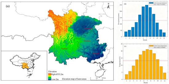
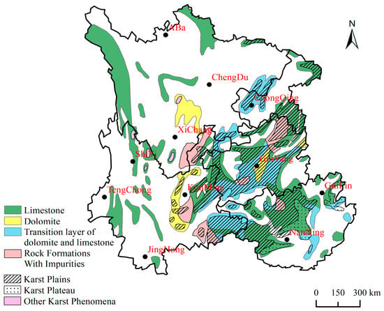
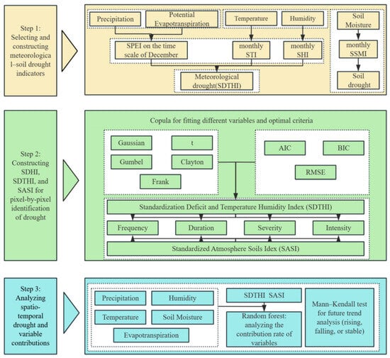
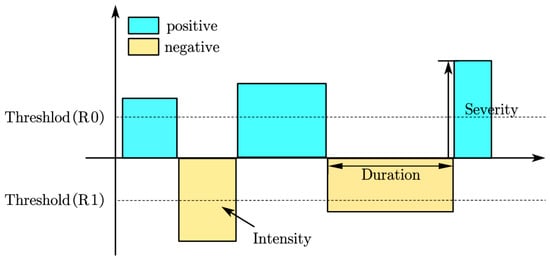
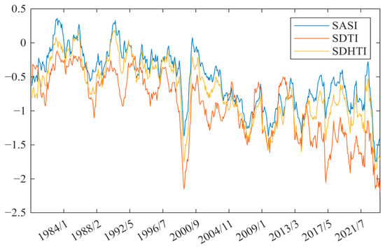
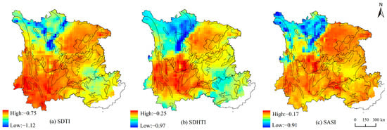
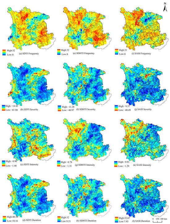
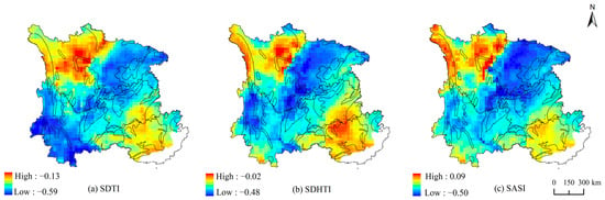
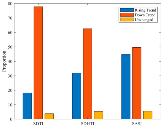
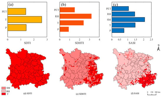
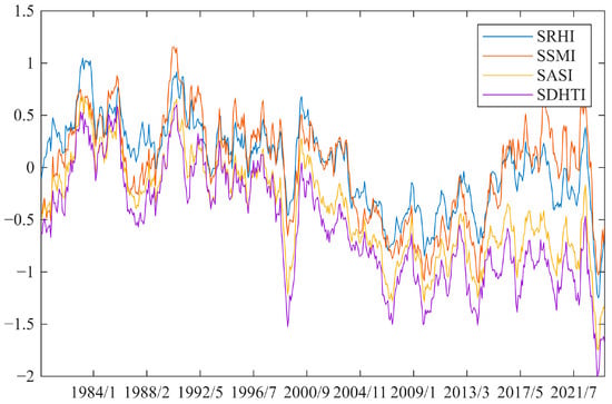
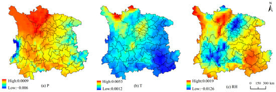
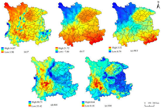
Due to its unique hydrogeological conditions, the Southwest Karst Area (SKA) in China experiences droughts far more frequently than non-karst regions. Exploring the distribution patterns and driving factors of different drought types is crucial for enhancing the region’s disaster prevention and mitigation capabilities and effectively addressing climate change risks. Using meteorological data from 1979 to 2023 in the SKA—including precipitation, temperature, humidity, potential evapotranspiration, and soil moisture—this study employed Copula theory to construct the Standardized Temperature Deficit Index (SDTI), the Standardized Humidity–Temperature Deficit Index (SDHTI), and the Standardized Atmosphere–Soil Index (SASI). Based on these indices and run theory, this study revealed the spatial distribution characteristics of different drought types (general, atmospheric, and composite) in terms of intensity, frequency, severity, and duration. Furthermore, the Mann–Kendall test and random forest analysis were applied to investigate drought trends and primary driving factors. The results indicate that droughts in the SKA exhibit significant regional characteristics and an overall worsening trend. Among them, droughts in karst-developed regions are generally more severe, though their manifestations vary across areas: compound droughts are particularly severe on the western Sichuan Plateau but relatively mild in Guangxi. In contrast, atmospheric droughts are more pronounced in Guangxi. Regarding trends, the rate of drought intensification was relatively moderate in Guangxi and the western Sichuan Plateau but more pronounced in other regions, with the maximum increase reaching 0.59. However, this upward trend is not statistically significant. Additionally, drought in karst areas was characterized by high frequency and intensity but shorter duration and lower severity, whereas the opposite was true in non-karst areas. Random forest analysis revealed that temperature is the primary driver of SDTI (2.60), while relative humidity and temperature have significant impacts on SDHTI (3.21 and 2.42, respectively). Soil moisture and temperature contribute most significantly to SASI (2.08 and 1.48, respectively). These findings provide important insights to guide the rational allocation of regional water resources and optimize agricultural management strategies.
Full article
(This article belongs to the Section Hydrology)
►▼
Show Figures

Figure 1
Open AccessReview
A Review of Trigger Index Construction Methods for Index-Based Flood Insurance
by
Jinjun Zhou, Chenrui Qin, Xujie Zheng, Tianyi Huang, Jiajia Wei and Hao Wang
Water 2026, 18(11), 1274; https://doi.org/10.3390/w18111274 - 25 May 2026
Abstract
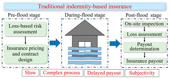
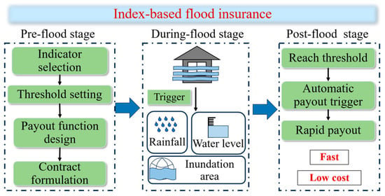
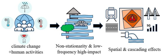
Under the combined impacts of climate change and urbanization, flood disasters have exhibited increasing non-stationarity, low-frequency but high-impact characteristics, and enhanced spatial dependence. Traditional indemnity-based flood insurance has certain limitations in claim efficiency and loss assessment. In contrast, index-based flood insurance, characterized by
[...] Read more.
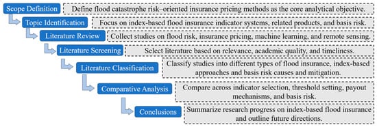
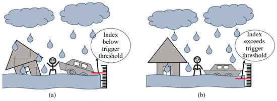
Under the combined impacts of climate change and urbanization, flood disasters have exhibited increasing non-stationarity, low-frequency but high-impact characteristics, and enhanced spatial dependence. Traditional indemnity-based flood insurance has certain limitations in claim efficiency and loss assessment. In contrast, index-based flood insurance, characterized by objective triggering mechanisms, rapid claim settlement, and low operational costs, has gradually become an important tool for flood catastrophe risk management. Based on a literature review approach, this study systematically reviews the index system, pricing mechanisms, and basis risk of index-based flood insurance, and provides a comprehensive analysis from the perspectives of index construction, threshold determination, and payout design. The results indicate that index systems have evolved from single hazard indicators to coupled indices integrating hazard characteristics and loss information, and multiple pricing approaches have been developed, including fixed, linear, piecewise payout, and probabilistic payout schemes (payouts determined by loss probabilities rather than fixed thresholds). Among the reviewed approaches, inundation-area-based indices generally show stronger consistency with actual losses at urban scales, whereas precipitation-based indices are more suitable for large-scale regional applications due to their rapid triggering capability. However, basis risk remains a critical issue, mainly arising from index errors, spatial scale mismatches, and inappropriate threshold settings. Therefore, to address the identified limitations of basis risk, threshold uncertainty, and spatial mismatches, future research should focus on multi-dimensional risk indices, dynamic threshold setting, and optimized spatial risk zoning, as well as the integration of remote sensing and machine learning methods to improve the consistency between indices and actual losses. The findings provide practical guidance for insurers in product design, for policymakers in regional flood risk financing, and for disaster managers in improving climate adaptation strategies.
Full article
(This article belongs to the Special Issue "Watershed–Urban" Flooding and Waterlogging Disasters)
►▼
Show Figures

Figure 1
Journal Menu
► ▼ Journal Menu-
- Water Home
- Aims & Scope
- Editorial Board
- Reviewer Board
- Topical Advisory Panel
- Instructions for Authors
- Special Issues
- Topics
- Sections
- Article Processing Charge
- Indexing & Archiving
- Editor’s Choice Articles
- Most Cited & Viewed
- Journal Statistics
- Journal History
- Journal Awards
- Society Collaborations
- Conferences
- Editorial Office
Journal Browser
► ▼ Journal BrowserHighly Accessed Articles
Latest Books
E-Mail Alert
News
Topics
Topic in
Applied Sciences, Toxics, Water, ChemEngineering, Processes
Environmental Remediation: Research Advances Towards a Comprehensive Sustainability Approach
Topic Editors: Rongkui Su, Giovanni Vinti, Franco Hernan Gomez, Lei HuangDeadline: 31 May 2026
Topic in
Environments, Hydrology, Sustainability, Water
Critical Issues in Groundwater Pollution Monitoring and Risk Warning
Topic Editors: Wenjing Zhang, Wenxia Wei, Huan Huan, Zhi Dou, Yuanzheng ZhaiDeadline: 30 June 2026
Topic in
Algorithms, Data, Earth, Geosciences, Mathematics, Land, Water, IJGI
Applications of Algorithms in Risk Assessment and Evaluation
Topic Editors: Yiding Bao, Qiang WeiDeadline: 31 July 2026
Topic in
Applied Sciences, Clean Technol., Energies, Membranes, Polymers, Sustainability, Water
New Advances in Membrane Technology and Its Contribution to Sustainability
Topic Editors: Patricia Luis Alconero, Bart Van der BruggenDeadline: 12 September 2026
Conferences
Special Issues
Special Issue in
Water
Recent Advances in Photocatalysis in Water and Wastewater Treatment
Guest Editors: Monica Brienza, Laura ScranoDeadline: 30 May 2026
Special Issue in
Water
Advances in the Application of Environmental Tracer Technology in Agricultural Water and Soil Management
Guest Editors: Kashif Akhtar, Misbah NazDeadline: 31 May 2026
Special Issue in
Water
Application of Machine Learning in Hydrologic Sciences, 2nd Edition
Guest Editors: Gonzalo Astray, Diego Fernández-NóvoaDeadline: 31 May 2026
Special Issue in
Water
Research on Wetland Ecohydrology
Guest Editors: Qiang Liu, Yanfeng WuDeadline: 31 May 2026