Next Issue
Volume 15, September
Previous Issue
Volume 15, July


Geosciences, Volume 15, Issue 8 (August 2025) – 52 articles

Cover Story (view full-size image): 
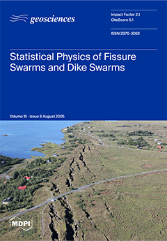
The image displays an aerial view of tension fractures in a Holocene pahoehoe lava flow at the southern end of Almannagjá, the western boundary fault of the main graben of the Thingvellir fissure swarm in Southwest Iceland. The (mostly) parallel fractures are oblique to the main direction of Almannagjá, giving rise to the observed en échelon fracture arrangement. The maximum opening of the fracture to the right of the white car is 12 m. Rock fractures control many of the most important dynamic processes in the Earth’s crust. Most rock fractures (and associated earthquakes) are comparatively small, while only a few are very large, resulting in poorly understood power or exponential size distributions. Using principles from statistical physics, fracture mechanics, and rock heterogeneity, an explanation is provided for these size distributions. View this paper
  • Issues are regarded as officially published after their release is announced to the table of contents alert mailing list.
  • You may sign up for e-mail alerts to receive table of contents of newly released issues.
  • PDF is the official format for papers published in both, html and pdf forms. To view the papers in pdf format, click on the "PDF Full-text" link, and use the free Adobe Reader to open them.
Order results
Result details
Section
Select all
Export citation of selected articles as:
20 pages, 2167 KB  
Review
Extending the Rock Cycle to a Cosmic Scale
by Andrea Vitrano, Nicola Mari, Daniele Musumeci, Luigi Ingaliso and Francesco Vetere
Geosciences 2025, 15(8), 327; https://doi.org/10.3390/geosciences15080327 - 21 Aug 2025
Viewed by 765
Abstract
The rock cycle, a cornerstone of geosciences, describes rock formation and transformation on Earth. However, this Earth-centric view overlooks the broader history of rock evolution across the cosmos, with two fundamental limitations: (i) Earth-centric paradigms that ignore extraterrestrial lithogenesis, excluding cosmically significant rocks [...] Read more.
The rock cycle, a cornerstone of geosciences, describes rock formation and transformation on Earth. However, this Earth-centric view overlooks the broader history of rock evolution across the cosmos, with two fundamental limitations: (i) Earth-centric paradigms that ignore extraterrestrial lithogenesis, excluding cosmically significant rocks and processes, and (ii) disciplinary fragmentation between geological and astrophysical sciences, from the micro- to the macroscale. This review proposes an extension of the rock cycle concept to a cosmic scale, exploring the origin of rocks and their evolution from interstellar space, through the aggregation of solid materials in protoplanetary disks, and their subsequent evolution on planetary bodies. Through systematic analysis of igneous, metamorphic, and sedimentary processes occurring beyond Earth, we identify four major domains in which distinct dynamics govern the rock cycle, each reworking rocks with domain-specific characteristics: (1) stellar and nebular dynamics, (2) protoplanetary disk dynamics, (3) asteroidal dynamics, and (4) planetary dynamics. Here we propose the cosmic rock cycle as a new epistemic tool that could transform interdisciplinary research and geoscience education. This perspective reveals Earth’s rock cycle as a rare and invaluable subset of rock genesis in the cosmos. Full article
(This article belongs to the Special Issue Insights in Planetary Geology)
Show Figures

Figure 1

21 pages, 10407 KB  
Article
Detecting the Occurrence and Explaining the Origin of Lithologic Discontinuities in Low-Mountain Soils: An Example from the Carpathians, Southern Poland
by Andrzej Kacprzak and Marek Kasprzak
Geosciences 2025, 15(8), 326; https://doi.org/10.3390/geosciences15080326 - 20 Aug 2025
Viewed by 361
Abstract
This study investigates the internal structure and lithologic variability of slope deposits in a small catchment in the Polish Outer Carpathians using pedological methods supported by geochemical analyses and Electrical Resistivity Tomography (ERT). It addresses the occurrence of lithologic discontinuities in the soils [...] Read more.
This study investigates the internal structure and lithologic variability of slope deposits in a small catchment in the Polish Outer Carpathians using pedological methods supported by geochemical analyses and Electrical Resistivity Tomography (ERT). It addresses the occurrence of lithologic discontinuities in the soils of flysch-dominated mountain areas. Diagnostic criteria from the WRB system—based on particle-size distribution and the content and lithology of coarse fragments—were applied to identify lithologic discontinuities, complemented by computation of sand and silt separates on a clay-free basis. Geochemical analyses and ERT were then used to assess their likely origin. Three major vertical sections were distinguished, separated by discontinuities: an uppermost unit consisting of aeolian material mixed with solifluctional deposits; a middle unit dominated by solifluctional materials; and a lowermost unit composed of colluvial deposits. The study confirms the utility of ERT in detecting subsurface differentiation of stratified slope sediments and provides a model for interpreting pedosedimentary sequences in Carpathian low-mountain environments. Full article
Show Figures

Figure 1

36 pages, 6877 KB  
Article
Machine Learning for Reservoir Quality Prediction in Chlorite-Bearing Sandstone Reservoirs
by Thomas E. Nichols, Richard H. Worden, James E. Houghton, Joshua Griffiths, Christian Brostrøm and Allard W. Martinius
Geosciences 2025, 15(8), 325; https://doi.org/10.3390/geosciences15080325 - 19 Aug 2025
Viewed by 300
Abstract
We have developed a generalisable machine learning framework for reservoir quality prediction in deeply buried clastic systems. Applied to the Lower Jurassic deltaic sandstones of the Tilje Formation (Halten Terrace, North Sea), the approach integrates sedimentological facies modelling with mineralogical and petrophysical prediction [...] Read more.
We have developed a generalisable machine learning framework for reservoir quality prediction in deeply buried clastic systems. Applied to the Lower Jurassic deltaic sandstones of the Tilje Formation (Halten Terrace, North Sea), the approach integrates sedimentological facies modelling with mineralogical and petrophysical prediction in a single workflow. Using supervised Extreme Gradient Boosting (XGBoost) models, we classify reservoir facies, predict permeability directly from standard wireline log parameters and estimate the abundance of porosity-preserving grain coating chlorite (gamma ray, neutron porosity, caliper, photoelectric effect, bulk density, compressional and shear sonic, and deep resistivity). Model development and evaluation employed stratified K-fold cross-validation to preserve facies proportions and mineralogical variability across folds, supporting robust performance assessment and testing generalisability across a geologically heterogeneous dataset. Core description, point count petrography, and core plug analyses were used for ground truthing. The models distinguish chlorite-associated facies with up to 80% accuracy and estimate permeability with a mean absolute error of 0.782 log(mD), improving substantially on conventional regression-based approaches. The models also enable prediction, for the first time using wireline logs, grain-coating chlorite abundance with a mean absolute error of 1.79% (range 0–16%). The framework takes advantage of diagnostic petrophysical responses associated with chlorite and high porosity, yielding geologically consistent and interpretable results. It addresses persistent challenges in characterising thinly bedded, heterogeneous intervals beyond the resolution of traditional methods and is transferable to other clastic reservoirs, including those considered for carbon storage and geothermal applications. The workflow supports cost-effective, high-confidence subsurface characterisation and contributes a flexible methodology for future work at the interface of geoscience and machine learning. Full article
Show Figures

Figure 1

19 pages, 4015 KB  
Article
New Geochemical Insights into Pre-Khorat Paleoenvironments: A Case Study of Triassic–Jurassic Reddish Sedimentary Rocks in Thailand
by Vimoltip Singtuen, Burapha Phajuy and Punya Charusiri
Geosciences 2025, 15(8), 324; https://doi.org/10.3390/geosciences15080324 - 19 Aug 2025
Viewed by 363
Abstract
The Nam Phong Formation, a key unit of the pre-Khorat Group in the western Khorat Plateau, provides critical insights into the Mesozoic geological evolution of northeastern Thailand. This study presents the first integrated petrographic and geochemical investigation of the formation within Khon Kaen [...] Read more.
The Nam Phong Formation, a key unit of the pre-Khorat Group in the western Khorat Plateau, provides critical insights into the Mesozoic geological evolution of northeastern Thailand. This study presents the first integrated petrographic and geochemical investigation of the formation within Khon Kaen Geopark to reconstruct its Late Triassic–Early Jurassic depositional settings, provenance, and paleoclimate. A detailed stratigraphic section and five supplementary sites reveal litharenite and lithic wacke sandstones, interbedded with red paleosols and polymictic conglomerates. Sedimentary structures—such as trough and planar cross-bedding, erosional surfaces, and mature paleosols—indicate deposition in a high-energy braided fluvial system under semi-arid to subhumid conditions with episodic subaerial exposure. Petrographic analysis identifies abundant quartz, feldspar, and volcanic lithic fragments. Geochemical data and REE patterns, including diagnostic negative Ce anomalies, provide compelling evidence for provenance from active continental margins and oxidizing weathering conditions. These findings point to a tectonically active syn-rift basin influenced by climatic variability. Strikingly, the Nam Phong Formation exhibits paleoenvironmental and sedimentological features comparable to the modern Ebro Basin in northeastern Spain, highlighting the relevance of uniformitarian principles in interpreting ancient continental depositional systems. Full article
Show Figures

Figure 1

16 pages, 3174 KB  
Article
Aeolian Saltation Flux Profiles: Comparison of Representation and Measurement Methods
by Douglas J. Sherman, Jinsu Bae, Jean T. Ellis, Christy Swann, Eric J. R. Parteli, Eugene Farrell, Bailiang Li, Ascânio Dias Araújo, Alexandre Medeiros de Carvalho, Diane L. Sherman and Pei Zhang
Geosciences 2025, 15(8), 323; https://doi.org/10.3390/geosciences15080323 - 19 Aug 2025
Viewed by 414
Abstract
Wind-blown sand concentrations decay rapidly and in an orderly manner with height above the surface. The saltation flux profiles are of interest to understand wind and sand interactions and for fundamental measurement and modeling of associated transport rates. This study compares methods to [...] Read more.
Wind-blown sand concentrations decay rapidly and in an orderly manner with height above the surface. The saltation flux profiles are of interest to understand wind and sand interactions and for fundamental measurement and modeling of associated transport rates. This study compares methods to measure and represent aeolian sand flux profiles. We measured vertical flux profiles and used quality-controlled data to test power, logarithmic, and exponential functions to reproduce the profiles. These results are used in a pragmatic assessment of the efficiency of reproducing flux profiles from vertically discontinuous arrays of traps or sensors compared to profiles obtained from continuous vertical arrays of segmented traps. Our analysis corroborates previous findings demonstrating that exponential decay functions are statistically the best method to approximate flux profiles. The results are used in a novel application to compare flux profiles reproduced from vertically discontinuous arrays of devices with those obtained from continuous vertical arrays comprising nine mesh-style traps. The results indicate that discontinuous arrays of 3, 4, 5, or 6 devices deployed less than 200 mm from the surface will effectively reproduce results from the continuous array, with average errors less than 3%. Errors increase when devices are at greater heights or as the number of devices decreases. Discontinuous arrays typically do not capture creep transport which would contribute to error in our comparisons. Therefore, creep must comprise less than 3% of total aeolian sand flux, contradicting typical assumptions of 25%. Full article
Show Figures

Figure 1

18 pages, 7359 KB  
Article
Least Squares Collocation for Estimating Terrestrial Water Storage Variations from GNSS Vertical Displacement on the Island of Haiti
by Renaldo Sauveur, Sajad Tabibi and Olivier Francis
Geosciences 2025, 15(8), 322; https://doi.org/10.3390/geosciences15080322 - 19 Aug 2025
Viewed by 330
Abstract
Water masses are continuously redistributing across the Earth, so accurately estimating their availability is essential. Global Navigation Satellite Systems (GNSSs) have demonstrated potential for observing vertical deformations, which is partly driven by terrestrial water storage (TWS) variations. This capability has been used in [...] Read more.
Water masses are continuously redistributing across the Earth, so accurately estimating their availability is essential. Global Navigation Satellite Systems (GNSSs) have demonstrated potential for observing vertical deformations, which is partly driven by terrestrial water storage (TWS) variations. This capability has been used in hydrogeodesy to estimate TWS variations. However, GNSS data inversions are often ill-posed, requiring regularization for stable solutions. This study considers the Least Squares Collocation (LSC) statistical method as an alternative. LSC uses covariance functions to characterize observations, parameters, and their interdependence. By incorporating additional physical information into inverse models, LSC allows ill-posed problems stabilization. To assess LSC effectiveness, we apply it to observed and simulated GNSS vertical displacement on Haiti island. Hydrological signals are modeled using Global Land Data Assimilation (GLDAS) data. In sparse GNSS data regions, findings indicate poor agreement between TWS and hydrological input, with a Root-Mean-Square-Error (RMSE) of 115 kg/m2, a correlation of 0.3, and a reduction of 73%. However, in dense simulated GNSS areas, TWS and hydrological input show strong agreement, with an RMSE of 41 kg/m2, a correlation of 0.83, and a reduction of 92%. The results confirm LSC potentiality for assessing TWS changes and improving water quantification in dense GNSS station region. Full article
(This article belongs to the Special Issue Geophysical Inversion)
Show Figures

Figure 1

18 pages, 10264 KB  
Article
Acoustic Seismic Inversion and Migration for Depth Velocity Model Reconstruction
by Maxim Protasov and Danil Dmitrachkov
Geosciences 2025, 15(8), 321; https://doi.org/10.3390/geosciences15080321 - 18 Aug 2025
Viewed by 334
Abstract
This paper investigates the combined application of seismic inversion and migration for processing seismic data in the depth domain. Seismic inversion serves as a widely used practical tool allowing the derivation of detailed subsurface models from seismic data. In this study, we implement [...] Read more.
This paper investigates the combined application of seismic inversion and migration for processing seismic data in the depth domain. Seismic inversion serves as a widely used practical tool allowing the derivation of detailed subsurface models from seismic data. In this study, we implement a constrained total variation inversion algorithm. The inversion input data comprise true-amplitude depth imaging results along with the depth migration velocity model. Furthermore, we develop and examine an iterative algorithm that jointly performs acoustic seismic inversion and depth migration. This approach aims to refine high-frequency and smooth low-frequency components of the depth velocity model. We validate our methods through numerical experiments using both synthetic data and a realistic Marmousi model. Full article
(This article belongs to the Section Geophysics)
Show Figures

Figure 1

20 pages, 7710 KB  
Article
The High-Precision Monitoring of Mining-Induced Overburden Fractures Based on the Full-Space Inversion of the Borehole Resistivity Method: A Case Study
by Zhongzhong Xu, Jiulong Cheng and Hongpeng Zhao
Geosciences 2025, 15(8), 320; https://doi.org/10.3390/geosciences15080320 - 16 Aug 2025
Viewed by 462
Abstract
The evolution of mining-induced overburden fractures (MIOFs) and their dynamic monitoring are critical for preventing roof water hazards and gas disasters in coal mines. Conventional methods often fail to provide sufficient accuracy under the thin soft–hard interbedded roof strata, necessitating advanced alternatives. Here, [...] Read more.
The evolution of mining-induced overburden fractures (MIOFs) and their dynamic monitoring are critical for preventing roof water hazards and gas disasters in coal mines. Conventional methods often fail to provide sufficient accuracy under the thin soft–hard interbedded roof strata, necessitating advanced alternatives. Here, we address this challenge by proposing a borehole resistivity method (BRM) based on Back-Propagation Neural Network full-space inversion (BPNN-FSI). Based on the Carboniferous Taiyuan Formation in the North China Coalfield, geoelectric models of MIOFs were established for different mining stages. Finite element simulations generated apparent resistivity responses to train and validate the BPNN-FSI model. At the 9-204 working face of Dianping Coal Mine (Shanxi Province), we compared the proposed BRM based on BPNN-FSI with an empirical formula, numerical simulation, similarity physical simulation, and underground inclined drilling water-loss observations (UIDWLOs). Results demonstrate that the BRM based on BPNN-FSI achieves sub-1% error in height of MIOF (HMIOF) monitoring, with a maximum detected fracture height of 52 m—significantly outperforming conventional methods. This study validates the accuracy and robustness of BRM based on BPNN-FSI for MIOF monitoring in thin soft–hard interbedded roof strata, offering a reliable tool for roof hazard prevention and sustainable mining practices. Full article
Show Figures

Figure 1

14 pages, 1200 KB  
Perspective
Refining the Concept of Earthquake Precursory Fingerprint
by Alexandru Szakács
Geosciences 2025, 15(8), 319; https://doi.org/10.3390/geosciences15080319 - 15 Aug 2025
Viewed by 265
Abstract
The recently proposed concept of “precursory fingerprint” is a logical consequence of the commonsense statement that seismic structures are unique and that their expected preshock behaviors, including precursory phenomena, are also unique. Our new prediction-related research strategy is conceptually based on the principles [...] Read more.
The recently proposed concept of “precursory fingerprint” is a logical consequence of the commonsense statement that seismic structures are unique and that their expected preshock behaviors, including precursory phenomena, are also unique. Our new prediction-related research strategy is conceptually based on the principles of (1) the uniqueness of seismogenic structures, (2) interconnected and interacting geospheres, and (3) non-equivalence of Earth’s surface spots in terms of precursory signal receptivity. The precursory fingerprint of a given seismic structure is a unique assemblage of precursory signals of various natures (seismic, physical, chemical, and biological), detectable in principle by using a system of proper monitoring equipment that consists of a matrix of n sensors placed on the ground at “sensitive” spots identified beforehand and on orbiting satellites. In principle, it is composed of a combination of signals that are emitted by the “responsive sensors”, in addition to the “non-responsive sensors”, coming from the sensor matrix, monitoring as many virtual precursory processes as possible by continuously measuring their relevant parameters. Each measured parameter has a pre-established (by experts) threshold value and an uncertainty interval, discriminating between background and anomalous values that are visualized similarly to traffic light signals (green, yellow, and red). The precursory fingerprint can thus be viewed as a particular configuration of “precursory signals” consisting of anomalous parameter values that are unique and characteristic to the targeted seismogenic structure. Presumably, it is a complex entity that consists of pattern, space, and time components. The “pattern component” is a particular arrangement of the responsive sensors on the master board of the monitoring system yielding anomalous parameter value signals, that can be re-arranged, after a series of experiments, in a spontaneously understandable new pattern. The “space component” is a map position configuration of the signal-detecting sensors, whereas the “time component” is a characteristic time sequence of the anomalous signals including the order, occurrence time before the event, transition time between yellow and red signals, etc. Artificial intelligence using pattern-recognition algorithms can be used to follow, evaluate, and validate the precursory signal assemblage and, finally, to judge, together with an expert board of human operators, its “precursory fingerprint” relevance. Signal interpretation limitations and uncertainties related to dependencies on sensor sensibility, focal depth, and magnitude can be established by completing all three phases (i.e., experimental, validation, and implementation) of the precursory fingerprint-based earthquake prediction research strategy. Full article
(This article belongs to the Special Issue Precursory Phenomena Prior to Earthquakes (2nd Edition))
Show Figures

Figure 1

21 pages, 8328 KB  
Article
Three-Dimensional Morphometric Analysis of the Columbretes Grande Turbidite Channel (Ebro Continental Margin, NW Mediterranean)
by José Luis Casamor
Geosciences 2025, 15(8), 318; https://doi.org/10.3390/geosciences15080318 - 15 Aug 2025
Viewed by 507
Abstract
Turbidite channels are final conduits for the transfer of terrigenous detritus to the deep-sea depositional systems. Studying their morphology and geometric parameters can provide information on density flow characteristics and sedimentary processes, making it an objective and quantitative way to differentiate the deep-sea [...] Read more.
Turbidite channels are final conduits for the transfer of terrigenous detritus to the deep-sea depositional systems. Studying their morphology and geometric parameters can provide information on density flow characteristics and sedimentary processes, making it an objective and quantitative way to differentiate the deep-sea deposits they feed, which are of special interest to the oil industry. In this work, the morphology is studied, the main geometric parameters are calculated, and the potential sedimentary fill of a turbiditic channel, the Columbretes Grande channel, located on the Ebro continental margin (NW Mediterranean Sea), is reconstructed and visualized in 3D. This complete morphometric analysis shows a concave and smooth channel indicating a profile in equilibrium with local evidence of erosion. Considering the height of the flanks (< 150 m), the existence of well-developed levees, the high sinuosity of some of its reaches, and the relatively low slopes, the channel can be classified as depositional. The sinuosity index is close to 2 in some courses, and the gentle slopes suggest that the fine-grained turbidity currents that episodically circulate in its interior reach the channel’s end. Full article
Show Figures

Figure 1

21 pages, 35452 KB  
Article
Integrated Geophysical Techniques to Investigate Water Resources in Self-Sustained Carbon-Farming Agroforestry
by John D. Alexopoulos, Vasileios Gkosios, Ioannis-Konstantinos Giannopoulos, Spyridon Dilalos, Antonios Eleftheriou and Simos Malamis
Geosciences 2025, 15(8), 317; https://doi.org/10.3390/geosciences15080317 - 13 Aug 2025
Viewed by 362
Abstract
The present paper deals with the combined application of near-surface geophysical techniques in a sustainable agriculture project. Their application is focused on the identification of any subsurface water in the context of sustainable water management for the selected living hub, located in the [...] Read more.
The present paper deals with the combined application of near-surface geophysical techniques in a sustainable agriculture project. Their application is focused on the identification of any subsurface water in the context of sustainable water management for the selected living hub, located in the semi-arid area of Agios Georgios-Mandra Attiki. The objective of the multidisciplinary geophysical study was to determine the depth of the bedrock and the thickness of the post-Alpine deposits. In addition, the subsurface karstification and the possible aquifer presence were examined. For that reason, the following techniques were implemented: Electrical Resistivity Tomography, Seismic Refraction Tomography, Ground-Penetrating Radar, and Very-Low Frequency electromagnetic technique. The study was also supported by drone LiDAR usage. The investigation revealed several hydrogeological characteristics of the area. The thickness of the post-Alpine sediments is almost 3 m. However, no shallow aquiferous systems have been developed in this formation, as indicated by their relatively high resistivity values (100–1000 Ohm.m). Furthermore, the alpine bedrock exhibits extensive karstification, facilitated by the development of fracture zones. The absence of an underlying impermeable layer prevented the development of aquiferous zones, at least up to a depth of 100 m. Full article
Show Figures

Figure 1

24 pages, 4639 KB  
Article
Testing Satellite Snow Cover Observations Using Time-Lapse Camera Images in Mid-Latitude Mountain Ranges (Northern Spain)
by Adrián Melón-Nava and Javier Santos-González
Geosciences 2025, 15(8), 316; https://doi.org/10.3390/geosciences15080316 - 13 Aug 2025
Viewed by 362
Abstract
Reliable monitoring of snow cover in mountainous regions remains a challenge due to frequent cloud cover and the revisit limitations of optical satellites. This study compares satellite snow-cover records with >99,000 ground-based time-lapse camera observations across northern Spain (2003–2025). Cloud cover caused major [...] Read more.
Reliable monitoring of snow cover in mountainous regions remains a challenge due to frequent cloud cover and the revisit limitations of optical satellites. This study compares satellite snow-cover records with >99,000 ground-based time-lapse camera observations across northern Spain (2003–2025). Cloud cover caused major data loss, with up to 57% of satellite images affected. Effective revisit intervals (the average time between usable images) diverge substantially from nominal values: 2.3 days for MODIS, 6.9 days for Sentinel-2, and over 21 days for Landsat. A hierarchical multisensor approach with 5-day gap-filling reduced this to just 1.3 days. On dates when cameras confirmed snow, satellites underestimated snow presence by 61.6% (Sentinel-2), 71.5% (Landsat), and 79.7% (MODIS), though gap-filling approaches reduced underestimation to 49.4%—deficits largely attributable to cloud-obscured scenes. When both satellite and camera provided cloud-free observations for the same date and location, classification agreement exceeded 85%. Despite this, satellites consistently failed to detect short-lived snow events and introduced temporal biases. On average, Snow Onset Dates were detected 13–52 days later, and Snow Melt-Out Dates differed by up to 40 days compared to camera-derived records. These results have implications for snow-cover monitoring using satellite images and highlight the need for integrating ground-based observations to compensate for satellite limitations and improve snow cover seasonality assessments in complex terrains. Full article
(This article belongs to the Section Cryosphere)
Show Figures

Figure 1

23 pages, 10900 KB  
Article
GIS-Based Process Automation of Calculating the Volume of Mineral Extracted from a Deposit
by Anna Szafarczyk and Michał Siwek
Geosciences 2025, 15(8), 315; https://doi.org/10.3390/geosciences15080315 - 12 Aug 2025
Viewed by 235
Abstract
The recording of minerals extracted from a deposit is crucial for effective planning, exploitation management, and compliance with legal requirements. It also enables improved workplace safety and the minimization of negative environmental impact. Automation in mining optimizes exploitation, transportation, and data management processes, [...] Read more.
The recording of minerals extracted from a deposit is crucial for effective planning, exploitation management, and compliance with legal requirements. It also enables improved workplace safety and the minimization of negative environmental impact. Automation in mining optimizes exploitation, transportation, and data management processes, resulting in better forecasting, more accurate resource calculations, and reduced operational costs. The usage of geographic information system tools facilitates data modeling and analysis, enhancing monitoring and mining exploitation management. This paper presents the classical approach to determining the volume of extracted minerals and proposes GIS-based tools for the automation of the volume calculation process. The automation of the process is presented both from a theoretical perspective, providing requirements and parameters for individual calculation procedures, and from a practical perspective, using the example of a typical open pit mine, where the procedure is implemented starting from field measurements, carrying out calculations, and ending with visualization and interpretation. The study highlights the benefits of automating the calculation procedure for the volume of extracted minerals, including task execution acceleration, increased efficiency, reduced calculation time, and minimized human error. This ultimately leads to more precise and consistent results. Full article
Show Figures

Figure 1

49 pages, 10419 KB  
Review
State-of-the-Art Review and Prospect of Modelling the Dynamic Fracture of Rocks Under Impact Loads and Application in Blasting
by Muhammad Kamran, Hongyuan Liu, Daisuke Fukuda, Peng Jia, Gyeongjo Min and Andrew Chan
Geosciences 2025, 15(8), 314; https://doi.org/10.3390/geosciences15080314 - 12 Aug 2025
Viewed by 443
Abstract
The dynamic fracture of rocks under impact loads has many engineering applications such as rock blasting. This study reviews the recent achievements of investigating rock dynamic fracturing and its application in rock blasting using computational mechanics methods and highlights the prospects of modelling [...] Read more.
The dynamic fracture of rocks under impact loads has many engineering applications such as rock blasting. This study reviews the recent achievements of investigating rock dynamic fracturing and its application in rock blasting using computational mechanics methods and highlights the prospects of modelling them with a hybrid finite-discrete element method (HFDEM) originally developed by the authors. The review first summarizes the peculiarities of rock dynamic fracturing compared with static fracturing, which are that the physical-mechanical properties of rocks, including stress wave propagation, strength, fracture toughness, energy partition and cracking mechanism, depend on loading rate. Then the modelling of these peculiarities and their applications in rock blasting using fast developing computational mechanics methods are reviewed with a focus on the advantages and disadvantages of prevalent finite element method (FEM) as representative continuum method, discrete element method (DEM) as representative discontinuum method and combined finite-discrete element (FDEM) as representative hybrid method, which highlights FDEM is the most promising method for modelling rock dynamic fracture and blasting application as well as points out the research gaps in the field of modelling the dynamic fracture of rocks under impact loads. After that, the progress of shortening some of these gaps by developing and applying HFDEM, i.e., the authors’ version of FDEM, for modelling rock dynamic fracture and applications in rock blasting are reviewed, which include the features of modelling the effects of loading rate; stress wave propagation, reflection and absorbing as well as stress wave-induced fracture; explosive-rock interaction including detonation-induced gas expansion and flow through fracturing rock; coupled multiaxial static and dynamic loads; heterogeneous rock and rock mass with pre-existing discrete fracture network; and dynamic fracturing-induced fragment size distribution. Finally, the future directions of modelling the dynamic fracture of rocks under impact loads are highlighted and a systematic numerical approach is proposed for modelling rock blasting. Full article
(This article belongs to the Section Geomechanics)
Show Figures

Figure 1

38 pages, 13807 KB  
Article
A Sediment Provenance Study of Middle Jurassic to Cretaceous Strata in the Eastern Sverdrup Basin: Implications for the Exhumation of the Northeastern Canadian-Greenlandic Shield
by Michael A. Pointon, Helen Smyth, Jenny E. Omma, Andrew C. Morton, Simon Schneider, Stephen J. Rippington, Berta Lopez-Mir, Quentin G. Crowley, Dirk Frei and Michael J. Flowerdew
Geosciences 2025, 15(8), 313; https://doi.org/10.3390/geosciences15080313 - 12 Aug 2025
Viewed by 644
Abstract
The Sverdrup Basin, Arctic Canada, is ideally situated to contain an archive of tectono-magmatic and climatic events that occurred within the wider Arctic region, including the exhumation of the adjacent (northeastern) part of the Canadian-Greenlandic Shield. To test this, a multi-analytical provenance study [...] Read more.
The Sverdrup Basin, Arctic Canada, is ideally situated to contain an archive of tectono-magmatic and climatic events that occurred within the wider Arctic region, including the exhumation of the adjacent (northeastern) part of the Canadian-Greenlandic Shield. To test this, a multi-analytical provenance study of Middle Jurassic to Cretaceous sandstones from the eastern Sverdrup Basin was undertaken. Most of the samples analysed were recycled from sedimentary rocks of the Franklinian Basin, with possible additional contributions from the Mesoproterozoic Bylot basins and metasedimentary shield rocks. The amount of high-grade metamorphic detritus in samples from central Ellesmere Island increased from Middle Jurassic times. This is interpreted to reflect exhumation of the area to the southeast/east of the Sverdrup Basin. Exhumation may have its origins in Middle Jurassic extension and uplift along the northwest Sverdrup Basin margin. Rift-flank uplift along the Canadian–West Greenland conjugate margin and lithospheric doming linked with the proximity of the Iceland hotspot and/or the emplacement of the Cretaceous High Arctic Large Igneous Province may have contributed to exhumation subsequently. The southeast-to-northwest thickening of Jurassic to Early Cretaceous strata across the Sverdrup Basin may be a distal effect of exhumation rather than rifting in the Sverdrup or Amerasia basins. Full article
Show Figures

Figure 1

51 pages, 29464 KB  
Review
Impact of Aerosols on Cloud Microphysical Processes: A Theoretical Review
by Kécia Maria Roberto da Silva, Dirceu Luís Herdies, Paulo Yoshio Kubota, Caroline Bresciani and Silvio Nilo Figueroa
Geosciences 2025, 15(8), 312; https://doi.org/10.3390/geosciences15080312 - 11 Aug 2025
Viewed by 431
Abstract
The direct relationship between aerosols and clouds strongly influences the effects of clouds on the global climate. Aerosol particles act as cloud condensation nuclei (CCN) and ice nuclei (IN), affecting cloud formation, microphysics, and precipitation, as well as increasing the reflection of solar [...] Read more.
The direct relationship between aerosols and clouds strongly influences the effects of clouds on the global climate. Aerosol particles act as cloud condensation nuclei (CCN) and ice nuclei (IN), affecting cloud formation, microphysics, and precipitation, as well as increasing the reflection of solar radiation at the cloud tops. Processes such as gas-to-particle conversion and new particle formation (NPF) control aerosol properties that, together with meteorological conditions, regulate cloud droplet nucleation through Köhler theory and related effects. The indirect aerosol effects described by Twomey and Albrecht demonstrate how changes in aerosols impact droplet number, cloud lifetime, and precipitation efficiency. Cloud microphysical processes, including droplet growth, collision-coalescence, and solid-phase mechanisms such as riming, vapor diffusion, and aggregation, shape precipitation development in warm, cold, and mixed-phase clouds. Ice nucleation remains a significant uncertainty due to the diversity of aerosol types and nucleation modes. This work synthesizes these physical interactions to better understand how the chemical and physical properties of aerosols influence cloud and precipitation processes, supporting improvements in weather and climate prediction models despite numerical challenges arising from the complexity of aerosol–cloud interactions. Full article
(This article belongs to the Section Climate and Environment)
Show Figures

Figure 1

40 pages, 14629 KB  
Article
Assessing the Geothermal Potential of a Fractured Carbonate Reservoir (Southern Apennines, Italy): Relationships Between Structural Control and Heat Flow
by Chrysanthi Pontikou, Ioannis Vakalas, Sotirios Kokkalas, Raffaele Di Cuia, Angelo Ricciato and Giovanni Toscani
Geosciences 2025, 15(8), 311; https://doi.org/10.3390/geosciences15080311 - 11 Aug 2025
Viewed by 545
Abstract
As part of the energy transition needed to mitigate global warming, the study and sustainable exploitation of geothermal resources—a largely underutilized form of energy and heat production—is crucial. The availability of subsurface data acquired for oil and gas exploration purposes provides an opportunity [...] Read more.
As part of the energy transition needed to mitigate global warming, the study and sustainable exploitation of geothermal resources—a largely underutilized form of energy and heat production—is crucial. The availability of subsurface data acquired for oil and gas exploration purposes provides an opportunity to reconsider these data to enhance the use of geothermal potential. This is the case of a fractured carbonate reservoir in the Southern Apennines (Italy). All available subsurface data were gathered, homogenized, and reinterpreted to build a 3D geological model of the study area, where a positive thermal anomaly is known, yet the mechanisms and pathways of heat transport were previously unclear. By integrating subsurface, temperature, and literature data, a geological model is proposed that explains how high temperatures and heat propagation are closely linked to specific geological features. By cross-referencing and weighing the relevance of data for geothermal purposes, an attempt is made to rank the geothermal potential of existing wells in the area. This study demonstrates how a well-constrained geological model and the joint analysis of multidisciplinary data can provide the necessary knowledge base for conducting further technical, engineering, and economic analyses to assess the commercial viability of the identified geothermal resource. Full article
(This article belongs to the Section Structural Geology and Tectonics)
Show Figures

Figure 1

2 pages, 132 KB  
Correction
Correction: Telesca et al. Statistical Investigation of the 2020–2023 Micro-Seismicity in Enguri Area (Georgia). Geosciences 2025, 15, 247
by Luciano Telesca, Nino Tsereteli, Nazi Tugushi and Tamaz Chelidze
Geosciences 2025, 15(8), 310; https://doi.org/10.3390/geosciences15080310 - 11 Aug 2025
Viewed by 170
Abstract
There was an error in the original publication [...] Full article
(This article belongs to the Section Geophysics)
25 pages, 5810 KB  
Article
Pliocene Marine Bivalvia from Vale Farpado (Pombal, Portugal): Palaeoenvironmental and Palaecological Significance
by Ricardo J. Pimentel, Pedro M. Callapez, Mahima Pai, Paulo Legoinha and Pedro A. Dinis
Geosciences 2025, 15(8), 309; https://doi.org/10.3390/geosciences15080309 - 8 Aug 2025
Viewed by 588
Abstract
The western Iberian marine Pliocene represents a key transitional zone between tropical and boreal molluscan faunas. Recent studies at the rediscovered fossil locality of Vale Farpado have yielded 34 bivalve species, distributed among 18 families. The most diverse families identified are Veneridae and [...] Read more.
The western Iberian marine Pliocene represents a key transitional zone between tropical and boreal molluscan faunas. Recent studies at the rediscovered fossil locality of Vale Farpado have yielded 34 bivalve species, distributed among 18 families. The most diverse families identified are Veneridae and Pectinidae. The assemblage is predominantly composed of suspension- and deposit-feeding taxa, with no evidence of carnivorous feeding strategies. Most taxa exhibit an infaunal life habitat. Initial colonising bivalve communities inhabited mobile, gravel-dominated substrates, where coarse clasts and disarticulated bioclasts provided stable microhabitats for epifaunal species. Over time, later assemblages became established, primarily on sandy substrates. Palaeoenvironmental indicators, including molluscs and foraminifera, suggest that these benthic communities occupied the infralittoral zone, at depths generally shallower than 30 metres, and the sea surface temperatures were broadly subtropical. However, periodic incursions of cooler, nutrient-rich waters driven by upwelling systems influenced local conditions, enhancing primary productivity and supporting a taxonomically rich and ecologically complex benthic ecosystem. The bivalve assemblages of Vale Farpado thus contribute valuable insights into the palaeoecology and biogeographical dynamics of the Pliocene North Atlantic, particularly in the context of sea surface temperature gradients and bivalve faunal interchange between temperate and tropical marine realms. Full article
(This article belongs to the Section Sedimentology, Stratigraphy and Palaeontology)
Show Figures

Figure 1

21 pages, 4201 KB  
Article
Short-Term Geomorphological Changes of the Sabato River (Southern Italy)
by Francesca Martucci, Floriana Angelone, Edoardo G. D’Onofrio, Filippo Russo and Paolo Magliulo
Geosciences 2025, 15(8), 308; https://doi.org/10.3390/geosciences15080308 - 8 Aug 2025
Viewed by 366
Abstract
Short-term channel adjustments are a research topic of great relevance in the framework of fluvial geomorphology, but studies on this topic have been quite scarce in Southern Italy, at least since the 2010s, notwithstanding the fact that this area is strongly representative of [...] Read more.
Short-term channel adjustments are a research topic of great relevance in the framework of fluvial geomorphology, but studies on this topic have been quite scarce in Southern Italy, at least since the 2010s, notwithstanding the fact that this area is strongly representative of a much wider morphoclimatic context, i.e., the Mediterranean area, which particularly suffers from the effects of current climate change. Currently, different interpretations still exist about the type and role of controlling factors, and a common morphoevolutionary trend is quite far from being defined; so, new case studies are needed. In this paper, the geomorphological changes experienced by the Sabato R. (Southern Italy) over a period of ~150 years were investigated. A reach-scale geomorphological analysis in a GIS environment of raster data, consisting of four topographic maps (from 1870, 1909, 1941 and 1955) and five sets of orthophotos (from 1998, 2004, 2008, 2011 and 2014), was carried out, integrated with field-surveyed data. Land-use changes, in-channel anthropic disturbances, floods and rainfall variations were selected as possible controlling factors. The study highlighted four morphoevolutionary phases of the studied river. Phase 1 (1870s–1910s) was characterized by a relative channel stability in terms of both mean width and pattern, while channel widening dominated during Phase 2 (1910s–1940s). In contrast, Phase 3 (1940s–1990s) was characterized by intense and diffuse narrowing. Finally, during Phase 4 (from the 1990s onward), an alternation in channel narrowing and flood-induced widening was detected. During all phases, changes in both channel pattern and riverbed elevation were less evident than those in channel width. Land-use changes and, later, floods, in addition to in-channel human disturbances at a local scale, were the main controlling factors. The obtained results have profound implications for rivers located outside Italy as well, as they provide new insights into the role played by the considered controlling factors in the geomorphological evolution of a typical Mediterranean river. Understanding this role is fundamental in regional-scale river management, hazard mitigation and environmental planning, as proved by the vast pre-existing scientific literature. Full article
Show Figures

Figure 1

28 pages, 4027 KB  
Review
Isotopes in Archeology: Perspectives on Post-Mortem Alteration and Climate Change
by Antonio Simonetti and Michele R. Buzon
Geosciences 2025, 15(8), 307; https://doi.org/10.3390/geosciences15080307 - 7 Aug 2025
Viewed by 756
Abstract
Isotopic investigations focused on determining the mobility and provenance of ancient human civilizations and sourcing of archeological artifacts continue to gain prominence in archeology. Most studies focus on the premise that the geographic variation in isotope systems of interest (e.g., Sr, Pb, Nd, [...] Read more.
Isotopic investigations focused on determining the mobility and provenance of ancient human civilizations and sourcing of archeological artifacts continue to gain prominence in archeology. Most studies focus on the premise that the geographic variation in isotope systems of interest (e.g., Sr, Pb, Nd, O) in the natural environment is recorded in both human hard tissues of local individuals and raw materials sourced for artifacts within the same region. The introduction of multi-collection–inductively coupled plasma mass spectrometry (MC-ICP-MS) and laser ablation systems are techniques that consume smaller sample sizes compared to previous mass spectrometric approaches due to their higher ionization efficiency and increased sensitivity. This development has facilitated the isotopic measurement of trace elements present at low abundances (e.g., Pb, Nd, <1-to-low ppm range) particularly in human tooth enamel. Accurate interpretation of any isotope ratio measurement for the proveniencing of such low-abundance samples requires the adequate evaluation of post-mortem diagenetic alteration. A synopsis of practices currently in use for identifying post-mortem alteration in human archeological samples is discussed here. Post-mortem shifts in radiogenic isotope signatures resulting from secondary alteration are distinct from those potentially related to the impact of climate change on the bioavailable budgets for these elements. This topic is of interest to the archeological community and discussed here in the context of Holocene-aged samples from burial sites within the Nile River Valley System, and preferred dust source areas from the neighboring Sahara Desert. Full article
Show Figures

Figure 1

23 pages, 3031 KB  
Article
Integrated Capuchin Search Algorithm-Optimized Multilayer Perceptron for Robust and Precise Prediction of Blast-Induced Airblast in a Blasting Mining Operation
by Kesalopa Gaopale, Takashi Sasaoka, Akihiro Hamanaka and Hideki Shimada
Geosciences 2025, 15(8), 306; https://doi.org/10.3390/geosciences15080306 - 6 Aug 2025
Viewed by 343
Abstract
Blast-induced airblast poses a significant environmental and operational issue for surface mining, affecting safety, regulatory adherence, and the well-being of surrounding communities. Despite advancements in machine learning methods for predicting airblast, present studies neglect essential geomechanical characteristics, specifically rock mass strength (RMS), which [...] Read more.
Blast-induced airblast poses a significant environmental and operational issue for surface mining, affecting safety, regulatory adherence, and the well-being of surrounding communities. Despite advancements in machine learning methods for predicting airblast, present studies neglect essential geomechanical characteristics, specifically rock mass strength (RMS), which is vital for energy transmission and pressure-wave attenuation. This paper presents a capuchin search algorithm-optimized multilayer perceptron (CapSA-MLP) that incorporates RMS, hole depth (HD), maximum charge per delay (MCPD), monitoring distance (D), total explosive mass (TEM), and number of holes (NH). Blast datasets from a granite quarry were utilized to train and test the model in comparison to benchmark approaches, such as particle swarm optimized artificial neural network (PSO-ANN), multivariate regression analysis (MVRA), and the United States Bureau of Mines (USBM) equation. CapSA-MLP outperformed PSO-ANN (RMSE = 1.120, R2 = 0.904 compared to RMSE = 1.284, R2 = 0.846), whereas MVRA and USBM exhibited lower accuracy. Sensitivity analysis indicated RMS as the main input factor. This study is the first to use CapSA-MLP with RMS for airblast prediction. The findings illustrate the significance of metaheuristic optimization in developing adaptable, generalizable models for various rock types, thereby improving blast design and environmental management in mining activities. Full article
(This article belongs to the Section Geomechanics)
Show Figures

Figure 1

19 pages, 14233 KB  
Article
Subsurface Characterization of the Merija Anticline’s Rooting Using Integrated Geophysical Techniques: Implications for Copper Exploration
by Mohammed Boumehdi, Hicham Khebbi, Doha Dchar, Lahsen Achkouch, Anwar Ain Tagzalt, Nour Eddine Berkat, Mohammed Magoua, Youssef Hahou and Othman Sadki
Geosciences 2025, 15(8), 305; https://doi.org/10.3390/geosciences15080305 - 6 Aug 2025
Viewed by 362
Abstract
This study investigates the subsurface rooting of the Merija anticline in the Missour Basin, Morocco, with a focus on copper mineralization exploration. A sequential geophysical workflow was implemented, combining gravity surveys, electrical resistivity (ER), and induced polarization (IP) methods. The gravity data, acquired [...] Read more.
This study investigates the subsurface rooting of the Merija anticline in the Missour Basin, Morocco, with a focus on copper mineralization exploration. A sequential geophysical workflow was implemented, combining gravity surveys, electrical resistivity (ER), and induced polarization (IP) methods. The gravity data, acquired along spaced profiles extending from outcropping areas to Quaternary-covered zones, clearly delineated the structural continuity of the anticline beneath the cover. The application of trend filtering in covered areas allowed the removal of regional effects, successfully isolating residual anomalies associated with the buried continuation of the anticline. Interpolated Bouguer anomaly maps highlighted a major regional fault, interpreted as controlling the deep rooting of the anticline. A resistivity profile was then deployed perpendicular to this fault, providing detailed imaging of the anticline’s geometry and lithological contrasts. Complementary IP profiles conducted near the mine site targeted the detection of chargeability anomalies associated with copper mineralization dominated by malachite, confirming the electrical signature of copper mineralization, particularly within the sandstone and conglomerate formations of the Lower Cretaceous. To validate the geophysical interpretations, a drilling campaign was conducted, which confirmed the presence of the identified lithological units and the anticline rooting, as revealed by geophysical data. This approach provides a robust framework for copper exploration in the Merija area and can be adapted to similar geological contexts elsewhere. Full article
(This article belongs to the Section Geophysics)
Show Figures

Figure 1

21 pages, 1212 KB  
Article
A Semi-Supervised Approach to Characterise Microseismic Landslide Events from Big Noisy Data
by David Murray, Lina Stankovic and Vladimir Stankovic
Geosciences 2025, 15(8), 304; https://doi.org/10.3390/geosciences15080304 - 6 Aug 2025
Viewed by 334
Abstract
Most public seismic recordings, sampled at hundreds of Hz, tend to be unlabelled, i.e., not catalogued, mainly because of the sheer volume of samples and the amount of time needed by experts to confidently label detected events. This is especially challenging for very [...] Read more.
Most public seismic recordings, sampled at hundreds of Hz, tend to be unlabelled, i.e., not catalogued, mainly because of the sheer volume of samples and the amount of time needed by experts to confidently label detected events. This is especially challenging for very low signal-to-noise ratio microseismic events that characterise landslides during rock and soil mass displacement. Whilst numerous supervised machine learning models have been proposed to classify landslide events, they rely on a large amount of labelled datasets. Therefore, there is an urgent need to develop tools to effectively automate the data-labelling process from a small set of labelled samples. In this paper, we propose a semi-supervised method for labelling of signals recorded by seismometers that can reduce the time and expertise needed to create fully annotated datasets. The proposed Siamese network approach learns best class-exemplar anchors, leveraging learned similarity between these anchor embeddings and unlabelled signals. Classification is performed via soft-labelling and thresholding instead of hard class boundaries. Furthermore, network output explainability is used to explain misclassifications and we demonstrate the effect of anchors on performance, via ablation studies. The proposed approach classifies four landslide classes, namely earthquakes, micro-quakes, rockfall and anthropogenic noise, demonstrating good agreement with manually detected events while requiring few training data to be effective, hence reducing the time needed for labelling and updating models. Full article
Show Figures

Figure 1

14 pages, 7406 KB  
Article
Machine Learning-Driven Calibration of MODFLOW Models: Comparing Random Forest and XGBoost Approaches
by Husam Musa Baalousha
Geosciences 2025, 15(8), 303; https://doi.org/10.3390/geosciences15080303 - 5 Aug 2025
Viewed by 399
Abstract
The groundwater inverse problem has several challenges such as instability, non-uniqueness, and complexity, especially for heterogeneous aquifers. Solving the inverse problem is the traditional way to calibrate models, but it is both time-consuming and sensitive to errors in the measurements. This study explores [...] Read more.
The groundwater inverse problem has several challenges such as instability, non-uniqueness, and complexity, especially for heterogeneous aquifers. Solving the inverse problem is the traditional way to calibrate models, but it is both time-consuming and sensitive to errors in the measurements. This study explores the use of machine learning (ML) surrogate models, namely Random Forest (RF) and Extreme Gradient Boosting (XGBoost), to solve the inverse problem for the groundwater model calibration. Datasets for 20 hydraulic conductivity fields were created randomly based on statistics of hydraulic conductivity from the available data of the Northern Aquifer of Qatar, which was used as a case study. The corresponding hydraulic head values were obtained using MODFLOW simulations, and the data were used to train and validate the ML models. The trained surrogate models were used to estimate the hydraulic conductivity based on field observations. The results show that both RF and XGBoost have considerable predictive skill, with RF having better R2 and RMSE values (R2 = 0.99 for training, 0.93 for testing) than XGBoost (R2 = 0.86 for training, 0.85 for testing). The ML-based method lowered the computational effort greatly compared to the classical solution of the inverse problem (i.e., using PEST) and still produced strong and reliable spatial patterns of hydraulic conductivity. This demonstrates the potential of machine learning models for calibrating complex groundwater systems. Full article
(This article belongs to the Section Hydrogeology)
Show Figures

Graphical abstract

19 pages, 6218 KB  
Article
Quantitative Relationship Between Electrical Resistivity and Water Content in Unsaturated Loess: Theoretical Model and ERT Imaging Verification
by Hu Zeng, Qianli Zhang, Cui Du, Jie Liu and Yilin Li
Geosciences 2025, 15(8), 302; https://doi.org/10.3390/geosciences15080302 - 5 Aug 2025
Viewed by 398
Abstract
As a typical porous medium, unsaturated loess demonstrates critical hydro-mechanical coupling properties that fundamentally influence geohazard mitigation, groundwater resource evaluation, and foundation stability in geotechnical engineering. This investigation develops a novel theoretical framework to overcome the limitations of existing models in converting electrical [...] Read more.
As a typical porous medium, unsaturated loess demonstrates critical hydro-mechanical coupling properties that fundamentally influence geohazard mitigation, groundwater resource evaluation, and foundation stability in geotechnical engineering. This investigation develops a novel theoretical framework to overcome the limitations of existing models in converting electrical resistivity tomography (ERT) profiles into water content distributions for unsaturated loess through quantitative inversion modeling. Systematic laboratory investigations on remolded loess specimens with controlled density and water content conditions revealed distinct resistivity–water interaction mechanisms. A characteristic two-stage decay pattern was identified: resistivity exhibited an exponential decrease from 420 Ω·m (water saturation (Sw = 10%)) to 90 Ω·m (Sw = 40%), followed by asymptotic stabilization at Sw ≥ 40%. The derived quantitative correlation provides a robust mathematical basis for water content profile inversion. Field validation through integrated ERT and borehole data demonstrated exceptional predictive accuracy in shallow strata (<20 m depth), achieving mean absolute errors of <5%. However, inversion reliability decreased with depth (>20 m), primarily attributed to density-dependent charge transport mechanisms. This underscores the necessity of incorporating coupled thermo-hydro-mechanical processes for deep-layer characterization. This study provides a robust framework for engineering applications of ERT in loess terrains, offering significant advancements in geotechnical monitoring and geohazard prevention. Full article
Show Figures

Figure 1

58 pages, 10593 KB  
Article
Statistical Physics of Fissure Swarms and Dike Swarms
by Agust Gudmundsson
Geosciences 2025, 15(8), 301; https://doi.org/10.3390/geosciences15080301 - 4 Aug 2025
Viewed by 464
Abstract
Fissure swarms and dike swarms in Iceland constitute the main parts of volcanic systems that are 40–150 km long, 5–20 km wide, extend to depths of 10–20 km, and contain 2 × 10¹⁴ outcrop-scale (≥0.1 m) and 1022–23 down to grain-scale [...] Read more.
Fissure swarms and dike swarms in Iceland constitute the main parts of volcanic systems that are 40–150 km long, 5–20 km wide, extend to depths of 10–20 km, and contain 2 × 10¹⁴ outcrop-scale (≥0.1 m) and 1022–23 down to grain-scale (≥1 mm) fractures, suggesting that statistical physics is an appropriate method of analysis. Length-size distributions of 565 outcrop-scale Holocene fissures (tension fractures and normal faults) and 1041 Neogene dikes show good to excellent fits with negative power laws and exponential laws. Here, the Helmholtz free energy is used to represent the energy supplied to the swarms and to derive the Gibbs–Shannon entropy formula. The calculated entropies of 12 sets and subsets of fissures and 3 sets and subsets of dikes all show strong positive correlations with sets/subsets length ranges and scaling exponents. Statistical physics considerations suggest that, at a given time, the probability of the overall state of stress in a crustal segment being heterogeneous is much greater than the state of stress being homogeneous and favourable to the propagation of a fissure or a dike. In a heterogeneous stress field, most fissures/dikes become arrested after a short propagation—which is a formal explanation of the observed statistical size-length distributions. As the size of the stress-homogenised rock volume increases larger fissures/dikes can form, increasing the length range of the distribution (and its entropy) which may, potentially, transform from an exponential distribution into a power-law distribution. Full article
Show Figures

Figure 1

29 pages, 12422 KB  
Article
Real-Time Foreshock–Aftershock–Swarm Discrimination During the 2025 Seismic Crisis near Santorini Volcano, Greece: Earthquake Statistics and Complex Networks
by Ioanna Triantafyllou, Gerassimos A. Papadopoulos, Constantinos Siettos and Konstantinos Spiliotis
Geosciences 2025, 15(8), 300; https://doi.org/10.3390/geosciences15080300 - 4 Aug 2025
Viewed by 2065
Abstract
The advanced determination of the type (foreshock–aftershock–swarm) of an ongoing seismic cluster is quite challenging; only retrospective solutions have thus far been proposed. In the period of January–March 2025, a seismic cluster, recorded between Santorini volcano and Amorgos Island, South Aegean Sea, caused [...] Read more.
The advanced determination of the type (foreshock–aftershock–swarm) of an ongoing seismic cluster is quite challenging; only retrospective solutions have thus far been proposed. In the period of January–March 2025, a seismic cluster, recorded between Santorini volcano and Amorgos Island, South Aegean Sea, caused considerable social concern. A rapid increase in both the seismicity rate and the earthquake magnitudes was noted until the mainshock of ML = 5.3 on 10 February; afterwards, activity gradually diminished. Fault-plane solutions indicated SW-NE normal faulting. The epicenters moved with a mean velocity of ~0.72 km/day from SW to NE up to the mainshock area at a distance of ~25 km. Crucial questions publicly emerged during the cluster. Was it a foreshock–aftershock activity or a swarm of possibly volcanic origin? We performed real-time discrimination of the cluster type based on a daily re-evaluation of the space–time–magnitude changes and their significance relative to background seismicity using earthquake statistics and the topological metric betweenness centrality. Our findings were periodically documented during the ongoing cluster starting from the fourth cluster day (2 February 2025), at which point we determined that it was a foreshock and not a case of seismic swarm. The third day after the ML = 5.3 mainshock, a typical aftershock decay was detected. The observed foreshock properties favored a cascade mechanism, likely facilitated by non-volcanic material softening and the likely subdiffusion processes in a dense fault network. This mechanism was possibly combined with an aseismic nucleation process if transient geodetic deformation was present. No significant aftershock expansion towards the NE was noted, possibly due to the presence of a geometrical fault barrier east of the Anydros Ridge. The 2025 activity offered an excellent opportunity to investigate deciphering the type of ongoing seismicity cluster for real-time discrimination between foreshocks, aftershocks, and swarms. Full article
(This article belongs to the Special Issue Editorial Board Members' Collection Series: Natural Hazards)
Show Figures

Figure 1

16 pages, 21475 KB  
Article
Palynostratigraphy of the “Muschelkalk Sedimentary Cycle” in the NW Iberian Range, Central Spain
by Manuel García-Ávila, Soledad García-Gil and José B. Diez
Geosciences 2025, 15(8), 299; https://doi.org/10.3390/geosciences15080299 - 4 Aug 2025
Viewed by 555
Abstract
The Muschelkalk sedimentary cycle in the northwestern region of the Iberian Range (central Spain) lies within a transitional area between the Iberian and Hesperia type Triassic domains. To improve the understanding of its paleopalynological record, fifty samples were analyzed from ten stratigraphic sections [...] Read more.
The Muschelkalk sedimentary cycle in the northwestern region of the Iberian Range (central Spain) lies within a transitional area between the Iberian and Hesperia type Triassic domains. To improve the understanding of its paleopalynological record, fifty samples were analyzed from ten stratigraphic sections corresponding to the Tramacastilla Dolostones Formation (TD Fm.), Cuesta del Castillo Sandstones and Siltstones Formation (CCSS Fm.), and Royuela Dolostones, Marls and Limestones Formation (RDML Fm.). Despite previous studies in the area, palynological data remain scarce or insufficiently detailed, highlighting the need for a systematic reassessment. Based on the identified palynological assemblages, the succession is assigned to an age spanning from the Fassanian to the Longobardian, with a possible extension into the base of the Julian (early Carnian). The results confirm that the siliciclastic unit (CCSS) represents a lateral facies change with respect to the carbonate formations of the upper Muschelkalk (TD and RDML). From a paleoecological perspective, the assemblages indicate a warm and predominantly dry environment, dominated by xerophytic conifers, although evidence of more humid local environments, such as marshes or coastal plains, is also observed. Full article
(This article belongs to the Section Sedimentology, Stratigraphy and Palaeontology)
Show Figures

Figure 1

21 pages, 4289 KB  
Article
H2 Transport in Sedimentary Basin
by Luisa Nicoletti, Juan Carlos Hidalgo, Dariusz Strąpoć and Isabelle Moretti
Geosciences 2025, 15(8), 298; https://doi.org/10.3390/geosciences15080298 - 3 Aug 2025
Viewed by 758
Abstract
Natural hydrogen is generated by fairly deep processes and/or in low-permeability rocks. In such contexts, fluids circulate mainly through the network of faults and fractures. However, hydrogen flows from these hydrogen-generating layers can reach sedimentary rocks with more typical permeability and porosity, allowing [...] Read more.
Natural hydrogen is generated by fairly deep processes and/or in low-permeability rocks. In such contexts, fluids circulate mainly through the network of faults and fractures. However, hydrogen flows from these hydrogen-generating layers can reach sedimentary rocks with more typical permeability and porosity, allowing H2 flows to spread out rather than be concentrated in fractures. In that case, three different H2 transport modes exist: advection (displacement of water carrying dissolved gas), diffusion, and free gas Darcy flow. Numerical models have been run to compare the efficiency of these different modes and the pathway they imply for the H2 in a sedimentary basin with active aquifers. The results show the key roles of these aquifers but also the competition between free gas flow and the dissolved gas displacement which can go in opposite directions. Even with a conservative hypothesis on the H2 charge, a gaseous phase exists at few kilometers deep as well as free gas accumulation. Gaseous phase displacement could be the faster and diffusion is neglectable. The modeling also allows us to predict where H2 is expected in the soil: in fault zones, eventually above accumulations, and, more likely, due to exsolution, above shallow aquifers. Full article
Show Figures

Figure 1

Previous Issue
Back to TopTop