

Geosciences, Volume 15, Issue 9 (September 2025) – 43 articles
Cover Story (view full-size image):
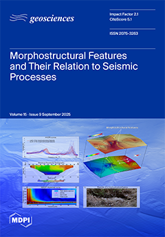
In southwestern Sicily, near the seismically active Belice Valley, this multidisciplinary study analyzed links between morphostructural features and seismic processes. Open fractures observed on the ground, later anthropogenically filled, reopened after a seismic swarm. Combining seismic event distribution, satellite imagery, HVSR (Horizontal to Vertical Spectral Ratio), MASW (Multichannel Analysis of Surface Waves), and ERT (Electrical Resistivity Tomography), correlations emerged between earthquakes, fracturing activity, and subsurface conditions. Grain-size and morphoscopic analyses revealed processes shaping elliptical depressions resembling liquefaction. All these features appear controlled by tectonics and influenced by quarry excavations, highlighting the interplay between seismicity, surface deformation and human impact. View this paper
- Issues are regarded as officially published after their release is announced to the table of contents alert mailing list.
- You may sign up for e-mail alerts to receive table of contents of newly released issues.
- PDF is the official format for papers published in both, html and pdf forms. To view the papers in pdf format, click on the "PDF Full-text" link, and use the free Adobe Reader to open them.
Previous Issue
Next Issue