Next Issue
Volume 17, November-1
Previous Issue
Volume 17, October-1
 
 
remotesensing-logo

Journal Browser

Journal Browser

Remote Sens., Volume 17, Issue 20 (October-2 2025) – 110 articles

Cover Story (view full-size image): 
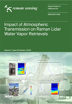
Accurate retrieval of atmospheric water vapour from Raman lidar measurements requires the evaluation of the differential atmospheric transmission term, which accounts for extinction differences between molecular reference (nitrogen and oxygen) and water vapour wavelengths. This study investigates its sensitivity for two optical configurations: vibrational–rotational Raman nitrogen (387 nm) and pure-rotational Raman molecular near 354 nm, both with the vibrational–rotational water vapour channel at 408 nm. The results indicate that neglecting this term may cause up to 18% systematic biases. An operational method based on aerosol optical depth and an exponential decay of aerosol concentration is proposed to estimate this term automatically, transforming systematic uncertainties into random ones and improving water vapour retrieval accuracy. View this paper
  • Issues are regarded as officially published after their release is announced to the table of contents alert mailing list.
  • You may sign up for e-mail alerts to receive table of contents of newly released issues.
  • PDF is the official format for papers published in both, html and pdf forms. To view the papers in pdf format, click on the "PDF Full-text" link, and use the free Adobe Reader to open them.
Order results
Result details
Section
Select all
Export citation of selected articles as:
18 pages, 5589 KB  
Technical Note
Dual-Task Supervised Network for SAR and Road Vector Image Matching
by Hanyu Cai, Yong Xian, Shaopeng Li and Decao Ma
Remote Sens. 2025, 17(20), 3504; https://doi.org/10.3390/rs17203504 - 21 Oct 2025
Viewed by 292
Abstract
We propose using Synthetic Aperture Radar (SAR) images as real-time images and road vector images as reference images for matching navigation, and propose a Siamese U-Net dual-task supervised network for solving the problem, called SUDS. Unlike existing methods of heterogenous image matching, which [...] Read more.
We propose using Synthetic Aperture Radar (SAR) images as real-time images and road vector images as reference images for matching navigation, and propose a Siamese U-Net dual-task supervised network for solving the problem, called SUDS. Unlike existing methods of heterogenous image matching, which extract common features and eliminate saliency differences for matching, we exploit the advantages of the vector images themselves to reduce the matching difficulty from the reference image selection. Firstly, we extract the common road features between SAR images and road vector images using a weight-sharing U-Net feature extraction network. Then, we propose to weight the sum of segmentation loss and matching loss as the network loss to optimize the feature extraction efficiency from both segmentation and matching perspectives. We prepare a specialized SAR-VEC dataset for experiments. Experiments show that the method is able to obtain high matching correctness, with 80.2% correctness within 5 pixels of matching error and 91.0% correctness within 10 pixels of matching error. Compared to existing methods, this method is able to identify the differences in similar roads and better eliminate the influence of imaging interference in SAR images on the matching results, obtaining more accurate matching results with better robustness. And we explore the effect of different weighting parameters β on the matching accuracy, and the best matching results are obtained when β=0.8. Full article
(This article belongs to the Special Issue Smart Monitoring of Urban Environment Using Remote Sensing)
Show Figures

Figure 1

21 pages, 962 KB  
Article
Evaluation of Atmospheric Preprocessing Methods and Chlorophyll Algorithms for Sentinel-2 Imagery in Coastal Waters
by Tori Wolters, Naomi E. Detenbeck, Steven Rego and Matthew Freeman
Remote Sens. 2025, 17(20), 3503; https://doi.org/10.3390/rs17203503 - 21 Oct 2025
Viewed by 372
Abstract
Cyanobacterial blooms have been increasingly detected in estuaries and freshwater tidal rivers. To enhance detailed monitoring, an efficient approach to detecting algal blooms through remote sensing is needed to focus more detailed monitoring focused on cyanobacteria. In this study, we compared different remote [...] Read more.
Cyanobacterial blooms have been increasingly detected in estuaries and freshwater tidal rivers. To enhance detailed monitoring, an efficient approach to detecting algal blooms through remote sensing is needed to focus more detailed monitoring focused on cyanobacteria. In this study, we compared different remote sensing processing methods to determine an efficient approach to mapping chlorophyll-a. Using a subset of paired chlorophyll-a observations with Sentinel-2 imagery (2015–2022), with sites located in the Chesapeake Bay and Indian River selected along gradients of salinity, turbidity, and trophic status, we compared the combined performance of two different atmospheric processing methods (Acolite, Polymer) and a suite of empirical (band ratio, spectral shape indices) and machine learning algorithms for chlorophyll-a prediction. Acolite outperformed Polymer, resulting in 176 observation points, compared to 106 observation points from Polymer, and a greater range in chlorophyll-a values (0–74 μg/L from Acolite compared to 0–36 μg/L from Polymer), although Polymer showed more responsiveness at lower chlorophyll-a levels. Two algorithms performed best in predicting chlorophyll-a, as well as trophic state and HABs risk classes: the machine learning mixture density network (MDN) approach and the one band-ratio approach (Mishra). Full article
Show Figures

Graphical abstract

26 pages, 32866 KB  
Article
Low-Altitude Multi-Object Tracking via Graph Neural Networks with Cross-Attention and Reliable Neighbor Guidance
by Hanxiang Qian, Xiaoyong Sun, Runze Guo, Shaojing Su, Bing Ding and Xiaojun Guo
Remote Sens. 2025, 17(20), 3502; https://doi.org/10.3390/rs17203502 - 21 Oct 2025
Viewed by 485
Abstract
In low-altitude multi-object tracking (MOT), challenges such as frequent inter-object occlusion and complex non-linear motion disrupt the appearance of individual targets and the continuity of their trajectories, leading to frequent tracking failures. We posit that the relatively stable spatio-temporal relationships within object groups [...] Read more.
In low-altitude multi-object tracking (MOT), challenges such as frequent inter-object occlusion and complex non-linear motion disrupt the appearance of individual targets and the continuity of their trajectories, leading to frequent tracking failures. We posit that the relatively stable spatio-temporal relationships within object groups (e.g., pedestrians and vehicles) offer powerful contextual cues to resolve such ambiguities. We present NOWA-MOT (Neighbors Know Who We Are), a novel tracking-by-detection framework designed to systematically exploit this principle through a multi-stage association process. We make three primary contributions. First, we introduce a Low-Confidence Occlusion Recovery (LOR) module that dynamically adjusts detection scores by integrating IoU, a novel Recovery IoU (RIoU) metric, and location similarity to surrounding objects, enabling occluded targets to participate in high-priority matching. Second, for initial data association, we propose a Graph Cross-Attention (GCA) mechanism. In this module, separate graphs are constructed for detections and trajectories, and a cross-attention architecture is employed to propagate rich contextual information between them, yielding highly discriminative feature representations for robust matching. Third, to resolve the remaining ambiguities, we design a cascaded Matched Neighbor Guidance (MNG) module, which uniquely leverages the reliably matched pairs from the first stage as contextual anchors. Through MNG, star-shaped topological features are built for unmatched objects relative to their stable neighbors, enabling accurate association even when intrinsic features are weak. Our comprehensive experimental evaluation on the VisDrone2019 and UAVDT datasets confirms the superiority of our approach, achieving state-of-the-art HOTA scores of 51.34% and 62.69%, respectively, and drastically reducing identity switches compared to previous methods. Full article
Show Figures

Figure 1

18 pages, 10300 KB  
Article
Assessment and Validation of FAPAR, a Satellite-Based Plant Health and Water Stress Indicator, over Uganda
by Ronald Ssembajwe, Amina Twah, Godfrey H. Kagezi, Tuula Löytty, Judith Kobusinge, Anthony Gidudu, Geoffrey Arinaitwe, Qingyun Du and Mihai Voda
Remote Sens. 2025, 17(20), 3501; https://doi.org/10.3390/rs17203501 - 21 Oct 2025
Viewed by 313
Abstract
This study aimed to assess, compare, and validate a satellite-based plant health and water stress indicator: Fraction of Absorbed Photosynthetically Active Radiation (FAPAR) over Uganda. We used a direct agricultural drought indicator—the Standardized Precipitation and Evapotranspiration Index at scale 3 (SPEI-03)—and a plant [...] Read more.
This study aimed to assess, compare, and validate a satellite-based plant health and water stress indicator: Fraction of Absorbed Photosynthetically Active Radiation (FAPAR) over Uganda. We used a direct agricultural drought indicator—the Standardized Precipitation and Evapotranspiration Index at scale 3 (SPEI-03)—and a plant water stress indicator—the crop water stress index (CWSI)—for the period of 1983–2013. Novel approaches such as spatial variability and trend analysis, along with correlation analysis, were used to achieve this. The results showed that there are six classes of highly variable photosynthetic activity over Uganda, dominated by class 4 (0.36–0.45). This dominant class encompassed 45% of the total land area, mainly spanning cropland. In addition, significant increases in monthly photosynthetic activity (FAPAR) and FAPAR-centered stress indicators (SFI < −1) were observed over 85% and 60% of total land area, respectively. The Standardized FAPAR Index (SFI) had a strong positive correlation with SPEI-03 over cropland, grassland, and forest lands, while SFI had a strong negative correlation with CWSI over 80% of the total area. These results highlight the state and variation in plant health and water stress, generate insights on ecosystem dynamics and functionality, and weigh in on the usability and reliability of satellite-based variables such as FAPAR in plant water monitoring over Uganda. We thus recommend satellite-based FAPAR as a robust proxy for vegetation health and water stress monitoring over Uganda, with potential application in crop yield prediction and irrigation management to inform effective agricultural planning and improve productivity. Full article
Show Figures

Graphical abstract

27 pages, 8712 KB  
Article
Assessing NDVI, Climate, and Management to Predict Winter Wheat Yields at Field Scale in Kansas, USA
by Rebecca Lima Albuquerque Maranhão, Marcellus Marques Caldas, Jude Kastens, Jordan Watson and Romulo Pisa Lollato
Remote Sens. 2025, 17(20), 3500; https://doi.org/10.3390/rs17203500 - 21 Oct 2025
Viewed by 665
Abstract
Accurate crop yield prediction is challenging in environmentally diverse areas. This study evaluated the potential of different satellite sensors to predict winter wheat grain yield at the field level in Kansas, the U.S.’s leading winter wheat producer. Using Landsat NDVI data from late [...] Read more.
Accurate crop yield prediction is challenging in environmentally diverse areas. This study evaluated the potential of different satellite sensors to predict winter wheat grain yield at the field level in Kansas, the U.S.’s leading winter wheat producer. Using Landsat NDVI data from late February to June, a linear regression model was able to reduce the standard deviation of predicted yields by over 20% (with a normalized root mean square error (nRMSE) of 80%). The NDVI during the anthesis and grain fill stages was essential for precise yield estimation. A subregional approach that incorporated weather and management data improved results, accounting for 51%, 63%, and 68% of the nRMSE in W, SC, and NC. Results indicate that NDVI-based yield models at the field scale are environmentally dependent, particularly in south-central and western Kansas, areas prone to heat stress and water deficit, respectively. Our findings showed the benefits of an environmental subregional model integrating remote sensing and field-specific weather and management data to improve yield prediction accuracy, particularly in large, environmentally diverse regions. Full article
Show Figures

Figure 1

18 pages, 24042 KB  
Article
Remote Sensing and AI Coupled Approach for Large-Scale Archaeological Mapping in the Andean Arid Highlands: Case Study in Altos Arica, Chile
by Maria Elena Castiello, Jürgen Landauer and Thibault Saintenoy
Remote Sens. 2025, 17(20), 3499; https://doi.org/10.3390/rs17203499 - 21 Oct 2025
Viewed by 506
Abstract
Artificial intelligence algorithms for automated archaeological site detection have been scarcely applied in the Andean highlands, regions that preserve a significant amount of surface archaeological architecture but have not yet been fully explored or mapped due to the difficult terrain. This paper presents [...] Read more.
Artificial intelligence algorithms for automated archaeological site detection have been scarcely applied in the Andean highlands, regions that preserve a significant amount of surface archaeological architecture but have not yet been fully explored or mapped due to the difficult terrain. This paper presents a case study of the application of convolutional neural networks (CNNs) to automatically identify archaeological architecture in the Azapa valley in the Arica y Parinacota region of Chile. Using a high-resolution and big regional-scale archaeological geodatabase created through a systematic and detailed photo-interpretation survey of satellite imagery and fieldwork, our study demonstrates the efficiency of CNN-based automated detection in identifying archaeological stone structures such as roundhouses and corrals in the Chilean highlands. After outlining the technical protocol for automated detection, we present the results and discuss the potential of our AI model for archaeological mapping in arid highland environments, from a regional to a more extended and global perspective. Full article
Show Figures

Figure 1

29 pages, 13306 KB  
Article
Building Outline Extraction via Topology-Aware Loop Parsing and Parallel Constraint from Airborne LiDAR
by Ke Liu, Hongchao Ma, Li Li, Shixin Huang, Liang Zhang, Xiaoli Liang and Zhan Cai
Remote Sens. 2025, 17(20), 3498; https://doi.org/10.3390/rs17203498 - 21 Oct 2025
Viewed by 321
Abstract
Building outlines are important vector data for various applications, but due to the uneven point density and complex building structures, extracting satisfactory building outlines from airborne light detection and ranging point cloud data poses significant challenges. Thus, a building outline extraction method based [...] Read more.
Building outlines are important vector data for various applications, but due to the uneven point density and complex building structures, extracting satisfactory building outlines from airborne light detection and ranging point cloud data poses significant challenges. Thus, a building outline extraction method based on topology-aware loop parsing and parallel constraint is proposed. First, constrained Delaunay triangulation (DT) is used to organize scattered projected building points, and initial boundary points and edges are extracted based on the constrained DT. Subsequently, accurate semantic boundary points are obtained by parsing the topology-aware loops searched from an undirected graph. Building dominant directions are estimated through angle normalization, merging, and perpendicular pairing. Finally, outlines are regularized using the parallel constraint-based method, which simultaneously considers the fitness between the dominant direction and boundary points, and the length of line segments. Experiments on five datasets, including three datasets provided by ISPRS and two datasets with high-density point clouds and complex building structures, verify that the proposed method can extract sequential and semantic boundary points, with over 97.88% correctness. Additionally, the regularized outlines are attractive, and most line segments are parallel or perpendicular. The RMSE, PoLiS, and RCC metrics are better than 0.94 m, 0.84 m, and 0.69 m, respectively. The extracted building outlines can be used for building three-dimensional (3D) reconstruction. Full article
Show Figures

Figure 1

23 pages, 11025 KB  
Article
HybriDet: A Hybrid Neural Network Combining CNN and Transformer for Wildfire Detection in Remote Sensing Imagery
by Fengming Dong and Ming Wang
Remote Sens. 2025, 17(20), 3497; https://doi.org/10.3390/rs17203497 - 21 Oct 2025
Viewed by 466
Abstract
Early warning systems on edge devices such as satellites and unmanned aerial vehicles (UAVs) are essential for effective forest fire prevention. Edge Intelligence (EI) enables deploying deep learning models on edge devices; however, traditional convolutional neural networks (CNNs)/Transformer-based models struggle to balance local-global [...] Read more.
Early warning systems on edge devices such as satellites and unmanned aerial vehicles (UAVs) are essential for effective forest fire prevention. Edge Intelligence (EI) enables deploying deep learning models on edge devices; however, traditional convolutional neural networks (CNNs)/Transformer-based models struggle to balance local-global context integration and computational efficiency in such constrained environments. To address these challenges, this paper proposes HybriDet, a novel hybrid-architecture neural network for wildfire detection. This architecture integrates the strengths of both CNNs and Transformers to effectively capture both local and global contextual information. Furthermore, we introduce efficient attention mechanisms—Windowed Attention and Coordinate-Spatial (CS) Attention—to simultaneously enhance channel-wise and spatial-wise features in high-resolution imagery, enabling long-range dependency modeling and discriminative feature extraction. Additionally, to optimize deployment efficiency, we also apply model pruning techniques to improve generalization performance and inference speed. Extensive experimental evaluations demonstrate that HybriDet achieves superior feature extraction capabilities while maintaining high computational efficiency. The optimized lightweight variant of HybriDet has a compact model size of merely 6.45 M parameters, facilitating seamless deployment on resource-constrained edge devices. Comparative evaluations on the FASDD-UAV, FASDD-RS, and VOC datasets demonstrate that HybriDet achieves superior performance over state-of-the-art models, particularly in processing highly heterogeneous remote sensing (RS) imagery. When benchmarked against YOLOv8, HybriDet demonstrates a 6.4% enhancement in mAP50 on the FASDD-RS dataset while maintaining comparable computational complexity. Meanwhile, on the VOC dataset and the FASDD-UAV dataset, our model improved by 3.6% and 0.2%, respectively, compared to the baseline model YOLOv8. These advancements highlight HybriDet’s theoretical significance as a novel hybrid EI framework for wildfire detection, with practical implications for disaster emergency response, socioeconomic security, and ecological conservation. Full article
(This article belongs to the Section Earth Observation for Emergency Management)
Show Figures

Graphical abstract

31 pages, 7411 KB  
Article
Quantifying Climate-Anthropogenic Forcing on Arid Basin Vegetation Dynamics Using Multi-Vegetation Indices and Geographical Detector
by Mengran Yu, Xinzhe Li, Xiufang Song, Xiang Li, Lan Wang and Qiuli Yang
Remote Sens. 2025, 17(20), 3496; https://doi.org/10.3390/rs17203496 - 21 Oct 2025
Viewed by 318
Abstract
Understanding the spatiotemporal dynamics of vegetation and their driving mechanisms is essential for ecological assessment and management. However, current assessments of the Heihe River Basin (HRB) vegetation dynamics remain uncertain due to reliance on single indices without cross-validation and oversimplified attribution of residual [...] Read more.
Understanding the spatiotemporal dynamics of vegetation and their driving mechanisms is essential for ecological assessment and management. However, current assessments of the Heihe River Basin (HRB) vegetation dynamics remain uncertain due to reliance on single indices without cross-validation and oversimplified attribution of residual variations. Here, we integrated four complementary vegetation indices (NDVI, EVI, kNDVI, and NIRv) with trend and abrupt change detection analyses to establish a framework for assessing vegetation changes in the HRB from 2004 to 2023. Given that the dominance of non-climatic factors is widely attributed to human water management and land use policies, land use change and other anthropogenic factors were incorporated together with topographic/edaphic factors into the optimal parameter-based geographical detector (OPGD), where vegetation changes induced by non-climatic factors were first isolated through residual trend analysis, thereby quantifying their explanatory power on vegetation index variations. The results demonstrate that vegetation in the HRB experienced a fluctuating upward trend (0.0013/yr) from 2004 to 2023, with significant improvement in 43% and degradation in 3% of the region. Climatic and non-climatic factors explained 26% and 74% of spatial variation, dominated by precipitation and land use change, respectively. Notably, the interaction of land use change and elevation accounted for 56% of NIRv variation, markedly exceeding single factors, as determined by the interaction detector in the OPGD. Additionally, large-scale ecological restoration projects and effective water resource management policies have played a pivotal role in facilitating vegetation recovery across the basin. This study enhances insight into vegetation dynamics and supports both sustainable restoration and development in the HRB. Full article
Show Figures

Figure 1

20 pages, 14459 KB  
Article
Extending AVHRR Climate Data Records into the VIIRS Era for Polar Climate Research
by Xuanji Wang, Jeffrey R. Key, Szuchia Moeller, Richard J. Dworak, Xi Shao and Kenneth R. Knapp
Remote Sens. 2025, 17(20), 3495; https://doi.org/10.3390/rs17203495 - 21 Oct 2025
Viewed by 238
Abstract
The Advanced Very High-Resolution Radiometer (AVHRR) onboard NOAA-7 through NOAA-19 satellites has been the primary data source for two Climate Data Records (CDRs) that were developed specifically for Arctic and Antarctic studies: the AVHRR Polar Pathfinder (APP) and Extended AVHRR Polar Pathfinder (APP-x). [...] Read more.
The Advanced Very High-Resolution Radiometer (AVHRR) onboard NOAA-7 through NOAA-19 satellites has been the primary data source for two Climate Data Records (CDRs) that were developed specifically for Arctic and Antarctic studies: the AVHRR Polar Pathfinder (APP) and Extended AVHRR Polar Pathfinder (APP-x). With the decommissioning of these satellites and the loss of the AVHRR, a method for extending the CDRs with the Visible Infrared Imaging Radiometer Suite (VIIRS) on NOAA’s recent satellites is presented. The goal is to produce long-term, continuous, consistent, and traceable CDRs for polar climate research. As a result, APP and APP-x can now be continued as the VIIRS Polar Pathfinder (VPP) and Extended VIIRS Polar Pathfinder (VPP-x) CDRs. To ensure consistency, a VIIRS Global Area Coverage (VGAC) dataset that is comparable to AVHRR GAC data was used to develop an analogous VIIRS Polar Pathfinder suite. Five VIIRS bands (I1, I2, M12, M15, and M16) were selected to correspond to AVHRR Channels 1, 2, 3b, 4, and 5, respectively. A multivariate regression approach was used to intercalibrate these VIIRS bands to AVHRR channels based on data from overlapping AVHRR and VIIRS observations from 2013 to 2018. The data from 2012 and 2019 were reserved for independent validation. For the Arctic region north of 60°N at 14:00/04:00 Local Solar Time (LST) during 2012–2019, mean biases between APP and VPP composites at a spatial resolution of 5 km are −0.85%/3.03% (Channel 1), −1.22%/3.65% (Channel 2), −0.18 K/0.81 K (Channel 3b), 0.01 K/0.24 K (Channel 4), and 0.07 K/0.19 K (Channel 5). Mean biases between APP-x and VPP-x at a spatial resolution of 25 km for the same region and period are −1.52%/−1.48% for surface broadband albedo, 0.69 K/0.61 K for surface skin temperature, and −0.011 m/−0.017 m for sea ice thickness. Similar results were observed for the Antarctic region south of 60°S at 14:00/02:00 LST, indicating strong agreement between APP and VPP, and between APP-x and VPP-x. Full article
Show Figures

Figure 1

24 pages, 42867 KB  
Article
Mining-Induced Subsidence Boundary Delineation Using Dual-Feature Clustering of InSAR-Derived Deformation Gradient
by Zhongwei Shen, Yunjia Wang, Teng Wang, Feng Zhao, Sen Du, Liyong Li, Xianlong Xu, Jinglong Liu, Wenqi Huo and Guangqian Zou
Remote Sens. 2025, 17(20), 3494; https://doi.org/10.3390/rs17203494 - 21 Oct 2025
Viewed by 279
Abstract
Mining-induced subsidence boundaries, i.e., the surface areas affected by underground mining, play an important role in surface damage assessment and illegal mining identification. Traditional boundary delineation methods rely on field surveys, which restrict their applicability in regions with limited ground observations. Interferometric Synthetic [...] Read more.
Mining-induced subsidence boundaries, i.e., the surface areas affected by underground mining, play an important role in surface damage assessment and illegal mining identification. Traditional boundary delineation methods rely on field surveys, which restrict their applicability in regions with limited ground observations. Interferometric Synthetic Aperture Radar (InSAR) technology provides a cost-effective and non-contact solution for delineating subsidence boundaries. However, existing InSAR-based methods for subsidence boundary delineation are susceptible to observation noise and other deformation sources, which reduce the accuracy of boundary identification. To this end, this study proposes a novel method for delineating mining-induced subsidence boundaries by integrating both the magnitude and direction of InSAR-derived deformation gradients, referred to as DMSB-DG. First, time-series line-of-sight (LOS) deformation is obtained based on InSAR technology over mining areas. Then, the Roberts operator is employed to compute the magnitude and direction of the deformation gradients, which serve as the basis for boundary delineation. Finally, the ISODATA clustering algorithm is used, incorporating both the magnitude and direction of the deformation gradients as dual constraints to achieve accurate delineation of mining-affected boundaries. The combination of the two features effectively enhances the completeness and accuracy of boundary delineation. The performance of the proposed DMSB-DG method has been verified by simulation and field data. Specifically, compared with the adaptive mining subsidence boundary delimitation (ASBD) method, the proposed method achieved Kappa coefficients of 91.96% and 87.28%, representing improvements of 21.23% and 27.14% in two field tests, respectively. Furthermore, the influence of ascending and descending SAR images, as well as observational noise, on the performance of the proposed algorithm is also evaluated. The results demonstrate that the proposed method effectively suppresses InSAR noise and other interfering deformations, enabling high-precision delineation of mining impact boundaries. Full article
(This article belongs to the Special Issue Application of Advanced Remote Sensing Techniques in Mining Areas)
Show Figures

Figure 1

25 pages, 5190 KB  
Article
An Automated System for Underground Pipeline Parameter Estimation from GPR Recordings
by Daniel Štifanić, Jelena Štifanić, Nikola Anđelić and Zlatan Car
Remote Sens. 2025, 17(20), 3493; https://doi.org/10.3390/rs17203493 - 21 Oct 2025
Viewed by 305
Abstract
Underground pipelines form a critical part of urban infrastructure, yet their complex configurations and fragmented documentation hinder efficient maintenance and risk management. Ground-penetrating radar provides a non-invasive method for subsurface inspection; however, traditional interpretation of B-scan data relies heavily on manual analysis, which [...] Read more.
Underground pipelines form a critical part of urban infrastructure, yet their complex configurations and fragmented documentation hinder efficient maintenance and risk management. Ground-penetrating radar provides a non-invasive method for subsurface inspection; however, traditional interpretation of B-scan data relies heavily on manual analysis, which is time-consuming and prone to error. This research proposes a two-step automated system for the detection and quantitative characterization of underground pipelines from GPR B-scans. In the first step, hyperbolic reflections are automatically detected and localized using state-of-the-art object detection algorithms, where YOLOv11x achieved superior stability compared to RT-DETR-X. In the second step, detected hyperbolic reflections are processed in order to estimate key parameters, including two-way travel time, burial depth, pipeline diameter, and the angle between GPR survey line and pipeline. Experimental results from 5-fold cross-validation demonstrate that TWTT and burial depth can be estimated with high performance, while pipeline diameter and angle exhibit moderate performance, reflecting their higher complexity and sensitivity to noise. According to the experimental results, EfficientNetV2L consistently produced the best overall performance. The proposed automated system reduces reliance on manual inspection, improves efficiency, and establishes a foundation for real-time, autonomous GPR-based underground infrastructure assessment. Full article
Show Figures

Figure 1

19 pages, 3709 KB  
Article
Evaluating the Influence of Aerosol Optical Depth on Satellite-Derived Nighttime Light Radiance in Asian Megacities
by Hyeryeong Park, Jaemin Kim and Yun Gon Lee
Remote Sens. 2025, 17(20), 3492; https://doi.org/10.3390/rs17203492 - 21 Oct 2025
Viewed by 258
Abstract
The Visible Infrared Imaging Radiometer Suite (VIIRS) Day/Night Band (DNB) provides invaluable nighttime light (NTL) radiance data, widely employed for diverse applications including urban and socioeconomic studies. However, the inherent reliability of NTL data as a proxy for socioeconomic activities is significantly compromised [...] Read more.
The Visible Infrared Imaging Radiometer Suite (VIIRS) Day/Night Band (DNB) provides invaluable nighttime light (NTL) radiance data, widely employed for diverse applications including urban and socioeconomic studies. However, the inherent reliability of NTL data as a proxy for socioeconomic activities is significantly compromised by atmospheric conditions, particularly aerosols. This study analyzed the long-term spatiotemporal variations in NTL radiance with respect to atmospheric aerosol optical depth (AOD) in nine major Asian cities from January 2012 to May 2021. Our findings reveal a complex and heterogeneous interplay between NTL radiance and AOD, fundamentally influenced by a region’s unique atmospheric characteristics and developmental stages. While major East Asian cities (e.g., Beijing, Tokyo, Seoul) exhibited a statistically significant inverse correlation, indicating aerosol-induced NTL suppression, other regions showed different patterns. For instance, the rapidly urbanizing city of Dhaka displayed a statistically significant positive correlation, suggesting a concurrent increase in NTL and AOD due to intensified urban activities. This highlights that the NTL-AOD relationship is not solely a physical phenomenon but is also shaped by independent socioeconomic processes. These results underscore the critical importance of comprehensively understanding these regional discrepancies for the reliable interpretation and effective reconstruction of NTL radiance data. By providing nuanced insights into how atmospheric aerosols influence NTL measurements in diverse urban settings, this research aims to enhance the utility and robustness of satellite-derived NTL data for effective socioeconomic analyses. Full article
Show Figures

Figure 1

22 pages, 5538 KB  
Article
Evaluating Macroalgal Hyperspectral Reflectance Separability in Support of Kelp Mapping
by Gillian S. L. Rowan, Joanna N. Smart, Chris Roelfsema and Stuart R. Phinn
Remote Sens. 2025, 17(20), 3491; https://doi.org/10.3390/rs17203491 - 21 Oct 2025
Viewed by 404
Abstract
Satellite-based Earth Observation (EO) has been proposed as an efficient, replicable, and scale-able method for monitoring kelp forests. Although kelps (Laminariales) have been mapped with multispectral EO, no evaluation of kelps’ separability across genera, and from other macroalgae, has been conducted [...] Read more.
Satellite-based Earth Observation (EO) has been proposed as an efficient, replicable, and scale-able method for monitoring kelp forests. Although kelps (Laminariales) have been mapped with multispectral EO, no evaluation of kelps’ separability across genera, and from other macroalgae, has been conducted with image-applicable methods. Since kelps and other macroalgae commonly cooccur, characterising their spectral separability is vital to defining appropriate use-cases, methods, and limitations of mapping them with EO. This work investigates the spectral reflectance separability of three kelps and twelve other macroalgae from three distinct regions of Australia and New Zealand. Separability was evaluated using hierarchical clustering, spectral angle, random forest classification, and linear discrimination classification algorithms. Random forest was most effective (average F1 score = 0.70) at classifying all macroalgae by genus, while the linear discriminant analysis was most effective at differentiating among kelp genera labelled by sampling region (average F1 score = 0.93). The observed intra-class geographic variability indicates that macroalgal spectral reflectance is regionally specific, thereby limiting reference spectrum transferability and large-spatial-extent classification accuracy. Of the four classification methods evaluated, the random forest was best suited to mapping large spatial extents (e.g., >100 s km2). Using aggregated target classes is recommended if relying solely on spectral reflectance information. This work suggests hyperspectral EO could be a useful tool in monitoring ecologically and economically valuable kelp forests with moderate to high confidence. Full article
Show Figures

Figure 1

25 pages, 8062 KB  
Article
Time-Series Surface Velocity and Backscattering Coefficients from Sentinel-1 SAR Images Document Glacier Seasonal Dynamics and Surges on the Puruogangri Ice Field in the Central Tibetan Plateau
by Qingxin Wen and Teng Wang
Remote Sens. 2025, 17(20), 3490; https://doi.org/10.3390/rs17203490 - 20 Oct 2025
Viewed by 302
Abstract
The Puruogangri Ice Field (PIF) in the central Tibetan Plateau, known as the world’s Third Pole, is the largest modern ice field in the Tibetan Plateau and a crucial indicator of climate change. Although it was thought to be quiet, recent studies identified [...] Read more.
The Puruogangri Ice Field (PIF) in the central Tibetan Plateau, known as the world’s Third Pole, is the largest modern ice field in the Tibetan Plateau and a crucial indicator of climate change. Although it was thought to be quiet, recent studies identified possible surging behaviors. But comprehensive velocity fields remain largely unknown. Here we present the first comprehensive and high spatiotemporal resolution 3D displacement field of the PIF from 2017 to 2024 using synthetic aperture radar (SAR) imaging geodesy. Using time-series InSAR and time-series pixel offset tracking and integrating ascending and descending Sentinel-1 SAR images, we invert the time-series 3D displacement over eight years. Our results reveal significant seasonal variations and three surging glaciers, with peak displacements exceeding 110 m in 12 days. Combined with ERA5 reanalysis and SAR backscatter coefficients analysis, we demonstrate that these surges are hydrologically controlled, likely initiated by damaged subglacial drainage systems. This study enhances our understanding of glacier dynamics in the central Tibetan Plateau and highlights the potential of using SAR imaging geodesy to monitor glacial hazards in High Mountain Asia. Full article
(This article belongs to the Section Environmental Remote Sensing)
Show Figures

Figure 1

24 pages, 1777 KB  
Systematic Review
Monitoring Biodiversity and Ecosystem Services Using L-Band Synthetic Aperture Radar Satellite Data
by Brian Alan Johnson, Chisa Umemiya, Koji Miwa, Takeo Tadono, Ko Hamamoto, Yasuo Takahashi, Mariko Harada and Osamu Ochiai
Remote Sens. 2025, 17(20), 3489; https://doi.org/10.3390/rs17203489 - 20 Oct 2025
Viewed by 329
Abstract
Over the last decade, L-band synthetic aperture radar (SAR) satellite data has become more widely available globally, providing new opportunities for biodiversity and ecosystem services (BES) monitoring. To better understand these opportunities, we conducted a systematic scoping review of articles that utilized L-band [...] Read more.
Over the last decade, L-band synthetic aperture radar (SAR) satellite data has become more widely available globally, providing new opportunities for biodiversity and ecosystem services (BES) monitoring. To better understand these opportunities, we conducted a systematic scoping review of articles that utilized L-band synthetic aperture radar (SAR) satellite data for BES monitoring. We found that the data have mainly been analyzed using image classification and regression methods, with classification methods attempting to understand how the extent, spatial distribution, and/or changes in different types of land use/land cover affect BES, and regression methods attempting to generate spatially explicit maps of important BES-related indicators like species richness or vegetation above-ground biomass. Random forest classification and regression algorithms, in particular, were used frequently and found to be promising in many recent studies. Deep learning algorithms, while also promising, have seen relatively little usage thus far. PALSAR-1/-2 annual mosaic data was by far the most frequently used dataset. Although free, this data is limited by its low temporal resolution. To help overcome this and other limitations of the existing L-band SAR datasets, 64% of studies combined them with other types of remote sensing data (most commonly, optical multispectral data). Study sites were mainly subnational in scale and located in countries with high species richness. Future research opportunities include investigating the benefits of new free, high temporal resolution L-band SAR datasets (e.g., PALSAR-2 ScanSAR data) and the potential of combining L-band SAR with new sources of SAR data (e.g., P-band SAR data from the “Biomass” satellite) and further exploring the potential of deep learning techniques. Full article
(This article belongs to the Special Issue Global Biospheric Monitoring with Remote Sensing (2nd Edition))
Show Figures

Figure 1

24 pages, 4921 KB  
Article
YOLOv11-DCFNet: A Robust Dual-Modal Fusion Method for Infrared and Visible Road Crack Detection in Weak- or No-Light Illumination Environments
by Xinbao Chen, Yaohui Zhang, Junqi Lei, Lelin Li, Lifang Liu and Dongshui Zhang
Remote Sens. 2025, 17(20), 3488; https://doi.org/10.3390/rs17203488 - 20 Oct 2025
Viewed by 343
Abstract
Road cracks represent a significant challenge that impacts the long-term performance and safety of transportation infrastructure. Early identification of these cracks is crucial for effective road maintenance management. However, traditional crack recognition methods that rely on visible light images often experience substantial performance [...] Read more.
Road cracks represent a significant challenge that impacts the long-term performance and safety of transportation infrastructure. Early identification of these cracks is crucial for effective road maintenance management. However, traditional crack recognition methods that rely on visible light images often experience substantial performance degradation in weak-light environments, such as at night or within tunnels. This degradation is characterized by blurred or deficient image textures, indistinct target edges, and reduced detection accuracy, which hinders the ability to achieve reliable all-weather target detection. To address these challenges, this study introduces a dual-modal crack detection method named YOLOv11-DCFNet. This method is based on an enhanced YOLOv11 architecture and incorporates a Cross-Modality Fusion Transformer (CFT) module. It establishes a dual-branch feature extraction structure that utilizes both infrared and visible light within the original YOLOv11 framework, effectively leveraging the high contrast capabilities of thermal infrared images to detect cracks under weak- or no-light conditions. The experimental results demonstrate that the proposed YOLOv11-DCFNet method significantly outperforms the single-modal model (YOLOv11-RGB) in both weak-light and no-light scenarios. Under weak-light conditions, the fusion model effectively utilizes the weak texture features of RGB images alongside the thermal radiation information from infrared (IR) images. This leads to an improvement in Precision from 83.8% to 95.3%, Recall from 81.5% to 90.5%, mAP@0.5 from 84.9% to 92.9%, and mAP@0.5:0.95 from 41.7% to 56.3%, thereby enhancing both detection accuracy and quality. In no-light conditions, the RGB single modality performs poorly due to the absence of visible light information, with an mAP@0.5 of only 67.5%. However, by incorporating IR thermal radiation features, the fusion model enhances Precision, Recall, and mAP@0.5 to 95.3%, 90.5%, and 92.9%, respectively, maintaining high detection accuracy and stability even in extreme no-light environments. The results of this study indicate that YOLOv11-DCFNet exhibits strong robustness and generalization ability across various low illumination conditions, providing effective technical support for night-time road maintenance and crack monitoring systems. Full article
Show Figures

Graphical abstract

29 pages, 48102 KB  
Article
Infrared Temporal Differential Perception for Space-Based Aerial Targets
by Lan Guo, Xin Chen, Cong Gao, Zhiqi Zhao and Peng Rao
Remote Sens. 2025, 17(20), 3487; https://doi.org/10.3390/rs17203487 - 20 Oct 2025
Viewed by 335
Abstract
Space-based infrared (IR) detection, with wide coverage, all-time operation, and stealth, is crucial for aerial target surveillance. Under low signal-to-noise ratio (SNR) conditions, however, its small target size, limited features, and strong clutters often lead to missed detections and false alarms, reducing stability [...] Read more.
Space-based infrared (IR) detection, with wide coverage, all-time operation, and stealth, is crucial for aerial target surveillance. Under low signal-to-noise ratio (SNR) conditions, however, its small target size, limited features, and strong clutters often lead to missed detections and false alarms, reducing stability and real-time performance. To overcome these issues of energy-integration imaging in perceiving dim targets, this paper proposes a biomimetic vision-inspired Infrared Temporal Differential Detection (ITDD) method. The ITDD method generates sparse event streams by triggering pixel-level radiation variations and establishes an irradiance-based sensitivity model with optimized threshold voltage, spectral bands, and optical aperture parameters. IR sequences are converted into differential event streams with inherent noise, upon which a lightweight multi-modal fusion detection network is developed. Simulation experiments demonstrate that ITDD reduces data volume by three orders of magnitude and improves the SNR by 4.21 times. On the SITP-QLEF dataset, the network achieves a detection rate of 99.31%, and a false alarm rate of 1.97×10⁵, confirming its effectiveness and application potential under complex backgrounds. As the current findings are based on simulated data, future work will focus on building an ITDD demonstration system to validate the approach with real-world IR measurements. Full article
(This article belongs to the Special Issue Deep Learning-Based Small-Target Detection in Remote Sensing)
Show Figures

Figure 1

19 pages, 4553 KB  
Article
Pointing Calibration for Spaceborne Doppler Scatterometers
by Ernesto Rodríguez, Hector Torres, Alexander G. Wineteer, Antoine Blondel and Clément Ubelmann
Remote Sens. 2025, 17(20), 3486; https://doi.org/10.3390/rs17203486 - 20 Oct 2025
Viewed by 255
Abstract
Doppler scatterometers have demonstrated the ability to measure wide-swath ocean surface currents from airborne platforms. Since platform velocities for spaceborne platforms are almost two orders of magnitude larger, errors in the knowledge of the pointing of the radar antenna result in ocean current [...] Read more.
Doppler scatterometers have demonstrated the ability to measure wide-swath ocean surface currents from airborne platforms. Since platform velocities for spaceborne platforms are almost two orders of magnitude larger, errors in the knowledge of the pointing of the radar antenna result in ocean current errors that are also two orders of magnitude larger, and this presents a major challenge to achieving useful measurements of ocean currents. Here, we present a new calibration method to estimate pointing biases that removes the dominant pointing errors, allowing for the retrieval of global ocean currents with modest requirements for system stability. The method uses the fact that pointing errors have a velocity signature that depends on cross-track distance (or azimuth angle) alone, while ocean currents do not, if averaged sufficiently along-track. This lack of correlation between error and true currents allows the use of along-track averages of residual radial velocity, after possibly subtracting prior estimates of the currents, for the inversion of the slowly varying pointing errors. The calibration method can be implemented in ground processing and does not impact the processing of onboard data. We illustrate the performance of the calibration on the performance of the proposed NASA/CNES ODYSEA Doppler scatterometer and assess its ability to meet the mission science goals. Full article
Show Figures

Figure 1

20 pages, 2682 KB  
Article
Inversion of Land Surface Temperature and Prediction of Geothermal Anomalies in the Gonghe Basin, Qinghai Province, Based on the Normalized Shade Vegetation Index
by Zongren Li, Rongfang Xin, Xing Zhang, Shengsheng Zhang, Delin Li, Xiaomin Li, Xin Zheng and Yuanyuan Fu
Remote Sens. 2025, 17(20), 3485; https://doi.org/10.3390/rs17203485 - 20 Oct 2025
Viewed by 246
Abstract
Against the backdrop of global energy transition, geothermal energy has emerged as a critical renewable resource, yet its exploration remains challenging due to uneven subsurface distribution and complex surface conditions. This study pioneers a novel framework integrating the Normalized Shaded Vegetation Index (NSVI) [...] Read more.
Against the backdrop of global energy transition, geothermal energy has emerged as a critical renewable resource, yet its exploration remains challenging due to uneven subsurface distribution and complex surface conditions. This study pioneers a novel framework integrating the Normalized Shaded Vegetation Index (NSVI) with radiative transfer-based land surface temperature inversion to detect geothermal anomalies in the Gonghe Basin, Qinghai Province. Using multi-source remote sensing data (GF5 B AHSI, ZY1–02D/E AHSI, and Landsat 9 TIRS), we first constructed NSVI, achieving 97.74% classification accuracy for shadowed vegetation/water bodies (Kappa = 0.9656). This effectively resolved spectral mixing issues in oblique terrain, enhancing emissivity calculations for land surface temperature retrieval. The radiative transfer equation method combined with NSVI-derived parameters yielded high-precision land surface temperature estimates (RMSE = 2.91 °C; R2 = 0.963 against Landsat 9 products), revealing distinct thermal stratification: bright vegetation (41.31 °C) > shadowed vegetation (38.43 °C) > water (33.56 °C). Geothermal anomalies were identified by integrating temperature thresholds (>45.80 °C), 7 km fault buffers, and concealed Triassic granite constraints, pinpointing high-potential zones covering 0.12% of the basin. These zones are concentrated in central Gonghe, northern Guinan, and central-northern Guide counties. The framework provides a replicable solution for geothermal prospecting in topographically complex regions, with implications for optimizing exploration across the Gonghe Basin. Full article
(This article belongs to the Special Issue Remote Sensing for Land Surface Temperature and Related Applications)
Show Figures

Figure 1

25 pages, 10406 KB  
Article
Evaluating the Effectiveness of High-Frequency Ground-Penetrating Radar in Identifying Active Layer Thickness in the Da Xing’anling Mountains
by Lei Yang, Yunhu Shang, Changlei Dai, Yang Liu, Guoyu Li, Kai Gao, Yi Wu and Yiru Wei
Remote Sens. 2025, 17(20), 3484; https://doi.org/10.3390/rs17203484 - 20 Oct 2025
Viewed by 467
Abstract
Ground-penetrating radar (GPR), due to its efficiency and non-invasive nature, has become an important tool for detecting the permafrost table, overcoming the limited spatial coverage and high costs associated with drilling and in situ temperature monitoring. Compared with the commonly used 50–100 MHz [...] Read more.
Ground-penetrating radar (GPR), due to its efficiency and non-invasive nature, has become an important tool for detecting the permafrost table, overcoming the limited spatial coverage and high costs associated with drilling and in situ temperature monitoring. Compared with the commonly used 50–100 MHz antennas, the potential of high-frequency antennas to improve detection accuracy and interface resolution has not been fully explored. To address this gap, this study introduces a multi-strategy interface identification method incorporating envelope analysis. Field experiments were conducted in the island-like permafrost zone of the Da Xing’anling Mountains, Heilongjiang Province, using shielded GPR systems operating at 250 MHz and 500 MHz to detect the permafrost table. Potential interfaces were extracted using centroid and edge-detection algorithms and validated against ground temperature observations. The results indicate that: (1) integrating GPR with multi-source data enables accurate estimation of active layer thickness, and the envelope-based multi-strategy approach is effective for interface identification; (2) the 250 MHz antenna is better suited for capturing broader subsurface structures, while the 500 MHz antenna provides higher resolution for shallow layers—combining the two enhances overall interpretive quality; and (3) snow cover significantly affects electromagnetic wave propagation, reducing the accuracy of radar detection. This study provides valuable guidance for engineering investigations, site selection, and foundation design in permafrost regions, contributing to improved precision and efficiency in GPR-based detection of the permafrost table. Full article
(This article belongs to the Special Issue Remote Sensing of Water Dynamics in Permafrost Regions)
Show Figures

Figure 1

31 pages, 17070 KB  
Article
WRF Simulations of Passive Tracer Transport from Biomass Burning in South America: Sensitivity to PBL Schemes
by Douglas Lima de Bem, Vagner Anabor, Damaris Kirsch Pinheiro, Luiz Angelo Steffenel, Hassan Bencherif, Gabriela Dornelles Bittencourt, Eduardo Landulfo and Umberto Rizza
Remote Sens. 2025, 17(20), 3483; https://doi.org/10.3390/rs17203483 - 19 Oct 2025
Viewed by 441
Abstract
This single high-impact case study investigates the impact of planetary boundary layer (PBL) representation on long-range transport of Amazon fire smoke that reached the Metropolitan Area of São Paulo (MASP) from 15 to 20 August 2019, using the WRF model to compare three [...] Read more.
This single high-impact case study investigates the impact of planetary boundary layer (PBL) representation on long-range transport of Amazon fire smoke that reached the Metropolitan Area of São Paulo (MASP) from 15 to 20 August 2019, using the WRF model to compare three PBL schemes (MYNN 2.5, YSU, and BouLac) and three source-tagged tracers. The simulations are evaluated against MODIS-derived aerosol optical depth (AOD), the Light Detection and Ranging (LiDAR) time–height curtain over MASP, and HYSPLIT forward trajectories. Transport is diagnosed along the source-to-MASP pathway using six-hourly cross-sections and two integrative metrics: the projected mean wind in the 700–600 hPa layer and the vertical moment of tracer mass above the boundary layer. Outflow and downwind impact are strongest when a persistent reservoir between 2 and 4 km coexists with projected winds for several hours. In this episode, MYNN maintains an elevated 2–5 km transport layer and matches the observed arrival time and altitude, YSU yields a denser but delayed column, and BouLac produces discontinuous pulses with reduced coherence over the city. A negatively tilted trough, jet coupling, and a nearly stationary front establish a northwest-to-southeast corridor consistent across model fields, trajectories, and satellite signal. Seasonal robustness should be assessed with multi-event, multi-model analyses. Full article
Show Figures

Figure 1

24 pages, 13226 KB  
Article
The Response of Alpine Permafrost to Decadal Human Disturbance in the Context of Climate Warming
by Shuping Zhang, Ji Chen, Lijun Huo, Xinyang Li, Chengying Wu, Hucai Zhang and Qi Feng
Remote Sens. 2025, 17(20), 3482; https://doi.org/10.3390/rs17203482 - 19 Oct 2025
Viewed by 240
Abstract
Alpine permafrost plays a vital role in regional hydrology and ecology. Alpine permafrost is highly sensitive to climate change and human disturbance. The Muri area, which is located in the headwaters of the Datong River, northeast of the Tibetan Plateau, has undergone decadal [...] Read more.
Alpine permafrost plays a vital role in regional hydrology and ecology. Alpine permafrost is highly sensitive to climate change and human disturbance. The Muri area, which is located in the headwaters of the Datong River, northeast of the Tibetan Plateau, has undergone decadal mining, and the permafrost stability there has attracted substantial concerns. In order to decipher how and to what extent the permafrost in the Muri area has responded to the decadal mining in the context of climate change, daily MODIS land surface temperatures (LSTs) acquired during 2000–2024 were downscaled to 30 m × 30 m. The active layer thickness (ALT)–ground thaw index (DDT) coefficient was derived from in situ ALT measurements. An annual ALT of 30 m × 30 m spatial resolution was subsequently estimated from the downscaled LST for the Muri area using the Stefan equation. Validation of the LST and ALT showed that the root of mean squared error (RMSE) and the mean absolute error (MAE) of the downscaled LST were 3.64 °C and −0.1 °C, respectively. The RMSE and MAE of the ALT estimated in this study were 0.5 m and −0.25 m, respectively. Spatiotemporal analysis of the downscaled LST and ALT found that (1) during 2000–2024, the downscaled LST and estimated ALT delineated the spatial extent and time of human disturbance to permafrost in the Muri area; (2) human disturbance (i.e., mining and replantation) caused ALT increase without significant spatial expansion; and (3) the semi-arid climate, rough terrain, thin root zone and gappy vertical structure beneath were the major controlling factors of ALT variations. ALT, estimated in this study with a high resolution and accuracy, filled the data gaps of this kind for the Muri area. The ALT variations depicted in this study provide references for understanding alpine permafrost evolution in other areas that have been subject to human disturbance and climate change. Full article
Show Figures

Figure 1

27 pages, 9555 KB  
Article
Quantifying the Spatiotemporal Dynamics and Driving Factors of Lake Turbidity in Northeast China from 1985 to 2023
by Yue Ma, Qiang Zheng, Kaishan Song, Chong Fang, Sijia Li, Qiuyue Chen and Yongchao Ma
Remote Sens. 2025, 17(20), 3481; https://doi.org/10.3390/rs17203481 - 18 Oct 2025
Viewed by 302
Abstract
Turbidity is a crucial indicator for evaluating water quality. This study obtained the long-term spatial distribution of water turbidity across Northeast China from 1985 to 2023. A combination of the geographically and temporally weighted regression (GTWR) model, the Lindeman, Merenda, and Gold (LMG) [...] Read more.
Turbidity is a crucial indicator for evaluating water quality. This study obtained the long-term spatial distribution of water turbidity across Northeast China from 1985 to 2023. A combination of the geographically and temporally weighted regression (GTWR) model, the Lindeman, Merenda, and Gold (LMG) method, and statistical data analysis methods were employed to quantify the spatiotemporal impacts of driving factors on turbidity changes. The stepwise regression model was able to credibly estimate turbidity, achieving a low RMSE of 18.432 Nephelometric Turbidity Units (NTU). Temporal variations in turbidity showed that 69.90% of lakes exhibited a decreasing trend. Spatial variations revealed that lakes with significantly increased turbidity were predominantly concentrated in the Songnen and Sanjiang Plains, whereas lakes with lower turbidity were situated in the Eastern Mountains regions and Liaohe Plain. Temporal changes were closely associated with socioeconomic development and anthropogenic interventions implemented by governments on the aquatic environment. Vegetation coverage, precipitation, and elevation demonstrated significant contributions (exceeding 16.39%) to turbidity variations in the Lesser Khingan and Eastern Mountains regions, where natural factors played a more dominant role. In contrast, cropland area, wind speed, and impervious surface area showed higher contribution rates of above 14.00% in the Songnen, Sanjiang, and Liaohe Plains, where anthropogenic factors were dominant. These findings provide valuable insights for informed decision-making in water environmental management in Northeast China and facilitate the aquatic ecosystem sustainability under human activities and climate change. Full article
Show Figures

Figure 1

27 pages, 14312 KB  
Article
Identification of Non-Photosynthetic Vegetation Fractional Cover via Spectral Data Constrained Unmixing Algorithm Optimization
by Xueting Han, Chengyi Zhao, Menghao Ji and Jianting Zhu
Remote Sens. 2025, 17(20), 3480; https://doi.org/10.3390/rs17203480 - 18 Oct 2025
Viewed by 325
Abstract
Non-photosynthetic vegetation fractional cover (fNPV) is a key indicator of vegetation decline and ecological health. Traditional inversion models assume identical spectral signatures for the same vegetation cover class across entire study areas. Spectral variations occur among regions due to divergent [...] Read more.
Non-photosynthetic vegetation fractional cover (fNPV) is a key indicator of vegetation decline and ecological health. Traditional inversion models assume identical spectral signatures for the same vegetation cover class across entire study areas. Spectral variations occur among regions due to divergent soil properties and vegetation types. To address this limitation, extensive ground sampling was conducted; ground observation data from multiple regions were utilized to establish localized spectral libraries, thereby enhancing spectral variability representation within the study area while concurrently optimizing vegetation indices across different sensor systems. The results reveal that, within the optimized spectral mixture analysis model, the coefficient of determination (R2) for fNPV using the NPV soil separation index (NSSI) for Sentinel sensor is 0.6258, and that of fPV using the modified soil adjusted vegetation index (MSAVI) is 0.8055. The MSAVI-NSSI achieved an R2 of 0.7825 for fNPV and 0.8725 for photosynthetic vegetation fractional cover (fPV). Optimized vegetation indices also yielded favorable validation results. Landsat’s theoretical predictions improved by 0.1725, with validated results up by 0.1635. MODIS showed improvements of 0.1365 and 0.1923, respectively. This enhancement significantly improves the accuracy of NPV fractional cover identification, providing critical insights for vegetation ecological health assessment in arid and semi-arid regions under global warming. Furthermore, by optimizing the spectral constraint weights in remote sensing images, a solution is provided for the long-term monitoring of vegetation health status. Full article
Show Figures

Graphical abstract

29 pages, 21103 KB  
Article
Dehazing of Panchromatic Remote Sensing Images Based on Histogram Features
by Hao Wang, Yalin Ding, Xiaoqin Zhou, Guoqin Yuan and Chao Sun
Remote Sens. 2025, 17(20), 3479; https://doi.org/10.3390/rs17203479 - 18 Oct 2025
Viewed by 251
Abstract
During long-range imaging, the turbid medium in the atmosphere absorbs and scatters light, resulting in reduced contrast, a narrowed dynamic range, and obscure detail information in remote sensing images. The prior-based method has the advantages of good real-time performance and a wide application [...] Read more.
During long-range imaging, the turbid medium in the atmosphere absorbs and scatters light, resulting in reduced contrast, a narrowed dynamic range, and obscure detail information in remote sensing images. The prior-based method has the advantages of good real-time performance and a wide application range. However, few of the existing prior-based methods are applicable to the dehazing of panchromatic images. In this paper, we innovatively propose a prior-based dehazing method for panchromatic remote sensing images through statistical histogram features. First, the hazy image is divided into plain image patches and mixed image patches according to the histogram features. Then, the features of the average occurrence differences between adjacent gray levels (AODAGs) of plain image patches and the features of the average distance to the gray-level gravity center (ADGG) of mixed image patches are, respectively, calculated. Then, the transmission map is obtained according to the statistical relation equation. Then, the atmospheric light of each image patch is calculated separately based on the maximum gray level of the image patch using the threshold segmentation method. Finally, the dehazed image is obtained based on the physical model. Extensive experiments in synthetic and real-world panchromatic hazy remote sensing images show that the proposed algorithm outperforms state-of-the-art dehazing methods in both efficiency and dehazing effect. Full article
Show Figures

Figure 1

30 pages, 21308 KB  
Article
Angle-Controllable SAR Image Generation and Target Recognition via StyleGAN2
by Ran Yang, Bo Wang, Tao Lai and Haifeng Huang
Remote Sens. 2025, 17(20), 3478; https://doi.org/10.3390/rs17203478 - 18 Oct 2025
Viewed by 337
Abstract
Due to the inherent characteristics of synthetic aperture radar (SAR) imaging, variations in target orientation, and the challenges posed by non-cooperative targets (i.e., targets without cooperative transponders or external markers), limited viewpoint coverage results in a small-sample problem that severely constrains the application [...] Read more.
Due to the inherent characteristics of synthetic aperture radar (SAR) imaging, variations in target orientation, and the challenges posed by non-cooperative targets (i.e., targets without cooperative transponders or external markers), limited viewpoint coverage results in a small-sample problem that severely constrains the application of deep learning to SAR image interpretation and target recognition. To address this issue, this paper proposes a multi-target, multi-view SAR image generation method based on conditional information and StyleGAN2, designed to generate high-quality, angle-controllable SAR images of typical targets from limited samples. The proposed framework consists of an angle encoder, a generator, and a discriminator. The angle encoder employs a sinusoidal encoding scheme that combines sine and cosine functions to address the discontinuity inherent in one-hot angle encoding, thereby enabling precise angle control. Moreover, the integration of SimAM and IAAM attention mechanisms enhances image quality, facilitates accurate angle control, and improves the network’s generalization to untrained angles. Experiments conducted on a self-constructed dataset of typical civilian targets and the SAMPLE subset of the MSTAR dataset demonstrate that the proposed method outperforms existing baselines in terms of structural fidelity and feature distribution consistency. The generated images achieve a minimum FID of 6.541 and a maximum MS-SSIM of 0.907, while target recognition accuracy improves by 6.03% and 7.14%, respectively. These results validate the feasibility and effectiveness of the proposed approach for SAR image generation and target recognition tasks. Full article
Show Figures

Graphical abstract

28 pages, 84824 KB  
Article
Deep Learning-Based Multitemporal Spatial Analytics for Assessing Reclamation Compliance of Coal Mining Permits in Kalimantan with Satellite Images
by Koni D. Prasetya and Fuan Tsai
Remote Sens. 2025, 17(20), 3477; https://doi.org/10.3390/rs17203477 - 18 Oct 2025
Viewed by 1045
Abstract
Monitoring reclamation compliance is important to ensure mining activities follow environmental regulations and reduce land degradation. Yet, few studies directly assess compliance by linking multitemporal satellite data with mining permits. This study presents a multitemporal spatial analytics approach to evaluate reclamation compliance in [...] Read more.
Monitoring reclamation compliance is important to ensure mining activities follow environmental regulations and reduce land degradation. Yet, few studies directly assess compliance by linking multitemporal satellite data with mining permits. This study presents a multitemporal spatial analytics approach to evaluate reclamation compliance in coal mining permit areas in South Kalimantan, Indonesia. Using satellite imagery from 2016 to 2021, a U-Net-based deep learning classification model classified five land surface types (topsoil, subsoil, vegetation, coal bodies and water bodies) with 0.94 accuracy and a Kappa statistic of 0.91. However, this relatively high accuracy was influenced by the dominance of vegetation compared to more challenging classes such as topsoil and subsoil, which remain subject to misclassification. Analysis of temporal transitions revealed patterns of surface disturbance and delayed reclamation, particularly shown by increased subsoil and reduced vegetation. These changes were integrated with coal mining permit boundaries to derived compliance ratios (CR) ranging from 0.32 to 1.44 across nine permit holders, most of which showed moderate to excellent compliance levels. This indicates that reclamation efforts have been generally being implemented, with several permit holders exceeding expectations, while a few others still need to improve. Reclamation Activity Index (RAI) was developed to classify annual performance and showed strong alignment with the U-Net-based deep learning classification model for surface change trends. The proposed approach provides a scalable and practical tool to support evidence-based monitoring and enforcement of mining reclamation policies. Full article
(This article belongs to the Special Issue Artificial Intelligence and Remote Sensing for Geohazards)
Show Figures

Graphical abstract

26 pages, 10675 KB  
Article
DFAS-YOLO: Dual Feature-Aware Sampling for Small-Object Detection in Remote Sensing Images
by Xiangyu Liu, Shenbo Zhou, Jianbo Ma, Yumei Sun, Jianlin Zhang and Haorui Zuo
Remote Sens. 2025, 17(20), 3476; https://doi.org/10.3390/rs17203476 - 18 Oct 2025
Viewed by 683
Abstract
In remote sensing imagery, detecting small objects is challenging due to the limited representational ability of feature maps when resolution changes. This issue is mainly reflected in two aspects: (1) upsampling causes feature shifts, making feature fusion difficult to align; (2) downsampling leads [...] Read more.
In remote sensing imagery, detecting small objects is challenging due to the limited representational ability of feature maps when resolution changes. This issue is mainly reflected in two aspects: (1) upsampling causes feature shifts, making feature fusion difficult to align; (2) downsampling leads to the loss of details. Although recent advances in object detection have been remarkable, small-object detection remains unresolved. In this paper, we propose Dual Feature-Aware Sampling YOLO (DFAS-YOLO) to address these issues. First, the Soft-Aware Adaptive Fusion (SAAF) module corrects upsampling by applying adaptive weighting and spatial attention, thereby reducing errors caused by feature shifts. Second, the Global Dense Local Aggregation (GDLA) module employs parallel convolution, max pooling, and average pooling with channel aggregation, combining their strengths to preserve details after downsampling. Furthermore, the detection head is redesigned based on object characteristics in remote sensing imagery. Extensive experiments on the VisDrone2019 and HIT-UAV datasets demonstrate that DFAS-YOLO achieves competitive detection accuracy compared with recent models. Full article
Show Figures

Figure 1

21 pages, 6547 KB  
Article
A High-Resolution Sea Ice Concentration Retrieval from Ice-WaterNet Using Sentinel-1 SAR Imagery in Fram Strait, Arctic
by Tingting Zhu, Xiangbin Cui and Yu Zhang
Remote Sens. 2025, 17(20), 3475; https://doi.org/10.3390/rs17203475 - 17 Oct 2025
Viewed by 382
Abstract
High spatial resolution sea ice concentration (SIC) is crucial for global climate and marine activity. However, retrieving high spatial resolution SIC from passive microwave sensors is challenging due to the trade-off between spatial resolution and atmospheric contamination. Our study develops the Ice-WaterNet framework, [...] Read more.
High spatial resolution sea ice concentration (SIC) is crucial for global climate and marine activity. However, retrieving high spatial resolution SIC from passive microwave sensors is challenging due to the trade-off between spatial resolution and atmospheric contamination. Our study develops the Ice-WaterNet framework, a novel superpixel-based deep learning model that integrates Conditional Random Fields (CRF) with a dual-attention U-Net to enhance ice–water classification in Synthetic Aperture Radar (SAR) imagery. The Ice-WaterNet model has been extensively tested on 2735 Sentinel-1 dual-polarized SAR images from 2021 to 2023, covering both winter and summer seasons in the Fram Strait. To tackle the complex surface features during the melt season, wind-roughened open water, and varying ice floe sizes, a superpixel strategy is employed to efficiently reduce classification uncertainty. Uncertain superpixels identified by CRF are iteratively refined using the U-Net attention mechanism. Experimental results demonstrate that Ice-WaterNet achieves significant improvements in classification accuracy, outperforming CRF and U-Net by 3.375% in Intersection over Union (IoU) and 3.09% in F1-score during the melt season, and by 1.96 in IoU and 1.75 in F1-score during the freeze season. The derived high-resolution SIC products, updated every two days, were evaluated against Met Norway ice charts and compared with ASI from AMSR-2 and SSM/I, showing a substantial reduction in misclassification in marginal ice zones, particularly under melting conditions. These findings underscore the potential of Ice-WaterNet in supporting precise sea ice monitoring and climate change research. Full article
Show Figures

Figure 1

Previous Issue
Back to TopTop