Previous Issue
Volume 9, June


Drones, Volume 9, Issue 7 (July 2025) – 59 articles

  • Issues are regarded as officially published after their release is announced to the table of contents alert mailing list.
  • You may sign up for e-mail alerts to receive table of contents of newly released issues.
  • PDF is the official format for papers published in both, html and pdf forms. To view the papers in pdf format, click on the "PDF Full-text" link, and use the free Adobe Reader to open them.
Order results
Result details
Section
Select all
Export citation of selected articles as:
37 pages, 3151 KiB  
Review
Systematic Review of Multi-Objective UAV Swarm Mission Planning Systems from Regulatory Perspective
by Luke Checker, Hui Xie, Siavash Khaksar and Iain Murray
Drones 2025, 9(7), 509; https://doi.org/10.3390/drones9070509 (registering DOI) - 20 Jul 2025
Abstract
Advancements in Unmanned Aerial Vehicle (UAV) technologies have increased exponentially in recent years, with UAV swarm being a key area of interest. UAV swarm overcomes the energy reserve, payload, and single-objective limitations of single UAVs, enabling broader mission scopes. Despite these advantages, UAV [...] Read more.
Advancements in Unmanned Aerial Vehicle (UAV) technologies have increased exponentially in recent years, with UAV swarm being a key area of interest. UAV swarm overcomes the energy reserve, payload, and single-objective limitations of single UAVs, enabling broader mission scopes. Despite these advantages, UAV swarm has yet to see widespread application within global industry. A leading factor hindering swarm application within industry is the divide that currently exists between the functional capacity of modern UAV swarm systems and the functionality required by legislation. This paper investigates this divide through an overview of global legislative practice, contextualized via a case study of Australia’s UAV regulatory environment. The overview highlighted legislative objectives that coincided with open challenges in the UAV swarm literature. These objectives were then formulated into analysis criteria that assessed whether systems presented sufficient functionality to address legislative concern. A systematic review methodology was used to apply analysis criteria to multi-objective UAV swarm mission planning systems. Analysis focused on multi-objective mission planning systems due to their role in defining the functional capacity of UAV swarms within complex real-world operational environments. This, alongside the popularity of these systems within the modern literature, makes them ideal candidates for defining new enabling technologies that could address the identified areas of weakness. The results of this review highlighted several legislative considerations that remain under-addressed by existing technologies. These findings guided the proposal of enabling technologies to bridge the divide between functional capacity and legislative concern. Full article
Show Figures

Figure 1

26 pages, 5914 KiB  
Article
BiDGCNLLM: A Graph–Language Model for Drone State Forecasting and Separation in Urban Air Mobility Using Digital Twin-Augmented Remote ID Data
by Zhang Wen, Junjie Zhao, An Zhang, Wenhao Bi, Boyu Kuang, Yu Su and Ruixin Wang
Drones 2025, 9(7), 508; https://doi.org/10.3390/drones9070508 (registering DOI) - 19 Jul 2025
Abstract
Accurate prediction of drone motion within structured urban air corridors is essential for ensuring safe and efficient operations in Urban Air Mobility (UAM) systems. Although real-world Remote Identification (Remote ID) regulations require drones to broadcast critical flight information such as velocity, access to [...] Read more.
Accurate prediction of drone motion within structured urban air corridors is essential for ensuring safe and efficient operations in Urban Air Mobility (UAM) systems. Although real-world Remote Identification (Remote ID) regulations require drones to broadcast critical flight information such as velocity, access to large-scale, high-quality broadcast data remains limited. To address this, this study leverages a Digital Twin (DT) framework to augment Remote ID spatio-temporal broadcasts, emulating the sensing environment of dense urban airspace. Using Remote ID data, we propose BiDGCNLLM, a hybrid prediction framework that integrates a Bidirectional Graph Convolutional Network (BiGCN) with Dynamic Edge Weighting and a reprogrammed Large Language Model (LLM, Qwen2.5–0.5B) to capture spatial dependencies and temporal patterns in drone speed trajectories. The model forecasts near-future speed variations in surrounding drones, supporting proactive conflict avoidance in constrained air corridors. Results from the AirSUMO co-simulation platform and a DT replica of the Cranfield University campus show that BiDGCNLLM outperforms state-of-the-art time series models in short-term velocity prediction. Compared to Transformer-LSTM, BiDGCNLLM marginally improves the R2 by 11.59%. This study introduces the integration of LLMs into dynamic graph-based drone prediction. It shows the potential of Remote ID broadcasts to enable scalable, real-time airspace safety solutions in UAM. Full article
Show Figures

Figure 1

23 pages, 5173 KiB  
Article
Improvement of Cooperative Localization for Heterogeneous Mobile Robots
by Efe Oğuzhan Karcı, Ahmet Mustafa Kangal and Sinan Öncü
Drones 2025, 9(7), 507; https://doi.org/10.3390/drones9070507 (registering DOI) - 19 Jul 2025
Abstract
This research focuses on enhancing cooperative localization for heterogeneous mobile robots composed of a quadcopter and an unmanned ground vehicle. The study employs sensor fusion techniques, particularly the Extended Kalman Filter, to fuse data from various sensors, including GPSs, IMUs, and cameras. By [...] Read more.
This research focuses on enhancing cooperative localization for heterogeneous mobile robots composed of a quadcopter and an unmanned ground vehicle. The study employs sensor fusion techniques, particularly the Extended Kalman Filter, to fuse data from various sensors, including GPSs, IMUs, and cameras. By integrating these sensors and optimizing fusion strategies, the research aims to improve the precision and reliability of cooperative localization in complex and dynamic environments. The primary objective is to develop a practical framework for cooperative localization that addresses the challenges posed by the differences in mobility and sensing capabilities among heterogeneous robots. Sensor fusion is used to compensate for the limitations of individual sensors, providing more accurate and robust localization results. Moreover, a comparative analysis of different sensor combinations and fusion strategies helps to identify the optimal configuration for each robot. This research focuses on the improvement of cooperative localization, path planning, and collaborative tasks for heterogeneous robots. The findings have broad applications in fields such as autonomous transportation, agricultural operation, and disaster response, where the cooperation of diverse robotic platforms is crucial for mission success. Full article
Show Figures

Figure 1

26 pages, 2819 KiB  
Article
Robust Predictive Functional Control for Quadrotor Flight Systems
by Kai Masuda and Kenji Uchiyama
Drones 2025, 9(7), 506; https://doi.org/10.3390/drones9070506 - 18 Jul 2025
Viewed by 74
Abstract
Predictive Functional Control (PFC) has a control structure similar to Model Predictive Control (MPC), determining control inputs by predicting future states using a motion model. However, PFC does not require solving a quadratic programming problem for every control loop like MPC. This feature [...] Read more.
Predictive Functional Control (PFC) has a control structure similar to Model Predictive Control (MPC), determining control inputs by predicting future states using a motion model. However, PFC does not require solving a quadratic programming problem for every control loop like MPC. This feature enables PFC to be implemented in small-scale systems such as actuators, where embedding a high-performance computer is difficult. However, similar to MPC, there are concerns with PFC regarding control performance degradation due to incorrect predictions of future states in environments affected by modeling errors and disturbances. Therefore, in this study, we propose a novel method that employs robustness, Robust Predictive Functional Control (RPFC). The proposed RPFC method was applied to a quadrotor flight control system, and its effectiveness was verified through numerical simulations. Specifically, the control performance of RPFC under disturbance conditions was compared with that of conventional PFC, demonstrating the advantages of the proposed approach. Full article
36 pages, 7426 KiB  
Article
PowerLine-MTYOLO: A Multitask YOLO Model for Simultaneous Cable Segmentation and Broken Strand Detection
by Badr-Eddine Benelmostafa and Hicham Medromi
Drones 2025, 9(7), 505; https://doi.org/10.3390/drones9070505 - 18 Jul 2025
Viewed by 137
Abstract
Power transmission infrastructure requires continuous inspection to prevent failures and ensure grid stability. UAV-based systems, enhanced with deep learning, have emerged as an efficient alternative to traditional, labor-intensive inspection methods. However, most existing approaches rely on separate models for cable segmentation and anomaly [...] Read more.
Power transmission infrastructure requires continuous inspection to prevent failures and ensure grid stability. UAV-based systems, enhanced with deep learning, have emerged as an efficient alternative to traditional, labor-intensive inspection methods. However, most existing approaches rely on separate models for cable segmentation and anomaly detection, leading to increased computational overhead and reduced reliability in real-time applications. To address these limitations, we propose PowerLine-MTYOLO, a lightweight, one-stage, multitask model designed for simultaneous power cable segmentation and broken strand detection from UAV imagery. Built upon the A-YOLOM architecture, and leveraging the YOLOv8 foundation, our model introduces four novel specialized modules—SDPM, HAD, EFR, and the Shape-Aware Wise IoU loss—that improve geometric understanding, structural consistency, and bounding-box precision. We also present the Merged Public Power Cable Dataset (MPCD), a diverse, open-source dataset tailored for multitask training and evaluation. The experimental results show that our model achieves up to +10.68% mAP@50 and +1.7% IoU compared to A-YOLOM, while also outperforming recent YOLO-based detectors in both accuracy and efficiency. These gains are achieved with a smaller model memory footprint and a similar inference speed compared to A-YOLOM. By unifying detection and segmentation into a single framework, PowerLine-MTYOLO offers a promising solution for autonomous aerial inspection and lays the groundwork for future advances in fine-structure monitoring tasks. Full article
Show Figures

Figure 1

33 pages, 4382 KiB  
Article
A Distributed Multi-Robot Collaborative SLAM Method Based on Air–Ground Cross-Domain Cooperation
by Peng Liu, Yuxuan Bi, Caixia Wang and Xiaojiao Jiang
Drones 2025, 9(7), 504; https://doi.org/10.3390/drones9070504 - 18 Jul 2025
Viewed by 160
Abstract
To overcome the limitations in the perception performance of individual robots and homogeneous robot teams, this paper presents a distributed multi-robot collaborative SLAM method based on air–ground cross-domain cooperation. By integrating environmental perception data from UAV and UGV teams across air and ground [...] Read more.
To overcome the limitations in the perception performance of individual robots and homogeneous robot teams, this paper presents a distributed multi-robot collaborative SLAM method based on air–ground cross-domain cooperation. By integrating environmental perception data from UAV and UGV teams across air and ground domains, this method enables more efficient, robust, and globally consistent autonomous positioning and mapping. First, to address the challenge of significant differences in the field of view between UAVs and UGVs, which complicates achieving a unified environmental understanding, this paper proposes an iterative registration method based on semantic and geometric features assistance. This method calculates the correspondence probability of the air–ground loop closure keyframes using these features and iteratively computes the rotation angle and translation vector to determine the coordinate transformation matrix. The resulting matrix provides strong initialization for back-end optimization, which helps to significantly reduce global pose estimation errors. Next, to overcome the convergence difficulties and high computational complexity of large-scale distributed back-end nonlinear pose graph optimization, this paper introduces a multi-level partitioning majorization–minimization DPGO method incorporating loss kernel optimization. This method constructs a multi-level, balanced pose subgraph based on the coupling degree of robot nodes. Then, it uses the minimization substitution function of non-trivial loss kernel optimization to gradually converge the distributed pose graph optimization problem to a first-order critical point, thereby significantly improving global pose estimation accuracy. Finally, experimental results on benchmark SLAM datasets and the GRACO dataset demonstrate that the proposed method effectively integrates environmental feature information from air–ground cross-domain UAV and UGV teams, achieving high-precision global pose estimation and map construction. Full article
Show Figures

Figure 1

30 pages, 4651 KiB  
Article
Differential Flatness-Based Singularity-Free Control of a Class of 5-DOF Aerial Platforms with Applications to Passively Articulated Dual-UAV Systems
by Jiali Sun, Yushu Yu, Zhe Chen, Meichen Jiang and Xin Meng
Drones 2025, 9(7), 503; https://doi.org/10.3390/drones9070503 - 17 Jul 2025
Viewed by 200
Abstract
This paper focuses on a class of 5-degrees-of-freedom (5-DOF) aerial platforms, particularly the Passively Articulated Dual UAVs (PADUAVs). These platforms have the potential to achieve omnidirectional motion, as their joints are free from position constraints. However, PADUAVs encounter singularity issues in certain configurations. [...] Read more.
This paper focuses on a class of 5-degrees-of-freedom (5-DOF) aerial platforms, particularly the Passively Articulated Dual UAVs (PADUAVs). These platforms have the potential to achieve omnidirectional motion, as their joints are free from position constraints. However, PADUAVs encounter singularity issues in certain configurations. To address this challenge, we propose a novel singularity-avoidance control strategy. The approach begins with an analysis of the flat outputs of the 5-DOF aerial system. Based on this analysis, we design a careful allocation strategy that maps position control to attitude control via the flat outputs. A variable intermediate attitude is introduced to ensure that this allocation remains singularity-free across all configurations of the 5-DOF aerial vehicle. The stability of the proposed controller is rigorously proven. We then apply the proposed control method to the PADUAV platform, providing detailed modeling, analysis, and dynamic decoupling of the system. Due to the presence of additional sub-vehicle dynamics in the PADUAV, an auxiliary attitude allocation module is also developed. The proposed position and attitude control allocation strategies enable the controller to maintain singularity-free stability across all configurations. Finally, we implement a 5-DOF tracking control strategy specifically tailored for the PADUAV. Numerical simulations validate the effectiveness of the proposed approach, demonstrating its robustness and reliability in aerial manipulation tasks. Full article
(This article belongs to the Section Drone Design and Development)
Show Figures

Figure 1

19 pages, 3520 KiB  
Article
Vision-Guided Maritime UAV Rescue System with Optimized GPS Path Planning and Dual-Target Tracking
by Suli Wang, Yang Zhao, Chang Zhou, Xiaodong Ma, Zijun Jiao, Zesheng Zhou, Xiaolu Liu, Tianhai Peng and Changxing Shao
Drones 2025, 9(7), 502; https://doi.org/10.3390/drones9070502 - 16 Jul 2025
Viewed by 283
Abstract
With the global increase in maritime activities, the frequency of maritime accidents has risen, underscoring the urgent need for faster and more efficient search and rescue (SAR) solutions. This study presents an intelligent unmanned aerial vehicle (UAV)-based maritime rescue system that combines GPS-driven [...] Read more.
With the global increase in maritime activities, the frequency of maritime accidents has risen, underscoring the urgent need for faster and more efficient search and rescue (SAR) solutions. This study presents an intelligent unmanned aerial vehicle (UAV)-based maritime rescue system that combines GPS-driven dynamic path planning with vision-based dual-target detection and tracking. Developed within the Gazebo simulation environment and based on modular ROS architecture, the system supports stable takeoff and smooth transitions between multi-rotor and fixed-wing flight modes. An external command module enables real-time waypoint updates. This study proposes three path-planning schemes based on the characteristics of drones. Comparative experiments have demonstrated that the triangular path is the optimal route. Compared with the other schemes, this path reduces the flight distance by 30–40%. Robust target recognition is achieved using a darknet-ROS implementation of the YOLOv4 model, enhanced with data augmentation to improve performance in complex maritime conditions. A monocular vision-based ranging algorithm ensures accurate distance estimation and continuous tracking of rescue vessels. Furthermore, a dual-target-tracking algorithm—integrating motion prediction with color-based landing zone recognition—achieves a 96% success rate in precision landings under dynamic conditions. Experimental results show a 4% increase in the overall mission success rate compared to traditional SAR methods, along with significant gains in responsiveness and reliability. This research delivers a technically innovative and cost-effective UAV solution, offering strong potential for real-world maritime emergency response applications. Full article
Show Figures

Figure 1

20 pages, 3233 KiB  
Article
A Two-Stage Optimization Framework for UAV Fleet Sizing and Task Allocation in Emergency Logistics Using the GWO and CBBA
by Yongchao Zhang, Wei Xu, Helin Ye and Zhuoyong Shi
Drones 2025, 9(7), 501; https://doi.org/10.3390/drones9070501 - 16 Jul 2025
Viewed by 155
Abstract
The joint optimization of fleet size and task allocation presents a critical challenge in deploying Unmanned Aerial Vehicles (UAVs) for time-sensitive missions such as emergency logistics. Conventional approaches often rely on pre-determined fleet sizes or computationally intensive centralized optimizers, which can lead to [...] Read more.
The joint optimization of fleet size and task allocation presents a critical challenge in deploying Unmanned Aerial Vehicles (UAVs) for time-sensitive missions such as emergency logistics. Conventional approaches often rely on pre-determined fleet sizes or computationally intensive centralized optimizers, which can lead to suboptimal performance. To address this gap, this paper proposes a novel two-stage hierarchical framework that integrates the Grey Wolf Optimizer (GWO) with the Consensus-Based Bundle Algorithm (CBBA). At the strategic level, the GWO determines the optimal number of UAVs by minimizing a comprehensive cost function that balances mission efficiency and operational costs. Subsequently, at the tactical level, the CBBA performs decentralized, real-time task allocation for the optimally sized fleet. We validated our GWO-CBBA framework through extensive simulations against three benchmarks: a standard CBBA with a fixed fleet, a centralized Particle Swarm Optimization (PSO) approach, and a Greedy Heuristic algorithm. The results are compelling: our framework demonstrates superior performance across all key metrics, reducing the overall scheduling cost by 13.2–36.5%, minimizing UAV mileage cost and significantly decreasing total task waiting time. This work provides a robust and efficient solution that effectively balances operational costs with service quality for dynamic multi-UAV scheduling problems. Full article
Show Figures

Figure 1

25 pages, 732 KiB  
Article
Accuracy-Aware MLLM Task Offloading and Resource Allocation in UAV-Assisted Satellite Edge Computing
by Huabing Yan, Hualong Huang, Zijia Zhao, Zhi Wang and Zitian Zhao
Drones 2025, 9(7), 500; https://doi.org/10.3390/drones9070500 - 16 Jul 2025
Viewed by 137
Abstract
This paper presents a novel framework for optimizing multimodal large language model (MLLM) inference through task offloading and resource allocation in UAV-assisted satellite edge computing (SEC) networks. MLLMs leverage transformer architectures to integrate heterogeneous data modalities for IoT applications, particularly real-time monitoring in [...] Read more.
This paper presents a novel framework for optimizing multimodal large language model (MLLM) inference through task offloading and resource allocation in UAV-assisted satellite edge computing (SEC) networks. MLLMs leverage transformer architectures to integrate heterogeneous data modalities for IoT applications, particularly real-time monitoring in remote areas. However, cloud computing dependency introduces latency, bandwidth, and privacy challenges, while IoT device limitations require efficient distributed computing solutions. SEC, utilizing low-earth orbit (LEO) satellites and unmanned aerial vehicles (UAVs), extends mobile edge computing to provide ubiquitous computational resources for remote IoTDs. We formulate the joint optimization of MLLM task offloading and resource allocation as a mixed-integer nonlinear programming (MINLP) problem, minimizing latency and energy consumption while optimizing offloading decisions, power allocation, and UAV trajectories. To address the dynamic SEC environment characterized by satellite mobility, we propose an action-decoupled soft actor–critic (AD-SAC) algorithm with discrete–continuous hybrid action spaces. The simulation results demonstrate that our approach significantly outperforms conventional deep reinforcement learning methods in convergence and system cost reduction compared to baseline algorithms. Full article
Show Figures

Figure 1

15 pages, 2325 KiB  
Article
Evaluation of Additive Manufacturing Techniques to Increase Drone Radar Detection Range
by Christian Maya, Joaquin Vico Navarro and Juan V. Balbastre Tejedor
Drones 2025, 9(7), 499; https://doi.org/10.3390/drones9070499 - 15 Jul 2025
Viewed by 206
Abstract
The deployment of drones in civil airspaces has increased rapidly in recent years. However, their small radar cross-section hinders detectability by existing surveillance systems. This paper evaluates the feasibility of using additive manufacturing techniques with materials with enhanced electromagnetic properties to increase RADAR [...] Read more.
The deployment of drones in civil airspaces has increased rapidly in recent years. However, their small radar cross-section hinders detectability by existing surveillance systems. This paper evaluates the feasibility of using additive manufacturing techniques with materials with enhanced electromagnetic properties to increase RADAR drone detectability. The examined methods include the production of propellers and landing gear with additive techniques and metal-doped plastics. Field experiments were performed measuring the radar detection range of an off-the-shelf drone with a 24 GHz RADAR module, and findings indicate that the use of specialized materials for drone manufacturing greatly improves drone detectability, increasing the detection range by a factor of 3.9 without changes to the drone design or inclusion of external electromagnetic reflectors. Full article
(This article belongs to the Section Innovative Urban Mobility)
Show Figures

Figure 1

36 pages, 9024 KiB  
Article
Energy Optimal Trajectory Planning for the Morphing Solar-Powered Unmanned Aerial Vehicle Based on Hierarchical Reinforcement Learning
by Tichao Xu, Wenyue Meng and Jian Zhang
Drones 2025, 9(7), 498; https://doi.org/10.3390/drones9070498 - 15 Jul 2025
Viewed by 218
Abstract
Trajectory planning is crucial for solar aircraft endurance. The multi-wing morphing solar aircraft can enhance solar energy acquisition through wing deflection, which simultaneously incurs aerodynamic losses, complicating energy coupling and challenging existing planning methods in efficiency and long-term optimization. This study presents an [...] Read more.
Trajectory planning is crucial for solar aircraft endurance. The multi-wing morphing solar aircraft can enhance solar energy acquisition through wing deflection, which simultaneously incurs aerodynamic losses, complicating energy coupling and challenging existing planning methods in efficiency and long-term optimization. This study presents an energy-optimal trajectory planning method based on Hierarchical Reinforcement Learning for morphing solar-powered Unmanned Aerial Vehicles (UAVs), exemplified by a Λ-shaped aircraft. This method aims to train a hierarchical policy to autonomously track energy peaks. It features a top-level decision policy selecting appropriate bottom-level policies based on energy factors, which generate control commands such as thrust, attitude angles, and wing deflection angles. Shaped properly by reward functions and training conditions, the hierarchical policy can enable the UAV to adapt to changing flight conditions and achieve autonomous flight with energy maximization. Evaluated through 24 h simulation flights on the summer solstice, the results demonstrate that the hierarchical policy can appropriately switch its bottom-level policies during daytime and generate real-time control commands that satisfy optimal energy power requirements. Compared with the minimum energy consumption benchmark case, the proposed hierarchical policy achieved 0.98 h more of full-charge high-altitude cruise duration and 1.92% more remaining battery energy after 24 h, demonstrating superior energy optimization capabilities. In addition, the strong adaptability of the hierarchical policy to different quarterly dates was demonstrated through generalization ability testing. Full article
Show Figures

Figure 1

32 pages, 1750 KiB  
Article
Latency Analysis of UAV-Assisted Vehicular Communications Using Personalized Federated Learning with Attention Mechanism
by Abhishek Gupta and Xavier Fernando
Drones 2025, 9(7), 497; https://doi.org/10.3390/drones9070497 - 15 Jul 2025
Viewed by 242
Abstract
In this paper, unmanned aerial vehicle (UAV)-assisted vehicular communications are investigated to minimize latency and maximize the utilization of available UAV battery power. As communication and cooperation among UAV and vehicles is frequently required, a viable approach is to reduce the transmission of [...] Read more.
In this paper, unmanned aerial vehicle (UAV)-assisted vehicular communications are investigated to minimize latency and maximize the utilization of available UAV battery power. As communication and cooperation among UAV and vehicles is frequently required, a viable approach is to reduce the transmission of redundant messages. However, when the sensor data captured by the varying number of vehicles is not independent and identically distributed (non-i.i.d.), this becomes challenging. Hence, in order to group the vehicles with similar data distributions in a cluster, we utilize federated learning (FL) based on an attention mechanism. We jointly maximize the UAV’s available battery power in each transmission window and minimize communication latency. The simulation experiments reveal that the proposed personalized FL approach achieves performance improvement compared with baseline FL approaches. Our model, trained on the V2X-Sim dataset, outperforms existing methods on key performance indicators. The proposed FL approach with an attention mechanism offers a reduction in communication latency by up to 35% and a significant reduction in computational complexity without degradation in performance. Specifically, we achieve an improvement of approximately 40% in UAV energy efficiency, 20% reduction in the communication overhead, and 15% minimization in sojourn time. Full article
Show Figures

Figure 1

23 pages, 3492 KiB  
Article
A Multimodal Deep Learning Framework for Accurate Biomass and Carbon Sequestration Estimation from UAV Imagery
by Furkat Safarov, Ugiloy Khojamuratova, Misirov Komoliddin, Xusinov Ibragim Ismailovich and Young Im Cho
Drones 2025, 9(7), 496; https://doi.org/10.3390/drones9070496 - 14 Jul 2025
Viewed by 171
Abstract
Accurate quantification of above-ground biomass (AGB) and carbon sequestration is vital for monitoring terrestrial ecosystem dynamics, informing climate policy, and supporting carbon neutrality initiatives. However, conventional methods—ranging from manual field surveys to remote sensing techniques based solely on 2D vegetation indices—often fail to [...] Read more.
Accurate quantification of above-ground biomass (AGB) and carbon sequestration is vital for monitoring terrestrial ecosystem dynamics, informing climate policy, and supporting carbon neutrality initiatives. However, conventional methods—ranging from manual field surveys to remote sensing techniques based solely on 2D vegetation indices—often fail to capture the intricate spectral and structural heterogeneity of forest canopies, particularly at fine spatial resolutions. To address these limitations, we introduce ForestIQNet, a novel end-to-end multimodal deep learning framework designed to estimate AGB and associated carbon stocks from UAV-acquired imagery with high spatial fidelity. ForestIQNet combines dual-stream encoders for processing multispectral UAV imagery and a voxelized Canopy Height Model (CHM), fused via a Cross-Attentional Feature Fusion (CAFF) module, enabling fine-grained interaction between spectral reflectance and 3D structure. A lightweight Transformer-based regression head then performs multitask prediction of AGB and CO2e, capturing long-range spatial dependencies and enhancing generalization. Proposed method achieves an R2 of 0.93 and RMSE of 6.1 kg for AGB prediction, compared to 0.78 R2 and 11.7 kg RMSE for XGBoost and 0.73 R2 and 13.2 kg RMSE for Random Forest. Despite its architectural complexity, ForestIQNet maintains a low inference cost (27 ms per patch) and generalizes well across species, terrain, and canopy structures. These results establish a new benchmark for UAV-enabled biomass estimation and provide scalable, interpretable tools for climate monitoring and forest management. Full article
(This article belongs to the Special Issue UAVs for Nature Conservation Tasks in Complex Environments)
Show Figures

Figure 1

21 pages, 3826 KiB  
Article
UAV-OVD: Open-Vocabulary Object Detection in UAV Imagery via Multi-Level Text-Guided Decoding
by Lijie Tao, Guoting Wei, Zhuo Wang, Zhaoshuai Qi, Ying Li and Haokui Zhang
Drones 2025, 9(7), 495; https://doi.org/10.3390/drones9070495 - 14 Jul 2025
Viewed by 231
Abstract
Object detection in drone-captured imagery has attracted significant attention due to its wide range of real-world applications, including surveillance, disaster response, and environmental monitoring. Although the majority of existing methods are developed under closed-set assumptions, and some recent studies have begun to explore [...] Read more.
Object detection in drone-captured imagery has attracted significant attention due to its wide range of real-world applications, including surveillance, disaster response, and environmental monitoring. Although the majority of existing methods are developed under closed-set assumptions, and some recent studies have begun to explore open-vocabulary or open-world detection, their application to UAV imagery remains limited and underexplored. In this paper, we address this limitation by exploring the relationship between images and textual semantics to extend object detection in UAV imagery to an open-vocabulary setting. We propose a novel and efficient detector named Unmanned Aerial Vehicle Open-Vocabulary Detector (UAV-OVD), specifically designed for drone-captured scenes. To facilitate open-vocabulary object detection, we propose improvements from three complementary perspectives. First, at the training level, we design a region–text contrastive loss to replace conventional classification loss, allowing the model to align visual regions with textual descriptions beyond fixed category sets. Structurally, building on this, we introduce a multi-level text-guided fusion decoder that integrates visual features across multiple spatial scales under language guidance, thereby improving overall detection performance and enhancing the representation and perception of small objects. Finally, from the data perspective, we enrich the original dataset with synonym-augmented category labels, enabling more flexible and semantically expressive supervision. Experiments conducted on two widely used benchmark datasets demonstrate that our approach achieves significant improvements in both mean mAP and Recall. For instance, for Zero-Shot Detection on xView, UAV-OVD achieves 9.9 mAP and 67.3 Recall, 1.1 and 25.6 higher than that of YOLO-World. In terms of speed, UAV-OVD achieves 53.8 FPS, nearly twice as fast as YOLO-World and five times faster than DetrReg, demonstrating its strong potential for real-time open-vocabulary detection in UAV imagery. Full article
(This article belongs to the Special Issue Applications of UVs in Digital Photogrammetry and Image Processing)
Show Figures

Figure 1

27 pages, 9802 KiB  
Article
Flight-Safe Inference: SVD-Compressed LSTM Acceleration for Real-Time UAV Engine Monitoring Using Custom FPGA Hardware Architecture
by Sreevalliputhuru Siri Priya, Penneru Shaswathi Sanjana, Rama Muni Reddy Yanamala, Rayappa David Amar Raj, Archana Pallakonda, Christian Napoli and Cristian Randieri
Drones 2025, 9(7), 494; https://doi.org/10.3390/drones9070494 - 14 Jul 2025
Viewed by 328
Abstract
Predictive maintenance (PdM) is a proactive strategy that enhances safety, minimizes unplanned downtime, and optimizes operational costs by forecasting equipment failures before they occur. This study presents a novel Field Programmable Gate Array (FPGA)-accelerated predictive maintenance framework for UAV engines using a Singular [...] Read more.
Predictive maintenance (PdM) is a proactive strategy that enhances safety, minimizes unplanned downtime, and optimizes operational costs by forecasting equipment failures before they occur. This study presents a novel Field Programmable Gate Array (FPGA)-accelerated predictive maintenance framework for UAV engines using a Singular Value Decomposition (SVD)-optimized Long Short-Term Memory (LSTM) model. The model performs binary classification to predict the likelihood of imminent engine failure by processing normalized multi-sensor data, including temperature, pressure, and vibration measurements. To enable real-time deployment on resource-constrained UAV platforms, the LSTM’s weight matrices are compressed using Singular Value Decomposition (SVD), significantly reducing computational complexity while preserving predictive accuracy. The compressed model is executed on a Xilinx ZCU-104 FPGA and uses a pipelined, AXI-based hardware accelerator with efficient memory mapping and parallelized gate calculations tailored for low-power onboard systems. Unlike prior works, this study uniquely integrates a tailored SVD compression strategy with a custom hardware accelerator co-designed for real-time, flight-safe inference in UAV systems. Experimental results demonstrate a 98% classification accuracy, a 24% reduction in latency, and substantial FPGA resource savings—specifically, a 26% decrease in BRAM usage and a 37% reduction in DSP consumption—compared to the 32-bit floating-point SVD-compressed FPGA implementation, not CPU or GPU. These findings confirm the proposed system as an efficient and scalable solution for real-time UAV engine health monitoring, thereby enhancing in-flight safety through timely fault prediction and enabling autonomous engine monitoring without reliance on ground communication. Full article
(This article belongs to the Special Issue Advances in Perception, Communications, and Control for Drones)
Show Figures

Figure 1

22 pages, 8767 KiB  
Article
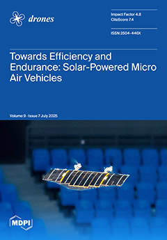
Towards Efficiency and Endurance: Energy–Aerodynamic Co-Optimization for Solar-Powered Micro Air Vehicles
by Weicheng Di, Xin Dong, Zixing Wei, Haoji Liu, Zhan Tu, Daochun Li and Jinwu Xiang
Drones 2025, 9(7), 493; https://doi.org/10.3390/drones9070493 - 11 Jul 2025
Viewed by 194
Abstract
Despite decades of development, micro air vehicles (MAVs) still face challenges related to endurance. While solar power has been successfully implemented in larger aircraft as a clean and renewable source of energy, its adaptation to MAVs presents unique challenges due to payload constraints [...] Read more.
Despite decades of development, micro air vehicles (MAVs) still face challenges related to endurance. While solar power has been successfully implemented in larger aircraft as a clean and renewable source of energy, its adaptation to MAVs presents unique challenges due to payload constraints and complex surface geometries. To address this, this work proposes an automated algorithm for optimal solar panel arrangement on complex upper surfaces of the MAV. In addition to that, the aerodynamic performance is evaluated through computational fluid dynamics (CFD) simulations based on the Reynolds-Averaged Navier–Stokes (RANS) method. A multi-objective optimization approach simultaneously considers photovoltaic energy generation and aerodynamic efficiency. Wind tunnel validation and stability analysis of flight dynamics confirm the advantages of our optimized design. To our knowledge, this represents the first systematic framework for the energy–aerodynamic co-optimization of solar-powered MAVs (SMAVs). Flight tests of a 500mm-span tailless prototype demonstrate the practical feasibility of our approach with maximum solar cell deployment. Full article
Show Figures

Figure 1

26 pages, 14110 KiB  
Article
Gemini: A Cascaded Dual-Agent DRL Framework for Task Chain Planning in UAV-UGV Collaborative Disaster Rescue
by Mengxuan Wen, Yunxiao Guo, Changhao Qiu, Bangbang Ren, Mengmeng Zhang and Xueshan Luo
Drones 2025, 9(7), 492; https://doi.org/10.3390/drones9070492 - 11 Jul 2025
Viewed by 398
Abstract
In recent years, UAV (unmanned aerial vehicle)-UGV (unmanned ground vehicle) collaborative systems have played a crucial role in emergency disaster rescue. To improve rescue efficiency, heterogeneous network and task chain methods are introduced to cooperatively develop rescue sequences within a short time for [...] Read more.
In recent years, UAV (unmanned aerial vehicle)-UGV (unmanned ground vehicle) collaborative systems have played a crucial role in emergency disaster rescue. To improve rescue efficiency, heterogeneous network and task chain methods are introduced to cooperatively develop rescue sequences within a short time for collaborative systems. However, current methods also overlook resource overload for heterogeneous units and limit planning to a single task chain in cross-platform rescue scenarios, resulting in low robustness and limited flexibility. To this end, this paper proposes Gemini, a cascaded dual-agent deep reinforcement learning (DRL) framework based on the Heterogeneous Service Network (HSN) for multiple task chains planning in UAV-UGV collaboration. Specifically, this framework comprises a chain selection agent and a resource allocation agent: The chain selection agent plans paths for task chains, and the resource allocation agent distributes platform loads along generated paths. For each mission, a well-trained Gemini can not only allocate resources in load balancing but also plan multiple task chains simultaneously, which enhances the robustness in cross-platform rescue. Simulation results show that Gemini can increase rescue effectiveness by approximately 60% and improve load balancing by approximately 80%, compared to the baseline algorithm. Additionally, Gemini’s performance is stable and better than the baseline in various disaster scenarios, which verifies its generalization. Full article
Show Figures

Figure 1

18 pages, 8486 KiB  
Article
An Efficient Downwelling Light Sensor Data Correction Model for UAV Multi-Spectral Image DOM Generation
by Siyao Wu, Yanan Lu, Wei Fan, Shengmao Zhang, Zuli Wu and Fei Wang
Drones 2025, 9(7), 491; https://doi.org/10.3390/drones9070491 - 11 Jul 2025
Viewed by 146
Abstract
The downwelling light sensor (DLS) is the industry-standard solution for generating UAV-based digital orthophoto maps (DOMs). Current mainstream DLS correction methods primarily rely on angle compensation. However, due to the temporal mismatch between the DLS sampling intervals and the exposure times of multispectral [...] Read more.
The downwelling light sensor (DLS) is the industry-standard solution for generating UAV-based digital orthophoto maps (DOMs). Current mainstream DLS correction methods primarily rely on angle compensation. However, due to the temporal mismatch between the DLS sampling intervals and the exposure times of multispectral cameras, as well as external disturbances such as strong wind gusts and abrupt changes in flight attitude, DLS data often become unreliable, particularly at UAV turning points. Building upon traditional angle compensation methods, this study proposes an improved correction approach—FIM-DC (Fitting and Interpolation Model-based Data Correction)—specifically designed for data collection under clear-sky conditions and stable atmospheric illumination, with the goal of significantly enhancing the accuracy of reflectance retrieval. The method addresses three key issues: (1) field tests conducted in the Qingpu region show that FIM-DC markedly reduces the standard deviation of reflectance at tie points across multiple spectral bands and flight sessions, with the most substantial reduction from 15.07% to 0.58%; (2) it effectively mitigates inconsistencies in reflectance within image mosaics caused by anomalous DLS readings, thereby improving the uniformity of DOMs; and (3) FIM-DC accurately corrects the spectral curves of six land cover types in anomalous images, making them consistent with those from non-anomalous images. In summary, this study demonstrates that integrating FIM-DC into DLS data correction workflows for UAV-based multispectral imagery significantly enhances reflectance calculation accuracy and provides a robust solution for improving image quality under stable illumination conditions. Full article
Show Figures

Figure 1

20 pages, 28459 KiB  
Article
An Efficient Autonomous Exploration Framework for Autonomous Vehicles in Uneven Off-Road Environments
by Le Wang, Yao Qi, Binbing He and Youchun Xu
Drones 2025, 9(7), 490; https://doi.org/10.3390/drones9070490 - 11 Jul 2025
Viewed by 269
Abstract
Autonomous exploration of autonomous vehicles in off-road environments remains challenging due to the adverse impact on exploration efficiency and safety caused by uneven terrain. In this paper, we propose a path planning framework for autonomous exploration to obtain feasible and smooth paths for [...] Read more.
Autonomous exploration of autonomous vehicles in off-road environments remains challenging due to the adverse impact on exploration efficiency and safety caused by uneven terrain. In this paper, we propose a path planning framework for autonomous exploration to obtain feasible and smooth paths for autonomous vehicles in 3D off-road environments. In our framework, we design a target selection strategy based on 3D terrain traversability analysis, and the traversability is evaluated by integrating vehicle dynamics with geometric indicators of the terrain. This strategy detects the frontiers within 3D environments and utilizes the traversability cost of frontiers as the pivotal weight within the clustering process, ensuring the accessibility of candidate points. Additionally, we introduced a more precise approach to evaluate navigation costs in off-road terrain. To obtain a smooth local path, we generate a cluster of local paths based on the global path and evaluate the optimal local path through the traversability and smoothness of the path. The method is validated in simulations and real-world environments based on representative off-road scenarios. The results demonstrate that our method reduces the exploration time by up to 36.52% and ensures the safety of the vehicle while exploring unknown 3D off-road terrain compared with state-of-the-art methods. Full article
Show Figures

Figure 1

26 pages, 987 KiB  
Article
Traj-Q-GPSR: A Trajectory-Informed and Q-Learning Enhanced GPSR Protocol for Mission-Oriented FANETs
by Mingwei Wu, Bo Jiang, Siji Chen, Hong Xu, Tao Pang, Mingke Gao and Fei Xia
Drones 2025, 9(7), 489; https://doi.org/10.3390/drones9070489 - 10 Jul 2025
Viewed by 273
Abstract
Routing in flying ad hoc networks (FANETs) is hindered by high mobility, trajectory-induced topology dynamics, and energy constraints. Conventional topology-based or position-based protocols often fail due to stale link information and limited neighbor awareness. This paper proposes a trajectory-informed routing protocol enhanced by [...] Read more.
Routing in flying ad hoc networks (FANETs) is hindered by high mobility, trajectory-induced topology dynamics, and energy constraints. Conventional topology-based or position-based protocols often fail due to stale link information and limited neighbor awareness. This paper proposes a trajectory-informed routing protocol enhanced by Q-learning: Traj-Q-GPSR, tailored for mission-oriented UAV swarm networks. By leveraging mission-planned flight trajectories, the protocol builds time-aware two-hop neighbor tables, enabling routing decisions based on both current connectivity and predicted link availability. This spatiotemporal information is integrated into a reinforcement learning framework that dynamically optimizes next-hop selection based on link stability, queue length, and node mobility patterns. To further enhance adaptability, the learning parameters are adjusted in real time according to network dynamics. Additionally, a delay-aware queuing model is introduced to forecast optimal transmission timing, thereby reducing buffering overhead and mitigating redundant retransmissions. Extensive ns-3 simulations across diverse mobility, density, and CBR connections demonstrate that the proposed protocol consistently outperforms GPSR, achieving up to 23% lower packet loss, over 80% reduction in average end-to-end delay, and improvements of up to 37% and 52% in throughput and routing efficiency, respectively. Full article
(This article belongs to the Section Drone Communications)
Show Figures

Figure 1

16 pages, 60222 KiB  
Article
Evaluating the Potential of UAVs for Monitoring Fine-Scale Restoration Efforts in Hydroelectric Reservoirs
by Gillian Voss, Micah May, Nancy Shackelford, Jason Kelley, Roger Stephen and Christopher Bone
Drones 2025, 9(7), 488; https://doi.org/10.3390/drones9070488 - 10 Jul 2025
Viewed by 276
Abstract
The construction of hydroelectric dams leads to substantial land-cover alterations, particularly through the removal of vegetation in wetland and valley areas. This results in exposed sediment that is susceptible to erosion, potentially leading to dust storms. While the reintroduction of vegetation plays a [...] Read more.
The construction of hydroelectric dams leads to substantial land-cover alterations, particularly through the removal of vegetation in wetland and valley areas. This results in exposed sediment that is susceptible to erosion, potentially leading to dust storms. While the reintroduction of vegetation plays a crucial role in restoring these landscapes and mitigating erosion, such efforts incur substantial costs and require detailed information to help optimize vegetation densities that effectively reduce dust storm risk. This study evaluates the performance of drones for measuring the growth of introduced low-lying grasses on reservoir beaches. A set of test flights was conducted to compare LiDAR and photogrammetry data, assessing factors such as flight altitude, speed, and image side overlap. The results indicate that, for this specific vegetation type, photogrammetry at lower altitudes significantly enhanced the accuracy of vegetation classification, permitting effective quantitative assessments of vegetation densities for dust storm risk reduction. Full article
Show Figures

Figure 1

20 pages, 2421 KiB  
Article
Mitigation of Water-Deficit Stress in Soybean by Seaweed Extract: The Integrated Approaches of UAV-Based Remote Sensing and a Field Trial
by Md. Raihanul Islam, Hasan Muhammad Abdullah, Md Farhadur Rahman, Mahfuzul Islam, Abdul Kaium Tuhin, Md Ashiquzzaman, Kh Shakibul Islam and Daniel Geisseler
Drones 2025, 9(7), 487; https://doi.org/10.3390/drones9070487 - 10 Jul 2025
Viewed by 306
Abstract
In recent years, global agriculture has encountered several challenges exacerbated by the effects of changes in climate, such as extreme water shortages for irrigation and heat waves. Water-deficit stress adversely affects the morpho-physiology of numerous crops, including soybean (Glycine max L.), which [...] Read more.
In recent years, global agriculture has encountered several challenges exacerbated by the effects of changes in climate, such as extreme water shortages for irrigation and heat waves. Water-deficit stress adversely affects the morpho-physiology of numerous crops, including soybean (Glycine max L.), which is considered as promising crop in Bangladesh. Seaweed extract (SWE) has the potential to improve crop yield and alleviate the adverse effects of water-deficit stress. Remote and proximal sensing are also extensively utilized in estimating morpho-physiological traits owing to their cost-efficiency and non-destructive characteristics. The study was carried out to evaluate soybean morpho-physiological traits under the application of water extracts of Gracilaria tenuistipitata var. liui (red seaweed) with two varying irrigation water conditions (100% of total crop water requirement (TCWR) and 70% of TCWR). Principal component analysis (PCA) revealed that among the four treatments, the 70% irrigation + 5% (v/v) SWE and the 100% irrigation treatments overlapped, indicating that the application of SWE effectively mitigated water-deficit stress in soybeans. This result demonstrates that the foliar application of 5% SWE enabled soybeans to achieve morpho-physiological performance comparable to that of fully irrigated plants while reducing irrigation water use by 30%. Based on Pearson’s correlation matrix, a simple linear regression model was used to ascertain the relationship between unmanned aerial vehicle (UAV)-derived vegetation indices and the field-measured physiological characteristics of soybean. The Normalized Difference Red Edge (NDRE) strongly correlated with stomatal conductance (R2 = 0.76), photosystem II efficiency (R2 = 0.78), maximum fluorescence (R2 = 0.64), and apparent transpiration rate (R2 = 0.69). The Soil Adjusted Vegetation Index (SAVI) had the highest correlation with leaf relative water content (R2 = 0.87), the Blue Normalized Difference Vegetation Index (bNDVI) with steady-state fluorescence (R2 = 0.56) and vapor pressure deficit (R2 = 0.74), and the Green Normalized Difference Vegetation Index (gNDVI) with chlorophyll content (R2 = 0.73). Our results demonstrate how UAV and physiological data can be integrated to improve precision soybean farming and support sustainable soybean production under water-deficit stress. Full article
(This article belongs to the Special Issue Recent Advances in Crop Protection Using UAV and UGV)
Show Figures

Graphical abstract

22 pages, 3045 KiB  
Article
Optimization of RIS-Assisted 6G NTN Architectures for High-Mobility UAV Communication Scenarios
by Muhammad Shoaib Ayub, Muhammad Saadi and Insoo Koo
Drones 2025, 9(7), 486; https://doi.org/10.3390/drones9070486 - 10 Jul 2025
Viewed by 323
Abstract
The integration of reconfigurable intelligent surfaces (RISs) with non-terrestrial networks (NTNs), particularly those enabled by unmanned aerial vehicles (UAVs) or drone-based platforms, has emerged as a transformative approach to enhance 6G connectivity in high-mobility scenarios. UAV-assisted NTNs offer flexible deployment, dynamic altitude control, [...] Read more.
The integration of reconfigurable intelligent surfaces (RISs) with non-terrestrial networks (NTNs), particularly those enabled by unmanned aerial vehicles (UAVs) or drone-based platforms, has emerged as a transformative approach to enhance 6G connectivity in high-mobility scenarios. UAV-assisted NTNs offer flexible deployment, dynamic altitude control, and rapid network reconfiguration, making them ideal candidates for RIS-based signal optimization. However, the high mobility of UAVs and their three-dimensional trajectory dynamics introduce unique challenges in maintaining robust, low-latency links and seamless handovers. This paper presents a comprehensive performance analysis of RIS-assisted UAV-based NTNs, focusing on optimizing RIS phase shifts to maximize the signal-to-interference-plus-noise ratio (SINR), throughput, energy efficiency, and reliability under UAV mobility constraints. A joint optimization framework is proposed that accounts for UAV path loss, aerial shadowing, interference, and user mobility patterns, tailored specifically for aerial communication networks. Extensive simulations are conducted across various UAV operation scenarios, including urban air corridors, rural surveillance routes, drone swarms, emergency response, and aerial delivery systems. The results reveal that RIS deployment significantly enhances the SINR and throughput while navigating energy and latency trade-offs in real time. These findings offer vital insights for deploying RIS-enhanced aerial networks in 6G, supporting mission-critical drone applications and next-generation autonomous systems. Full article
(This article belongs to the Section Drone Communications)
Show Figures

Figure 1

18 pages, 769 KiB  
Article
Optimization of Transmission Power in a 3D UAV-Enabled Communication System
by Jorge Carvajal-Rodríguez, David Vega-Sánchez, Christian Tipantuña, Luis Felipe Urquiza, Felipe Grijalva and Xavier Hesselbach
Drones 2025, 9(7), 485; https://doi.org/10.3390/drones9070485 - 10 Jul 2025
Viewed by 136
Abstract
Unmanned Aerial Vehicles (UAVs) are increasingly used in the new generation of communication systems. They serve as access points, base stations, relays, and gateways to extend network coverage, enhance connectivity, or offer communications services in places lacking telecommunication infrastructure. However, optimizing UAV placement [...] Read more.
Unmanned Aerial Vehicles (UAVs) are increasingly used in the new generation of communication systems. They serve as access points, base stations, relays, and gateways to extend network coverage, enhance connectivity, or offer communications services in places lacking telecommunication infrastructure. However, optimizing UAV placement in three-dimensional (3D) environments with diverse user distributions and uneven terrain conditions is a crucial challenge. Therefore, this paper proposes a novel framework to minimize UAV transmission power while ensuring a guaranteed data rate in realistic and complex scenarios. To this end, using the particle swarm optimization evolution (PSO-E) algorithm, this paper analyzes the impact of user-truncated distribution models for suburban, urban and dense urban environments. Extensive simulations demonstrate that dense urban environments demand higher power than suburban and urban environments, with uniform user distributions requiring the most power in all scenarios. Conversely, Gaussian and exponential distributions exhibit lower power requirements, particularly in scenarios with concentrated user hotspots. The proposed model provides insight into achieving efficient network deployment and power optimization, offering practical solutions for future communication networks in complex 3D scenarios. Full article
(This article belongs to the Section Drone Communications)
Show Figures

Figure 1

39 pages, 1775 KiB  
Article
A Survey on UAV Control with Multi-Agent Reinforcement Learning
by Chijioke C. Ekechi, Tarek Elfouly, Ali Alouani and Tamer Khattab
Drones 2025, 9(7), 484; https://doi.org/10.3390/drones9070484 - 9 Jul 2025
Viewed by 681
Abstract
Unmanned Aerial Vehicles (UAVs) have become increasingly prevalent in both governmental and civilian applications, offering significant reductions in operational costs by minimizing human involvement. There is a growing demand for autonomous, scalable, and intelligent coordination strategies in complex aerial missions involving multiple Unmanned [...] Read more.
Unmanned Aerial Vehicles (UAVs) have become increasingly prevalent in both governmental and civilian applications, offering significant reductions in operational costs by minimizing human involvement. There is a growing demand for autonomous, scalable, and intelligent coordination strategies in complex aerial missions involving multiple Unmanned Aerial Vehicles (UAVs). Traditional control techniques often fall short in dynamic, uncertain, or large-scale environments where decentralized decision-making and inter-agent cooperation are crucial. A potentially effective technique used for UAV fleet operation is Multi-Agent Reinforcement Learning (MARL). MARL offers a powerful framework for addressing these challenges by enabling UAVs to learn optimal behaviors through interaction with the environment and each other. Despite significant progress, the field remains fragmented, with a wide variety of algorithms, architectures, and evaluation metrics spread across domains. This survey aims to systematically review and categorize state-of-the-art MARL approaches applied to UAV control, identify prevailing trends and research gaps, and provide a structured foundation for future advancements in cooperative aerial robotics. The advantages and limitations of these techniques are discussed along with suggestions for further research to improve the effectiveness of MARL application to UAV fleet management. Full article
Show Figures

Figure 1

17 pages, 4293 KiB  
Article
Predicting Nitrogen Flavanol Index (NFI) in Mentha arvensis Using UAV Imaging and Machine Learning Techniques for Sustainable Agriculture
by Bhavneet Gulati, Zainab Zubair, Ankita Sinha, Nikita Sinha, Nupoor Prasad and Manoj Semwal
Drones 2025, 9(7), 483; https://doi.org/10.3390/drones9070483 - 9 Jul 2025
Viewed by 1240
Abstract
Crop growth monitoring at various growth stages is essential for optimizing agricultural inputs and enhancing crop yield. Nitrogen plays a critical role in plant development; however, its improper application can reduce productivity and, in the long term, degrade soil health. The aim of [...] Read more.
Crop growth monitoring at various growth stages is essential for optimizing agricultural inputs and enhancing crop yield. Nitrogen plays a critical role in plant development; however, its improper application can reduce productivity and, in the long term, degrade soil health. The aim of this study was to develop a non-invasive approach for nitrogen estimation through proxies (Nitrogen Flavanol Index) in Mentha arvensis using UAV-derived multispectral vegetation indices and machine learning models. Support Vector Regression, Random Forest, and Gradient Boosting were used to predict the Nitrogen Flavanol Index (NFI) across different growth stages. Among the tested models, Random Forest achieved the highest predictive accuracy (R2 = 0.86, RMSE = 0.32) at 75 days after planting (DAP), followed by Gradient Boosting (R2 = 0.75, RMSE = 0.43). Model performance was lowest during early growth stages (15–30 DAP) but improved markedly from mid to late growth stages (45–90 DAP). The findings highlight the significance of UAV-acquired data coupled with machine learning approaches for non-destructive nitrogen flavanol estimation, which can immensely contribute to improving real-time crop growth monitoring. Full article
(This article belongs to the Section Drones in Agriculture and Forestry)
Show Figures

Figure 1

14 pages, 6120 KiB  
Article
Drones and Deep Learning for Detecting Fish Carcasses During Fish Kills
by Edna G. Fernandez-Figueroa, Stephanie R. Rogers and Dinesh Neupane
Drones 2025, 9(7), 482; https://doi.org/10.3390/drones9070482 - 8 Jul 2025
Viewed by 302
Abstract
Fish kills are sudden mass mortalities that occur in freshwater and marine systems worldwide. Fish kill surveys are essential for assessing the ecological and economic impacts of fish kill events, but are often labor-intensive, time-consuming, and spatially limited. This study aims to address [...] Read more.
Fish kills are sudden mass mortalities that occur in freshwater and marine systems worldwide. Fish kill surveys are essential for assessing the ecological and economic impacts of fish kill events, but are often labor-intensive, time-consuming, and spatially limited. This study aims to address these challenges by exploring the application of unoccupied aerial systems (or drones) and deep learning techniques for coastal fish carcass detection. Seven flights were conducted using a DJI Phantom 4 RGB quadcopter to monitor three sites with different substrates (i.e., sand, rock, shored Sargassum). Orthomosaics generated from drone imagery were useful for detecting carcasses washed ashore, but not floating or submerged carcasses. Single shot multibox detection (SSD) with a ResNet50-based model demonstrated high detection accuracy, with a mean average precision (mAP) of 0.77 and a mean average recall (mAR) of 0.81. The model had slightly higher average precision (AP) when detecting large objects (>42.24 cm long, AP = 0.90) compared to small objects (≤14.08 cm long, AP = 0.77) because smaller objects are harder to recognize and require more contextual reasoning. The results suggest a strong potential future application of these tools for rapid fish kill response and automatic enumeration and characterization of fish carcasses. Full article
Show Figures

Figure 1

17 pages, 8900 KiB  
Article
Development of an Unmanned Glider for Temperature and Image Monitoring
by Joel Eldo, Sivasankar Sibi, Zehin A. Ibrahim and Efstratios L. Ntantis
Drones 2025, 9(7), 481; https://doi.org/10.3390/drones9070481 - 7 Jul 2025
Viewed by 469
Abstract
This paper presents the design, fabrication, simulation, and partial validation of a low-cost, fixed-wing unmanned glider equipped for temperature and image monitoring. Aerodynamic optimization was performed using XFLR5 and ANSYS Fluent 2023 R1, with spanwise variation between NACA 63(3)-618 and NACA 4415 to [...] Read more.
This paper presents the design, fabrication, simulation, and partial validation of a low-cost, fixed-wing unmanned glider equipped for temperature and image monitoring. Aerodynamic optimization was performed using XFLR5 and ANSYS Fluent 2023 R1, with spanwise variation between NACA 63(3)-618 and NACA 4415 to enhance performance. Wind tunnel tests of the selected airfoil showed good agreement with CFD predictions, with deviations within 5–10%. The airframe, fabricated using 3D-printed PLA with a cross-lattice structure, was integrated with an ESP32-CAM and temperature sensor. A reflective thermal coating was applied to mitigate the heat sensitivity of PLA. Propeller-induced flow was analyzed separately using the lattice Boltzmann method. Real-time flight behavior was simulated in a virtual environment via Simulink and FlightGear. While full in-flight testing is pending, the results demonstrate a scalable, open-source UAV platform for environmental monitoring and academic research. Full article
Show Figures

Figure 1

23 pages, 4420 KiB  
Article
A Control Strategy for Autonomous Approaching and Coordinated Landing of UAV and USV
by Yongguo Li, Ruiqing Lv and Jiangdong Wang
Drones 2025, 9(7), 480; https://doi.org/10.3390/drones9070480 - 7 Jul 2025
Viewed by 312
Abstract
Unmanned aerial vehicles (UAVs) autonomous landing plays a key role in cooperative work with other heterogeneous agents. A neglected aspect of UAV autonomous landing on a moving platform is addressed in this study. The landing process is divided into three stages: positioning, tracking, [...] Read more.
Unmanned aerial vehicles (UAVs) autonomous landing plays a key role in cooperative work with other heterogeneous agents. A neglected aspect of UAV autonomous landing on a moving platform is addressed in this study. The landing process is divided into three stages: positioning, tracking, and landing. In the tracking phase, MPCs are designed to implement tracking of the target landing platform. In the landing phase, we adopt a nested Apriltags collaboration identifier combined with the Aprilatags algorithm to design a PID speed controller, thereby improving the dynamic tracking accuracy of UAVs and completing the landing. The experimental data suggested that the method enables the UAV to perform dynamic tracking and autonomous landing on a moving platform. The experimental results show that the success rate of UAV autonomous landing is as high as 90%, providing a highly feasible solution for UAV autonomous landing. Full article
Show Figures

Figure 1

Previous Issue
Back to TopTop