Next Issue
Volume 8, June
Previous Issue
Volume 7, December


Hydrology, Volume 8, Issue 1 (March 2021) – 55 articles

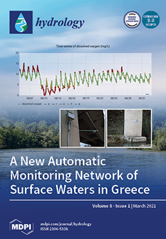
Cover Story (view full-size image): This work presents the first homogeneous real-time network of 18 automatic surface water monitoring stations across 11 rivers in Greece, which were developed by the Institute of Inland Waters of the Hellenic Centre for Marine Research. The network provides real-time measurements of the water levels and parameters of pH, temperature, electrical conductivity and dissolved oxygen. The procedures of the station installation, station maintenance and data evaluation, via range and variability tests, are presented, along with selected data visualization options from the online dissemination platform. The usefulness of the network is high since it can inform decisions regarding drinking and irrigation water and can assist water managers in preventing adverse effects on aquatic life. View this paper
  • Issues are regarded as officially published after their release is announced to the table of contents alert mailing list.
  • You may sign up for e-mail alerts to receive table of contents of newly released issues.
  • PDF is the official format for papers published in both, html and pdf forms. To view the papers in pdf format, click on the "PDF Full-text" link, and use the free Adobe Reader to open them.
Order results
Result details
Section
Select all
Export citation of selected articles as:
16 pages, 4338 KiB  
Article
Pressures and Status of the Riparian Vegetation in Greek Rivers: Overview and Preliminary Assessment
by Anna Latsiou, Theodora Kouvarda, Konstantinos Stefanidis, George Papaioannou, Konstantinos Gritzalis and Elias Dimitriou
Hydrology 2021, 8(1), 55; https://doi.org/10.3390/hydrology8010055 - 23 Mar 2021
Cited by 15 | Viewed by 2968
Abstract
Riparian zones play an important role in the ecological stability of rivers. In particular, the quality of the riparian vegetation is a significant component of the hydromorphological status. In Europe, the QBR index (Qualitat del Bosc de Ribera) and the River Habitat Survey [...] Read more.
Riparian zones play an important role in the ecological stability of rivers. In particular, the quality of the riparian vegetation is a significant component of the hydromorphological status. In Europe, the QBR index (Qualitat del Bosc de Ribera) and the River Habitat Survey (RHS) are commonly used for the qualitative assessment of the riparian vegetation. In this study, we estimated the QBR index and the Riparian Quality index, which is derived from the RHS method, for 123 river reaches of the National Monitoring Network of Greece. Our field work included the completion of RHS and QBR protocols, as well as the use of Unmanned Aerial Vehicles (UAVs). The aim of this study is to assess the riparian vegetation status and to identify linkages with the dominant land uses within the catchment. Correlation analysis was used to identify the relationships between hydromorphological alterations and the degradation of the riparian vegetation, as well as their connection to land uses in the catchment area. Our results highlighted severe modifications of the riparian vegetation for the majority of the studied reaches. We also showed a differentiation of the QBR with respect to changes in the altitude and the land uses in the catchment area. Overall QBR reflects the variation in the riparian vegetation quality better than RQI. Our findings constitute an assessment of the status of the riparian zones in Greek rivers and set the basis for further research for the development of new and effective tools for a rapid quality assessment of the riparian zones. Full article
(This article belongs to the Special Issue Aquatic Ecosystems and Water Resources)
Show Figures

Figure 1

11 pages, 4262 KiB  
Communication
Hydrological Mapping in the Luquillo Experimental Forest: New Local Datum Improves Watershed Ecological Knowledge
by Miguel C. Leon, Tamara Heartsill-Scalley, Iván Santiago and William H. McDowell
Hydrology 2021, 8(1), 54; https://doi.org/10.3390/hydrology8010054 - 23 Mar 2021
Cited by 1 | Viewed by 3265
Abstract
Streams and rivers of the Luquillo Experimental Forest, Puerto Rico, have been the subject of extensive watershed and aquatic research since the 1980s. This research includes understanding stream export of nutrients and coarse particulate organic matter, physicochemical constituents, aquatic fauna populations and community [...] Read more.
Streams and rivers of the Luquillo Experimental Forest, Puerto Rico, have been the subject of extensive watershed and aquatic research since the 1980s. This research includes understanding stream export of nutrients and coarse particulate organic matter, physicochemical constituents, aquatic fauna populations and community structure. However, many of the streams and watersheds studied do not appear in standard scale maps. We document recent collaborative and multi-institutional work to improve hydrological network information and identify knowledge gaps. The methods used to delimit and densify stream networks include establishment and incorporation of an updated new vertical datum for Puerto Rico, LIDAR derived elevation, and a combination of visual-manual and automated digitalization processes. The outcomes of this collaborative effort have resulted in improved watershed delineation, densification of hydrologic networks to reflect the scale of on-going studies, and the identification of constraining factors such as unmapped roadways, culverts, and other features of the built environment that interrupt water flow and alter runoff pathways. This work contributes to enhanced knowledge for watershed management, including attributes of riparian areas, effects of road and channel intersections and ridge to reef initiatives with broad application to other watersheds. Full article
(This article belongs to the Special Issue Hydrology in the Caribbean Basin)
Show Figures

Figure 1

20 pages, 10521 KiB  
Article
An Evaluation of Risk-Based Agricultural Land-Use Adjustments under a Flood Management Strategy in a Floodplain
by Muhammad Atiq Ur Rehman Tariq, Zohreh Rajabi and Nitin Muttil
Hydrology 2021, 8(1), 53; https://doi.org/10.3390/hydrology8010053 - 21 Mar 2021
Cited by 6 | Viewed by 4146
Abstract
Agricultural damage due to floods in the Indus basin’s fertile land has been the most damaging natural disaster in Pakistan so far. Earthen dikes are protecting the vast areas of the floodplain from regular flooding. However, the floodplain is attractive to farmers due [...] Read more.
Agricultural damage due to floods in the Indus basin’s fertile land has been the most damaging natural disaster in Pakistan so far. Earthen dikes are protecting the vast areas of the floodplain from regular flooding. However, the floodplain is attractive to farmers due to its fertility and experiences regular crop production within and out of the dike area. This paper evaluates the flood risk in a floodplain of the Chenab river in Pakistan and recommends land-use changes to reduce the flood risk for crops and associated settlements within the study area. The objective of the land-use change is not just to reduce flood losses but also to increase the overall benefits of the floodplain in terms of its Economic Rent (ER). This preliminary study analyses the economic impacts of the risk-based land-use improvements on existing floodplain land uses. Expected Annual Damage (EAD) maps were developed using hydrodynamic models and GIS data. The developed model identified the areas where maize can be economically more productive compared to rice under flood conditions. Promising results were obtained for the settlement relocations. It was also observed that the infra-structure, running parallel to the river, plays a significant role in curtailing the extent of floods. The results show that a combination of structural and non-structural measures proves more effective. The study also recommends the inclusion of social and environmental damages as well as other types of non-structural measures to develop the most effective flood management strategy. Full article
Show Figures

Figure 1

18 pages, 12335 KiB  
Article
Data Assimilation of Satellite-Based Soil Moisture into a Distributed Hydrological Model for Streamflow Predictions
by Navid Jadidoleslam, Ricardo Mantilla and Witold F. Krajewski
Hydrology 2021, 8(1), 52; https://doi.org/10.3390/hydrology8010052 - 20 Mar 2021
Cited by 10 | Viewed by 3965
Abstract
The authors examine the impact of assimilating satellite-based soil moisture estimates on real-time streamflow predictions made by the distributed hydrologic model HLM. They use SMAP (Soil Moisture Active Passive) and SMOS (Soil Moisture Ocean Salinity) data in an agricultural region of the state [...] Read more.
The authors examine the impact of assimilating satellite-based soil moisture estimates on real-time streamflow predictions made by the distributed hydrologic model HLM. They use SMAP (Soil Moisture Active Passive) and SMOS (Soil Moisture Ocean Salinity) data in an agricultural region of the state of Iowa in the central U.S. They explore three different strategies for updating model soil moisture states using satellite-based soil moisture observations. The first is a “hard update” method equivalent to replacing the model soil moisture with satellite observed soil moisture. The second is Ensemble Kalman Filter (EnKF) to update the model soil moisture, accounting for modeling and observational errors. The third strategy introduces a time-dependent error variance model of satellite-based soil moisture observations for perturbation of EnKF. The study compares streamflow predictions with 131 USGS gauge observations for four years (2015–2018). The results indicate that assimilating satellite-based soil moisture using EnKF reduces predicted peak error compared to that from the open-loop and hard update data assimilation. Furthermore, the inclusion of the time-dependent error variance model in EnKF improves overall streamflow prediction performance. Implications of the study are useful for the application of satellite soil moisture for operational real-time streamflow forecasting. Full article
Show Figures

Graphical abstract

15 pages, 11777 KiB  
Article
Common Pool Resource Management: Assessing Water Resources Planning for Hydrologically Connected Surface and Groundwater Systems
by Francisco Muñoz-Arriola, Tarik Abdel-Monem and Alessandro Amaranto
Hydrology 2021, 8(1), 51; https://doi.org/10.3390/hydrology8010051 - 19 Mar 2021
Cited by 8 | Viewed by 3316
Abstract
Common pool resource (CPR) management has the potential to overcome the collective action dilemma, defined as the tendency for individual users to exploit natural resources and contribute to a tragedy of the commons. Design principles associated with effective CPR management help to ensure [...] Read more.
Common pool resource (CPR) management has the potential to overcome the collective action dilemma, defined as the tendency for individual users to exploit natural resources and contribute to a tragedy of the commons. Design principles associated with effective CPR management help to ensure that arrangements work to the mutual benefit of water users. This study contributes to current research on CPR management by examining the process of implementing integrated management planning through the lens of CPR design principles. Integrated management plans facilitate the management of a complex common pool resource, ground and surface water resources having a hydrological connection. Water governance structures were evaluated through the use of participatory methods and observed records of interannual changes in rainfall, evapotranspiration, and ground water levels across the Northern High Plains. The findings, documented in statutes, field interviews and observed hydrologic variables, point to the potential for addressing large-scale collective action dilemmas, while building on the strengths of local control and participation. The feasibility of a “bottom up” system to foster groundwater resilience was evidenced by reductions in groundwater depths of 2 m in less than a decade. Full article
(This article belongs to the Special Issue Socio-Hydrology: The New Paradigm in Resilient Water Management)
Show Figures

Figure 1

22 pages, 7300 KiB  
Article
Using Environmental Tracers to Characterize Groundwater Flow Mechanisms in the Fractured Crystalline and Karst Aquifers in Upper Crocodile River Basin, Johannesburg, South Africa
by Khahliso Leketa and Tamiru Abiye
Hydrology 2021, 8(1), 50; https://doi.org/10.3390/hydrology8010050 - 19 Mar 2021
Cited by 4 | Viewed by 3771
Abstract
Environmental isotope tracers were applied in the Upper Crocodile River Basin, Johannesburg, South Africa, to understand the groundwater recharge conditions, flow mechanisms and interactions between surface and subsurface water. Stable isotope analysis indicated that recharge into the fractured quartzite aquifer occurs through direct [...] Read more.
Environmental isotope tracers were applied in the Upper Crocodile River Basin, Johannesburg, South Africa, to understand the groundwater recharge conditions, flow mechanisms and interactions between surface and subsurface water. Stable isotope analysis indicated that recharge into the fractured quartzite aquifer occurs through direct mechanisms. The high variability in the stable isotope signature of temporal samples from Albert Farm spring indicated the importance of multiple samples for groundwater characterization, and that using a single sample may be yielding biased conclusions. The observed inverse relationship between spring discharge and isotope signature indicated the traces of rainfall amount effect during recharge, thereby suggesting piston groundwater flow. It is deduced that a measured discharge value can be used in this relationship to calculate the isotopic signature, which resembles effective rainfall. In the shallow alluvial deposits that overlie the granitic bed-rock, piezometer levels and stable isotopes revealed an interaction between Montgomery stream and interflow, which regulates streamflow throughout the year. This suggests that caution should be taken where hydrograph separation is applied for baseflow estimates, because the stream flow that overlies such geology may include significant interflow. The hydrochemistry evolution was observed in a stream fed by karst springs. As pH rises due to CO2 degassing, CaCO3 precipitates, thereby forming travertine moulds. The values of saturation indices that were greater than zero in all samples indicated supersaturation by calcite and dolomite and hence precipitation. Through 14C analysis, groundwater flow rate in the karst aquifer was estimated as 11 km/year, suggesting deep circulation in karst structures. Full article
Show Figures

Figure 1

17 pages, 7028 KiB  
Article
How Perceptions of Trust, Risk, Tap Water Quality, and Salience Characterize Drinking Water Choices
by Madeline A. Grupper, Madeline E. Schreiber and Michael G. Sorice
Hydrology 2021, 8(1), 49; https://doi.org/10.3390/hydrology8010049 - 18 Mar 2021
Cited by 20 | Viewed by 4772
Abstract
Provision of safe drinking water by water utilities is challenged by disturbances to water quality that have become increasingly frequent due to global changes and anthropogenic impacts. Many water utilities are turning to adaptable and flexible strategies to allow for resilient management of [...] Read more.
Provision of safe drinking water by water utilities is challenged by disturbances to water quality that have become increasingly frequent due to global changes and anthropogenic impacts. Many water utilities are turning to adaptable and flexible strategies to allow for resilient management of drinking water supplies. The success of resilience-based management depends on, and is enabled by, positive relationships with the public. To understand how relationships between managers and communities spill over to in-home drinking water behavior, we examined the role of trust, risk perceptions, salience of drinking water, and water quality evaluations in the choice of in-home drinking water sources for a population in Roanoke Virginia. Using survey data, our study characterized patterns of in-home drinking water behavior and explored related perceptions to determine if residents’ perceptions of their water and the municipal water utility could be intuited from this behavior. We characterized drinking water behavior using a hierarchical cluster analysis and highlighted the importance of studying a range of drinking water patterns. Through analyses of variance, we found that people who drink more tap water have higher trust in their water managers, evaluate water quality more favorably, have lower risk perceptions, and pay less attention to changes in their tap water. Utility managers may gauge information about aspects of their relationships with communities by examining drinking water behavior, which can be used to inform their future interactions with the public, with the goal of increasing resilience and adaptability to external water supply threats. Full article
(This article belongs to the Special Issue Socio-Hydrology: The New Paradigm in Resilient Water Management)
Show Figures

Figure 1

29 pages, 9522 KiB  
Article
Assessing the Impact of Land Use and Climate Change on Surface Runoff Response Using Gridded Observations and SWAT+
by Paul Kiprotich, Xianhu Wei, Zongke Zhang, Thomas Ngigi, Fengting Qiu and Liuhao Wang
Hydrology 2021, 8(1), 48; https://doi.org/10.3390/hydrology8010048 - 17 Mar 2021
Cited by 38 | Viewed by 6882
Abstract
The Anthropocene period is characterised by a general demographic shift from rural communities to urban centres that transform the predominantly wild global landscape into mostly cultivated land and cities. In addition to climate change, there are increased uncertainties in the water balance and [...] Read more.
The Anthropocene period is characterised by a general demographic shift from rural communities to urban centres that transform the predominantly wild global landscape into mostly cultivated land and cities. In addition to climate change, there are increased uncertainties in the water balance and these feedbacks cannot be modelled accurately due to scarce or incomplete in situ data. In African catchments with limited current and historical climate data, precise modelling of potential runoff regimes is difficult, but a growing number of model applications indicate that useful simulations are feasible. In this study, we used the new generation of soil and water assessment tool (SWAT) dubbed SWAT+ to assess the viability of using high resolution gridded data as an alternative to station observations to investigate surface runoff response to continuous land use change and future climate change. Simultaneously, under two representative concentration pathways (RCP4.5 and RCP8.5), six regional climate models (RCMs) from the Coordinated Regional Climate Downscaling Experiment Program (CORDEX) and their ensemble were evaluated for model skill and systematic biases and the best performing model was selected. The gridded data predicted streamflow accurately with a Nash–Sutcliffe efficiency greater than 0.89 in both calibration and validation phases. The analysis results show that further conversion of grasslands and forests to agriculture and urban areas doubled the runoff depth between 1984 and 2016. Climate projections predict a decline in March–May rainfall and an increase in the October–December season. Mean temperatures are expected to rise by about 1.3–1.5 °C under RCP4.5 and about 2.6–3.5 °C under RCP8.5 by 2100. Compared to the 2010–2016 period, simulated surface runoff response to climate change showed a decline under RCP4.5 and an increase under RCP8.5. In contrast, the combine effects of land use change and climate change simulated a steady increase in surface runoff under both scenarios. This suggests that the land use influence on the surface runoff response is more significant than that of climate change. The study results highlight the reliability of gridded data as an alternative to instrumental measurements in limited or missing data cases. More weight should be given to improving land management practices to counter the imminent increase in the surface runoff to avoid an increase in non-point source pollution, erosion, and flooding in the urban watersheds. Full article
Show Figures

Figure 1

21 pages, 4131 KiB  
Article
Quantitative Classification of Desertification Severity for Degraded Aquifer Based on Remotely Sensed Drought Assessment
by Pantelis Sidiropoulos, Nicolas R. Dalezios, Athanasios Loukas, Nikitas Mylopoulos, Marios Spiliotopoulos, Ioannis N. Faraslis, Nikos Alpanakis and Stavros Sakellariou
Hydrology 2021, 8(1), 47; https://doi.org/10.3390/hydrology8010047 - 17 Mar 2021
Cited by 24 | Viewed by 3571
Abstract
Natural and anthropogenic causes jointly lead to land degradation and eventually to desertification, which occurs in arid, semiarid, and dry subhumid areas. Furthermore, extended drought periods may cause soil exposure and erosion, land degradation and, finally, desertification. Several climatic, geological, hydrological, physiographic, biological, [...] Read more.
Natural and anthropogenic causes jointly lead to land degradation and eventually to desertification, which occurs in arid, semiarid, and dry subhumid areas. Furthermore, extended drought periods may cause soil exposure and erosion, land degradation and, finally, desertification. Several climatic, geological, hydrological, physiographic, biological, as well as human factors contribute to desertification. This paper presents a methodological procedure for the quantitative classification of desertification severity over a watershed with degraded groundwater resources. It starts with drought assessment using Standardized Precipitation Index (SPI), based on gridded satellite-based precipitation data (taken from the CHIRPS database), then erosion potential is assessed through modeling. The groundwater levels are estimated with the use of a simulation model and the groundwater quality components of desertification, based on scattered data, are interpolated with the use of geostatistical tools. Finally, the combination of the desertification severity components leads to the final mapping of desertification severity classification. Full article
(This article belongs to the Special Issue Drought and Water Scarcity: Monitoring, Modelling and Mitigation)
Show Figures

Figure 1

12 pages, 3179 KiB  
Article
Enhancing Ecosystem Services to Minimize Impact of Climate Variability in a Dry Tropical Forest with Vertisols
by Maria Simas Guerreiro, Eunice Maia de Andrade, Helba Araújo de Queiroz Palácio, José Bandeira Brasil and Jacques Carvalho Ribeiro Filho
Hydrology 2021, 8(1), 46; https://doi.org/10.3390/hydrology8010046 - 16 Mar 2021
Cited by 7 | Viewed by 2517
Abstract
Increased droughts and variable rainfall patterns may alter the capacity to provide ecosystem services, such as biomass production and clean water provision. The impact of these factors in a semi-arid region, especially on a dry tropical forest with Vertisols and under different land [...] Read more.
Increased droughts and variable rainfall patterns may alter the capacity to provide ecosystem services, such as biomass production and clean water provision. The impact of these factors in a semi-arid region, especially on a dry tropical forest with Vertisols and under different land uses such as regenerated vegetation and thinned vegetation, is still unclear. This study analyzes hydrologic processes under precipitation pulses and intra-seasonal droughts, and suggests management practices for ecosystem services improvement. A local 43-year dataset showed a varying climate with a decrease in number of small events, and an increase in the number of dry days and in event rainfall intensity, in two catchments with different land use patterns and with Vertisols, a major soil order in semi-arid tropics. The onset of runoff depends on the expansive characteristics of the soil rather than land use, as dry spells promote micro-cracks that delay the runoff process. Forest thinning enhances groundcover development and is a better management practice for biomass production. This management practice shows a lower water yield when compared to a regenerated forest, supporting the decision of investing in forest regeneration in order to attend to an increasing water storage demand. Full article
(This article belongs to the Special Issue Advances in the Ecohydrology of Arid Lands)
Show Figures

Figure 1

12 pages, 4163 KiB  
Article
Effects of River Discharge and Sediment Load on Sediment Plume Behaviors in a Coastal Region: The Yukon River, Alaska and the Bering Sea
by Kazuhisa A. Chikita, Tomoyuki Wada, Isao Kudo, Sei-Ichi Saitoh and Mitsuhiro Toratani
Hydrology 2021, 8(1), 45; https://doi.org/10.3390/hydrology8010045 - 12 Mar 2021
Cited by 6 | Viewed by 2422
Abstract
In the Bering Sea around and off the Yukon River delta, surface sediment plumes are markedly formed by glacier-melt and rainfall sediment runoffs of the Yukon River, Alaska, in June– September. The discharge and sediment load time series of the Yukon River were [...] Read more.
In the Bering Sea around and off the Yukon River delta, surface sediment plumes are markedly formed by glacier-melt and rainfall sediment runoffs of the Yukon River, Alaska, in June– September. The discharge and sediment load time series of the Yukon River were obtained at the lowest gauging station of US Geological Survey in June 2006–September 2010. Meanwhile, by coastal observations on boat, it was found out that the river plume plunges at a boundary between turbid plume water and clean marine water at the Yukon River sediment load of more than ca. 2500 kg/s. Grain size analysis with changing salinity (‰) for the river sediment indicated that the suspended sediment becomes coarse at 2 to 5‰ by flocculation. Hence, the plume’s plunging probably occurred by the flocculation of the Yukon suspended sediment in the brackish zone upstream of the plunging boundary, where the differential settling from the flocculation is considered to have induced the turbid water intrusion into the bottom layer. Full article
Show Figures

Figure 1

12 pages, 534 KiB  
Review
A Review of Coupled Hydrologic-Hydraulic Models for Floodplain Assessments in Africa: Opportunities and Challenges for Floodplain Wetland Management
by Innocent C. Chomba, Kawawa E. Banda, Hessel C. Winsemius, Machaya J. Chomba, Mulema Mataa, Victoria Ngwenya, Henry M. Sichingabula, Imasiku A. Nyambe and Bruce Ellender
Hydrology 2021, 8(1), 44; https://doi.org/10.3390/hydrology8010044 - 11 Mar 2021
Cited by 21 | Viewed by 4974
Abstract
Floodplain wetlands are a fundamental part of the African continent’s ecosystem and serve as habitat for fish and wildlife species, biodiversity, and micro-organisms that support life. It is generally recognised that wetlands are and remain fragile ecosystems that should be subject to sustainable [...] Read more.
Floodplain wetlands are a fundamental part of the African continent’s ecosystem and serve as habitat for fish and wildlife species, biodiversity, and micro-organisms that support life. It is generally recognised that wetlands are and remain fragile ecosystems that should be subject to sustainable conservation and management through the use of sustainable tools. In this paper, we propose a synthesis of the state of art concerning coupled hydrologic and hydraulic models for floodplains assessments in Africa. Case studies reviewed in this paper have pointed out the potential of applying coupled hydrologic and hydraulic models and the opportunities present to be used in Africa especially for data scarce and large basin for floodplain assessments through the use of available open access models, coupling frameworks and remotely sensed datasets. To our knowledge this is the first case study review of this kind on this topic. A Hydrological model coupled with Hydraulic Model of the floodplain provides improvements in floodplain model simulations and hence better information for floodplain management. Consequently, this would lead to improved decision-making and planning of adaption and mitigation measures for sound floodplain wetland management plans and programmes especially with the advent of climate change and variability. Full article
(This article belongs to the Special Issue Aquatic Ecosystems and Water Resources)
Show Figures

Figure 1

26 pages, 8216 KiB  
Article
Alteration of the Ecohydrological Status of the Intermittent Flow Rivers and Ephemeral Streams due to the Climate Change Impact (Case Study: Tsiknias River)
by Soumaya Nabih, Ourania Tzoraki, Prodromos Zanis, Thanos Tsikerdekis, Dimitris Akritidis, Ioannis Kontogeorgos and Lahcen Benaabidate
Hydrology 2021, 8(1), 43; https://doi.org/10.3390/hydrology8010043 - 5 Mar 2021
Cited by 7 | Viewed by 3259
Abstract
Climate change projections predict the increase of no-rain periods and storm intensity resulting in high hydrologic alteration of the Mediterranean rivers. Intermittent flow Rivers and Ephemeral Streams (IRES) are particularly vulnerable to spatiotemporal variation of climate variables, land use changes and other anthropogenic [...] Read more.
Climate change projections predict the increase of no-rain periods and storm intensity resulting in high hydrologic alteration of the Mediterranean rivers. Intermittent flow Rivers and Ephemeral Streams (IRES) are particularly vulnerable to spatiotemporal variation of climate variables, land use changes and other anthropogenic factors. In this work, the impact of climate change on the aquatic state of IRES is assessed by the combination of the hydrological model Soil and Water Assessment Tool (SWAT) and the Temporary Rivers Ecological and Hydrological Status (TREHS) tool under two different Representative Concentration Pathways (RCP 4.5 and RCP 8.5) using CORDEX model simulations. A significant decrease of 20–40% of the annual flow of the examined river (Tsiknias River, Greece) is predicted during the next 100 years with an increase in the frequency of extreme flood events as captured with almost all Regional Climate Models (RCMs) simulations. The occurrence patterns of hyporheic and edaphic aquatic states show a temporal extension of these states through the whole year due to the elongation of the dry period. A shift to the Intermittent-Pools regime type shows dominance according to numerous climate change scenarios, harming, as a consequence, both the ecological system and the social-economic one. Full article
(This article belongs to the Special Issue Advances in the Ecohydrology of Arid Lands)
Show Figures

Figure 1

19 pages, 4300 KiB  
Article
Decision Support for the (Inter-)Basin Management of Water Resources Using Integrated Hydro-Economic Modeling
by Gerald Norbert Souza da Silva and Márcia Maria Guedes Alcoforado de Moraes
Hydrology 2021, 8(1), 42; https://doi.org/10.3390/hydrology8010042 - 5 Mar 2021
Cited by 12 | Viewed by 2881
Abstract
The development of adequate modeling at the basin level to establish public policies has an important role in managing water resources. Hydro-economic models can measure the economic effects of structural and non-structural measures, land and water management, ecosystem services and development needs. Motivated [...] Read more.
The development of adequate modeling at the basin level to establish public policies has an important role in managing water resources. Hydro-economic models can measure the economic effects of structural and non-structural measures, land and water management, ecosystem services and development needs. Motivated by the need of improving water allocation using economic criteria, in this study, a Spatial Decision Support System (SDSS) with a hydro-economic optimization model (HEAL system) was developed and used for the identification and analysis of an optimal economic allocation of water resources in a case study: the sub-middle basin of the São Francisco River in Brazil. The developed SDSS (HEAL system) made the economically optimum allocation available to analyze water allocation conflicts and trade-offs. With the aim of providing a tool for integrated economic-hydrological modeling, not only for researchers but also for decision-makers and stakeholders, the HEAL system can support decision-making on the design of regulatory and economic management instruments in practice. The case study results showed, for example, that the marginal benefit function obtained for inter-basin water transfer, can contribute for supporting the design of water pricing and water transfer decisions, during periods of water scarcity, for the well-being in both basins. Full article
Show Figures

Figure 1

18 pages, 3660 KiB  
Article
Landslide Susceptibility Analysis: A Logistic Regression Model Case Study in Coonoor, India
by Evangelin Ramani Sujatha and Venkataramana Sridhar
Hydrology 2021, 8(1), 41; https://doi.org/10.3390/hydrology8010041 - 5 Mar 2021
Cited by 54 | Viewed by 4401
Abstract
Landslides are a common geologic hazard that disrupts the social and economic balance of the affected society. Therefore, identifying zones prone to landslides is necessary for safe living and the minimal disruption of economic activities in the event of the hazard. The factors [...] Read more.
Landslides are a common geologic hazard that disrupts the social and economic balance of the affected society. Therefore, identifying zones prone to landslides is necessary for safe living and the minimal disruption of economic activities in the event of the hazard. The factors causing landslides are often a function of the local geo-environmental set-up and need a region-specific study. This study evaluates the site characteristics primarily altered by anthropogenic activities to understand and identify the various factors causing landslides in Coonoor Taluk of Uthagamandalam District in Tamil Nadu, India. Studies on landslide susceptibility show that slope gradient, aspect, relative relief, topographic wetness index, soil type, and land use of the region influence slope instability. Rainfall characteristics have also played a significant role in causing landslides. Logistic Regression, a popular statistical tool used for predictive analysis, is employed to assess the various selected factors’ impact on landslide susceptibility. The factors are weighted and combined in a GIS platform to develop the region’s landslide susceptibility map. This region has a direct link between natural physical systems, hydrology, and humans from the socio-hydrological perspective. The landslide susceptibility map derived using the watershed’s physical and environmental conditions offers the best tool for planning the developmental activities and prioritizing areas for mitigation activities in the region. The Coonoor region’s tourism and agriculture sectors can significantly benefit from identifying zones prone to landslides for their economic stability and growth. Full article
(This article belongs to the Special Issue Socio-Hydrology: The New Paradigm in Resilient Water Management)
Show Figures

Figure 1

21 pages, 1851 KiB  
Article
Development of a Decision Support System for Sustainable Environmental Management and Stakeholder Engagement
by Angelos Alamanos, Alec Rolston and George Papaioannou
Hydrology 2021, 8(1), 40; https://doi.org/10.3390/hydrology8010040 - 4 Mar 2021
Cited by 21 | Viewed by 6274
Abstract
Undertaking integrated and sustainable water resources management (ISWRM) and providing socially acceptable solutions with scientifically solid bases is a dynamic and challenging process. Two basic pillars–umbrellas can be identified in the literature: stakeholder engagement and analysis; and integrated monitoring–modelling in the form of [...] Read more.
Undertaking integrated and sustainable water resources management (ISWRM) and providing socially acceptable solutions with scientifically solid bases is a dynamic and challenging process. Two basic pillars–umbrellas can be identified in the literature: stakeholder engagement and analysis; and integrated monitoring–modelling in the form of a decision support system (DSS) that can assess, evaluate and rank the management options. This study presents a framework that can be used as a good-practice example of successful stakeholder engagement (public engagement and collaboration with local communities towards shared visions) and an integrated DSS for ISWRM (including characterisation at catchment and local scales, programmes of measures and their evaluation): the Framework for Integrated Land and Landscape Management (FILLM), developed by an Irish multi-disciplinary and multi-stakeholder platform, the Water Forum. The fundamental theoretical principles and practical aspects of the FILLM are analysed. A step-by-step guide is proposed for its application, bridging the above pillars, using examples, reviewing methods and software, and analysing challenges and trends. It can help both socio-economic and environmental scientists (modellers) understand each other’s roles and find reviews of useful tools and methods for their work. This work can be a reference point for future ISWRM and environment management and can contribute to holistic education on such topics. Full article
(This article belongs to the Special Issue Impacts of Land Use Changes on Hydrological Processes and Modelling)
Show Figures

Figure 1

23 pages, 4046 KiB  
Article
Optimizing Irrigation Water Use Efficiency for Tomato and Maize Fields across Italy Combining Remote Sensing Data and the AquaCrop Model
by Chiara Corbari, Imen Ben Charfi and Marco Mancini
Hydrology 2021, 8(1), 39; https://doi.org/10.3390/hydrology8010039 - 2 Mar 2021
Cited by 14 | Viewed by 3751
Abstract
Remote sensing data of canopy cover and leaf area index are used together with the AquaCrop model to optimize irrigation water use efficiency for tomato and maize fields across Italy, which differ in climate, soil types and irrigation technique. An optimization irrigation strategy, [...] Read more.
Remote sensing data of canopy cover and leaf area index are used together with the AquaCrop model to optimize irrigation water use efficiency for tomato and maize fields across Italy, which differ in climate, soil types and irrigation technique. An optimization irrigation strategy, “SIM strategy”, is developed based on crop stress thresholds and then applied to all the analyzed fields in different crop seasons, evaluating the effect not only on irrigation volume and number of irrigations but also on crop yield and canopy cover, and on the drainage flux which represents the main water loss. Irrigation volume reduction is found to be between 200 and 1000 mm, mainly depending on the different soil types within the climate, irrigation technique and crop type. This is directly related to the drainage flux reduction which is of a similar entity. The SIM strategy efficiency has then been quantified by different indicators, such as the irrigation water use efficiency (IWUE) which is higher than with the observed irrigations (around 35% for tomato fields in Southern Italy, between 30 and 80% for maize in Northern Italy), and the percolation deficit and irrigation efficiency. The AquaCrop model has been previously calibrated against canopy cover and leaf area index (LAI) data, producing errors between 0.7 and 5%, while absolute mean errors (MAE) between 0.015 and 0.04 are obtained for soil moisture (SM). The validation of the AquaCrop model has been performed against evapotranspiration (ET) ground-measured data and crop yields producing MAE values ranging from 0.3 to 0.9 mm/day, and 0.9 ton/ha for maize and 10 ton/ha for tomatoes, respectively. Full article
Show Figures

Figure 1

23 pages, 6370 KiB  
Article
Risk Assessment of Future Climate and Land Use/Land Cover Change Impacts on Water Resources
by Nick Martin
Hydrology 2021, 8(1), 38; https://doi.org/10.3390/hydrology8010038 - 25 Feb 2021
Cited by 6 | Viewed by 2838
Abstract
Climate and land use and land cover (LULC) changes will impact watershed-scale water resources. These systemic alterations will have interacting influences on water availability. A probabilistic risk assessment (PRA) framework for water resource impact analysis from future systemic change is described and implemented [...] Read more.
Climate and land use and land cover (LULC) changes will impact watershed-scale water resources. These systemic alterations will have interacting influences on water availability. A probabilistic risk assessment (PRA) framework for water resource impact analysis from future systemic change is described and implemented to examine combined climate and LULC change impacts from 2011–2100 for a study site in west-central Texas. Internally, the PRA framework provides probabilistic simulation of reference and future conditions using weather generator and water balance models in series—one weather generator and water balance model for reference and one of each for future conditions. To quantify future conditions uncertainty, framework results are the magnitude of change in water availability, from the comparison of simulated reference and future conditions, and likelihoods for each change. Inherent advantages of the framework formulation for analyzing future risk are the explicit incorporation of reference conditions to avoid additional scenario-based analysis of reference conditions and climate change emissions scenarios. In the case study application, an increase in impervious area from economic development is the LULC change; it generates a 1.1 times increase in average water availability, relative to future climate trends, from increased runoff and decreased transpiration. Full article
Show Figures

Figure 1

16 pages, 6785 KiB  
Article
Residence Time Analysis in the Albufera of Valencia, a Mediterranean Coastal Lagoon, Spain
by Juan Soria, Lucía Vera-Herrera, Sara Calvo, Susana Romo, Eduardo Vicente, María Sahuquillo and Xavier Sòria-Perpinyà
Hydrology 2021, 8(1), 37; https://doi.org/10.3390/hydrology8010037 - 25 Feb 2021
Cited by 14 | Viewed by 3514
Abstract
The Albufera of Valencia is a coastal lagoon located in the western area of the Mediterranean Sea, in the Iberian Peninsula. It has an area of 23.1 km2 and an average depth of only 1 m, with a maximum depth of 1.6 [...] Read more.
The Albufera of Valencia is a coastal lagoon located in the western area of the Mediterranean Sea, in the Iberian Peninsula. It has an area of 23.1 km2 and an average depth of only 1 m, with a maximum depth of 1.6 m. This lagoon is the remnants of an original and more extensive wetland of about 220 km2 which is now mostly dedicated to rice cultivation. Surface water is supplied through several main and many secondary canals for a total of 64 water entry points and three exit points to the sea. It is difficult to evaluate the residence time due to the lack of reliable measurements of the inflow or outflow, as well as continuous measurements. Between 1988 and 2018, several procedures were used, the results of which are outlined in this document. Overall, a decrease in the inflow during these thirty years was observed and, therefore, it can be concluded that the residence time is increasing. There is a temporal variation during the year due to rainfall and cultivation periods. Likewise, the results found that the natural hydrological zoning of the lagoon causes a spatial heterogeneity with small Northern areas with low residence time of 4.7 days, almost on a weekly basis and large Western extensions with high residence time of 222.9 days. It is impossible to know this information if individual flow measurements are not taken from each of the main watercourses. Full article
(This article belongs to the Special Issue Aquatic Ecosystems and Water Resources)
Show Figures

Figure 1

20 pages, 3966 KiB  
Article
On the Choice of Metric to Calibrate Time-Invariant Ensemble Kalman Filter Hyper-Parameters for Discharge Data Assimilation and Its Impact on Discharge Forecast Modelling
by Jean Bergeron, Robert Leconte, Mélanie Trudel and Sepehr Farhoodi
Hydrology 2021, 8(1), 36; https://doi.org/10.3390/hydrology8010036 - 24 Feb 2021
Cited by 6 | Viewed by 2272
Abstract
An important step when using some data assimilation methods, such as the ensemble Kalman filter and its variants, is to calibrate its parameters. Also called hyper-parameters, these include the model and observation errors, which have previously been shown to have a strong impact [...] Read more.
An important step when using some data assimilation methods, such as the ensemble Kalman filter and its variants, is to calibrate its parameters. Also called hyper-parameters, these include the model and observation errors, which have previously been shown to have a strong impact on the performance of the data assimilation method. Many metrics can be used to calibrate these hyper-parameters but may not all yield the same optimal set of values. The current study investigated the importance of the choice of metric used during the hyper-parameter calibration phase and its impact on discharge forecasts. The types of metrics used each focused on discharge accuracy, ensemble spread or observation-minus-background statistics. The calibration was performed for the ensemble square root Kalman filter over two catchments in Canada using two different hydrologic models per catchment. Results show that the optimal set of hyper-parameters depended heavily on the choice of metric used during the calibration phase, where data assimilation was applied. These sets of hyper-parameters in turn produced different hydrologic forecasts. This influence was reduced as the forecast lead time increased, because of not applying data assimilation in the forecast mode, and accordingly, convergence of model state ensembles produced in the calibration phase. However, the influence could remain considerable for a few days up to multiple weeks depending on the catchment and the model. As such, a preliminary analysis would be recommended for future studies to better understand the impact that metrics can have within and outside the bounds of hyper-parameter calibration. Full article
Show Figures

Figure 1

16 pages, 510 KiB  
Review
Surface and Groundwater Interactions: A Review of Coupling Strategies in Detailed Domain Models
by Arefin Haque, Amgad Salama, Kei Lo and Peng Wu
Hydrology 2021, 8(1), 35; https://doi.org/10.3390/hydrology8010035 - 23 Feb 2021
Cited by 18 | Viewed by 5383
Abstract
In groundwater numerical simulations, the interactions between surface and groundwater have received great attention due to difficulties related to their validation and calibration due to the dynamic exchange occurring at the soil–water interface. The interaction is complex at small scales. However, at larger [...] Read more.
In groundwater numerical simulations, the interactions between surface and groundwater have received great attention due to difficulties related to their validation and calibration due to the dynamic exchange occurring at the soil–water interface. The interaction is complex at small scales. However, at larger scales, the interaction is even more complicated, and has never been fully addressed. A clear understanding of the coupling strategies between the surface and groundwater is essential in order to develop numerical models for successful simulations. In the present review, two of the most commonly used coupling strategies in detailed domain models—namely, fully-coupled and loosely-coupled techniques—are reviewed and compared. The advantages and limitations of each modelling scheme are discussed. This review highlights the strategies to be considered in the development of groundwater flow models that are representative of real-world conditions between surface and groundwater interactions at regional scales. Full article
Show Figures

Graphical abstract

14 pages, 5586 KiB  
Technical Note
WaterbalANce, a WebApp for Thornthwaite–Mather Water Balance Computation: Comparison of Applications in Two European Watersheds
by Elisa Mammoliti, Davide Fronzi, Adriano Mancini, Daniela Valigi and Alberto Tazioli
Hydrology 2021, 8(1), 34; https://doi.org/10.3390/hydrology8010034 - 20 Feb 2021
Cited by 20 | Viewed by 5270
Abstract
Nowadays, the balance between incoming precipitation and stream or spring discharge is a challenging aspect in many scientific disciplines related to water management. In this regard, although advances in the methodologies for water balance calculation concerning each component of the water cycle have [...] Read more.
Nowadays, the balance between incoming precipitation and stream or spring discharge is a challenging aspect in many scientific disciplines related to water management. In this regard, although advances in the methodologies for water balance calculation concerning each component of the water cycle have been achieved, the Thornthwaite–Mather method remains one of the most used, especially for hydrogeological purposes. In fact, in contrast to physical-based models, which require many input parameters, the Thornthwaite–Mather method is a simple, empirical, data-driven procedure in which the error associated with its use is smaller than that associated with the measurement of input data. The disadvantage of this method is that elaboration times can be excessively long if a classical MS Excel file is used for a large amount of data. Although many authors have attempted to automatize the procedure using simple algorithms or graphical user interfaces, some bugs have been detected. For these reasons, we propose a WebApp for monthly water balance calculation, called WaterbalANce. WaterbalANce was written in Python and is driven by a serverless computing approach. Two respective European watersheds are selected and presented to demonstrate the application of this method. Full article
Show Figures

Figure 1

23 pages, 10580 KiB  
Technical Note
A New Automatic Monitoring Network of Surface Waters in Greece: Preliminary Data Quality Checks and Visualization
by Yiannis Panagopoulos, Anna Konstantinidou, Konstantinos Lazogiannis, Anastasios Papadopoulos and Elias Dimitriou
Hydrology 2021, 8(1), 33; https://doi.org/10.3390/hydrology8010033 - 20 Feb 2021
Cited by 6 | Viewed by 2805
Abstract
The monitoring of surface waters is of fundamental importance for their preservation under good quantitative and qualitative conditions, as it can facilitate the understanding of the actual status of water and indicate suitable management actions. Taking advantage of the experience gained from the [...] Read more.
The monitoring of surface waters is of fundamental importance for their preservation under good quantitative and qualitative conditions, as it can facilitate the understanding of the actual status of water and indicate suitable management actions. Taking advantage of the experience gained from the coordination of the national water monitoring program in Greece and the available funding from two ongoing infrastructure projects, the Institute of Inland Waters of the Hellenic Centre for Marine Research has developed the first homogeneous real-time network of automatic water monitoring across many Greek rivers. In this paper, its installation and maintenance procedures are presented with emphasis on the data quality checks, based on values range and variability tests, before their online publication and dissemination to end-users. Preliminary analyses revealed that the water pH and dissolved oxygen (DO) sensors and produced data need increased maintenance and quality checks respectively, compared to the more reliably recorded water stage, temperature (T) and electrical conductivity (EC). Moreover, the data dissemination platform and selected data visualization options are demonstrated and the need for both this platform and the monitoring network to be maintained and potentially expanded after the termination of the funding projects is highlighted. Full article
Show Figures

Figure 1

20 pages, 15282 KiB  
Article
Seasonal and Ephemeral Snowpacks of the Conterminous United States
by Benjamin J. Hatchett
Hydrology 2021, 8(1), 32; https://doi.org/10.3390/hydrology8010032 - 18 Feb 2021
Cited by 18 | Viewed by 3485
Abstract
Snowpack seasonality in the conterminous United States (U.S.) is examined using a recently-released daily, 4 km spatial resolution gridded snow water equivalent and snow depth product developed by assimilating station-based observations and gridded temperature and precipitation estimates from PRISM. Seasonal snowpacks for the [...] Read more.
Snowpack seasonality in the conterminous United States (U.S.) is examined using a recently-released daily, 4 km spatial resolution gridded snow water equivalent and snow depth product developed by assimilating station-based observations and gridded temperature and precipitation estimates from PRISM. Seasonal snowpacks for the period spanning water years 1982–2017 were calculated using two established methods: (1) the classic Sturm approach that requires 60 days of snow cover with a peak depth >50 cm and (2) the snow seasonality metric (SSM) that only requires 60 days of continuous snow cover to define seasonal snow. The latter approach yields continuous values from −1 to +1, where −1 (+1) indicates an ephemeral (seasonal) snowpack. The SSM approach is novel in its ability to identify both seasonal and ephemeral snowpacks. Both approaches identify seasonal snowpacks in western U.S. mountains and the northern central and eastern U.S. The SSM approach identifies greater areas of seasonal snowpacks compared to the Sturm method, particularly in the Upper Midwest, New England, and the Intermountain West. This is a result of the relaxed depth constraint compared to the Sturm approach. Ephemeral snowpacks exist throughout lower elevation regions of the western U.S. and across a broad longitudinal swath centered near 35° N spanning the lee of the Rocky Mountains to the Atlantic coast. Because it lacks a depth constraint, the SSM approach may inform the location of shallow but long-duration snowpacks at risk of transitioning to ephemeral snowpacks with climatic change. A case study in Oregon during an extreme snow drought year (2014/2015) highlights seasonal to ephemeral snowpack transitions. Aggregating seasonal and ephemeral snowpacks to the HUC-8 watershed level in the western U.S. demonstrates the majority of watersheds are at risk of losing seasonal snow. Full article
(This article belongs to the Special Issue Advances in Land Surface Hydrological Processes)
Show Figures

Figure 1

26 pages, 3456 KiB  
Review
A Critical Review of Water Resources and Their Management in Bhutan
by Muhammad Atiq Ur Rehman Tariq, Kelden Wangchuk and Nitin Muttil
Hydrology 2021, 8(1), 31; https://doi.org/10.3390/hydrology8010031 - 13 Feb 2021
Cited by 16 | Viewed by 16163
Abstract
Bhutan is a small yet water-abundant country. The country suffers from frequent flooding and is lately experiencing a growing risk of localized droughts due to inappropriate water resource management and climate change. Such a situation calls for much more efficient use and management [...] Read more.
Bhutan is a small yet water-abundant country. The country suffers from frequent flooding and is lately experiencing a growing risk of localized droughts due to inappropriate water resource management and climate change. Such a situation calls for much more efficient use and management of water in Bhutan. This paper undertakes an extensive analysis of the country’s water resources for better planning and management of the available water resources. Bhutan can be divided into three zones, the Southern Foothills, the Central Inner Himalayas, and the Higher Himalayas. The top four leading industries of Bhutan are related to water, either directly or indirectly. The country at present is at a very early stage of development. The government has prioritized water resources management over recent years. Water for hydropower in Bhutan has been in focus as compared to that allocated for irrigation, industries, and environmental demand. The demand for water in Bhutan has also increased in the last decade due to population increase, changes in lifestyle, and economic advancements through tourism and hydropower projects. Climate variation, deteriorating water quality, frequent floods, and increasing urbanization threaten the sustainability of water resources. Water accessibility issues for settlements due to the country’s harsh geographical landscape is leading towards localized water scarcity. Serious attention to rainwater harvesting and groundwater recharge is required to address localized water scarcity issues. Full article
(This article belongs to the Special Issue Observations in Water Resources)
Show Figures

Figure 1

17 pages, 1652 KiB  
Article
Sustainable Production of Reclaimed Water by Constructed Wetlands for Combined Irrigation and Microalgae Cultivation Applications
by Henrique J. O. Pinho and Dina M. R. Mateus
Hydrology 2021, 8(1), 30; https://doi.org/10.3390/hydrology8010030 - 13 Feb 2021
Cited by 7 | Viewed by 3195
Abstract
Considering the increasing pressure on freshwater resources due to the constant increase in water consumption and insufficient wastewater control and treatment, recovering wastewater is a path to overcoming water scarcity. The present work describes the potential of reusing treated wastewater (reclaimed water) for [...] Read more.
Considering the increasing pressure on freshwater resources due to the constant increase in water consumption and insufficient wastewater control and treatment, recovering wastewater is a path to overcoming water scarcity. The present work describes the potential of reusing treated wastewater (reclaimed water) for irrigation and production of microalgae biomass in an integrated way, through experimental evaluation of plant and microalgae growth, and creation of an application model. First, two parallel experiments were conducted to evaluate the use of reclaimed water produced by a constructed wetland filled with a mix of solid waste: the irrigation of a set of small pots filled with soil and planted with Tagetes patula L., and the cultivation of microalgae Chlorella sp. and a mixed microalgae population with predominant species of the genus Scenedesmus sp. in shaken flasks and tubular bubble column photobioreactors. Results indicated no negative effects of using the reclaimed water on the irrigated plants and in the cultivated microalgae. The growth indicators of plants irrigated with reclaimed water were not significantly different from plants irrigated with fertilized water. The growth indicators of the microalgae cultivated with reclaimed water are within the range of published data. Second, to apply the results to a case study, the seasonal variability of irrigation needs in an academic campus was used to propose a conceptual model for wastewater recovery. The simulation results of the model point to a positive combination of using reclaimed water for the irrigation of green spaces and microalgae production, supported by a water storage strategy. Water abstraction for irrigation purposes can be reduced by 89%, and 2074 kg dry weight microalgae biomass can be produced annually. Besides the need for future work to optimize the model and to add economical evaluation criteria, the model shows the potential to be applied to non-academic communities in the perspective of smarter and greener cities. Full article
Show Figures

Figure 1

13 pages, 3253 KiB  
Article
Comparative Analysis of Rain Gauge and Radar Precipitation Estimates towards Rainfall-Runoff Modelling in a Peri-Urban Basin in Attica, Greece
by Apollon Bournas and Evangelos Baltas
Hydrology 2021, 8(1), 29; https://doi.org/10.3390/hydrology8010029 - 10 Feb 2021
Cited by 8 | Viewed by 3221
Abstract
In this research work, an analysis is conducted concerning the impact on rainfall-runoff simulations of utilizing rain gauge precipitation measurements against weather radar quantitative precipitation estimates. The study area is the Sarantapotamos river basin, a peri-urban basin located in the greater area of [...] Read more.
In this research work, an analysis is conducted concerning the impact on rainfall-runoff simulations of utilizing rain gauge precipitation measurements against weather radar quantitative precipitation estimates. The study area is the Sarantapotamos river basin, a peri-urban basin located in the greater area of Athens, and measurements from a newly installed X-Band weather radar system, referred to as rainscanner, along with ground rain gauge stations were used. Rainscanner, in contrast to rain gauges, is able to provide with higher resolution surface precipitation datasets, but due to signal errors, uncertainty is involved, and thus proper calibration and evaluation of these estimates must be first performed. In this context, this research work evaluates the impact of adopting different precipitation datasets and interpolation methods for generating runoff, through the use of a lumped based rainfall-runoff model. Initially, the analysis focuses on the correlation between the rain gauge and the rainscanner estimations for each station, as well as for the calculated mean areal precipitation. The results of the rainfall-runoff simulations show that even though a different spatial and temporal variability of the rainfall field is calculated through the two datasets, in a lumped-based scheme, the most important factor that dictates the runoff generation is the amount of total precipitation. Full article
Show Figures

Figure 1

31 pages, 8477 KiB  
Article
Contemporary Long-Term Trends in Water Discharge, Suspended Sediment Load, and Erosion Intensity in River Basins of the North Caucasus Region, SW Russia
by Artyom V. Gusarov, Aidar G. Sharifullin and Mikhail A. Komissarov
Hydrology 2021, 8(1), 28; https://doi.org/10.3390/hydrology8010028 - 7 Feb 2021
Cited by 12 | Viewed by 4478
Abstract
For the first time, contemporary trends in water discharge, suspended sediment load, and the intensity of overall erosion in the river basins of the North Caucasus region, as one of Russia’s most agriculturally developed geographic areas, were identified. The study was carried out [...] Read more.
For the first time, contemporary trends in water discharge, suspended sediment load, and the intensity of overall erosion in the river basins of the North Caucasus region, as one of Russia’s most agriculturally developed geographic areas, were identified. The study was carried out using monitoring data of the Federal Service for Hydrometeorology and Environmental Monitoring of the country for 21 rivers by comparing two periods: 1963–1980 and 2008–2017. According to the study’s results, trends of an increase in the mean annual water discharge (by 2–97%) and the essential reduction in its intra-annual variability have been found in most of the studied rivers. On the contrary, the trends of reduction in annual suspended sediment load and the intensity of erosion in the river basins were identified in most of the study region. Their most essential and statistically significant decreases (by 47–94%) were recorded within the Stavropol Upland, which several decades ago was considered one of the most erosion-dangerous territories of the entire country, as well as in some river basins of the central part of the Greater Caucasus’s northern slope (by 17–94%). The changes in climate (reducing the depth of soil freezing and meltwater runoff on the soil) and land use/cover (reduction of acreage and load (pressure) of agricultural machinery on the soil, reducing livestock on pastures, and the transfer of water from the neighboring, more full-flowing rivers) are considered the leading causes of the aforementioned trends. The findings will contribute to solving some economic and environmental problems of both the region and adjacent territories and water areas. Full article
Show Figures

Figure 1

17 pages, 39079 KiB  
Article
Numerical Modeling of Venturi Flume
by Mehdi Heyrani, Abdolmajid Mohammadian, Ioan Nistor and Omerul Faruk Dursun
Hydrology 2021, 8(1), 27; https://doi.org/10.3390/hydrology8010027 - 4 Feb 2021
Cited by 9 | Viewed by 5156
Abstract
In order to measure flow rate in open channels, including irrigation channels, hydraulic structures are used with a relatively high degree of reliance. Venturi flumes are among the most common and efficient type, and they can measure discharge using only the water level [...] Read more.
In order to measure flow rate in open channels, including irrigation channels, hydraulic structures are used with a relatively high degree of reliance. Venturi flumes are among the most common and efficient type, and they can measure discharge using only the water level at a specific point within the converging section and an empirical discharge relationship. There have been a limited number of attempts to simulate a venturi flume using computational fluid dynamics (CFD) tools to improve the accuracy of the readings and empirical formula. In this study, simulations on different flumes were carried out using a total of seven different models, including the standard k–ε, RNG k–ε, realizable k–ε, k–ω, and k–ω SST models. Furthermore, large-eddy simulation (LES) and detached eddy simulation (DES) were performed. Comparison of the simulated results with physical test data shows that among the turbulence models, the k–ε model provides the most accurate results, followed by the dynamic k LES model when compared to the physical experimental data. The overall margin of error was around 2–3%, meaning that the simulation model can be reliably used to estimate the discharge in the channel. In different cross-sections within the flume, the k–ε model provides the lowest percentage of error, i.e., 1.93%. This shows that the water surface data are well calculated by the model, as the water surface profiles also follow the same vertical curvilinear path as the experimental data. Full article
Show Figures

Figure 1

14 pages, 4228 KiB  
Article
Sensitivity of the Evapotranspiration Deficit Index to Its Parameters and Different Temporal Scales
by Frank Joseph Wambura
Hydrology 2021, 8(1), 26; https://doi.org/10.3390/hydrology8010026 - 2 Feb 2021
Cited by 4 | Viewed by 2079
Abstract
Sound estimates of drought characteristics are very important for planning intervention measures in drought-prone areas. Due to data scarcity, many studies are increasingly using less data-intensive approaches, such as the evapotranspiration deficit index (ETDI), in estimations of agricultural droughts. However, little is known [...] Read more.
Sound estimates of drought characteristics are very important for planning intervention measures in drought-prone areas. Due to data scarcity, many studies are increasingly using less data-intensive approaches, such as the evapotranspiration deficit index (ETDI), in estimations of agricultural droughts. However, little is known about the sensitivity of this specific ETDI formula to its parameters, and to data at different temporal scales. In this study, a general ETDI formula, homologous to the specific ETDI formula, was introduced and used to test the sensitivity of the ETDI to its parameters and to data at different temporal scales. The tests used time series of remotely sensed evapotranspiration data in the Ruvu River basin in Tanzania. The parameter sensitivity tests revealed that ETDI is sensitive to its parameters, and different parameter combinations resulted in different drought characteristics. The temporal scale sensitivity test showed that drought characteristics, such as the number of drought events and the total drought durations, decreased as the temporal scale increased. Thus, an inappropriate temporal scale may lead to the misrepresentation of drought characteristics. To reduce uncertainty and increase the accuracy of ETDI-based agricultural drought characteristics, ETDI requires parameter calibration and the use of data with small temporal scales, respectively. These findings are useful for improving estimations of ETDI-based agricultural droughts. Full article
(This article belongs to the Special Issue Advances in Evaporation and Evaporative Demand)
Show Figures

Figure 1

Previous Issue
Next Issue
Back to TopTop