Next Issue
Volume 16, January-1
Previous Issue
Volume 15, December-1
 
 
water-logo

Journal Browser

Journal Browser

Water, Volume 15, Issue 24 (December-2 2023) – 119 articles

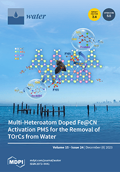
Cover Story (view full-size image): In this study, heteroatom-doped (S, P, B) carbon nitride coupled with NH2-MIL-53(Fe) was used to synthesize X-Fe@CN, which was then used for the activation of persulfate (PMS) for the reduction of trace organic contaminants (TOrCs). Through performance evaluations on the catalytic activity and iron leaching of X-Fe@CN in the degradation of dicamba (DIC) and atenolol (ATL) by activating PMS, B-Fe@CN and PB-Fe@CN were identified as efficient and stable catalysts. The results suggested the surface reaction mechanism was that B-Fe@CN’s surface defects, O-B-O, and pyrrolic nitrogen can adsorb PMS and initiate the formation of ·OH, SO4•−, and 1O2. The addition of P to the catalyst’s surface boosts electron transfers and, consequently, the activation of PMS. View this paper
  • Issues are regarded as officially published after their release is announced to the table of contents alert mailing list.
  • You may sign up for e-mail alerts to receive table of contents of newly released issues.
  • PDF is the official format for papers published in both, html and pdf forms. To view the papers in pdf format, click on the "PDF Full-text" link, and use the free Adobe Reader to open them.
Order results
Result details
Section
Select all
Export citation of selected articles as:
22 pages, 8990 KiB  
Article
ZnO-CuO Nanocomposite as an Efficient Adsorbent for As(III) Removal from Water
by Jesús Plácido Medina Salas, Francisco Gamarra Gómez, Elisban Juani Sacari Sacari, Wilson Orlando Lanchipa Ramos, Rocío María Tamayo Calderón, Efracio Mamani Flores, Víctor Yapuchura Platero, Walter Dimas Florez Ponce de León and Elmer Marcial Limache Sandoval
Water 2023, 15(24), 4318; https://doi.org/10.3390/w15244318 - 18 Dec 2023
Cited by 2 | Viewed by 1630
Abstract
Arsenic (III) exposure, often from contaminated water, can have severe health repercussions. Chronic exposure to this toxic compound is linked to increased risks of various health issues. Various technologies exist for arsenic (III) removal from contaminated water sources. This work synthesized ZnO-CuO nanocomposites [...] Read more.
Arsenic (III) exposure, often from contaminated water, can have severe health repercussions. Chronic exposure to this toxic compound is linked to increased risks of various health issues. Various technologies exist for arsenic (III) removal from contaminated water sources. This work synthesized ZnO-CuO nanocomposites through ultrasound-assisted coprecipitation, generating abundant hydroxylated sites via the deposition of ZnO nanoparticles onto CuO sheets for enhanced arsenic (III) adsorption. Structural characterization verified the formation of phase-pure heterostructures with emergent properties. Batch studies demonstrated exceptional 85.63% As(III) removal at pH 5, where binding with prevalent neutral H3AsO3 occurred through inner-sphere complexation with protonated groups. However, competing anions decreased removal through site blocking. Favorable pseudo-second order chemisorption kinetics and the 64.77 mg/g maximum Langmuir capacity revealed rapid multilayer uptake, enabled by intrinsic synergies upon nanoscale mixing of Zn/Cu oxides. The straightforward, energy-efficient ultrasonic production route makes this material promising for real-world water treatment integration. Full article
(This article belongs to the Special Issue Toxic Pollutants in Water: Health Risk Assessment and Removal)
Show Figures

Figure 1

18 pages, 5727 KiB  
Article
Ground-Runoff Harvesting to Increase Water Availability in Isolated Households on Hilly Mediterranean Islands: A Case Study in a Micro-Catchment of Ibiza (Spain)
by Daniele Pedretti, Inés Roig Palomeque and Stefan Meier
Water 2023, 15(24), 4317; https://doi.org/10.3390/w15244317 - 18 Dec 2023
Viewed by 1295
Abstract
Mediterranean islands suffer from a lack of freshwater due to persistent and recursive droughts, limited groundwater availability and mass tourism. In Ibiza (Spain), private estates disconnected from the water distribution network consume about 21% of the total freshwater demand on the island. We [...] Read more.
Mediterranean islands suffer from a lack of freshwater due to persistent and recursive droughts, limited groundwater availability and mass tourism. In Ibiza (Spain), private estates disconnected from the water distribution network consume about 21% of the total freshwater demand on the island. We conducted a study to evaluate the potential of ground-runoff harvesting (GRH) as a sustainable and inexpensive solution to increase freshwater availability in isolated households in Ibiza. The study involved an innovative modular tank of 40 m3 buried in the garden of a private property. The tank intercepted runoff forming in a 12,300 m2 hilly micro-catchment. We found that an extreme rainfall event with an intensity of 65 mm/h was able to create sufficient runoff to fill up the tank in one hour. A curve-number-based rainfall-runoff model was used to simulate the experimental results and to obtain a first-cut estimation of the potential of GRH at the scale of the island. The analysis indicates that, if installed in all forest areas in Ibiza with a similar slope to the study area, a volume of 1.31×10⁶ m3 of freshwater could be harvested per year on the island just from extreme precipitation events. Such a volume of water is equivalent to about 5% of the island’s total freshwater budget. The study concludes that GRH is a highly valuable, yet still unexploited opportunity to save large freshwater volumes in dry-climate areas like Ibiza. GRH should be promoted across Mediterranean islands, and it can be easily incorporated within local water regulations. Full article
(This article belongs to the Special Issue Rainwater Harvesting and Treatment)
Show Figures

Figure 1

15 pages, 7072 KiB  
Article
Attribution Analysis on Areal Change of Main Wetland and Its Influence on Runoff in the Naolihe River Basin
by Hong Ding, Qinghui Zeng, Qin Yang, Huan Liu, Peng Hu, Haifeng Zhu and Yinan Wang
Water 2023, 15(24), 4316; https://doi.org/10.3390/w15244316 - 18 Dec 2023
Viewed by 981
Abstract
Wetlands have powerful runoff regulation functions, which can effectively store and retain surface runoff. The runoff regulation function of wetlands is affected by wetland areas, which affect the capacity of flood control. To explore the law of the area change of the main [...] Read more.
Wetlands have powerful runoff regulation functions, which can effectively store and retain surface runoff. The runoff regulation function of wetlands is affected by wetland areas, which affect the capacity of flood control. To explore the law of the area change of the main wetlands of the Naolihe River Basin (MWNRB), the visual interpretation method was used to extract wetlands. To identify the reasons for area changes in the MWNRB, the maximum likelihood method, minimum distance method, and neural network method were used to classify land use types from remote sensing images; the M-K variation point test and Theil-Sen trend analysis were used to test the variation point and calculate the trend of precipitation and temperature series. To clarify the influence of wetland areas on runoff, the Gini coefficient and SRI of runoff were used to calculate runoff temporal inhomogeneity. The results showed that the area of the MWNRB obviously decreased, with 74.5 × 10⁶ m2/year from 1993 to 2008, and increased slowly from 2008 to 2015, with 27.7 × 10⁶ m2/year. From 1993 to 2008, 50.74% and 38.87% of wetlands were transformed into paddy fields and dry fields, respectively. From 2008 to 2015, 61.69% and 7.76% of wetlands were transformed from paddy fields and dry fields, respectively. The temperature of the MWNRB increased slowly by 0.04 °C/year from 1993 to 2008 and increased obviously by 0.16 °C/year from 2008 to 2015. The precipitation decreased by 5.6–8.1 mm/year and increased by 16.6–41.2 mm/year in 1993–2008 and 2008–2015, respectively. Compared with precipitation and temperature, land use change caused by human activities is the main cause of wetland area change. The area change of the MWNRB has a certain influence on the runoff regulation and storage capacity. The Gini coefficient and SRI index increased from 0.002/year (0.008) to 0.023/year from 1993 to 2008 and decreased from 0.046/year (0.045) to 0.161/year from 2008 to 2015, respectively. Full article
Show Figures

Figure 1

18 pages, 2356 KiB  
Article
Designing Water Inter-Plant Networks of Single and Multiple Contaminants through Mathematical Programming
by Abeer M. Shoaib, Amr A. Atawia, Mohamed H. Hassanean, Abdelrahman G. Gadallah and Ahmed A. Bhran
Water 2023, 15(24), 4315; https://doi.org/10.3390/w15244315 - 18 Dec 2023
Viewed by 966
Abstract
Water is the meaning of life for humans, agricultural and industrial processes; controlling the distribution of water and wastewater between industrial processes is very vital for rationalizing water and preserving the environment. This paper addresses a mathematical approach to optimizing water inter-plant networks. [...] Read more.
Water is the meaning of life for humans, agricultural and industrial processes; controlling the distribution of water and wastewater between industrial processes is very vital for rationalizing water and preserving the environment. This paper addresses a mathematical approach to optimizing water inter-plant networks. The water network problem is formulated as a nonlinear program (NLP) that is solved by LINGO Software, version 14.0. A generalized two-step mathematical model is designed to be valid for solving networks containing large numbers of sources and sinks. The introduced model is proposed to be used for both single and multiple contaminant problems with up to six contaminants. Two mathematical models are presented to design water inter-plant networks efficiently. Firstly, the introduced model is solved by LINGO, in which the data given are applied; the obtained results are simultaneously sent to a second model (based on Excel Software 2019, v. 16.0), by which the obtained water networks are automatically drawn. The proposed approach has been applied in three case studies; the first case study contains five plants of single contaminants, the second case study contains three plants of single contaminants, and the third case study contains three plants of multiple contaminants. The results showed a noticeable reduction in the percentages of freshwater consumption in the investigated three case studies, which were 38.6, 4.74 and 8.64%, respectively, and the wastewater discharge of the three case studies were decreased by 38.1, 4.61 and 8.65%, respectively. Full article
(This article belongs to the Special Issue Water Quality, Water Security and Risk Assessment)
Show Figures

Figure 1

18 pages, 4973 KiB  
Article
Adsorption of Lead from Water Using MnO2-Modified Red Mud: Performance, Mechanism, and Environmental Risk
by Yang Bai, Yin Pang, Zheng Wu, Xi Li, Jiang Jing, Hongbin Wang and Zheng Zhou
Water 2023, 15(24), 4314; https://doi.org/10.3390/w15244314 - 18 Dec 2023
Cited by 2 | Viewed by 1279
Abstract
A manganese dioxide-modified red mud (Mn-RM) was developed as an adsorbent for the effective removal of lead ions (Pb2+) from wastewater. Various methods were used to characterize the prepared Mn-RM, analyze its adsorption performance, and evaluate the associated environmental risks post-adsorption. [...] Read more.
A manganese dioxide-modified red mud (Mn-RM) was developed as an adsorbent for the effective removal of lead ions (Pb2+) from wastewater. Various methods were used to characterize the prepared Mn-RM, analyze its adsorption performance, and evaluate the associated environmental risks post-adsorption. The results revealed that Mn-RM has a large surface area (38.91 m2/g) and a developed porous structure (0.02 cm3/g). The adsorption process exhibited good agreement with the Langmuir isotherm and pseudo-second-order kinetic models, showcasing a theoretical maximum saturation adsorption capacity of 721.35 mg/g. The adsorption mechanism primarily involves electrostatic attraction, ion exchange, and chemical precipitation. The optimal treatment conditions were determined by utilizing a response surface model, resulting in a maximum Pb2+ removal efficiency of 87.45% at pH 5.21, a dosage of 0.83 g/L, and an initial concentration of 301.04 mg/L. The risk assessment code (RAC) for each heavy metal in Mn-RM was less than 1%, indicating low environmental risk. Furthermore, the synthetic toxicity index (STI) values showed a significant decrease post-treatment. This study introduces the concept of “controlling waste with waste”, offering a cost-effective approach to both utilizing red mud and removing aqueous Pb2+ while ensuring environmental safety and minimal ecological impact. Full article
Show Figures

Figure 1

25 pages, 13130 KiB  
Article
Variations in Precipitation at the Shimantan Reservoir, China
by Jinghan Zhang, Xiaopei Ju, Sheng Wang, Fengping Li and Ziyue Zhao
Water 2023, 15(24), 4313; https://doi.org/10.3390/w15244313 - 18 Dec 2023
Cited by 1 | Viewed by 1074
Abstract
Global warming substantially intensifies hydrologic cycles, causing increasing frequency and magnitude of catastrophic floods and droughts. Understanding the patterns and mechanisms of precipitation in historical periods is pivotal for regional disaster prevention and mitigation. Here, we analyzed the daily precipitation of six stations [...] Read more.
Global warming substantially intensifies hydrologic cycles, causing increasing frequency and magnitude of catastrophic floods and droughts. Understanding the patterns and mechanisms of precipitation in historical periods is pivotal for regional disaster prevention and mitigation. Here, we analyzed the daily precipitation of six stations at the Shimantan Reservoir from 1952 to 2013 to examine precipitation characteristics at different time scales. The Mann–Kendall test, moving t-test, and Innovative Polygon Trend Analysis (IPTA) were employed to detect the trends and change points in total precipitation amount, frequency, and duration. Influences of atmospheric circulations on precipitation were then explored via cross-wavelet analysis. Our results showed increased average precipitation and decreased precipitation days annually at the Shimantan Reservoir in the past decades. Specifically, increased seasonal precipitation was only detected in summer, while precipitation days were mainly reduced in winter. There was a noticeable increasing to decreasing transition trend in precipitation from July to August, and a transition from decreasing to increasing from June to July in precipitation days. Summer rainfall was predominantly moderate and light, accompanied by shortening and highly fluctuating rainstorm durations. July exhibited the highest precipitation frequency and always experienced rainstorms. The Arctic Oscillation and East Asian summer monsoon showed positive and negative correlations, respectively, with the changes in precipitation at the Shimantan Reservoir. Our analyses provide a fine-scale portrait of precipitation patterns and mechanisms under a changing climate and benefit regional flood control and sustainable development. Full article
Show Figures

Figure 1

29 pages, 11607 KiB  
Article
Developing an Approach for Equitable and Reasonable Utilization of International Rivers: The Nile River
by Yared Gari, Paul Block, Tammo S. Steenhuis, Muluneh Mekonnen, Getachew Assefa, Abebe Kidus Ephrem, Yared Bayissa and Seifu A. Tilahun
Water 2023, 15(24), 4312; https://doi.org/10.3390/w15244312 - 18 Dec 2023
Cited by 1 | Viewed by 1738
Abstract
The absence of a basin-wide apportionment agreement on using the Nile River equitably has been a long-standing source of disagreement among Nile riparian states. This study introduces a new approach that the riparian states can consider that quantifies the Nile River’s apportionment. The [...] Read more.
The absence of a basin-wide apportionment agreement on using the Nile River equitably has been a long-standing source of disagreement among Nile riparian states. This study introduces a new approach that the riparian states can consider that quantifies the Nile River’s apportionment. The approach includes (1) developing a basin-wide database of indicators representative of the United Nations Watercourse Convention (UNWC) relevant factors and circumstances, (2) developing an ensemble of indicator weighting scenarios using various weighting methods, and (3) developing six water-sharing methods to obtain a range of apportionments for Egypt, Sudan, Ethiopia and the group of the White Nile Equatorial States for each weighting scenarios. The results illustrate a relatively narrow range of country-level water apportionments, even though some individual factor weights vary from 3% to 26%. Considering the entire Nile River, the water apportionment for Ethiopia ranges from 32% to 38%, Sudan and South Sudan from 25% to 33%, Egypt from 26% to 35%, and the Equatorial States from 5% to 7%. We trust that the six proposed equitable water-sharing methods may aid in fostering basin-wide negotiations toward a mutual agreement and address the dispute over water sharing. Full article
Show Figures

Graphical abstract

39 pages, 8183 KiB  
Article
The Effect of the El Nino Southern Oscillation on Precipitation Extremes in the Hindu Kush Mountains Range
by Muhammad Umer Masood, Saif Haider, Muhammad Rashid, Muhammad Usama Khan Lodhi, Chaitanya B. Pande, Fahad Alshehri, Kaywan Othman Ahmed, Miklas Scholz and Saad Sh. Sammen
Water 2023, 15(24), 4311; https://doi.org/10.3390/w15244311 - 18 Dec 2023
Viewed by 1555
Abstract
The El Nino Southern Oscillation (ENSO) phenomenon is devastating as it negatively impacts global climatic conditions, which can cause extreme events, including floods and droughts, which are harmful to the region’s economy. Pakistan is also considered one of the climate change hotspot regions [...] Read more.
The El Nino Southern Oscillation (ENSO) phenomenon is devastating as it negatively impacts global climatic conditions, which can cause extreme events, including floods and droughts, which are harmful to the region’s economy. Pakistan is also considered one of the climate change hotspot regions in the world. Therefore, the present study investigates the effect of the ENSO on extreme precipitation events across the Upper Indus Basin. We examined the connections between 11 extreme precipitation indices (EPIs) and two ENSO indicators, the Southern Oscillation Index (SOI) and the Oceanic Niño Index (ONI). This analysis covers both annual and seasonal scales and spans the period from 1971 to 2019. Statistical tests (i.e., Mann–Kendall (MK) and Innovative Trend Analysis (ITA)) were used to observe the variations in the EPIs. The results revealed that the number of Consecutive Dry Days (CDDs) is increasing more than Consecutive Wet Days (CWDs); overall, the EPIs exhibited increasing trends, except for the Rx1 (max. 1-day precipitation) and Rx5 (max. 5-day precipitation) indices. The ENSO indicator ONI is a temperature-related ENSO index. The results further showed that the CDD value has a significant positive correlation with the SOI for most of the UIB (Upper Indus Basin) region, whereas for the CWD value, high elevated stations gave a positive relationship. A significant negative relationship was observed for the lower portion of the UIB. The Rx1 and Rx5 indices were observed to have a negative relationship with the SOI, indicating that El Nino causes heavy rainfall. The R95p (very wet days) and R99p (extreme wet days) indices were observed to have significant negative trends in most of the UIB. In contrast, high elevated stations depicted a significant positive relationship that indicates they are affected by La Nina conditions. The PRCPTOT index exhibited a negative relationship with the SOI, revealing that the El Nino phase causes wet conditions in the UIB. The ONI gave a significant positive relationship for the UIB region, reinforcing the idea that both indices exhibit more precipitation during El Nino. The above observations imply that while policies are being developed to cope with climate change impacts, the effects of the ENSO should also be considered. Full article
Show Figures

Figure 1

36 pages, 4275 KiB  
Review
Aquaponics: A Sustainable Path to Food Sovereignty and Enhanced Water Use Efficiency
by Lubna A. Ibrahim, Hiba Shaghaleh, Gamal Mohamed El-Kassar, Mohamed Abu-Hashim, Elsayed Ahmed Elsadek and Yousef Alhaj Hamoud
Water 2023, 15(24), 4310; https://doi.org/10.3390/w15244310 - 18 Dec 2023
Cited by 7 | Viewed by 9991
Abstract
This comprehensive review explores aquaponics as an environmentally friendly solution aligned with SDGs and food sovereignty, assessing various aspects from system design to automation, and weighing social, economic, and environmental benefits through literature and case studies. However, challenges persist in obtaining organic certification [...] Read more.
This comprehensive review explores aquaponics as an environmentally friendly solution aligned with SDGs and food sovereignty, assessing various aspects from system design to automation, and weighing social, economic, and environmental benefits through literature and case studies. However, challenges persist in obtaining organic certification and legislative recognition, hindering its growth. Achieving remarkable water use efficiency, up to 90%, relies on adaptable fish species like Nile tilapia and carp. Nutrient-rich fish feeds notably benefit low-nutrient-demanding greens. Ensuring water quality and efficient nitrification are pivotal, supported by IoT systems. Despite its efficiency, integrating Industry 4.0 involves complexity and cost barriers, necessitating ongoing innovation. Economies of scale and supportive horticultural policies can bolster its viability. Aquaponics, known for its efficiency in enhancing crop yields while minimizing water use and waste, is expanding globally, especially in water-scarce regions. Aquaponics, pioneered by the University of the Virgin Islands, is expanding in Europe, notably in Spain, Denmark, Italy, and Germany. Asia and Africa also recognize its potential for sustainable food production, especially in water-limited areas. While it offers fresh produce and cost savings, challenges arise in scaling up, managing water quality, and meeting energy demands, particularly for indoor systems. Egypt’s interest in desert and coastal regions highlights aquaponics’ eco-friendly food production potential. Despite the associated high costs, there is a quest for practical and affordable designs for everyday integration. Research in arid regions and industry advancements are crucial for aquaponics’ global food production potential. Deeper exploration of intelligent systems and automation, particularly in large-scale setups, is essential, highlighting the industry’s promise. Practical application, driven by ongoing research and local adaptations, is a key to fully harnessing aquaponics for sustainable food production worldwide. Full article
(This article belongs to the Special Issue Review Papers of Water, Agriculture and Aquaculture)
Show Figures

Figure 1

22 pages, 16640 KiB  
Article
Deformation Field Analysis of Small-Scale Model Experiment on Overtopping Failure of Embankment Dams
by Qiang Lu, Yanchang Gu, Shijun Wang, Xiandong Liu and Hong Wang
Water 2023, 15(24), 4309; https://doi.org/10.3390/w15244309 - 18 Dec 2023
Viewed by 1178
Abstract
There are a large number of reservoir dams in China, of which embankment dams account for more than 90%, and public safety will be seriously endangered in case of dam failure. Overtopping is the leading cause of dam failure, and the existing research [...] Read more.
There are a large number of reservoir dams in China, of which embankment dams account for more than 90%, and public safety will be seriously endangered in case of dam failure. Overtopping is the leading cause of dam failure, and the existing research mainly focuses on the study of the failure process, with less research on the change in the deformation field during the failure process. In this study, the measured deformation field data of a modeled embankment dam during the whole process of impoundment, operation, and failure were obtained by carrying out indoor small-scale model experiments of overtopping failure, embedding inclinometers inside the dam body, and setting vertical displacement measurement markers on the surface. A refined analysis of the measured deformation data shows that the dam body displaces vertically downward during the impoundment stage and the vertical displacement at the dam crest has the largest amplitude; the internal horizontal displacement changes to the left bank and downstream side, and the amplitude of the internal horizontal displacement (upstream and downstream direction and dam axis direction) on the right dam sections is more significant than that in the middle of the dam; during the breaching stage, the time sequence of the sudden change in each internal horizontal displacement measuring point is from the downstream side to the upstream side and from the higher elevation to the lower elevation, which is basically consistent with the process of overtopping of embankment dams; and the overall sudden change in left and right bank horizontal displacements within the downstream side of the dam crest and the downstream side of the dam body gauges is significant, and the sudden change in upstream and downstream horizontal displacement (U&D HD) within the downstream side of the dam crest gauges is significant. The experimental analysis results can support the disaster mechanism of embankment dam failure and the theory of early warning of failure. Full article
(This article belongs to the Special Issue Safety Monitoring of Hydraulic Structures)
Show Figures

Figure 1

20 pages, 4838 KiB  
Article
Impact of Xiaolangdi Reservoir on the Evolution of Water Infiltration Influence Zones of the Secondary Perched Reach of the Lower Yellow River
by Min Zhang, Jianhua Ping, Yafei Zou, He Li, Joshua Mahwa, Jichang Zhao and Jiaqi Liu
Water 2023, 15(24), 4308; https://doi.org/10.3390/w15244308 - 18 Dec 2023
Viewed by 1138
Abstract
Understanding the complex interplay between water management infrastructure and groundwater dynamics is crucial for sustainable resource utilization. This study investigates water infiltration dynamics in the secondary perched reach of the Yellow River after the operation of the Xiaolangdi Reservoir. The methodology included the [...] Read more.
Understanding the complex interplay between water management infrastructure and groundwater dynamics is crucial for sustainable resource utilization. This study investigates water infiltration dynamics in the secondary perched reach of the Yellow River after the operation of the Xiaolangdi Reservoir. The methodology included the application of the single-factor analysis of variance and water balance method, alongside a dual-structure, one-dimensional seepage model to simulate interactions within the system, while exploring characteristics of the groundwater flow system and the exploitation depth of below 100 m. Furthermore, we studied the influence zone range and alterations in river water infiltration in the secondary perched reach of the river following the operation of Xiaolangdi Reservoir. The results show that before the operation of the reservoir, the influence ranges of the north and south banks of the aboveground reach extended from 20.13 km to 20.48 km and 15.85 km to 16.13 km, respectively. Following the initiation of the reservoir, the river channel underwent scouring, leading to enhanced riverbed permeability. Additionally, the influence of long-term groundwater exploitation on both riverbanks extended the influence range of groundwater recharge within the secondary perched reach of the river. The influence zone of the north bank is now 23.41 km–26.74 km and the south bank 18.43 km–21.05 km. After years of shallow groundwater extraction, multiple groundwater depression cones emerged within the five major groundwater source areas on both sides of the river. Notably, deeper water levels (Zhengzhou to Kaifeng) have significantly decreased, with a drop of 42 m to 20 m to 15 m. This change in groundwater dynamics extended beyond the main channel of the river, creating a localized shallow groundwater field. Full article
(This article belongs to the Section Hydrogeology)
Show Figures

Figure 1

24 pages, 6117 KiB  
Article
Wildlife Roadkill Driven by Hydrological Regime in a Subtropical Wetland
by Rutineia Tassi, Enio Júnior Seidel, David da Motta-Marques, Adolfo Villanueva and Latif Kalin
Water 2023, 15(24), 4307; https://doi.org/10.3390/w15244307 - 18 Dec 2023
Viewed by 1373
Abstract
This study explored the role of the hydrological regime as a trigger factor for wildlife roadkill along a 22 km road crossing the Taim Wetland, a Ramsar site of international importance in South Brazil. The north–south crossing of BR-471, a federal highway, causes [...] Read more.
This study explored the role of the hydrological regime as a trigger factor for wildlife roadkill along a 22 km road crossing the Taim Wetland, a Ramsar site of international importance in South Brazil. The north–south crossing of BR-471, a federal highway, causes fatalities to numerous animals due to collisions with vehicles. An 11-year long-term time series study encompassing monthly roadkill incidents, water level, and rainfall was analyzed by considering three different periods related to a Wildlife Protection System (WPS): (i) 3 initial years before the WPS implementation (BWPS); (ii) 4 intermediate years after the WPS implementation (AWPS), which includes fences, fauna tunnels, cattle guard stocks, bumps, and speed control; (iii) 4 final years during partial destruction of the WPS (PDWPS). A pseudo-2D full hydrodynamic cell model was employed to fill missing water level data. The model had a good to very good performance (NSE: 0.73 to 0.87; R2: 0.79 to 0.90). The relationship between roadkill incidents and the WPS periods (BWPS, AWPS, and PDWPS) was modeled using Generalized Additive Models for Location, Scale, and Shape (GAMLSS), considering rainfall and water level as predictor variables. The analysis revealed a higher incidence of wildlife roadkill in BWPS compared to AWPS and PDWPS, suggesting the effectiveness of the implemented measures. Critical season and interplay between water levels, rainfall, and the roadkill were assessed. Mammals was the most common roadkill class identified (~92%), followed by reptiles (13%) and birds (2%), with no change in these percentual in the BWPS, AWPS, and PDWPS. Among mammals, capybara (Hydrochoerus hydrochaeris) and coypu (Myocastor coypu) were the most frequent victims (~93% of mammals). Winter, followed by autumn, recorded the highest number of roadkill incidents (>60%), and this pattern remained consistent during the three periods. While rainfall did not emerge as a determining variable for roadkill, water levels above certain thresholds (>3.3 m) drastically diminished the effectiveness of the WPS, mainly due to fauna tunnel submersion. These findings offer valuable insights for enhancing wildlife conservation strategies in this protected area by incorporating hydrological information providing a baseline for designing WPS in similar environments. Full article
(This article belongs to the Special Issue Wetland Processes, Monitoring and Modeling for Design and Management)
Show Figures

Figure 1

14 pages, 7071 KiB  
Article
Removing Norfloxacin from Aqueous Solutions Using Biochar Derived from Waste Disposable Bamboo Chopsticks
by Ming Zhang, Shuai Shao, Penghui Li and Runjuan Zhou
Water 2023, 15(24), 4306; https://doi.org/10.3390/w15244306 - 18 Dec 2023
Cited by 2 | Viewed by 1097
Abstract
The presence of antibiotics in water environments increases the resistance of bacterial and can also cause irreversible damage to ecosystems and the human body. In this study, disposable bamboo chopsticks were used as raw material to prepare bamboo biochar (BB) via oxygen-limited pyrolysis [...] Read more.
The presence of antibiotics in water environments increases the resistance of bacterial and can also cause irreversible damage to ecosystems and the human body. In this study, disposable bamboo chopsticks were used as raw material to prepare bamboo biochar (BB) via oxygen-limited pyrolysis to remove norfloxacin (NOR) from aqueous solutions. The properties of the BB were explained through the characterization of its SBET, morphology, structure, and functional groups. The effects of the dosage, pH, ionic strength, and water type on the removal of NOR using BB were investigated. The maximum theoretical adsorption capacities (Qmax) of NOR removed by BB at 25, 35, and 45 °C obtained using the Langmuir model were 76.17, 77.22, and 105.19 mg/g, respectively. To facilitate a comparison with other types of biochar, this study also prepared biochar of rice straw, wheat straw, soybean straw, corn straw, rape straw, peanut shell, Eichhornia crassipes, and other biomass raw materials under the same preparation conditions as the BB. The results demonstrated that the removal rate of NOR using BB was the highest under the same adsorption conditions, reaching 99.71%. Biochar from waste disposable bamboo chopsticks can be used for the treatment of new types of pollutants in water bodies, such as antibiotics and other organic contaminants, which will help to achieve sustainable solid waste management. Full article
Show Figures

Figure 1

13 pages, 5462 KiB  
Article
Refined Assessment and Future Projections of Indian Summer Monsoon Rainfall Using CMIP6 Models
by Jiahao Li, Lingli Fan, Xuzhe Chen, Chunqiao Lin, Luchi Song and Jianjun Xu
Water 2023, 15(24), 4305; https://doi.org/10.3390/w15244305 - 18 Dec 2023
Viewed by 1347
Abstract
Analyzing and forecasting the Indian Summer Monsoon Rainfall (ISMR) is vital for South Asia’s socio-economic stability. Using 35 climate models from the latest generation of the Coupled Model Intercomparison Project (CMIP6) to simulate and project ISMR, we integrated statistical methods, such as Taylor [...] Read more.
Analyzing and forecasting the Indian Summer Monsoon Rainfall (ISMR) is vital for South Asia’s socio-economic stability. Using 35 climate models from the latest generation of the Coupled Model Intercomparison Project (CMIP6) to simulate and project ISMR, we integrated statistical methods, such as Taylor diagrams, comprehensive rating indicators, and interannual variability scores, to compare performance differences between various models and analyze influencing mechanisms. The results show that the majority of models effectively simulate the climatology of the ISMR. However, they exhibit limitations in accurately capturing its interannual variability. Importantly, we observed no significant correlation between a model’s ability to simulate ISMR’s general climatology and its accuracy in representing annual variability. After a comprehensive assessment, models, like BCC-ESM1, EC-Earth3-Veg, GFDL-CM4, INM-CM5-0, and SAM0-UNICON were identified as part of the prime model mean ensemble (pMME), demonstrating superior performance in spatiotemporal simulations. The pMME can accurately simulate the sea surface temperature changes in the North Indian Ocean and the atmospheric circulation characteristics of South Asia. This accuracy is pivotal for CMIP6’s prime models to precisely simulate ISMR climatic variations. CMIP6 projections suggest that, by the end of the 21st century, ISMR will increase under low, medium, and high emission scenarios, with a significant rise in rainfall under the high emission scenario, especially in the western and northern parts of India. Among the pMME, the projected increase in rainfall across India is more moderate, with an estimated increase of 30%. The findings of this study suggest that selecting the best models for regional climate downscaling research will project regional climate changes more accurately. This provides valuable recommendations for model improvements in the Indian region. Full article
(This article belongs to the Special Issue Hydroclimatic Modeling and Monitoring under Climate Change)
Show Figures

Figure 1

16 pages, 7744 KiB  
Article
Study of Tip Clearance on Dynamic and Static Head of a Spiral Axial-Flow Blade Pump under Cavitation Conditions
by Haigang Wen, Wenjuan Lv and Guangtai Shi
Water 2023, 15(24), 4304; https://doi.org/10.3390/w15244304 - 18 Dec 2023
Viewed by 961
Abstract
A spiral axial-flow blade pump (SABP) is an indispensable device in the closed gathering and transporting technology of oil and natural gas exploitation; it can not only transport a gas–liquid mixture with a high gas content, but also transport a gas–liquid–solid mixture containing [...] Read more.
A spiral axial-flow blade pump (SABP) is an indispensable device in the closed gathering and transporting technology of oil and natural gas exploitation; it can not only transport a gas–liquid mixture with a high gas content, but also transport a gas–liquid–solid mixture containing a small amount of sand. However, due to the large vortices that often appear in the flow channel of the SABP, cavitation is induced extremely easily. This paper presents a numeric calculation of the cavitation performance of an SABP to reveal the law governing the impact of cavitation on its internal flow. The impact of tip clearance with different sizes on the dynamic and static head of the SABP was analyzed, and the change rules of the absolute velocity, relative velocity, and dynamic and static head were revealed under different cavitation stages, too. Full article
(This article belongs to the Special Issue Design and Optimization of Fluid Machinery)
Show Figures

Figure 1

15 pages, 8469 KiB  
Article
Experimental Study on the Filtration Characteristics and Sediment Distribution Influencing Factors of Sand Media Filters
by Wenzheng Zhang, Jiumao Cai, Guoliang Zhai, Lei Song and Mouchao Lv
Water 2023, 15(24), 4303; https://doi.org/10.3390/w15244303 - 18 Dec 2023
Cited by 1 | Viewed by 1802
Abstract
The sand media filter is a crucial component of micro-irrigation filtration systems. Investigating the effects of various factors on filtration performance and the migration patterns of sediment particles within the filter can enhance the healthy operation of sand media filters. This study, based [...] Read more.
The sand media filter is a crucial component of micro-irrigation filtration systems. Investigating the effects of various factors on filtration performance and the migration patterns of sediment particles within the filter can enhance the healthy operation of sand media filters. This study, based on a sand media filter model, conducts indoor hydraulic experiments, selecting different experimental factors and observation indices for research under varying conditions. Results indicate that filter thickness and raw water concentration are positively correlated with the turbidity of filtered water samples, while changes in filtration rate have no obvious impact on turbidity. When filter thickness is large, particle content differs obviously from other filter thicknesses, and the effect of raw water concentration changes on particle content is similar to that of filter thickness changes. Sediment particle size distribution within the filter layer is primarily concentrated in the upper region. By focusing on the area situated 20 cm below the filter layer surface, the sediment retention rate reached 80% or higher at a depth of 20 cm below the filter layer surface. As the depth of the filter layer increases, the sediment retention characteristics show a decreasing trend for larger particle sizes and an increasing trend for smaller particle sizes. Head loss is positively correlated with filtration rate, raw water concentrations, and filter thickness changes. It is suggested that, when meeting micro-irrigation water quality requirements, the filter material particle size can be appropriately increased to improve filtration efficiency and reduce energy consumption. These research findings are highly significant for sand media filter material selection and working condition design. Full article
Show Figures

Figure 1

18 pages, 6016 KiB  
Article
Impact of Land Use Change on the Water Environment of a Key Marsh Area in Vientiane Capital, Laos
by Keophouxone Phanmala, Yizhe Lai and Kang Xiao
Water 2023, 15(24), 4302; https://doi.org/10.3390/w15244302 - 18 Dec 2023
Cited by 2 | Viewed by 1686
Abstract
The water environment is critical to maintaining ecosystem balance and human well-being globally. It is essential to comprehend the effects of land use change on water quantity and quality for sustainable development of the urban environment. Expansion of urban areas leads to intensified [...] Read more.
The water environment is critical to maintaining ecosystem balance and human well-being globally. It is essential to comprehend the effects of land use change on water quantity and quality for sustainable development of the urban environment. Expansion of urban areas leads to intensified human activity and increased pollution loads in natural waterbodies. This study aimed to monitor changes in land use over a span of two decades to evaluate the condition of the water environment in That Luang Marsh (TLM). The land use and land cover (LULC) classes, including agricultural land, bare land, built-up land, vegetation, waterbody, and wetland, were categorized via Landsat images utilizing the maximum likelihood algorithm. A digital elevation model was used to estimate the water surface area and volume, and the nutrient delivery ratio model was employed to analyze nutrient distribution across the LULC classes. The results showed that from 2001 to 2020, the bare land, built-up, waterbody, and wetland areas increased by 29.92, 18.64, 0.87, and 0.16 times, respectively, while the agricultural and vegetation land decreased by 0.80 and 0.76 times, respectively. A binary logistic regression model for influential factors implies that road network expansion within the special economic zone in TLM could result in an increase in residential areas, thereby impacting the LULC classes. The increase in water volume showed a robust correlation with the expansion of built-up land, bare land, and waterbody. TLM had an average nitrate-nitrogen export of 317 tons/year with a 95% confidence interval of (56, 770) tons/year in 2020. The distribution over LULC classes affected the export, which varied dynamically. Vegetation land had the highest nitrate-nitrogen load of 0.57 tons/ha/year, probably due to poorly managed use of fertilizers. The developed land surface for an artificial lake could lead to an increase in the water volume, which could be involved in the dilution of nutrient concentration. Therefore, it is crucial to prioritize policies that aim to establish sustainable urban water environments through rational urban planning and by making LULC management a primary consideration, especially for developing countries undergoing similar processes of urbanization along the Mekong River in Southeast Asia. Full article
(This article belongs to the Section Water Resources Management, Policy and Governance)
Show Figures

Figure 1

15 pages, 7242 KiB  
Article
Identification Method of River Blocking by Debris Flow in the Middle Reaches of the Dadu River, Southwest of China
by Zhi Song, Gang Fan, Yanni Chen and Darui Liu
Water 2023, 15(24), 4301; https://doi.org/10.3390/w15244301 - 18 Dec 2023
Viewed by 955
Abstract
Debris flow is a typical natural disaster in the middle reaches of the Dadu River, which seriously threatens the safety of life and property of local residents. However, there is currently a lack of a comprehensive analysis methods applicable to the blockage of [...] Read more.
Debris flow is a typical natural disaster in the middle reaches of the Dadu River, which seriously threatens the safety of life and property of local residents. However, there is currently a lack of a comprehensive analysis methods applicable to the blockage of river channels by debris flow in the Dadu River basin, limiting disaster prevention and mitigation in this area. Based on previous large-scale model tests carried out in the middle reaches of the Dadu River, the debris flows are divided into dam-type debris flows and submerged debris flows. The calculation formulas for the maximum travel distance of the two kinds of debris flows entering the river are obtained via theoretical derivation. The formulas for calculating the length and volume of debris flow accumulation are derived, and the relationship between the debris flow loss coefficient and river blocking degree in the middle part of the Dadu River is analyzed. An identification method of river blocking by debris flow is put forward in this study. By calculating the maximum blocking degree, S (the ratio of the maximum driving distance of the debris flow to the width of the river), and the volume of the source materials needed to form a debris flow dam under the conditions that the debris flow does not reach the opposite bank (V1), reaches the opposite bank but does not block the river (V2), and reaches the opposite bank (V3), the form of debris flow blocking the river is distinguished. When S = 1, V > V3, complete blockage occurs; when S = 1, V > V2, the river is mostly blocked; when S < 1, V > V1, the river is half-blocked. This study established an identification method of river blocking by debris flow, providing a basis for early warning for river blocking and disaster prevention in the middle reaches of the Dadu River. Full article
(This article belongs to the Special Issue Risk Analysis in Landslides and Groundwater-Related Hazards)
Show Figures

Figure 1

24 pages, 6959 KiB  
Article
Soil-Matric-Potential-Based Irrigation Scheduling to Increase Yield and Water Productivity of Okra
by Arunadevi K., Singh M., Khanna M., Mishra A. K., Prajapati V. K., Denny F., Ramachandran J. and Maruthi Sankar G. R.
Water 2023, 15(24), 4300; https://doi.org/10.3390/w15244300 - 18 Dec 2023
Cited by 1 | Viewed by 1461
Abstract
A field experiment was conducted on okra (Abelmoschus esculentus L.) for assessing the sustainability of yield with optimum irrigation schedule based on soil moisture depletion. Four irrigation treatments: Irrigation at I1:20%, I2:30%, I3:40% and I4 [...] Read more.
A field experiment was conducted on okra (Abelmoschus esculentus L.) for assessing the sustainability of yield with optimum irrigation schedule based on soil moisture depletion. Four irrigation treatments: Irrigation at I1:20%, I2:30%, I3:40% and I4:50% of soil moisture depletion rate in main plots and three fertilizer treatments: Fertigation at F1:100%, F2:80% and F3:60% of recommended NPK (100:25:40 kg/ha) in subplots were tested. Soil matric potential was recorded continuously using electronic tensiometers. The soil moisture characteristics curve was derived for various soil matric potential value sand the soil water content. The irrigation controller triggered solenoid valves for irrigation when soil moisture depletion reached a prespecified level in each treatment. Soil moisture depletion values were significantly predicted based on a regression model calibrated for each treatment over the crop growing period. The model gave minimum prediction error (PE) for I1, followed by I2, I3 and I4, respectively. Plant growth and yield parameters were significantly influenced by the soil moisture availability under each treatment. It is recommended that irrigation be scheduled at 20% soil moisture depletion rate together with 100% NPK fertilizer application for attaining sustainable yield of okra (12.3 t/ha), apart from maximum WUE (3.5 kg/m3) and plant growth parameters under semiarid inceptisols. Full article
(This article belongs to the Special Issue Research on Soil Moisture and Irrigation)
Show Figures

Graphical abstract

11 pages, 2810 KiB  
Article
Determination of Chemical Species Dominating the Corrosivity of Japanese Tap Water by Multiple Regression Analysis
by Yuji Nakamura, Yasuki Matsukawa, Shinji Okazaki and Shukuji Asakura
Water 2023, 15(24), 4299; https://doi.org/10.3390/w15244299 - 18 Dec 2023
Viewed by 984
Abstract
Japanese tap water is Ca2+-poor and SiO2-rich in comparison with that of other counties. Thus, there have been few studies on its corrosivity. We sampled tap waters at 70 different sites and in different seasons in Japan, subjected the [...] Read more.
Japanese tap water is Ca2+-poor and SiO2-rich in comparison with that of other counties. Thus, there have been few studies on its corrosivity. We sampled tap waters at 70 different sites and in different seasons in Japan, subjected the samples to chemical analysis and measured localized corrosion depth and the total corrosion loss of carbon steel placed in these waters. The average corrosion rate vavg and maximum localized corrosion rate vmax were calculated. The ratio of vmax to vavg, which was defined as localized corrosion factor LCF (=vmax/vavg), was also studied. The multiple regression method was applied to obtain the dependence of vavg (objective variable) on concentrations of chemical species (explanatory variables). In the same manner, the relation of vmax and LCF to concentrations of chemical species was derived. As a result, we showed that SiO2 and SO42− mainly dominate the corrosivity of Japanese tap water. In particular, as SO42− increased, vavg became larger and vmax became smaller. Also, as SiO2 increased, vmax became larger and vavg became smaller. The behavior of LCF was similar to that of vmax. The findings of this study will be useful for estimating the corrosivity of tap waters that have low Ca2+ and high SiO2 concentrations. Full article
Show Figures

Figure 1

15 pages, 4312 KiB  
Article
The C/N Ratio’s Effect on a Membrane-Aerated Biofilm Reactor (MABR): COD and Nitrogen Removal, Biofilm Characteristics, and Microbial Community Structure
by Huiyun Zhong, Liangfei Dong, Yuanyuan Tang, Lin Qi and Mengyu Wang
Water 2023, 15(24), 4298; https://doi.org/10.3390/w15244298 - 17 Dec 2023
Cited by 2 | Viewed by 1465
Abstract
In this study, a laboratory-scale membrane aerated biofilm reactor system was operated successively through four phases with different C/N ratios (7, 5, 3, and 1) for 15 days each to investigate the C/N ratio’s effect on the COD and nitrogen removal. The COD [...] Read more.
In this study, a laboratory-scale membrane aerated biofilm reactor system was operated successively through four phases with different C/N ratios (7, 5, 3, and 1) for 15 days each to investigate the C/N ratio’s effect on the COD and nitrogen removal. The COD and NH4+-N removal efficiencies were slightly affected; however, NO3-N accumulated in the C/N = 1 phase, and slight NO2-N accumulation was observed in the C/N = 7 phase, leading to lower total nitrogen (TN) removal in the two phases. The TN removal efficiency reached the highest in the C/N = 5 phase at around 70%, and the TN concentration was reduced to 12.3 mg/L on average. Biomass and biofilm thickness had a positive correlation with C/N ratios. The C/N ratio affected not only the generation of extracellular polymeric substances but also their chemical composition. Microbial analysis revealed that a C/N ratio of 5 was the most suitable for both nitrifying and denitrifying bacteria, and a higher C/N ratio favored aerobic denitrifying microbes. Full article
Show Figures

Figure 1

17 pages, 2098 KiB  
Article
An Optimal Model and Application of Hydraulic Structure Regulation to Improve Water Quality in Plain River Networks
by Fan Huang, Haiping Zhang, Qiaofeng Wu, Shanqing Chi and Mingqing Yang
Water 2023, 15(24), 4297; https://doi.org/10.3390/w15244297 - 17 Dec 2023
Cited by 1 | Viewed by 1119
Abstract
The proper dispatching of hydraulic structures in water diversion projects is a desirable way to maximize project benefits. This study aims to provide a reliable, optimal scheduling model for hydraulic engineering to improve the regional water environment. We proposed an improved gravitational search [...] Read more.
The proper dispatching of hydraulic structures in water diversion projects is a desirable way to maximize project benefits. This study aims to provide a reliable, optimal scheduling model for hydraulic engineering to improve the regional water environment. We proposed an improved gravitational search algorithm (IPSOGSA) based on multi-strategy hybrid technology to solve this practical problem. The opposition-based learning strategy, elite mutation strategy, local search strategy, and co-evolution strategies were employed to balance the exploration and exploitation of the algorithm through the adaptive evolution of the elite group. Compared with several other algorithms, the preponderance of the proposed algorithm in single-objective optimization problems was demonstrated. We combined the water quality mechanism model, an artificial neural network (ANN), and the proposed algorithm to establish the optimal scheduling model for hydraulic structures. The backpropagation neural network (IGSA-BPNN) trained by the improved algorithm has a high accuracy, with a coefficient of determination (R2) over 0.95. Compared to the two traditional algorithms, the IGSA-BPNN model was, respectively, improved by 1.5% and 0.9% on R2 in the train dataset, and 1.1% and 1.5% in the test dataset. The optimal scheduling model for hydraulic structures led to a reduction of 46~69% in total power consumption while achieving the water quality objectives. With the lowest cost scheme in practice, the proposed intelligent scheduling model is recommended for water diversion projects in plain river networks. Full article
Show Figures

Figure 1

20 pages, 1806 KiB  
Article
Multi-Dimensional Urban Flooding Impact Assessment Leveraging Social Media Data: A Case Study of the 2020 Guangzhou Rainstorm
by Shuang Lu, Jianyun Huang and Jing Wu
Water 2023, 15(24), 4296; https://doi.org/10.3390/w15244296 - 17 Dec 2023
Cited by 1 | Viewed by 1490
Abstract
In the contexts of global climate change and the urbanization process, urban flooding poses significant challenges worldwide, necessitating effective rapid assessments to understand its impacts on various aspects of urban systems. This can be achieved through the collection and analysis of big data [...] Read more.
In the contexts of global climate change and the urbanization process, urban flooding poses significant challenges worldwide, necessitating effective rapid assessments to understand its impacts on various aspects of urban systems. This can be achieved through the collection and analysis of big data sources such as social media data. However, existing literature remains limited in terms of conducting a comprehensive disaster impact assessment leveraging social media data. This study employs mixed-methods research, a synergy of statistical analysis, machine learning algorithms, and geographical analysis to examine the impacts of urban flooding using the case of the 2020 Guangzhou rainstorm event. The result show that: (1) analyzing social media content enables monitoring of the development of disaster situations, with varied distributions of impact categories observed across different phases of the urban flood event; (2) a lexicon-based approach allows for tracking specific sentiment categories, revealing differential contributions to negative sentiments from various impact topics; (3) location information derived from social media texts can unveil the geographic distribution of impacted areas, and significant correlations are indicated between the waterlogging hotspots and four predisposing factors, namely precipitation, proportion of built-up surfaces, population density, and road density. Consequently, this study suggests that collecting and analyzing social media data is a reliable and feasible way of conducting rapid impact assessment for disasters. Full article
Show Figures

Figure 1

23 pages, 5483 KiB  
Article
Flood Risk Assessment Based on Hydrodynamic Model—A Case of the China–Pakistan Economic Corridor
by Xiaolin Sun, Ke Jin, Hui Tao, Zheng Duan and Chao Gao
Water 2023, 15(24), 4295; https://doi.org/10.3390/w15244295 - 16 Dec 2023
Viewed by 1772
Abstract
Under global warming, flooding has become one of the most destructive natural disasters along the China–Pakistan Economic Corridor (CPEC), which significantly jeopardizes the construction and ongoing stability of the CPEC. The assessment of regional flood potential is, therefore, crucial for effective flood prevention [...] Read more.
Under global warming, flooding has become one of the most destructive natural disasters along the China–Pakistan Economic Corridor (CPEC), which significantly jeopardizes the construction and ongoing stability of the CPEC. The assessment of regional flood potential is, therefore, crucial for effective flood prevention and relief measures. In light of this, our study applied MIKE 11 hydrodynamic model for the Indus River Basin of Pakistan to achieve a comprehensive analysis of the flood-affected locations and depths under typical scenarios. The flood risk zones along the CPEC were evaluated using the indicator system method in conjunction with the combination weighting method. The results show that the hydrodynamic model has a Nash–Sutcliffe efficiency of 0.86, allowing for the investigation of floods at more precise temporal and spatial scales. Punjab, Sindh, and Balochistan Provinces are the main inundation areas under a 100-year flood scenario, with inundation depths ranging from 1 to 4 m. The coastal regions of Sindh and Hafizabad in Punjab witnessed the most severe floods, with maximum inundation depths exceeding 8 m. Flooding predominantly impacts the southeastern region of the CPEC. The medium- to high-risk zones comprise 25.56% of the region, while high-risk areas constitute 4.18%. Particularly, the eastern and southern regions of Punjab, along with the central and southern regions of Sindh, have been pinpointed as high-risk areas, primarily due to their dense population and riverine characteristics. Overall, our findings provide a scientific basis for informed decision making pertaining to disaster reduction and flood prevention. Full article
Show Figures

Figure 1

26 pages, 3735 KiB  
Article
Leakage Risk Assessment of Urban Water Distribution Network Based on Unascertained Measure Theory and Game Theory Weighting Method
by Chuyu Xiong, Jiaying Wang, Wei Gao, Xianda Huang and Tao Tao
Water 2023, 15(24), 4294; https://doi.org/10.3390/w15244294 - 16 Dec 2023
Cited by 1 | Viewed by 1583
Abstract
Assessing the risk of water leakage within urban water distribution networks (UWDN) is crucial prior to implementing any control measures. Conducting a risk assessment facilitates the development of effective water leakage management plans. By comprehensively analyzing the probability and loss factors that contribute [...] Read more.
Assessing the risk of water leakage within urban water distribution networks (UWDN) is crucial prior to implementing any control measures. Conducting a risk assessment facilitates the development of effective water leakage management plans. By comprehensively analyzing the probability and loss factors that contribute to the risk of leakage in UWDN, this paper presents an evaluation index system for pipeline leakage risk. This index system utilized both quantitative and qualitative data on influencing factors derived from an actual pipeline network. In order to determine the precise level of pipeline leakage risk, an index theory-based pipeline leakage risk evaluation model was established. This model consisted of a single-index measure function and a multi-index comprehensive measure vector. The combined weight of evaluation indices through game theory was used to determine the weight of each index, thereby minimizing the negative effects of a single weight determination method. A risk assessment model that evaluated the leakage risk of specific pipelines was constructed based on actual data from the water distribution network in a certain area of China. The analysis showed that the risk of pipeline leakage in this area was mainly classified as a third-level risk, which is consistent with the actual evaluation results obtained from field visits. Full article
(This article belongs to the Special Issue Diagnosis and Risk Assessment of Water Engineering Systems)
Show Figures

Figure 1

19 pages, 9493 KiB  
Article
Environmental Risk Assessment of the Harbin Section of the Songhua River Basin Based on Multi-Source Data Fusion
by Ying Zhao, Huige Sun, Jingrui Tang, Ying Li, Zhihao Sun, Zhe Tao, Liang Guo and Sheng Chang
Water 2023, 15(24), 4293; https://doi.org/10.3390/w15244293 - 16 Dec 2023
Viewed by 1228
Abstract
Surface water is a vital resource for human survival. However, economic and social development has resulted in significant pollutants from human activities, causing environmental pollution in watersheds. This pollution has had a profound impact on the surface water environment. However, limited studies have [...] Read more.
Surface water is a vital resource for human survival. However, economic and social development has resulted in significant pollutants from human activities, causing environmental pollution in watersheds. This pollution has had a profound impact on the surface water environment. However, limited studies have been conducted on the environmental risk evaluation of the watershed. In this study, we accounted for agricultural, industrial, and domestic source discharges in the districts and counties of the Harbin section of the Songhua River Basin for 2021. Data were collected from Statistical Yearbooks and governmental departments, and the characteristics of pollutant discharges in Harbin’s districts and counties were analyzed. Subsequently, we employed the Back Propagation neural network optimization method, combining remote sensing data, accounting data, pollution discharge data from each district and county, and economic and social data from the Statistical Yearbook and literature. This fusion of multiple data sources facilitated the construction of a watershed environmental risk evaluation system. The analysis considered four levels: economic and social, resource load, environmental infrastructure, and pollution discharge. Via this comprehensive evaluation, we identified the reasons for environmental risks in the water environment of the Harbin section of the Songhua River Basin. The evaluation results indicate that Nangang District, Xiangfang District, and Pingfang District face a higher risk to the water environment. Consequently, recommendations for mitigating water environment risks in these areas and across Harbin City are presented. The research methods and findings in this paper contribute valuable insights for developing control strategies to manage water quality in critically polluted areas of the Harbin section of the Songhua River Basin, providing a scientific foundation for regional river water quality management studies. Full article
(This article belongs to the Special Issue Application of Membrane-Based Technology in Water Treatment)
Show Figures

Figure 1

13 pages, 4348 KiB  
Article
Removal of Nitrate Nitrogen from Municipal Wastewater Using Autotrophic Denitrification Based on Magnetic Pyrite
by Bowei Zhang, Changsheng Zhao, Ting Liu and Xiaokai Wang
Water 2023, 15(24), 4292; https://doi.org/10.3390/w15244292 - 16 Dec 2023
Cited by 1 | Viewed by 1341
Abstract
As the problem of eutrophication of water bodies and nitrate pollution of surface and groundwater is becoming more and more prominent, deep denitrification of wastewater can effectively reduce the amount of nitrate nitrogen (NO3-N) discharged into natural water bodies. To [...] Read more.
As the problem of eutrophication of water bodies and nitrate pollution of surface and groundwater is becoming more and more prominent, deep denitrification of wastewater can effectively reduce the amount of nitrate nitrogen (NO3-N) discharged into natural water bodies. To solve this problem, in this research, the autotrophic denitrifying bacteria were incorporated in an autotrophic denitrification simulator equipped with magnetic pyrite to remove NO3-N and total nitrogen (TN) from wastewater. The purified strains were inoculated into municipal sewage. When the ratio of magnetic pyrite to quartz sand was 1:1 and the particle size of the filler was 0.5–1 mm, the removal rate of NO3-N and TN was optimized, at 93.52% and 83.22%, respectively. Sulphate (SO42−) concentrations will level off during stable system operation, and SO42− concentrations show a positive correlation with NO3-N and TN removal. The 16s rDNA sequencing analysis of the screened sludge showed that the main phyla in the screened and purified sludge were Epsilonbacteraeota and Proteobacteria, with an abundance of 65.83% and 26.88%, and the final enriched products were dominated by Sulfurimonas and Thiobacillus, with an abundance of 64.91% and 9.32%, respectively. The results showed that autotrophic denitrifying bacteria could be screened and purified using thiosulfate as a substrate, and that the use of magneto pyrite as an electron donor reduced most of the NO3-N to N2, while reducing the TN content. Full article
Show Figures

Figure 1

14 pages, 3922 KiB  
Article
Predicting the Distribution of the Invasive Species Atractosteus spatula, the Alligator Gar, in China
by Manli Li and Hua Zhang
Water 2023, 15(24), 4291; https://doi.org/10.3390/w15244291 - 16 Dec 2023
Cited by 2 | Viewed by 1310
Abstract
The Alligator Gar (Atractosteus spatula) is a very dangerous species that has an extremely destructive impact on the ecological environment in aquatic areas. As a kind of ornamental fish, it is spreading rapidly all over the world. In order to avoid [...] Read more.
The Alligator Gar (Atractosteus spatula) is a very dangerous species that has an extremely destructive impact on the ecological environment in aquatic areas. As a kind of ornamental fish, it is spreading rapidly all over the world. In order to avoid or delay the spread of Alligator Gar in China, it is urgent to further monitor and clarify its distribution range within the country. In this study, a maximum entropy model (MaxEnt) and geographical information system (ArcGIS) were used to identify suitable regions under climate change scenarios in China, and the significance of environmental factors that shape this species’ distribution were evaluated. According to the geographical distribution data of Alligator Gar and selected environmental variables, the potential habitat area of Chinese Alligator Gar under four climate scenarios in the present (2000s) and future (2050s and 2070s) was predicted. (1) The main environmental variables affecting the potential geographical distribution of Alligator Gar are temperature factor variables (the mean temperature of the warmest quarter and the mean temperature of the coldest quarter), precipitation factor variables (precipitation in the driest month and in the driest quarter), and altitude. (2) Under the current climate conditions, the suitable breeding areas of Alligator Gar are mainly concentrated in the Guangxi Zhuang Autonomous Region, Guangdong Province, and Hainan Province. Under the four future climate scenarios, the distribution area of the total suitable area of Alligator Gar will gradually decrease, and the suitable area of Alligator Gar will spread to high latitudes. Full article
Show Figures

Figure 1

26 pages, 6284 KiB  
Article
SARS-CoV-2 Wastewater Monitoring in Thuringia, Germany: Analytical Aspects and Normalization of Results
by Sarah Haeusser, Robert Möller, Kay Smarsly, Yousuf Al-Hakim, Norbert Kreuzinger, Johannes Pinnekamp, Mathias W. Pletz, Claudia Kluemper and Silvio Beier
Water 2023, 15(24), 4290; https://doi.org/10.3390/w15244290 - 15 Dec 2023
Viewed by 1427
Abstract
Wastewater monitoring for SARS-CoV-2 is a valuable tool for surveillance in public health. However, reliable analytical methods and appropriate approaches for the normalization of results are important requirements for implementing state-wide monitoring programs. In times of insufficient case reporting, the evaluation of wastewater [...] Read more.
Wastewater monitoring for SARS-CoV-2 is a valuable tool for surveillance in public health. However, reliable analytical methods and appropriate approaches for the normalization of results are important requirements for implementing state-wide monitoring programs. In times of insufficient case reporting, the evaluation of wastewater data is challenging. Between December 2021 and July 2022, we analyzed 646 samples from 23 WWTPs in Thuringia, Germany. We investigated the performance of a direct capture-based method for RNA extraction (4S-method) and evaluated four normalization methods (NH4-N, COD, Ntot, and PMMoV) in a pooled analysis using different epidemiological metrics. The performance requirements of the 4S method were well met. The method could be successfully applied to implement a state-wide wastewater monitoring program including a large number of medium and small wastewater treatment plants (<100,000 p.e) in high spatial density. Correlations between wastewater data and 7-day incidence or 7-day-hospitalization incidence were strong and independent from the normalization method. For the test positivity rate, PMMoV-normalized data showed a better correlation than data normalized with chemical markers. In times of low testing frequency and insufficient case reporting, 7-day-incidence data might become less reliable. Alternative epidemiological metrics like hospital admissions and test positivity data are increasingly important for evaluating wastewater monitoring data and normalization methods. Furthermore, future studies need to address the variance in biological replicates of wastewater. Full article
Show Figures

Graphical abstract

18 pages, 4915 KiB  
Article
Extraction of Phenol as Pollutant from Aqueous Effluents Using Hydrophobic Deep Eutectic Solvents
by Irfan Wazeer, Hanee F. Hizaddin, Ng Xue Wen, Lahssen El Blidi, Mohd A. Hashim and Mohamed K. Hadj-Kali
Water 2023, 15(24), 4289; https://doi.org/10.3390/w15244289 - 15 Dec 2023
Cited by 1 | Viewed by 1518
Abstract
Due to their toxicity and persistence in the environment, phenolic pollutants pose a serious threat to the ecosystem. In this work, the performance of hydrophobic deep eutectic solvents (HDESs) for phenol removal from aqueous effluents is thoroughly investigated using COSMO-RS screening followed by [...] Read more.
Due to their toxicity and persistence in the environment, phenolic pollutants pose a serious threat to the ecosystem. In this work, the performance of hydrophobic deep eutectic solvents (HDESs) for phenol removal from aqueous effluents is thoroughly investigated using COSMO-RS screening followed by experimental validation. The screening results of 73 HDESs showed that the efficacy of phenol removal is significantly affected by chain length, functional groups, and aromaticity. Trioctylphosphine oxide (TOPO)-based HDESs were found to be the most effective HDESs for phenol elimination combined either with menthol (Men), 1-hexanol (Hex), Decanoic acid (DecA), or Thymol (Thy) all in 1:1 molar ratios. The better phenol elimination abilities of the selected HDESs were confirmed by experimental LLE data obtained at 298.15 K and 101 kPa. In fact, it has been found that there is a positive correlation between extraction efficiency and phenol content. For instance, at a phenol concentration of 7%, TOPO:Men had the highest extraction efficiency (96%). Moreover, the physicochemical properties of the selected HDESs, such as density, viscosity, FTIR, 1HNMR, and TGA, were also measured. The results showed their high thermal stability and low water solubility, which makes them suitable for phenol extraction applications. This study shows that HDESs are capable of removing phenolic contaminants from aqueous effluents in a sustainable and efficient manner and that the selected TOPO-based HDESs are of particular interest for further research and application in phenol removal. Full article
(This article belongs to the Section Water Quality and Contamination)
Show Figures

Figure 1

Previous Issue
Back to TopTop