

Remote Sens., Volume 15, Issue 14 (July-2 2023) – 246 articles
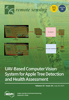
Cover Story (view full-size image):
This paper proposes a UAV-based computer vision framework for individual tree detection and health assessment. The proposed approach involves a two-stage process. Firstly, we propose a tree detection model by employing a hard negative mining strategy using RGB UAV images. Subsequently, we address the health classification problem by leveraging multi-band imagery-derived vegetation indices. The proposed framework achieves an F1-score of 86.24% for tree detection and an overall accuracy of 97.52% for the tree health assessment. This study demonstrates the robustness of the proposed framework in accurately assessing orchard tree health from UAV images. Moreover, the proposed approach holds potential for application in various other plantation settings, enabling plant detection and health assessments using UAV imagery. View this paper
- Issues are regarded as officially published after their release is announced to the table of contents alert mailing list.
- You may sign up for e-mail alerts to receive table of contents of newly released issues.
- PDF is the official format for papers published in both, html and pdf forms. To view the papers in pdf format, click on the "PDF Full-text" link, and use the free Adobe Reader to open them.
Previous Issue
Next Issue