Skip to Content

Remote Sensing, Volume 14, Issue 1

2022 January-1 - 241 articles

Cover Story: 
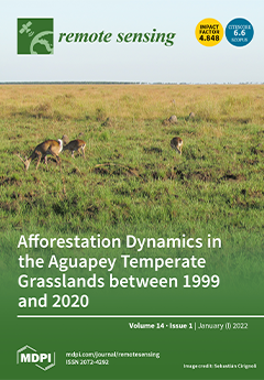
The Aguapey Valuable Grassland Area (VGA), one of the most well-preserved temperate grassland areas within Argentina, is currently threatened by the anthropogenic expansion of exotic tree plantations. The aim of this study was to characterize structural changes in the landscape of the Aguapey VGA between 1999 and 2020 based on remotely sensed data. The analysis revealed that over the 20-year period studied temperate grassland cover decreased by almost 22% due to the expansion of tree plantations. The afforestation process led first to grassland perforation and then to its attrition. The evidence of grassland loss and fragmentation within the Aguapey VGA should be considered as an early warning to promote sustainable land-use policies, mainly towards the Aguapey VGA’s southern region where temperate grassland remains the predominant land cover. View this paper.
  • Issues are regarded as officially published after their release is announced to the table of contents alert mailing list .
  • You may sign up for email alerts to receive table of contents of newly released issues.
  • PDF is the official format for papers published in both, html and pdf forms. To view the papers in pdf format, click on the "PDF Full-text" link, and use the free Adobe Reader to open them.

Articles (241)

  • Article
  • Open Access
12 Citations
3,399 Views
23 Pages

5 January 2022

Currently, soil salinization is a serious problem affecting agricultural production and human settlements. Remote sensing techniques have the advantages of a large monitoring range, rapid acquisition of information, implementation of dynamic monitori...

  • Article
  • Open Access
16 Citations
6,945 Views
17 Pages

5 January 2022

Remotely sensed LiDAR data has allowed for more accurate flood map generation through hydraulic simulations. Topographic and bathymetric LiDARs are the two types of LiDAR used, of which the former cannot penetrate water bodies while the latter can. U...

  • Article
  • Open Access
10 Citations
4,443 Views
17 Pages

A Multiview Semantic Vegetation Index for Robust Estimation of Urban Vegetation Cover

  • Asim Khan,
  • Warda Asim,
  • Anwaar Ulhaq and
  • Randall W. Robinson

5 January 2022

Urban vegetation growth is vital for developing sustainable and liveable cities in the contemporary era since it directly helps people’s health and well-being. Estimating vegetation cover and biomass is commonly done by calculating various vege...

  • Article
  • Open Access
42 Citations
6,823 Views
22 Pages

Estimation of Chlorophyll-a Concentrations in Small Water Bodies: Comparison of Fused Gaofen-6 and Sentinel-2 Sensors

  • Jiarui Shi,
  • Qian Shen,
  • Yue Yao,
  • Junsheng Li,
  • Fu Chen,
  • Ru Wang,
  • Wenting Xu,
  • Zuoyan Gao,
  • Libing Wang and
  • Yuting Zhou

5 January 2022

Chlorophyll-a concentrations in water bodies are one of the most important environmental evaluation indicators in monitoring the water environment. Small water bodies include headwater streams, springs, ditches, flushes, small lakes, and ponds, which...

  • Technical Note
  • Open Access
10 Citations
3,927 Views
13 Pages

Vegetation Mapping in the Permafrost Region: A Case Study on the Central Qinghai-Tibet Plateau

  • Defu Zou,
  • Lin Zhao,
  • Guangyue Liu,
  • Erji Du,
  • Guojie Hu,
  • Zhibin Li,
  • Tonghua Wu,
  • Xiaodong Wu and
  • Jie Chen

5 January 2022

An accurate and detailed vegetation map is of crucial significance for understanding the spatial heterogeneity of subsurfaces, which can help to characterize the thermal state of permafrost. The absence of an alpine swamp meadow (ASM) type, or an ins...

  • Article
  • Open Access
14 Citations
8,729 Views
25 Pages

Mapping Blue and Red Color-Coated Steel Sheet Roof Buildings over China Using Sentinel-2A/B MSIL2A Images

  • Alim Samat,
  • Paolo Gamba,
  • Wei Wang,
  • Jieqiong Luo,
  • Erzhu Li,
  • Sicong Liu,
  • Peijun Du and
  • Jilili Abuduwaili

5 January 2022

Accurate and efficiently updated information on color-coated steel sheet (CCSS) roof materials in urban areas is of great significance for understanding the potential impact, challenges, and issues of these materials on urban sustainable development,...

  • Article
  • Open Access
24 Citations
8,511 Views
35 Pages

Image-Aided LiDAR Mapping Platform and Data Processing Strategy for Stockpile Volume Estimation

  • Raja Manish,
  • Seyyed Meghdad Hasheminasab,
  • Jidong Liu,
  • Yerassyl Koshan,
  • Justin Anthony Mahlberg,
  • Yi-Chun Lin,
  • Radhika Ravi,
  • Tian Zhou,
  • Jeremy McGuffey and
  • Ayman Habib
  • + 2 authors

5 January 2022

Stockpile quantity monitoring is vital for agencies and businesses to maintain inventory of bulk material such as salt, sand, aggregate, lime, and many other materials commonly used in agriculture, highways, and industrial applications. Traditional a...

  • Technical Note
  • Open Access
6 Citations
3,985 Views
16 Pages

5 January 2022

Convolutional neural networks (CNNs) are becoming an increasingly popular approach for classification mapping of large complex regions where manual data collection is too time consuming. Stream boundaries in hyper-arid polar regions such as the McMur...

  • Article
  • Open Access
9 Citations
4,717 Views
25 Pages

5 January 2022

Compared with single-band remote sensing images, multispectral images can obtain information on the same target in different bands. By combining the characteristics of each band, we can obtain clearer enhanced images; therefore, we propose a multispe...

  • Article
  • Open Access
50 Citations
5,712 Views
22 Pages

Target Classification of Similar Spatial Characteristics in Complex Urban Areas by Using Multispectral LiDAR

  • Binhan Luo,
  • Jian Yang,
  • Shalei Song,
  • Shuo Shi,
  • Wei Gong,
  • Ao Wang and
  • Lin Du

5 January 2022

With the rapid modernization, many remote-sensing sensors were developed for classifying urban land and environmental monitoring. Multispectral LiDAR, which serves as a new technology, has exhibited potential in remote-sensing monitoring due to the s...

  • Article
  • Open Access
49 Citations
6,477 Views
28 Pages

5 January 2022

Ecosystem services in arid inland regions are significantly affected by climate change and land use/land cover change associated with agricultural activity. However, the dynamics and relationships of ecosystem services affected by natural and anthrop...

  • Technical Note
  • Open Access
4 Citations
4,147 Views
14 Pages

Validation of Recent Altimeter Missions at Non-Dedicated Tide Gauge Stations in the Southeastern North Sea

  • Saskia Esselborn,
  • Tilo Schöne,
  • Julia Illigner,
  • Robert Weiß,
  • Thomas Artz and
  • Xinge Huang

5 January 2022

Consistent calibration and monitoring is a basic prerequisite for providing a reliable time series of global and regional sea-level variations from altimetry. The precisions of sea-level measurements and regional biases for six altimeter missions (Ja...

  • Technical Note
  • Open Access
27 Citations
5,210 Views
15 Pages

CO2 Injection Deformation Monitoring Based on UAV and InSAR Technology: A Case Study of Shizhuang Town, Shanxi Province, China

  • Tian Zhang,
  • Wanchang Zhang,
  • Ruizhao Yang,
  • Dan Cao,
  • Longfei Chen,
  • Dewei Li and
  • Lingbin Meng

5 January 2022

Carbon Capture, Utilization and Storage, also referred to as Carbon Capture, Utilization and Sequestration (CCUS), is one of the novel climate mitigation technologies by which CO2 emissions are captured from sources, such as fossil power generation a...

  • Article
  • Open Access
4 Citations
3,706 Views
19 Pages

5 January 2022

MDT recovery over coastal regions is challenging, as the mean sea surface (MSS) and geoid/quasi-geoid models are of low quality. The altimetry satellites equipped with the synthetic aperture radar (SAR) altimeters provide more accurate sea surface he...

  • Article
  • Open Access
24 Citations
5,848 Views
24 Pages

Identifying Forest Structural Types along an Aridity Gradient in Peninsular Spain: Integrating Low-Density LiDAR, Forest Inventory, and Aridity Index

  • Julián Tijerín-Triviño,
  • Daniel Moreno-Fernández,
  • Miguel A. Zavala,
  • Julen Astigarraga and
  • Mariano García

5 January 2022

Forest structure is a key driver of forest functional processes. The characterization of forest structure across spatiotemporal scales is essential for forest monitoring and management. LiDAR data have proven particularly useful for cost-effectively...

  • Article
  • Open Access
8 Citations
4,855 Views
14 Pages

5 January 2022

This study demonstrates the results of Russian airborne radio-echo sounding (RES) investigations and also seismic reflection soundings carried out in 1971–2020 over a vast area of coastal part of East Antarctica. It is the first comprehensive s...

  • Article
  • Open Access
7 Citations
2,629 Views
21 Pages

An Efficient Ground Moving Target Imaging Method for Airborne Circular Stripmap SAR

  • Yongkang Li,
  • Tianyu Huo,
  • Chenxi Yang,
  • Tong Wang,
  • Juan Wang and
  • Beiyu Li

4 January 2022

This paper studies the imaging of a ground moving target with airborne circular stripmap synthetic aperture radar (CSSAR). First, the range equation of a target moving with accelerations is developed. Then, a new range model of high accuracy is propo...

  • Article
  • Open Access
68 Citations
9,205 Views
22 Pages

4 January 2022

Landslides often cause significant casualties and economic losses, and therefore landslide susceptibility mapping (LSM) has become increasingly urgent and important. The potential of deep learning (DL) like convolutional neural networks (CNN) based o...

  • Article
  • Open Access
32 Citations
5,963 Views
33 Pages

Impact of Water Level Fluctuations on Landslide Deformation at Longyangxia Reservoir, Qinghai Province, China

  • Shufen Zhao,
  • Runqiang Zeng,
  • Hongxue Zhang,
  • Xingmin Meng,
  • Zonglin Zhang,
  • Xiangpei Meng,
  • Hong Wang,
  • Yi Zhang and
  • Jun Liu

4 January 2022

The construction of Longyangxia Reservoir has altered the hydrogeological conditions of its banks. Infiltration and erosion caused by the periodic rise and fall of the water level leads to collapse of the reservoir banks and local deformation of the...

  • Article
  • Open Access
8 Citations
3,513 Views
24 Pages

A Novel Real-Time Echo Separation Processing Architecture for Space–Time Waveform-Encoding SAR Based on Elevation Digital Beamforming

  • Jinsong Qiu,
  • Zhimin Zhang,
  • Zhen Chen,
  • Shuo Han,
  • Wei Wang,
  • Yuhao Wen,
  • Xiangrui Meng and
  • Huaitao Fan

4 January 2022

Space–time waveform-encoding (STWE) SAR can receive echoes from multiple sub-swaths simultaneously with a single receive window. The echoes overlap each other in the time domain. To separate the echoes from different directions, traditional schemes a...

  • Article
  • Open Access
12 Citations
6,713 Views
20 Pages

4 January 2022

The semantic segmentation of fine-resolution remotely sensed images is an urgent issue in satellite image processing. Solving this problem can help overcome various obstacles in urban planning, land cover classification, and environmental protection,...

  • Article
  • Open Access
19 Citations
5,578 Views
19 Pages

4 January 2022

The TROPOspheric Monitoring Instrument (TROPOMI) aboard the Sentinel-5 Precursor satellite has been used to detect the atmospheric environment since 2017, and it is of great significance to investigate the accuracy of its products. In this work, we p...

  • Article
  • Open Access
16 Citations
4,119 Views
17 Pages

4 January 2022

Hyperspectral remote sensing presents a unique big data research paradigm through its rich information captured across hundreds of spectral bands, which embodies vital spatial and temporal information about the underlying land cover. Deep-learning-ba...

  • Article
  • Open Access
10 Citations
4,217 Views
18 Pages

4 January 2022

The evolution of the coastal fringe is closely linked to the impact of climate change, specifically increases in sea level and storm intensity. The anthropic pressure that is inflicted on these fragile environments strengthens the risk. Therefore, nu...

  • Article
  • Open Access
18 Citations
5,596 Views
18 Pages

Potential of Multiway PLS (N-PLS) Regression Method to Analyse Time-Series of Multispectral Images: A Case Study in Agriculture

  • Eva Lopez-Fornieles,
  • Guilhem Brunel,
  • Florian Rancon,
  • Belal Gaci,
  • Maxime Metz,
  • Nicolas Devaux,
  • James Taylor,
  • Bruno Tisseyre and
  • Jean-Michel Roger

4 January 2022

Recent literature reflects the substantial progress in combining spatial, temporal and spectral capacities for remote sensing applications. As a result, new issues are arising, such as the need for methodologies that can process simultaneously the di...

  • Article
  • Open Access
13 Citations
3,764 Views
20 Pages

Retrieval of DTM under Complex Forest Stand Based on Spaceborne LiDAR Fusion Photon Correction

  • Bin Li,
  • Guangpeng Fan,
  • Tianzhong Zhao,
  • Zhuo Deng and
  • Yonghui Yu

4 January 2022

The new generation of satellite-borne laser radar Ice, Cloud, and land Elevation Satellite-2 (ICESat-2) data has been successfully used for ground information acquisition. However, when dealing with complex terrain and dense vegetation cover, the acc...

  • Article
  • Open Access
31 Citations
4,856 Views
22 Pages

Optimization and Evaluation of SO2 Emissions Based on WRF-Chem and 3DVAR Data Assimilation

  • Yiwen Hu,
  • Zengliang Zang,
  • Dan Chen,
  • Xiaoyan Ma,
  • Yanfei Liang,
  • Wei You,
  • Xiaobin Pan,
  • Liqiong Wang,
  • Daichun Wang and
  • Zhendong Zhang

4 January 2022

Emission inventories are important for modeling studies and policy-making, but the traditional “bottom-up” emission inventories are often outdated with a time lag, mainly due to the lack of accurate and timely statistics. In this study, w...

  • Article
  • Open Access
4 Citations
6,028 Views
17 Pages

4 January 2022

A fixed-receiver mobile-transmitter passive bistatic synthetic aperture radar (MF-PB-SAR) system, which uses the Sentinel-1 SAR satellite as its non-cooperative emitting source, has been developed by using embedded software-defined radio (SDR) hardwa...

  • Feature Paper
  • Article
  • Open Access
78 Citations
11,127 Views
20 Pages

Flood Detection Using Real-Time Image Segmentation from Unmanned Aerial Vehicles on Edge-Computing Platform

  • Daniel Hernández,
  • José M. Cecilia,
  • Juan-Carlos Cano and
  • Carlos T. Calafate

4 January 2022

With the proliferation of unmanned aerial vehicles (UAVs) in different contexts and application areas, efforts are being made to endow these devices with enough intelligence so as to allow them to perform complex tasks with full autonomy. In particul...

  • Article
  • Open Access
1 Citations
2,742 Views
20 Pages

The Role of Model Dimensionality in Linear Inverse Scattering from Dielectric Objects

  • Gianluca Gennarelli,
  • Giovanni Ludeno,
  • Noviello Carlo,
  • Ilaria Catapano and
  • Francesco Soldovieri

4 January 2022

This paper deals with 3D and 2D linear inverse scattering approaches based on the Born approximation, and investigates how the model dimensionality influences the imaging performance. The analysis involves dielectric objects hosted in a homogenous an...

  • Article
  • Open Access
6 Citations
3,890 Views
21 Pages

Updated GOES-13 Heliosat-2 Method for Global Horizontal Irradiation in the Americas

  • Jessica Bechet,
  • Tommy Albarelo,
  • Jérémy Macaire,
  • Maha Salloum,
  • Sara Zermani,
  • Antoine Primerose and
  • Laurent Linguet

4 January 2022

Increasing the utilization of renewable energy is at the center of most sustainability policies. Solar energy is the most abundant resource of this type on Earth, and optimizing its use requires the optimal estimation of surface solar irradiation. He...

  • Article
  • Open Access
23 Citations
4,707 Views
14 Pages

4 January 2022

Rapid and accurate mapping of the spatial distribution of cotton fields is helpful to ensure safe production of cotton fields and the rationalization of land-resource planning. As cotton is an important economic pillar in Xinjiang, accurate and effic...

  • Article
  • Open Access
12 Citations
3,816 Views
17 Pages

3 January 2022

The landscape visual effect of a city, which is generated by its long-term development, is an important index in city planning. In this study, we build a quantitative evaluation and remote sensing estimation scheme of landscape visual effect. The stu...

  • Article
  • Open Access
54 Citations
5,615 Views
20 Pages

3 January 2022

Water area segmentation is an important branch of remote sensing image segmentation, but in reality, most water area images have complex and diverse backgrounds. Traditional detection methods cannot accurately identify small tributaries due to incomp...

  • Article
  • Open Access
5 Citations
2,472 Views
22 Pages

3 January 2022

It is difficult to detect ports in polarimetric SAR images due to the complicated components, morphology, and coastal environment. This paper proposes an unsupervised port detection method by extracting the water of the port based on three-component...

  • Article
  • Open Access
20 Citations
5,077 Views
14 Pages

LIME-Based Data Selection Method for SAR Images Generation Using GAN

  • Mingzhe Zhu,
  • Bo Zang,
  • Linlin Ding,
  • Tao Lei,
  • Zhenpeng Feng and
  • Jingyuan Fan

3 January 2022

Deep learning has obtained remarkable achievements in computer vision, especially image and video processing. However, in synthetic aperture radar (SAR) image recognition, the application of DNNs is usually restricted due to data insufficiency. To au...

  • Article
  • Open Access
16 Citations
4,753 Views
22 Pages

3 January 2022

High-resolution remote sensing images have been put into the application in remote sensing parsing. General remote sensing parsing methods based on semantic segmentation still have limitations, which include frequent neglect of tiny objects, high com...

  • Article
  • Open Access
11 Citations
2,947 Views
15 Pages

3 January 2022

Intense human activities and rapid climate changes both have obvious impacts on alpine ecosystems. However, the magnitudes and directions of the impacts by these two drivers remain uncertain due to a lack of a reasonable assessment method to distingu...

  • Article
  • Open Access
34 Citations
7,468 Views
22 Pages

Mapping Deforestation in Cerrado Based on Hybrid Deep Learning Architecture and Medium Spatial Resolution Satellite Time Series

  • Bruno Menini Matosak,
  • Leila Maria Garcia Fonseca,
  • Evandro Carrijo Taquary,
  • Raian Vargas Maretto,
  • Hugo do Nascimento Bendini and
  • Marcos Adami

3 January 2022

Cerrado is the second largest biome in Brazil, covering about 2 million km2. This biome has experienced land use and land cover changes at high rates due to agricultural expansion so that more than 50% of its natural vegetation has already been remov...

  • Article
  • Open Access
25 Citations
6,231 Views
19 Pages

2 January 2022

Peat fires differ from other wildfires in their duration, carbon losses, emissions of greenhouse gases and highly hazardous products of combustion and other environmental impacts. Moreover, it is difficult to identify peat fires using ground-based me...

  • Article
  • Open Access
18 Citations
4,077 Views
21 Pages

2 January 2022

Current railway tunnel inspections rely on expert operators performing a visual examination of the entire infrastructure and manually annotating encountered defects. Automatizing the inspection and maintenance task of such critical and aging infrastr...

  • Article
  • Open Access
3 Citations
2,650 Views
28 Pages

2 January 2022

The support tensor machine (STM) extended from support vector machine (SVM) can maintain the inherent information of remote sensing image (RSI) represented as tensor and obtain effective recognition results using a few training samples. However, the...

  • Article
  • Open Access
8 Citations
3,589 Views
24 Pages

2 January 2022

The analysis of the Earth system and interactions among its spheres is increasingly important to improve the understanding of global environmental change. In this regard, Earth observation (EO) is a valuable tool for monitoring of long term changes o...

  • Article
  • Open Access
35 Citations
5,445 Views
22 Pages

Understanding the Relationship between China’s Eco-Environmental Quality and Urbanization Using Multisource Remote Sensing Data

  • Dong Xu,
  • Jie Cheng,
  • Shen Xu,
  • Jing Geng,
  • Feng Yang,
  • He Fang,
  • Jinfeng Xu,
  • Sheng Wang,
  • Yubai Wang and
  • Haixing Li
  • + 3 authors

2 January 2022

The rapid development of urbanization and population growth in China has posed a major threat to the green sustainable development of the ecological environment. However, the impact of urbanization on the eco-environmental quality (EEQ) in China rema...

  • Article
  • Open Access
13 Citations
5,457 Views
22 Pages

Small Water Body Detection and Water Quality Variations with Changing Human Activity Intensity in Wuhan

  • Lingjun Wang,
  • Wanjuan Bie,
  • Haocheng Li,
  • Tanghong Liao,
  • Xingxing Ding,
  • Guofeng Wu and
  • Teng Fei

2 January 2022

Small water bodies ranging in size from 1 to 50,000 m2, are numerous, widely distributed, and have various functions in water storage, agriculture, and fisheries. Small water bodies used for agriculture and fisheries are economically significant in C...

  • Article
  • Open Access
27 Citations
6,083 Views
22 Pages

Classification of Mediterranean Shrub Species from UAV Point Clouds

  • Juan Pedro Carbonell-Rivera,
  • Jesús Torralba,
  • Javier Estornell,
  • Luis Ángel Ruiz and
  • Pablo Crespo-Peremarch

2 January 2022

Modelling fire behaviour in forest fires is based on meteorological, topographical, and vegetation data, including species’ type. To accurately parameterise these models, an inventory of the area of analysis with the maximum spatial and tempora...

  • Article
  • Open Access
45 Citations
5,505 Views
15 Pages

Transfer Learning for Improving Seismic Building Damage Assessment

  • Qigen Lin,
  • Tianyu Ci,
  • Leibin Wang,
  • Sanjit Kumar Mondal,
  • Huaxiang Yin and
  • Ying Wang

2 January 2022

The rapid assessment of building damage in earthquake-stricken areas is of paramount importance for emergency response. The development of remote sensing technology has aided in deriving reliable and precise building damage assessments of extensive a...

  • Article
  • Open Access
12 Citations
3,805 Views
22 Pages

2 January 2022

It is an effective measure to estimate groundwater storage anomalies (GWSA) by combining Gravity Recovery and Climate Experiment (GRACE) data and hydrological models. However, GWSA results based on a single hydrological model and GRACE data may have...

  • Article
  • Open Access
11 Citations
3,002 Views
25 Pages

1 January 2022

Due to different designs of receiver correlators and front ends, receiver-related pseudorange biases, called signal distortion biases (SDBs), exist. Ignoring SDBs that can reach up to 0.66 cycles and 10 ns in Melbourne-Wübbena (MW) and ionospher...

  • Communication
  • Open Access
7 Citations
2,635 Views
12 Pages

1 January 2022

In this paper, a joint maritime moving target detection and imaging approach, referred to as the fast inverse synthetic aperture radar (ISAR) imaging approach, based on the multi-resolution space−time adaptive processing (STAP), is proposed to...

of 5

Get Alerted

Add your email address to receive forthcoming issues of this journal.

XFacebookLinkedIn
Remote Sens. - ISSN 2072-4292