Skip Content
You are currently on the new version of our website. Access the old version .

Remote Sensing, Volume 13, Issue 14

2021 July-2 - 204 articles

Cover Story: 
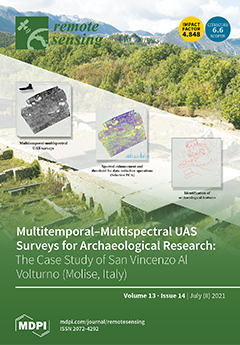
This work shows data acquired by multitemporal and multispectral aerial surveys in the archaeological site of San Vincenzo al Volturno (Molise, Italy). The site is one of the most important medieval archaeological sites in the world. Thanks to the use of multispectral aerial photography at different times of the year, an area not accessible to archaeological excavation has been investigated. To avoid a redundancy of information, a method based on spectral and radiometric enhancement techniques, combined with a selective principal component analysis, was used for the identification of useful information. The combination of already published archaeological data and new remote sensing discoveries has allowed us to better define the situation of the abbey during the building phases of the 8th/9th century and 11th century. View this paper
  • Issues are regarded as officially published after their release is announced to the table of contents alert mailing list .
  • You may sign up for email alerts to receive table of contents of newly released issues.
  • PDF is the official format for papers published in both, html and pdf forms. To view the papers in pdf format, click on the "PDF Full-text" link, and use the free Adobe Reader to open them.

Articles (204)

  • Article
  • Open Access
13 Citations
5,002 Views
20 Pages

Exploring the Impacts and Temporal Variations of Different Building Roof Types on Surface Urban Heat Island

  • Yingbin Deng,
  • Renrong Chen,
  • Yichun Xie,
  • Jianhui Xu,
  • Ji Yang and
  • Wenyue Liao

20 July 2021

This study examined the impact of different types of building roofs on urban heat islands. This was carried out using building roof data from remotely sensed Landsat 8 Operational Land Imager (OLI) and Thermal Infrared Sensor (TIRS) imagery. The roof...

  • Article
  • Open Access
19 Citations
5,286 Views
30 Pages

Identification of Aerosol Pollution Hotspots in Jiangsu Province of China

  • Yu Wang,
  • Md. Arfan Ali,
  • Muhammad Bilal,
  • Zhongfeng Qiu,
  • Song Ke,
  • Mansour Almazroui,
  • Md. Monirul Islam and
  • Yuanzhi Zhang

20 July 2021

Aerosol optical depth (AOD) is an important atmospheric parameter for climate change assessment, human health, and for total ecological situation studies both regionally and globally. This study used 21-year (2000–2020) high-resolution (1 km) Multian...

  • Article
  • Open Access
15 Citations
3,812 Views
14 Pages

Pre-Launch Radiometric Characterization of EMI-2 on the GaoFen-5 Series of Satellites

  • Minjie Zhao,
  • Fuqi Si,
  • Haijin Zhou,
  • Yu Jiang,
  • Chunyan Ji,
  • Shimei Wang,
  • Kai Zhan and
  • Wenqing Liu

20 July 2021

The environmental trace gas monitoring instrument (EMI) is a space-borne imaging spectrometer onboard GaoFen-5, which was launched in May 2018, covering wavelengths in the range of 240–710 nm to measure NO2, O3, HCHO, and SO2. An advanced EMI-2 instr...

  • Article
  • Open Access
18 Citations
4,169 Views
25 Pages

Non-Parametric Statistical Approaches for Leaf Area Index Estimation from Sentinel-2 Data: A Multi-Crop Assessment

  • Margherita De Peppo,
  • Andrea Taramelli,
  • Mirco Boschetti,
  • Alberto Mantino,
  • Iride Volpi,
  • Federico Filipponi,
  • Antonella Tornato,
  • Emiliana Valentini and
  • Giorgio Ragaglini

20 July 2021

The leaf area index (LAI) is a key biophysical variable for agroecosystem monitoring, as well as a relevant state variable in crop modelling. For this reason, temporal and spatial determination of LAI are required to improve the understanding of seve...

  • Article
  • Open Access
4 Citations
3,767 Views
15 Pages

Improving CyGNSS-Based Land Remote Sensing: Track-Wise Data Calibration Schemes

  • Qingyun Yan,
  • Ting Hu,
  • Shuanggen Jin,
  • Weimin Huang,
  • Yan Jia,
  • Tiexi Chen and
  • Jian Wang

20 July 2021

Cyclone Global Navigation Satellite System (CyGNSS) data have been used for generating several intermediate products, such as surface reflectivity (Γ), to facilitate a wide variety of land remote sensing applications. The accuracy of Γ relies on prec...

  • Article
  • Open Access
4 Citations
3,518 Views
11 Pages

20 July 2021

Urban geophysical exploration plays an important role in the sustainable development of and the mitigation of geological hazards in metropolitan areas. However, it is not suitable to implement active seismic methods in densely populated urban areas....

  • Article
  • Open Access
10 Citations
3,209 Views
17 Pages

Retrieving Doppler Frequency via Local Correlation Method of Segmented Modeling

  • Lue Chen,
  • Jinsong Ping,
  • Jianfeng Cao,
  • Xiang Liu,
  • Na Wang,
  • Zhen Wang,
  • Ping Zhu,
  • Mei Wang,
  • Haijun Man and
  • Songtao Han
  • + 3 authors

20 July 2021

The high accuracy radio Doppler frequency is critical for navigating a deep space probe and for planetary radio science experiments. In this paper, we propose a novel method based on the local correlation of segmented modeling to retrieve Doppler fre...

  • Project Report
  • Open Access
3 Citations
4,451 Views
26 Pages

Results of the Dragon 4 Project on New Ocean Remote Sensing Data for Operational Applications

  • Ferran Gibert,
  • Jacqueline Boutin,
  • Wolfgang Dierking,
  • Alba Granados,
  • Yan Li,
  • Eduard Makhoul,
  • Junmin Meng,
  • Alexandre Supply,
  • Ester Vendrell and
  • Xi Zhang
  • + 5 authors

20 July 2021

This paper provides an overview of the Dragon 4 project dealing with operational monitoring of sea ice and sea surface salinity (SSS) and new product developments for altimetry data. To improve sea ice thickness retrieval, a new method was developed...

  • Article
  • Open Access
20 Citations
4,134 Views
18 Pages

20 July 2021

Obtaining large-scale, long-term, and spatial continuous soil moisture (SM) data is crucial for climate change, hydrology, and water resource management, etc. ESA CCI SM is such a large-scale and long-term SM (longer than 40 years until now). However...

  • Article
  • Open Access
17 Citations
3,424 Views
24 Pages

Vessel Target Echo Characteristics and Motion Compensation for Shipborne HFSWR under Non-Uniform Linear Motion

  • Yonggang Ji,
  • Yiming Wang,
  • Weimin Huang,
  • Weifeng Sun,
  • Jie Zhang,
  • Ming Li and
  • Xiaoyu Cheng

19 July 2021

For shipborne high-frequency surface wave radar (HFSWR), the movement of the ship has a great impact on the radar echo, thus affecting target detection performance. In this paper, the characteristics of the target echo spectrum and the motion compens...

  • Communication
  • Open Access
28 Citations
4,713 Views
15 Pages

19 July 2021

Land surface temperature (LST) is a crucial input parameter in the study of land surface water and energy budgets at local and global scales. Because of cloud obstruction, there are many gaps in thermal infrared remote sensing LST products. To fill t...

  • Article
  • Open Access
12 Citations
3,356 Views
19 Pages

19 July 2021

Aboveground dry weight (AGDW) and leaf area index (LAI) are indicators of crop growth status and grain yield as affected by interactions of genotype, environment, and management. Unmanned aerial vehicle (UAV) based remote sensing provides cost-effect...

  • Article
  • Open Access
37 Citations
5,561 Views
20 Pages

Monitoring and Mapping Vineyard Water Status Using Non-Invasive Technologies by a Ground Robot

  • Juan Fernández-Novales,
  • Verónica Saiz-Rubio,
  • Ignacio Barrio,
  • Francisco Rovira-Más,
  • Andrés Cuenca-Cuenca,
  • Fernando Santos Alves,
  • Joana Valente,
  • Javier Tardaguila and
  • María Paz Diago

19 July 2021

There is a growing need to provide support and applicable tools to farmers and the agro-industry in order to move from their traditional water status monitoring and high-water-demand cropping and irrigation practices to modern, more precise, reduced-...

  • Article
  • Open Access
48 Citations
5,850 Views
20 Pages

Evaluation of Eight Global Precipitation Datasets in Hydrological Modeling

  • Yiheng Xiang,
  • Jie Chen,
  • Lu Li,
  • Tao Peng and
  • Zhiyuan Yin

19 July 2021

The number of global precipitation datasets (PPs) is on the rise and they are commonly used for hydrological applications. A comprehensive evaluation on their performance in hydrological modeling is required to improve their performance. This study c...

  • Article
  • Open Access
11 Citations
3,900 Views
22 Pages

A Spliced Satellite Optical Camera Geometric Calibration Method Based on Inter-Chip Geometry Constraints

  • Tao Wang,
  • Yan Zhang,
  • Yongsheng Zhang,
  • Zhenchao Zhang,
  • Xiongwu Xiao,
  • Ying Yu and
  • Longhui Wang

19 July 2021

When in orbit, spliced satellite optical cameras are affected by various factors that degrade the actual image stitching precision and the accuracy of their data products. This is a major bottleneck in the current remote sensing technology. Previous...

  • Article
  • Open Access
6 Citations
4,131 Views
17 Pages

Rigidity Strengthening of Landslide Materials Measured by Seismic Interferometry

  • Keng-Hao Kang,
  • Wei-An Chao,
  • Che-Ming Yang,
  • Ming-Chien Chung,
  • Yu-Ting Kuo,
  • Chih-Hsiang Yeh,
  • Hsin-Chang Liu,
  • Chun-Hung Lin,
  • Chih-Pin Lin and
  • Tung-Lin Tai
  • + 4 authors

19 July 2021

Landslides have caused extensive infrastructure damage and caused human fatalities for centuries. Intense precipitation and large earthquakes are considered to be two major landslide triggers, particularly in the case of catastrophic landslides. The...

  • Article
  • Open Access
15 Citations
5,201 Views
34 Pages

Improvement of a Dasymetric Method for Implementing Sustainable Development Goal 11 Indicators at an Intra-Urban Scale

  • Mariella Aquilino,
  • Maria Adamo,
  • Palma Blonda,
  • Angela Barbanente and
  • Cristina Tarantino

19 July 2021

Local and Regional Authorities require indicators at the intra-urban scale to design adequate policies to foster the achievement of the objectives of Sustainable Development Goal (SDG) 11. Updated high-resolution population density and settlement map...

  • Article
  • Open Access
12 Citations
4,086 Views
20 Pages

19 July 2021

Dams are important for flood mitigation, water supply, and hydroelectricity. Every dam has a water conveyance structure, such as a spillway, to safely release extreme floods when needed. The flows down spillways are often self-aerated and spillway de...

  • Feature Paper
  • Review
  • Open Access
136 Citations
16,493 Views
43 Pages

Deep Learning in Forestry Using UAV-Acquired RGB Data: A Practical Review

  • Yago Diez,
  • Sarah Kentsch,
  • Motohisa Fukuda,
  • Maximo Larry Lopez Caceres,
  • Koma Moritake and
  • Mariano Cabezas

19 July 2021

Forests are the planet’s main CO2 filtering agent as well as important economical, environmental and social assets. Climate change is exerting an increased stress, resulting in a need for improved research methodologies to study their health, composi...

  • Article
  • Open Access
26 Citations
8,218 Views
18 Pages

19 July 2021

Sediment grain size is a fundamental parameter conditioning beach-face morphology and shoreline changes. From remote sensing data, an efficient definition of the shoreline position as the water–land interface may allow studying the geomorphological c...

  • Article
  • Open Access
41 Citations
8,338 Views
18 Pages

Identifying Optimal Wavelengths as Disease Signatures Using Hyperspectral Sensor and Machine Learning

  • Xing Wei,
  • Marcela A. Johnson,
  • David B. Langston,
  • Hillary L. Mehl and
  • Song Li

19 July 2021

Hyperspectral sensors combined with machine learning are increasingly utilized in agricultural crop systems for diverse applications, including plant disease detection. This study was designed to identify the most important wavelengths to discriminat...

  • Review
  • Open Access
80 Citations
8,780 Views
21 Pages

19 July 2021

Land surface temperature (LST) is an important environmental parameter in climate change, urban heat islands, drought, public health, and other fields. Thermal infrared (TIR) remote sensing is the main method used to obtain LST information over large...

  • Technical Note
  • Open Access
3 Citations
3,549 Views
13 Pages

On the Geomagnetic Field Line Resonance Eigenfrequency Variations during Seismic Event

  • Mirko Piersanti,
  • William Jerome Burger,
  • Vincenzo Carbone,
  • Roberto Battiston,
  • Roberto Iuppa and
  • Pietro Ubertini

19 July 2021

In this paper, we report high statistical evidence for a seismo–ionosphere effects occurring in conjunction with an earthquake. This finding supports a lithosphere-magnetosphere coupling mechanism producing a plasma density variation along the magnet...

  • Article
  • Open Access
24 Citations
6,332 Views
21 Pages

18 July 2021

Lunar craters are very important for estimating the geological age of the Moon, studying the evolution of the Moon, and for landing site selection. Due to a lack of labeled samples, processing times due to high-resolution imagery, the small number of...

  • Article
  • Open Access
48 Citations
6,621 Views
22 Pages

Mapping Plastic Greenhouses with Two-Temporal Sentinel-2 Images and 1D-CNN Deep Learning

  • Haoran Sun,
  • Lei Wang,
  • Rencai Lin,
  • Zhen Zhang and
  • Baozhong Zhang

18 July 2021

Plastic greenhouses (PGs) are widely built near cities in China to produce vegetables and fruits. In order to promote sustainable agriculture, rural landscape construction, and better manage water resources, numerous remote sensing methods have been...

  • Article
  • Open Access
18 Citations
3,969 Views
24 Pages

Simulation and Assessment of the Capabilities of Orbita Hyperspectral (OHS) Imagery for Remotely Monitoring Chlorophyll-a in Eutrophic Plateau Lakes

  • Runfei Zhang,
  • Zhubin Zheng,
  • Ge Liu,
  • Chenggong Du,
  • Chao Du,
  • Shaohua Lei,
  • Yifan Xu,
  • Jie Xu,
  • Meng Mu and
  • Jianzhong Li
  • + 1 author

18 July 2021

The chlorophyll-a (Chl-a) concentration of eutrophic lakes fluctuates significantly due to the disturbance of wind and anthropogenic activities on the water body. Consequently, estimation of the Chl-a concentration has become an immense challenge. Du...

  • Article
  • Open Access
45 Citations
6,357 Views
16 Pages

18 July 2021

An accurate stand count is a prerequisite to determining the emergence rate, assessing seedling vigor, and facilitating site-specific management for optimal crop production. Traditional manual counting methods in stand assessment are labor intensive...

  • Technical Note
  • Open Access
12 Citations
4,698 Views
16 Pages

Seasonal M2 Internal Tides in the Arabian Sea

  • Jingyi Ma,
  • Daquan Guo,
  • Peng Zhan and
  • Ibrahim Hoteit

18 July 2021

Internal tides play a crucial role in ocean mixing. To explore the seasonal features of mode-1 M2 internal tides in the Arabian Sea, we analyzed their propagation and energy distribution using along-track sea-level anomaly data collected by satellite...

  • Article
  • Open Access
32 Citations
7,066 Views
19 Pages

Global Analysis of the Relationship between Reconstructed Solar-Induced Chlorophyll Fluorescence (SIF) and Gross Primary Production (GPP)

  • Haiqiang Gao,
  • Shuguang Liu,
  • Weizhi Lu,
  • Andrew R. Smith,
  • Rubén Valbuena,
  • Wende Yan,
  • Zhao Wang,
  • Li Xiao,
  • Xi Peng and
  • Gui Zhang
  • + 6 authors

18 July 2021

Solar-induced chlorophyll fluorescence (SIF) is increasingly known as an effective proxy for plant photosynthesis, and therefore, has great potential in monitoring gross primary production (GPP). However, the relationship between SIF and GPP remains...

  • Article
  • Open Access
12 Citations
3,620 Views
15 Pages

Modulation of Wind-Wave Breaking by Long Surface Waves

  • Vladimir A. Dulov,
  • Aleksandr E. Korinenko,
  • Vladimir N. Kudryavtsev and
  • Vladimir V. Malinovsky

18 July 2021

This paper reports the results of field measurements of wave breaking modulations by dominant surface waves, taken from the Black Sea research platform at wind speeds ranging from 10 to 20 m/s. Wave breaking events were detected by video recordings o...

  • Article
  • Open Access
11 Citations
3,373 Views
24 Pages

Refocusing of Moving Ships in Squint SAR Images Based on Spectrum Orthogonalization

  • Xuyao Tong,
  • Min Bao,
  • Guangcai Sun,
  • Liang Han,
  • Yu Zhang and
  • Mengdao Xing

17 July 2021

Moving ship refocusing is challenging because the target motion parameters are unknown. Moreover, moving ships in squint synthetic aperture radar (SAR) images obtained by the back-projection (BP) algorithm usually suffer from geometric deformation an...

  • Article
  • Open Access
9 Citations
5,123 Views
18 Pages

17 July 2021

Clouds play a significant role in regulating the Arctic climate and water cycle due to their impacts on radiative balance through various complex feedback processes. However, there are still large discrepancies in satellite and numerical model-derive...

  • Article
  • Open Access
9 Citations
3,379 Views
24 Pages

17 July 2021

Surface displacement is an common environmental geological phenomenon in the Beijing Plain. Research on surface displacement in the Beijing Plain has mainly focused on vertical surface displacement, whereas the horizontal displacement has scarcely be...

  • Technical Note
  • Open Access
11 Citations
6,537 Views
28 Pages

17 July 2021

The rapid development of remote sensing technology for obtaining high-resolution digital elevation models (DEMs) in recent years has made them more and more widely available and has allowed them to be used for morphometric assessment of concave landf...

  • Article
  • Open Access
3 Citations
3,761 Views
18 Pages

Seismic Ambient Noise Imaging of a Quasi-Amagmatic Ultra-Slow Spreading Ridge

  • Mohamadhasan Mohamadian Sarvandani,
  • Emanuel Kästle,
  • Lapo Boschi,
  • Sylvie Leroy and
  • Mathilde Cannat

17 July 2021

Passive seismic interferometry has become very popular in recent years in exploration geophysics. However, it has not been widely applied in marine exploration. The purpose of this study is to investigate the internal structure of a quasi-amagmatic p...

  • Article
  • Open Access
11 Citations
3,033 Views
21 Pages

17 July 2021

Sparse imaging relies on sparse representations of the target scenes to be imaged. Predefined dictionaries have long been used to transform radar target scenes into sparse domains, but the performance is limited by the artificially designed or existi...

  • Article
  • Open Access
49 Citations
7,148 Views
19 Pages

17 July 2021

In data-sparse regions such as the Arctic, atmospheric reanalysis is one of the key tools for understanding rapid climate change at the regional and global scales. The utility of reanalysis datasets based on data assimilation is affected by their acc...

  • Technical Note
  • Open Access
12 Citations
4,655 Views
14 Pages

Near Surface Velocity Estimation Using GPR Data: Investigations by Numerical Simulation, and Experimental Approach with AVO Response

  • Ibrar Iqbal,
  • Xiong Bin,
  • Gang Tian,
  • Honghua Wang,
  • Peng Sanxi,
  • Yang Yang,
  • Zahid Masood and
  • Sun Hanwu

17 July 2021

The velocity of near-surface materials is one of the most important for Ground-Penetrating Radar (GPR). In the study, we evaluate the options for determining the GPR velocity to measure the accuracy of velocity approximations from the acquired GPR da...

  • Technical Note
  • Open Access
14 Citations
4,429 Views
18 Pages

Preliminary Application of Ground-Penetrating Radar for Reconstruction of Root System Architecture in Moso Bamboo

  • Longdong Xiao,
  • Chong Li,
  • Yue Cai,
  • Mingxing Zhou,
  • Tao Zhou,
  • Xueyan Gao,
  • Huaqiang Du,
  • Yufeng Zhou and
  • Guomo Zhou

17 July 2021

Root system architecture (RSA) refers to the geometric features and topology of the root system. Ground-penetrating radar (GPR) is a possible method of RSA reconstruction. However, because the topology of the root system is not directly accessible by...

  • Article
  • Open Access
75 Citations
5,772 Views
22 Pages

17 July 2021

Over the last few years, under the combined effects of climate change and human factors, the ecological environment of coal mining areas has undergone tremendous changes. Therefore, the rapid and accurate quantitative assessments of the temporal and...

  • Article
  • Open Access
30 Citations
10,062 Views
19 Pages

Satellite-Observed Multi-Scale Variability of Sea Surface Chlorophyll-a Concentration along the South Coast of the Sumatra-Java Islands

  • Tengfei Xu,
  • Zexun Wei,
  • Shujiang Li,
  • Raden Dwi Susanto,
  • Nyoman Radiarta,
  • Chao Yuan,
  • Agus Setiawan,
  • Anastasia Kuswardani,
  • Teguh Agustiadi and
  • Mukti Trenggono

17 July 2021

The southern coast of Java is known as one of the most productive fishing grounds for tuna, feeding by nutrient-rich water along the coast caused by the subsurface water upwelling. This primary productivity can be evidenced by the high sea surface ch...

  • Article
  • Open Access
9 Citations
5,250 Views
26 Pages

17 July 2021

Timely acquisition of spatial flood distribution is an essential basis for flood-disaster monitoring and management. Remote-sensing data have been widely used in water-body surveys. However, due to the cloudy weather and complex geomorphic environmen...

  • Article
  • Open Access
4 Citations
4,739 Views
15 Pages

16 July 2021

Urban forest is an important component of terrestrial ecosystems and is highly related to global climate change. However, because of complex city landscapes, deriving the spatial distribution of urban forest carbon density and conducting accuracy ass...

  • Article
  • Open Access
29 Citations
4,557 Views
18 Pages

16 July 2021

Most natural rubber trees (Hevea brasiliensis) are grown on plantations, making rubber an important industrial crop. Rubber plantations are also an important source of household income for over 20 million people. The accurate mapping of rubber planta...

  • Article
  • Open Access
39 Citations
5,483 Views
24 Pages

Building Multi-Feature Fusion Refined Network for Building Extraction from High-Resolution Remote Sensing Images

  • Shuhao Ran,
  • Xianjun Gao,
  • Yuanwei Yang,
  • Shaohua Li,
  • Guangbin Zhang and
  • Ping Wang

16 July 2021

Deep learning approaches have been widely used in building automatic extraction tasks and have made great progress in recent years. However, the missing detection and wrong detection causing by spectrum confusion is still a great challenge. The exist...

  • Article
  • Open Access
13 Citations
4,316 Views
19 Pages

UCalib: Cameras Autocalibration on Coastal Video Monitoring Systems

  • Gonzalo Simarro,
  • Daniel Calvete and
  • Paola Souto

16 July 2021

Following the path set out by the “Argus” project, video monitoring stations have become a very popular low cost tool to continuously monitor beaches around the world. For these stations to be able to offer quantitative results, the cameras must be c...

  • Article
  • Open Access
30 Citations
10,077 Views
32 Pages

16 July 2021

UAV laser scanning (ULS) has the potential to support forest operations since it provides high-density data with flexible operational conditions. This study examined the use of ULS systems to estimate several tree attributes from an uneven-aged north...

  • Article
  • Open Access
21 Citations
4,961 Views
20 Pages

16 July 2021

The Pulang porphyry copper deposit (PCD), one of the main potential areas for copper resource exploration in China, exhibits typical porphyry alteration zoning. However, further investigation of the indicative significance of alteration minerals, add...

  • Article
  • Open Access
4 Citations
3,171 Views
19 Pages

16 July 2021

Virtual measurement workflow (VMW) was a generic data mining method developed in this study. It was used to extract tree information from archived point clouds under limited conditions by applying virtual measurements in virtual reality. As an exampl...

of 5

Get Alerted

Add your email address to receive forthcoming issues of this journal.

XFacebookLinkedIn
Remote Sens. - ISSN 2072-4292