Skip to Content
You are currently on the new version of our website. Access the old version .

Remote Sensing, Volume 12, Issue 22

2020 November-2 - 172 articles

Cover Story: 
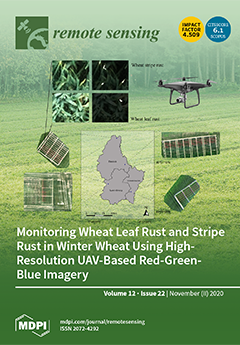
Employing red-green-blue (RGB) imagery acquired from UAV remote sensing to discriminate healthy from diseased plant areas and monitor the progress of such plant diseases in fields has yet to be fully investigated. Here, wheat leaf rust and stripe rust diseased leaf areas in winter wheat were identified and their severities quantified during the critical period for efficacious fungicide application using RGB imagery-derived indices. Good agreements between the UAV-based estimates and observations were found for both fungal diseases, with statistically significant correlations (P < 0.0001). The study provides clear evidence that UAV-based RGB imagery is a useful tool for monitoring fungal foliar diseases throughout the cropping season, supporting the identification of potential new disease outbreaks and efficient control of their spread. View this paper
  • Issues are regarded as officially published after their release is announced to the table of contents alert mailing list .
  • You may sign up for email alerts to receive table of contents of newly released issues.
  • PDF is the official format for papers published in both, html and pdf forms. To view the papers in pdf format, click on the "PDF Full-text" link, and use the free Adobe Reader to open them.

Articles (172)

  • Letter
  • Open Access
17 Citations
4,221 Views
14 Pages

Uncertainty-Based Human-in-the-Loop Deep Learning for Land Cover Segmentation

  • Carlos García Rodríguez,
  • Jordi Vitrià and
  • Oscar Mora

23 November 2020

In recent years, different deep learning techniques were applied to segment aerial and satellite images. Nevertheless, state of the art techniques for land cover segmentation does not provide accurate results to be used in real applications. This is...

  • Article
  • Open Access
16 Citations
4,049 Views
17 Pages

Development of an Automated Visibility Analysis Framework for Pavement Markings Based on the Deep Learning Approach

  • Kyubyung Kang,
  • Donghui Chen,
  • Cheng Peng,
  • Dan Koo,
  • Taewook Kang and
  • Jonghoon Kim

23 November 2020

Pavement markings play a critical role in reducing crashes and improving safety on public roads. As road pavements age, maintenance work for safety purposes becomes critical. However, inspecting all pavement markings at the right time is very challen...

  • Article
  • Open Access
3 Citations
3,236 Views
22 Pages

23 November 2020

The time-series state and parameter estimations of indoor localization continue to be a topic of growing importance. To deal with the nonlinear and positive skewed non-Gaussian dynamic of indoor CSS–TOF (Chirp-Spread-Spectrum Time-of-Flight) ra...

  • Article
  • Open Access
25 Citations
4,810 Views
35 Pages

Lossy Compression of Multichannel Remote Sensing Images with Quality Control

  • Vladimir Lukin,
  • Irina Vasilyeva,
  • Sergey Krivenko,
  • Fangfang Li,
  • Sergey Abramov,
  • Oleksii Rubel,
  • Benoit Vozel,
  • Kacem Chehdi and
  • Karen Egiazarian

23 November 2020

Lossy compression is widely used to decrease the size of multichannel remote sensing data. Alongside this positive effect, lossy compression may lead to a negative outcome as making worse image classification. Thus, if possible, lossy compression sho...

  • Article
  • Open Access
15 Citations
3,795 Views
23 Pages

23 November 2020

Deep learning has become an effective method for hyperspectral image classification. However, the high band correlation and data volume associated with airborne hyperspectral images, and the insufficiency of training samples, present challenges to th...

  • Article
  • Open Access
6 Citations
2,927 Views
17 Pages

23 November 2020

Clouds affect the assimilation of microwave data from satellites and therefore the detection of clouds is important under both clear sky and cloudy conditions. We introduce a new cloud detection method based on the assimilation of data from the advan...

  • Article
  • Open Access
7 Citations
3,315 Views
14 Pages

Characterization of Intertidal Bar Morphodynamics Using a Bi-Annual LiDAR Dataset

  • Anne-Lise Montreuil,
  • Robrecht Moelans,
  • Rik Houthuys,
  • Patrick Bogaert and
  • Margaret Chen

23 November 2020

Intertidal bars are common features on meso-and macro-tidal sandy beaches with low to moderate wave energy environments. Understanding their morphodynamics is, hence, crucial for enhancing our knowledge on beach processes which is beneficial for coas...

  • Article
  • Open Access
23 Citations
7,384 Views
25 Pages

23 November 2020

Rapid urbanization processes and indiscriminate disposal of urban wastewaters are major causes for anthropogenic lake-sediment deposition and eutrophication. However, information about the spatial and temporal variation of macrophyte and phytoplankto...

  • Article
  • Open Access
23 Citations
5,116 Views
20 Pages

23 November 2020

Unmanned Aerial Vehicles (UAVs) represent easy, affordable, and simple solutions for many tasks, including the collection of traffic data. The main aim of this study is to propose a new, low-cost framework for the determination of highly accurate tra...

  • Article
  • Open Access
72 Citations
7,272 Views
18 Pages

A Novel Intelligent Classification Method for Urban Green Space Based on High-Resolution Remote Sensing Images

  • Zhiyu Xu,
  • Yi Zhou,
  • Shixin Wang,
  • Litao Wang,
  • Feng Li,
  • Shicheng Wang and
  • Zhenqing Wang

23 November 2020

The real-time, accurate, and refined monitoring of urban green space status information is of great significance in the construction of urban ecological environment and the improvement of urban ecological benefits. The high-resolution technology can...

  • Article
  • Open Access
28 Citations
5,245 Views
18 Pages

Investigating the Long-Range Transport of Aerosol Plumes Following the Amazon Fires (August 2019): A Multi-Instrumental Approach from Ground-Based and Satellite Observations

  • Hassan Bencherif,
  • Nelson Bègue,
  • Damaris Kirsch Pinheiro,
  • David Jean du Preez,
  • Jean-Maurice Cadet,
  • Fábio Juliano da Silva Lopes,
  • Lerato Shikwambana,
  • Eduardo Landulfo,
  • Thomas Vescovini and
  • Cathy Clerbaux
  • + 7 authors

23 November 2020

Despite a number of studies on biomass burning (BB) emissions in the atmosphere, observation of the associated aerosols and pollutants requires continuous efforts. Brazil, and more broadly Latin America, is one of the most important seasonal sources...

  • Article
  • Open Access
6 Citations
4,765 Views
25 Pages

22 November 2020

A project was constructed to integrate remotely sensed data from multiple sensors and platforms to characterize range of ecosystem characteristics in the Peace–Athabasca Delta in Northern Alberta, Canada. The objective of this project was to provide...

  • Letter
  • Open Access
13 Citations
3,565 Views
9 Pages

22 November 2020

The well-known triangle method in optical/thermal remote sensing, its construction, uncertainties, and the significance of its products are first discussed. These topics are then followed by an outline of how the method can be implemented operational...

  • Article
  • Open Access
31 Citations
8,268 Views
18 Pages

Quality Assessment of Photogrammetric Methods—A Workflow for Reproducible UAS Orthomosaics

  • Marvin Ludwig,
  • Christian M. Runge,
  • Nicolas Friess,
  • Tiziana L. Koch,
  • Sebastian Richter,
  • Simon Seyfried,
  • Luise Wraase,
  • Agustin Lobo,
  • M.-Teresa Sebastià and
  • Thomas Nauss
  • + 1 author

22 November 2020

Unmanned aerial systems (UAS) are cost-effective, flexible and offer a wide range of applications. If equipped with optical sensors, orthophotos with very high spatial resolution can be retrieved using photogrammetric processing. The use of these ima...

  • Technical Note
  • Open Access
12 Citations
3,786 Views
16 Pages

22 November 2020

Stereo photogrammetric survey used to be used to extract the height of buildings, then to convert the height to number of stories through certain rules to estimate the number of stories of buildings by means of satellite remote sensing. In contrast,...

  • Article
  • Open Access
38 Citations
6,004 Views
17 Pages

22 November 2020

Mangrove forests play an important role in maintaining water quality, mitigating climate change impacts, and providing a wide range of ecosystem services. Effective identification of mangrove species using remote-sensing images remains a challenge. T...

  • Article
  • Open Access
14 Citations
4,575 Views
22 Pages

22 November 2020

The application of remote sensing techniques for disaster management often requires rapid damage assessment to support decision-making for post-treatment activities. As the on-demand acquisition of pre-event very high-resolution (VHR) images is typic...

  • Article
  • Open Access
31 Citations
6,621 Views
26 Pages

UAV-Derived Data Application for Environmental Monitoring of the Coastal Area of Lake Sevan, Armenia with a Changing Water Level

  • Andrey Medvedev,
  • Natalia Telnova,
  • Natalia Alekseenko,
  • Alexander Koshkarev,
  • Pyotr Kuznetchenko,
  • Shushanik Asmaryan and
  • Alexey Narykov

21 November 2020

The paper presents the range and applications of thematic tasks for ultra-high spatial resolution data from small unmanned aerial vehicles (UAVs) in the integral system of environmental multi-platform and multi-scaled monitoring of Lake Sevan, which...

  • Article
  • Open Access
24 Citations
5,756 Views
23 Pages

Spatial Analysis of Land Subsidence in the San Luis Potosi Valley Induced by Aquifer Overexploitation Using the Coherent Pixels Technique (CPT) and Sentinel-1 InSAR Observation

  • María Inés Navarro-Hernández,
  • Roberto Tomás,
  • Juan M. Lopez-Sanchez,
  • Abraham Cárdenas-Tristán and
  • Jordi J. Mallorquí

21 November 2020

The San Luis Potosi metropolitan area has suffered considerable damage from land subsidence over the past decades, which has become visible since 1990. This paper seeks to evaluate the effects of groundwater withdrawal on land subsidence in the San L...

  • Article
  • Open Access
19 Citations
4,990 Views
19 Pages

21 November 2020

Effective 3D tree reconstruction based on point clouds from terrestrial Light Detection and Ranging (LiDAR) scans (TLS) has been widely recognized as a critical technology in forestry and ecology modeling. The major advantages of using TLS lie in its...

  • Article
  • Open Access
28 Citations
5,355 Views
27 Pages

Wildfire Smoke Particle Properties and Evolution, From Space-Based Multi-Angle Imaging II: The Williams Flats Fire during the FIREX-AQ Campaign

  • Katherine T. Junghenn Noyes,
  • Ralph A. Kahn,
  • James A. Limbacher,
  • Zhanqing Li,
  • Marta A. Fenn,
  • David M. Giles,
  • Johnathan W. Hair,
  • Joseph M. Katich,
  • Richard H. Moore and
  • Edward L. Winstead
  • + 5 authors

21 November 2020

Although the characteristics of biomass burning events and the ambient ecosystem determine emitted smoke composition, the conditions that modulate the partitioning of black carbon (BC) and brown carbon (BrC) formation are not well understood, nor are...

  • Article
  • Open Access
15 Citations
3,993 Views
19 Pages

21 November 2020

A fully connected “deep” neural network algorithm with the Community Radiative Transfer Model (FCDN_CRTM) is proposed to explore the efficiency and accuracy of reproducing the Visible Infrared Imaging Radiometer Suite (VIIRS) radiances in five therma...

  • Article
  • Open Access
32 Citations
4,911 Views
19 Pages

21 November 2020

The ability to quantify green vegetation across space and over time is useful for studying grassland health and function and improving our understanding of the impact of land use and climate change on grasslands. Directly measuring the fraction of gr...

  • Article
  • Open Access
27 Citations
7,126 Views
23 Pages

Mapping Burned Areas of Mato Grosso State Brazilian Amazon Using Multisensor Datasets

  • Yosio Edemir Shimabukuro,
  • Andeise Cerqueira Dutra,
  • Egidio Arai,
  • Valdete Duarte,
  • Henrique Luís Godinho Cassol,
  • Gabriel Pereira and
  • Francielle da Silva Cardozo

21 November 2020

Quantifying forest fires remain a challenging task for the implementation of public policies aimed to mitigate climate change. In this paper, we propose a new method to provide an annual burned area map of Mato Grosso State located in the Brazilian A...

  • Article
  • Open Access
20 Citations
4,349 Views
16 Pages

Detection of Defoliation Injury in Peanut with Hyperspectral Proximal Remote Sensing

  • José Pinto,
  • Scott Powell,
  • Robert Peterson,
  • David Rosalen and
  • Odair Fernandes

21 November 2020

Remote sensing can be applied to optimize efficiency in pest detection, as an insect sampling tool. This efficiency can result in more precise recommendations for decision making in pest management. Pest detection with remote sensing is often feasibl...

  • Technical Note
  • Open Access
13 Citations
4,491 Views
15 Pages

UAV Laser Scans Allow Detection of Morphological Changes in Tree Canopy

  • Martin Slavík,
  • Karel Kuželka,
  • Roman Modlinger,
  • Ivana Tomášková and
  • Peter Surový

21 November 2020

High-resolution laser scans from unmanned aerial vehicles (UAV) provide a highly detailed description of tree structure at the level of fine branches. Apart from ultrahigh spatial resolution, unmanned aerial laser scanning (ULS) can also provide high...

  • Article
  • Open Access
16 Citations
5,039 Views
26 Pages

21 November 2020

More and more scholars are committed to light detection and ranging (LiDAR) as a roadside sensor to obtain traffic flow data. Filtering and clustering are common methods to extract pedestrians and vehicles from point clouds. This kind of method ignor...

  • Article
  • Open Access
12 Citations
3,235 Views
19 Pages

20 November 2020

High resolution synthetic aperture radar (SAR) imaging has extensive application value especially in military reconnaissance and disaster monitoring. The motion of the satellite during the transmission and reception of the signal introduces notable e...

  • Article
  • Open Access
18 Citations
8,525 Views
25 Pages

20 November 2020

Earth Observation satellite imaging helps building diagnosis during a disaster. Several models are put forward on the xBD dataset, which can be divided into two levels: the building level and the pixel level. Models from two levels evolve into severa...

  • Article
  • Open Access
8 Citations
3,562 Views
19 Pages

20 November 2020

An accelerating trend of global urbanization accompanying various environmental and urban issues makes frequently urban mapping. Nighttime light data (NTL) has shown great advantages in urban mapping at regional and global scales over long time serie...

  • Article
  • Open Access
83 Citations
5,415 Views
19 Pages

Monitoring Wheat Fusarium Head Blight Using Unmanned Aerial Vehicle Hyperspectral Imagery

  • Linyi Liu,
  • Yingying Dong,
  • Wenjiang Huang,
  • Xiaoping Du and
  • Huiqin Ma

20 November 2020

The monitoring of winter wheat Fusarium head blight via rapid and non-destructive measures is important for agricultural production and disease control. Images of unmanned aerial vehicles (UAVs) are particularly suitable for the monitoring of wheat d...

  • Technical Note
  • Open Access
20 Citations
5,827 Views
10 Pages

20 November 2020

The small satellite market continues to grow year after year. A compound annual growth rate of 17% is estimated during the period between 2020 and 2025. Low-cost satellites can send a vast amount of images to be post-processed at the ground to improv...

  • Article
  • Open Access
29 Citations
6,191 Views
19 Pages

20 November 2020

An accurate forecast of fine particulate matter (PM2.5) concentration in the forthcoming days is crucial since it can be used as an early warning for the prevention of general public from hazardous PM2.5 pollution events. Though the European Copernic...

  • Article
  • Open Access
27 Citations
4,670 Views
28 Pages

20 November 2020

Sinkholes linked to cover evaporite karst in urban environments still represent a challenge in terms of their clear identification and mapping considering the rehash and man-made structures. In the present research, we have proposed and tested a meth...

  • Article
  • Open Access
16 Citations
4,891 Views
26 Pages

20 November 2020

The development of artificial intelligence technology has prompted an immense amount of researches on improving the performance of change detection approaches. Existing deep learning-driven methods generally regard changes as a specific type of land...

  • Article
  • Open Access
10 Citations
3,940 Views
23 Pages

Forecasting Sunflower Grain Yield by Assimilating Leaf Area Index into a Crop Model

  • Ronan Trépos,
  • Luc Champolivier,
  • Jean-François Dejoux,
  • Ahmad Al Bitar,
  • Pierre Casadebaig and
  • Philippe Debaeke

20 November 2020

Forecasting sunflower grain yield a few weeks before crop harvesting is of strategic interest for cooperatives that collect and store grains. With such information, they can optimize their logistics and thus reduce the financial and environmental cos...

  • Article
  • Open Access
18 Citations
4,107 Views
26 Pages

Growth Stage Classification and Harvest Scheduling of Snap Bean Using Hyperspectral Sensing: A Greenhouse Study

  • Amirhossein Hassanzadeh,
  • Sean P. Murphy,
  • Sarah J. Pethybridge and
  • Jan van Aardt

20 November 2020

The agricultural industry suffers from a significant amount of food waste, some of which originates from an inability to apply site-specific management at the farm-level. Snap bean, a broad-acre crop that covers hundreds of thousands of acres across...

  • Article
  • Open Access
31 Citations
7,139 Views
21 Pages

Thirty Years of Land Cover and Fraction Cover Changes over the Sudano-Sahel Using Landsat Time Series

  • Niels Souverijns,
  • Marcel Buchhorn,
  • Stéphanie Horion,
  • Rasmus Fensholt,
  • Hans Verbeeck,
  • Jan Verbesselt,
  • Martin Herold,
  • Nandin-Erdene Tsendbazar,
  • Paulo N. Bernardino and
  • Ruben Van De Kerchove
  • + 1 author

20 November 2020

Historical land cover maps are of high importance for scientists and policy makers studying the dynamic character of land cover change in the Sudano-Sahel, including anthropogenic and climatological drivers. Despite its relevance, an accurate high re...

  • Article
  • Open Access
7 Citations
5,975 Views
27 Pages

Visual-Inertial Odometry of Smartphone under Manhattan World

  • YuAn Wang,
  • Liang Chen,
  • Peng Wei and
  • XiangChen Lu

20 November 2020

Based on the hypothesis of the Manhattan world, we propose a tightly-coupled monocular visual-inertial odometry (VIO) system that combines structural features with point features and can run on a mobile phone in real-time. The back-end optimization i...

  • Article
  • Open Access
20 Citations
6,186 Views
21 Pages

20 November 2020

Large-scale spatial databases contain information of different objects in the public domain and are of great importance for many stakeholders. These data are not only used to inventory the different assets of the public domain but also for project pl...

  • Article
  • Open Access
67 Citations
13,025 Views
19 Pages

A Satellite-Based Spatio-Temporal Machine Learning Model to Reconstruct Daily PM2.5 Concentrations across Great Britain

  • Rochelle Schneider,
  • Ana M. Vicedo-Cabrera,
  • Francesco Sera,
  • Pierre Masselot,
  • Massimo Stafoggia,
  • Kees de Hoogh,
  • Itai Kloog,
  • Stefan Reis,
  • Massimo Vieno and
  • Antonio Gasparrini

20 November 2020

Epidemiological studies on the health effects of air pollution usually rely on measurements from fixed ground monitors, which provide limited spatio-temporal coverage. Data from satellites, reanalysis, and chemical transport models offer additional i...

  • Article
  • Open Access
16 Citations
5,096 Views
23 Pages

20 November 2020

In this research, we developed and evaluated a new scheme for merging soil moisture (SM) retrievals from both passive and active microwave satellite estimates, based on maximized signal-to-noise ratios, in order to produce improved SM products using...

  • Article
  • Open Access
18 Citations
8,226 Views
20 Pages

Rapid Assessment of Hillslope Erosion Risk after the 2019–2020 Wildfires and Storm Events in Sydney Drinking Water Catchment

  • Xihua Yang,
  • Mingxi Zhang,
  • Lorena Oliveira,
  • Quinn R. Ollivier,
  • Shane Faulkner and
  • Adam Roff

20 November 2020

The Australian Black Summer wildfires between September 2019 and January 2020 burnt many parts of eastern Australia including major forests within the Sydney drinking water catchment (SDWC) area, almost 16.000 km2. There was great concern on post-fir...

  • Feature Paper
  • Article
  • Open Access
24 Citations
3,866 Views
29 Pages

Intercomparison of Data-Driven and Learning-Based Interpolations of Along-Track Nadir and Wide-Swath SWOT Altimetry Observations

  • Maxime Beauchamp,
  • Ronan Fablet,
  • Clément Ubelmann,
  • Maxime Ballarotta and
  • Bertrand Chapron

20 November 2020

Over the last few years, a very active field of research has aimed at exploring new data-driven and learning-based methodologies to propose computationally efficient strategies able to benefit from the large amount of observational remote sensing and...

  • Review
  • Open Access
388 Citations
30,238 Views
29 Pages

Remote Sensing in Agriculture—Accomplishments, Limitations, and Opportunities

  • Sami Khanal,
  • Kushal KC,
  • John P. Fulton,
  • Scott Shearer and
  • Erdal Ozkan

19 November 2020

Remote sensing (RS) technologies provide a diagnostic tool that can serve as an early warning system, allowing the agricultural community to intervene early on to counter potential problems before they spread widely and negatively impact crop product...

  • Article
  • Open Access
42 Citations
7,391 Views
20 Pages

HierarchyNet: Hierarchical CNN-Based Urban Building Classification

  • Salma Taoufiq,
  • Balázs Nagy and
  • Csaba Benedek

19 November 2020

Automatic building categorization and analysis are particularly relevant for smart city applications and cultural heritage programs. Taking a picture of the facade of a building and instantly obtaining information about it can enable the automation o...

  • Article
  • Open Access
5 Citations
4,476 Views
17 Pages

Dark Glacier Surface of Greenland’s Largest Floating Tongue Governed by High Local Deposition of Dust

  • Angelika Humbert,
  • Ludwig Schröder,
  • Timm Schultz,
  • Ralf Müller,
  • Niklas Neckel,
  • Veit Helm,
  • Robin Zindler,
  • Konstantinos Eleftheriadis,
  • Roberto Salzano and
  • Rosamaria Salvatori

19 November 2020

Surface melt, driven by atmospheric temperatures and albedo, is a strong contribution of mass loss of the Greenland Ice Sheet. In the past, black carbon, algae and other light-absorbing impurities were suggested to govern albedo in Greenland’s ablati...

  • Article
  • Open Access
4 Citations
2,868 Views
19 Pages

19 November 2020

In the present study, the spatiotemporal and vertical distributions of ice cloud properties and their association with meteorological variables are analyzed for the period 2007–2016 using the Cloud-Aerosol Lidar and Infrared Pathfinder Satellit...

  • Article
  • Open Access
18 Citations
5,227 Views
22 Pages

19 November 2020

Measuring and monitoring the height of vegetation provides important insights into forest age and habitat quality. These are essential for the accuracy of applications that are highly reliant on up-to-date and accurate vegetation data. Current vegeta...

  • Article
  • Open Access
14 Citations
3,842 Views
17 Pages

19 November 2020

Recently, time-series from optical satellite data have been frequently used in object-based land-cover classification. This poses a significant challenge to object-based image analysis (OBIA) owing to the presence of complex spatio-temporal informati...

of 4

Get Alerted

Add your email address to receive forthcoming issues of this journal.

XFacebookLinkedIn
Remote Sens. - ISSN 2072-4292