- Article

Habitat Preferences and Ecological Relationships of Bark-Inhabiting Bryophytes in Central Polish Forests
- Grzegorz J. Wolski,
- Alicja Cienkowska and
- Vítězslav Plášek
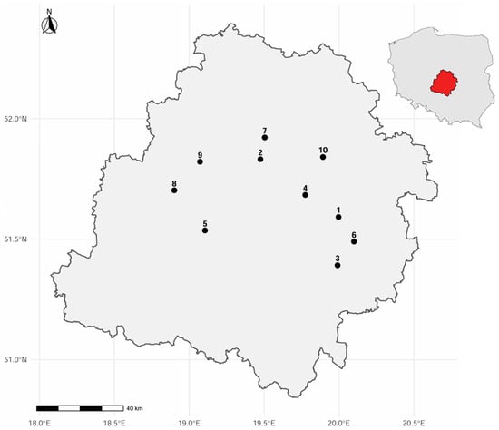
In Central Poland, bryophytes growing on trees have not previously been the subject of detailed analysis. Furthermore, the collected data have never been examined using mathematical methods. Several years of observation of the bryoflora in Central Poland, conducted across 465 hectares of forest and involving 21 tree species, revealed that these trees are colonized by 67 bryophyte taxa, primarily mosses. In this part of Poland most of the trees were overgrown by common, multi-substrate forest species such as Hypnum cupressiforme, Brachythecium rutabulum, or Lophocolea heterophylla. On the other hand, species occurring more rarely, and typically limited to single tree species, included, e.g., Dicranum viride and representatives of the genus Orthotrichum sensu lato (e.g., O. affine, O. pumilum, O. speciosum). The conducted research indicated that not only deciduous trees (e.g., Quercus robur, Carpinus betulus, Betula pendula) were readily colonized by bryophytes—Abies alba, as well as other coniferous trees, also proved to be a highly favorable substrate for these organisms. Moreover, analysis of the bryophytes of individual trees revealed that the trees formed three distinct groups, and the grouping is influenced not only by the species composition of the growing bryophytes. Nonetheless, deciduous and coniferous taxa within each group were colonized by similar mosses and liverworts species. Additionally, different zones of the tree trunk were found to be inhabited by distinct bryophyte assemblages. Thus, the study highlights the specificity of mosses and liverworts flora growing on trees in Central Poland.
2 January 2026