Next Issue
Volume 7, June
Previous Issue
Volume 6, December


Hydrology, Volume 7, Issue 1 (March 2020) – 19 articles

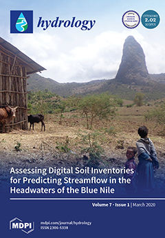
Cover Story (view full-size image): Spatially referenced soil resource data are considered a crucial input to watershed models. Only FAO soil data are globally available. To investigate whether detailed soil resources data in developing countries would improve watershed discharge predictions, we compared the FAO soil database with two detailed soil inventories that were available in a large (1316 km2) and a small watershed (3.6 km2) in the Ethiopian highlands. Stream predictions with the SWAT model improved statistically after model calibration but were similar for the three soil databases, justifying the use of the globally available FAO soil map in data-scarce regions for simulating watershed discharge. View this paper
  • Issues are regarded as officially published after their release is announced to the table of contents alert mailing list.
  • You may sign up for e-mail alerts to receive table of contents of newly released issues.
  • PDF is the official format for papers published in both, html and pdf forms. To view the papers in pdf format, click on the "PDF Full-text" link, and use the free Adobe Reader to open them.
Order results
Result details
Section
Select all
Export citation of selected articles as:
15 pages, 2744 KiB  
Article
Potential Impacts of Climate Change on Extreme Weather Events in the Niger Delta Part of Nigeria
by Ibrahim Hassan, Robert M. Kalin, Jamiu A. Aladejana and Christopher J. White
Hydrology 2020, 7(1), 19; https://doi.org/10.3390/hydrology7010019 - 21 Mar 2020
Cited by 13 | Viewed by 5024
Abstract
The Niger Delta is the most climate-vulnerable region in Nigeria. Flooding events are recorded annually in settlements along the River Niger and its tributaries, inundating many towns and displacing people from their homes. In this study, climate change impacts from extreme meteorological events [...] Read more.
The Niger Delta is the most climate-vulnerable region in Nigeria. Flooding events are recorded annually in settlements along the River Niger and its tributaries, inundating many towns and displacing people from their homes. In this study, climate change impacts from extreme meteorological events over the period 2010–2099 are predicted and analyzed. Four coupled model intercomparison project phase 5 (CMIP5) global climate models (GCMs) under respectively concentration pathways (RCP4.5 and RCP8.5) emission scenarios were used for climate change predictions. Standardized precipitation indices (SPI) of 1-month and 12-month time steps were used for extreme event assessment. Results from the climate change scenarios predict an increase in rainfall across all future periods and under both emission scenarios, with the highest projected increase during the last three decades of the century. Under the RCP8.5 emission scenario, the rainfall at Port Harcourt and Yenagoa Stations is predicted to increase by about 2.47% and 2.62% while the rainfall at Warri Station is predicted to increase by about 1.39% toward the end of the century. The 12-month SPI under RCP4.5 and RCP8.5 emission scenarios predict an exceedance in the extreme wet threshold (i.e., SPI > 2) during all future periods and across all study locations. These findings suggest an increasing risk of flooding within the projected periods. The finding can be useful to policymakers for the formulation and planning of flood mitigation and adaptation measures. Full article
Show Figures

Graphical abstract

14 pages, 2592 KiB  
Article
Bottom Sediment Characteristics of a Tropical Lake: Lake Tana, Ethiopia
by Mebrahtom G. Kebedew, Seifu A. Tilahun, Fasikaw A. Zimale and Tammo S. Steenhuis
Hydrology 2020, 7(1), 18; https://doi.org/10.3390/hydrology7010018 - 19 Mar 2020
Cited by 15 | Viewed by 4153
Abstract
Sediment concentration of rivers in developing countries has been increasing greatly over the last 50 years due to the conversion of forest to continuously cultivated land with the increasing population. Few studies have addressed its effect on sedimentation and water quality of the [...] Read more.
Sediment concentration of rivers in developing countries has been increasing greatly over the last 50 years due to the conversion of forest to continuously cultivated land with the increasing population. Few studies have addressed its effect on sedimentation and water quality of the lakes by analyzing bottom sediment characteristics. In this study, the objective was to investigate the spatial distribution (and their interrelationships) of the bottom sediment characteristics in the largest lake in Ethiopia, Lake Tana where water hyacinths have been spreading rapidly during the last decade. Sediment samples were collected from the lake bottom at 60 locations and analyzed for texture, organic matter, total nitrogen, and available phosphorus. Bottom sediment samples had a median of 75% clay, 13% silt, and 9% sand. Clay was greatest in the northwestern part and smallest in the areas near the major rivers entering or exiting the lake. Clay percentage and lake depth were strongly correlated. The mean organic matter content of bottom sediment was 16 g kg−1, total nitrogen 0.8 g kg−1, and Olsen available phosphorus 19 mg kg−1. Phosphorus concentrations peaked where water hyacinths were found in the northeastern part of the lake. This study will serve as a baseline for future water quality and sedimentation changes in Lake Tana. In particular, it might aid in explaining the spread of the water hyacinths. Full article
Show Figures

Graphical abstract

18 pages, 1948 KiB  
Article
Evaluating and Predicting the Effects of Land Use Changes on Hydrology in Wami River Basin, Tanzania
by Sekela Twisa, Shija Kazumba, Mathew Kurian and Manfred F. Buchroithner
Hydrology 2020, 7(1), 17; https://doi.org/10.3390/hydrology7010017 - 19 Mar 2020
Cited by 20 | Viewed by 4928
Abstract
Understanding the variation in the hydrological response of a basin associated with land use changes is essential for developing management strategies for water resources. The impact of hydrological changes caused by expected land use changes may be severe for the Wami river system, [...] Read more.
Understanding the variation in the hydrological response of a basin associated with land use changes is essential for developing management strategies for water resources. The impact of hydrological changes caused by expected land use changes may be severe for the Wami river system, given its role as a crucial area for water, providing food and livelihoods. The objective of this study is to examine the influence of land use changes on various elements of the hydrological processes of the basin. Hybrid classification, which includes unsupervised and supervised classification techniques, is used to process the images (2000 and 2016), while CA–Markov chain analysis is used to forecast and simulate the 2032 land use state. In the current study, a combined approach—including a Soil and Water Assessment Tool (SWAT) model and Partial Least Squares Regression (PLSR)—is used to explore the influences of individual land use classes on fluctuations in the hydrological components. From the study, it is evident that land use has changed across the basin since 2000 (which is expected to continue in 2032), as well as that the hydrological effects caused by land use changes were observed. It has been found that the major land use changes that affected hydrology components in the basin were expansion of cultivation land, built-up area and grassland, and decline in natural forests and woodland during the study period. These findings provide baseline information for decision-makers and stakeholders concerning land and water resources for better planning and management decisions in the basin resources’ use. Full article
Show Figures

Figure 1

28 pages, 3122 KiB  
Article
Future Changes in Water Supply and Demand for Las Vegas Valley: A System Dynamic Approach based on CMIP3 and CMIP5 Climate Projections
by Neekita Joshi, Kazi Tamaddun, Ranjan Parajuli, Ajay Kalra, Pankaj Maheshwari, Lorenzo Mastino and Marco Velotta
Hydrology 2020, 7(1), 16; https://doi.org/10.3390/hydrology7010016 - 10 Mar 2020
Cited by 17 | Viewed by 4789
Abstract
The study investigated the impact on water supply and demand as an effect of climate change and population growth in the Las Vegas Valley (LVV) as a part of the Thriving Earth Exchange Program. The analyses evaluated future supply and demand scenarios utilizing [...] Read more.
The study investigated the impact on water supply and demand as an effect of climate change and population growth in the Las Vegas Valley (LVV) as a part of the Thriving Earth Exchange Program. The analyses evaluated future supply and demand scenarios utilizing a system dynamics model based on the climate and hydrological projections from the Coupled Model Intercomparison Project phases 3 and 5 (CMIP3 and CMIP5, respectively) using the simulation period expanding from 1989 to 2049. The main source of water supply in LVV is the water storage in Lake Mead, which is directly related to Lake Mead elevation. In order to assess the future water demand, the elevation of Lake Mead was evaluated under several water availability scenarios. Fifty-nine out of the 97 (27 out of the 48) projections from CMIP5 (CMIP3) indicated that the future mean elevation of Lake Mead is likely to be lower than the historical mean. Demand forecasts showed that the Southern Nevada Water Authority’s conservation goal for 2035 can be significantly met under prevalent conservation practices. Findings from this study can be useful for water managers and resource planners to predict future water budget and to make effective decisions in advance to attain sustainable practices and conservation goals. Full article
Show Figures

Figure 1

15 pages, 6496 KiB  
Case Report
Subsoil Reconstruction in Geostatistics beyond Kriging: A Case Study in Veneto (NE Italy)
by Paolo Fabbri, Carlo Gaetan, Luca Sartore and Nico Dalla Libera
Hydrology 2020, 7(1), 15; https://doi.org/10.3390/hydrology7010015 - 07 Mar 2020
Cited by 6 | Viewed by 2512
Abstract
The reconstruction of hydro-stratigraphic units in subsoil (a general term indicating all the materials below ground level) plays an important role in the assessment of soil heterogeneity, which is a keystone in groundwater flow and transport modeling. A geostatistical approach appears to be [...] Read more.
The reconstruction of hydro-stratigraphic units in subsoil (a general term indicating all the materials below ground level) plays an important role in the assessment of soil heterogeneity, which is a keystone in groundwater flow and transport modeling. A geostatistical approach appears to be a good way to reconstruct subsoil, and now other methods besides the classical indicator (co)kriging are available as alternative approximations of the conditional probabilities. Some of these techniques take specifically into account categorical variables as lithologies, but they are computationally prohibitive. Moreover, the stage before subsoil prediction/simulation can be very informative from a hydro-stratigraphic point of view, as the detailed transiogram analysis of this paper demonstrates. In this context, an application of the spMC package for the R software is presented by using a test site located within the Venetian alluvial plain (NE Italy). First, a detailed transiogram analysis was conducted, and then a maximum entropy approach, based on transition probabilities, named Markovian-type Categorical Prediction (MCP), was applied to approximate the posterior conditional probabilities. The study highlights some advantages of the presented approach in term of hydrogeological knowledge and computational efficiency. The spMC package couples transiogram analysis with a maximum entropy approach by taking advantage of High-Performance Computing (HPC) techniques. These characteristics make the spMC package useful for simulating hydro-stratigraphic units in subsoil, despite the use of a large number of lithologies (categories). The results obtained by spMC package suggest that this software should be considered a good candidate for simulating subsoil lithological distributions, especially of limited areas. Full article
Show Figures

Figure 1

14 pages, 4888 KiB  
Article
An Empirical Approach for Modeling Hysteresis Behavior of Pyroclastic Soils
by Giovanna Capparelli and Gennaro Spolverino
Hydrology 2020, 7(1), 14; https://doi.org/10.3390/hydrology7010014 - 03 Mar 2020
Cited by 9 | Viewed by 3870
Abstract
For modeling physical and mechanical phenomena that occur in unsaturated soils, it is very important to identify the correct relationship between suction and water content. This relationship defines the soil water retention curve (SWRC). Its shape depends on numerous factors, including grain size [...] Read more.
For modeling physical and mechanical phenomena that occur in unsaturated soils, it is very important to identify the correct relationship between suction and water content. This relationship defines the soil water retention curve (SWRC). Its shape depends on numerous factors, including grain size composition, particles’ thickening state and, above all, the hydraulic and stress soil history. In particular, the SWRC in wetting phase differs from SWRC in drying phase, showing a hysteretic behavior. Hysteresis domain is defined by the main drying and wetting curves; when moving from one phase to another, relationship between suction and water content defines secondary curves within them. In this paper, a laboratory experiment was carried out to determine main wetting and drying curves of a pyroclastic ash sample from southern Italy. In same site of the sample collection, a monitoring station was installed that measured the suction and water content values. The experimental curves were compared with the data recorded on the site. In this paper, moreover, an empirical procedure is proposed to model secondary curves (or scanning curves) within the hysteresis domain. The scanning curves obtained with this method were compared with data collected by the in-situ monitoring network, revealing the ability to describe a situation realistically with a good adaptation. With this procedure, it is therefore possible to minimize errors since it covers a hysteretic behavior. Full article
Show Figures

Figure 1

19 pages, 18956 KiB  
Article
Assessment of Erosion in River Basins: A Distributed Model to Estimate the Sediment Production over Watersheds by a 3-Dimensional LS Factor in RUSLE Model
by Carmine Covelli, Luigi Cimorelli, Danila Nicole Pagliuca, Bruno Molino and Domenico Pianese
Hydrology 2020, 7(1), 13; https://doi.org/10.3390/hydrology7010013 - 24 Feb 2020
Cited by 21 | Viewed by 4379
Abstract
Erosive processes influence on several phenomena. In particular, they could influence on land depletion, on vegetation weakening, on aggradation phenomena of intermediate, and plain reaches of rivers, on waterways interruption due to overaggradation phenomena caused by floods, and on the losses of water [...] Read more.
Erosive processes influence on several phenomena. In particular, they could influence on land depletion, on vegetation weakening, on aggradation phenomena of intermediate, and plain reaches of rivers, on waterways interruption due to overaggradation phenomena caused by floods, and on the losses of water volumes that may be stored in reservoirs. Among the models proposed in the literature for the prediction of erosion on the annual scale, one of the most widely used is the Revised Universal Soil Loss Equation (RUSLE). In the present paper, starting from the definition of the original model, the authors improved the important combined slope length and slope angle (LS-factor), taking into account the mutual interaction of solid particles, in terms of path and confluences, so as to transform the model, which was first classified on a slope scale or at most on a parcel one, into a distributed model on a basin scale. The use of a distributed approach is an integral part of the analysis of the hydrogeological risk. In this way, it is possible to obtain a map of the erodibility of any basin, from which to derive the most vulnerable areas. The proposed methodology has been tested on the Camastra Basin, located in Basilicata Region of Southern Italy. Full article
Show Figures

Figure 1

24 pages, 8618 KiB  
Article
Evaluation of Hydrological and Hydraulic Models Applied in Typical Mediterranean Ungauged Watersheds Using Post-Flash-Flood Measurements
by Aristeidis Kastridis and Dimitrios Stathis
Hydrology 2020, 7(1), 12; https://doi.org/10.3390/hydrology7010012 - 18 Feb 2020
Cited by 27 | Viewed by 3462
Abstract
In this paper, three different flash floods episodes were analyzed, which occurred in October 2006, February 2010, and June 2018 in the Chalkidiki peninsula (North Greece). The Soil Conservation Service (SCS) model and a revised assessment of the CN parameter were applied to [...] Read more.
In this paper, three different flash floods episodes were analyzed, which occurred in October 2006, February 2010, and June 2018 in the Chalkidiki peninsula (North Greece). The Soil Conservation Service (SCS) model and a revised assessment of the CN parameter were applied to estimate the flood hydrographs, and Hydrologic Engineering Center’s-River Analysis System (HEC-RAS) software was used for the flood simulations. Initially, hydrological and hydraulic models were calibrated at Vatonias watershed (240.90 km2, North Greece), where three rain gauges and one water level station are located. Vatonias is located very close to the Stavros ungauged watersheds and presents similar geomorphology and land use conditions. The effectiveness and accuracy of the methodology were validated using post-flash-flood measurements. The root mean square error goodness of fit was used to compare the observed and simulated flood depths. Critical success index was calculated for the assessment of the accuracy of observed and modeled flooded areas. The results showed that the dense forest vegetation was not capable of preventing the flash flood generation or reducing the peak discharge, especially in small watersheds characterized by short concentration times. The main cause of flash flood generation was the human interference that influenced the hydraulic characteristics of streams and floodplains. The revised assessment of the CN parameter enhanced the estimation and spatial distribution of CN over the entire watershed. The results revealed that the proposed methodology could be a very useful tool to researchers and policy makers for flood risk assessment of higher accuracy and effectiveness in ungauged Mediterranean watersheds. Full article
Show Figures

Figure 1

21 pages, 2686 KiB  
Article
Evaluation of General Circulation Models over the Upper Ouémé River Basin in the Republic of Benin
by André Attogouinon, Agnidé E. Lawin and Jean-François Deliège
Hydrology 2020, 7(1), 11; https://doi.org/10.3390/hydrology7010011 - 14 Feb 2020
Cited by 5 | Viewed by 2360
Abstract
This study assessed the performance of eight general circulation models (GCMs) implemented in the upper Ouémé River basin in Benin Republic (West Africa) during the Fifth Assessment Report on Climate Change. Historical rainfall simulations of the climate model of Rossby Regional Centre (RCA4) [...] Read more.
This study assessed the performance of eight general circulation models (GCMs) implemented in the upper Ouémé River basin in Benin Republic (West Africa) during the Fifth Assessment Report on Climate Change. Historical rainfall simulations of the climate model of Rossby Regional Centre (RCA4) driven by eight Coupled Model Intercomparison Project (CMIP5) GCMs over a 55-year period (1951 to 2005) are evaluated using the observational data set. Apart from daily rainfall, other rainfall parameters calculated from observed and simulated rainfall were compared. U-test and other statistical criteria (R2, MBE, MAE, RMSE and standard of standard deviations) were used. According to the results, the simulations correctly reproduce the interannual variability of precipitation in the upper Ouémé River basin. However, the models tend to produce drizzle. Especially, the overestimation of April, May and November rains not only explains the overestimation of seasonal and annual cumulative rainfall but also the early onset of the rainy season and its late withdrawal. However, we noted that this overestimation magnitude varies from one model to another. As for extreme rainfall indices, the models reproduced them poorly. The CanESM2, CNRM-CM5 and EC-EARTH models perform well for daily rainfall. A trade-off is formulated to select the common MPI-ESM-LR, GFDL-ESM2M, NorESM1-M and CanESM2 models for different rainfall parameters for the reliable projection of rainfall in the area. However, the MPI-ESM-LR model is a valuable tool for studying future climate change. Full article
Show Figures

Figure 1

15 pages, 1354 KiB  
Article
Flash Flood Impact Assessment in Jeddah City: An Analytic Hierarchy Process Approach
by Umar Lawal Dano
Hydrology 2020, 7(1), 10; https://doi.org/10.3390/hydrology7010010 - 06 Feb 2020
Cited by 33 | Viewed by 5748
Abstract
Floods are among the most destructive natural hazards that cost lives and disrupt the socioeconomic activities of residents, especially in the rapidly growing cities of developing countries. Jeddah, a coastal city situated in Saudi Arabia, has experienced severe flash flood events in recent [...] Read more.
Floods are among the most destructive natural hazards that cost lives and disrupt the socioeconomic activities of residents, especially in the rapidly growing cities of developing countries. Jeddah, a coastal city situated in Saudi Arabia, has experienced severe flash flood events in recent years. With intense rainfall, extensive coastal developments, and sensitive ecosystems, the city is susceptible to severe flash flood risks. The objective of this article is to apply an Analytic Hierarchy Process (AHP) model to explore the impacts of flash flood hazards and identify the most effective approaches to reducing the flash flood impacts in Jeddah using expert’s opinions. The study utilizes experts’ judgments and employs the AHP for data analyses and modeling. The results indicated that property loss has the highest probability of occurrence in the events of a flash flood with a priority level of 42%, followed by productivity loss (28%). Injuries and death were rated the least priority of 18% and 12%, respectively. Concerning flood impact reduction alternatives, river management (41%) and early warning system (38%) are the most favorable options. The findings could assist the government to design appropriate measures to safeguard the lives and properties of the residents. The study concludes by underscoring the significance of incorporating experts’ judgments in assessing flash flood impacts. Full article
Show Figures

Figure 1

12 pages, 8272 KiB  
Article
Simulating Flash Floods Using Geostationary Satellite-Based Rainfall Estimation Coupled with a Land Surface Model
by Dwi Prabowo Yuga Suseno and Tomohito J. Yamada
Hydrology 2020, 7(1), 9; https://doi.org/10.3390/hydrology7010009 - 25 Jan 2020
Cited by 9 | Viewed by 2570
Abstract
Clarifying hydrologic behavior, especially behavior related to extreme events such as flash floods, is vital for flood mitigation and management. However, discharge and rainfall measurement data are scarce, which is a major obstacle to flood mitigation. This study: (i) simulated flash floods on [...] Read more.
Clarifying hydrologic behavior, especially behavior related to extreme events such as flash floods, is vital for flood mitigation and management. However, discharge and rainfall measurement data are scarce, which is a major obstacle to flood mitigation. This study: (i) simulated flash floods on a regional scale using three types of rainfall forcing implemented in a land surface model; and (ii) evaluated and compared simulated flash floods with the observed discharge. The three types of rainfall forcing were those observed by the Automated Meteorological Data Acquisition System (AMeDAS) (Simulation I), the observed rainfall from the Ministry of Land, Infrastructure and Transportation (MLIT) (Simulation II), and the estimated rainfall from the Multi-purpose Transport Satellite (MTSAT), which was downscaled by AMeDAS rainfall (Simulation III). MLIT rainfall observations have a denser station network over the Ishikari River basin (spacing of approximately 10 km) compared with AMeDAS (spacing of approximately 20 km), so they are expected to capture the rainfall spatial distribution more accurately. A land surface model, the Minimal Advance Treatments of Surface Interaction and Runoff (MATSIRO), was implemented for the flash flood simulation. The river flow simulations were run over the Ishikari river basin at a 1-km grid resolution and a 1-h temporal resolution during August 2010. The statistical performance of the river flow simulations during a flash flood event on 23 and 24 August 2010 demonstrated that Simulation I was reasonable compared with Simulation III. The findings also suggest that the advantages of the MTSAT-based estimated rainfall (i.e., good spatial distribution) can be coupled with the benefit of direct AMeDAS observations (i.e., representation of the true rainfall). Full article
Show Figures

Figure 1

19 pages, 6730 KiB  
Article
Assessing Digital Soil Inventories for Predicting Streamflow in the Headwaters of the Blue Nile
by Anwar A. Adem, Yihun T. Dile, Abeyou W. Worqlul, Essayas K. Ayana, Seifu A. Tilahun and Tammo S. Steenhuis
Hydrology 2020, 7(1), 8; https://doi.org/10.3390/hydrology7010008 - 24 Jan 2020
Cited by 8 | Viewed by 2754
Abstract
Comprehensive spatially referenced soil data are a crucial input in predicting biophysical and hydrological landscape processes. In most developing countries, these detailed soil data are not yet available. The objective of this study was, therefore, to evaluate the detail needed in soil resource [...] Read more.
Comprehensive spatially referenced soil data are a crucial input in predicting biophysical and hydrological landscape processes. In most developing countries, these detailed soil data are not yet available. The objective of this study was, therefore, to evaluate the detail needed in soil resource inventories to predict the hydrologic response of watersheds. Using three distinctively different digital soil inventories, the widely used and tested soil and water assessment tool (SWAT) was selected to predict the discharge in two watersheds in the headwaters of the Blue Nile: the 1316 km2 Rib watershed and the nested 3.59 km2 Gomit watershed. The soil digital soil inventories employed were in increasing specificity: the global Food and Agricultural Organization (FAO), the Africa Soil Information Service (AfSIS) and the Amhara Design and Supervision Works Enterprise (ADSWE). Hydrologic simulations before model calibration were poor for all three soil inventories used as input. After model calibration, the streamflow predictions improved with monthly Nash–Sutcliffe efficiencies greater than 0.68. Predictions were statistically similar for the three soil databases justifying the use of the global FAO soil map in data-scarce regions for watershed discharge predictions. Full article
Show Figures

Graphical abstract

4 pages, 221 KiB  
Editorial
Acknowledgement to Reviewers of Hydrology in 2019
by Hydrology Editorial Office
Hydrology 2020, 7(1), 7; https://doi.org/10.3390/hydrology7010007 - 20 Jan 2020
Viewed by 1456
Abstract
The editorial team greatly appreciates the reviewers who have dedicated their considerable time and
expertise to the journal’s rigorous editorial process over the past 12 months, regardless of whether
the papers are finally published or not [...] Full article
16 pages, 691 KiB  
Article
Permafrost Hydrology Research Domain: Process-Based Adjustment
by Nikita Tananaev, Roman Teisserenc and Matvey Debolskiy
Hydrology 2020, 7(1), 6; https://doi.org/10.3390/hydrology7010006 - 07 Jan 2020
Cited by 11 | Viewed by 4248
Abstract
Permafrost hydrology is an emerging discipline, attracting increasing attention as the Arctic region is undergoing rapid change. However, the research domain of this discipline had never been explicitly formulated. Both ‘permafrost’ and ‘hydrology’ yield differing meanings across languages and scientific domains; hence, ‘permafrost [...] Read more.
Permafrost hydrology is an emerging discipline, attracting increasing attention as the Arctic region is undergoing rapid change. However, the research domain of this discipline had never been explicitly formulated. Both ‘permafrost’ and ‘hydrology’ yield differing meanings across languages and scientific domains; hence, ‘permafrost hydrology’ serves as an example of cognitive linguistic relativity. From this point of view, the English and Russian usages of this term are explained. The differing views of permafrost as either an ecosystem class or a geographical region, and hydrology as a discipline concerned with either landscapes or generic water bodies, maintain a language-specific touch of the research in this field. Responding to a current lack of a unified approach, we propose a universal process-based definition of permafrost hydrology, based on a specific process assemblage, specific to permafrost regions and including: (1) Unconfined groundwater surface dynamics related to the active layer development; (2) water migration in the soil matrix, driven by phase transitions in the freezing active layer; and (3) transient water storage in both surface and subsurface compartments, redistributing runoff on various time scales. This definition fills the gap in existing scientific vocabulary. Other definitions from the field are revisited and discussed. The future of permafrost hydrology research is discussed, where the most important results would emerge at the interface between permafrost hydrology, periglacial geomorphology, and geocryology. Full article
Show Figures

Figure 1

14 pages, 7793 KiB  
Article
Effects of Aquifer Bed Slope and Sea Level on Saltwater Intrusion in Coastal Aquifers
by Hany F. Abd-Elhamid, Ismail Abd-Elaty and Mohsen M. Sherif
Hydrology 2020, 7(1), 5; https://doi.org/10.3390/hydrology7010005 - 31 Dec 2019
Cited by 14 | Viewed by 3695
Abstract
The quality of groundwater resources in coastal aquifers is affected by saltwater intrusion. Over-abstraction of groundwater and seawater level rise due to climate change accelerate the intrusion process. This paper investigates the effects of aquifer bed slope and seaside slope on saltwater intrusion. [...] Read more.
The quality of groundwater resources in coastal aquifers is affected by saltwater intrusion. Over-abstraction of groundwater and seawater level rise due to climate change accelerate the intrusion process. This paper investigates the effects of aquifer bed slope and seaside slope on saltwater intrusion. The possible impacts of increasing seawater head due to sea level rise and decreasing groundwater level due to over-pumping and reduction in recharge are also investigated. A numerical model (SEAWAT) is applied to well-known Henry problem to assess the movement of the dispersion zone under different settings of bed and seaside slopes. The results showed that increasing seaside slope increased the intrusion of saltwater by 53.2% and 117% for slopes of 1:1 and 2:1, respectively. Increasing the bed slope toward the land decreased the intrusion length by 2% and 4.8%, respectively. On the other hand, increasing the bed slope toward the seaside increased the intrusion length by 3.6% and 6.4% for bed slopes of 20:1 and 10:1, respectively. The impacts of reducing the groundwater level at the land side and increasing the seawater level at the shoreline by 5% and 10% considering different slopes are studied. The intrusion length increased under both conditions. Unlike Henry problem, the current investigation considers inclined beds and sea boundaries and, hence, provides a better representation of the field conditions. Full article
Show Figures

Figure 1

10 pages, 236 KiB  
Review
Mathematical Treatment of Saturated Macroscopic Flow in Heterogeneous Porous Medium: Evaluating Darcy’s Law
by R. William Nelson and Gustavious P. Williams
Hydrology 2020, 7(1), 4; https://doi.org/10.3390/hydrology7010004 - 31 Dec 2019
Cited by 2 | Viewed by 2450
Abstract
We present a rigorous mathematical treatment of water flow in saturated heterogeneous porous media based on the classical Navier-Stokes formulation that includes vorticity in a heterogeneous porous media. We used the mathematical approach proposed in 1855 by James Clark Maxwell. We show that [...] Read more.
We present a rigorous mathematical treatment of water flow in saturated heterogeneous porous media based on the classical Navier-Stokes formulation that includes vorticity in a heterogeneous porous media. We used the mathematical approach proposed in 1855 by James Clark Maxwell. We show that flow in heterogeneous media results in a flow field described by a heterogeneous complex lamellar vector field with rotational flows, compared to the homogeneous lamellar flow field that results from Darcy’s law. This analysis shows that Darcy’s Law does not accurately describe flow in a heterogeneous porous medium and we encourage precise laboratory experiments to determine under what conditions these issues are important. We publish this work to encourage others to perform numerical and laboratory experiments to determine the circumstances in which this derivation is applicable, and in which the complications can be disregarded. Full article
12 pages, 518 KiB  
Correction
Correction: Aga, A.O. et al. Estimating the Sediment Flux and Budget for a Data Limited Rift Valley Lake in Ethiopia. Hydrology 2019, 6, 1
by Alemu O. Aga, Assefa M. Melesse and Bayou Chane
Hydrology 2020, 7(1), 3; https://doi.org/10.3390/hydrology7010003 - 27 Dec 2019
Cited by 1 | Viewed by 2107
Abstract
The authors wish to make the following corrections to this paper (Aga et al [...] Full article
15 pages, 778 KiB  
Article
Localized Floods, Poverty and Food Security: Empirical Evidence from Rural Pakistan
by Akhter Ali and Dil Bahadur Rahut
Hydrology 2020, 7(1), 2; https://doi.org/10.3390/hydrology7010002 - 27 Dec 2019
Cited by 10 | Viewed by 4160
Abstract
National level floods affect large sections of the population, and in turn, receive attention from the government and international agencies. Localized natural disasters, including localized floods, do not get the attention of the government and policymakers because their impact is felt within limited [...] Read more.
National level floods affect large sections of the population, and in turn, receive attention from the government and international agencies. Localized natural disasters, including localized floods, do not get the attention of the government and policymakers because their impact is felt within limited geographical areas, despite the fact that these disasters severely affect the livelihood of rural communities. This study examines the impact of localized floods on the livelihood of farmers in Pakistan using a cross-sectional data set collected from 812 households. The empirical results show that localized floods severely affect rural livelihoods, and affected households have lowered cereal crop yields, less income, and reduced food security levels. Farmers adopt a number of strategies, including crop and livestock insurance, bund-making, land-leveling, and tree planting, to combat the impact of localized floods. Among all these mitigating strategies, the tree plantation is ranked as the best mitigating strategy followed by crop and livestock insurance, land leveling, and bund making, respectively. Education, wealth, access to non-governmental organizations (NGOs), extension services, and infrastructure, influence the adoption of measures to mitigate the effect of flood risks. National policy on localized flood risks needs to strengthen local institutions to provide support to families and extension services to train farmers to mitigate the impact of localized floods. Full article
Show Figures

Figure 1

22 pages, 3541 KiB  
Article
Lake Volume Data Analyses: A Deep Look into the Shrinking and Expansion Patterns of Lakes Azuei and Enriquillo, Hispaniola
by Mahrokh Moknatian and Michael Piasecki
Hydrology 2020, 7(1), 1; https://doi.org/10.3390/hydrology7010001 - 24 Dec 2019
Cited by 4 | Viewed by 2944
Abstract
This paper presents the development of an evenly spaced volume time series for Lakes Azuei and Enriquillo both located on the Caribbean island of Hispaniola. The time series is derived from an unevenly spaced Landsat imagery data set which is then exposed to [...] Read more.
This paper presents the development of an evenly spaced volume time series for Lakes Azuei and Enriquillo both located on the Caribbean island of Hispaniola. The time series is derived from an unevenly spaced Landsat imagery data set which is then exposed to several imputation methods to construct the gap filled uniformly-spaced time series so it can be subjected to statistical analyses methods. The volume time series features both gradual and sudden changes the latter of which is attributed to North Atlantic cyclone activity. Relevant cyclone activity is defined as an event passing within 80 km and having regional monthly rainfall averages higher than a threshold value of 87 mm causing discontinuities in the lake responses. Discontinuities are accounted for in the imputation algorithm by dividing the time series into two sub-sections: Before/after the event. Using leave-p-out cross-validation and computing the NRMSE index the Stineman interpolation proves to be the best algorithm among 15 different imputation alternatives that were tested. The final time series features 16-day intervals which is subsequently resampled into one with monthly time steps. Data analyses of the monthly volume change time series show Lake Enriquillo’s seasonal periodicity in its behavior and also its sensitivity due to the occurrence of storm events. Response times feature a growth pattern lasting for one to two years after an extreme event, followed by a shrinking pattern lasting 5–7 years returning the lake to its original state. While both lakes show a remarkable long term increase in size starting in 2005, Lake Azuei is different in that it is much less sensitive to storm events and instead shows a stronger response to just changing seasonal rainfall patterns. Full article
Show Figures

Figure 1

Previous Issue
Next Issue
Back to TopTop