Skip to Content
You are currently on the new version of our website. Access the old version .

Remote Sensing, Volume 17, Issue 8

2025 April-2 - 161 articles

Cover Story: 
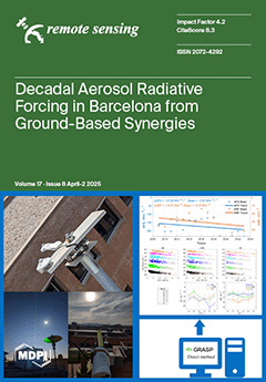
Long-term aerosol radiative effects (2009-2023) have been assessed in Barcelona, Spain, using ground-based instruments and combining Global Solar Radiation from a pyranometer and Aerosol Optical Depth from an AERONET photometer. Aerosol Radiative Forcing and Aerosol Forcing Efficiency were estimated with the direct method for clear-sky days, which were selected using quadratic fitting. These aerosol radiative effects from desert dust, urban/industrial-biomass burning, and mixed aerosol types were also calculated. The results show a dominant cooling effect, increasing in absolute value over time. GRASP retrievals from lidar and photometer combinations were also used to assess aerosol radiative effects for three case studies and reduce uncertainties at high aerosol loads. View this paper
  • Issues are regarded as officially published after their release is announced to the table of contents alert mailing list .
  • You may sign up for email alerts to receive table of contents of newly released issues.
  • PDF is the official format for papers published in both, html and pdf forms. To view the papers in pdf format, click on the "PDF Full-text" link, and use the free Adobe Reader to open them.

Articles (161)

  • Communication
  • Open Access
1 Citations
903 Views
15 Pages

21 April 2025

By extending synthetic aperture technology from a microwave band to laser wavelength, the synthetic aperture ladar (SAL) achieves extremely high spatial resolution independent of the target distance in long-range imaging. Nonlinear phase correction i...

  • Article
  • Open Access
1,134 Views
24 Pages

Rapeseed Area Extraction Based on Time-Series Dual-Polarization Radar Vegetation Indices

  • Yiqing Zhu,
  • Hong Cao,
  • Shangrong Wu,
  • Yongli Guo and
  • Qian Song

21 April 2025

Accurate, real-time, and dynamic monitoring of crop planting distributions in hilly areas with complex terrain and frequent meteorological changes is highly important for agricultural production. Dual-polarization SAR has high application value in th...

  • Article
  • Open Access
4 Citations
2,645 Views
25 Pages

21 April 2025

Deep learning has significantly advanced synthetic aperture radar (SAR) ship detection in recent years. However, existing approaches predominantly rely on amplitude information while largely overlooking the critical phase component, limiting further...

  • Article
  • Open Access
2,835 Views
23 Pages

A Geospatial Livestock-Carrying Capacity Model (GLCC) in the Akmola Oblast, Kazakhstan

  • Jiaguo Qi,
  • Zihan Lin,
  • Mark A. Weltz,
  • Kenneth E. Spaeth,
  • Gulnaz Iskakova,
  • Jason Nesbit,
  • David Toledo,
  • Tlektes Yespolov,
  • Maira Kussainova and
  • Xiaoping Xin
  • + 1 author

21 April 2025

Spatial disparities in rangeland conditions across Kazakhstan complicate field-based assessments of livestock-carrying capacity (LCC), a critical metric for the country’s food security and economic planning. This study developed a geospatial li...

  • Article
  • Open Access
1 Citations
3,075 Views
21 Pages

21 April 2025

Tiny object detection remains a formidable challenge in the field of computer vision. There are many factors that influence tiny object detection performance. In this paper, we focus primarily on the following two aspects. First, due to diminutive si...

  • Article
  • Open Access
6 Citations
2,558 Views
26 Pages

21 April 2025

Mid-wave infrared (MWIR) hyperspectral imaging integrates MWIR technology with hyperspectral remote sensing, enabling the capture of radiative information that is difficult to obtain in the visible spectrum, thus demonstrating significant value in ca...

  • Article
  • Open Access
3 Citations
3,660 Views
19 Pages

21 April 2025

Semi-supervised learning aims to improve the generalization performance of a model by exploiting the large quantity of unlabeled data together with limited labeled data during training. When applied to object detection in remote sensing images, semi-...

  • Article
  • Open Access
2 Citations
2,244 Views
20 Pages

A Method for the 3D Reconstruction of Landscape Trees in the Leafless Stage

  • Jiaqi Li,
  • Qingqing Huang,
  • Xin Wang,
  • Benye Xi,
  • Jie Duan,
  • Hang Yin and
  • Lingya Li

20 April 2025

Three-dimensional models of trees can help simulate forest resource management, field surveys, and urban landscape design. With the advancement of Computer Vision (CV) and laser remote sensing technology, forestry researchers can use images and point...

  • Article
  • Open Access
2 Citations
2,809 Views
16 Pages

20 April 2025

Dust storms, as an important extreme weather event on Mars, have significant impacts on the Martian atmosphere and climate and the activities of Martian probes. Therefore, it is necessary to analyze and predict the activity trends of Martian dust sto...

  • Article
  • Open Access
2 Citations
1,909 Views
22 Pages

Cover Crop Types Influence Biomass Estimation Using Unmanned Aerial Vehicle-Mounted Multispectral Sensors

  • Sk Musfiq Us Salehin,
  • Chiranjibi Poudyal,
  • Nithya Rajan and
  • Muthukumar Bagavathiannan

20 April 2025

Accurate cover crop biomass estimation is critical for evaluating their ecological benefits. Traditional methods, like destructive sampling, are labor-intensive and time-consuming. This study investigates the application of unmanned aerial vehicle (U...

  • Technical Note
  • Open Access
1 Citations
828 Views
15 Pages

20 April 2025

Deep learning has shown significant potential in multi-band Polarimetric Synthetic Aperture Radar (PolSAR) land cover classification. However, the existing methods face two main challenges: accurately modeling the complex nonlinear relationships betw...

  • Article
  • Open Access
1 Citations
1,656 Views
22 Pages

20 April 2025

Mesoscale eddies play a crucial role as primary transporters of heat, salinity, and freshwater in oceanic systems. Utilizing the latest Surface Water and Ocean Topography (SWOT) dataset, this study employed the py-eddy-tracker (PET) algorithm to iden...

  • Article
  • Open Access
939 Views
21 Pages

20 April 2025

Accurately and timely estimating three-dimensional ocean states is crucial for improving operational ocean forecasting capabilities. Although satellite observations provide valuable evolutionary information, they are confined to surface-level variabl...

  • Article
  • Open Access
3 Citations
1,769 Views
30 Pages

Assessing Habitat Quality on Synergetic Land-Cover Dataset Across the Greater Mekong Subregion over the Last Four Decades

  • Shu’an Liu,
  • Tianle Sun,
  • Philippe Ciais,
  • Huifang Zhang,
  • Junjun Fang,
  • Jingchun Fang,
  • Tewekel Melese Gemechu and
  • Baozhang Chen

20 April 2025

In the face of rapid infrastructure expansion and escalating anthropogenic activities, it becomes imperative to prioritize the examination of long-term transformations in land cover and ecological quality within the Greater Mekong Subregion (GMS). We...

  • Article
  • Open Access
1,261 Views
19 Pages

20 April 2025

The sea surface temperature (SST) is an important parameter reflecting the energy exchange between the ocean and the atmosphere, which has a key impact on climate change, marine ecology and fisheries. However, most of the existing SST fusion methods...

  • Article
  • Open Access
2 Citations
3,185 Views
22 Pages

20 April 2025

Object detection is a critical task in autonomous driving. Currently, 3D object detection methods for autonomous driving primarily rely on stereo cameras and LiDAR, which are susceptible to adverse weather conditions and low lighting, resulting in li...

  • Article
  • Open Access
2 Citations
1,126 Views
18 Pages

A Cross-Domain Landslide Extraction Method Utilizing Image Masking and Morphological Information Enhancement

  • Jie Chen,
  • Jinge Liu,
  • Xu Zeng,
  • Songshan Zhou,
  • Geng Sun,
  • Siqiang Rao,
  • Ya Guo and
  • Jingru Zhu

20 April 2025

The deployment of landslide intelligent recognition models in non-training regions encounters substantial challenges, primarily attributed to heterogeneous remote sensing acquisition parameters and inherent geospatial variability in factors such as t...

  • Article
  • Open Access
2 Citations
1,371 Views
18 Pages

Remote Sensing-Based Detection and Analysis of Slow-Moving Landslides in Aba Prefecture, Southwest China

  • Juan Ren,
  • Wunian Yang,
  • Zhigang Ma,
  • Weile Li,
  • Shuai Zeng,
  • Hao Fu,
  • Yan Wen and
  • Jiayang He

19 April 2025

Aba Tibetan and Qiang Autonomous Prefecture (Aba Prefecture), located in Southwest China, has complex geological conditions and frequent seismic activity, facing an increasing landslide risk that threatens the safety of local communities. This study...

  • Article
  • Open Access
2 Citations
2,461 Views
25 Pages

19 April 2025

Remote Sensing Image Change Captioning (RSICC) has emerged as a cross-disciplinary technology that automatically generates sentences describing the changes in bi-temporal remote sensing images. While demonstrating significant potential for urban plan...

  • Article
  • Open Access
6 Citations
2,153 Views
26 Pages

19 April 2025

Deep learning-based hyperspectral image (HSI) classification methods, such as Transformers and Mambas, have attracted considerable attention. However, several challenges persist, e.g., (1) Transformers suffer from quadratic computational complexity d...

  • Review
  • Open Access
3 Citations
2,023 Views
20 Pages

19 April 2025

While groundwater-dependent ecosystems (GDEs) occupy only a small portion of the Earth’s surface, they hold significant ecological value by providing essential ecosystem services such as habitat for flora and fauna, carbon sequestration, and er...

  • Article
  • Open Access
904 Views
21 Pages

19 April 2025

The estimation and correction of antenna patterns are essential for ensuring the relative radiometric quality of SAR images. Traditional methods for antenna pattern estimation rely on artificial calibrators or specific stable natural scenes like the...

  • Article
  • Open Access
2,174 Views
17 Pages

18 April 2025

Light detection and ranging (LiDAR) has the advantage of simultaneous localization and mapping with high precision, making it one of the important sensors for intelligent robotics navigation, positioning, and perception. It is common knowledge that t...

  • Article
  • Open Access
4 Citations
1,134 Views
24 Pages

DB-MFENet: A Dual-Branch Multi-Frequency Feature Enhancement Network for Hyperspectral Image Classification

  • Chen Zang,
  • Gaochao Song,
  • Lei Li,
  • Guangrui Zhao,
  • Wanxuan Lu,
  • Guiyuan Jiang and
  • Qian Sun

18 April 2025

HSI classification is essential for monitoring and analyzing the Earth’s surface, with methods utilizing convolutional neural networks (CNNs) and transformers rapidly gaining prominence and advancing in recent years. However, CNNs are limited b...

  • Technical Note
  • Open Access
1 Citations
970 Views
16 Pages

Bayesian Time-Domain Ringing Suppression Approach in Impulse Ultrawideband Synthetic Aperture Radar

  • Xinhao Xu,
  • Wenjie Li,
  • Haibo Tang,
  • Longyong Chen,
  • Chengwei Zhang,
  • Tao Jiang,
  • Jie Liu and
  • Xingdong Liang

18 April 2025

Impulse ultrawideband (UWB) synthetic aperture radar (SAR) combines high-azimuth-range resolution with robust penetration capabilities, making it ideal for applications such as through-wall detection and subsurface imaging. In such systems, the perfo...

  • Article
  • Open Access
2,278 Views
19 Pages

TerrAInav Sim: An Open-Source Simulation of UAV Aerial Imaging from Map-Based Data

  • Seyedeh Parisa Dajkhosh,
  • Peter M. Le,
  • Orges Furxhi and
  • Eddie L. Jacobs

18 April 2025

Capturing real-world aerial images for vision-based navigation (VBN) is challenging due to limited availability and conditions that make it nearly impossible to access all desired images from any location. The complexity increases when multiple locat...

  • Article
  • Open Access
4 Citations
2,035 Views
32 Pages

Predicting Tree-Level Diameter and Volume for Radiata Pine Using UAV LiDAR-Derived Metrics Across a National Trial Series in New Zealand

  • Michael S. Watt,
  • Sadeepa Jayathunga,
  • Midhun Mohan,
  • Robin J. L. Hartley,
  • Nicolò Camarretta,
  • Benjamin S. C. Steer,
  • Weichen Zhang and
  • Mitch Bryson

18 April 2025

The rapid development of UAV-LiDAR and data processing capabilities is likely to enable accurate individual-tree inventories in the near future, requiring few on-ground calibration measurements. Using data collected from 20 radiata pine trials disper...

  • Article
  • Open Access
1 Citations
1,152 Views
16 Pages

18 April 2025

Using Planetscope imagery, we trained a random forest model to detect Callery pear (Pyrus calleryana) throughout a diverse urban landscape in Columbia, Missouri. The random forest model had a classification accuracy of 89.78%, a recall score of 0.693...

  • Article
  • Open Access
3 Citations
1,921 Views
18 Pages

An Improved Point Cloud Filtering Algorithm Applies in Complex Urban Environments

  • Guangyu Liang,
  • Ximin Cui,
  • Debao Yuan,
  • Liuya Zhang and
  • Renxu Yang

18 April 2025

Point cloud filtering plays a crucial role in ground point extraction in urban environments. It can effectively distinguish ground points from object points, reduce data redundancy, and improve processing efficiency, providing accurate foundational d...

  • Article
  • Open Access
1 Citations
1,142 Views
20 Pages

18 April 2025

Airborne hyperspectral LiDAR (AHSL) is a technology that integrates the spectral content collected using hyperspectral imaging and the precise 3D descriptions of observed objects obtained using LiDAR (light detection and ranging). AHSL detects the sp...

  • Article
  • Open Access
1 Citations
2,285 Views
20 Pages

18 April 2025

Precise point positioning ambiguity resolution (PPP-AR) is a key technique for high-precision global navigation satellite system (GNSS) observations, with phase bias products playing a critical role in its implementation. The multi-GNSS experiment an...

  • Article
  • Open Access
7 Citations
3,360 Views
25 Pages

18 April 2025

Aiming at the problem of nonlinear observation model mismatch and insufficient anti-interference ability of SINS/GNSS integrated navigation system in complex dynamic environment, this paper proposes an adaptive robust filtering algorithm with improve...

  • Article
  • Open Access
1,946 Views
20 Pages

18 April 2025

This paper proposes a novel point cloud multi-scale completion algorithm guided by image rotation attention mechanisms to address the challenges of severe information loss and suboptimal fusion effects in multi-modal feature extraction and integratio...

  • Article
  • Open Access
5 Citations
3,606 Views
18 Pages

18 April 2025

The long-term monitoring of nighttime lights is essential for understanding sources of light pollution. Nighttime lights observed in space are affected by atmospheric conditions as they transmit from the Earth surface through clouds and aerosols to t...

  • Article
  • Open Access
3 Citations
1,714 Views
27 Pages

Analysis and Experiments of an Electromagnetic Docking Mechanism for Repeated Docking and Separation of the CubeSats

  • Xiaoze Yang,
  • Chenyuan Li,
  • Lili Zhang,
  • Zeming Zhao,
  • Caiting He,
  • Tao Hu,
  • Mingyang Li,
  • Honghao Yue,
  • Yong Zhao and
  • Yitong Wei
  • + 1 author

17 April 2025

With the background of on-orbit repetitive connection and separation of CubeSats, an electromagnetic docking mechanism for repeated docking and separation is proposed. A reusable electromagnetic docking scheme combining lead screw transmission with e...

  • Article
  • Open Access
1 Citations
2,042 Views
17 Pages

Plant Height and Soil Compaction in Coffee Crops Based on LiDAR and RGB Sensors Carried by Remotely Piloted Aircraft

  • Nicole Lopes Bento,
  • Gabriel Araújo e Silva Ferraz,
  • Lucas Santos Santana,
  • Rafael de Oliveira Faria,
  • Giuseppe Rossi and
  • Gianluca Bambi

17 April 2025

Remotely Piloted Aircraft (RPA) as sensor-carrying airborne platforms for indirect measurement of plant physical parameters has been discussed in the scientific community. The utilization of RGB sensors with photogrammetric data processing based on S...

  • Article
  • Open Access
6 Citations
1,465 Views
23 Pages

17 April 2025

Low Earth Orbit (LEO) satellite communication is gradually becoming the main carrier for satellite communication by virtue of its advantages, such as high landing power, narrow beam, large transmission bandwidth, and small time delay. In the military...

  • Article
  • Open Access
2 Citations
2,067 Views
17 Pages

17 April 2025

The deterioration of stone materials due to atmospheric factors is a growing global concern, affecting the integrity and preservation of numerous UNESCO World Heritage Sites around the world. This study provides an estimate of the long-term impact of...

  • Article
  • Open Access
1 Citations
1,595 Views
22 Pages

17 April 2025

For the satellite orbit pursuit–evasion game problem, this paper proposes a multi-stage optimization-based solution aimed at improving the confrontation strategies between task satellites and target satellites in complex space environments. The...

  • Article
  • Open Access
1 Citations
972 Views
20 Pages

17 April 2025

The temperature and humidity profiles within the planetary boundary layer (PBL) are crucial for Earth’s climate research. The Atmospheric Sounder Spectrometer by Infrared Spectral Technology (ASSIST) measures downward thermal radiation in the a...

  • Article
  • Open Access
2 Citations
1,423 Views
22 Pages

Infrared Small Target Detection Based on Entropy Variation Weighted Local Contrast Measure

  • Yuyang Xi,
  • Yushan Zhang,
  • Ying Jiang,
  • Liuwei Zhang and
  • Qingyu Hou

17 April 2025

Infrared small target detection plays a crucial role in fields such as remote sensing and surveillance. However, during long-distance imaging, factors such as atmospheric attenuation lead to a low signal-to-clutter ratio for the targets, making their...

  • Article
  • Open Access
1 Citations
1,345 Views
33 Pages

Aerosol Forcing from Ground-Based Synergies over a Decade in Barcelona, Spain

  • Daniel Camilo Fortunato dos Santos Oliveira,
  • Michaël Sicard,
  • Alejandro Rodríguez-Gómez,
  • Adolfo Comerón,
  • Constantino Muñoz-Porcar,
  • Cristina Gil-Díaz,
  • Oleg Dubovik,
  • Yevgeny Derimian,
  • Masahiro Momoi and
  • Anton Lopatin

17 April 2025

This research aims to estimate long-term aerosol radiative effects by combining radiation and Aerosol Optical Depth (AOD) observations in Barcelona, Spain. Aerosol Radiative Forcing and Aerosol Forcing Efficiency (ARF and AFE) were estimated by combi...

  • Article
  • Open Access
10 Citations
3,327 Views
36 Pages

A Holistic High-Resolution Remote Sensing Approach for Mapping Coastal Geomorphology and Marine Habitats

  • Evagoras Evagorou,
  • Thomas Hasiotis,
  • Ivan Theophilos Petsimeris,
  • Isavela N. Monioudi,
  • Olympos P. Andreadis,
  • Antonis Chatzipavlis,
  • Demetris Christofi,
  • Josephine Kountouri,
  • Neophytos Stylianou and
  • Diofantos Hadjimitsis
  • + 2 authors

17 April 2025

Coastal areas have been the target of interdisciplinary research aiming to support studies related to their socio-economic and ecological value and their role in protecting backshore ecosystems and assets from coastal erosion and flooding. Some of th...

  • Article
  • Open Access
3 Citations
1,341 Views
21 Pages

17 April 2025

The effective segmentation of cloud and cloud shadow is an important issue in remote sensing image processing, which is of great significance for surface feature extraction, climate detection, atmospheric correction, etc. However, the characteristics...

  • Article
  • Open Access
7 Citations
2,966 Views
25 Pages

Self-Supervised Feature Contrastive Learning for Small Weak Object Detection in Remote Sensing

  • Zheng Li,
  • Xueyan Hu,
  • Jin Qian,
  • Tianqi Zhao,
  • Dongdong Xu and
  • Yongcheng Wang

17 April 2025

Despite advances in remote sensing object detection, accurately identifying small, weak objects remains challenging. Their limited pixel representation often fails to capture distinctive features, making them susceptible to environmental interference...

  • Article
  • Open Access
4 Citations
1,100 Views
24 Pages

17 April 2025

Ground-penetrating radar (GPR) has emerged as a promising technology for estimating the soil water content (SWC) in the vadose zone. However, most current studies focus on partial GPR data, such as travel-time or amplitude, to achieve SWC estimation....

  • Article
  • Open Access
944 Views
23 Pages

Neural Network Based on Dynamic Collaboration of Flows for Temporal Downscaling

  • Junkai Wang,
  • Lianlei Lin,
  • Yu Zhang,
  • Zongwei Zhang,
  • Sheng Gao and
  • Hanqing Zhao

17 April 2025

Time downscaling is one of the most challenging topics in remote sensing and meteorological data processing. Traditional methods often face the problems of high computing cost and poor generalization ability. The framework interpolation method based...

  • Article
  • Open Access
4 Citations
1,599 Views
21 Pages

Estimating the Effects of Natural and Anthropogenic Activities on Vegetation Cover: Analysis of Zhejiang Province, China, from 2000 to 2022

  • Lv Chen,
  • Chong Li,
  • Chunyu Pan,
  • Yancun Yan,
  • Jiejie Jiao,
  • Yufeng Zhou,
  • Xiaoxian Wang and
  • Guomo Zhou

17 April 2025

Zhejiang Province, a pivotal economically developed region within China’s Yangtze River Delta, requires systematic investigation of spatiotemporal vegetation dynamics and their drivers to formulate targeted ecological protection policies and op...

  • Article
  • Open Access
1 Citations
3,324 Views
27 Pages

17 April 2025

Monitoring volumetric glacier change requires cost-effective and accessible methods to generate multi-temporal digital elevation models (DEMs). We present Planet4Stereo, an open-source photogrammetry pipeline developed to generate DEMs from low-cost...

  • Article
  • Open Access
2 Citations
1,203 Views
22 Pages

17 April 2025

Arid zone lakes function as indicators of watershed ecology and environment, significantly influencing regional social development. In Ebinur Lake, a fuzzy water–land boundary hinders lake area extraction using remote sensing. Furthermore, unqu...

of 4

Get Alerted

Add your email address to receive forthcoming issues of this journal.

XFacebookLinkedIn
Remote Sens. - ISSN 2072-4292