You are currently viewing a new version of our website. To view the old version click .

Remote Sensing, Volume 17, Issue 5

March-1 2025 - 212 articles

Cover Story: 
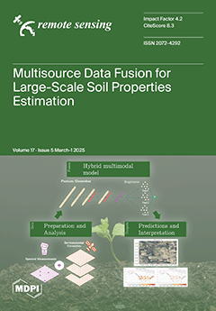
The following study introduces a novel framework for predicting soil organic carbon by integrating spectral data from a low-cost near-infrared device with open geospatial datasets derived from remote sensing. The proposed hybrid modeling approach processes multimodal data using convolutional neural networks to extract spectral features, which are then combined with climate, landform, and vegetation covariates in an extreme gradient boosting model. Applied at a national scale across the United States, this architecture significantly enhances predictive performance compared to traditional machine learning methods while enabling interpretability. By identifying key environmental drivers such as rainfall and valley bottom flatness, the model provides deeper insights into SOC variability, demonstrating the power of multimodal data fusion for soil assessment. View this paper
  • Issues are regarded as officially published after their release is announced to the table of contents alert mailing list .
  • You may sign up for email alerts to receive table of contents of newly released issues.
  • PDF is the official format for papers published in both, html and pdf forms. To view the papers in pdf format, click on the "PDF Full-text" link, and use the free Adobe Reader to open them.

Articles (212)

  • Article
  • Open Access
1 Citations
1,512 Views
25 Pages

Detecting Temporal Trends in Straw Incorporation Using Sentinel-2 Imagery: A Mann-Kendall Test Approach in Household Mode

  • Jian Li,
  • Weijian Zhang,
  • Jia Du,
  • Kaishan Song,
  • Weilin Yu,
  • Jie Qin,
  • Zhengwei Liang,
  • Kewen Shao,
  • Kaizeng Zhuo and
  • Yu Han
  • + 1 author

6 March 2025

Straw incorporation (SI) is a key strategy for promoting sustainable agriculture. It aims to mitigate environmental pollution caused by straw burning and enhances soil organic matter content, which increases crop yields. Consequently, the accurate an...

  • Article
  • Open Access
1 Citations
1,294 Views
25 Pages

A Cross-Track Interferometric Synthetic Aperture 3D Passive Positioning Algorithm

  • Yuan Zhang,
  • Xiangxi Bu,
  • Sheng Guan,
  • Jihao Xin,
  • Zhiyu Jiang,
  • Xuyang Ge,
  • Miaomiao Li,
  • Yanlei Li and
  • Xingdong Liang

6 March 2025

High-precision, robust, and rapid three-dimensional (3D) passive positioning of the radiation source is critical for modern reconnaissance systems. While synthetic aperture technology has advanced 2D passive positioning performance, existing methods...

  • Article
  • Open Access
3 Citations
1,691 Views
25 Pages

Effective Cultivated Land Extraction in Complex Terrain Using High-Resolution Imagery and Deep Learning Method

  • Zhenzhen Liu,
  • Jianhua Guo,
  • Chenghang Li,
  • Lijun Wang,
  • Dongkai Gao,
  • Yali Bai and
  • Fen Qin

6 March 2025

The accurate extraction of cultivated land information is crucial for optimizing regional farmland layouts and enhancing food supply. To address the problem of low accuracy in existing cultivated land products and the poor applicability of cultivated...

  • Article
  • Open Access
1,153 Views
18 Pages

6 March 2025

Evapotranspiration (ET) rates will be affected by climate change and increasing frequency of extreme heat events. To understand how forests may respond to probable future climate conditions, it may be helpful to look at the past relationship between...

  • Editorial
  • Open Access
2 Citations
3,206 Views
7 Pages

6 March 2025

Roads are a form of critical infrastructure, influencing economic growth, mobility, and public safety. However, the management, monitoring, and maintenance of road networks remain a challenge, particularly given limited budgets and the complexity of...

  • Article
  • Open Access
4 Citations
2,171 Views
22 Pages

Hyperspectral Canopy Reflectance and Machine Learning for Threshold-Based Classification of Aphid-Infested Winter Wheat

  • Sandra Skendžić,
  • Hrvoje Novak,
  • Monika Zovko,
  • Ivana Pajač Živković,
  • Vinko Lešić,
  • Marko Maričević and
  • Darija Lemić

5 March 2025

Aphids are significant pests of winter wheat, causing damage by feeding on plant sap and reducing crop yield and quality. This study evaluates the potential of hyperspectral remote sensing (350–2500 nm) and machine learning (ML) models for clas...

  • Article
  • Open Access
1 Citations
1,029 Views
20 Pages

5 March 2025

Traditional single-channel Synthetic Aperture Radar (SAR) cannot achieve high-resolution and wide-swath (HRWS) imaging due to the constraint of the minimum antenna area. Distributed HRWS SAR can realize HRWS imaging and also possesses the resolution...

  • Article
  • Open Access
2 Citations
1,391 Views
15 Pages

A Micro-Topography Enhancement Method for DEMs: Advancing Geological Hazard Identification

  • Qiulin He,
  • Xiujun Dong,
  • Haoliang Li,
  • Bo Deng and
  • Jingsong Sima

5 March 2025

Geological hazards in densely vegetated mountainous regions are challenging to detect due to terrain concealment and the limitations of traditional visualization methods. This study introduces the LiDAR image highlighting algorithm (LIHA), a novel ap...

  • Article
  • Open Access
2 Citations
2,470 Views
28 Pages

5 March 2025

High-resolution visible remote sensing imagery, as a fundamental contributor to Earth observation, has found extensive application in land use classification. However, the heterogeneous array of optical sensors, distinguished by their unique design a...

  • Article
  • Open Access
961 Views
26 Pages

5 March 2025

In this article, the problem of Bayesian detecting rank-one distributed targets under subspace interference and compound Gaussian clutter with inverse Gaussian texture is investigated. Due to the clutter heterogeneity, the training data may be insuff...

of 22

Get Alerted

Add your email address to receive forthcoming issues of this journal.

XFacebookLinkedIn
Remote Sens. - ISSN 2072-4292