Next Issue
Volume 17, March-1
Previous Issue
Volume 17, February-1
 
 
remotesensing-logo

Journal Browser

Journal Browser

Remote Sens., Volume 17, Issue 4 (February-2 2025) – 169 articles

Cover Story (view full-size image): 
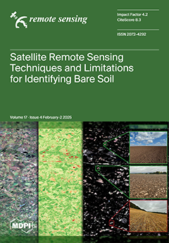
Bare soil (BS) identification through satellite remote sensing is crucial for monitoring land degradation and supporting digital soil mapping. Accurate BS identification enables the better assessment of soil properties, erosion risks, and land use dynamics. However, distinguishing BS from spectrally similar surfaces—such as non-photosynthetic vegetation and urban areas—remains a challenge due to spectral confusion and inconsistencies in validation approaches. In this review, we synthesise the methodologies used for BS identification, including threshold masking and classification algorithms, and evaluate their limitations. We also assess validation strategies, emphasising the need for robust ground truthing to improve classification accuracy. View this paper
  • Issues are regarded as officially published after their release is announced to the table of contents alert mailing list.
  • You may sign up for e-mail alerts to receive table of contents of newly released issues.
  • PDF is the official format for papers published in both, html and pdf forms. To view the papers in pdf format, click on the "PDF Full-text" link, and use the free Adobe Reader to open them.
Order results
Result details
Section
Select all
Export citation of selected articles as:
20 pages, 4144 KiB  
Article
Fine Estimation of Water Quality in the Yangtze River Basin Based on a Geographically Weighted Random Forest Regression Model
by Fuliang Deng, Wenhui Liu, Mei Sun, Yanxue Xu, Bo Wang, Wei Liu, Ying Yuan and Lei Cui
Remote Sens. 2025, 17(4), 731; https://doi.org/10.3390/rs17040731 - 19 Feb 2025
Viewed by 249
Abstract
Water quality evaluation usually relies on limited state-controlled monitoring data, making it challenging to fully capture variations across an entire basin over time and space. The fine estimation of water quality in a spatial context presents a promising solution to this issue; however, [...] Read more.
Water quality evaluation usually relies on limited state-controlled monitoring data, making it challenging to fully capture variations across an entire basin over time and space. The fine estimation of water quality in a spatial context presents a promising solution to this issue; however, traditional analyses often ignore spatial non-stationarity between variables. To solve the above-mentioned problems in water quality mapping research, we took the Yangtze River as our study subject and attempted to use a geographically weighted random forest regression (GWRFR) model to couple massive station observation data and auxiliary data to carry out a fine estimation of water quality. Specifically, we first utilized state-controlled sections’ water quality monitoring data as input for the GWRFR model to train and map six water quality indicators at a 30 m spatial resolution. We then assessed various geographical and environmental factors contributing to water quality and identified spatial differences. Our results show accurate predictions for all indicators: ammonia nitrogen (NH3-N) had the lowest accuracy (R2 = 0.61, RMSE = 0.13), and total nitrogen (TN) had the highest (R2 = 0.74, RMSE = 0.48). The mapping results reveal total nitrogen as the primary pollutant in the Yangtze River basin. Chemical oxygen demand and the permanganate index were mainly influenced by natural factors, while total nitrogen and total phosphorus were impacted by human activities. The spatial distribution of critical influencing factors shows significant clustering. Overall, this study demonstrates the fine spatial distribution of water quality and provides insights into the influencing factors that are crucial for the comprehensive management of water environments. Full article
Show Figures

Figure 1

21 pages, 885 KiB  
Article
An Optimization Method for Multi-Functional Radar Network Deployment in Complex Regions
by Yi Han, Xueting Li, Xiangliang Xu, Zhenxing Zhang, Tianxian Zhang and Xiaobo Yang
Remote Sens. 2025, 17(4), 730; https://doi.org/10.3390/rs17040730 - 19 Feb 2025
Viewed by 342
Abstract
This paper addresses the deployment of a multi-functional radar network (MFRN) in complex regions that may exhibit non-connectivity, holes, or concave shapes, utilizing multi-objective particle swarm optimization (MOPSO). Unlike traditional approaches that rely on constraint-handling techniques, the proposed methodology leverages the unique characteristics [...] Read more.
This paper addresses the deployment of a multi-functional radar network (MFRN) in complex regions that may exhibit non-connectivity, holes, or concave shapes, utilizing multi-objective particle swarm optimization (MOPSO). Unlike traditional approaches that rely on constraint-handling techniques, the proposed methodology leverages the unique characteristics of polygonal deployment regions to enhance deployment efficiency. Specifically, for the aforementioned complex deployment regions, a region decomposition approach based on convex partitioning is proposed. This approach allows for the decomposition of complex regions into multiple non-overlapping convex subregions. Moreover, for convex deployment regions or subregions, we propose a coordinate transformation approach to eliminate the constraints introduced by the shape of the convex region. By combining the above approaches, we introduce a novel MOPSO based on decomposition and transformation, named MOPSO-DT. This algorithm aims to optimize MFRN deployment in these challenging environments. Experimental results demonstrate the superiority of the MOPSO-DT algorithm over two existing algorithms across a variety of deployment cases, highlighting its enhanced efficiency, effectiveness, and stability. These findings indicate that the proposed algorithm is well suited for optimizing MFRN deployment in complex, irregular regions, offering significant improvements in performance compared to conventional methods. Full article
(This article belongs to the Topic Radar Signal and Data Processing with Applications)
Show Figures

Figure 1

17 pages, 6024 KiB  
Article
Spatial Estimation of Soil Organic Matter and Total Nitrogen by Fusing Field Vis–NIR Spectroscopy and Multispectral Remote Sensing Data
by Dongyun Xu, Songchao Chen, Yin Zhou, Wenjun Ji and Zhou Shi
Remote Sens. 2025, 17(4), 729; https://doi.org/10.3390/rs17040729 - 19 Feb 2025
Viewed by 369
Abstract
Accurate and timely acquisition of soil information is crucial for precision agriculture, food security, and environmental protection. Proximal visible near-infrared reflectance (vis–NIR) spectroscopy has been widely employed for rapid and accurate soil measurement, but its point measurement nature limits its direct applicability for [...] Read more.
Accurate and timely acquisition of soil information is crucial for precision agriculture, food security, and environmental protection. Proximal visible near-infrared reflectance (vis–NIR) spectroscopy has been widely employed for rapid and accurate soil measurement, but its point measurement nature limits its direct applicability for large-scale soil surveys. On the other hand, remote sensing techniques can provide soil information at a larger scale, but their resolution is relatively coarse. While both techniques have been used independently for soil analyses, integrating vis–NIR spectroscopy with remote sensing remains a challenge and is underexplored, especially at the field scale. This study addresses this gap by combining field vis–NIR spectra with Gaofen-1 remote sensing data to spatially analyze soil organic matter and total nitrogen at the field scale. Unlike previous work, we first applied Gaofen-1 data and 10 derived spectral indices to estimate soil organic matter and total nitrogen using partial least squares regression and random forest, identifying the optimal combination of spectral indices. Then, we integrated the proximal vis–NIR spectra with this optimal spectral index combination for improved soil property estimation. This integration advanced existing methodologies by leveraging the high spatial resolution of Gaofen-1 data and the detailed spectral information from vis–NIR spectroscopy. The results showed the following: (1) the coefficient of variation across different crop growth stages of Gaofen-1 data was more crucial for modeling these two properties compared to bare soil Gaofen-1 data; (2) integrating proximal vis–NIR spectra with Gaofen-1 data improved model performance, yielding Lin’s concordance correlation coefficient (ρc) values of 0.63 and 0.72 and ratios of performance to interquartile distance (RPIQ) of 1.99 and 1.59 for soil organic matter and total nitrogen, respectively; and (3) the combined use of vis–NIR spectra and Gaofen-1 data provided higher spatial estimation accuracy (R2 of 0.68 and 0.57 for soil organic matter and total nitrogen) compared to ordinary kriging (R2 of 0.63 and 0.31 for soil organic matter and total nitrogen). These results demonstrate that the synergistic use of remote sensing and proximal soil sensing is a practical approach for spatially estimating soil organic matter and total nitrogen at the field scale. Full article
(This article belongs to the Section Remote Sensing in Agriculture and Vegetation)
Show Figures

Figure 1

18 pages, 42529 KiB  
Article
Physical and AI-Based Algorithms for Retrieving Cloud Liquid Water and Total Precipitable Water from Microwave Observation
by Wenxiang Chen, Yang Han, Fuzhong Weng, Hao Hu and Jun Yang
Remote Sens. 2025, 17(4), 728; https://doi.org/10.3390/rs17040728 - 19 Feb 2025
Viewed by 346
Abstract
Cloud liquid water (CLW) and total precipitable water (TPW) are two important parameters for weather and climate applications. These parameters are typically retrieved at 23.8 GHz and 31.4 GHz. Historically, the CLW and TPW physical retrievals always required the sea surface temperature (SST) [...] Read more.
Cloud liquid water (CLW) and total precipitable water (TPW) are two important parameters for weather and climate applications. These parameters are typically retrieved at 23.8 GHz and 31.4 GHz. Historically, the CLW and TPW physical retrievals always required the sea surface temperature (SST) and sea surface wind speed (SSW), which are difficult to obtain from conventional measurements. This study employs the multilayer perceptron (MLP) model to retrieve SST and SSW from FY-3F Microwave Radiometer Imager (MWRI) observations. Collocated with ERA5 reanalysis data, the MLP model predicts SST well, with a correlation coefficient of 0.98, the root mean squared error (RMSE) of 1.10, and mean absolute error (MAE) of 0.70 K. For SSW, the correlation coefficient is 0.82, RMSE is 1.80, and MAE is 1.30 m/s, respectively. The SST and SSW parameters derived from MWRI are then used to retrieve CLW and TPW based on the observations from the Microwave Temperature Sounder (MWTS) onboard the FY-3F satellite. The spatial distributions of CLW and TPW derived from this new algorithm agree well with those from ERA5 data. Cloud liquid water (CLW) and total precipitable water (TPW) are crucial parameters for weather and climate applications. The integration of physical and AI-based algorithms enables the retrieval of CLW and TPW directly from FY-3F satellite observations. This approach overcomes the limitations imposed by the need for other data sources, such as ERA5 reanalysis data, and offers distinct advantages in terms of data processing timeliness. Full article
(This article belongs to the Section Atmospheric Remote Sensing)
Show Figures

Figure 1

17 pages, 6549 KiB  
Article
Improved Landslide Deformation Prediction Using Convolutional Neural Network–Gated Recurrent Unit and Spatial–Temporal Data
by Honglei Yang, Youfeng Liu, Qing Han, Linlin Xu, Tengjun Zhang, Zeping Wang, Ao Yan, Songxue Zhao, Jianfeng Han and Yuedong Wang
Remote Sens. 2025, 17(4), 727; https://doi.org/10.3390/rs17040727 - 19 Feb 2025
Viewed by 267
Abstract
As one of the major forms of geological disaster, landslides cause huge casualties and economic losses in China every year. Given the importance of landslide prediction, it is a challenging task due to difficulties in efficiently leveraging the spatial–temporal information for enhanced prediction. [...] Read more.
As one of the major forms of geological disaster, landslides cause huge casualties and economic losses in China every year. Given the importance of landslide prediction, it is a challenging task due to difficulties in efficiently leveraging the spatial–temporal information for enhanced prediction. This paper presents a novel spatial–temporal enhanced CNN-GRU model to improve landslide predictions with the following contributions. First, this paper explicitly models the spatial correlation in the dataset and constructs a spatial–temporal time-sequence deformation prediction model that greatly improves landslide predictions. This model integrates the spatial correlation of monitoring points into time-series deformation prediction to improve the prediction of landslide deformation trends. Second, we develop a complete data processing pipeline involving SBAS-InSAR, time-series data preprocessing, spatial–temporal homogeneous point selection and weighting, as well as CNN-GRU model training. The pipeline is tailor-designed to leverage the spatial–temporal correlation in the data to enhance the prediction performance. Third, we apply the proposed model to monitor landslide deformation around Woda Village, Chamdo City, Tibet. The results show that the root mean square error (RMSE) of the monitoring points in the landslide area is reduced by about 20.9% and the number of points with an RMSE of less than 3 mm is increased by 12.9%, leading to a significant improvement in prediction accuracy. Full article
Show Figures

Figure 1

19 pages, 8210 KiB  
Article
A Dual-Branch U-Net for Staple Crop Classification in Complex Scenes
by Jiajin Zhang, Lifang Zhao and Hua Yang
Remote Sens. 2025, 17(4), 726; https://doi.org/10.3390/rs17040726 - 19 Feb 2025
Viewed by 257
Abstract
Accurate information on crop planting and spatial distribution is critical for understanding and tracking long-term land use changes. The method of using deep learning (DL) to extract crop information has been applied in large-scale datasets and plain areas. However, current crop classification methods [...] Read more.
Accurate information on crop planting and spatial distribution is critical for understanding and tracking long-term land use changes. The method of using deep learning (DL) to extract crop information has been applied in large-scale datasets and plain areas. However, current crop classification methods face some challenges, such as poor image time continuity, difficult data acquisition, rugged terrain, fragmented plots, and diverse planting conditions in complex scenes. In this study, we propose the Complex Scene Crop Classification U-Net (CSCCU), which aims to improve the mapping accuracy of staple crops in complex scenes by combining multi-spectral bands with spectral features. CSCCU features a dual-branch structure: the main branch concentrates on image feature extraction, while the auxiliary branch focuses on spectral features. In our method, we use the hierarchical feature-level fusion mechanism. Through the hierarchical feature fusion of the shallow feature fusion module (SFF) and the deep feature fusion module (DFF), feature learning is optimized and model performance is improved. We conducted experiments using GaoFen-2 (GF-2) images in Xiuwen County, Guizhou Province, China, and established a dataset consisting of 1000 image patches of size 256, covering seven categories. In our method, the corn and rice accuracies are 89.72% and 88.61%, and the mean intersection over union (mIoU) is 85.61%, which is higher than the compared models (U-Net, SegNet, and DeepLabv3+). Our method provides a novel solution for the classification of staple crops in complex scenes using high-resolution images, which can help to obtain accurate information on staple crops in larger regions in the future. Full article
Show Figures

Graphical abstract

21 pages, 6412 KiB  
Article
Inverse Synthetic Aperture Radar Image Multi-Modal Zero-Shot Learning Based on the Scattering Center Model and Neighbor-Adapted Locally Linear Embedding
by Xinfei Jin, Hongxu Li, Xinbo Xu, Zihan Xu and Fulin Su
Remote Sens. 2025, 17(4), 725; https://doi.org/10.3390/rs17040725 - 19 Feb 2025
Viewed by 214
Abstract
Inverse Synthetic Aperture Radar (ISAR) images are extensively used in Radar Automatic Target Recognition (RATR) for non-cooperative targets. However, acquiring training samples for all target categories is challenging. Recognizing target classes without training samples is called Zero-Shot Learning (ZSL). When ZSL involves multiple [...] Read more.
Inverse Synthetic Aperture Radar (ISAR) images are extensively used in Radar Automatic Target Recognition (RATR) for non-cooperative targets. However, acquiring training samples for all target categories is challenging. Recognizing target classes without training samples is called Zero-Shot Learning (ZSL). When ZSL involves multiple modalities, it becomes Multi-modal Zero-Shot Learning (MZSL). To achieve MZSL, a framework is proposed for generating ISAR images with optical image aiding. The process begins by extracting edges from optical images to capture the structure of ship targets. These extracted edges are used to estimate the potential locations of the target’s scattering centers. Using the Geometric Theory of Diffraction (GTD)-based scattering center model, the edges’ ISAR images are generated from the scattering centers. Next, a mapping is established between the edges’ ISAR images and the actual ISAR images. Neighbor-Adapted Local Linear Embedding (NALLE) generates pseudo-ISAR images for the unseen classes by combining the edges’ ISAR images with the actual ISAR images from the seen classes. Finally, these pseudo-ISAR images serve as training samples, enabling the recognition of test samples. In contrast to the network-based approaches, this method requires only a limited number of training samples. Experiments based on simulated and measured data validate the effectiveness. Full article
(This article belongs to the Section Remote Sensing Image Processing)
Show Figures

Graphical abstract

28 pages, 3329 KiB  
Article
PhenoCam Guidelines for Phenological Measurement and Analysis in an Agricultural Cropping Environment: A Case Study of Soybean
by S. Sunoj, C. Igathinathane, Nicanor  Saliendra, John Hendrickson, David Archer and Mark Liebig
Remote Sens. 2025, 17(4), 724; https://doi.org/10.3390/rs17040724 - 19 Feb 2025
Viewed by 303
Abstract
A PhenoCam is a near-surface remote sensing system traditionally used for monitoring phenological changes in diverse landscapes. Although initially developed for forest landscapes, these near-surface remote sensing systems are increasingly being adopted in agricultural settings, with deployment expanding from 106 sites in 2020 [...] Read more.
A PhenoCam is a near-surface remote sensing system traditionally used for monitoring phenological changes in diverse landscapes. Although initially developed for forest landscapes, these near-surface remote sensing systems are increasingly being adopted in agricultural settings, with deployment expanding from 106 sites in 2020 to 839 sites by February 2025. However, agricultural applications present unique challenges because of rapid crop development and the need for precise phenological monitoring. Despite the increasing number of PhenoCam sites, clear guidelines are missing on (i) the phenological analysis of images, (ii) the selection of a suitable color vegetation index (CVI), and (iii) the extraction of growth stages. This knowledge gap limits the full potential of PhenoCams in agricultural applications. Therefore, a study was conducted in two soybean (Glycine max L.) fields to formulate image analysis guidelines for PhenoCam images. Weekly visual assessments of soybean phenological stages were compared with PhenoCam images. A total of 15 CVIs were tested for their ability to reproduce the seasonal variation from RGB, HSB, and Lab color spaces. The effects of image acquisition time groups (10:00 h–14:00 h) and object position (ROI locations: far, middle, and near) on selected CVIs were statistically analyzed. Excess green minus excess red (EXGR), color index of vegetation (CIVE), green leaf index (GLI), and normalized green red difference index (NGRDI) were selected based on the least deviation from their loess-smoothed phenological curve at each image acquisition time. For the selected four CVIs, the time groups did not have a significant effect on CVI values, while the object position had significant effects at the reproductive phase. Among the selected CVIs, GLI and EXGR exhibited the least deviation within the image acquisition time and object position groups. Overall, we recommend employing a consistent image acquisition time to ensure sufficient light, capture the largest possible image ROI in the middle region of the field, and apply any of the selected CVIs in order of GLI, EXGR, NGRDI, and CIVE. These results provide a standardized methodology and serve as guidelines for PhenoCam image analysis in agricultural cropping environments. These guidelines can be incorporated into the standard protocol of the PhenoCam network. Full article
(This article belongs to the Special Issue Crops and Vegetation Monitoring with Remote/Proximal Sensing II)
Show Figures

Figure 1

14 pages, 4142 KiB  
Article
Comparative Analysis of Prior and Posterior Integrity Monitoring Techniques for Enhanced Global Navigation Satellite System Positioning Continuity and Accuracy
by Yuting Gao, Baoyu Liu, Yang Gao, Guanwen Huang and Qin Zhang
Remote Sens. 2025, 17(4), 723; https://doi.org/10.3390/rs17040723 - 19 Feb 2025
Viewed by 271
Abstract
GNSS integrity is an essential component for ensuring the reliability of safety-critical applications using Global Navigation Satellite Systems (GNSSs). These applications, such as use in aviation and autonomous vehicles, demand high precision and dependability. There are two major GNSS integrity monitoring techniques, namely [...] Read more.
GNSS integrity is an essential component for ensuring the reliability of safety-critical applications using Global Navigation Satellite Systems (GNSSs). These applications, such as use in aviation and autonomous vehicles, demand high precision and dependability. There are two major GNSS integrity monitoring techniques, namely prior and posterior integrity monitoring. The principles of the two approaches, however, differ significantly, each influencing the GNSS positioning system’s continuity and accuracy performance in unique ways. In this study, we conduct a thorough evaluation and comparison of these two approaches to integrity monitoring, focusing on their effects on continuity and accuracy performance. We assess the probability of false alarms and continuity risks associated with posterior integrity monitoring by defining specific geometric spheres, both inside and outside the contours of the parity set, where the integrity risk requirement is satisfied. By using these defined spheres, we determine the lower and upper bounds for the probability of false alarms and continuity risks in posterior integrity monitoring. These spheres provide a novel and effective framework for comparing the continuity performance between the Chi-squared residual-based prior and posterior integrity monitoring. Our analysis highlights that, under fault-free scenarios, posterior integrity monitoring offers superior accuracy compared with the Chi-squared residual-based prior integrity monitoring approach. This finding underscores the critical importance of selecting an appropriate integrity monitoring strategy to enhance GNSS positioning system performance, particularly in environments where safety and precision are paramount. The insights gained from this study contribute to the advancement of GNSS technologies, supporting their implementation in an increasingly wide range of safety-critical applications. Full article
Show Figures

Figure 1

25 pages, 25542 KiB  
Article
Automatic Mapping of 10 m Tropical Evergreen Forest Cover in Central African Republic with Sentinel-2 Dynamic World Dataset
by Wenqiong Zhao, Xinyan Zhong, Xiaodong Li, Xia Wang, Yun Du and Yihang Zhang
Remote Sens. 2025, 17(4), 722; https://doi.org/10.3390/rs17040722 - 19 Feb 2025
Viewed by 277
Abstract
Tropical evergreen forests represent the richest biodiversity in terrestrial ecosystems, and the fine spatial-temporal resolution mapping of these forests is essential for the study and conservation of this vital natural resource. The current methods for mapping tropical evergreen forests frequently exhibit coarse spatial [...] Read more.
Tropical evergreen forests represent the richest biodiversity in terrestrial ecosystems, and the fine spatial-temporal resolution mapping of these forests is essential for the study and conservation of this vital natural resource. The current methods for mapping tropical evergreen forests frequently exhibit coarse spatial resolution and lengthy production cycles. This can be attributed to the inherent challenges associated with monitoring diverse surface changes and the persistence of cloudy, rainy conditions in the tropics. We propose a novel approach to automatically map annual 10 m tropical evergreen forest covers from 2017 to 2023 with the Sentinel-2 Dynamic World dataset in the biodiversity-rich and conservation-sensitive Central African Republic (CAR). The Copernicus Global Land Cover Layers (CGLC) and Global Forest Change (GFC) products were used first to track stable evergreen forest samples. Then, initial evergreen forest cover maps were generated by determining the threshold of evergreen forest cover for each of the yearly median forest cover probability maps. From 2017 to 2023, the annual modified 10 m tropical evergreen forest cover maps were finally produced from the initial evergreen forest cover maps and NEFI (Non-Evergreen Forest Index) images with the estimated thresholds. The results produced by the proposed method achieved an overall accuracy of >94.10% and a Cohen’s Kappa of >87.63% across all years (F1-Score > 94.05%), which represents a significant improvement over the performance of previous methods, including the CGLC evergreen forest cover maps and yearly median forest cover probability maps based on Sentinel-2 Dynamic World. Our findings demonstrate that the proposed method provides detailed spatial characteristics of evergreen forests and time-series change in the Central African Republic, with substantial consistency across all years. Full article
(This article belongs to the Section Forest Remote Sensing)
Show Figures

Figure 1

27 pages, 7925 KiB  
Article
A Distributed Collaborative Navigation Strategy Based on Adaptive Extended Kalman Filter Integrated Positioning and Model Predictive Control for Global Navigation Satellite System/Inertial Navigation System Dual-Robot
by Wanqiang Chen, Yunpeng Jing, Shuo Zhao, Lei Yan, Quancheng Liu and Zichang He
Remote Sens. 2025, 17(4), 721; https://doi.org/10.3390/rs17040721 - 19 Feb 2025
Viewed by 251
Abstract
In the field of multi-robot cooperative localization and task planning, traditional filtering algorithms encounter synchronization and consistency issues during multi-source data fusion. These challenges result in cumulative localization errors and inefficient information sharing, which limits the system’s collaborative capabilities and control accuracy. To [...] Read more.
In the field of multi-robot cooperative localization and task planning, traditional filtering algorithms encounter synchronization and consistency issues during multi-source data fusion. These challenges result in cumulative localization errors and inefficient information sharing, which limits the system’s collaborative capabilities and control accuracy. To overcome these limitations, a distributed cooperative navigation strategy is introduced. Initially, a Distributed Adaptive Extended Kalman Filter (DAEKF) is implemented, which adaptively adjusts the noise covariance matrix to effectively manage nonlinearities and multi-source noise conditions. Subsequently, a Distributed Model Predictive Control (DMPC) framework is introduced. This framework predicts and optimizes each robot’s kinematic model, thereby improving the system’s collaborative operations and dynamic decision-making capabilities. Finally, the efficacy of this strategy is confirmed through detailed simulations and robotic experiments. The simulation results for cooperative localization demonstrate that DAEKF outperforms Kalman Filter (KF) and Extended Kalman Filter (EKF) in terms of localization accuracy. In the straight-line path-tracking experiments, DAEKF effectively reduced both lateral and heading errors for both robots. For Robot 1, DAEKF reduced the lateral error Root Mean Squared Error (RMSE) by 68.87%, 27.80%, and 25.76%, compared to No Filtering, KF, and EKF. In heading error, DAEKF reduced the RMSE by 52.29%, 41.89%, and 36.47%. For Robot 2, DAEKF reduced the lateral error RMSE by 51.30%, 22.88%, and 11.60%, compared to No Filtering, KF, and EKF. In heading error, DAEKF reduced the RMSE by 39.55%, 37.15%, and 26.00%. In the curved path-tracking experiments, both robots demonstrated high trajectory conformity while traveling along a predefined path combining straight-line and circular arc segments, with lateral errors in the straight-line segments all below 0.05 m. The strategy proposed in this study significantly enhanced the precision and stability of multi-robot collaborative navigation, demonstrating strong practicality and scalability. Full article
(This article belongs to the Special Issue Satellite Navigation and Signal Processing (Second Edition))
Show Figures

Figure 1

18 pages, 16129 KiB  
Article
Revisiting the 2020 Mw 6.8 Elaziğ, Türkiye Earthquake with Physics-Based 3D Numerical Simulations Constrained by Geodetic and Seismic Observations
by Zhongqiu He, Yuchen Zhang, Wenqiang Wang, Zijia Wang, T. C. Sunilkumar and Zhenguo Zhang
Remote Sens. 2025, 17(4), 720; https://doi.org/10.3390/rs17040720 - 19 Feb 2025
Viewed by 219
Abstract
Dynamic rupture simulations of earthquakes offer crucial insights into the physical mechanisms of driving fault slip and seismic hazards. By incorporating non-planar fault models that accurately represent subsurface structures, this study provides a realistic depiction of the rupture processes of the 2020 Mw [...] Read more.
Dynamic rupture simulations of earthquakes offer crucial insights into the physical mechanisms of driving fault slip and seismic hazards. By incorporating non-planar fault models that accurately represent subsurface structures, this study provides a realistic depiction of the rupture processes of the 2020 Mw 6.8 Elazığ, Türkiye earthquake, influenced by geometric complexities. Initially, we determined its coseismic slip on the non-planar fault using near-field strong motion and InSAR observations. Subsequently, we established the heterogeneous initial stress on the fault plane based on the coseismic slip and integrated it into the dynamic rupture modeling to assess physics-based ground motion and seismic hazards. The numerical simulations utilized the curved grid finite-difference method (CGFDM), which effectively models rupture dynamics with heterogeneities in fault geometry, initial stress, and other factors. Our synthetic surface deformation and seismograms align well with the observational data obtained from InSAR and seismic instruments. We observed localized occurrences of supershear rupture during fault propagation. Furthermore, the intensity distribution we simulated closely aligns with the actual observations. These findings highlight the critical role of source heterogeneity in seismic hazard assessment, advancing our understanding of fault dynamics and enhancing predictive capabilities. Full article
Show Figures

Figure 1

21 pages, 1486 KiB  
Article
DDFAV: Remote Sensing Large Vision Language Models Dataset and Evaluation Benchmark
by Haodong Li, Xiaofeng Zhang and Haicheng Qu
Remote Sens. 2025, 17(4), 719; https://doi.org/10.3390/rs17040719 - 19 Feb 2025
Cited by 1 | Viewed by 301
Abstract
With the rapid development of large visual language models (LVLMs) and multimodal large language models (MLLMs), these models have demonstrated strong performance in various multimodal tasks. However, alleviating the generation of hallucinations remains a key challenge in LVLMs research. For remote sensing LVLMs, [...] Read more.
With the rapid development of large visual language models (LVLMs) and multimodal large language models (MLLMs), these models have demonstrated strong performance in various multimodal tasks. However, alleviating the generation of hallucinations remains a key challenge in LVLMs research. For remote sensing LVLMs, there are problems such as low quality, small number and unreliable datasets and evaluation methods. Therefore, when applied to remote sensing tasks, they are prone to hallucinations, resulting in unsatisfactory performance. This paper proposes a more reliable and effective instruction set production process for remote sensing LVLMs to address these issues. The process generates detailed and accurate instruction sets through strategies such as shallow-to-deep reasoning, internal and external considerations, and manual quality inspection. Based on this production process, we collect 1.6 GB of remote sensing images to create the DDFAV dataset, which covers a variety of remote sensing LVLMs tasks. Finally, we develop a closed binary classification polling evaluation method, RSPOPE, specifically designed to evaluate hallucinations in remote sensing LVLMs or MLLMs visual question-answering tasks. Using this method, we evaluate the zero-shot remote sensing visual question-answering capabilities of multiple mainstream LVLMs. Our proposed dataset images, corresponding instruction sets, and evaluation method files are all open source. Full article
Show Figures

Figure 1

17 pages, 6915 KiB  
Article
Dam Deformation Data Preprocessing with Optimized Variational Mode Decomposition and Kernel Density Estimation
by Siyu Chen, Chaoning Lin, Yanchang Gu, Jinbao Sheng and Mohammad Amin Hariri-Ardebili
Remote Sens. 2025, 17(4), 718; https://doi.org/10.3390/rs17040718 - 19 Feb 2025
Viewed by 260
Abstract
Deformation is one of the critical response quantities reflecting the structural safety of dams. To enhance outlier identification and denoising in dam deformation monitoring data, this study proposes a novel preprocessing method based on optimized Variational Mode Decomposition (VMD) and Kernel Density Estimation [...] Read more.
Deformation is one of the critical response quantities reflecting the structural safety of dams. To enhance outlier identification and denoising in dam deformation monitoring data, this study proposes a novel preprocessing method based on optimized Variational Mode Decomposition (VMD) and Kernel Density Estimation (KDE). The approach systematically processes data in three steps: First, VMD decomposes raw data into intrinsic mode functions without recursion. The parallel Jaya algorithm is used to adaptively optimize VMD parameters for improved decomposition. Second, the intrinsic mode functions containing outlier and noise characteristics are identified and separated using sample entropy and correlation coefficients. Finally, KDE thresholds are applied for outlier localization, while a data superposition method ensures effective denoising. Validation using simulated deformation data and Global Navigation Satellite Systems (GNSS)-based observed horizontal deformation from dam engineering demonstrates the method’s robustness in accurately identifying outliers and denoising data, achieving superior preprocessing performance. Full article
(This article belongs to the Special Issue Dam Stability Monitoring with Satellite Geodesy II)
Show Figures

Figure 1

32 pages, 13937 KiB  
Article
A Comprehensive Evaluation of Monocular Depth Estimation Methods in Low-Altitude Forest Environment
by Jiwen Jia, Junhua Kang, Lin Chen, Xiang Gao, Borui Zhang and Guijun Yang
Remote Sens. 2025, 17(4), 717; https://doi.org/10.3390/rs17040717 - 19 Feb 2025
Viewed by 341
Abstract
Monocular depth estimation (MDE) is a critical computer vision task that enhances environmental perception in fields such as autonomous driving and robot navigation. In recent years, deep learning-based MDE methods have achieved notable progress in these fields. However, achieving robust monocular depth estimation [...] Read more.
Monocular depth estimation (MDE) is a critical computer vision task that enhances environmental perception in fields such as autonomous driving and robot navigation. In recent years, deep learning-based MDE methods have achieved notable progress in these fields. However, achieving robust monocular depth estimation in low-altitude forest environments remains challenging, particularly in scenes with dense and cluttered foliage, which complicates applications in environmental monitoring, agriculture, and search and rescue operations. This paper presents a comprehensive evaluation of state-of-the-art deep learning-based MDE methods on low-altitude forest datasets. The evaluated models include both self-supervised and supervised approaches, employing different network structures such as convolutional neural networks (CNNs) and Vision Transformers (ViTs). We assessed the generalization of these approaches across diverse low-altitude scenarios, specifically focusing on forested environments. A systematic set of evaluation criteria is employed, comprising traditional image-based global statistical metrics as well as geometry-aware metrics, to provide a more comprehensive evaluation of depth estimation performance. The results indicate that most Transformer-based models, such as DepthAnything and Metric3D, outperform traditional CNN-based models in complex forest environments by capturing detailed tree structures and depth discontinuities. Conversely, CNN-based models like MiDas and Adabins struggle with handling depth discontinuities and complex occlusions, yielding less detailed predictions. On the Mid-Air dataset, the Transformer-based DepthAnything demonstrates a 54.2% improvement in RMSE for the global error metric compared to the CNN-based Adabins. On the LOBDM dataset, the CNN-based MiDas has the depth edge completeness error of 93.361, while the Transformer-based Metric3D demonstrates the significantly lower error of only 5.494. These findings highlight the potential of Transformer-based approaches for monocular depth estimation in low-altitude forest environments, with implications for high-throughput plant phenotyping, environmental monitoring, and other forest-specific applications. Full article
(This article belongs to the Special Issue Image Analysis for Forest Environmental Monitoring)
Show Figures

Graphical abstract

31 pages, 16304 KiB  
Article
Estimating and Downscaling ESA-CCI Soil Moisture Using Multi-Source Remote Sensing Images and Stacking-Based Ensemble Learning Algorithms in the Shandian River Basin, China
by Liguo Wang and Ya Gao
Remote Sens. 2025, 17(4), 716; https://doi.org/10.3390/rs17040716 - 19 Feb 2025
Viewed by 211
Abstract
Soil Moisture (SM) plays a crucial role in agricultural production, ecology, and sustainable development. The prevailing resolution of microwave-based SM products is notably coarse, typically spanning from 10 to 50 km, which might prove inadequate for specific applications. In this research, various single-model [...] Read more.
Soil Moisture (SM) plays a crucial role in agricultural production, ecology, and sustainable development. The prevailing resolution of microwave-based SM products is notably coarse, typically spanning from 10 to 50 km, which might prove inadequate for specific applications. In this research, various single-model machine learning algorithms have been employed to study SM downscaling, each with its own limitations. In contrast to existing methodologies, our research introduces a pioneering algorithm that amalgamates diverse individual models into an integrated Stacking framework for the purpose of downscaling SM data within the Shandian River Basin. This basin spans the southern region of Inner Mongolia and the northern area of Hebei province. In this paper, factors exerting a profound influence on SM were comprehensively integrated. Ultimately, the surface variables involved in the downscaling process were determined to be Land Surface Temperature (LST), Normalized Difference Vegetation Index (NDVI), Surface Reflectance (SR), Evapotranspiration (ET), Digital Elevation Model (DEM), slope, aspect, and European Space Agency-Climate Change Initiative (ESA-CCI) product. The goal is to generate a 1 km SM downscaling dataset for a 16-day period. Two distinct models are constructed for the SM downscaling process. In one case, the downscaling is followed by the inversion of SM, while in the other case, the inversion is performed after the downscaling analysis. We also employ the Categorical Features Gradient Boosting (CatBoost) algorithm, a single model, for analytical evaluation in identical circumstances. According to the results, the accuracy of the 1 km SM obtained using the inversion-followed-by-downscaling model is higher. Furthermore, it is observed that the stacking algorithm, which integrates multiple models, outperforms the single-model CatBoost algorithm in terms of accuracy. This suggests that the stacking algorithm can overcome the limitations of a single model and improve prediction accuracy. We compared the predicted SM and ESA-CCI SM; it is evident that the predicted results exhibit a strong correlation with ESA-CCI SM, with a maximum Pearson correlation coefficient (PCC) value of 0.979 and a minimum value of 0.629. The Mean Absolute Error (MAE) values range from 0.002 to 0.005 m3/m3, and the Root Mean Square Error (RMSE) ranges from 0.003 to 0.006 m3/m3. Overall, the results demonstrate that the stacking algorithm based on multi-model integration provides more accurate and consistent retrieval and downscaling of SM. Full article
Show Figures

Graphical abstract

26 pages, 14273 KiB  
Article
Improving National Forest Mapping in Romania Using Machine Learning and Sentinel-2 Multispectral Imagery
by Mohamed Islam Keskes, Aya Hamed Mohamed, Stelian Alexandru Borz and Mihai Daniel Niţă
Remote Sens. 2025, 17(4), 715; https://doi.org/10.3390/rs17040715 - 19 Feb 2025
Cited by 1 | Viewed by 313
Abstract
Forest attributes, such as standing stock, diameter at breast height (DBH), tree height, and basal area, are critical for effective forest management; yet, traditional estimation methods remain labor-intensive and often lack the spatial detail required for contemporary decision-making. This study addresses these challenges [...] Read more.
Forest attributes, such as standing stock, diameter at breast height (DBH), tree height, and basal area, are critical for effective forest management; yet, traditional estimation methods remain labor-intensive and often lack the spatial detail required for contemporary decision-making. This study addresses these challenges by integrating machine learning algorithms with high-resolution remotely sensed data and rigorously collected ground truth measurements to produce accurate, national-scale maps of forest attributes in Romania. To ensure the reliability of the model predictions, extensive field campaigns were conducted across representative Romanian forests. During these campaigns, detailed measurements were recorded for every tree within selected plots. For each tree, DBH was measured directly, and tree heights were obtained either by direct measurement—using hypsometers or clinometers—or, when direct measurements were not feasible, by applying well-established DBH—height allometric relationships that have been calibrated for the local forest types. This comprehensive approach to ground data collection, supplemented by an independent dataset from Brasov County collected using the same protocols, allowed for robust training and validation of the machine learning models. This study evaluates the performance of three machine learning algorithms—Random Forest (RF), Classification and Regression Trees (CART), and the Gradient Boosting Tree Algorithm (GBTA)—in predicting the forest attributes from Sentinel-2 satellite imagery. While Random Forest consistently delivered high R2 values and low root mean square errors (RMSE) across all attributes, GBTA showed particular strength in predicting standing stock, and CART excelled in basal area estimation but was less reliable for other attributes. A sensitivity analysis across multiple spatial resolutions revealed that the performance of all algorithms varied significantly with changes in resolution, emphasizing the importance of selecting an appropriate scale for accurate forest mapping. By focusing on both the methodological advancements in machine learning applications and the rigorous, detailed empirical forest data collection, this study provides a clear solution to the problem of obtaining reliable, spatially detailed forest attribute maps. Full article
Show Figures

Figure 1

26 pages, 8481 KiB  
Article
Deciphering the Social Vulnerability of Landslides Using the Coefficient of Variation-Kullback-Leibler-TOPSIS at an Administrative Village Scale
by Yueyue Wang, Xueling Wu, Guo Lin and Bo Peng
Remote Sens. 2025, 17(4), 714; https://doi.org/10.3390/rs17040714 - 19 Feb 2025
Viewed by 208
Abstract
Yu’nan County is located in the Pacific Rim geological disaster-prone area. Frequent landslides are an important cause of population, property, and infrastructure losses, which directly threaten the sustainable development of the regional social economy. Based on field survey data, this paper employs the [...] Read more.
Yu’nan County is located in the Pacific Rim geological disaster-prone area. Frequent landslides are an important cause of population, property, and infrastructure losses, which directly threaten the sustainable development of the regional social economy. Based on field survey data, this paper employs the coefficient of variation method (CV) and an improved TOPSIS model (Kullback-Leibler-Technique for Order Preference by Similarity to an Ideal Solution) to assess the social vulnerability to landslide disasters in 182 administrative villages of Yu’nan County. Also, it conducts a ranking and comprehensive analysis of their social vulnerability levels. Finally, the accuracy of the evaluation results is validated by applying the losses incurred from landslide disasters per unit area within the same year. The results indicate significant spatial variability in social vulnerability across Yu’nan County, with 68 out of 182 administrative villages exhibiting moderate vulnerability levels or higher. This suggests a high risk of widespread damage from potential disasters. Among these, Xincheng village has the highest social vulnerability score, while Chongtai village has the lowest, with a 0.979 difference in their vulnerabilities. By comparing the actual losses incurred per unit area from landslides, it is found that the social vulnerability results predicted by the CV-KL-TOPSIS model are more consistent with the actual survey results. Furthermore, among the ten sub-factors, population density, building value, and road value contribute most significantly to the overall weight with 0.269, 0.152, and 0.105, respectively, suggesting that in mountainous areas where the population is relatively concentrated, high social vulnerability to landslide hazards is a reflection of population characteristics and local economic level. The evaluation framework and evaluation indicators proposed in this paper can systematically and accurately evaluate the social vulnerability of landslide-prone areas, which provide a reference for urban planning and management in landslide-prone areas. Full article
Show Figures

Figure 1

18 pages, 33036 KiB  
Article
Three-Dimensional Magnetotelluric Forward Modeling Using Multi-Task Deep Learning with Branch Point Selection
by Fei Deng, Hongyu Shi, Peifan Jiang and Xuben Wang
Remote Sens. 2025, 17(4), 713; https://doi.org/10.3390/rs17040713 - 19 Feb 2025
Viewed by 221
Abstract
Magnetotelluric (MT) forward modeling is a key technique in magnetotelluric sounding, and deep learning has been widely applied to MT forward modeling. In three-dimensional (3-D) problems, although existing methods can predict forward modeling results with high accuracy, they often use multiple networks to [...] Read more.
Magnetotelluric (MT) forward modeling is a key technique in magnetotelluric sounding, and deep learning has been widely applied to MT forward modeling. In three-dimensional (3-D) problems, although existing methods can predict forward modeling results with high accuracy, they often use multiple networks to simulate multiple forward modeling parameters, resulting in low efficiency. We apply multi-task learning (MTL) to 3-D MT forward modeling to achieve simultaneous inference of apparent resistivity and impedance phase, effectively improving overall efficiency. Furthermore, through comparative analysis of feature map differences in various decoder layers of the network, we identify the optimal branching point for multi-task learning decoders. This enhances the feature extraction capabilities of the network and improves the prediction accuracy of forward modeling parameters. Additionally, we introduce an uncertainty-based loss function to dynamically balance the learning weights between tasks, addressing the shortcomings of traditional loss functions. Experiments demonstrate that compared with single-task networks and existing multi-task networks, the proposed network (MT-FeatureNet) achieves the best results in terms of Structural Similarity Index Measure (SSIM), Mean Relative Error (MRE), and Mean Absolute Error (MAE). The proposed multi-task learning model not only improves the efficiency and accuracy of 3-D MT forward modeling but also provides a novel approach to the design of multi-task learning network structures. Full article
Show Figures

Graphical abstract

21 pages, 11665 KiB  
Article
Influences of Discontinuous Attitudes on GNSS/LEO Integrated Precise Orbit Determination Based on Sparse or Regional Networks
by Yuanxin Wang, Baoqi Sun, Kan Wang, Xuhai Yang, Zhe Zhang, Minjian Zhang and Meifang Wu
Remote Sens. 2025, 17(4), 712; https://doi.org/10.3390/rs17040712 - 19 Feb 2025
Viewed by 206
Abstract
A uniformly distributed global ground network is essential for the accurate determination of GNSS orbit and clock parameters. However, achieving an ideal ground network is often difficult. When limited to a sparse or regional network of ground stations, the integration of LEO satellites [...] Read more.
A uniformly distributed global ground network is essential for the accurate determination of GNSS orbit and clock parameters. However, achieving an ideal ground network is often difficult. When limited to a sparse or regional network of ground stations, the integration of LEO satellites can substantially enhance the accuracy of GNSS Precise Orbit Determination (POD). In practical processing, discontinuities with complicated gaps can occur in LEO attitude quaternions, particularly when working with a restricted observation network. This hampers the accuracy of determining GNSS/LEO integrated orbits. To address this, an investigation was conducted using data from seven LEO satellites, including those from Sentinel-3, GRACE-FO, and Swarm, to evaluate integrated POD performance under sparse or regional station conditions. Particular focus was placed on addressing attitude discontinuities. Four scenarios were analyzed, encompassing both continuous data availability and one-, two-, and three-hour interruptions after one hour of continuous data availability. The results showed that the proposed quaternion rotation matrix interpolation method is reliable for the integrated POD of GNSSs and LEOs with strict attitude control. Full article
Show Figures

Figure 1

23 pages, 10921 KiB  
Article
A Weakly Supervised and Self-Supervised Learning Approach for Semantic Segmentation of Land Cover in Satellite Images with National Forest Inventory Data
by Daniel Moraes, Manuel L. Campagnolo and Mário Caetano
Remote Sens. 2025, 17(4), 711; https://doi.org/10.3390/rs17040711 - 19 Feb 2025
Viewed by 241
Abstract
National Forest Inventories (NFIs) provide valuable land cover (LC) information but often lack spatial continuity and an adequate update frequency. Satellite-based remote sensing offers a viable alternative, employing machine learning to extract thematic data. State-of-the-art methods such as convolutional neural networks rely on [...] Read more.
National Forest Inventories (NFIs) provide valuable land cover (LC) information but often lack spatial continuity and an adequate update frequency. Satellite-based remote sensing offers a viable alternative, employing machine learning to extract thematic data. State-of-the-art methods such as convolutional neural networks rely on fully pixel-level annotated images, which are difficult to obtain. Although reference LC datasets have been widely used to derive annotations, NFIs consist of point-based data, providing only sparse annotations. Weakly supervised and self-supervised learning approaches help address this issue by reducing dependence on fully annotated images and leveraging unlabeled data. However, their potential for large-scale LC mapping needs further investigation. This study explored the use of NFI data with deep learning and weakly supervised and self-supervised methods. Using Sentinel-2 images and the Portuguese NFI, which covers other LC types beyond forest, as sparse labels, we performed weakly supervised semantic segmentation with a convolutional neural network to create an updated and spatially continuous national LC map. Additionally, we investigated the potential of self-supervised learning by pretraining a masked autoencoder on 65,000 Sentinel-2 image chips and then fine-tuning the model with NFI-derived sparse labels. The weakly supervised baseline achieved a validation accuracy of 69.60%, surpassing Random Forest (67.90%). The self-supervised model achieved 71.29%, performing on par with the baseline using half the training data. The results demonstrated that integrating both learning approaches enabled successful countrywide LC mapping with limited training data. Full article
(This article belongs to the Section Earth Observation Data)
Show Figures

Figure 1

23 pages, 16814 KiB  
Article
A New Method for Automatic Glacier Extraction by Building Decision Trees Based on Pixel Statistics
by Xiao Liu, Hongyi Cheng, Jiang Liu, Xianbao Su, Yuchen Wang, Bin Qiao, Yipeng Wang and Nai’ang Wang
Remote Sens. 2025, 17(4), 710; https://doi.org/10.3390/rs17040710 - 19 Feb 2025
Viewed by 171
Abstract
Automatic glacier extraction from remote sensing images is the most important approach for large scale glacier monitoring. Commonly used band calculation indices to enhance glacier information are not effective in identifying shadowed glaciers and debris-covered glaciers. In this study, we used the Kolmogorov–Smirnov [...] Read more.
Automatic glacier extraction from remote sensing images is the most important approach for large scale glacier monitoring. Commonly used band calculation indices to enhance glacier information are not effective in identifying shadowed glaciers and debris-covered glaciers. In this study, we used the Kolmogorov–Smirnov test as the theoretical basis and determined the most suitable band calculation indices to distinguish different land cover classes by comparing inter-sample separability and reasonable threshold range ratios of different indices. We then constructed a glacier classification decision tree. This approach resulted in the development of a method to automatically extract glacier areas at given spatial and temporal scales. In comparison with the commonly used indices, this method demonstrates an improvement in Cohen’s kappa coefficient by more than 3.8%. Notably, the accuracy for shadowed glaciers and debris-covered glaciers, which are prone to misclassification, is substantially enhanced by 108.0% and 6.3%, respectively. By testing the method in the Qilian Mountains, the positive prediction value of glacier extraction was calculated to be 91.8%, the true positive rate was 94.0%, and Cohen’s kappa coefficient was 0.924, making it well suited for glacier extraction. This method can be used for monitoring glacier changes in global mountainous regions, and provide support for climate change research, water resource management, and disaster early warning systems. Full article
Show Figures

Figure 1

20 pages, 7061 KiB  
Article
Research on High-Resolution Modeling of Satellite-Derived Marine Environmental Parameters Based on Adaptive Global Attention
by Ruochu Cui, Liwen Ma, Yaning Hu, Jiaji Wu and Haiying Li
Remote Sens. 2025, 17(4), 709; https://doi.org/10.3390/rs17040709 - 19 Feb 2025
Viewed by 158
Abstract
The analysis of marine environmental parameters plays an important role in areas such as sea surface simulation modeling, analysis of sea clutter characteristics, and environmental monitoring. However, ocean observation remote sensing satellites typically deliver large volumes of data with limited spatial resolution, which [...] Read more.
The analysis of marine environmental parameters plays an important role in areas such as sea surface simulation modeling, analysis of sea clutter characteristics, and environmental monitoring. However, ocean observation remote sensing satellites typically deliver large volumes of data with limited spatial resolution, which often does not meet the precision requirements of practical applications. To overcome challenges in constructing high-resolution marine environmental parameters, this study conducts a systematic comparison of various interpolation techniques and deep learning models, aiming to develop a highly effective and efficient model optimized for enhancing the resolution of marine applications. Specifically, we incorporated adaptive global attention (AGA) mechanisms and a spatial gating unit (SGU) into the model. The AGA mechanism dynamically adjusts the weights of different regions in feature maps, enabling the model to focus more on critical spatial features and channel features. The SGU optimizes the utilization of spatial information by controlling the information transmission pathways. The experimental results indicate that for four types of marine environmental parameters from ERA5, our model achieves an overall PSNR of 44.0705, an SSIM of 0.9947, and an MAE of 0.2606 when the resolution is increased by a upscale factor of 2, as well as an overall PSNR of 35.5215, an SSIM of 0.9732, and an MAE of 0.8330 when the resolution is increased by an upscale factor of 4. These experiments demonstrate the model’s effectiveness in enhancing the spatial resolution of satellite-derived marine environmental parameters and its ability to be applied to any marine region, providing data support for many subsequent oceanic studies. Full article
Show Figures

Figure 1

26 pages, 6164 KiB  
Article
Remote Sensing and Soil Moisture Sensors for Irrigation Management in Avocado Orchards: A Practical Approach for Water Stress Assessment in Remote Agricultural Areas
by Emmanuel Torres-Quezada, Fernando Fuentes-Peñailillo, Karen Gutter, Félix Rondón, Jorge Mancebo Marmolejos, Willy Maurer and Arturo Bisono
Remote Sens. 2025, 17(4), 708; https://doi.org/10.3390/rs17040708 - 19 Feb 2025
Viewed by 357
Abstract
Water scarcity significantly challenges agricultural systems worldwide, especially in tropical areas such as the Dominican Republic. This study explores integrating satellite-based remote sensing technologies and field-based soil moisture sensors to assess water stress and optimize irrigation management in avocado orchards in Puerto Escondido, [...] Read more.
Water scarcity significantly challenges agricultural systems worldwide, especially in tropical areas such as the Dominican Republic. This study explores integrating satellite-based remote sensing technologies and field-based soil moisture sensors to assess water stress and optimize irrigation management in avocado orchards in Puerto Escondido, Dominican Republic. Using multispectral imagery from the Landsat 8 and 9 satellites, key vegetation indices (NDVI and SAVI) and NDWI, a water-related index that specifically indicates changes in crop water contents, rather than vegetation vigor, were derived to monitor vegetation health, growth stages, and soil water contents. Crop coefficient (Kc) values were calculated from these vegetation indices and combined with reference evapotranspiration (ETo) estimates derived from three meteorological models (Hargreaves–Samani, Priestley–Taylor, and Blaney–Criddle) to assess crop water requirements. The results revealed that soil moisture data from sensors at 30 cm depth strongly correlated with satellite-derived estimates, reflecting avocado trees’ critical root zone dynamics. Additionally, seasonal patterns in the vegetation indices showed that NDVI and SAVI effectively tracked vegetative growth stages, while NDWI indicated changes in the canopy water content, particularly during periods of water stress. Integrating these satellite-derived indices with field measurements allowed a comprehensive assessment of crop water requirements and stress, providing valuable insights for improving irrigation practices. Finally, this study demonstrates the potential of remote sensing technologies for large-scale water stress assessment, offering a scalable and cost-effective solution for optimizing irrigation practices in water-limited regions. These findings advance precision agriculture, especially in tropical environments, and provide a foundation for future research aimed at enhancing data accuracy and optimizing water management practices. Full article
(This article belongs to the Special Issue Remote Sensing for Eco-Hydro-Environment)
Show Figures

Figure 1

32 pages, 124914 KiB  
Article
CNN–Transformer Hybrid Architecture for Underwater Sonar Image Segmentation
by Juan Lei, Huigang Wang, Zelin Lei, Jiayuan Li and Shaowei Rong
Remote Sens. 2025, 17(4), 707; https://doi.org/10.3390/rs17040707 - 19 Feb 2025
Viewed by 333
Abstract
The salient object detection (SOD) of forward-looking sonar images plays a crucial role in underwater detection and rescue tasks. However, the existing SOD algorithms find it difficult to effectively extract salient features and spatial structure information from images with scarce semantic information, uneven [...] Read more.
The salient object detection (SOD) of forward-looking sonar images plays a crucial role in underwater detection and rescue tasks. However, the existing SOD algorithms find it difficult to effectively extract salient features and spatial structure information from images with scarce semantic information, uneven intensity distribution, and high noise. Convolutional neural networks (CNNs) have strong local feature extraction capabilities, but they are easily constrained by the receptive field and lack the ability to model long-range dependencies. Transformers, with their powerful self-attention mechanism, are capable of modeling the global features of a target, but they tend to lose a significant amount of local detail. Mamba effectively models long-range dependencies in long sequence inputs through a selection mechanism, offering a novel approach to capturing long-range correlations between pixels. However, since the saliency of image pixels does not exhibit sequential dependencies, this somewhat limits Mamba’s ability to fully capture global contextual information during the forward pass. Inspired by multimodal feature fusion learning, we propose a hybrid CNN–Transformer–Mamba architecture, termed FLSSNet. FLSSNet is built upon a CNN and Transformer backbone network, integrating four core submodules to address various technical challenges: (1) The asymmetric dual encoder–decoder (ADED) is capable of simultaneously extracting features from different modalities and systematically modeling both local contextual information and global spatial structure. (2) The Transformer feature converter (TFC) module optimizes the multimodal feature fusion process through feature transformation and channel compression. (3) The long-range correlation attention (LRCA) module enhances CNN’s ability to model long-range dependencies through the collaborative use of convolutional kernels, selective sequential scanning, and attention mechanisms, while effectively suppressing noise interference. (4) The recursive contour refinement (RCR) model refines edge contour information through a layer-by-layer recursive mechanism, achieving greater precision in boundary details. The experimental results show that FLSSNet exhibits outstanding competitiveness among 25 state-of-the-art SOD methods, achieving MAE and Eξ values of 0.04 and 0.973, respectively. Full article
(This article belongs to the Special Issue Ocean Remote Sensing Based on Radar, Sonar and Optical Techniques)
Show Figures

Figure 1

17 pages, 10636 KiB  
Article
High-Resolution Reconstruction of Total Organic Carbon Content in Lake Sediments Using Hyperspectral Imaging
by Xuening Lin, Xin Zhou, Hongfei Zhao, Guangcheng Zhang, Yiyan Chen, Shiwei Jiang, Tao Zhan and Luyao Tu
Remote Sens. 2025, 17(4), 706; https://doi.org/10.3390/rs17040706 - 19 Feb 2025
Viewed by 235
Abstract
The total organic carbon (TOC) content in lake sediments is an effective archive indicating past climate changes. However, the resolution of the TOC record has generally been limited by factors such as subsampling intervals, hampering further comprehension of past climate change. Recently, hyperspectral [...] Read more.
The total organic carbon (TOC) content in lake sediments is an effective archive indicating past climate changes. However, the resolution of the TOC record has generally been limited by factors such as subsampling intervals, hampering further comprehension of past climate change. Recently, hyperspectral imaging technology has been increasingly employed to scan lake sediment cores, presenting new opportunities to reconstruct high-resolution sequences, but the reconstruction of long-term high-resolution TOC records using hyperspectral imaging and the climate implications have not been well studied. In this study, we scanned sedimentary cores from Wudalianchi Crater Lake in northeast China with a spatial resolution of 400 × 400 μm, utilizing visible and near-infrared (VNIR) hyperspectral imaging technology. Then, a partial least-squares regression (PLSR) model was constructed by comparing eight different preprocessing methods and optimally selecting the best spectral subset combined with a genetic algorithm (GA). Our analysis demonstrates that the PLSR model, constructed using 62 relevant bands selected by the Savitzky–Golay second derivative (D2) preprocessing method and GA, was the most reliable, with the validation set’s R-value reaching a high of 0.91 and RMSE as low as 1.18%. Notably, the spectral range of 656–669 nm showed a strong positive correlation with measured TOC, indicating its sensitivity for TOC estimation. Given this advantage, we reconstructed the TOC records of sediments from the Wudalianchi Crater Lake during the 38–13 ka BP period, which exhibited significant millennial-scale fluctuation events. These corresponded well with the millennial-scale events in pollen and TOC from Lake Sihailongwan, δ18O records of Greenland ice cores, and δ18O records from Asian stalagmites. Thus, the combination of hyperspectral imaging and the PLSR model is effective in reconstructing high-resolution TOC changes in lake sediments, which is essential for understanding climate change as well as carbon burial in lakes. Full article
Show Figures

Graphical abstract

22 pages, 2245 KiB  
Article
A Lightweight Drone Detection Method Integrated into a Linear Attention Mechanism Based on Improved YOLOv11
by Sicheng Zhou, Lei Yang, Huiting Liu, Chongqing Zhou, Jiacheng Liu, Shuai Zhao and Keyi Wang
Remote Sens. 2025, 17(4), 705; https://doi.org/10.3390/rs17040705 - 19 Feb 2025
Viewed by 459
Abstract
The timely and accurate detection of unidentified drones is vital for public safety. However, the unique characteristics of drones in complex environments and the varied postures they may adopt during approach present significant challenges. Additionally, deep learning algorithms often require large models and [...] Read more.
The timely and accurate detection of unidentified drones is vital for public safety. However, the unique characteristics of drones in complex environments and the varied postures they may adopt during approach present significant challenges. Additionally, deep learning algorithms often require large models and substantial computational resources, limiting their use on low-capacity platforms. To address these challenges, we propose LAMS-YOLO, a lightweight drone detection method based on linear attention mechanisms and adaptive downsampling. The model’s lightweight design, inspired by CPU optimization, reduces parameters using depthwise separable convolutions and efficient activation functions. A novel linear attention mechanism, incorporating an LSTM-like gating system, enhances semantic extraction efficiency, improving detection performance in complex scenarios. Building on insights from dynamic convolution and multi-scale fusion, a new adaptive downsampling module is developed. This module efficiently compresses features while retaining critical information. Additionally, an improved bounding box loss function is introduced to enhance localization accuracy. Experimental results demonstrate that LAMS-YOLO outperforms YOLOv11n, achieving a 3.89% increase in mAP and a 9.35% reduction in parameters. The model also exhibits strong cross-dataset generalization, striking a balance between accuracy and efficiency. These advancements provide robust technical support for real-time drone monitoring. Full article
(This article belongs to the Section Engineering Remote Sensing)
Show Figures

Figure 1

29 pages, 28035 KiB  
Article
A New Earth Crustal Velocity Field Estimation from ROA cGNSS Station Networks in the South of Spain and North Africa
by David Rodríguez Collantes, Abel Blanco Hernández, María Clara de Lacy Pérez de los Cobos, Jesús Galindo-Zaldivar, Antonio J. Gil, Manuel Ángel Sánchez Piedra, Mohamed Mastere and Ibrahim Ouchen
Remote Sens. 2025, 17(4), 704; https://doi.org/10.3390/rs17040704 - 19 Feb 2025
Viewed by 258
Abstract
The convergence zone of the Eurasian (EURA) and North Africa plate (NUBIA) is primarily marked by the activity between the Betics in south of Spain and the Rif and Atlas in Morocco. This area, where the diffuse tectonics between these plates are currently [...] Read more.
The convergence zone of the Eurasian (EURA) and North Africa plate (NUBIA) is primarily marked by the activity between the Betics in south of Spain and the Rif and Atlas in Morocco. This area, where the diffuse tectonics between these plates are currently converging in a NW-SE direction, presents several continuous fault zones, such as the Betic–Alboran–Rif shear zone. The Royal Institute and Observatory of the Spanish Navy (ROA) currently operates geodetic stations in various parts of North Africa, some in particularly interesting locations, such as the Alhucemas (ALHU) rock, and also in more stable areas within the Nubian plate, such as Tiouine (TIOU). For the first time, the displacement velocities of the ROA CGNSS stations have been estimated to provide additional geodynamic information in an area with few stations. The obtained velocities have been compared with other recent studies in this field that included data older than 10 years or episodic campaigns without continuous stations. PRIDE (3.1.2) and SARI (February, 2025) software were used for processing, and the velocities were obtained by the ROA for international stations (RABT, SFER, MALA, HUEL, LAGO, TARI, and ALME). These initial results confirm the convergence trend between Eurasia and Nubia of approximately 4 mm/year in the NW-SE direction. It is also evident that there is independent behavior among the Atlas stations and those in the Moroccan Meseta compared to those located in the Rif mountain range, which could indicate the separation of smaller tectonic domains within the continental plate convergence zone. Along the Rif coast in Al Hoceima Bay, the faults are being approached; additionally, there is a slight clockwise displacement towards Melilla, which has also been demonstrated by stations in the Middle Atlas, such as TAZA. As for the stations in the Strait of Gibraltar, they exhibit a similar behavior until reaching the diffuse zone of the Guadalquivir basin where the diffuse convergence zone may exist. This may explain why stations to the north of the basin, such as LIJA or HUEL, change their behavior compared to nearby ones like SFER in the south. Furthermore, Alboran seems to follow the same displacement in direction and velocity as the other stations in North Africa and southern Spain. Full article
(This article belongs to the Section Earth Observation Data)
Show Figures

Figure 1

26 pages, 29509 KiB  
Article
MangiSpectra: A Multivariate Phenological Analysis Framework Leveraging UAV Imagery and LSTM for Tree Health and Yield Estimation in Mango Orchards
by Muhammad Munir Afsar, Muhammad Shahid Iqbal, Asim Dilawar Bakhshi, Ejaz Hussain and Javed Iqbal
Remote Sens. 2025, 17(4), 703; https://doi.org/10.3390/rs17040703 - 19 Feb 2025
Viewed by 338
Abstract
Mango (Mangifera Indica L.), a key horticultural crop, particularly in Pakistan, has been primarily studied locally using low- to medium-resolution satellite imagery, usually focusing on a particular phenological stage. The large canopy size, complex tree structure, and unique phenology of mango trees [...] Read more.
Mango (Mangifera Indica L.), a key horticultural crop, particularly in Pakistan, has been primarily studied locally using low- to medium-resolution satellite imagery, usually focusing on a particular phenological stage. The large canopy size, complex tree structure, and unique phenology of mango trees further accentuate intrinsic challenges posed by low-spatiotemporal-resolution data. The absence of mango-specific vegetation indices compounds the problem of accurate health classification and yield estimation at the tree level. To overcome these issues, this study utilizes high-resolution multi-spectral UAV imagery collected from two mango orchards in Multan, Pakistan, throughout the annual phenological cycle. It introduces MangiSpectra, an integrated two-staged framework based on Long Short-Term Memory (LSTM) networks. In the first stage, nine conventional and three mango-specific vegetation indices derived from UAV imagery were processed through fine-tuned LSTM networks to classify the health of individual mango trees. In the second stage, associated data such as the trees’ age, variety, canopy volume, height, and weather data were combined with predicted health classes for yield estimation through a decision tree algorithm. Three mango-specific indices, namely the Mango Tree Yellowness Index (MTYI), Weighted Yellowness Index (WYI), and Normalized Automatic Flowering Detection Index (NAFDI), were developed to measure the degree of canopy covered by flowers to enhance the robustness of the framework. In addition, a Cumulative Health Index (CHI) derived from imagery analysis after every flight is also proposed for proactive orchard management. MangiSpectra outperformed the comparative benchmarks of AdaBoost and Random Forest in health classification by achieving 93% accuracy and AUC scores of 0.85, 0.96, and 0.92 for the healthy, moderate and weak classes, respectively. Yield estimation accuracy was reasonable with R2=0.21, and RMSE=50.18. Results underscore MangiSpectra’s potential as a scalable precision agriculture tool for sustainable mango orchard management, which can be improved further by fine-tuning algorithms using ground-based spectrometry, IoT-based orchard monitoring systems, computer vision-based counting of fruit on control trees, and smartphone-based data collection and insight dissemination applications. Full article
(This article belongs to the Special Issue Application of Satellite and UAV Data in Precision Agriculture)
Show Figures

Graphical abstract

18 pages, 6889 KiB  
Article
Machine Learning-Based Detection of Icebergs in Sea Ice and Open Water Using SAR Imagery
by Zahra Jafari, Pradeep Bobby, Ebrahim Karami and Rocky Taylor
Remote Sens. 2025, 17(4), 702; https://doi.org/10.3390/rs17040702 - 19 Feb 2025
Viewed by 423
Abstract
Icebergs pose significant risks to shipping, offshore oil exploration, and underwater pipelines. Detecting and monitoring icebergs in the North Atlantic Ocean, where darkness and cloud cover are frequent, is particularly challenging. Synthetic aperture radar (SAR) serves as a powerful tool to overcome these [...] Read more.
Icebergs pose significant risks to shipping, offshore oil exploration, and underwater pipelines. Detecting and monitoring icebergs in the North Atlantic Ocean, where darkness and cloud cover are frequent, is particularly challenging. Synthetic aperture radar (SAR) serves as a powerful tool to overcome these difficulties. In this paper, we propose a method for automatically detecting and classifying icebergs in various sea conditions using C-band dual-polarimetric images from the RADARSAT Constellation Mission (RCM) collected throughout 2022 and 2023 across different seasons from the east coast of Canada. This method classifies SAR imagery into four distinct classes: open water (OW), which represents areas of water free of icebergs; open water with target (OWT), where icebergs are present within open water; sea ice (SI), consisting of ice-covered regions without any icebergs; and sea ice with target (SIT), where icebergs are embedded within sea ice. Our approach integrates statistical features capturing subtle patterns in RCM imagery with high-dimensional features extracted using a pre-trained Vision Transformer (ViT), further augmented by climate parameters. These features are classified using XGBoost to achieve precise differentiation between these classes. The proposed method achieves a low false positive rate of 1% for each class and a missed detection rate ranging from 0.02% for OWT to 0.04% for SI and SIT, along with an overall accuracy of 96.5% and an area under curve (AUC) value close to 1. Additionally, when the classes were merged for target detection (combining SI with OW and SIT with OWT), the model demonstrated an even higher accuracy of 98.9%. These results highlight the robustness and reliability of our method for large-scale iceberg detection along the east coast of Canada. Full article
Show Figures

Figure 1

Previous Issue
Next Issue
Back to TopTop