Next Issue
Volume 11, December
Previous Issue
Volume 11, October


ISPRS Int. J. Geo-Inf., Volume 11, Issue 11 (November 2022) – 46 articles

Cover Story (view full-size image): 
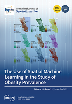
Some studies have found links between neighborhood conditions and health. They do not, however, assess the relative importance of neighborhood factors in increasing obesity, nor, more importantly, how these neighborhood factors vary geographically. The geographical random forest method is used to examine each factor's spatial variation and contribution to explaining tract-level obesity prevalence in Chicago, Illinois, USA. View this paper
  • Issues are regarded as officially published after their release is announced to the table of contents alert mailing list.
  • You may sign up for e-mail alerts to receive table of contents of newly released issues.
  • PDF is the official format for papers published in both, html and pdf forms. To view the papers in pdf format, click on the "PDF Full-text" link, and use the free Adobe Reader to open them.
Order results
Result details
Select all
Export citation of selected articles as:
18 pages, 3431 KiB  
Article
Multi-Mode Huff-Based 2SFCA: Examining Geographical Accessibility to Food Outlets in Austin, Texas
by He Jin and Yongmei Lu
ISPRS Int. J. Geo-Inf. 2022, 11(11), 579; https://doi.org/10.3390/ijgi11110579 - 21 Nov 2022
Cited by 2 | Viewed by 1901
Abstract
The retail food environment draws much attention from scholars because it can shape individuals’ eating behaviors and health outcomes. Although much progress has been made, current retail food environment assessments mainly use simple food accessibility measures while overlooking the role of multiple transportation [...] Read more.
The retail food environment draws much attention from scholars because it can shape individuals’ eating behaviors and health outcomes. Although much progress has been made, current retail food environment assessments mainly use simple food accessibility measures while overlooking the role of multiple transportation modes. This research proposed a multiple-mode Huff-based Two-step Floating Catchment Area (2SFCA) method to measure geographical access to food outlets in Austin, Texas. The spatial accessibility score was calculated with low to high impedance coefficients. Our analyses revealed an urban core-and-peripheral disparity in spatial accessibility to food outlets. We also compared the proposed multiple-mode Huff-based 2SFCA with its single-mode counterpart using t-test and relative difference methods. The comparison illustrates that the difference between the two methods of calculating healthy and unhealthy food accessibility is significant when the impedance coefficient is set to be 1.4 and 1.5, respectively. Our proposed multi-mode Huff-based 2SFCA method accounts for the various transport means and the spatial heterogeneity in population demand for food services; this could support developing intervention strategies to target under-served healthy food areas and over-served unhealthy food areas. Full article
Show Figures

Figure 1

18 pages, 2838 KiB  
Article
Does Culture Shape Our Spatial Ability? An Investigation Based on Eye Tracking
by Yuyang Tian, Tianyu Yang and Weihua Dong
ISPRS Int. J. Geo-Inf. 2022, 11(11), 578; https://doi.org/10.3390/ijgi11110578 - 21 Nov 2022
Cited by 1 | Viewed by 2345
Abstract
Culture affects people’s spatial memory, mental representations, and spatial reference frameworks. People with different cultural backgrounds show different degrees of spatial ability. However, the current research does not reveal the shaping of spatial ability by culture from the perspective of visual cognition. In [...] Read more.
Culture affects people’s spatial memory, mental representations, and spatial reference frameworks. People with different cultural backgrounds show different degrees of spatial ability. However, the current research does not reveal the shaping of spatial ability by culture from the perspective of visual cognition. In this study, we used eye tracking and designed mental rotation, spatial visualization, spatial orientation, and spatial correlation tasks to compare the spatial ability of Chinese and Malaysian Chinese people. The results showed that there were some minimal differences between them. Chinese participants had higher accuracy in the mental rotation task, showed more fixation to landmarks in spatial orientation, showed more fixation to the main map, and switched more frequently between the two thematic maps when judging spatial relationships. As “cultural citizens” of China, Malaysian Chinese people’s spatial ability is not only shaped by their own ethnic culture in terms of language but also influenced by foreign races in terms of education, wayfinding tendency, and cognitive style. This study can contribute to the understanding of the influence of culture on spatial ability and its possible causes. Full article
(This article belongs to the Special Issue Eye-Tracking in Cartography)
Show Figures

Figure 1

17 pages, 11282 KiB  
Article
Map Design and Usability of a Simplified Topographic 2D Map on the Smartphone in Landscape and Portrait Orientations
by Beata Medyńska-Gulij, Jacek Gulij, Paweł Cybulski, Krzysztof Zagata, Jakub Zawadzki and Tymoteusz Horbiński
ISPRS Int. J. Geo-Inf. 2022, 11(11), 577; https://doi.org/10.3390/ijgi11110577 - 20 Nov 2022
Cited by 6 | Viewed by 2355
Abstract
Map design and usability issues are crucial when considering different device orientations. It is visible, especially in exploring the topographical space in landscape or portrait orientation on the mobile phone. In this study, we aim to reveal the main differences and similarities among [...] Read more.
Map design and usability issues are crucial when considering different device orientations. It is visible, especially in exploring the topographical space in landscape or portrait orientation on the mobile phone. In this study, we aim to reveal the main differences and similarities among participants’ performance in a map-based task. The study presents an original research scheme, including establishing conceptual assumptions, developing map applications with gaming elements, user testing, and visualizing results. It appears that the different phone orientation triggers different visual strategy. This transfers into decision-making about the path selection. It turned out that in landscape orientation, participants preferred paths oriented east–west. On the other hand, portrait orientation supported north–south path selection. However, considering the given task accomplishment, both mobile phones’ orientations are adequate for the exploration of topographical space. Full article
(This article belongs to the Special Issue Cartography and Geomedia)
Show Figures

Figure 1

18 pages, 4859 KiB  
Article
Spatial Pattern and Influencing Factors of Basic Education Resources in Rural Areas around Metropolises—A Case Study of Wuhan City’s New Urban Districts
by Liang Jiang, Jie Chen, Ye Tian and Jing Luo
ISPRS Int. J. Geo-Inf. 2022, 11(11), 576; https://doi.org/10.3390/ijgi11110576 - 19 Nov 2022
Cited by 3 | Viewed by 1793
Abstract
Basic education resources are basic urban and rural social public security resources, and their spatial distribution is an important issue related to people’s livelihoods and social justice. Taking Wuhan as a case study, this paper analyzed the spatial distribution characteristics of rural basic [...] Read more.
Basic education resources are basic urban and rural social public security resources, and their spatial distribution is an important issue related to people’s livelihoods and social justice. Taking Wuhan as a case study, this paper analyzed the spatial distribution characteristics of rural basic education resources based on the methods of the average nearest neighbor index, imbalance index, kernel density analysis and two-step floating catchment area and then used geographic detector analysis to detect its influencing factors. The following findings were obtained: (1) Rural kindergartens and elementary schools in Wuhan City’s new urban districts showed a clustered distribution pattern, while secondary schools showed a uniform distribution trend. The spatial distribution of rural basic education resources is poorly balanced, with a tendency to cluster in Huangpi District, Xinzhou District and Caidian District; the overall spatial distribution density of rural basic education resources showed the distribution characteristics of “block-like clustering and multicenter development”. (2) The spatial accessibility of kindergartens showed a spatial pattern of “large dispersion and small clustering”, with multiple high-value clustering areas; and the accessibility of elementary and secondary schools showed a spatial pattern of high in the south and low in the north. (3) The population, economy and education development level are the main factors affecting the spatial distribution of rural basic education resources, while the influence of infrastructure construction is weak. The core influencing factors of the spatial distribution of each type of basic education resource are both consistent and different. According to the interaction factor detection, the spatial distribution of rural basic education resources in Wuhan City’s new urban districts is the result of the combined effect of multiple factors. Full article
Show Figures

Figure 1

20 pages, 4122 KiB  
Article
Urban Human-Land Spatial Mismatch Analysis from a Source-Sink Perspective with ICT Support
by Tong Li, Chunliang Xiu and Huisheng Yu
ISPRS Int. J. Geo-Inf. 2022, 11(11), 575; https://doi.org/10.3390/ijgi11110575 - 17 Nov 2022
Viewed by 1528
Abstract
The development management of the city constantly pursues sustainable development of human-land matching. Under the new research framework, this study discusses the urban human-land relationship from the perspective of the source-sink of daily population mobility, making up for the lack of a static [...] Read more.
The development management of the city constantly pursues sustainable development of human-land matching. Under the new research framework, this study discusses the urban human-land relationship from the perspective of the source-sink of daily population mobility, making up for the lack of a static research perspective in the past. The spatial relationship between population source-sink and land use intensity was studied by bivariate Moran’s I and multivariate correspondence analysis. The results show that there is a significant spatial correlation between urban population source-sink and land use intensity, which is obviously affected by urban circles and land use types, and these laws are cyclical day after day. The urban fringe becomes the main place where spatial mismatch occurs. Currently, the spatial mismatch of cities in northeast China, represented by Shenyang, is dominated by the high intensity of land use and low flow of the population. The key to solving the problem is to curb the high-density urban sprawl. The research results improve the integrity and accuracy of urban human-land spatial mismatch analysis and provide support for formulating more specific urban land use policies. Full article
Show Figures

Figure 1

18 pages, 2891 KiB  
Article
Field Cognitive Styles on Visual Cognition in the Event Structure Design of Bivariate Interactive Dorling Cartogram—The Similarities and Differences of Field-Independent and Field-Dependent Users
by Yanfei Zhu, Jie Gu, Yun Lin, Mo Chen, Qi Guo, Xiaoxi Du and Chengqi Xue
ISPRS Int. J. Geo-Inf. 2022, 11(11), 574; https://doi.org/10.3390/ijgi11110574 - 17 Nov 2022
Viewed by 1307
Abstract
As a simple, discontinuous, surface deformation statistical map, Dorling cartograms are effective means with which to characterize the geographic distribution of event data attributes. According to existing research, behavioral differences exist in the visual cognition of individuals with different cognitive field styles in [...] Read more.
As a simple, discontinuous, surface deformation statistical map, Dorling cartograms are effective means with which to characterize the geographic distribution of event data attributes. According to existing research, behavioral differences exist in the visual cognition of individuals with different cognitive field styles in the spatial task of switching layers in a two-dimensional electronic map. However, there are few studies that compare the visual cognitive ability of individuals with different cognitive field styles in the cross-layer structure design of Dorling cartogram event information. This paper uses the visual behavior measurement method to analyze the similarities and differences in the visual cognitive ability of two types of individuals, namely, field-independent and field-dependent individuals, in the cross-layer event structure design of Dorling cartograms. We recruited 40 subjects to perform visualization tasks on Dorling cartograms designed with two event structures, and we recorded the visual cognition data for the two types of subjects in both tasks. The results show that the subjects with the field-independent style perform better in the cognition of the Dorling cartogram event structure than the subjects with the field-dependent style, and the “S-T” event structure design is generally more user-friendly than the “T-S” event structure design. Our findings help to provide some references for the event structure design of human-centered Dorling cartograms. Full article
Show Figures

Figure 1

19 pages, 5301 KiB  
Article
Evaluating BFASTMonitor Algorithm in Monitoring Deforestation Dynamics in Coniferous and Deciduous Forests with LANDSAT Time Series: A Case Study on Marmara Region, Turkey
by Nooshin Mashhadi and Ugur Alganci
ISPRS Int. J. Geo-Inf. 2022, 11(11), 573; https://doi.org/10.3390/ijgi11110573 - 16 Nov 2022
Cited by 5 | Viewed by 1955
Abstract
Time series analysis combined with remote sensing data allows for the study of abrupt changes in the environment due to significant and severe disturbances such as deforestation, agricultural activities, fires, and urban expansion, as well as gradual changes such as climate variability and [...] Read more.
Time series analysis combined with remote sensing data allows for the study of abrupt changes in the environment due to significant and severe disturbances such as deforestation, agricultural activities, fires, and urban expansion, as well as gradual changes such as climate variability and forest degradation in the ecosystem. The precision of any change detection analysis is highly dependent upon its ability to separate actual changes and fluctuations on a seasonal scale. One of the efficient methods in this context is using the Breaks for Additive Seasonal and Trend (BFAST) set of algorithms. This study aims to perform a comprehensive and comparative evaluation of different Vis’ performance in forest degradation with the Landsat 8 images and BFASTMonitor approach. Through evaluation, the study also considers the potential effects of different forest types and deforestation scales in the Marmara region of Turkey. For this purpose, the Normalized Difference Vegetation Index (NDVI), Enhanced Vegetation Index (EVI), Normalized Difference Moisture Index (NDMI), and Normalized Burn Ratio (NBR) vegetation indices (VI) were selected for a comparative evaluation. The overall accuracy of VIs in deciduous forests was around 85% for NDVI, NDMI, and NBR, and 78.80% for EVI, while in coniferous forests, the overall accuracy demonstrated higher values of about 88% for NDVI, NDMI, and EVI, and 87.28% for NBR. Consequently, water-sensitive VIs that utilize shortwave infrared bands proved to be slightly more sensitive in detecting forest disturbances while chlorophyll-sensitive VIs represented lower accuracy for both forest types. Overall, all VIs faced an underestimation error in deforested area detection that was observable through negative BIAS. The results illuminate that BFASTMonitor can be considered as a tool in monitoring forest environments due to its acceptable deforestation determination capability in deciduous and coniferous forests, with slightly higher performance for small-scale deforestation patterned regions. Full article
(This article belongs to the Special Issue Geomatics in Forestry and Agriculture: New Advances and Perspectives)
Show Figures

Figure 1

13 pages, 6173 KiB  
Article
Building Block Extraction from Historical Maps Using Deep Object Attention Networks
by Yao Zhao, Guangxia Wang, Jian Yang, Lantian Zhang and Xiaofei Qi
ISPRS Int. J. Geo-Inf. 2022, 11(11), 572; https://doi.org/10.3390/ijgi11110572 - 16 Nov 2022
Cited by 1 | Viewed by 1371
Abstract
The geographical feature extraction of historical maps is an important foundation for realizing the transition from human map reading to machine map reading. The current methods for building block extraction from historical maps have many problems, such as low accuracy and poor scalability. [...] Read more.
The geographical feature extraction of historical maps is an important foundation for realizing the transition from human map reading to machine map reading. The current methods for building block extraction from historical maps have many problems, such as low accuracy and poor scalability. Moreover, the high cost of annotating historical maps further limits its applications. In this study, a method for extracting building blocks from historical maps is proposed based on the deep object attention network. Based on the OCRNet framework, multiple attention mechanisms were used to improve the ability of the network to extract the contextual information of the target. Moreover, through the optimization of the feature extraction network structure, the impact of the down-sampling process on local information and boundary contours was reduced, in order to improve the network’s ability to capture boundary information. Subsequently, the transfer learning method was used to jointly train the network model on both remote sensing datasets and few-shot historical map datasets to further improve the feature learning ability of the network, which overcomes the constraints of small sample sizes. The experimental results show that the proposed method can effectively improve the extraction accuracy of building blocks from historical maps. Full article
Show Figures

Figure 1

30 pages, 11876 KiB  
Article
Site Selection of Natural Gas Emergency Response Team Centers in Istanbul Metropolitan Area Based on GIS and FAHP
by Mehmet Şerif Sarıkaya, Mustafa Yanalak and Himmet Karaman
ISPRS Int. J. Geo-Inf. 2022, 11(11), 571; https://doi.org/10.3390/ijgi11110571 - 16 Nov 2022
Cited by 4 | Viewed by 1804
Abstract
The location of natural gas emergency response team centers (NGERTCs) is critical in terms of addressing natural gas notifications that require a timely emergency response. The selection of NGERTCs in Istanbul has an important place in terms of providing better service, due to [...] Read more.
The location of natural gas emergency response team centers (NGERTCs) is critical in terms of addressing natural gas notifications that require a timely emergency response. The selection of NGERTCs in Istanbul has an important place in terms of providing better service, due to the necessity of responding to emergency natural gas notifications within 15 min, in addition to the over 200,000 natural gas notifications per year and heavy traffic conditions. Therefore, this study proposes a solution based on GIS and FAHP to determine suitable NGERTC locations in Istanbul Metropolitan Area. In the first stage of the study, the required 15-min coverage areas for emergency calls for 36 existing NGERTCs in Istanbul were extracted and the adequacy of their locations was analyzed. In the second stage of the study, the weights of seven criteria determined for new NGERTC site selection were calculated by the FAHP method. With spatial analysis made, 12 new NGERTC locations were proposed. Finally, re-coverage analysis was performed for proposed and existing NGERTCs, and changes in coverage area within a 15 min response time were analyzed. Natural gas network coverage increased from 70.04% to 83.86%, and natural gas subscriber coverage increased from 91.03% to 96.27%. The results show that GIS and FAHP are worth using in selecting suitable NGERTC locations. Full article
Show Figures

Figure 1

17 pages, 3875 KiB  
Article
A Machine Learning Approach for Detecting Rescue Requests from Social Media
by Zheye Wang, Nina S. N. Lam, Mingxuan Sun, Xiao Huang, Jin Shang, Lei Zou, Yue Wu and Volodymyr V. Mihunov
ISPRS Int. J. Geo-Inf. 2022, 11(11), 570; https://doi.org/10.3390/ijgi11110570 - 16 Nov 2022
Cited by 2 | Viewed by 2011
Abstract
Hurricane Harvey in 2017 marked an important transition where many disaster victims used social media rather than the overloaded 911 system to seek rescue. This article presents a machine-learning-based detector of rescue requests from Harvey-related Twitter messages, which differentiates itself from existing ones [...] Read more.
Hurricane Harvey in 2017 marked an important transition where many disaster victims used social media rather than the overloaded 911 system to seek rescue. This article presents a machine-learning-based detector of rescue requests from Harvey-related Twitter messages, which differentiates itself from existing ones by accounting for the potential impacts of ZIP codes on both the preparation of training samples and the performance of different machine learning models. We investigate how the outcomes of our ZIP code filtering differ from those of a recent, comparable study in terms of generating training data for machine learning models. Following this, experiments are conducted to test how the existence of ZIP codes would affect the performance of machine learning models by simulating different percentages of ZIP-code-tagged positive samples. The findings show that (1) all machine learning classifiers except K-nearest neighbors and Naïve Bayes achieve state-of-the-art performance in detecting rescue requests from social media; (2) using ZIP code filtering could increase the effectiveness of gathering rescue requests for training machine learning models; (3) machine learning models are better able to identify rescue requests that are associated with ZIP codes. We thereby encourage every rescue-seeking victim to include ZIP codes when posting messages on social media. This study is a useful addition to the literature and can be helpful for first responders to rescue disaster victims more efficiently. Full article
Show Figures

Figure 1

13 pages, 1582 KiB  
Review
Geographic Information System Applied to Sustainability Assessments: Conceptual Structure and Research Trends
by Victor Tomaz de Oliveira, Denilson Teixeira, Lucia Rocchi and Antonio Boggia
ISPRS Int. J. Geo-Inf. 2022, 11(11), 569; https://doi.org/10.3390/ijgi11110569 - 16 Nov 2022
Cited by 2 | Viewed by 1326
Abstract
The conceptual variations and divergences that permeate the debate on sustainability end up directly reflecting the choice of sustainability assessment (SA) processes, providing different methodological approaches. Among them, some researchers have pointed out challenges, but also opportunities to use geospatial data, techniques, and [...] Read more.
The conceptual variations and divergences that permeate the debate on sustainability end up directly reflecting the choice of sustainability assessment (SA) processes, providing different methodological approaches. Among them, some researchers have pointed out challenges, but also opportunities to use geospatial data, techniques, and tools as resources to be explored in sustainability assessments. However, it was still unclear how geospatial tools have contributed in this context, as well as their future potential. Thus, through bibliometric mapping, this research answers these questions, through the identification of both the thematic fields of action of the geographic information system (GIS) in SA as well as the emerging research areas in this domain of knowledge. For this, we selected 1721 articles spanning 31 years (1990–2020). We observe that this is a subject of growing interest, as more than 50% of all publications were published after 2015. The main results indicated that, initially, the GIS supported sustainability assessments as a mapping tool associated mostly with environmental issues, however, the evolution of the analysis potential, through data modeling, gives rise to new application perspectives. This evolution takes place, in parallel, with the global discussion on sustainability, where multidimensionality starts to play a leading role, and sustainability indicators assume geographic positions. Full article
Show Figures

Figure 1

21 pages, 7135 KiB  
Article
Evaluation of Coastal Erosion in the Watersheds of Municipality of Buenaventura, Colombia: Using Geospatial Techniques and the Composite Vulnerability Index
by Jose Eduardo Fuentes, Robin Alexis Olaya and Cesar Edwin Garcia
ISPRS Int. J. Geo-Inf. 2022, 11(11), 568; https://doi.org/10.3390/ijgi11110568 - 15 Nov 2022
Cited by 1 | Viewed by 2056
Abstract
Buenaventura on the Colombian Pacific coast has experienced a wide range of threats, mainly due to the effects of coastal erosion and flooding. Globally, millions of people will experience increased vulnerability in the coming decades due to climate change. The change in the [...] Read more.
Buenaventura on the Colombian Pacific coast has experienced a wide range of threats, mainly due to the effects of coastal erosion and flooding. Globally, millions of people will experience increased vulnerability in the coming decades due to climate change. The change in the coastline (1986–2020) over time was analyzed with remote sensors and the Digital Shoreline Analysis System (DSAS) in conjunction with GIS. A total of 16 indicators were selected to quantitatively evaluate exposure, sensitivity, and adaptive capacity to construct a composite vulnerability index (COVI). The endpoint rate (EPR) of the change in the coastline was estimated. The results showed that 35% of the study area was stable, 18% of the coastline experienced erosion processes, and 47% experienced accretion. The COVI analysis revealed that coastal watersheds show great spatial heterogeneity; 31.4% of the area had moderate vulnerability levels, 26.5% had low vulnerability levels, and 41.9% had high vulnerability levels. This analysis revealed that the watersheds located in the northern (Málaga Bay) and central (Anchicaya, Cajambre, and Rapposo basins) parts of the coastal zone were more vulnerable than the other areas. Full article
(This article belongs to the Special Issue Geo-Information for Watershed Processes)
Show Figures

Figure 1

18 pages, 5850 KiB  
Article
The Verification of Land Cover Datasets with the Geo-Tagged Natural Scene Images
by Liu Cui, Hui Yang, Liang Chu, Qingping He, Fei Xu, Yina Qiao, Zhaojin Yan, Ran Wang and Hui Ci
ISPRS Int. J. Geo-Inf. 2022, 11(11), 567; https://doi.org/10.3390/ijgi11110567 - 13 Nov 2022
Cited by 3 | Viewed by 1409
Abstract
Land cover is important for global change studies, and its accuracy and reliability are usually verified by field sampling, which costs a lot. A method was proposed for the verification of land cover datasets with the geo-tagged natural scene images using a convolutional [...] Read more.
Land cover is important for global change studies, and its accuracy and reliability are usually verified by field sampling, which costs a lot. A method was proposed for the verification of land cover datasets with the geo-tagged natural scene images using a convolutional neural network. The nature scene images were firstly collected from the Land Use and Cover Area frame Survey (LUCAS) and global crowdsourcing images platform Flickr, then classified according to the Land Cover Classification System. The Nature Scene Image Classification (NSIC) model based on the GoogLeNet Inception network for recognition of natural scene images was then constructed. Finally, in the UK, as a verification area, the European Space Agency Climate Change Initiative Land Cover (ESA CCI-LC) datasets and the Global land-cover product with fine classification system (GLC-FCS) were verified using the NSIC-Inception model with the nature scene image set. The verification results showed that the overall accuracy verified by LUCAS was very close to the accuracy of the land cover product, which was 94.41% of CCI LC and 92.89% of GLC-FCS, demonstrating the feasibility of using geo-tagged images classified by the NSIC model. In addition, the VGG16 and ResNet50 were compared with GoogLeNet Inception. The differences in verification between LUCAS and Flickr images were discussed regarding the image’s quantity, the spatial distribution, the representativeness, and so on. The uncertainties of verification arising from differences in the spatial resolution of the different datasets were explored by CCI LC and GCL-FCS. The application of the method has great potential to support and improve the efficiency of land cover verification. Full article
Show Figures

Figure 1

17 pages, 26169 KiB  
Article
Optimization of Complex Function Expansions for Gauss-Krüger Projections
by Xiaoyong Li, Houpu Li, Guohui Liu and Shaofeng Bian
ISPRS Int. J. Geo-Inf. 2022, 11(11), 566; https://doi.org/10.3390/ijgi11110566 - 11 Nov 2022
Cited by 2 | Viewed by 1312
Abstract
Compared with complex and lengthy Gauss-Krüger projection series expansions and real number expressions, we improve the complex function representation of Gauss-Krüger projections and rewrite them into the “multiple Angle form”, “exponential form”, and “double Angle form”. The coefficients were expanded in the power [...] Read more.
Compared with complex and lengthy Gauss-Krüger projection series expansions and real number expressions, we improve the complex function representation of Gauss-Krüger projections and rewrite them into the “multiple Angle form”, “exponential form”, and “double Angle form”. The coefficients were expanded in the power series based on the first eccentricity e and the third flattening n, respectively, and the truncation difference was analyzed when expanded to different orders to obtain the simplified practical formulas for each form on the premise of meeting the accuracy requirements of geodesy. Through numerical analysis, the computational efficiency of the forward and inverse solutions of the Gauss-Krüger projection is analyzed, which shows the superiority of the “double Angle form”. Through the above measures, the expressions for forward and inverse solutions of the Gauss-Krüger projection are obtained, meeting the accuracy requirements with a higher computational efficiency and a more concise form. Full article
Show Figures

Figure 1

27 pages, 17101 KiB  
Article
The Influence of Point Cloud Accuracy from Image Matching on Automatic Preparation of Training Datasets for Object Detection in UAV Images
by Paulina Zachar, Wojciech Ostrowski, Anna Płatek-Żak and Zdzisław Kurczyński
ISPRS Int. J. Geo-Inf. 2022, 11(11), 565; https://doi.org/10.3390/ijgi11110565 - 10 Nov 2022
Cited by 2 | Viewed by 3029
Abstract
The dynamic development of deep learning methods in recent years has prompted the widespread application of these algorithms in the field of photogrammetry and remote sensing, especially in the areas of image recognition, classification, and object detection. Still, one of the biggest challenges [...] Read more.
The dynamic development of deep learning methods in recent years has prompted the widespread application of these algorithms in the field of photogrammetry and remote sensing, especially in the areas of image recognition, classification, and object detection. Still, one of the biggest challenges in this field is the low availability of training datasets, especially regarding applications of oblique aerial imagery and UAV data. The process of acquiring such databases is labor-intensive. The solution to the problem of the unavailability of datasets and the need for manual annotation is to automate the process of generating annotations for images. One such approach is used in the following work. The proposed methodology for semi-automating the creation of training datasets was applied to detect objects on nadir and oblique images acquired from UAV. The methodology includes the following steps: (1) the generation of a dense 3D point cloud by two different methods: UAV photogrammetry and TLS (terrestrial laser scanning); (2) data processing, including clipping to objects and filtering of point clouds; (3) the projection of cloud points onto aerial images; and (4) the generation of bounding boxes bounding the objects of interest. In addition, the experiments performed are designed to test the accuracy and quality of the training datasets acquired in the proposed way. The effect of the accuracy of the point cloud extracted from dense UAV image matching on the resulting bounding boxes extracted by the proposed method was evaluated. Full article
(This article belongs to the Special Issue Upscaling AI Solutions for Large Scale Mapping Applications)
Show Figures

Figure 1

21 pages, 7857 KiB  
Article
Vulnerability Identification and Cascading Failure Spatiotemporal Patterns on Road Network under the Rainstorm Disaster
by Qirui Wu, Zhigang Han, Caihui Cui, Feng Liu, Yifan Zhao and Zhaoxin Xie
ISPRS Int. J. Geo-Inf. 2022, 11(11), 564; https://doi.org/10.3390/ijgi11110564 - 09 Nov 2022
Cited by 4 | Viewed by 2248
Abstract
Road vulnerability is crucial for enhancing the robustness of urban road networks and urban resilience. In medium or large cities, road failures in the face of unexpected events, such as heavy rainfall, can affect regional traffic efficiency and operational stability, which can cause [...] Read more.
Road vulnerability is crucial for enhancing the robustness of urban road networks and urban resilience. In medium or large cities, road failures in the face of unexpected events, such as heavy rainfall, can affect regional traffic efficiency and operational stability, which can cause high economic losses in severe cases. Conventional studies of road cascading failures under unexpected events focus on dynamic traffic flow, but the significant drop in traffic flow caused by urban flooding does not accurately reflect road load changes. Meanwhile, limited studies analyze the spatiotemporal pattern of cascading failure of urban road networks under real rainstorms and the correlation of this pattern with road vulnerability. In this study, road vulnerability is calculated using a network’s global efficiency measures to identify locations of high and low road vulnerability. Using the between centrality as a measure of road load, the spatiotemporal patterns of road network cascading failure during a real rainstorm are analyzed. The spatial association between road network vulnerability and cascading failure is then investigated. It has been determined that 90.09% of the roads in Zhengzhou city have a vulnerability of less than one, indicating a substantial degree of spatial heterogeneity. The vulnerability of roads adjacent to the city ring roads and city center is often lower, which has a significant impact on the global network’s efficiency. In contrast, road vulnerability is greater in areas located on the urban periphery, which has little effect on the global network’s efficiency. Five hot spots and three cold spots of road vulnerability are identified by using spatial autocorrelation analysis. The cascading failure of a road network exhibits varied associational characteristics in distinct clusters of road vulnerability. Road cascading failure has a very minor influence on the network in hot spots but is more likely to cause widespread traffic congestion or disruption in cold spots. These findings can help stakeholders adopt more targeted policies and strategies in urban planning and disaster emergency management to build more resilient cities and promote sustainable urban development. Full article
(This article belongs to the Special Issue Urban Geospatial Analytics Based on Crowdsourced Data)
Show Figures

Figure 1

20 pages, 2213 KiB  
Article
An Evaluation of Urban Renewal Based on Inclusive Development Theory: The Case of Wuhan, China
by Wei Liu, Jie Yang, Yue Gong and Qi Cheng
ISPRS Int. J. Geo-Inf. 2022, 11(11), 563; https://doi.org/10.3390/ijgi11110563 - 09 Nov 2022
Cited by 2 | Viewed by 2124
Abstract
After decades of development, China’s urban renewal is facing the problems of inequality and intolerance, neglecting vulnerable groups and triggering gentrification. These problems are rarely quantified and draw limited public concerns. To promote an inclusive urban development, we proposed a framework for the [...] Read more.
After decades of development, China’s urban renewal is facing the problems of inequality and intolerance, neglecting vulnerable groups and triggering gentrification. These problems are rarely quantified and draw limited public concerns. To promote an inclusive urban development, we proposed a framework for the inclusive evaluation of urban renewal spaces, thus increasing the understanding of inclusive urban renewal. An evaluation method based on the theory of inclusive development was proposed, and it includes two steps. First, the evaluation index system of inclusive development at the community scale was created, including 24 indicators from five aspects: cognitive well-being, vulnerable groups, affordable public service facilities, economic agency, and environmental factors. Second, a combination of the CRITIC-TOPSIS method and k-means algorithm was used to grade and classify the inclusive development of the community. In this study, multisource data were used to measure the inclusiveness of communities in the core area of Wuhan’s inner city. The results show that the renewed communities are more inclusive than the unrenewed communities; however, even in the more inclusive and renewed communities, a lack of protection for vulnerable groups and a certain level of gentrification still exists. Full article
Show Figures

Figure 1

15 pages, 3231 KiB  
Article
A Shape-Preserving Simplification Method for Urban Building Models
by Hanyu Xiang, Xianfeng Huang, Feng Lan, Chong Yang, Yunlong Gao, Wenyu Wu and Fan Zhang
ISPRS Int. J. Geo-Inf. 2022, 11(11), 562; https://doi.org/10.3390/ijgi11110562 - 09 Nov 2022
Cited by 3 | Viewed by 1572
Abstract
With the expansion of model scale and the improvement of model accuracy, the real-time rendering and displaying of 3D mesh models remain infeasible. To relieve such pressure, mesh simplification methods have been proposed to reduce the structural complexity while preserving the appearance. This [...] Read more.
With the expansion of model scale and the improvement of model accuracy, the real-time rendering and displaying of 3D mesh models remain infeasible. To relieve such pressure, mesh simplification methods have been proposed to reduce the structural complexity while preserving the appearance. This work introduces a shape-preserving simplification method for urban building models. Compared to traditional simplification methods that only consider preserving local geometric features, we also consider the overall shapes of building models to avoid collapse with an increased simplification rate. The proposed method works in four steps. First, we filter mesh models to yield planar structures while preserving sharp features. Second, we detect the shapes of planar regions. Third, we simplify the planar and non-planar regions constrained by the overall shapes and local geometric features. Finally, we remap the texture. Experiments show the effectiveness of this method by evaluating it on various building models and comparing its performance with the original QEM algorithms. Furthermore, we maintain better spatial consistency in building models with different levels of detail (LOD) than traditional methods. Full article
Show Figures

Figure 1

24 pages, 49029 KiB  
Article
Construction of a COVID-19 Pandemic Situation Knowledge Graph Considering Spatial Relationships: A Case Study of Guangzhou, China
by Xiaorui Yang, Weihong Li, Yebin Chen and Yunjian Guo
ISPRS Int. J. Geo-Inf. 2022, 11(11), 561; https://doi.org/10.3390/ijgi11110561 - 09 Nov 2022
Cited by 3 | Viewed by 1977
Abstract
The outbreak of COVID-19 (coronavirus disease 2019) has generated a large amount of spatiotemporal data. Using a knowledge graph can help to analyze the transmission relationship between cases and locate the transmission path of the pandemic, but researchers have paid little attention to [...] Read more.
The outbreak of COVID-19 (coronavirus disease 2019) has generated a large amount of spatiotemporal data. Using a knowledge graph can help to analyze the transmission relationship between cases and locate the transmission path of the pandemic, but researchers have paid little attention to the spatial relationships between geographical entities related to the pandemic. Therefore, we propose a method for constructing a pandemic situation knowledge graph of COVID-19 that considers spatial relationships. First, we created an ontology design of the pandemic data in which spatial relationships are considered. We then constructed a non-spatial relationships extraction model based on BERT and a spatial relationships extraction model based on spatial analysis theory. Second, taking the pandemic and geographic data of Guangzhou as an example, we modeled a pandemic corpus. We extracted entities and relationships based on this model, and we constructed a pandemic situation knowledge graph that considers spatial relationships. Finally, we verified the feasibility of using this method as a visualization exploratory tool in the analysis of spatial characteristics, pandemic development situation, case sources, and case relationships analysis of pandemic-related areas. Full article
Show Figures

Figure 1

16 pages, 6266 KiB  
Article
Evaluation of Automatic Prediction of Small Horizontal Curve Attributes of Mountain Roads in GIS Environments
by Sercan Gülci, Hafiz Hulusi Acar, Abdullah E. Akay and Neşe Gülci
ISPRS Int. J. Geo-Inf. 2022, 11(11), 560; https://doi.org/10.3390/ijgi11110560 - 09 Nov 2022
Viewed by 1575
Abstract
Road curve attributes can be determined by using Geographic Information System (GIS) to be used in road vehicle traffic safety and planning studies. This study involves analyzing the GIS-based estimation accuracy in the length, radius and the number of small horizontal road curves [...] Read more.
Road curve attributes can be determined by using Geographic Information System (GIS) to be used in road vehicle traffic safety and planning studies. This study involves analyzing the GIS-based estimation accuracy in the length, radius and the number of small horizontal road curves on a two-lane rural road and a forest road. The prediction success of horizontal curve attributes was investigated using digitized raw and generalized/simplified road segments. Two different roads were examined, involving 20 test groups and two control groups, using 22 datasets obtained from digitized and surveyed roads based on satellite imagery, GIS estimates, and field measurements. Confusion matrix tables were also used to evaluate the prediction accuracy of horizontal curve geometry. F-score, Mathews Correlation Coefficient, Bookmaker Informedness and Balanced Accuracy were used to investigate the performance of test groups. The Kruskal–Wallis test was used to analyze the statistical relationships between the data. Compared to the Bezier generalization algorithm, the Douglas–Peucker algorithm showed the most accurate horizontal curve predictions at generalization tolerances of 0.8 m and 1 m. The results show that the generalization tolerance level contributes to the prediction accuracy of the number, curve radius, and length of the horizontal curves, which vary with the tolerance value. Thus, this study underlined the importance of calculating generalizations and tolerances following a manual road digitization. Full article
Show Figures

Figure 1

16 pages, 14373 KiB  
Article
Mining the Spatial Distribution Pattern of the Typical Fast-Food Industry Based on Point-of-Interest Data: The Case Study of Hangzhou, China
by Yan Zhou, Xuan Shen, Chen Wang, Yixue Liao and Junli Li
ISPRS Int. J. Geo-Inf. 2022, 11(11), 559; https://doi.org/10.3390/ijgi11110559 - 09 Nov 2022
Cited by 3 | Viewed by 2359
Abstract
There is a Chinese proverb which states “Where there are Shaxian Snacks, there are generally Lanzhou Ramen nearby”. This proverb reflects the characteristics of spatial clustering in the catering industry. Since the proverbs are rarely elucidated from the geospatial perspective, we aimed to [...] Read more.
There is a Chinese proverb which states “Where there are Shaxian Snacks, there are generally Lanzhou Ramen nearby”. This proverb reflects the characteristics of spatial clustering in the catering industry. Since the proverbs are rarely elucidated from the geospatial perspective, we aimed to explore the spatial clustering characteristics of the fast food industry from the perspective of geographical proximity and mutual attraction. Point-of-interest, OSM road network, population, and other types of data from the typical fast-food industry in Hangzhou were used as examples. The spatial pattern of the overall catering industry in Hangzhou was analyzed, while the spatial distribution of the four types of fast food selected in Hangzhou was identified and evaluated. The “core-edge” circle structure characteristics of Hangzhou’s catering industry were fitted by the inverse S function. The common location connection between the Western fast-food KFC and McDonald’s and the Chinese fast-food Lanzhou Ramen and Shaxian Snacks and the spatial aggregation were elucidated, being supported by correlation analysis. The degree of mutual attraction between the two was applied to express the spatial correlation. The analysis demonstrated that (1) the distribution of the catering industry in Hangzhou was northeast–southwest. The center of the catering industry in Hangzhou was located near the economic center of the main city rather than in the center of urban geography. (2) The four types of fast food were distributed in densely populated areas and exhibited an anti-S law, which first increased but then decreased as the distance from the center increased. Among these, the number of four typical fast foods was the highest within a distance of 4–10 km from the center. (3) It was concluded that 81.6% of KFCs had a McDonald’s nearby within 2500 m, and 68.5% of Shaxian Snacks had a Lanzhou Ramen nearby within 400 m. McDonald’s attractiveness to KFC was calculated as 0.928448. KFC’s attractiveness to McDonald’s was 0.908902. The attractiveness of the Shaxian Snacks to Lanzhou Ramen was 0.826835. The attractiveness of Lanzhou Ramen to Shaxian Snacks was 0.854509. McDonald’s was found to be dependent on KFC in the main urban area. Shaxian Snacks were strongly attributed to Lanzhou Ramen in commercial centers and streets, while Shaxian Snacks were distributed independently in the eastern Xiaoshan and Yuhang Districts. This study also helped us to optimize the spatial distribution of a typical fast-food industry, while providing case references and decision-making assistance with respect to the locations of catering industries. Full article
(This article belongs to the Special Issue Urban Geospatial Analytics Based on Crowdsourced Data)
Show Figures

Figure 1

12 pages, 743 KiB  
Article
Acceptance of Online Mapping Technology among Older Adults: Technology Acceptance Model with Facilitating Condition, Compatibility, and Self-Satisfaction
by Siu Shing Man, Yingqian Guo, Alan Hoi Shou Chan and Huiping Zhuang
ISPRS Int. J. Geo-Inf. 2022, 11(11), 558; https://doi.org/10.3390/ijgi11110558 - 09 Nov 2022
Cited by 6 | Viewed by 2240
Abstract
The benefits of traveling for older adults are extensively supported in the literature. Online mapping technology (OMT) is one of the most widely used applications by people during traveling. This study aimed to obtain insight into the acceptance of OMT among older adults. [...] Read more.
The benefits of traveling for older adults are extensively supported in the literature. Online mapping technology (OMT) is one of the most widely used applications by people during traveling. This study aimed to obtain insight into the acceptance of OMT among older adults. Additionally, an OMT acceptance model for older adults was developed in this study by integrating facilitating condition (FC), compatibility (COM), and self-satisfaction (SS) into the technology acceptance model (TAM). In this study, structural equation modeling was applied to the test of the OMT acceptance model. This study adopted a cross-sectional structured questionnaire survey for collecting quantitative data from older adults in China. Four hundred and sixteen Chinese older adults were involved in this survey. This study found that TAM was useful to explain the OMT acceptance among older adults. Additionally, FC was confirmed to be a positive factor in determining the perceived ease of use, while COM and SS were found to positively influence perceived usefulness. The results of this study are helpful for OMT developers to design OMT and adopt measures to enhance the use of OMT among older adults, thereby increasing their travel frequency. Full article
Show Figures

Figure 1

22 pages, 329 KiB  
Article
Proposal of Redefinition of the Terms Geomatics and Geoinformatics on the Basis of Terminological Postulates
by Artur Krawczyk
ISPRS Int. J. Geo-Inf. 2022, 11(11), 557; https://doi.org/10.3390/ijgi11110557 - 09 Nov 2022
Cited by 7 | Viewed by 3342
Abstract
The article attempts to redefine the names for the research area, which is the use of information systems for the analysis and management of spatial data. To resolve the nomenclature issues, the studies were conducted into the structure evolution of spatial data, and [...] Read more.
The article attempts to redefine the names for the research area, which is the use of information systems for the analysis and management of spatial data. To resolve the nomenclature issues, the studies were conducted into the structure evolution of spatial data, and on software for these data processing, GIS acronyms were reviewed; another study was performed by means of terminological analogies, comparing definitions of similar, in terms of word formation, names referred to other areas of research. Moreover, questionnaires of job positions were analysed and, based on a literature review, the nomenclature used to define the field of studies on spatial data was analysed. The conducted studies resulted in the development of seven terminological postulates intended for the formulation of limitations and rules to give new definitions. The new author’s definitions of geomatics and geoinformatics terms are presented at the end of the paper. Full article
Show Figures

Graphical abstract

19 pages, 1434 KiB  
Article
Evaluating Stable Matching Methods and Ridesharing Techniques in Optimizing Passenger Transportation Cost and Companionship
by Elmer Magsino, Gerard Ryan Ching, Francis Miguel Espiritu and Kerwin Go
ISPRS Int. J. Geo-Inf. 2022, 11(11), 556; https://doi.org/10.3390/ijgi11110556 - 09 Nov 2022
Cited by 1 | Viewed by 1679
Abstract
In this work, we propose a Game Theory-based pricing solution to the ridesharing problem of taxi commuters that addresses the optimal selection of their travel companionship and effectively minimizes their cost. Two stable matching techniques are proposed in this study, namely: First-Come, First-Served [...] Read more.
In this work, we propose a Game Theory-based pricing solution to the ridesharing problem of taxi commuters that addresses the optimal selection of their travel companionship and effectively minimizes their cost. Two stable matching techniques are proposed in this study, namely: First-Come, First-Served (FCFS) and Best Time Sharing (BT). FCFS discovers pairs based on earliest time of pair occurrences, while BT prioritizes selecting pairs with high proportion of shared distance between passengers to the overall distance of their trips. We evaluate our methods through extensive simulations from empirical taxi trajectories from Jakarta, Singapore, and New York. Results in terms of post-stable matching, cost savings, successful matches, and total number of trips have been evaluated to gauge the performance with respect to the no ridesharing condition. BT outperformed FCFS in terms of generating more pairs with compatible routes. Additionally, in the New York dataset with high amount of trip density, BT has efficiently reduced the number of trips present at a given time. On the other hand, FCFS has been more effective in pairing trips for the Jakarta and Singapore datasets because of lower density due to limited number of trajectories. The Game Theory (GT) pricing model proved to generally be the most beneficial to the ride share’s cost savings, specifically leaning toward the passenger benefits. Analysis has shown that the stable matching algorithm reduced the overall number of trips while still adhering to the temporal frequency of trips within the dataset. Moreover, our developed Best Time Pairing and Game Theory Pricing methods served the most efficient based on passenger cost savings. Applying these stable matching algorithms will benefit more users and will encourage more ridesharing instances. Full article
(This article belongs to the Special Issue Urban Geospatial Analytics Based on Crowdsourced Data)
Show Figures

Figure 1

24 pages, 3813 KiB  
Article
Agglomeration Externalities, Network Externalities and Urban High-Quality Development: A Case Study of Urban Agglomeration in the Middle Reaches of the Yangtze River
by He Liu, Xueming Li, Songbo Li, Shenzhen Tian, Yilu Gong, Yingying Guan and He Sun
ISPRS Int. J. Geo-Inf. 2022, 11(11), 555; https://doi.org/10.3390/ijgi11110555 - 08 Nov 2022
Cited by 4 | Viewed by 1876
Abstract
The rapid development of the urban network has led to the fact that cities are no longer single individuals, and the network has changed the urban development environment. The interaction between cities has gradually become an important factor for the high-quality development (HQD) [...] Read more.
The rapid development of the urban network has led to the fact that cities are no longer single individuals, and the network has changed the urban development environment. The interaction between cities has gradually become an important factor for the high-quality development (HQD) of cities. From the perspective of externalities, it is of great significance to explore the impact of agglomeration externalities and network externalities on the HQD of cities to promote the high-quality and sustainable development of the region. Taking the urban agglomeration in the middle reaches of the Yangtze River as an example, this study constructs a theoretical framework to empirically study the influence of agglomeration externalities and network externalities on the HQD of the city. The results show that the integrated network of the urban agglomeration from 2011 to 2020 had a high clustering coefficient and a small average path length with the characteristics of a “small world”. The centrality of urban nodes was hierarchical and had a “pyramid” structure. From 2011 to 2020, the high-quality development level (HQDL) of the urban agglomeration steadily improved and the regional “development gap” gradually narrowed. Wuhan, Changsha, and Nanchang were in a relatively advantageous position in the urban agglomeration. Furthermore, there was a spatial agglomeration effect and a spatial spillover effect in the HQD of urban agglomeration. Network externalities presented difference in different cities, and the influence of agglomeration externalities on HQD presented a u-shaped nonlinear relationship. Network externalities could significantly promote HQD, and the indirect effect of HQD was greater than its direct effect. In addition, factors such as government capacity and level of opening to the outside world also had a significant impact on the HQD of the region. Full article
Show Figures

Figure 1

14 pages, 12646 KiB  
Article
Geomedia Attributes for Perspective Visualization of Relief for Historical Non-Cartometric Water-Colored Topographic Maps
by Beata Medyńska-Gulij
ISPRS Int. J. Geo-Inf. 2022, 11(11), 554; https://doi.org/10.3390/ijgi11110554 - 08 Nov 2022
Cited by 6 | Viewed by 2024
Abstract
The selection of appropriative geomedia attributes for constructing natural and suggestive perspective visualizations of historical non-cartometric manuscript topographic works is investigated, to enable an intuitive perception of relief landforms. The main objective of the study is to demonstrate geomedia parameters for representing the [...] Read more.
The selection of appropriative geomedia attributes for constructing natural and suggestive perspective visualizations of historical non-cartometric manuscript topographic works is investigated, to enable an intuitive perception of relief landforms. The main objective of the study is to demonstrate geomedia parameters for representing the third dimension in topographic watercolor maps from the eighteenth century, using cartographic rules and geoinformation operations for transforming graphic means of expression. The following methods were used: the choice of representative map fragments with specific painterly means of expression; the analysis of main relief forms on historical and modern maps; the rectification; vectorization of contour lines, and the transformation to a GRID model; the use of parameter variations: elevation rise, azimuth and altitude, contrast of illumination; and the creation of the final bird’s-eye-view visualization, with appropriate parameters. It is found that the parameters for the visualization of the non-cartometric water-colored topographic image on a 3D model can be selected in turn. However, what matters is maintaining their complementarity. The proposed parameters for the three maps work well for creating the general static bird’s-eye-view visualization, with the natural and suggestive perception of the landscapes’ relief. Full article
(This article belongs to the Special Issue Cartography and Geomedia)
Show Figures

Figure 1

22 pages, 2642 KiB  
Article
Reconsidering Tourism Destination Images by Exploring Similarities between Travelogue Texts and Photographs
by Xin Zhang, Xiaoqian Lu, Xiaolan Zhou and Chaohai Shen
ISPRS Int. J. Geo-Inf. 2022, 11(11), 553; https://doi.org/10.3390/ijgi11110553 - 08 Nov 2022
Cited by 4 | Viewed by 1966
Abstract
With the rise of user-generated content (UGC) and deep learning technology, more and more researchers construct and measure the tourism destination image (TDI) through online travelogues. However, due to the impact of COVID-19 prevention and control, the number of online travelogues has decreased [...] Read more.
With the rise of user-generated content (UGC) and deep learning technology, more and more researchers construct and measure the tourism destination image (TDI) through online travelogues. However, due to the impact of COVID-19 prevention and control, the number of online travelogues has decreased significantly and, therefore, the scientific validity of the TDI based only on text or photos has been questioned. This research fills a gap by comparing the differences between visual and semantic images in terms of the overall image perception and image formation through natural language processing technology and image caption technology in obtaining TDIs, taking Tiantai County in Zhejiang Province of China as a case. Our results show that the texts and photographs shared major similarities in the overall TDI, but from the perspective of interest, they reflect differently. Therefore, when considering the data source selection for TDI research with a small number of travelogues, texts should be the main content, supplemented by photographs. Full article
Show Figures

Figure 1

16 pages, 2884 KiB  
Article
Panic Detection Using Machine Learning and Real-Time Biometric and Spatiotemporal Data
by Ilias Lazarou, Anastasios L. Kesidis, George Hloupis and Andreas Tsatsaris
ISPRS Int. J. Geo-Inf. 2022, 11(11), 552; https://doi.org/10.3390/ijgi11110552 - 08 Nov 2022
Cited by 3 | Viewed by 2681
Abstract
It is common sense that immediate response and action are among the most important terms when it comes to public safety, and emergency response systems (ERS) are technology components strictly tied to this purpose. While the use of ERSs is increasingly adopted across [...] Read more.
It is common sense that immediate response and action are among the most important terms when it comes to public safety, and emergency response systems (ERS) are technology components strictly tied to this purpose. While the use of ERSs is increasingly adopted across many aspects of everyday life, the combination of them with real-time biometric and location data appears to provide a different perspective. Panic is one of the most important emergency indicators. Until now, panic events of any cause tend to be treated in a local manner. Various attempts to detect such events have been proposed based on traditional methods such as visual surveillance technologies and community engagement systems. The aim of this paper is twofold. First, it presents an innovative multimodal dataset containing biometric and spatiotemporal data associated with the detection of panic state in subjects that perform various activities during a certain period. For this purpose, time-enabled location data are combined with biometrics coming from wearables and smartphones that are analyzed in real-time and produce data indicating possible panic events that are geospatially described. Second, the proposed dataset is used to train various machine learning models, and their applicability to correctly distinguish panic states from normal behavior is thoroughly examined. As a result, the Gaussian SVM classifier ranked first among seven classifiers, achieving an accuracy score of 94.5%. The dataset was also tested in a deep learning framework, achieving an accuracy level of 93.4%. A long short-term memory approach was also used, which reached a top accuracy of 94%. Moreover, the contribution of the various biometric and geospatial features is analyzed in-depth to determine their partial importance in the overall panic detection process. This is moving towards the creation of a smart geo-referenced ERS that could be used to inform the authorities regarding a potentially unpleasant event by detecting possible crowd panic patterns and helping to act accordingly, getting the information right from the source of the event, the human body. The proposed dataset is freely distributed to the scientific community under the third version of GNU General Public License (GPL v3) through the GitHub platform. Full article
Show Figures

Figure 1

18 pages, 3397 KiB  
Article
Modelling Bottlenecks of Bike-Sharing Travel Using the Distinction between Endogenous and Exogenous Demand: A Case Study in Beijing
by Sun Chao and Lu Jian
ISPRS Int. J. Geo-Inf. 2022, 11(11), 551; https://doi.org/10.3390/ijgi11110551 - 08 Nov 2022
Viewed by 1277
Abstract
This paper aims to investigate the internal mechanisms of bottlenecks in bike-sharing travel. We perform kernel density analysis to obtain analysis points and areas designated by buffer areas. Additionally, we improve the spatial lag model through Tobit regression, so as to avoid the [...] Read more.
This paper aims to investigate the internal mechanisms of bottlenecks in bike-sharing travel. We perform kernel density analysis to obtain analysis points and areas designated by buffer areas. Additionally, we improve the spatial lag model through Tobit regression, so as to avoid the interference of autocorrelation and to set reasonable constraints for dependent variables. The proposed model distinguishes between bike-sharing demand determined by land use and other built environmental factors, which helps to define and identify bottlenecks in bike-sharing travel. Based on a Bayesian network fault tree, we define the diagnosis mode of evidence nodes to calculate the posterior probabilities and to determine the most sensitive factors for bottlenecks. We use Beijing city as the case study. The results show that the most sensitive factors that induce bottlenecks in bike-sharing travel are few subway stations, few bus stops, few bus lines, a low density of bike lanes, and more serious home–work separation. The findings presented here can enhance the generation of bike-sharing trips in response to bike-sharing development and contribute to adjusting the urban structure and reconstructing the green infrastructure layout. Full article
Show Figures

Figure 1

14 pages, 2028 KiB  
Article
Ecological Associations between Obesity Prevalence and Neighborhood Determinants Using Spatial Machine Learning in Chicago, Illinois, USA
by Aynaz Lotfata, Stefanos Georganos, Stamatis Kalogirou and Marco Helbich
ISPRS Int. J. Geo-Inf. 2022, 11(11), 550; https://doi.org/10.3390/ijgi11110550 - 08 Nov 2022
Cited by 5 | Viewed by 3040
Abstract
Some studies have established relationships between neighborhood conditions and health. However, they neither evaluate the relative importance of neighborhood components in increasing obesity nor, more crucially, how these neighborhood factors vary geographically. We use the geographical random forest to analyze each factor’s spatial [...] Read more.
Some studies have established relationships between neighborhood conditions and health. However, they neither evaluate the relative importance of neighborhood components in increasing obesity nor, more crucially, how these neighborhood factors vary geographically. We use the geographical random forest to analyze each factor’s spatial variation and contribution to explaining tract-level obesity prevalence in Chicago, Illinois, United States. According to our findings, the geographical random forest outperforms the typically used nonspatial random forest model in terms of the out-of-bag prediction accuracy. In the Chicago tracts, poverty is the most important factor, whereas biking is the least important. Crime is the most critical factor in explaining obesity prevalence in Chicago’s south suburbs while poverty appears to be the most important predictor in the city’s south. For policy planning and evidence-based decision-making, our results suggest that social and ecological patterns of neighborhood characteristics are associated with obesity prevalence. Consequently, interventions should be devised and implemented based on local circumstances rather than generic notions of prevention strategies and healthcare barriers that apply to Chicago. Full article
Show Figures

Figure 1

Previous Issue
Next Issue
Back to TopTop