Skip to Content
You are currently on the new version of our website. Access the old version .

Geosciences, Volume 9, Issue 6

2019 June - 35 articles

Cover Story: 
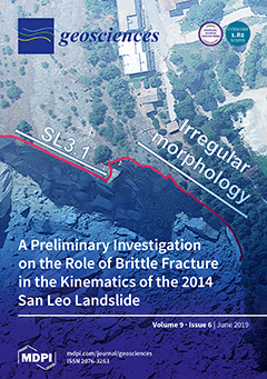
This paper uses combined remote sensing and advanced numerical modeling methods to investigate the intact rock fracturing that occurred prior to and during the 2014 San Leo landslide (Northern Italy). Numerical analyses showed that erosion of clay-rich materials at the base of the slope drives the brittle propagation of fractures within the rock mass. The progressive formation of a fully persistent rupture surface was simulated, resulting in the detachment and toppling of fault-bounded rock columns. This study highlights the potential role of intact rock fracturing on slope kinematics, and the interaction among intact rock strength, structural geology, and slope morphology. View this paper
  • Issues are regarded as officially published after their release is announced to the table of contents alert mailing list .
  • You may sign up for email alerts to receive table of contents of newly released issues.
  • PDF is the official format for papers published in both, html and pdf forms. To view the papers in pdf format, click on the "PDF Full-text" link, and use the free Adobe Reader to open them.

Articles (35)

  • Editorial
  • Open Access
6 Citations
4,155 Views
6 Pages

Snow cover is an essential climate variable directly affecting the Earth’s energy balance. Snow cover has a number of important physical properties that exert an influence on global and regional energy, water, and carbon cycles. Remote sensing...

  • Article
  • Open Access
24 Citations
5,395 Views
37 Pages

Coastal to shallow-marine deposits are inherently highly heterogeneous in sediment composition due to variable depositional conditions. Representation of heterogeneity at sub-seismic scales is required for understanding flow and geochemical processes...

  • Communication
  • Open Access
7 Citations
3,080 Views
6 Pages

Tectonics-Related Geosites: Towards Accurate Nomenclature

  • Dmitry A. Ruban,
  • Anna V. Mikhailenko and
  • Vladimir A. Ermolaev

Accurate nomenclature of geological heritage sites (geosites) is necessary to facilitate their description and territorial geodiversity evaluation (both important for sustainable development and efficient land-use planning). As suggested by previous...

  • Article
  • Open Access
4 Citations
3,642 Views
14 Pages

Microstratigraphic Records as Tools for the Detection of Climatic Changes in Tana di Badalucco Cave (Liguria, NW Italy)

  • Eleonora Sessa,
  • Ivano Rellini,
  • Antonella Traverso,
  • Irene Molinari,
  • Giulio Montinari,
  • Guido Rossi and
  • Marco Firpo

Tana di Badalucco cave is located in Imperia (Liguria, Italy), not far from the French border. This site is scarcely known and it has never been studied accurately, even though different archaeological excavations have returned really important eleme...

  • Article
  • Open Access
17 Citations
7,295 Views
17 Pages

Earthquake Environmental Effects of the 1992 MS7.3 Suusamyr Earthquake, Kyrgyzstan, and Their Implications for Paleo-Earthquake Studies

  • Christoph Grützner,
  • Richard Walker,
  • Eleanor Ainscoe,
  • Austin Elliott and
  • Kanatbek Abdrakhmatov

Large pre-historical earthquakes leave traces in the geological and geomorphological record, such as primary and secondary surface ruptures and mass movements, which are the only means to estimate their magnitudes. These environmental earthquake effe...

  • Article
  • Open Access
5 Citations
4,957 Views
17 Pages

The Sena Gallica Roman town was settled on the Adriatic coast in the 5th to 4th century BC. The choice of the site was largely influenced by the geomorphological and physiographic conditions near the Misa river mouth. The interactions among climate v...

  • Article
  • Open Access
25 Citations
8,424 Views
20 Pages

Classification of Red-Bed Rock Mass Structures and Slope Failure Modes in South China

  • Cuiying Zhou,
  • Xu Yang,
  • Yanhao Liang,
  • Zichun Du,
  • Zhen Liu,
  • Wei Huang and
  • Weihua Ming

Red beds are Meso–Cenozoic continental sedimentary strata that are mainly composed of gravel stone, sandstone, siltstone, mudstone, and shale and occasionally have interlayers of limestone, halite, and gypsum. As a typical rock mass, red beds a...

  • Article
  • Open Access
22 Citations
5,023 Views
17 Pages

Comparison of Hydraulic and Tracer Tomography for Discrete Fracture Network Inversion

  • Lisa Maria Ringel,
  • Márk Somogyvári,
  • Mohammadreza Jalali and
  • Peter Bayer

Fractures serve as highly conductive preferential flow paths for fluids in rocks, which are difficult to exactly reconstruct in numerical models. Especially, in low-conductive rocks, fractures are often the only pathways for advection of solutes and...

  • Article
  • Open Access
21 Citations
4,664 Views
22 Pages

The hydrographic basin of Ribeira Grande (S. Miguel Island, Azores) has a set of characteristics that enhance the occurrence of shallow slides that have been triggered by rainfall and earthquakes. Two landslide inventories were built according to the...

  • Article
  • Open Access
14 Citations
5,913 Views
19 Pages

Engineering and geographic substantiation of the anti-erosion organization of agricultural landscapes requires not only differentiated estimations of erosion losses, but also commensurate (in terms of space–time scales) estimations of the soil...

  • Article
  • Open Access
2 Citations
6,344 Views
14 Pages

The Upper Jurassic (Oxfordian Age) Smackover Formation is a significant source for hydrocarbon production in southwest Alabama. Brooklyn Field is in southeast Conecuh County, Alabama, and has been a major producer of oil and natural gas for the state...

  • Article
  • Open Access
8 Citations
4,243 Views
21 Pages

To develop multi-century stable isotope chronologies from tree rings, pooling techniques are applied to reduce laboratory costs and time. However, pooling of wood samples from different trees may have adverse effects on the signal amplitude in the fi...

  • Article
  • Open Access
36 Citations
5,256 Views
15 Pages

Petrographic and Mechanical Characteristics of Concrete Produced by Different Type of Recycled Materials

  • Petros Petrounias,
  • Panagiota P. Giannakopoulou,
  • Aikaterini Rogkala,
  • Paraskevi Lampropoulou,
  • Basilios Tsikouras,
  • Ioannis Rigopoulos and
  • Konstantin Hatzipanagiotou

This paper examined three different types of recycled materials, such as beer green glass, waste tile, and asphalt, which will be used in different mixtures in order to prepare concrete specimens and, more specifically, their effect on concrete stren...

  • Article
  • Open Access
21 Citations
6,514 Views
21 Pages

Assessing the Multiple Impacts of Extreme Hurricanes in Southern New England, USA

  • David S. Ullman,
  • Isaac Ginis,
  • Wenrui Huang,
  • Catherine Nowakowski,
  • Xuanyu Chen and
  • Peter Stempel

The southern New England coast of the United States is particularly vulnerable to land-falling hurricanes because of its east-west orientation. The impact of two major hurricanes on the city of Providence (Rhode Island, USA) during the middle decades...

  • Article
  • Open Access
13 Citations
5,576 Views
17 Pages

The Influence of Olive Orchards Copper-Based Fungicide Use, in Soils and Sediments—The Case of Aetoliko (Etoliko) Lagoon Western Greece

  • Pavlos Avramidis,
  • Pantelis Barouchas,
  • Thomas Dünwald,
  • Ingmar Unkel and
  • Dionisios Panagiotaras

In this study, soil and aquatic sediments were sampled in the Aetoliko Lagoon and its catchment area, which is exclusively dominated by olive orchards. For the first time in Greece, soil as well as sediments samples of one coherent protected aquatic...

  • Article
  • Open Access
26 Citations
5,810 Views
18 Pages

First Calibration and Application of Leaf Wax n-Alkane Biomarkers in Loess-Paleosol Sequences and Modern Plants and Soils in Armenia

  • Yesmine Trigui,
  • Daniel Wolf,
  • Lilit Sahakyan,
  • Hayk Hovakimyan,
  • Kristina Sahakyan,
  • Roland Zech,
  • Markus Fuchs,
  • Tilmann Wolpert,
  • Michael Zech and
  • Dominik Faust

Interpreting paleoenvironmental conditions by means of n-alkane biomarker analyses is challenging because results depend on different influencing factors. Thus, regional calibration of n-alkane patterns is needed because of different plant chemo-taxo...

  • Article
  • Open Access
17 Citations
8,203 Views
19 Pages

Impact of Deforestation on Streamflow in the Amur River Basin

  • Galina V. Sokolova,
  • Andrei L. Verkhoturov and
  • Sergei P. Korolev

In the basin of the Amur River in the Russian Far East, the influence of watershed areas covered by forests on the river basin has a complex nature, and no strict functional dependency has been established yet between these two factors. A study of th...

  • Review
  • Open Access
120 Citations
12,109 Views
12 Pages

Dust storms present numerous hazards to human society and are particularly significant to people living in the Dust Belt which stretches from the Sahara across the Middle East to northeast Asia. This paper presents a review of dust storm variability...

  • Article
  • Open Access
9 Citations
4,682 Views
12 Pages

Metal Distribution and Short-Time Variability in Recent Sediments from the Ganges River towards the Bay of Bengal (India)

  • Estefanía Bonnail,
  • Rocío Antón-Martín,
  • Inmaculada Riba and
  • T. Ángel DelValls

The Ganges River receives inputs from highly populated cities of India (New Delhi, Calcutta, among others) and a strong influence of anthropogenic activities until reaching the Bay of Bengal. It is a seasonal river with 80% of discharges occurring be...

  • Article
  • Open Access
36 Citations
9,292 Views
21 Pages

Glacier Dynamics in Changme Khangpu Basin, Sikkim Himalaya, India, between 1975 and 2016

  • Manasi Debnath,
  • Milap Chand Sharma and
  • Hiambok Jones Syiemlieh

This study provides a high resolution glacier database in the Changme Khangpu Basin (CKB) using LANDSAT 8 (2014) and Sentinel-2A image (2016), mapping of 81 glaciers that cover a 75.78 ± 1.54 km2 area. Composite maps of land surface temperatur...

  • Article
  • Open Access
10 Citations
4,330 Views
17 Pages

Knowledge of the paleo-stress distribution is crucial to understand the fracture set up and orientations during the tectonic evolution of a basin, and thus the corresponding fluid flow patterns in a reservoir. This study aims to predict the main stre...

  • Article
  • Open Access
10 Citations
4,703 Views
22 Pages

Chemical weathering is the main natural mechanism limiting the atmospheric carbon dioxide levels on geologic time scales (>1 Ma) but its role on shorter time scales is still debated, highlighting the need for an increase of knowledge about the rel...

  • Review
  • Open Access
33 Citations
10,543 Views
29 Pages

Back to the Future: Using Long-Term Observational and Paleo-Proxy Reconstructions to Improve Model Projections of Antarctic Climate

  • Thomas J. Bracegirdle,
  • Florence Colleoni,
  • Nerilie J. Abram,
  • Nancy A. N. Bertler,
  • Daniel A. Dixon,
  • Mark England,
  • Vincent Favier,
  • Chris J. Fogwill,
  • John C. Fyfe and
  • Ilana Wainer
  • + 12 authors

Quantitative estimates of future Antarctic climate change are derived from numerical global climate models. Evaluation of the reliability of climate model projections involves many lines of evidence on past performance combined with knowledge of the...

  • Article
  • Open Access
24 Citations
6,029 Views
31 Pages

The stability of high rock slopes is largely controlled by the location and orientation of geological features, such as faults, folds, joints, and bedding planes, which can induce structurally controlled slope instability. Under certain conditions, s...

  • Article
  • Open Access
50 Citations
7,376 Views
34 Pages

A Spatially Explicit Comparison of Quantitative and Categorical Modelling Approaches for Mapping Seabed Sediments Using Random Forest

  • Benjamin Misiuk,
  • Markus Diesing,
  • Alec Aitken,
  • Craig J. Brown,
  • Evan N. Edinger and
  • Trevor Bell

Seabed sediment composition is an important component of benthic habitat and there are many approaches for producing maps that convey sediment information to marine managers. Random Forest is a popular statistical method for thematic seabed sediment...

  • Article
  • Open Access
115 Citations
48,081 Views
23 Pages

This paper summarizes current understanding of the processes that determine the dynamics of the subsea permafrost–hydrate system existing in the largest, shallowest shelf in the Arctic Ocean; the East Siberian Arctic Shelf (ESAS). We review key...

  • Article
  • Open Access
39 Citations
6,377 Views
14 Pages

Geotectonic Controls on CO2 Formation and Distribution Processes in the Brazilian Pre-Salt Basins

  • Luiz Gamboa,
  • André Ferraz,
  • Rui Baptista and
  • Eugênio V. Santos Neto

Exploratory work for hydrocarbons along the southeastern Brazilian Margin discovered high concentrations of CO2 in several fields, setting scientific challenges to understand these accumulations. Despite significant progress in understanding the cons...

  • Article
  • Open Access
7 Citations
5,209 Views
12 Pages

In this paper, we investigate the mysterious tsunami fires that occurred at Aonae Harbor on Okushiri Island during the 1993 Hokkaido Nansei-Oki earthquake. Specifically, five fishing boats moored separately from each other in the harbor suddenly caug...

  • Editorial
  • Open Access
97 Citations
13,972 Views
11 Pages

With a wide spectrum of data, case studies, monitoring, and experimental and numerical simulation techniques, the multidisciplinary approach of material, environmental, and computer science applied to the conservation of cultural heritage offers seve...

  • Article
  • Open Access
80 Citations
7,129 Views
18 Pages

UAV and Airborne LiDAR Data for Interpreting Kinematic Evolution of Landslide Movements: The Case Study of the Montescaglioso Landslide (Southern Italy)

  • Roberta Pellicani,
  • Ilenia Argentiero,
  • Paola Manzari,
  • Giuseppe Spilotro,
  • Cosimo Marzo,
  • Ruggero Ermini and
  • Ciro Apollonio

Airborne remote sensing systems are increasingly used in engineering geology and geomorphology for studying and monitoring natural hazardous scenarios and events. In this study, we used two remote sensing monitoring techniques, i.e., light detection...

  • Article
  • Open Access
50 Citations
6,459 Views
27 Pages

The 2011 Great East Japan tsunami revealed the limit of using natural or artificial infrastructures as a single tsunami countermeasure. In recent tsunami mitigation strategy, interest in a hybrid defense system (combination of natural and artificial...

  • Article
  • Open Access
8 Citations
6,009 Views
21 Pages

High-Silica Lava Morphology at Ocean Spreading Ridges: Machine-Learning Seafloor Classification at Alarcon Rise

  • Christina H. Maschmeyer,
  • Scott M. White,
  • Brian M. Dreyer and
  • David A. Clague

The oceanic crust consists mostly of basalt, but more evolved compositions may be far more common than previously thought. To aid in distinguishing rhyolite from basaltic lava and help guide sampling and understand spatial distribution, we constructe...

  • Article
  • Open Access
4 Citations
4,701 Views
12 Pages

Sandstones and many carbonates (e.g., oolitic limestone and other grainstones), comprise solid particulates (grains) and pores, which have a given pore network architecture relationship, and associated porosity—permeability values. Over time, t...

  • Article
  • Open Access
8 Citations
3,882 Views
32 Pages

Toxic trace metals are a common and significant contaminant in riverine ecosystems, and are derived from both natural and anthropogenic sources. Determining the contributions of metals from these sources has proven difficult, in part, because physica...

Get Alerted

Add your email address to receive forthcoming issues of this journal.

XFacebookLinkedIn
Geosciences - ISSN 2076-3263